One of the things you have to consider about camping in November is how short the days are so darn short. Literally, you get up to darkness, and by 4 PM, you have to get camp set before the impeading darkness.
Literally, you won’t see the sun most mornings until 6:45-7 AM, so you wake in darkness. And total darkness overtakes the landscape by no later then 5 pm. While artificial light can help make the nights a little shorter, it really cuts down on time for the day’s adventures.
I’ve found the best way to handle the long nights is to get up early. Set up the alarm clock and be up prior to dawn. Cook breakfast under the camp lights and wait for morning to come.
Then at the break of dawn, get on to the day’s activities. Try to make the best out of your limited hours prior to dusk appearing once again at 4:30. It’s just the nature of this time of year.
I have been toying around in mind what I want to do in mid-November as I take a week off from work to travel. While there is two big ifs in my mind — the exact amount of time I will have off and the cost of gasoline — the later being a big expensive question, I have already been thinking what I want to do.
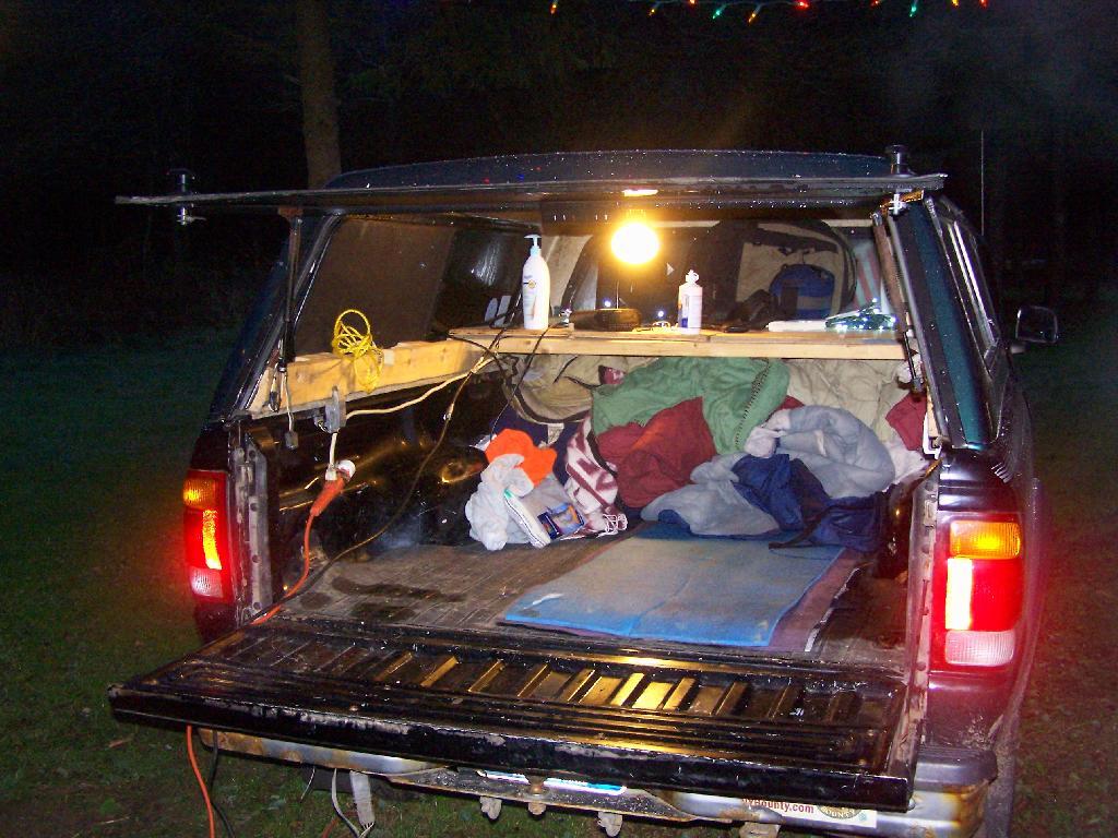
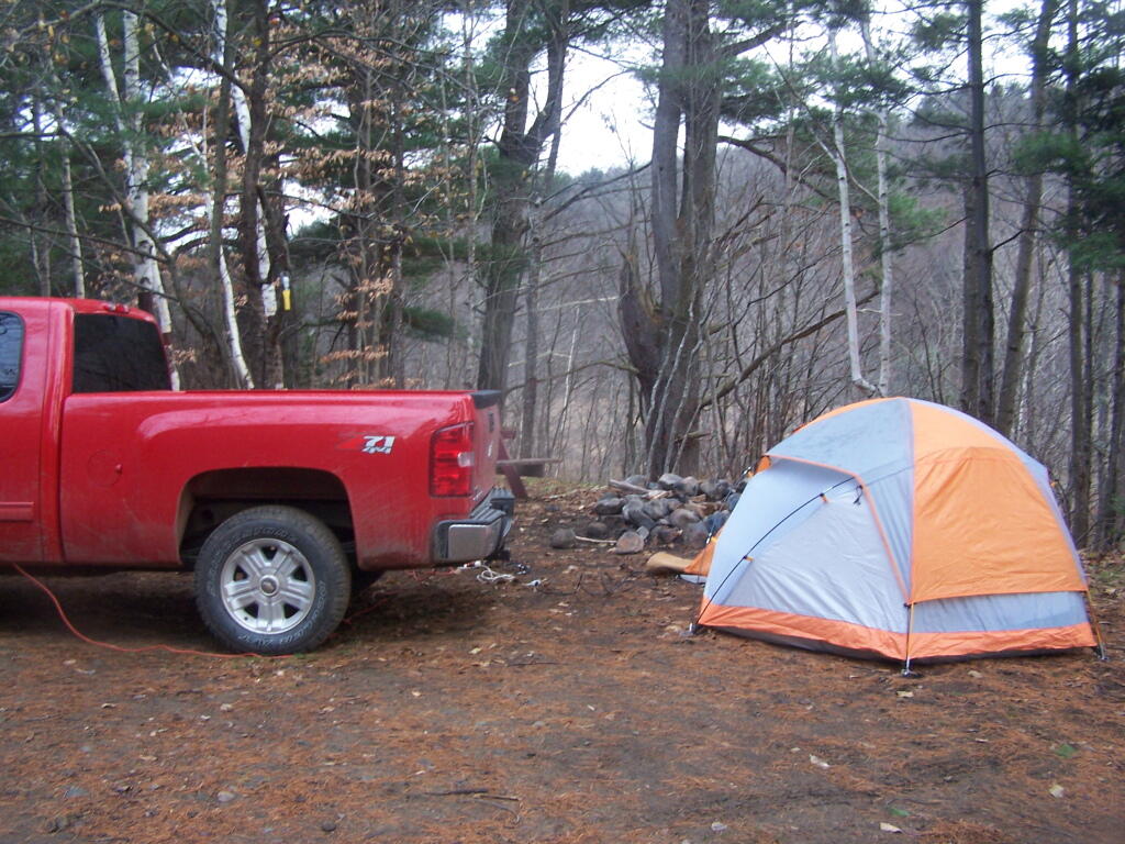
Traveling in November can be tricky. You get up before sunrise, or near it. You have to rush around all day, knowing you have to locate a campsite by 3 PM or so, and be well on your way of setting up camp by 4 PM, because it will be dark out at 5 PM, and you will want to have firewood and a fire started by dusk. The long evenings are not much of a problem, as I have lighting powered by the deep cycle battery in my pickup, but still daylight limits day time activities. The potential for snow and hunting season are other constaining factors. Cold can be bad, but at least with my current set up with the truck, having a dead battery is not a real risk.
I have three different trip options in mind:
Tug Hill/Northern Tier/Adirondack Trip
Southern Tier/Western NY/Northern Tier of PA Trip
Wayne National Forest and Monongahela National Forest Trip
The Tug Hill/Northern Tier/Adirondack Trip would take me up through the Tug Hill checking out Whetstone State Park, maybe Moose Plains or Independence River Wild Forest, Brasher-Bombay State Forest near Massena, and then maybe somewheres around St Regis Canoe-area. Would have to worry more about snow, and it would be big game season, but its the shortest and most economic trip especially if gas prices are high.
The Southern Tier/Western NY/Northern Tier of PA Trip would have me going out US 20, probably camping at Stony Pond Campground, then out to East Otto State Forest or maybe Sugar Hill in between. I would check out Zoar Valley, and then probably drive down to Chautauqua County and ultimately to Allegheny National Forest. Probably stay there a couple of days, then head back east on US 6, through the Endless Mountains, and return through Binghamton. That said, this is somewhat repeative of the mid-summer trip, so I don’t know if I want to do it again.
Then there is the trip I really want to take, which is to Coal Country Ohio and West Virigina, and the Wayne National Forest and Monongahela National Forest. It would be a delightful trip, even if it was kind of a lng trip. But that is dependent on gas prices, and if I can get a week plus off to make it all happen. But I have truck and gear, so it could be really awesome trip if I could make it happen. I want to travel to new frontiers, and I am ready to make that happen.
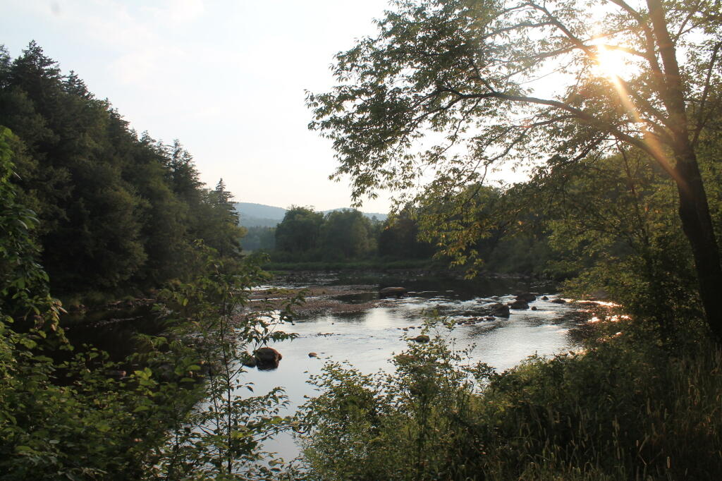
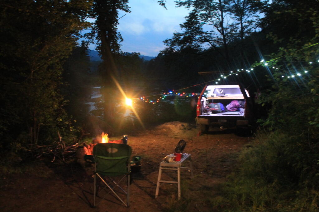
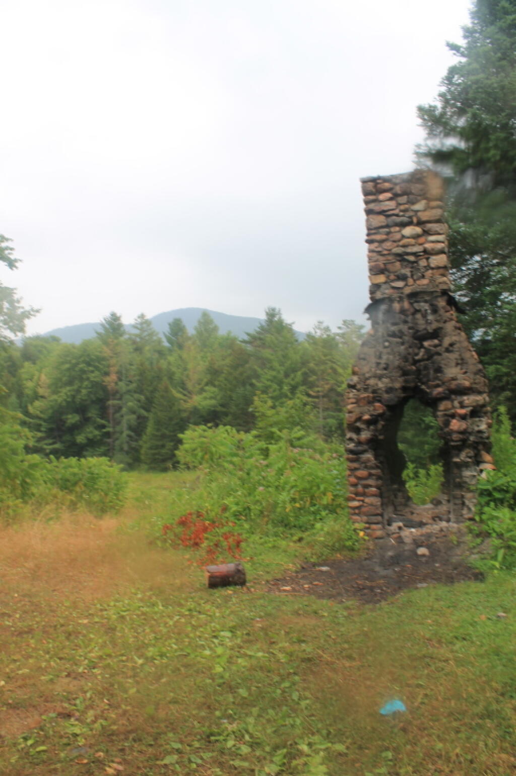
Tonight I write this words on my laptop, camping on West River Road, along the West Branch of the Sacanadaga River. This a beautiful site, soon to be gated off miles in the distance, to supposedly improve the “wilderness” character of this area.
Despite the fact that …
The lands of the state, now owned or hereafter acquired, constituting the forest preserve as now fixed by law, shall be forever kept as wild forest lands. They shall not be leased, sold or exchanged, or be taken by any corporation, public or private, nor shall the timber thereon be sold, removed or destroyed.
… the Department of Environmental Conservation and the Adirondack Park Agency feels it neccessary to close off West River Road to “enhance” the wilderness quality of the “Silver Lake Wilderness”. West River Road will never be expanded or extended, and it’s unlikely many campsites will ever be added to it because the lands are forever wild, and no tree over 3″ may ever cut.
I am not advocating for paving over the Adirondack Park for strip malls, or running high-speed expressways through virgin forest. I am advocating for keeping traditional, well maintained, roads open, and protecting our remaining roads and campsites in their traditional uses.
Yet, still the DEC finds it’s hands tied due to Adirondack Park State Land Master Plan that dicates the Adirondack Park’s state land must become increasingly restricted in public use, and that more restrictions must be placed on public use — less camping, less roads open to the public.
It’s sad, because people like myself liked camping on these lands. While in the future, people will be able to walk on this perfectly good road for vehicular traffic, and backpack into the limited number of campsites, roadside camping might forever be gone from this area. More and more Adirondack Park Roads are forever gone, and unless your willing to backpack in often many miles, these lands will forever be closed off for public use.
You often hear commericals on radio that “Subrarus are made in zero landfill factories.” Basically, what they are talking about is their automobile assembly factory, where manufactured components are shipped in reusable containers (to save money), bolted or welded together, and finished up.
They do not include manufacturing of components, or the mining of raw materials to build the cars. Even at zero-landfill assembly factories, some waste is generated, but valuable metal scraps are sent to scrap dealers, and plastic garbage and other wastes are shipped off to municipal trash incinerators, and burned for energy. Zero-landfill Assembly factories typically also have recycling programs in lunch rooms for aluminum cans and recycling for paper in offices, which is fairly common in most industries.
When you read into the claim, you have to be kind of skeptical. Indeed, zero-landfill is much different then zero-waste, or near zero-waste as many environmentalists are persuing. Indeed, much of it’s just certification, rather then any real change in process — as it’s stupid not to reuse shipping containers, scrap waste metals, and do other things that save businesses money.
Zero Landfill Camping.
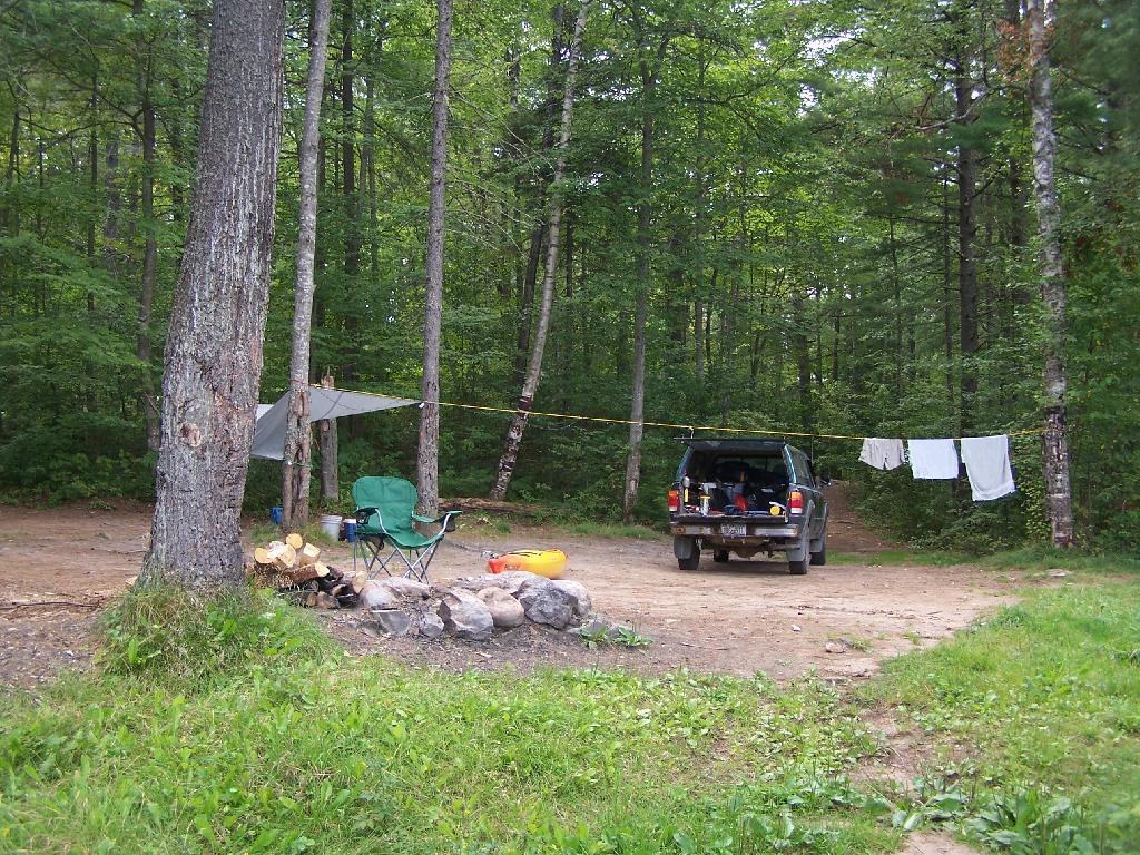
I don’t generate any trash when I camping that I haul home, and then take to the transfer station for disposal in a landfill. I seperate out the burnable trash from the non-burnable trash, the later which I take home for recycling either for remedemption of the deposit or regular municipal recycling at transfer station. I don’t leave any waste behind, and indeed, I often pick up litter from other persons, including small scraps of paper or plastic people overlook.
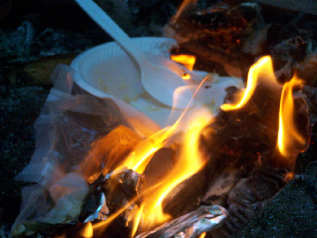
I do use styrofoam plates and plastic forks, paper towels, wet whipes, and often camp food comes in more packaging then stuff you get a home, as more stuff is canned or in dry packaging. I don’t use reusable bags when buying camp food, because having lots of plastic bags is handy for camping. It’s a lot easier to burn your trash, then have to wash up a lot of dishes. Food waste is also burned in a hot fire, because one doesn’t want attract bears.
I generate a lot more trash at camp then I do at home. Yet, I don’t want to haul a lot of smelly trash around, so the garbage gets burned at the end of the evening in the campfire. The day’s plastic bag full of burnables gets burned in the hot campfire at the end of day — and is almost instantly incinerated. I like watching trash burn, and I’m not that worried about it compared to what a lot of farmers and rural folks in more rural states burn regularly in their burn barrels and pits.
Tin cans are burned out, to rid of food residue, and tossed in the bin with the aluminim beer and beverage cans. Glass bottles are washed out. Anything that doesn’t burn is hauled home for recycling. I make sure to pick out any aluminum foil or partially burnt trash out of the fire pit. I don’t litter, and there is no trash generated that ever sees a landfill.
Mocking Zero-landfill Concept.
To a certain extent I am mocking the concept of zero-landfill manufacturing, that some manufacturers like to brag about it. Are farmers and rural residents who burn their garbage, recycle tin cans and glass, compost, zero-landfill folk? They are keeping their waste out of landfills after all.
But more seriously, it’s not zero-landfill but zero-waste we should be getting to as a society. It’s one things for a country boy out in the boonies to burning his garbage in a fire, it’s another thing for an urban society to be taking steps to reduce it’s waste. All of the country boys, farmers, and rural residents of the world, generate relatively little trash compared to what our big cities generate.
Cities need to find steps to recycle more of their waste, and recover their organics through source-seperated organics composting, biogas, or source-seperate organic biomass energy production. Cities need to find ways to keep their organic waste seperate from toxic technical materials — we got to stop dumping massive quanities of plastics and metals mixed with organics like food waste and brush into massive garbage incinerators and landfills.
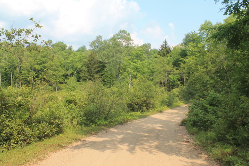
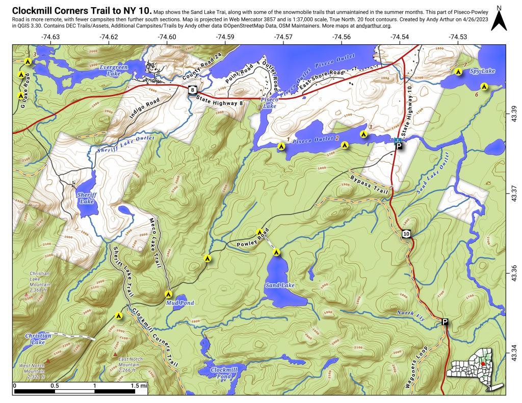
The two longest back country roads in Adirondacks — Cedar River-Limekiln Lake Road and Piseco-Powley Road — are generally closed during mud season. Other dirt roads like Moose Club Way tend to be muddy, and their is a risk you’ll get stuck back there.
It’s always a good idea to bring extra weight in your truck bed, a come-a-long or whinch, and snow shovel. You might not be far from a blacktop road at these campsites, but that is no guarantee you won’t get stuck.
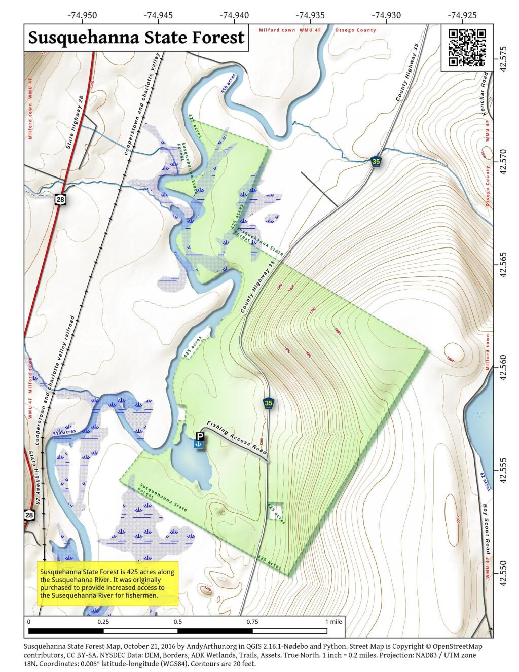
1) NY Route 8 / East Branch of Sacandaga River
The campsites are all off NY 8, an all season plowed and maintained asphalt road. Some sites are reinforced with gravel. Be aware some sites may be plowed full of snow from the winter clearing of NY 8. Roughly 15 campsites along this road, however some may be too muddy for this time of year.
2) South of Arietta Town Line on Piseco-Powley Road
There are 7 campsites along Piseco-Powley Road, north of Stratford, prior to the Arietta Town Line gate, which is near the Potholers on East Canada Creek. This road is well packed dirt, reinforced with gravel up to gate, and should be accessiable year round, minus the snow.
3) NY 421 at Horseshoe Lake
NY 421 is an asphalt road, and there are 4 campsites prior to the gates for Horseshoe Lake Road and Lows Lower Dam Road. These gates will be closed, but the sites along NY 421 before the asphalt runs out should be good as long the snow is off of NY 421..
4) Mountain Pond
Mountain Pond Campsites are on an old routing of NY 30. While now unplowed in the winter, the road is mostly hard asphalt, asphalt chips, and gravel. Many of the campsites are reinforced with gravel, but be careful with some of the sites.
5) First Campsite on Wolf Lake Road.
There is a campsite on Wolf Lake Road, right before the parking area and winter road gate for Wolf Lake Road Extension. This campsite is grass, however if it’s relatively dry, snow and mud free, this is possiblity.
6) Reeds Pond Campsite.
Before the black top runs out, there is a campsite along Reeds Pond, which is nice for it’s solitude, but nearness to a dirt road. The campsite may be muddy, depending on the conditions.
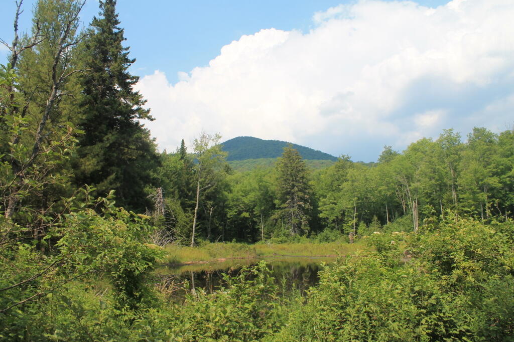
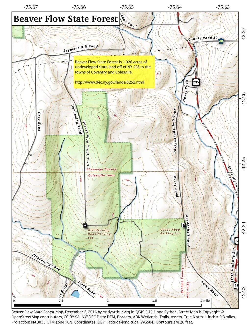
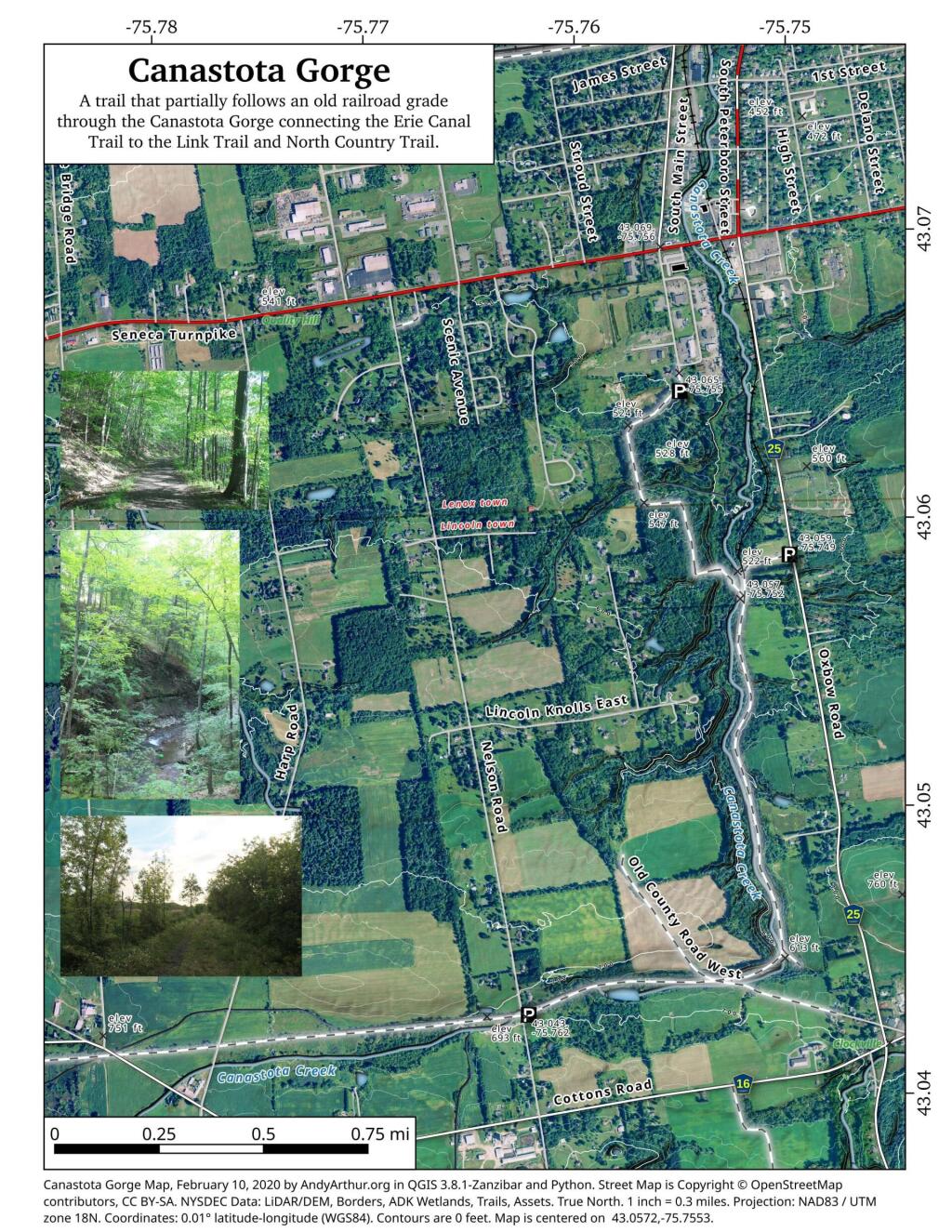
I have spent a lot of this past summer exploring the Black River Wild Forest, and decided it would be a good to share my experiences and some of the roadside and other campsites I’ve discovered along the way. As of September 2011, Lands and Forests in Albany doesn’t have these campsites in the central inventory, so all of this campsite data is based on personal exploration of these campsites.
North Lake.
Some of the best camping in the Black River Wild Forest is North Lake in Atwell. There are 22 campsites — many of them vehicle accessible along this man made lake. The southern end of the lake has some private houses and cabins on it, but it still is relatively pristine and beautiful. Most sites have outhouses and fire pits. Some but not all sites have limited wood supply. All sites designated.
Motors are allowed on this lake — as are on all wild forest lakes — so don’t be surprised to hear a jet ski or small boat on there. There are no public boat ramp on lake, so only hand launched boats can get on the lake.
Click to download or print this map.
South Lake.
South Lake is another Erie Canal Corp / Black River Reservoir near North Lake. There is a single large campsite on South Lake, with a private in-holding on the other side of the lake. There may be other campsites here, as I didn’t explore this whole lake. There is an outhouse here, grassy field for camping, fire pit.
Click to download or print this map.
Reeds Pond.
There are a couple of campsites along Reeds Pond, North Lake Road, and Farr Road as you head up to North Lake from Forestport. This pristine, but relatively small pond is fairly popular for camping.
Click to download or print this map.
Wolf Lake Road.
There are 5 fairly remote roadside campsites along Wolf Lake Road, as you head down to Woodhull Lake. Note also how there are lean-tos at Bear Lake and Woodhull Lake. The roadside campsites have no facilities, and some can be muddy as they are not hardened with gravel.
Wolf Lake Road has recently been rebuilt and resurfaced with gravel, however spring rains did lead to one part that may lead low-clearance cars to bottom out. Camp on this road, and your unlikely to see more then 2-3 people drive by on any particular day.
Be aware that the last 1/8th of a mile to Woodhull Lake is gated, so you’ll have to carry your boat the rest of the way down to the lake.
Click to download or print this map.
Remsen Falls.
Remsen Falls, which probably should be called “Remsen Rapids”, is a popular swimming place, and offers two well used campsites. There is an outhouse and picnic table down here. The trail follows a gated dirt road.
This past week, I decided to re-do the Moose River Plains Maps I had previously rendered in QGIS. I got some new data from the DEC, and wanted to simply the existing maps by taking off Wilderness Boundaries, and other details not of particular interest to hikers, campers, and kayakers. I also removed campsites that are in process of being removed or relocated under the finalized Unit Plan for the area. Be aware that the elevation on these maps is metric, as that’s what the NYSDOT Topographic Maps use in this region.
Click on any of the maps to display the high resolution version, that you can download and save, or print. Laser printers are great, especially for the Cedar River Flow Maps, as they’ll keep the ink from the running. All of these maps are free for you to use and distribute as they are based on public data. If you have ideas on how to improve these maps or seek similar maps of the area of other trails or locations, please feel free to contact me at andy@andyarthur.org.
There is no charge to camp here, however if you plan on staying more then 3 nights, you will have to a get a free permit from the forest ranger. Most campsites offer picnic tables, fireplaces or rings, and outhouses. Moose River Plains are all back country dirt roads, with a speed limit of 15 MPH, and there are some rough sections on the roads. As of September 2011, all of the roads shown on these maps are open.
Moose River Plains Camping Area.
Roads are red, hiking trails are black dotted lines on the map. All of the campsites in pink shaded area (“Moose River Plains Camping Area”) offer vehicle accessible camping including RVs and other tow-behind campers. The campsites outside of the “Camping Area” — specifically those on Otter Brook Road — will in the future be reserved for tent camping (most with vehicle accessability) except during Big Game Season when campers will be allowed at all sites. Most of the other trails with campsites on them offer wheelchair or mountain bike accessiability, as they tend to be gravel paths.
Moose River Plains Campsites.
Note: Campsites are numbered starting from the east, as you are coming from Cedar River Flow, heading towards Limekiln Lake. Many campsites have been closed or added over the year, and that’s why there are many gaps in the numbering system.
Cedar River Flow and Wakely Dam.
Cedar River Flow is a popular destination at Moose River Plains. In many ways it’s the gateway to Moose River Plains, as you reach Wakely Dam, which holds back the waters of Cedar River Flow as one of your first destinations heading West on Cedar River-Limekiln Lake Road from Indian Lake.
The Cedar River Flow is a popular lake for canoeing and kayaking. There are several designated and undesignated campsites along Cedar River Flow, with the designated ones shown on the map. There are also a handful of campsites, closely grouped together at Wakely Dam. The Cedar River is navigable for several miles upstream, and some people will paddle to the Lean-To on Sucker Brook Trail.
Wakely Pond and Wakely Dam Areas.
Along the Northville-Placid Trail near Wakely Pond there are several designated tent campsites. A map of Wakely Pond-Wakely Dam Areas, and the rapids downstream of the Cedar River Flow.
Wakely Mountain Firetower.
By far one of the most popular destinations in the area is the Wakely Mountain Fire Tower. It offers truly spectular views of Moose River Plains, Blue Ridge Wilderness, West Canada Wilderness, Fulton Chain of Lakes, and even the High Peaks.