that

Classification and Acres

An overview of the amount of land in each classification of the Adirondack Park. Here are a summary of the meanings of the various land classifications.

CLASS Acres Percent
PRIMITIVE CORRIDOR 292 0.01%
UNCLASSIFIED 365 0.01%
ADMINISTRATIVE 391 0.02%
HISTORIC 531 0.02%
CANOE AREA 18,989 0.74%
INTENSIVE USE 23,382 0.91%
PRIMITIVE 46,647 1.83%
WILDERNESS 1,160,125 45.39%
WILD FOREST 1,305,233 51.07%
TOTAL ADIRONDACK FOREST PRESERVE 2,555,955 100.00%

After The Fire

A look at each facility (e.g. campground, wild forest, wilderness area), sorted by size, ascending.

FACILITY Acres Percent
SIGNAL BUOY ISLAND 0.1 0.0%
NORTH CREEK PARKING FISHING ACCESS 0.2 0.0%
MILL CREEK PARKING AREA 0.2 0.0%
SAINT REGIS MOUNTAIN HISTORIC AREA 0.2 0.0%
HURRICANE MOUNTAIN HISTORIC AREA 0.2 0.0%
SHEEPSHEAD ISLAND 0.4 0.0%
MILL CREEK FISHING ACCESS 0.5 0.0%
GARDEN ISLAND 0.5 0.0%
GOOSENECK POND PRIMITIVE AREA 0.6 0.0%
COLE ISLAND 0.9 0.0%
FORTH LAKE BOAT LAUNCH 1.1 0.0%
TAHAWAS PRIMITIVE AREA 1.6 0.0%
LAKE COLBY ENVIRONMENTAL EDUCATIONAL CAMP 1.8 0.0%
MIRROR LAKE BOAT LAUNCH 1.9 0.0%
SPOON ISLAND PRIMITIVE AREA 1.9 0.0%
GREENE ISLAND MAINTENANCE FACILITY 1.9 0.0%
LAKE FLOWER BOAT LAUNCH 2.1 0.0%
PORT DOUGLASS BOAT LAUNCH 2.4 0.0%
UPPER CHATEAUGAY LAKE BOAT LAUNCH 2.4 0.0%
WILMURT CLUB ROAD 2.9 0.0%
GREAT SACANDAGA LAKE BOAT LAUNCH 3.0 0.0%
TUPPER LAKE BOAT LAUNCH 3.2 0.0%
SARANAC LAKE BOAT LAUNCH 3.3 0.0%
WESTPORT BOAT LAUNCH 3.9 0.0%
PORT HENRY BOAT LAUNCH 4.3 0.0%
STILLWATER BOAT LAUNCH 4.3 0.0%
SOUTH BAY STATE BOAT LAUNCH 4.8 0.0%
CRANBERRY LAKE BOAT LAUNCH 5.1 0.0%
RAQUETTE RIVER BOAT LAUNCH 6.3 0.0%
PRIMITIVE AREA 6.6 0.0%
MIDDLE SARANAC LAKE BOAT LAUNCH 6.8 0.0%
LAKE GEORGE FOREST PRESERVE 7.2 0.0%
SACANDAGA PRIMITIVE AREA 7.2 0.0%
WANAKENA PRIMITIVE CORRIDOR 7.5 0.0%
NORTHVILLE-SUB-OFFICE 7.9 0.0%
WILLSBORO BAY BOAT LAUNCH 8.0 0.0%
FULTON CHAIN BOAT LAUNCH 9.1 0.0%
TIED LAKE PRIMITIVE CORRIDOR 9.8 0.0%
SARANAC LAKE ISLANDS CAMPGROUND 9.9 0.0%
HURRICANE MOUNTAIN PRIMITIVE AREA 11.2 0.0%
LOWER SARANAC LAKE BOAT LAUNCH 13.6 0.0%
BEAR POND PRIMITIVE CORRIDOR 14.1 0.0%
FORKS MOUNTAIN PRIMITIVE CORRIDOR 14.7 0.0%
BROADALBIN BOAT LAUNCH 15.7 0.0%
MOSSY POINT STATE BOAT LAUNCH 16.8 0.0%
ALICE BROOK PRIMITIVE AREA 18.8 0.0%
SACANDAGA RIVER STATE BOAT LAUNCH 19.9 0.0%
LONG LAKE STATE BOAT LAUNCH 20.2 0.0%
EAGLE POINT CAMPGROUND 21.0 0.0%
ALDER CREEK PRIMITIVE CORRIDOR 23.0 0.0%
SUNY ATMOSPHERIC SCIENCES RESEARCH CENTER 23.1 0.0%
RAVEN LAKE PRIMTIVE AREA 24.7 0.0%
POPLAR POINT CAMPGROUND 32.8 0.0%
LAKE GEORGE BATTLEGROUND CAMPGROUND 33.5 0.0%
CAMP SANTANONI 36.1 0.0%
TIOGA POINT CAMPGROUND 36.2 0.0%
ALGER ISLAND CAMPGROUND 37.6 0.0%
PARTLOW LAKE PRIMITIVE CORRIDOR 39.0 0.0%
PRIMITVE AREA 45.4 0.0%
BUCK POND PRIMITIVE CORRIDOR 47.8 0.0%
CAROGA LAKE CAMPGROUND 49.1 0.0%
DUG MT. PRIMITIVE AREA 49.7 0.0%
LEWEY LAKE CAMPGROUND 53.4 0.0%
LITTLE SAND POINT CAMPGROUND 66.5 0.0%
CROWN POINT CAMPGROUND 73.6 0.0%
ADIRONDACK FISH HATCHERY 74.1 0.0%
POINT COMFORT CAMPGROUND 75.0 0.0%
LAKE GEORGE BATTLEFIELD DAY USE AREA 81.3 0.0%
BOQUET RIVER PRIMTIVE AREA 85.5 0.0%
NEHASANE PRIMITIVE CORRIDOR 87.6 0.0%
SUCKER LAKE WATER ACCESS 90.6 0.0%
FIRST BROTHER PRIMITIVE AREA 91.4 0.0%
HEARTHSTONE POINT CAMPGROUND 97.4 0.0%
GOLDEN BEACH CAMPGROUND 98.6 0.0%
INDIAN LAKE ISLANDS CAMPGROUND 102.1 0.0%
JOHN BROWNS FARM HISTORIC SITE 104.6 0.0%
SACANDAGA CAMPGROUND 116.8 0.0%
MEADOWBROOK CAMPGROUND 117.8 0.0%
WILMINGTON NOTCH CAMPGROUND 119.7 0.0%
LINCOLN POND CAMPGROUND 134.1 0.0%
JOHNS BROOK PRIMITIVE AREA 146.6 0.0%
TAYLOR POND CAMPGROUND 146.8 0.0%
LAKE EATON CAMPGROUND 152.1 0.0%
CAMP GABRIELS 158.0 0.0%
SCHUYLER ISLAND PRIMITIVE AREA 167.3 0.0%
CATHEAD MTN. PRIMITIVE AREA 172.9 0.0%
SHARP BRIDGE CAMPGROUND 192.9 0.0%
NORTHAMPTON BEACH CAMPGROUND 219.2 0.0%
WAKELY MOUNTAIN PRIMITIVE AREA 224.1 0.0%
LAKE HARRIS CAMPGROUND 233.4 0.0%
SCAROON MANOR DAY USE AREA 240.2 0.0%
EIGHTH LAKE CAMPGROUND 242.0 0.0%
AUSABLE POINT CAMPGROUND 259.5 0.0%
CRANBERRY LAKE CAMPGROUND 264.2 0.0%
LIMEKILN LAKE CAMPGROUND 266.0 0.0%
BROWN TRACT POND CAMPGROUND 272.9 0.0%
POKE-O-MOONSHINE CAMPGROUND 274.1 0.0%
LAKE DURANT CAMPGROUND 276.4 0.0%
PARADOX LAKE CAMPGROUND 287.8 0.0%
BUCK POND CAMPGROUND 302.3 0.0%
ROGERS ROCK CAMPGROUND 307.7 0.0%
FORKED LAKE CAMPGROUND 346.8 0.0%
MEACHAM LAKE CAMPGROUND 359.6 0.0%
UNCLASSIFIED 364.7 0.0%
MOFFITT BEACH CAMPGROUND 386.0 0.0%
CROWN POINT HISTORIC AREA 389.9 0.0%
AMPERSAND PRIMITIVE AREA 423.5 0.0%
ROLLINS POND CAMPGROUND 518.9 0.0%
BALD LEDGE PRIMITIVE AREA 556.5 0.0%
FISH CREEK POND CAMPGROUND 560.1 0.0%
HINCKELY RESERVOIR DAY USE AREA 568.7 0.0%
LAKE GEORGE ISLANDS CAMPGROUND 593.5 0.0%
NICKS LAKE CAMPGROUND 699.6 0.0%
PUTNAM POND CAMPGROUND 850.1 0.0%
LUZERNE CAMPGROUND 853.2 0.0%
VALCOUR ISLAND PRIMITIVE AREA 956.9 0.0%
PROSPECT MOUNTAIN 1,001.7 0.0%
DEAD CREEK PRIMITIVE AREA 1,134.9 0.0%
MT. VAN HOEVENBERG SPORTS FACILITY 1,476.6 0.1%
DEER RIVER PRIMITIVE AREA 1,870.0 0.1%
EASTERN FIVE PONDS ACCESS PRIMITIVE AREA 1,907.8 0.1%
MOOSE RIVER PLAINS CAMPING AREA 2,907.1 0.1%
WHITEFACE MTN. SKI CENTER 3,015.9 0.1%
WEST CANADA MTN. PRIMITIVE AREA 3,137.5 0.1%
RAQUETTE RIVER WILD FOREST 3,550.2 0.1%
SPLIT ROCK WILD FOREST 3,662.5 0.1%
GORE MTN. SKI CENTER 3,783.7 0.1%
MADAWASKA FLOW – QUEBEC BROOK PRIMITIVE AREA 6,035.6 0.2%
JAY MTN. WILDERNESS 7,892.3 0.3%
WHITE HILL WILD FOREST 9,640.6 0.4%
ROUND LAKE WILDERNESS 11,426.7 0.4%
LITTLE MOOSE MOUNTAIN WILDERNESS 12,277.8 0.5%
RAQUETTE-JORDAN BOREAL PRIMITIVE AREA 12,437.4 0.5%
GRASSE RIVER WILD FOREST 13,172.6 0.5%
WATSON EAST TRIANGLE WILD FOREST 13,424.3 0.5%
HURRICANE MOUNTAIN WILDERNESS 13,986.7 0.5%
PEPPERBOX WILDERNESS 14,580.0 0.6%
FULTON CHAIN WILD FOREST 15,948.9 0.6%
HORSESHOE LAKE WILD FOREST 17,139.7 0.7%
HUDSON GORGE PRIMITIVE AREA 17,161.8 0.7%
WILMINGTON WILD FOREST 17,493.2 0.7%
SAINT REGIS CANOE AREA 18,989.0 0.7%
WILLIAM C. WHITNEY WILDERNESS 19,273.7 0.8%
GIANT MTN. WILDERNESS 23,460.5 0.9%
SENTINEL RANGE WILDERNESS 23,991.8 0.9%
HA-DE-RON-DAH WILDERNESS 25,788.3 1.0%
CRANBERRY LAKE WILD FOREST 25,897.3 1.0%
ALDRICH POND WILD FOREST 26,179.6 1.0%
MCKENZIE MTN. WILDERNESS 37,464.1 1.5%
BLUE MTN. WILD FOREST 38,394.3 1.5%
HOFFMAN NOTCH WILDERNESS 38,497.6 1.5%
TAYLOR POND WILD FOREST 39,134.9 1.5%
SHAKER MOUNTAIN WILD FOREST 41,360.7 1.6%
SARGENT PONDS WILD FOREST 43,532.3 1.7%
DIX MTN. WILDERNESS 44,753.8 1.8%
HAMMOND POND WILD FOREST 45,907.0 1.8%
PHARAOH LAKE WILDERNESS 46,071.3 1.8%
BLUE RIDGE WILDERNESS 47,297.2 1.9%
CHAZY HIGHLANDS WILD FOREST 47,855.6 1.9%
JESSUP RIVER WILD FOREST 48,228.7 1.9%
PIGEON LAKE WILDERNESS 50,390.5 2.0%
MOOSE RIVER PLAINS WILD FOREST 66,624.9 2.6%
LAKE GEORGE WILD FOREST 71,157.1 2.8%
DEBAR MTN. WILD FOREST 75,893.9 3.0%
SARANAC LAKES WILD FOREST 77,726.8 3.0%
INDEPENDENCE RIVER WILD FOREST 79,096.6 3.1%
VANDERWHACKER MTN. WILD FOREST 83,986.5 3.3%
SILVER LAKE WILDERNESS 108,848.6 4.3%
SIAMESE PONDS WILDERNESS 114,923.8 4.5%
WILCOX LAKE WILD FOREST 125,839.3 4.9%
BLACK RIVER WILD FOREST 127,156.6 5.0%
FIVE PONDS WILDERNESS 139,228.7 5.4%
FERRIS LAKE WILD FOREST 147,184.3 5.8%
WEST CANADA LAKE WILDERNESS 174,292.4 6.8%
HIGH PEAKS WILDERNESS 205,772.7 8.1%
TOTAL ADIRONDACK FOREST PRESERVE 2,555,955.4 100.0%

South Over Cedar River Flow

Now each class of land, broken down by Class, Unit, Facility, Acreage, and Percent.

CLASS UNIT FACILITY Acres Percent
ADMINISTRATIVE DEBAR MTN. CAMP GABRIELS 158.0 0.0%
FERRIS LAKE FERRIS LAKE WILD FOREST 3.3 0.0%
GRASSE RIVER GRASSE RIVER WILD FOREST 7.4 0.0%
LAKE GEORGE GREENE ISLAND MAINTENANCE FACILITY 1.9 0.0%
SARANAC LAKES ADIRONDACK FISH HATCHERY 74.1 0.0%
SARANAC LAKES WILD FOREST 35.8 0.0%
WILCOX LAKE NORTHVILLE-SUB-OFFICE 7.9 0.0%
WILLIAM C. WHITNEY WILLIAM C. WHITNEY WILDERNESS 79.4 0.0%
WILMINGTON SUNY ATMOSPHERIC SCIENCES RESEARCH CENTER 23.1 0.0%
TOTAL ADMINISTRATIVE 391.0 0.0%
CANOE AREA SAINT REGIS SAINT REGIS CANOE AREA 18,989.0 0.7%
TOTAL CANOE AREA 18,989.0 0.7%
HISTORIC HAMMOND POND CROWN POINT HISTORIC AREA 389.9 0.0%
HURRICANE MOUNTAIN HURRICANE MOUNTAIN HISTORIC AREA 0.2 0.0%
SAINT REGIS SAINT REGIS MOUNTAIN HISTORIC AREA 0.2 0.0%
SARANAC LAKES JOHN BROWNS FARM HISTORIC SITE 104.6 0.0%
VANDERWHACKER MOUNTAIN CAMP SANTANONI 36.1 0.0%
TOTAL HISTORIC 531.0 0.0%
INTENSIVE USE BLACK RIVER NICKS LAKE CAMPGROUND 699.6 0.0%
BLUE MTN. LAKE DURANT CAMPGROUND 276.4 0.0%
LONG LAKE STATE BOAT LAUNCH 20.2 0.0%
BOG RIVER TUPPER LAKE BOAT LAUNCH 3.2 0.0%
CHAZY HIGHLANDS UPPER CHATEAUGAY LAKE BOAT LAUNCH 2.4 0.0%
CRANBERRY LAKE CRANBERRY LAKE BOAT LAUNCH 5.1 0.0%
CRANBERRY LAKE CAMPGROUND 264.2 0.0%
DEBAR MTN. BUCK POND CAMPGROUND 302.3 0.0%
MEACHAM LAKE CAMPGROUND 359.6 0.0%
FERRIS LAKE HINCKELY RESERVOIR DAY USE AREA 568.7 0.0%
LITTLE SAND POINT CAMPGROUND 66.5 0.0%
POINT COMFORT CAMPGROUND 75.0 0.0%
FULTON CHAIN ALGER ISLAND CAMPGROUND 37.6 0.0%
FORTH LAKE BOAT LAUNCH 1.1 0.0%
HAMMOND POND CROWN POINT CAMPGROUND 73.6 0.0%
LINCOLN POND CAMPGROUND 134.1 0.0%
PARADOX LAKE CAMPGROUND 287.8 0.0%
PORT HENRY BOAT LAUNCH 4.3 0.0%
SHARP BRIDGE CAMPGROUND 192.9 0.0%
INDEPENDENCE RIVER STILLWATER BOAT LAUNCH 4.3 0.0%
JESSUP RIVER INDIAN LAKE ISLANDS CAMPGROUND 102.1 0.0%
LEWEY LAKE CAMPGROUND 53.4 0.0%
MOFFITT BEACH CAMPGROUND 386.0 0.0%
POPLAR POINT CAMPGROUND 32.8 0.0%
LAKE GEORGE HEARTHSTONE POINT CAMPGROUND 97.4 0.0%
LAKE GEORGE BATTLEFIELD DAY USE AREA 81.3 0.0%
LAKE GEORGE BATTLEGROUND CAMPGROUND 33.5 0.0%
LAKE GEORGE FOREST PRESERVE 7.2 0.0%
LAKE GEORGE ISLANDS CAMPGROUND 593.5 0.0%
LUZERNE CAMPGROUND 853.2 0.0%
MOSSY POINT STATE BOAT LAUNCH 16.8 0.0%
PROSPECT MOUNTAIN 1,001.7 0.0%
ROGERS ROCK CAMPGROUND 307.7 0.0%
SOUTH BAY STATE BOAT LAUNCH 4.8 0.0%
MOOSE RIVER PLAINS BROWN TRACT POND CAMPGROUND 272.9 0.0%
EIGHTH LAKE CAMPGROUND 242.0 0.0%
FULTON CHAIN BOAT LAUNCH 9.1 0.0%
LIMEKILN LAKE CAMPGROUND 266.0 0.0%
MOOSE RIVER PLAINS CAMPING AREA 2,907.1 0.1%
PHARAOH LAKE PUTNAM POND CAMPGROUND 850.1 0.0%
SARANAC LAKES FISH CREEK POND CAMPGROUND 560.1 0.0%
LAKE COLBY ENVIRONMENTAL EDUCATIONAL CAMP 1.8 0.0%
LAKE FLOWER BOAT LAUNCH 2.1 0.0%
LOWER SARANAC LAKE BOAT LAUNCH 13.6 0.0%
MEADOWBROOK CAMPGROUND 117.8 0.0%
MIDDLE SARANAC LAKE BOAT LAUNCH 6.8 0.0%
MIRROR LAKE BOAT LAUNCH 1.9 0.0%
MT. VAN HOEVENBERG SPORTS FACILITY 1,476.6 0.1%
RAQUETTE RIVER BOAT LAUNCH 6.3 0.0%
ROLLINS POND CAMPGROUND 518.9 0.0%
SARANAC LAKE BOAT LAUNCH 3.3 0.0%
SARANAC LAKE ISLANDS CAMPGROUND 9.9 0.0%
SARGENT PONDS FORKED LAKE CAMPGROUND 346.8 0.0%
GOLDEN BEACH CAMPGROUND 98.6 0.0%
LAKE EATON CAMPGROUND 152.1 0.0%
TIOGA POINT CAMPGROUND 36.2 0.0%
SHAKER MOUNTAIN CAROGA LAKE CAMPGROUND 49.1 0.0%
NORTHAMPTON BEACH CAMPGROUND 219.2 0.0%
SACANDAGA RIVER STATE BOAT LAUNCH 19.9 0.0%
TAYLOR POND AUSABLE POINT CAMPGROUND 259.5 0.0%
POKE-O-MOONSHINE CAMPGROUND 274.1 0.0%
PORT DOUGLASS BOAT LAUNCH 2.4 0.0%
TAYLOR POND CAMPGROUND 146.8 0.0%
WESTPORT BOAT LAUNCH 3.9 0.0%
WILLSBORO BAY BOAT LAUNCH 8.0 0.0%
VANDERWHACKER MOUNTAIN EAGLE POINT CAMPGROUND 21.0 0.0%
GORE MTN. SKI CENTER 3,783.7 0.1%
LAKE HARRIS CAMPGROUND 233.4 0.0%
SCAROON MANOR DAY USE AREA 240.2 0.0%
WHITEFACE MTN. SKI CENTER WHITEFACE MTN. SKI CENTER 3,015.9 0.1%
WILMINGTON NOTCH CAMPGROUND 119.7 0.0%
WILCOX LAKE BROADALBIN BOAT LAUNCH 15.7 0.0%
GREAT SACANDAGA LAKE BOAT LAUNCH 3.0 0.0%
SACANDAGA CAMPGROUND 116.8 0.0%
TOTAL INTENSIVE USE 23,382.3 0.9%
PRIMITIVE ALDRICH POND PRIMITVE AREA 45.4 0.0%
BLUE RIDGE WAKELY MOUNTAIN PRIMITIVE AREA 224.1 0.0%
DEBAR MTN. DEER RIVER PRIMITIVE AREA 1,870.0 0.1%
MADAWASKA FLOW – QUEBEC BROOK PRIMITIVE AREA 6,035.6 0.2%
FIVE PONDS ALICE BROOK PRIMITIVE AREA 18.8 0.0%
EASTERN FIVE PONDS ACCESS PRIMITIVE AREA 1,907.8 0.1%
GIANT MTN. BOQUET RIVER PRIMTIVE AREA 85.5 0.0%
HIGH PEAKS AMPERSAND PRIMITIVE AREA 423.5 0.0%
JOHNS BROOK PRIMITIVE AREA 146.6 0.0%
TAHAWAS PRIMITIVE AREA 1.6 0.0%
HORSESHOE LAKE DEAD CREEK PRIMITIVE AREA 1,134.9 0.0%
HUDSON GORGE HUDSON GORGE PRIMITIVE AREA 17,161.8 0.7%
HURRICANE MOUNTAIN HURRICANE MOUNTAIN PRIMITIVE AREA 11.2 0.0%
LAKE CHAMPLAIN ISLANDS COLE ISLAND 0.9 0.0%
GARDEN ISLAND 0.5 0.0%
SCHUYLER ISLAND PRIMITIVE AREA 167.3 0.0%
SHEEPSHEAD ISLAND 0.4 0.0%
SIGNAL BUOY ISLAND 0.1 0.0%
SPOON ISLAND PRIMITIVE AREA 1.9 0.0%
VALCOUR ISLAND PRIMITIVE AREA 956.9 0.0%
PHARAOH LAKE BALD LEDGE PRIMITIVE AREA 556.5 0.0%
FIRST BROTHER PRIMITIVE AREA 91.4 0.0%
GOOSENECK POND PRIMITIVE AREA 0.6 0.0%
RAQUETTE RIVER RAQUETTE-JORDAN BOREAL PRIMITIVE AREA 12,437.4 0.5%
SENTINEL RANGE PRIMITIVE AREA 6.6 0.0%
SIAMESE PONDS DUG MT. PRIMITIVE AREA 49.7 0.0%
SILVER LAKE CATHEAD MTN. PRIMITIVE AREA 172.9 0.0%
WEST CANADA LAKE WEST CANADA MTN. PRIMITIVE AREA 3,137.5 0.1%
TOTAL PRIMITIVE 46,647.3 1.8%
PRIMITIVE CORRIDOR FIVE PONDS ALDER CREEK PRIMITIVE CORRIDOR 23.0 0.0%
BEAR POND PRIMITIVE CORRIDOR 14.1 0.0%
BUCK POND PRIMITIVE CORRIDOR 47.8 0.0%
PARTLOW LAKE PRIMITIVE CORRIDOR 39.0 0.0%
TIED LAKE PRIMITIVE CORRIDOR 9.8 0.0%
WANAKENA PRIMITIVE CORRIDOR 7.5 0.0%
PEPPERBOX RAVEN LAKE PRIMTIVE AREA 24.7 0.0%
SIAMESE PONDS FORKS MOUNTAIN PRIMITIVE CORRIDOR 14.7 0.0%
SILVER LAKE SACANDAGA PRIMITIVE AREA 7.2 0.0%
WEST CANADA LAKE WEST CANADA LAKE WILDERNESS 13.8 0.0%
WILMURT CLUB ROAD 2.9 0.0%
WILLIAM C. WHITNEY NEHASANE PRIMITIVE CORRIDOR 87.6 0.0%
TOTAL PRIMITIVE CORRIDOR 291.9 0.0%
UNCLASSIFIED UNCLASSIFIED UNCLASSIFIED 364.7 0.0%
TOTAL UNCLASSIFIED 364.7 0.0%
WILD FOREST ALDRICH POND ALDRICH POND WILD FOREST 26,179.6 1.0%
SUCKER LAKE WATER ACCESS 90.6 0.0%
BLACK RIVER BLACK RIVER WILD FOREST 127,156.6 5.0%
BLUE MTN. BLUE MTN. WILD FOREST 38,394.3 1.5%
CHAZY HIGHLANDS CHAZY HIGHLANDS WILD FOREST 47,855.6 1.9%
CRANBERRY LAKE CRANBERRY LAKE WILD FOREST 25,897.3 1.0%
DEBAR MTN. DEBAR MTN. WILD FOREST 75,893.9 3.0%
FERRIS LAKE FERRIS LAKE WILD FOREST 147,181.0 5.8%
FULTON CHAIN FULTON CHAIN WILD FOREST 15,948.9 0.6%
GRASSE RIVER GRASSE RIVER WILD FOREST 13,165.1 0.5%
HAMMOND POND HAMMOND POND WILD FOREST 45,907.0 1.8%
HORSESHOE LAKE HORSESHOE LAKE WILD FOREST 17,139.7 0.7%
INDEPENDENCE RIVER INDEPENDENCE RIVER WILD FOREST 79,096.6 3.1%
JESSUP RIVER JESSUP RIVER WILD FOREST 48,228.7 1.9%
LAKE GEORGE LAKE GEORGE WILD FOREST 71,157.1 2.8%
MOOSE RIVER PLAINS MOOSE RIVER PLAINS WILD FOREST 66,624.9 2.6%
RAQUETTE RIVER RAQUETTE RIVER WILD FOREST 3,550.2 0.1%
SARANAC LAKES SARANAC LAKES WILD FOREST 77,691.0 3.0%
SARGENT PONDS SARGENT PONDS WILD FOREST 43,532.3 1.7%
SHAKER MOUNTAIN SHAKER MOUNTAIN WILD FOREST 41,360.7 1.6%
SPLIT ROCK SPLIT ROCK WILD FOREST 3,662.5 0.1%
TAYLOR POND TAYLOR POND WILD FOREST 39,134.9 1.5%
VANDERWHACKER MOUNTAIN NORTH CREEK PARKING FISHING ACCESS 0.2 0.0%
VANDERWHACKER MTN. WILD FOREST 83,986.5 3.3%
WATSON EAST TRIANGLE WATSON EAST TRIANGLE WILD FOREST 13,424.3 0.5%
WHITE HILL WHITE HILL WILD FOREST 9,640.6 0.4%
WILCOX LAKE MILL CREEK FISHING ACCESS 0.5 0.0%
MILL CREEK PARKING AREA 0.2 0.0%
WILCOX LAKE WILD FOREST 125,839.3 4.9%
WILMINGTON WILMINGTON WILD FOREST 17,493.2 0.7%
TOTAL WILD FOREST 1,305,233.2 51.1%
WILDERNESS BLUE RIDGE BLUE RIDGE WILDERNESS 47,297.2 1.9%
DIX MTN. DIX MTN. WILDERNESS 44,753.8 1.8%
FIVE PONDS FIVE PONDS WILDERNESS 139,228.7 5.4%
GIANT MTN. GIANT MTN. WILDERNESS 23,460.5 0.9%
HA-DE-RON-DAH HA-DE-RON-DAH WILDERNESS 25,788.3 1.0%
HIGH PEAKS HIGH PEAKS WILDERNESS 205,772.7 8.1%
HOFFMAN NOTCH HOFFMAN NOTCH WILDERNESS 38,497.6 1.5%
HURRICANE MOUNTAIN HURRICANE MOUNTAIN WILDERNESS 13,986.7 0.5%
JAY MTN. JAY MTN. WILDERNESS 7,892.3 0.3%
LITTLE MOOSE MOUNTAIN LITTLE MOOSE MOUNTAIN WILDERNESS 12,277.8 0.5%
MCKENZIE MTN. MCKENZIE MTN. WILDERNESS 37,464.1 1.5%
PEPPERBOX PEPPERBOX WILDERNESS 14,580.0 0.6%
PHARAOH LAKE PHARAOH LAKE WILDERNESS 46,071.3 1.8%
PIGEON LAKE PIGEON LAKE WILDERNESS 50,390.5 2.0%
ROUND LAKE ROUND LAKE WILDERNESS 11,426.7 0.4%
SENTINEL RANGE SENTINEL RANGE WILDERNESS 23,991.8 0.9%
SIAMESE PONDS SIAMESE PONDS WILDERNESS 114,923.8 4.5%
SILVER LAKE SILVER LAKE WILDERNESS 108,848.6 4.3%
WEST CANADA LAKE WEST CANADA LAKE WILDERNESS 174,278.6 6.8%
WILLIAM C. WHITNEY WILLIAM C. WHITNEY WILDERNESS 19,194.3 0.8%
TOTAL WILDERNESS 1,160,125.2 45.4%
TOTAL ADIRONDACK FOREST PRESERVE 2,555,955.4 100.0%

While this is a re-run of a couple of years ago, and the data is somewhat out of date with the addition of the Essex Chain of Lakes, it still gives a good overview of the public lands of the Adirondacks.

Why Kayak the Hudson River Between Albany and Troy?

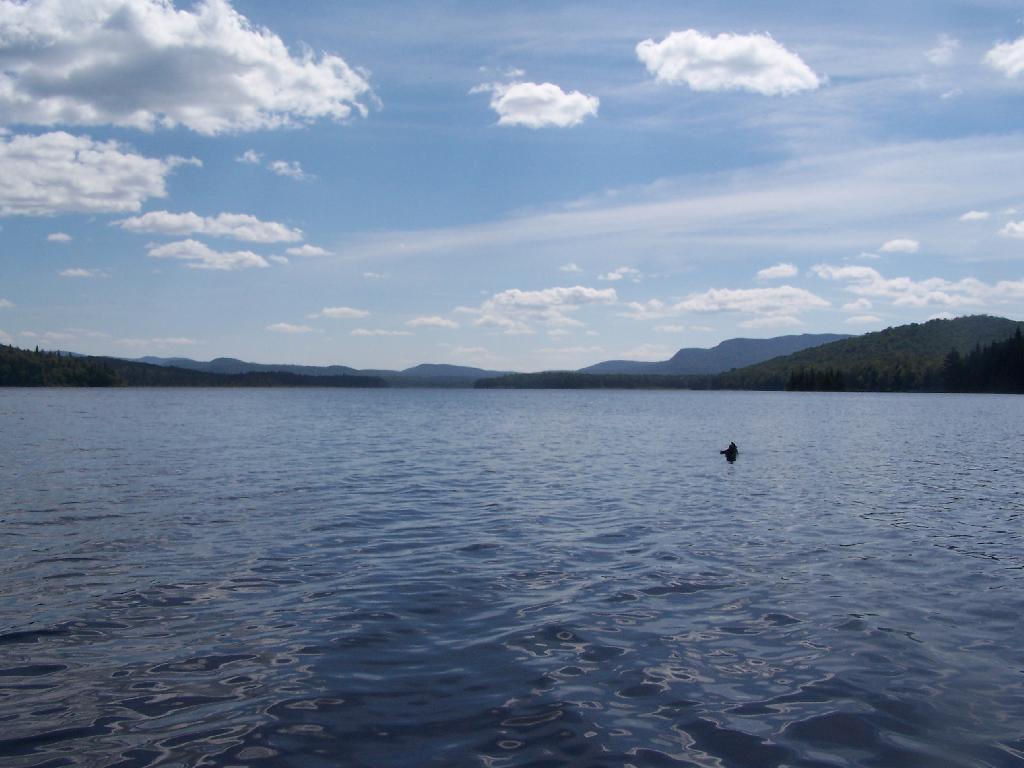
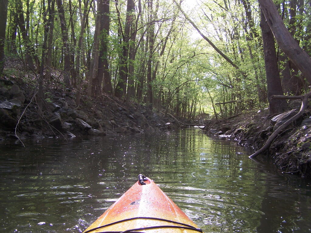
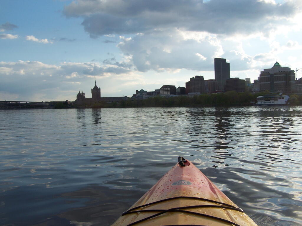
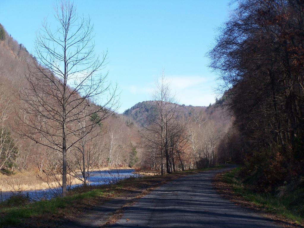
Most people have probably never kayaked between Albany and Troy on the Hudson River. Yet, it’s a trip one should make, because it’s both fascinating and relaxing, as you paddle between two cities through a lush green landscape.

 Livingston State Forest

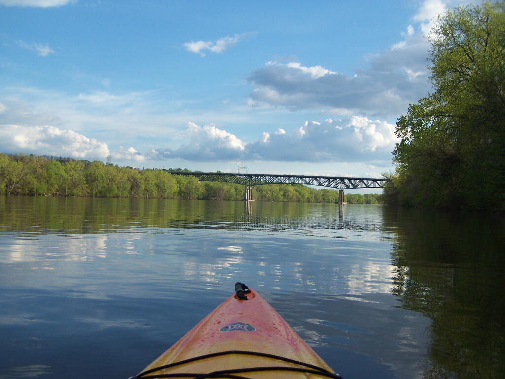
Not only is the Hudson River conviently located between the two cities, a short drive for residents of the Capital Drive, it demostrates the solitude one can get, and still be within a couple of miles of major former industrial cities in Upstate NY.

Scenic Hudson River

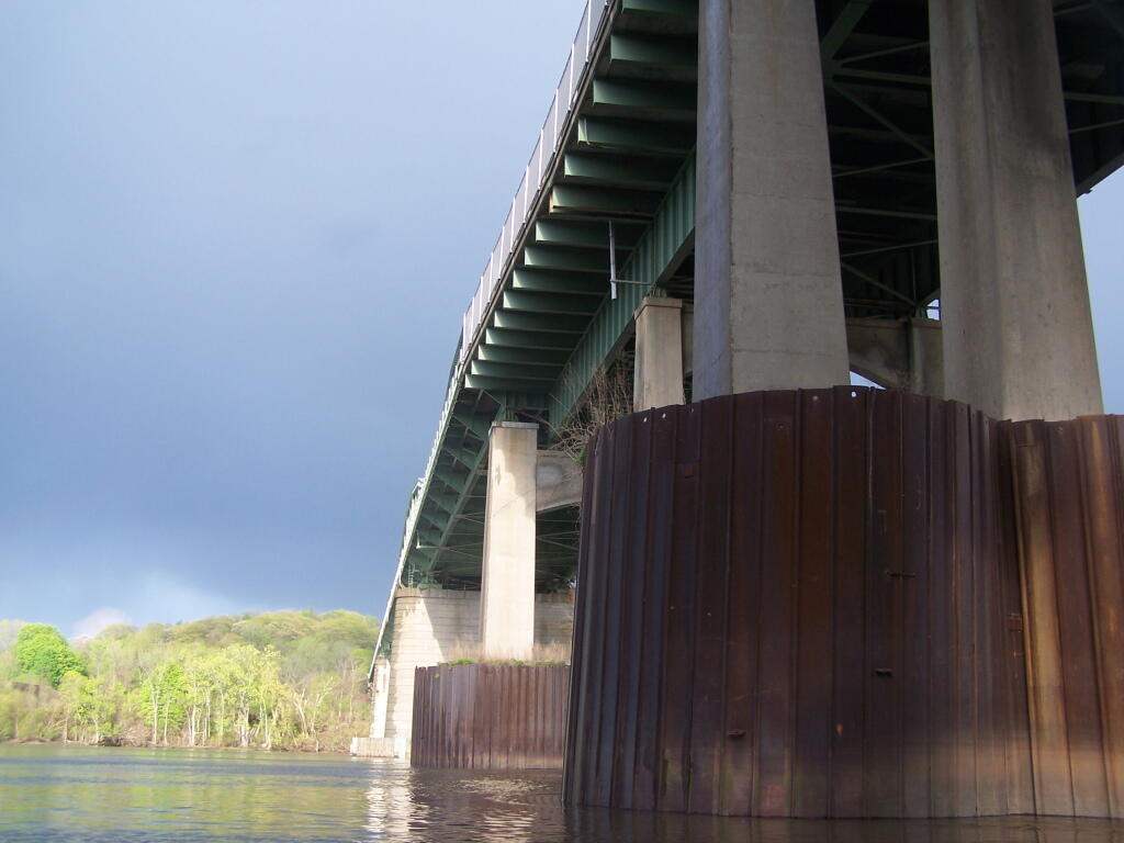
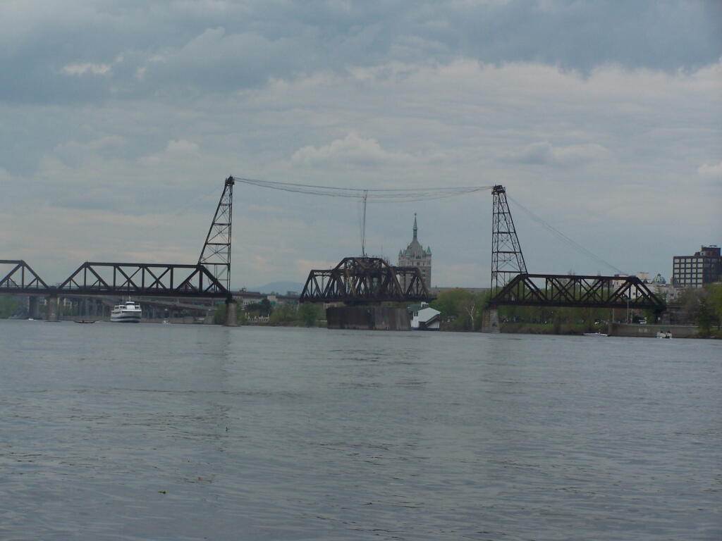
It shows the scale of man’s industrial works up close, as they tower far above you. Who would have ever thought the South Troy Bridge was so tall?

Heading Under the South Troy Bridge

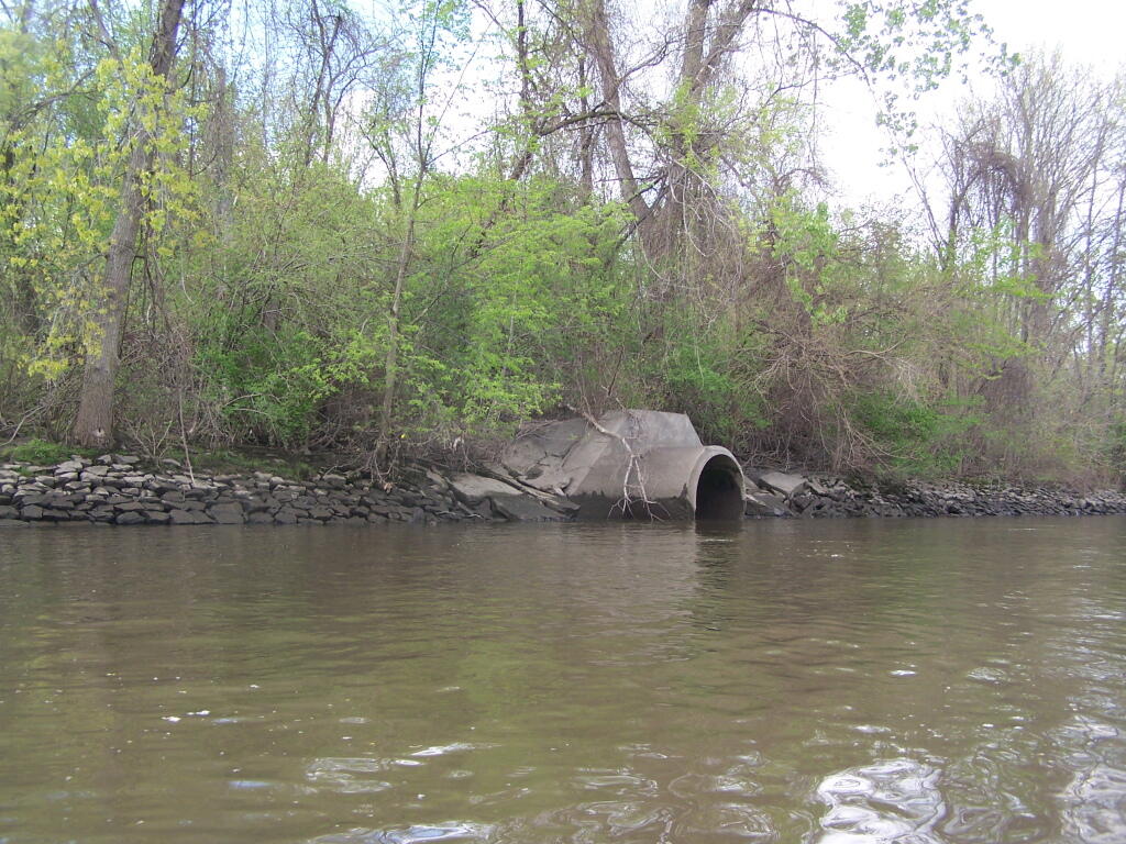
And while the river is much cleaner then yesteryear, you will still smell the raw sewage floating in from some storm drains.

Stormwater Outfall Into the Hudson River

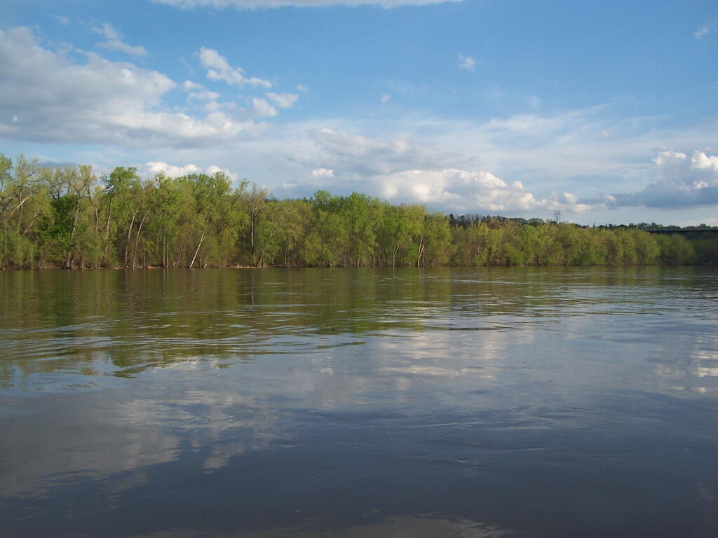
You’ll find secret little tributatories, all but forgotten about in the era of powerboats and superhighways that once buried important little rivers and creeks, and made islands into mainland.

Creek Channel on Breaker Island

You will get a new impression of the river and it’s many crossings, and the noisey automobile traffic that “flies” over the river.

Heading Towards Patroon Island Bridge

You’ll notice how nature’s creations tower far above our cities and urbanized areas.

Livingston Ave Bridge Opens

And you’ll get a new look at the ordinary city, that often looked at as one passes it buy almost in an ignorant fashion.

 Albany

True Believers

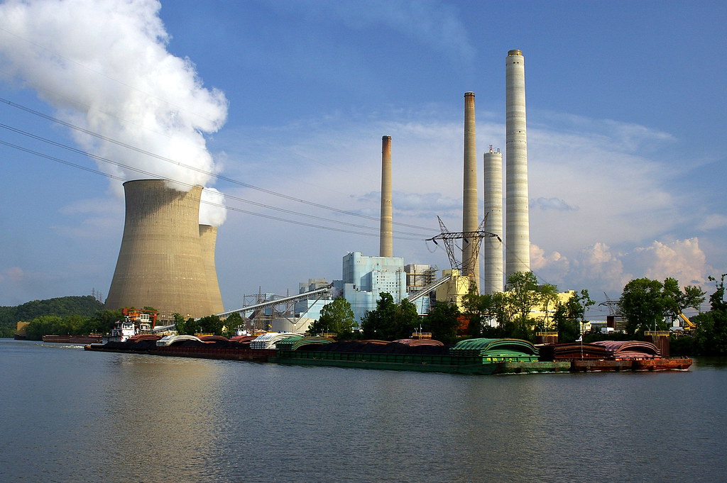
I was looking at the coal company advertisements that the “Quit Coal” project put up. Basically, those advertisements criticize “aggressive” regulations put forward by the government, and policies pursued by Congress to control air pollution. Not surprisingly, the folks that worked in corporations did not want to be told how to run their business, much less do something that would put uncertainty in their business.

Some will say that coal companies were actively spreading lies and falsehoods. Or did they actually believe in what they were advertising — a statement of belief of reality as it appeared to a coal power plant operator? Certainly many of the pollution control technologies of early 1970s were not to the point where well tested or even scaled up. A coal power plant operator, who always operated their plant one way, did not want to deal with the risk of changing operating methods and technologies.

The "Fred Way" @ the John E. Amos Coal Power Plant

Some will claim that coal-fired power plant operators were mostly motivated by greed. Yet, if you look at historically, did the clean air equipment on power plants actually cost that much — especially compared to existing revenue? Most upgrades to power plants were covered by small increases in electric rates, granted by public service commissions. If anything, more pollution controls meant more employees, and more opportunities for companies to profit because now operated more complex power plants in a regulated market that fixed their profit above cost.

In retrospect, the coal power industry is run by people who believe their mission — to provide inexpensive electricity, using proven technologies. These people who are resistant to change, because they don’t always understand what it will mean in the future.

The lessons of coal advertising is three fold:

  • Most people don’t actively lie due to moral conscience, nor do the corporations that represent the aggregation of people lie due to threat to litigation
  • People and corporations that make them up are highly resistant to change, because they fear the unknown and potential costs of unknown, even if the costs really don’t prove to be significant over the long run.
  • Government has an important role in setting emissions and efficiency standards, to force corporations, which represent large aggregations of people, to take calculated risks to improve their environmental preformance.

As Summer 2012 Fades Away

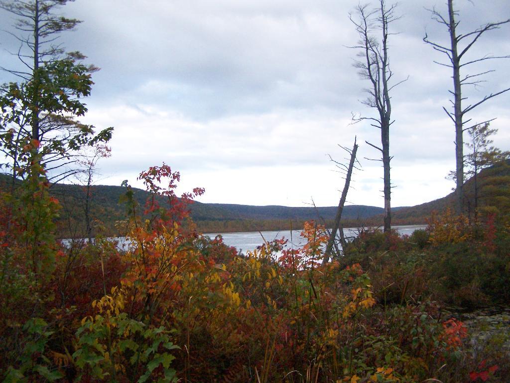
The endless summer has shown it must come to an end. I woke up the other day at Moose Plains, and the temperature was only 46 degrees out. It was a chilly morning out, but only a symbol of what is to come as we fade into winter. Daylight is rapidly dropping every day.

Labrador Pond

Probably it would not be as big of deal for me, if I didn’t have to work so much during the fall. But I expect this fall to be a very busy season, where I won’t get to spend much time in the wilderness, camping, hiking, and spending time outdoors until mid-November. You know, I got to work and make money for the toys. And by mid-November, the winter will be well among us.

North Fork Mountain

There is nothing to stop to winter from returning. And as soon as winter comes, winter will be on its way out, as we move back towards April and ultimately mid-May when things finally green up and the endless days of summer return once again. It’s the cycle of life.

Inside the Pine Creek Gorge

… It just seems like summer is much too short.

Why Are So Many Mega-Suburbs to be Home to Mass Murders?

Lately there has been a fair bit of discussion about the mass-murder shootings, that usually occur in large suburbs, with populations greater then 100,000, located outside of large cities. Not only do these happen in large suburbs, but often the outer rim of the suburbs, towards the rural fringe, where some of the newest suburban housing is located.

Much of the discussion has been over gun control and accessibility of guns in many households. Yet, if gun ownership was the problem, then most mass murders would come from rural households where gun ownership and hunting is far more common on the farm and forest lands. Yet, that’s not where the majority of mass murders come from.

Suburbia, Wyoming, OH

It’s the suburbs. Usually the outer suburbs, usually home to the most politically, and especially socially conservative Americans. The outer suburbs tend to be not only very white and wealthy, but also outspoken on issues of prohibiting gay marriage and abortion. Mega-churches preaching gospel from Walmart sized and styled cathedrals dot the landscape.

Yet, being a social conservative is not what makes one a killer. Plenty of rural folks are conservative after all, yet they don’t kill. Rural churches often preach very conservative views too. Those folks don’t kill much besides deer and turkeys. What does make a killer is living in vast spiritual wasteland known as the mega-suburbs.

Strip malls everywhere

The Mega-Suburban Environment.

Mega-suburbs are basically a mid-size city scaled up to the automobile-size, with private detached houses with yards, on endless sets of cul de sacs and parking lots. Land use is strictly segregated, with housing in one location, retail outlets in another, and office parks in finally another. Everything is massive to accommodate a large population, yet isolating and impersonal.

Life has no style or passion in such locations. It’s all about Keeping Up with the Jones, having the new big house, the new big car, and all things else built with plywood and vinyl siding. It’s about the good paying job to pay for all these expensive things, and try to provide your kids with a “better life” in the suburbs. Life is boring and repulsive.

In these mega-suburbs, typically everything is connected by massive connector roads with 6-8 lanes with endless stoplights, bordered by retail, and often overcrowded but underbuilt 2-lane secondary roads. Folks drive everywhere, greatly cutting down on interaction with one and another. People spend multiple hours a day stuck in traffic and fighting for a parking spot at the shopping center. Never meeting another person through much of days activities, it’s easy to develop hostile feelings towards others you don’t interact with except from within the confines of an automobile.

Mega church in San Antonio

The Mega-Suburban Fascist Police State.

At same time, mega-suburbs tend be governed draconian governments that try to regulate every part of one’s lives, to keep the “quality” of the community up. Every mega-suburb has very detailed zoning codes that try to keep up appearances of endless vinyl siding houses, and strip malls, over the pretend value that it increases neighbors property values.

With the masses of faceless people driving on crowded but large highways, strict anti-road rage and speeding laws must be strictly enforced by the police. Bored teenagers, wandering the streets, must be strictly disciplined by the police, because there are no parents or neighbors outside to watch out for the kids. Cameras dot the streets of the mega-suburbs, because people are afraid of crime, real or imagined. The police presence is always very noticeable in mega-suburbs.

Life in mega-suburb is a life of government fascism. People in mega-suburbs often have no interaction with their legislative bodies, except maybe to vote to pro-business and pro-growth conservatives in the fall. They feel they need the security provided by an overbearing police force, and complicated home security systems. People are paranoid and scared living in the mega-suburbs, fearing others will take all that they’ve worked so hard to obtain.

Parking lot

The Mega-Suburban Nature Deficit.

Mega-suburbs, while often close to corn fields, farms, and rural areas, have little contact with areas beyond the urban-rural interface. Most suburbanites never go past it, and if anything view the rural folks beyond the urban-rural interface to be little more then under-educated rural idiots.

Mega-suburbs have parks, but they are usually just highly developed recreational areas for use solely by paying and structured High School football and softballs teams. They are not for relaxation or nature enjoyment β€” but always developed and highly controlled activities. There is no getting away from it all β€” except in one’s own home β€” where the stresses of home and feelings of isolation creep in.

Sprawl

The Mega-Suburbs Are Scary Places With Scary People.

Folks who live in mega-suburbs rarely get out of highly controlled environments, where informal interactions are rare. In the mega-suburbs, people don’t pass each other on streets without 2-tons of steel wrapped around them. They don’t interact with people except in office complexes, or at Credit Card checkout lines at mega-Walmarts.

In cities, folks walk down streets, ride public transit, and interact with people at small bodegas and shops. In rural areas, people attend small personable churches, know their neighbors, and shop at places with familiar faces. In contrast, the mega-suburbs lack any kind of personal interaction, without highly regimented rules and government controls.

… we need to ban mega-suburbs to save human life.

There Ought To Be Sunlight on Non-Profit Organizations

One thing that concerns me is the lack of transparency for all not-for-profit organizations that are involved in influencing government polic or representing themselves in front of government agencies.

While all not-for-profit organizations must disclose how they spend their money, at least on an yearly bases on publically avaliable IRS Form 901, they do not have to disclose individual donors, or the amount each donor gives. In many cases, through the advocacy and other works of not-for-profits, substantial government lobbying and political influence is given by the organization, yet few actually know who is funding the organization, or what the true rational for the organization’s actions.

Round Mountain

If persons are afraid to give to not-for-profit organizations, for fear of disclosure, then they should not give. Not all not-for-profit organizations serve the public interest, as many spend a substantial amount of their funds advocate for policies that are highly detrimental to the public interest. Likewise, there should be public pressure on not-for-profit organizations avoid taking donations from corrupting sources of funds.

A great deal of advocacy on behalf of major corporations takes on behalf of citizens groups. Many cases, grass roots efforts are amplified by large corporate donations, but nobody really knows where the money comes from, except that they report large donations as being a key to sustaining their organization. For sake of openess, all not-for-profit organizations should have to disclose all donations and where they came from.

Why I Don’t Own Any Propane Camping Appliances

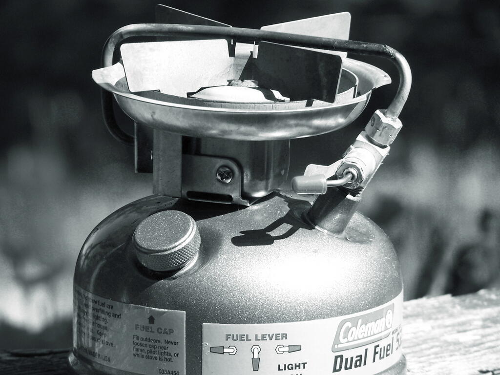
I spent a little extra when I bought my Coleman lantern and Coleman stove, and went for the dual fuel models over the propane models. Dual fuel appliances can burn either automobile gasoline or Coleman fuel.

Stove

I like using liquid fuels, primarily gasoline, for a couple of reasons…

First off it’s cheap.Second, there are no containers to discard or recycle. Propane containers are often difficult to recycle. Gasoline, in contrast, you purchase and put in a reusable gasoline container. You buy gasoline at any gas station, put it in a portable gasoline container, and you can reuse the gasoline container for a long period of time.

Third, having extra gasoline is handy in an emergency. You never know when you run your tank a little low, and the extra gallon or two of gasoline can get you to the gas station.

There is a slight inconvience of having to pump liquid fuel stoves and lanterns, but compared to all of the benefits of using automobile gasoline, nothing beats them.