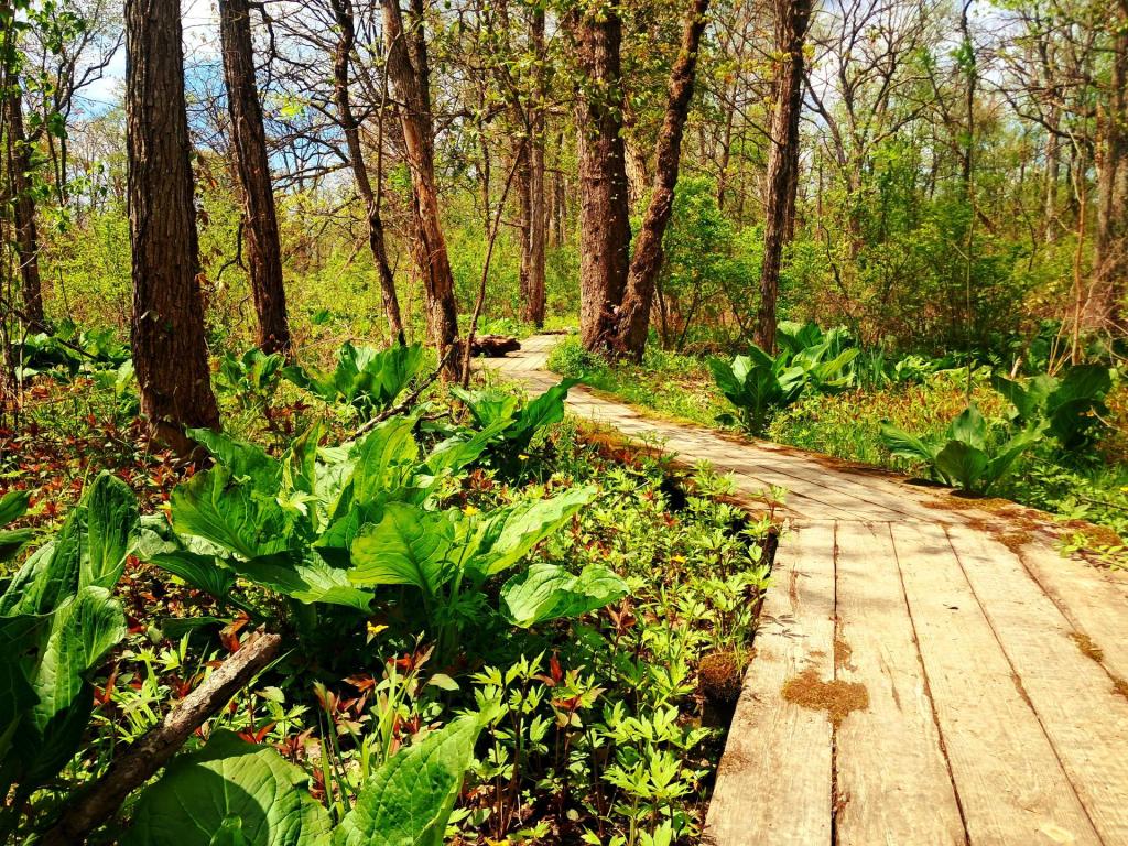
Andy

Show only the Charts, Google Maps, Maps, Photos or Videos.

Home
15 Elm Avenue
Albany
Albany Pine Bush Preserve
Albany, New York
Alfred E Smith Building
Allegany County, New York
Auburn, New York
Bath, NY
Bennington Welcome Center
Berne, New York
Bethlehem Town Center
Bethlehem, NY
Big Bend, New York
Blenheim, New York
Bradford, Pennsylvania
Bridgewater, New York
Brookfield, New York
Burnt-Rossman Hills State Forest
Buzzard Swamp Coop Mangement Area
Buzzard Swamp Coop Wildlife Management Area
Canastota, New York
Carlisle, New York
Catskill , New York
CDTA 18
CDTA Bus Stop
CDTA Bus Stop - Dove And Washington
CDTA Bus Stop #449
Central Valley, New York
Charter Township of Shippen
Chittenango Creek
City Beer Hall
City of Albany
City of Troy NY
Clarksville, New York
Clay
Colonial Laundromats
Cook Forest
Cooperstown
Cooperstown, New York
Corning Preserve
Cuba, New York
Danby, Vermont
Davis, West Virginia
Delaware Ave
Delaware Plaza
Deleware Ave
Delmar
Delmar Laundry
Delmar, NY
Dolgeville, New York
Dons Barber Shop
Dormansville
Dormansville, NY
Downtown Albany
Dwight D. Eisenhower Lock
East Branch Sacandaga River Gorge
East Worcester Rest Area
Easter
Electronics
Elm Ave Park and Ride
Elm Ave RT-32 Park & Ride
Elm Avenue Park
Elm Avenue Park and Ride
Elsmere
Elsmere Fire Department
Elsmere. NY
Erastus Corning Tower
Erie County, NY
Erwin Park
Esperance, New York
Exit 23 - Albany (I-787)
Falling Spring Falls
Fenner, New York
Fingerlakes National Forest
First Advantage Dental
Five Rivers Environmental Central
Five Rivers Environmental Education
Four Corners
French Azilum Historical Site
Fultonham, New York
Garrett County, Maryland
Garrett County, MD
George Vanderbuilt Town Park
Glenfield, New York
Glenmont Car Wash
GLENMONT CAR WASH AND DETAIL CENTER
Glenmont, New York
Google County Maps
Greenville, New York
Griffin, New York
Hannacroix Perserve
Hannaford Supermarket
Harriman State Park
Hector Falls
High Point Cliff
Hillabrandt Vly
Hobart, New York
Hopeville, West Virginia
Hoye-Crest
Hunter, New York
I-787 South
Imler, Pennsylvania
Ithaca, New York
Jake Moon Cafe and Restaurant
Jakes Rocks Overlook
Jersey Shore, Pennsylvania
John Boyd Thacher Park
Johnsburg
Johnstown, New York
Kehler Preserve
Kentuck Campground
Keystone Builders
Lake Pleasant
Lamar, Pennsylvania
Lamoka Lake
Lark Street
Laurel Highlands State Park
Linux
Little Falls, New York
Livingston County, NY
Long Branch Park
Louise E. Keir WMA
Lycoming County, Pennsylvania
Lye Brook Wilderness
Lyme Diease
Madison, New York
Marie Antoinette Lookout
Maryland High Point
Mavis Discount Tire
Middleburg Cliff
Middleburgh, New York
Mobil
Montour Falls, New York
Montrose, Pennsylvania
Moose River recreation area
Morris Run, Pennsylvania
Morrisville, New York
Mount Davis
Mount Davis State Park
Nebraska Bridge
New York State
New York State Education Department
North Syracuse, New York
North Syracuse, NY
Northโ€“South Lake
NYS Capitol
NYS Department of Environmental Conservation
Off-Grid Living
Ohiopyle State Park
Onondaga Hill, New York
Onondaga Lake
Otego, New York
Other States
Otsego County, NY
Otter Creek Campsite
Ovid, New York
Parent's House
Peebles Island State Park
Perkins Clearing
Pisceo Powley Road
Podunk, New York
Point Au Roche State Park
Port Allegany, Pennsylvania
Port Leyden, New York
Pratt Rock
Rawley Springs, Virginia
Relay State Forest
Rimrock
Rimrock Overlook
Robert Moses State Park
Rock City State Forest
Roger's Center
S Pearl St
Sacandaga River
Sandy, Pennsylvania
Saratoga, NY
Sawyer Mountain
Science
Seneca Falls, New York
Seneca Rocks
Sharon Springs, New York
Shawnee State Park
Sheffield
Shenandoah Mountain
Shenandoah National Park
ShopRite
Skaneateles, New York
Slingerlands, New York
Sloansville, New York
Sloatsburg Rest Stop
Social Media
Somerset County, PA
Somerset County, Pennsylvania
Somerset Reservoir
South Bethlehem, New York
Space
Speculator, New York
Speculator, NY
St. Mary's Church (Albany, New York)
Staples
State College, Pennsylvania
Steamboat Square
Stewart's Shops
Stockport Flats
Stoney Pond
Stoystown, Pennsylvania
Stratford
Stratton, VT
SUNY Plattsburgh
Swain, New York
Syracuse
Table Rock
Tannersville, New York
The City Beer Hall
The Hollow Bar + Kitchen
The Inlet Library
The Netherlands
Tioga County Pa
Tionesta, PA
Topics
Towanda, PA
Towanda, Pennsylvania
Town of Westerlo
Tricentennial Park
Trout Run, Pennsylvania
Troy, PA
Unadilla Forks, New York
Unadilla Rest Area
Valero
Vanderbilt Park
Veterans Day
Via Aquarium
Visionworks
Voorheesville
Voorheesville, New York
Vroman's Nose
Vrooman's Nose
Warren County, Pennsylvania
Warrensburg, NY
Washington And Lark Bus Stop
Watkins Glen Public Library
Watkins Glen, New York
Watkins Glen, NY
Wellsboro, Pennsylvania
West Canada Lakes Wilderness
West Capital Park
West Winfield, New York
Westerlo, New York
Westerlo, NY
Westminster Church
Windham High Point
Winifred Matthews Holt Preserve
Woodchuck Lodge
Worcester Rest Area

Questions? Need an updated map? Email me andy@andyarthur.org.

Good evening! Partly clear and 53 degrees at the Monongahela National Forest. There is a southeast breeze at 5 mph. ๐Ÿƒ. The dew point is 43 degrees.

It was a beautiful day hiking at Dolly Sods. ๐ŸšถDefinitely the best day so far on vacation. Dolly Sods was amazing for color, and I had a great campfire back at camp. Tired ๐Ÿ˜ด after hiking more than ten miles ๐Ÿ”Ÿ, it seemed like I barely went that far as with the open sods of the area, you can see a long way. Later on in the afternoon I stopped at Seneca Rocks. If it was earlier I would have climbed the Seneca Rocks but it was 5:45 pm and sunset ๐ŸŒ‡ was just around the corner. โŒ›I downshifted to first gear and took breaks going down Dolly Sods Road and didn’t have any issues with the brakes. I thought about stopping by Spruce Knob Mountain to watch the sun set from West Virginia’s highest peak at 4,860 feet but I didn’t want to drive back to camp an hour away in the darkness.

There was a Southern Wedding ๐Ÿ’’ at the Bear Rocks today in Dolly Sods. Kind of odd to see all those people in suits standing in the Mountain Laurel and Blueberry bushes but it’s certainly a beautiful place to get married in the wilderness. โ™ฅ Looked like a beautiful ceremony in the wilderness. Very lovely, it looked like a real Appalachian couple ๐Ÿ‘ซ not a high priced ceremony.

It was pretty crossing the Appalachian divide on US 33 this evening ๐Ÿšš except for the part behind a slow moving truck. US 33 in that part is pretty wide and while there are some hairpin curves โคต it’s fairly wide and an easy drive. Harmon WV is a cute Appalachian town nestled in the mountains, I’d eventually want to live in a place like that but not in the village proper but up in the hills. ๐Ÿก Probably with open burning laws more like Pennsylvania though.

Tonight will be mostly cloudy ๐ŸŒฅ, with a low of 51 degrees at 1am. 10 degrees above normal, which is similar to a typical night around September 18th. Maximum dew point of 47 at 6am. South wind 5 to 8 mph. Nice mild evening with the full moon or pretty close. ๐ŸŒ• In 2018, we had light drizzle in the evening, which became mostly clear by the early hours of the morning. It was somewhat humid. It got down to 45 degrees. The record low of 22 occurred back in 1964.

Had a nice little camp fire ๐Ÿ”ฅ for a while now that the burn ban is over. Made sure to dig out the pit well before starting the fire and cleared all the leaves nearby, moved the tent further away and made sure to drown the coals and bury them in the pit to make sure that the fire was cold before bed. Probably excessive as this part of the Monongahela National Forest is not sioe dry – there is water in the ditch and digging through the leaf litter you can feel the dampness in the soil. But based on how easy the dry wood I used for firewood is obvious the dead wood is primed to burn. The fire was fantastic and made quick work of the camp trash.

Tonight is the Hunter Moon ๐ŸŒ• or pretty darn close to it. The sun will rise at 7:23 am with the first light at 6:56 am, which is 59 seconds later than yesterday. ๐ŸŒ„ Tonight will have 12 hours and 38 minutes of darkness, an increase of 2 minutes and 31 seconds over last night.

Tomorrow will be scattered showers, mainly between 10am and 2pm. I’ll probably sleep in tomorrow and if it’s really drizzling in the morning, hot tent with a good book. Mostly cloudy ๐ŸŒฆ, with a high of 54 degrees at 7am. Seven degrees below normal, which is similar to a typical day around October 30th. Maximum dew point of 52 at 10am. West wind 10 to 13 mph. Chance of precipitation is 50%. New precipitation amounts of less than a tenth of an inch possible. Doesn’t sound like a a major rain event, should be good enough at least for visiting Blackwater Falls State Park tomorrow. Batteries are well charged from the sun today and driving so it’s not a big concern for me. ๐Ÿ”‹ Probably not a torrent going over the falls but the Blackwater Creek looked full enough when I crossed it yesterday. A year ago, we had light rain in the morning, which became light rain by afternoon. The high last year was 61 degrees. The record high of 85 was set in 1954. There was a dusting of snow in 1904.โ„

In four weeks on November 8 the sun will be setting at 5:10 pm (Standard Time) in Davis WV,๐ŸŒ„ which is one hour, 35 minutes and 39 seconds earlier then tonight. In 2018 on that day, we had partly cloudy and temperatures between 49 and 31 degrees. Typically, you have temperatures between 51 and 34 degrees. The record high of 75 degrees was set back in 1975.

Looking ahead, November ๐Ÿฅง is in 3 weeks, Veterans Day ๐Ÿ‡บ๐Ÿ‡ธ is a month away, Buy Nothing Day ๐Ÿ›๏ธ is in 7 weeks, Saint Nicholas Day ๐ŸŽ… is in 8 weeks and Latest Sunrise of the Winter ๐ŸŒ„๏ธ is in 12 weeks.

Photo #2930

Never see any New York license plates in West Virginia, even though West Virginia is the best Virginia. It’s more scenic, quieter and generally nicer and less southern, less urban, less traffic and mountainous then the inferior Virginia.

Generally the reaction I get from New Yorkers when I come down here is, “what’s in West Virginia to see and do“. Maybe it’s a good thing it’s a blank space on their map.

Map: Harrisburg Lake

Map: Harrisburg Lake

Harrisburg Lake is a developed lake with many houses along the shore in Harrisburg NY near Stony Creek. The parking area and hand launch is marked and is the public right-of-way of the road. To go from one side of the causeway to the other, you have to portage over the causeway. The north end of the lake is pretty shallow.

Good morning! Absolutely beautiful Friday morning with the leaves turning and deep blue skies. Off in a little bit to head to Dolly Sods for a nice hike. ๐Ÿšถ Three weeks to November ๐Ÿฅง. Mostly sunny and 47 degrees at the Monongahela National Forest. There is a east-southeast breeze at 6 mph. ๐Ÿƒ.

I checked โ˜‘ and the fire ban is over โ›” for the Monongahela National Forest. I am going to have to rearrange camp tonight and gather firewood so I can have a nice fire tonight. I won’t have to worry about moldy cans or accumulating to much garbage, attracting wildlife too which is another benefit of having a fire. ๐Ÿšฎ๐Ÿ”ฅIt surprisingly wet ๐Ÿ’ฆ up here, there is water running through the roadside ditches and the ground is damp. A bit of a breeze but I’ll fill my water container so I can drown the fire before bed. They must have repealed it before the holiday weekend, or maybe earlier in the week and the website wasn’t updated. Regardless, Pennsylvania was nice. ๐Ÿ‘๐Ÿ˜

Today will be mostly sunny ๐ŸŒž, with a high of 65 degrees at 2pm. Three degrees above normal, which is similar to a typical day around October 4th. Maximum dew point of 48 at 10am. Southeast wind around 6 mph becoming calm in the morning. A year ago, we had light rain in the morning, which became light rain by afternoon. It was sticky. The high last year was 72 degrees. The record high of 86 was set in 1949. There was a dusting of snow in 1987.โ„

The sun will set at 6:45 pm with dusk around 7:12 pm, which is one minute and 31 seconds earlier than yesterday. ๐ŸŒ‡ At sunset, look for mostly clear skies ๐ŸŒ„ and temperatures around 59 degrees. The dew point will be 47 degrees. There will be a calm wind. Tomorrow will have 11 hours and 19 minutes of daytime, an increase of 2 minutes and 29 seconds over today.

Tonight will be partly cloudy ๐ŸŒค, with a low of 51 degrees at 11pm. 10 degrees above normal, which is similar to a typical night around September 18th. Maximum dew point of 47 at 6pm. Light and variable wind becoming south 5 to 7 mph in the evening. In 2018, we had light drizzle in the evening, which became mostly clear by the early hours of the morning. It was somewhat humid. It got down to 45 degrees. The record low of 22 occurred back in 1964.

Tomorrow will have a chance of showers, mainly between 9am and 4pm. Mostly cloudy ๐ŸŒฆ, with a high of 57 degrees at 11am. Four degrees below normal, which is similar to a typical day around October 22nd. Maximum dew point of 53 at 11am. West wind 10 to 15 mph. Chance of precipitation is 50%. New precipitation amounts of less than a tenth of an inch possible. Not going to be a real great day but if it’s cold and wet I’ll hang out in the tent for a while in the morning and then in the afternoon explore Blackwater State Park and maybe Cannan Valley Refuge, although the later would be better to do early Sunday. A year ago, we had light rain in the morning, which became light rain by afternoon. It was sticky. The high last year was 61 degrees. The record high of 85 was set in 1954. There was a dusting of snow in 1904.โ„

Looking ahead to Sunday, mostly sunny โ˜€ , with a high near 58. South wind 6 to 8 mph. Typical average high for the weekend is 61 degrees. Going to be a beautiful day for driving back up through Pennsylvania and visiting Mount Pisgah State Park. Should be great colors there too. ๐ŸOvernight at County Bridge Pennsylvania and leave before dawn Columbus Day for home ๐Ÿก in Albany.

Already starting to think about November and December trips. I’m not sure if I can get another full week off before the end of the year but I’ll probably take some long weekends off to head to the Adirondacks, hike and hunt. ๐Ÿ”ซ I’m also thinking about a trip out to the Finger Lakes National Forest to hot tent again in December – depends on the weather but it was a lot of fun camping for that week in the snow โ›„.

As previously noted, there are 3 weeks until November ๐Ÿฅง when the sun will be setting at 6:17 pm with dusk at 6:45 pm. On that day in 2018, we had rain showers, mostly cloudy and temperatures between 59 and 48 degrees. Typically, the high temperature is 54 degrees. We hit a record high of 78 back in 1950.

Photo #5703

Good evening! Clear and 50 degrees at the Monongahela National Forest. There is a east-southeast breeze at 5 mph. ๐Ÿƒ.

It was a long drive down to West Virginia but I enjoyed it and have the most perfect campsite that I love. ๐Ÿ˜ It’s a small site but the Mountain Laurel of Cannan Heights makes it amazing. As does the beautiful moonlit evening. The colors were absolutely specular on Mount Davis in Pennsylvania, although honestly the high point of both Pennsylvania and Maryland are a bit underwhelming. I was surprised how many Amish and Mennonite farms there were around Mount Davis and Somerset. The simple life is beautiful, although I’ve heard that the Amish don’t always use the most environmentally sensitive practices with their farm operations.

No campfire for me in West Virginia but it’s not a cold night here and the heater was fine. This being a small site, they’re wouldn’t really be room for a fire ๐Ÿ”ฅ along with a tent. Northern West Virginia though isn’t bone ๐Ÿ– dry after the rain earlier in the week – you could feel the leaf litter moisture ๐Ÿ‚and even see a few puddles around. Down south in the state is much drier and I get with the breeze especially in these higher elevations the authorities are concerned, especially with reckless campers. I set the table up over the fire pit and am saving the burnables for the overnight in Pennsylvania on the way home. They’ll work fine for getting the fire started back up north. Ducks ๐Ÿ”that there is the fire ban down here.

I took a mostly different route down here then I did in 2015, heading down Pennsylvania 36 through Pennsylvania coal country and Punxsutawney. Yes, I did stop at Gobler’s Knob. You could see the hills of GOB left over from coal mining, ๐Ÿ—ป with their sometimes steep slopes and often free of anything but grasses and a few bushes. Until the 1960s, coal companies didn’t have to do any restoration of the land after doing strip mining. Even now, when you strip the to the top soil, it’s almost impossible to restore anything close to a natural cover – soil compaction, oxygenation and natural bacteria are all destroyed when you strip the land down even if you try to rebuild the surface. ๐Ÿšœ Farmers know darn well that any heavy equipment run over a farm field can do enormous damage from compaction – and it can take generations of tillage and manure spreading ๐Ÿ’ฉ to bring land back up to its natural fertility.

Driving through Johnstown Penna there was what appeared to be a wildfire on the hill outside of it ๐Ÿ’จand a lot of haze. ๐Ÿ‘€ It also looked like a building ๐Ÿข was on fire, from all the black smoke but it could have been a controlled burn. At any rate, between the fires and the coal fired power plants, ๐Ÿญ the was super hazy around there, a brown ozone haze. By the time I got down to Mount Davis outside of Somerset the haze wasn’t bad and the views were excellent.

The Somerset extension of the US 219 expressway is a major time savings over the windy Mason-Dixon Turnpike ๐ŸŒ‰ with some really high bridges and deep rock cuts, which weren’t done when I came down here in 2015.

Maryland 495 was a nice alternative to US 219 for heading down to West Virginia. ๐Ÿฎ A lot of dairy farms along there, lots of farmers harvesting crops and a few were spreading manure ๐Ÿ’ฉ including one with an old fashioned belt spreader towed by an open cab old Ford Tractor. I bet he took a shower ๐Ÿšฟ wbn he got home.

Midday on a Wednesday, there wasn’t a lot of Pennsylvania rednecks burning trash ๐Ÿ”ฅ. I did see one garage somewhere burning a pile of debris behind the shop including a tread from a truck tire and a house outside of North Cambria burning something in a burn barrel that was producing a lot of thin black smoke. ๐Ÿ’จAmish farm outside of Somerset had two burn barrels right ou front of their door as did some of dairies in Maryland farm country.

Deer were bad in Pennsylvania. I kept seeing young road kill does along PA 36 outside of Punxsutawney, came very close to hitting a small doe in Cook Forest along the Clarion River and had to slam on the brakes again on southern Clarion County when another small one ran out into the road. They really like hiding in the shadows. I swear young doe are a bit like bullhead in some lakes. Hopefully they’ll grow up and produce some big deer.

Tonight will be mostly clear ๐ŸŒƒ, with a low of 45 degrees at 4am. Four degrees above normal, which is similar to a typical night around October 2nd. Southeast wind around 5 mph. In 2018, we had mostly clear skies in the evening, which became light rain by the early hours of the morning. It became very sticky as the night progressed. It got down to 61 degrees. The record low of 22 occurred back in 1943.

Tonight will have a Waxing Gibbous Moon ๐ŸŒ” with 97% illuminated. The moon will set at 4:36 am. The Hunter Moon ๐ŸŒ• is on Saturday night with a chance of rain showers and breezy conditions up here in the high country of West Virginia. I pitched my tent so I’m ready for that – I’ll go sit by the heater in the tent if it’s truly miserable. The sun will rise at 7:22 am with the first light at 6:55 am, which is 58 seconds later than yesterday. ๐ŸŒ„ Tonight will have 12 hours and 36 minutes of darkness, an increase of 2 minutes and 30 seconds over last night.

Tomorrow will be sunny ๐ŸŒž, with a high of 63 degrees at 2pm. One degree above normal, which is similar to a typical day around October 9th. Maximum dew point of 47 at 12pm. Southeast wind around 5 mph becoming calm in the morning. A year ago, we had mostly sunny skies. It was humid. The high last year was 72 degrees. The record high of 86 was set in 1949. There was a dusting of snow in 1987.โ„

Tomorrow I plan to hike in Dolly Sods. ๐Ÿšถ I’m hoping the road up there won’t be too washboard. If it is, I’ll probably one back over Corridor H. Probably do one of the bigger loops, I’d like to see upwards of ten miles ๐Ÿ”Ÿ hiking it tomorrow. It would be cool to also drive down to West Virginia High Peak , Spruce Knob Mountain ๐Ÿ—ป but time is limited and that’s quite far south if I remember right. Well see. Saturday it’s Blackwater Falls and Cannan Valley Refuge as long as it’s not pouring. If it rains, I’ll hot tent with a book ๐Ÿ“™.

In four weeks on November 7 the sun will be setting at 5:11 pm (Standard Time),๐ŸŒ„ which is one hour, 36 minutes and 11 seconds earlier then tonight. That’s good to know if I decide to go West Virginia after Election Day next year. โ›บ Who knows? In 2018 on that day, we had mostly sunny, shallow fog and temperatures between 59 and 41 degrees. Typically, you have temperatures between 51 and 34 degrees. The record high of 75 degrees was set back in 1938.

Looking ahead, Halloween ๐Ÿ›ฅ๏ธ is in 3 weeks, Average High is 50 ๐Ÿ‚ is a month away, Thanksgiving ๐Ÿฆƒ is in 7 weeks, Repeal of Prohibition Day ๐Ÿบ is in 8 weeks, 7:15 AM Sunrise โŒ›๏ธ is in 2 months, Boxing Day ๐ŸฅŠ is in 11 weeks and National Cheese Lovers Day ๐Ÿง€ is in 15 weeks.

Photo #9234

West Virginia in absolutely beautiful tonight. The campsite I am in is the one I got two years ago, surrounded by dense mountain laurel (so thick no light passes through) on three sides, which is over ten feet tall it not higher. The stars are above and the white pines that tower over the sods is outlined by the moonlight that makes it possible to see the road and the land without a flashlight.

I’m mastering the art of driving in West Virginia and parts of Pennsylvania:

  1. See that road with all the squiggly marks on the map? Avoid it.
  2. Always try to take valleys rather than go over mountains. It’s almost always quicker.
  3. Roads labeled xxx/x like 32/7. Just don’t drive them especially not downhill.
  4. Normally you want to drive with driver side wheel touching the yellow line. When you see a car approaching in the opposite direction, reduce speed look at your passenger side mirror and move the vehicle to 6″ of the ditch or in the few places guardrail exists. Continuously go back and forth between glancing at windshield and checking mirror for position. Depending on how wide the road is, you may have to come close to a stop. Don’t get too close to the drop off, the driver away from the drop off has most of the responsibility for letting you pass.
  5. Always select the lowest gear you think you will need prior to descending the hill. You shouldn’t be downshifting further as you go down the hill.

๐ŸŽ‰Happy Hour for Groceries! ๐ŸŽ‰

I was listening to The World about a S-Market grocery store in Finland that discounts expiring foods at the grocery store ๐Ÿ‡by 60% at nine o’clock every day.๐Ÿ’ธ

What a great idea! ๐Ÿ’ญ Less things thrown away and a great discount for cost sensitive customers. And stores are making money rather than spending money to dispose of expiring foods. ๐Ÿฒ

I saw a grocery store near the Mason Dixon Line that was called Scratch ‘N Dent Discount groceries, I thought about checking out. ๐Ÿ‘ Foods are a big part of working folks budget and the more savings people can get and the more food kept out of landfill the better. โ™ป