Cloverleafs have long fallen out of popularity due to the dangerous weaving conditions they create in heavy traffic but are still used in some cases where two major arterials cross, yet there is not enough traffic to justify building a three or four level stack. Capital Region superhighways where largely built after the first big group of superhighways where completed, so traditional cloverleafs are rare, or the original designs seriously modified.
NY 7 and I-787 in Troy.
A classic cloverleaf with a fly-over/fly-under ramp for the dominate South bound traffic heading out of Troy. The curlique heading onto Alternate Route 7 can get notrouiusly congested at Rush Hour.
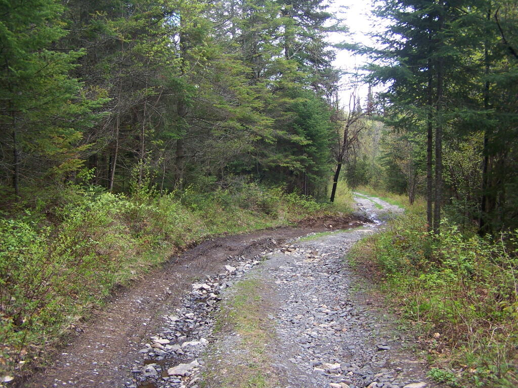
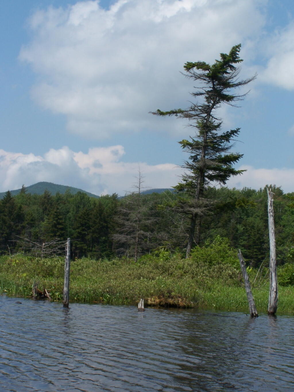
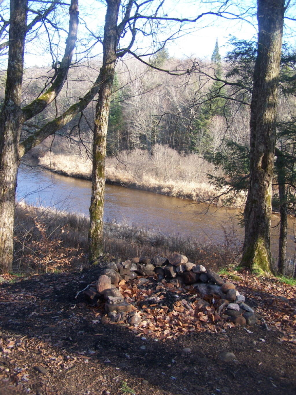
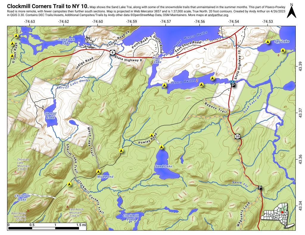
The two longest back country roads in Adirondacks — Cedar River-Limekiln Lake Road and Piseco-Powley Road — are generally closed during mud season. Other dirt roads like Moose Club Way tend to be muddy, and their is a risk you’ll get stuck back there.
It’s always a good idea to bring extra weight in your truck bed, a come-a-long or whinch, and snow shovel. You might not be far from a blacktop road at these campsites, but that is no guarantee you won’t get stuck.
1) NY Route 8 / East Branch of Sacandaga River
The campsites are all off NY 8, an all season plowed and maintained asphalt road. Some sites are reinforced with gravel. Be aware some sites may be plowed full of snow from the winter clearing of NY 8. Roughly 15 campsites along this road, however some may be too muddy for this time of year.
2) South of Arietta Town Line on Piseco-Powley Road
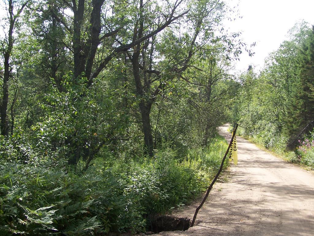
There are 7 campsites along Piseco-Powley Road, north of Stratford, prior to the Arietta Town Line gate, which is near the Potholers on East Canada Creek. This road is well packed dirt, reinforced with gravel up to gate, and should be accessiable year round, minus the snow.
3) NY 421 at Horseshoe Lake
NY 421 is an asphalt road, and there are 4 campsites prior to the gates for Horseshoe Lake Road and Lows Lower Dam Road. These gates will be closed, but the sites along NY 421 before the asphalt runs out should be good as long the snow is off of NY 421..
4) Mountain Pond
Mountain Pond Campsites are on an old routing of NY 30. While now unplowed in the winter, the road is mostly hard asphalt, asphalt chips, and gravel. Many of the campsites are reinforced with gravel, but be careful with some of the sites.
5) First Campsite on Wolf Lake Road.
There is a campsite on Wolf Lake Road, right before the parking area and winter road gate for Wolf Lake Road Extension. This campsite is grass, however if it’s relatively dry, snow and mud free, this is possiblity.
6) Reeds Pond Campsite.
Before the black top runs out, there is a campsite along Reeds Pond, which is nice for it’s solitude, but nearness to a dirt road. The campsite may be muddy, depending on the conditions.
This past week, I decided to re-do the Moose River Plains Maps I had previously rendered in QGIS. I got some new data from the DEC, and wanted to simply the existing maps by taking off Wilderness Boundaries, and other details not of particular interest to hikers, campers, and kayakers. I also removed campsites that are in process of being removed or relocated under the finalized Unit Plan for the area. Be aware that the elevation on these maps is metric, as that’s what the NYSDOT Topographic Maps use in this region.
Click on any of the maps to display the high resolution version, that you can download and save, or print. Laser printers are great, especially for the Cedar River Flow Maps, as they’ll keep the ink from the running. All of these maps are free for you to use and distribute as they are based on public data. If you have ideas on how to improve these maps or seek similar maps of the area of other trails or locations, please feel free to contact me at andy@andyarthur.org.
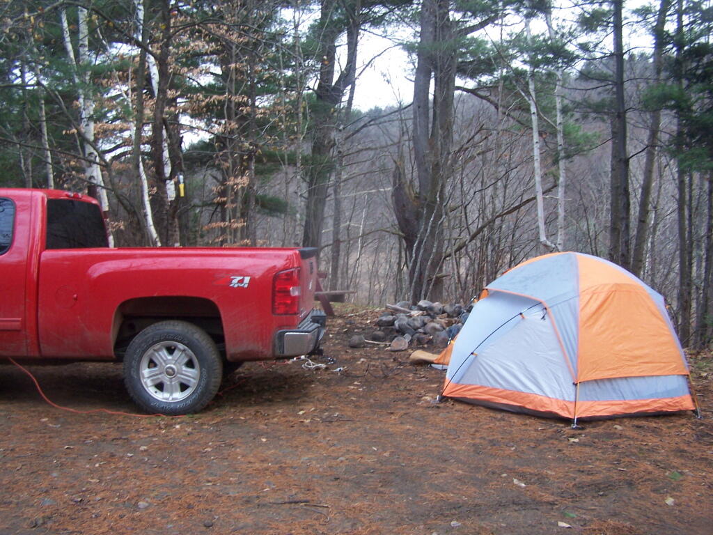
There is no charge to camp here, however if you plan on staying more then 3 nights, you will have to a get a free permit from the forest ranger. Most campsites offer picnic tables, fireplaces or rings, and outhouses. Moose River Plains are all back country dirt roads, with a speed limit of 15 MPH, and there are some rough sections on the roads. As of September 2011, all of the roads shown on these maps are open.
Moose River Plains Camping Area.
Roads are red, hiking trails are black dotted lines on the map. All of the campsites in pink shaded area (“Moose River Plains Camping Area”) offer vehicle accessible camping including RVs and other tow-behind campers. The campsites outside of the “Camping Area” — specifically those on Otter Brook Road — will in the future be reserved for tent camping (most with vehicle accessability) except during Big Game Season when campers will be allowed at all sites. Most of the other trails with campsites on them offer wheelchair or mountain bike accessiability, as they tend to be gravel paths.
Moose River Plains Campsites.
Note: Campsites are numbered starting from the east, as you are coming from Cedar River Flow, heading towards Limekiln Lake. Many campsites have been closed or added over the year, and that’s why there are many gaps in the numbering system.
Cedar River Flow and Wakely Dam.
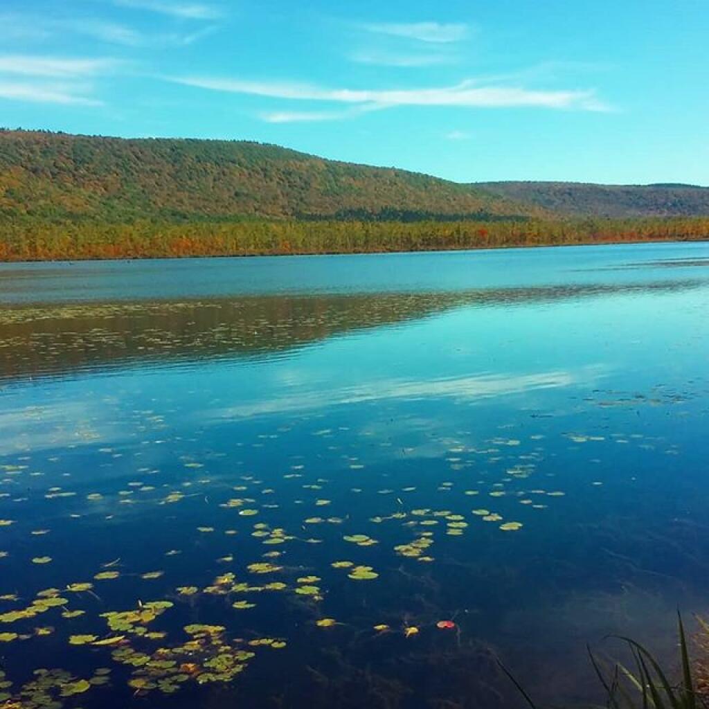
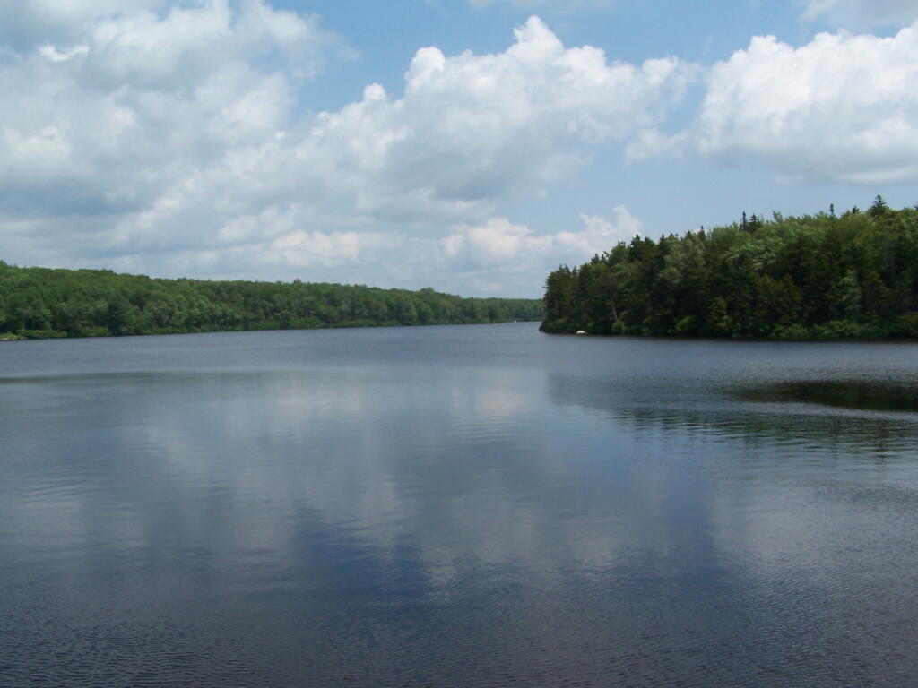
Cedar River Flow is a popular destination at Moose River Plains. In many ways it’s the gateway to Moose River Plains, as you reach Wakely Dam, which holds back the waters of Cedar River Flow as one of your first destinations heading West on Cedar River-Limekiln Lake Road from Indian Lake.
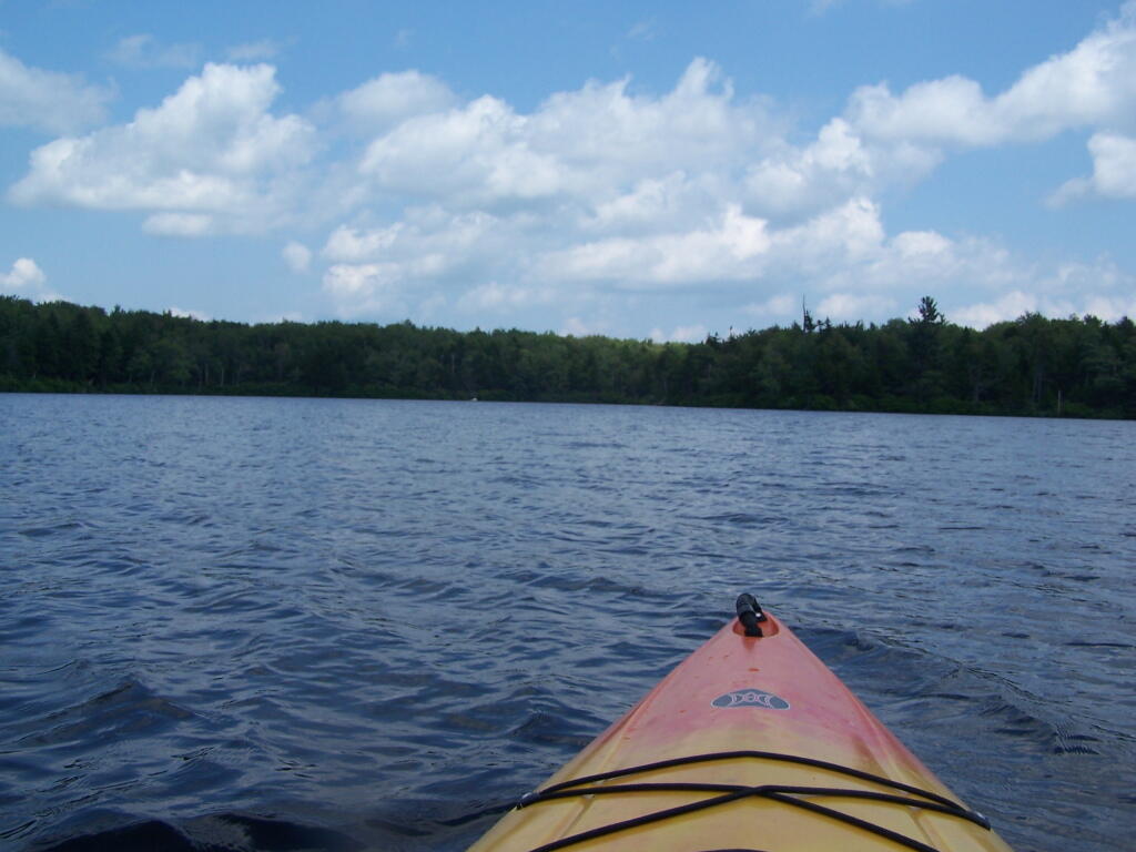
The Cedar River Flow is a popular lake for canoeing and kayaking. There are several designated and undesignated campsites along Cedar River Flow, with the designated ones shown on the map. There are also a handful of campsites, closely grouped together at Wakely Dam. The Cedar River is navigable for several miles upstream, and some people will paddle to the Lean-To on Sucker Brook Trail.
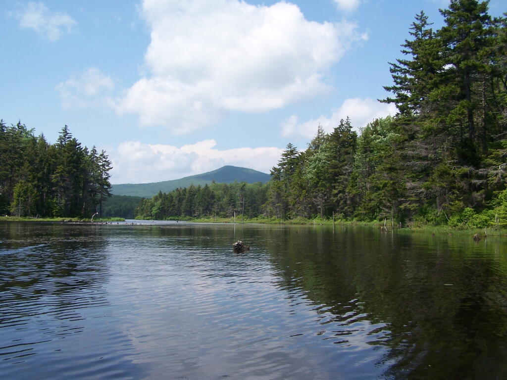
Wakely Pond and Wakely Dam Areas.
Along the Northville-Placid Trail near Wakely Pond there are several designated tent campsites. A map of Wakely Pond-Wakely Dam Areas, and the rapids downstream of the Cedar River Flow.
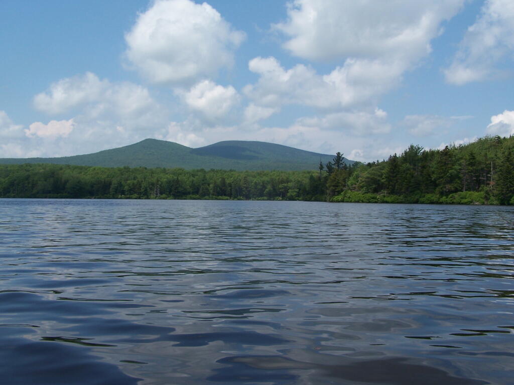
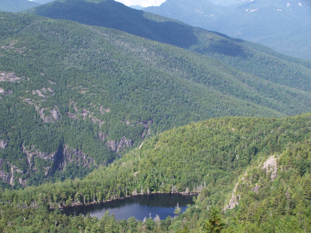
Wakely Mountain Firetower.
By far one of the most popular destinations in the area is the Wakely Mountain Fire Tower. It offers truly spectular views of Moose River Plains, Blue Ridge Wilderness, West Canada Wilderness, Fulton Chain of Lakes, and even the High Peaks.
Most times when you look at maps, they contain a lot more information then just roads. Most maps have parks, water bodies, road names and numbers. Lots of data to make the map useful. Yet, that distracts from the main purpose of roads — a circulatory system for the state’s commerce, to allow goods and people to move freely across the state.
As you will see, Highway Systems could almost be maps of human veins and arteries. Terrain plays a role in highway systems, though modern highways can blast their way through almost any barrier, climb any hill, cross any water body, to be fully connected. Highways go where people have historically chosen to engage in commerce.
Expressways, Primary Arteries.
These are the most traveled and most important arteries of NY State, that allow commerce to flow across state. Not too surprising, but shows how cities across our state are connected.
Various NY State Cities.
Many Upstate Regions have similar looking arterial systems. There is an urban street grid, then a twisty suburban street grid, with major arterial surrounding the cities, often only partially completed after 1973 when Nelson Rockefeller canceled most major urban highway projects due to the recession and increased concern about urban expressway impacts. The arterial system around Binghamton is particularly interesting, as a reflection of the deep alluvial valleys and rugged terrain that surrounds this relatively small city.
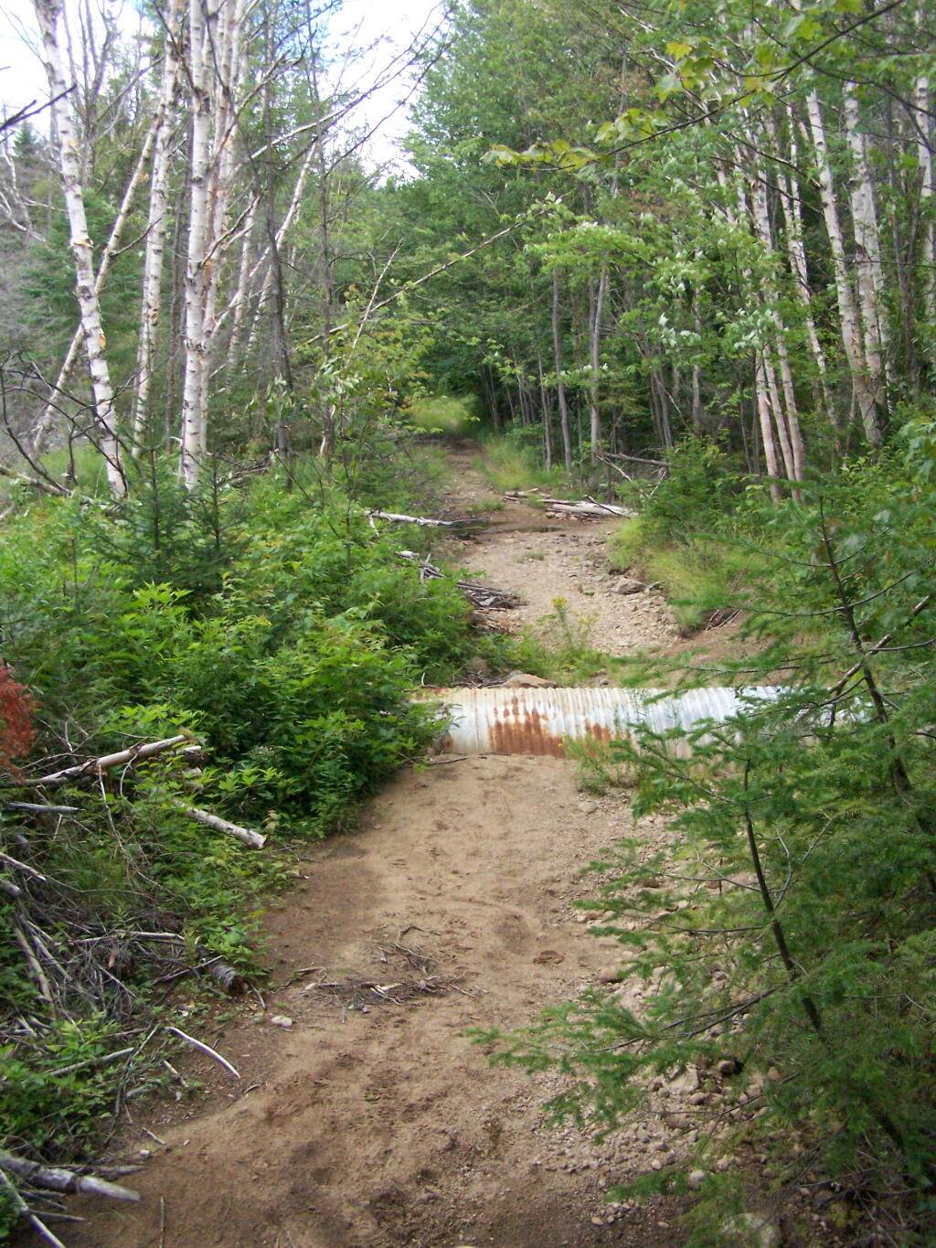
Like thousands of New Yorkers this past year I have been seriously bummed out on how Cedar River-Limekiln Lake Road from Wakely Dam to Lost Ponds was washed out for the first three months of summer season. It probably was the first time Cedar River-Limekiln Lake Road was closed off for such a long period in summer time — due to springtime flooding and severe erosion and bridge scour — combined with a very tight budget for the Environmental Conservation Department.
It seems the list of damaged or still closed roads throughout the Adirondack Park is long this year. Haskell Road is closed. Lester Flow Road and Woodhull Lake Road are rough and badly eroded. Maybe it’s just a bad year, and DEC Division of Lands and Forests is unfunded, and they lack the staff and fuel budget to fix things promptly. Or maybe it’s a more ominous sign — that DEC needs to rethink it’s road construction practices to reflect a changing climate, with heavier rains and more erosion.
As the average temperatures increase in the summer, there is going to be more demand then ever before for recreational access to the Adirondack Park. Yet, the danger is not from increased vehicle traffic, but instead erosion and bridge scour from flooding and increased heavy rains. Simply said, it may come to the point where Adirondack Park back country roads need to be built to a higher standard, with more reinforcement from wash outs.
That does not mean the end to the dirt or gravel truck trail. It does mean, around streams there is going to have to be more riprap and other course rubble rock to prevent erosion and bridge scour. Courser gravel is going to have to be used on steeper slopes, or maybe a mixture of tar and gravel to keep things in place. While blacktop may seem like the anti-thesis to the back country, it might be necessary in limited stretches to keep things in place, on road surfaces most pounded by the forces of erosion.
All of this will escalate the cost of maintenance of back country roads. Yet, the cost of improving back country roads before future cases of erosion, will ultimately save money and improve the public’s experience. Repairing roads to a higher engineering standard makes a lot of sense as the Adirondacks experience increased flooding and erosion from climate change.
From the east, probably the best way to get to Grout Pond is via Kelley Stand Road, a twisty one lane dirt road that heads east out of East Arlington in Vermont. Pay careful attention to this map, it’s easy to get lost in East Arlington or East Kansas. I know I ended up at Covered Bridge in Chiselville the first time I got there.
Grout pond isn’t the biggest in the world. If you want lots of open water, check out the Somerset Reservoir. This area, however offers either backpack-in camping along the east shore, or 25 drive-in campsites, in a primitive campground nearby. There is no charge to use this National Recreation Area. Other roadside campsites along Kelly Strand Road, FR 71, and FR 70. Forest Road 70’s campsites are particularly nice, and it’s a 1/4 mile portage down to Branch Pond (bring wheels).
The lake is very shallow and marshy in one. Supposedly good fishing if you have a Vermont State Fishing License.
The State of New York has too much legislatively-designated wilderness, or lands designated as wilderness by the act of a bureaucrat, but not necessarily true wilderness. Legislatively defined wilderness typically has:
Remains of former logging and farm roads with graded embankments cutting into hillsides.
Former ruins of houses and barns, long burned down, but visible on the landscape.
Non-native trees and plants planted by earlier settlers.
Lands that lack old-growth timber and the diversity expected in lands not previously timbered or mined.
Many if not most wilderness parcels in New York State have old woods roads, the remains of farm fields and logging operations. While it’s certain that old growth forests and areas with unique or endangered species deserve special protections, wilderness status need not be granted so haphazardly in the park.
…generally appear to have been affected primarily by the forces of nature, with the imprint of man’s work substantially unnoticeable.
This would suggest that lands subject to timbering, agriculture, hunting camps, or other types of development in previous years should not be subject to wilderness rules.
Currently there are 1,016,979 acres of wilderness. I propose:
Capping forest preserve lands in the Adirondack Park to no more then 1 million acres.
Prohibit wilderness designation from any lands within a 1/4 mile of any public highway or intensive use area.
Requiring wilderness designation to show that any lands receiving such designation are truly untrameled by man and are authentic wilderness — such as old growth or close to at least hundred year or older forests.
Reclassify all lands above the 1 million mark as Wild Forest.
It’s pratically impossible to repeal existing lands with wilderness overlays, and convert them back to wild forest. Wilderness forever locks up land and limits what the public can use the land for. Therefore, there should be no material increase in wilderness ever again in our state.
Capping wilderness would have both strengthen the concept of wilderness in our state and improve the wilderness quality and scenic beauty. Capping wilderness at a certain level would have the following benefits:
Limit wilderness area would concentrate the wilderness designation to the most environmentally significant areas — such as old growth forests and the High Peaks.
Ensure that wilderness designation not be applied to places where it’s not appropriate.
Concentrate enforcement of wilderness designation to this limited 1 million acres within the Adirondack Park.
We already cap snowmobile trails and roads at their 1972 limits in the Adirondack Park’s State Land Master Plan. Even if the state obtains new parcels of lands, there can be no net increase in road milege, even if the lands increase. For the sake of fairness, we should also cap wilderness growth, or at least repeal the existing arbitrary caps on roads and snowmobile trails.
… excessive wilderness protections makes NO sense in public lands that where traditonal timber lands once stood.


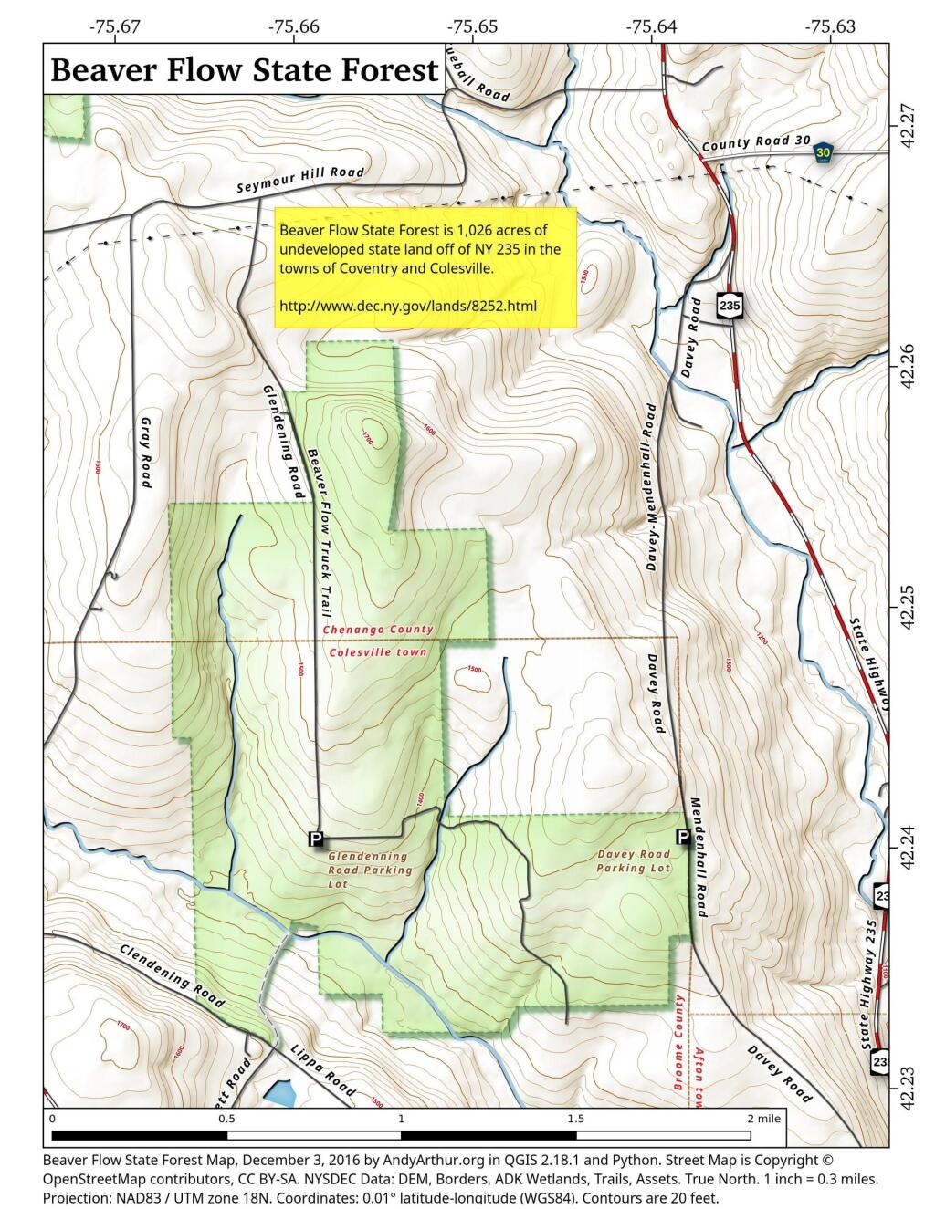


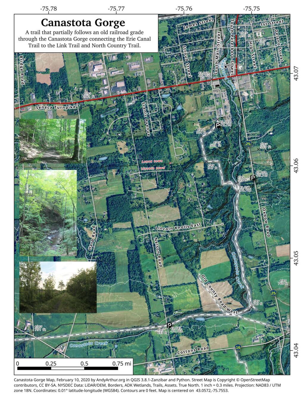

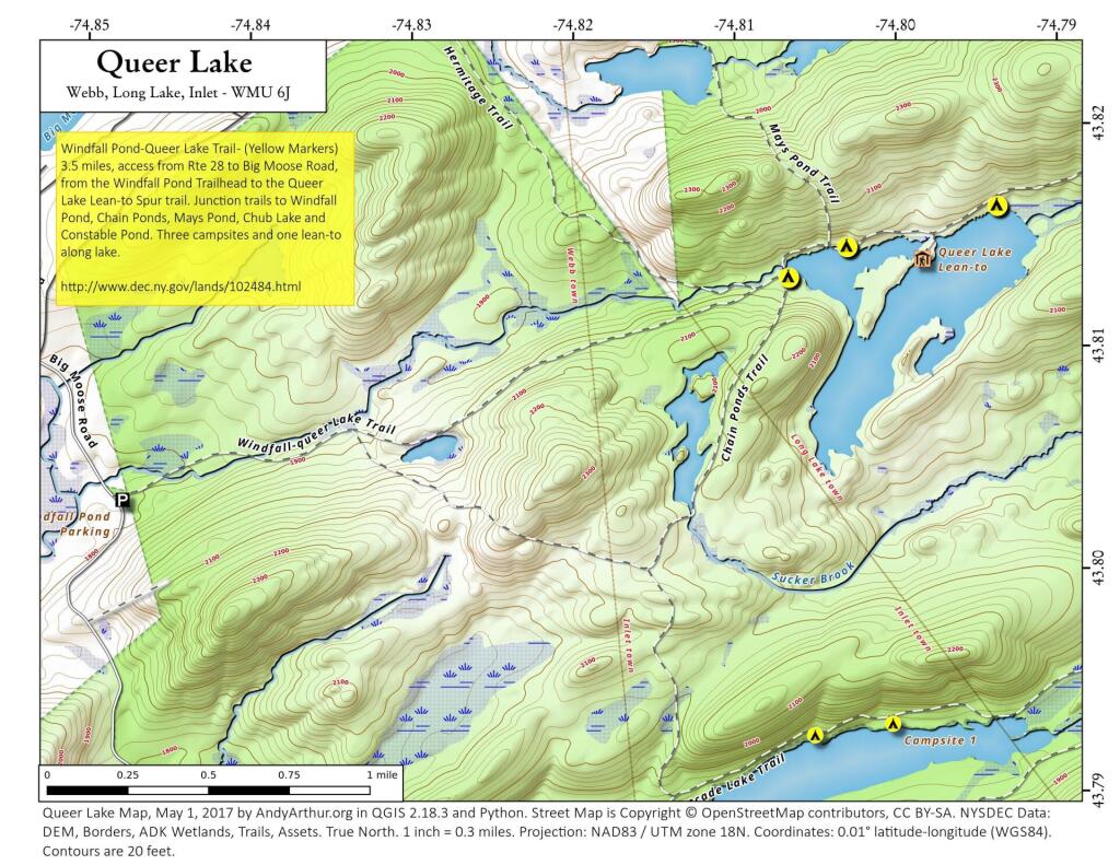
 compare to Moose River Plains Camping Area?")