various

Classification and Acres

An overview of the amount of land in each classification of the Adirondack Park. Here are a summary of the meanings of the various land classifications.

CLASS Acres Percent
PRIMITIVE CORRIDOR 292 0.01%
UNCLASSIFIED 365 0.01%
ADMINISTRATIVE 391 0.02%
HISTORIC 531 0.02%
CANOE AREA 18,989 0.74%
INTENSIVE USE 23,382 0.91%
PRIMITIVE 46,647 1.83%
WILDERNESS 1,160,125 45.39%
WILD FOREST 1,305,233 51.07%
TOTAL ADIRONDACK FOREST PRESERVE 2,555,955 100.00%

After The Fire

A look at each facility (e.g. campground, wild forest, wilderness area), sorted by size, ascending.

FACILITY Acres Percent
SIGNAL BUOY ISLAND 0.1 0.0%
NORTH CREEK PARKING FISHING ACCESS 0.2 0.0%
MILL CREEK PARKING AREA 0.2 0.0%
SAINT REGIS MOUNTAIN HISTORIC AREA 0.2 0.0%
HURRICANE MOUNTAIN HISTORIC AREA 0.2 0.0%
SHEEPSHEAD ISLAND 0.4 0.0%
MILL CREEK FISHING ACCESS 0.5 0.0%
GARDEN ISLAND 0.5 0.0%
GOOSENECK POND PRIMITIVE AREA 0.6 0.0%
COLE ISLAND 0.9 0.0%
FORTH LAKE BOAT LAUNCH 1.1 0.0%
TAHAWAS PRIMITIVE AREA 1.6 0.0%
LAKE COLBY ENVIRONMENTAL EDUCATIONAL CAMP 1.8 0.0%
MIRROR LAKE BOAT LAUNCH 1.9 0.0%
SPOON ISLAND PRIMITIVE AREA 1.9 0.0%
GREENE ISLAND MAINTENANCE FACILITY 1.9 0.0%
LAKE FLOWER BOAT LAUNCH 2.1 0.0%
PORT DOUGLASS BOAT LAUNCH 2.4 0.0%
UPPER CHATEAUGAY LAKE BOAT LAUNCH 2.4 0.0%
WILMURT CLUB ROAD 2.9 0.0%
GREAT SACANDAGA LAKE BOAT LAUNCH 3.0 0.0%
TUPPER LAKE BOAT LAUNCH 3.2 0.0%
SARANAC LAKE BOAT LAUNCH 3.3 0.0%
WESTPORT BOAT LAUNCH 3.9 0.0%
PORT HENRY BOAT LAUNCH 4.3 0.0%
STILLWATER BOAT LAUNCH 4.3 0.0%
SOUTH BAY STATE BOAT LAUNCH 4.8 0.0%
CRANBERRY LAKE BOAT LAUNCH 5.1 0.0%
RAQUETTE RIVER BOAT LAUNCH 6.3 0.0%
PRIMITIVE AREA 6.6 0.0%
MIDDLE SARANAC LAKE BOAT LAUNCH 6.8 0.0%
LAKE GEORGE FOREST PRESERVE 7.2 0.0%
SACANDAGA PRIMITIVE AREA 7.2 0.0%
WANAKENA PRIMITIVE CORRIDOR 7.5 0.0%
NORTHVILLE-SUB-OFFICE 7.9 0.0%
WILLSBORO BAY BOAT LAUNCH 8.0 0.0%
FULTON CHAIN BOAT LAUNCH 9.1 0.0%
TIED LAKE PRIMITIVE CORRIDOR 9.8 0.0%
SARANAC LAKE ISLANDS CAMPGROUND 9.9 0.0%
HURRICANE MOUNTAIN PRIMITIVE AREA 11.2 0.0%
LOWER SARANAC LAKE BOAT LAUNCH 13.6 0.0%
BEAR POND PRIMITIVE CORRIDOR 14.1 0.0%
FORKS MOUNTAIN PRIMITIVE CORRIDOR 14.7 0.0%
BROADALBIN BOAT LAUNCH 15.7 0.0%
MOSSY POINT STATE BOAT LAUNCH 16.8 0.0%
ALICE BROOK PRIMITIVE AREA 18.8 0.0%
SACANDAGA RIVER STATE BOAT LAUNCH 19.9 0.0%
LONG LAKE STATE BOAT LAUNCH 20.2 0.0%
EAGLE POINT CAMPGROUND 21.0 0.0%
ALDER CREEK PRIMITIVE CORRIDOR 23.0 0.0%
SUNY ATMOSPHERIC SCIENCES RESEARCH CENTER 23.1 0.0%
RAVEN LAKE PRIMTIVE AREA 24.7 0.0%
POPLAR POINT CAMPGROUND 32.8 0.0%
LAKE GEORGE BATTLEGROUND CAMPGROUND 33.5 0.0%
CAMP SANTANONI 36.1 0.0%
TIOGA POINT CAMPGROUND 36.2 0.0%
ALGER ISLAND CAMPGROUND 37.6 0.0%
PARTLOW LAKE PRIMITIVE CORRIDOR 39.0 0.0%
PRIMITVE AREA 45.4 0.0%
BUCK POND PRIMITIVE CORRIDOR 47.8 0.0%
CAROGA LAKE CAMPGROUND 49.1 0.0%
DUG MT. PRIMITIVE AREA 49.7 0.0%
LEWEY LAKE CAMPGROUND 53.4 0.0%
LITTLE SAND POINT CAMPGROUND 66.5 0.0%
CROWN POINT CAMPGROUND 73.6 0.0%
ADIRONDACK FISH HATCHERY 74.1 0.0%
POINT COMFORT CAMPGROUND 75.0 0.0%
LAKE GEORGE BATTLEFIELD DAY USE AREA 81.3 0.0%
BOQUET RIVER PRIMTIVE AREA 85.5 0.0%
NEHASANE PRIMITIVE CORRIDOR 87.6 0.0%
SUCKER LAKE WATER ACCESS 90.6 0.0%
FIRST BROTHER PRIMITIVE AREA 91.4 0.0%
HEARTHSTONE POINT CAMPGROUND 97.4 0.0%
GOLDEN BEACH CAMPGROUND 98.6 0.0%
INDIAN LAKE ISLANDS CAMPGROUND 102.1 0.0%
JOHN BROWNS FARM HISTORIC SITE 104.6 0.0%
SACANDAGA CAMPGROUND 116.8 0.0%
MEADOWBROOK CAMPGROUND 117.8 0.0%
WILMINGTON NOTCH CAMPGROUND 119.7 0.0%
LINCOLN POND CAMPGROUND 134.1 0.0%
JOHNS BROOK PRIMITIVE AREA 146.6 0.0%
TAYLOR POND CAMPGROUND 146.8 0.0%
LAKE EATON CAMPGROUND 152.1 0.0%
CAMP GABRIELS 158.0 0.0%
SCHUYLER ISLAND PRIMITIVE AREA 167.3 0.0%
CATHEAD MTN. PRIMITIVE AREA 172.9 0.0%
SHARP BRIDGE CAMPGROUND 192.9 0.0%
NORTHAMPTON BEACH CAMPGROUND 219.2 0.0%
WAKELY MOUNTAIN PRIMITIVE AREA 224.1 0.0%
LAKE HARRIS CAMPGROUND 233.4 0.0%
SCAROON MANOR DAY USE AREA 240.2 0.0%
EIGHTH LAKE CAMPGROUND 242.0 0.0%
AUSABLE POINT CAMPGROUND 259.5 0.0%
CRANBERRY LAKE CAMPGROUND 264.2 0.0%
LIMEKILN LAKE CAMPGROUND 266.0 0.0%
BROWN TRACT POND CAMPGROUND 272.9 0.0%
POKE-O-MOONSHINE CAMPGROUND 274.1 0.0%
LAKE DURANT CAMPGROUND 276.4 0.0%
PARADOX LAKE CAMPGROUND 287.8 0.0%
BUCK POND CAMPGROUND 302.3 0.0%
ROGERS ROCK CAMPGROUND 307.7 0.0%
FORKED LAKE CAMPGROUND 346.8 0.0%
MEACHAM LAKE CAMPGROUND 359.6 0.0%
UNCLASSIFIED 364.7 0.0%
MOFFITT BEACH CAMPGROUND 386.0 0.0%
CROWN POINT HISTORIC AREA 389.9 0.0%
AMPERSAND PRIMITIVE AREA 423.5 0.0%
ROLLINS POND CAMPGROUND 518.9 0.0%
BALD LEDGE PRIMITIVE AREA 556.5 0.0%
FISH CREEK POND CAMPGROUND 560.1 0.0%
HINCKELY RESERVOIR DAY USE AREA 568.7 0.0%
LAKE GEORGE ISLANDS CAMPGROUND 593.5 0.0%
NICKS LAKE CAMPGROUND 699.6 0.0%
PUTNAM POND CAMPGROUND 850.1 0.0%
LUZERNE CAMPGROUND 853.2 0.0%
VALCOUR ISLAND PRIMITIVE AREA 956.9 0.0%
PROSPECT MOUNTAIN 1,001.7 0.0%
DEAD CREEK PRIMITIVE AREA 1,134.9 0.0%
MT. VAN HOEVENBERG SPORTS FACILITY 1,476.6 0.1%
DEER RIVER PRIMITIVE AREA 1,870.0 0.1%
EASTERN FIVE PONDS ACCESS PRIMITIVE AREA 1,907.8 0.1%
MOOSE RIVER PLAINS CAMPING AREA 2,907.1 0.1%
WHITEFACE MTN. SKI CENTER 3,015.9 0.1%
WEST CANADA MTN. PRIMITIVE AREA 3,137.5 0.1%
RAQUETTE RIVER WILD FOREST 3,550.2 0.1%
SPLIT ROCK WILD FOREST 3,662.5 0.1%
GORE MTN. SKI CENTER 3,783.7 0.1%
MADAWASKA FLOW – QUEBEC BROOK PRIMITIVE AREA 6,035.6 0.2%
JAY MTN. WILDERNESS 7,892.3 0.3%
WHITE HILL WILD FOREST 9,640.6 0.4%
ROUND LAKE WILDERNESS 11,426.7 0.4%
LITTLE MOOSE MOUNTAIN WILDERNESS 12,277.8 0.5%
RAQUETTE-JORDAN BOREAL PRIMITIVE AREA 12,437.4 0.5%
GRASSE RIVER WILD FOREST 13,172.6 0.5%
WATSON EAST TRIANGLE WILD FOREST 13,424.3 0.5%
HURRICANE MOUNTAIN WILDERNESS 13,986.7 0.5%
PEPPERBOX WILDERNESS 14,580.0 0.6%
FULTON CHAIN WILD FOREST 15,948.9 0.6%
HORSESHOE LAKE WILD FOREST 17,139.7 0.7%
HUDSON GORGE PRIMITIVE AREA 17,161.8 0.7%
WILMINGTON WILD FOREST 17,493.2 0.7%
SAINT REGIS CANOE AREA 18,989.0 0.7%
WILLIAM C. WHITNEY WILDERNESS 19,273.7 0.8%
GIANT MTN. WILDERNESS 23,460.5 0.9%
SENTINEL RANGE WILDERNESS 23,991.8 0.9%
HA-DE-RON-DAH WILDERNESS 25,788.3 1.0%
CRANBERRY LAKE WILD FOREST 25,897.3 1.0%
ALDRICH POND WILD FOREST 26,179.6 1.0%
MCKENZIE MTN. WILDERNESS 37,464.1 1.5%
BLUE MTN. WILD FOREST 38,394.3 1.5%
HOFFMAN NOTCH WILDERNESS 38,497.6 1.5%
TAYLOR POND WILD FOREST 39,134.9 1.5%
SHAKER MOUNTAIN WILD FOREST 41,360.7 1.6%
SARGENT PONDS WILD FOREST 43,532.3 1.7%
DIX MTN. WILDERNESS 44,753.8 1.8%
HAMMOND POND WILD FOREST 45,907.0 1.8%
PHARAOH LAKE WILDERNESS 46,071.3 1.8%
BLUE RIDGE WILDERNESS 47,297.2 1.9%
CHAZY HIGHLANDS WILD FOREST 47,855.6 1.9%
JESSUP RIVER WILD FOREST 48,228.7 1.9%
PIGEON LAKE WILDERNESS 50,390.5 2.0%
MOOSE RIVER PLAINS WILD FOREST 66,624.9 2.6%
LAKE GEORGE WILD FOREST 71,157.1 2.8%
DEBAR MTN. WILD FOREST 75,893.9 3.0%
SARANAC LAKES WILD FOREST 77,726.8 3.0%
INDEPENDENCE RIVER WILD FOREST 79,096.6 3.1%
VANDERWHACKER MTN. WILD FOREST 83,986.5 3.3%
SILVER LAKE WILDERNESS 108,848.6 4.3%
SIAMESE PONDS WILDERNESS 114,923.8 4.5%
WILCOX LAKE WILD FOREST 125,839.3 4.9%
BLACK RIVER WILD FOREST 127,156.6 5.0%
FIVE PONDS WILDERNESS 139,228.7 5.4%
FERRIS LAKE WILD FOREST 147,184.3 5.8%
WEST CANADA LAKE WILDERNESS 174,292.4 6.8%
HIGH PEAKS WILDERNESS 205,772.7 8.1%
TOTAL ADIRONDACK FOREST PRESERVE 2,555,955.4 100.0%

South Over Cedar River Flow

Now each class of land, broken down by Class, Unit, Facility, Acreage, and Percent.

CLASS UNIT FACILITY Acres Percent
ADMINISTRATIVE DEBAR MTN. CAMP GABRIELS 158.0 0.0%
FERRIS LAKE FERRIS LAKE WILD FOREST 3.3 0.0%
GRASSE RIVER GRASSE RIVER WILD FOREST 7.4 0.0%
LAKE GEORGE GREENE ISLAND MAINTENANCE FACILITY 1.9 0.0%
SARANAC LAKES ADIRONDACK FISH HATCHERY 74.1 0.0%
SARANAC LAKES WILD FOREST 35.8 0.0%
WILCOX LAKE NORTHVILLE-SUB-OFFICE 7.9 0.0%
WILLIAM C. WHITNEY WILLIAM C. WHITNEY WILDERNESS 79.4 0.0%
WILMINGTON SUNY ATMOSPHERIC SCIENCES RESEARCH CENTER 23.1 0.0%
TOTAL ADMINISTRATIVE 391.0 0.0%
CANOE AREA SAINT REGIS SAINT REGIS CANOE AREA 18,989.0 0.7%
TOTAL CANOE AREA 18,989.0 0.7%
HISTORIC HAMMOND POND CROWN POINT HISTORIC AREA 389.9 0.0%
HURRICANE MOUNTAIN HURRICANE MOUNTAIN HISTORIC AREA 0.2 0.0%
SAINT REGIS SAINT REGIS MOUNTAIN HISTORIC AREA 0.2 0.0%
SARANAC LAKES JOHN BROWNS FARM HISTORIC SITE 104.6 0.0%
VANDERWHACKER MOUNTAIN CAMP SANTANONI 36.1 0.0%
TOTAL HISTORIC 531.0 0.0%
INTENSIVE USE BLACK RIVER NICKS LAKE CAMPGROUND 699.6 0.0%
BLUE MTN. LAKE DURANT CAMPGROUND 276.4 0.0%
LONG LAKE STATE BOAT LAUNCH 20.2 0.0%
BOG RIVER TUPPER LAKE BOAT LAUNCH 3.2 0.0%
CHAZY HIGHLANDS UPPER CHATEAUGAY LAKE BOAT LAUNCH 2.4 0.0%
CRANBERRY LAKE CRANBERRY LAKE BOAT LAUNCH 5.1 0.0%
CRANBERRY LAKE CAMPGROUND 264.2 0.0%
DEBAR MTN. BUCK POND CAMPGROUND 302.3 0.0%
MEACHAM LAKE CAMPGROUND 359.6 0.0%
FERRIS LAKE HINCKELY RESERVOIR DAY USE AREA 568.7 0.0%
LITTLE SAND POINT CAMPGROUND 66.5 0.0%
POINT COMFORT CAMPGROUND 75.0 0.0%
FULTON CHAIN ALGER ISLAND CAMPGROUND 37.6 0.0%
FORTH LAKE BOAT LAUNCH 1.1 0.0%
HAMMOND POND CROWN POINT CAMPGROUND 73.6 0.0%
LINCOLN POND CAMPGROUND 134.1 0.0%
PARADOX LAKE CAMPGROUND 287.8 0.0%
PORT HENRY BOAT LAUNCH 4.3 0.0%
SHARP BRIDGE CAMPGROUND 192.9 0.0%
INDEPENDENCE RIVER STILLWATER BOAT LAUNCH 4.3 0.0%
JESSUP RIVER INDIAN LAKE ISLANDS CAMPGROUND 102.1 0.0%
LEWEY LAKE CAMPGROUND 53.4 0.0%
MOFFITT BEACH CAMPGROUND 386.0 0.0%
POPLAR POINT CAMPGROUND 32.8 0.0%
LAKE GEORGE HEARTHSTONE POINT CAMPGROUND 97.4 0.0%
LAKE GEORGE BATTLEFIELD DAY USE AREA 81.3 0.0%
LAKE GEORGE BATTLEGROUND CAMPGROUND 33.5 0.0%
LAKE GEORGE FOREST PRESERVE 7.2 0.0%
LAKE GEORGE ISLANDS CAMPGROUND 593.5 0.0%
LUZERNE CAMPGROUND 853.2 0.0%
MOSSY POINT STATE BOAT LAUNCH 16.8 0.0%
PROSPECT MOUNTAIN 1,001.7 0.0%
ROGERS ROCK CAMPGROUND 307.7 0.0%
SOUTH BAY STATE BOAT LAUNCH 4.8 0.0%
MOOSE RIVER PLAINS BROWN TRACT POND CAMPGROUND 272.9 0.0%
EIGHTH LAKE CAMPGROUND 242.0 0.0%
FULTON CHAIN BOAT LAUNCH 9.1 0.0%
LIMEKILN LAKE CAMPGROUND 266.0 0.0%
MOOSE RIVER PLAINS CAMPING AREA 2,907.1 0.1%
PHARAOH LAKE PUTNAM POND CAMPGROUND 850.1 0.0%
SARANAC LAKES FISH CREEK POND CAMPGROUND 560.1 0.0%
LAKE COLBY ENVIRONMENTAL EDUCATIONAL CAMP 1.8 0.0%
LAKE FLOWER BOAT LAUNCH 2.1 0.0%
LOWER SARANAC LAKE BOAT LAUNCH 13.6 0.0%
MEADOWBROOK CAMPGROUND 117.8 0.0%
MIDDLE SARANAC LAKE BOAT LAUNCH 6.8 0.0%
MIRROR LAKE BOAT LAUNCH 1.9 0.0%
MT. VAN HOEVENBERG SPORTS FACILITY 1,476.6 0.1%
RAQUETTE RIVER BOAT LAUNCH 6.3 0.0%
ROLLINS POND CAMPGROUND 518.9 0.0%
SARANAC LAKE BOAT LAUNCH 3.3 0.0%
SARANAC LAKE ISLANDS CAMPGROUND 9.9 0.0%
SARGENT PONDS FORKED LAKE CAMPGROUND 346.8 0.0%
GOLDEN BEACH CAMPGROUND 98.6 0.0%
LAKE EATON CAMPGROUND 152.1 0.0%
TIOGA POINT CAMPGROUND 36.2 0.0%
SHAKER MOUNTAIN CAROGA LAKE CAMPGROUND 49.1 0.0%
NORTHAMPTON BEACH CAMPGROUND 219.2 0.0%
SACANDAGA RIVER STATE BOAT LAUNCH 19.9 0.0%
TAYLOR POND AUSABLE POINT CAMPGROUND 259.5 0.0%
POKE-O-MOONSHINE CAMPGROUND 274.1 0.0%
PORT DOUGLASS BOAT LAUNCH 2.4 0.0%
TAYLOR POND CAMPGROUND 146.8 0.0%
WESTPORT BOAT LAUNCH 3.9 0.0%
WILLSBORO BAY BOAT LAUNCH 8.0 0.0%
VANDERWHACKER MOUNTAIN EAGLE POINT CAMPGROUND 21.0 0.0%
GORE MTN. SKI CENTER 3,783.7 0.1%
LAKE HARRIS CAMPGROUND 233.4 0.0%
SCAROON MANOR DAY USE AREA 240.2 0.0%
WHITEFACE MTN. SKI CENTER WHITEFACE MTN. SKI CENTER 3,015.9 0.1%
WILMINGTON NOTCH CAMPGROUND 119.7 0.0%
WILCOX LAKE BROADALBIN BOAT LAUNCH 15.7 0.0%
GREAT SACANDAGA LAKE BOAT LAUNCH 3.0 0.0%
SACANDAGA CAMPGROUND 116.8 0.0%
TOTAL INTENSIVE USE 23,382.3 0.9%
PRIMITIVE ALDRICH POND PRIMITVE AREA 45.4 0.0%
BLUE RIDGE WAKELY MOUNTAIN PRIMITIVE AREA 224.1 0.0%
DEBAR MTN. DEER RIVER PRIMITIVE AREA 1,870.0 0.1%
MADAWASKA FLOW – QUEBEC BROOK PRIMITIVE AREA 6,035.6 0.2%
FIVE PONDS ALICE BROOK PRIMITIVE AREA 18.8 0.0%
EASTERN FIVE PONDS ACCESS PRIMITIVE AREA 1,907.8 0.1%
GIANT MTN. BOQUET RIVER PRIMTIVE AREA 85.5 0.0%
HIGH PEAKS AMPERSAND PRIMITIVE AREA 423.5 0.0%
JOHNS BROOK PRIMITIVE AREA 146.6 0.0%
TAHAWAS PRIMITIVE AREA 1.6 0.0%
HORSESHOE LAKE DEAD CREEK PRIMITIVE AREA 1,134.9 0.0%
HUDSON GORGE HUDSON GORGE PRIMITIVE AREA 17,161.8 0.7%
HURRICANE MOUNTAIN HURRICANE MOUNTAIN PRIMITIVE AREA 11.2 0.0%
LAKE CHAMPLAIN ISLANDS COLE ISLAND 0.9 0.0%
GARDEN ISLAND 0.5 0.0%
SCHUYLER ISLAND PRIMITIVE AREA 167.3 0.0%
SHEEPSHEAD ISLAND 0.4 0.0%
SIGNAL BUOY ISLAND 0.1 0.0%
SPOON ISLAND PRIMITIVE AREA 1.9 0.0%
VALCOUR ISLAND PRIMITIVE AREA 956.9 0.0%
PHARAOH LAKE BALD LEDGE PRIMITIVE AREA 556.5 0.0%
FIRST BROTHER PRIMITIVE AREA 91.4 0.0%
GOOSENECK POND PRIMITIVE AREA 0.6 0.0%
RAQUETTE RIVER RAQUETTE-JORDAN BOREAL PRIMITIVE AREA 12,437.4 0.5%
SENTINEL RANGE PRIMITIVE AREA 6.6 0.0%
SIAMESE PONDS DUG MT. PRIMITIVE AREA 49.7 0.0%
SILVER LAKE CATHEAD MTN. PRIMITIVE AREA 172.9 0.0%
WEST CANADA LAKE WEST CANADA MTN. PRIMITIVE AREA 3,137.5 0.1%
TOTAL PRIMITIVE 46,647.3 1.8%
PRIMITIVE CORRIDOR FIVE PONDS ALDER CREEK PRIMITIVE CORRIDOR 23.0 0.0%
BEAR POND PRIMITIVE CORRIDOR 14.1 0.0%
BUCK POND PRIMITIVE CORRIDOR 47.8 0.0%
PARTLOW LAKE PRIMITIVE CORRIDOR 39.0 0.0%
TIED LAKE PRIMITIVE CORRIDOR 9.8 0.0%
WANAKENA PRIMITIVE CORRIDOR 7.5 0.0%
PEPPERBOX RAVEN LAKE PRIMTIVE AREA 24.7 0.0%
SIAMESE PONDS FORKS MOUNTAIN PRIMITIVE CORRIDOR 14.7 0.0%
SILVER LAKE SACANDAGA PRIMITIVE AREA 7.2 0.0%
WEST CANADA LAKE WEST CANADA LAKE WILDERNESS 13.8 0.0%
WILMURT CLUB ROAD 2.9 0.0%
WILLIAM C. WHITNEY NEHASANE PRIMITIVE CORRIDOR 87.6 0.0%
TOTAL PRIMITIVE CORRIDOR 291.9 0.0%
UNCLASSIFIED UNCLASSIFIED UNCLASSIFIED 364.7 0.0%
TOTAL UNCLASSIFIED 364.7 0.0%
WILD FOREST ALDRICH POND ALDRICH POND WILD FOREST 26,179.6 1.0%
SUCKER LAKE WATER ACCESS 90.6 0.0%
BLACK RIVER BLACK RIVER WILD FOREST 127,156.6 5.0%
BLUE MTN. BLUE MTN. WILD FOREST 38,394.3 1.5%
CHAZY HIGHLANDS CHAZY HIGHLANDS WILD FOREST 47,855.6 1.9%
CRANBERRY LAKE CRANBERRY LAKE WILD FOREST 25,897.3 1.0%
DEBAR MTN. DEBAR MTN. WILD FOREST 75,893.9 3.0%
FERRIS LAKE FERRIS LAKE WILD FOREST 147,181.0 5.8%
FULTON CHAIN FULTON CHAIN WILD FOREST 15,948.9 0.6%
GRASSE RIVER GRASSE RIVER WILD FOREST 13,165.1 0.5%
HAMMOND POND HAMMOND POND WILD FOREST 45,907.0 1.8%
HORSESHOE LAKE HORSESHOE LAKE WILD FOREST 17,139.7 0.7%
INDEPENDENCE RIVER INDEPENDENCE RIVER WILD FOREST 79,096.6 3.1%
JESSUP RIVER JESSUP RIVER WILD FOREST 48,228.7 1.9%
LAKE GEORGE LAKE GEORGE WILD FOREST 71,157.1 2.8%
MOOSE RIVER PLAINS MOOSE RIVER PLAINS WILD FOREST 66,624.9 2.6%
RAQUETTE RIVER RAQUETTE RIVER WILD FOREST 3,550.2 0.1%
SARANAC LAKES SARANAC LAKES WILD FOREST 77,691.0 3.0%
SARGENT PONDS SARGENT PONDS WILD FOREST 43,532.3 1.7%
SHAKER MOUNTAIN SHAKER MOUNTAIN WILD FOREST 41,360.7 1.6%
SPLIT ROCK SPLIT ROCK WILD FOREST 3,662.5 0.1%
TAYLOR POND TAYLOR POND WILD FOREST 39,134.9 1.5%
VANDERWHACKER MOUNTAIN NORTH CREEK PARKING FISHING ACCESS 0.2 0.0%
VANDERWHACKER MTN. WILD FOREST 83,986.5 3.3%
WATSON EAST TRIANGLE WATSON EAST TRIANGLE WILD FOREST 13,424.3 0.5%
WHITE HILL WHITE HILL WILD FOREST 9,640.6 0.4%
WILCOX LAKE MILL CREEK FISHING ACCESS 0.5 0.0%
MILL CREEK PARKING AREA 0.2 0.0%
WILCOX LAKE WILD FOREST 125,839.3 4.9%
WILMINGTON WILMINGTON WILD FOREST 17,493.2 0.7%
TOTAL WILD FOREST 1,305,233.2 51.1%
WILDERNESS BLUE RIDGE BLUE RIDGE WILDERNESS 47,297.2 1.9%
DIX MTN. DIX MTN. WILDERNESS 44,753.8 1.8%
FIVE PONDS FIVE PONDS WILDERNESS 139,228.7 5.4%
GIANT MTN. GIANT MTN. WILDERNESS 23,460.5 0.9%
HA-DE-RON-DAH HA-DE-RON-DAH WILDERNESS 25,788.3 1.0%
HIGH PEAKS HIGH PEAKS WILDERNESS 205,772.7 8.1%
HOFFMAN NOTCH HOFFMAN NOTCH WILDERNESS 38,497.6 1.5%
HURRICANE MOUNTAIN HURRICANE MOUNTAIN WILDERNESS 13,986.7 0.5%
JAY MTN. JAY MTN. WILDERNESS 7,892.3 0.3%
LITTLE MOOSE MOUNTAIN LITTLE MOOSE MOUNTAIN WILDERNESS 12,277.8 0.5%
MCKENZIE MTN. MCKENZIE MTN. WILDERNESS 37,464.1 1.5%
PEPPERBOX PEPPERBOX WILDERNESS 14,580.0 0.6%
PHARAOH LAKE PHARAOH LAKE WILDERNESS 46,071.3 1.8%
PIGEON LAKE PIGEON LAKE WILDERNESS 50,390.5 2.0%
ROUND LAKE ROUND LAKE WILDERNESS 11,426.7 0.4%
SENTINEL RANGE SENTINEL RANGE WILDERNESS 23,991.8 0.9%
SIAMESE PONDS SIAMESE PONDS WILDERNESS 114,923.8 4.5%
SILVER LAKE SILVER LAKE WILDERNESS 108,848.6 4.3%
WEST CANADA LAKE WEST CANADA LAKE WILDERNESS 174,278.6 6.8%
WILLIAM C. WHITNEY WILLIAM C. WHITNEY WILDERNESS 19,194.3 0.8%
TOTAL WILDERNESS 1,160,125.2 45.4%
TOTAL ADIRONDACK FOREST PRESERVE 2,555,955.4 100.0%

While this is a re-run of a couple of years ago, and the data is somewhat out of date with the addition of the Essex Chain of Lakes, it still gives a good overview of the public lands of the Adirondacks.

State Land Acreage By Classification

All figures are in acres except where noted. Table updated April 2011. Reprinted from the DEC Website.

Inspiration Point

Land Classification Region
1
Region
2
Region
3
Region
4
Region
5
Region
6
Region
7
Region
8
Region
9
Catskill
Park Total
Adirondack
Park Total
State
Total
Percent of Total
State Land and
Conservation
Easements
State Forest 16,056 758 31,763 102,248 58,354 221,924 200,419 55,581 99,121 16,264 ** 786,224 17%
Forest
Preserve
Wilderness 89,352 53,482 954,601 206,151 142,834 1,160,752 1,303,586 28%
Wild Forest 75,588 60,368 938,664 ** 367,123 135,956 1,305,787 1,441,743 31%
Primitive 31,309 15,704 47,013 47,013 1%
Primitive Bicycle
Corridor
15 283 298 298 0.006%
Canoe 18,989 18,989 18,989 0.4%
Intensive Use 4,104 1,542 21,591 1,828 5,646 23,419 29,065 0.6%
Administrative 392 0 *** 384 7 392 391 783 0.02%
Historic 531 531 531 0.01%
Pending
Classification
259 111 370 370 0.007%
Under Water*
(Unclassified)
17,395 6,534 23,929 23,929 0.5%
Detached
Parcel
1,382 4,141 1,441 4,318 11,282 0.2%
Total Forest Preserve 170,833 119,816 2,001,313 601,776 285,126 2,597,267 2,893,738 61%
Wildlife Management Area 6,007 12,021 18,518 6,524 ** 46,371 49,562 41,462 17,178 407 *** 2,755 ** 197,643 4%
Conservation Easement 108 21 7,264 7,286 488,463 336,783 436 10 9,437 769,579 840,371 18%
TOTALS: 22,171 779 221,881 247,868 2,554,654 1,206,854 250,417 97,043 116,309 294,970 3,385,865 4,717,976 100%

Blue Ridge and Blue Mountain

Notes from the DEC.

* Certain lake beds are considered Forest Preserve, despite some level of private ownership adjacent to the lakes. These underwater lands are not classified. For the purposes of this table, however, lakes and ponds that are completely surrounded by Forest Preserve have been classified the same as the adjacent land.

** Where State Forests and Wildlife Management Areas exist within the Adirondack Park, the Adirondack Park State Land Master Plan also classifies these lands as Wild Forest. However, since these lands are not Forest Preserve, State Forest and Wildlife Management Area acreages within the Adirondack Park were NOT included in the Wild Forest category.

*** Where Wildlife Management Areas exist within the Catskill Park, the Catskill Park State Land Master Plan also classifies these lands as Administrative. For calculation purposes in this table, however, Wildlife Management Area acreage within the Catskill Park was NOT also included in the Administrative category.

Adirondack Wild Forests I Camped in 2011

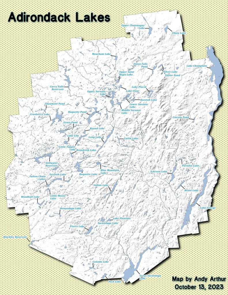
This past year, I got up to nine different Adirondack Wild Forests as part of my explorations of the Adirondack Park. Did a lot of hiking, kayaking, and camping. The map below shows the Adirondack Park’s various units.

Change in Price Since March 2020

I camped in Aldrich Pond (1 night), Black River (4), Debar Mountain (3), Ferris Lake (5), Independence River (2), Moose River Plains (3), Taylor Pond (2), Vandwhacker Mountain (1), and Wilcox Lake (4). My preference for certain Wild Forests over others, is not just based on scenic beauty or activities to do, as much as closeness to Albany and compatability with weekend plans.

I saw quite a bit of Adirondack Park for sure.

Aldrich Pond (1 night)

Camped one night on Streeter Lake Road in Aldrich Pond Wild Forest near the hamlet of Oswagatchie. Paddled part of Little River and Streeter Lake.

 Field

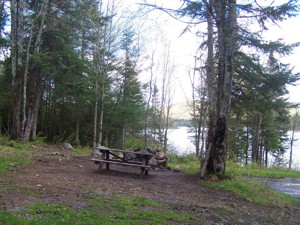
Campsite 3 on Streeter Lake Road

Black River (4 nights)

Camped two nights at Wolf Lake Landing Road. Paddled around Woodhull Lake, hiked over to Remsen Falls.

Adirondack Lakes

Roadside Camping at Site 5

Camped two nights at North Lake. Sat down by the lake, enjoyed the moonlight. Explored Atwell and part of South Lake.

Total Greenhouse Gas Equalivent, by Country

View of Lake from Campsite

Debar Mountain (3 nights)

I camped for two nights at Mountain Pond near Paul Smiths, NY, while visiting the Saint Regis Canoe Area.

Damp

Then coming back from North Country, I decided to spend a night at Jones Pond, which is between Rainbow Lake and Paul Smiths.

Ferris Lake (5 nights)

I did two weekend trips up to Ferris Lake Wild Forest. The first was during Memorial Day Weekend, which was pretty wet and rainy for most of the weekend. The second was during the mid-summer on a super oppressive, hot and humid day out. While I explored Edick Roadside Camping, and also Good Luck Lake, both times I roadside camped on Piseco-Powley Road, three nights at PR 9, one night at PR 4, and one night at 11.

Renters vs Population Density - NY Census Tracts

Strawberry Moon

 Cascade Lake

Gwen Wright (D) vs. Steven F. McLaughlin (R) Rensselaer County Executive (2021)

Independence River (2 nights)

Camped two nights at Independence River Wild Forest on Smith Road, at field Campsite 1. There are ten campsites on this road, including one with an outhouse. Several of them are located in old logging load pads, that are now mowed as fields for camping. Nothing particularly fancy here.

Rainy Morning

Moose River Plains (3 nights)

Planned to spend a week at Moose River Plains, brakes failed on third day up there. Still got three days of fall camping in along Cedar River – Limekiln Lake Road. Camped one night at Campsite 24, and two at Campsite 57 this year.

 Almost To Bus Stop

 Summer Evening

Greene County, NY - Change in Grasslands and Pasture, 2001 to 2021

Taylor Pond (2 nights)

Camped up at Union Falls for two nights in the fall, while hiking and exploring several locations in Clinton County and eastern portion of the North Country.

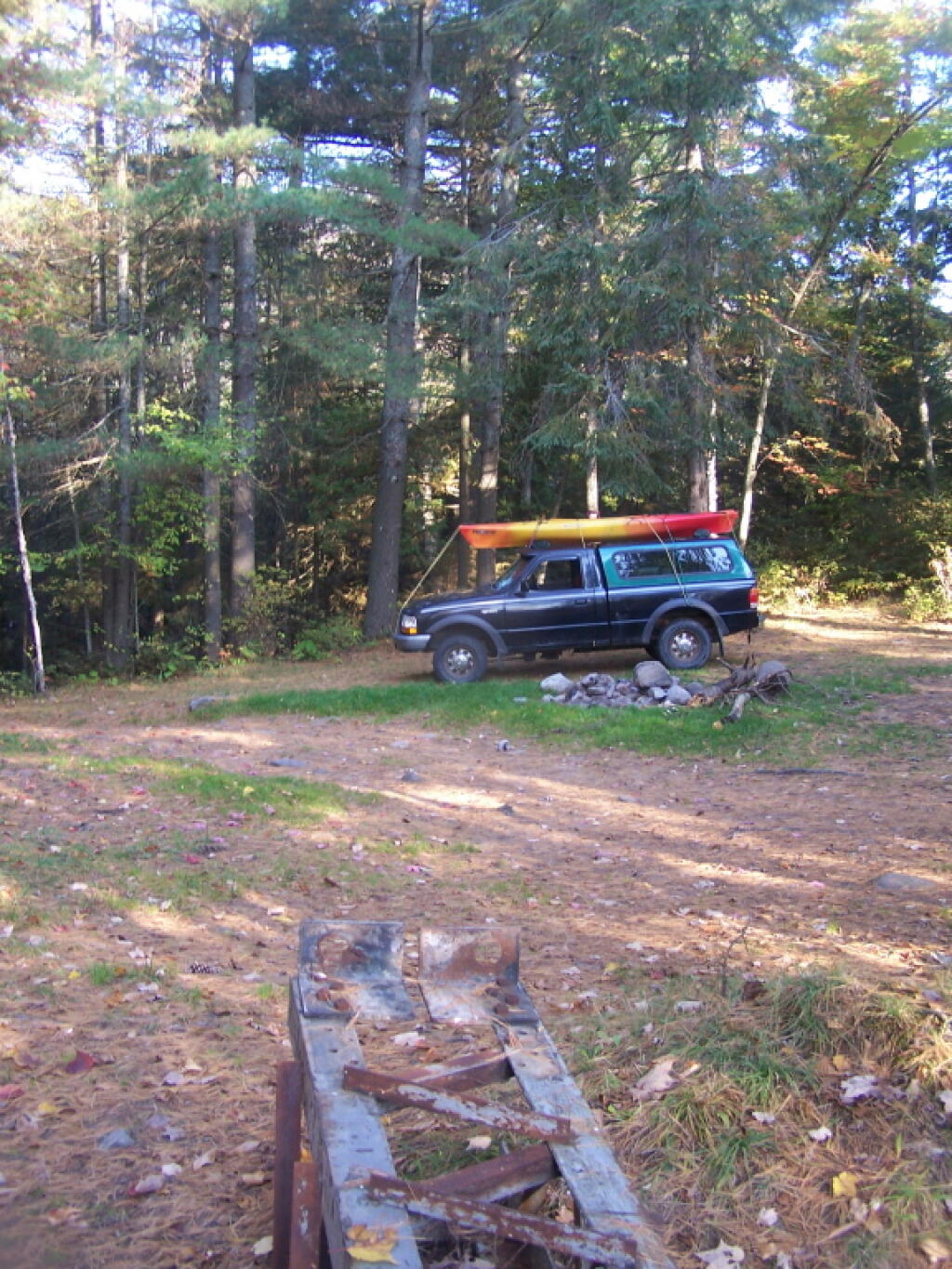
All Packed Up at Union Falls Campsite

Vandwhacker Mountain (1 nights)

Camped one night at Cheney Pond at the Vanderwhacker Wild Forest.

Abortion Providers Operating by State, 2017

Road Campsite at Cheney Pond

Wilcox Lake (4 nights)

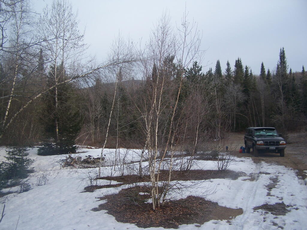
Camped three nights up off of NY 8 — one at an old Gravel Pit along the East Sacandaga River in April when the snow was still there, two nights at Fox Lair Campsite, and one night at Hope Falls Road, which is off of NY 30, near Northville.

Oil Exports

North-South Lake Campground

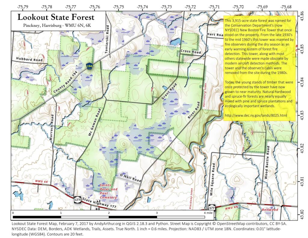
 Lookout State Forest

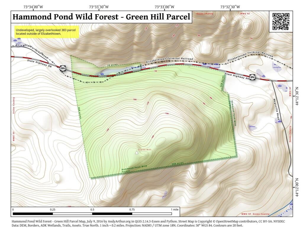
 Hammond Pond Wild Forest - Green Hill Parcel

Campsite I Stayed At

Camping Back at Fox Lair

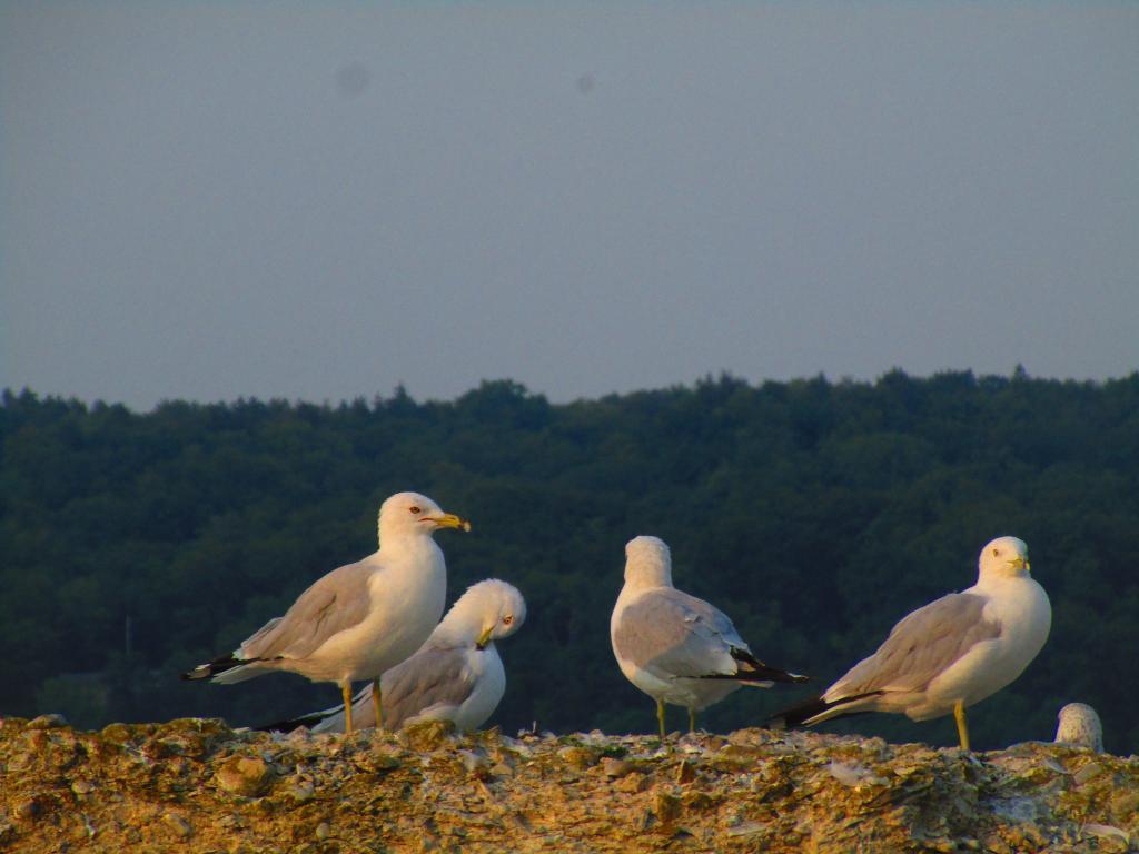
Gulls on the breakwater

Where to Camp in Black River Wild Forest

I have spent a lot of this past summer exploring the Black River Wild Forest, and decided it would be a good to share my experiences and some of the roadside and other campsites I’ve discovered along the way. As of September 2011, Lands and Forests in Albany doesn’t have these campsites in the central inventory, so all of this campsite data is based on personal exploration of these campsites.

North Lake.

Some of the best camping in the Black River Wild Forest is North Lake in Atwell. There are 22 campsites — many of them vehicle accessible along this man made lake. The southern end of the lake has some private houses and cabins on it, but it still is relatively pristine and beautiful. Most sites have outhouses and fire pits. Some but not all sites have limited wood supply. All sites designated.

Motors are allowed on this lake — as are on all wild forest lakes — so don’t be surprised to hear a jet ski or small boat on there. There are no public boat ramp on lake, so only hand launched boats can get on the lake.

Click to download or print this map.

Total Greenhouse Gas Equalivent, by Country

South Lake.

South Lake is another Erie Canal Corp / Black River Reservoir near North Lake. There is a single large campsite on South Lake, with a private in-holding on the other side of the lake. There may be other campsites here, as I didn’t explore this whole lake. There is an outhouse here, grassy field for camping, fire pit.

Click to download or print this map.

Hudson Valley

Reeds Pond.

There are a couple of campsites along Reeds Pond, North Lake Road, and Farr Road as you head up to North Lake from Forestport. This pristine, but relatively small pond is fairly popular for camping.

Click to download or print this map.

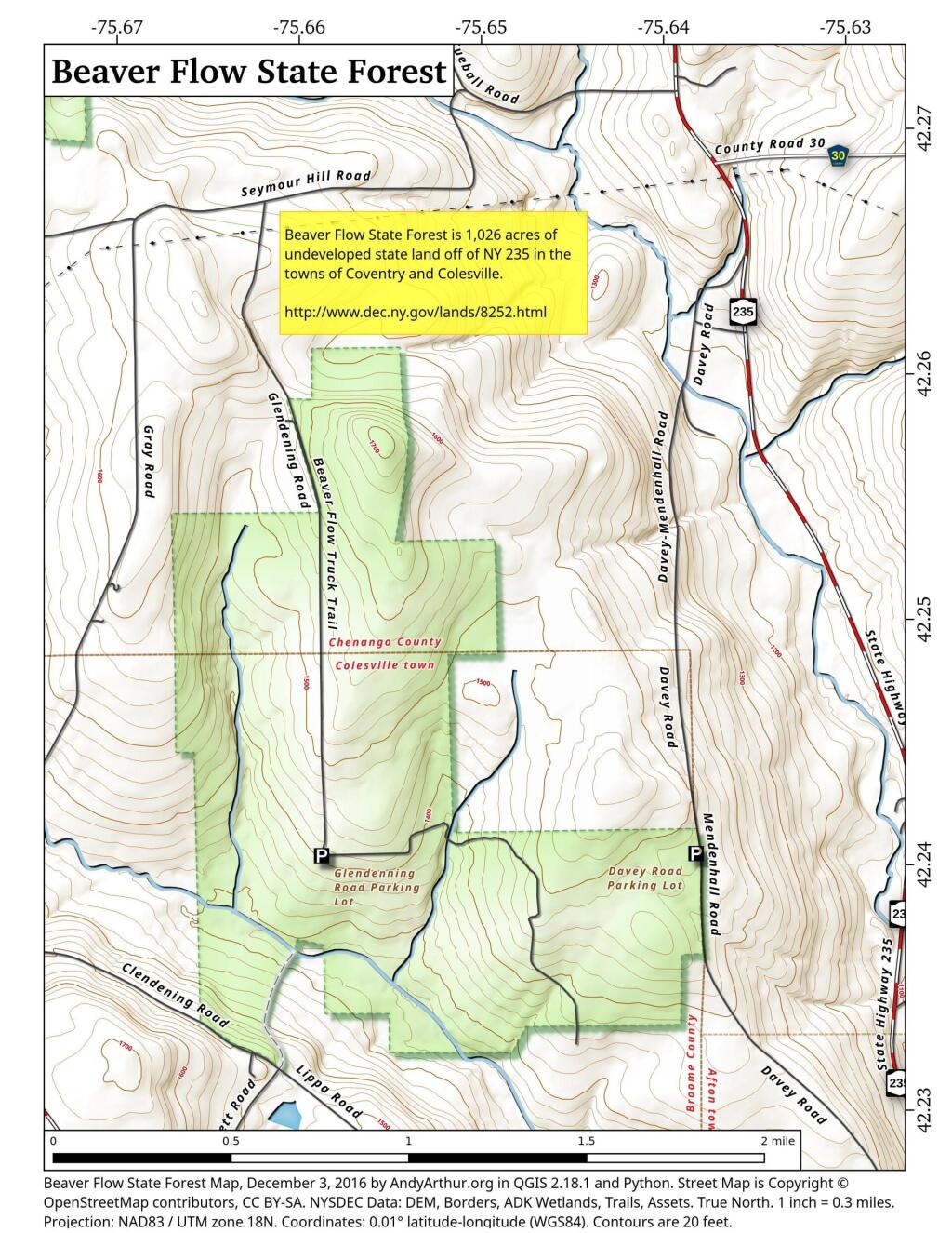
 Beaver Flow State Forest

Wolf Lake Road.

There are 5 fairly remote roadside campsites along Wolf Lake Road, as you head down to Woodhull Lake. Note also how there are lean-tos at Bear Lake and Woodhull Lake. The roadside campsites have no facilities, and some can be muddy as they are not hardened with gravel.

Wolf Lake Road has recently been rebuilt and resurfaced with gravel, however spring rains did lead to one part that may lead low-clearance cars to bottom out. Camp on this road, and your unlikely to see more then 2-3 people drive by on any particular day.

Be aware that the last 1/8th of a mile to Woodhull Lake is gated, so you’ll have to carry your boat the rest of the way down to the lake.

Click to download or print this map.

Adirondack Lakes

Remsen Falls.

Remsen Falls, which probably should be called “Remsen Rapids”, is a popular swimming place, and offers two well used campsites. There is an outhouse and picnic table down here. The trail follows a gated dirt road.

Click to download or print this map.

Roadway

How NY State is Connected By Roads

Most times when you look at maps, they contain a lot more information then just roads. Most maps have parks, water bodies, road names and numbers. Lots of data to make the map useful. Yet, that distracts from the main purpose of roads — a circulatory system for the state’s commerce, to allow goods and people to move freely across the state.

As you will see, Highway Systems could almost be maps of human veins and arteries. Terrain plays a role in highway systems, though modern highways can blast their way through almost any barrier, climb any hill, cross any water body, to be fully connected. Highways go where people have historically chosen to engage in commerce.

Expressways, Primary Arteries.

These are the most traveled and most important arteries of NY State, that allow commerce to flow across state. Not too surprising, but shows how cities across our state are connected.

 Clear Morning

Various NY State Cities.

Many Upstate Regions have similar looking arterial systems. There is an urban street grid, then a twisty suburban street grid, with major arterial surrounding the cities, often only partially completed after 1973 when Nelson Rockefeller canceled most major urban highway projects due to the recession and increased concern about urban expressway impacts. The arterial system around Binghamton is particularly interesting, as a reflection of the deep alluvial valleys and rugged terrain that surrounds this relatively small city.

 Autumn Skies

 Dusk

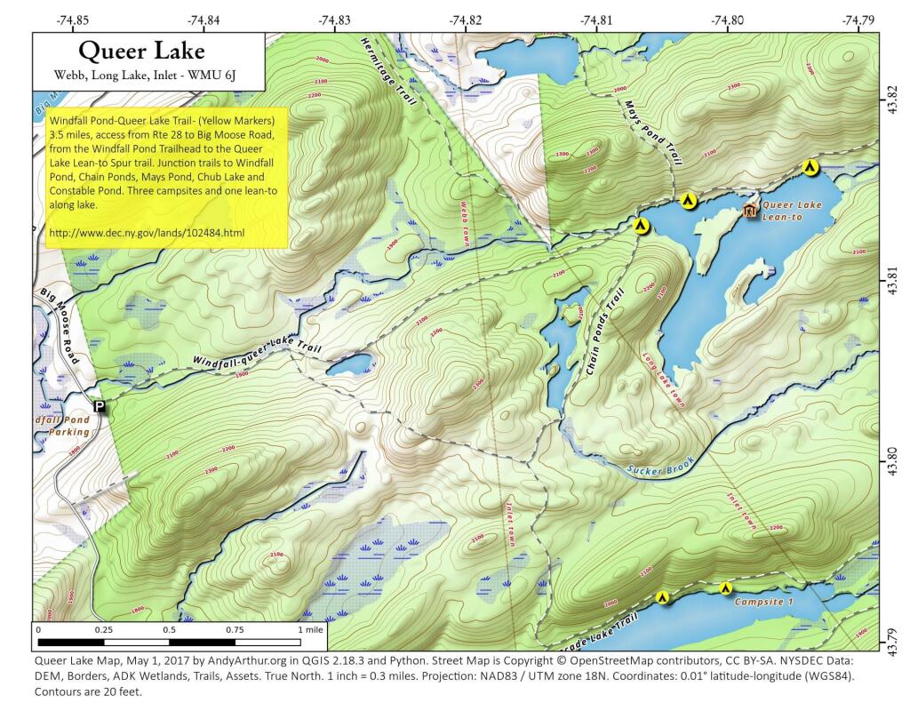
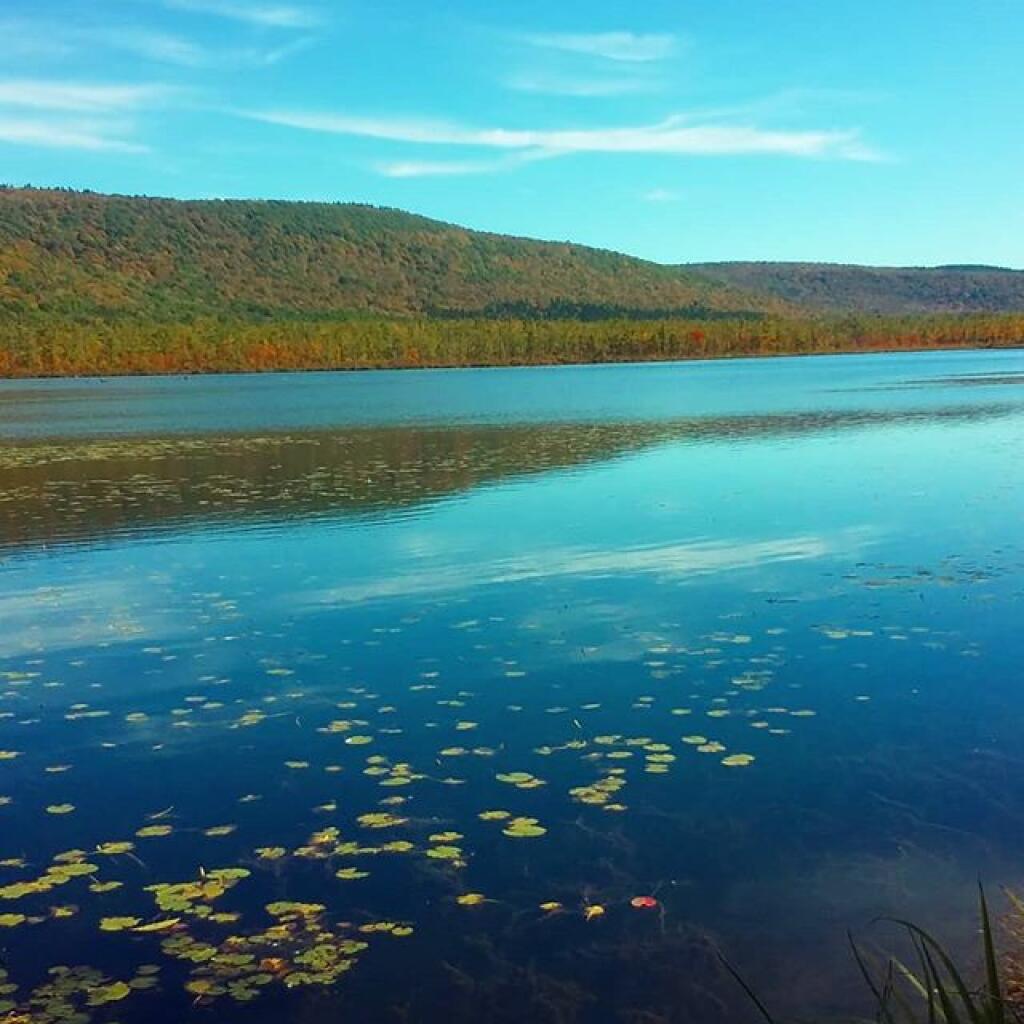
 Queer Lake

Labrador Pond

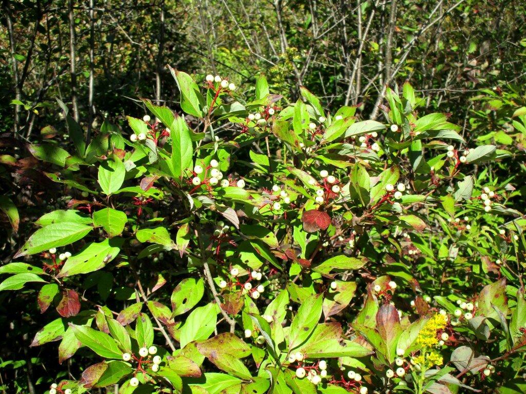
 Baneberry

Morning walk

My Concerns with a Nine County Solid Waste Authority

Dear Decision Maker:

I am writing you to express my concerns with the Regional Solid Waste Management Authority Study, recently completed by Albany County. I became concerned with solid waste issues back in 2003 when I was a college student studying part-time at SUNY Albany, and stumbled upon the Albany Pine Bush, and discovered how wasteful our urban societies really are.

I grew up on my parents land out in Westerlo in Hilltowns of Albany County. We never had trash pick up, in part because we never had a lot of trash. My parents where working class, they struggled to find good paying work after the early-1990s recession. We grew or raised a lot of our food, burned and composted what “waste” we could on our little farm. It was a sin to toss a recyclable can or bottle in with the burnable trash, and food scraps and other organics wasn’t just something to be wasted in burn barrel. Some see a carved up animal carcass, I see valuable organic materials. On my parents farm, trips to transfer station where rare. We often took more home from the Westerlo transfer station, then we sent to the Albany landfill.

Plowing Day's Trash

This was totally different then what I saw going on in the city, where food waste was “just garbage”, recycling was at best window dressing or a political statement, and people didn’t really care much about the impact of their garbage output. I saw this urban garbage was being dumped in beautiful Albany Pine Bush — are rare ecological oasis in an urban waste land. This landfill will close soon due to this wastefulness. I couldn’t believe city folk would even dream of tossing a valuable aluminum can in the trash.

Today, I also am very aggressive in avoiding waste myself, bringing organic waste out to my parents farm, and hauling the carefully separated recyclables and a minimal amount of trash to the Rupert Road Transfer Station a couple of times of year. I don’t have weekly trash pickup here. Just following what I learned growing up, I know it’s wrong to be wasteful and generate a lot of trash.

I believe we must change how we deal with waste in our cities.

We Recycle

Since becoming a resident of Town of Bethlehem in 2007, I have voted in all elections including primaries and school board, and are involved in numerous local political campaigns, particularly when there are true progressive leaders fighting to change our community for the better. I am an active member of Save the Pine Bush, and are constantly advocating for more conservation of the Albany Pine Bush, and for better recycling and especially organic waste recovery policies in our cities.

Below are my comments on the “Regional Solid Waste Management Authority Study”, please review them carefully. Thank you for your consideration! If you have questions, please don’t hesitate to call my cell at 518-281-9873 or email andy@andyarthur.org.

Sincerely,

Andy Arthur

“The policy of the state shall be to conserve and protect its natural resources and scenic beauty and encourage the development and improvement of its agricultural lands for the production of food and other agricultural products.”
— Article XIV Section 4, NY State Constitution

Point 1: Study Should Analyze Best Way to Get to Zero Waste

  • Study spends too much time considering how to build and construct a disposal facility. There are more then adequate trash landfills and incinerators to dispose of waste within our state for the foreseeable future.
  • Study should define best practices for maximizing recycling and organics recovery, not disposal.
  • Many studies have shown that large disposal facilities — incinerators or landfills — are expensive to run and cannibalize recycling efforts.
  • If a solid waste agency builds a 1,000 ton per day incinerator or landfill, it will require that much trash. If it can’t find that amount of trash, it will reduce recycling efforts to have enough trash to fill the incinerator or landfill. This undermines efforts to get to zero waste or near zero waste by increasing recycling and composting of organic materials.
  • The study should include a 20-year plan similar to that of the recently submitted Albany Solid Waste Management Plan that proposes steady reductions in disposal of waste in favor of recycling.
  • The study should have a Zero Waste goal, where nearly all waste is recycled and organics are recovered. Many communities across the country have adopted a Zero Waste goal and are vastly more aggressive in recycling and organics recovery then what this study is proposing.

Point 2: Public Authorities Are Anti-democratic

  • The study fails to acknowledge the benefits of competition, and how having competing transfer stations or disposal facilities could lower disposal costs.
  • Authorities are anti-democratic. Citizens have the right to influence their leaders on what solid waste facilities are build and what solid waste laws are implemented. The study should not call for the authority to decide on disposal facilities — it’s up to elected officials to decide.
  • The lack of competition with an Authority will lead to large bureaucratic overhead, waste, fraud, and abuse.
  • Citizens and elected officials have a right to know ahead of time what kind of disposal facilities if any would be constructed prior to creation of an authority.
  • Local communities should have a voice in process and all decisions should be made by consensus of all communities. A large governmental body makes consensus impossible.
  • Communities named in an authority’s legislation are stuck in the authority until the legislature amends the law or allows it sunset, regardless of democratic choice. Any solid waste agency should be democratic in nature, and allow communities to freely join or leave it with sufficient notice (e.g. 90 days).

Point 3: Study Fails to Acknowledge Alternatives

  • The study does not analysis the effectiveness of a Solid Waste District similar to those in Vermont. A Solid Waste District would have no employees or bureaucracy, but is a consistent set of regulations and permitting guidelines administered by multiple towns.
  • The study fails to show what is wrong with the current ANSWERS structure. While the current ANSWERS disposal facility will close shortly, ANSWERS for many years has relied on communities contracting with private recycling brokers. Why can’t communities also contract with private disposal brokers, while maintaining a coordination of solid waste planning through the current ANSWERS board?
  • Citizens should be free to choose what hauler and disposal or recycling facility they use. Some may choose a landfill for disposal of their waste, while others seeking a more different option, may prefer extra to have waste hauled to an incinerator. The choice of disposal facility should be a key part of a any plan, to allow citizens weight costs and benefits of different facilities.
  • Consider creating a “Green Rating” system for trash haulers. Let consumers choose if what lower-value materials they wish to be recycled, and what kind of disposal facility they wish to pay for.

Point 4: Town of Colonie, 8 Other Counties Have Not Expressed Interest in this Proposed Authority

  • The study claims to be on behalf of a 9-county region. However, only ANSWERS Communities have given resolutions in support of this study, and most notably the Town of Colonie has not given a resolution of support of the study. No other town or county, has formally stated their support or opposition to creation of a regional authority. Why not?
  • Would Saratoga or Rensselaer Counties want to join the Authority, if they knew a massive 1,000 tons per day incinerator or landfill was going to built in their county, and all of the trash from Albany County through Otsego County was going to be hauled there?
  • If other counties and non-ANSWERS towns are interested in creating an authority, they should be at the table now, and their citizens and elected officials should be kept fully informed. All counties, all towns, and all regions MUST have regular meetings on this topic, and a full debate in each community must occur prior joining any solid waste agency.

Point 5: 9 County Regional Authority Would Ignore Need for Rural Area Flexibility, Differences in Urban vs Rural Waste Stream

  • Waste compositions varies by town and by county. Different regions have different disposal needs. For example, farmers and rural residents may burn or bury some of their wastes on site rather then needing a centralized facility. Wastes generated on a farm are significantly different then those generated by a commercial center or urban resident.
  • In rural communities, it may make sense to have town owned and operated source-separated organics composting facilities or even disposal facilities for non-toxic farm and household trash. Decentralized composting and disposal facilities (e.g. less then 20 tons per day) will have a far lower impact on surrounding communities then large facilities.
  • Recycling programs should be tailored towards large generators of waste in a community. An centralized authority could not adequately focus on need to recycle agricultural plastics and agricultural chemicals, while also focusing on recycling of urban organic wastes or electronic waste.

Point 6: Polluter Pays, No Taxpayer Subsidies

  • Any disposal program should operate without taxpayer subsidies. Polluter pays. There should be no volume discounts — a person who disposes 10 lbs of trash should pay the same proportional rate as a corporation who disposes of 200 tons of trash.
  • Those who do not use the services of ANSWERS should not pay for it. For example a farmer or rural resident who burns or buries non-toxic waste on their property, should not be charged for disposal of that waste. Those who compost on their property should not pay for commercial composting operations.
  • No taxpayer subsidies for waste disposal, all services administered by ANSWERS should come from those who seek to recycle or dispose of a material.

Point 7: Small is Beautiful

  • Study over states the benefits of scaling up facilities and bureaucracy.
  • Numerous political science studies show that larger bureaucracies are less efficient, more subject to waste, fraud, and abuse. If a bureaucracy employees hundreds of persons it is difficult to maximize productivity and keep employees from watching Youtube at work.
  • Avoiding the bureaucracy of an authority, by simply using existing structures reduces cost and waste.
  • Large landfills, trash incinerators, recycling plants are more polluting. While large facilities may have better pollution controls then small facilities, large facilities inherently release more pollution in aggregate, have more truck traffic, and more potential for serious harm.
  • A 1,000 tons per day incinerator puts out 1,000 tons per day of carbon dioxide. That’s 365,000 tons per year of carbon dioxide, that could be avoided — or possibly a multiple of the number, by increasing recycling or organics composting.
  • Ask yourself, would you prefer to live next door to a 20-tons per day unlined town landfill, only consisting of local household trash and farm waste, or a massive 1,000 tons per day incinerator burning unsorted and largely unregulated mixed waste next door? How about being downwind of a neighboring farm’s burn barrel vs living next to a 1,000 tons per day incinerator burning mixed waste from far away? Again, while some pollutants may be better controlled by a mega-facility, the reality is other pollutants will increase and be particularly burdensome to the host community.
  • No disposal or recycling facility should be larger then 100 tons per day, and all facilities should be decentralized and close to sources of waste generation. Where scale is necessary to overcome costs of pollution control, it must be as small as possible and use the least toxic processes possible.
  • A large incinerator or landfill would incur significant costs and would require a large amount of trash to be disposed on it. This would undermine attempts at expanding recycling efforts.
  • Least desirable facilities (incinerators, landfills, recycling plants, composting plants) should be spread over as many communities as possible to be fair and democratic. It should not just target poor rural or urban communities, but include facilities in wealthy suburban communities too.
  • No one community should have the burden of disposal of waste for a nine-county region. It is especially obscene to site a large disposal facility in a rural or farming region, where many farmers may have traditionally disposed of their own waste on-farm, and are not responsible for the entire region’s long-term solid waste problem.

Truck Camping in Pictures

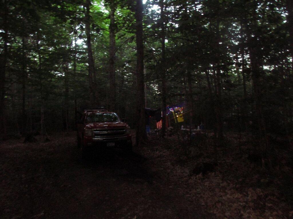
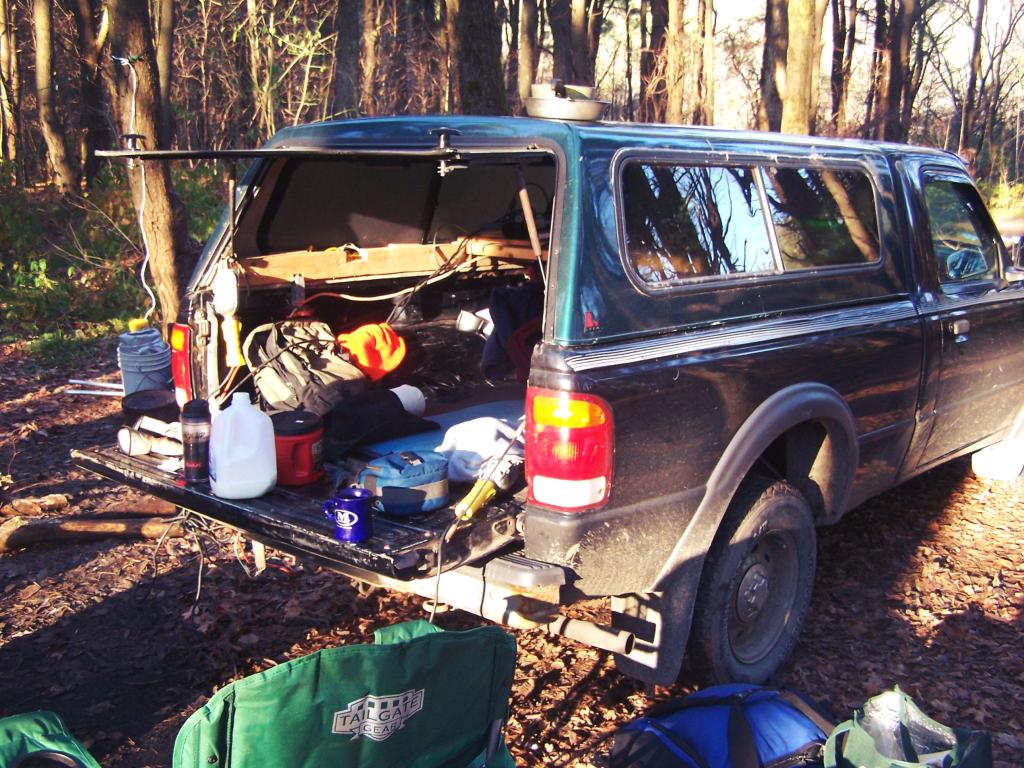
In recent months I have done a series of articles about truck camping and my set up. This time I decided to do an article with pictures, showing my set up over the years and some of the equipment I currently use.

My Truck.

Campsite

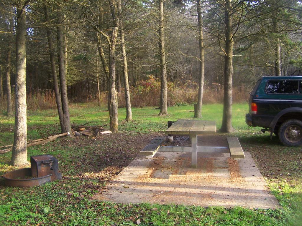
This picture was taken camping down by Betty Brook in the Burnt Rossman State Forest. This is one of my favorite places for camping. No fancy gear set up here, just unloaded the things I needed from the back, started a campfire, and enjoying the afternoon sunshine on this cold fall afternoon.

Electricity Generation.

Hillcross Farm Parcel now posted as State Forest

Lanterns are okay for camping in the back country. I however like being able to camp with electrical lighting and small electrical appliances when I am truck camping, as I have a ready source of energy — the truck’s battery. My current inverter (Vector 800-watt inverter) has voltage meter that displays how much power the truck’s battery is putting out, so as it gets lower, I simply just turn on the engine for 10-15 minutes to recharge the battery. At idle speed, especially in summer months, the truck uses minimal gasoline to recharge the battery.

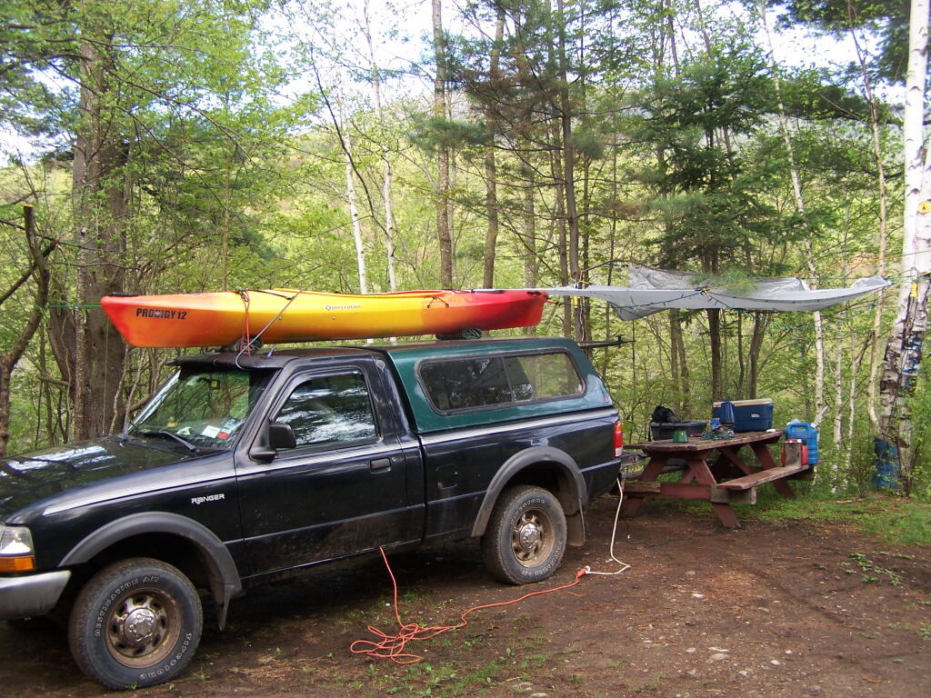
Kayak Tying Down Tarp

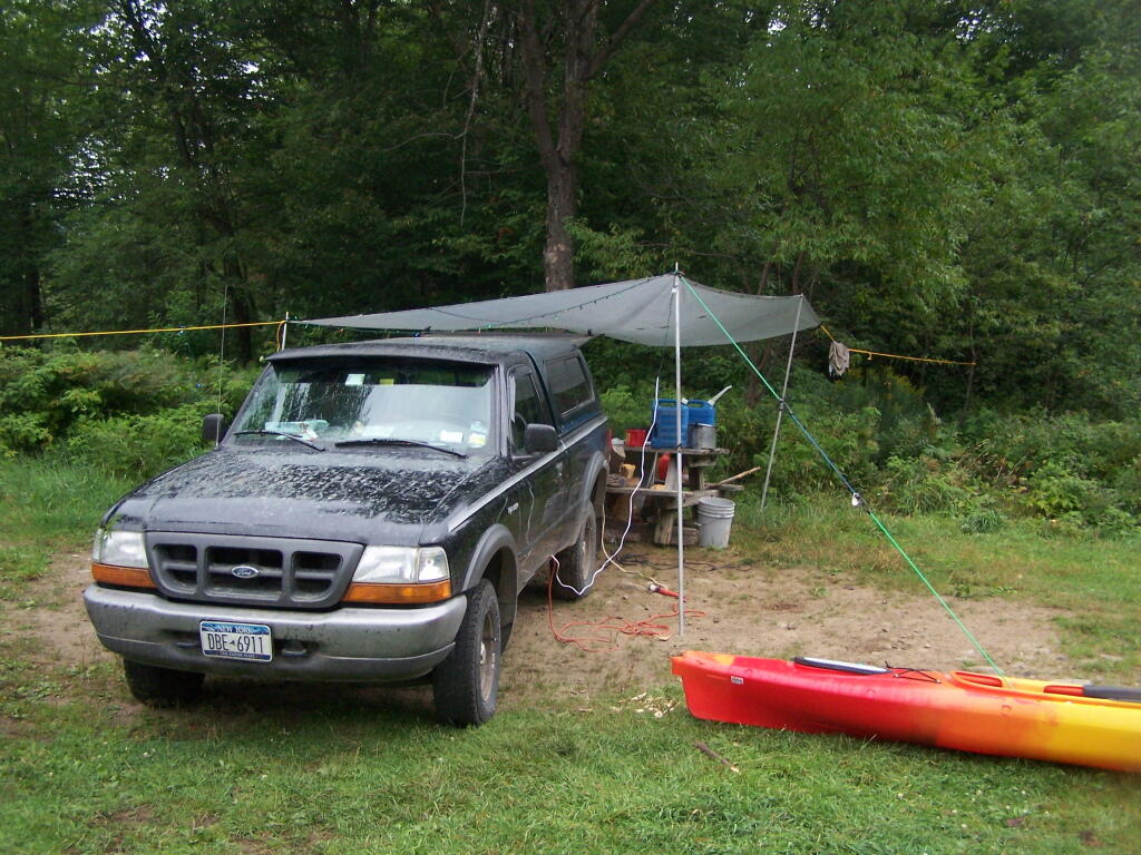
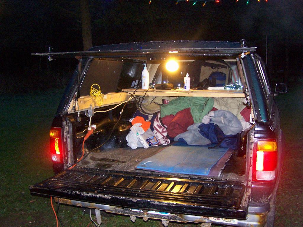
In this picture, you can see the wires coming out of the cab, from the inverter, out to Christmas Lights, and to the regular old power strip I have in the bed of pickup, which provides places to plug in the lead lamps, the alarm clock, more Christmas Lights, and anything else that needs juice like my camera battery charger or even my laptop.

Lighting the Campsite.

Campsite

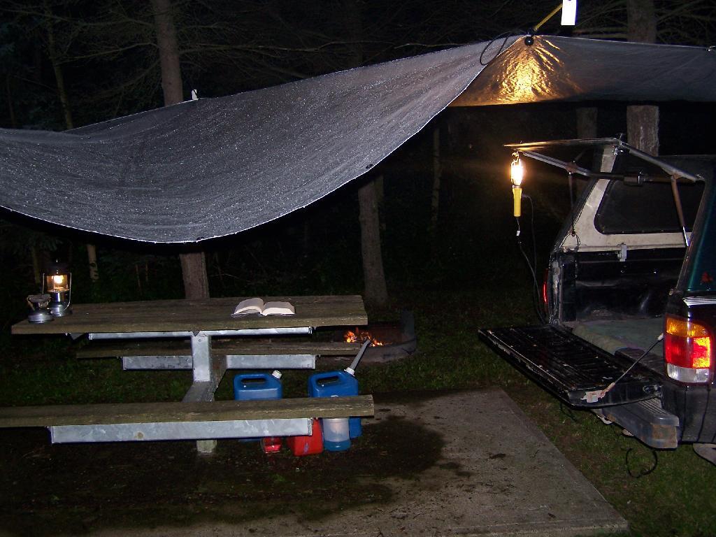
I use a set of 9-watt, 12-watt or 26-watt compact floresecent lamps in conventional lead lamps to light the campsite. I swap out light bulbs depending on my need for light, choosing smaller bulbs to conserve energy whenever possible. These compact lamps put out the equalivent of a 40-watt, 60-watt, or 100-watt conventional light bulb respectively.

Reading in the Rain

The light is largely flicker free, much brighter and higher quality then white-gas lanterns, and is superior for reading. I frequently read late into the night when I am out camping.

Tarp and Polls.

Camping

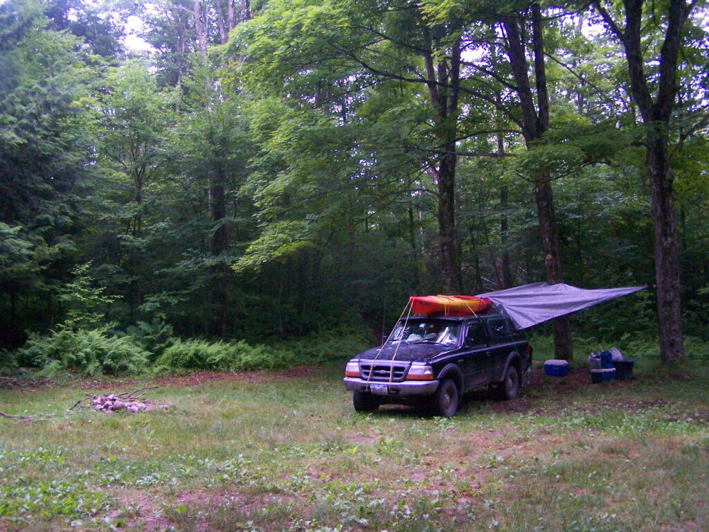
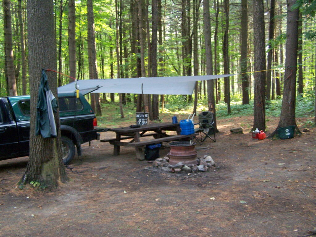
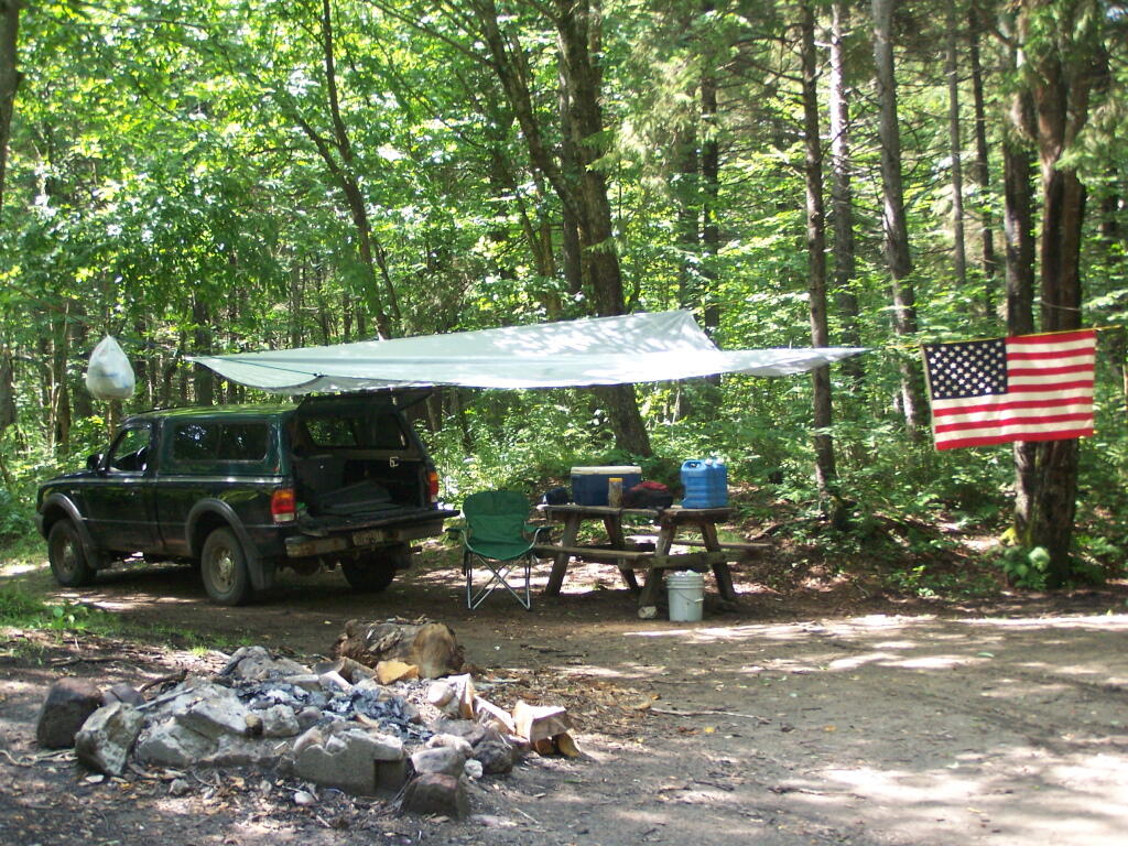
I originally bought this inexpensive tarp from Walmart for privacy while taking “showers” from my portable shower bag. I use it far more to keep the rain off my head on rainy days when camping. Usually it’s just attached to surrounding trees with bungee cords, other times I use a mixture of poles, trees, stakes, and occassionally the kayak.

Camping Down By Otter Brook

In this picture, the tarp is held up entirely by trees and long bungee cords, when I was camping up at Moose River Plains down by the Otter Brook.

In the Cab


I frequently store one or more plastic tubs in the cab of my truck at night, usually with food and other things that I want to keep away from animals and don’t want back where I am sleeping.

Under the Cap.

Packing Up the Gear

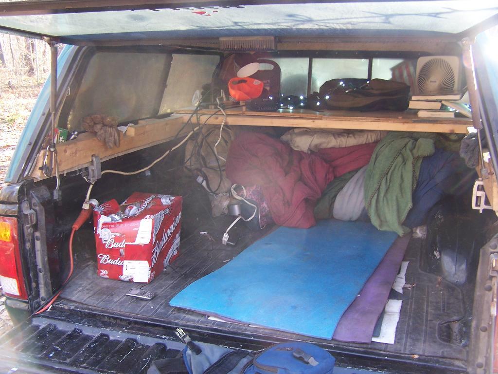
This picture shows some of the wires, camping gear, and box full of beer I had when I was camping up at the Allegheny National Forest.

Camping Set Up

Camping at Sugar Hill, with my wooden table in my pickup, a little bit before the un was up. I have a table lamp up there, and below the table is all the blankets I brought to stay warm this time of year.

Truck Camping

Using my tailgate as a table as I have breakfast when I was camping up at Stoney Pond.

Hanging Out at the Campsite.

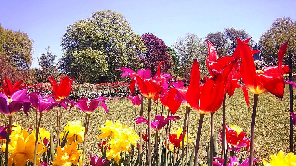
Tulip Beds

Camping up on Leonard Hill last summer. The beer is chilling on the bumper, and the campfire in the front, along with Christmas light.

Oil Heating in NY State

Camping up at Allegenheny National Forest. Getting ready and packed up for the morning, burning off some trash before I head out for the day’s events.