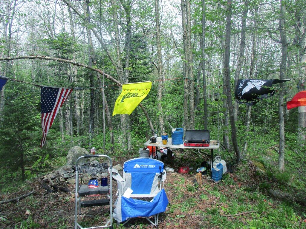
look

How Much Recreational Development is Allowed in the Forest Preserve?

Most people probably agree it’s not the intent of the original drafters of the state consitution to allow totally unbridled development in the forest preserve. Article XIV Section 1 of the State Constitution states:

The lands of the state, now owned or hereafter acquired, constituting the forest preserve as now fixed by law, shall be forever kept as wild forest lands. They shall not be leased, sold or exchanged, or be taken by any corporation, public or private, nor shall the timber thereon be sold, removed or destroyed. [… exceptions removed]

It’s pretty clear that on Forest Preserve lands that the following is totally inappropriate:

  • Commerical facilities, such as shopping or amusements.
  • Government facilities that are not primarily rustic in character (i.e. wooden administrative cabins and barns that lack plumbing and electricity)
  • Highly developed recreation facilities, such as large metal or concrete luge tracks, ski slopes
  • Asphalt roads, and those roads designed for movement of vehicles not exclusively for the forest preserve use, or for speeds greater then 25 MPH.

Goodnight Mr Sun

Controlling Principles Of Recreation in the Forest Preserve.

I think most people can agree forest Preserve must have an essentially wild character. Indeed, that is what the Court of Appeals upheld in Association for Protection of Adirondacks v MacDonald (253 N.Y. 234, affg 228 App Div 73, 1930), as I shared earlier this week. If you missed this earlier in the week, this case’s essence is cited in Balsam Anglers Club v. DEC (153 Misc. 2d 606, 1991).

Respondents adopted the UMP in furtherance of the Catskill Park State Land Master Plan, which was adopted in order to provide classifications and guidelines for the uniform protection and management of State-owned lands within the Catskill Forest Preserve. Under the UMP, respondents intend to construct a number of small parking areas providing access to trails and primitive campsites, to relocate certain trails to avoid private lands and to construct new trails within the Balsam Lake Mountain Wild Forest area. Since respondents must necessarily cut a certain number of seedlings, saplings and trees to complete such projects, petitioner contends that the UMP is in violation of article XIV, § 1 of the New York State Constitution. p>The Constitution provides, “[t]he lands of the state, now owned or hereafter acquired, constituting the forest preserve as now fixed by law, shall be forever kept as wild forest lands. They shall not be leased, sold or exchanged, or be taken by any corporation, public or private, nor shall the timber thereon be sold, removed, or destroyed.” Petitioner contends that the cutting of as many as 2,000 “trees”, most of which are less than three inches diameter at breast height, constitutes the removal or destruction of timber.

This specific constitutional issue has rarely been litigated. The Court of Appeals and the Appellate Division in Association for Protection of Adirondacks v MacDonald (253 N.Y. 234, affg 228 App Div 73) addressed legislation authorizing the construction of a bobsled run within the Adirondack Forest Preserve for the 1932 Winter Olympics.

The Appellate Division addressed the legislative history of the New York State Constitution and found an intent to prevent any actions “which might convert this preserve into anything but a wilderness” (228 App Div, at 79). However, the Appellate Division found that the framers of the New York State Constitution obviously distinguished between “timber” and any form of tree or wood. They quoted the framers as stating, “[a]ny campers that cannot pick up something on the shores, that will not be timber, to warm themselves with, would better either carry in their fuel or stay out” (supra, at 78). (emphasis added)

The Appellate Division also discussed the 1915 Constitutional Convention which sought to change the wording of the New York State Constitution to “trees and timber” (supra, at 79). Thereafter, the Appellate Division found that the project involved “the cutting of 2,600 trees which must unquestionably be regarded as of `timber’ size” (supra, at 82).

Based upon an 609*609 agreed statement of facts, all 2,600 trees were in excess of 3 inches diameter at breast height, 480 trees were in excess of 8 inches and 33 trees were in excess of 20 inches. The project involved total clearing of between 4 and 5 acres, some of which constituted first growth hardwoods and involved the removal of some 60,000 board feet of timber. The Appellate Division held the legislation unconstitutional based both upon the substantial destruction of timber and the nature of the proposed project.

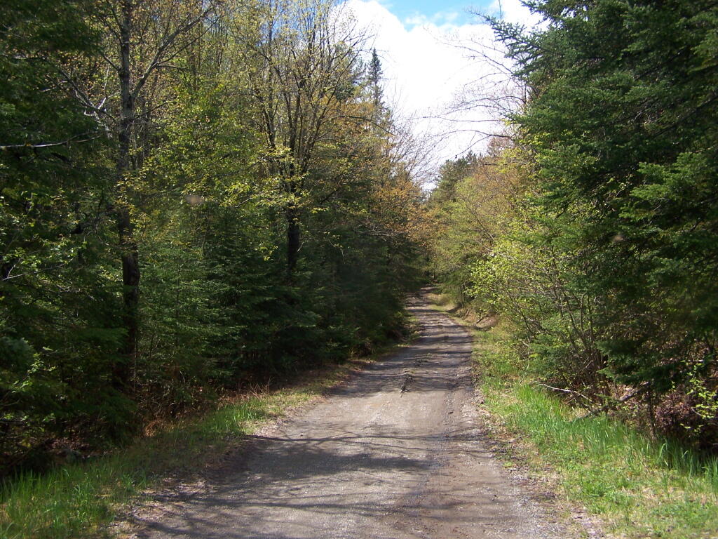
Moose River Plains Road

The citation of Helms v. Reid, 90 Misc. 2d 583 gives further incite into the Assocation for the Protection of Adirondacks vs McDonald case:

The major case interpreting the “forever wild” clause is Association for Protection of Adirondacks v MacDonald (228 App Div 73, supra). The question before that court was whether a statute passed by the Legislature providing for the construction of a bobsled run on forest preserve land and the necessary cutting of some 2,600 trees was violative of section 7 of article VII of the Constitution (presently art XIV, § 1). The Appellate Division had carefully traced the adoption of the forest preserve language and then made a careful inspection of the record from the 1894 Constitutional Convention where the “forever wild” clause language was adopted as a proposed amendment to the Constitution. The Appellate Divison concluded that the constitutional mandate was clear and in declaring the statute unconstitutional stated at page 81: “Giving to the phrase `forever kept as wild forest lands’ the significance which the term `wild forest’ bears, we must conclude that the idea intended was a health resort and playground with the attributes of a wild forest park as distinguished from other parks so common to our civilization. We must preserve it in its wild nature, its trees, its rocks, its streams. It was to be a great resort for the free use of all the people, but it was made a wild resort in which nature is given free rein. Its uses for health and pleasure must not be inconsistent 595*595 with its preservation as forest lands in a wild state. It must always retain the character of a wilderness. Hunting, fishing, tramping, mountain climbing, snowshoeing, skiing or skating find ideal setting in nature’s wilderness. It is essentially a quiet and healthful retreat from the turmoils and artificialities of a busy urban life. Breathing its pure air is invigorating to the sick. No artificial setting is required for any of these purposes. Sports which require a setting that is man-made are unmistakeably inconsistent with the preservation of these forest lands in the wild and natural state in which Providence has developed them.”

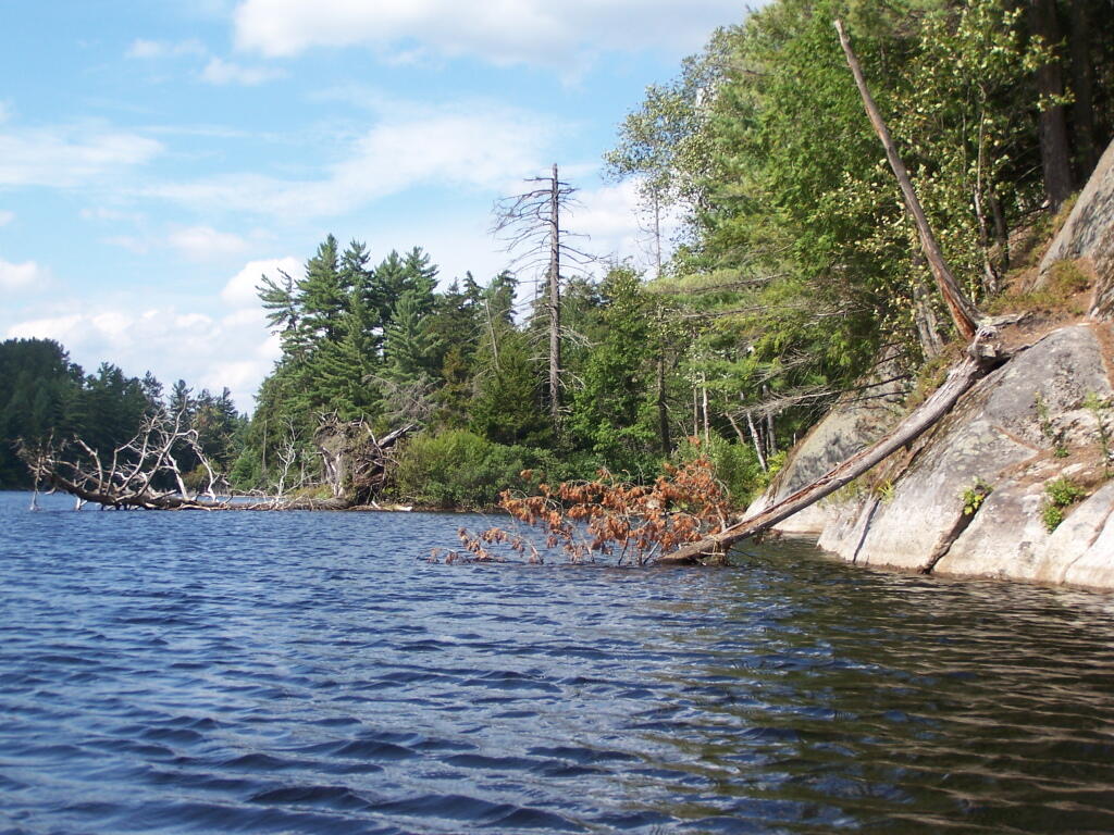
Many Downed Trees

What About Developing More Modest Recreation Facilities in Forest Preserve?

Certainly building a bob sled run would have been a massive project with visible impacts on the mountain vistas where the timber was removed, the steel infrastructure of the bob sled run, and the general changes the wild forest character. But what about more minor projects, e.g.

  • Scenic Vista Cut Along Trails
  • Primative tent campsites, along lakes, streams, or in the woods.
  • Roadside campsites with vehicular access.
  • State Campgrounds with Flush Toilets and Showers.
  • Horse stalls and horse barns.
  • Construction of hiking trails that require the cutting of brush or a de minis amount of timber.
  • Construction of snowmobile trails that potentially could involve cutting a larger amount of timber.
  • Horse trails that require the cutting of brush or a de minis amount of timber.

Moose Pond Way

The Case Law on Recreational Facilities in the Forest Preserve.

We learn in Helms v. Reid, 90 Misc. 2d 583 some of debates surrounding adoption of Article XIV Section 1 of the State Consitution, and how the Consitutional Convention of 1894 intended not to prohibit “all things necessary” to provide public access and not damage the forst preserve.

The Court of Appeals decision in MacDonald is of great importance and must necessarily be the guiding light in the analysis of the “forever wild” clause which this court must follow in rendering its opinion. At page 238 Judge CRANE states: “The words of the Constitution, like those of any other law, must receive a reasonable interpretation, considering the purpose and the object in view. (State of Ohio ex rel Popovici v. Agler, 280 U. S. 379.) Words are but symbols indicating ideas and are subject to contraction and expansion to meet the idea sought to be expressed; they register frequently according to association, or like the thermometer, by the atmosphere surrounding them. The purpose of the constitutional provision, as indicated by the debates in the Convention of 1894, was to prevent the cutting or destruction of the timber or the sale thereof, as had theretofore been permitted by legislation, to the injury and ruin of the Forest Preserve. To accomplish the end in view, it was thought necessary to close all gaps and openings in the law, and to prohibit any cutting or any removal of the trees and timber to a substantial extent.”

This language sets forth that the purpose of the “forever wild” clause was to prevent the commercial exploitation of the forest preserve which had previously been sanctioned by the Legislature, and it appears to be the court’s feeling that some cutting is permissible as long as it is not a substantial amount. Continuing on page 238: “The Adirondack Park was to be preserved, not destroyed. Therefore, all things necessary were permitted, such as measures to prevent forest fires, the repairs to roads and proper inspection, or the erection and maintenance of proper facilities for the use by the public which did not call for the removal of the timber to any material degree.”

This language indicates the court’s recognition of the fact that even though the Constitution was intended to protect and preserve our natural forest lands, such protection does not prohibit use and enjoyment of the areas by the people of the State. Such a principle is based upon the theory that the forest preserve was for the use and benefit of the people and was not to be an isolated area in which no man would wander. (People v Adirondack Ry. Co., 160 N.Y. 225, affd 176 US 335). (emphasis added)

While the Court never ruled on these matters in Helms, plantiff Herbert R. Helms cited that the State Conservation Department, made major changes and “man-made improvements” to the Adirondack Forest Preserve, over the past 50 years, many of them of questionable consitutional virtue under McDonald, abit never challenged in court.

The first cause of action in the complaint sets forth the “forever wild” clause and then lists various uses undertaken within the forest preserve in the past and present by the New York State Department of Environmental Conservation (ENCON), which the plaintiffs contend destroy the wild forest nature of the preserve because they all entail cutting significant amounts of timber and over use of the forest preserve area. The purported misuses are as follows: construction of 42 or more public campsites; dirt access roads to these campsites, along with various outbuildings, facilities, boat launchings, sewage disposal systems and the maintenance thereof; construction of hundreds of lean-tos, trails, jeep trails, fire roads 587*587 and paved roads other than those specifically authorized by the Constitution; construction and maintenance of ranger stations, fire watch towers, telephone and electrical transmission lines, as well as other utility lines; construction of boat launchings, parking lots and tent platforms; overuse and misuse of backwoods causing unreasonable widening of trails, littering and defoliation of areas, and finally allowing private individuals to adversely possess forest preserve lands to the preclusion of other citizens.

Helms cites McDonald in saying limited development and recreation is allowed in the park, as long as it’s primarily primative in nature:

“What may be done in these forest lands to preserve them or to open them up for the use of the public, or what reasonable cutting or removal of timber may be necessitated in order to properly preserve the State Park, we are not at this time called upon to determine. What regulations may reasonably be made by the Commission for the use of the park by campers and those who seek recreation and health in the quiet and solitude of the north woods is not before us in this case. The Forest Preserve and the Adirondack Park within it are for the reasonable use and benefit of the public, as heretofore stated. A very considerable use may be made by campers and others without in any way interfering with this purpose of preserving them as wild forest lands. (See `The Problem of the Wilderness’ by Robert Marshall in `The Scientific Monthly’, Feb. 1930, p. 141.)”

Cheney Pond Lean-To

Helms goes further to state:

If we assume that a constitutional amendment is not necessary for every use in the preserve which requires a cutting of timber, then we must apply our reasonableness standard to proposed uses. The question then becomes, who is to apply this standard?

It would appear that although the Constitution has deprived the Legislature of any power to authorize a cutting of timber in the forest preserve for commercial purposes, it has not deprived that body of its power with respect to public purposes. The MacDonald decision has allowed the Legislature the power to make reasonable regulations as to this public use and preservation, and such use and preservation must necessarily include some cutting of timber.

Since the Legislature still retains at least this limited authority, it may properly delegate this authority to the administrative agency best adapted to applying the principles heretofore enumerated. This is precisely what our Legislature has done by the creation of the Adirondack Park Agency. (emphasis added)

While ultimately Helms went on to decline an attempt to overturn float plane restrictions in newly designated “Wilderness” areas, first implemented by Governor Rockefeller’s Environmental Conservation Commissioner, Henry Diamond, it did include this important note:

In the discussion of the “forever wild” clause it was pointed out that the preserve was not to be closed to the public, but was to be held open for all of the public to enjoy in its natural wild state. Therefore, plaintiffs’ main theory is correct, and any regulation which arbitrarily restricts public access to or a reasonable public use of the lands in the preserve is violative of section 1 of article XIV.

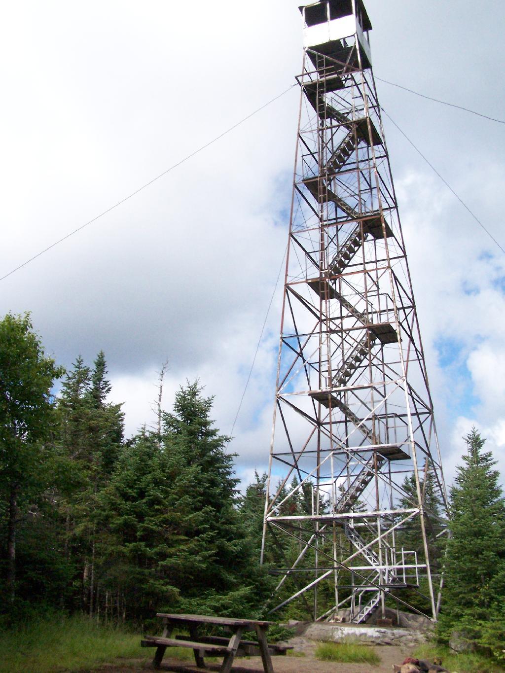
Wakley Fire Tower

The principle of limited development of the Adirondack and Catskill Forest Preserve, to enhance public access was upheld most recently in Balsam Lake Anglers Club v Department of Environmental Conservation (upheld on Appeal to 2nd Appelate Division). It states:

Respondents adopted the UMP in furtherance of the Catskill Park State Land Master Plan, which was adopted in order to provide classifications and guidelines for the uniform protection and management of State-owned lands within the Catskill Forest Preserve. Under the UMP, respondents intend to construct a number of small parking areas providing access to trails and primitive campsites, to relocate certain trails to avoid private lands and to construct new trails within the Balsam Lake Mountain Wild Forest area. Since respondents must necessarily cut a certain number of seedlings, saplings and trees to complete such projects, petitioner contends that the UMP is in violation of article XIV, § 1 of the New York State Constitution.

The Constitution provides, “[t]he lands of the state, now owned or hereafter acquired, constituting the forest preserve as now fixed by law, shall be forever kept as wild forest lands. They shall not be leased, sold or exchanged, or be taken by any corporation, public or private, nor shall the timber thereon be sold, removed, or destroyed.” Petitioner contends that the cutting of as many as 2,000 “trees”, most of which are less than three inches diameter at breast height, constitutes the removal or destruction of timber.

This specific constitutional issue has rarely been litigated. The Court of Appeals and the Appellate Division in Association for Protection of Adirondacks v MacDonald (253 N.Y. 234, affg 228 App Div 73) addressed legislation authorizing the construction of a bobsled run within the Adirondack Forest Preserve for the 1932 Winter Olympics. The Appellate Division addressed the legislative history of the New York State Constitution and found an intent to prevent any actions “which might convert this preserve into anything but a wilderness” (228 App Div, at 79). However, the Appellate Division found that the framers of the New York State Constitution obviously distinguished between “timber” and any form of tree or wood. They quoted the framers as stating, “[a]ny campers that cannot pick up something on the shores, that will not be timber, to warm themselves with, would better either carry in their fuel or stay out” (supra, at 78). The Appellate Division also discussed the 1915 Constitutional Convention which sought to change the wording of the New York State Constitution to “trees and timber” (supra, at 79). Thereafter, the Appellate Division found that the project involved “the cutting of 2,600 trees which must unquestionably be regarded as of `timber’ size” (supra, at 82). Based upon an 609*609 agreed statement of facts, all 2,600 trees were in excess of 3 inches diameter at breast height, 480 trees were in excess of 8 inches and 33 trees were in excess of 20 inches. The project involved total clearing of between 4 and 5 acres, some of which constituted first growth hardwoods and involved the removal of some 60,000 board feet of timber. The Appellate Division held the legislation unconstitutional based both upon the substantial destruction of timber and the nature of the proposed project.

The Court of Appeals in affirming the Appellate Division determination rejected the absolutist argument that not even a single tree or even fallen timber or deadwood could be removed and stated that the constitutional provision must be interpreted reasonably. “[A]ll things necessary were permitted, such as measures to prevent forest fires, the repairs to roads and proper inspection, or the erection and maintenance of proper facilities for the use by the public which did not call for the removal of the timber to any material degree. The Forest Preserve is preserved for the public; its benefits are for the people of the State as a whole. Whatever the advantages may be of having wild forest lands preserved in their natural state, the advantages are for every one within the State and for the use of the people of the State. Unless prohibited by the constitutional provision, this use and preservation are subject to the reasonable regulations of the Legislature” (supra, 253 NY, at 238-239). It is thus clear that the Court of Appeals determined that insubstantial and immaterial cutting of timber-sized trees was constitutionally authorized in order to facilitate public use of the forest preserve so long as such use is consistent with wild forest lands.

With respect to the relocation of the Hardenberg Neversink Trail challenged herein, petitioner contends that the amount of cutting is of constitutional dimension. The relocated trail is in excess of two miles long and is approximately six feet wide. With the trail approximately 80% completed, 73 trees of timber size, that is three inches or more, have been cut, including one nine-inch tree and one six-inch tree which was dead. The remaining trees are three, four or five inches in diameter. It is estimated by the court that the entire cutting, including trees not of timber size, that is, less than three inches, amounts to little more than one cord of firewood. The great majority of such cutting will be completely decomposed within a few years leaving no trace of their existence but 610*610 providing increased growth opportunity for the remaining trees in the forest.

It is therefore determined the amount of vegetation, seedlings, saplings and timber-sized trees destroyed so far in the construction of the relocated Hardenberg Neversink Trail is not constitutionally prohibited, nor is the number of trees planned to be removed to complete such relocation. While the actual route for the Millbrook Ridge Trail has not been chosen and it is not known how many trees, saplings, seedlings and other vegetation must be destroyed, it may be presumed that the Department of Environmental Conservation, pursuant to its regulations concerning the construction of trails and the destruction of trees and timber, will comply with the provisions of the New York State Constitution. In the event that the Department of Environmental Conservation does not comply, petitioner could certainly challenge the specific trail route or construction techniques at an appropriate time.

Petitioner also contends that the construction of new trails in the Balsam Lake Mountain Wild Forest area violates that portion of the New York State Constitution which requires that forest preserve lands “be forever kept as wild forest lands”, arguing that new trails will increase human activity, thereby necessarily making such areas less wild. Based upon the decisions of the Appellate Division and Court of Appeals in Association for Protection of Adirondacks v MacDonald (supra), it appears that the framers of the New York State Constitution intended not to prevent or hinder public use of the forest, but to allow forested areas to revert to their natural or wild state without human interference with the natural succession of different types of trees, selective cutting or thinning to “improve” the timber, or the harvesting of any mature timber. There is no indication of any intent to maintain the forest in an “absolutely” wild state with no organized human alteration or intervention at all.

The Court of Appeals specifically held that facilities consistent with the nature of the forest preserve could be constructed for the use by the public, including camping and hiking. Such use facilitated by the construction of new trails or increasing parking and camping areas will almost certainly degrade the pristine quality of certain areas of the forest preserve. While it may be desirable to initiate a policy to refrain from actions which will have the effect of increasing human activity, such issues are not of constitutional dimension unless significant cutting of timber is involved. Accordingly, it is declared that the Unit Management Plan adopted for the Balsam Lake Mountain Wild Forest area does not violate the provisions of article XIV of the New York State Constitution.

Towards Indian Lake

What is the Standard Held This Cases?

Over the years, the courts have created a certain principles on recreation facilities in Adirondacks. Distilled down, one can probably agree that courts in NY State hold:

  • Any project to be constructed in forest preserve must cut as few trees as possible, particularly of timber-grade trees, those larger then 3″ in diameter. Any project requiring significant timber cuts are unconstitutional.
  • There is a clear preference towards development of facilities in natural meadows and brushy areas, locating paths, trails, and roads on existing old woods road rather then cutting new roadways or trails through the woods.
  • Limited timber cutting is allowed for essentially wild forest purposes, such as campsites and trail location. It must be as limited as practical.
  • Any developed facilities must be rustic in nature (wood, painted brown), and must exist solely to complement forest preserve uses such as primative camping, hiking, hunting and fishing.
  • Intensive use areas are allowed, such as developed state campgrounds or firetowers, but they can not change the forest character or require the excessive removal of timber.
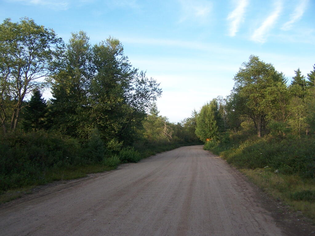
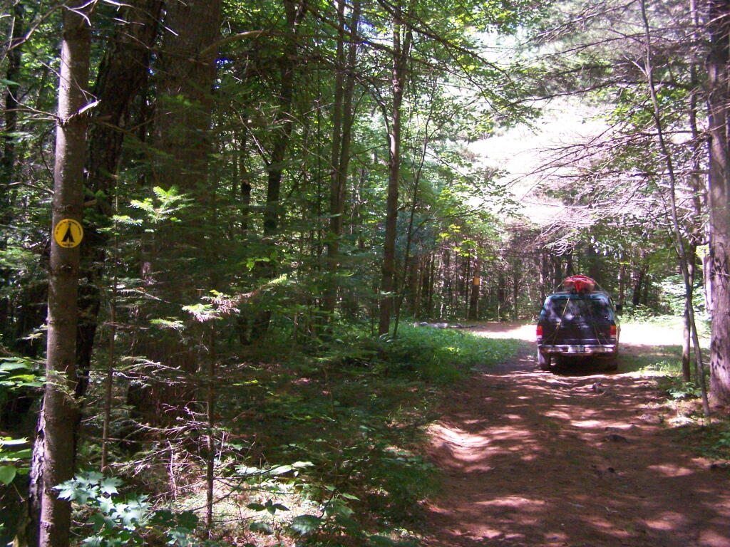
Tiny Roadside Campsite

… the courts have sought a balance between recreational demands and keeping the primarily wild nature of forests wild.

DEC Commissioner Policy #38 – Forest Preserve Roads

For today’s fodder, we take a look at the policies relating to the development and maintenance of the forest preserve system of roads. In March 2006, DEC Commissioner Denise M. Sheehan issued this policy based on a lawsuit by the Residents Committee to Protect the Adirondacks, that allows for limited road maintenance and development, consistent with the Adirondack and Catskill Unit Management Plans.

While any road in a Adirondack or Catskill Park is bound to be controversial, there is a need to make some portions of the backcountry accessible to the general public. This policy attempts to balance constitutional restraints with the desire of the public to have access to parts of Adirondack and Catskill Park, that might otherwise be unaccessible.

Note: These requirements do not apply to roughly 800,000 acres of public lands outside of the Adirondack and Catskill Park on State Forests, Wildlife Management Areas and other areas. They also do not apply to intensive use areas.

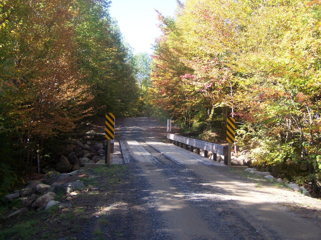
New Bridge Over Bradley Brook

I. Summary

This policy establishes procedures and protocols for the maintenance, rehabilitation, relocation, and, when authorized by the State Constitution, widening and new construction of roads and state truck trails under Department of Environmental Conservation (“Department”)jurisdiction in the Forest Preserve which are situated in units classified by the Adirondack Park State Land Master Plan (“APSLMP”) as Wild Forest, Primitive or Canoe Area or classified by the Catskill Park State Land Master Plan (“CPSLMP”) as Wild Forest. This policy pertains to all such roads and state truck trails on Forest Preserve lands whether or not they are open for public motor vehicle use, except it does not pertain to roads or state truck trails in Intensive Use Areas and Administrative Areas. Further, this policy establishes that generally Forest Preserve roads are low maintenance seasonal roads which are narrow, surfaced with gravel, suitable for low speeds, lightly traveled by the public, and partially or fully shaded by tree canopy. Such roads are further constructed and maintained to the minimum standard necessary to provide passage by appropriate motor vehicles in a manner which protects the environment.

Less Muddy Section of Moose Club Way

II. Policy:

It is the policy of the Department to ensure that comprehensive and consistent procedures are applied to all maintenance, rehabilitation, widening and construction of roads and state truck trails (roads) in the Forest Preserve to ensure that such activities minimize the impacts on the environment and maintain the wild forest character of the road and state truck trail corridors.The 2003 Memorandum of Understanding Between the Adirondack Park Agency and theDepartment of Environmental Conservation Concerning Implementation of the State LandMaster Plan for the Adirondack Park (MOU) provides guidance concerning ordinary maintenance, rehabilitation and minor relocation of conforming structures and improvements on Forest Preserve lands in the Adirondack Park, including whether consultation between the two agencies is required. This policy is intended in part to build upon the MOU and provide additional direction and clarification on coordination of road work in the Adirondack Forest Preserve. This Policy takes precedence over previously existing authority, guidelines, andpolicies.

This policy does not include standards for determining if a road has become legally abandoned. Determinations of road abandonment will be made on a case by case basis inc onsultation with the Division of Legal Affairs.

1 The following definitions, guidelines, responsibilities and procedures shall govern work to be done on roads and state truck trails being carried out on lands of the Forest Preserve which are classified by the APSLMP or CPSLMP as Wild Forest, Primitive, or Canoe.

A. Definitions:

1.Brushing means cutting of woody vegetation less than 3 inches in diameter at breast height (d.b.h.).

2. Ditch means an excavated drainage structure situated adjacent and generally parallel to the driving surface and shoulder of a road or truck trail, designed to convey water away from the driving surface.

3. Ditchline means the low point or centerline of the ditch.

4. Drainage structure means a device which drains water off or away from the road. Drainage structures include such structures as water bars, ditches, French drains,culverts and underdrains.

5. Driving Surface means that portion of the road surface which is designed for vehicles to travel on.

6. Footprint means the limits of disturbance of the road. The foot print includes the driving surface, shoulders, drainage structures, and side slopes. The Original Footprint is the limit of disturbance of the road at the time that it was initially constructed. The currently maintained or existing foot print means areas of the footprint not currently occupied by trees greater than 3″ dbh.

7. French drain means a subsurface drain consisting of a trench backfilled with porous soil or loose stone and covered with earth or other appropriate surface material.

8. Minor relocation of a road or state truck trail means the relocation of a short segment of a road in order to avoid drainage, wetlands, safety, or other site specific problems which cannot otherwise be adequately addressed. A minor relocation shall be the minimum length of new road required to avoid or lessen the site specific problem, but shall not exceed 300 feet in length.

9. Mowing means cutting of non-woody vegetation and woody vegetation less than 3feet in height.

10. Ordinary maintenance means activities within the currently maintained footprint of the road which are needed to keep the road in good working order and which overtime do not materially change the use or appearance of the land or the vegetation thereon from its current use and appearance, including the maintenance or in-kind replacement of road appurtenances and work to address public health and safety issues where such maintenance or activities periodically occur on an as-needed basis. For purposes of this policy, ordinary maintenance includes the following activities when carried out within the currently maintained footprint:

i. pothole filling;

ii. blowdown clearing;

iii. grading of driving surface;iv. bridge repair and maintenance;

v. bridge replacement with a bridge of the same design and of similar dimensions and which is constructed of similar materials;

vi. culvert maintenance, or replacement with a culvert of a length not to exceed the existing foot print and the same nominal height as the culvert being replaced in the same location, provided that the culvert does not involve a freshwater wetland;

vii. drainage structure maintenance, or replacement with a structure in the same location with the same design and similar dimensions and which is constructed of similar materials;

viii. cleaning of existing ditches and culverts that do not impact fresh waterwetlands;

ix. mowing and brushing routinely maintained roads up to four feet beyond theshoulder or ditchline to maintain existing sight lines, road shoulders, andditches;

x. resurfacing of driving surface, with similar material as currently used on theroad, provided that such resurfacing will not likely facilitate levels of public motor vehicle use which significantly exceed existing levels of such use;

xi. limited rock removal that does not require blasting;

xii. trimming select individual tree branches that impede vehicular traffic, obscure sight lines, and hide roadside hazards; and

xiii. cutting select individual dead or hazardous trees pursuant to Lands and Forests Policy 91-2, Cutting and Removal of Trees in the Forest Preserve.

11. Rehabilitation means work that does not occur on a routine basis within the currently maintained footprint of the road which is essential to address environmental impacts, improve safety, or to restore the road or truck trail to a usable condition. It includes the construction of new road appurtenances or work outside of the currently maintained foot print of a road, but within the original footprint of the road. Rehabilitation includes but is not limited to the following activities:

i. placing culverts at new locations;

ii. replacing existing culverts with culverts that have a nominal height greaterthan the nominal height of the existing culvert;

iii. constructing new ditches or drainage structures;

iv. widening existing ditches;

v. cutting trees other than dead or hazardous trees pursuant to Lands and ForestsPolicy Lands and Forests Policy 91-2, Cutting and Removal of Trees in theForest Preserve;

vi. brushing in areas which have not been routinely maintained;

vii. resurfacing the driving surface where such resurfacing will likely facilitate levels of public motor vehicle use which significantly exceed existing levels of such use;

viii. resurfacing of the driving surface with material that is different from the material which currently covers the surface of the road when there is a clear determination that this measure is necessary to protect the natural resources of the Forest Preserve adjoining the road corridor by controlling erosion or runoff; and

ix. regrading of side slopes.

12. Road means motorized transportation corridors that include both roads and state truck trails as defined in the Catskill and Adirondack Park State Land Master Plans, unless the context indicates otherwise.

Road (APSLMP definition): The APSLMP defines “road” on page 18-19 as “an improved or partially improved way designed for travel by automobiles and which may also be used by other types of motor vehicles except snowmobiles, unless the way is a designated snowmobile trail; and is, either maintained by a state agency or a local government and open to the general public maintained by private persons or corporations primarily for private use but which may also be open to the general public for all or a segment thereof; or maintained by the Department of Environmental Conservation or other state agency and open to the public on a discretionary basis.

Road (CPSLMP definition): The CPSLMP defines “road” in Appendix C as “an improved way designed for travel by automobiles and which may also be used by other types of motor vehicles except snowmobiles, unless the way is a designated snowmobile trail; and is, either maintained by a state agency or a local government and open to the general public; or maintained by private persons or corporations primarily for private use but which may also be open to the general public for all or a segment thereof; or, maintained by the Department of Environmental Conservation or other state agency and open to the public on a discretionary basis; or, maintained by the Department of Environmental Conservation for its administrative use only.”

13. Road work means any physical alteration of a road including ordinary maintenance, minor relocation, rehabilitation, widening and new construction as defined in this policy.

14. Shoulder means a transition zone between the driving surface and the road edge or the ditchline. In general, a wheel of a motor vehicle is not on the shoulder unless the motor vehicle is parked or pulled over to let another car pass.

15. Side slope means that area outside of the ditch or road shoulder that is graded to a uniform slope in order to stabilize the soil between the ditch or shoulder and the native, undisturbed ground.

16. State truck trail:

i. State truck trail (APSLMP definition). The APSLMP on page 19 defines “state truck trail” as an improved way maintained by the Department ofEnvironmental Conservation for the principal purpose of facilitatingadministration of state lands or of allowing access for fire fighting equipment and not normally open for public use of motorized vehicles.

ii. State truck trail (CPSLMP definition). “State truck trail†is defined in Appendix C of the CPSLMP as “an improved way maintained by the Department of Environmental Conservation for the principal purpose offacilitating administration of state lands or to allow access for fire fighting equipment and not normally open to the public for motorized vehicle use.

17. Trimming means the removal of lateral branches or leaders of a tree or shrub, that does not sever the plant from its roots.

18. Underdrain means a perforated culvert in porous fill for drawing off subsurface water from the soil.

19. Widening means a lateral expansion of the currently maintained footprint, or lateral expansion of the driving surface of the road. Widening includes the clearing of trees and other vegetation from areas of the existing footprint that are not currently so maintained to restore the opening of the original footprint.

20. Work plan means a detailed description of work to be performed, the Best Management Practices that will be used in performance of the work, and the desired final condition of the road and surrounding area.

B. Guidelines for roads subject to this Policy

1. Determination of Road Width, Driving Surface and Desired Condition. The width, existing condition and desired condition of all roads will be addressed in Unit Management Plans (“UMPs”).. 2. Relocation, rehabilitation, widening or construction of roads. Any road work, except for ordinary maintenance, not authorized in a UMP may not be performed until it is determined whether or not a UMP amendment may be required. This determination will be made by the Director of the Division of Lands and Forests in consultation with APA after a work plan has been developed. Ordinary maintenance of existing roads does not require UMP authorization. Roads designated as closed in a UMP may not be maintained.

3. Work plans. All rehabilitation, relocation (including minor relocation), widening and new construction of roads in the Adirondack Park and the Catskill Park will be done in accordance with a written work plan. Work plans will detail the work to be performed and the Best Management Practices that will be used in performance of the work and the desired final condition of the road and surrounding area. In both the Adirondack Park and Catskill Park, ordinary maintenance of a road requires approval from the Regional Forester in the form of a written work order or an approved “Requests for Routine Maintenance Projects on Forest Preserve Lands.All work plans will describe the work to be performed, including any tree cutting, in relation to a linear distance from the projectâ’ starting point. Markers corresponding to the work described in the work plan shall be placed at the work site. Work plans should include photographs taken at representative locations along with location by location descriptions of the road condition, driving surface and width.

5 All work plans in the Adirondack Park will be developed in consultation with APA as per the MOU and must be approved by the Regional Director and the Director of the Division of Lands and Forests or their designees. If a work plan for a project in the Adirondack Park indicates that the proposed work may materially change the appearance of the land or vegetation thereon or use of the road, then the Director of the Division of Lands and Forests or the Director’s designee shall consult with APA staff to determine whether such work must first be authorized by an approved UMP or UMP amendment. If a work plan for a project in the Catskill Park indicates that the proposed work may materially change theappearance of the land or vegetation or use of the road, then the Director of the Division of Lands and Forests shall determine whether such work must first be authorized by an approved UMP or UMP amendment.

4. Best Management Practices. All work on roads shall be done in accordance with Best Management Practices (BMPs). The New York State Forestry Best Management Practices for Water Quality, BMP Field Guide shall serve as a reference for developing BMPs.

5. Approvals and Consultation

i. Ordinary Maintenance. Ordinary maintenance of a road in the Adirondack Park does not require either APA consultation or UMP authorization, except that, as per the MOU, APA consultation is required if wetlands might be impacted. Ordinary maintenance of a road in the Catskill Park does not require UMP authorization, except that consultation with the Department’s Division Fish, Wildlife and Marine Resources Freshwater Wetlands Manager is required if wetlands might be impacted. In both the Adirondack Park and Catskill Park, ordinary maintenance of a road requires approval from the Regional Forester in the form of a written work order or an approved “Requests for Routine Maintenance Projects on Forest Preserve Lands.”

ii. Rehabilitation. Rehabilitation of roads has the potential to impact the wild forest character of the road, cause significant environmental impacts and facilitate additional public use. For these reasons, rehabilitation of roads inthe Adirondack Park requires a written work plan and consultation with the APA. Depending upon site specific considerations, rehabilitation may require authorization by an approved UMP or UMP amendment. This determination requires approval from the Director of the Division of lands and Forests and will be made in consultation with APA.

ehabilitation of roads in the Catskill Park requires approval from the Director of the Division of Lands and Forests or the Director’s designee and, depending upon site specific considerations, may require authorization in an approved UMP or UMP amendment.

iii. Minor relocation . Minor relocation of roads in the Adirondack Parkrequires a written work plan, approval from the Director of the Division of Lands and Forests and consultation with the APA, and may require a UMP or UMP amendment. Minor relocation of roads in the Catskill Park requires a written work plan and approval from the Director of the Division of Lands and Forests, or the Director’s designee, and requires authorization in an approved UMP or UMP amendment. Relocation of portions of roads or state truck trails that are greater than 300 feet, or any or relocation that may have significant environmental impacts will be considered as constituting new road construction and must follow the procedures and protocols on new road construction set forth subsequently in this document.In the Adirondack Park, the determination of whether a particular road relocation project constitutes a minor relocation will be made by the Director of the Division of Lands andForests or the Director’s designee in consultation with the APA. In theCatskill Park, the determination of whether a particular road relocation project constitutes a minor relocation will be made by the Director of the Division of Lands and Forests or the Director’s designee.

iv. Road widening and new road construction on roads in units classified as Wild Forest. As noted above, the widening of existing state truck trails and roads and the construction of new state truck trails and roads on lands classified as Wild Forest under the APSLMP and the CPSLMP, must be authorized by the State Constitution.

Supplementing this constitutional requirement is the APSLMP’s requirement that “No new roads will be constructed in wild forest areas nor will new state truck trails be constructed unless such construction is absolutely essential to the protection or administration of an area, no feasible alternative exists and no deterioration of the wild forest character or natural resources quality of the area will result.

The CPSLMP requires that, in Wild Forest, “No new roads will beconstructed. No new state truck trails will be constructed unless suchconstruction is absolutely essential to protect or administer an area and there will be no material adverse effect on the wild forest character of the area by the proposed construction. Further, the APSLMP and the CPSLMP require that such work must be authorized by an approved UMP. To ensure that such work is authorized by the State Constitution and that environmental issues are identified and fully addressed, widening and new construction of roads in the Adirondack Park must be authorized by an approved UMP or UMP amendment, and require a written work plan and consultation with the APA as per the MOU.

Widening and new construction of roads in the Catskill Park must be authorized by an approved UMP or UMP amendment, and require a written work plan which must be approved by the Regional Director and the Director of the Division of Lands and Forests, or their designees.

Road Wandering Up Back Side of Sturges Hills

III. Purpose and Background:

Forest Preserve roads, which are generally low maintenance seasonal roads, are a means of providing the public with access to recreational programs on Forest Preserve lands.

Although design, maintenance and rehabilitation standards for these roads must provide for the health and safety of users, such roads must be consistent with the “wild forest” character of the Forest Preserve and comply with the requirements of the APSLMP or the CPSLMP, as applicable. Thus, proposals for road work in the Forest Preserve must be carefully scrutinized to ensure that health and safety goals are accomplished in a manner which maintains the existing wild forest character of the road corridors and otherwise complies with applicable law.

Article XIV, Section 1 of the New York State Constitution, the paramount legal authority with respect to Forest Preserve land management, provides in relevant part:

“The lands of the state, now owned or hereafter acquired, constituting the forest preserve as now fixed by law, shall be forever kept as wild forest lands. They shall not be leased, sold or exchanged, or be taken by any corporation, public or private, nor shall the timber thereon besold, removed or destroyed. (Emphasis added).”

All road work for roads in the Forest Preserve must be consistent with the directives contained in this constitutional provision. Case law interpreting this provision has held that an immaterial amount of tree cutting does not violate this clause when done in furtherance of one of the purposes for which the Forest Preserve was created, namely, watershed protection and public recreation in a forever wild forest setting. See The Association for the Protection of the Adirondacks v. MacDonald, 253N.Y. 234 (1930); Balsam Lake Anglers Club v. Department of Environmental Conservation, 199 A.D. 2d 852, 605 N.Y.S. 2d 795 (App. Div., Third Department, 1993); Helms v. Reid, 90 Misc. 2d 583 (Hamilton County Supreme Court, 1977), and Flacke v. Town of Fine 113 Misc. 2d 56 (St. Lawrence County Supreme Court, 1982).

Under the rationale set forth in these cases, Forest Preserve road corridors should maintain a wild forest character, with minimal tree cutting. Thus, the current character of Forest Preserve roads should not be changed, and such roads should continue to have narrow driving surfaces, be surfaced with gravel, be suitable for low speeds only, and be shaded by tree canopy.

Roads and state truck trails are nonconforming in areas classified by the APSLMP and CPSLMP as Wilderness. Therefore, there shall be no maintenance, rehabilitation, relocation, widening, or new construction of roads or state truck trails in Wilderness areas.

In areas classified as Primitive by the APSLMP, existing roads and state truck trails may be maintained, rehabilitated or relocated only if the road or truck trail was in existence when the land was classified as Primitive and the road or truck trail is used by administrative personnelto reach and maintain structures and improvements whose removal cannot be effected by a fixed deadline or whose presence is of an essentially permanent character.

In addition, existing roads in areas classified as Primitive may be maintained, rehabilitated or relocated if the roads are open for public use at the Department’s discretion pending wilderness classification. There may be no widening or new construction of roads or state truck trails in Primitive Areas.

In areas classified as Canoe by the APSLMP, the use of roads is prohibited and therefore such roads may not be maintained, rehabilitated, relocated, widened or constructed. Existing state truck trails in areas classified as Canoe may be maintained, rehabilitated or relocatedwhere the truck trails are being used by administrative personnel for purposes designed to preserve or enhance the water or fishery resources of the area as specified in UMPs. The widening or new construction of truck trails is prohibited in Canoe areas.

In areas classified as Wild Forest by the APSLMP, existing roads and state truck trails which are used solely by administrative personnel to reach, maintain and construct permitted structures and improvements may be maintained, rehabilitated, and relocated, but may not be widened. New roads and state truck trails to be used solely for these purposes may not be constructed. Existing public roads open to the public for motor vehicle use in APSLMP Wild Forest areas may be maintained, rehabilitated and relocated. Existing public roads maybe wide ned only if authorized by Article XIV, Section 1 of the New York State Constitution.

No new roads or state truck trails will be constructed in APSLMP Wild Forest areas unless such construction is authorized by Article XIV, Section 1 of the New York State Constitution and such construction is absolutely essential to the protection or administration of the area, no feasible alternative exists and no deterioration of the wild forest character or natural resource quality of the area will result. In addition, such construction is allowed only if it will not result in a material increase in the cumulative mileage of roads open to motorized use by the public in Adirondack Park Wild Forest units.

In areas classified as Wild Forest by the CPSLMP, existing roads and state truck trails which are used by administrative personnel to reach, maintain and construct permitted structures and improvements, to conduct approved fish and wildlife research and management projects, for rescues, or for other appropriate law enforcement and general supervision of public use may be maintained, rehabilitated, and relocated, but may not be widened.

New roads and state truck trails to be used solely for these purposes may not be constructed. Existing public roads open to the public for motor vehicle use in CPSLMP Wild Forest areas may be maintained, rehabilitated, and relocated. Existing roads and state truck trails may be widenedonly if authorized by Article XIV, Section 1 of the New York State Constitution. No new roads or new state truck trails will be constructed in CPSLMP Wild Forest areas unless such construction is authorized by Article XIV, Section 1 of the New York State Constitution and such construction is absolutely essential to protect or administer the area and there will be no material adverse effect on the wild forest character of the area by the proposed construction.

In addition, such construction is allowed only if it will not result in a material increase in the cumulative mileage of roads open to motorized use by the public in the Catskill Park Wild Forest units. This policy is intended to ensure that road work in the Forest Preserve is in compliance with constitutional and APSLMP and CPSLMP directives. Thus, this policy will ensure that all road and state truck trail maintenance, rehabilitation, relocation, widening and construction projects will be properly authorized and that work plans will be developed and appropriately approved prior to the commencement of such work. This policy will enable staff to determine whether such work: requires approval by the Regional Forester and the Director of the Division of Lands and Forests or the Director’s designee; requires consultation with the Adirondack Park Agency; and requires authorization by an approved UMP or UMP amendment

The policy also will enable staff to determine whether a work plan is needed, and, if so, what it must contain and who must approve it.

Little Moose Mountain

IV. Responsibility:

It shall be the responsibility of all Department divisions and staff to implement the guidelines and procedures of this policy.

It shall be the responsibility of the Forester assigned as the land manger of a management unit to prepare work plans for the unit in consultation with the Division of Operations. It shall be the responsibility of the Regional Forester to review and approve work plans for road work and ensure that work plans are developed for all road work as required by this policy. The Regional Forester shall ensure work plans are in compliance with UMPs and that current best management practices are utilized and any associated impacts on the environment are minimized. It shall be the responsibility of all Department staff involved in road work projects in the Forest Preserve to ensure that all work authorized and is carried out in accordance with the approved work plan and to ensure that any tree cutting complies with policy Lands and Forests Policy 91-2, Cutting and Removal of Trees in the Forest Preserve.It shall be the responsibility of the Regional Director and the Division Director or their designees to review and approve any work plans for road work involving maintenance, relocation, rehabilitation, widening, and new construction proposed under this policy and to assign staff to coordinate with the APA where such coordination is appropriate under thispolicy.

It shall also be the responsibility of the Director of the Division of Lands and Forests to periodically review the provisions of this policy and recommend amendments, where necessary.

Dry Grass at Hang Gliders Cliff

V. Procedure:

The management and actions taken regarding road maintenance, rehabilitation, widening, relocation, and construction on Adirondack Forest Preserve lands shall be in accordance with the above stated policy and the following procedure:

1. Regional staff shall consult with Regional Forester to determine if a proposed project is ordinary maintenance, rehabilitation, minor relocation, relocation other than minor relocation, widening or new construction.

2. APA consultation is required if wetlands in the Adirondack Park might be impacted as required per the MOU. Depending on the scope of the work, an APA Jurisdictional Inquiry Form and Application for Wetlands General Permit, 2005G-1, may be required.

3. Ordinary maintenance of roads may be carried out with the approval of the Regional Forester. At the Regional Forester’s discretion, a work plan may be required for ordinary maintenance. Such work plans must be approved by the Regional Forester and the Director of the Division of Lands and Forests or their designees.

4. All rehabilitation, minor relocation, widening and new construction of roads in the Adirondack Park will be done in accordance with a written work plan prepared by DEC staff in consultation with the APA as per the MOU. All relocation projects should be forwarded to the Director of the Division of Lands and Forests for consultation with APA to determine if the project is considered a minor relocation. Projects that are not part of an approved UMP or UMP amendment and are not minor relocations will be referred to the Director of the Division of Lands and Forests forconsultation with APA to determine if an approved UMP or UMP amendment isrequired for the project.

5. The Regional Forester will ensure that the work plan details the work to be performed, the BMPs that will be used in performance of the work, and the desired final condition of the road and surrounding area. All work plans must describe the work to be performed, including any tree cutting, in relation to a linear distance from the project’s starting point. Markers corresponding to the work described in the work plan shall be placed at the work site. Work plans should include photographs taken at each station and at representative locations along with station by station descriptions of the road condition, driving surface and width.

The Regional Forester will forward work plans approved by the Regional Director or the Regional Director’s Designee to the Director of the Division of Lands and Forests. The Division Director or the Division Director’s designee will notify the Regional Forester of approval or denial of the work plan.

The management and actions taken regarding road maintenance, rehabilitation, minor relocation, relocation, widening and construction on Catskill Forest Preserve lands shall be in accordance with the above stated policy and the following procedure:

1. Regional staff shall consult with the Regional Forester to determine if the proposed project is ordinary maintenance, rehabilitation, minor relocation, relocation other than minor relocation, widening or new construction.

2. Consultation with the Department’s Division of Fish, Wildlife and Marine Resources Freshwater Wetlands Manager is required if wetlands might be impacted.

3. Ordinary maintenance of roads may be carried out with the approval of the Regional Forester.

4. All rehabilitation, minor relocation, widening and new construction of roads in the Forest Preserve will be done in accordance with a written work plan prepared by Department staff. All relocation projects should be forwarded to the Director of the Division of Lands and Forests to determine if the project is considered a minor relocation. Projects that are not part of an approved UMP or UMP amendment will be referred to the Director of the Division of Lands and Forests to determine if an approved UMP or UMP amendment is required for the project.

5. The Regional Forester will ensure that the work plan details the work to be performed and the Best Management Practices that will be used in performance of the work and the final condition of the road and surrounding area. All work plans must describe the work to be performed, including any tree cutting, in relation to a linear distance from the project’s starting point. Markers corresponding to the work described in the work plan shall be placed at the work site.

The Regional Forester will forward work plans approved by the Regional Director or the Regional Director’s Designee to the Director of the Division of Lands and Forests. The Division Director or the Division Director’s designee will notify the Regional Forester of approval or denial of the work plan.

Sunny Morning at Powley Place Bridge

Related References:

Adirondack Park State Land Master Plan (APSLMP), Adirondack Park Agency, June 2001

Catskill Park State land Master Plan (CPSLMP), NYSDEC, 1985

New York State Forestry, Best Management Practices for Water Quality, BMP Field Guide,NYSDEC, January 2000

Lands and Forests Policy 91-2, Cutting and Removal of Trees in the Forest Preserve

2003 Adirondack Park Agency/Department of Environmental Conservation Memorandum ofUnderstanding

Classification and Acres

An overview of the amount of land in each classification of the Adirondack Park. Here are a summary of the meanings of the various land classifications.

CLASS Acres Percent
PRIMITIVE CORRIDOR 292 0.01%
UNCLASSIFIED 365 0.01%
ADMINISTRATIVE 391 0.02%
HISTORIC 531 0.02%
CANOE AREA 18,989 0.74%
INTENSIVE USE 23,382 0.91%
PRIMITIVE 46,647 1.83%
WILDERNESS 1,160,125 45.39%
WILD FOREST 1,305,233 51.07%
TOTAL ADIRONDACK FOREST PRESERVE 2,555,955 100.00%

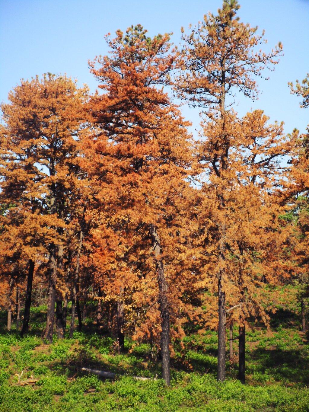
After The Fire

A look at each facility (e.g. campground, wild forest, wilderness area), sorted by size, ascending.

FACILITY Acres Percent
SIGNAL BUOY ISLAND 0.1 0.0%
NORTH CREEK PARKING FISHING ACCESS 0.2 0.0%
MILL CREEK PARKING AREA 0.2 0.0%
SAINT REGIS MOUNTAIN HISTORIC AREA 0.2 0.0%
HURRICANE MOUNTAIN HISTORIC AREA 0.2 0.0%
SHEEPSHEAD ISLAND 0.4 0.0%
MILL CREEK FISHING ACCESS 0.5 0.0%
GARDEN ISLAND 0.5 0.0%
GOOSENECK POND PRIMITIVE AREA 0.6 0.0%
COLE ISLAND 0.9 0.0%
FORTH LAKE BOAT LAUNCH 1.1 0.0%
TAHAWAS PRIMITIVE AREA 1.6 0.0%
LAKE COLBY ENVIRONMENTAL EDUCATIONAL CAMP 1.8 0.0%
MIRROR LAKE BOAT LAUNCH 1.9 0.0%
SPOON ISLAND PRIMITIVE AREA 1.9 0.0%
GREENE ISLAND MAINTENANCE FACILITY 1.9 0.0%
LAKE FLOWER BOAT LAUNCH 2.1 0.0%
PORT DOUGLASS BOAT LAUNCH 2.4 0.0%
UPPER CHATEAUGAY LAKE BOAT LAUNCH 2.4 0.0%
WILMURT CLUB ROAD 2.9 0.0%
GREAT SACANDAGA LAKE BOAT LAUNCH 3.0 0.0%
TUPPER LAKE BOAT LAUNCH 3.2 0.0%
SARANAC LAKE BOAT LAUNCH 3.3 0.0%
WESTPORT BOAT LAUNCH 3.9 0.0%
PORT HENRY BOAT LAUNCH 4.3 0.0%
STILLWATER BOAT LAUNCH 4.3 0.0%
SOUTH BAY STATE BOAT LAUNCH 4.8 0.0%
CRANBERRY LAKE BOAT LAUNCH 5.1 0.0%
RAQUETTE RIVER BOAT LAUNCH 6.3 0.0%
PRIMITIVE AREA 6.6 0.0%
MIDDLE SARANAC LAKE BOAT LAUNCH 6.8 0.0%
LAKE GEORGE FOREST PRESERVE 7.2 0.0%
SACANDAGA PRIMITIVE AREA 7.2 0.0%
WANAKENA PRIMITIVE CORRIDOR 7.5 0.0%
NORTHVILLE-SUB-OFFICE 7.9 0.0%
WILLSBORO BAY BOAT LAUNCH 8.0 0.0%
FULTON CHAIN BOAT LAUNCH 9.1 0.0%
TIED LAKE PRIMITIVE CORRIDOR 9.8 0.0%
SARANAC LAKE ISLANDS CAMPGROUND 9.9 0.0%
HURRICANE MOUNTAIN PRIMITIVE AREA 11.2 0.0%
LOWER SARANAC LAKE BOAT LAUNCH 13.6 0.0%
BEAR POND PRIMITIVE CORRIDOR 14.1 0.0%
FORKS MOUNTAIN PRIMITIVE CORRIDOR 14.7 0.0%
BROADALBIN BOAT LAUNCH 15.7 0.0%
MOSSY POINT STATE BOAT LAUNCH 16.8 0.0%
ALICE BROOK PRIMITIVE AREA 18.8 0.0%
SACANDAGA RIVER STATE BOAT LAUNCH 19.9 0.0%
LONG LAKE STATE BOAT LAUNCH 20.2 0.0%
EAGLE POINT CAMPGROUND 21.0 0.0%
ALDER CREEK PRIMITIVE CORRIDOR 23.0 0.0%
SUNY ATMOSPHERIC SCIENCES RESEARCH CENTER 23.1 0.0%
RAVEN LAKE PRIMTIVE AREA 24.7 0.0%
POPLAR POINT CAMPGROUND 32.8 0.0%
LAKE GEORGE BATTLEGROUND CAMPGROUND 33.5 0.0%
CAMP SANTANONI 36.1 0.0%
TIOGA POINT CAMPGROUND 36.2 0.0%
ALGER ISLAND CAMPGROUND 37.6 0.0%
PARTLOW LAKE PRIMITIVE CORRIDOR 39.0 0.0%
PRIMITVE AREA 45.4 0.0%
BUCK POND PRIMITIVE CORRIDOR 47.8 0.0%
CAROGA LAKE CAMPGROUND 49.1 0.0%
DUG MT. PRIMITIVE AREA 49.7 0.0%
LEWEY LAKE CAMPGROUND 53.4 0.0%
LITTLE SAND POINT CAMPGROUND 66.5 0.0%
CROWN POINT CAMPGROUND 73.6 0.0%
ADIRONDACK FISH HATCHERY 74.1 0.0%
POINT COMFORT CAMPGROUND 75.0 0.0%
LAKE GEORGE BATTLEFIELD DAY USE AREA 81.3 0.0%
BOQUET RIVER PRIMTIVE AREA 85.5 0.0%
NEHASANE PRIMITIVE CORRIDOR 87.6 0.0%
SUCKER LAKE WATER ACCESS 90.6 0.0%
FIRST BROTHER PRIMITIVE AREA 91.4 0.0%
HEARTHSTONE POINT CAMPGROUND 97.4 0.0%
GOLDEN BEACH CAMPGROUND 98.6 0.0%
INDIAN LAKE ISLANDS CAMPGROUND 102.1 0.0%
JOHN BROWNS FARM HISTORIC SITE 104.6 0.0%
SACANDAGA CAMPGROUND 116.8 0.0%
MEADOWBROOK CAMPGROUND 117.8 0.0%
WILMINGTON NOTCH CAMPGROUND 119.7 0.0%
LINCOLN POND CAMPGROUND 134.1 0.0%
JOHNS BROOK PRIMITIVE AREA 146.6 0.0%
TAYLOR POND CAMPGROUND 146.8 0.0%
LAKE EATON CAMPGROUND 152.1 0.0%
CAMP GABRIELS 158.0 0.0%
SCHUYLER ISLAND PRIMITIVE AREA 167.3 0.0%
CATHEAD MTN. PRIMITIVE AREA 172.9 0.0%
SHARP BRIDGE CAMPGROUND 192.9 0.0%
NORTHAMPTON BEACH CAMPGROUND 219.2 0.0%
WAKELY MOUNTAIN PRIMITIVE AREA 224.1 0.0%
LAKE HARRIS CAMPGROUND 233.4 0.0%
SCAROON MANOR DAY USE AREA 240.2 0.0%
EIGHTH LAKE CAMPGROUND 242.0 0.0%
AUSABLE POINT CAMPGROUND 259.5 0.0%
CRANBERRY LAKE CAMPGROUND 264.2 0.0%
LIMEKILN LAKE CAMPGROUND 266.0 0.0%
BROWN TRACT POND CAMPGROUND 272.9 0.0%
POKE-O-MOONSHINE CAMPGROUND 274.1 0.0%
LAKE DURANT CAMPGROUND 276.4 0.0%
PARADOX LAKE CAMPGROUND 287.8 0.0%
BUCK POND CAMPGROUND 302.3 0.0%
ROGERS ROCK CAMPGROUND 307.7 0.0%
FORKED LAKE CAMPGROUND 346.8 0.0%
MEACHAM LAKE CAMPGROUND 359.6 0.0%
UNCLASSIFIED 364.7 0.0%
MOFFITT BEACH CAMPGROUND 386.0 0.0%
CROWN POINT HISTORIC AREA 389.9 0.0%
AMPERSAND PRIMITIVE AREA 423.5 0.0%
ROLLINS POND CAMPGROUND 518.9 0.0%
BALD LEDGE PRIMITIVE AREA 556.5 0.0%
FISH CREEK POND CAMPGROUND 560.1 0.0%
HINCKELY RESERVOIR DAY USE AREA 568.7 0.0%
LAKE GEORGE ISLANDS CAMPGROUND 593.5 0.0%
NICKS LAKE CAMPGROUND 699.6 0.0%
PUTNAM POND CAMPGROUND 850.1 0.0%
LUZERNE CAMPGROUND 853.2 0.0%
VALCOUR ISLAND PRIMITIVE AREA 956.9 0.0%
PROSPECT MOUNTAIN 1,001.7 0.0%
DEAD CREEK PRIMITIVE AREA 1,134.9 0.0%
MT. VAN HOEVENBERG SPORTS FACILITY 1,476.6 0.1%
DEER RIVER PRIMITIVE AREA 1,870.0 0.1%
EASTERN FIVE PONDS ACCESS PRIMITIVE AREA 1,907.8 0.1%
MOOSE RIVER PLAINS CAMPING AREA 2,907.1 0.1%
WHITEFACE MTN. SKI CENTER 3,015.9 0.1%
WEST CANADA MTN. PRIMITIVE AREA 3,137.5 0.1%
RAQUETTE RIVER WILD FOREST 3,550.2 0.1%
SPLIT ROCK WILD FOREST 3,662.5 0.1%
GORE MTN. SKI CENTER 3,783.7 0.1%
MADAWASKA FLOW – QUEBEC BROOK PRIMITIVE AREA 6,035.6 0.2%
JAY MTN. WILDERNESS 7,892.3 0.3%
WHITE HILL WILD FOREST 9,640.6 0.4%
ROUND LAKE WILDERNESS 11,426.7 0.4%
LITTLE MOOSE MOUNTAIN WILDERNESS 12,277.8 0.5%
RAQUETTE-JORDAN BOREAL PRIMITIVE AREA 12,437.4 0.5%
GRASSE RIVER WILD FOREST 13,172.6 0.5%
WATSON EAST TRIANGLE WILD FOREST 13,424.3 0.5%
HURRICANE MOUNTAIN WILDERNESS 13,986.7 0.5%
PEPPERBOX WILDERNESS 14,580.0 0.6%
FULTON CHAIN WILD FOREST 15,948.9 0.6%
HORSESHOE LAKE WILD FOREST 17,139.7 0.7%
HUDSON GORGE PRIMITIVE AREA 17,161.8 0.7%
WILMINGTON WILD FOREST 17,493.2 0.7%
SAINT REGIS CANOE AREA 18,989.0 0.7%
WILLIAM C. WHITNEY WILDERNESS 19,273.7 0.8%
GIANT MTN. WILDERNESS 23,460.5 0.9%
SENTINEL RANGE WILDERNESS 23,991.8 0.9%
HA-DE-RON-DAH WILDERNESS 25,788.3 1.0%
CRANBERRY LAKE WILD FOREST 25,897.3 1.0%
ALDRICH POND WILD FOREST 26,179.6 1.0%
MCKENZIE MTN. WILDERNESS 37,464.1 1.5%
BLUE MTN. WILD FOREST 38,394.3 1.5%
HOFFMAN NOTCH WILDERNESS 38,497.6 1.5%
TAYLOR POND WILD FOREST 39,134.9 1.5%
SHAKER MOUNTAIN WILD FOREST 41,360.7 1.6%
SARGENT PONDS WILD FOREST 43,532.3 1.7%
DIX MTN. WILDERNESS 44,753.8 1.8%
HAMMOND POND WILD FOREST 45,907.0 1.8%
PHARAOH LAKE WILDERNESS 46,071.3 1.8%
BLUE RIDGE WILDERNESS 47,297.2 1.9%
CHAZY HIGHLANDS WILD FOREST 47,855.6 1.9%
JESSUP RIVER WILD FOREST 48,228.7 1.9%
PIGEON LAKE WILDERNESS 50,390.5 2.0%
MOOSE RIVER PLAINS WILD FOREST 66,624.9 2.6%
LAKE GEORGE WILD FOREST 71,157.1 2.8%
DEBAR MTN. WILD FOREST 75,893.9 3.0%
SARANAC LAKES WILD FOREST 77,726.8 3.0%
INDEPENDENCE RIVER WILD FOREST 79,096.6 3.1%
VANDERWHACKER MTN. WILD FOREST 83,986.5 3.3%
SILVER LAKE WILDERNESS 108,848.6 4.3%
SIAMESE PONDS WILDERNESS 114,923.8 4.5%
WILCOX LAKE WILD FOREST 125,839.3 4.9%
BLACK RIVER WILD FOREST 127,156.6 5.0%
FIVE PONDS WILDERNESS 139,228.7 5.4%
FERRIS LAKE WILD FOREST 147,184.3 5.8%
WEST CANADA LAKE WILDERNESS 174,292.4 6.8%
HIGH PEAKS WILDERNESS 205,772.7 8.1%
TOTAL ADIRONDACK FOREST PRESERVE 2,555,955.4 100.0%

South Over Cedar River Flow

Now each class of land, broken down by Class, Unit, Facility, Acreage, and Percent.

CLASS UNIT FACILITY Acres Percent
ADMINISTRATIVE DEBAR MTN. CAMP GABRIELS 158.0 0.0%
FERRIS LAKE FERRIS LAKE WILD FOREST 3.3 0.0%
GRASSE RIVER GRASSE RIVER WILD FOREST 7.4 0.0%
LAKE GEORGE GREENE ISLAND MAINTENANCE FACILITY 1.9 0.0%
SARANAC LAKES ADIRONDACK FISH HATCHERY 74.1 0.0%
SARANAC LAKES WILD FOREST 35.8 0.0%
WILCOX LAKE NORTHVILLE-SUB-OFFICE 7.9 0.0%
WILLIAM C. WHITNEY WILLIAM C. WHITNEY WILDERNESS 79.4 0.0%
WILMINGTON SUNY ATMOSPHERIC SCIENCES RESEARCH CENTER 23.1 0.0%
TOTAL ADMINISTRATIVE 391.0 0.0%
CANOE AREA SAINT REGIS SAINT REGIS CANOE AREA 18,989.0 0.7%
TOTAL CANOE AREA 18,989.0 0.7%
HISTORIC HAMMOND POND CROWN POINT HISTORIC AREA 389.9 0.0%
HURRICANE MOUNTAIN HURRICANE MOUNTAIN HISTORIC AREA 0.2 0.0%
SAINT REGIS SAINT REGIS MOUNTAIN HISTORIC AREA 0.2 0.0%
SARANAC LAKES JOHN BROWNS FARM HISTORIC SITE 104.6 0.0%
VANDERWHACKER MOUNTAIN CAMP SANTANONI 36.1 0.0%
TOTAL HISTORIC 531.0 0.0%
INTENSIVE USE BLACK RIVER NICKS LAKE CAMPGROUND 699.6 0.0%
BLUE MTN. LAKE DURANT CAMPGROUND 276.4 0.0%
LONG LAKE STATE BOAT LAUNCH 20.2 0.0%
BOG RIVER TUPPER LAKE BOAT LAUNCH 3.2 0.0%
CHAZY HIGHLANDS UPPER CHATEAUGAY LAKE BOAT LAUNCH 2.4 0.0%
CRANBERRY LAKE CRANBERRY LAKE BOAT LAUNCH 5.1 0.0%
CRANBERRY LAKE CAMPGROUND 264.2 0.0%
DEBAR MTN. BUCK POND CAMPGROUND 302.3 0.0%
MEACHAM LAKE CAMPGROUND 359.6 0.0%
FERRIS LAKE HINCKELY RESERVOIR DAY USE AREA 568.7 0.0%
LITTLE SAND POINT CAMPGROUND 66.5 0.0%
POINT COMFORT CAMPGROUND 75.0 0.0%
FULTON CHAIN ALGER ISLAND CAMPGROUND 37.6 0.0%
FORTH LAKE BOAT LAUNCH 1.1 0.0%
HAMMOND POND CROWN POINT CAMPGROUND 73.6 0.0%
LINCOLN POND CAMPGROUND 134.1 0.0%
PARADOX LAKE CAMPGROUND 287.8 0.0%
PORT HENRY BOAT LAUNCH 4.3 0.0%
SHARP BRIDGE CAMPGROUND 192.9 0.0%
INDEPENDENCE RIVER STILLWATER BOAT LAUNCH 4.3 0.0%
JESSUP RIVER INDIAN LAKE ISLANDS CAMPGROUND 102.1 0.0%
LEWEY LAKE CAMPGROUND 53.4 0.0%
MOFFITT BEACH CAMPGROUND 386.0 0.0%
POPLAR POINT CAMPGROUND 32.8 0.0%
LAKE GEORGE HEARTHSTONE POINT CAMPGROUND 97.4 0.0%
LAKE GEORGE BATTLEFIELD DAY USE AREA 81.3 0.0%
LAKE GEORGE BATTLEGROUND CAMPGROUND 33.5 0.0%
LAKE GEORGE FOREST PRESERVE 7.2 0.0%
LAKE GEORGE ISLANDS CAMPGROUND 593.5 0.0%
LUZERNE CAMPGROUND 853.2 0.0%
MOSSY POINT STATE BOAT LAUNCH 16.8 0.0%
PROSPECT MOUNTAIN 1,001.7 0.0%
ROGERS ROCK CAMPGROUND 307.7 0.0%
SOUTH BAY STATE BOAT LAUNCH 4.8 0.0%
MOOSE RIVER PLAINS BROWN TRACT POND CAMPGROUND 272.9 0.0%
EIGHTH LAKE CAMPGROUND 242.0 0.0%
FULTON CHAIN BOAT LAUNCH 9.1 0.0%
LIMEKILN LAKE CAMPGROUND 266.0 0.0%
MOOSE RIVER PLAINS CAMPING AREA 2,907.1 0.1%
PHARAOH LAKE PUTNAM POND CAMPGROUND 850.1 0.0%
SARANAC LAKES FISH CREEK POND CAMPGROUND 560.1 0.0%
LAKE COLBY ENVIRONMENTAL EDUCATIONAL CAMP 1.8 0.0%
LAKE FLOWER BOAT LAUNCH 2.1 0.0%
LOWER SARANAC LAKE BOAT LAUNCH 13.6 0.0%
MEADOWBROOK CAMPGROUND 117.8 0.0%
MIDDLE SARANAC LAKE BOAT LAUNCH 6.8 0.0%
MIRROR LAKE BOAT LAUNCH 1.9 0.0%
MT. VAN HOEVENBERG SPORTS FACILITY 1,476.6 0.1%
RAQUETTE RIVER BOAT LAUNCH 6.3 0.0%
ROLLINS POND CAMPGROUND 518.9 0.0%
SARANAC LAKE BOAT LAUNCH 3.3 0.0%
SARANAC LAKE ISLANDS CAMPGROUND 9.9 0.0%
SARGENT PONDS FORKED LAKE CAMPGROUND 346.8 0.0%
GOLDEN BEACH CAMPGROUND 98.6 0.0%
LAKE EATON CAMPGROUND 152.1 0.0%
TIOGA POINT CAMPGROUND 36.2 0.0%
SHAKER MOUNTAIN CAROGA LAKE CAMPGROUND 49.1 0.0%
NORTHAMPTON BEACH CAMPGROUND 219.2 0.0%
SACANDAGA RIVER STATE BOAT LAUNCH 19.9 0.0%
TAYLOR POND AUSABLE POINT CAMPGROUND 259.5 0.0%
POKE-O-MOONSHINE CAMPGROUND 274.1 0.0%
PORT DOUGLASS BOAT LAUNCH 2.4 0.0%
TAYLOR POND CAMPGROUND 146.8 0.0%
WESTPORT BOAT LAUNCH 3.9 0.0%
WILLSBORO BAY BOAT LAUNCH 8.0 0.0%
VANDERWHACKER MOUNTAIN EAGLE POINT CAMPGROUND 21.0 0.0%
GORE MTN. SKI CENTER 3,783.7 0.1%
LAKE HARRIS CAMPGROUND 233.4 0.0%
SCAROON MANOR DAY USE AREA 240.2 0.0%
WHITEFACE MTN. SKI CENTER WHITEFACE MTN. SKI CENTER 3,015.9 0.1%
WILMINGTON NOTCH CAMPGROUND 119.7 0.0%
WILCOX LAKE BROADALBIN BOAT LAUNCH 15.7 0.0%
GREAT SACANDAGA LAKE BOAT LAUNCH 3.0 0.0%
SACANDAGA CAMPGROUND 116.8 0.0%
TOTAL INTENSIVE USE 23,382.3 0.9%
PRIMITIVE ALDRICH POND PRIMITVE AREA 45.4 0.0%
BLUE RIDGE WAKELY MOUNTAIN PRIMITIVE AREA 224.1 0.0%
DEBAR MTN. DEER RIVER PRIMITIVE AREA 1,870.0 0.1%
MADAWASKA FLOW – QUEBEC BROOK PRIMITIVE AREA 6,035.6 0.2%
FIVE PONDS ALICE BROOK PRIMITIVE AREA 18.8 0.0%
EASTERN FIVE PONDS ACCESS PRIMITIVE AREA 1,907.8 0.1%
GIANT MTN. BOQUET RIVER PRIMTIVE AREA 85.5 0.0%
HIGH PEAKS AMPERSAND PRIMITIVE AREA 423.5 0.0%
JOHNS BROOK PRIMITIVE AREA 146.6 0.0%
TAHAWAS PRIMITIVE AREA 1.6 0.0%
HORSESHOE LAKE DEAD CREEK PRIMITIVE AREA 1,134.9 0.0%
HUDSON GORGE HUDSON GORGE PRIMITIVE AREA 17,161.8 0.7%
HURRICANE MOUNTAIN HURRICANE MOUNTAIN PRIMITIVE AREA 11.2 0.0%
LAKE CHAMPLAIN ISLANDS COLE ISLAND 0.9 0.0%
GARDEN ISLAND 0.5 0.0%
SCHUYLER ISLAND PRIMITIVE AREA 167.3 0.0%
SHEEPSHEAD ISLAND 0.4 0.0%
SIGNAL BUOY ISLAND 0.1 0.0%
SPOON ISLAND PRIMITIVE AREA 1.9 0.0%
VALCOUR ISLAND PRIMITIVE AREA 956.9 0.0%
PHARAOH LAKE BALD LEDGE PRIMITIVE AREA 556.5 0.0%
FIRST BROTHER PRIMITIVE AREA 91.4 0.0%
GOOSENECK POND PRIMITIVE AREA 0.6 0.0%
RAQUETTE RIVER RAQUETTE-JORDAN BOREAL PRIMITIVE AREA 12,437.4 0.5%
SENTINEL RANGE PRIMITIVE AREA 6.6 0.0%
SIAMESE PONDS DUG MT. PRIMITIVE AREA 49.7 0.0%
SILVER LAKE CATHEAD MTN. PRIMITIVE AREA 172.9 0.0%
WEST CANADA LAKE WEST CANADA MTN. PRIMITIVE AREA 3,137.5 0.1%
TOTAL PRIMITIVE 46,647.3 1.8%
PRIMITIVE CORRIDOR FIVE PONDS ALDER CREEK PRIMITIVE CORRIDOR 23.0 0.0%
BEAR POND PRIMITIVE CORRIDOR 14.1 0.0%
BUCK POND PRIMITIVE CORRIDOR 47.8 0.0%
PARTLOW LAKE PRIMITIVE CORRIDOR 39.0 0.0%
TIED LAKE PRIMITIVE CORRIDOR 9.8 0.0%
WANAKENA PRIMITIVE CORRIDOR 7.5 0.0%
PEPPERBOX RAVEN LAKE PRIMTIVE AREA 24.7 0.0%
SIAMESE PONDS FORKS MOUNTAIN PRIMITIVE CORRIDOR 14.7 0.0%
SILVER LAKE SACANDAGA PRIMITIVE AREA 7.2 0.0%
WEST CANADA LAKE WEST CANADA LAKE WILDERNESS 13.8 0.0%
WILMURT CLUB ROAD 2.9 0.0%
WILLIAM C. WHITNEY NEHASANE PRIMITIVE CORRIDOR 87.6 0.0%
TOTAL PRIMITIVE CORRIDOR 291.9 0.0%
UNCLASSIFIED UNCLASSIFIED UNCLASSIFIED 364.7 0.0%
TOTAL UNCLASSIFIED 364.7 0.0%
WILD FOREST ALDRICH POND ALDRICH POND WILD FOREST 26,179.6 1.0%
SUCKER LAKE WATER ACCESS 90.6 0.0%
BLACK RIVER BLACK RIVER WILD FOREST 127,156.6 5.0%
BLUE MTN. BLUE MTN. WILD FOREST 38,394.3 1.5%
CHAZY HIGHLANDS CHAZY HIGHLANDS WILD FOREST 47,855.6 1.9%
CRANBERRY LAKE CRANBERRY LAKE WILD FOREST 25,897.3 1.0%
DEBAR MTN. DEBAR MTN. WILD FOREST 75,893.9 3.0%
FERRIS LAKE FERRIS LAKE WILD FOREST 147,181.0 5.8%
FULTON CHAIN FULTON CHAIN WILD FOREST 15,948.9 0.6%
GRASSE RIVER GRASSE RIVER WILD FOREST 13,165.1 0.5%
HAMMOND POND HAMMOND POND WILD FOREST 45,907.0 1.8%
HORSESHOE LAKE HORSESHOE LAKE WILD FOREST 17,139.7 0.7%
INDEPENDENCE RIVER INDEPENDENCE RIVER WILD FOREST 79,096.6 3.1%
JESSUP RIVER JESSUP RIVER WILD FOREST 48,228.7 1.9%
LAKE GEORGE LAKE GEORGE WILD FOREST 71,157.1 2.8%
MOOSE RIVER PLAINS MOOSE RIVER PLAINS WILD FOREST 66,624.9 2.6%
RAQUETTE RIVER RAQUETTE RIVER WILD FOREST 3,550.2 0.1%
SARANAC LAKES SARANAC LAKES WILD FOREST 77,691.0 3.0%
SARGENT PONDS SARGENT PONDS WILD FOREST 43,532.3 1.7%
SHAKER MOUNTAIN SHAKER MOUNTAIN WILD FOREST 41,360.7 1.6%
SPLIT ROCK SPLIT ROCK WILD FOREST 3,662.5 0.1%
TAYLOR POND TAYLOR POND WILD FOREST 39,134.9 1.5%
VANDERWHACKER MOUNTAIN NORTH CREEK PARKING FISHING ACCESS 0.2 0.0%
VANDERWHACKER MTN. WILD FOREST 83,986.5 3.3%
WATSON EAST TRIANGLE WATSON EAST TRIANGLE WILD FOREST 13,424.3 0.5%
WHITE HILL WHITE HILL WILD FOREST 9,640.6 0.4%
WILCOX LAKE MILL CREEK FISHING ACCESS 0.5 0.0%
MILL CREEK PARKING AREA 0.2 0.0%
WILCOX LAKE WILD FOREST 125,839.3 4.9%
WILMINGTON WILMINGTON WILD FOREST 17,493.2 0.7%
TOTAL WILD FOREST 1,305,233.2 51.1%
WILDERNESS BLUE RIDGE BLUE RIDGE WILDERNESS 47,297.2 1.9%
DIX MTN. DIX MTN. WILDERNESS 44,753.8 1.8%
FIVE PONDS FIVE PONDS WILDERNESS 139,228.7 5.4%
GIANT MTN. GIANT MTN. WILDERNESS 23,460.5 0.9%
HA-DE-RON-DAH HA-DE-RON-DAH WILDERNESS 25,788.3 1.0%
HIGH PEAKS HIGH PEAKS WILDERNESS 205,772.7 8.1%
HOFFMAN NOTCH HOFFMAN NOTCH WILDERNESS 38,497.6 1.5%
HURRICANE MOUNTAIN HURRICANE MOUNTAIN WILDERNESS 13,986.7 0.5%
JAY MTN. JAY MTN. WILDERNESS 7,892.3 0.3%
LITTLE MOOSE MOUNTAIN LITTLE MOOSE MOUNTAIN WILDERNESS 12,277.8 0.5%
MCKENZIE MTN. MCKENZIE MTN. WILDERNESS 37,464.1 1.5%
PEPPERBOX PEPPERBOX WILDERNESS 14,580.0 0.6%
PHARAOH LAKE PHARAOH LAKE WILDERNESS 46,071.3 1.8%
PIGEON LAKE PIGEON LAKE WILDERNESS 50,390.5 2.0%
ROUND LAKE ROUND LAKE WILDERNESS 11,426.7 0.4%
SENTINEL RANGE SENTINEL RANGE WILDERNESS 23,991.8 0.9%
SIAMESE PONDS SIAMESE PONDS WILDERNESS 114,923.8 4.5%
SILVER LAKE SILVER LAKE WILDERNESS 108,848.6 4.3%
WEST CANADA LAKE WEST CANADA LAKE WILDERNESS 174,278.6 6.8%
WILLIAM C. WHITNEY WILLIAM C. WHITNEY WILDERNESS 19,194.3 0.8%
TOTAL WILDERNESS 1,160,125.2 45.4%
TOTAL ADIRONDACK FOREST PRESERVE 2,555,955.4 100.0%

While this is a re-run of a couple of years ago, and the data is somewhat out of date with the addition of the Essex Chain of Lakes, it still gives a good overview of the public lands of the Adirondacks.

What Are Groupings of Primtive Tent Sites?

The Adirondack Park State Land Master Plan provides for “groupings of primitive tent sites”, that could be viewed as a loophole, or at least a solution to the 1/4 mile seperation that is normally required of “primitive tent sites”.

Designated Campsite

Small groupings of primitive tent sitesdesigned to accommodate a maximum of 20people per grouping under group campingconditions may be provided at carefullyselected locations in wild forest areas, eventhough each individual site may be withinsight or sound and less than approximatelyone-quarter mile from any other site withinsuch grouping, subject to the followingcriteria:

— such groupings will only beestablished or maintained on a site specificbasis in conformity with a duly adopted unitmanagement plan for the wild forest area inquestion;

— such groupings will be widelydispersed (generally a mile apart) andlocated in a manner that will blend with thesurrounding environment and have aminimum impact on the wild forestcharacter and natural resource quality of thearea;

— all new, reconstructed orrelocated tent sites in such groupings will beset back a minimum of 100 feet from themean high water mark of lakes, ponds,rivers and major streams and will be locatedso as to be reasonably screened from thewater body to avoid intruding on the naturalcharacter of the shoreline and the publicenjoyment and use thereof.

In a strict constructionist view of this language, one could claim that this only would apply to campsites specifically allowed to be use by groups of people, as permitted by the DEC. But also could it apply to small “groupings” of campsites along lakes or ponds, that might otherwise not comply with the 1/4 mile of seperation.

Therefore, if you have a grouping of 3-4 “individual” campsites, in a group setting (like on Mountain Pond), you would still have fewer then 20 people camping in a “group camping conditions”. While not an ideal situtation, it does seem to comply with the letter of the Adirondack State Land Master Plan, even if the most radical elements in park might not apprechiate that reading by state land unit management plan authors.

Unlike the language relating to individual primitive tent sites, there is no absolute language that requires a specific seperation, although the preference for these groupings is clearly one mile apart. If you had multiple groupings, out of eyeshot and earshot, let’s say a 1/4 mile apart, would it be consistent with the Adirondack State Land Master Plan?

In addition, the Adirondack Park State Land Master Plan provides that in some language that allows tent sites for reasons of “severe terrian constraints” to violate the 1/4 mile seperation.

1. The structures andimprovements listed below will beconsidered as conforming to wildernessstandards and their maintenance,rehabilitation and construction permitted:

— primitive tent sites below 3,500feet in elevation that are out of sight andsound and generally one-quarter mile fromany other primitive tent site or lean-to:

(i) where physical and biologicalconditions are favorable, individual unitmanagement plans may permit theestablishment, on a site-specific basis, ofprimitive tent sites between 3,500 and 4,000feet in elevation, and,

(ii) where severe terrainconstraints prevent the attainment of theguideline for a separation distance ofgenerally one-quarter mile betweenprimitive tent sites, individual unitmanagement plans may provide, on asite-specific basis, for lesser separationdistances, provided such sites remain out ofsight and sound from each other, beconsistent with the carrying capacity of theaffected area and are generally not less than500 feet from any other primitive tent site;

Gulls on the breakwater

Many of the campsites that currently violate the 1/4 mile seperation along roads, could be consistent with the Adirondack State Land Master Plan, if this reading of the language of APSLMP was adopted. It might rankle some of the more extreme elements in the park, but it seems consistent both with pratice and the letter of the law.

Time to Feed the Beast

Today is tax day. The day where we look back at how much of our income we paid in taxes, and how much additional we must pay by today to avoid even further taxes and penalities.

It would be one thing if taxes always served a purpose of benefiting the people. Yet, we know that increasingly is not true. Increasingly taxes buy deregulation of corporations, tax breaks on wealthy individuals, and increased regulation on working folks.

 Across Alder Pond

Take Obamacare. The Individual Mandate is just one example of the government supposedly helping the people, while it’s mostly just a way to drum up additional income for insurance companies by forcing everybody to buy landyacht healthcare policies.

We don’t really have much of a choice in paying income tax. But we as citizens have the ability to advocate that our government use such monies for our interest, and not just for corporate benefit. We can advocate against waste and corporate giveaways. We can fight back against such policies that force individuals to buy corporate products and those that are deregulation solely in favor of corporations.

State Land Acreage By Classification

All figures are in acres except where noted. Table updated April 2011. Reprinted from the DEC Website.

Inspiration Point

Land Classification Region
1
Region
2
Region
3
Region
4
Region
5
Region
6
Region
7
Region
8
Region
9
Catskill
Park Total
Adirondack
Park Total
State
Total
Percent of Total
State Land and
Conservation
Easements
State Forest 16,056 758 31,763 102,248 58,354 221,924 200,419 55,581 99,121 16,264 ** 786,224 17%
Forest
Preserve
Wilderness 89,352 53,482 954,601 206,151 142,834 1,160,752 1,303,586 28%
Wild Forest 75,588 60,368 938,664 ** 367,123 135,956 1,305,787 1,441,743 31%
Primitive 31,309 15,704 47,013 47,013 1%
Primitive Bicycle
Corridor
15 283 298 298 0.006%
Canoe 18,989 18,989 18,989 0.4%
Intensive Use 4,104 1,542 21,591 1,828 5,646 23,419 29,065 0.6%
Administrative 392 0 *** 384 7 392 391 783 0.02%
Historic 531 531 531 0.01%
Pending
Classification
259 111 370 370 0.007%
Under Water*
(Unclassified)
17,395 6,534 23,929 23,929 0.5%
Detached
Parcel
1,382 4,141 1,441 4,318 11,282 0.2%
Total Forest Preserve 170,833 119,816 2,001,313 601,776 285,126 2,597,267 2,893,738 61%
Wildlife Management Area 6,007 12,021 18,518 6,524 ** 46,371 49,562 41,462 17,178 407 *** 2,755 ** 197,643 4%
Conservation Easement 108 21 7,264 7,286 488,463 336,783 436 10 9,437 769,579 840,371 18%
TOTALS: 22,171 779 221,881 247,868 2,554,654 1,206,854 250,417 97,043 116,309 294,970 3,385,865 4,717,976 100%

Blue Ridge and Blue Mountain

Notes from the DEC.

* Certain lake beds are considered Forest Preserve, despite some level of private ownership adjacent to the lakes. These underwater lands are not classified. For the purposes of this table, however, lakes and ponds that are completely surrounded by Forest Preserve have been classified the same as the adjacent land.

** Where State Forests and Wildlife Management Areas exist within the Adirondack Park, the Adirondack Park State Land Master Plan also classifies these lands as Wild Forest. However, since these lands are not Forest Preserve, State Forest and Wildlife Management Area acreages within the Adirondack Park were NOT included in the Wild Forest category.

*** Where Wildlife Management Areas exist within the Catskill Park, the Catskill Park State Land Master Plan also classifies these lands as Administrative. For calculation purposes in this table, however, Wildlife Management Area acreage within the Catskill Park was NOT also included in the Administrative category.

The New York City Mapping Problem

I have in the past made maps up of New York State’s population, divided by population density or actual population per municipality. I almost always have to distort that maps for Upstate to show any detail, because of the extreme population concentration downstate, specifically in New York City.

Juneteenth 2022 Weekend

Simply said, there is nothing in Upstate New York at all like downstate. There simply are not the concentrations of people or dense urban core. Our Upstate cities are dense compared to the surrounding countryside — often as much as 100 times more dense (e.g. 100 times more people per mile), but Manhattan is 9 times more dense then even our most dense upstate cities.

 Camp

New York is truly a metropolitian area, unlike any other in New York State, and like few in America. I welds immense power not just over itself but the more rural parts upstate, and the surrounding countryside that seems — at least to the city folk — so unimportant compared to their extremely dense and complicated living arrangements.