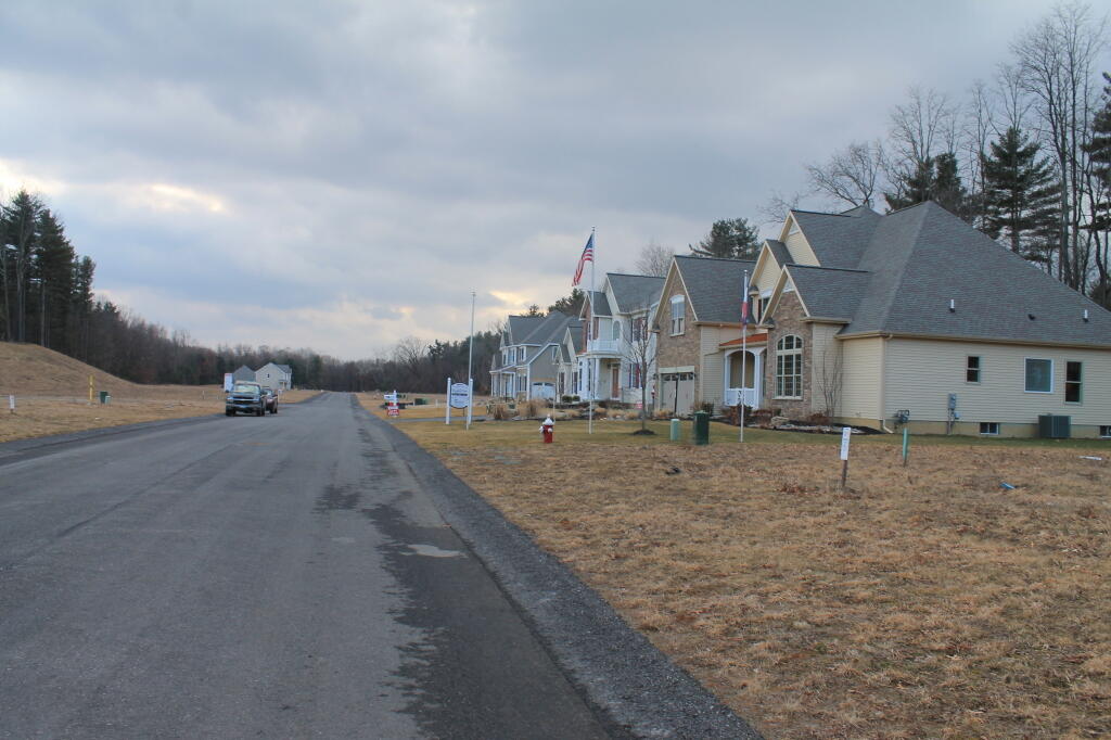
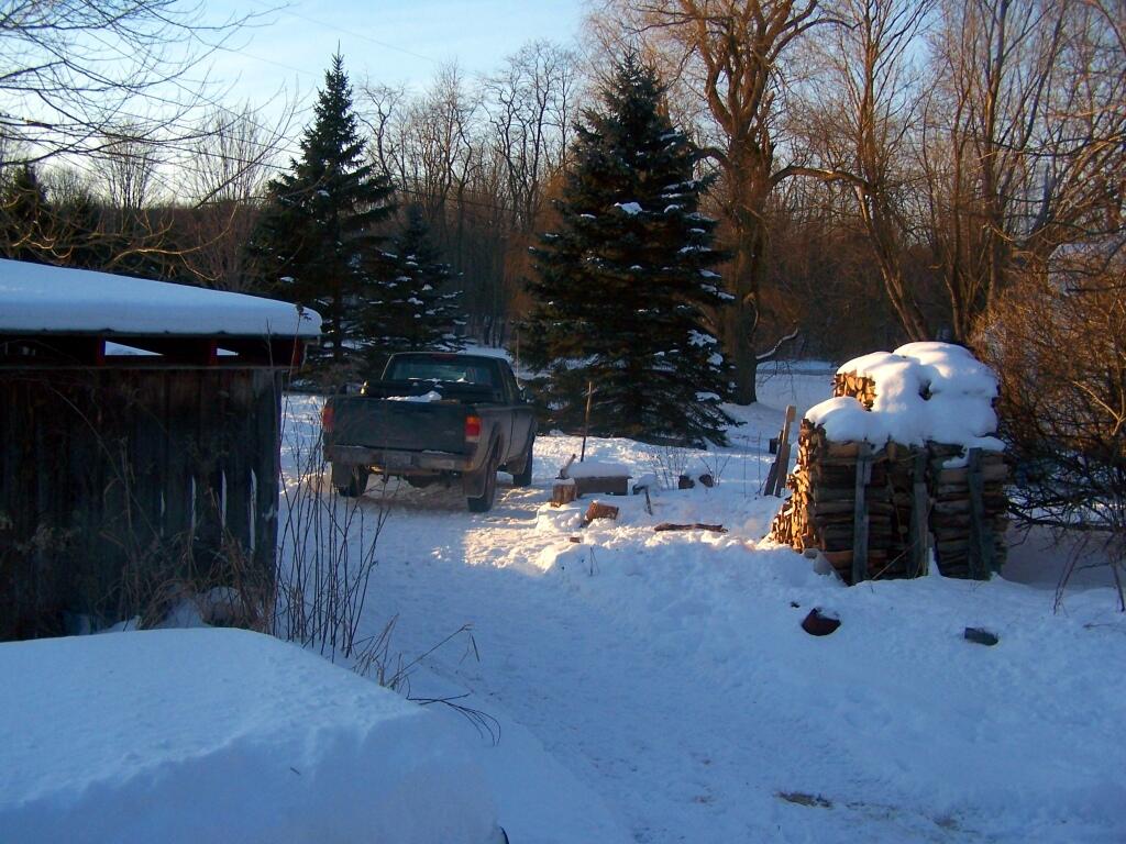
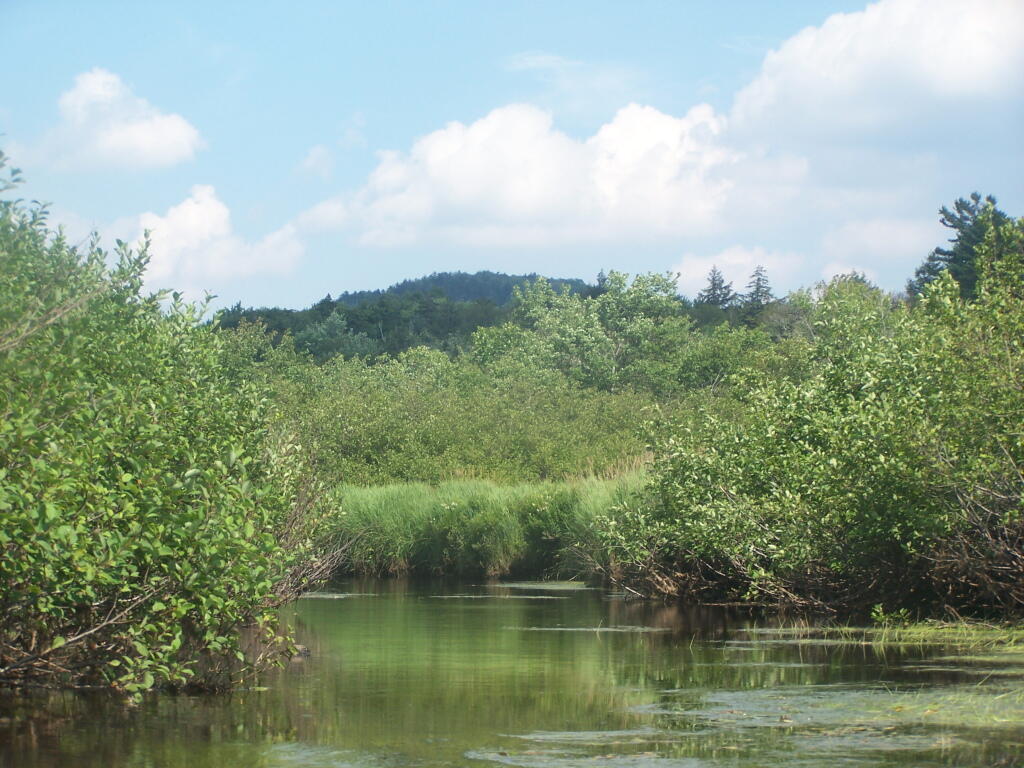
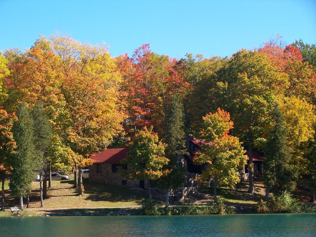
Several years back, the D&H Railroad abandoned the Slingerlands Railroad, that runs from the Port of Albany out to Altamont. This route had fallen out of favor for main freight line that runs from the Selkirk Railyard, north through Altamont.
I wasn’t a supporter of the rail trail, as I believe it will be an impediment in the future to preserve the right-of-away, for whatever future needs might come along — be it a bus rapid transit, a new rail line, or some future method of moving people and freight
I also maintain that rail trails are boring, overly straight routes, built for the convience of large locomotives pulling freight at high speeds, and not for recreational hiking or biking, at much lower speeds. Being that one can only bike or walk at speeds less then 25 MPH — and that bicycles aren’t even allowed yet — the trail seems relatively uninteresting at a walking speed.
Currently the rail trail runs from Slingerlands Fire Station down to the Delaware Avenue Bridge. West of Slingerlands Fire Station, the trail is posted No Tresspassing by the county, but east of Delaware Avenue Bridge, the trail is unmaintained but not posted.
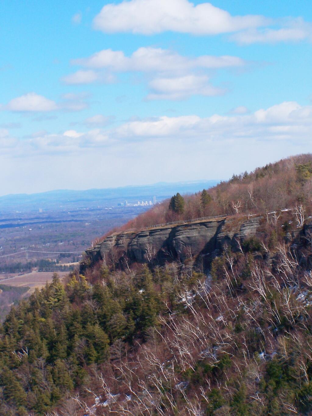
Hiking under the Cherry Avenue Extension Bridge.
One of the filled in areas where the rail line once run.
Gully as seen from the rail trail viaduct.
Delaware Avenue as seen from the former Delaware Avenue Railroad Bridge (this ends the maintained section of the trail).
Elsmere Avenue as seen from the Railroad Bridge.
As a whole, I am very under impressed by the Albany County Rail Trail. I have heard the views
Important Update: Make sure to connect the negative terminals of the two batteries. Grounding to the frame for the accessory battery will not excite the hal-effect (current) sensor, which is located on the negative terminal between the starting battery and alternator on the truck.
Not making this connection will lead to both batteries undercharging, especially in warmer weather or longer trips. Failure to make this connection will cause premature failure of the batteries, potential dead starting batteries, and repeated undercharging. You have been warned.
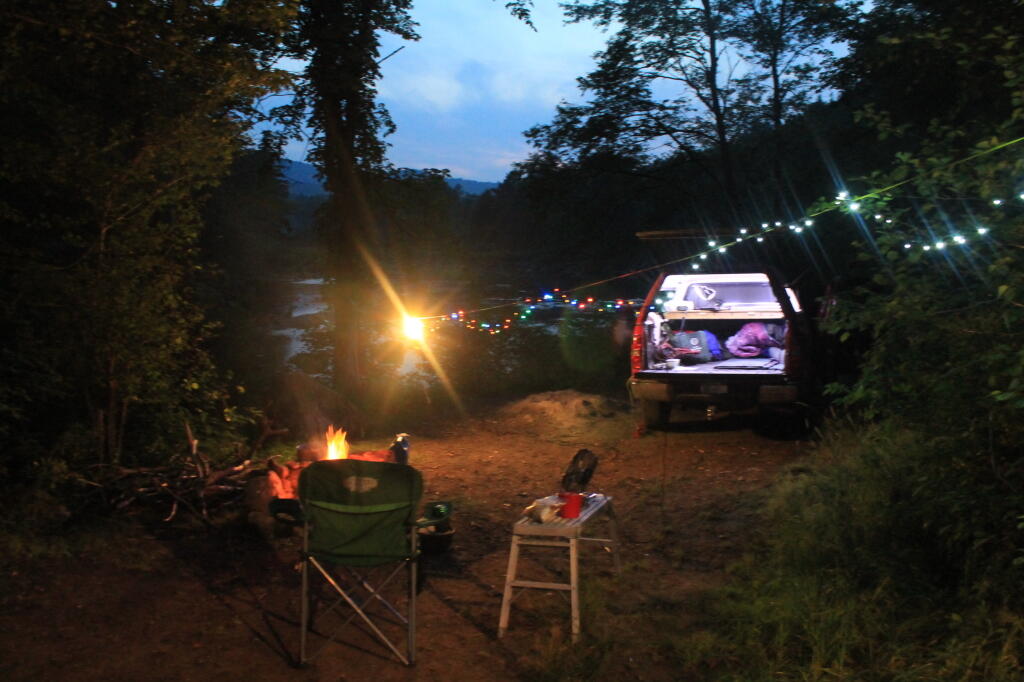
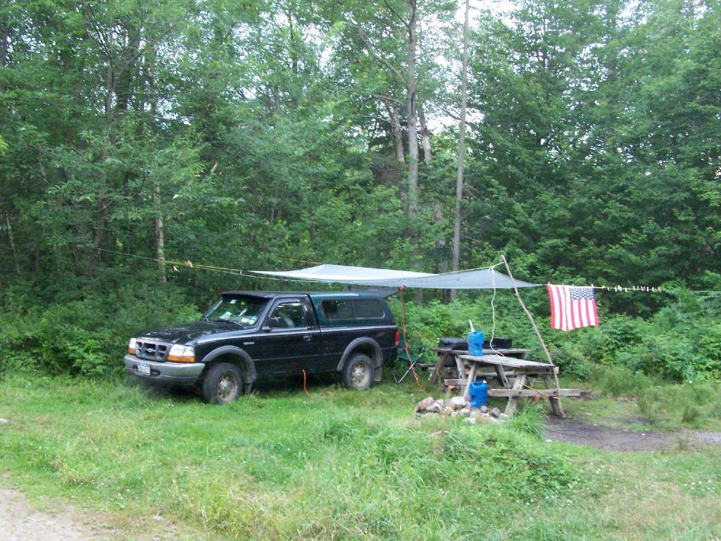
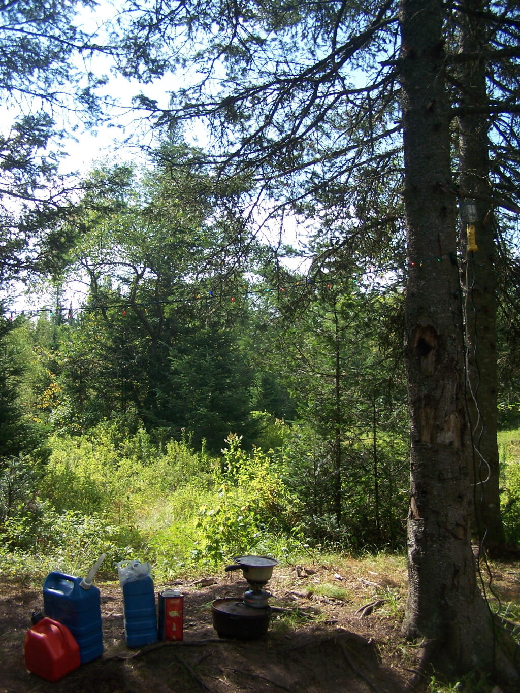
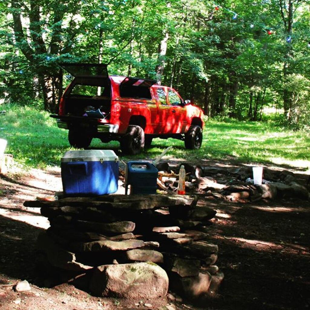
Since 2004, I have always run a power inverter off my truck, that converts 12 volt DC power into 120 volt household power. I use it extensively through the summer season to provide light and power to camp for small appliances like my alarm clock, laptop, and electric lighting. Electric lighting really beats any other camp lighting.
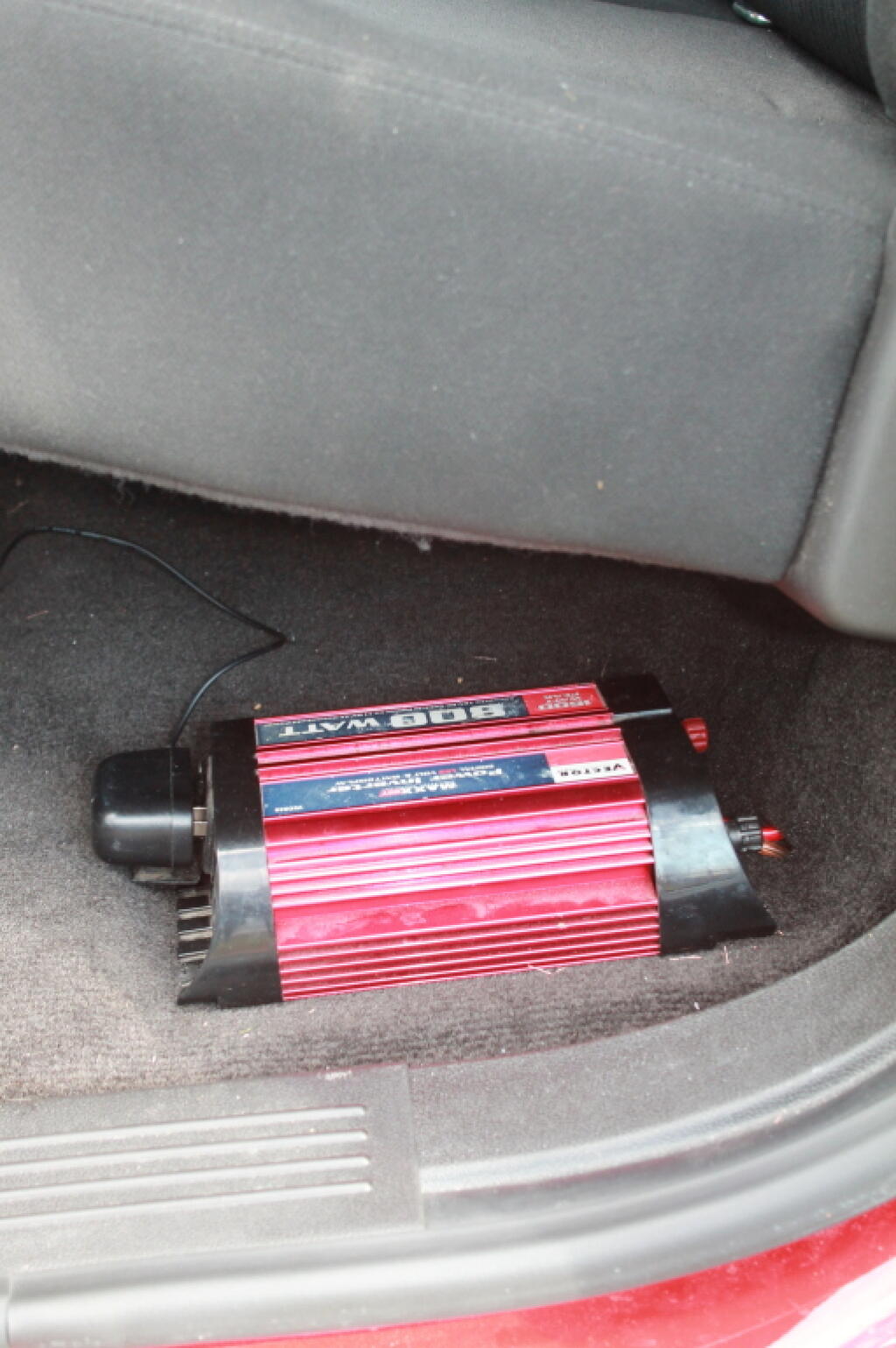
My current set up uses a Vector-brand 800-watt Power Inverter, connected to a second battery, that is disconnected from the starting battery when the engine is off. There is no danger of a dead starting battery as the second battery is disconnected from starting battery when the truck is off. Once the truck is turned on, the isolator relay reconnects the second battery to the alternator.
As long as you don’t drop the battery below 11.3 volts — where the inverter automatically turns off due to low voltage, you will have constant 120 volt output. As the isolator does not kick in until the alternator is spinning, there is no voltage drop when the engine is cranking.
When I got my 2011 Chevrolet Silverado to replace my old pickup, I was quite happy to discover that all full-size pickups come with dual battery locations, and at least with All-Star Edition Silverado, all of the hardware for installing a second battery exists (second battery tray, high-output 145 amp alternator), except for the $5 tie down and the wiring.
Equipment Used and Costs.
The installation would have cost me a total of around $475, although $75 of it was the inverter I had already purchased years ago and have moved on over my old truck.
Vector 800-watt Power Inverter – $75 – Pepboys (probably less now)
Wire, Conduit, Connectors, Fuse Tap – $80 – Boomer-McLoud
The parts total was $305. Not too bad. If were to install it all myself, it would have required additional tools like a battery cable crimp, plastic molding puller, sealants, which if you don’t own such tools and parts would add costs. In addition, you would have to buy extra parts in packages you wouldn’t neccessarly use. That proaly would add up to close to $150, plus your time isn’t free.
I had Boomer-McCloud, on Central Ave in Albany, a chain automobile electronics/car audio wiring store, do all the wiring, install the isolator and assorted related parts. They did it in two hours of labor, which cost $150. While the wiring is not rocket science, having it professionally done, increased the quality over what it would have been done had I done it myself. I am not a wiring expert, even if I know how electrons flow.
What I Had To Do.
Boomer-McLoud did all of the wiring and installation, although I had to purchase the battery and tie down, and also provide the battery inverter.
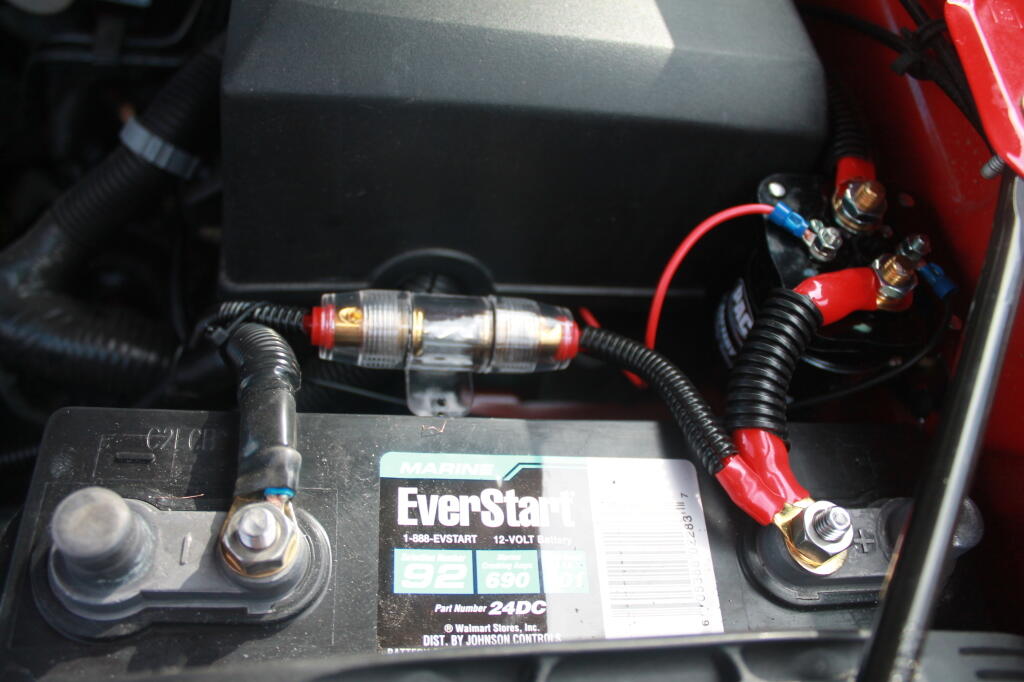
I decided to get a Walmart Everstart 24DC-6 Marine Battery, which is a dual purpose battery for starting and deep cycle. Walmart Everstart batteries are pretty good quality for the price, they are manufactured by Johnson Controls in the USA. I would have gotten a true deep-cycle, but I was on a budget, and finding something that would fit in the battery tray was a bit of a challenge. I figured if going to take some abuse — occassionally being overly deep cycled — I might as well not spend a fortune.
The Walmart Everstart 24DC-6 Marine Battery fit perfectly in the tray without sliding or being oversized, although is slightly taller then the standard Group 48 battery. It has a 101 amp/hr rating, which is sufficent power for at least a day’s worth of camp compact florescent lighting and small appliances like an alarm clock, cellphone chargers, etc. If battery gets too low, you just fire up the truck and charge it up.
Then I went to DePaula Chevrolet’s Parts Department and picked up a battery tie down. You just want the tie down plate and battery bolt. It’s like $5 for both of those parts. I then had to install the battery myself, and tie it down. You will need several long socket extensions to reach below the battery to install the tie down bolt. Once it’s installed, the battery is very secure, just like the factory battery.
Then I had to make an appointment with Boomer-McLoud, and explain what I wanted to do. They had some questions, and I showed them where I wanted the inverter mounted, and they did the rest. I just dropped it off before work one day, then picked it up later in the afternoon. Paid $315 with tax. Hit the switch on the inverter, plugged in electronics, and I was off.
Pictures of Individual Components.
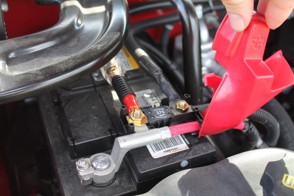
This is the second battery, with the isolator mounted close to it.
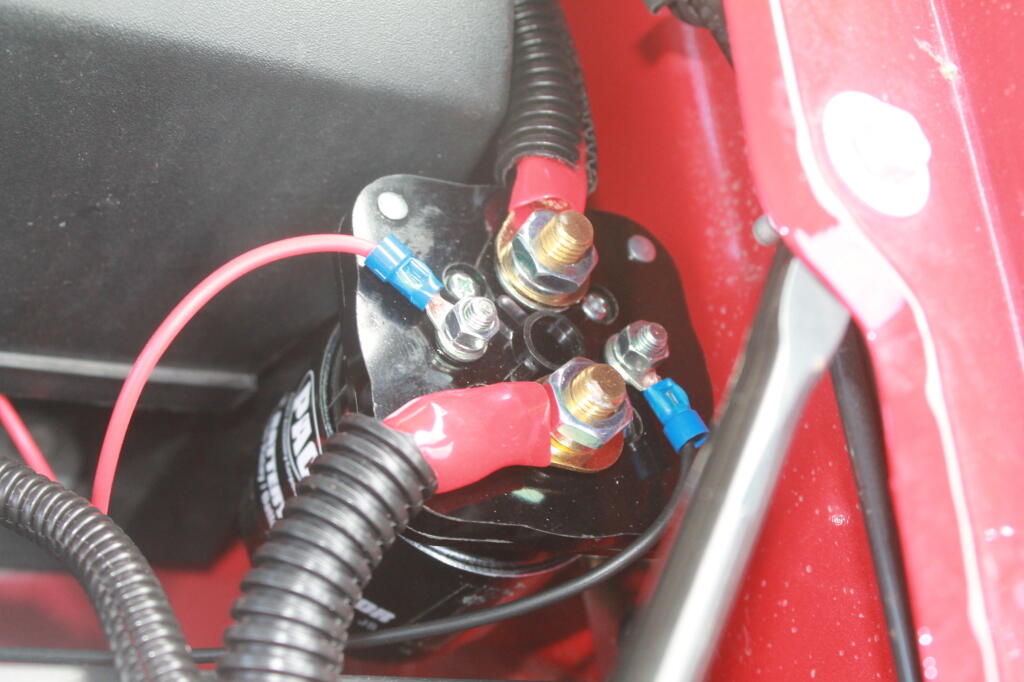
The isolator is like a giant electro-mechanical switch or relay, that is closed or “excited” by a small amount of current that causes the relay to shut. It is excited by a fuse tap in the Throttle Position Sensor Fuse from the main power bus. In the background is the main fuse bus, with the top off it.
Rather then mess with any factory wiring, the main feed wire comes off of the main (starting) battery terminal. Notice the 150 amp fuse for safety. You don’t want a shorted wire to equal a fire.
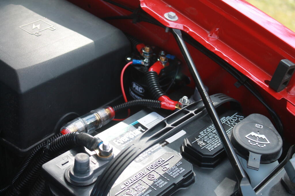
Here are the fuses and other wires coming off the second (inverter battery).
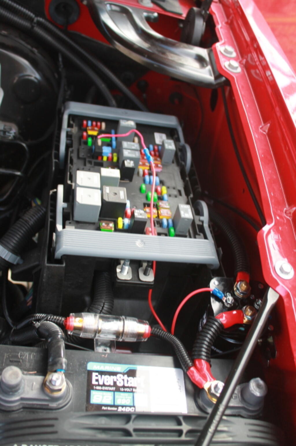
And finally, the power feed to the second battery, runs right on top of the main power bus from the Main Power Bus Distribution Box, just like how Chevy does it with the factory second battery install.
I’ve only used this set up for a couple of nights, but appears to work real well. The starting battery never gets low, the camp power works well all night long. you can easily plug in heavier loads like my 90-watt laptop adapter, and there is no dimming of headlines or sign of stress on the alternator.
I hope this is helpful. Please feel free to email me with any questions. — Andy
Like Fuck.
Like Fuck You Guilderland.
Like Fuck You Wealthy Folk.
We’ve all probably uttered that word, sometimes more then we’d be proud of it. Yet, sometimes somethings are just truly vulgur like tearing down sand dunes to build McMansions.
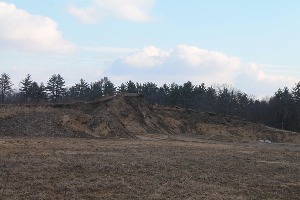
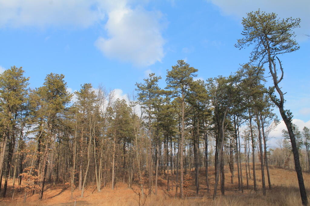
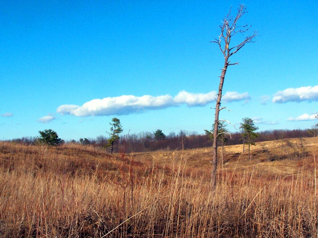
The first part of any housing development in the Albany Pine Bush appears to be the leveling of the land, and the carting off the sand to fill in other areas. To make the landscape flat and boring, so a suburban street grid, driveways, and foundations can be laid.
It involves tearing down tall beautiful pitch pines, removing habitat that might be restored if fire were to touch it once again, to sterlize the landscape for generations to come.
People need places to live, places to farm, places to use. But do they really need to tear down magnificent sand dunes? If they had to build, couldn’t they have left more of the trees standing, and built on the dunes, and preserved the terrian?
It might be easy and cheap to bulldoze sand. There is no rocks to blast away at. But making it all flat, just to stick tacky, plastic and plywood houses for the wealthy just seems so vulgur and awful.
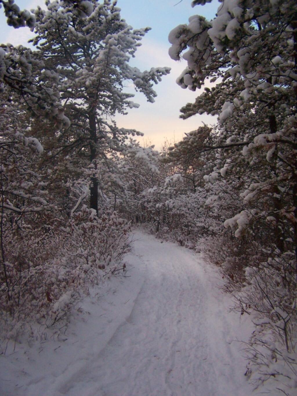
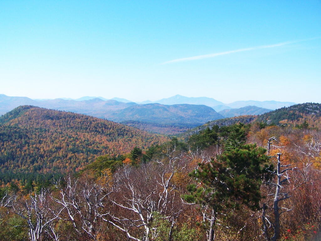
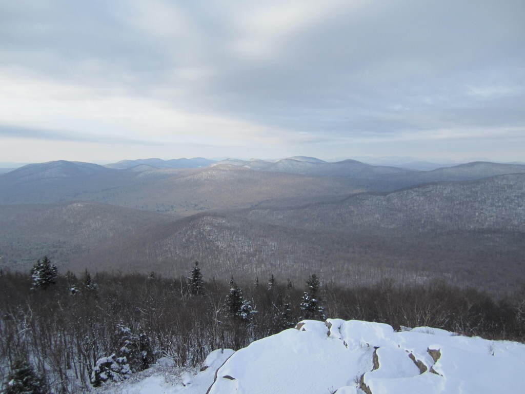
After a fresh snow fall it was a winter wonderland in the Albany Pine Barriens, a forever wild ecosystem on the outskirts of the city. It felt like one was walking through a marshmallow forest.
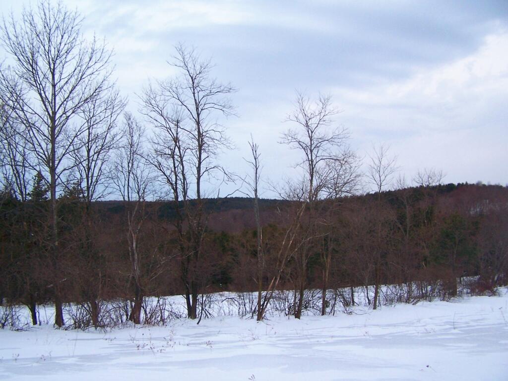
A cold winters day at my parents house in late January, after a long cold spell that never seemed to want to end.
February.
A icy sheen shown on the snow at Partridge Run, as I went for an afternoon walk with the dogs up there in the middle of the month.
Snowshoeing back down Bennett Hill in late February.
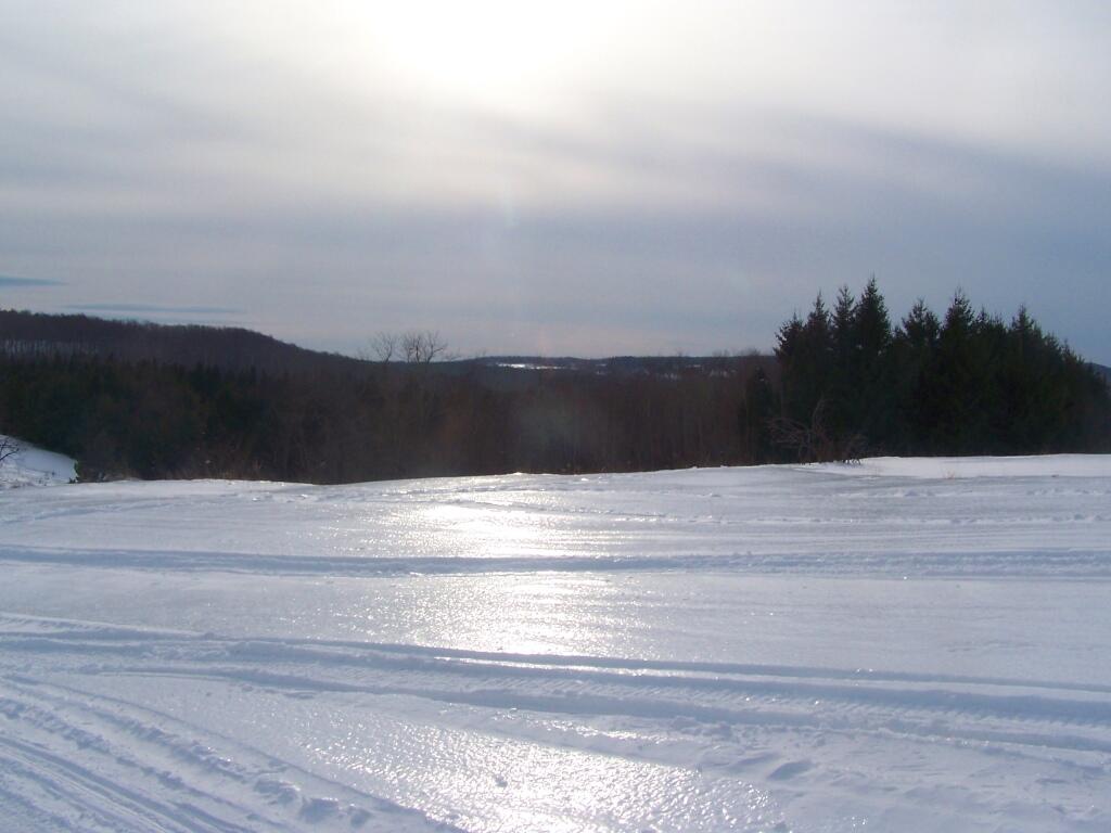
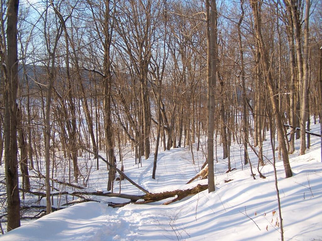
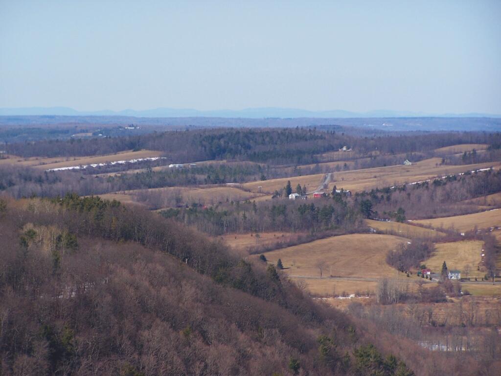
March.
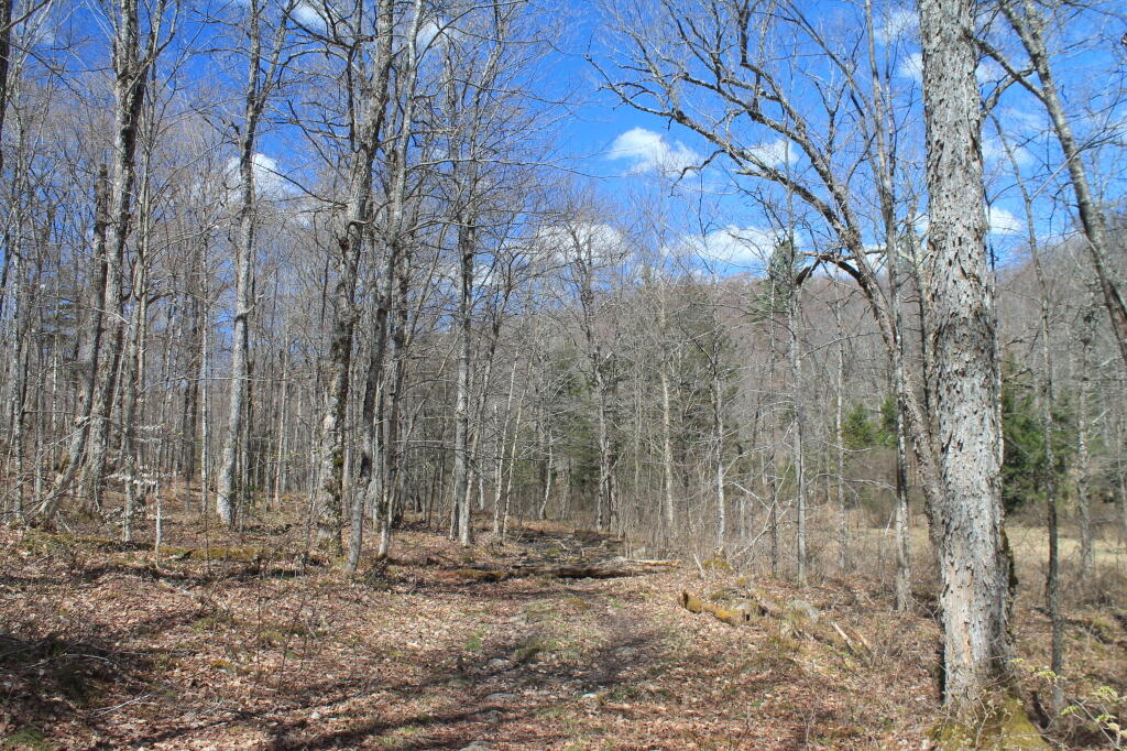
A recently logged section of Cole Hill provided breath-taking views of Irish Hill and the Fox Kill Valley down in Berne.
What a clear spring day up at Horseshoe Clove at Thacher Park. Warmer, nicer days can’t be far way.
April.
April 9th was the first day I got out camping in 2011. Spent the day exploring Rogers Environmental Center, camped at Moscow Hill Horse Assembly Area.
It may start to warm up earlier in lower elevations, but winter is still very much a force in late April in the Adirondacks. The East Sacanadaga River on this morning looks icy and cold.
May.
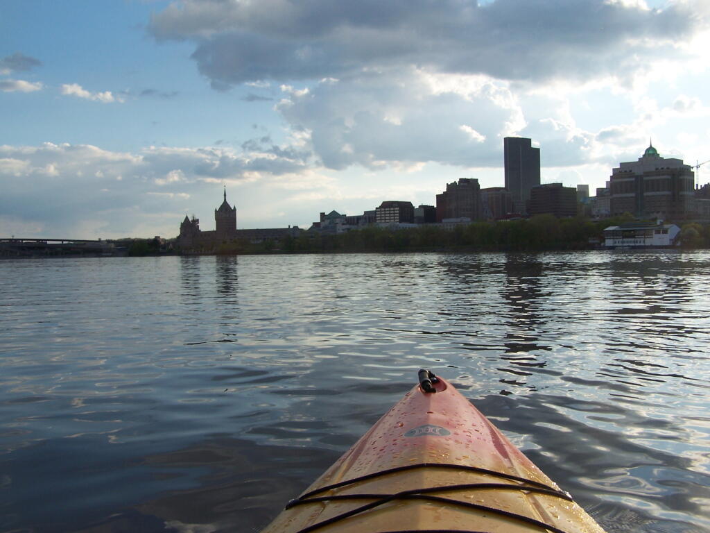
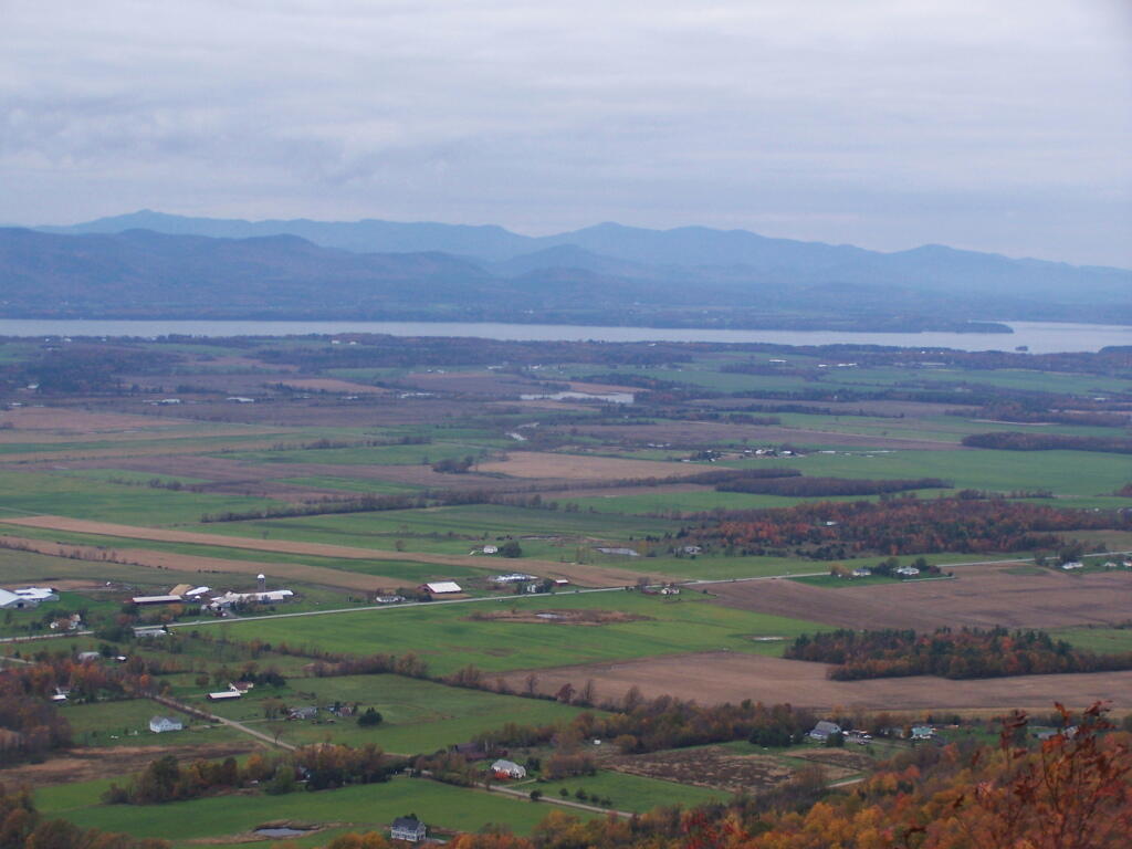
There’s Albany! From my kayak. I kayaked up to Downtown Troy from the Corning Preserve.
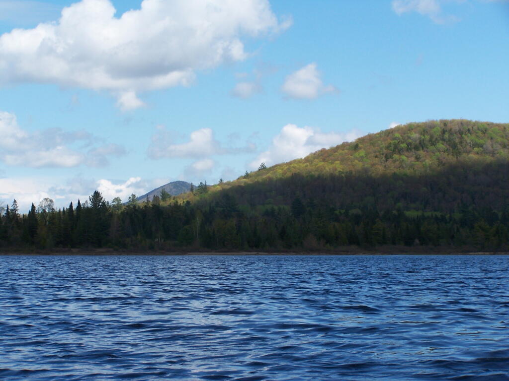
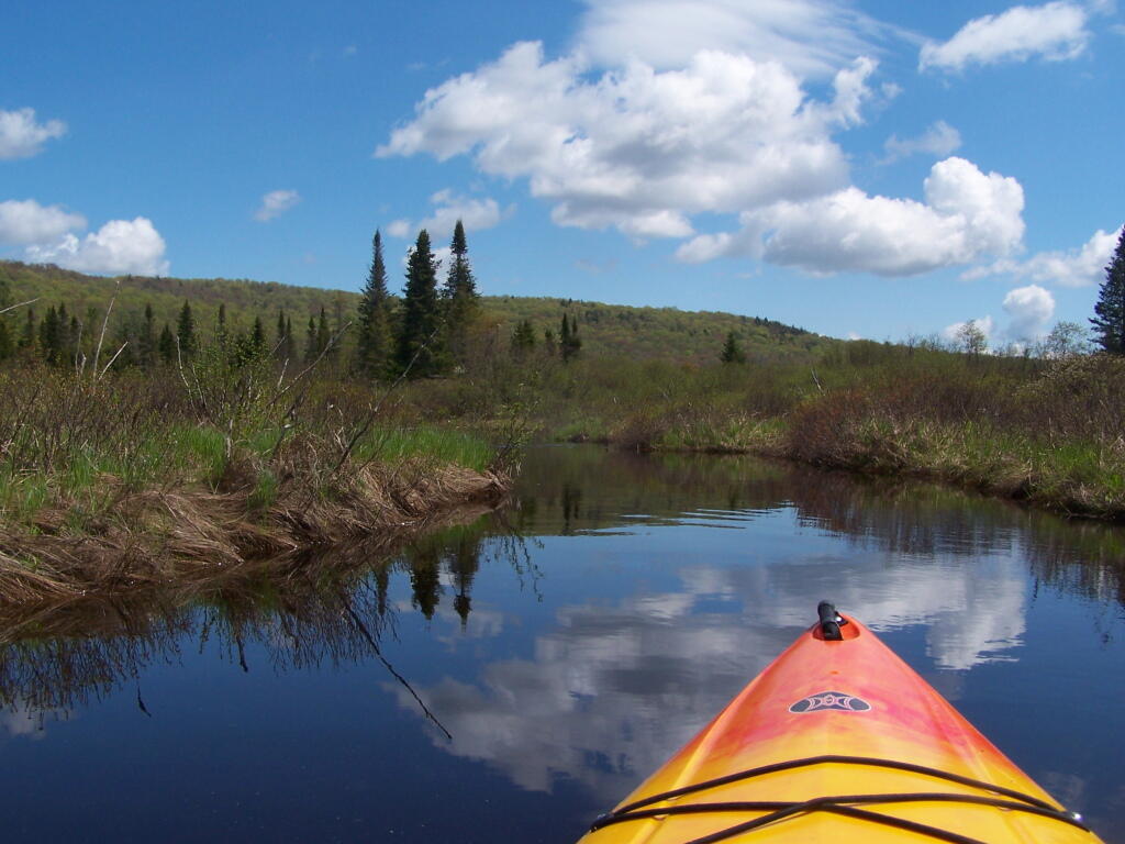
Spring finally comes to Adirondacks by late May. Paddling around Cheney Pond, looking towards Sand Mountain in the distance, on the other side of Hoffman Notch.
June.
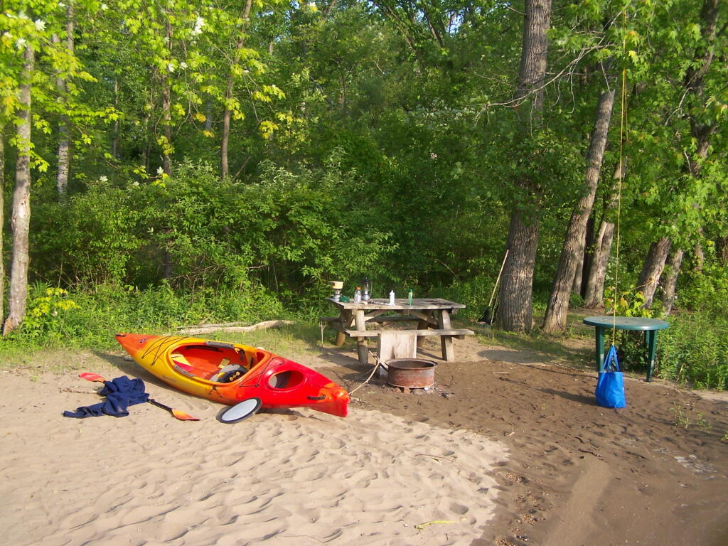
Kayak camping on Stockmans Island in the middle of the Hudson River. What an adventure, one I picked on a night when they had fireworks up at the Coxscake Town Park.
Oswegatchie River up in Watson’s Triangle in Adirondacks. There are few places as remote as this that you can drive on largely unmarked and rarely traversed back country roads. Watson’s Triangle is a place far of the beaten path.
July.
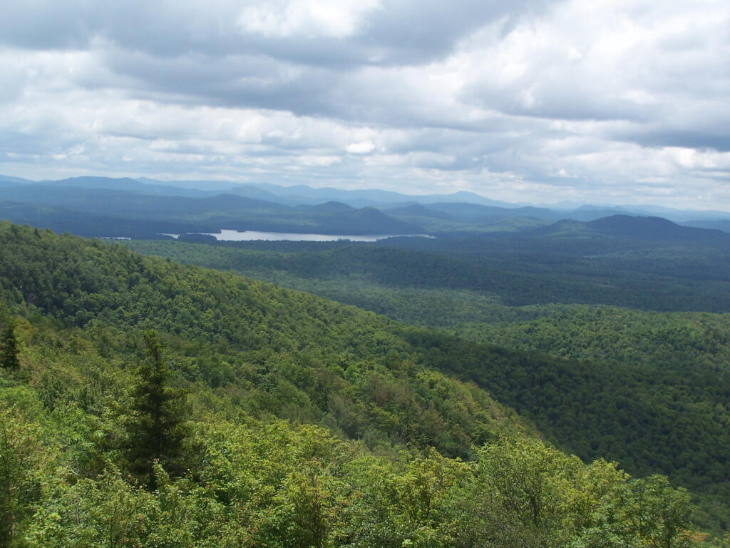
A dramatically cloudy day, looking down towards Tupper Lake from Mount Arab.
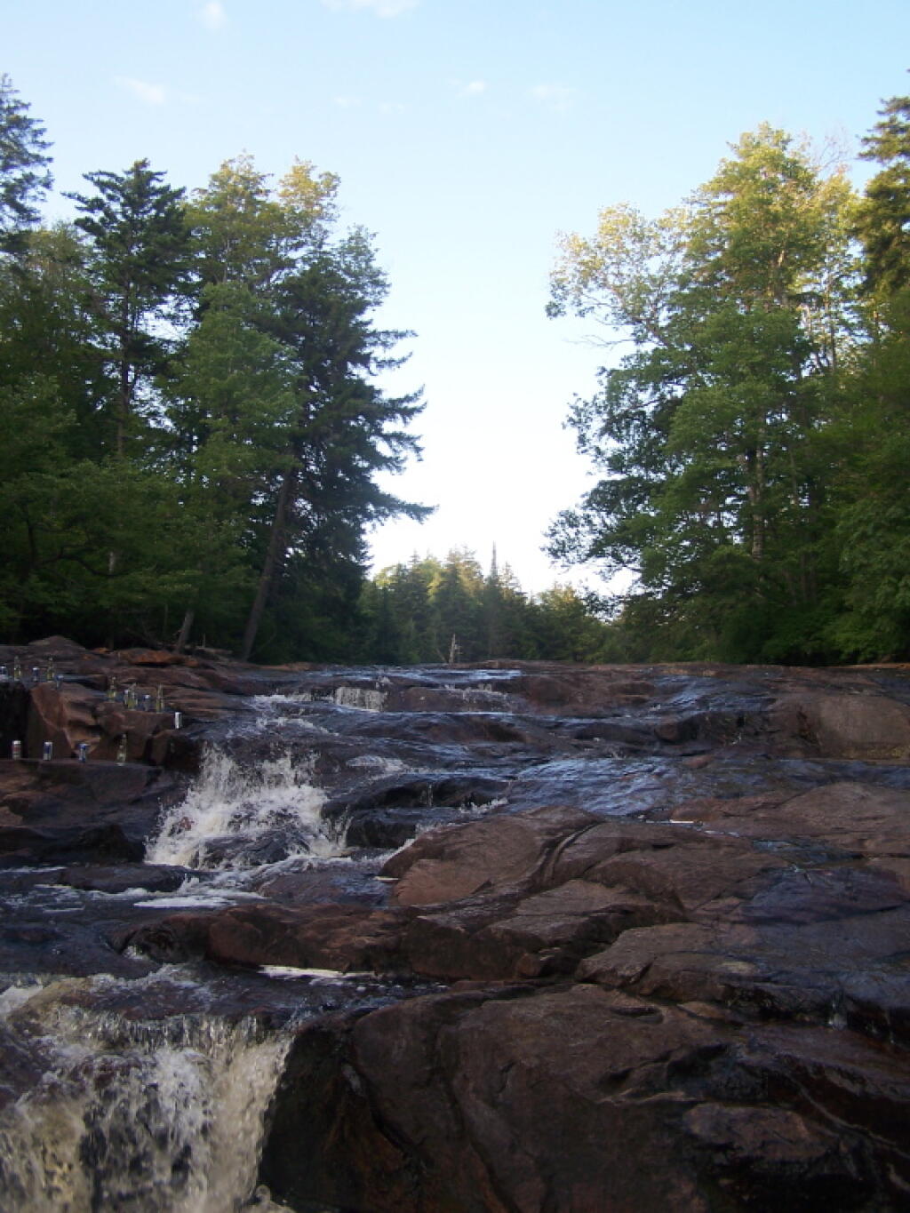
Cooling off at the Potholers on an oppressively humid summer’s day.
August.
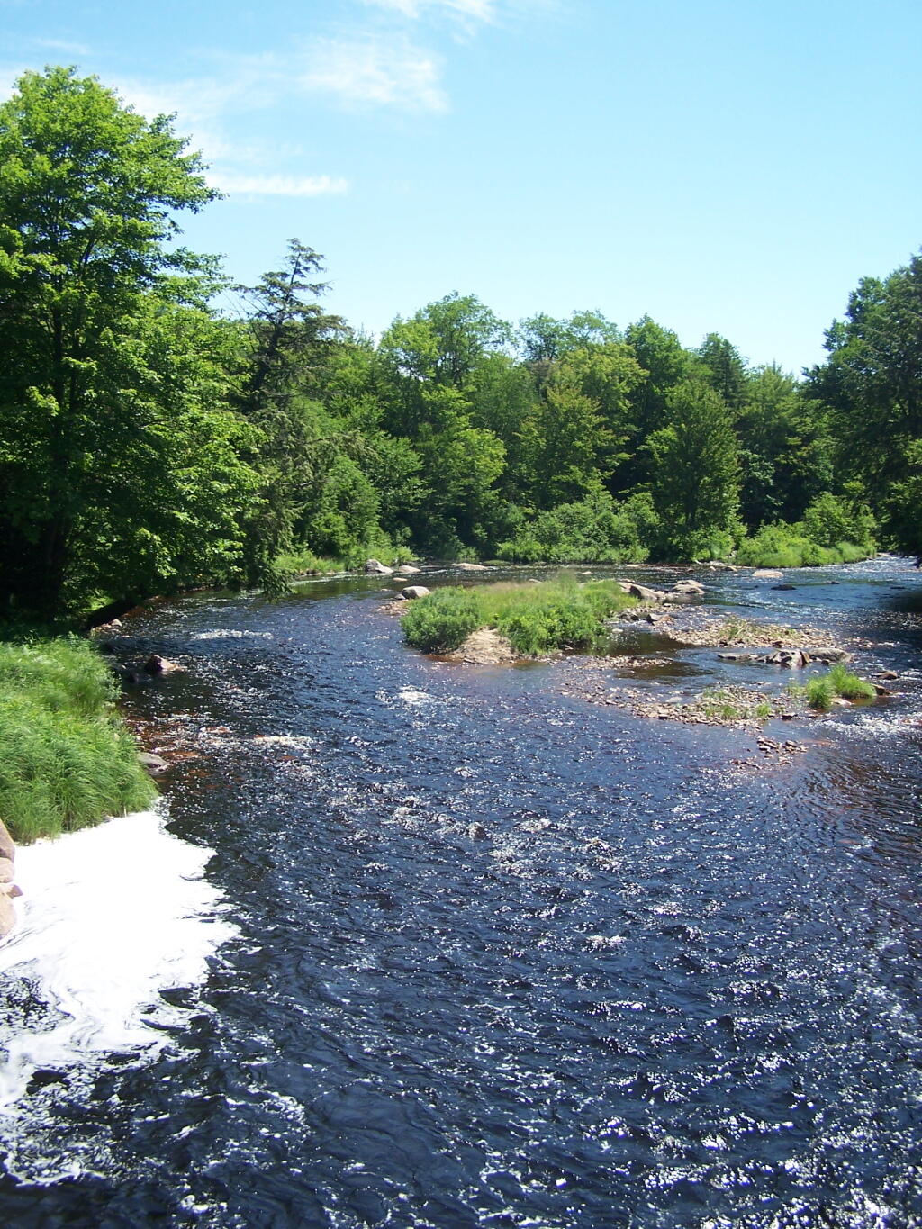
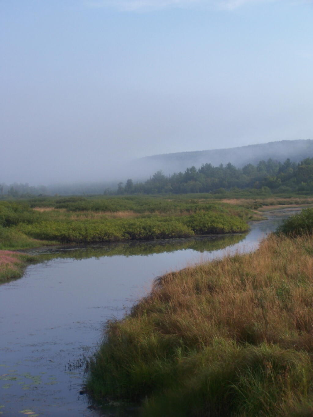
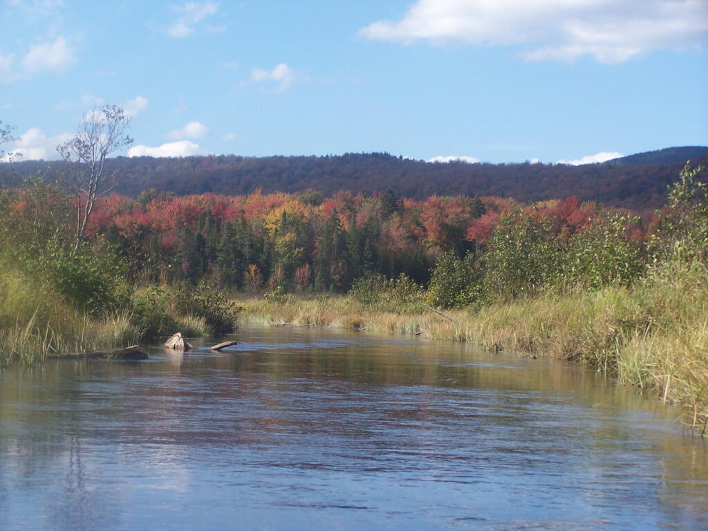
Exploring Beaver Creek at the Brookfield Railroad State Forest in Brookfield, NY.
Watching the fog burn off Beaver Creek at Brookfield Railroad State Forest on a summer morning..
September.
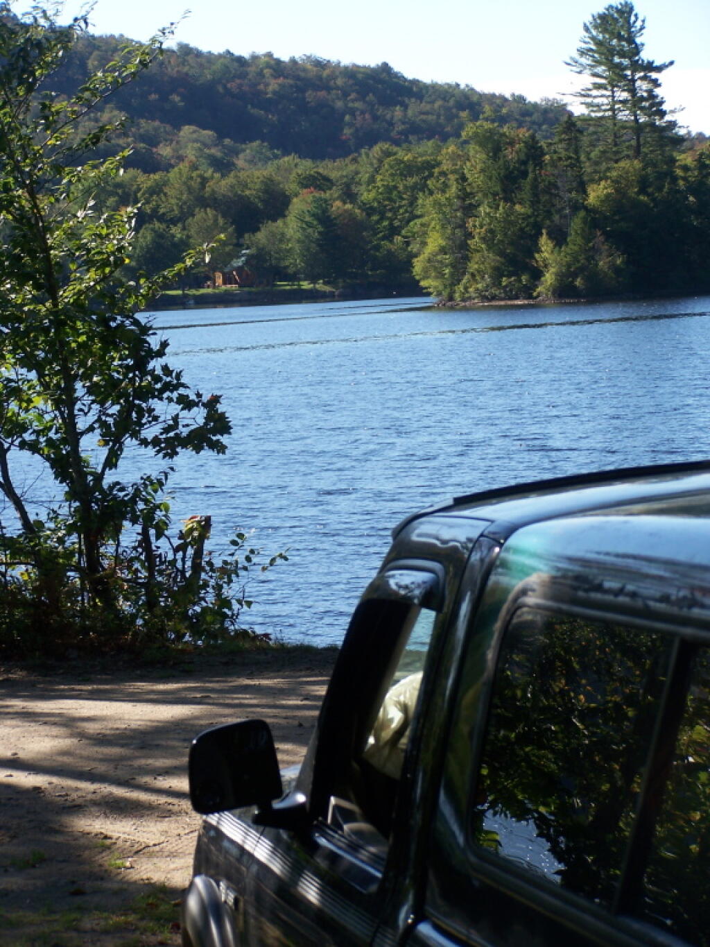
A beautiful late summer morning at North Lake in Adirondacks. North Lake is such a jewel, especially as you head farther north on the largely undeveloped portion of the lake.
Fall was well underway, and even past peak at Moose River Plains by September 20th.
October.
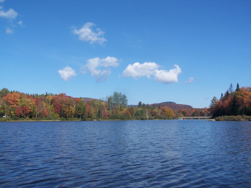
Second week of October, I went up to the North Country for some leaf peeping, hiking, and kayaking. The colors may be faded in Central Adirondacks, but still were good in lower elevation parts of the Northern Adirondacks.
And later in October, I drove up to Snake Mountain in Vermont, overlooking the Champlain Valley and the Adirondacks. Colors lasted the longest
And by October 30th, we had snow, actually several inches, as seen up at Lake Taghkanic State Park.
November.
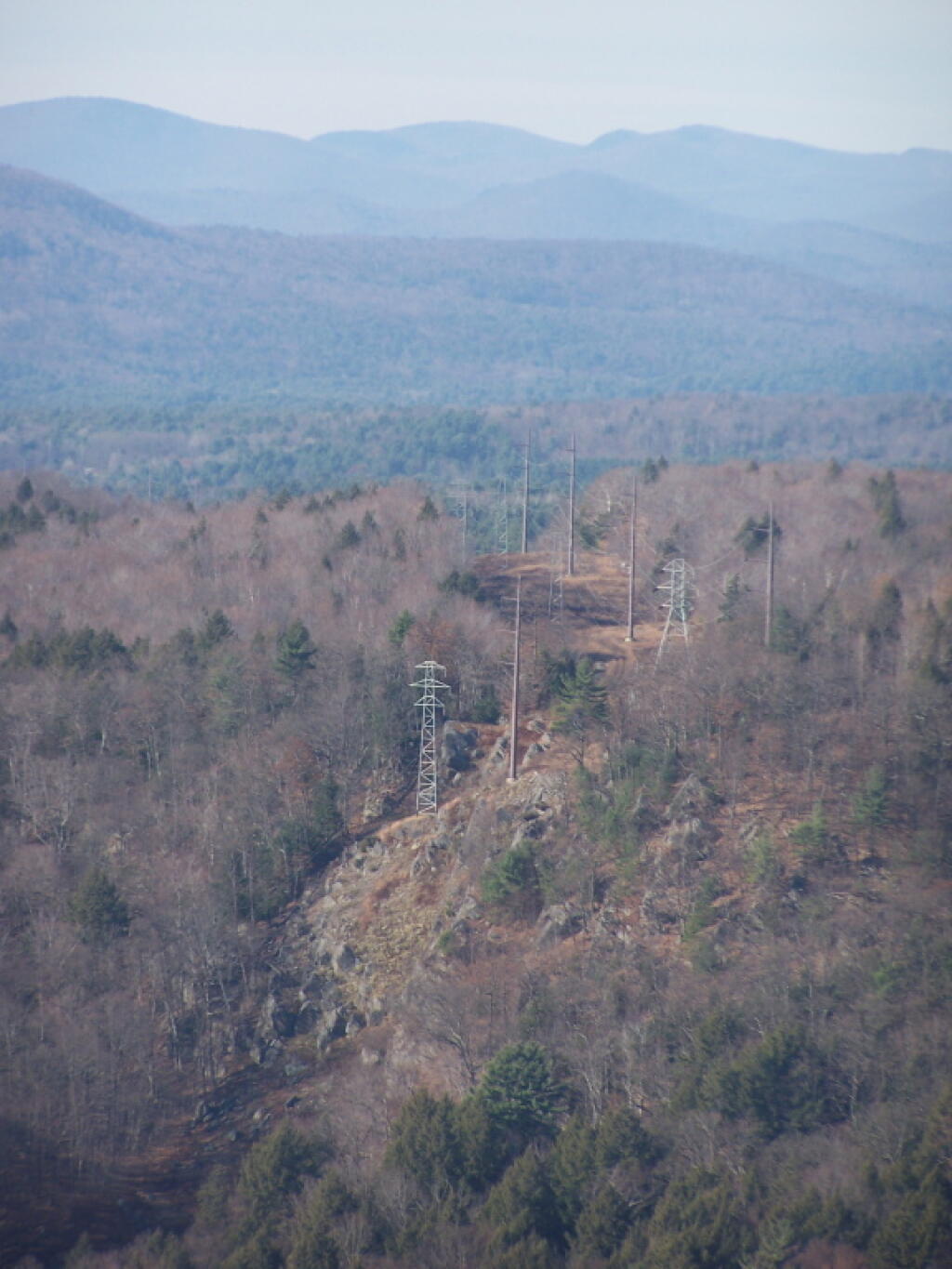
In November I visited Monreau Lake State Park for the first time, and checked out the Palmerstown Ridge above the Hudson River and Spier Falls. These power lines transfer power from Spier Falls Hydro Dam over to Corinth.
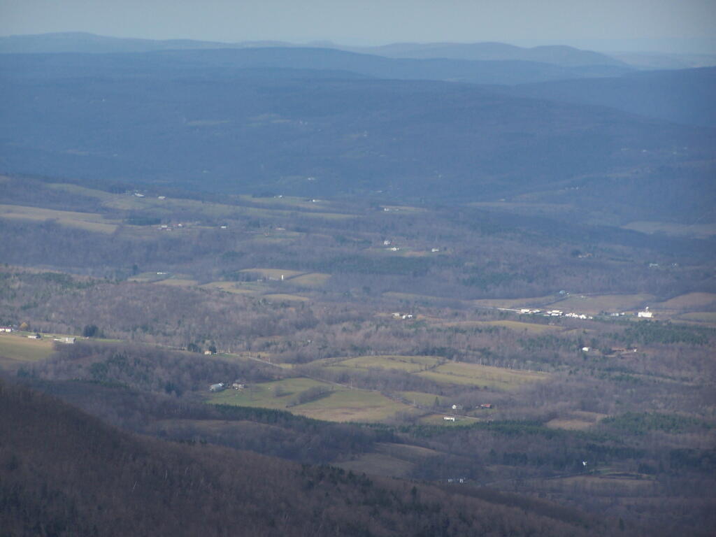
I also hiked up Windham High Peak. I hadn’t been there in many years, and it was interesting to look down at Preston Hollow and Medusa, far, far below.
December.
On Christmas Day, I hiked up Hadley Mountain. While cloudy and cold, it was very beautiful.
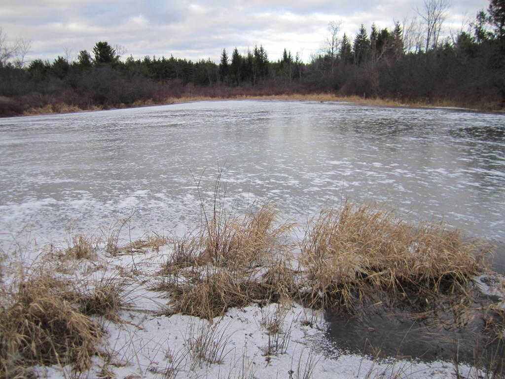
While the pond at Thacher Park was frozen, there still is very little snow locally.
I am concerned about what the Occupy Movement means for our public parks. Public parks are the commons in our society, the places where anybody may go to gather and to recreate. Public parks belong to us all, therefore private individual organizations must not be allowed to have exclusive use to them.
Inherit in the concept of a public park is that man is just a visitor, and that nobody resides there permanently. Parks are places where men dwell only temporarily for fellowship or solitude, it is an escape from the private places we normally reside in.
When kayaking on a lake or hiking a mountain, one may stop to enjoy the view. You only stop for a few minutes to enjoy the view, and then you move on. Your experience is non-exclusive, anyone can walk by when your there, or come by five minutes after you’ve left in solitude. Laws prevent you from building a house or setting up long-term residency there, you must move on an allow others to see what you once saw.
Campsites are same way. Whether in a DEC Campground or a back-country site, one can only set up a campsite and camp there for a set amount of time. Typically this is limited to two weeks except during Big Game Season. When your time is up, you must pack up your gear, and leave the site cleaner then you have found it.
When your camping, a campsite becomes your temporary place of residency. You unpack your gear, you make a fire, you set up your tent. You cook your meals there, you camp there, and you probably do your business in an outhouse or in woods a short ways from there. For all purposes, you live there and campsite is like your house for a short period of time.
A campsite is never an exclusive site. Campsites can get elaborately set up, with lots of canopies, tents, lanterns and other gear. Some people hang Christmas lights and drive in large RVs to campsites. You may dwell there for a while but after a number of days you must pack up and leave. Others may then use your campsite, enjoy the views and benefits the public lands provide for all that wish to use them.
Public parks are excellent places for individuals and groups to get together and discuss public business. They are good places to get together and protests. Many parks are large, and can accommodate large groups of people. Many parks are appropriate for camping and other recreational pursuits.
Yet, we can not allow any individual or group to remain in a park for too long of a period. Individuals must remain visitors, those who come only for a short period of time to enjoy the land in solitude or fellowship. Two weeks, needs to remain the maximum use for a piece of land, except in very narrow exception.
… Allowing people to stay too long in a park, only serves to undermine the concept of public lands and the commons.
Today we look at Campsites and Lean-tos and other “developed” camping opporunties in DEC Region 7, which consists of lands in Central NY Counties of Broome, Cayuga, Chenango, Cortland, Madison, Onondaga, Oswego, Tompkins and Tioga, and is based on data in Region 7 Recreation Master Plan.
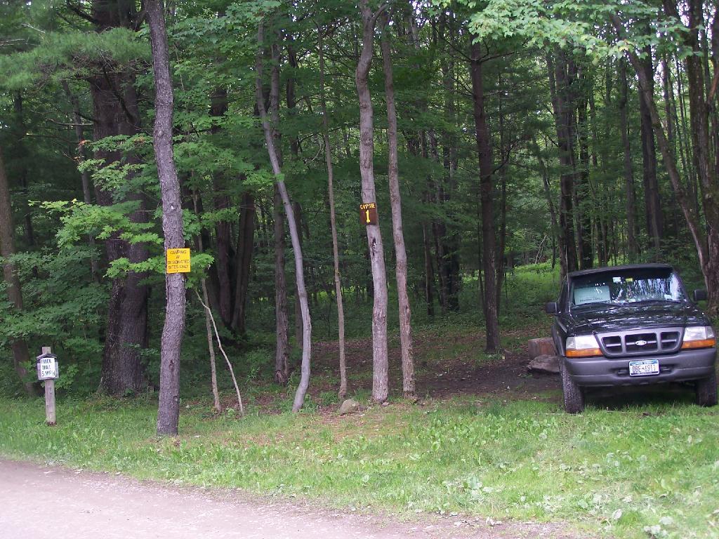
Current 85 Designated Campsites/Lean-Tos.
Balsam Pond State Forest (Chenango 17) – 1 campsite at Baker’s pond
Balsam Pond State Forest (Chenango 34) – 9 campsites 3
Beaver Creek State Forest (Madison 12) – 2 campsites at the assembly area 4
Charles E. Baker State Forest (Madison 1) – 14 campsites at Moscow Hill 4
Charles E. Baker State Forest (Madison 1) – 2 lean-tos
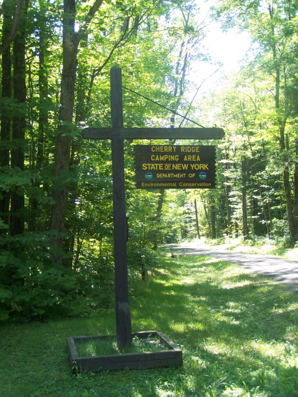
Charles E. Baker State Forest (Madison 1) – 8 campsites at Cherry Ridge 3
Stoney Pond State Forest (Madison 13) – 12 campsites 2
Taylor Valley State Forest (Cortland 2) – 12 campsites 5
Tuller Hill State Forest (Cortland 9) – 1 lean-to
Whaupaunaucau State Forest (Chenango 31) – 1 lean-to
Wiley Brook State Forest (Chenango 7) – 1 campsite
1 DEC Camping permit required. Call (607) 674-4036 to have a permit mailed to you.
2DEC Camping permit required from April 15-October 15th. Call (607) 674-4036 to have a permit mailed to you.
3 Vehicle accessible.
4Horse Assembly and Camping-area.
5 Currently undesignated sites (lacks “Camp Here Markers”) on an old loop road that was part of CCC Camp in Taylor Valley.
Related Maps.
DEC’s Future Plans for Region 7
1. Develop 31 additional campsites in Region 7. Twenty-eight of these will be open campsites and three will be lean-tos. A portion of the new campsite development will occur on Hall Island State Forest (Oswego 10), as noted in items b and c. The Department will consider the option of permanently closing any or all of the Island campsites if patrol or enforcement problems become an issue. Fiscal constraints and public demand will determine if any additional campsites are to be developed within the Region.
a. Development of the new campsites will be in compliance with the guidelines for access by people with disabilities.
b. Develop 12 to 15 open campsites on Hall Island State Forest (Oswego10). These campsites will be located on the south side of the Salmon River Reservoir and will only be accessible by water. A permit will be required to occupy these sites. Three of these sites will be developed for people with disabilities . c. On Hall Island State Forest (Oswego 10), upgrade two designated campsites on Burdick Island and two campsites on Huckleberry Island in the Salmon River Reservoir. A permit will be required to occupy these sites. Two of these sites will be developed for people with disabilities.
d. Develop one lean-to campsite along the Finger Lakes Trail on Perkins Pond State Forest (Chenango 22) in the Town of Otselic.
e. Develop two open campsites on the Marsh Pond State Forest (Broome 4) near the pond. One of these sites will be developed for people with disabilities.
f. Develop three campsites on Robinson Hill State Forest (Tioga 3) near Tricounty Pond. The exact number of sites will be determined from local demand. One or two of these sites will be developed for people with disabilities. Install kiosk and develop area brochure.
g. Develop one lean-to on the Genegantslet State Forest with access from Creek Road. The access trail to the lean-to will be approximately 0.7 miles of hiking trail.
h. Develop an open campsite in stand C-7 on Long Pond State Forest (Chenango 35) designed for access by canoe or boat.
i. Develop three open campsites on Oakley Corners State Forest (Tioga 2). One of these sites will be developed for people with disabilities. Use of these sites will be by permit only.
j. Upgrade and designate three formal sites on the Salmon River State Forest (Oswego 8). A permit will be required to occupy these sites.
k. Rebuild the lean-to along the trail on Chateaugay State Forest (Oswego 4 & 5).
l. Build one lean-to on Cuyler Hill State Forest (Cortland 6).
m. Inspect and, if necessary, repair or replace lean-tos on the Finger Lakes Trail.
2. Propose a change to the current regulations to address the conflicts encountered with camping within 150 feet of a road.
a. Propose a change to the current regulation that prohibits camping within 150′ of any road. The intent of this proposal is to accommodate the style of camping that is common during hunting season.
3. Provide camping opportunities on State Forests for people with disabilities. These ADA compliant facilities will be distributed throughout the Region. Most of the designated campsites will have fire rings and several of the sites will have picnic tables. Fire rings, picnic tables and benches will be of Universal Design. Accessible latrines will be located at areas with several campsites, such as Long Pond, Stoney Pond and Charles E. Baker State Forests. All camping areas that can be driven to will have at least one accessible parking space. a. Make alterations to the Moscow Hill campsites on the Charles E. Baker State Forest (Madison 1 & 4) so that at least four of the sites are accessible by people with disabilities.
4. Designate 14 campsites at Moscow Hill, Madison 1, camping area.
5. Maintain 85 existing campsites.
6. Propose a regulation to prohibit camping at Nanticoke Lake Multiple-Use Area and Redfield Island Day-Use Area
7. Remove the lean-to on New Michigan State Forest (Chenango 5) This lean-to is structurally poor and is no longer located on an active trail. The lean-to proposed in 1. d will replace this lean-to.
Today’s fodder is based on the text of the Adirondack Park State Land Master Plan that explains the Adirondack Scenic, Wild and Recreational Rivers System and the policies surrounding it quite well. — Andy
The Adirondack Park contains many rivers which, with their immediate environs, constitute an important and unusual resource. Classification of those portions of rivers that flow through state land is vital to the protection of existing free flowing streams. The classification system and the recommended guidelines specified below are designed to be consistent with and complementary to both the basic intent and structure of the legislation passed by the legislature in 1972 creating a wild, scenic and recreational rivers system on both state and private lands.
Definitions
A wild river is a river or section of river that is free of diversions and impoundments, inaccessible to the general public except by water, foot or horse trail, and with a river area primitive in nature and free of any man-made development except foot bridges.
A scenic river is a river or section of river that is free of diversions or impoundments except for log dams, with limited road access and with a river area largely primitive and undeveloped, or that is partially or predominantly used for agriculture, forest management and other dispersed human activities that do not substantially interfere with public use and enjoyment of the river and its shore. A recreational river is a river or section of river that is readily accessible by road or railroad, that may have development in the river area and that may have undergone some diversion or impoundment in the past.
Guidelines for Management and Use
Basic guidelines
1. No river or river area will be managed or used in a way that would be less restrictive in nature than the statutory requirements of the Wild, Scenic and Recreational Rivers Act, Article l5, title 27 of the Environmental Conservation Law, or than the guidelines for the management and use of the land classification within which the river area lies, but the river or river area may be administered in a more restrictive manner.
2. Rivers will be kept free of pollution and the water quality thereof kept sufficiently high to meet other management guidelines contained in this section.
3. No dam or other structure impeding the natural flow of a river will be constructed on a wild, scenic or recreational river, except for stream improvement structures for fisheries management purposes which are permissible on recreational and scenic rivers only.
4. The precise boundaries of the river area will be determined by the Department of Environmental Conservation, will be specified in the individual unit management plans for the river area or the areas, where the more restrictive guidelines of the particular area will apply) and with the following additional guidelines.
2. Access points to the river shore or crossings of the river by roads, fire truck trails or other trails open to motor vehicle use by the public or administrative personnel will normally be located at least two miles apart.
3. Other motor vehicle roads or trails in the river area will not be encouraged and, where permitted, will normally be kept at least 500 feet from the river shore and will be screened by vegetation or topography from view from the river itself.
4. The natural character of the river and its immediate shoreline will be preserved.
5. The following structures and improvements may be located so as to be visible from the river itself:
== fishing and waterway access sites;
== foot and horse trails and foot and horse trail bridges crossing the river; and,
== motor vehicle bridges crossing the river.
6. All other new, reconstructed or relocated conforming structures and improvements (other than individual lean-tos, primitive tent sites and pit privies which are governed by the regular guidelines of the master plan) will be located a minimum of 250 feet from the mean high water mark of the river and will in all cases be reasonably screened by vegetation or topography from view from the river itself.
7. Motorboat usage of scenic rivers will not normally be permitted but may be allowed by the Department of Environmental Conservation, where such use is already established, is consistent with the character of the river and river area, and will not result in any undue adverse impacts upon the natural resource quality of the area.
Recreational rivers
1. Recreational rivers and their river areas will be administered in accordance with the guidelines for management of wild forest areas (except where such rivers flow through wilderness, primitive or canoe areas, where the more restrictive guidelines of the particular area will apply) and with the following additional guidelines:
2. Where a recreational river flows through an intensive use area, structures, improvements and uses permitted in intensive use areas will be permitted, provided the scale and intensity of these intensive uses do not adversely affect the recreational character of the river and the river area.
3. The natural character of the river and its immediate shoreline will be preserved and enhanced.
4. The following structures and improvements may be located so as to be visible from the river itself:
== fishing and waterway access sites;
== docks;
== foot and horse trails and foot and horse trail bridges crossing the river;
== snowmobile trails, roads, and truck trails; and,
== motor vehicle bridges crossing the river.
5. All other new, reconstructed or relocated conforming structures and improvements (other than individual lean-tos and primitive tent sites which are governed by the regular guidelines of the master plan) will be located a minimum of 150 feet from the mean high water mark of the river and will in all cases be reasonably screened by vegetation or topography from view from the river itself.
6. Motorboat use of recreational rivers may be permitted, as determined by the Department of Environmental Conservation.
Designation of Wild, Scenic and Recreational Rivers
The application of the above definitions and criteria to rivers on state lands in the Park results in the current designation under this master plan of 155.1 miles of wild rivers, 511.3 miles of scenic rivers, and 539.5 miles of recreational rivers. A significant amount of private lands not covered by this master plan are included in these mileage figures. A brief description of these rivers and their classification is set forth in Chapter III.
River
Wild
Scenic
Recreational
Ampersand Brook
8.6
Ausable — Main Branch
21.7
Ausable — East Branch
8.8
25.2
Ausable — West Branch
31.8
Black
6.8
5.8
Bog
6.2
Boreas
11.4
Bouquet
42.7
Bouquet — North Fork
5.9
Bouquet — South Fork
5.0
Blue Mountain Stream (Trib. of Middle Branch, Grasse River)
![Untitled [Expires February 17 2025]](https://andyarthur.org//data/photo_010084_large.jpg)