For the first year of doing topographic maps, I relied extensively on using NYSDOT topographic maps, I originally downloaded from the NYSGIS consortium website. The NYSDOT topographic maps have a lot of good information on them, an in many ways have the most accurate topography.
But what I’ve also found with those maps is they have several real limitations…
1) They Don’t Scale Well.
NYSDOT topographic maps are designed to viewed at 1:2400 feet ratio, as they are 7.5″ quads. You can get away with rendering them anywhere between 1:1800 to 1:2600, but beyond that the text looks too small, too crowded, or two pixelated. For smaller parks and larger areas, NYSDOT topographic maps do not work well.
2) Unneeded Information and Clutter.
DOT Topographic Maps try to suit the need of any user, and include information like town lines and other jurisdictional information that is unnecessarily for the average outdoors person.
3) Outdated Information.
Often topographic maps have dated information on man-made boundaries and buildings. The state often buys new land, demolishes existing buildings, and closes off trails. Old trails appear on topographic maps, as do labels such a “Restricted”, even though to this day such roads may be valid, despite the incorrect or outdated information on topographic maps.
4) Metric Scale; Differentiating Contour Scales.
Metric elevations are maddening for anyone trying to calculate their elevation from select DOT topo maps, and often when you load multiple topographic maps, they do not fit together seamlessly, as one will be using one unit for contours, while another will use another unit. Contour scales throughout the state very widely, which when put together can be confusing.
On the other hand, topos do have some benefits…
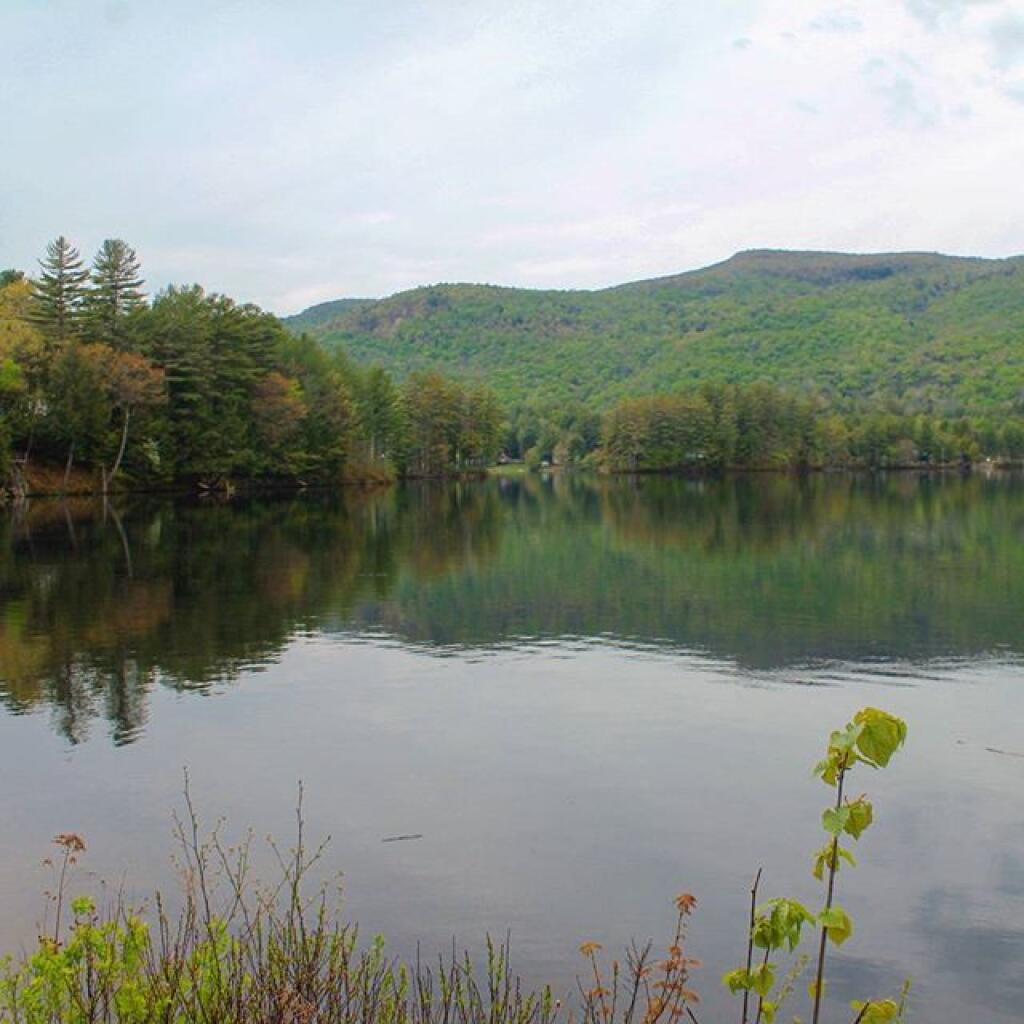
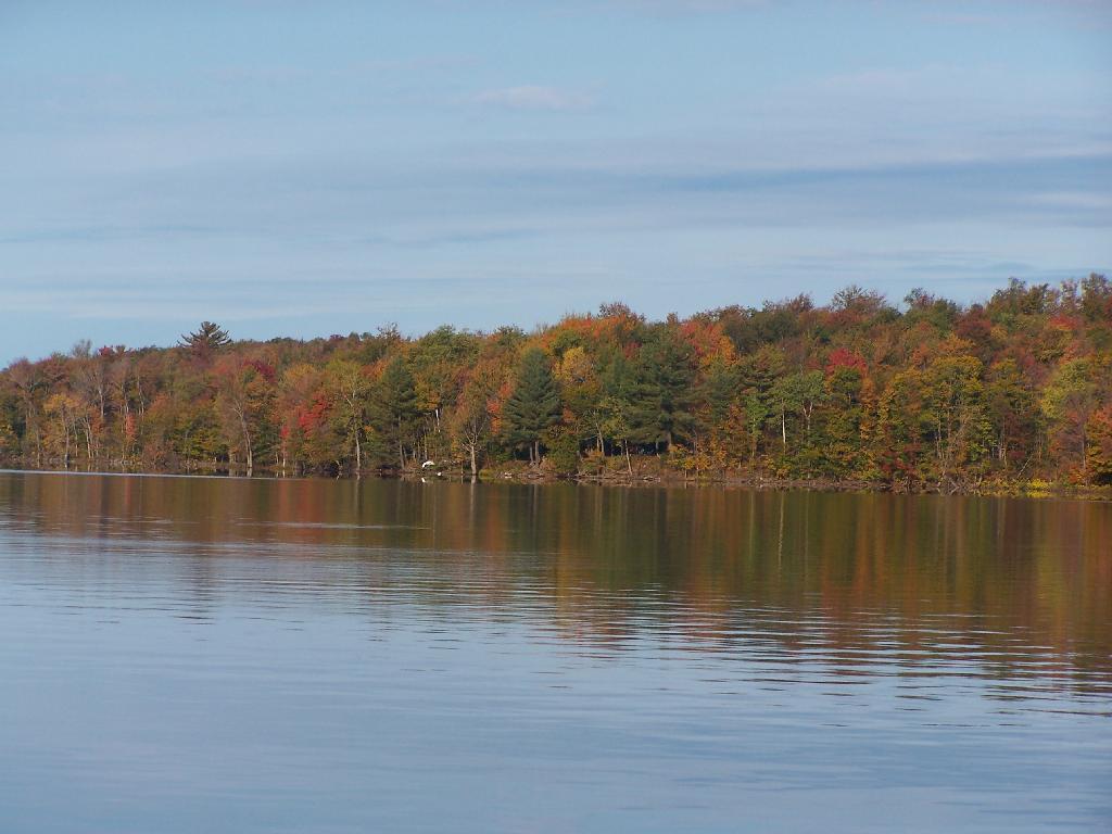
1) Most Accurate Shorelines.
The Census Water Area and Liner Water Shapefiles from TIGER/Line are pretty accurate, but they are not nearly as good as topographic maps.
2) Wetlands.
Currently I don’t have any good source of data or wetlands to add to my maps. I probably should do more research into this, as I know the state does have wetland maps available — but how much of a PITA are they to use?
3) Buildings.
Topographic maps have many of the buildings on them. While this information can be outdated, it does provide useful information to the viewer of such maps. TIGER/line has some features, like cemeteries and some buildings, but this data set is tiny compared to what’s on the NYSDOT topographic maps.
Today we look at Campsites and Lean-tos and other “developed” camping opporunties in DEC Region 7, which consists of lands in Central NY Counties of Broome, Cayuga, Chenango, Cortland, Madison, Onondaga, Oswego, Tompkins and Tioga, and is based on data in Region 7 Recreation Master Plan.
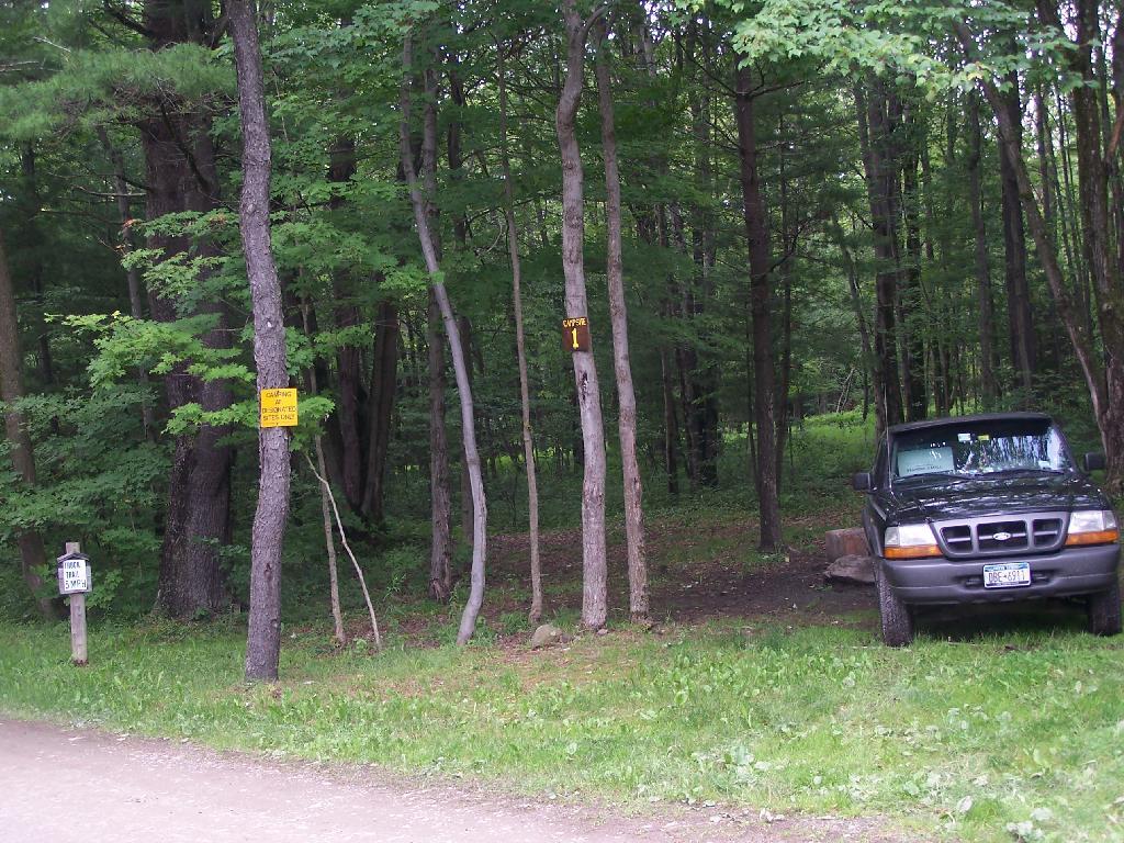
Current 85 Designated Campsites/Lean-Tos.
Balsam Pond State Forest (Chenango 17) – 1 campsite at Baker’s pond
Balsam Pond State Forest (Chenango 34) – 9 campsites 3
Beaver Creek State Forest (Madison 12) – 2 campsites at the assembly area 4
Charles E. Baker State Forest (Madison 1) – 14 campsites at Moscow Hill 4
Charles E. Baker State Forest (Madison 1) – 2 lean-tos
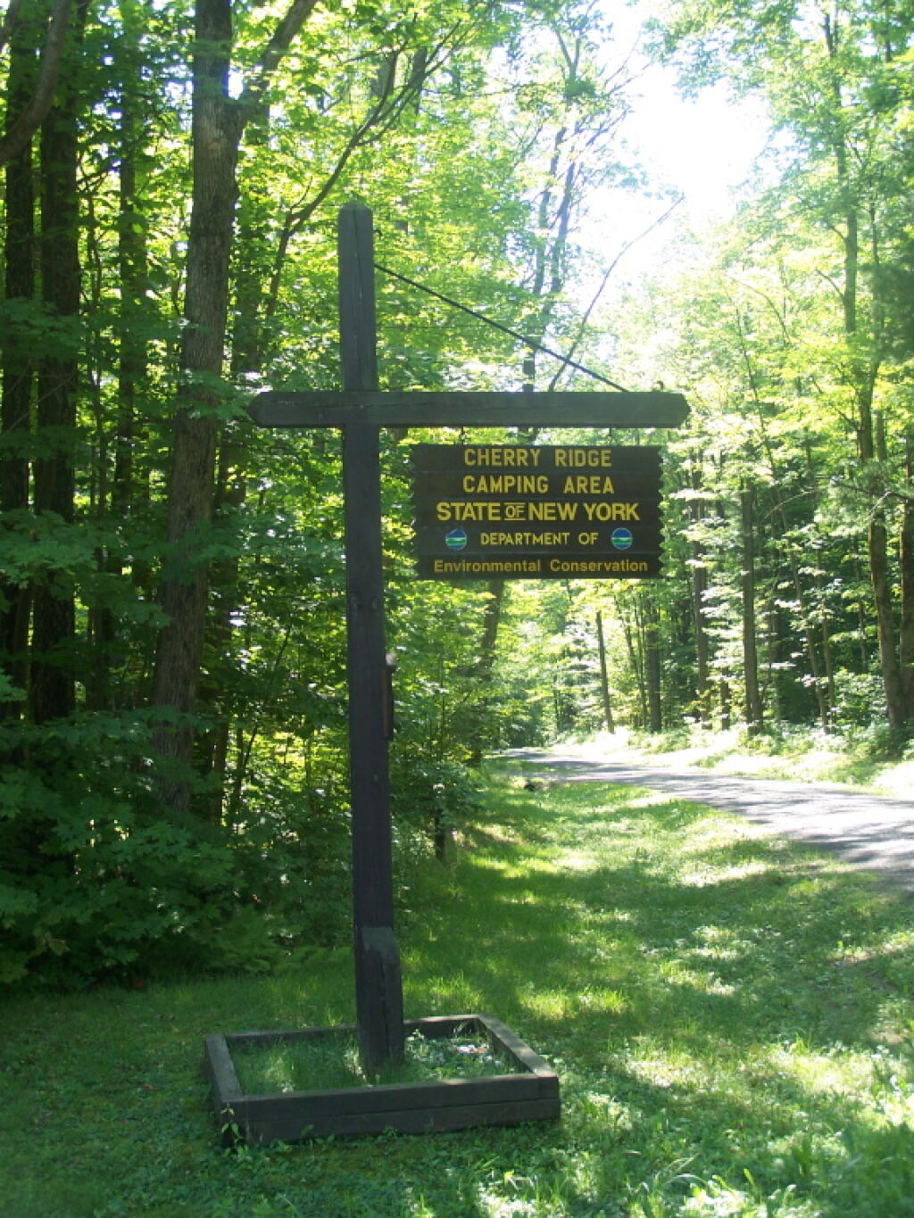
Charles E. Baker State Forest (Madison 1) – 8 campsites at Cherry Ridge 3
Stoney Pond State Forest (Madison 13) – 12 campsites 2
Taylor Valley State Forest (Cortland 2) – 12 campsites 5
Tuller Hill State Forest (Cortland 9) – 1 lean-to
Whaupaunaucau State Forest (Chenango 31) – 1 lean-to
Wiley Brook State Forest (Chenango 7) – 1 campsite
1 DEC Camping permit required. Call (607) 674-4036 to have a permit mailed to you.
2DEC Camping permit required from April 15-October 15th. Call (607) 674-4036 to have a permit mailed to you.
3 Vehicle accessible.
4Horse Assembly and Camping-area.
5 Currently undesignated sites (lacks “Camp Here Markers”) on an old loop road that was part of CCC Camp in Taylor Valley.
Related Maps.
DEC’s Future Plans for Region 7
1. Develop 31 additional campsites in Region 7. Twenty-eight of these will be open campsites and three will be lean-tos. A portion of the new campsite development will occur on Hall Island State Forest (Oswego 10), as noted in items b and c. The Department will consider the option of permanently closing any or all of the Island campsites if patrol or enforcement problems become an issue. Fiscal constraints and public demand will determine if any additional campsites are to be developed within the Region.
a. Development of the new campsites will be in compliance with the guidelines for access by people with disabilities.
b. Develop 12 to 15 open campsites on Hall Island State Forest (Oswego10). These campsites will be located on the south side of the Salmon River Reservoir and will only be accessible by water. A permit will be required to occupy these sites. Three of these sites will be developed for people with disabilities . c. On Hall Island State Forest (Oswego 10), upgrade two designated campsites on Burdick Island and two campsites on Huckleberry Island in the Salmon River Reservoir. A permit will be required to occupy these sites. Two of these sites will be developed for people with disabilities.
d. Develop one lean-to campsite along the Finger Lakes Trail on Perkins Pond State Forest (Chenango 22) in the Town of Otselic.
e. Develop two open campsites on the Marsh Pond State Forest (Broome 4) near the pond. One of these sites will be developed for people with disabilities.
f. Develop three campsites on Robinson Hill State Forest (Tioga 3) near Tricounty Pond. The exact number of sites will be determined from local demand. One or two of these sites will be developed for people with disabilities. Install kiosk and develop area brochure.
g. Develop one lean-to on the Genegantslet State Forest with access from Creek Road. The access trail to the lean-to will be approximately 0.7 miles of hiking trail.
h. Develop an open campsite in stand C-7 on Long Pond State Forest (Chenango 35) designed for access by canoe or boat.
i. Develop three open campsites on Oakley Corners State Forest (Tioga 2). One of these sites will be developed for people with disabilities. Use of these sites will be by permit only.
j. Upgrade and designate three formal sites on the Salmon River State Forest (Oswego 8). A permit will be required to occupy these sites.
k. Rebuild the lean-to along the trail on Chateaugay State Forest (Oswego 4 & 5).
l. Build one lean-to on Cuyler Hill State Forest (Cortland 6).
m. Inspect and, if necessary, repair or replace lean-tos on the Finger Lakes Trail.
2. Propose a change to the current regulations to address the conflicts encountered with camping within 150 feet of a road.
a. Propose a change to the current regulation that prohibits camping within 150′ of any road. The intent of this proposal is to accommodate the style of camping that is common during hunting season.
3. Provide camping opportunities on State Forests for people with disabilities. These ADA compliant facilities will be distributed throughout the Region. Most of the designated campsites will have fire rings and several of the sites will have picnic tables. Fire rings, picnic tables and benches will be of Universal Design. Accessible latrines will be located at areas with several campsites, such as Long Pond, Stoney Pond and Charles E. Baker State Forests. All camping areas that can be driven to will have at least one accessible parking space. a. Make alterations to the Moscow Hill campsites on the Charles E. Baker State Forest (Madison 1 & 4) so that at least four of the sites are accessible by people with disabilities.
4. Designate 14 campsites at Moscow Hill, Madison 1, camping area.
5. Maintain 85 existing campsites.
6. Propose a regulation to prohibit camping at Nanticoke Lake Multiple-Use Area and Redfield Island Day-Use Area
7. Remove the lean-to on New Michigan State Forest (Chenango 5) This lean-to is structurally poor and is no longer located on an active trail. The lean-to proposed in 1. d will replace this lean-to.
Could 15 minutes a month make a big difference in how your government is run and allow you to make informed decisions about government policies? With New York’s Freedom of Information Law (FOIL), and a quick email off to your government officials, you can make a big difference.
Under Article 6 of the Public Officers Law, any person can request almost any government document using a quick email to the Records Access Officer that every state agency and subdivision such as counties, cities, towns, public authorities, public corporations, and school boards keep. You can request meeting agendas, meeting notes, email sent from government accounts, studies, maps, word documents, GIS Shapefiles, databases. While there are some exceptions to this law, the reality is most government documents are public property, and can be received through FOIL.
To send a FOIL request, you simply need to …
1) Figure out what your interested in. It helps to know what format the records are stored in, such as Word Processor Documents, Spreadsheets, Email, Database, GIS Shapefile, PDF. You also should try to make the best guess where the data is from, and describe it as possible. You have to accept records in whatever format stored by the agency as they are not required to convert or summarize the record, meaning you need to accurately request what they have or risk being denied access.
2) Go to agency’s website your are interested in, and try to find the Records Access Officer or FOIL request officer or other email. Typically emailing the highest level official in the agency is acceptable if no FOIL information is listed.
3) While not every agency accepts emails, but any that has a capacity to e-mail must accept requests in that format.
4) Write a very quick and simple email to the agency saying:
Dear Records Access Officer:
Under Article 6 of the Public Officers Law (NY Freedom of Information Law), I am requesting the following records:
Any and all emails sent from Commissioner John Smith jsmith@example.state.ny.us from April 1, 2011 through May 1, 2011 with the words “solid waste management” in the body of the email.
The Microsoft Excel spreadsheet, relating to revenue received through recycling programs. I am requesting the April 2011 numbers, as prepared by Solid Waste Specialist Deborah Smith.
Thank you. If you have any questions or need clarification, please email me at joe@example.com.
It’s that easy. You will get a receipt of your request within 5 days. Within 35 days, you will receive the requested documents or reasons for denial of such requests under the limited exceptions of NY Freedom of Information Act. You have the right to appeal such a denial to the records appeal officer, which you should be notified of whom it is when such information is denied. The Committee on Open Government offers advisory opinions to help you understand the law, and cite case law in your response.
I really encourage you to get into the practice of regularly writing FOIL requests. With e-mail it’s easy, and it keeps your elected officials and public servants on their toes. Receiving even one request for information perks up their ears, and more requests makes them realize that the public is keeping a watchful eye over them. Moreover, the records you will receive are both interesting and informative, and allow you to make better comment over public policies in the future.
You can be the hero that saves democracy and get lots of fun government documents for free to your email!