I try to be careful with saving money every week, and putting a little away for a goal. I contribute to my pension plan and a little bit my Roth IRA every week to save towards retirement. That’s fine, but I also like to save a lot more money into my boring old savings account for more immediate goals — within the next couple of years.
The problem is I really don’t have another goal. I am kind of saving for nothing, or actually one of many choices that I really don’t have a solid figure on what I want to do with the money. It also has grown tougher to save money these days, as the interest rates are so low that money doesn’t really grow much in the bank.
Idea 1: Save Money to Move Out of NY State.
I am not a big fan of New York State by any means. I think it’s policies are so dracionian, and it’s urban dominance means that Upstate will forever be governed by absentee landlords from New York City, who develop policies in wine bars high above the strip in trendy Manhattan.
I don’t like the Sullivan Act. I don’t like the burn ban. I don’t liek the Adirondack Park Agency, or just the state’s official dislike of all rural areas. I don’t like the fact the state increasingly nickling and diming working folks just to feed the beast.
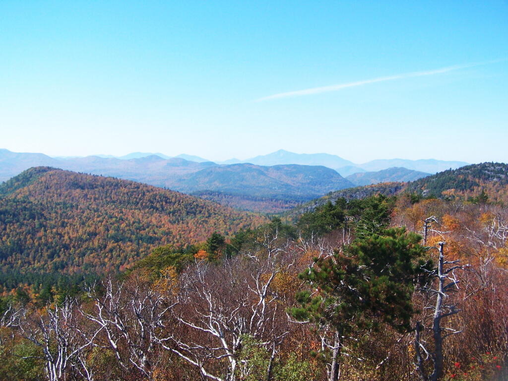
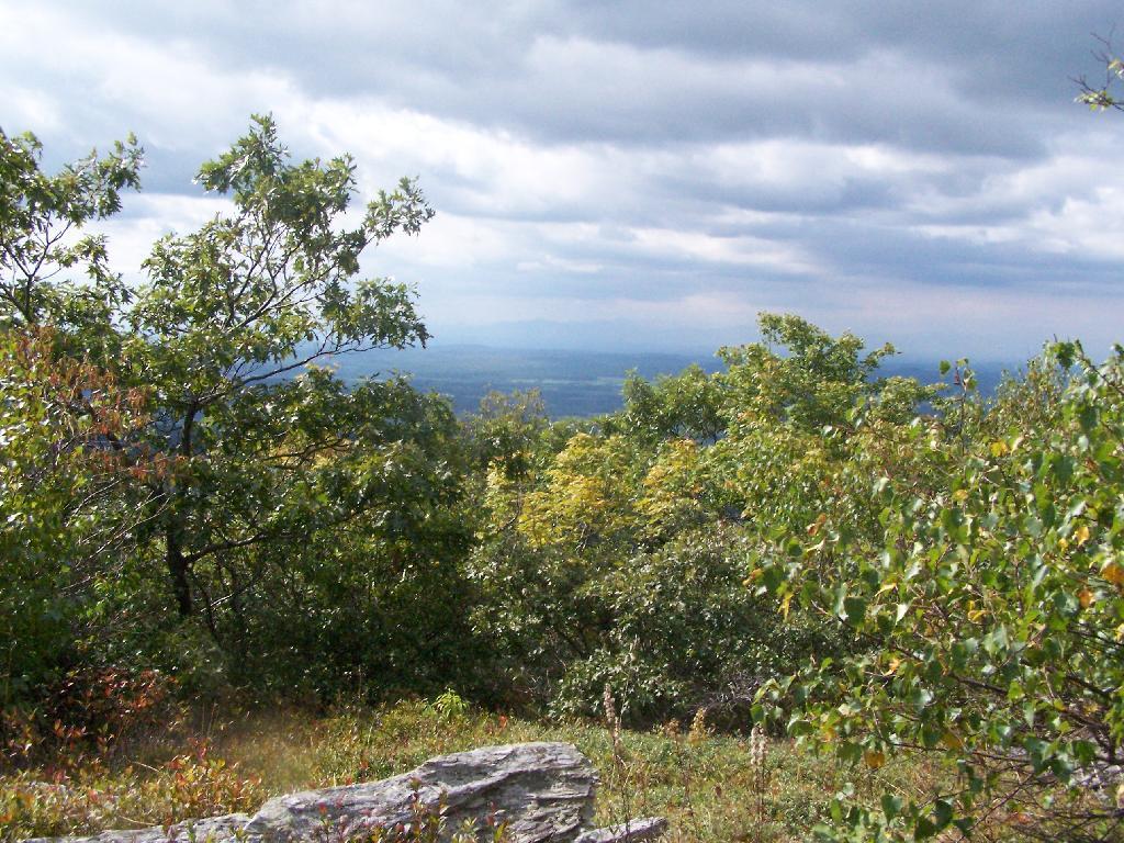
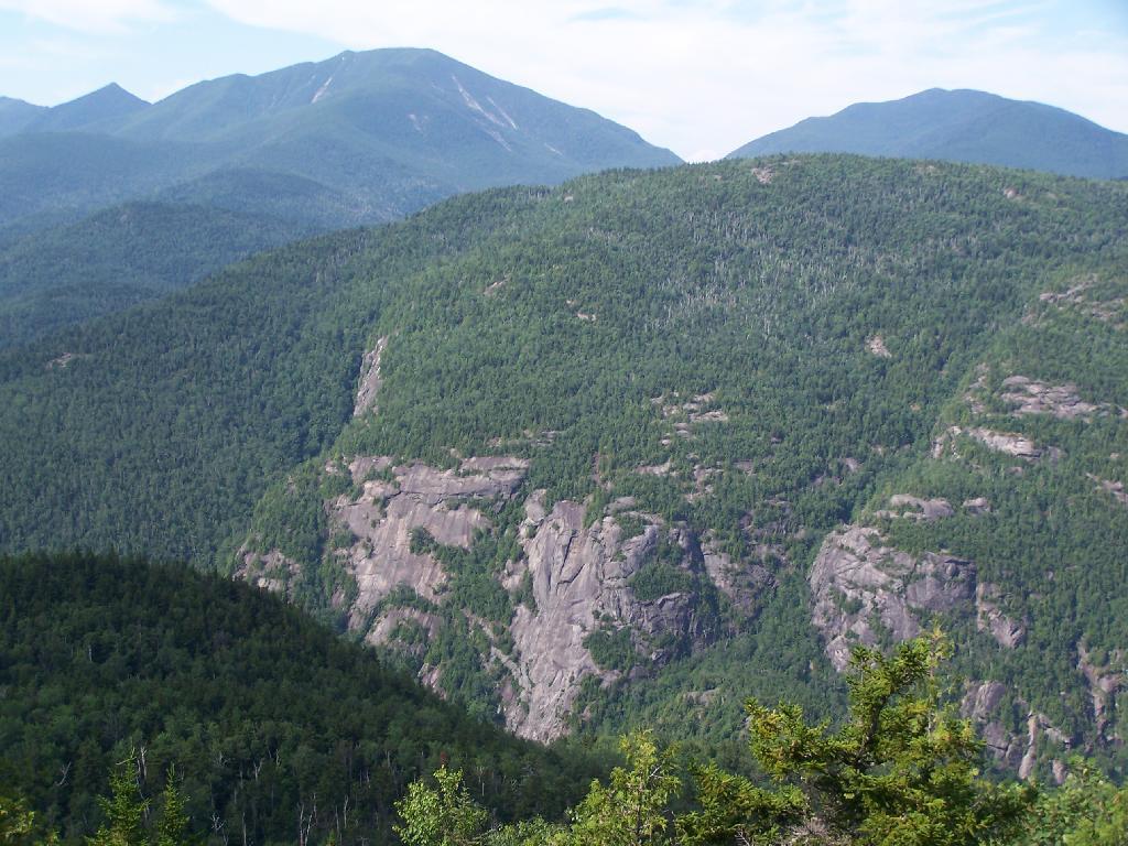
But, hey I like the Adirondacks, Catskills, Greens, Taconics, and other amazing places being so close to home. The recession makes it hard to find a job elsewheres, and the reality is any place I would go would certainly involve a massive cut in salary, benefits, and a relearning of how to live.
But some day I do want to move out of state, on to some rural land, have animals, do a little hobby farming, play in the mud, shoot some guns, and burn things. I really dislike state’s open burn ban. But for now, the Adirondack Park and Catskill Park works well enough for me.
Idea 2: Go Back to College.
I’ve been toying with the idea of going back to college. But it’s so dang expensive. And I really don’t want to sit in class all day, and learn stuff I am not really interested in or could better learn on my own. I struggled through 6 years of college, in and out of school and at work to get my bachelors degree, and I am less then excited about the whole thing.
I would like to go back to school to study GIS map making, and turn my hobby into actually marketable skills. Doing that would allow me to make more money, but more importantly have more flexiability in where I live, so I can live in rural area not run by citidiots.
Idea 3: Sled.
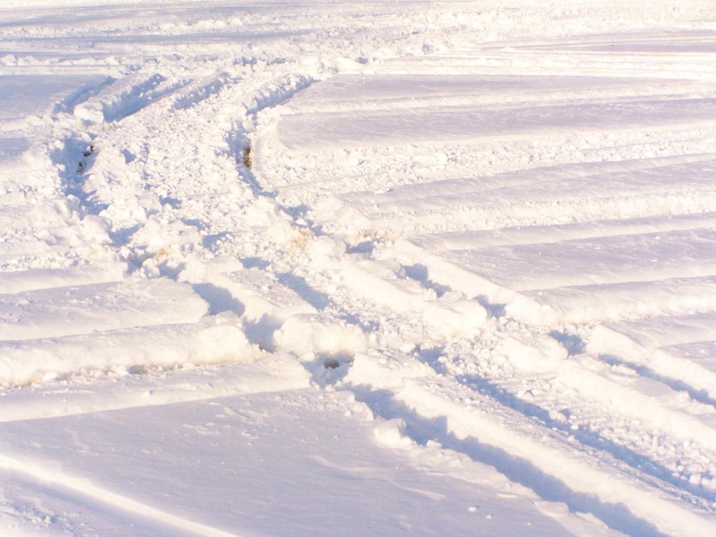
I have been thinking about getting a snowmobile at the end of winter season for next year. Not something brand new, but something decently reliable that I could use to access the deep back country in winter. It might also be fun for camping in the winter, as I could strap a backpack on with gear.
But it’s also an expensive hobby to say least. Plus, even if I got a snowmobile in the spring time, I would have to store it until the winter before I could really use it for much better. But I figure an end of season special would probably save some real money.
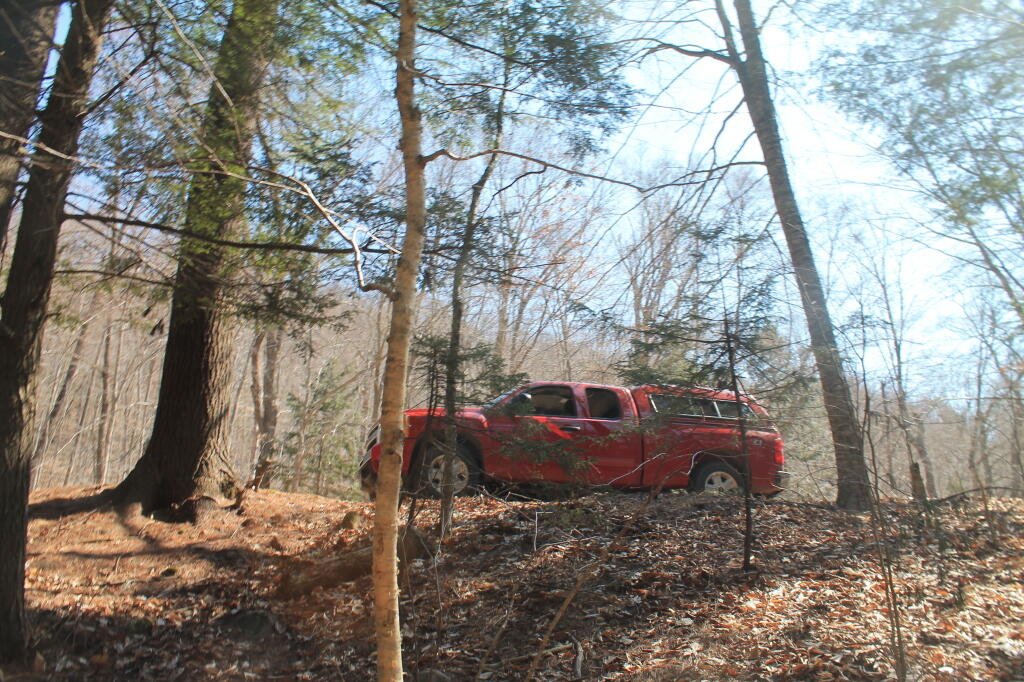
Idea 4: Fix Up My Truck.
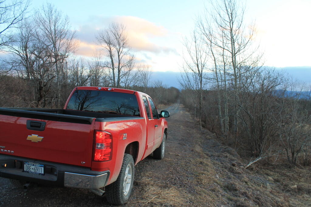
I got to fix the bumper on my truck. It annoys the fuck out me, to put it the way I see it. The way it is bent — the particular angle — is so ugly. Yet, do I want to just fix the parts that are damaged or do I want to get a real bumper for my truck? I know they make heavy duty off-road bumpers.
Which got me thinking — if I replace the rear bumper, shouldn’t I also replace the front bumper with a real bumper, so it at least matches? Or should I wait until I do something stupid and damage it?
Likewise, I want to jack my truck up. It would be fun to ride up higher, would add at least “visual” value to the truck, and make me like it better. Although, maybe I would eventually get tired of jacked up truck. But should I wait until the first set of tires are worn out, before going for the jacked up routine? I don’t know.
Many Possibilities.
I continue to chew over my choices and possibilities. Moving out of NY State — to a nicer state with more sane policies — continues to be a priority of mine, but that has to be balanced by my good paying job that pays the bills, and the proximity to the great Adirondack and Catskill Parks.
Then there are all the toys I could spend my money on. But toys require gasoline, which sure is expensive these days. Certainly having more money in the bank account makes it grow faster. But I also got to have fun, and have an excuse for saving money. So I don’t know.
Like most Americans, I believe strongly we should do something about Climate Change, to limit it’s most severe impacts. Yet at the same time, I am fully aware of our needs for energy services – the stuff that energy provides for us like lighting, transportation, powering electronics and motors, heating, and cooling. We need a lot of energy too – as I noted when the BP Oil Spill occurred – all the oil that spoiled the ocean could only fuel America for about 45 seconds. Turns out the oil spill severity was much worst then originally predicted, but still it was only one and half minutes worth of petroleum consumption for the United States.
So how do we get there from here? I do not advocate a “crash” diet on petroleum and other fossil fuels. People really like the energy services that fossil fuels provide, and most people aren’t give up their vacations using their petroleum fueled automobiles, or heat and air conditioning in their houses – especially for a “projected” future problem. Electric lighting and computers are essentials of modern life that most people aren’t going to want to give up either. Cities – particularly large cities – have such intense energy needs, that fully substituting with renewables isn’t going to be practical, much less cost effective.
What needs to happen is a big compromise. We need reasonable but strong energy standards that promote and preferable renewables and energy efficiency. Those standards can’t compromise the core things that make up the necessities modern life – including reliable and affordable energy and products. We have to continue to develop fossil energy sources responsibility. At the same time, we need to choose a realistic climate goal that matches our need for energy.
There are those out there that say we can’t afford that much Climate Change destruction. Essentially slaughtering millions of people and destroying billions in property to ensure our society has the energy it needs, really isn’t a pretty choice. But it’s a realistic choice. There is no free lunch on climate change – and protecting all the energy services provides for our society is important. America needs services that energy provides, and it has to be balanced against the painful consequences of consuming that energy.
Today’s debate needs not be whether we will need fossil energy to provide for energy services we all depend on and deeply enjoy. We will need fossil energy for the foreseeable future – and probably more of it in coming years. The question is can we burn it cleanly, and efficiently so it provides the most energy services for the least amount of actual fossil energy consumed. We got to take the oldest and dirtiest power plants and replace them with modern technology. We also got to boost renewable energy to be the preferred source of energy whenever it’s reasonably cost effective.
One thing that concerns me is the lack of transparency for all not-for-profit organizations that are involved in influencing government polic or representing themselves in front of government agencies.
While all not-for-profit organizations must disclose how they spend their money, at least on an yearly bases on publically avaliable IRS Form 901, they do not have to disclose individual donors, or the amount each donor gives. In many cases, through the advocacy and other works of not-for-profits, substantial government lobbying and political influence is given by the organization, yet few actually know who is funding the organization, or what the true rational for the organization’s actions.
If persons are afraid to give to not-for-profit organizations, for fear of disclosure, then they should not give. Not all not-for-profit organizations serve the public interest, as many spend a substantial amount of their funds advocate for policies that are highly detrimental to the public interest. Likewise, there should be public pressure on not-for-profit organizations avoid taking donations from corrupting sources of funds.
A great deal of advocacy on behalf of major corporations takes on behalf of citizens groups. Many cases, grass roots efforts are amplified by large corporate donations, but nobody really knows where the money comes from, except that they report large donations as being a key to sustaining their organization. For sake of openess, all not-for-profit organizations should have to disclose all donations and where they came from.
The other night, I was an event when the speaker lamented the modern era with all it’s problems and how much fun they had in the “innocent” 1960s. My thought was that’s pretty darn unfair.
Why shouldn’t we — the young — be able to have some fun like they had in “olden” days, and wait to be ultra-conservative and have no fun like the old folks?
For the first year of doing topographic maps, I relied extensively on using NYSDOT topographic maps, I originally downloaded from the NYSGIS consortium website. The NYSDOT topographic maps have a lot of good information on them, an in many ways have the most accurate topography.
But what I’ve also found with those maps is they have several real limitations…
1) They Don’t Scale Well.
NYSDOT topographic maps are designed to viewed at 1:2400 feet ratio, as they are 7.5″ quads. You can get away with rendering them anywhere between 1:1800 to 1:2600, but beyond that the text looks too small, too crowded, or two pixelated. For smaller parks and larger areas, NYSDOT topographic maps do not work well.
2) Unneeded Information and Clutter.
DOT Topographic Maps try to suit the need of any user, and include information like town lines and other jurisdictional information that is unnecessarily for the average outdoors person.
3) Outdated Information.
Often topographic maps have dated information on man-made boundaries and buildings. The state often buys new land, demolishes existing buildings, and closes off trails. Old trails appear on topographic maps, as do labels such a “Restricted”, even though to this day such roads may be valid, despite the incorrect or outdated information on topographic maps.
4) Metric Scale; Differentiating Contour Scales.
Metric elevations are maddening for anyone trying to calculate their elevation from select DOT topo maps, and often when you load multiple topographic maps, they do not fit together seamlessly, as one will be using one unit for contours, while another will use another unit. Contour scales throughout the state very widely, which when put together can be confusing.
On the other hand, topos do have some benefits…
1) Most Accurate Shorelines.
The Census Water Area and Liner Water Shapefiles from TIGER/Line are pretty accurate, but they are not nearly as good as topographic maps.
2) Wetlands.
Currently I don’t have any good source of data or wetlands to add to my maps. I probably should do more research into this, as I know the state does have wetland maps available — but how much of a PITA are they to use?
3) Buildings.
Topographic maps have many of the buildings on them. While this information can be outdated, it does provide useful information to the viewer of such maps. TIGER/line has some features, like cemeteries and some buildings, but this data set is tiny compared to what’s on the NYSDOT topographic maps.
Commuting is a big consumer of time in people’s lives. For every ten minutes added to a person’s daily commute, each way, takes 43 hours per year out of a person’s life, that could be spent doing other activities. Moreover, as most people commute by private automobile, time spent in cars, is time not doing physical exercise or getting outdoors, promoting obesity and poor health.
From this map of Albany County, you would think rural people all have long commutes to work. Indeed, people who live in Renselearville, where there are few jobs, often commute to downtown Albany, leading to a very long commutes, that are particularly challenging in the winter.
However, that is not the norm in NY State. Indeed, the Adirondack Mountains, have some of the shortest commutes in the state. Residents of the North Country and Southern Tier also have very short commutes. Many work in the small towns they reside in, or farm the land they live on.
Also of interest is that commutes, in general are much shorter upstate then downstate. In some areas — like Albany — commutes from suburban areas to jobs are shorter then in more urban areas, due to the use of private automobiles over mass transit.
One of the concepts I have grown interested in lately is the use of density to draw districts for governing bodies. Rather then draw districts based on historical lines, partisan politics, or ethnicity, why not draw them based on a formula that considers density?
How it would work…
Take the entire population of a region, state, or country, and divide it by the number of districts one views as appropiate.
Neighborhooring census blocks with the closest average density would be grouped together until they had equal population.
Why this is a good idea…
Areas with similiar densities have the most similiar needs.
Connect farming areas with other farming areas, connect dense urban areas with other dense urban areas, suburbs with suburbs.
Representives are non-conflicted by different consituencies, they can be pure in what they advocate for in their elected bodies.
Rural, suburban, and urban infrastructure needs are best met when communities are grouped together and non-conflicting in their nature.
Politicians probably would not like this system as it would make it hard to game the system. There would be far fewer marginal districts, far fewer competitive non-primary races. Yet, fewer consituencies would be underr-epresented due to their minority status in their districts, and there would be more cohesive blocks of land.