I went for a walk at Bennett Hill on a warm afternoon in Novmeber. Here, walking along the pastures that run along the border of Bennett Hill.
Walking along the trail.
Here is the new “Bathtub Spring” we installed as part of a local scout’s Eagle Project. This allows people to refill their water bottles or give their thirsty dog some water. I drank some, it didn’t really kill me yet. Tastes a little bit muddy/gritty.
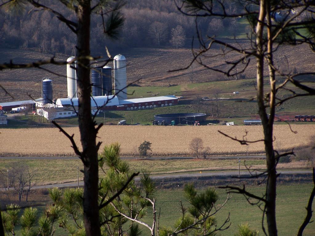
Meadow Brook Farm from the top of the hill, looking through the trees.
On the top of the hill there is a new clearing you can look out of above Clarksville.
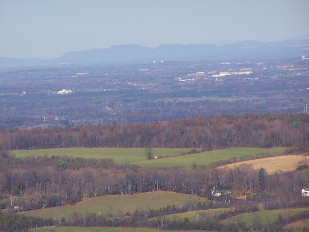
Looking up towards the Adirondacks / Lake George area in the background, with the NYSDOT headquarters and Colonie Center closer in the foreground.
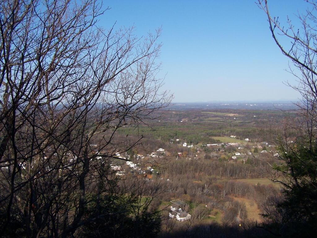
Descending the Red Trail on the Eastern side of the hill, looking out towards of Albany.
And as I headed back to the truck, the sun was setting over Cass Hill.
I really enjoy debating with people. I realise that many times I probably won’t change their minds, but I like putting out my side of the story, and pointing out why I believe the things that I do. My opponents may at times have far better researched facts or be set in their ways, but it is so much fun to say it how I see it.
I’m not one to like to be pushed around. I don’t like seeing people disagreeing with me. I wish I could push them over to see the world the way I do based on my own personal experiences. While granted I doubt I will ever change any body’s mind, it’s just so much fun to argue.
They say our country is as strong as it is based on the amount and quality of free speech there is out there. More speech and more voices is always improving the quality of the debate. Yet I sometimes wonder when too much can start to crowd out the debate. Or when I dilute down my best ideas by combining them with too many others.
They say that November is the greyest month of the year. It is the month that has the fewest sunny days of year, where clouds are the norm. November isn’t particularly rainy, but it sure feels cold at times. We might get some snow, but usually not much. What snow we do get usually disappears quickly.
It’s a month of many holidays and special events. It’s when election day comes, sometimes a big deal nationally, and sometimes just a time more for local campaigns. The politicians and their volunteers try to round up their supporters, and get them out to vote. Then everybody takes a big breath when all the politicking is over.
It’s the month that sees deer season, a big thing in our rural communities. Deer hunters look forward to the first day, when 47% of the take happens each year. It’s a time for communion in the woods and spending time out there hoping for the big bag.
Later in the month comes Thanksgiving, a time for family and food. Around that time the sometimes obnoxious Christmas seasons gets underway. Yet it’s an important time of tradition and reflecting on what has happened in past year and what we hope happens in the new one.
The leaves may be off the trees. It might be getting cold out there. Yet, there still is much to look forward to in the upcoming months.
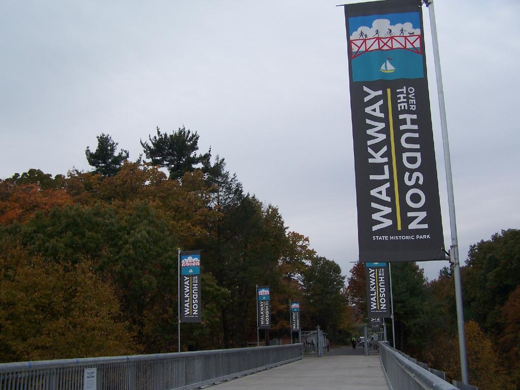
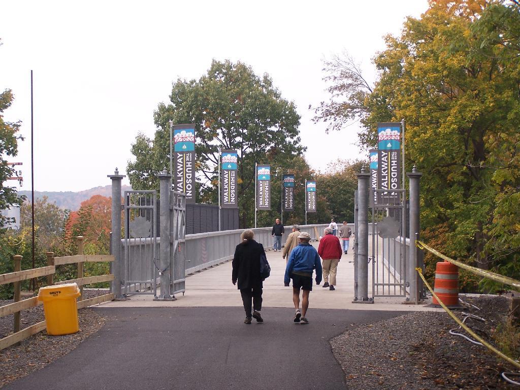
On a rather cloudy day that I had taken off from work last week, I decided to drive down to the Walkway Over the Hudson. I got down there around 9:30 PM, on a cloudy Wednesday, and the parking lot only had one parking spot left on the Pougkeepsie side. It is accessible from the Poughkeepsie side via taking US Route 9 North from Pougkeepsie then turning onto NY Route 9G south. Alternatively, you can access it from Haviland Road in Highland.
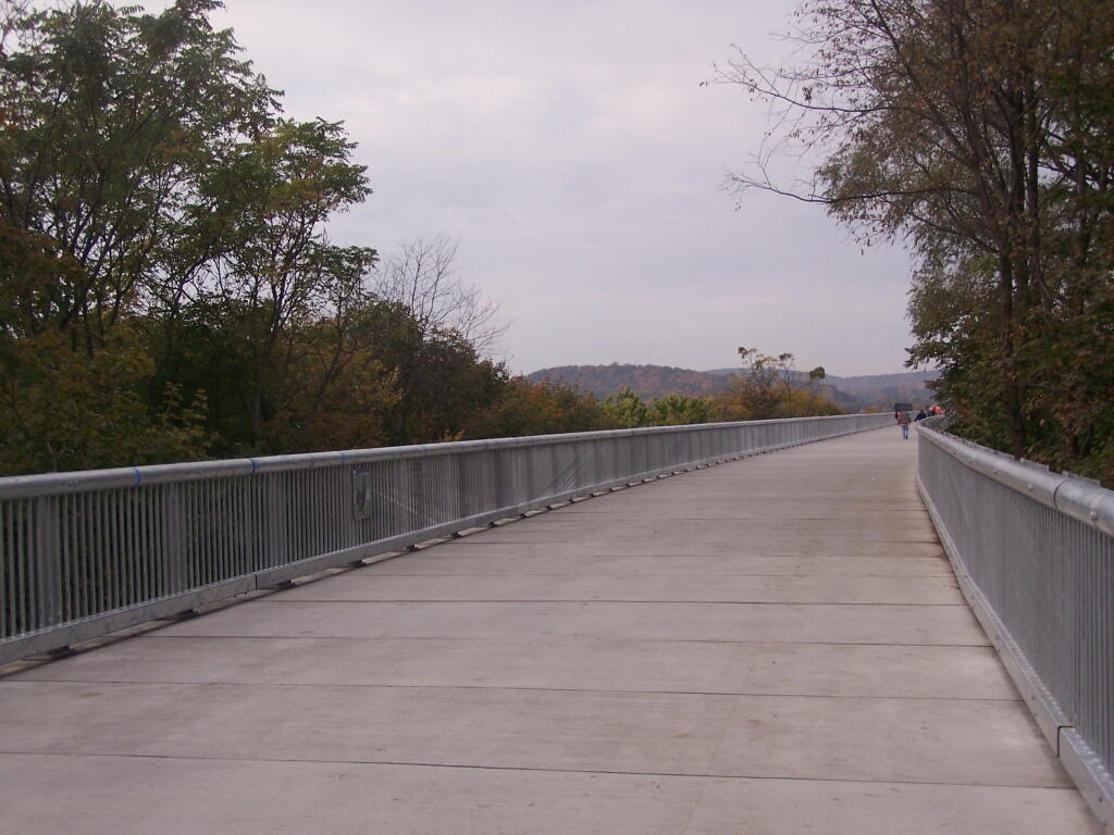
The newly extended bike trail leads directly to the Walkway from the rather large Poughkeepsie parking lot. If you can’t find space in the lot, there is plenty of space on nearby city streets.
Big crowds of people entering the Walkway.
At 28-feet wide and nearly two miles long, it’s pretty big and wide. Despite probably several hundred folks on the bridge, it doesn’t feel at claustrophobic or tight.
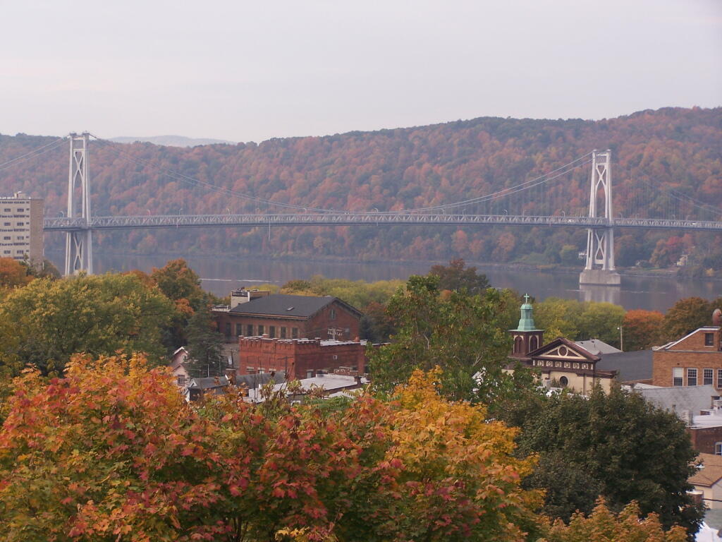
Looking across Poughkeepsie at the Mid-Hudson Vehicle/Pedestrian bridge.
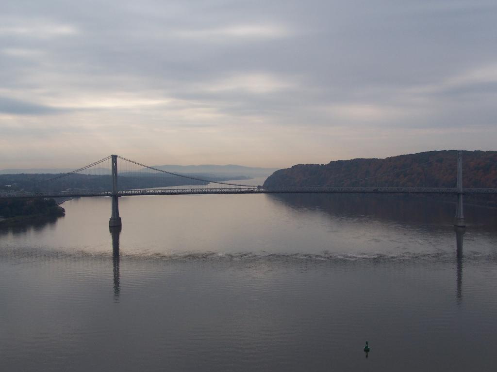
From the center of the bridge looking directly south.
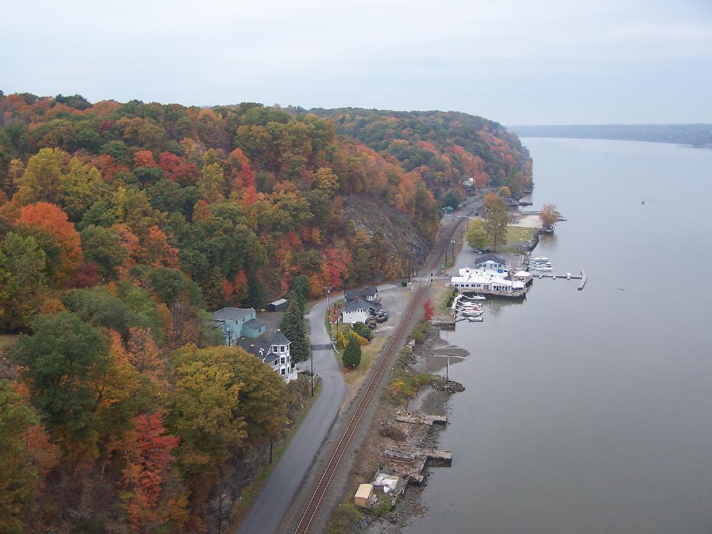
North along the Highland side of the Hudson River.
All and all it is a beautiful walk across the bridge. If you plan on taking some pictures, and want to walk from one side of the bridge to another, you should figure about two hours of time. More at walkway.org.
I am big fan of using steel wool to clean pots and pans. I don’t know if I get my pots and pans particularly dirty, being that I sometimes really badly burn food on the stove and sometimes cook over a fire, so I really need steel wool.
The thing is,
it’s hard to get steel wool any more…
Steel wool is durable, it holds up to hard scrubbing against my cast iron frying pan and my all-steel pots and pans. I like things nice and clean, my pots and pans aren’t really damaged by a little scrubbing. You really want steel wool to get burnt food and smoke off of cast iron.
Yet, few places have steel wool. You can sometimes get copper or even occasionally steel scrubbies if you search around, but non are as effective or durable as plain old steel wool. I guess most places just don’t stock steel wool as so many people use those Teflon crap, that can’t take a good scrubbin’.
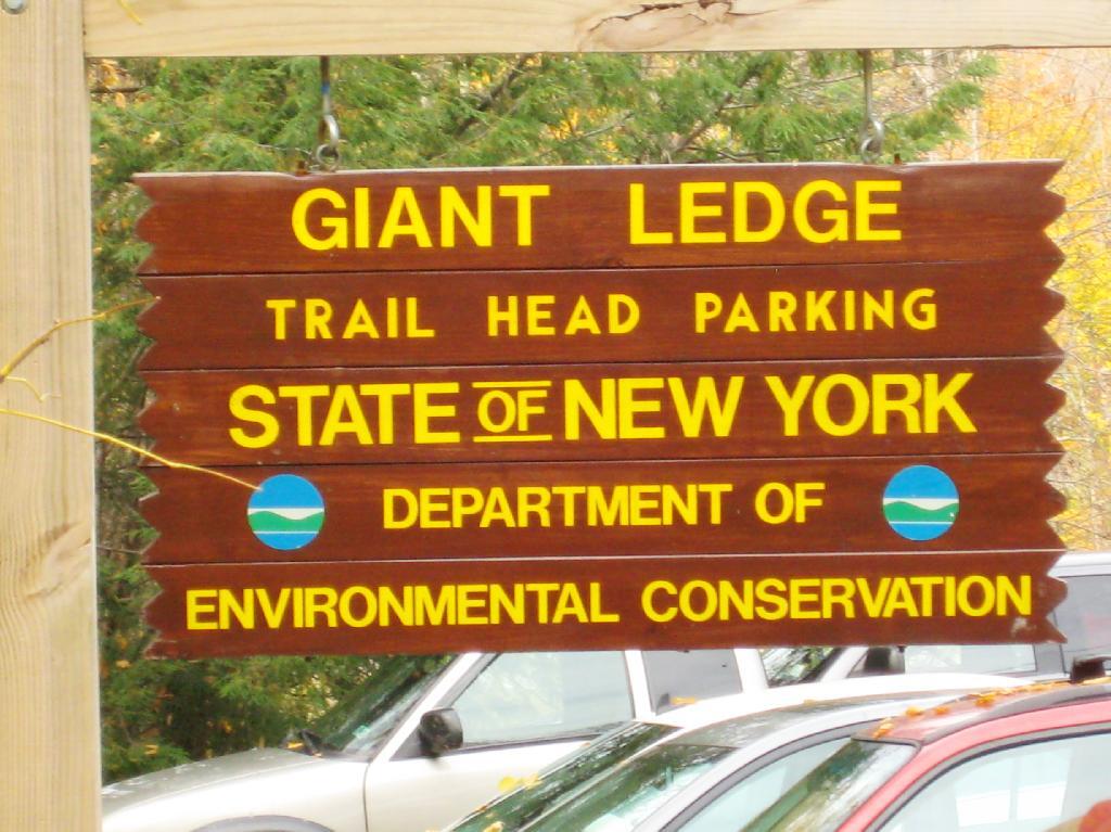
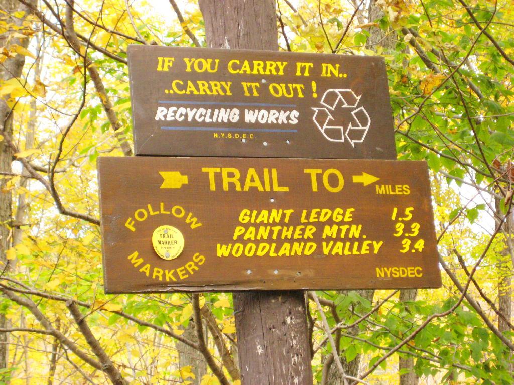
Giant Ledge is a relatively flat hill located on the ridge between Slide Mountain and Panther Mountain. It can be accessed from the Giant Ledge Parking Area, off of hairpin turn on Slide Mountain Road.
I went hiking on Columbus Day, a little past peak foliage system after spending two nights camping out in Schoharie County. It is a short hike.
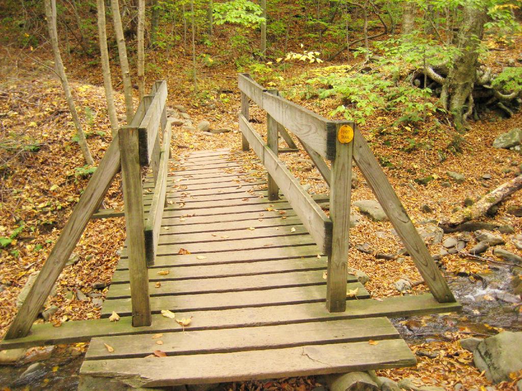
Here is cute little bridge that goes over an unamed creek, running down the northern face of Slide Mountain.
After a moderately steep 3/4 mile hike, you reach the “pass” that goes between Slide Mountain and Panther Mountain. This portion is relatively flat, until you reach the last 150 feet of elevation gain, to reach the top of Giant Ledge.
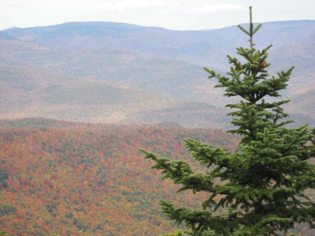
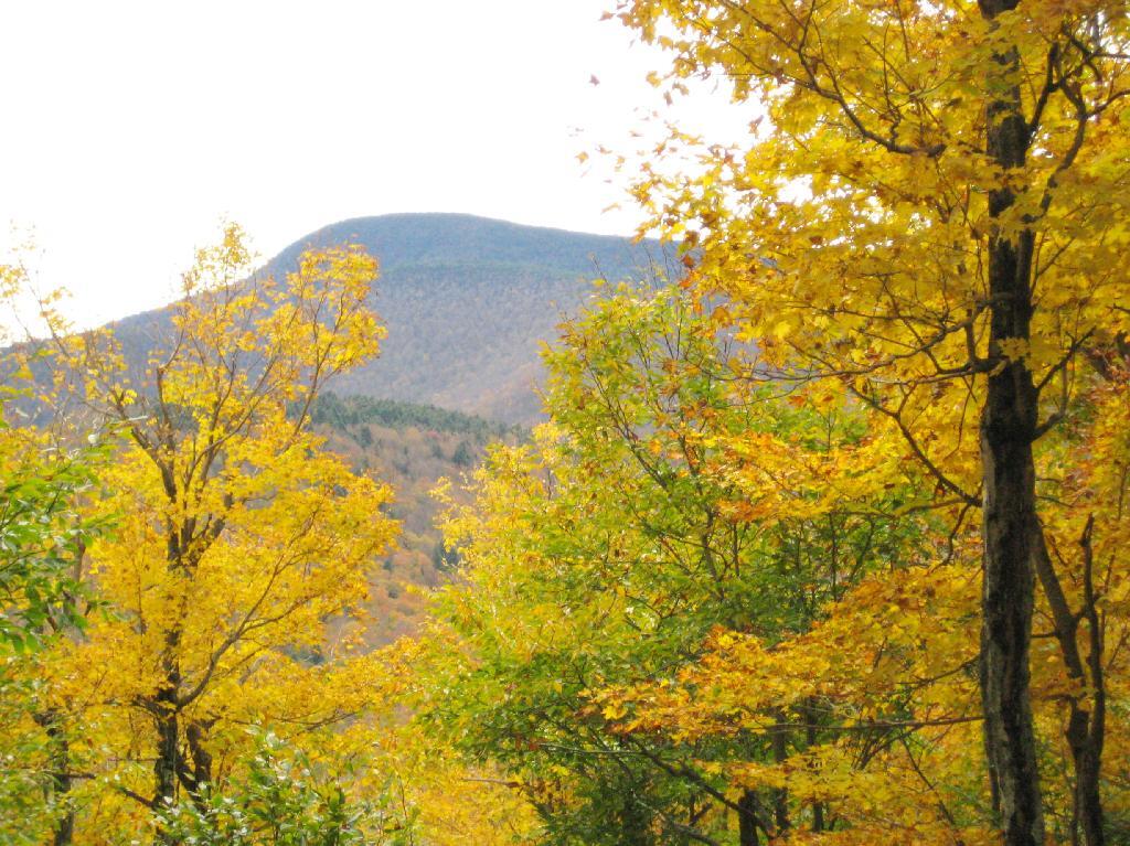
Here is Slide Mountain, peaking through the trees as your going up to the last bit to Giant Ledge.
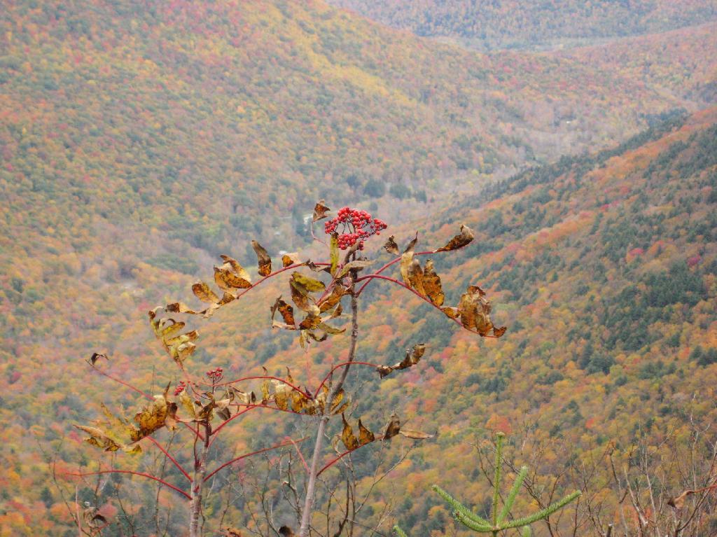
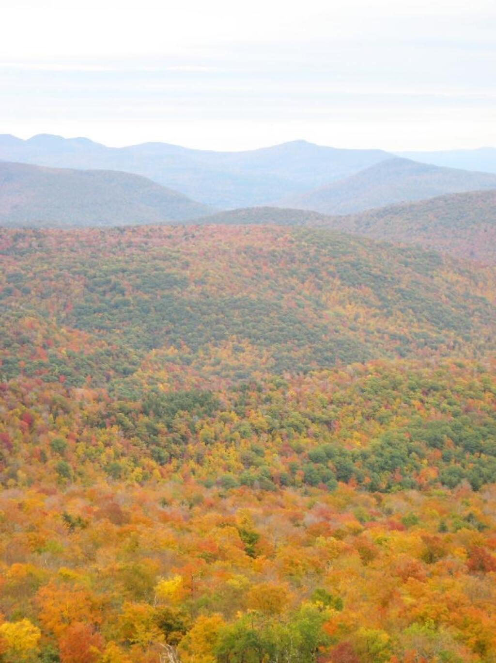
Looking off Giant Ledge, towards Woodlawn Valley (in the colorful foreground), with Plateau Mountain, Twin Mountain, Indian Head Mountain, and in the middle, Tremper Mountain.
Here is the Wittenberg and Cornell Mountains.
This is the Woodlawn Valley’s beautiful colors.
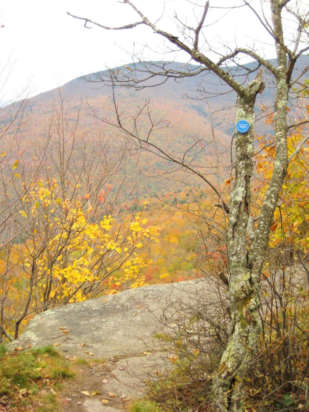
Part of the trail runs right along the edge.
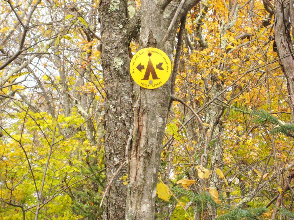
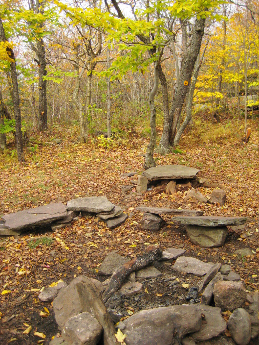
Off the main blue trail on Giant Ledge, there are two campsites at are primative, but nice. This also leads to a trail with views of the Big Indian Valley
Here is the second of two designated campsites on Giant Ledge. There are no campsites on Panther Mountain, which is too high to allow camping. There also is camping on the lower portion Slide Mountain, minus the wonderful views.
After you hike across the trail to the campsites, there is another short little trail that runs over to a viewpoint with views of Big Indian Mountain, and the Big Indian Valley (where Slide Mountain Road runs).
From here, I hiked up Panther Mountain. Here is a map of the hike.
The same day I visited Giant Ledge, I also hiked up Panther Mountain. Panther Mountain is about 750 feet higher then Giant Ledge, and is one of the high peaks, at an elevation over 3,500.
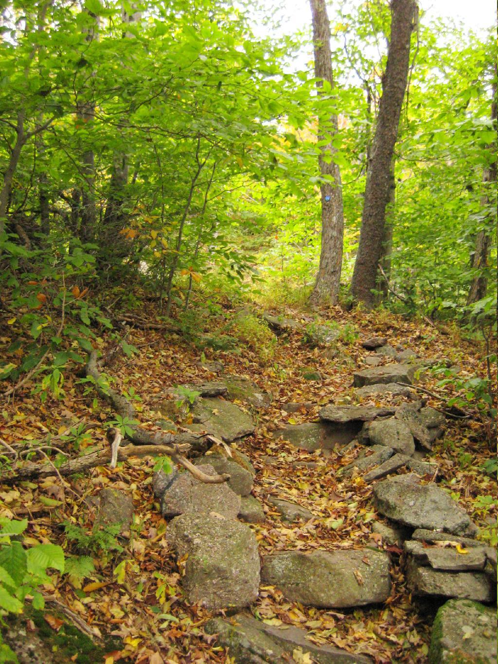
Portions of the trail are made up of rock stairs up the mountain. Other parts you climbed up rocks, but nothing too steep.
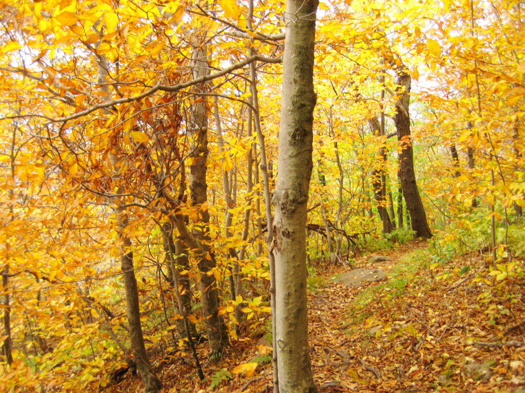
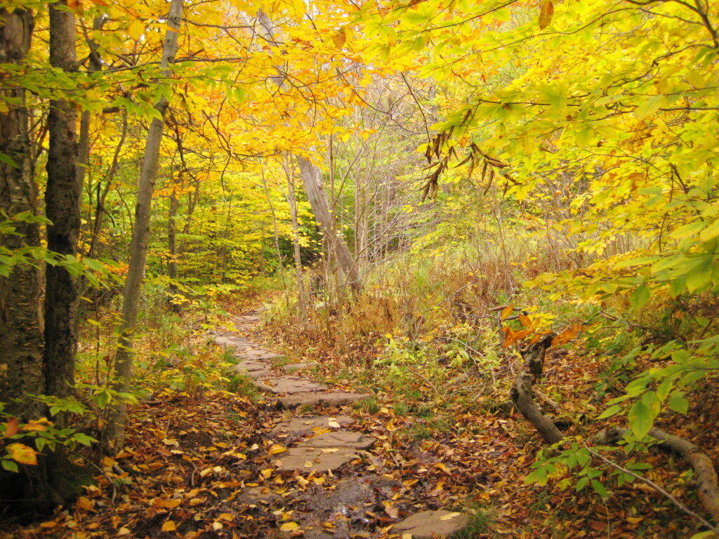
Along the trail in full color.
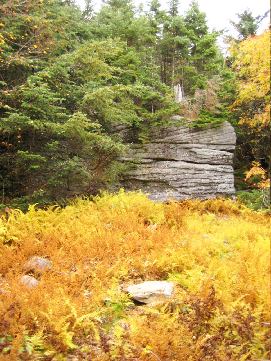
Interesting swamp with the ferns a bright yellow color.
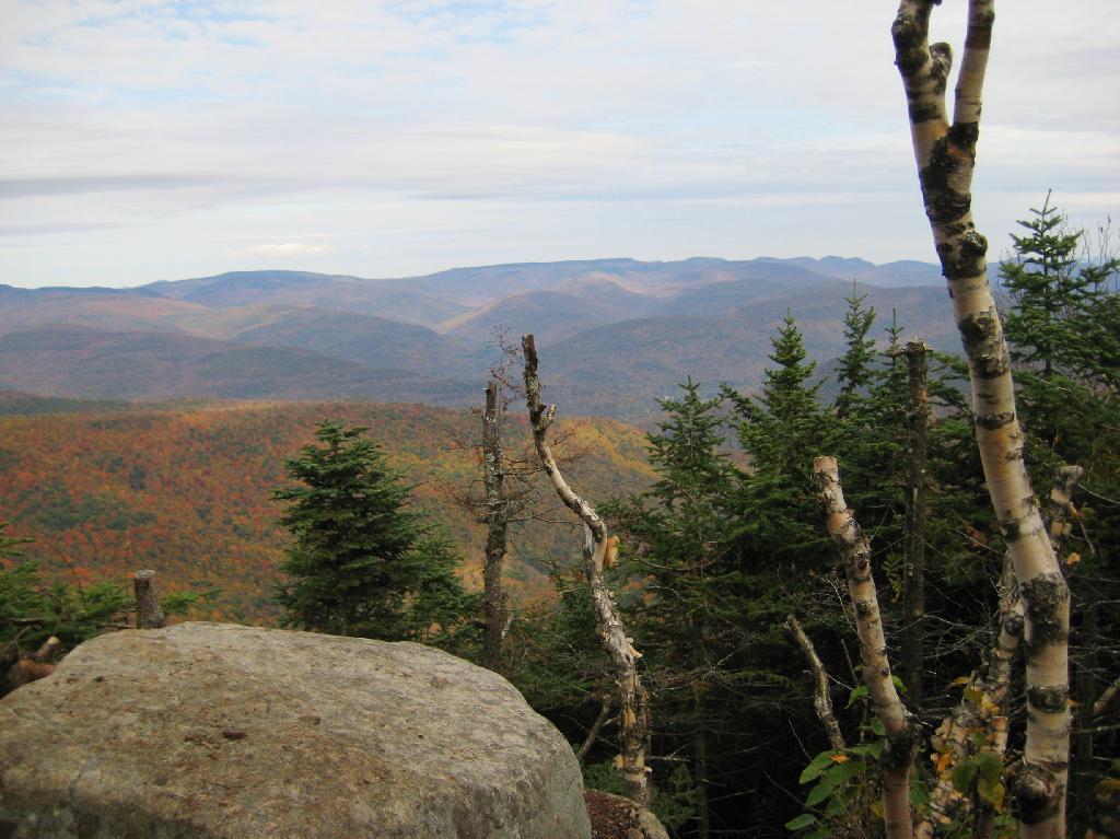
A top the mountain, one of the first views is on top of a boulder.
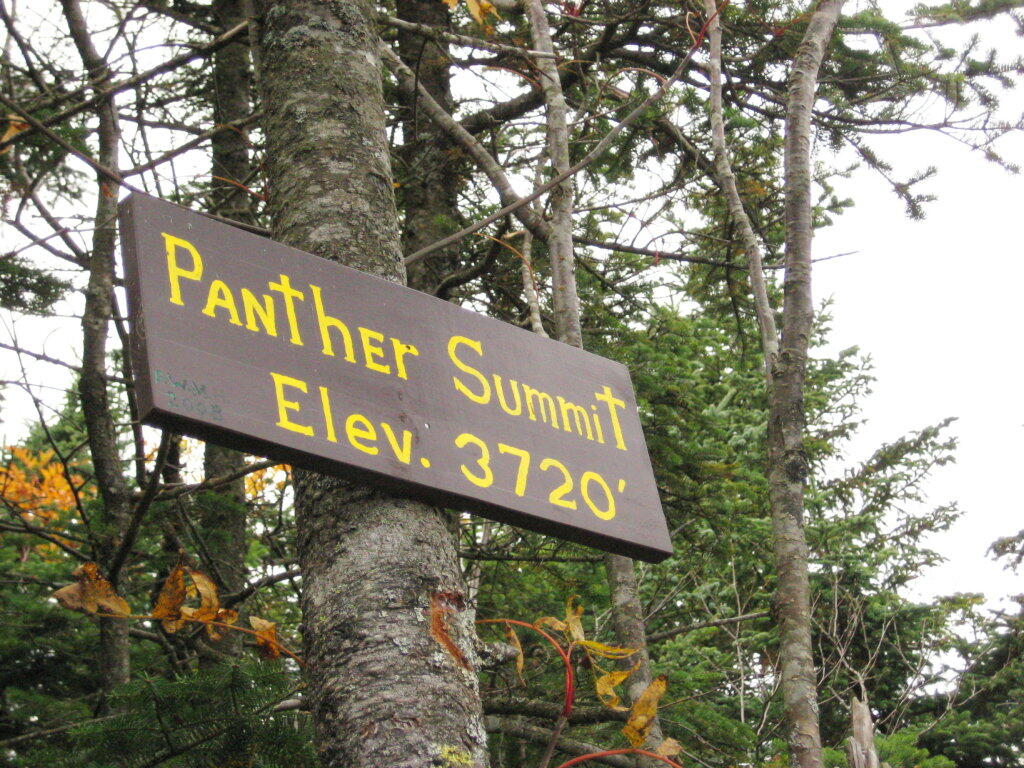
The Panther Summit is at 3,720 feet.
One of the best views off the mountain was how clear Indian Head Mountain looks from off of Panther Mountain.
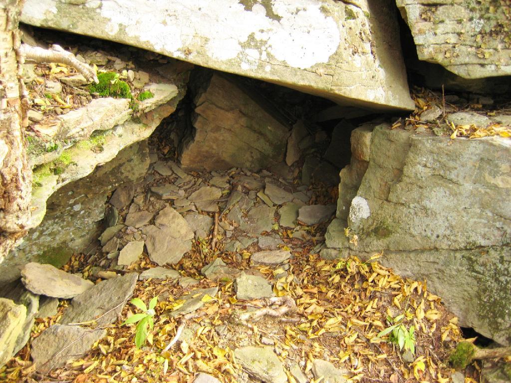
Off the trail, there is this cute little cave.
Looking into the Woodlawn Valley.
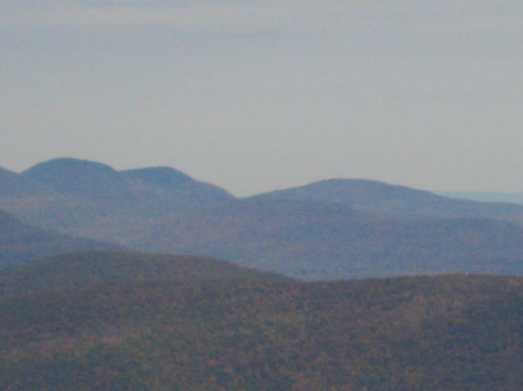
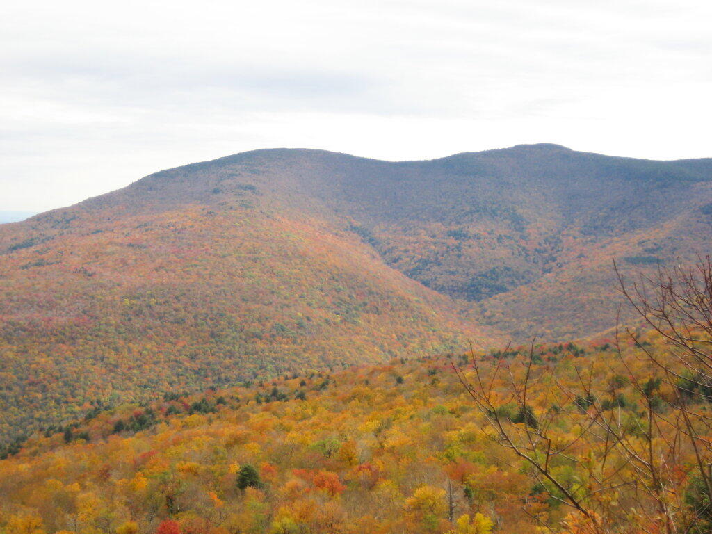
Mountains through the valley, looking off of Panther Mountain.
![Across the Potamac River to West VIrigina [Expires November 12 2023]](https://andyarthur.org//data/photo_003065_large.jpg)