Pharaoh Mountain is located about 10 miles east of Schroon Lake, and can be accessed from the Long Swing / Pharaoh Mountain Trail from the North along with a much steeper and longer trail from Pharaoh Lake from south.
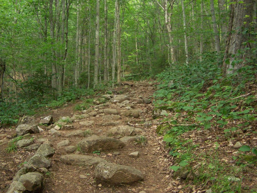
If you choose to take the infamous and rough Crane Pond Truck Trail to it’s end, and then park at Crane Pond, it’s only about a 3 1/2 mile hike up the mountain. If you stop at Alder Pond, and don’t drive through the shallow end of Alder Pond to get to the last mile of Crane Pond Road, then it’s a 4 1/2 mile hike each way.
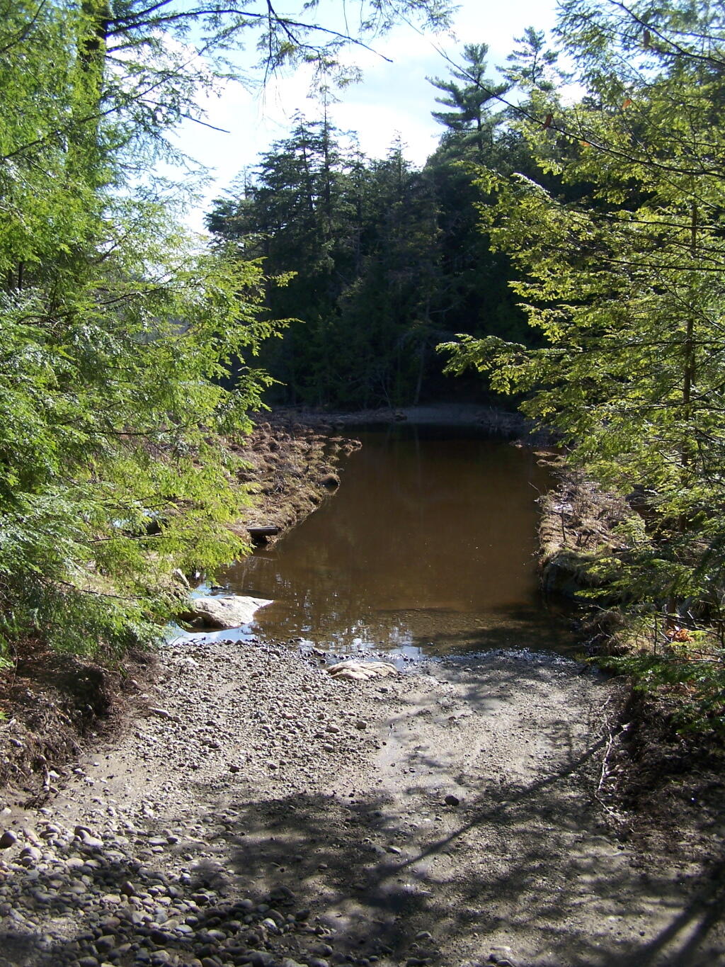
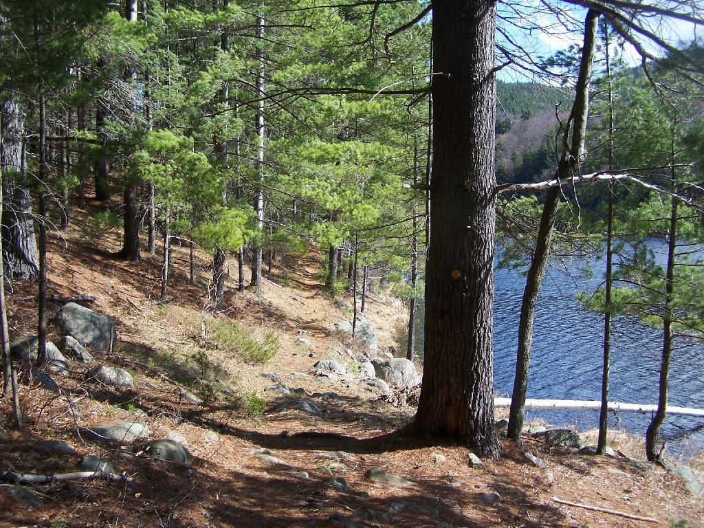
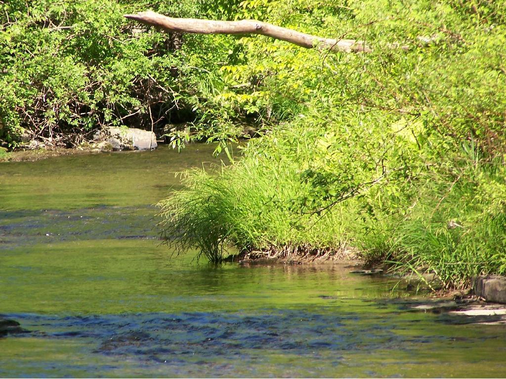
Below is Alder Pond. It was an amazing morning, as the rain let up and started to clear off. The truck trail cuts through the end of the pond, and with the recent rains, it was deeper then I wanted to take my old pickup through.
At end of Crane Pond Road is Crane Pond (not surpisingly!) There is a parking area here, and Crane Pond is known for it’s good fishing and beauty.
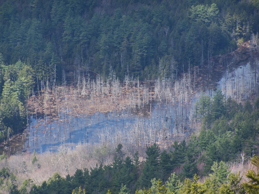
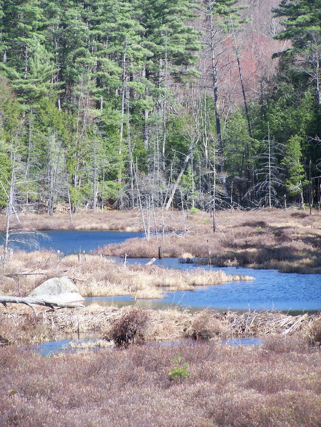
Reaching Glidden Marsh on the Pharaoh Mountain Trail. Pharoah Mountain is in the distance, with the peak sticking up. Most of the trail is relatively flat, until you reach the mountain, and then you start climbing.
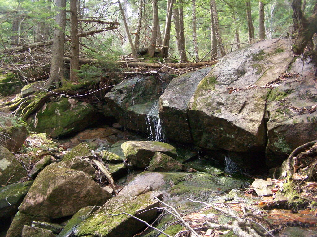
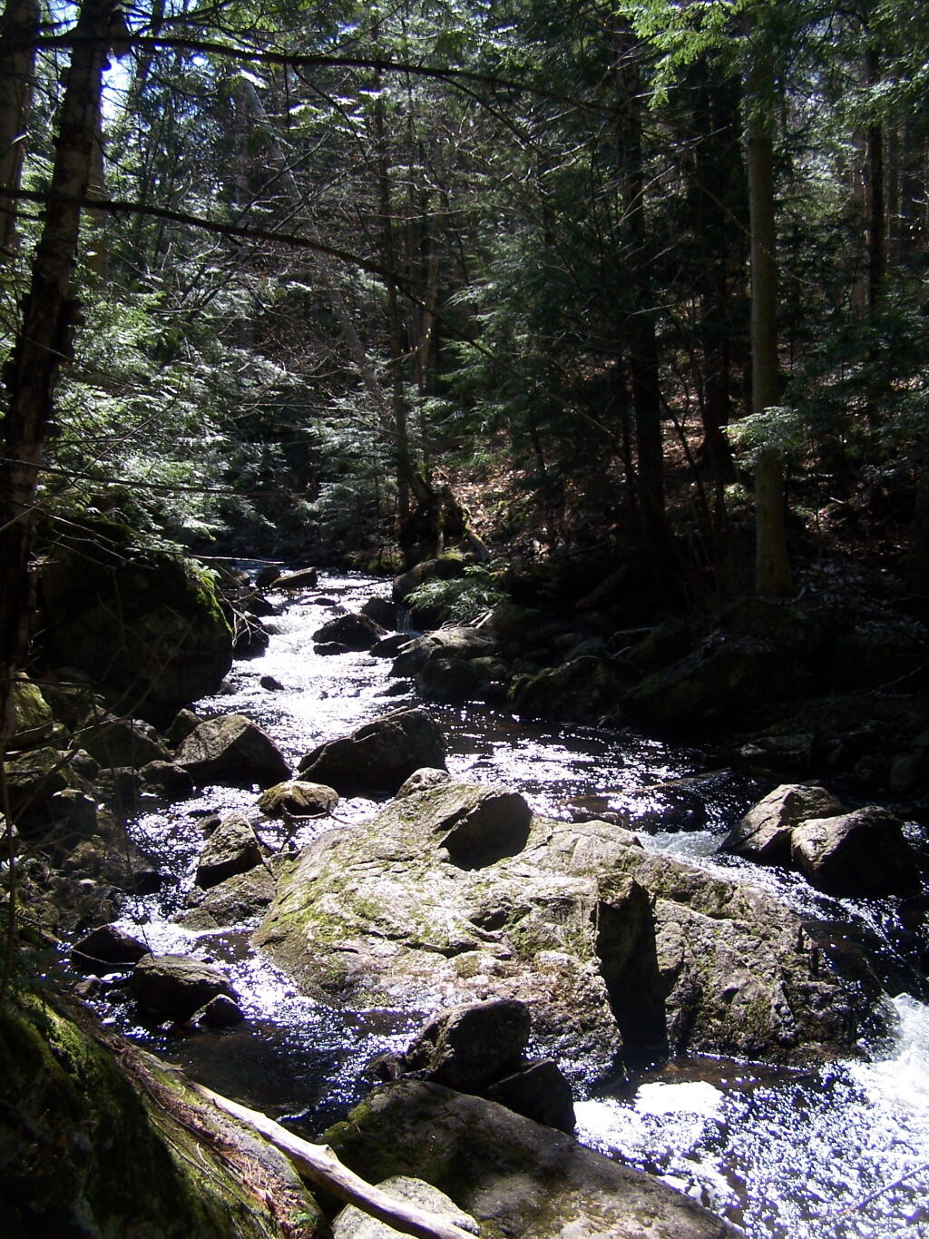
About halfway up there, there is the most charming little water fall.
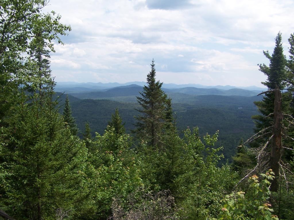
As you climb, views become progressively better.
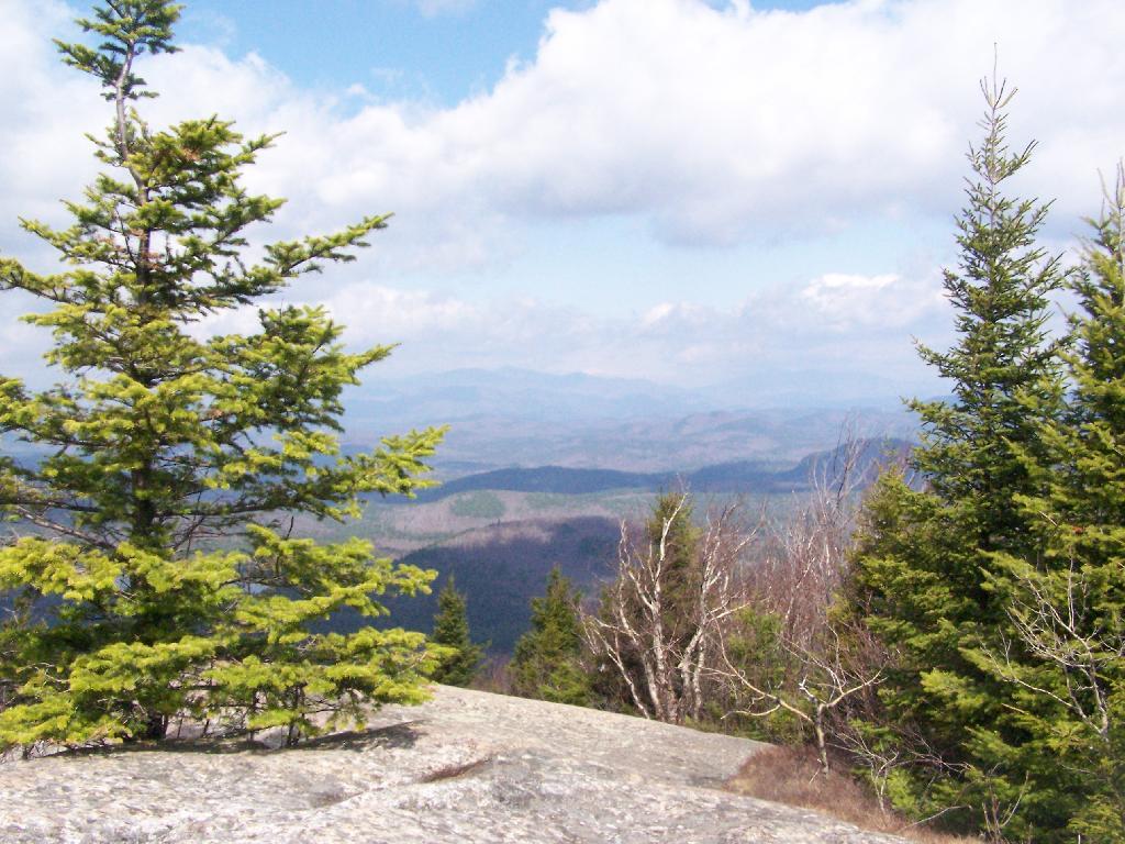
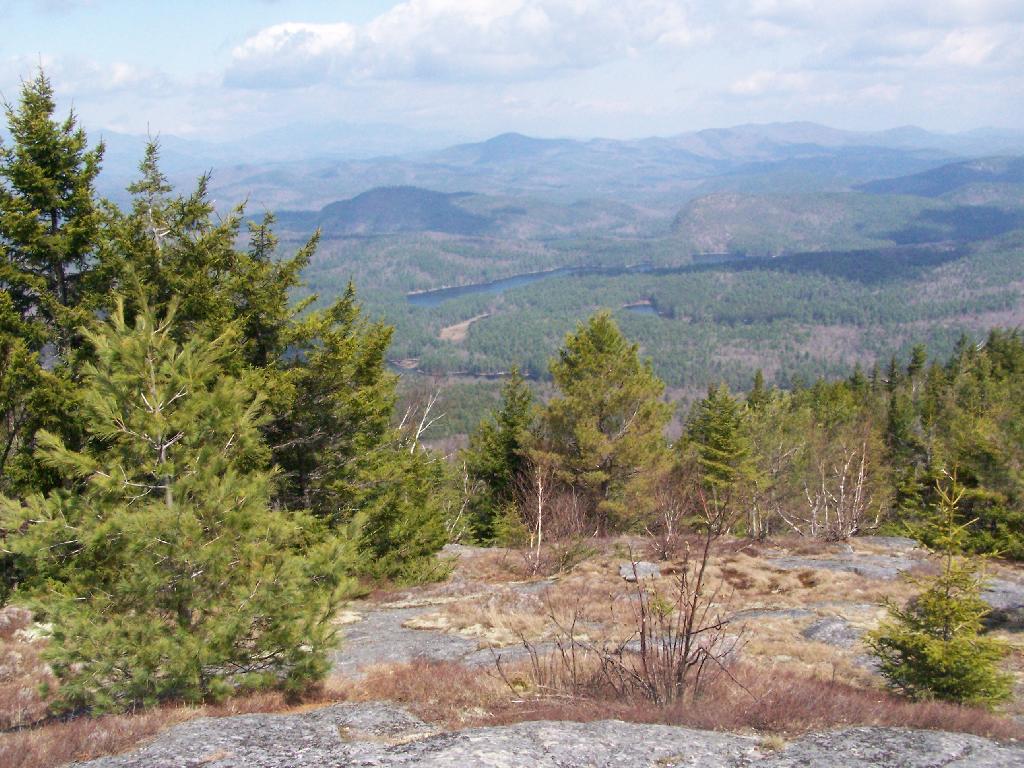
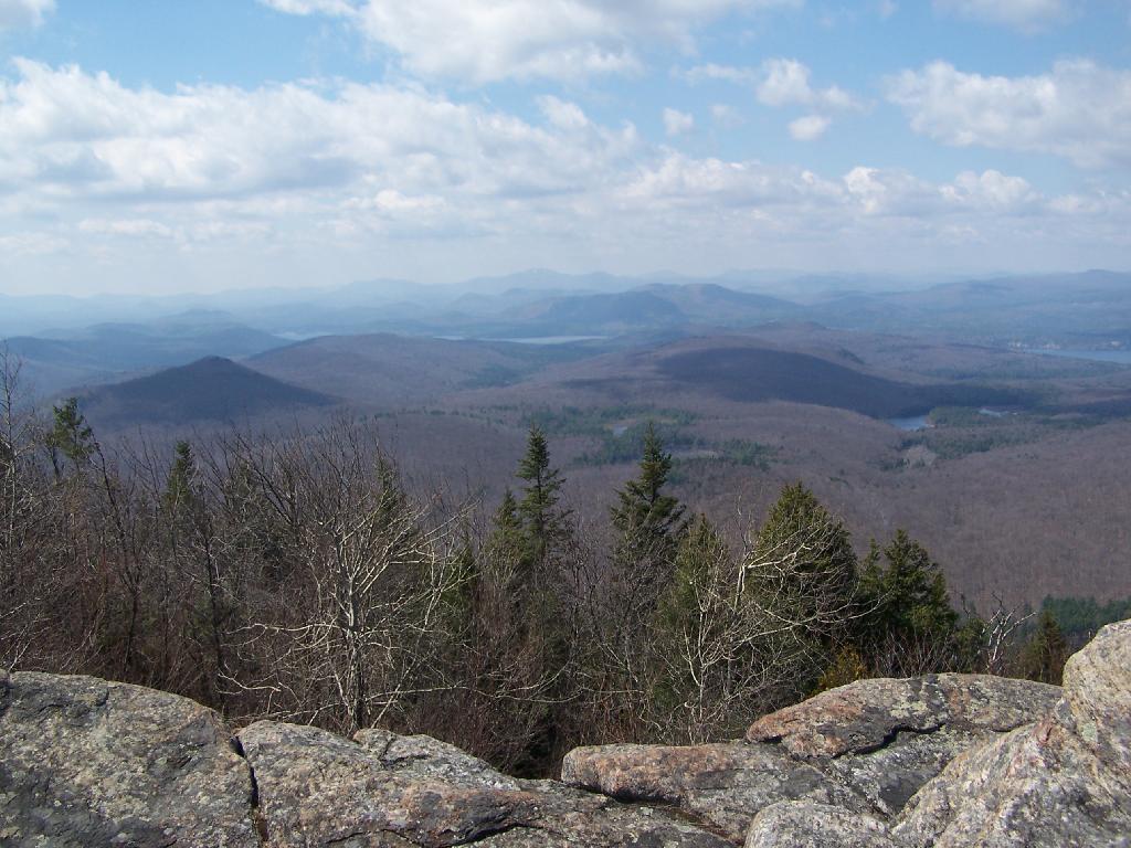
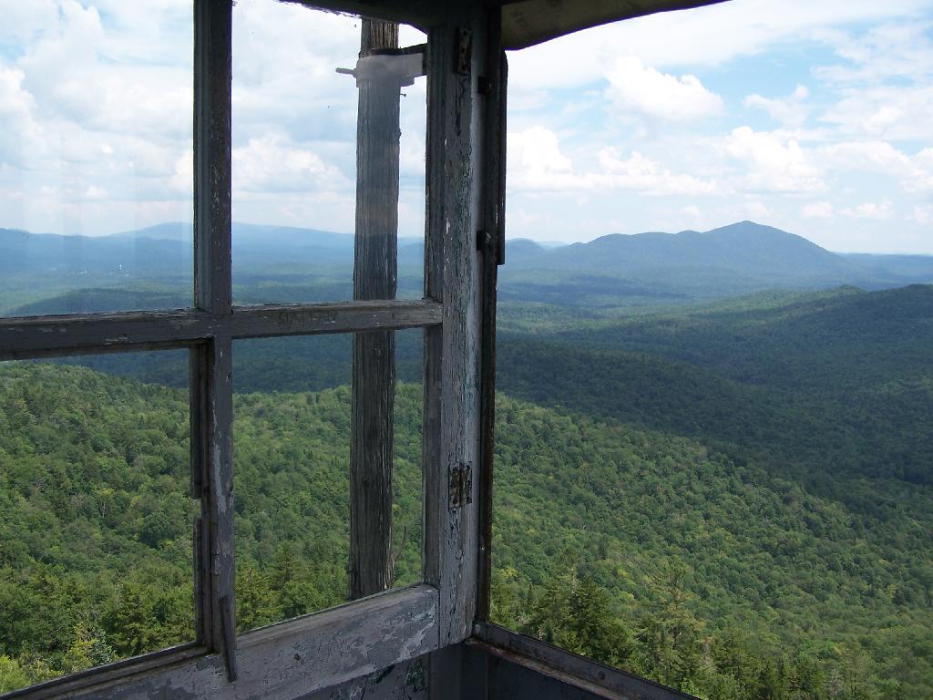
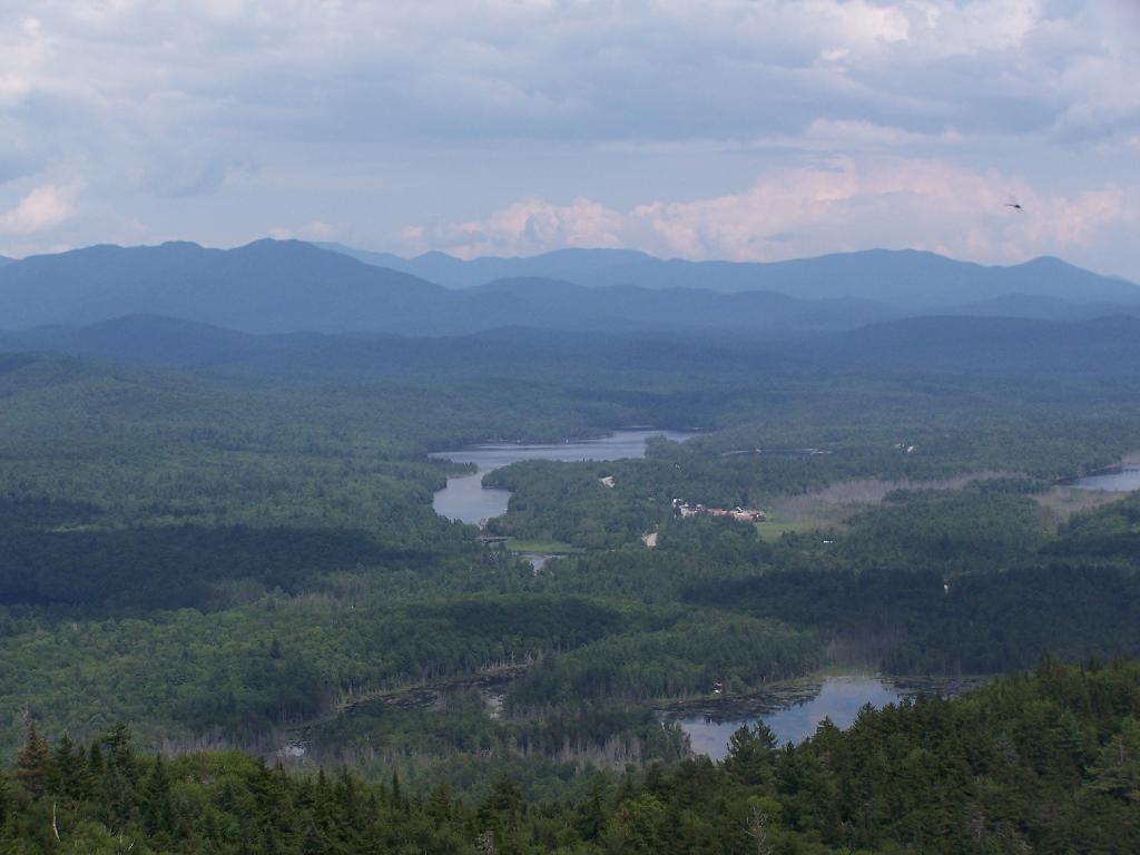
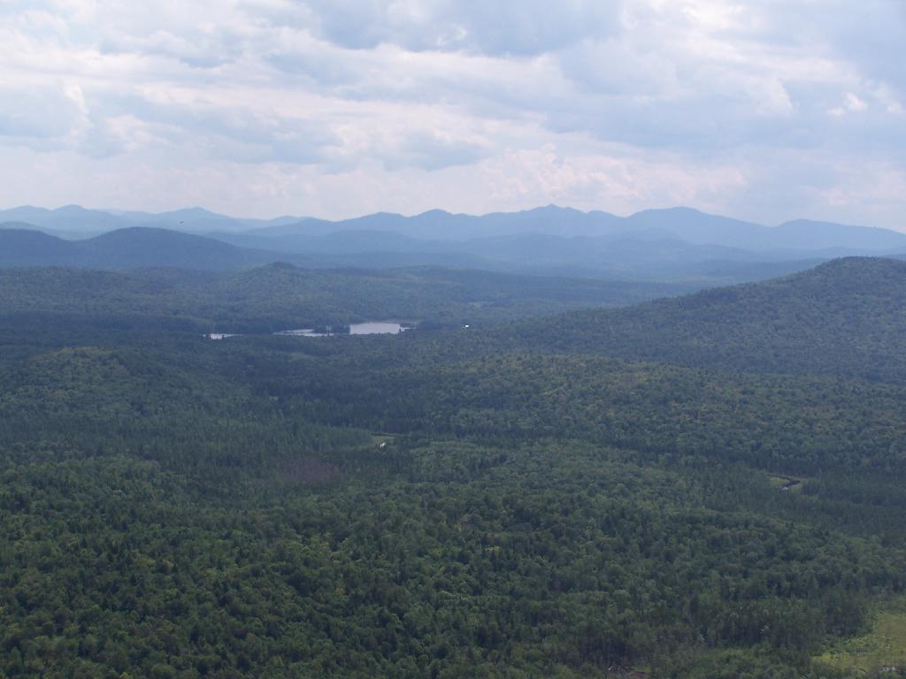
Reaching the summit, there are views in almost all directions, although you have to wonder around the top of the mountain to get all views. Here is looking North-East toward Ticonderoga. You can see Lake Champlain in the distance — barely, along with Crane Pond, Alder Pond, Oxbow Lake, and other features up close.
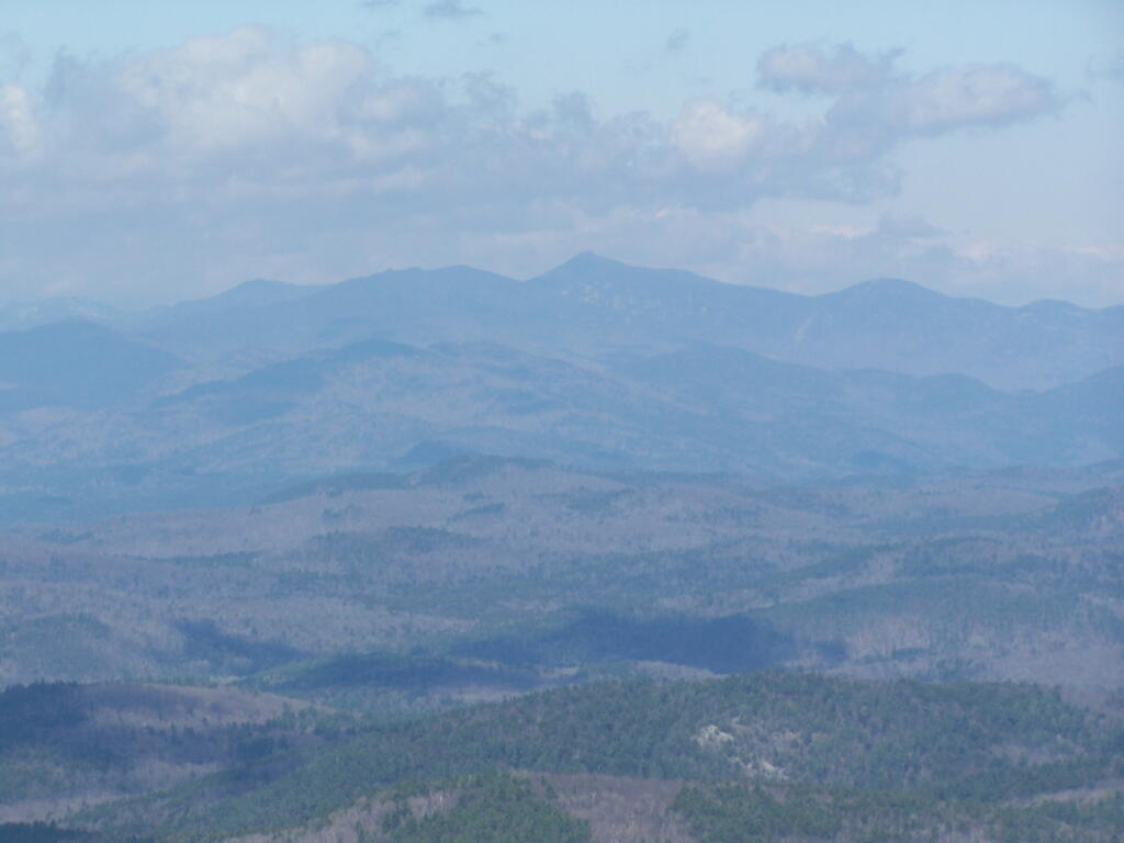
On the northernly view, you have nice views of the High Peaks Region of the Adirondacks, with Mount Marcy and Alonquin Mountains peaking out top.
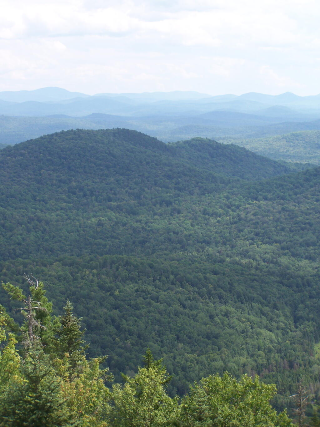
To the south-west, there are view of Gore Mountain (ski trails still with snow on it as of April 11).
There also is a primative campsite on top of Pharaoh Mountain.
To the South-East there is Pharaoh Lake, which I did not visit, but the maps show about 5 lean-tos surround it.
Desolate Swamp is quite purty from the mountain.
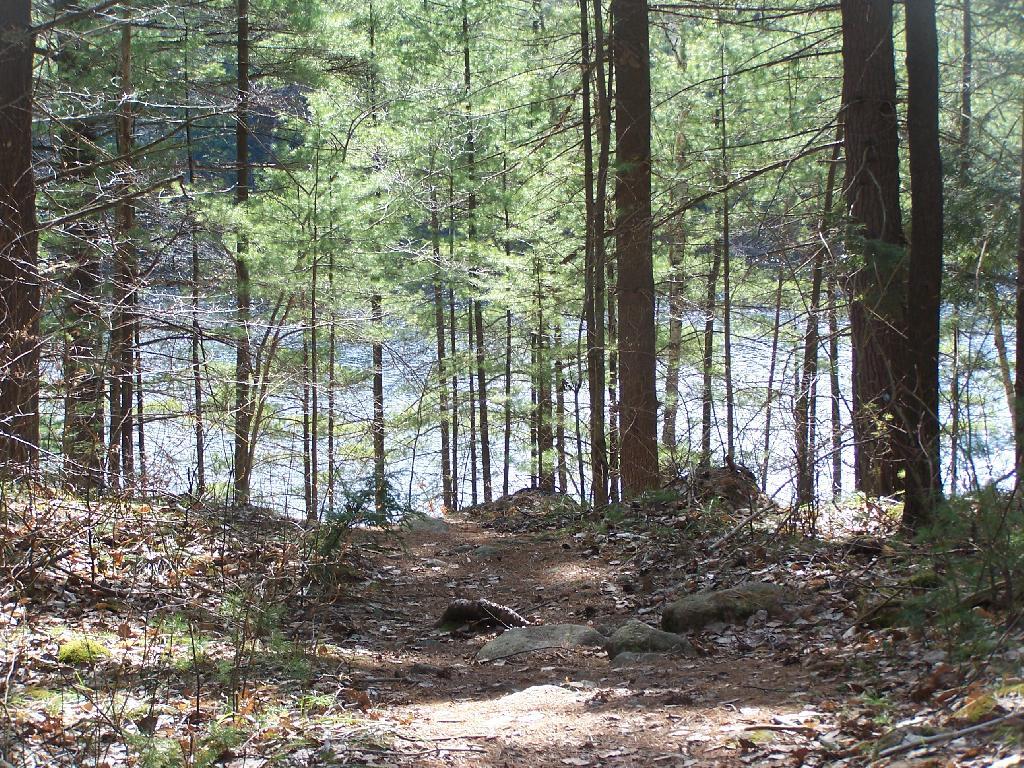
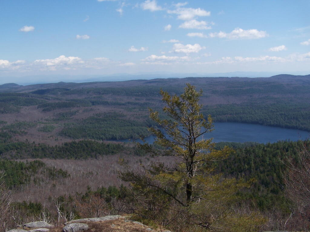
After hiking up the mountain, I took a side trip to the beautiful Oxbow Pond, and the other side of Glidden Marsh. Here is the Long-Swing Trail along the edge of Glidden Marsh, near the turn off to Oxbow Lake.
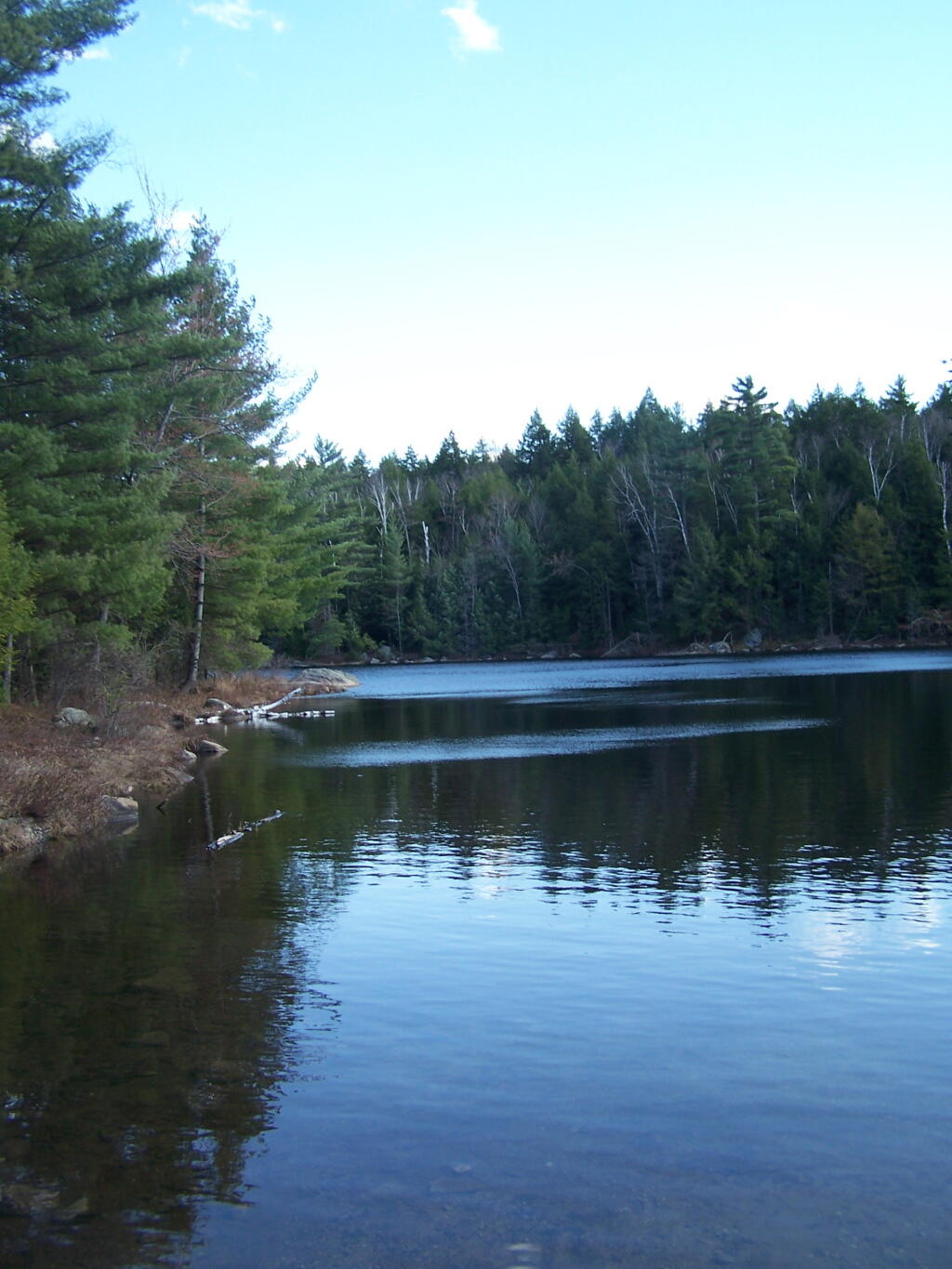
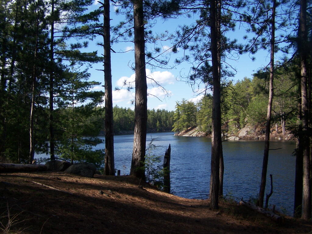
Oxbow Lake is so beautiful, and probably real deep.
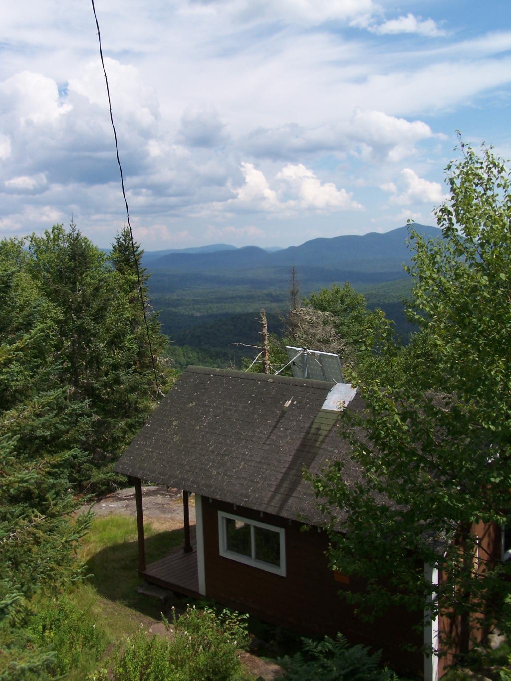
The Oxbow Lean-To. It looks well used, but is in good shape, and has a decent outhouse a little ways from it, a fire pit, along with lots of water for cooking in the nearby pond.
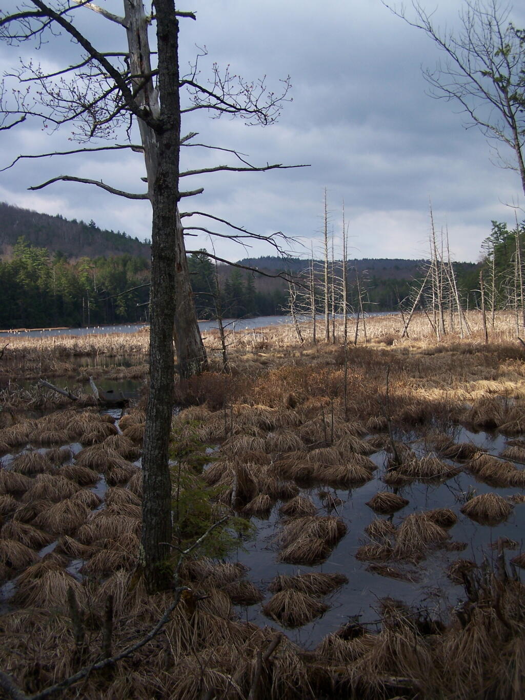
The one end of Oxbow Lake is swampy, as it runs between outfall of Crab Pond down to Oxbow.
Heading back to the truck, the sun flickers on the outlet of Glidden Marsh.
An amazing hike. Definitely want to come back, and possibly spend a night at Oxbow Pond.
One of the reason I want to move out west is to move into a political environment that is more comfortable and agreeable. Living in New York and being involved in City of Albany politics, I frequently run into people that are extremely liberal and whose views are much farther to the left then I could ever accept. At least for some city political activists, I’ve been characterized as downright conservative, even if I’m generally pro-union, pro-worker rights, and pro-strong environmental protections.
I find it particularly painful to be categorized as a conservative outsider. I support many progressive positions, and for people to just label me as a conservative who is against progress just bothers me. I want to have a clean healthy environment, I want to have a high minimum wage, and allow people to make their own private lifestyle choices.
In a more conservative area, many of core beliefs, particularly on rural issues, will be norm for the society. I may face an uphill battle in rural areas on more progressive issues like the minimum wage or clean air from big corporate polluters, but wherever one goes there still is a core progressive group that I can join up with that shares my progressive beliefs. I find it much easier to fight for a liberal cause, then against a liberal cause I disagree passionately with.
One the things I loved best about attending college in North Country of New York State was I could find like minded Democrats in the region. Many of the progressives of the North Country shared the same beliefs that I hold dear, but also where strong progressives on the major issues. Rural progressives generally where not proponents of gun control or hostile to rural issues but still cared strongly about labor rights and strong environmental protections against some of the worst abuses across our country.
I am often very critical of efforts to deem public lands as wilderness, as a form of statutory or constitutional protection of the lands, forever condemning motorized uses, and severely limiting other uses of the land, especially if the land has previously been farmed, logged, or otherwise changed by man. Certainly there are some unique parcels that should be preserved in such a pristine state, but many others are just wild lands to be used by man and nature alike.
I really do not like the legal definition of wilderness. I don’t think it captures my view of the forest lands I belove, the real wilderness in my imagination. Wilderness is the state of being wild and natural, largely uncontrolled by society’s social structures. It’s a land where man is free to use, largely without the control of government dictating how it is to be used except for minimal standards to protect its quality for future generations. Wilderness is a place where you go to get away from it.
Wilderness is any wild location in a rural area. It could be a hobby or even a professional farm, run by it’s operator. Or it could be any forest privately or publicly owned. It could be a hunting camp. It could be a dirt road in the middle of nowhere, or a state forest. It could be a wild forest in Adirondacks, a National Forest, or some other wild land. It could be a state truck trail or a back-country location. It does not have to be road-less or totally untrammeled by man, just wild and free without excessive government control and oppressive populations.
… wilderness is a place to escape, a place to get away from it all.
The warmest month is upon us, when we celebrate our country's independence and enjoy many delightful summer past-times.
July is the hottest month of the summer. It’s the month when the school children are out from school and the legislature has left Albany for the year. Hot and humid, but wonderful summer days upon us, as we enjoy long nights in the summer haze.
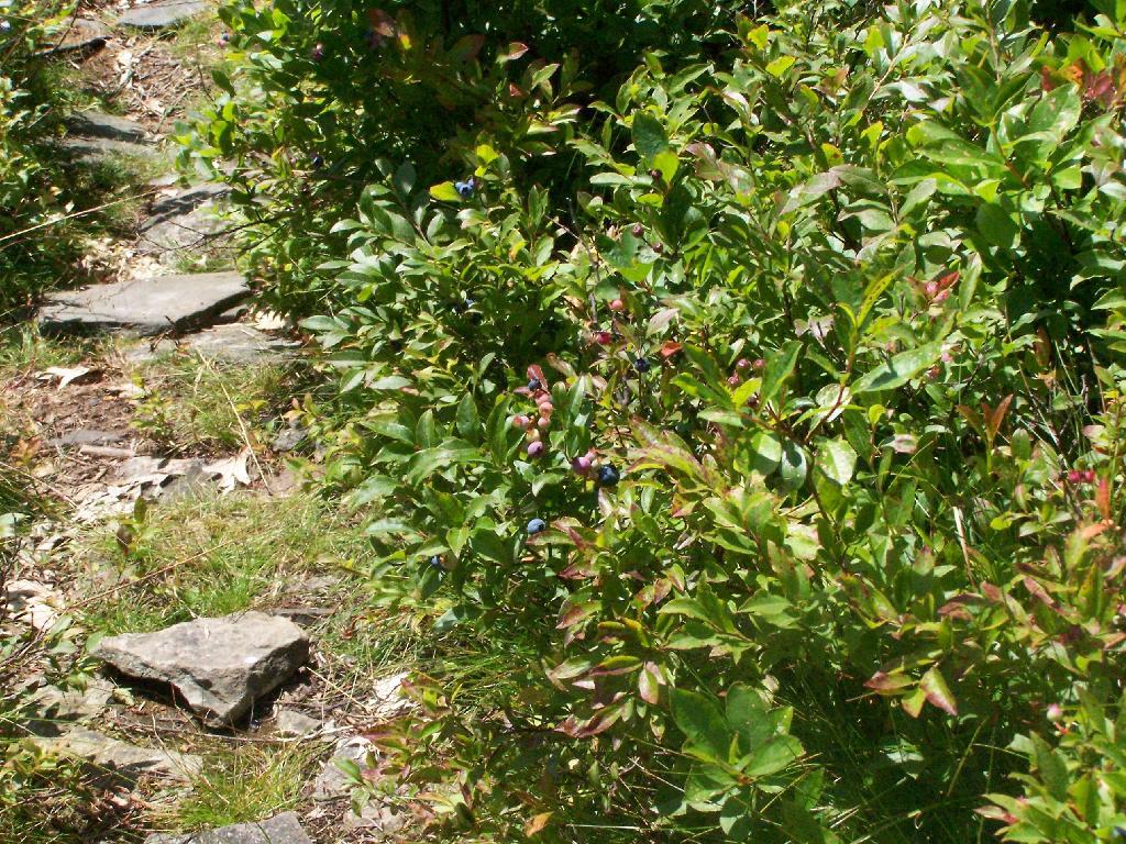
There won’t be any real cold days in this month. Rainy days are a rarity, although one always to be on the watch for the heavy thunderstorms that often come by afternoon. Humidity will be high, one things warm up by mid-day. Regardless, with long days, one can get up, hike up a mountain, break by early afternoon, and then enjoy nice nights. We will enjoy the wild blueberries and the wild raspberries as spend time outdoors.
July is the month when we celebrate the birth of our nation with Independence Day. Always a long weekend, it will be a nice one. We will enjoy fireworks, both legal and illegal, lighting them off, into the summer skies. We will watch the fireflies as they fill the fields at night with their flickers of light.
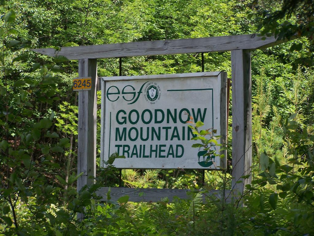
A couple of weeks ago I hiked up Goodnow Mountain, on a beautiful clear afternoon, that by the time I reached the mountain it started to cloud up and the humidity started to increase. I had previously in the morning attempted to hike up Giant Mountain in the High Peaks, and wanted to do something easier for the afternoon.
Goodnow Mountain is located at the SUNY ESF (Environmental Science-Forestry) College, just south of the Adirondack High Peaks on NY 28, just to the west of Newcomb. It’s a bit of a drive from the Adirondack Northway from the east or even a little ways from Long Lake to the west, but well worth it for the views.
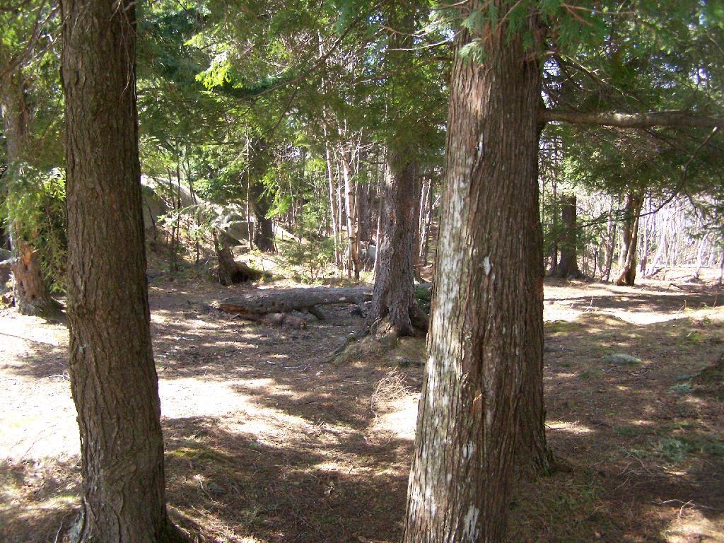
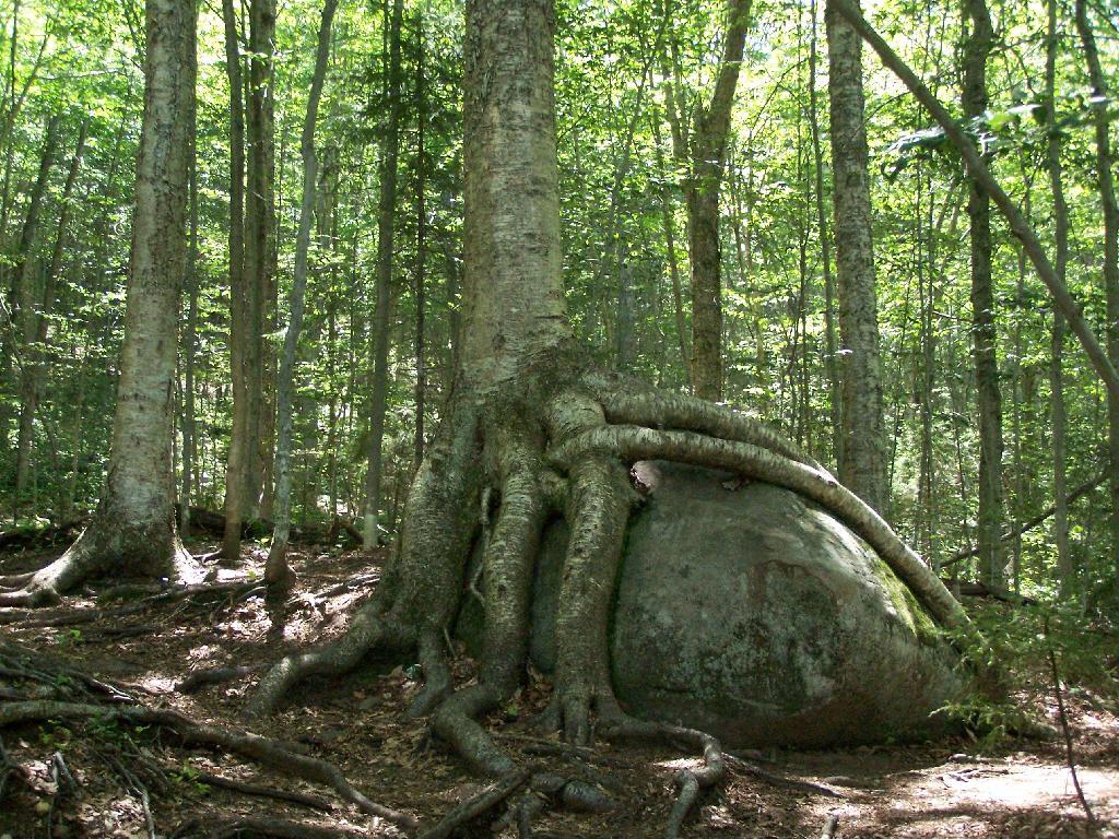
About a quarter mile up the trail you pass an interesting tree grown over a rock. This is not as uncommon as you might think in the Adirondacks where the soils are poor and the ground is rocky, and trees seek to put down more roots to pick up nuetrants.
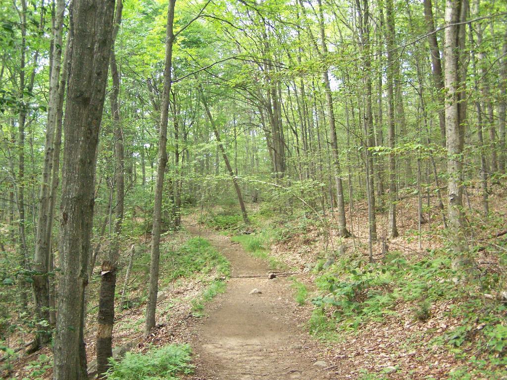
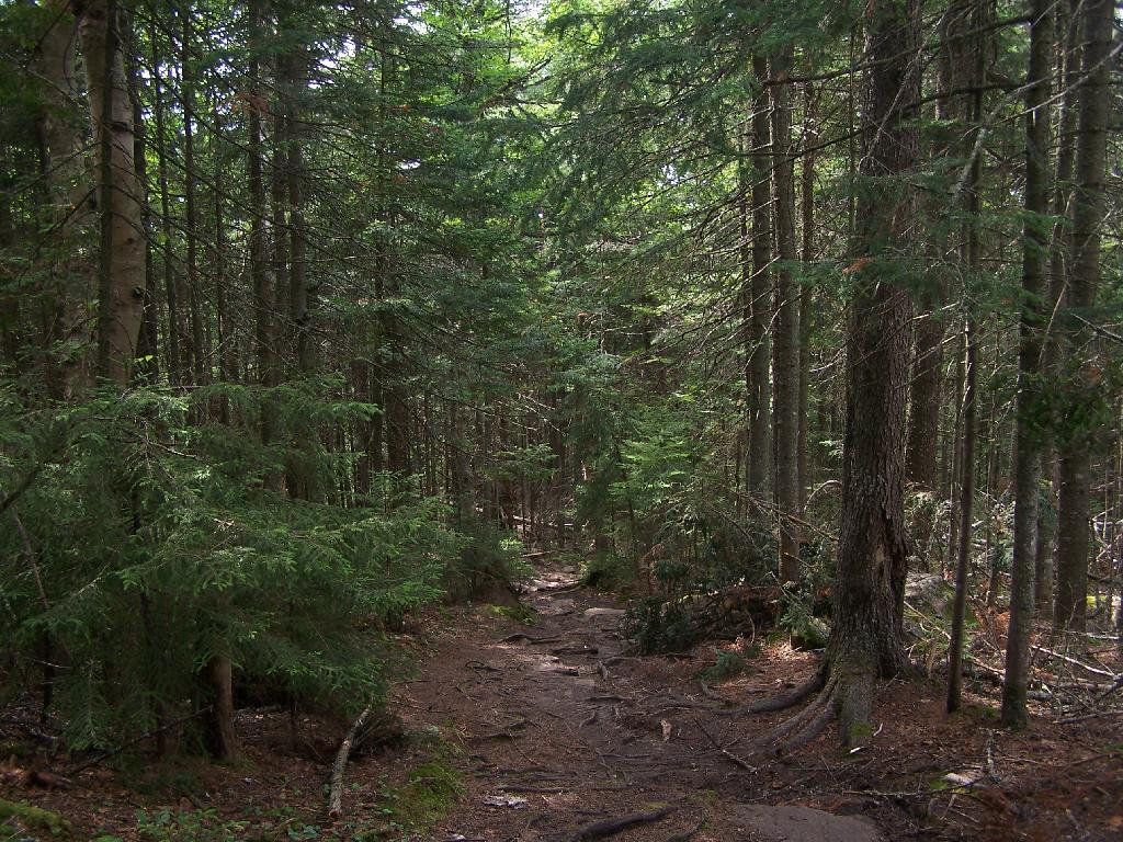
At about 1/2 mile you reach the old woods road that at one time, decades ago, provide vehicular access to the tower for forest rangers. Part of the trail is flat, but then it keeps steeper and erosion is noticable on the old road bed, no longer passable by anything then ATV in an emergency.
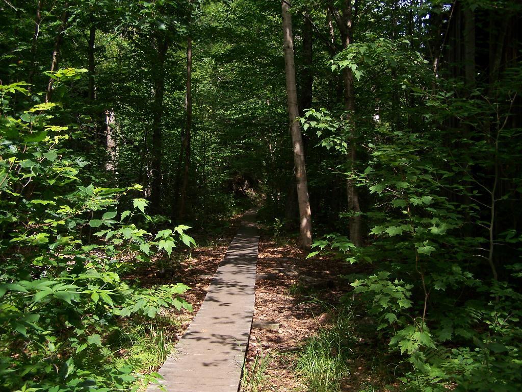
Further up the mountain, the trail follows a series of boardwalks that keeps most of the trail out of the mud and the muck.
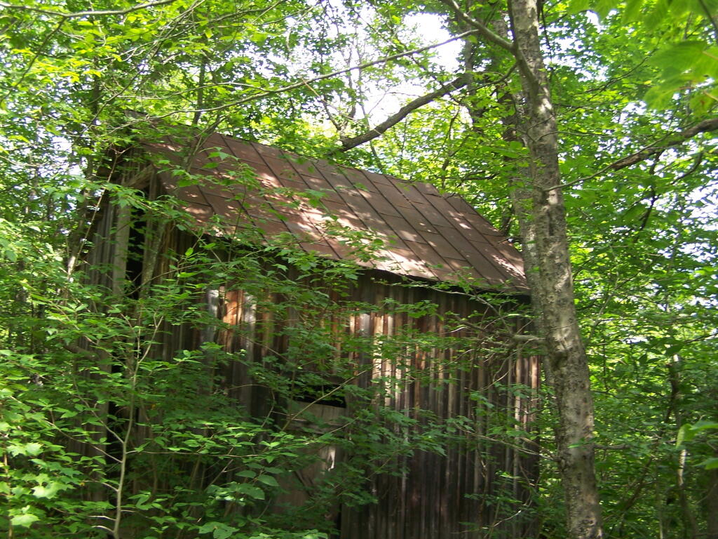
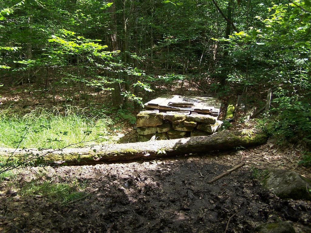
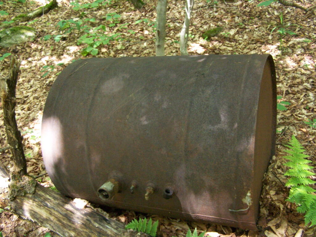
Then you reach an old abandoned barn, a well, and some interesting old debris like what appears to be a tank from a hot water heater storage unit.
You ascend a ledge, with some limited views to the south.
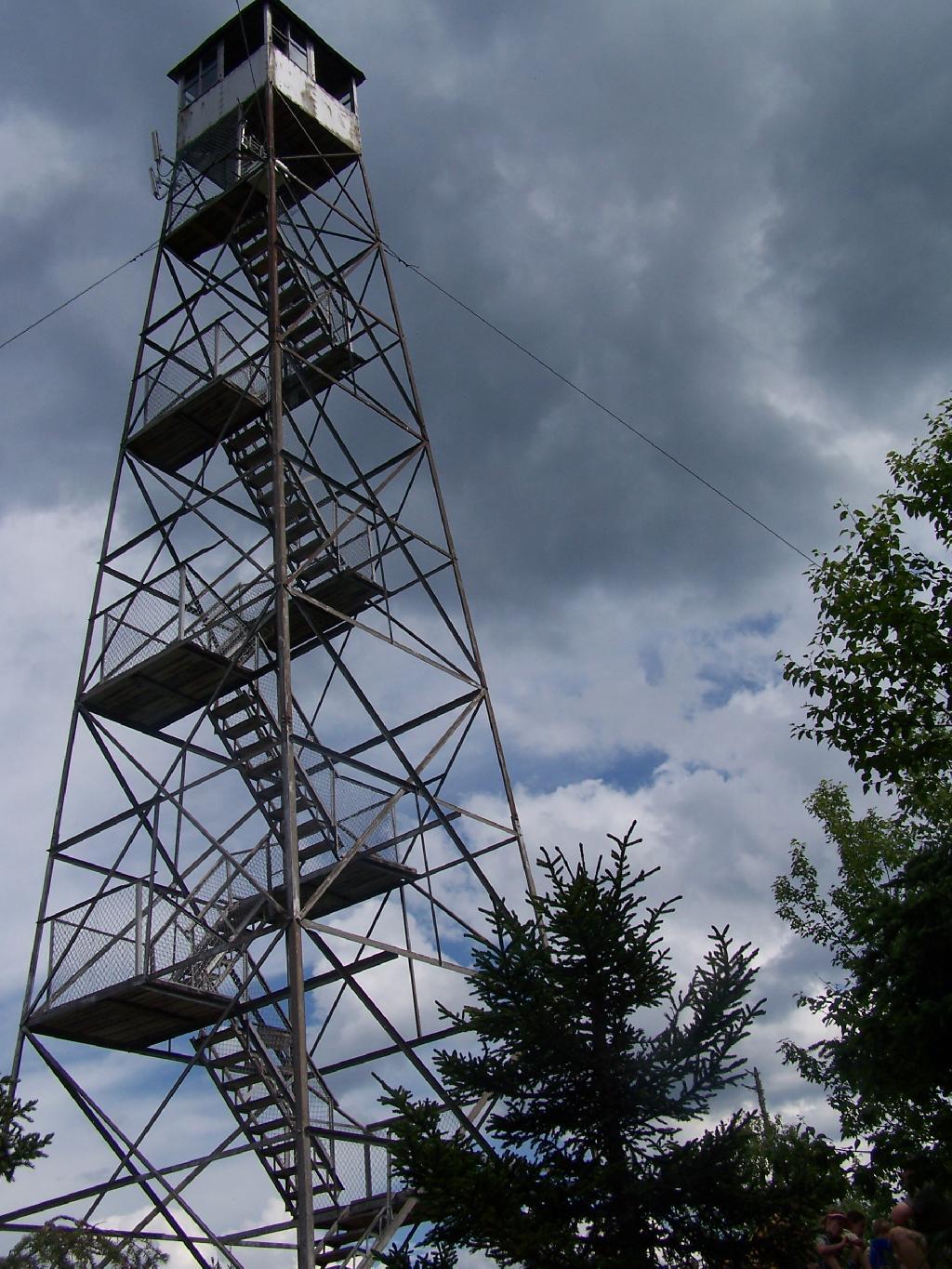
Then their is a thick planation of White Pines along the trail as you make one relatively short ascent to the firetower.
Eventually at the last possible moment, you break through the White Pines to see the Goodnow Firetower, and almost instantly want to start climbing it for the views, unless your suffering from heat exhaustion, then you might want to look for the relatively limited shaded but open sections on the mountain.
SUNY ESF has restored to the Ranger’s cabin, and the porch is a farely popular place to sit, enjoy the view, beat the heat for a few moments.
There are many interesting views from the firetower. Here are the High Peaks looking North, the Vanderwhacker Wild Forest to the east, Kempshall Mountain / Long Lake to the west, and Blue Mountain / Blue Ridge to the South.
The first official month of summer is upon us, with the Summer Solstice occurring on June 21st. It is the month when summer activities get fully underway, when the crops and gardens are planted, with primary and secondary schools recess for the summertime.
By the 21st of the month, we will have seen the longest day come and go for the year. Sunsets will occur as late as 8:37 PM, with it not being totally dark until after 9:10 PM most nights. The long summer nights will be a pleasure.
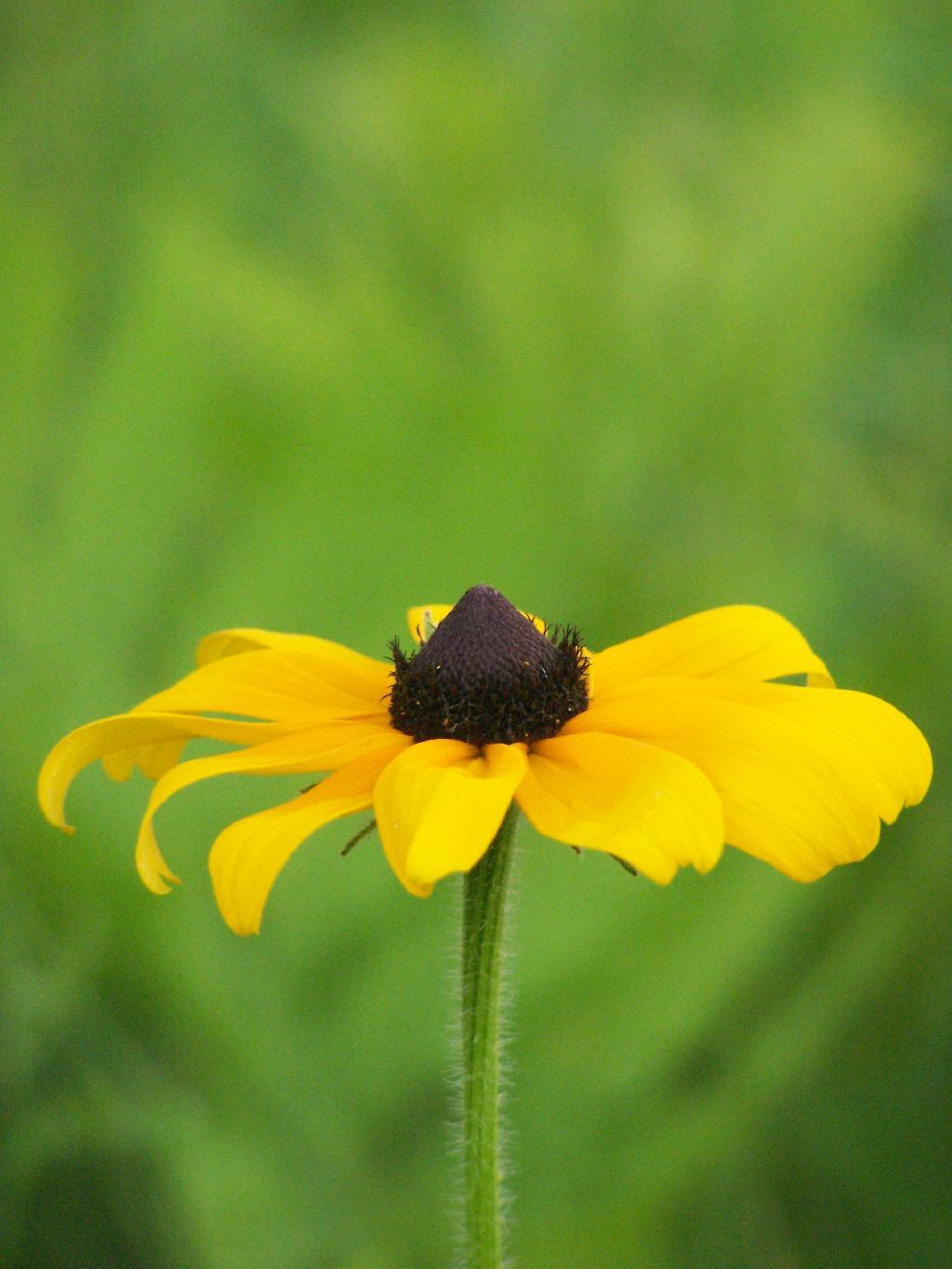
Folks will camp, they will fish, they will picnic and enjoy the beautiful weather. The wildflowers will cover the fields, first the daisies, then the black-eyed susans. We will explore the hay fields looking for Juneberries, those ever so small, but wonderfully tasting “wild strawberries”.
One of three months of wonderful summer weather, there will be much to enjoy as nature starts to mature into it’s full born of beauty of summer time.