Search Results for: photo upper end

July 12, 2015 evening

Good evening. It is currently 75 degrees and clear. The humidity is starting to come back in, but we will get down to 65 degrees later with some possible fog by morning. Tommorow is going to be hazy-hot-and-humid with a heat index pushing 90. Real temperatures in the upper 80s. Dewpoints will rise to an uncomfortable 65 by mid-day. Tuesday will be even sticker, but a little less warm, and the clouds and showers might moderate the heat for Tuesday. Seek water, air conditioning, and ice cream.

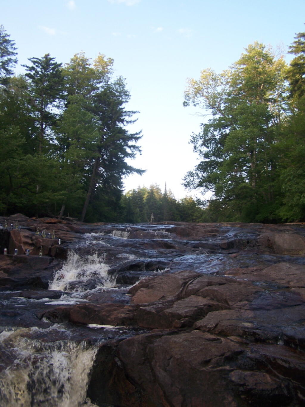
Back from Piseco-Powley Road.Β Went up there for the weekend. Spent some time in the Potholers, along with paddling from Stewart Landing up to Lily Lake on the Sprite Creek. The Potholers were okay yesterday, but today they were almost perfect with the greater warm of the weather. It was nice, as was swimming at Stewart Landing. My cellphone got damp on Saturday, so now it’s not working properly except when charging. So I only got a handful of photos, mostly of the campsite. I’m hoping it will dry out over the next few days and start working on battery, but if not I will start stealing parts from the other phone that seemed to break a few months ago. I love my Smartphone, but they aren’t always that reliable.

Classification and Acres

An overview of the amount of land in each classification of the Adirondack Park. Here are a summary of the meanings of the various land classifications.

CLASS Acres Percent
PRIMITIVE CORRIDOR 292 0.01%
UNCLASSIFIED 365 0.01%
ADMINISTRATIVE 391 0.02%
HISTORIC 531 0.02%
CANOE AREA 18,989 0.74%
INTENSIVE USE 23,382 0.91%
PRIMITIVE 46,647 1.83%
WILDERNESS 1,160,125 45.39%
WILD FOREST 1,305,233 51.07%
TOTAL ADIRONDACK FOREST PRESERVE 2,555,955 100.00%

After The Fire

A look at each facility (e.g. campground, wild forest, wilderness area), sorted by size, ascending.

FACILITY Acres Percent
SIGNAL BUOY ISLAND 0.1 0.0%
NORTH CREEK PARKING FISHING ACCESS 0.2 0.0%
MILL CREEK PARKING AREA 0.2 0.0%
SAINT REGIS MOUNTAIN HISTORIC AREA 0.2 0.0%
HURRICANE MOUNTAIN HISTORIC AREA 0.2 0.0%
SHEEPSHEAD ISLAND 0.4 0.0%
MILL CREEK FISHING ACCESS 0.5 0.0%
GARDEN ISLAND 0.5 0.0%
GOOSENECK POND PRIMITIVE AREA 0.6 0.0%
COLE ISLAND 0.9 0.0%
FORTH LAKE BOAT LAUNCH 1.1 0.0%
TAHAWAS PRIMITIVE AREA 1.6 0.0%
LAKE COLBY ENVIRONMENTAL EDUCATIONAL CAMP 1.8 0.0%
MIRROR LAKE BOAT LAUNCH 1.9 0.0%
SPOON ISLAND PRIMITIVE AREA 1.9 0.0%
GREENE ISLAND MAINTENANCE FACILITY 1.9 0.0%
LAKE FLOWER BOAT LAUNCH 2.1 0.0%
PORT DOUGLASS BOAT LAUNCH 2.4 0.0%
UPPER CHATEAUGAY LAKE BOAT LAUNCH 2.4 0.0%
WILMURT CLUB ROAD 2.9 0.0%
GREAT SACANDAGA LAKE BOAT LAUNCH 3.0 0.0%
TUPPER LAKE BOAT LAUNCH 3.2 0.0%
SARANAC LAKE BOAT LAUNCH 3.3 0.0%
WESTPORT BOAT LAUNCH 3.9 0.0%
PORT HENRY BOAT LAUNCH 4.3 0.0%
STILLWATER BOAT LAUNCH 4.3 0.0%
SOUTH BAY STATE BOAT LAUNCH 4.8 0.0%
CRANBERRY LAKE BOAT LAUNCH 5.1 0.0%
RAQUETTE RIVER BOAT LAUNCH 6.3 0.0%
PRIMITIVE AREA 6.6 0.0%
MIDDLE SARANAC LAKE BOAT LAUNCH 6.8 0.0%
LAKE GEORGE FOREST PRESERVE 7.2 0.0%
SACANDAGA PRIMITIVE AREA 7.2 0.0%
WANAKENA PRIMITIVE CORRIDOR 7.5 0.0%
NORTHVILLE-SUB-OFFICE 7.9 0.0%
WILLSBORO BAY BOAT LAUNCH 8.0 0.0%
FULTON CHAIN BOAT LAUNCH 9.1 0.0%
TIED LAKE PRIMITIVE CORRIDOR 9.8 0.0%
SARANAC LAKE ISLANDS CAMPGROUND 9.9 0.0%
HURRICANE MOUNTAIN PRIMITIVE AREA 11.2 0.0%
LOWER SARANAC LAKE BOAT LAUNCH 13.6 0.0%
BEAR POND PRIMITIVE CORRIDOR 14.1 0.0%
FORKS MOUNTAIN PRIMITIVE CORRIDOR 14.7 0.0%
BROADALBIN BOAT LAUNCH 15.7 0.0%
MOSSY POINT STATE BOAT LAUNCH 16.8 0.0%
ALICE BROOK PRIMITIVE AREA 18.8 0.0%
SACANDAGA RIVER STATE BOAT LAUNCH 19.9 0.0%
LONG LAKE STATE BOAT LAUNCH 20.2 0.0%
EAGLE POINT CAMPGROUND 21.0 0.0%
ALDER CREEK PRIMITIVE CORRIDOR 23.0 0.0%
SUNY ATMOSPHERIC SCIENCES RESEARCH CENTER 23.1 0.0%
RAVEN LAKE PRIMTIVE AREA 24.7 0.0%
POPLAR POINT CAMPGROUND 32.8 0.0%
LAKE GEORGE BATTLEGROUND CAMPGROUND 33.5 0.0%
CAMP SANTANONI 36.1 0.0%
TIOGA POINT CAMPGROUND 36.2 0.0%
ALGER ISLAND CAMPGROUND 37.6 0.0%
PARTLOW LAKE PRIMITIVE CORRIDOR 39.0 0.0%
PRIMITVE AREA 45.4 0.0%
BUCK POND PRIMITIVE CORRIDOR 47.8 0.0%
CAROGA LAKE CAMPGROUND 49.1 0.0%
DUG MT. PRIMITIVE AREA 49.7 0.0%
LEWEY LAKE CAMPGROUND 53.4 0.0%
LITTLE SAND POINT CAMPGROUND 66.5 0.0%
CROWN POINT CAMPGROUND 73.6 0.0%
ADIRONDACK FISH HATCHERY 74.1 0.0%
POINT COMFORT CAMPGROUND 75.0 0.0%
LAKE GEORGE BATTLEFIELD DAY USE AREA 81.3 0.0%
BOQUET RIVER PRIMTIVE AREA 85.5 0.0%
NEHASANE PRIMITIVE CORRIDOR 87.6 0.0%
SUCKER LAKE WATER ACCESS 90.6 0.0%
FIRST BROTHER PRIMITIVE AREA 91.4 0.0%
HEARTHSTONE POINT CAMPGROUND 97.4 0.0%
GOLDEN BEACH CAMPGROUND 98.6 0.0%
INDIAN LAKE ISLANDS CAMPGROUND 102.1 0.0%
JOHN BROWNS FARM HISTORIC SITE 104.6 0.0%
SACANDAGA CAMPGROUND 116.8 0.0%
MEADOWBROOK CAMPGROUND 117.8 0.0%
WILMINGTON NOTCH CAMPGROUND 119.7 0.0%
LINCOLN POND CAMPGROUND 134.1 0.0%
JOHNS BROOK PRIMITIVE AREA 146.6 0.0%
TAYLOR POND CAMPGROUND 146.8 0.0%
LAKE EATON CAMPGROUND 152.1 0.0%
CAMP GABRIELS 158.0 0.0%
SCHUYLER ISLAND PRIMITIVE AREA 167.3 0.0%
CATHEAD MTN. PRIMITIVE AREA 172.9 0.0%
SHARP BRIDGE CAMPGROUND 192.9 0.0%
NORTHAMPTON BEACH CAMPGROUND 219.2 0.0%
WAKELY MOUNTAIN PRIMITIVE AREA 224.1 0.0%
LAKE HARRIS CAMPGROUND 233.4 0.0%
SCAROON MANOR DAY USE AREA 240.2 0.0%
EIGHTH LAKE CAMPGROUND 242.0 0.0%
AUSABLE POINT CAMPGROUND 259.5 0.0%
CRANBERRY LAKE CAMPGROUND 264.2 0.0%
LIMEKILN LAKE CAMPGROUND 266.0 0.0%
BROWN TRACT POND CAMPGROUND 272.9 0.0%
POKE-O-MOONSHINE CAMPGROUND 274.1 0.0%
LAKE DURANT CAMPGROUND 276.4 0.0%
PARADOX LAKE CAMPGROUND 287.8 0.0%
BUCK POND CAMPGROUND 302.3 0.0%
ROGERS ROCK CAMPGROUND 307.7 0.0%
FORKED LAKE CAMPGROUND 346.8 0.0%
MEACHAM LAKE CAMPGROUND 359.6 0.0%
UNCLASSIFIED 364.7 0.0%
MOFFITT BEACH CAMPGROUND 386.0 0.0%
CROWN POINT HISTORIC AREA 389.9 0.0%
AMPERSAND PRIMITIVE AREA 423.5 0.0%
ROLLINS POND CAMPGROUND 518.9 0.0%
BALD LEDGE PRIMITIVE AREA 556.5 0.0%
FISH CREEK POND CAMPGROUND 560.1 0.0%
HINCKELY RESERVOIR DAY USE AREA 568.7 0.0%
LAKE GEORGE ISLANDS CAMPGROUND 593.5 0.0%
NICKS LAKE CAMPGROUND 699.6 0.0%
PUTNAM POND CAMPGROUND 850.1 0.0%
LUZERNE CAMPGROUND 853.2 0.0%
VALCOUR ISLAND PRIMITIVE AREA 956.9 0.0%
PROSPECT MOUNTAIN 1,001.7 0.0%
DEAD CREEK PRIMITIVE AREA 1,134.9 0.0%
MT. VAN HOEVENBERG SPORTS FACILITY 1,476.6 0.1%
DEER RIVER PRIMITIVE AREA 1,870.0 0.1%
EASTERN FIVE PONDS ACCESS PRIMITIVE AREA 1,907.8 0.1%
MOOSE RIVER PLAINS CAMPING AREA 2,907.1 0.1%
WHITEFACE MTN. SKI CENTER 3,015.9 0.1%
WEST CANADA MTN. PRIMITIVE AREA 3,137.5 0.1%
RAQUETTE RIVER WILD FOREST 3,550.2 0.1%
SPLIT ROCK WILD FOREST 3,662.5 0.1%
GORE MTN. SKI CENTER 3,783.7 0.1%
MADAWASKA FLOW – QUEBEC BROOK PRIMITIVE AREA 6,035.6 0.2%
JAY MTN. WILDERNESS 7,892.3 0.3%
WHITE HILL WILD FOREST 9,640.6 0.4%
ROUND LAKE WILDERNESS 11,426.7 0.4%
LITTLE MOOSE MOUNTAIN WILDERNESS 12,277.8 0.5%
RAQUETTE-JORDAN BOREAL PRIMITIVE AREA 12,437.4 0.5%
GRASSE RIVER WILD FOREST 13,172.6 0.5%
WATSON EAST TRIANGLE WILD FOREST 13,424.3 0.5%
HURRICANE MOUNTAIN WILDERNESS 13,986.7 0.5%
PEPPERBOX WILDERNESS 14,580.0 0.6%
FULTON CHAIN WILD FOREST 15,948.9 0.6%
HORSESHOE LAKE WILD FOREST 17,139.7 0.7%
HUDSON GORGE PRIMITIVE AREA 17,161.8 0.7%
WILMINGTON WILD FOREST 17,493.2 0.7%
SAINT REGIS CANOE AREA 18,989.0 0.7%
WILLIAM C. WHITNEY WILDERNESS 19,273.7 0.8%
GIANT MTN. WILDERNESS 23,460.5 0.9%
SENTINEL RANGE WILDERNESS 23,991.8 0.9%
HA-DE-RON-DAH WILDERNESS 25,788.3 1.0%
CRANBERRY LAKE WILD FOREST 25,897.3 1.0%
ALDRICH POND WILD FOREST 26,179.6 1.0%
MCKENZIE MTN. WILDERNESS 37,464.1 1.5%
BLUE MTN. WILD FOREST 38,394.3 1.5%
HOFFMAN NOTCH WILDERNESS 38,497.6 1.5%
TAYLOR POND WILD FOREST 39,134.9 1.5%
SHAKER MOUNTAIN WILD FOREST 41,360.7 1.6%
SARGENT PONDS WILD FOREST 43,532.3 1.7%
DIX MTN. WILDERNESS 44,753.8 1.8%
HAMMOND POND WILD FOREST 45,907.0 1.8%
PHARAOH LAKE WILDERNESS 46,071.3 1.8%
BLUE RIDGE WILDERNESS 47,297.2 1.9%
CHAZY HIGHLANDS WILD FOREST 47,855.6 1.9%
JESSUP RIVER WILD FOREST 48,228.7 1.9%
PIGEON LAKE WILDERNESS 50,390.5 2.0%
MOOSE RIVER PLAINS WILD FOREST 66,624.9 2.6%
LAKE GEORGE WILD FOREST 71,157.1 2.8%
DEBAR MTN. WILD FOREST 75,893.9 3.0%
SARANAC LAKES WILD FOREST 77,726.8 3.0%
INDEPENDENCE RIVER WILD FOREST 79,096.6 3.1%
VANDERWHACKER MTN. WILD FOREST 83,986.5 3.3%
SILVER LAKE WILDERNESS 108,848.6 4.3%
SIAMESE PONDS WILDERNESS 114,923.8 4.5%
WILCOX LAKE WILD FOREST 125,839.3 4.9%
BLACK RIVER WILD FOREST 127,156.6 5.0%
FIVE PONDS WILDERNESS 139,228.7 5.4%
FERRIS LAKE WILD FOREST 147,184.3 5.8%
WEST CANADA LAKE WILDERNESS 174,292.4 6.8%
HIGH PEAKS WILDERNESS 205,772.7 8.1%
TOTAL ADIRONDACK FOREST PRESERVE 2,555,955.4 100.0%

South Over Cedar River Flow

Now each class of land, broken down by Class, Unit, Facility, Acreage, and Percent.

CLASS UNIT FACILITY Acres Percent
ADMINISTRATIVE DEBAR MTN. CAMP GABRIELS 158.0 0.0%
FERRIS LAKE FERRIS LAKE WILD FOREST 3.3 0.0%
GRASSE RIVER GRASSE RIVER WILD FOREST 7.4 0.0%
LAKE GEORGE GREENE ISLAND MAINTENANCE FACILITY 1.9 0.0%
SARANAC LAKES ADIRONDACK FISH HATCHERY 74.1 0.0%
SARANAC LAKES WILD FOREST 35.8 0.0%
WILCOX LAKE NORTHVILLE-SUB-OFFICE 7.9 0.0%
WILLIAM C. WHITNEY WILLIAM C. WHITNEY WILDERNESS 79.4 0.0%
WILMINGTON SUNY ATMOSPHERIC SCIENCES RESEARCH CENTER 23.1 0.0%
TOTAL ADMINISTRATIVE 391.0 0.0%
CANOE AREA SAINT REGIS SAINT REGIS CANOE AREA 18,989.0 0.7%
TOTAL CANOE AREA 18,989.0 0.7%
HISTORIC HAMMOND POND CROWN POINT HISTORIC AREA 389.9 0.0%
HURRICANE MOUNTAIN HURRICANE MOUNTAIN HISTORIC AREA 0.2 0.0%
SAINT REGIS SAINT REGIS MOUNTAIN HISTORIC AREA 0.2 0.0%
SARANAC LAKES JOHN BROWNS FARM HISTORIC SITE 104.6 0.0%
VANDERWHACKER MOUNTAIN CAMP SANTANONI 36.1 0.0%
TOTAL HISTORIC 531.0 0.0%
INTENSIVE USE BLACK RIVER NICKS LAKE CAMPGROUND 699.6 0.0%
BLUE MTN. LAKE DURANT CAMPGROUND 276.4 0.0%
LONG LAKE STATE BOAT LAUNCH 20.2 0.0%
BOG RIVER TUPPER LAKE BOAT LAUNCH 3.2 0.0%
CHAZY HIGHLANDS UPPER CHATEAUGAY LAKE BOAT LAUNCH 2.4 0.0%
CRANBERRY LAKE CRANBERRY LAKE BOAT LAUNCH 5.1 0.0%
CRANBERRY LAKE CAMPGROUND 264.2 0.0%
DEBAR MTN. BUCK POND CAMPGROUND 302.3 0.0%
MEACHAM LAKE CAMPGROUND 359.6 0.0%
FERRIS LAKE HINCKELY RESERVOIR DAY USE AREA 568.7 0.0%
LITTLE SAND POINT CAMPGROUND 66.5 0.0%
POINT COMFORT CAMPGROUND 75.0 0.0%
FULTON CHAIN ALGER ISLAND CAMPGROUND 37.6 0.0%
FORTH LAKE BOAT LAUNCH 1.1 0.0%
HAMMOND POND CROWN POINT CAMPGROUND 73.6 0.0%
LINCOLN POND CAMPGROUND 134.1 0.0%
PARADOX LAKE CAMPGROUND 287.8 0.0%
PORT HENRY BOAT LAUNCH 4.3 0.0%
SHARP BRIDGE CAMPGROUND 192.9 0.0%
INDEPENDENCE RIVER STILLWATER BOAT LAUNCH 4.3 0.0%
JESSUP RIVER INDIAN LAKE ISLANDS CAMPGROUND 102.1 0.0%
LEWEY LAKE CAMPGROUND 53.4 0.0%
MOFFITT BEACH CAMPGROUND 386.0 0.0%
POPLAR POINT CAMPGROUND 32.8 0.0%
LAKE GEORGE HEARTHSTONE POINT CAMPGROUND 97.4 0.0%
LAKE GEORGE BATTLEFIELD DAY USE AREA 81.3 0.0%
LAKE GEORGE BATTLEGROUND CAMPGROUND 33.5 0.0%
LAKE GEORGE FOREST PRESERVE 7.2 0.0%
LAKE GEORGE ISLANDS CAMPGROUND 593.5 0.0%
LUZERNE CAMPGROUND 853.2 0.0%
MOSSY POINT STATE BOAT LAUNCH 16.8 0.0%
PROSPECT MOUNTAIN 1,001.7 0.0%
ROGERS ROCK CAMPGROUND 307.7 0.0%
SOUTH BAY STATE BOAT LAUNCH 4.8 0.0%
MOOSE RIVER PLAINS BROWN TRACT POND CAMPGROUND 272.9 0.0%
EIGHTH LAKE CAMPGROUND 242.0 0.0%
FULTON CHAIN BOAT LAUNCH 9.1 0.0%
LIMEKILN LAKE CAMPGROUND 266.0 0.0%
MOOSE RIVER PLAINS CAMPING AREA 2,907.1 0.1%
PHARAOH LAKE PUTNAM POND CAMPGROUND 850.1 0.0%
SARANAC LAKES FISH CREEK POND CAMPGROUND 560.1 0.0%
LAKE COLBY ENVIRONMENTAL EDUCATIONAL CAMP 1.8 0.0%
LAKE FLOWER BOAT LAUNCH 2.1 0.0%
LOWER SARANAC LAKE BOAT LAUNCH 13.6 0.0%
MEADOWBROOK CAMPGROUND 117.8 0.0%
MIDDLE SARANAC LAKE BOAT LAUNCH 6.8 0.0%
MIRROR LAKE BOAT LAUNCH 1.9 0.0%
MT. VAN HOEVENBERG SPORTS FACILITY 1,476.6 0.1%
RAQUETTE RIVER BOAT LAUNCH 6.3 0.0%
ROLLINS POND CAMPGROUND 518.9 0.0%
SARANAC LAKE BOAT LAUNCH 3.3 0.0%
SARANAC LAKE ISLANDS CAMPGROUND 9.9 0.0%
SARGENT PONDS FORKED LAKE CAMPGROUND 346.8 0.0%
GOLDEN BEACH CAMPGROUND 98.6 0.0%
LAKE EATON CAMPGROUND 152.1 0.0%
TIOGA POINT CAMPGROUND 36.2 0.0%
SHAKER MOUNTAIN CAROGA LAKE CAMPGROUND 49.1 0.0%
NORTHAMPTON BEACH CAMPGROUND 219.2 0.0%
SACANDAGA RIVER STATE BOAT LAUNCH 19.9 0.0%
TAYLOR POND AUSABLE POINT CAMPGROUND 259.5 0.0%
POKE-O-MOONSHINE CAMPGROUND 274.1 0.0%
PORT DOUGLASS BOAT LAUNCH 2.4 0.0%
TAYLOR POND CAMPGROUND 146.8 0.0%
WESTPORT BOAT LAUNCH 3.9 0.0%
WILLSBORO BAY BOAT LAUNCH 8.0 0.0%
VANDERWHACKER MOUNTAIN EAGLE POINT CAMPGROUND 21.0 0.0%
GORE MTN. SKI CENTER 3,783.7 0.1%
LAKE HARRIS CAMPGROUND 233.4 0.0%
SCAROON MANOR DAY USE AREA 240.2 0.0%
WHITEFACE MTN. SKI CENTER WHITEFACE MTN. SKI CENTER 3,015.9 0.1%
WILMINGTON NOTCH CAMPGROUND 119.7 0.0%
WILCOX LAKE BROADALBIN BOAT LAUNCH 15.7 0.0%
GREAT SACANDAGA LAKE BOAT LAUNCH 3.0 0.0%
SACANDAGA CAMPGROUND 116.8 0.0%
TOTAL INTENSIVE USE 23,382.3 0.9%
PRIMITIVE ALDRICH POND PRIMITVE AREA 45.4 0.0%
BLUE RIDGE WAKELY MOUNTAIN PRIMITIVE AREA 224.1 0.0%
DEBAR MTN. DEER RIVER PRIMITIVE AREA 1,870.0 0.1%
MADAWASKA FLOW – QUEBEC BROOK PRIMITIVE AREA 6,035.6 0.2%
FIVE PONDS ALICE BROOK PRIMITIVE AREA 18.8 0.0%
EASTERN FIVE PONDS ACCESS PRIMITIVE AREA 1,907.8 0.1%
GIANT MTN. BOQUET RIVER PRIMTIVE AREA 85.5 0.0%
HIGH PEAKS AMPERSAND PRIMITIVE AREA 423.5 0.0%
JOHNS BROOK PRIMITIVE AREA 146.6 0.0%
TAHAWAS PRIMITIVE AREA 1.6 0.0%
HORSESHOE LAKE DEAD CREEK PRIMITIVE AREA 1,134.9 0.0%
HUDSON GORGE HUDSON GORGE PRIMITIVE AREA 17,161.8 0.7%
HURRICANE MOUNTAIN HURRICANE MOUNTAIN PRIMITIVE AREA 11.2 0.0%
LAKE CHAMPLAIN ISLANDS COLE ISLAND 0.9 0.0%
GARDEN ISLAND 0.5 0.0%
SCHUYLER ISLAND PRIMITIVE AREA 167.3 0.0%
SHEEPSHEAD ISLAND 0.4 0.0%
SIGNAL BUOY ISLAND 0.1 0.0%
SPOON ISLAND PRIMITIVE AREA 1.9 0.0%
VALCOUR ISLAND PRIMITIVE AREA 956.9 0.0%
PHARAOH LAKE BALD LEDGE PRIMITIVE AREA 556.5 0.0%
FIRST BROTHER PRIMITIVE AREA 91.4 0.0%
GOOSENECK POND PRIMITIVE AREA 0.6 0.0%
RAQUETTE RIVER RAQUETTE-JORDAN BOREAL PRIMITIVE AREA 12,437.4 0.5%
SENTINEL RANGE PRIMITIVE AREA 6.6 0.0%
SIAMESE PONDS DUG MT. PRIMITIVE AREA 49.7 0.0%
SILVER LAKE CATHEAD MTN. PRIMITIVE AREA 172.9 0.0%
WEST CANADA LAKE WEST CANADA MTN. PRIMITIVE AREA 3,137.5 0.1%
TOTAL PRIMITIVE 46,647.3 1.8%
PRIMITIVE CORRIDOR FIVE PONDS ALDER CREEK PRIMITIVE CORRIDOR 23.0 0.0%
BEAR POND PRIMITIVE CORRIDOR 14.1 0.0%
BUCK POND PRIMITIVE CORRIDOR 47.8 0.0%
PARTLOW LAKE PRIMITIVE CORRIDOR 39.0 0.0%
TIED LAKE PRIMITIVE CORRIDOR 9.8 0.0%
WANAKENA PRIMITIVE CORRIDOR 7.5 0.0%
PEPPERBOX RAVEN LAKE PRIMTIVE AREA 24.7 0.0%
SIAMESE PONDS FORKS MOUNTAIN PRIMITIVE CORRIDOR 14.7 0.0%
SILVER LAKE SACANDAGA PRIMITIVE AREA 7.2 0.0%
WEST CANADA LAKE WEST CANADA LAKE WILDERNESS 13.8 0.0%
WILMURT CLUB ROAD 2.9 0.0%
WILLIAM C. WHITNEY NEHASANE PRIMITIVE CORRIDOR 87.6 0.0%
TOTAL PRIMITIVE CORRIDOR 291.9 0.0%
UNCLASSIFIED UNCLASSIFIED UNCLASSIFIED 364.7 0.0%
TOTAL UNCLASSIFIED 364.7 0.0%
WILD FOREST ALDRICH POND ALDRICH POND WILD FOREST 26,179.6 1.0%
SUCKER LAKE WATER ACCESS 90.6 0.0%
BLACK RIVER BLACK RIVER WILD FOREST 127,156.6 5.0%
BLUE MTN. BLUE MTN. WILD FOREST 38,394.3 1.5%
CHAZY HIGHLANDS CHAZY HIGHLANDS WILD FOREST 47,855.6 1.9%
CRANBERRY LAKE CRANBERRY LAKE WILD FOREST 25,897.3 1.0%
DEBAR MTN. DEBAR MTN. WILD FOREST 75,893.9 3.0%
FERRIS LAKE FERRIS LAKE WILD FOREST 147,181.0 5.8%
FULTON CHAIN FULTON CHAIN WILD FOREST 15,948.9 0.6%
GRASSE RIVER GRASSE RIVER WILD FOREST 13,165.1 0.5%
HAMMOND POND HAMMOND POND WILD FOREST 45,907.0 1.8%
HORSESHOE LAKE HORSESHOE LAKE WILD FOREST 17,139.7 0.7%
INDEPENDENCE RIVER INDEPENDENCE RIVER WILD FOREST 79,096.6 3.1%
JESSUP RIVER JESSUP RIVER WILD FOREST 48,228.7 1.9%
LAKE GEORGE LAKE GEORGE WILD FOREST 71,157.1 2.8%
MOOSE RIVER PLAINS MOOSE RIVER PLAINS WILD FOREST 66,624.9 2.6%
RAQUETTE RIVER RAQUETTE RIVER WILD FOREST 3,550.2 0.1%
SARANAC LAKES SARANAC LAKES WILD FOREST 77,691.0 3.0%
SARGENT PONDS SARGENT PONDS WILD FOREST 43,532.3 1.7%
SHAKER MOUNTAIN SHAKER MOUNTAIN WILD FOREST 41,360.7 1.6%
SPLIT ROCK SPLIT ROCK WILD FOREST 3,662.5 0.1%
TAYLOR POND TAYLOR POND WILD FOREST 39,134.9 1.5%
VANDERWHACKER MOUNTAIN NORTH CREEK PARKING FISHING ACCESS 0.2 0.0%
VANDERWHACKER MTN. WILD FOREST 83,986.5 3.3%
WATSON EAST TRIANGLE WATSON EAST TRIANGLE WILD FOREST 13,424.3 0.5%
WHITE HILL WHITE HILL WILD FOREST 9,640.6 0.4%
WILCOX LAKE MILL CREEK FISHING ACCESS 0.5 0.0%
MILL CREEK PARKING AREA 0.2 0.0%
WILCOX LAKE WILD FOREST 125,839.3 4.9%
WILMINGTON WILMINGTON WILD FOREST 17,493.2 0.7%
TOTAL WILD FOREST 1,305,233.2 51.1%
WILDERNESS BLUE RIDGE BLUE RIDGE WILDERNESS 47,297.2 1.9%
DIX MTN. DIX MTN. WILDERNESS 44,753.8 1.8%
FIVE PONDS FIVE PONDS WILDERNESS 139,228.7 5.4%
GIANT MTN. GIANT MTN. WILDERNESS 23,460.5 0.9%
HA-DE-RON-DAH HA-DE-RON-DAH WILDERNESS 25,788.3 1.0%
HIGH PEAKS HIGH PEAKS WILDERNESS 205,772.7 8.1%
HOFFMAN NOTCH HOFFMAN NOTCH WILDERNESS 38,497.6 1.5%
HURRICANE MOUNTAIN HURRICANE MOUNTAIN WILDERNESS 13,986.7 0.5%
JAY MTN. JAY MTN. WILDERNESS 7,892.3 0.3%
LITTLE MOOSE MOUNTAIN LITTLE MOOSE MOUNTAIN WILDERNESS 12,277.8 0.5%
MCKENZIE MTN. MCKENZIE MTN. WILDERNESS 37,464.1 1.5%
PEPPERBOX PEPPERBOX WILDERNESS 14,580.0 0.6%
PHARAOH LAKE PHARAOH LAKE WILDERNESS 46,071.3 1.8%
PIGEON LAKE PIGEON LAKE WILDERNESS 50,390.5 2.0%
ROUND LAKE ROUND LAKE WILDERNESS 11,426.7 0.4%
SENTINEL RANGE SENTINEL RANGE WILDERNESS 23,991.8 0.9%
SIAMESE PONDS SIAMESE PONDS WILDERNESS 114,923.8 4.5%
SILVER LAKE SILVER LAKE WILDERNESS 108,848.6 4.3%
WEST CANADA LAKE WEST CANADA LAKE WILDERNESS 174,278.6 6.8%
WILLIAM C. WHITNEY WILLIAM C. WHITNEY WILDERNESS 19,194.3 0.8%
TOTAL WILDERNESS 1,160,125.2 45.4%
TOTAL ADIRONDACK FOREST PRESERVE 2,555,955.4 100.0%

While this is a re-run of a couple of years ago, and the data is somewhat out of date with the addition of the Essex Chain of Lakes, it still gives a good overview of the public lands of the Adirondacks.

Article XIV (Conservation) of NY State Constitution

As amended by the voters on November 5, 2013.

Section 1: Forest preserve to be forever kept wild; authorized uses and exceptions.

The lands of the state, now owned or hereafter acquired, constituting the forest preserve as now fixed by law, shall be forever kept as wild forest lands. They shall not be leased, sold or exchanged, or be taken by any corporation, public or private, nor shall the timber thereon be sold, removed or destroyed.

Snowy Mountain

Exception 1:
Adirondack Northway.

Nothing herein contained shall prevent the state from constructing, completing and maintaining any highway heretofore specifically authorized by constitutional amendment, nor from constructing and maintaining to federal standards federal aid interstate highway route five hundred two from a point in the vicinity of the city of Glens Falls, thence northerly to the vicinity of the villages of Lake George and Warrensburg, the hamlets of South Horicon and Pottersville and thence northerly in a generally straight line on the west side of Schroon Lake to the vicinity of the hamlet of Schroon, then continuing northerly to the vicinity of Schroon Falls, Schroon River and North Hudson, and to the east of Makomis Mountain, east of the hamlet of New Russia, east of the village of Elizabethtown and continuing northerly in the vicinity of the hamlet of Towers Forge, and east of Poke-O-Moonshine Mountain and continuing northerly to the vicinity of the village of Keeseville and the city of Plattsburgh, all of the aforesaid taking not to exceed a total of three hundred acres of state forest preserve land, …

Exception 2:
State-owned Ski Resorts Bellayre and Gore Mountain.

… nor from constructing and maintaining not more than twenty-five miles of ski trails thirty to two hundred feet wide, together with appurtenances thereto, provided that no more than five miles of such trails shall be in excess of one hundred twenty feet wide, on the north, east and northwest slopes of Whiteface Mountain in Essex county, nor from constructing and maintaining not more than twenty-five miles of ski trails thirty to two hundred feet wide, together with appurtenances thereto, provided that no more than two miles of such trails shall be in excess of one hundred twenty feet wide, on the slopes of Belleayre Mountain in Ulster and Delaware counties and not more than forty miles of ski trails thirty to two hundred feet wide, together with appurtenances thereto, provided that no more than eight miles of such trails shall be in excess of one hundred twenty feet wide, on the slopes of Gore and Pete Gay mountains in Warren county, …

Exception 3:
Realignment of Certain State Highways in Adirondacks,
Namely Route 9, Route 73, Route 28, and Route 30.

… nor from relocating, reconstructing and maintaining a total of not more than fifty miles of existing state highways for the purpose of eliminating the hazards of dangerous curves and grades, provided a total of no more than four hundred acres of forest preserve land shall be used for such purpose and that no single relocated portion of any highway shall exceed one mile in length.

Exception 4:
Saranac Lake Town Dump Land Exchange.

Notwithstanding the foregoing provisions, the state may convey to the village of Saranac Lake ten acres of forest preserve land adjacent to the boundaries of such village for public use in providing for refuse disposal and in exchange therefore the village of Saranac Lake shall convey to the state thirty acres of certain true forest land owned by such village on Roaring Brook in the northern half of Lot 113, Township 11, Richards Survey.

Exception 5:
Piseco Airport, Part I, Land Exchange.

Notwithstanding the foregoing provisions, the state may convey to the town of Arietta twenty-eight acres of forest preserve land within such town for public use in providing for the extension of the runway and landing strip of the Piseco airport and in exchange therefor the town of Arietta shall convey to the state thirty acres of certain land owned by such town in the town of Arietta.

Exception 6:
Moose River Plains and International Paper Land Exchange.

Notwithstanding the foregoing provisions and subject to legislative approval of the tracts to be exchanged prior to the actual transfer of title, the state, in order to consolidate its land holdings for better management, may convey to International Paper Company approximately eight thousand five hundred acres of forest preserve land located in townships two and three of Totten and Crossfield Purchase and township nine of the Moose River Tract, Hamilton county, and in exchange therefore International Paper Company shall convey to the state for incorporation into the forest preserve approximately the same number of acres of land located within such townships and such County on condition that the legislature shall determine that the lands to be received by the state are at least equal in value to the lands to be conveyed by the state.

Exception 7:
Sagamore Insitute Land Exchange.

Notwithstanding the foregoing provisions and subject to legislative approval of the tracts to be exchanged prior to the actual transfer of title and the conditions herein set forth, the state, in order to facilitate the preservation of historic buildings listed on the national register of historic places by rejoining an historic grouping of buildings under unitary ownership and stewardship, may convey to Sagamore Institute, Inc., a not-for-profit educational organization, approximately ten acres of land and buildings thereon adjoining the real property of the Sagamore Institute, Inc. and located on Sagamore Road, near Racquette Lake Village, in the Town of Long Lake, county of Hamilton, and in exchange therefor; Sagamore Institute, Inc. shall convey to the state for incorporation into the forest preserve approximately two hundred acres of wild forest land located within the Adirondack Park on condition that the legislature shall determine that the lands to be received by the state are at least equal in value to the lands and buildings to be conveyed by the state and that the natural and historic character of the lands and buildings conveyed by the state will be secured by appropriate covenants and restrictions and that the lands and buildings conveyed by the state will reasonably be available for public visits according to agreement between Sagamore Institute, Inc. and the state.

Exception 8:
Piseco Airport, Part II Land Exchange.

Notwithstanding the foregoing provisions the state may convey to the town of Arietta fifty acres of forest preserve land within such town for public use in providing for the extension of the runway and landing strip of the Piseco airport and providing for the maintenance of a clear zone around such runway, and in exchange therefor, the town of Arietta shall convey to the state fifty-three acres of true forest land located in lot 2 township 2 Totten and Crossfield’s Purchase in the town of Lake Pleasant.

Exception 9:
Town of Keene Cemetery Land Exchange.

Notwithstanding the foregoing provisions and subject to legislative approval prior to actual transfer of title, the state may convey to the town of Keene, Essex county, for public use as a cemetery owned by such town, approximately twelve acres of forest preserve land within such town and, in exchange therefor, the town of Keene shall convey to the state for incorporation into the forest preserve approximately one hundred forty-four acres of land, together with an easement over land owned by such town including the riverbed adjacent to the land to be conveyed to the state that will restrict further development of such land, on condition that the legislature shall determine that the property to be received by the state is at least equal in value to the land to be conveyed by the state.

Exception 9:
Hamlet of Raquette Lake Drinking Wells, Land Exchange.

Notwithstanding the foregoing provisions and subject to legislative approval prior to actual transfer of title, because there is no viable alternative to using forest preserve lands for the siting of drinking water wells and necessary appurtenances and because such wells are necessary to meet drinking water quality standards, the state may convey to the town of Long Lake, Hamilton county, one acre of forest preserve land within such town for public use as the site of such drinking water wells and necessary appurtenances for the municipal water supply for the hamlet of Raquette Lake. In exchange therefor, the town of Long Lake shall convey to the state at least twelve acres of land located in Hamilton county for incorporation into the forest preserve that the legislature shall determine is at least equal in value to the land to be conveyed by the state. The Raquette Lake surface reservoir shall be abandoned as a drinking water supply source.

Exception 10:
Tupper Lake/National Grid “Tri-Lakes Reliability Project” Land Exchange.

Notwithstanding the foregoing provisions and subject to legislative approval prior to actual transfer of title, the state may convey to National Grid up to six acres adjoining State Route 56 in St. Lawrence County where it passes through Forest Preserve in Township 5, Lots 1, 2, 5 and 6 that is necessary and appropriate for National Grid to construct a new 46kV power line and in exchange therefore National Grid shall convey to the state for incorporation into the forest preserve at least 10 acres of forest land owned by National Grid in St. Lawrence county, on condition that the legislature shall determine that the property to be received by the state is at least equal in value to the land conveyed by the state.

Exception 11:
Ending the Township 40/Racquette Lake Property Dispute.

Notwithstanding the foregoing provisions, the legislature may authorize the settlement, according to terms determined by the legislature, of title disputes in township forty, Totten and Crossfield purchase in the town of Long Lake, Hamilton county, to resolve longstanding and competing claims of title between the state and private parties in said township, provided that prior to, and as a condition of such settlement, land purchased without the use of state‐appropriated funds, and suitable for incorporation in the forest preserve within the Adirondack park, shall be conveyed to the state on the condition that the legislature shall determine that the property to be conveyed to the state shall provide a net benefit to the forest preserve as compared to the township forty lands subject to such settlement.

Exception 12:
NYCO Minerals Land Exchange.

Notwithstanding the foregoing provisions, the state may authorize NYCO Minerals, Inc. to engage in mineral sampling operations, solely at its expense, to determine the quantity and quality of wollastonite on approximately 200 acres of forest preserve land contained in lot 8, Stowers survey, town of Lewis, Essex county provided that NYCO Minerals, Inc. shall provide the data and information derived from such drilling to the state for appraisal purposes. Subject to legislative approval of the tracts to be exchanged prior to the actual transfer of title, the state may subsequently convey said lot 8 to NYCO Minerals, Inc., and, in exchange therefor, NYCO Minerals, Inc. shall convey to the state for incorporation into the forest preserve not less than the same number of acres of land, on condition that the legislature shall determine that the lands to be received by the state are equal to or greater than the value of the land to be conveyed by the state and on condition that the assessed value of the land to be conveyed to the state shall total not less than one million dollars. When NYCO Minerals, Inc. terminates all mining operations on such lot 8 it shall remediate the site and convey title to such lot back to the state of New York for inclusion in the forest preserve. In the event that lot 8 is not conveyed to NYCO Minerals, Inc. pursuant to this paragraph, NYCO Minerals, Inc. nevertheless shall convey to the state for incorporation into the forest preserve not less than the same number of acres of land that is disturbed by any mineral sampling operations conducted on said lot 8 pursuant to this paragraph on condition that the legislature shall determine that the lands to be received by the state are equal to or greater than the value of the lands disturbed by the mineral sampling operations.

Ashokan Reservior

Section 2:
Reserviors.

The legislature may by general laws provide for the use of not exceeding three per centum of such lands for the construction and maintenance of reservoirs for municipal water supply, and for the canals of the state.

Such reservoirs shall be constructed, owned and controlled by the state, but such work shall not be undertaken until after the boundaries and high flow lines thereof shall have been accurately surveyed and fixed, and after public notice, hearing and determination that such lands are required for such public use.

The expense of any such improvements shall be apportioned on the public and private property and municipalities benefited to the extent of the benefits received. Any such reservoir shall always be operated by the state and the legislature shall provide for a charge upon the property and municipalities benefited for a reasonable return to the state upon the value of the rights and property of the state used and the services of the state rendered, which shall be fixed for terms of not exceeding ten years and be readjustable at the end of any term. Unsanitary conditions shall not be created or continued by any such public works.

Mallet Pond Dam

Section 3:
Forest and wild life conservation; use or disposition of certain lands authorized.

1. Forest and wild life conservation are hereby declared to be policies of the state. For the purpose of carrying out such policies the legislature may appropriate moneys for the acquisition by the state of land, outside of the Adirondack and Catskill parks as now fixed by law, for the practice of forest or wild life conservation. The prohibitions of section 1 of this article shall not apply to any lands heretofore or hereafter acquired or dedicated for such purposes within the forest preserve counties but outside of the Adirondack and Catskill parks as now fixed by law, except that such lands shall not be leased, sold or exchanged, or be taken by any corporation, public or private.

2. As to any other lands of the state, now owned or hereafter acquired, constituting the forest preserve referred to in section one of this article, but outside of the Adirondack and Catskill parks as now fixed by law, and consisting in any case of not more than one hundred contiguous acres entirely separated from any other portion of the forest preserve, the legislature may by appropriate legislation, notwithstanding the provisions of section one of this article, authorize:

(a) the dedication thereof for the practice of forest or wild life conservation; or

(b) the use thereof for public recreational or other state purposes or the sale, exchange or other disposition thereof; provided, however, that all moneys derived from the sale or other disposition of any of such lands shall be paid into a special fund of the treasury and be expended only for the acquisition of additional lands for such forest preserve within either such Adirondack or Catskill park.

Farm Tractor

Section 4:
Protection of natural resources; development of agricultural lands

The policy of the state shall be to conserve and protect its natural resources and scenic beauty and encourage the development and improvement of its agricultural lands for the production of food and other agricultural products.

The legislature, in implementing this policy, shall include adequate provision for the abatement of air and water pollution and of excessive and unnecessary noise, the protection of agricultural lands, wetlands and shorelines, and the development and regulation of water resources.

The legislature shall further provide for the acquisition of lands and waters, including improvements thereon and any interest therein, outside the forest preserve counties, and the dedication of properties so acquired or now owned, which because of their natural beauty, wilderness character, or geological, ecological or historical significance, shall be preserved and administered for the use and enjoyment of the people.

Properties so dedicated shall constitute the state nature and historical preserve and they shall not be taken or otherwise disposed of except by law enacted by two successive regular sessions of the legislature.

Off Firetower

Section 5:
Violations of article; how restrained.

A violation of any of the provisions of this article may be restrained at the suit of the people or, with the consent of the supreme court in appellate division, on notice to the attorney-general at the suit of any citizen.

Gorging on Gorges, An Adventure, Day 2

I awoke for Day 2 of Gorging on Gorges, and it was a fairly warm morning, at least for the day before Columbus Day, in the back country of the Finger Lakes National Forest. I decided I wanted a full breakfast this morning, so I got some sausage frying up, the coffee peculator doing its thing, then scrambled some eggs with mushrooms and sweet peppers. It was a good breakfast. Packed up my gear, folded the flag, headed out on Potamac Road, and stopped grab a few pictures of the pastures along the road.

Potamac Road 2

Driving along all these back-country roads, I was amazed during most of my trip in New York State, on how many anti-SAFE Act signs there were in front of houses and farms along the way. If there ever was an issue that galvinized the backwoods of Upstate NY, it has to be that stupid gun law. I would reminded of the opposition to the SAFE Act all week, until I finally crossed into Pennsylvania state-line – the last SAFE Act sign ended a ΒΌ mile before I left the state. I bet you that poor dairy farmer, was awful pissed to live on the wrong side of an imaginary line, so they had to be subjected to stupid laws, high taxes, and anti-farm regulations.

Across the Gorge

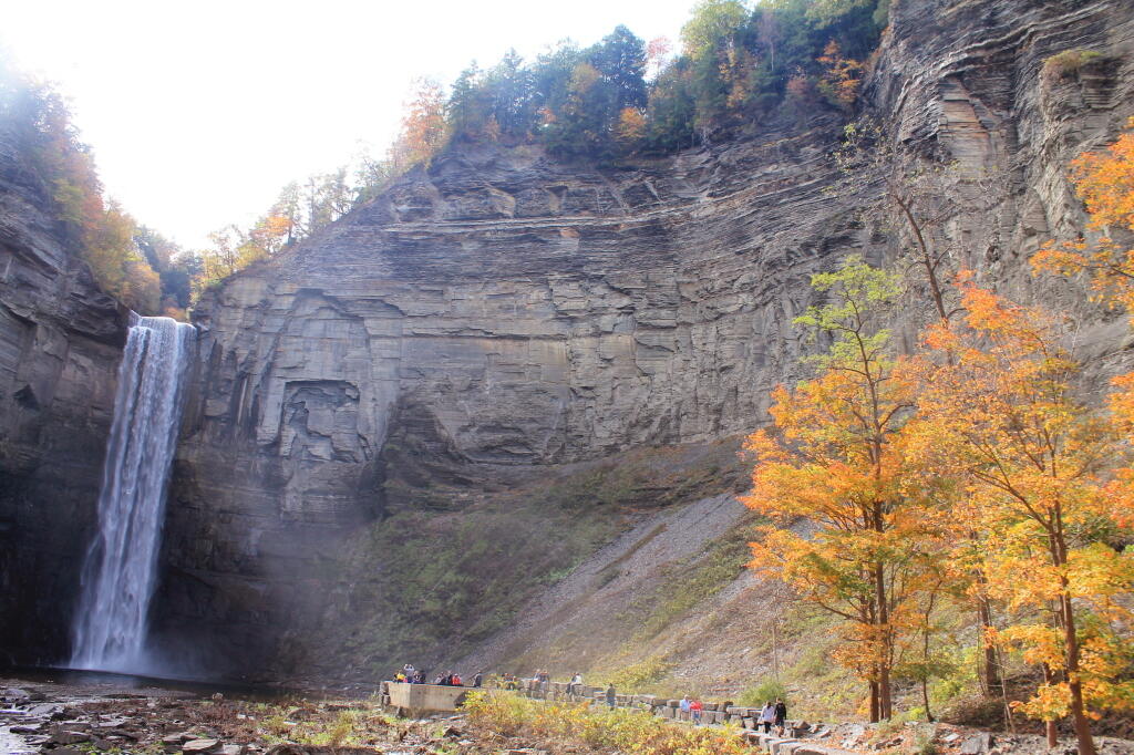
Drove down to Trumansburg and then to Taughannock Falls State Park’s Gorge Overlook. The main overlook, next to the parking lot was a complete tourist trap, with dozens of tourists, many obviously traveling a long ways to get there, crowded around the overlook deck, as everyone – myself included – scrambled to get that one trademark photo of the falls. I was glad to get away from that overlook.

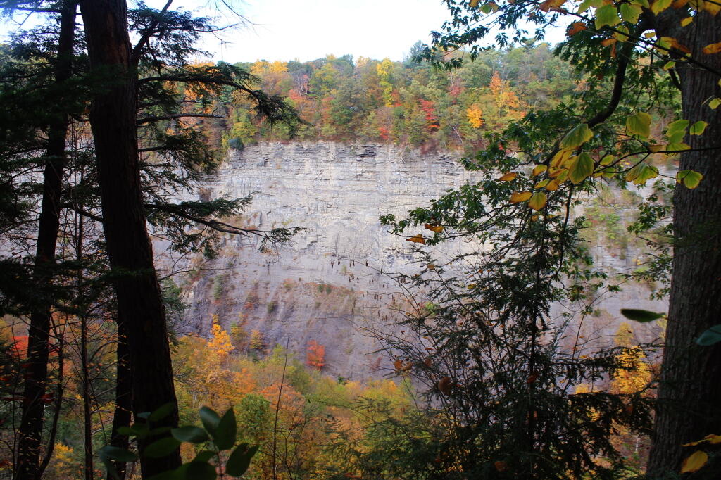
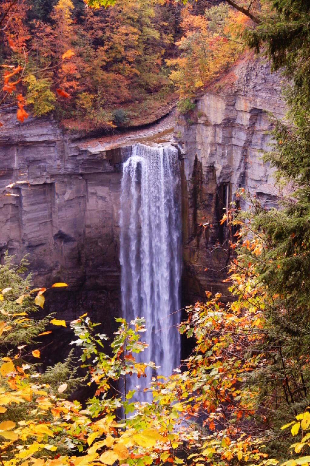
Started along the North Rim trail along the gorge. I was looking for secret places to find isolated, beautiful views of fall, and the hike did not disappoint. I found one perfectly shrouded in colorful fall leaves, but with a view of falls. I snapped a picture. I continued along, and found some good views in the gorge, showing the depth and width it below the falls. Then I ran into Robin Smith and his wife – Twitter and Facebook friend. Chatted for five minutes, then I proceeded on.

A Secret Spot for Observing the Falls

In part, I was in a bit of a rush, trying to find a place to take a piss. All that coffee plus maybe an eye-opener drink wasn’t great for the bladder. There also were a few to many people around to do it right on trail, especially being so close to the road most of way. But eventually I did it, and was on my way.

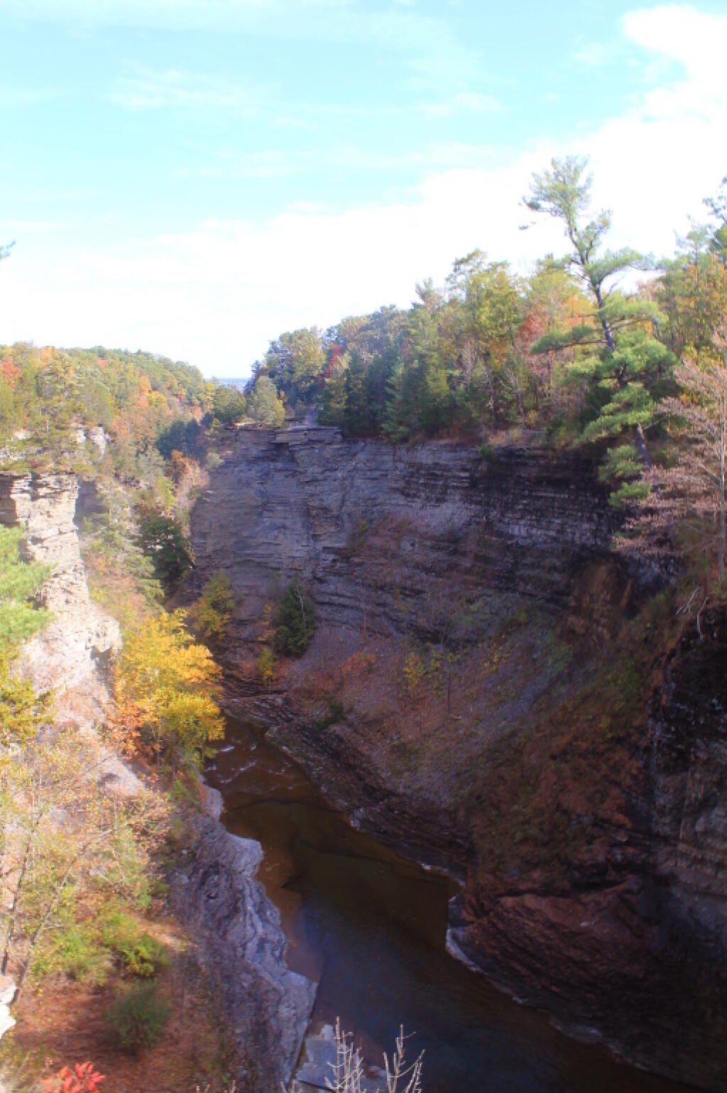
The North Rim trail runs into the Black Diamond Trail, which crosses an old railroad bridge, converted to a hiking trail via some concrete slaps and fence placed on it. The high, old railroad trestle provides views of a smaller, upper waterfalls and the little known, but quite impressive upper gorge. The upper gorge, above the falls, is a deep, narrow, but beautiful gorge where the Taughannock Creek runs, cutting deep into the valley. For the best views, you have to take the South Rim trail, which is what I took next.

Upper Gorge

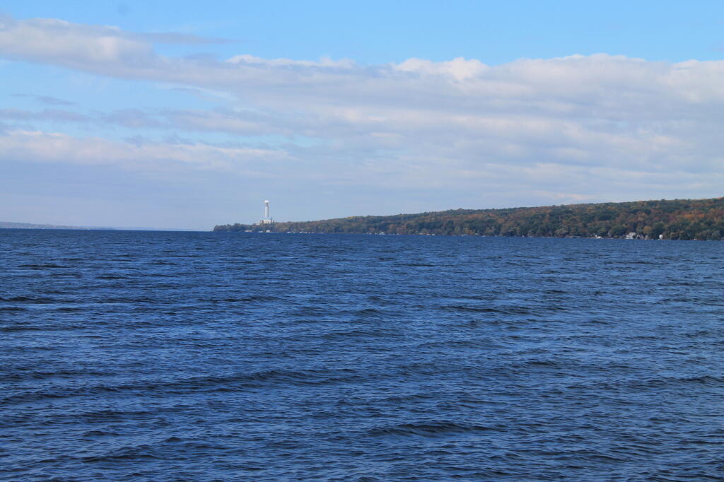
The South Rim trail is impressive. There is the big parking lot from the Gorge Overlook on Taughannock Road, or you can alternatively take Gorge Road, and halfway down it, park in the smallish pull-off. Don’t miss it though. If you follow the South Rim Trail, there are some views of the gorge below the falls, and one view of the gorge, extending out to Seneca Lake.

I hiked back to my pickup truck, and then drove down to the main part of Taughannock Falls State Park. I parked in main portion of the park, rather then the always crowded and tight to park in lot next to the trail to Gorge Trail, which runs inside the gorge to below the falls. Not wanting my truck damaged by an overly excited tourist, I figured it’s always safer to park in an empty lot. Walked down to Seneca Lake, and noticed how green the trees were still on the lake shore. This contrasts to sections of US 20, the previous day, where the colors were burnt out to say the least. I was also surprised to see the AES Cayuga in Lansing, across the lake, burning coal today. They must keep in standby for when the line frequency drops to low locally. Stopped in the bathrooms at Taughannock Falls State Park, which were just very gross – clean, but rusty and in old shape – like so many state facilities.

AES Cayuga Coal Plant in Lansing

Then I hiked along the gorge trail to the fall, taking several moments to stop and take photos, and explore the river bed. I had previously been here, in mid-July, but it certainly was different now that fall was in full swing. The trail was popular, and in some places, downright crowded, but the riverbed, at least as far as one could hike, wasn’t nearly as crowded. The gorge walls were pretty with the fall leaves, although by the time I got the falls, the sun was right over the top of the waterfalls, so most of the pictures of the falls came out pretty poorly.

The Falls From Below

Headed back to the truck, then drove down to Ithaca. The traffic was as awful as always in that city. I had stop at the pharmacy, then it was off to Buttermilk Falls State Park. I was surprised they were still charging – the last day must be Columbus Day. By now, it was too late to keep Robert Treman State Park on my list; that will have to wait until tomorrow. This time, I intentionally hiked up the North Rim trail, up to West King Road, then down into the gorge. Last November, I hiked up the gorge, so I figured it would be interesting to go the other way this time.

North Rim Trail

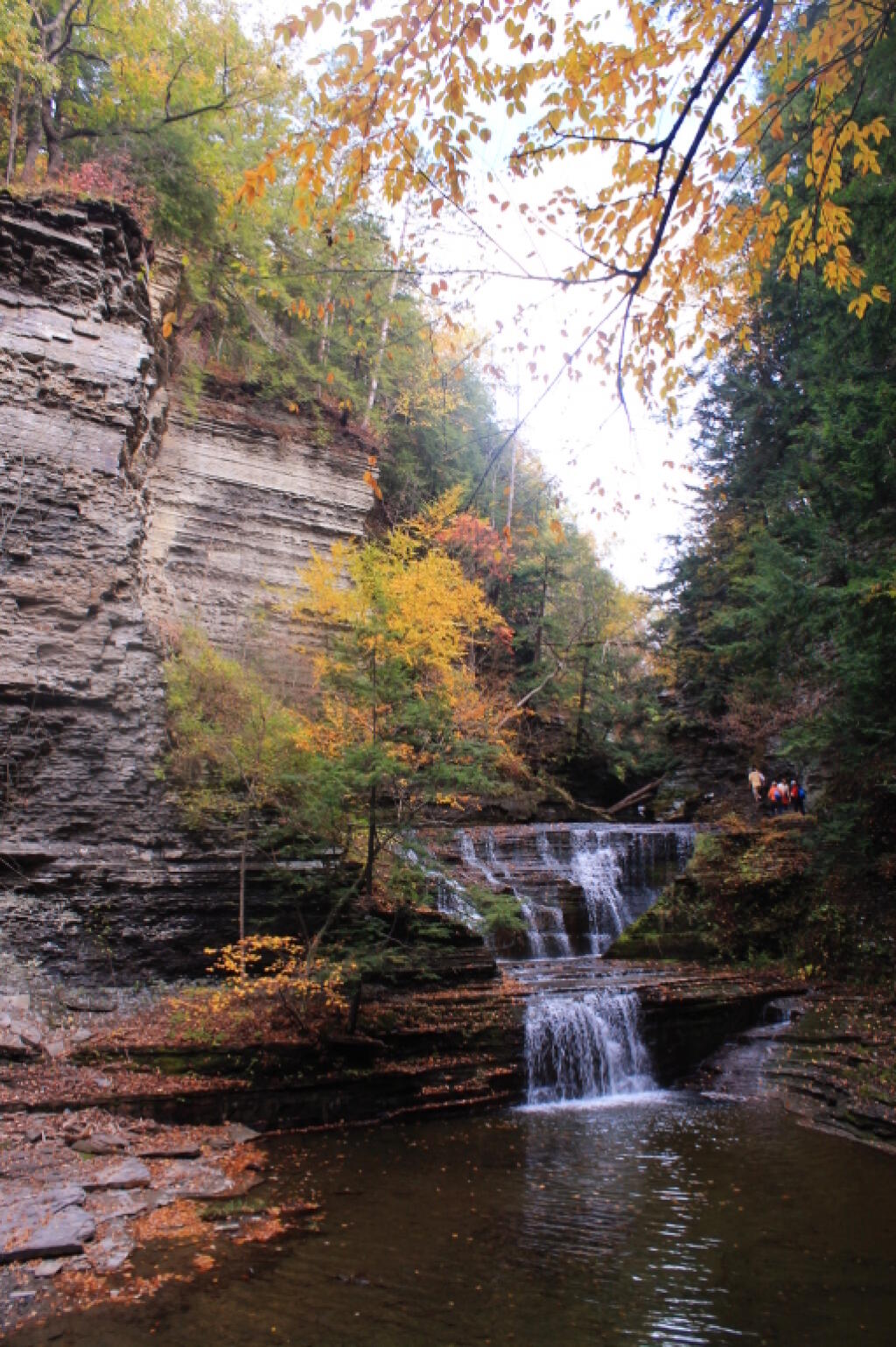
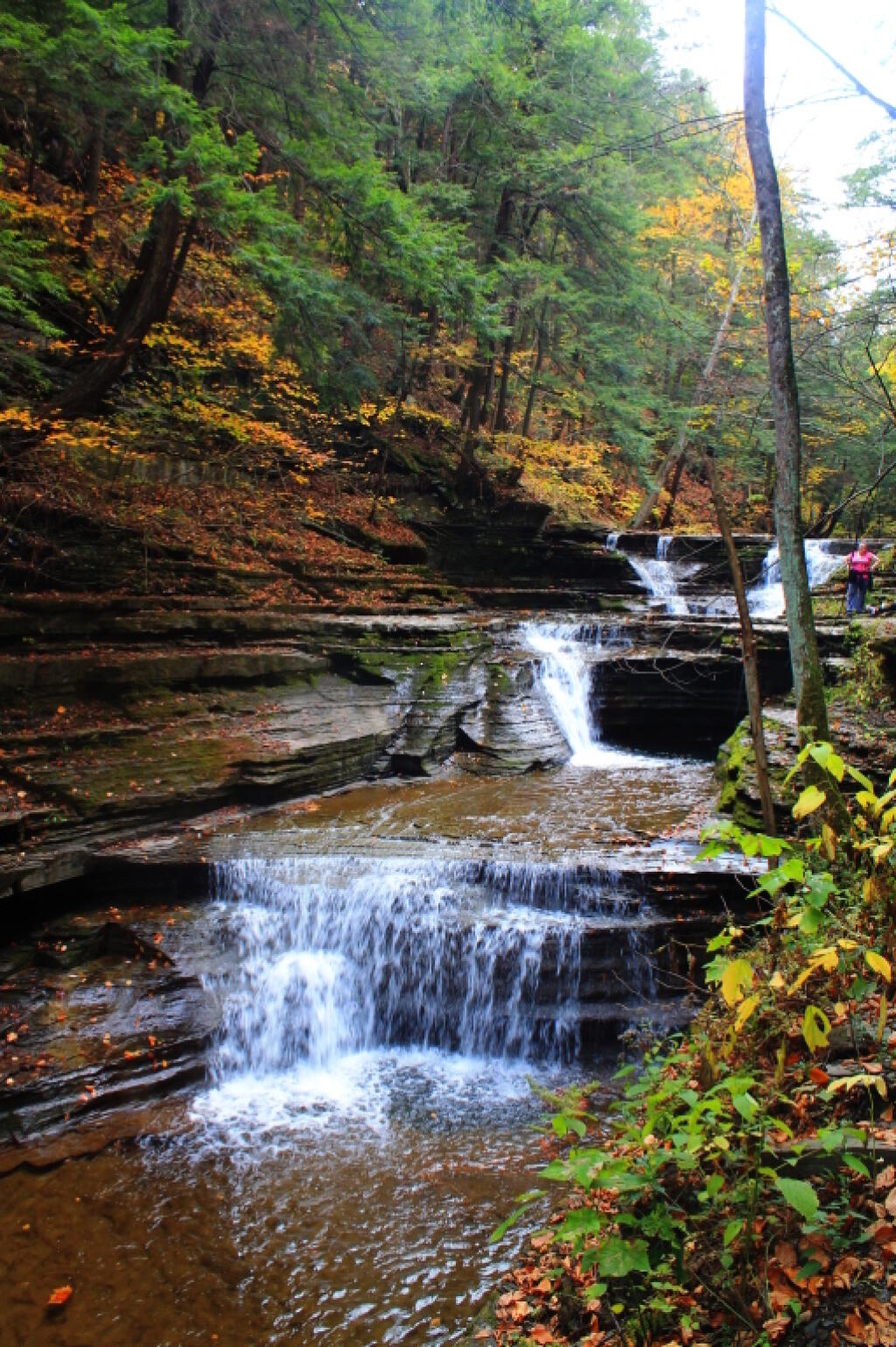
Hiking down Buttermilk Falls was scenic, but not as a scenic as I remember it. Maybe after all this time hiking in gorges and exploring the gorges, they also start to look a bit alike – and we are only day two. It’s more scenic then most of other glens, besides Enfield Glen and Watkins Glen, but it’s still a step below them. The gorge swimming pool at the bottom of the gorge it was nice.

 An Autumn Afternoon at the Falls

It was a good hike, until descending the slippery stairs, I slipped, and dropped my camera, and it fell like 20 feet, hitting a dozen of the stone stairs before coming to a rest. The fall did some serious damage to the camera, as one might expect. The protective UV filter was shattered, the case was cracked up the lens. I was not pleased, to say the least. There may have been a few cuss words. But so be it. The camera was under a drop warranty that I bought when I got it, but I was more worried that the fall would damage the camera, so I would be out of luck for taking more pictures for the rest of the trip.

I might have been pissed at myself for my careless handling and missteps, for a little while, cussed myself out. I was less pissed when I discovered the lens wasn’t destroyed, only the $5 UV filter. The camera seemed to continue to work well, although the flash doesn’t always pop up – a feature I almost never use at any rate. The camera seemed to work okay, and I picked up a second UV filter at Walmart later in the evening. Later in the week, I noticed the automatic focus was sticking – fortunately I have a drop warranty on the lens too. One of these days, I will get around to sending the camera back to the factory for warranty repairs or replacement.

Nice Little Falls

Once I got over the shock, anger, and amusement of smashing up my camera, and got the shattered UV filter off the camera – it took a little fiddling, as the impact of the fall bent the ring – I enjoyed the remaining hike and vistas of falls. Snapped several other quite nice pictures. Went to Walmart to pick up a few supplies, then back to Finger Lakes National Forest, for another evening at camp.

When I drove up to the campsites on Chicken Coop Road, I was pleasantly surprised to find out the campsite I like was vacant. Whoever was the night before packed up, and there was no mess left over. Hung the flag up, set up the table, hung lights up, and gathered wood. Started a campfire, cracked open a beer, had soup and sandwitches for dinner. The colors in the woods were about peak here. Around 6:15 PM, walked across the road, to take a closer look at the cows grazing in the pasture.

Pasture View from Campsite

I stayed up until 8:15 PM, when it started to sprinkle, and quickly turned to a heavier rain, and decided it was time to seek shelter under the truck cap. Again a bit annoyed about the rain, and my stupidity about not setting up a tarp earlier in the evening. I listened to the radio for a bit, played on my cellphone, and retired for the night. The good news was that by morning, the rain would have passed, although the skies would be cloudy, damp, and the temperature only around 47 degrees.

2011 Pictures of the Year

January.

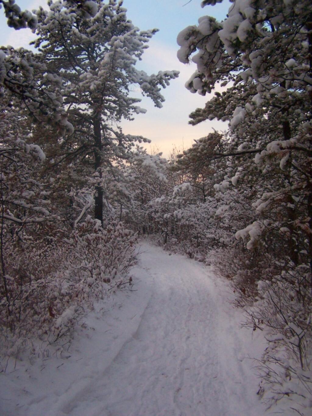
Walking Along the Trail

After a fresh snow fall it was a winter wonderland in the Albany Pine Barriens, a forever wild ecosystem on the outskirts of the city. It felt like one was walking through a marshmallow forest.

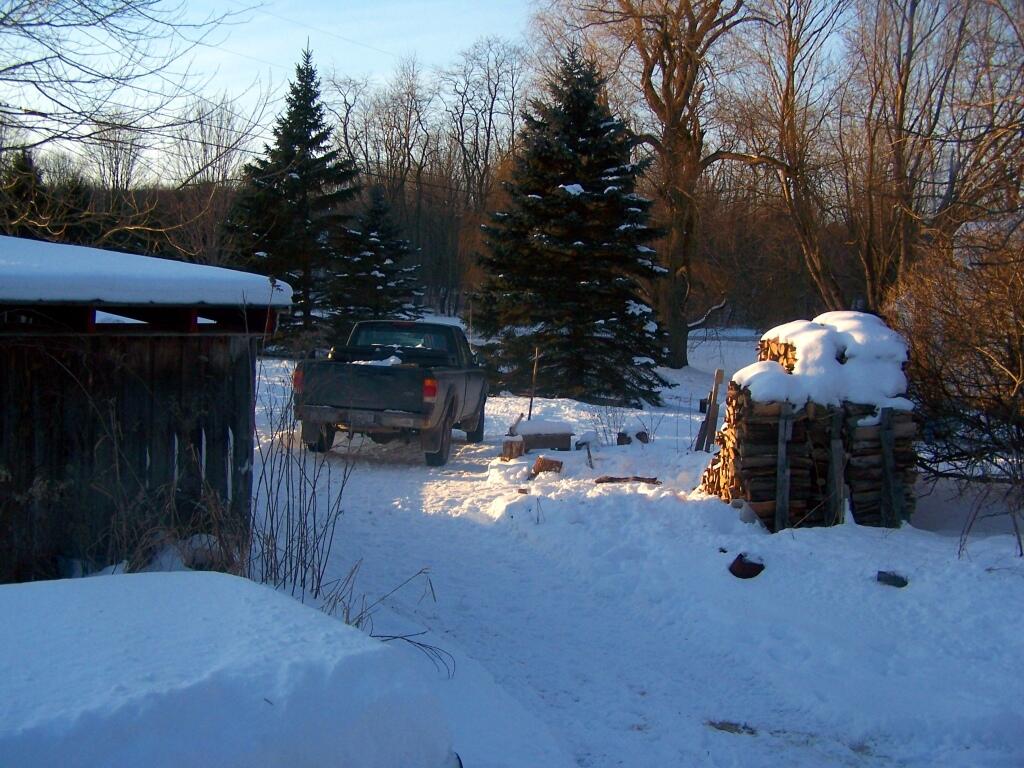
Truck By the Woodpile

A cold winters day at my parents house in late January, after a long cold spell that never seemed to want to end.

February.

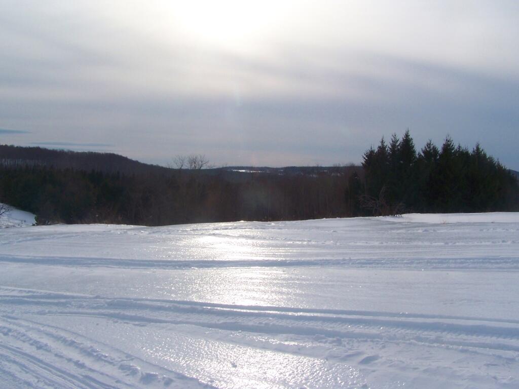
Sheen of Sun on Ice

A icy sheen shown on the snow at Partridge Run, as I went for an afternoon walk with the dogs up there in the middle of the month.

Descending Bennett Hill

Snowshoeing back down Bennett Hill in late February.

March.

Irish Hill and Beyond

A recently logged section of Cole Hill provided breath-taking views of Irish Hill and the Fox Kill Valley down in Berne.

Thatcher Park Cliff

What a clear spring day up at Horseshoe Clove at Thacher Park. Warmer, nicer days can’t be far way.

April.

Shallow Pond

April 9th was the first day I got out camping in 2011. Spent the day exploring Rogers Environmental Center, camped at Moscow Hill Horse Assembly Area.

Looking Across the River

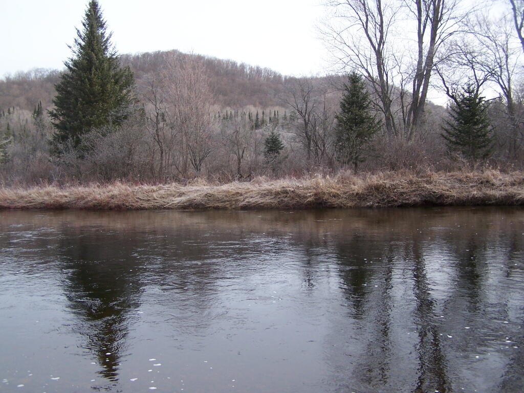
It may start to warm up earlier in lower elevations, but winter is still very much a force in late April in the Adirondacks. The East Sacanadaga River on this morning looks icy and cold.

May.

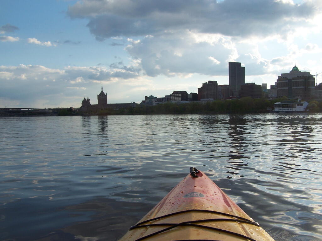
 Albany

There’s Albany! From my kayak. I kayaked up to Downtown Troy from the Corning Preserve.

Towards Sand Pond Mountain

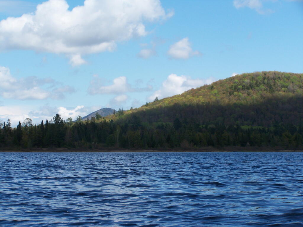
Spring finally comes to Adirondacks by late May. Paddling around Cheney Pond, looking towards Sand Mountain in the distance, on the other side of Hoffman Notch.

June.

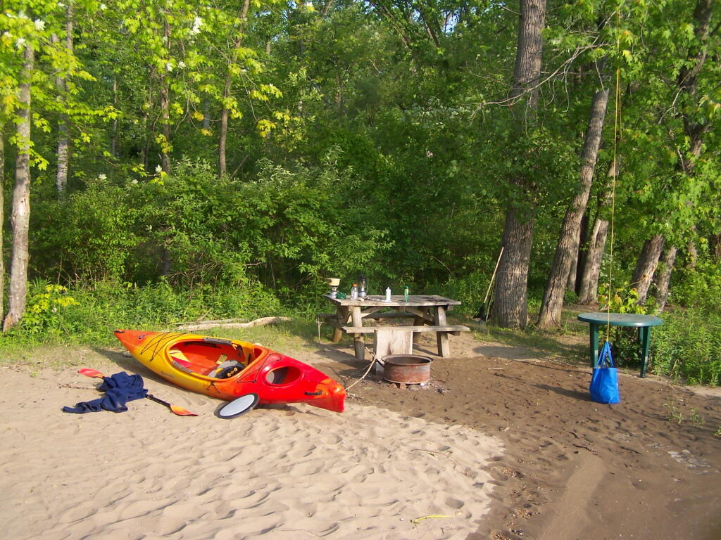
Campsite in Morning

Kayak camping on Stockmans Island in the middle of the Hudson River. What an adventure, one I picked on a night when they had fireworks up at the Coxscake Town Park.

Foam from White Watch on Oswegatchie

Oswegatchie River up in Watson’s Triangle in Adirondacks. There are few places as remote as this that you can drive on largely unmarked and rarely traversed back country roads. Watson’s Triangle is a place far of the beaten path.

July.

Cloudy Day

A dramatically cloudy day, looking down towards Tupper Lake from Mount Arab.

Falling Water

Cooling off at the Potholers on an oppressively humid summer’s day.

August.

Wider But Shallow Section of Beaver Creek

Exploring Beaver Creek at the Brookfield Railroad State Forest in Brookfield, NY.

Beaver Creek North

Watching the fog burn off Beaver Creek at Brookfield Railroad State Forest on a summer morning..

September.

View of Lake from Campsite

A beautiful late summer morning at North Lake in Adirondacks. North Lake is such a jewel, especially as you head farther north on the largely undeveloped portion of the lake.

Looking Back to Wakely Dam

Fall was well underway, and even past peak at Moose River Plains by September 20th.

October.

South-West from the Top

Second week of October, I went up to the North Country for some leaf peeping, hiking, and kayaking. The colors may be faded in Central Adirondacks, but still were good in lower elevation parts of the Northern Adirondacks.

Snake Mountain 5

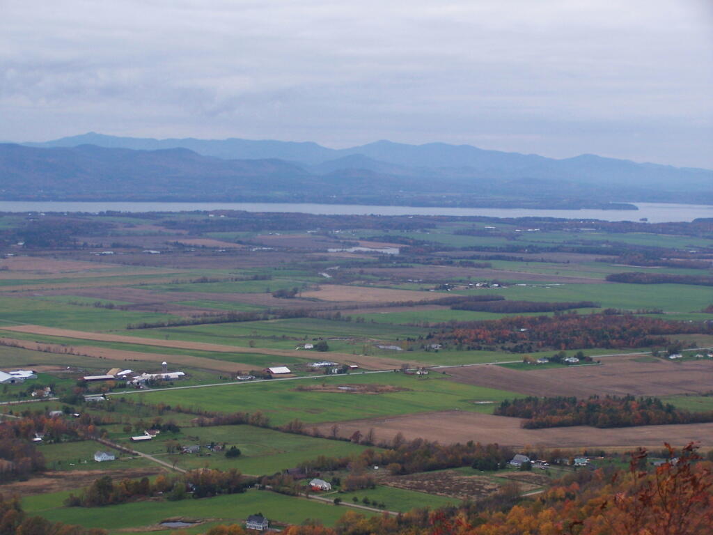
And later in October, I drove up to Snake Mountain in Vermont, overlooking the Champlain Valley and the Adirondacks. Colors lasted the longest

Leaves on Snow

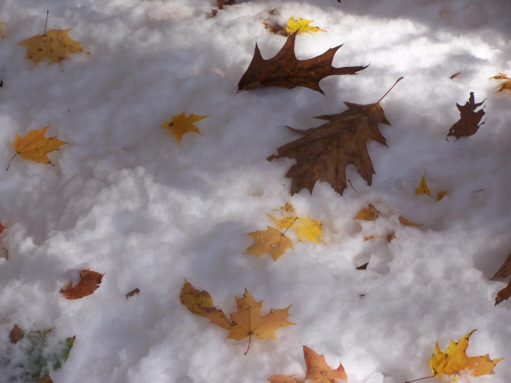
And by October 30th, we had snow, actually several inches, as seen up at Lake Taghkanic State Park.

November.

Powerlines Leaving the Hydro Dam

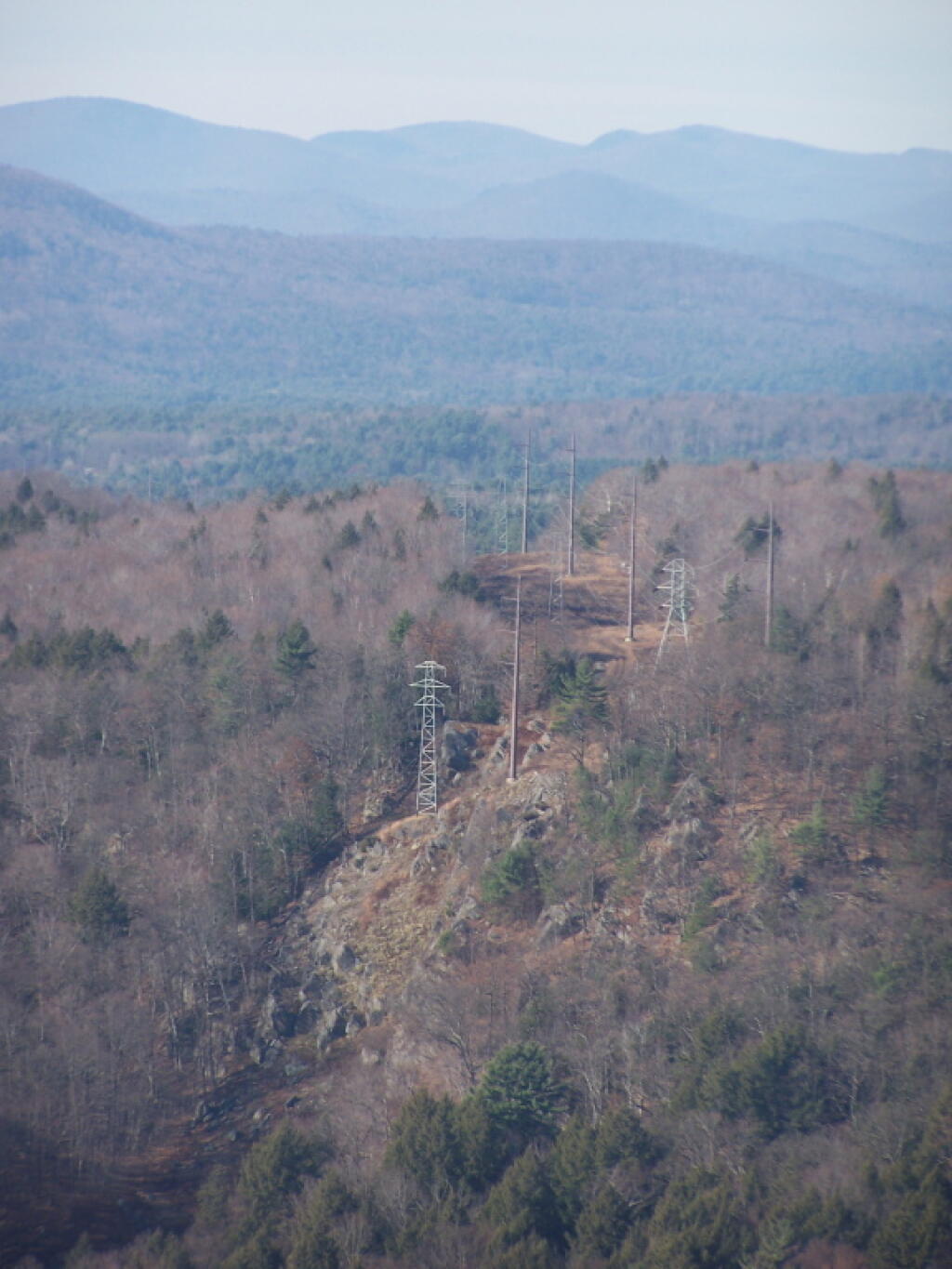
In November I visited Monreau Lake State Park for the first time, and checked out the Palmerstown Ridge above the Hudson River and Spier Falls. These power lines transfer power from Spier Falls Hydro Dam over to Corinth.

Durham Area

I also hiked up Windham High Peak. I hadn’t been there in many years, and it was interesting to look down at Preston Hollow and Medusa, far, far below.

December.

Rays Over Wilcox Lake Wild Forest

On Christmas Day, I hiked up Hadley Mountain. While cloudy and cold, it was very beautiful.

Ice Covered Pond

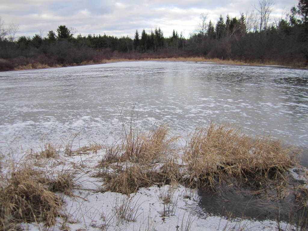
While the pond at Thacher Park was frozen, there still is very little snow locally.

Making Maps of Round Lake Wilderness in QGIS

You are thinking about going to the Round Lake Wilderness for a Canoe Trip. You would like a map, but don’t want to spend $10 bucks to buy one, when you get a better looking map for free with more accurate data from the NYS Department of Environmental Conservation and NYS Department of Transportation, using a free GIS program known as Quantum GIS or “QGIS” for short. When you are done with this tutorial, you will end up with a map that looks like this.
Fermented

QGIS like all GIS programs can seamlessly glue together multiple topographic quadrangles (such as the Sabbist and Little Tupper Lake quads needed for this map), and then superimpose campsites, trails, and other data you need β€” that might not be available on a typical topographic map. As your printing your own map, you don’t have to worry about keeping it dry or keeping it from getting damaged.

All GIS software is highly technical and a bit complicated to use. Putting together a good map is a fair bit of work, but once you master it, you will be able to put together quite nice looking maps. I hope this rather length fodder article will send you on your way to making good maps of NY State.

Step 1: Download and Install QGIS.

First you need to download a free copy of the open-source Quantum GIS program from QGIS.org. It runs on Windows, Linux, or Mac OS X and is relatively easy to install. Then open QGIS on up. It will look something like this, depending how many plugins you have installed and your version of QGIS.

Hint: Save your work regularly when working in QGIS by going to File -> Save Project menu. It’s always good to save regularly in any GIS program, as your dealing with large files, and its always possible that QGIS could crash, and you would lose your work.

Step 2: NYS DOT Topographic Index.

Next, you will need to get some data to fill up that blank screen. You will probably want to go the NYS GIS website and download the 7.5 minute topographic index (aka 1:24,000 scaled topographic maps). This “Shapefile” β€” a file containing data used to draw shapes, dots, or lines in a Geographic Information System (GIS) program β€” contains an overview map of NY State, with boxes representing each of the 965 7.5 minute topographic maps that make up NY State.

NY 1:24,000 Topographic Map Coverage Index Shapefile. (90 KB) Contains the outlines of all 965 7.5′ topographic maps in NY State. Freely available from NYSGIS Website, under the Digital Raster Quadrangles.

Download, expand, and open the NYSDOT Topographic Map. You can open it in QGIS by using Vector -> Add Vector Layer.

7.5 minute topographic maps are the most accurate topographic maps typically available. The NYS Department of Transportation provides high-resolution, 509 DPI, scans of all 965 topographic maps it creates. Each scanned in map is in a file called a “GeoTIFF”, and is divided into 3 or four files, consisting of each color used on a standard DOT topographic map.

Step 3: Projection.

It’s Very Confusing, BUT VERY IMPORTANT!!

When you load that 7.5 minute topographic index into QGIS, you might be surprised to see how that map is distorted, and does not look like the map above. This is because the earth is not a flat surface, and there are many ways to draw a map of the earth, to reflect the curvature of the earth. We call that the projection of the map β€” how we project a curved surface on a flat sheet of paper or a flat screen.

There are actually thousands of ways to project the surface of the earth, such as unprojected latitude and longitude (called WGS84) that squashes north and south on maps, regular Mercator which puts things on an even latitude or longitude on a flat plain (NY State appears with a flat border along Pennsylvania at the 42nd parallel), and Universal Transverse Mercator (UTM), which most accurately shows distance and relative position of items, at the cost of over distance appearing somewhat distorted.

For all your New York State mapping projects, you are only going to use one projection β€” Universal Transverse Mercator (UTM) Zone 18. This is one set in official state regulations as what all state agencies are supposed to use, and it’s what NYSDOT Topographic maps are drawn in. For your adventures in making maps for hiking, camping, hunting, fishing, and boating, your going to want to always use NAD83 / UTM Zone 18N in NY State.

Go to File -> Project Properties, and click on the Coordinate Reference System (CRS) tab. Browse through the list for NAD 83 / UTM Zone 18N. Click on “Enable ‘On the Fly CRS Transformation”.

Clarification. Then click the triangle next to Projected Coordinate Systems, then click the triangle next to Universal Transverse Mercator, then scroll down to NAD 83 / UTM Zone 18N (ESPG:26918). Alternatively on the search box on that same page, search for Authority: All, Search for: ID, and enter in 26918. QGIS will remember your settings and default to this projection for future projects.

To ensure everything is projected in NAD 83 / UTM 18N, make sure to Enable ‘On the Fly’ CRS Transformation. QGIS will automatically convert “Shapefiles” and other vector data into the proper projection. QGIS can not do this for scanned in images or similar “raster” data.

Check and recheck to make sure you did this projection step correctly. Otherwise, you will get messed up maps, and you will get lost. Confusing, definitely but the most important step.

Step 4: Now Let’s Load Some Data.

Shapefiles and vector data are all loaded in the same way. You download the file, expand it, and load it into QGIS. Here are some Shapefiles I recommend you download and load into QGIS:

DEC Lands Outlines Shapefile. (5.4 MB) Contains the outlines of all lands under the control and jurisdiction of the Department of Environmental Conservation. Does not include Town Parks, Canal Authority Parks, Parks Maintained by Office of Parks, Recreation, and Historic Preservation. Also does not include Conservation Easements. Freely available from NYSGIS Website, under the DEC Section.

DEC Roads and Trails Shapefile. (5.8 MB) Contains many of the roads and trails maintained by the DEC. Does not include local, county, or state roads, and in some regions of state, there is no trail data available. Freely available from NYSGIS Website, under the DEC Section.

DEC Physical Assets Shapefile. (0.2 MB) Contains many of the physical facilities maintained by DEC β€” specifically lean-tos, back country campsites, boat launches, fishing docks, firetowers, etc. This is available using a Freedom of Information Law Request. The DEC will send it to you in 5 days, if you email the Records Access Officer. I have put a copy of this file on my blog, of the exact form I got it back from the DEC, to allow you to avoid unnecessary FOIL requests.

OpenStreet Map: NY State Shapefile. (105 MB) I found this some time ago on a now defunct website and have made several modifications to it over the years. It is freely available data, originally based on US Census TIGER lines, but with certain modifications, such as removing certain roads from wilderness areas. One should consider it public domain as it’s just US Census data, and you are free to edit and redistribute it. You can download my copy from this blog.

Once you load the data into QGIS you should be able to zoom in and explore the map, and get a general idea of what area you are interested. The random colors chosen by QGIS to display this data are pretty hideous, but we will change them in a bit.

Zoom into the area you interested in, by looking at the general outlines of the public lands. You can use the maganifying glass to zoom in, the hand to move around, and the cursor next to the (i) icon, to display information about various features.

Step 5: NYSDOT Topographic Maps.

Next we need to figure what NY State Department of Transportation (NYSDOT) 7.5″ topographic maps we will need to make a “base” map of Round Lake. Click the cursor next to the (i) icon, then onto the the map, where you need to figure out what topographic map you want. As I see from the results, I will need the Sabbatist Quadrangle (among 4 others nearby), which is available from NYSGIS.

NYSDOT Topographic GeoTIFFs at 1:24,000 Scale. (2 MB per quad) There are 965 quads in NY State. The NYSDOT topos have the most up to date roads on them, and come with each color layer seperate. The average file is about 2 MB. I downloaded the whole set from their FTP site, but you can download only the ones you need at first, but having the full set sure is convient.

NYSDOT Topographic Maps are scanned at 508 DPI, and are georeferenced NAD 83 / UTM 18N GeoTIFF images, that QGIS will automatically position on map for you to create a seamless map across data layers, as long as you properly set the projection in QGIS in Step 2. Maps will line up perfectly, even a certain map consists of many different quadrangles.

I do not recommend the USGS Digital Raster Graphic (DRG) Quadrangles. They are typically older, use the obsolete UTM 18 / NAD 27 coordinate system, and do not have individual files for each color layer. Moreover, the 1:100,000 Digital Raster Quadrangles and 1:250,000 Digital Raster Quadrangles, do not have the needed resolution (detail) for doing hiking or other outdoor maps. If your doing a broad overview maps β€” like for spotting peaks off a firetower, they might be useful, but not for general use.

Each NYSDOT Topographic Map consists of 4 different black and white GeoTIFF images. There is no transparency data in this maps, nor any color in them. You are free to set transparency or color as you please. They are as follows:

  • plan – Man made features and labels such as roads or mountain names. May also include unnavigable streams, borders on lakes, etc. Anything that would be printed black on the NYSDOT topographic map.
  • hyd – Lakes and navigable waterways. Anything that would be printed light blue on the NYSDOT topographic map.
  • topo – Topographic lines showing general elevation and slope. Anything that would be printed light brown (color of topographic lines) on the NYSDOT topographic map
  • bua – Built Up Area, background. Areas that have a lot of development, such as cities. Anything that would be printed light pink or yellow on a NYSDOT topographic map. I usually don’t use this layer, not found in rural quads.

You can load them using the Layer Menu -> Add Raster Layer, menu item. Using the control key, you can load multiple files at one. I try to load all the layers I will need at once, as it can take time to load layers, and it’s good to get it done at once.

Remember, these are scanned in images or pictures of the topographic maps, they can not be easily edited or queried in QGIS. Zoom in too far, and they become pixelated. Yet, they usually provide an excellent back drop for outdoors maps.

When you first load one of these maps, you will see a picture like this. The topographic layers for some reason chose to load first, and appear on top, and with no color or transparency set, they are pretty useless out of the box.

Typically you will want to arrange the topographic layers, so that the plan layers are on top, followed by the hyd layers, then the topo layers, and finally the bua layers. With the plan layer up top, the map will start to make a little bit more sense, give you a better idea if you loaded the proper quads.

Next you will want to go through every GeoTIFF Topographic Map layer you have uploaded, and change white to transparent. You do this by right clicking on each layer, and choosing Properties. Then click on the Transparency tab in the Layers Properties dialog that comes up.

Double click on -32768.00 on the Indexed Value column, and change it to 0. This will make all white portions of the map 100% transparent. NYSDOT Topographic Maps do not contain any useful transparency data, so you will want to make all white areas in the map transparent.

If you are working on a hyd layer, topo layer, or bua layer, you will want to go the color map layer, and change the color for value 1.00000 by double clicking on the color next to it. Black is the default color, but that isn’t helpful except for the plan layer. You need not change the 0.0000 color, as you have already set that to be transparent, and it will not be visible on the map.

Then click OK, and the dialog will close, and transparency and colors will be visible on the map layer you just changed. Besides those awful background colors, the map that is being displayed starts to look a lot more useful now.

Right click on NYS_QuadIndex and choose Properties. Go to the Style tab. While we really do not have to use this layer any more, and could just disable it by unchecking it, I like to use it as a yellow background to indicate non-DEC lands on a map. To do this, click on the color box next to Fill Options, and set it to light yellow, as I did, or whatever color you want to represent private lands. Then go to Outline Options and choose an invisible line, to hide the quad boundaries.

It’s now starting to look a little better.

Now it we do the same with DEC Lands Outlines, setting it white or whatever color you prefer. Make sure it’s dragged above NYS Quad Index on the Layers, but below the Topographic Maps. I prefer no borders to be shown, as I find DEC boundaries to be confusing, as often Wilderness borders Wild Forest or Primitive Areas, leading to strange lines appearing in the maps. If you care about such borders, do leave them on though.

Now you got a map that is almost ready for use, that is once we delete roads that we know don’t really exist in a wilderness area, stylize campsites versus other facilities, stylize roads versus hiking trails, and maybe add some labels.

Step 6: Stylizing Roads versus Trails.

I like to make hiking trails a dashed black line of 0.75 map units, and roads a solid black line of 0.75 map units. This ensures on black and white printers one can tell the difference. To do this, right click on DEC Road and Trails, then the Style tab. From here, choose Unique Value from Legend Type.

We will use the MOTORV field to decide if something is a road or a hiking trail. Obviously, if this was a winter map, we might change this field to SNOWMOBILE or X-COUNTRY SKI. This field contains, ‘Y’, ‘N’, ‘M’, ‘U’, and sometimes ‘YES’, ‘NO’, depending on the forest ranger that inputed the data. Set the style as you wish.

Choose classification field MOTORV, then click the classify button. All of the different possibilities for roads or trails allowing motor vehicles will be shown. From there, set the colors and line styles as you so choose.

Step 7: Removing Invalid Roads from NYS Highways Shapefile.

If you use the OpenStreet Map Highway file future on the page, you will see it often has lines that overlap DEC hiking and truck trails, and has old woods roads or other invalid data, that you will need to delete to clean up your map, and avoid confusing users. It’s pretty safe to delete all highways from Wilderness-areas, unless you are sure that such a road actually exists.

You need to right click on New York Highways Shapefile, and choose Toggle Editing. A pencil will appear next to that layer. Then use the select tool on the second toolbar, in the upper left (selected in box below). Highlight the streets you want to delete, and they will appear yellow.

Use the Delete Selected button to delete the roads you have highlighted. Notice buttons nearby that allow you to split features into multiple features. These are helpful if you know only part of a road has been closed or abandoned, and you want to remove only part of the road from your map.

I zoomed in on Round Lake to search for other invalid roads I wanted to remove. Looks okay now, although I still question some of those roads located in Whitney Headquarters. Having not been there, I can not say which ones have been gated or abandoned, so I will leave them on for now. Right click on the NY Highways Layer to save your changes to that Shapefile.

Step 8: Stylizing Assets.

Next we need to change the various DEC Physical Assets from a single color dot, to icons that represent the asset. With the current map, we can not tell the difference between a campsite, a parking area, or trail register. This could be rather confusing for anyone using our map.

This is very similar to changing the symbols for roads versus hiking trails in the previous step. Go back to the properties dialog. This time, we want to stylize things based on Unique Value, then Classification field Asset. Then, click Classify. This will create unique color for each icon. By browsing the “Point Symbol”, you can now give primitive campsites proper looking icons. Don’t forget to set the size. I usually set icons at Size 3.0 or 4.0, but it varies a lot on the final scale of the map.

Finally, I zoomed in to check on my work. Wit the icons set, we have a pretty nice looking map. I can spot the campsites, parking areas, trails, and the private property-public lands boundaries. I know where to put in my kayak, to explore Round Lake. It’s too bad, I don’t know which if any roads to remove from Whitney Headquarters, so I’ll have to go in person if I want to correct the map.

Step 9: Adding Labels to Trails and Roads.

Yet, I would also like to see some names on the roads and trails. Select the DEC Trails layer. Go to Layers menu and choose Labeling. From here, click Label This Layer, then choose Fields with Labels and select Name. The default style of 12 point fonts is almost always too large for most maps, a font size between 5 to 7 points is what you mostly likely will use. Then select, Buffer to create a small white background around each label. This is usually necessary to make your labels appear readable on the map.

Then click the Advanced tab. The default placement for labels is Parallel, which labels the largest amount of items, but doesn’t look very pretty. Curved is the prettiest, but it will not label particularly twisty lines. Priority controls which labels are most important if you have multiple layered roads. I usually set NYS Highway Shapefile to a low priority as the underlying topos usually also have road names, and trails to a much higher priority.

So now you should be set with labels. You have to do this with each layer with labels, such as the NYS Highways layer. You can do this also with the assets layers, although I generally do not bother, as I don’t really care about the sometimes lengthy names the DEC gives campsites.

Step 10: Printing and Making Images to Export.

Looking at a map in QGIS is kind of fun, but pretty useless when your on the trail. Go to File -> New Print Composer. A dialog like this will appear.

Next, you will want to change the paper size to something more reasonable then A4. Most likely you’ll choose Letter-sized paper. Below that set the resolution. Choose the orientation most appropriate for your map, I often use Landscape. To get high quality map print outs, you will want to set the the quality box somewheres between 300 to 500 dpi. Even if you are just exporting as a picture, it is good to preserve the resolution for future printing.

Then click on the canvas icon (circled in blue), to draw the surface the map on your canvas. This will provide you a canvas to draw on your page surface. You may wish to click “Snap to Grid” and set “Spacing to 5.0” to make it easier to line the canvas up. Click the magnifying glass, with the plus sign or the icon directly to the left of it, to expand the window so it’s easier to work on the canvas. This doesn’t change output, only the display on the screen.

Next, click Item tab, and then the Extents label. This will bring up the map extent box. The extents of the map will be listed in Northing and Easting, a series of large numbers that tell you how many meters you are North and East of the Greenwich, England. This is the standard form of measurement used by the Universal Transverse Mercator positioning system. Just click, “Set to Map Canvas Extent”.

Click Map. You can use the Earth on Hand Tool (circled blue on this screenshot), to move around the image on the map. Then you can go to the scale box, and adjust the zoom. Smaller numbers mean more zoom in. A standard topographic map is at 1:24,000 scale, however, I generally prefer a scale of 1:18,000 or so to make the map more readable. If you zoom in too far, the topographic map β€” a raster map, will become pixalated. In addition, if you zoom in too far in or out, you will have to adjust the thickness of trails on the map, and the size of icons.

Scale Bar, Labels.

The labeling tool is fairly self explanatory. It appears like a tag on the top of the screen (circled red). Use it to add labels, such as the name of the map and other details. Set the font, background color, and other options under the Item tab and the various lablels.

More challenging is adding a scale bar. Draw it using the scale bar tool (circled in green). The big hint here is that topographic maps are projected in Universal Transverse Mercator or UTM, which is a metric system. Each map unit is equal to one meter. Chances are you don’t care about kilometers. Set Map units per bar unit to 1610, which is roughly 1610 meters per mile. There are actually closer to 1609 meters per mile, but you will never notice the difference, as the map is at too large of a scale to notice that extra meter.

Then set the Segment size (map units) to a fraction of 1610. I typically do maps at 1:18,000 scale, so a segment size of 402.5, which is equal to 402.5 meters or 1/4 mile works perfectly. For larger maps, you’ll want to use a segment size of 805 meters (1/2 mile), or maybe even 1610 meters (1 mile).

Below Map units per bar unit is 4 Right segments and 0 Left segments. Set them as you please, but if your doing a 1/4 mile per segment scale, then the default of 4 usually works well.

Finally, don’t forget to type in a unit label. This doesn’t effect anything, but it’s nice for the user of the map to know what the scale is done in.

Step 11: Printing or Saving.

Most of the time you’ll want to save your map as a JPEG image, that you can open up at any time easily, add to a Microsoft Word document, email to friends, or print at a later time. I circled the save as an image button with a yellow circle. Assuming, you set the resolution sufficiently detailed (such as 300-500 DPI), you’ll get an excellent print out later on. Save your image and your done.

Alternatively, you can print directly from QGIS. I circled the print icon with red. I do not recommend this option, as it’s a pain to have to open up the saved QGIS project, and then the open print composer, every time you need a particular map, compared to having it saved. Even on fast computers, loading QGIS can take a bit of time to load and navigate.

Conclusions.

Fermented

If all goes well, you should end up with a map that looks like this map. Your styling choices may be different, but you will still know where to put your kayak out, when going up to Round Lake in the Round Lake Wilderness, and the location of all the campsites.

I appologize if I missed any major steps. There are a lot more you can do with QGIS, but I wanted to cover the major steps, and provide hints for some of the things I found most confusing about using QGIS when I started using it regularly about a year ago now. I hope this is helpful. β€” Andy
I Support the Wisconsin State Workers

I rarely write essays on specific political events. I normally stick to broad topics or areas I have personal experiences about. I do not have the experience or knowledge to really judge what is happening out in afar away in the upper Midwest State, known primarily for its agriculture and for its various progressive leaders over the years. Yet, I feel particularly strongly about this issue and think its important to raise my voice about it.
Listening to the Rachel Maddow Podcast of Fridays show I learned many things. I learned about how Wisconsin is a state with eight towns named Union, with a proud tradition of being a state where average people band together to try to get a better bargain for themselves. Wisconsin is a place where farmers band together to negotiate a better price with big processors, a place where workers band together to get a fair wage.

Off the Cliff

Wisconsin, as I learned from Rachel Maddow, is the state that literally brought us the weekend. Workers banned together to form unions and demand a 40-hour work week, and to make not just Sunday a day of rest, but also Saturday too. The demands of organized workers lead not just to better conditions and more time off for the organized, but for all Americans. The idea that most people would work on Saturday and more then five days a week is unthinkable today.

We live in a society of laws and rules, designed to protect both individuals and institutions alike. While pursuant to the US Constitution, each state has the right to dedicate what terms public employees operate under, with most states allowing public employees to organize and join unions. The unions push for a fair bargain at the table for the workers they represent. Management and political leaders choose how much money they want to spend at each agency, and they negotiate with unions based on the money available. If managers can not get the cost savings they desire, managers can lay employees off to reach their spending targets. Fewer employees means less union dues and less clout for the union.

Stream of Water

The Wisconsin governor has the right to lay off state employees after asking for concessions from the union. The established rules make it clear that this is the executives right to do. Certainly more workers at a discounted price to Wisconsin in this troubled economic times would be the preferred solution to layoffs. This should come from the established process, not by changing the rules mid-negotiations. Just like its not fair to change the rules in the middle of a game of Chess to benefit one side over another, its not fair for the Wisconsin governor to change the rules just so he can a better deal from public employees

Wisconsin State Employees should continue have the right to unionize, and the Wisconsin Governor should not change the rules just because hes not making his desired progress in negotiations. Thats only fair.