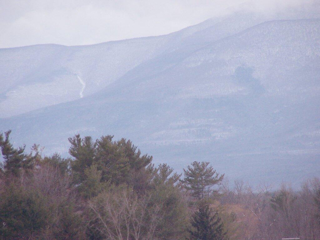
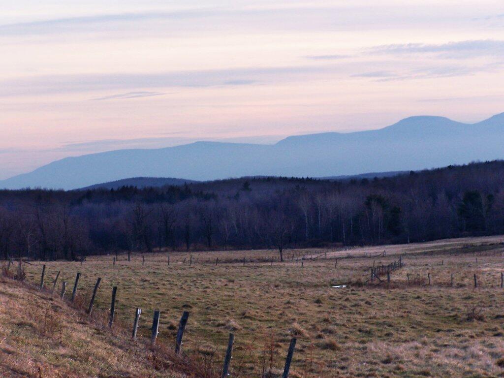
There are relatively few people who can say that they grew up in the shadow of the mountains. The mountains loomed large over the town I grew up, showing their large footprint as the rose out of the land just south of the town where I went to Elementary and High School.
While I lived most of my first 25-years of my life on my parents eight-acres, playing in the woods and in the creek, I went to school in Greenville, which is about 15 miles from the northern-most range of the Catskills. Those mountains loom large over the town as one proceeds south on the two-lane NY Route 32. At times, they look as though they must almost reach up to the sky, as high exists in the world.
They are an impressive feature. A routine feature to anybody who lives out by Greenville and sees them everyday, but still one that leaves a lasting impression on oneself. When I was younger I might have hiked the mountains a few times, but I never spent an extended period up there. I certainly could not have identified every peak from memory or been able to look up and know what it look likes on down. Today I can.
When I was younger I probably should have asked more questions and respected those mountains more. I should have paid more attention, and spent more time hiking them. Yet I didn’t. Regardless, those mountains, constantly hanging over the Greenville skyline had a persist ant impact on my life.
I decided it was a nice day out, and I wanted to be able to say I had gone up to the tallest peak in the Catskills, at 4,180 feet. According to Wikipedia, it may actually be somewhat taller then that (as much as 4,200 feet), but they’ve never done a bench mark on the top of it.
The first part of the trail is fairly steep.
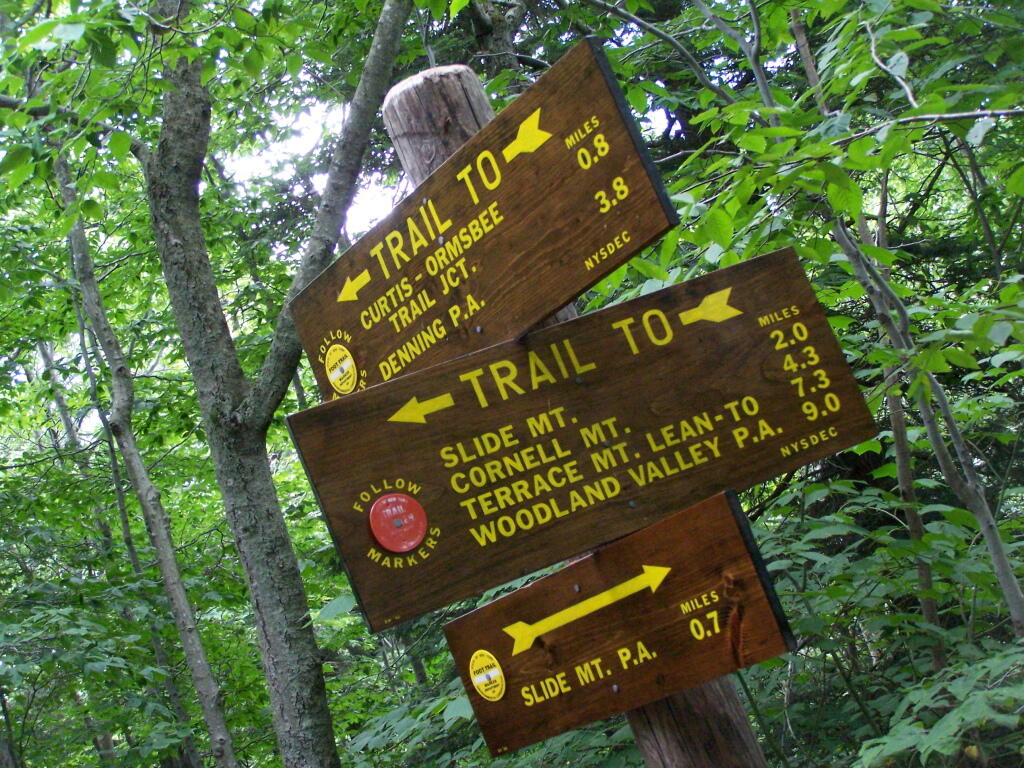
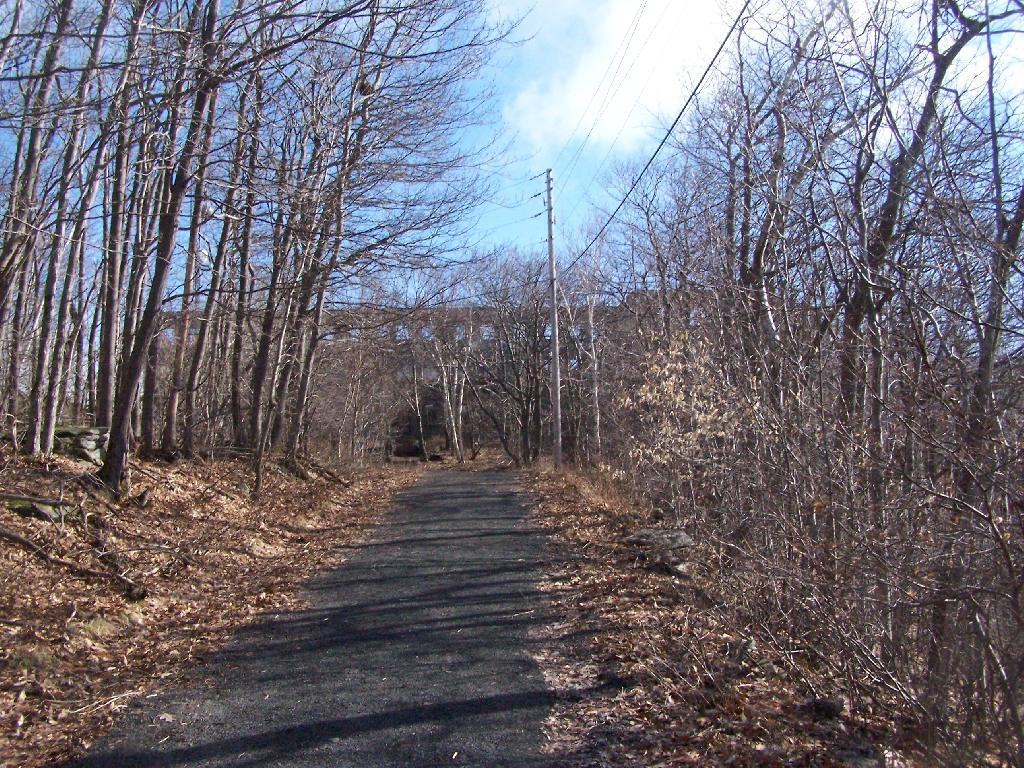
It climbs up to an old woods road, that is an easy walk and relatively flat, as it goes up to the Curtis-Olsbee Trail. You see the split between the old Jeep trail up Slide Mountain, and the the trail to Curstis-Olsmbee.
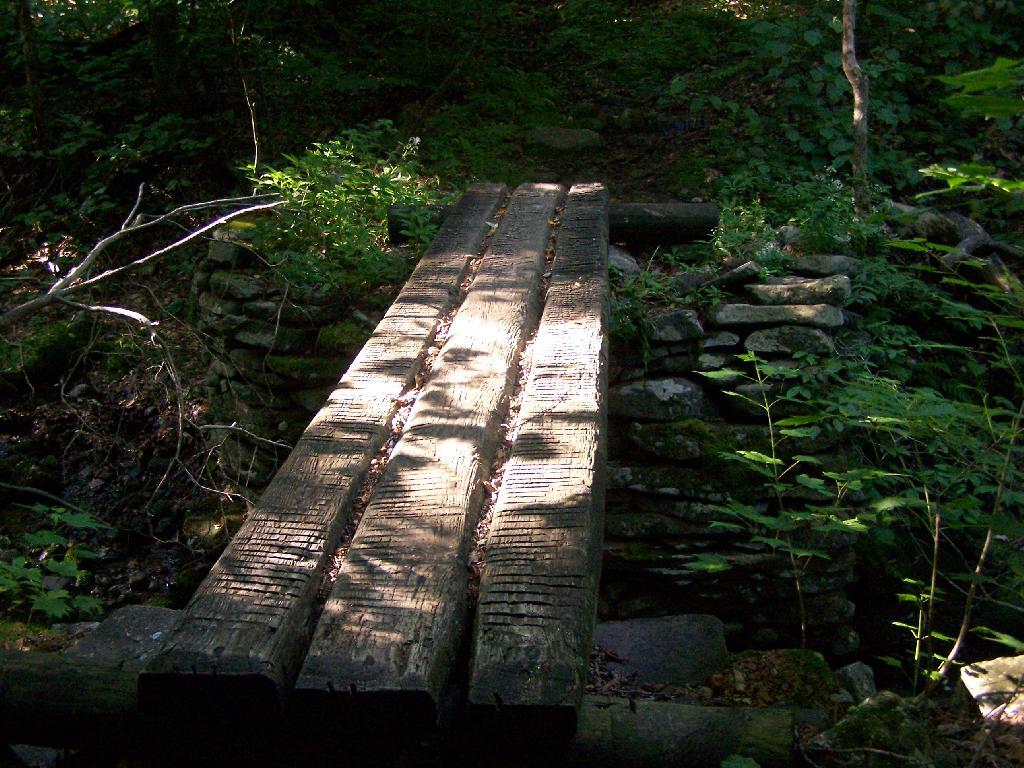
The trail crosses a high footbridge, without rails. It once was a full-size bridge for vechicles, but no more.
Reaching a historic marker of Curtis-Olmsbee Trail.
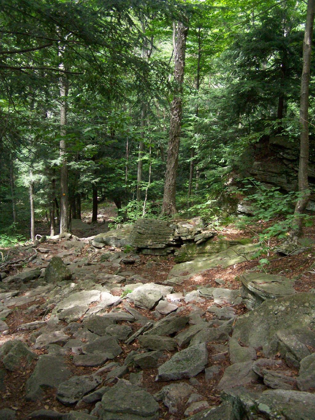
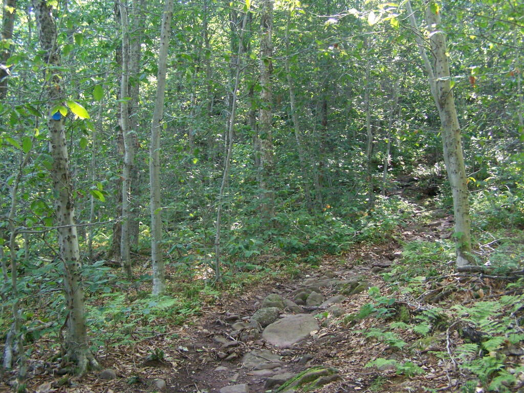
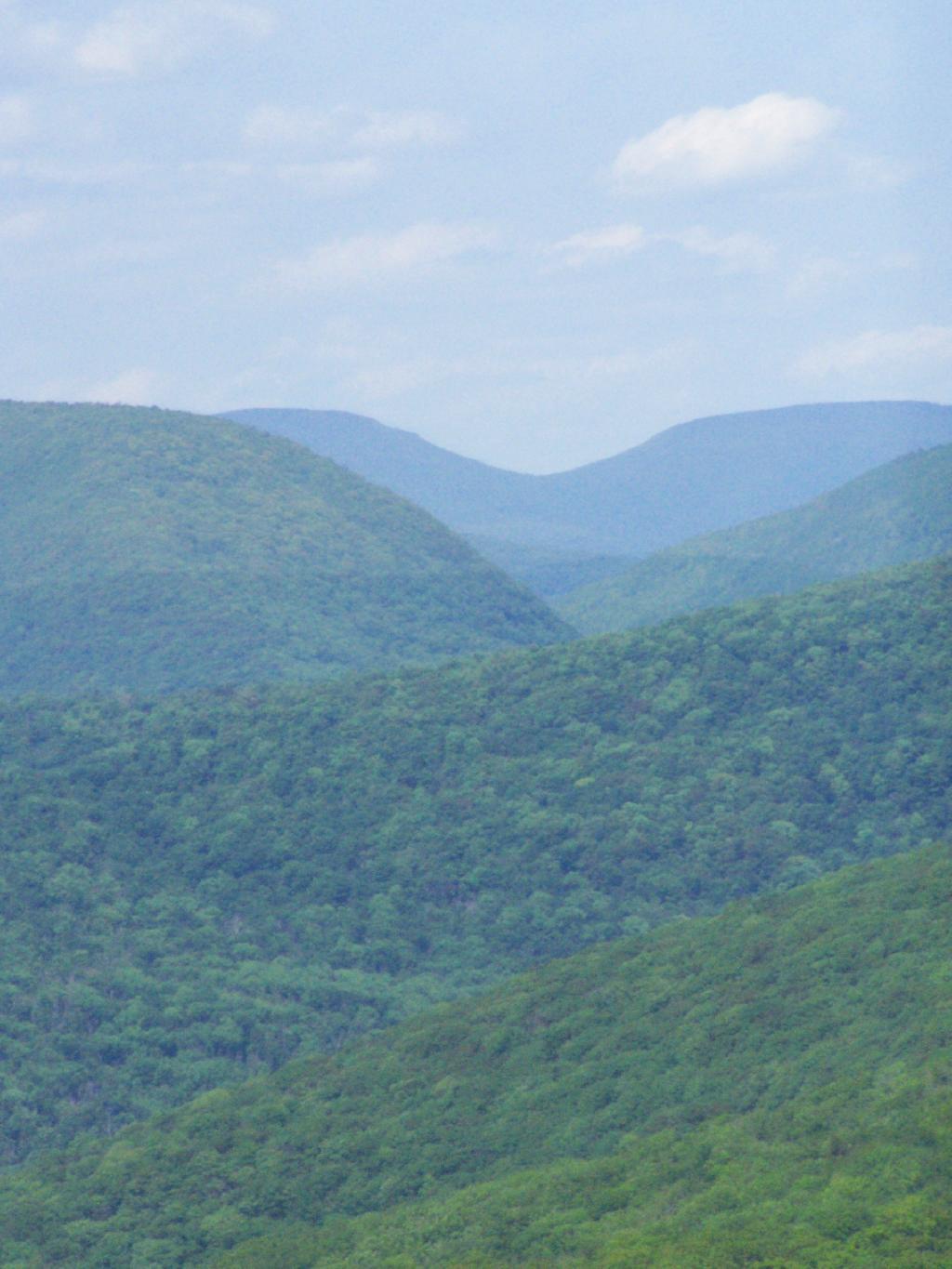
You climb, and then there are some places with views to South and West as you continue along. A few moderately steep places, but overall the trail is not super-steep.
The trail once you reach the first couple of views, remains relatively flat as you wander past several swamps and borreal forests.
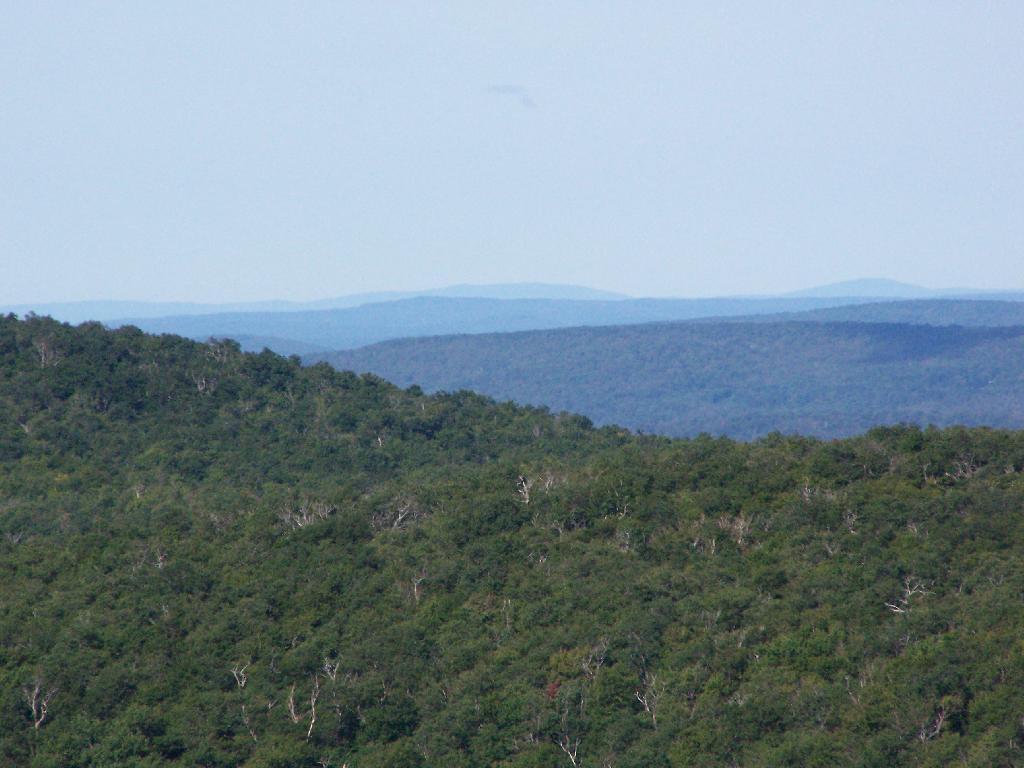
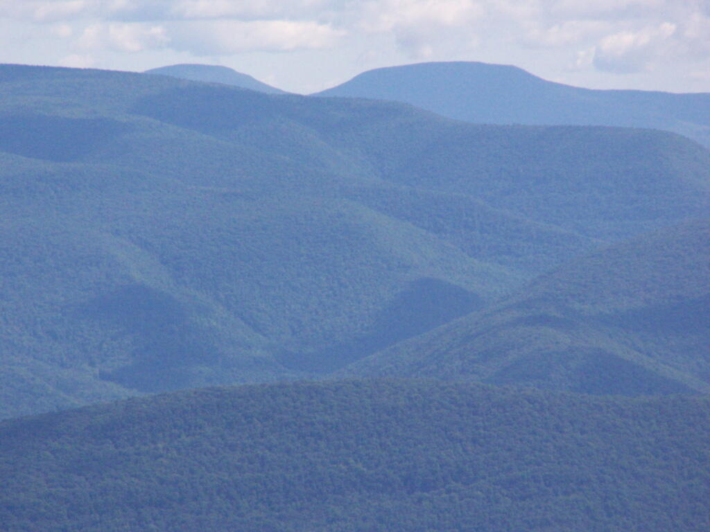
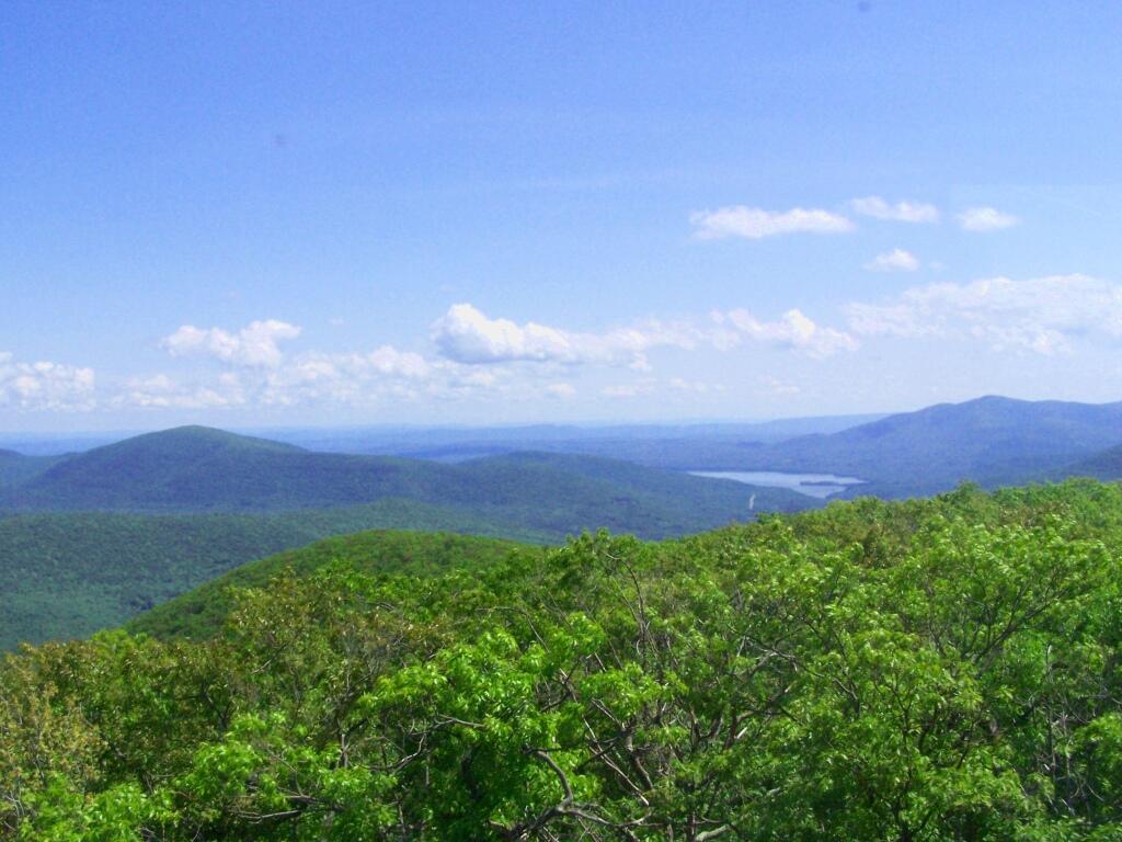
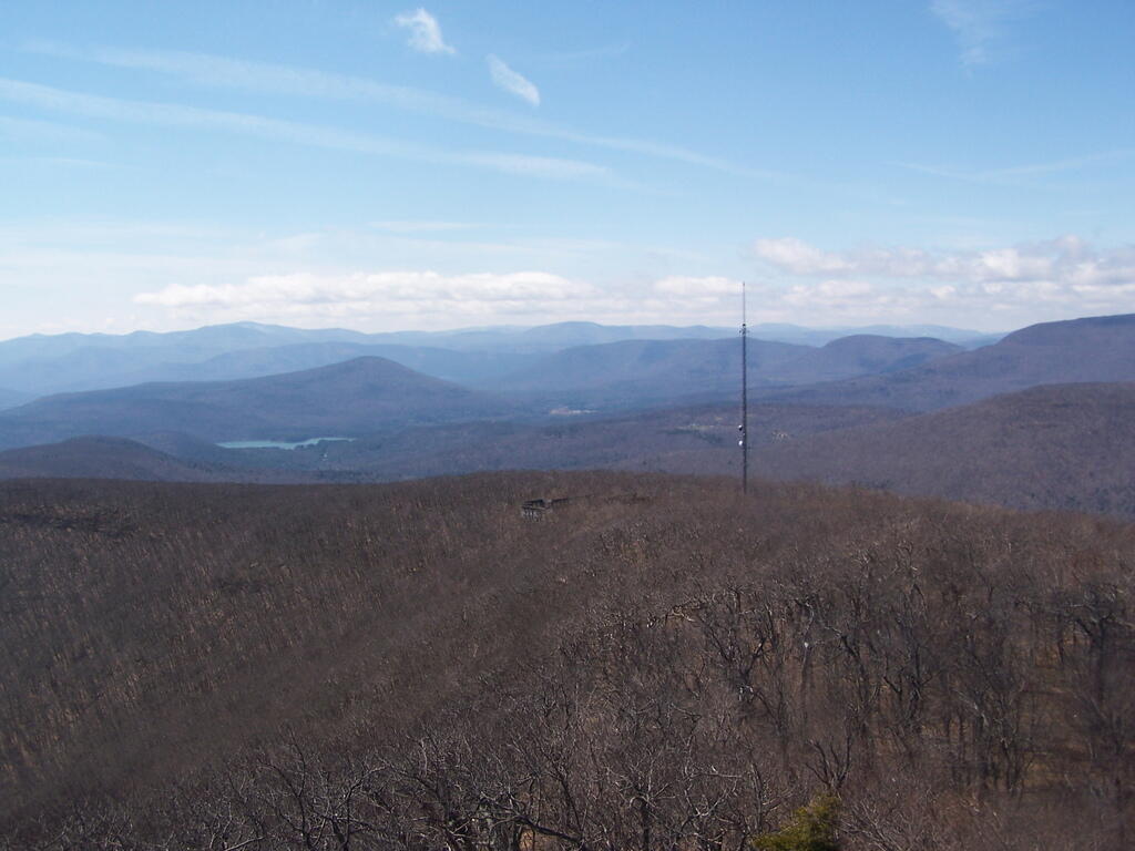
When you reach almost the top there is a point where you can see almost 70 named peaks.
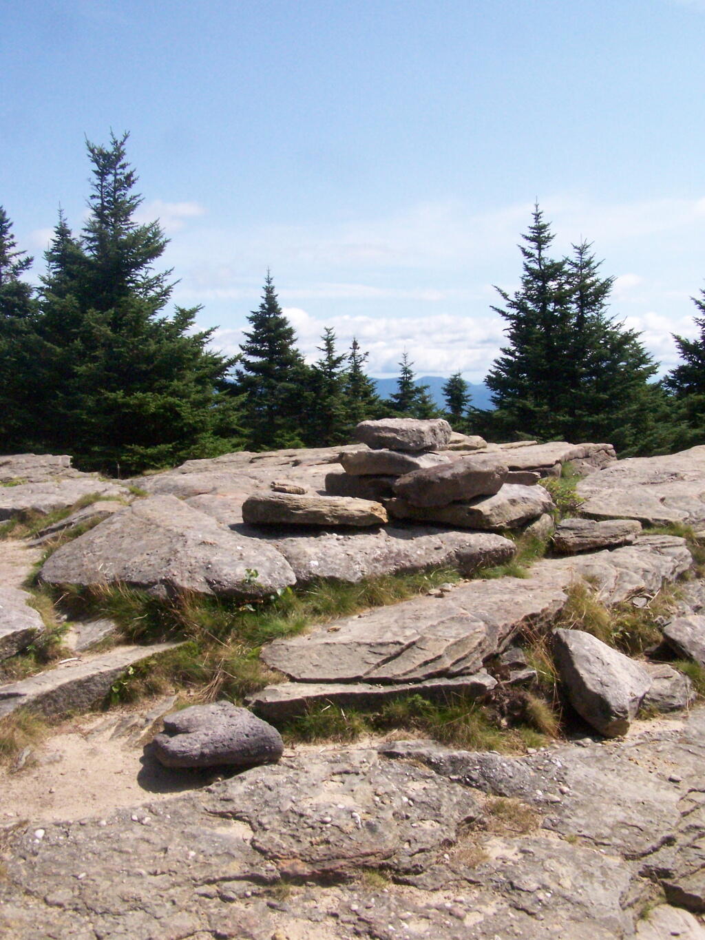
Enjoying the mountains.
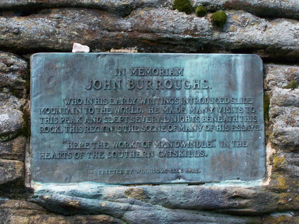
The top of the mountain is John Broughs Point. It has some interesting, partial views to the north and east.
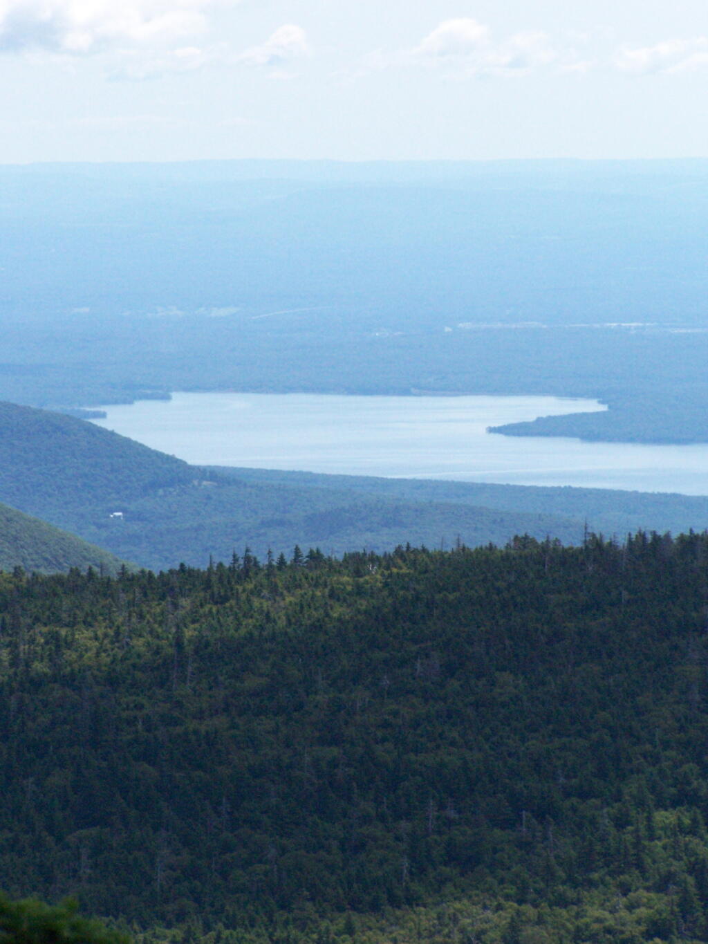
The Ashokan Reservior from Slide Mountain.
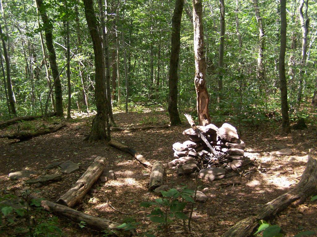
An established, primative campsite about 3/4 the way down the mountain or one mile from the Slide Mountain Parking Area.
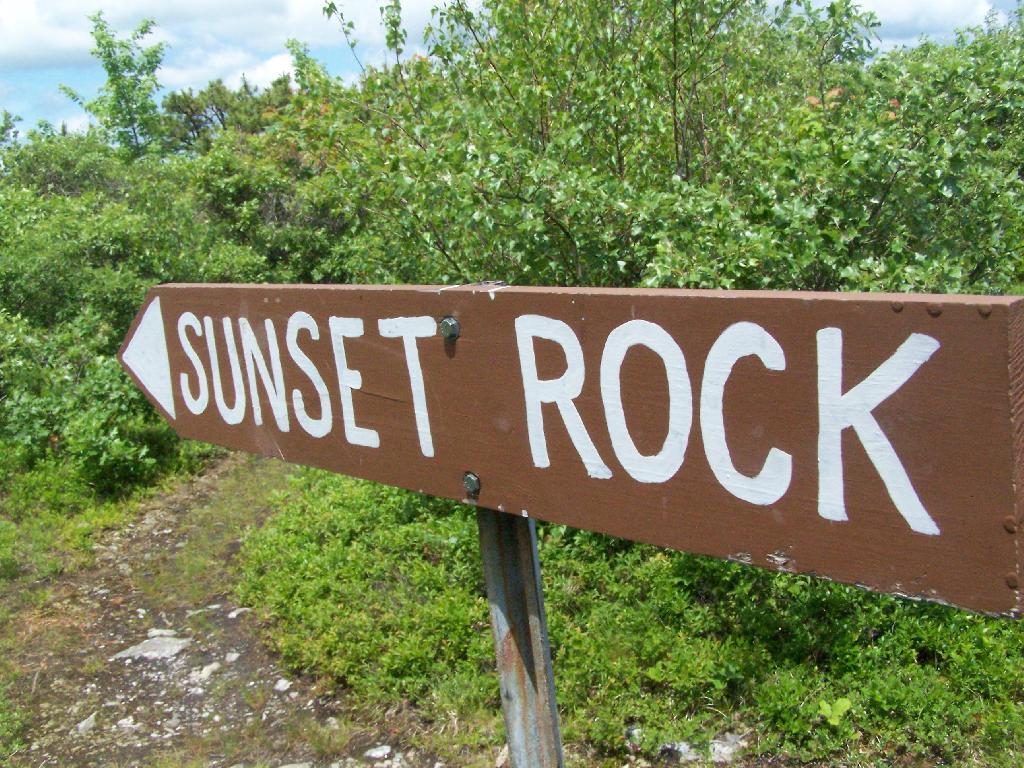
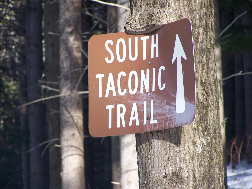
After hiking Bash Bish Mountain, I decided it was early enough in the morning that I would have time to visit Sunset Rock on Cedar Mountain. It has some of the most impressive views around.
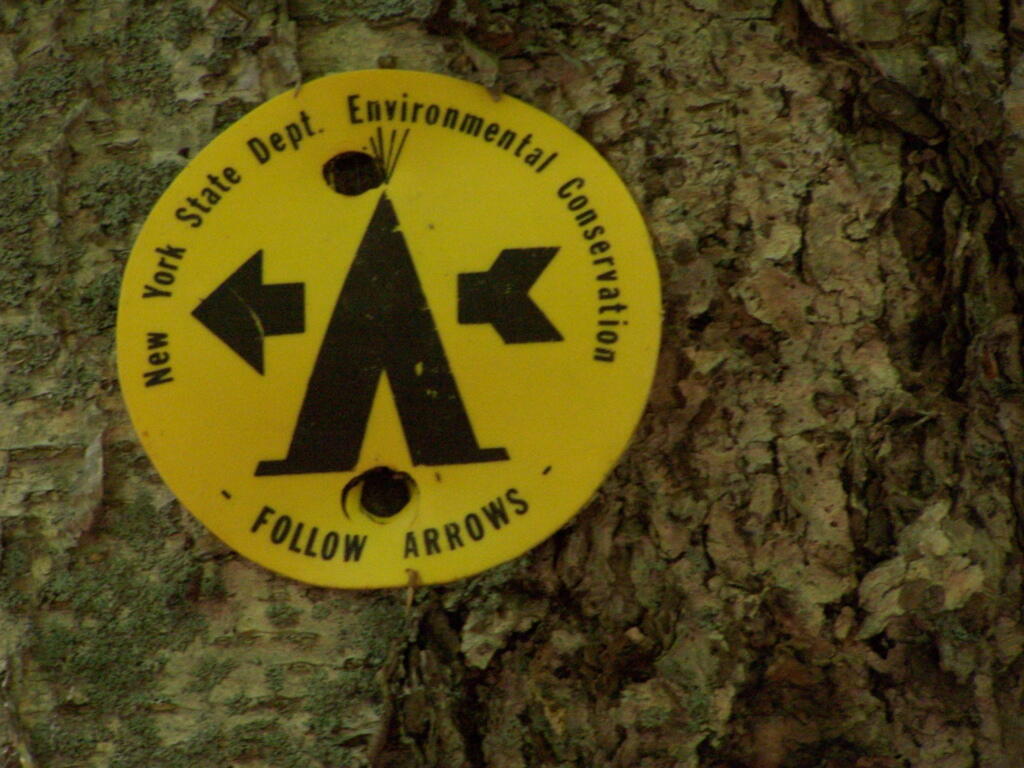
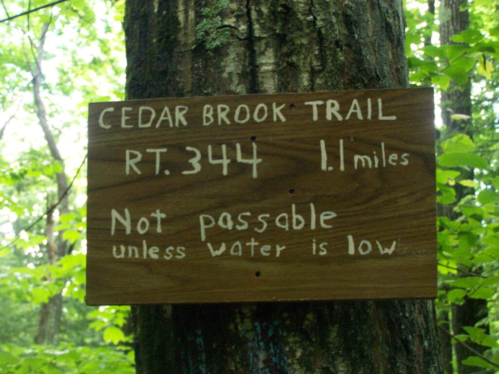
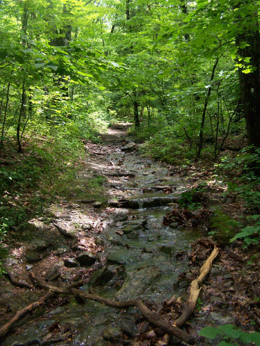
I decided to take the Cedar Brook Trail, the Blue Trail on up the mountain. This is not the recommended route if it’s been raining the day before hiking, like as it had been when I went out hiking.
The trail crosses the Cedar Brook five times, and one of locations was deep enough I found myself wading through at least one of those spots.
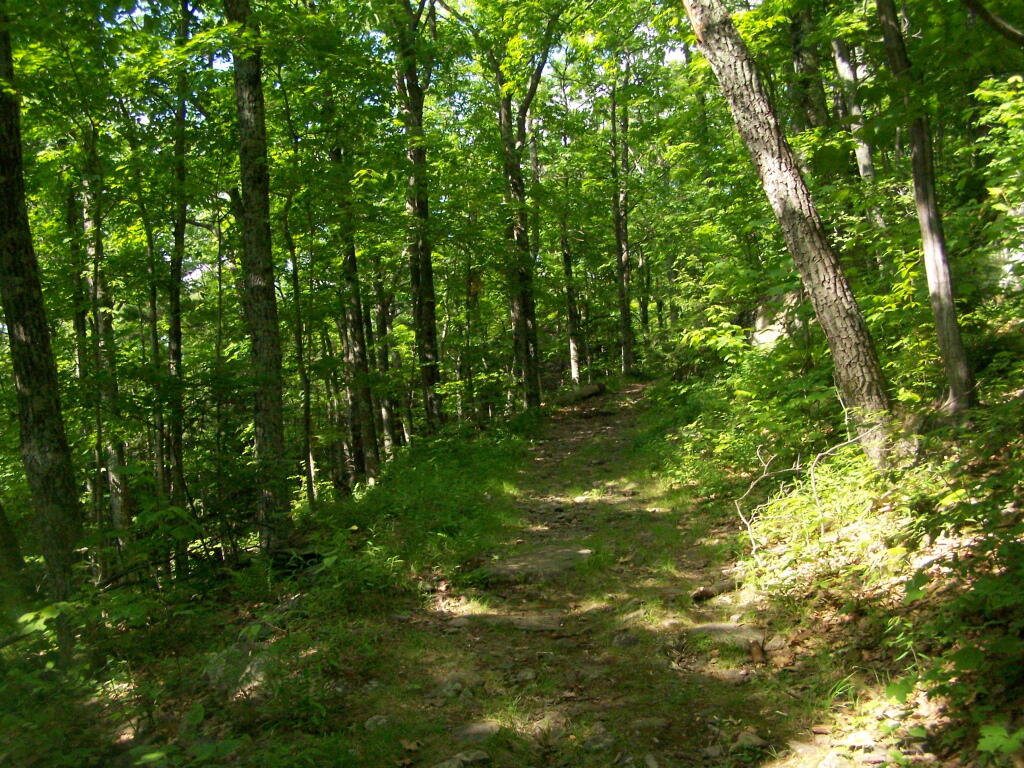
Once you climb out of the Cedar Brook Valley, via a rather steep trail, you connect up with the main South Taconic trail to Sunset Rock. This trail was much less wet then crossing the brook, but still rather flooded in several locations
Once you reach the top, the foliage changes. First it goes to open canopy with ample ferns and decedious trees high above. At the top, it is quite open with just a little bit of scrub oak and ample blueberries around. From the must-needed Sunset Rock sign, you follow a trail about 1/4 mile to Sunset Rock, a small boulder you walk on top for wonderful views of the valley below.
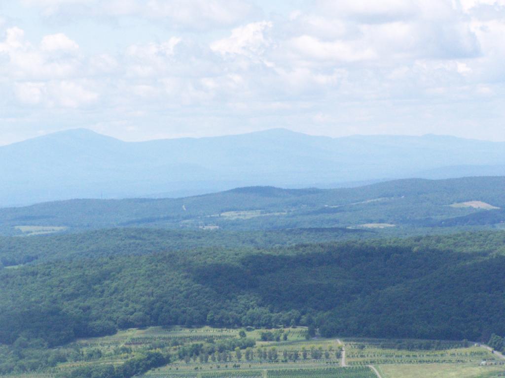
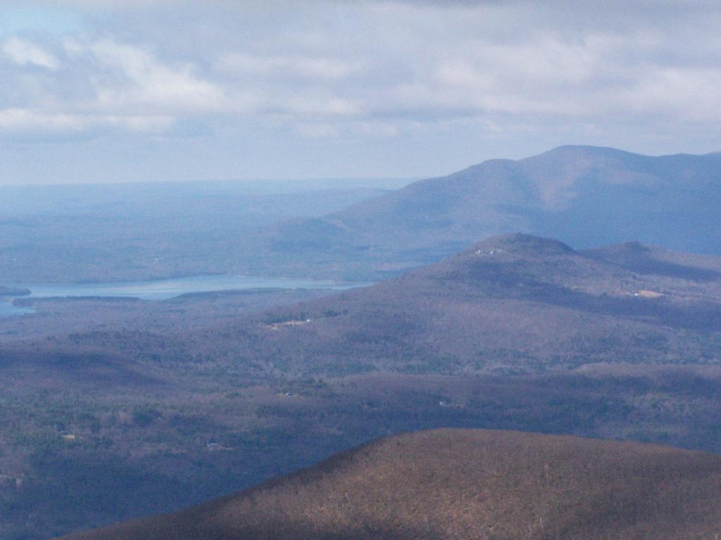
The views from Sunset Rock are amazing. As you could see by this picture, it’s gotten very clear out by around 1 PM. I have to say this is one of the nicer views I’ve seen around, with the Catskill Mountains in the background.
Here is what it looks like towards the South-West, towards Overlook Mountain and beyond that, the Shawangunks.
The main South Taconics Trail descending Sunset Rock was much drier, following an old wagon road, that is smooth enough you could drive a regular car up it. If you have any question about how wet it’s been, this route is the one to take. I will upload a photo later.
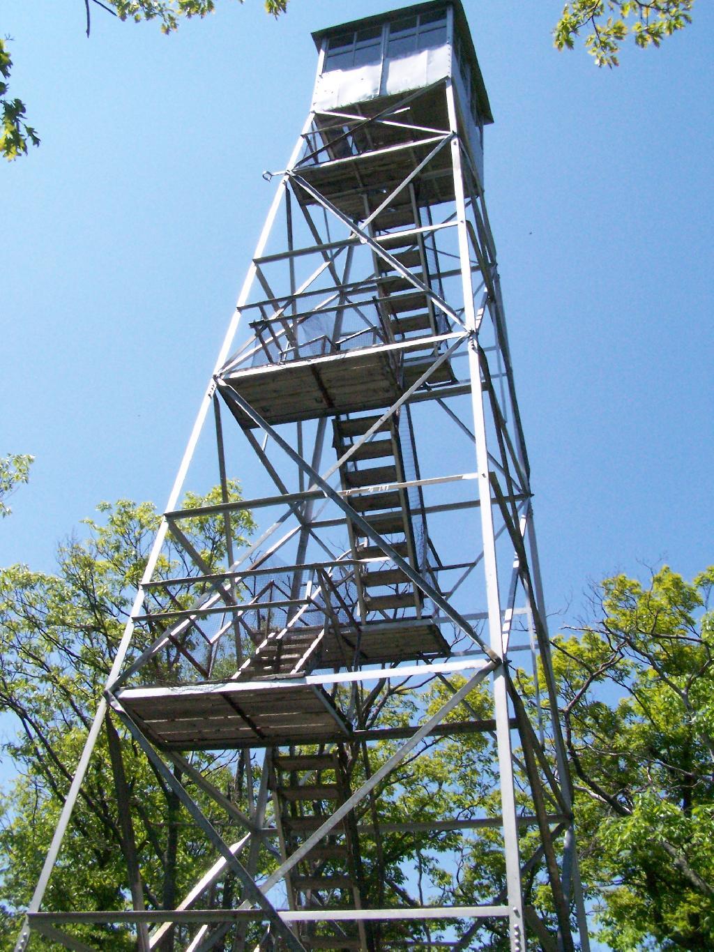
Last Saturday I went hiking up Mount Tremper in the Catskills. This is one of five remaining fire towers in the Catskills, and I was excited to do my fifth tower in the Catskills.
It was a nice day out, warm, but not to warm. It also was quite clear which I discovered when I reached the top of the mountain. The trail is 2.5 miles to the top, but it’s elevation increases are moderate, following an old woods road to the tower the entire way. Parts of the old woods road are eroded away, but it’s still an easy hike, as long as your patient.
As I often go hiking along, one technique I use on such a trail like this is to bring my Mp3 player and listen to podcasts as I hike on up. I knew it would be about a two hour hike up, so I put two hour long programs on the player, and the time passed quickly.
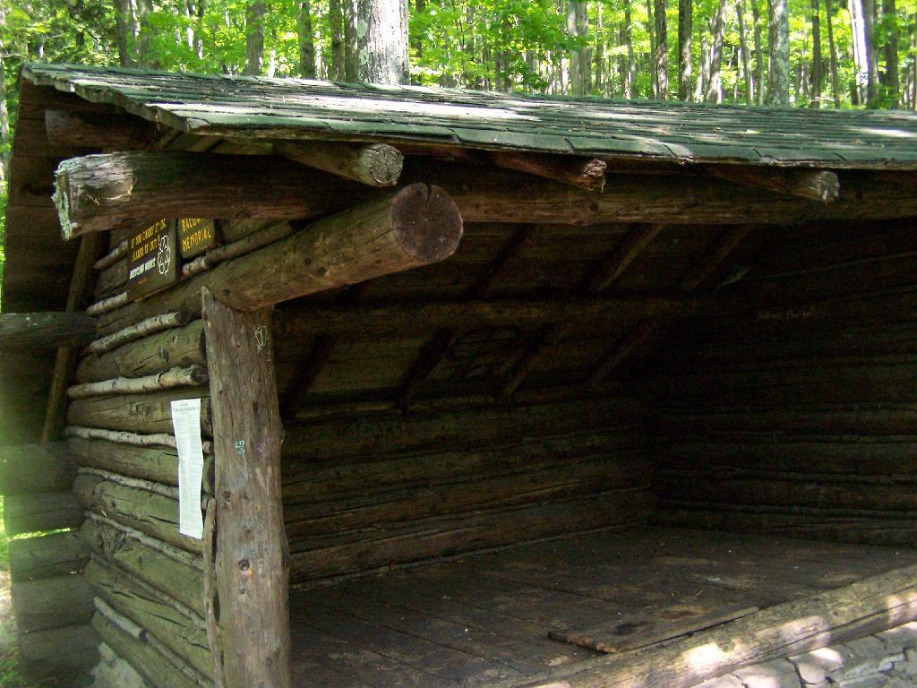
About 2/3rds the way up the mountain there is a lean to, the Baldwin Shelter once can stay in. There also is another lean-to adopt the mountain.
Once you reach the top, there are no views except a few between the trees. The only views you can see from this mountain are from the fire tower, which are quite spectaular, however you must go all the way up into the tower’s cabin before your above the tree level.
The views from the tower are amazing. This is out toward Hurley and the Ashoken Reservior.
Here’s Devils Clove. Some reflections are noticeable from trying to shoot through the windows of the Fire Tower cabin.
Slide Mountain through the windows of the tower. It was hot up there, and the bugs and glass made it hard to get pictures. I tried to open a window in the tower, but the latch wouldn’t budge.
Descending the tower.
I walked a ways onto the blue trail beyond the tower, searching for other views, however there are no views except on the tower on Mount Tremeper. A nice hike for sure, but I would have preferred some views where I could sit down, have my lunch, and enjoy the edge of the mountain.
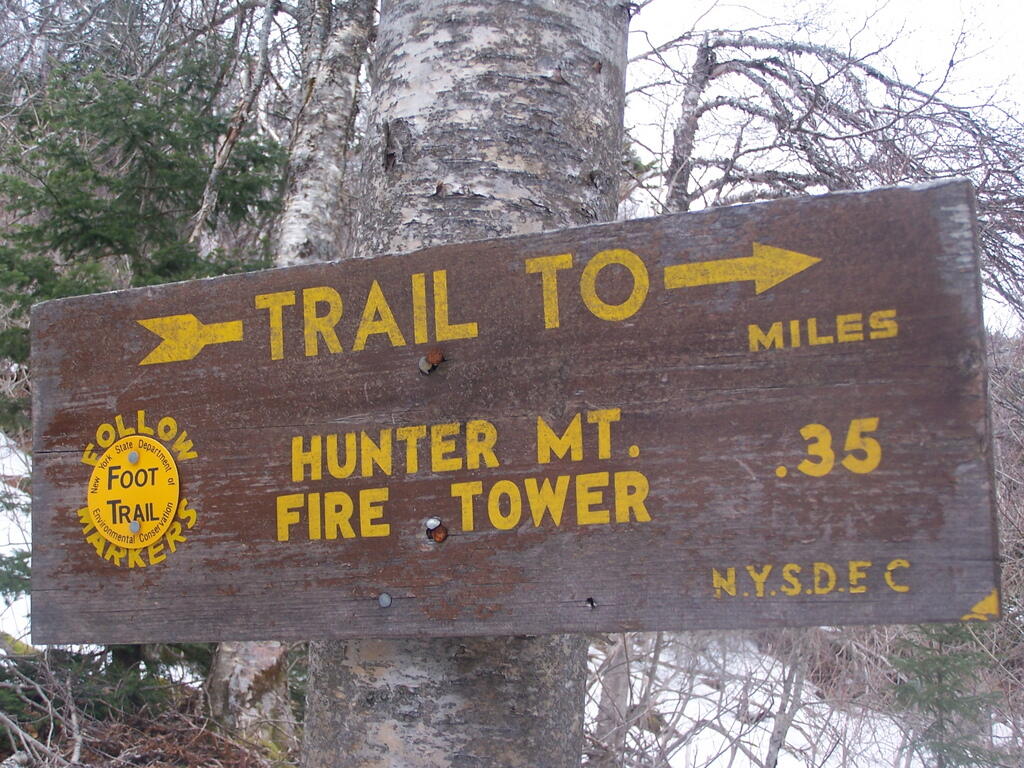
On Friday I hiked up Hunter Mountain, the second tallest peak in the Catskills at 4040′ elevation above sea level. From the trail head you clime 2020′ feet in elevation, about doubling your height, but it’s not that bad when you consider the climb is over 2.5 miles via the Becker Hollow Trail.
It was a beautiful sunny day, although I was well aware that rain was expected by afternoon. I had gotten a late start, not reaching the trail head until about 9:30 AM. It was quite hot going up, in part because there was little shade to hide out under.
The first part of the trail was relatively modest, but it quickly got steeper. It didn’t seem that bad, but I could feel the elevation, and with the sun it was quite warm. I took frequent breaks, stopping for lunch, pictures, water, and just to cool down, especially where I could find shade under the pine trees.
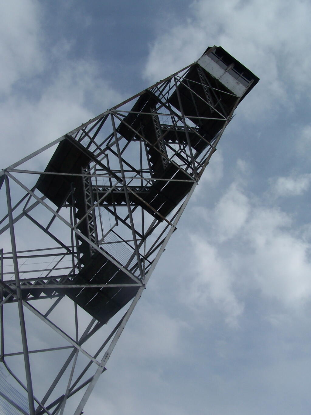
Around 3500 elevation marker, the trail headed south and got snowy and icy. It was a steeper hike, but not any worst then any other of the Catskill peaks. Then the yellow trail split off the blue trail, and it was a 1/4 mile up to the fire tower.
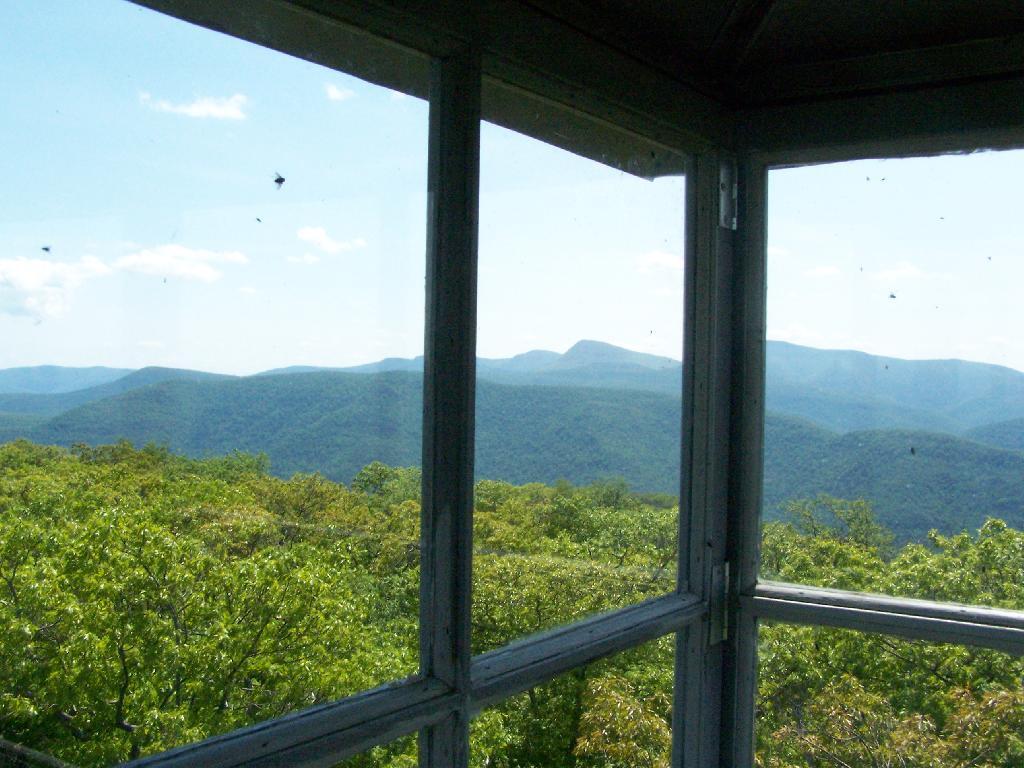
The fire tower is in the middle of the Catskills, so the surrounding mountains block the view of the valley except for a few views, such as down the Palenville Clove. Westerly views are the best, as are some of the southerly views.
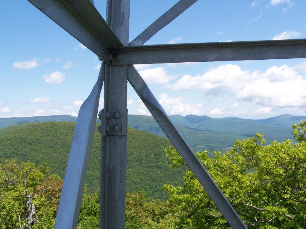
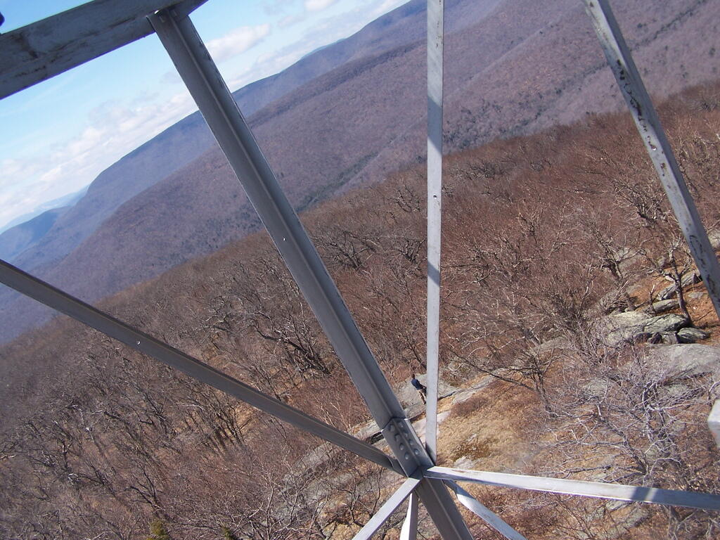
The top deck of the fire tower of is missing the safety screen. Not that it matters much as the railing makes it pretty unlikely to fall, but I still have enough of a fear of heights to be extra careful. Stupid, sure.
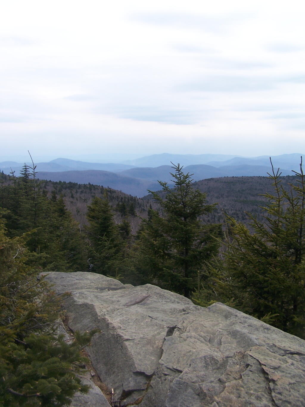
A little ways to the south on the blue trail, about 1/2 mile, there is another view that overlooks the south-west, including West Kill Mountains, Slide Mountain, and Belleayre, all clearly identifiable.
This hike is definitely worthwhile when things are green out, if you enjoy looking at mountains. But it was awful gray out, especially by the time I reached the top, and it had clouded over. The lack of views of the Hudson Valley and the river was somewhat disappointing, but not surprising.
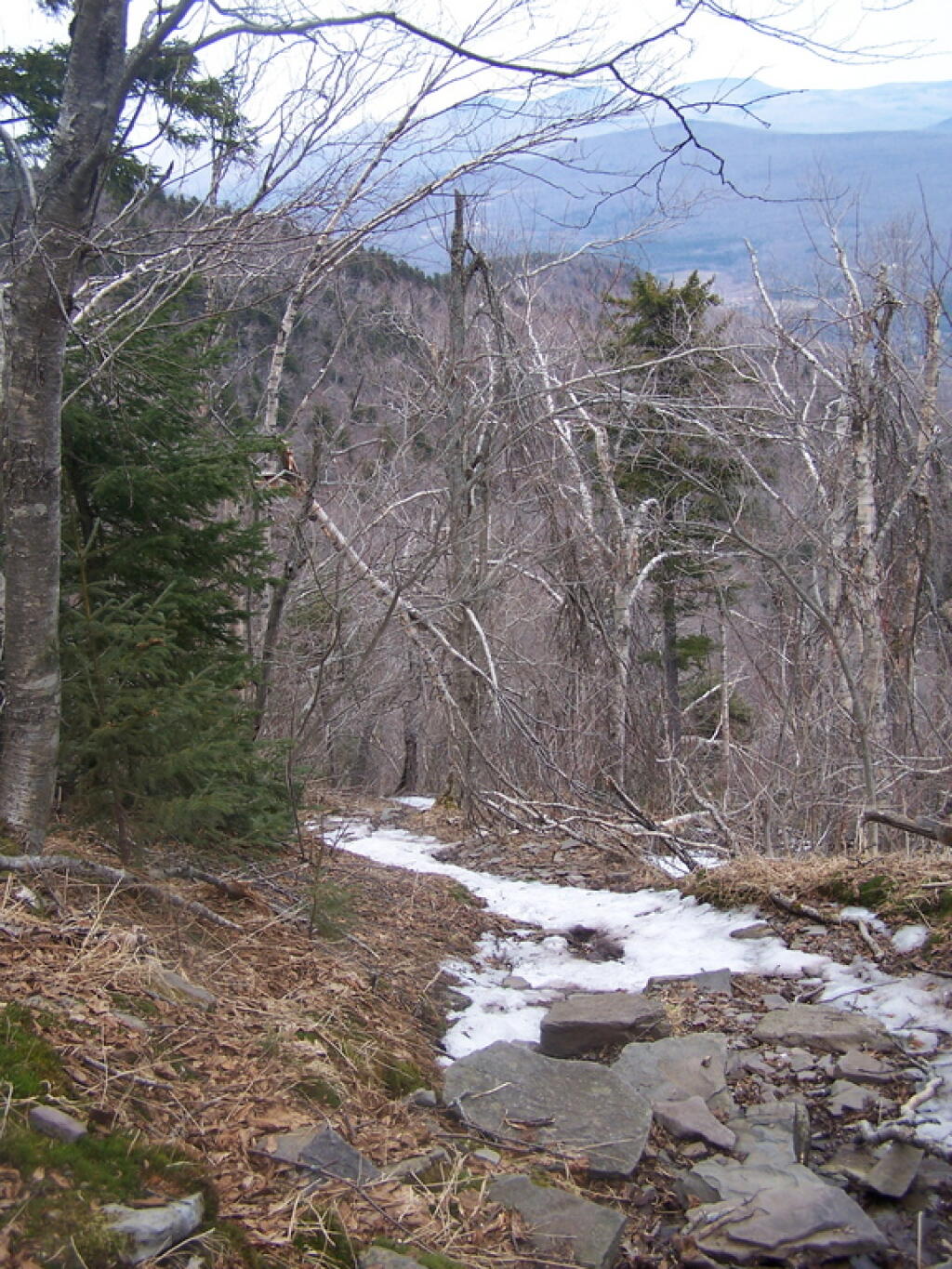
I slipped on some ice on the way down, slide about 10 feet and certainly felt it the next day. Other then that, it was a nice descent, much easier then going up. It started to pour, just about the time I reached my truck.
This past weekend’s Catskill Mountain hike was a return to Overlook Mountain, the first hike I took when I was working on my Hiking Merit Badge back in Boy Scouts. I also chose it because it was a quick hop down Route 9W or Thruway from Albany.
Not getting as early of a start as I would have liked, I arrived at the trail at around 8 AM. There was only one other car when I got there, it was packed by the time I leftbe aware if you plan hiking there. It was a nice clear morning on Sunday, and I made it up to the Catskill Mountain house around 9 AM, and to the fire tower around 9:30 AM. It was an easy hike up, following a well maintained authorized-vehicle only road, although somewhat more difficult psychologically, as you could see a quarter mile or more of the road, as it sloped uphill, sometimes at a 10-15% grade. It was not particularly warm at this hour, but I stopped frequently to snap pictures and stay hydrated.
The ruins over the Overlook Mountain House (2.0 miles from parking area on Meads Mountain Road), was bigger then I last remember it. It was too bad it burned, although it’s kind of neat how the general public can inspect it and think how grand it must of been in the 1920s when it opened, and people drove up there in their Cadillacs of the era. I walked around and snapped some pictures. Then I went up to the fire tower, about 1/2 mile further. It was windy, and it appeared there was a gate closing it off, but I pushed it open and went right up. I didn’t go all the way to the top at first, because I have a little bit fear of heights remaining. I snapped several dozen of pictures.
There also is a trail with southerly view, allowing you to sit and look out over the Hudson River, Woodstock, mountains South of Overlook, and the Ashokian Reservoir. I can’t imagine how beautiful it must look in summer with everything nice and green. I took some notes, pictures, and just gazed at the landscape.
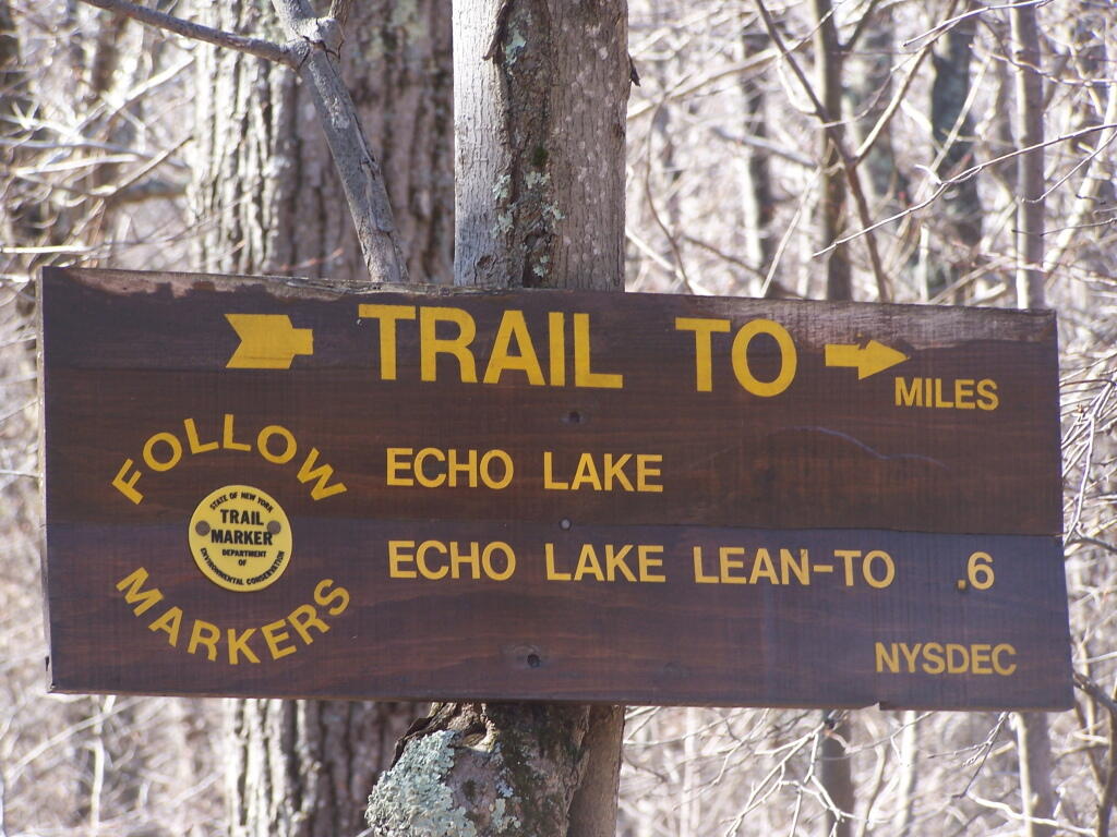
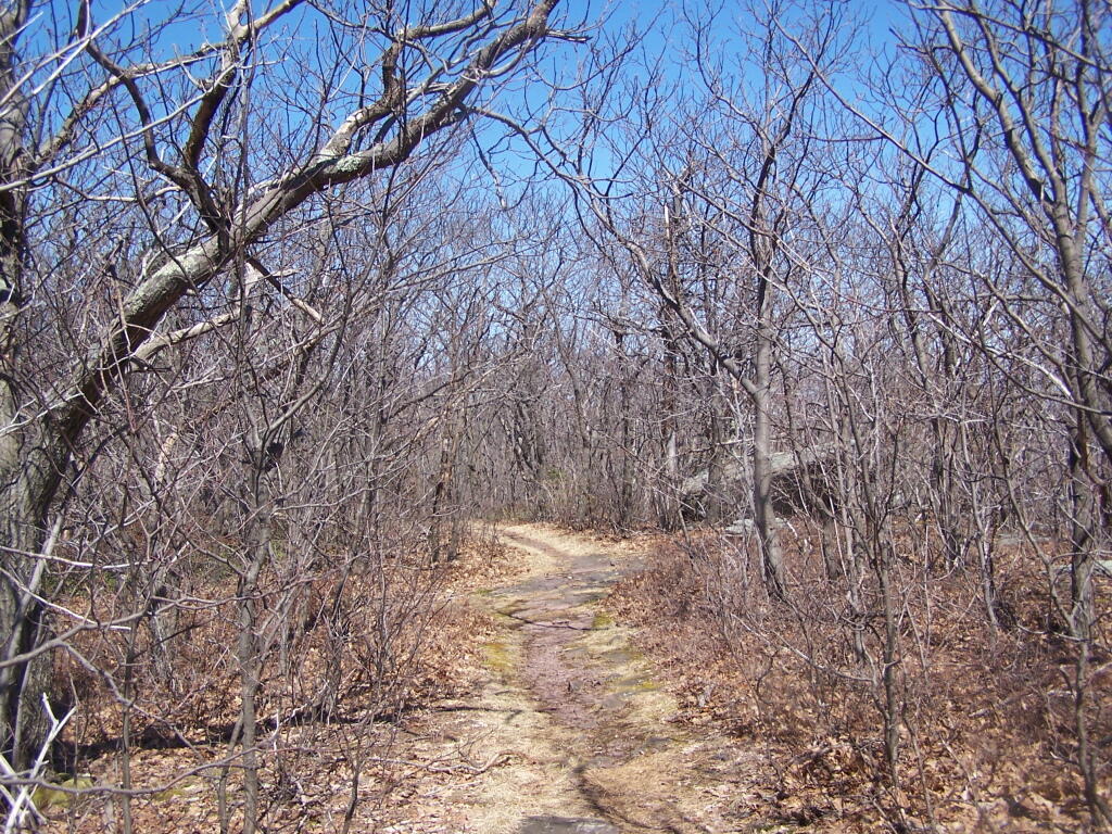
I then decided to head down the mountain. But it was early, around 11 AM, so I decided to go for a hike down to Echo Lake. It looked pretty from the fire tower. I had forgotten I had been down there, during the Boy Scout hike, until I reached the turn off for the Echo Lake trail. The trail from the fire tower to Echo Lake trail turn off, also known as the Overlook Mountain Blue trail, is a gentle descent, following a long abandoned old woods road, complete with extensive grading for travel by automobiles. It’s no longer passable by cars, but remains of the fairly extensive cut and fill can be seen. Some snow and ice where on the trail, and parts where muddy, but no part too bad. This section is 2.0 miles.
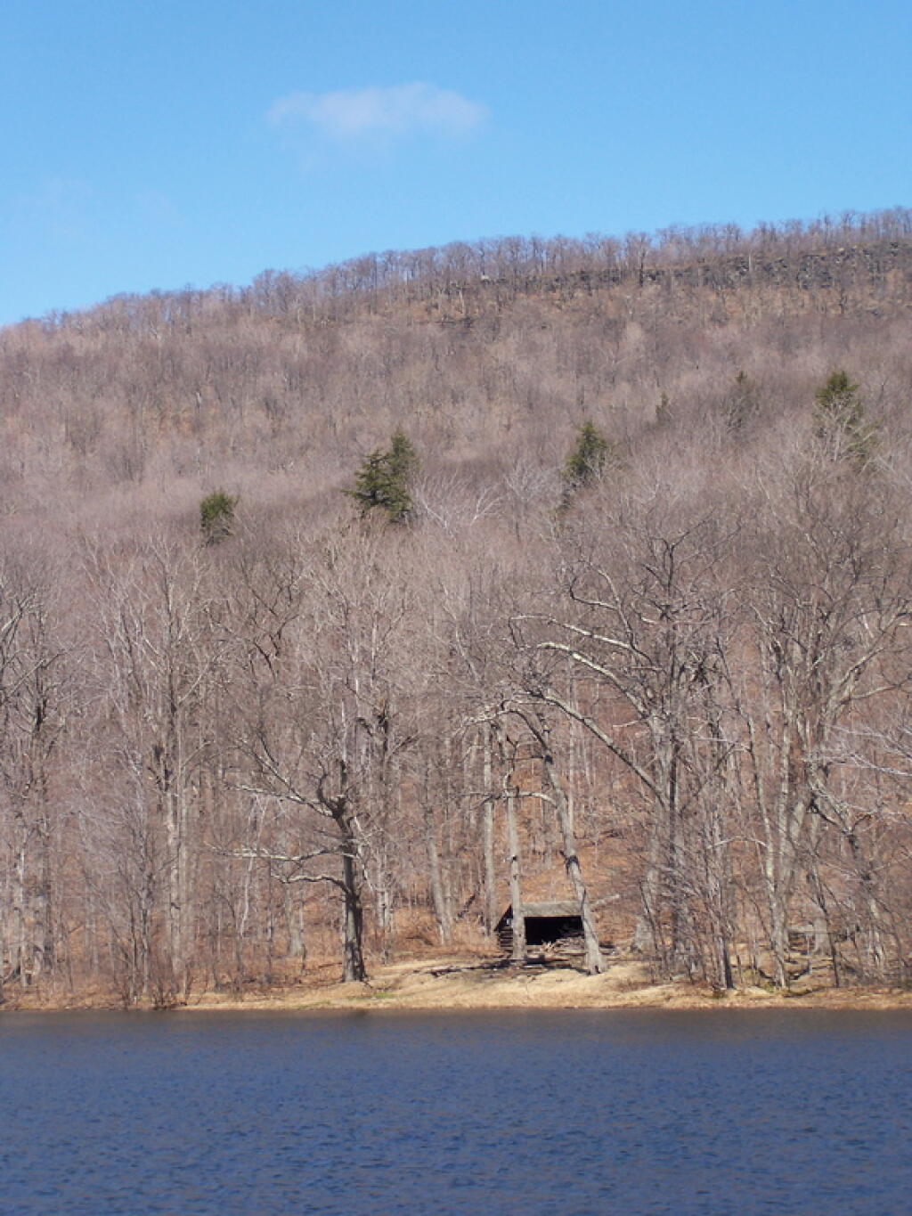
The yellow trail down to Echo Lake is somewhat steeper. You descend a lot of altitude in 0.6 miles. Echo Lake is relatively small, but pretty. There is a lean-to down there, along with an established camping area near the lake. The lean-to appeared to be well used and older. It arrived there around noon time. Spend about a half hour there.
The trail from Echo Lake back up to the fire tower was not a bad hike. Passed several hikers, and made it back to the fire tower around 1:30 PM. It was amazing how much the light had changed in 3 hours. It went all the way up the tower this time, as the wind wasn’t blowing so hard, and also to the overlook. Around 2 PM, descended the trail and headed back to the truck. I arrived back around 2:45 PM. It was an easy hike down, although you had to keep holding yourself back.