Search Results for: photo above the pond

Gorging on Gorges, An Adventure, Day 1

About a month ago, I took a trip I gave the name β€œGorging on Gorges”. As the name would suggest, most of the trip involved visiting various gorges, taking photographs of them, and otherwise exploring them. About half of them I had previously been to, while the rest were new. I also visited several other state parks, state forests, and national forests – and did something I haven’t done in a long time – camped one night in a developed campground.

Towards the Park

I started out my trip from Albany, taking US Route 20 West from I-88. I really wanted to avoid expressways for the bulk of my trip, is my general view is that expressways are the best way to get across America without really seeing anything. It’s more then a philosophical argument for me – what’s the purpose of a vacation if your rushing from point β€œA” to point β€œB”.

The first part of the trip, I drove to Chittenango Falls State Park via Nelson and beautiful farm country so high above. I walked down into the gorge, and up and around the falls. The color was somewhat muted, but it still was quite pretty. Then I headed off, taking some side roads as recommended by my GPS’s most direct route, and ended up passing a few miles from Labrador Hollow and the beautiful Labrador Pond, and said, heck, I got to stop on by there.

I drove down to Labrador Pond parking area, and hiked down to the pond. The colors were still not fully-turned on Jones Hill, but on Labrador Mountain were well past peak. Despite the crowds of fall foliage peepers from Syracuse, crowding the area, there were adequate opportunities for solitude. I walked down to the lake, snapped a few photos, then hiked the nature trail/boardwalk. It was nice. It also was great to see the boardwalk being used by a disabled man – he could get out and enjoy nature, despite his difficulties he had walking. One of the large dairies in the area was spreading something on fields nearby, and it sure stunk – it seemed nastier then fermented grain, although that’s probably what it was. Didn’t stick around too long, as I had places to go.

Somewhat Faded Colors

Drove down through Prebles, another deep, rich agricultural valley, dotted by large dairies that take advantage of the area’s rich soils for producing many bushels of corn on each acre. Got held up for about 5 minutes during a paving job, where they had the road restricted to one lane, for what had to been a half mile or so. Noticed how most of remaining trash burning barrels had disappeared from the landscape, that might have only been there 3 or 4 years ago.

Then it was off to Homer, where I passed a moose, made out of welded scrap metal along the road. It was kind of a neat roadside attraction, and I really should have stopped and got a picture, but I had a tight schedule and was burning daylight. I would come to later regret not getting that picture, but heck, I figure I can probably find a picture of it on the Internet using Google Images or Flickr. If not, it will certainly be there, the next time I find myself going through this roadside wilderness.

Millard Fillmore Historic Marker

I got lost on my way to Moravia. Not really lost, because I was following the GPS, but because I had programmed the β€œmost direct route” rather then β€œfastest route”, the GPS.decided to take me up a rough dirt road through Hewitt State Forest. I declined, and eventually the GPS found a new route, that happened to take me past Milton Fillmore’s birthplace. There is now a picnic pavilion and a some landscaping in that location. I turned around, snapped a few pictures, and explored it briefly. I wanted to a get a picture for dad for his historical markers collection.

Then it was off to Fillmore Glen. I was running a bit late at this point, but it’s a pleasant drive down to Filmore. The landscape is pretty rural until you drop, rather quickly into Moravia. Moravia is a pretty, small rural town; the glen is located at far southernly end of the town. There was a bridge being replaced in town, and you had to wait, for what seemed like an eternity for the light to green on the on-one lane bridge.

Finally, I got to the park entrance. The older guy there, grumbled when I said I had an Empire Pass. He was like β€œwhere is it – I can’t see it”. The rear window on my truck where the Empire Pass is tinted, but not that dark. I was slightly annoyed that the park entrance guy wasn’t friendly, and I forgot to ask for a map. I was kind of rushing. Got parked, and there was a big wedding going on, complete with horse drawn carriage. Crossed the β€œDry Creek” and started up the trail, first to the Cow Shed falls, then decided to take the Northern Rim Trail. It wasn’t apparent at first that it was the rim trail, but I didn’t have a map. I actually printed up a map, and had it my truck, but I of course forgot it.

Small Waterfall in Gorge

The Northern Rim climbs a fair bit, then runs along the rim, with very limited and occasional views. It crosses a pretty little creek that tumbles down the gorge, and eventually leads to a path down to the gorge trail, three-quarters the way up the gorge. I decided to hike down to the gorge trail, and then head back down the gorge towards the parking area. I missed a bit of the gorge trail, and the overlook, but so be it, time was tight.

The Gorge trail was scenic, but certainly not the most scenic of gorges. There were several small waterfalls, and some stairs and bridges, although most of the trail was gravel along the edge. The β€œDry Creek” had plenty of water, but in general, the gorges was smaller then other Finger Lake gorges. There were several glens of interest, but the most beautiful portion of the glen was the Cow Sheds in the button of the gorge. Cow Sheds falls, are the wider portion of the gorge, where at one time, historically, cows would gather for shelter in severe or cold weather.

Cow Sheds Falls

Snapped a few more pictures of Fillmore Glen, and it was off to Ithaca. I made pretty good time to Ithaca, although I admit I certainly wasn’t poking along. I really should have stopped more places, but I wanted to get to the Finger Lakes National Forest relatively early so I could set up camp and/or make alternative plans should my desired campsite on Chicken Coop Road be unavailable. Passed a giant bull statue on a farm, along NY 38, a few miles south of Moravia. I really should have stopped for a picture, but I was burning daylight, and the Finger Lakes National Forest, was over an hour away. I think this is the one, that the farmer paid like $10,000 to haul from an abandoned Steakhouse in Binghamton to the farm. I am sure the bull will be there for a long time – in case anybody forgot what is raised on farms.

Then it was down to Freeville.. The only thing real remarkable about that town, was the pine barrens and swamps, consisting of heading into it. When you think of the Finger Lakes, you tend to think open landscapes and farms, at least until you get mostly south of them of them, or in the highest points to the west. But not here. The Finger Lakes Trust owns some land, on the north side, where it the land is mostly the backwaters of the Oswaco Inlet.

Finally made it to Ithaca by 4:45 PM. I was lucky at this hour that traffic wasn’t too much of a slog by Ithaca standards, then I was off heading up Trumansberg Road. It seemed like an endless drive. Finally made it to Perry City, and then to the Finger Lakes National Forest. There was no sign of the government closure when I got there, but a bit disappointed, my favorite campsite on Chicken Coop Road was already taken. It was off to campsite on Potamac Road, just past the hunting camp.

I wasn’t thrilled by campsite, a big field campsite, but it had some trees along one edge for hanging the flag and lights. It was pretty good site for observing the stars, although there was a hunting camp down the road a little ways, so I had to keep the music down. I really don’t want to piss off the hunters. I gathered up some firewood from the woods, and got a fire started. The sun was fading fast, but so be it. I wired up my lights, some Christmas lights, and got the spot light on the flag.

It got dark, and I tuned into the Ithaca Progressive Radio Station, and gazed on the stars for a couple of hours. Nibbled on some snacks, cracked open a beer or two. Tossed some more wood on fire, and was happy to finally be on vacation.

Untitled [Expires August 10 2024]

It was a good first day… more adventures to come.

New Theme for the Blog. Central Vermont/Green Mountains This Extended Weekend. Lift Kits vs Other Toys. Getting off the Grid.

Good Morning! Happy Wednesday.Β Yes, folks it’s Wednesday. I think this is the first note I’ve done in a few months, but so be it. It really isn’t that hard to do notes, especially now that I’ve switched WordPress, and everything is pretty much standardized and easy to use. It’s a long one, jotted down over the past week,w with lots of things to talk about.

Working on a New WordPress Theme for the Blog. When I brought the blog over to WordPress, my intent was not to create another generic looking WordPress blog, although in many ways that’s how it ended up. I also messed up some of the code, and didn’t build a proper client theme, instead relying on an adapted theme.

The result was a kind of bland mess. The good news is I am now learning how to build a proper client theme on top of an existing, much nicer WordPress theme — that doesn’t look so much like a generic WordPress theme. One of the reasons I avoided for so long going with WordPress, as I didn’t want to end up with a very generic theme. But somehow it all ended up that way. I think the new theme I am going to — based on the popular Pinboard theme is much nicer.

Hopefully it will be up by the start of September, if all goes well. New maps up are on the blog today.

Untitled [Expires August 15 2024]

Heading Up to the Northern Half of Green Mountains this Weekend.Β Probably leave Friday after work, first camp in the Southern Green Mountains near Somerset Reservior, then head North on Vermont 100. Β There looks to be a lot of neat places to see in the northern Green Mountains, Β and some spectular scenery.

Plan to stay for a long weekend, by also taking off Monday and Tuesday, which promise to be pretty nice weather. As I don’t really know the area, a lot of the trip will be about seeing what is up there, and going from there to figure out what to do. I will bring the kayak and camera, and certainly are keeping my mind open to taking a nice hike somewheres. They are talking about a continuation of the recent low-humidity, temperate climate weather over the weekend, especially as we head into Monday and Tuesday. Supposed to be some good meteor showers.

I’ve decided to do more of these long weekends, rather then take any full weeks off this summer. I guess you could say the July 4th week was technically a week off, although actually July 4th and July 5th were holidays at the office, so they didn’t really count.

I might take a week-long trip in October to Western NY and Pennsylvania during peak foliage season. That said, I also want to do an extended weekend trip to Moose River Plains and also Lake Kushaqua/Jones Pond and recently re-opened Loon Mountain firetower.

Going to Put Off Getting the Lift-Kit Installed Until at Least March.Β Originally the plan was to have a lift-kit installed on my truck in October. But after giving it more thought, and carefully reviewing the options, I’ve decided the best option is to wait another six months or so. For one, I want to wear down the stock tires more, so I’m not wasting them as much, and also so I’m a bit closer to end of the factory warranty — the lift kit isn’t covered by the truck’s factory warranty, and while it wouldn’t invalidate the whole warranty, certainly any damage (as unlikely as it is) it could cause wouldn’t be warrantied.

But the other part of the rational is partly money-wise, and because I’m not totally sold on the lift-kit idea. I’ve thought about getting Β a snowmobile instead this winter, and have been looking at Want Ad Digest. That said, the more I look at it, the more I am not in a rush to get a snowmobile. As much fun as it would be to get deep in the back country in winter — assuming there are groomed trails back there — I worry about break downs and the alike. Not to mention, snowmobiles use a lot of gas, and really aren’t much more efficient then automobiles, because the snow drags them down.

The money-wise issue comes in that things are more expensive then I first estimated a year ago. I think I am going to go with 35s and a 6″ lift kit from a good brand like BDS. Any bigger then that isn’t cost-effective, and non-pratical. That will get me up high enough. The final increase in the height of the truck will be something like 8 inches, because the 35s are 4 inches larger in diameter then factory 31s, and a six-inch lift is half foot higher.

31626460002_large

I also think I will go for full-leaf replacements in the back rather then add-a-leafs, to ensure the weight of the camper shell and equipment in the back won’t cause the nose to be pointing in the air, etc. Going to have it re-geared to save fuel, add some more power, not kill the engine or tranny. And there are some other things like the narrower brake lines that are recommended, among other parts, I would probably spring for when it comes to lift-kit. Plus all that labor cost, which will easily be a grand on it’s own.

I want to ride up higher. I am a tall guy. It also will give me a chance to “freshen” up the look of my truck, which after 2 1/2 years will be getting kind of boring and old. I want something I can get 10 years or more out of without getting totally bored with. After I do the lift kit, there are other projects for future years, such as getting the rocker panels Line-X’d, and replacing the bumpers with those awesome Ranch bumpers, that can actually be used for parallel parking without being damaged.

Or maybe I’ll find other toys to spend my money on. It’s good having some extra disposable money kicking around, as I’m sure future jobs won’t nearly pay as much.

Been Reading and Watching More Videos About Getting Off the Grid. Being somebody who camps most weekends from April to November in the back of my pickup truck, and relies heavily on my inverter and the deep cycle battery to keep things lighted up all evening long. I cook my own food in the woods, clean dishes using bottled water, burn my garbage, and dig a whole in Β woods when I need to go to the bathroom. Heck, with my laptop and the wireless card, I can be up in woods and surfing the web, doing work, and even fielding calls over my cellphone.

I have a pretty decent working understanding of electricity, and how all the off-the-grid thing too. I grew up in the country, are comfortable in woods, and know how to build a good fire in woodstove. I am fascinated to learn more about some of the relatively inexpensive and simplistic living arrangement many-off-the-griders live with, without all costs and hassles of an on-grid house.

My grandfather had one of those absorption-cooler refigerators/freezers in his RV at his campsite in Warrensburg. They’re neat, as one needs more then just a cooler when you live somewhere permanently, rather then wondering the wilderness in your pickup truck. They burn like 5-10 gallons of propane a month. But there also is these high-efficiency refrigerators that are electric and have a lot of insulation, so they don’t strain batteries in a PV/micro-hydro/wind system as much.

But a bigger issue for me is the ability to take showers and get cleaned up properly wherever I live. For that purpose, there are amazingly small tankless-water heaters that use a small amount of propane, but can get water very hot quickly. If you think small, you don’t really need that much flow, compared to a full-scale modern house with a massive-tanked water heater. Hot showers, and hot water for dishes is a necessity to keep clean. If I can get away with it from the code inspectors, I’d be fine with composting toilets or even just a plain old outhouse. That’s a luxury in woods.

Woodstoves, radiant flooring, and other familiar technology is self-explanatory. Having good insulation is a must in this part of the country. I don’t want to have trash pickup — I’m happy enough burning what can be burnt, and taking the glass and metals for proper recycling in the normal industrial fashion.

I like small houses. Smaller is better. I would rather spend my money on land, that could not only be used for recreation like riding quads, shooting guns, and hunting, but also for money by grazing livestock and timber. I am not a greeny, I don’t got a problem with using styrofoam plates for dinner and disposing them in an open fire. I just hate the whole upper-middle class, fancy house living style in the suburbs.

All this reading library books gots me thinking …

But for now I’m fine. As a transition though, I think I would next like to live in a small, handsome, downtown, one that is walkable to a bar and a store, but also provides ample-off-street parking. I think it would be a lot of fun to have an apartment on the second or third floor, above a shop, and be able to sit out and look at my window and watch the traffic go by.

Anywhere I live, I want to be near a National Forest or State Forest that allows free, primitive camping, in a remote-roadside fashion. Not to mention scenic vistas, places to hunt, fish, hike, and spend time outdoors. But I really want to get out of New York, at least eventually. I think it would be fun to own an AR-15, and eventually get a concealed carry permit from a must-issue state, without any pesky questions about whatever stupid things I did decades ago back in college — that hurt nothing but folks egos. To say nothing of not being in a state that’s totally anti-rural and not into the philosophical nature thing.

Far off I guess. Things aren’t that bad right now.

2011 Pictures of the Year

January.

Walking Along the Trail

After a fresh snow fall it was a winter wonderland in the Albany Pine Barriens, a forever wild ecosystem on the outskirts of the city. It felt like one was walking through a marshmallow forest.

Truck By the Woodpile

A cold winters day at my parents house in late January, after a long cold spell that never seemed to want to end.

February.

Sheen of Sun on Ice

A icy sheen shown on the snow at Partridge Run, as I went for an afternoon walk with the dogs up there in the middle of the month.

Descending Bennett Hill

Snowshoeing back down Bennett Hill in late February.

March.

Irish Hill and Beyond

A recently logged section of Cole Hill provided breath-taking views of Irish Hill and the Fox Kill Valley down in Berne.

Thatcher Park Cliff

What a clear spring day up at Horseshoe Clove at Thacher Park. Warmer, nicer days can’t be far way.

April.

Shallow Pond

April 9th was the first day I got out camping in 2011. Spent the day exploring Rogers Environmental Center, camped at Moscow Hill Horse Assembly Area.

Looking Across the River

It may start to warm up earlier in lower elevations, but winter is still very much a force in late April in the Adirondacks. The East Sacanadaga River on this morning looks icy and cold.

May.

 Albany

There’s Albany! From my kayak. I kayaked up to Downtown Troy from the Corning Preserve.

Towards Sand Pond Mountain

Spring finally comes to Adirondacks by late May. Paddling around Cheney Pond, looking towards Sand Mountain in the distance, on the other side of Hoffman Notch.

June.

Campsite in Morning

Kayak camping on Stockmans Island in the middle of the Hudson River. What an adventure, one I picked on a night when they had fireworks up at the Coxscake Town Park.

Foam from White Watch on Oswegatchie

Oswegatchie River up in Watson’s Triangle in Adirondacks. There are few places as remote as this that you can drive on largely unmarked and rarely traversed back country roads. Watson’s Triangle is a place far of the beaten path.

July.

Cloudy Day

A dramatically cloudy day, looking down towards Tupper Lake from Mount Arab.

Falling Water

Cooling off at the Potholers on an oppressively humid summer’s day.

August.

Wider But Shallow Section of Beaver Creek

Exploring Beaver Creek at the Brookfield Railroad State Forest in Brookfield, NY.

Beaver Creek North

Watching the fog burn off Beaver Creek at Brookfield Railroad State Forest on a summer morning..

September.

View of Lake from Campsite

A beautiful late summer morning at North Lake in Adirondacks. North Lake is such a jewel, especially as you head farther north on the largely undeveloped portion of the lake.

Looking Back to Wakely Dam

Fall was well underway, and even past peak at Moose River Plains by September 20th.

October.

South-West from the Top

Second week of October, I went up to the North Country for some leaf peeping, hiking, and kayaking. The colors may be faded in Central Adirondacks, but still were good in lower elevation parts of the Northern Adirondacks.

Snake Mountain 5

And later in October, I drove up to Snake Mountain in Vermont, overlooking the Champlain Valley and the Adirondacks. Colors lasted the longest

Leaves on Snow

And by October 30th, we had snow, actually several inches, as seen up at Lake Taghkanic State Park.

November.

Powerlines Leaving the Hydro Dam

In November I visited Monreau Lake State Park for the first time, and checked out the Palmerstown Ridge above the Hudson River and Spier Falls. These power lines transfer power from Spier Falls Hydro Dam over to Corinth.

Durham Area

I also hiked up Windham High Peak. I hadn’t been there in many years, and it was interesting to look down at Preston Hollow and Medusa, far, far below.

December.

Rays Over Wilcox Lake Wild Forest

On Christmas Day, I hiked up Hadley Mountain. While cloudy and cold, it was very beautiful.

Ice Covered Pond

While the pond at Thacher Park was frozen, there still is very little snow locally.

Adirondack Wild, Scenic and Recreational Rivers System

Today’s fodder is based on the text of the Adirondack Park State Land Master Plan that explains the Adirondack Scenic, Wild and Recreational Rivers System and the policies surrounding it quite well. — Andy

The Adirondack Park contains many rivers which, with their immediate environs, constitute an important and unusual resource. Classification of those portions of rivers that flow through state land is vital to the protection of existing free flowing streams. The classification system and the recommended guidelines specified below are designed to be consistent with and complementary to both the basic intent and structure of the legislation passed by the legislature in 1972 creating a wild, scenic and recreational rivers system on both state and private lands.

LED Driver built on perfboard as Arduino shield

Definitions

A wild river is a river or section of river that is free of diversions and impoundments, inaccessible to the general public except by water, foot or horse trail, and with a river area primitive in nature and free of any man-made development except foot bridges.

A scenic river is a river or section of river that is free of diversions or impoundments except for log dams, with limited road access and with a river area largely primitive and undeveloped, or that is partially or predominantly used for agriculture, forest management and other dispersed human activities that do not substantially interfere with public use and enjoyment of the river and its shore. A recreational river is a river or section of river that is readily accessible by road or railroad, that may have development in the river area and that may have undergone some diversion or impoundment in the past.

River Picks Up Speed As You End the Flow

Guidelines for Management and Use

Basic guidelines

1. No river or river area will be managed or used in a way that would be less restrictive in nature than the statutory requirements of the Wild, Scenic and Recreational Rivers Act, Article l5, title 27 of the Environmental Conservation Law, or than the guidelines for the management and use of the land classification within which the river area lies, but the river or river area may be administered in a more restrictive manner.

2. Rivers will be kept free of pollution and the water quality thereof kept sufficiently high to meet other management guidelines contained in this section.

3. No dam or other structure impeding the natural flow of a river will be constructed on a wild, scenic or recreational river, except for stream improvement structures for fisheries management purposes which are permissible on recreational and scenic rivers only.

4. The precise boundaries of the river area will be determined by the Department of Environmental Conservation, will be specified in the individual unit management plans for the river area or the areas, where the more restrictive guidelines of the particular area will apply) and with the following additional guidelines.

2. Access points to the river shore or crossings of the river by roads, fire truck trails or other trails open to motor vehicle use by the public or administrative personnel will normally be located at least two miles apart.

3. Other motor vehicle roads or trails in the river area will not be encouraged and, where permitted, will normally be kept at least 500 feet from the river shore and will be screened by vegetation or topography from view from the river itself.

4. The natural character of the river and its immediate shoreline will be preserved.

5. The following structures and improvements may be located so as to be visible from the river itself:

== fishing and waterway access sites;

== foot and horse trails and foot and horse trail bridges crossing the river; and,

== motor vehicle bridges crossing the river.

6. All other new, reconstructed or relocated conforming structures and improvements (other than individual lean-tos, primitive tent sites and pit privies which are governed by the regular guidelines of the master plan) will be located a minimum of 250 feet from the mean high water mark of the river and will in all cases be reasonably screened by vegetation or topography from view from the river itself.

7. Motorboat usage of scenic rivers will not normally be permitted but may be allowed by the Department of Environmental Conservation, where such use is already established, is consistent with the character of the river and river area, and will not result in any undue adverse impacts upon the natural resource quality of the area.

Recreational rivers

1. Recreational rivers and their river areas will be administered in accordance with the guidelines for management of wild forest areas (except where such rivers flow through wilderness, primitive or canoe areas, where the more restrictive guidelines of the particular area will apply) and with the following additional guidelines:

2. Where a recreational river flows through an intensive use area, structures, improvements and uses permitted in intensive use areas will be permitted, provided the scale and intensity of these intensive uses do not adversely affect the recreational character of the river and the river area.

3. The natural character of the river and its immediate shoreline will be preserved and enhanced.

4. The following structures and improvements may be located so as to be visible from the river itself:

== fishing and waterway access sites;

== docks;

== foot and horse trails and foot and horse trail bridges crossing the river;

== snowmobile trails, roads, and truck trails; and,

== motor vehicle bridges crossing the river.

5. All other new, reconstructed or relocated conforming structures and improvements (other than individual lean-tos and primitive tent sites which are governed by the regular guidelines of the master plan) will be located a minimum of 150 feet from the mean high water mark of the river and will in all cases be reasonably screened by vegetation or topography from view from the river itself.

6. Motorboat use of recreational rivers may be permitted, as determined by the Department of Environmental Conservation.

Cheney Pond Outlet

Designation of Wild, Scenic and Recreational Rivers

The application of the above definitions and criteria to rivers on state lands in the Park results in the current designation under this master plan of 155.1 miles of wild rivers, 511.3 miles of scenic rivers, and 539.5 miles of recreational rivers. A significant amount of private lands not covered by this master plan are included in these mileage figures. A brief description of these rivers and their classification is set forth in Chapter III.

River Wild Scenic Recreational
Ampersand Brook 8.6
Ausable — Main Branch 21.7
Ausable — East Branch 8.8 25.2
Ausable — West Branch 31.8
Black 6.8 5.8
Bog 6.2
Boreas 11.4
Bouquet 42.7
Bouquet — North Fork 5.9
Bouquet — South Fork 5.0
Blue Mountain Stream (Trib. of Middle Branch, Grasse River) 7.9
Cedar 13.5 13.0 10.4
Cold 14.5
Deer 5.7
East Canada Creek 19.3
Grasse — Middle Branch 12.9
Grasse — North Branch 25.4
Grasse — South Branch 36.1 4.2
Hudson 11.2 11.8 55.1
Independence 24.5
Indian (Trib. of Hudson River) 7.5
Indian (Trib. of Moose River — South Branch) 15.1
Jordan 15.7
Kunjamuk 7.1 9.1
Long Pond Outlet 16.3
Marion 4.4
Moose — Main Branch 15.0 11.0
Moose – North Branch 5.3 11.6
Moose — South Branch 33.6
Opalescent 10.4
Oswegatchie — Main Branch 14.9
Oswegatchie — Middle Branch 13.0 22.7
Oswegatchie — West Branch 7.2 6.3
Otter River 8.8
Ouluska Pass Brook 2.3
Piseco Outlet 3.8
Raquette 36.0 51.6
Red 8.0
Rock 6.4 1.3
Round Lake Outlet 2.4
St. Regis — East Branch 15.4 6.3
St. Regis — Main Branch 15.6 23.9
St. Regis — West Branch 31.5 5.5
Sacandaga — East Branch 11.3 12.6
Sacandaga — Main Branch 28.5
Sacandaga — West Branch 18.1 16.6
Salmon 11.6
Saranac 62.7
Schroon 63.9
West Canada Creek 7.4 17.1 9.1
West Canada Creek — South Branch 5.7 9.1
West Stony Creek 7.4 7.7
Total 148.4 487.2 545.6

Association for the Protection of the Adirondacks v. Alexander MacDonald

As I could not find this court case online, despite being public domain, I obtained a copy from the Research Librarian at the Bethlehem Public Library. I am posting this case in it’s entirety, as it’s key to understanding the core holdings in the case, that must be upheld whenever a proposed use is undertaken in the forest preserve.

The Association for the Protection of the Adirondacks et al., Respondents, v.
Alexander MacDonald, Conservation Commissioner of the State of New York, et al., Appellants

[NO NUMBER IN ORIGINAL]

Court of Appeals of New York

253 N.Y. 234; 170 N.E. 902; 1930 N.Y. LEXIS 820

February 11, 1930, Argued
March 18, 1930, Decided

PRIOR HISTORY.

[***1] Appeal from a judgment of the Appellate Division of the Supreme Court in the third judicial department, entered January 21, 1930, in favor of plaintiffs, upon the submission of a controversy under sections 546-548 of the Civil Practice Act.

Assn. for Protection of Adirondacks v. MacDonald, 228 App. Div. 73, affirmed.

DISPOSITION.

Judgment affirmed.

Cedar River Entrance Sign

OVERVIEW.

1929 N.Y. Laws ch. 417 was enacted to authorize the construction of a bobsleigh run in a forest preserve belonging to the state in order to provide facilities for the Olympic winter games. The officials planned to cut down 2,500 trees, and the association, a group that sought to protect state lands, objected, arguing that the state’s constitution prevented the cutting of the trees. The association obtained an injunction restraining the construction on the ground that the statute was void and unconstitutional, and the officials appealed. The court affirmed the decision, holding that ch. 417 was unconstitutional and that the timber on the lands in the forest preserve could not be cut and removed to construct a toboggan slide because N.Y. Const. art. VII, § 7 said that it could not be done. The court held that the constitution, like any other law, had to receive a reasonable interpretation, considering the purpose and the object in view, and the purpose of § 7 was that the forest preserve should be forever kept as wild forest lands and the timber could not be sold, removed, or destroyed.

Campsite North of Powley Place

SYLLABUS.

Chapter 417 of the Laws of 1929, authorizing the Conservation Commissioner to construct and maintain a bobsleigh run or slide on State lands in the Forest Preserve in the town of North Elba, necessitating the removal of a substantial number of trees from the land set aside therefor, is violative of section 7 of article 7 of the State Constitution, directing that timber in the Forest Preserve shall not be “sold, removed or destroyed,” and is, consequently, void.

COUNSEL: Hamilton Ward, Attorney-General (C. S. Ferris of counsel), for appellants. Section 7 of article 7 of the Constitution was not intended to prohibit the cutting of a relatively small number of trees, [***2] or even a single tree, when such cutting will in no wise impair the forest or subvert the purpose for which the Forest Preserve was acquired and is now being maintained. ( People ex rel. Manhattan Ry. Co. v. Barker, 152 N. Y. 433; People ex rel. Jackson v. Potter, 47 N. Y. 375; People v. Adirondack Ry. Co., 160 N. Y. 225; Einsfeld v. Murray, 149 N. Y. 367.)

Wallace T. Stock, Frederick T. Kelsey and John W. DeWitt for Public Park and Playgrounds District of the Town of North Elba, amicus curiae. The constitutional provision must be given a broad interpretation consistent with the purposes of government and with the ascertained intent of the framers thereof and of the people. ( People v. Tremaine, 252 N. Y. 27; Koster v. Coyne, 184 N. Y. 494; Matter of Burns, 155 N. Y. 23; Rochester v. Quintard, 136 N. Y. 221; People v. Petrea, 92 N. Y. 128; Matter of Gilbert El. R. Co., 70 N. Y. 361; Goodell v. Jackson, 20 Johns. 693; People v. Fancher, 50 N. Y. 288; People v. Albertson, 55 N. Y. 50; People v. Lorillard, 135 N. Y. 285; [***3] Admiral Realty Co. v. City of N. Y., 206 N. Y. 110; Matter of Dowling, 219 N. Y. 44.) The intent of the People in adopting this provision of the Constitution was the preservation and use of the Forest Preserve as a great resort for the public for the purposes of health and recreation. (Black on Interpretation of Laws [2d ed.], pp. 20, 194; Wendell v. Lavin, 246 N. Y. 115; People v. Potter, 47 N. Y. 375; Sweet v. Syracuse, 129 N. Y. 316; Stradar v. Stern, 184 App. Div. 700; Waters v. Gerard, 189 N. Y. 302; People v. Mosher, 163 N. Y. 32; People v. Lyman, 157 N. Y. 368.) The proposed bobsled run is a proper and desirable use of the State’s forest lands, consistent with the Constitution. ( Matter of Watson, 226 N. Y. 384.)

Jacob Gould Schurman, Jr., George Welwood Murray, Samuel H. Ordway and Alanson W. Willcox for respondents. The history of section 7 of article 7 of the Constitution and the effect uniformly attributed to it, demonstrate the invalidity of chapter 417 of the Laws of 1929. ( People v. Adirondack R. Co., 160 N. Y. 225; Adirondack R. Co. v. Indian River Co., 27 App. Div. 326; [***4] People v. New York Central & H. R. R. R. Co., 161 App. Div. 322; 213 N. Y. 649; Newcombe v. Ostrander, 66 Misc. Rep. 103; 140 App. Div. 945.) The legislation in question cannot be sustained as an exercise of the police power or as a reasonable use of the Forest Preserve. ( Barrett v. State of New York, 220 N. Y. 423.)

JUDGES: Crane, J. Cardozo, Ch. J., Pound, Lehman, Kellogg, O’Brien and Hubbs, JJ., concur.

OPINION BY: CRANE

Marshy Flow and Pillsbury Mountain

OPINION.

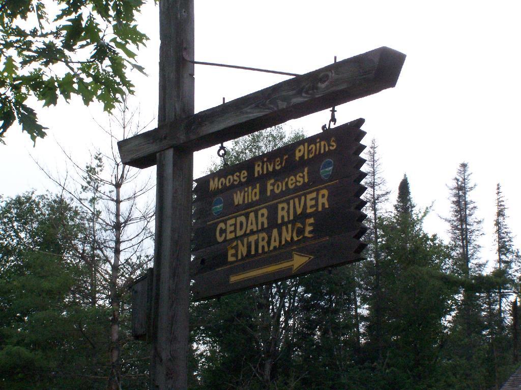
[*236] [**903] By chapter 417 of the Laws of 1929 the Conservation Commissioner is authorized to construct and maintain a bobsleigh run or slide on State lands in the Forest Preserve in the town of North Elba, Essex county, on the western slope of the Sentinel Range.

The act was passed for the purpose of providing facilities for the third Olympic winter games, which are to be held at or in the vicinity of Lake Placid, in the year 1932. The bobsleigh run will be approximately one and one-quarter miles in length and six and one-half feet wide, with a return route or go-back road. As additional land will have to be cleared on either side of the run, the width in actual use will be approximately sixteen feet, and twenty feet where the course curves. It is estimated that the [***5] construction will necessitate the removal of trees from about four and one-half acres of land, or a total number of trees, large and small, estimated at 2,500. The Forest Preserve within the Adirondacks consists of 1,941,403 acres. The taking of four acres out of this vast acreage for this international sports’ meet seems a very slight inroad upon the preserve for a matter of such public interest and benefit to the people of the State of New York and elsewhere. The Legislature, recognizing the benefits of an international gathering of this kind, has sought in the public interest, by the [*237] enactment of the above law, to provide appropriately and in the spirit of hospitality, the necessary equipment and facilities for these games, and contests, incident to winter sport, of which tobogganing is a large feature. Winter sports of course must be held in a place where there will be an assurance of sufficient continual cold weather for snow and ice, and the vicinity of Lake Placid gives this assurance. The western slope of the Sentinel range, chosen for the toboggan slide, is the nearest and most appropriate place for its construction in connection with the center of attractions.

[***6] Considering the distinction of having one of the beauty spots of New York State selected as appropriate for the International Olympic winter games and the advantages afforded by Lake Placid and its vicinity, together with the good will promoted in the recognition by the State, through its Legislature, of the event, what possible objection can there be to the above law permitting this toboggan slide to be constructed on State land? One objection, and one only — the Constitution of the State, which prevents the cutting of the trees. This objection has been raised by the Association for the Protection of the Adirondacks, which has sought and obtained an injunction restraining the Conservation Commission of this State and the Superintendent of Lands and Forests from constructing and maintaining the bobsleigh run on the ground that chapter 417 of the Laws of 1929 is unconstitutional and void.

The constitutional provision is HN1section 7 of article VII, reading: “The lands of the state, now owned or hereafter acquired, constituting the forest preserve as now fixed by law, shall be forever kept as wild forest lands. They shall not be leased, sold or exchanged, or be taken by any corporation, [***7] public or private, nor shall the timber thereon be sold, removed or destroyed.”

The lands and trees proposed to be taken for the toboggan slide are within the Forest Preserve and covered [*238] by this provision of the Constitution. Taking the words of section 7 in their ordinary meaning, we have the command that the timber, that is, the trees, shall not be sold, removed or destroyed. To cut down 2,500 trees for a toboggan slide, or perhaps for any other purpose, is prohibited. Some opinions, notably those of the Attorneys-General of the State, cited on the briefs and by the Appellate Division, have even gone so far as to state that a single tree, and even fallen timber and dead wood, cannot be removed; that to preserve the property as wild forest lands means to preserve it from the interference in any way by the hand of man.

HN2The words of the Constitution, like those of any other law, must receive a reasonable interpretation, considering the purpose [**904] and the object in view. ( State of Ohio ex rel. Popovici v. Agler, 280 U.S. 379.) Words are but symbols indicating ideas and are subject to contraction and expansion to meet the idea sought to be expressed; [***8] they register frequently according to association, or like the thermometer, by the atmosphere surrounding them. The purpose of the constitutional provision, as indicated by the debates in the Convention of 1894, was to prevent the cutting or destruction of the timber or the sale thereof, as had theretofore been permitted by legislation, to the injury and ruin of the Forest Preserve. To accomplish the end in view, it was thought necessary to close all gaps and openings in the law, and to prohibit any cutting or any removal of the trees and timber to a substantial extent. The Adirondack Park was to be preserved, not destroyed. Therefore, all things necessary were permitted, such as measures to prevent forest fires, the repairs to roads and proper inspection, or the erection and maintenance of proper facilities for the use by the public which did not call for the removal of the timber to any material degree. The Forest Preserve is preserved for the public; its benefits are for the people of the State as a whole. Whatever the advantages may be of having wild forest lands [*239] preserved in their natural state, the advantages are for every one within the State and for the use [***9] of the people of the State. Unless prohibited by the constitutional provision, this use and preservation are subject to the reasonable regulations of the Legislature.

The laws developing the Forest Preserve and the Adirondack Park, up to the Constitution of 1894, are reviewed in the opinion of this court in People v. Adirondack Ry. Co. (160 N. Y. 225). By chapter 707 of the Laws of 1892 the State Park, known as the Adirondack Park, was created within certain of the Forest Preserve counties. Such park is to be “forever reserved, maintained and cared for as ground open for the free use of all the people for their health or pleasure, and as forest lands necessary to the preservation of the headwaters of the chief rivers of the State, and a future timber supply.”

Chapter 332 of the Laws of 1893, combining all previous acts, gave to the Forest Commissioners authority to sell certain timber on the Forest Preserve and also power to sell such of the lands as were not needed. They were also authorized to lease camp sites and lay out paths and roads in the park. Then came the Convention of 1894 with the debates indicating a change of policy regarding the sale and destruction of [***10] timber and the use of the lands. (Revised Record of the Constitutional Convention of 1894, vol. I, pp. 1100, 1148; vol. II, pp. 57, 1201; vol. IV, pp. 128, 137.)

At the time of the assembling of this Convention, the law of the State authorized the sale, lease, clearing and cultivation of lands in the Forest Preserve and the sale of standing or fallen timber thereon; also permitted the laying out of paths and roads through the property. (See chap. 283, Laws of 1885; chap. 475, Laws of 1887; chap. 707, Laws of 1892; chap. 332, Laws of 1893.)

With these laws before them and the statements in the debates revealing the depredations which had been made on the forest lands, and the necessity for restricting the [*240] appropriation of trees and timber, section 7 of article VII was adopted and became part of the Constitution January 1, 1895, where it has remained ever since.

No longer was the land or timber to be sold or even condemned for public purposes. ( People v. Adirondack Ry. Co., supra.) The forests were to be preserved as wild forest lands, and the trees were not to be sold or removed or destroyed. Whereas the Legislature had authorized the building of roads through [***11] these lands, this power was thereafter conferred not through legislation, but by constitutional amendments adopted in 1918 and 1927. The section with these amendments now reads: “Nothing contained in this section shall prevent the State from constructing a State highway from Saranac lake in Franklin county to Long lake in Hamilton county and thence to Old Forge in Herkimer county by way of Blue Mountain lake and Raquette lake, and nothing shall prevent the State from constructing a State highway in Essex county from Wilmington to the top of Whiteface mountain.” If it were deemed necessary to obtain a constitutional amendment for the construction of a State highway, the use to which the Forest Preserve might be put with legislative sanction was greatly limited. Trees could not be cut or the timber destroyed, even for the building of a road. This seems to be a fair conclusion to be drawn from the adoption of these constitutional amendments after the Constitution of 1894.

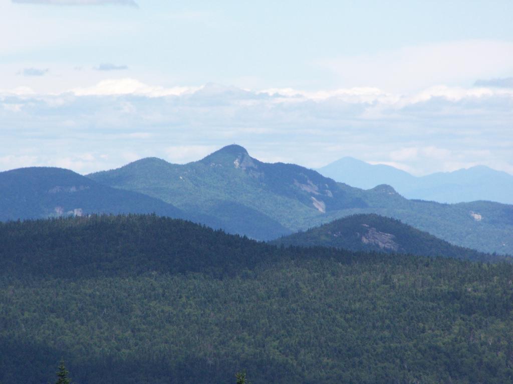
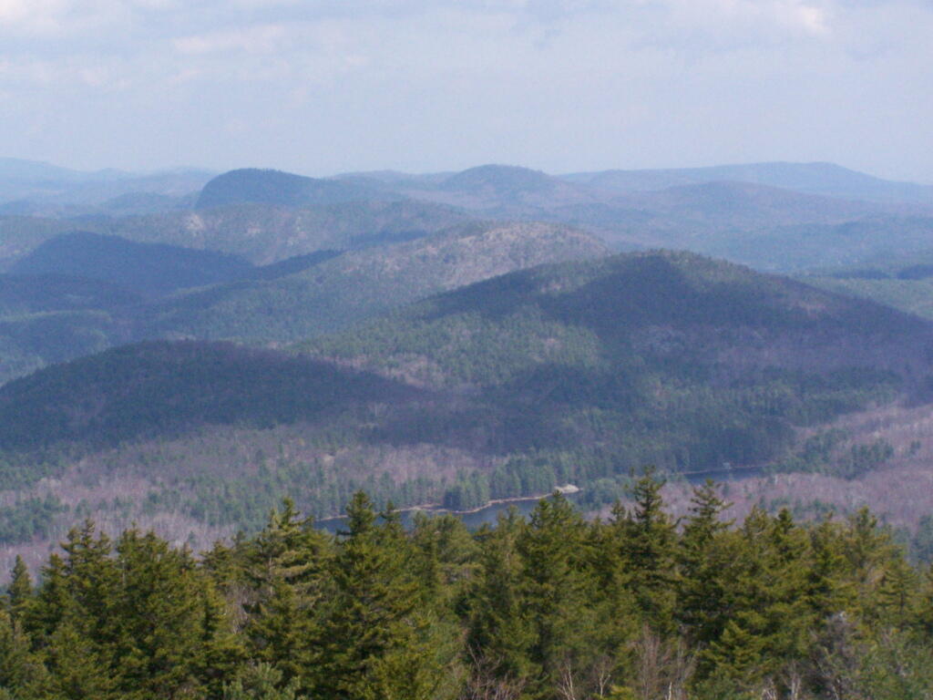
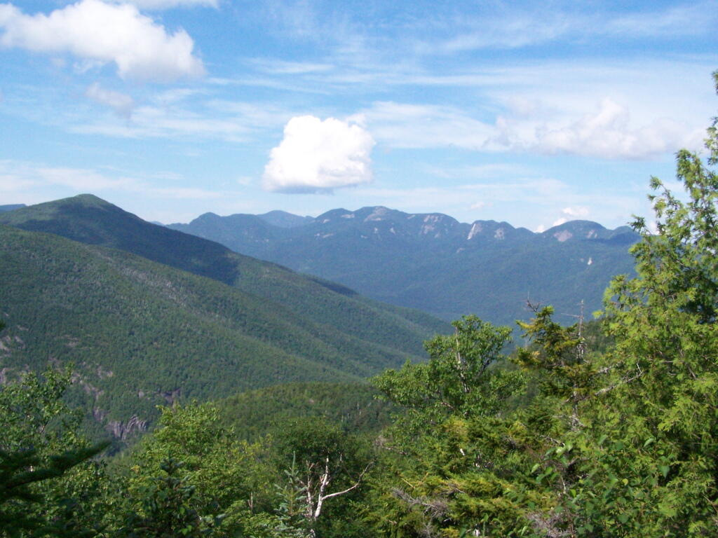
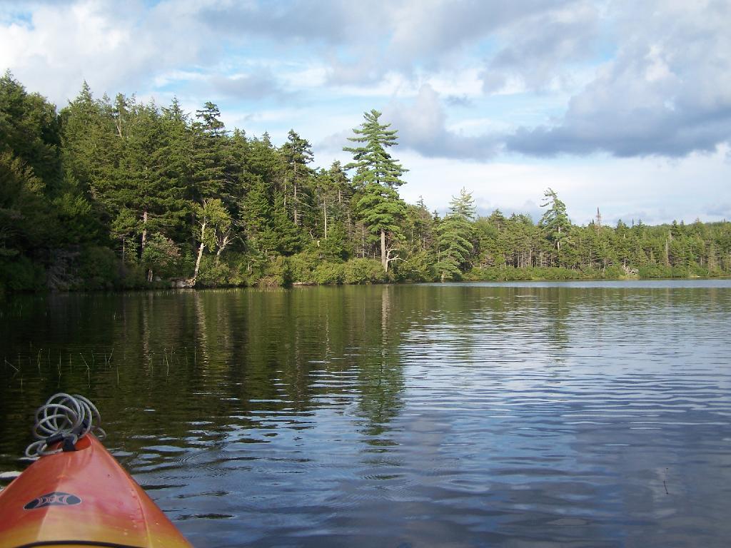
What may be done in these forest lands to preserve them or to open them up for the use of the public, or what reasonable cutting or removal of timber may be necessitated in order to properly preserve the State Park, [***12] we are not at this time called upon to determine. What regulations may reasonably be made by the Commission for the use of the park by campers and those who seek recreation and [**905] health in the quiet and solitude of the north woods is not before us in this case. The [*241] Forest Preserve and the Adirondack Park within it are for the reasonable use and benefit of the public, as heretofore stated. A very considerable use may be made by campers and others without in any way interfering with this purpose of preserving them as wild forest lands. (See “The Problem of the Wilderness” by Robert Marshall in “The Scientific Monthly,” Feb. 1930, p. 141.)

But the question still remains whether the construction of a toboggan slide, which requires the cutting of 2,500 trees, is such a reasonable use, or is forbidden by the Constitution.

Counsel for the appellants has very ably argued that as the underlying purpose of all these restrictions upon the State lands is to preserve them for the free use of all the people for their health and pleasure, the erection of a toboggan slide for sport is within this purpose. He has pressed upon our attention the fact that outdoor sports do [***13] much to maintain the health, the happiness and the welfare of the people of this State; and that if a branch of these outdoor sports is to a minor extent permitted within the public lands, the very purpose which the framers of the Constitution of 1894 had in mind will be accomplished; that it is the benefit to the people which this constitutional provision sought to preserve in the preservation of the forest. What can be more beneficial, asks counsel, than the establishment of forest sports, among which is classed this toboggan slide? We must admit much, if not all, that counsel has so eloquently pleaded in behalf of outdoor games. Perhaps much may be due to international sports, such as the Olympic games, lawn tennis, golf, even aviation, for creating good will among the nations, and a desire to establish those friendly relationships so vigorously claimed and earnestly sought for through treaties and world conferences. However tempting it may be to yield to the seductive influences of outdoor sports and international contests, we must not overlook the fact that [*242] constitutional provisions cannot always adjust themselves to the nice relationships of life. The framers [***14] of the Constitution, as before stated, intended to stop the willful destruction of trees upon the forest lands, and to preserve these in the wild state now existing; they adopted a measure forbidding the cutting down of these trees to any substantial extent for any purpose.

Tobogganing is not the only outdoor sport. Summer sports in the Adirondacks attract a larger number of people than the winter sports, simply for the reason, if no other, that the summer time still remains the vacation period for most of us. The same plea made for the toboggan slide in winter might be made for the golf course in summer, or for other sports requiring the use or the removal of timber. In other words, this plea in behalf of sport is a plea for an open door through which abuses as well as benefits may pass. The Constitution intends to take no more chances with abuses, and, therefore, says the door must be kept shut. The timber on the lands of the Adirondack Park in the Forest Preserve, or that on the western slope of the Sentinel range cannot be cut and removed to construct a toboggan slide simply and solely for the reason that section 7, article VII, of the Constitution says that it cannot be [***15] done. (emphasis added)

Consequently, chapter 417 of the Laws of 1929, permitting the erection of this bobsleigh slide and the destruction of the trees is unconstitutional, and the judgment should be affirmed, with costs.

Section 212 of the State Highway Law

Section 212 of Highway Law.

S 212. Changing location of highways over certain lands owned and occupied by the state. 1. If a highway passes over or through lands wholly owned and occupied by the state, the location of such portion of such highway as passes through such lands may be altered and changed, or the same may be abandoned or the use thereof as a highway discontinued with the consent and approval of the state authority having jurisdiction or control over such lands by an order directing such change in location, abandonment or discontinuance. Such order shall contain a description of that portion of the highway the location of which has been changed, abandoned or discontinued, and a description of the new location thereof, if any, and shall be filed in the office of the state authority having control of such lands.

 Relatively Smooth Section of Crane Pond Road

John J. Kelly v. DEC Commissioner Jorling (1990).

You can read the court case online.

SUPREME COURT OF NEW YORK, APPELLATE DIVISION, THIRD DEPARTMENT

November 21, 1990

IN THE MATTER OF JOHN J. KELLY, APPELLANT,
v.
THOMAS C. JORLING, AS COMMISSIONER OF THE DEPARTMENT OF ENVIRONMENTAL CONSERVATION, RESPONDENT

Appeal from a judgment of the Supreme Court (Dominick J. Viscardi, J.), entered March 29, 1990 in Essex County in a proceeding pursuant to CPLR article 78, which dismissed a petition to prohibit respondent from directing closure of a portion of a road traversing State-owned land in Essex County.

Roemer & Featherstonhaugh (E. Guy Roemer of counsel), for appellant.

Robert Abrams, Attorney-General (Lawrence A. Rappoport of counsel), for respondent.

Kane, J. P. Casey, Mikoll, Yesawich, Jr., and Mercure, JJ., concur.

Author: Kane

OPINION OF THE COURT

Crane Pond Road is a gravel and dirt roadway located in the Town of Schroon, Essex County, of which the last 2 1/2 miles (hereinafter referred to as the road) lead through State-owned lands to the edge of Crane Pond. That part of the Adirondack Forest Preserve surrounding the road was reclassified “wilderness” in 1979 and, in 1987, the road itself was reclassified wilderness. In December 1989, respondent issued an order, pursuant to Highway Law ? 212, closing the road in accordance with the Adirondack State Land Master Plan. Guidelines within that plan called for the closing of roads which impermissibly allowed for the prohibited use by the public of motorized vehicles and equipment in wilderness areas. Petitioner, the Town Supervisor, subsequently commenced this CPLR article 78 proceeding to challenge respondent’s authority to close the road pursuant to Highway Law ? 212. Supreme Court found that respondent possessed such authority and dismissed the petition. This appeal followed.

We affirm. Petitioner apparently does not question respondent’s jurisdiction over the lands at issue or the State’s power to close the road, but instead challenges the specific statutory authority pursuant to which respondent ordered said closing. Highway Law Sec 212 was amended in 1988 to read as follows: “If a highway passes over or through lands wholly owned and occupied by the state, the location of such portion of such highway as passes through such lands may be altered and changed, or the same may be abandoned or the use thereof as a highway discontinued with the consent and approval of the state authority having jurisdiction or control over such lands by an order directing such change in location, abandonment or discontinuance. Such order shall contain a description of that portion of the highway the location of which has been changed, abandoned or discontinued, and a description of the new location thereof, if any, and shall be filed in the office of the state authority having control of such lands.” The 1988 amendment eliminated the need for the Commissioner of Transportation to issue the order of closure (see, L 1988, ch 161, ? 2), essentially leaving that decision to the State agency having appropriate jurisdiction (see, mem of State Dept of Transp, 1988 McKinney’s Session Laws of NY, at 1980-1981). Petitioner argues that the express language of the statute does not specifically authorize respondent to issue an order of closure and that no such power may properly be inferred therefrom. We disagree.

The primary consideration of statutory construction is legislative intent (see, Matter of Long v Adirondack Park Agency, 76 N.Y.2d 416, 422; Hudson City Savs. Inst. v Drazen, 153 A.D.2d 91, 93; see also, McKinney’s Cons Laws of NY, Book 1, Statutes ? 92), and courts are to avoid a literal construction when it leads to either a frustration of the over-all design of the Legislature (see, McKinney’s Cons Laws of NY, Book 1, Statutes ? 111) or an ineffectually absurd result (see, Matter of Long v Adirondack Park Agency, supra, at 421; see also, McKinney’s Cons Laws of NY, Book 1, Statutes ?? 144, 145). The legislative intent behind Highway Law ? 212 was to permit the State to close roads on State lands that endangered a State purpose (see, Matter of Altona Citizens Comm. v Hennessy, 77 A.D.2d 956, 957, lv denied 52 N.Y.2d 705). Adopting petitioner’s view, that respondent has the power to consent to and approve the closing of a roadway but does not possess the authority to order its closure, would eviscerate the statute and render it meaningless. In our view, the statute’s expressed intent provides an ample basis and rationale to conclude that “the state authority having jurisdiction or control over [state] lands” (Highway Law ? 212) is empowered to issue orders effectuating that authority. Accordingly, respondent’s order was a valid exercise of the statutory power given to the appropriate State agency pursuant to Highway Law ? 212.

Disposition

Judgment affirmed, without costs.

North Up to Piseco-Powley

In the Matter of the Alleged Violations by JAMES W. McCULLEY, Respondent. (2009)

This is an excerpt of relvant portions of this adminstrative law decision.

2. Department’s Jurisdiction To Regulate Motor Vehicle Traffic Over Old Mountain Road

Department staff contends that the portion of Lot 146 owned by the State is part of the forest preserve. Accordingly, staff asserts jurisdiction to regulate motor vehicle traffic over that portion of Old Mountain Road that crosses State-owned land.

Department staff has established that the State-owned portion of Lot 146 is part of the forest preserve. It is undisputed that the State acquired the northern half and southeastern quarter of Lot 146 in 1875 (see Deed, Department Exh 48, at 556). The forest preserve was subsequently created by chapter 283 of the Laws of 1885, which provided in relevant part:

“All lands now owned or which may hereinafter be acquired by the state of New York within the counties of . . . Essex . . . shall constitute and be known as the forest preserve.”

(L 1885, ch 283, § 7). Chapter 283 is now codified at ECL 9- 0101(6). Thus, the State-owned portion of Lot 146 was and remains part of the forest preserve.

The existence of Old Mountain Road as a public right of way, however, pre-dates the State’s ownership of Lot 146. In the 1810 legislation appropriating money for the repair of Old Mountain Road, the State Legislature declared the road to be a “public highway” (L 1810, ch CLXXVII, § I). Because the Legislature did not provide for acquisition of the fees underlying the public highway, the public acquired merely an easement of passage, the fee title remaining in the landowners (see Bashaw v Clark, 267 AD2d 681, 684-685 [1999]). Thus, when the State acquired its portion of Lot 146 from the prior landowner, it did so subject to a public highway in the nature of an easement (see id.; see also Matter of Moncure v New York State Dept. of Envtl. Conservation, 218 AD2d 262, 267 [1996] [when the Department acquires forest preserve lands burdened by a leasehold, the Department takes such property subject to that leasehold]).

Department staff asserts that subsequent statutory law vests the Department with jurisdiction over public rights of way crossing forest preserve land. Accordingly, citing the Vehicle and Traffic Law, Department staff asserts that it has the power to “prohibit, restrict or regulate” motor vehicle traffic on any highway under its jurisdiction, including Old Mountain Road (see Vehicle and Traffic Law [“VTL”] § 1630). Pursuant to section 1630, Department staff claims it has the authority to close Old Mountain Road to motor vehicle traffic while allowing pedestrian and other forms of non-motorized traffic (see Adirondack Park State Land Master Plan [updated June 2001], DEC Exh 17, at 66 [indicated that Old Military Road has been closed]).

Respondent, on the other hand, argues that Old Mountain Road was and remains under the jurisdiction of the Towns of North Elba and Keene. 3 Thus, respondent contends that the exception under 6 NYCRR 196.1(b) for roads under the jurisdiction of a town highway department applies in this case (see 6 NYCRR 196.1[b][1]). Respondent contends that the exception for public rights of way over State land also applies (see 6 NYCRR 196.1[b][5]).4

VTL § 1630 does not itself vest in the Department jurisdiction over any particular highway. Whether a State agency has jurisdiction to regulate motor vehicle traffic pursuant to section 1630 depends upon whether that agency is otherwise authorized by law to regulate the use and management of the public highway at issue (see People v Noto, 92 Misc 2d 611, 612- 613 [1977]; see also Highway Law § 3)

On this motion, it cannot be determined, as a matter of law, which entity has jurisdiction to regulate the use and management of Old Mountain Road. When the New York State Legislature declared Old Mountain Road to be a public highway in 1810, it provided that after an initial four-year period of repair and improvement by a commissioner specially appointed for that purpose, the maintenance of the road would be assumed by the several towns through which it passed (see L 1810, ch CLXXVII, § III). Thus, at the time the State acquired Lot 146, subject to the public right of way, that right of way was apparently a town road under the jurisdiction of the Town of Keene and later the Town of North Elba (see Highway Law § 3[5]).5

Nothing in the submissions on this motion allow me to conclude, as a matter of law, that jurisdiction to regulate the use and management of Old Mountain Road has transferred from the Towns of North Elba and Keene to the Department. To the contrary, conflicting statutory provisions and circumstantial evidence require further legal argument and evidentiary proof before such a determination can be made.

For example, in support of Departmental jurisdiction to regulate traffic, Department staff notes that when the powers of the Conservation Department were revised in 1916, the “free use of roads” provision from the 1885 law limiting the forest commission’s power to prescribe rules and regulations for the forest preserve, was eliminated (see L 1916, ch 451). Staff further notes that the current ECL and Executive Law provisions authorizing the Department to make necessary rules and regulations for the protection of the forest preserve generally, and the Adirondack Park specifically, contain no limitation on regulating the free use of roads (see ECL 9-0105[3]; Executive Law § 816). However, although the Department has the power to regulate uses of the forest preserve generally, and the Adirondack Park specifically, it does not necessarily follow that such power includes the authority to regulate public rights of way under the jurisdiction of other State entities or municipalities.

In contrast, legislation adopted subsequent to 1916 suggests that the Department was not vested with the power to regulate use and maintenance of highways in the forest preserve. In 1924, the former State Commission of Highways was granted the power to maintain existing State and county highways in the forest preserve (see L 1924, ch 275). In 1937, town superintendents were expressly granted the right to occupy a right of way over State lands as may be required in the maintenance or reconstruction of town highways that cross those lands, subject to the approval of the Superintendent of Public Works and the Conservation Commissioner (see L 1937, ch 488). The grant of a right of way over State land to maintain and repair town highways strongly implies that towns retained jurisdiction over town highways in the forest preserve, notwithstanding the Department’s grant of authority to regulate the forest preserve generally (see Flacke v Town of Fine, 113 Misc 2d 56 [1982]).

Department staff also points out that Old Mountain Road has not appeared on either the Town of North Elba or the Town of Keene inventory of town highways. The evidence on this is equivocal, however. Old Mountain Road has not appeared on any inventory of State or county highways either (see L 1921, ch 18 [designating system of State and county highways]). On the other hand, Old Mountain Road did appear on a 1935 Highway Survey Commission map, although its status as a State, county or town highway is not indicated (see Department Exhs 51-53).

Respondent provides some circumstantial evidence suggesting that the Towns of North Elba and Keene retain the jurisdiction to regulate traffic on Old Mountain Road. For example, in 1971, the Town of North Elba adopted a resolution, which is still in effect, regulating the use of snowmobiles on Old Mountain Road (see N. Elba Ordinance [2-12-71], Affidavit of Norman Harlow, Highway Superintendent, Town of North Elba, Exh B). Respondent also provides letters dated June 7 and November 13, 1996, respectively, from Mr. Tom Wahl, former Department Regional Forester, expressing the opinion that Old Mountain Road remains a town highway (see Respondent Exhs 16 and 17).

Finally, research reveals some authority suggesting that Old Mountain Road is under the jurisdiction of predecessors to the Department of Transportation (see People v Paul Smith’s Elec. Light and Power and R.R. Co., Sup Ct, Essex County, July 29, 1953, Imrie, J., Decision, at 3-4, 6; 1950 Opn of the Atty Gen 153-154). Whether the portions of Old Mountain Road at issue here are subject to the above authorities, however, is unclear at this time.

In sum, legal and factual issues exist concerning whether the Department has jurisdiction under VTL § 1630 to regulate motor vehicle traffic on Old Mountain Road that require further hearings and legal argument.

3. Request for Relief Pursuant to Highway Law § 212

In its motion for order without hearing, Department staff requests an order of the Commissioner declaring Old Mountain Road between the eastern and western boundaries of the Sentinel Range Wilderness Area closed to all motorized vehicles and motorized equipment. Among the statutory authorities staff relies upon for this request is Highway Law § 212.

Highway Law § 212 provides:

“If a highway passes over or through lands wholly owned and occupied by the state, the location of such portion of such highway as passes through such lands may be altered and changed, or the same may be abandoned or the use thereof as a highway discontinued with the consent and approval of the state authority having jurisdiction or control over such lands by an order directing such change in location, abandonment or discontinuance”

The Department is the State authority with jurisdiction to order abandonment or discontinuance of roads over forest preserve lands in order to protect a relevant State interest (see Matter of Kelly v Jorling, 164 AD2d 181 [1990], lv denied 77 NY2d 807 [1991]; see also Matter of Altona Citizens Comm., Inc. v Hennessy, 77 AD2d 956, lv denied 52 NY2d 705). Such authority includes the power to order the discontinuance or abandonment of town highways (see id.).

Department staff does not address this request for relief in its brief in support of its motion. Nevertheless, to the extent Department staff contends that the Department has already closed Old Mountain Road pursuant to Highway Law § 212, I conclude that triable issues exist before the requested relief may be granted. Staff supplies no evidence that a Departmental order pursuant to Highway Law § 212 has been filed with respect to that portion of Old Mountain Road that is at issue in this case. Accordingly, to the extent Department staff relies upon such a closure order in support of the violation alleged against respondent, staff has not established a prima facie case.

With respect to abandonment, an order of closure is not required to deem a public right of way extinguished by operation of law if the highway has in fact been abandoned by the public for six years or more (see Matter of Wills v Town of Orleans, 236 AD2d 889, 890 [1997]). However, the record reveals triable issues of fact concerning abandonment (see Matter of Smigel v Town of Rensselaerville, 283 AD2d 863, 864 [2001] [a determination of abandonment is a factual determination]).

Pedestrian use and even recreational use may support a finding of non-abandonment, even if a highway has not been subject to motor vehicle traffic, as staff alleges in this case (see Town of Leray v New York Cent. R. Co., 226 NY 109 [1919] [pedestrian use may preserve highway though vehicles are barred]; Matter of Smigel, 283 AD2d at 865 [recreational use may preclude finding of abandonment]). The record contains conflicting evidence concerning the degree to which the public has continued to use the road, thereby necessitating a hearing on abandonment.

With respect to discontinuance, assuming Department staff is seeking a prospective order from the Commissioner, such a prospective order would not support the violation alleged here. Moreover, it is not clear what findings, if any, the Commissioner must make and whether such an order can be issued on the present record. Again, Department staff does not address this item of relief in its brief. Accordingly, the request for a prospective order of closure pursuant to Highway Law § 212 is denied, without prejudice.

 Purple Flowers Along Otter Brook Road

Adirondack Council Press Release (2009).

You can read it here.

ADIRONDACK COUNCIL CALLS ON ENCON COMMISSIONER GRANNIS TO CLOSE FOREST PRESERVE ROADS IN WAKE OF JUDGE’S DECISION

Administrative Judge Declares Former Town Road in State Wilderness Area to be Open for Motorized Use; Grannis Should Re-Close it and Any Others Affected

For more information:
John F. Sheehan
518-432-1770 (ofc)
518-441-1340 (cell)

Released: Thursday, May 21, 2009

LAKE PLACID, N.Y. – The Adirondack Council today called on NYS Department of Environmental Conservation Commissioner Peter Grannis to use his administrative authority to re-close a former road in an Adirondack Wilderness Area that was opened to motorized traffic today by a state administrative law judge.

“It appears from the judge’s decision that the state didn’t properly close this road when it assumed ownership of it and converted it to a hiking, ski and horse trail,” said Adirondack Council Executive Director Brian L. Houseal. “But today’s decision doesn’t have to be the final word on the matter.

“Commissioner Grannis has the authority to use the NYS Vehicle and Traffic Law to prohibit the use of motorized vehicles on this and other roads that are affected by this decision,” Houseal explained. “We urge Commissioner Grannis to begin that process right away. He should have done so today, as this decision was announced, to avoid the chance that someone is already out there riding a jeep or an all-terrain vehicle on this road.

“It is also imperative that the DEC issue its ATV Policy for state lands, which was first announced by Commissioner Erin Crotty during the Pataki Administration,” Houseal said. “DEC cannot allow fragile wildlife habitat and water quality to suffer in New York’s premiere Wilderness Park due to DEC’s inability to complete its work in a timely way.”

Commissioner Grannis can act right now to stop motorized traffic in off-limits locations in the Adirondack Park by exercising NYS Highway Law Section 212, Houseal said,

NYS Highway Law Section 212:

§ 212. Changing location of highways over certain lands owned and occupied by the state. If a highway passes over or through lands wholly owned and occupied by the state, the location of such portion of such highway as passes through such lands may be altered and changed, or the same may be abandoned or the use thereof as a highway discontinued with the consent and approval of the state authority having jurisdiction or control over such lands by an order directing such change in location, abandonment or discontinuance. Such order shall contain a description of that portion of the highway the location of which has been changed, abandoned or discontinued, and a description of the new location thereof, if any, and shall be filed in the office of the state authority having control of such lands.

“If Commissioner Grannis doesn’t make use of Section 212, today’s decision could turn into a disaster for the natural character of the Adirondack Park,” Houseal explained. “There are more than one million acres of protected, roadless Wilderness in the Adirondack Park. It represents nearly 85 percent of all roadless, wilderness forest lands in the eastern United States. Yet, it is only 1/30th of New York State’s total land area – very rare.

“Opening these roads to motorized traffic will harm wildlife, water quality and the peaceful nature of the last big place left in the Northeast where you can escape the noise and pollution of motorized traffic,” he said.

Under the Adirondack Park State Land Master Plan, approved by the Legislature in 1972, all motorized or mechanized travel is banned by state law in Adirondack Wilderness Areas, including mountain bikes.

Another 1.5 million acres of the public Adirondack Forest Preserve is classified as Wild Forest, where motorized traffic is allowed on some designated highways, but not in sensitive areas. Today’s ruling could be interpreted to mean that any road that was never lawfully abandoned to motorized traffic is now open, regardless of its classification as Wilderness or Wild Forest.

The Adirondack Council is a privately funded not-for-profit organization dedicated to ensuring the ecological integrity and wild character of New York’s 9,300-square-mile Adirondack Park. The Council carries out its mission through research, education, advocacy and legal action. The Council has members in all 50 United States and on four continents.

Tiny Roadside Campsite

Resolution from Adirondack Assocation of Towns (2010).

From their 2010 Adirondack Towns Association Resolution Book.

RESOLUTION REQUESTING AMENDMENT OF HIGHWAY LAW SECTION 212 BACKGROUND OF RESOLUTION

The State of New York has closed Town roads in the Adirondacks without the consent and against the wishes of the involved Towns. Highway Law Section 212 which has been interpreted by the courts to authorize the Commissioner of the Department of Environmental Conservation to close roads by Commissioner’s order should be repealed or amended to remove that authority, because it does not provide due process to residents and the involved Towns. The remaining provisions of the Highway Law provide a procedure for towns to close abandoned town roads and to discontinue maintenance on roads which do not provide access to structures by declaring them to be “Qualified Abandoned”.

Whereas, Highway Law Section 212 entitled “Changing location of highways over certain lands owned and occupied by the state” provides as follows:

“If a highway passes over or through lands wholly owned and occupied by the state, the location of such portion of such highway as passes through such lands may be altered and19 changed, or the same may be abandoned or the use thereof as a highway discontinued with the consent and approval of the state authority having jurisdiction or control over such lands by an order directing such change in location, abandonment or discontinuance. Such order shall contain a description of that portion of the highway the location of which has been changed, abandoned or discontinued, and a description of the new location thereof, if any, and shall be filed in the office of the state authority having control of such lands.”

Whereas, the Appellate Division held in Altona Citizens Committee, Incorporated v. Hennessy, 77 AD2d 956 (3rd Dept., 1980) that “Section 212 as originally adopted, related to closing or changing the location of highways passing over lands wholly owned and occupied by the State for farm or prison purposes (L. 1920, ch. 558, s 1). In 1924, the statute was amended to permit the application of the statute to State lands without regard to their use (L. 1924, ch. 141). The removal of the restriction that only prison or farm lands were covered by the statute indicates a legislative intention that closure be permitted whenever a State purpose is endangered by a roadway on State land. To effectuate this intention of the Legislature the occupancy requirement of section 212 of the Highway Law should be given a liberal construction.”

Whereas, the State used Section 212 to close a road in the Town of Altona in the 1970s despite the fact that the State did not occupy the land and despite the fact that the land was occupied by the Ganienkeh group of Indians; and Whereas, the State used Section 212 to close a road in the Town of Wells in the 1970s (see Town of Wells v. New York State Department of Transportation, 90 Misc2d 535 [Sup. Ct. Hamilton County, 1977]); and

Where as, in December 1989 the Commissioner of the Department of Environmental Conservation ordered the closure of a well traveled town road (Crane Pond Road) in the Town of Schroon pursuant to Section 212, without the approval and despite the opposition of the duly elected officials of the Town of Schroon, (see Kelly v. Jorling, 164 AD2d 181 [3rd Dept., 1990]); and

Whereas, the New York State Department of Environmental Conservation proposes in the Silver Lake Unit Management Plan recently approved by the Adirondack Park Agency to “work with the Town of Wells”: to close the West River Road in the Town of Wells; and

Whereas, the Town Board of the Town of Wells is adamantly opposed to the closure of West River Road and wishes to continue to maintain it and to keep it open to the traveling public as it has been open for many decades; and

Whereas, Highway Law Section 212 as it currently exists; and as it has been interpreted, is a threat to the authority of the duly elected officials of the Town of Wells and their ability to maintain their transportation system; and20

Whereas, Section 212 also constitutes a threat to every town and village in the Adirondacks which has a town and village road passing through state lands,

NOW, THEREFORE, it is hereby RESOLVED that the Adirondack Association of Towns and Villages hereby requests that a bill be introduced in the New York State Legislature to amend Section 212 to make it clear that Section 212 may not be used by the State to close town and village roads in the Adirondacks, except where the lands are occupied and used by the State for prison or farm purposes as Section 212 provided when originally enacted.

CURRENT STATUS: DEC Commissioner Grannis dismissed an enforcement proceeding in Essex County against an individual driving on a road that the DEC had said was Forest Preserve on the ground that it had not been demonstrated that the road was an abandoned road or that the road was not a legal right-ofway for public use. The decision of Commissioner Grannis supports the town’s position that the DEC does not have the authority to close town roads that the town has continually maintained and does not wish to abandon.

Milepost 6 on Plains Road

Assemblywomen Sayward’s Bill Limiting Section 212 to Areas Outside of Adirondack Park (2011).

                STATE OF NEW YORK
        ________________________________________________________________________
 
            S. 343                                                    A. 149
 
                               2011-2012 Regular Sessions
 
                SENATE - ASSEMBLY
 
                                       (Prefiled)
 
                                     January 5, 2011
                                       ___________
 
        IN  SENATE — Introduced by Sen. LITTLE — read twice and ordered print-
          ed, and when printed to be committed to the Committee  on  Transporta-
          tion
 
        IN  ASSEMBLY — Introduced by M. of A. SAYWARD — read once and referred
          to the Committee on Transportation
 
        AN ACT to amend the highway law, in relation to changing the location of
          highways over certain lands owned and occupied by  the  state  in  the
          Adirondack park
 
          The  People of the State of New York, represented in Senate and Assem-
        bly, do enact as follows:
 
     1    Section 1. Section 212 of the highway law, as amended by  chapter  161
     2  of the laws of 1988, is amended to read as follows:
     3    §  212.  Changing  location  of  highways over certain lands owned and
     4  occupied by the state. 1. If a highway  passes  over  or  through  lands
     5  wholly  owned and occupied by the state, the location of such portion of
     6  such highway as passes through such lands may be altered and changed, or
     7  the same may be abandoned or the use thereof as a  highway  discontinued
     8  with the consent and approval of the state authority having jurisdiction
     9  or  control  over  such  lands  by  an  order  directing  such change in
    10  location, abandonment or discontinuance.  Such  order  shall  contain  a
    11  description  of  that  portion  of the highway the location of which has
    12  been changed, abandoned or discontinued, and a description  of  the  new
    13  location  thereof, if any, and shall be filed in the office of the state
    14  authority having control of such lands.
    15    2. The provisions of this section shall not apply to any highway with-
    16  in the Adirondack park, as defined in subdivision one of section  9-0101
    17  of the environmental conservation law.
    18    § 2. This act shall take effect immediately.
 
         EXPLANATION--Matter in italics (underscored) is new; matter in brackets
                              [ ] is old law to be omitted.
                                                                   LBD01285-01-1

Land Use Classifications in Adirondack Forest Preserve

These definations are from the Adirondack Park State Land Master Plan.

‘ ?>


View Larger Map ‘ ?>

Wild Forest.

A wild forest area is an area where the resources permit a somewhat higher degree of human use than in wilderness, primitive or canoe areas, while retaining an essentially wild character. A wild forest area is further defined as an area that frequently lacks the sense of remoteness of wilderness, primitive or canoe areas and that permits a wide variety of outdoor recreation.

Towards Indian Lake

To the extent that state lands classified as wild forest were given or devised to the state for silvicultural or wildlife management purposes pursuant to statutory provisions specifying that these lands will not form part of the forest preserve (if such provisions are constitutional), the following guidelines are not to be interpreted to prevent silvicultural or wildlife management practices on these lands, provided that other guidelines for wild forest land are respected.

Those areas classified as wild forest are generally less fragile, ecologically, than the wilderness and primitive areas. Because the resources of these areas can withstand more human impact, these areas should accommodate much of the future use of the Adirondack forest preserve. The scenic attributes and the variety of uses to which these areas lend themselves provide a challenge to the recreation planner. Within constitutional constraints, those types of outdoor recreation that afford enjoyment without destroying the wild forest character or natural resource quality should be encouraged.

Many of these areas are under-utilized. For example the crescent of wild forest areas from Lewis County south and east through Old Forge, southern Hamilton and northern Fulton Counties and north and east to the Lake George vicinity can and should afford extensive outdoor recreation readily accessible from the primary east-west transportation and population axis of New York State.

Snowy Mountain

Wilderness.

A wilderness area, in contrast with those areas where man and his own works dominate the landscape, is an area where the earth and its community of life are untrammeled by man–where man himself is a visitor who does not remain.

A wilderness area is further defined to mean an area of state land or water having a primeval character, without significant improvement or permanent human habitation, which is protected and managed so as to preserve, enhance and restore, where necessary, its natural conditions, and which:

(1) generally appears to have been affected primarily by the forces of nature, with the imprint of man’s work substantially unnoticeable;

(2) has outstanding opportunities for solitude or a primitive and unconfined type of recreation;

(3) has at least ten thousand acres of contiguous land and water or is of sufficient size and character as to make practicable its preservation and use in an unimpaired condition; and (4) may also contain ecological, geological or other features of scientific, educational, scenic or historical value.

Crane Pond from Pharaoh Mountain

Significant portions of the state lands within the Park are in a wilderness or near-wilderness condition today. These areas constitute nearly 20% of all designated federal and state wilderness east of the Rocky Mountains and 85% of the designated wilderness in the eleven northeastern states. At the time of the original enactment of this master plan, a majority of these areas contained some structures and improvements or were subjected to uses by the public or by official personnel that were incompatible with wilderness. However, the extent of these non-conforming uses was very modest from the standpoint of the total acreage involved. Since 1972 all but a few of those non-conforming uses have been removed by the Department of Environmental Conservation.

Gothics

Primative Area.

A primitive area is an area of land or water that is either:

1. Essentially wilderness in character but, (a) contains structures, improvements, or uses that are inconsistent with wilderness, as defined, and whose removal, though a long term objective, cannot be provided for by a fixed deadline, and/or, (b) contains, or is contiguous to, private lands that are of a size and influence to prevent wilderness designation; or,

2. Of a size and character not meeting wilderness standards, but where the fragility of the resource or other factors require wilderness management.

Northeast Tip

The definition recognizes two basic types of primitive areas: (i) where the ultimate goal is clearly to upgrade the area to wilderness at some future time, however distant, when the non-conforming uses can be removed and/or acquisition of private tracts is accomplished, and, (ii) where eventual wilderness classification is impossible or extremely unlikely.

An example of the first type would be the existence of a fire tower and associated structures and improvements (observer cabins, telephone lines, etc.) whose precise date of removal cannot be ascertained until the new aerial surveillance program of the Department of Environmental Conservation is fully implemented and communication systems modernized. Another example would be a private or minor public road traversing a tract otherwise suitable for wilderness designation or separating such an area from a designated wilderness. Finally, an extensive private inholding or a series of smaller private inholdings whose eventual acquisition is desirable but cannot now be provided for, might so affect a potential wilderness area as to require primitive designation.

Lows Ledge

The second type includes smaller tracts that are most unlikely to attain wilderness standards, such as a small island in close proximity to a highly developed shoreline, or larger tracts with non-conforming uses, such as a railroad or major public highway, that are essentially permanent, but where in each case the high quality or fragility of the resource requires wilderness management.

The definition recognizes two basic types of primitive areas: (i) where the ultimate goal is clearly to upgrade the area to wilderness at some future time, however distant, when the non-conforming uses can be removed and/or acquisition of private tracts is accomplished, and, (ii) where eventual wilderness classification is impossible or extremely unlikely.

Wakley Fire Tower

An example of the first type would be the existence of a fire tower and associated structures and improvements (observer cabins, telephone lines, etc.) whose precise date of removal cannot be ascertained until the new aerial surveillance program of the Department of Environmental Conservation is fully implemented and communication systems modernized. Another example would be a private or minor public road traversing a tract otherwise suitable for wilderness designation or separating such an area from a designated wilderness. Finally, an extensive private inholding or a series of smaller private inholdings whose eventual acquisition is desirable but cannot now be provided for, might so affect a potential wilderness area as to require primitive designation.

The second type includes smaller tracts that are most unlikely to attain wilderness standards, such as a small island in close proximity to a highly developed shoreline, or larger tracts with non-conforming uses, such as a railroad or major public highway, that are essentially permanent, but where in each case the high quality or fragility of the resource requires wilderness management.

Lows Ledge

Canoe Area.

A canoe area is an area where the watercourses or the number and proximity of lakes and ponds make possible a remote and unconfined type of water-oriented recreation in an essentially wilderness setting.

The terrain associated with parcels meeting the above definition is generally ideally suited to ski touring and snowshoeing in the winter months.

Long Pond Entrance