Truck Trails

State Truck Trails and Forest Preserve Roads Over A Half Mile

Looking for state land to wheel on? This list shows all of the conservation department-maintained DEC truck trails and public access roads that are more then a 1/2 mile long. This roads are varied, but most of them are dirt roads that take you through the back country. Town maintained roads through state forests are generally not shown on in this listing.

State Land Road Miles
Albert J. Woodford Memorial State Forest Truck Trail 0.7
Albert J. Woodford Memorial State Forest Janis Road 1.1
Aldrich Pond Wild Forest Powell Road 0.5
Aldrich Pond Wild Forest Mullins Flow Road 0.6
Aldrich Pond Wild Forest Little River Road 0.7
Aldrich Pond Wild Forest Silver Dawn Road 0.7
Aldrich Pond Wild Forest Jackworks Trail 1.1
Aldrich Pond Wild Forest South Creek Lake Road 1.6
Aldrich Pond Wild Forest Tyler Road 3.7
Aldrich Pond Wild Forest Streeter Lake Road 4.8
Allen Lake State Forest George Forest Road 1.5
Ambler State Forest Truck Trail 1.8
Ampersand Primitive Area Ampersand Park Road 3.2
Andersen Hill State Forest Big Pine Public Forest Acess Road 1.5
Arctic China State Forest China Public Forest Access Road 1.1
Arctic China State Forest Shears Public Forest Access Road 2
Arctic China State Forest Dunbar Public Forest Access Road 2.1
Armlin Hill State Forest Truck Trail 1.1
Arnold Lake State Forest Public Forest Access Road 0.9
Arnold Lake State Forest Hartwick Forest Access Road 1
Ashland Pinnacle State Forest Ashland Pinnacle Access Road #2 0.5
Ashland Pinnacle State Forest Haul Road #1/Long Path Hiking Trail 1.4
Avon Regional Office Goodlake Year Entrance Road 0.7
Baker School House State Forest Baker School House Public Forest Acess Road 1.8
Bald Mountain State Forest Howe Forest Road 2.4
Balsam Creek State Forest Briar Hill Road 1.5
Barbour Brook State Forest Barbour Brook Public Forest Access Road 2
Basswood State Forest Burlington Public Forest Access Road 0.5
Basswood State Forest Basswood Pond Public Forest Access Road 1
Basswood State Forest Dr. Crouch Truck Trail 1.3
Bates State Forest Pucker Street 1
Bates State Forest Bates Forest Road 2.6
Battle Hill State Forest Unnamed 1.3
Bear Pond Primitive Area Bear Pond Road 0.8
Bear Swamp State Forest Karsch Haul Road 0.5
Bear Swamp State Forest Joe Chamberlin Public Forest Access Road 1.6
Bear Swamp State Forest Roseboom Public Facility Truck Trail 1.8
Bear Swamp State Forest Snowmobile Trail 8.3
Bearpen Mountain State Forest Ski Run Road 2.1
Beartown State Forest Town Road 0.7
Beartown State Forest Cotton Road 0.8
Beartown State Forest Steam Mill Road 0.8
Beartown State Forest Aspen Hollow Road 2.4
Beaver Creek State Forest Public Forest Access Road 2, Madison 11 0.5
Beaver Creek State Forest Truck Trail -2-12 0.7
Beaver Creek State Forest Public Forest Access Road 1, Madison 11 1.3
Beaver Creek State Forest Truck Trail -1-12 3.6
Beaver Dam State Forest Sears Public Forest Acess Road 1.4
Beaver Meadow State Forest Weir Dam Truck Trail 0.5
Beebe Hill State Forest Barrett Pond Road 1.4
Beebe Hill State Forest Loop Road 2.3
Big Brook State Forest County Line Road Spur 0.6
Big Brook State Forest Walasek Mulcoy Road 0.8
Big Brook State Forest Hanifin Road 0.9
Big Brook State Forest County Line Road 1.4
Birdseye Hollow State Forest Sanford Lake Access Road 0.5
Black Creek State Forest Stanley Road 1.1
Black River Wild Forest Remsen Falls Trail 0.5
Black River Wild Forest Woods Lake Road 0.5
Black River Wild Forest Gull Lake Road 0.6
Black River Wild Forest Flansburg Road 0.7
Black River Wild Forest Party Road 0.7
Black River Wild Forest Black Creek Road 0.8
Black River Wild Forest Cohen Road 1.7
Black River Wild Forest Flansberg Road 2.6
Black River Wild Forest Black Creek Lake Road 3
Black River Wild Forest Haskell Road 3
Black River Wild Forest Mill Creek Road 3.4
Black River Wild Forest Nicks Lake Campground Roads 3.5
Black River Wild Forest Wolf Lake Landing Road 4.8
Black River Wild Forest West Creek Road 6.3
Blenheim Hill State Forest Ward Allen Road 1.1
Blenheim Hill State Forest Quarry Road 1.2
Blue Mountain Wild Forest Deer Pond Road 1.1
Blue Mountain Wild Forest Chain Lakes Road North 1.3
Blue Mountain Wild Forest Polaris Road 1.3
Bombay State Forest Cross Haul Road 0.7
Bombay State Forest Railroad Bed Public Forest Acess Road 1.2
Bombay State Forest Pike Brook Haul Road 3.1
Bonaparte’s Cave State Forest Corbine Road 0.8
Bonaparte’s Cave State Forest Mud Pond Road 0.8
Boutwell Hill State Forest Arab Hill Forest Road, Cha 1 Section 0.8
Boutwell Hill State Forest Arab Hill Forest Road, Cha 7 Section 2.1
Boyce Hill State Forest Jackson Forest Road 0.6
Brasher State Forest Route 53 Haul Road 0.5
Brasher State Forest Beaver Pond Trail 0.6
Brasher State Forest Kennehan Haul Road 0.8
Brasher State Forest Bush Road 1.1
Brasher State Forest Buckley Haul Road 1.2
Brasher State Forest Cc Dam Public Forest Access Road 1.2
Brasher State Forest Mccarthy Public Forest Access Road 1.6
Brasher State Forest Liberty Public Forest Access Road 1.7
Brasher State Forest Hastings Falls Haul Road 2.1
Brasher State Forest Wilson Public Forest Access Road 2.1
Brasher State Forest Camp / Larue Public Forest Access Road 2.2
Brasher State Forest Pascal Haul Road 2.4
Brasher State Forest Bush Public Forest Access Road 2.9
Brasher State Forest Railroad Bed Public Forest Access Road 3.6
Brokenstraw State Forest Brokenstraw Forest Road 1.7
Bryant Hill State Forest Hawk Forest Road 1.4
Buck Hill State Forest Hertz Road 0.7
Buck Hill State Forest Truck Trail 1.5
Buck Hill State Forest Buck Hill Road 3.1
Bucks Brook State Forest Access Trail 0.6
Buckton State Forest Buckton Haul Road 0.8
Bucktooth State Forest Baily Hollow Forest Road 0.6
Bucktooth State Forest Manley Hill Forest Road 1
Bully Hill State Forest Dixon Forest Road 1
Bully Hill State Forest Connection Forest Road 1.6
Bully Hill State Forest Stearns Forest Road 2.1
Burnt-Rossman Hills State Forest Koenig Road 0.5
Burnt-Rossman Hills State Forest Betty Brook Haul Road 0.6
Burnt-Rossman Hills State Forest Eminence Dead End Truck Trail 0.7
Burnt-Rossman Hills State Forest Duck Pond Road 1.2
Burnt-Rossman Hills State Forest Monkey Run Truck Trail East 1.3
Burnt-Rossman Hills State Forest Yankee Street Truck Trail 1.3
Burnt-Rossman Hills State Forest Betty Brook Road 1.4
Burnt-Rossman Hills State Forest Betty Brook Truck Trail 1.5
Burnt-Rossman Hills State Forest Duck Pond Truck Trail 1.5
Burnt-Rossman Hills State Forest Morey Road Truck Trail 1.7
Burnt-Rossman Hills State Forest Eminence Road Truck Trail 2.6
Burnt-Rossman Hills State Forest Burnt Hill Road 2.9
Bush Hill State Forest Fox Cross Forest Road 2
California Hill State Forest Wayawanda Road 0.7
Canacadea State Forest Macduff Road 2.3
Canadaway Creek Wma Dibble Hill Forest Road 2
Canaseraga State Forest Ringelberg Truck Trail 0.5
Canaseraga State Forest Right Fork Truck Trail 1
Canaseraga State Forest Stanley Road 1.1
Canaseraga State Forest Left Fork Truck Trail 1.4
Caroga Lake Campground Campground Road 2
Catherineville State Forest Santamont Access Trail 1.1
Catherineville State Forest Circle Public Forest Access Road 1.8
Charles E. Baker State Forest Truck Trail 5 0.6
Charles E. Baker State Forest Truck Trail 2 0.9
Charles E. Baker State Forest Truck Trail 6 0.9
Charles E. Baker State Forest Truck Trail 4 1.4
Charles E. Baker State Forest Truck Trail 12 1.5
Charles E. Baker State Forest Truck Trail 8 1.9
Charles E. Baker State Forest Truck Trail 7 2.1
Charles E. Baker State Forest Truck Trail 1 3
Charles E. Baker State Forest Truck Trail 13 3.2
Chazy Highlands State Forest Spring Road 0.6
Cherry Valley State Forest Kniskern Public Access Road 1.2
Cherry Valley State Forest Mosse Public Forest Access Road 1.9
Cinnamon Lake State Forest Hornby Road Haul Road 0.7
Clapper Hollow State Forest Clapper Hollow Truck Trail 1
Clark Hill State Forest Abandoned Town Road 0.8
Clark Hill State Forest Truck Trail 0.9
Clark Hill State Forest Access Road North Of Buck Hill Road 0.9
Clark Hill State Forest Class A Truck Trail 1.2
Clark Hill State Forest Haul Road 1.3
Cliffside State Forest Railroad Haul Road 1.3
Cobb Brook State Forest Unnamed Truck Trail 0.6
Cold Creek State Forest Headwaters Forest Road 1.4
Cold Spring Brook State Forest Cold Spring Brook Public Forest Access Road 1.9
Cole Hill State Forest Cr 2 Access Road 0.8
Coyle Hill State Forest Warner Spur Forest Road 0.5
Coyle Hill State Forest Slawson Forest Road 0.8
Coyle Hill State Forest Warner Forest Road 1.8
Cranberry Lake Campground Campground Road 2.5
Cranberry Lake Wild Forest Grass River Railroad 6.1
Cuyler Hill State Forest Jipson Hill Public Forest Acess Road 1.3
Cuyler Hill State Forest Cuyler Hill Public Forest Acess Road 5.1
David A. Sarnoff Preserve Field Access Road 0.8
Debar Mountain Wild Forest Debar Game Refuge Road 0.5
Debar Mountain Wild Forest Debar Meadow Road 0.6
Debar Mountain Wild Forest Vanderwalker Road 0.9
Debar Mountain Wild Forest 4 Mile Road Riffle Season Access Corridor 1.1
Debar Mountain Wild Forest Ny Centrail Railroad Bed 2.2
Deer River State Forest Ccc Road 0.6
Deer River State Forest Hogsback Road 0.6
Deer River State Forest Willow Road 0.6
Deer River State Forest Glaze Road 0.7
Deer River State Forest Avery Lot Road 0.9
Deer River State Forest Esseltine Hill Road 0.9
Deer River State Forest Ricky’s Number Trail 1
Deer River State Forest Horse Barn Road 1.2
Deer River State Forest Laramie Road 1.3
Deer River State Forest Beanville Road 1.4
Deer River State Forest Spruce Road 1.6
Deer River State Forest Loope Road 2
Deer River State Forest Firewood Road 2.6
Degrasse State Forest Burns Flats Road 0.5
Degrasse State Forest Loop Road 1.2
Deruyter State Forest Tromp Road 1.5
Dobbins Memorial State Forest Snowmobile Trail 3.5
Dog Hollow State Forest Brewer Public Forest Acess Road 0.9
Downerville State Forest River Public Forest Access Road 1
Dry Run State Forest Wildcat Hollow 0.8
Dunkin’s Reserve State Forest Access Road 3.5
Dutch Settlement State Forest Haul Road #1 0.6
Dutton Ridge State Forest Dutton Ridge Access Road 1.5
Earlville State Forest Mad 2 Forest Access Road 1.5
East Osceola State Forest Malloy Brook Road 1.1
East Otto State Forest Kriedeman Forest Road 1.7
Edgewood Oak Brush Plains Preserve Edgewood Oak Brush Plains Preserve 0.5
Edgewood Oak Brush Plains Preserve Unpaved Forest Road 0.5
Edgewood Oak Brush Plains Preserve Old Commack Road 1.6
English Hill State Forest Ricketts Forest Road 0.9
Exeter State Forest Exeter Public Forest Access Road 1.3
Fairfield State Forest Jenksville Hill Public Forest Acess Road 2
Fall Brook State Forest Gossner Road 0.6
Fall Brook State Forest Haul Road To B-45 Wetland 0.9
Fall Brook State Forest Access Road From Co. Rt 67A 1
Fall Brook State Forest Forest Access Roaad 1.2
Ferris Lake Wild Forest Meco Lake Trail 0.9
Ferris Lake Wild Forest Sheriff Lake Trail 0.9
Ferris Lake Wild Forest Mud Lake Road 5.5
Fish Creek State Forest Forward Road 0.5
Fish Creek State Forest Trestle Road 0.6
Fish Creek Wma State Highway 184 Access Road 0.9
Five Rivers Education Center Goose Lane 0.5
Flat Rock State Forest Pedobo Road 0.8
Flat Rock State Forest Karsch Haul Road 0.9
Flat Rock State Forest Ampersand Park Road 1.9
Florence Hill State Forest Florence Hill Road 1.9
Fort Jackson State Forest Sheldon Public Forest Access Road 0.5
Frank E. Jadwin Memorial State Forest Keesler Road 0.6
Frank E. Jadwin Memorial State Forest Old Croghan Road 0.7
Frank E. Jadwin Memorial State Forest Henry Road 0.8
Frank E. Jadwin Memorial State Forest Nelson Road 0.8
Frank E. Jadwin Memorial State Forest Wahalula Road 0.8
Frank E. Jadwin Memorial State Forest Q- Road 1.5
Frank E. Jadwin Memorial State Forest Patchin Road 1.7
Frank E. Jadwin Memorial State Forest Blanchard Creek Road 2.7
Frank E. Jadwin Memorial State Forest Wisner Road 2.7
Frank E. Jadwin Memorial State Forest Judy Cole Road 2.8
Frank E. Jadwin Memorial State Forest Loop Road 3.2
Fulton Chain Wild Forest Cary Lake Road 1.8
Furnace Creek State Forest Miller Road East 0.7
Furnace Creek State Forest Powerline Row 0.7
Furnace Creek State Forest Sheehan Road 1.2
Furnace Creek State Forest B-29 Road 1.4
Gates Hill State Forest Coons Den Truck Trail 0.6
Gates Hill State Forest Eviann Road 1.2
Genegantslet State Forest South Loomis Road 0.7
Gillies Hill State Forest Abbey Forest Road 0.9
Gillies Hill State Forest Pettit Forest Road 1.4
Golden Hill State Forest Firelane Forest Road 1.6
Goundry Hill State Forest Guiren Road 1
Goundry Hill State Forest Corbett Hollow Access Road 1.1
Grant Powell State Forest Huck Berry Road 2.1
Grass River Wild Forest Spruce Mountain Road 0.8
Grass River Wild Forest Hollywood Road 2.5
Grass River Wild Forest Railroad Grade Road 2.9
Greenwood Creek State Forest Grass Pond Public Forest Access Road 0.9
Grigg’s Gulf State Forest Grigg’s Gulf Public Forest Acess Road 1.5
Gulf Unique Area Gulf R.O.W. Road 0.5
Gulf Unique Area Old Skid Road 1.1
Hall Island State Forest Unnamed Public Forest Acess Road 0.7
Hammond Hill State Forest Redman Run Public Forest Acess Road 1.1
Hammond Hill State Forest Cannan Public Forest Acess Road 1.3
Hammond Pond Wild Forest Paynes Way 0.7
Harris Hill State Forest Sprague Forest Road 0.8
Harvey Mountain State Forest Harvey Mt Access Road 0.9
Harvey Mountain State Forest East Hill Access Road 2.4
Hatch Creek State Forest Hodge Forest Road 0.6
Hatch Creek State Forest North Forest Road 0.8
Hatch Creek State Forest South Forest Road 0.9
Hemlock-Canadice State Forest South Hemlock Access Road 0.7
Henderson Shores Unique Area Radar Road 0.8
Hewitt State Forest Hewitt Rd 1.1
Hickok Brook Multiple Use Area Spur Road 0.7
Hickok Brook Multiple Use Area Main Road 1.1
High Flats State Forest Chapel Hill Access Trail 0.5
High Flats State Forest Crowley Access Trail 0.5
High Flats State Forest Close Pond Access Trail 0.7
High Flats State Forest Donovan Public Forest Access Road 1.1
High Knob State Forest Shale Pit Road 1.9
High Peaks Wilderness Northville-Placid Trail-Northern Terminus 1.1
Hill Higher State Forest Hill Higher Forest Road 1.1
Hinckley State Forest Elm Flats Road 0.5
Hinckley State Forest Roberts Road 0.5
Hinckley State Forest Lanning Road 0.8
Hinckley State Forest Access Road 1.6
Hinckley State Forest Black Creek Road 2
Hogsback State Forest Forest Access Road 3
Honey Hill State Forest Edwards Public Forest Access Road 1.4
Hooker Mountain State Forest Norton Public Forest Access Road 0.8
Horseshoe Lake Wild Forest Cut Off Road 0.6
Horseshoe Lake Wild Forest Lower Dam Road 0.7
Horseshoe Lake Wild Forest Otter Brook Trail 0.9
Horseshoe Lake Wild Forest Grass River Railroad 1.7
Horseshoe Lake Wild Forest Otter Brook Road 2.2
Hoxie Gorge State Forest Russel Hill Public Forest Acess Road 2.5
Huntersfield State Forest Huntersfield Access Road #2 0.7
Huntersfield State Forest Huntersfield Access Road #1 1.9
Hunts Pond State Forest Truck Trail 1.7
Independence River State Forest Assembly Road 1
Independence River Wild Forest Blue Jog Road 0.5
Independence River Wild Forest Sunday Lake Road 0.5
Independence River Wild Forest Evies Pond Road 0.7
Independence River Wild Forest Burnt Creek Road 0.7
Independence River Wild Forest Elbow Rd 0.7
Independence River Wild Forest Shortcut Road 0.8
Independence River Wild Forest Fish Pond Road 1
Independence River Wild Forest Halfmoon Lake Rd 1
Independence River Wild Forest Little Otter Creek Road 1
Independence River Wild Forest Long Pond Spur 1
Independence River Wild Forest East Loop Road 1.1
Independence River Wild Forest Copper Lake Road 1.2
Independence River Wild Forest Necessary Dam Road 1.2
Independence River Wild Forest Pitcher Pond Road 1.3
Independence River Wild Forest Hinchings Pond Road 1.8
Independence River Wild Forest Basket Factory Road 2.1
Independence River Wild Forest Catspaw Lake Road 2.4
Independence River Wild Forest Confusion Flats Road 2.6
Independence River Wild Forest Big Otter Lake Road 3.1
Independence River Wild Forest Stony Lake Road 3.1
Independence River Wild Forest Florence Pond Road 3.1
Independence River Wild Forest Steam Mill Road 3.5
Independence River Wild Forest Smith Road 3.7
Indian Pipe State Forest Dunes Road 0.7
Indian River Wma Red Lake Road 2
Jackson Hill State Forest Forest Access Road 2.1
Jersey Hill State Forest Scholes Forest Road 1.6
Jessup River Wild Forest Lake Colby Camp Road 0.7
Karr Valley Creek State Forest Frungillo Forest Road 0.8
Karr Valley Creek State Forest Norton Forest Road 1.3
Karr Valley Creek State Forest Davison Forest Road 1.4
Keeney Swamp State Forest Fitch Hill Spur Forest Road 0.7
Keeney Swamp State Forest C3D 0.8
Keeney Swamp State Forest Fitch Hill Forest Road 1.2
Keeney Swamp State Forest Gordon Forest Road 1.4
Kennedy State Forest Courtney Hill Public Forest Acess Road 0.7
Kennedy State Forest Cotton-Hanlon Public Forest Acess Road 1
Kennedy State Forest Kennedy Public Forest Acess Road 2.5
Kenneth Wilson Campground Campground Road 9.7
Ketchumville State Forest Ketchumville Public Forest Acess Road 1
Keyserkill State Forest Guinea Road Truck Trail 1
Keyserkill State Forest Keyserkill Truck Trail #1 1.3
Klipnocky State Forest Emery Forest Road 1.2
Klipnocky State Forest Marble Forest Road 1.6
Klondike State Forest Klondike Public Forest Acess Road 1.7
Lafayetteville Multiple Use Area Wilbur Flats Road 0.9
Lake Durant Campground Scott Public Forest Acess Road 0.9
Lake George Wild Forest Jabe Pond Road 1
Lake George Wild Forest Dacy Clearing Road 1.6
Lake George Wild Forest Lily Pond Road 2.1
Lake George Wild Forest Gay Pond Road 4
Lake Harris Campground Campground Road 0.9
Lakeview Marsh Wma Skinner Road 0.7
Leonard Hill State Forest Leonard Hill Access Road #1 0.7
Leonard Hill State Forest Leonard Hill Access Road #3 1.2
Leonard Hill State Forest Leonard Hill Access Road #2 1.6
Lesser Wilderness State Forest Gomer Hill Road 0.5
Lesser Wilderness State Forest Toole Road 0.6
Lesser Wilderness State Forest Alguire Road 0.7
Lesser Wilderness State Forest Smith Road 0.8
Lesser Wilderness State Forest Nob Road 0.9
Lesser Wilderness State Forest Seelman Road 1.3
Lesser Wilderness State Forest Mcgoldrick Road 3
Lesser Wilderness State Forest #9 Road 4.7
Limekiln Lake Campground Lime Kiln Lake Campground Trails 3.9
Linda Gronlund Memorial At Barcelona Neck Trustee Road West 1
Linda Gronlund Memorial At Barcelona Neck Trustee Road East 1.7
Lonesome Bay State Forest Alamogin Public Forest Access Road 2.2
Long Pond State Forest Access Road 0.5
Long Pond State Forest Truck Trail 0.7
Long Pond State Forest Long Pond Snowmobile Trail 0.8
Lookout State Forest Ball Road 0.6
Lost Nation State Forest Brookdale Road / Jenkins Corners Rd / Red Barn Rd 2.5
Lost Valley State Forest Lost Valley Haul Road 1.2
Lowville Demonstration Area Dadville Road 0.6
Ludlow Creek State Forest Trail Road 1.3
Lutheranville State Forest Access Road #1 0.5
Lutheranville State Forest Access Road #2 1.2
Lyon Brook State Forest Lyon Brook Truck Trail 1.2
Mad River State Forest Thompson Corners Florence Road 0.5
Mad River State Forest Bartlett Road 0.6
Mad River State Forest Rehm Road 0.6
Mad River State Forest Phalen Road South 1.9
Mad River State Forest Mcspirit Road 2.1
Madawaska Flow – Quebec Brook Primitive Area Benz Pond Road 2.2
Mallet Pond State Forest Cemetery Road Truck Trail 2
Maxon Creek State Forest Pease Hill Public Forest Acess Road 1
Mccarthy Hill State Forest Main Access Road 0.5
Mccarty Hill State Forest Ccc Forest Road 1.5
Mccarty Hill State Forest Mccarty Hill East Forest Road 2
Mcdonough State Forest Ccc Trail 1
Mcdonough State Forest Truck Trail 4 1.1
Mcdonough State Forest Finger Lakes Trail 1.8
Mcdonough State Forest Truck Trail 3 2
Melondy Hill State Forest Public Forest Access Road 2.5
Montrose Point State Forest Through Trail 0.6
Moose River Plains Wild Forest Loop Road 1.2
Moose River Plains Wild Forest Indian Lake Road 3.4
Moose River Plains Wild Forest Otter Brook Road 3.4
Moose River Plains Wild Forest Rock Dam Road 4.2
Moose River Plains Wild Forest Lime Kiln Lake – Cedar River Road 16.9
Morgan Hill State Forest Herlihy Haul Road 0.6
Morgan Hill State Forest Keith Gutchess Haul Road 0.7
Morrow Mountain State Forest Mollie Road 2.8
Mount Hunger State Forest Whalen Road 0.6
Mount Pisgah State Forest Mt Pisgah Access Road #1 1.3
Mount Pleasant State Forest Beck Forest Road 0.6
Mount Pleasant State Forest Brumagin Forest Road 0.7
Mount Pleasant State Forest Spruce Forest Road 0.8
Mount Tom State Forest Notch Lane Access Road 1.4
Mount Tom State Forest Shaker Hollow Access Trail 1.4
Muller Hill State Forest Davenport Road 1.4
Muller Hill State Forest Bliss Road 1.5
New Forge State Forest New Forge Access Road #2 0.5
New Forge State Forest New Forge Access Road #3 0.6
New Forge State Forest New Forge Access Road 1.5
Newfield State Forest Irish Hill Haul Road 0.8
Nicks Lake Campground Nicks Lake Campground Roads 0.6
Nimham Mountain Multiple Use Area Coles Mills Road 0.7
Nimham Mountain Multiple Use Area Tower Road 0.7
Nine Mile Creek State Forest North Nine Mile Town Road 0.5
Nine Mile Creek State Forest Phearsdorf Forest Road 0.5
Nine Mile Creek State Forest North Nine Mile Forest Road 2.2
North Harmony State Forest Snake Forest Road 0.9
North South Lake Campground South Lake Road 1.3
North South Lake Campground North Lake Campground Road 1.8
Northhampton Beach Campground Campground Road 5.5
Oakley Corners State Forest Oakley Corners North Public Forest Acess Road 1.6
Ohissa State Forest Cramers Corner Road 0.8
Onjebonge State Forest Lime Quarry Road 1.3
Onjebonge State Forest Alice Coffey Road 2.5
Orebed Creek State Forest Ritz Road 1.3
Ossian State Forest Back Road To Rattlesnake 0.7
Ossian State Forest Scoville Access Road 1
Ossian State Forest Linzy Road Truck Trail 1.8
Otselic State Forest Truck Trail 3.1
Otsquago State Forest Wagner Hill Road 0.8
Otter Creek State Forest Eatonville Road 0.6
Otter Creek State Forest Mikes Road 1.2
Otter Creek State Forest Otter Creek Road 1.5
Palmer’s Pond State Forest Geitner Forest Road 0.7
Palmer’s Pond State Forest Palmer’s Pond Forest Road 1.5
Palmer’s Pond State Forest 6 2.4
Partridge Run Wma Boys Camp Road Ext 2
Patria State Forest Pleasant Valley Road 0.6
Patria State Forest Barkman Road Access 0.6
Patria State Forest Hardscrabble Road Access 0.8
Peck Hill State Forest Swamp Road 0.5
Peck Hill State Forest West Boundary Trail 0.6
Peck Hill State Forest Beaver Vly 0.7
Peck Hill State Forest Dam Road 0.7
Penn Mountain State Forest Star Hill Road 1
Penn Mountain State Forest West Gate Road 2.6
Penn Mountain State Forest South Gate Road 3.6
Penn Mountain State Forest East Gate Road 3.8
Perch River Wma Perch Lake Road 0.5
Perch River Wma Buckminster Road 0.9
Perch River Wma Cook Road 1.4
Perch River Wma Allen Road 2.1
Perch River Wma State Route 12 2.6
Perch River Wma Vaadi Road 3
Perch River Wma Dog Hill Road 4
Pharsalia Woods State Forest Nine Mile Truck Trail Snowmobile Trail 1.6
Piermont Marsh Tidal Wetland Piermont Pier Access Road 0.9
Pine Hill State Forest Bundy Hollow Public Forest Access Road 1
Pittstown State Forest State Fire Lane 2.2
Plainfield State Forest Hughes Public Forest Access Road 1.3
Plattekill State Forest Mountain Brook Road 1
Plumbottom State Forest Reddy Forest Road 3
Point Peninsula Wma Pine Woods Road 1.5
Point Peninsula Wma Beach Road 2.1
Point Peninsula Wma Shore Road 8
Point Rock State Forest Egger Brrok Raod 1.3
Popple Pond State Forest Smith Road 0.7
Popple Pond State Forest Haul Road Shared By Oneida 6 And County Forest 1.6
Popple Pond State Forest Truck Trail 3
Potato Hill State Forest Blackman Hill Rd 1.1
Potato Hill State Forest Level Green Rd 1.2
Pulpit Rock State Forest Watson Road 0.6
Punkeyville State Forest Irish Settlement Road 0.7
Punkeyville State Forest River Road 0.9
R Milton Hick Memorial State Forest Lafleuer Road 1.2
Relay State Forest Relay Public Forest Access Road 1.2
Rensselaerville State Forest Kenyon Road Access 2.4
Ridge Conservation Area And Maintenance Center Mid-Island Access Road 0.5
Rock City State Forest Salamanca Forest Road 0.8
Rock City State Forest Eckert Forest Road 0.9
Rock City State Forest Little Rock City Forest Road 2
Rock Creek State Forest Admin Access Road 1.3
Rockwood State Forest Spring Road 0.5
Rockwood State Forest B Road 0.6
Rocky Point Pine Barrens State Forest Accessible 0.5
Rocky Point Pine Barrens State Forest Firestone Road 1.7
Rural Grove State Forest Rural Grove Access Road (Shibley Road) 3.1
Rush Creek State Forest C2-C 1.2
Rush Creek State Forest Russell Forest Road 3
Sacandaga Campground Sacandaga Campground 1.4
Salmon River State Forest Harpers Ferry Public Forest Acess Road 0.9
Sand Flats State Forest Bucks Corners Road 0.9
Sand Flats State Forest Obrian Road 0.9
Sand Flats State Forest Water Hole Road 1
Sand Flats State Forest Y Road 1.5
Sand Flats State Forest Powell Road 1.7
Sand Flats State Forest Fall Brook Road 2.2
Saranac Lakes Wild Forest Horseshoe Pond Trail 0.5
Saranac Lakes Wild Forest Little Clear Pond Road 0.5
Saranac Lakes Wild Forest Connery Pond Road 0.6
Saranac Lakes Wild Forest Little Green Pond Road 0.6
Saranac Lakes Wild Forest Rollins Pond Access Road 0.8
Saranac Lakes Wild Forest Medow Pond Truck Trail 0.9
Saranac Lakes Wild Forest Bartlett Carry Road 1.2
Saranac Lakes Wild Forest Floodwood Mountain Road 1.2
Saranac Lakes Wild Forest Rat Pond Road 1.5
Saranac Lakes Wild Forest Sunday Pond Road 1.6
Scott Patent State Forest Scott Patent Access Road 1.4
Shawangunk Ridge State Forest Woods Road 1
Shindagin Hollow State Forest Ekroos Public Forest Acess Road 1.4
Skyline Drive State Forest Skyline Drive Public Forest Acess Road 2.2
Slader Creek State Forest Oberdorf Forest Road 2.1
Sonyea State Forest Shaker Access Road 1.9
South Bradford State Forest Ccc Road 1.6
South Hill State Forest South Hill Truck Trail 0.5
South Hill State Forest Public Forest Access Road Extension 0.9
South Hill State Forest South Hill Public Forest Access Road 0.9
South Hill State Forest Kotary Road Extension 1
South Hill State Forest Powerline Road 1
South Mountain State Forest Ashland Pinnacle Access Road #2 0.5
South Mountain State Forest South Mountain Access Road 0.9
South Mountain State Forest Bluebird Road 1.1
South Valley State Forest Phillips Brook Fr First Section 0.7
South Valley State Forest Phillips Brook Forest Road 1.2
St. Regis River State Forest Old Railroad Bed 1.6
Stammer Creek State Forest Sugar Bush Haul Road 1.1
Steam Mill State Forest Zion Public Forest Access Road #2 0.5
Steam Mill State Forest Glass House Hill Road 1
Steam Mill State Forest Assembly Road 1.1
Steam Mill State Forest Steammill Rd 1.4
Steam Mill State Forest Carroll Hill Public Forest Access Road #2 1.9
Steam Mill State Forest Zion Public Forest Access Road #1 2
Steam Mill State Forest Carroll Hill Public Forest Access Road #3 2.5
Stewart State Forest Great Swamp Road 0.5
Stewart State Forest Drakes Ln 0.6
Stewart State Forest Orlando Dr 0.6
Stewart State Forest Ridge Road South 0.6
Stewart State Forest Scofield Lane 0.7
Stewart State Forest Armstrong Lane Trail 0.9
Stewart State Forest Giles Road 0.9
Stewart State Forest Pittman Robertson Pond Road 0.9
Stewart State Forest Weed Road 1.2
Stewart State Forest Beaver Pond Road 1.3
Stewart State Forest Barron Road 1.8
Stewart State Forest Barron Road South 208 1.8
Stewart State Forest Ridge Road 2.8
Stewart State Forest Maple Ave 3.1
Stewart State Forest New Road 3.4
Stockton State Forest Blackman Forest Road 1.4
Stone Store State Forest Fawn Ridge Road 2.7
Sugar Hill State Forest Firetower Access Road 0.5
Sugar Hill State Forest Old Westerfield Road 0.5
Sugar Hill State Forest A Trail 1
Sugar Hill State Forest Pine Knob Road 1
Sugar Hill State Forest Maple Lane 2.1
Summer Hill State Forest Snowmobile Trail 5
Sundown Wild Forest South Mountain Extension 1
Swancott Hill State Forest Tower Road 2.3
Swancott Mill State Forest Swancott Mill Road 0.9
Taconic Hereford Multiple Use Area Pirate Crrek 0.5
Taconic Hereford Multiple Use Area Whatchamacallit 0.5
Taconic Hereford Multiple Use Area Camp 0.6
Taconic Hereford Multiple Use Area Mercury 0.6
Taconic Hereford Multiple Use Area Border Trail 0.8
Taconic Hereford Multiple Use Area Mustang 0.8
Taconic Hereford Multiple Use Area Outer Gut 0.8
Taconic Hereford Multiple Use Area Brockway Road 0.9
Taconic Hereford Multiple Use Area Green Acres 1.2
Taconic Hereford Multiple Use Area Tsp Road 1.2
Taconic Hereford Multiple Use Area Pond Gut Road 1.3
Taconic Hereford Multiple Use Area Timbuktu 1.3
Taconic Hereford Multiple Use Area Fong’s Way 1.4
Taconic Hereford Multiple Use Area Getaway 1.9
Taconic Hereford Multiple Use Area Upper Snowmobile Trail 1.9
Taconic Ridge State Forest Rounds Mountain Rd. 0.8
Taconic Ridge State Forest Robinson’s Hollow Road 0.9
Taconic Ridge State Forest Green Hollow Access Road 1.1
Taylor Creek State Forest T Road Public Forest Access Road 1
Taylor Valley State Forest Seacord Hill Spur Public Forest Acess Road 0.9
Taylor Valley State Forest Seacord Hill Public Forest Acess Road 2.1
Taylor Valley State Forest Mount Roderick Public Forest Acess Road 4.3
Terry Mountain State Forest Lynch Mt Road Trail 1
Terry Mountain State Forest Red Road 1.7
Terry Mountain State Forest Mud Pond Road Trail 2
Terry Mountain State Forest Tower Road 2
Texas Hill State Forest M8 Access Trail 0.6
Texas Hill State Forest Texas Hill Truck Trail 0.7
Texas School House State Forest New Lisbon Public Forest Access Road 1.2
Three Springs State Forest Three Springs Access Road 1.6
Tied Lake Primitive Area Tied Lake Road 1.2
Titusville Mountain State Forest Lee Road 2
Tomannex State Forest Tomannex Public Forest Access Road 1
Tomannex State Forest Haul Road #1 4.7
Toothaker Creek State Forest Garrison Access Trail 1.1
Tri-County State Forest Flanagan Road 0.5
Trout Lake State Forest Cedar Lake Public Forest Access Road 0.5
Tug Hill State Forest Home Run Road 0.6
Tug Hill State Forest Babbit Road 0.8
Tug Hill State Forest Gruntley Road 1.3
Tug Hill State Forest Mile Strip Road 2.5
Tug Hill State Forest Denning (West) Road 2.8
Tug Hill State Forest Willams Road 2.9
Tug Hill State Forest Horace Forward Road 3.3
Tug Hill Wma Alphabet Lane Road 0.8
Tug Hill Wma Runing George Road 1.3
Tug Hill Wma Beech Street Road 1.7
Tug Hill Wma Running George Road 3.8
Tuller Hill State Forest Snyder Hill Public Forest Acess Road 1.6
Tuller Hill State Forest Pipeline Public Forest Acess Road 1.6
Tuller Hill State Forest Vinnedge Public Forest Acess Road 1.7
Turkey Hill State Forest Turkey Hill Public Forest Acess Road 1.3
Turkey Ridge State Forest Turkey Road 0.7
Turnpike State Forest Turnpike Forest Road 2.2
Turnpike State Forest Stewart Forest Road 3.1
Upper And Lower Lakes Wma Canton Access Road 0.5
Upper And Lower Lakes Wma Logging Access Road 0.5
Upper And Lower Lakes Wma Corning Access Road 1
Upper And Lower Lakes Wma Middle Access Road 1.2
Vandermark State Forest Allen Forest Road 1.1
Vandermark State Forest Bird Forest Road 1.5
Vanderwhacker Mountain Wild Forest Cheney Pond Road 0.5
Vanderwhacker Mountain Wild Forest Thilo Road 1.7
Vanderwhacker Mountain Wild Forest Vanderwhacker Road 2.6
Watson’s East Triangle Wild Forest Wolf Creek Road West 0.5
Watson’s East Triangle Wild Forest Deep Cuts Road 0.6
Watson’s East Triangle Wild Forest Tunnel Road 0.7
Watson’s East Triangle Wild Forest Number 1 Road 2.1
Watson’s East Triangle Wild Forest Bear Pond Road 8.4
Webster Hill State Forest Webster Hill Forest Access Road 0.8
West Canada Lake Wilderness Northville-Placid Trail 2.2
West Parishville State Forest Scotch Pine Access Trail 0.5
West Parishville State Forest Red Pine Access Trail 0.7
West Parishville State Forest Kidney Killer Access Trail 0.9
Whalen Memorial State Forest Whalen Forest Road 1.6
Whaupaunaucau State Forest Haul Road #4 0.5
Whaupaunaucau State Forest Alguire Road 1
Whaupaunaucau State Forest C8 – B15 Road 1.3
Whippoorwill Corners State Forest Loop Access Road 1.3
Whiskey Flats State Forest Capell Access Road 0.5
Whiskey Flats State Forest Sochia Pond Public Forest Access Road 0.5
Whiskey Flats State Forest Sandy Public Forest Access Road 0.7
White Pond Multiple Use Area Farmers Mills Road 0.9
White Pond Multiple Use Area White Pond Road 1
Wilcox Lake Wild Forest Dorr Road 0.5
Wilcox Lake Wild Forest Lizard Pond Road 0.6
Wilcox Lake Wild Forest Mud Pond Road 0.7
Wilcox Lake Wild Forest Fish Ponds Road 0.8
Wilcox Lake Wild Forest Harrisburg Lake Road 1.5
Wilcox Lake Wild Forest Pumpkin Hollow Road 1.5
Wilcox Lake Wild Forest Oregon Road 1.7
Wilcox Lake Wild Forest West Stony Creek Road 5.4
Wiley Brook State Forest Finger Lakes Trail 0.7
William C. Whitney Wilderness Lake Lila Road 5.8
Wilson Hill Wma Sand Road 0.6
Wilson Hill Wma Northern Access Road 1.9
Winona State Forest Blood Road 0.7
Winona State Forest Hessel Road 0.9
Winona State Forest Remington 1.1
Winona State Forest Hawley Road 1.5
Winona State Forest Tucker Road 2.6
Winona State Forest Bargy (Main) Road 3.2
Wolf Lake State Forest Orbegezo Row 1.4
Woodland Valley Campground Woodland Valley Road 0.5
Woodland Valley Campground Camping Trail Road 0.8
Yatesville Falls State Forest Yatesville Falls Access Road 1.2

Along Pheasant Truck Trail

Looking for state land to wheel on? This list shows all of the conservation department-maintained DEC truck trails and public access roads that are more then a 1/2 mile long. This roads are varied, but most of them are dirt roads that take you through the back country. Town maintained roads through state forests are generally not shown on in this listing.

DEC Commissioner Policy #38 – Forest Preserve Roads

For today’s fodder, we take a look at the policies relating to the development and maintenance of the forest preserve system of roads. In March 2006, DEC Commissioner Denise M. Sheehan issued this policy based on a lawsuit by the Residents Committee to Protect the Adirondacks, that allows for limited road maintenance and development, consistent with the Adirondack and Catskill Unit Management Plans.

While any road in a Adirondack or Catskill Park is bound to be controversial, there is a need to make some portions of the backcountry accessible to the general public. This policy attempts to balance constitutional restraints with the desire of the public to have access to parts of Adirondack and Catskill Park, that might otherwise be unaccessible.

Note: These requirements do not apply to roughly 800,000 acres of public lands outside of the Adirondack and Catskill Park on State Forests, Wildlife Management Areas and other areas. They also do not apply to intensive use areas.

New Bridge Over Bradley Brook

I. Summary

This policy establishes procedures and protocols for the maintenance, rehabilitation, relocation, and, when authorized by the State Constitution, widening and new construction of roads and state truck trails under Department of Environmental Conservation (“Department”)jurisdiction in the Forest Preserve which are situated in units classified by the Adirondack Park State Land Master Plan (“APSLMP”) as Wild Forest, Primitive or Canoe Area or classified by the Catskill Park State Land Master Plan (“CPSLMP”) as Wild Forest. This policy pertains to all such roads and state truck trails on Forest Preserve lands whether or not they are open for public motor vehicle use, except it does not pertain to roads or state truck trails in Intensive Use Areas and Administrative Areas. Further, this policy establishes that generally Forest Preserve roads are low maintenance seasonal roads which are narrow, surfaced with gravel, suitable for low speeds, lightly traveled by the public, and partially or fully shaded by tree canopy. Such roads are further constructed and maintained to the minimum standard necessary to provide passage by appropriate motor vehicles in a manner which protects the environment.

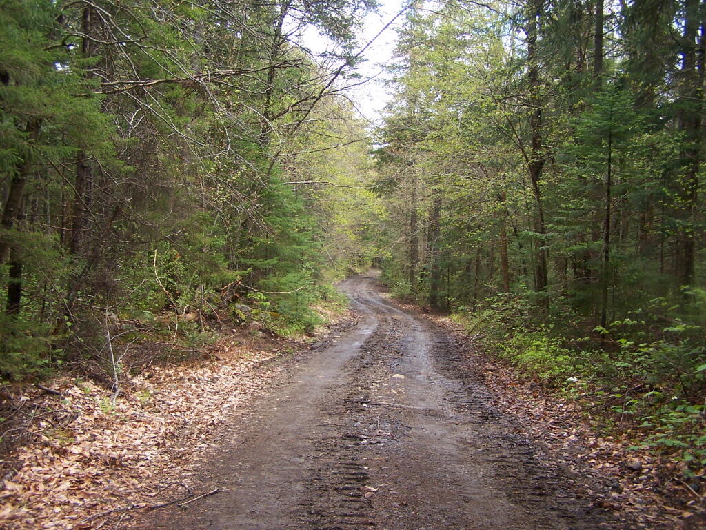
Less Muddy Section of Moose Club Way

II. Policy:

It is the policy of the Department to ensure that comprehensive and consistent procedures are applied to all maintenance, rehabilitation, widening and construction of roads and state truck trails (roads) in the Forest Preserve to ensure that such activities minimize the impacts on the environment and maintain the wild forest character of the road and state truck trail corridors.The 2003 Memorandum of Understanding Between the Adirondack Park Agency and theDepartment of Environmental Conservation Concerning Implementation of the State LandMaster Plan for the Adirondack Park (MOU) provides guidance concerning ordinary maintenance, rehabilitation and minor relocation of conforming structures and improvements on Forest Preserve lands in the Adirondack Park, including whether consultation between the two agencies is required. This policy is intended in part to build upon the MOU and provide additional direction and clarification on coordination of road work in the Adirondack Forest Preserve. This Policy takes precedence over previously existing authority, guidelines, andpolicies.

This policy does not include standards for determining if a road has become legally abandoned. Determinations of road abandonment will be made on a case by case basis inc onsultation with the Division of Legal Affairs.

1 The following definitions, guidelines, responsibilities and procedures shall govern work to be done on roads and state truck trails being carried out on lands of the Forest Preserve which are classified by the APSLMP or CPSLMP as Wild Forest, Primitive, or Canoe.

A. Definitions:

1.Brushing means cutting of woody vegetation less than 3 inches in diameter at breast height (d.b.h.).

2. Ditch means an excavated drainage structure situated adjacent and generally parallel to the driving surface and shoulder of a road or truck trail, designed to convey water away from the driving surface.

3. Ditchline means the low point or centerline of the ditch.

4. Drainage structure means a device which drains water off or away from the road. Drainage structures include such structures as water bars, ditches, French drains,culverts and underdrains.

5. Driving Surface means that portion of the road surface which is designed for vehicles to travel on.

6. Footprint means the limits of disturbance of the road. The foot print includes the driving surface, shoulders, drainage structures, and side slopes. The Original Footprint is the limit of disturbance of the road at the time that it was initially constructed. The currently maintained or existing foot print means areas of the footprint not currently occupied by trees greater than 3″ dbh.

7. French drain means a subsurface drain consisting of a trench backfilled with porous soil or loose stone and covered with earth or other appropriate surface material.

8. Minor relocation of a road or state truck trail means the relocation of a short segment of a road in order to avoid drainage, wetlands, safety, or other site specific problems which cannot otherwise be adequately addressed. A minor relocation shall be the minimum length of new road required to avoid or lessen the site specific problem, but shall not exceed 300 feet in length.

9. Mowing means cutting of non-woody vegetation and woody vegetation less than 3feet in height.

10. Ordinary maintenance means activities within the currently maintained footprint of the road which are needed to keep the road in good working order and which overtime do not materially change the use or appearance of the land or the vegetation thereon from its current use and appearance, including the maintenance or in-kind replacement of road appurtenances and work to address public health and safety issues where such maintenance or activities periodically occur on an as-needed basis. For purposes of this policy, ordinary maintenance includes the following activities when carried out within the currently maintained footprint:

i. pothole filling;

ii. blowdown clearing;

iii. grading of driving surface;iv. bridge repair and maintenance;

v. bridge replacement with a bridge of the same design and of similar dimensions and which is constructed of similar materials;

vi. culvert maintenance, or replacement with a culvert of a length not to exceed the existing foot print and the same nominal height as the culvert being replaced in the same location, provided that the culvert does not involve a freshwater wetland;

vii. drainage structure maintenance, or replacement with a structure in the same location with the same design and similar dimensions and which is constructed of similar materials;

viii. cleaning of existing ditches and culverts that do not impact fresh waterwetlands;

ix. mowing and brushing routinely maintained roads up to four feet beyond theshoulder or ditchline to maintain existing sight lines, road shoulders, andditches;

x. resurfacing of driving surface, with similar material as currently used on theroad, provided that such resurfacing will not likely facilitate levels of public motor vehicle use which significantly exceed existing levels of such use;

xi. limited rock removal that does not require blasting;

xii. trimming select individual tree branches that impede vehicular traffic, obscure sight lines, and hide roadside hazards; and

xiii. cutting select individual dead or hazardous trees pursuant to Lands and Forests Policy 91-2, Cutting and Removal of Trees in the Forest Preserve.

11. Rehabilitation means work that does not occur on a routine basis within the currently maintained footprint of the road which is essential to address environmental impacts, improve safety, or to restore the road or truck trail to a usable condition. It includes the construction of new road appurtenances or work outside of the currently maintained foot print of a road, but within the original footprint of the road. Rehabilitation includes but is not limited to the following activities:

i. placing culverts at new locations;

ii. replacing existing culverts with culverts that have a nominal height greaterthan the nominal height of the existing culvert;

iii. constructing new ditches or drainage structures;

iv. widening existing ditches;

v. cutting trees other than dead or hazardous trees pursuant to Lands and ForestsPolicy Lands and Forests Policy 91-2, Cutting and Removal of Trees in theForest Preserve;

vi. brushing in areas which have not been routinely maintained;

vii. resurfacing the driving surface where such resurfacing will likely facilitate levels of public motor vehicle use which significantly exceed existing levels of such use;

viii. resurfacing of the driving surface with material that is different from the material which currently covers the surface of the road when there is a clear determination that this measure is necessary to protect the natural resources of the Forest Preserve adjoining the road corridor by controlling erosion or runoff; and

ix. regrading of side slopes.

12. Road means motorized transportation corridors that include both roads and state truck trails as defined in the Catskill and Adirondack Park State Land Master Plans, unless the context indicates otherwise.

Road (APSLMP definition): The APSLMP defines “road” on page 18-19 as “an improved or partially improved way designed for travel by automobiles and which may also be used by other types of motor vehicles except snowmobiles, unless the way is a designated snowmobile trail; and is, either maintained by a state agency or a local government and open to the general public maintained by private persons or corporations primarily for private use but which may also be open to the general public for all or a segment thereof; or maintained by the Department of Environmental Conservation or other state agency and open to the public on a discretionary basis.

Road (CPSLMP definition): The CPSLMP defines “road” in Appendix C as “an improved way designed for travel by automobiles and which may also be used by other types of motor vehicles except snowmobiles, unless the way is a designated snowmobile trail; and is, either maintained by a state agency or a local government and open to the general public; or maintained by private persons or corporations primarily for private use but which may also be open to the general public for all or a segment thereof; or, maintained by the Department of Environmental Conservation or other state agency and open to the public on a discretionary basis; or, maintained by the Department of Environmental Conservation for its administrative use only.”

13. Road work means any physical alteration of a road including ordinary maintenance, minor relocation, rehabilitation, widening and new construction as defined in this policy.

14. Shoulder means a transition zone between the driving surface and the road edge or the ditchline. In general, a wheel of a motor vehicle is not on the shoulder unless the motor vehicle is parked or pulled over to let another car pass.

15. Side slope means that area outside of the ditch or road shoulder that is graded to a uniform slope in order to stabilize the soil between the ditch or shoulder and the native, undisturbed ground.

16. State truck trail:

i. State truck trail (APSLMP definition). The APSLMP on page 19 defines “state truck trail” as an improved way maintained by the Department ofEnvironmental Conservation for the principal purpose of facilitatingadministration of state lands or of allowing access for fire fighting equipment and not normally open for public use of motorized vehicles.

ii. State truck trail (CPSLMP definition). “State truck trail†is defined in Appendix C of the CPSLMP as “an improved way maintained by the Department of Environmental Conservation for the principal purpose offacilitating administration of state lands or to allow access for fire fighting equipment and not normally open to the public for motorized vehicle use.

17. Trimming means the removal of lateral branches or leaders of a tree or shrub, that does not sever the plant from its roots.

18. Underdrain means a perforated culvert in porous fill for drawing off subsurface water from the soil.

19. Widening means a lateral expansion of the currently maintained footprint, or lateral expansion of the driving surface of the road. Widening includes the clearing of trees and other vegetation from areas of the existing footprint that are not currently so maintained to restore the opening of the original footprint.

20. Work plan means a detailed description of work to be performed, the Best Management Practices that will be used in performance of the work, and the desired final condition of the road and surrounding area.

B. Guidelines for roads subject to this Policy

1. Determination of Road Width, Driving Surface and Desired Condition. The width, existing condition and desired condition of all roads will be addressed in Unit Management Plans (“UMPs”).. 2. Relocation, rehabilitation, widening or construction of roads. Any road work, except for ordinary maintenance, not authorized in a UMP may not be performed until it is determined whether or not a UMP amendment may be required. This determination will be made by the Director of the Division of Lands and Forests in consultation with APA after a work plan has been developed. Ordinary maintenance of existing roads does not require UMP authorization. Roads designated as closed in a UMP may not be maintained.

3. Work plans. All rehabilitation, relocation (including minor relocation), widening and new construction of roads in the Adirondack Park and the Catskill Park will be done in accordance with a written work plan. Work plans will detail the work to be performed and the Best Management Practices that will be used in performance of the work and the desired final condition of the road and surrounding area. In both the Adirondack Park and Catskill Park, ordinary maintenance of a road requires approval from the Regional Forester in the form of a written work order or an approved “Requests for Routine Maintenance Projects on Forest Preserve Lands.All work plans will describe the work to be performed, including any tree cutting, in relation to a linear distance from the projectâ’ starting point. Markers corresponding to the work described in the work plan shall be placed at the work site. Work plans should include photographs taken at representative locations along with location by location descriptions of the road condition, driving surface and width.

5 All work plans in the Adirondack Park will be developed in consultation with APA as per the MOU and must be approved by the Regional Director and the Director of the Division of Lands and Forests or their designees. If a work plan for a project in the Adirondack Park indicates that the proposed work may materially change the appearance of the land or vegetation thereon or use of the road, then the Director of the Division of Lands and Forests or the Director’s designee shall consult with APA staff to determine whether such work must first be authorized by an approved UMP or UMP amendment. If a work plan for a project in the Catskill Park indicates that the proposed work may materially change theappearance of the land or vegetation or use of the road, then the Director of the Division of Lands and Forests shall determine whether such work must first be authorized by an approved UMP or UMP amendment.

4. Best Management Practices. All work on roads shall be done in accordance with Best Management Practices (BMPs). The New York State Forestry Best Management Practices for Water Quality, BMP Field Guide shall serve as a reference for developing BMPs.

5. Approvals and Consultation

i. Ordinary Maintenance. Ordinary maintenance of a road in the Adirondack Park does not require either APA consultation or UMP authorization, except that, as per the MOU, APA consultation is required if wetlands might be impacted. Ordinary maintenance of a road in the Catskill Park does not require UMP authorization, except that consultation with the Department’s Division Fish, Wildlife and Marine Resources Freshwater Wetlands Manager is required if wetlands might be impacted. In both the Adirondack Park and Catskill Park, ordinary maintenance of a road requires approval from the Regional Forester in the form of a written work order or an approved “Requests for Routine Maintenance Projects on Forest Preserve Lands.”

ii. Rehabilitation. Rehabilitation of roads has the potential to impact the wild forest character of the road, cause significant environmental impacts and facilitate additional public use. For these reasons, rehabilitation of roads inthe Adirondack Park requires a written work plan and consultation with the APA. Depending upon site specific considerations, rehabilitation may require authorization by an approved UMP or UMP amendment. This determination requires approval from the Director of the Division of lands and Forests and will be made in consultation with APA.

ehabilitation of roads in the Catskill Park requires approval from the Director of the Division of Lands and Forests or the Director’s designee and, depending upon site specific considerations, may require authorization in an approved UMP or UMP amendment.

iii. Minor relocation . Minor relocation of roads in the Adirondack Parkrequires a written work plan, approval from the Director of the Division of Lands and Forests and consultation with the APA, and may require a UMP or UMP amendment. Minor relocation of roads in the Catskill Park requires a written work plan and approval from the Director of the Division of Lands and Forests, or the Director’s designee, and requires authorization in an approved UMP or UMP amendment. Relocation of portions of roads or state truck trails that are greater than 300 feet, or any or relocation that may have significant environmental impacts will be considered as constituting new road construction and must follow the procedures and protocols on new road construction set forth subsequently in this document.In the Adirondack Park, the determination of whether a particular road relocation project constitutes a minor relocation will be made by the Director of the Division of Lands andForests or the Director’s designee in consultation with the APA. In theCatskill Park, the determination of whether a particular road relocation project constitutes a minor relocation will be made by the Director of the Division of Lands and Forests or the Director’s designee.

iv. Road widening and new road construction on roads in units classified as Wild Forest. As noted above, the widening of existing state truck trails and roads and the construction of new state truck trails and roads on lands classified as Wild Forest under the APSLMP and the CPSLMP, must be authorized by the State Constitution.

Supplementing this constitutional requirement is the APSLMP’s requirement that “No new roads will be constructed in wild forest areas nor will new state truck trails be constructed unless such construction is absolutely essential to the protection or administration of an area, no feasible alternative exists and no deterioration of the wild forest character or natural resources quality of the area will result.

The CPSLMP requires that, in Wild Forest, “No new roads will beconstructed. No new state truck trails will be constructed unless suchconstruction is absolutely essential to protect or administer an area and there will be no material adverse effect on the wild forest character of the area by the proposed construction. Further, the APSLMP and the CPSLMP require that such work must be authorized by an approved UMP. To ensure that such work is authorized by the State Constitution and that environmental issues are identified and fully addressed, widening and new construction of roads in the Adirondack Park must be authorized by an approved UMP or UMP amendment, and require a written work plan and consultation with the APA as per the MOU.

Widening and new construction of roads in the Catskill Park must be authorized by an approved UMP or UMP amendment, and require a written work plan which must be approved by the Regional Director and the Director of the Division of Lands and Forests, or their designees.

Road Wandering Up Back Side of Sturges Hills

III. Purpose and Background:

Forest Preserve roads, which are generally low maintenance seasonal roads, are a means of providing the public with access to recreational programs on Forest Preserve lands.

Although design, maintenance and rehabilitation standards for these roads must provide for the health and safety of users, such roads must be consistent with the “wild forest” character of the Forest Preserve and comply with the requirements of the APSLMP or the CPSLMP, as applicable. Thus, proposals for road work in the Forest Preserve must be carefully scrutinized to ensure that health and safety goals are accomplished in a manner which maintains the existing wild forest character of the road corridors and otherwise complies with applicable law.

Article XIV, Section 1 of the New York State Constitution, the paramount legal authority with respect to Forest Preserve land management, provides in relevant part:

“The lands of the state, now owned or hereafter acquired, constituting the forest preserve as now fixed by law, shall be forever kept as wild forest lands. They shall not be leased, sold or exchanged, or be taken by any corporation, public or private, nor shall the timber thereon besold, removed or destroyed. (Emphasis added).”

All road work for roads in the Forest Preserve must be consistent with the directives contained in this constitutional provision. Case law interpreting this provision has held that an immaterial amount of tree cutting does not violate this clause when done in furtherance of one of the purposes for which the Forest Preserve was created, namely, watershed protection and public recreation in a forever wild forest setting. See The Association for the Protection of the Adirondacks v. MacDonald, 253N.Y. 234 (1930); Balsam Lake Anglers Club v. Department of Environmental Conservation, 199 A.D. 2d 852, 605 N.Y.S. 2d 795 (App. Div., Third Department, 1993); Helms v. Reid, 90 Misc. 2d 583 (Hamilton County Supreme Court, 1977), and Flacke v. Town of Fine 113 Misc. 2d 56 (St. Lawrence County Supreme Court, 1982).

Under the rationale set forth in these cases, Forest Preserve road corridors should maintain a wild forest character, with minimal tree cutting. Thus, the current character of Forest Preserve roads should not be changed, and such roads should continue to have narrow driving surfaces, be surfaced with gravel, be suitable for low speeds only, and be shaded by tree canopy.

Roads and state truck trails are nonconforming in areas classified by the APSLMP and CPSLMP as Wilderness. Therefore, there shall be no maintenance, rehabilitation, relocation, widening, or new construction of roads or state truck trails in Wilderness areas.

In areas classified as Primitive by the APSLMP, existing roads and state truck trails may be maintained, rehabilitated or relocated only if the road or truck trail was in existence when the land was classified as Primitive and the road or truck trail is used by administrative personnelto reach and maintain structures and improvements whose removal cannot be effected by a fixed deadline or whose presence is of an essentially permanent character.

In addition, existing roads in areas classified as Primitive may be maintained, rehabilitated or relocated if the roads are open for public use at the Department’s discretion pending wilderness classification. There may be no widening or new construction of roads or state truck trails in Primitive Areas.

In areas classified as Canoe by the APSLMP, the use of roads is prohibited and therefore such roads may not be maintained, rehabilitated, relocated, widened or constructed. Existing state truck trails in areas classified as Canoe may be maintained, rehabilitated or relocatedwhere the truck trails are being used by administrative personnel for purposes designed to preserve or enhance the water or fishery resources of the area as specified in UMPs. The widening or new construction of truck trails is prohibited in Canoe areas.

In areas classified as Wild Forest by the APSLMP, existing roads and state truck trails which are used solely by administrative personnel to reach, maintain and construct permitted structures and improvements may be maintained, rehabilitated, and relocated, but may not be widened. New roads and state truck trails to be used solely for these purposes may not be constructed. Existing public roads open to the public for motor vehicle use in APSLMP Wild Forest areas may be maintained, rehabilitated and relocated. Existing public roads maybe wide ned only if authorized by Article XIV, Section 1 of the New York State Constitution.

No new roads or state truck trails will be constructed in APSLMP Wild Forest areas unless such construction is authorized by Article XIV, Section 1 of the New York State Constitution and such construction is absolutely essential to the protection or administration of the area, no feasible alternative exists and no deterioration of the wild forest character or natural resource quality of the area will result. In addition, such construction is allowed only if it will not result in a material increase in the cumulative mileage of roads open to motorized use by the public in Adirondack Park Wild Forest units.

In areas classified as Wild Forest by the CPSLMP, existing roads and state truck trails which are used by administrative personnel to reach, maintain and construct permitted structures and improvements, to conduct approved fish and wildlife research and management projects, for rescues, or for other appropriate law enforcement and general supervision of public use may be maintained, rehabilitated, and relocated, but may not be widened.

New roads and state truck trails to be used solely for these purposes may not be constructed. Existing public roads open to the public for motor vehicle use in CPSLMP Wild Forest areas may be maintained, rehabilitated, and relocated. Existing roads and state truck trails may be widenedonly if authorized by Article XIV, Section 1 of the New York State Constitution. No new roads or new state truck trails will be constructed in CPSLMP Wild Forest areas unless such construction is authorized by Article XIV, Section 1 of the New York State Constitution and such construction is absolutely essential to protect or administer the area and there will be no material adverse effect on the wild forest character of the area by the proposed construction.

In addition, such construction is allowed only if it will not result in a material increase in the cumulative mileage of roads open to motorized use by the public in the Catskill Park Wild Forest units. This policy is intended to ensure that road work in the Forest Preserve is in compliance with constitutional and APSLMP and CPSLMP directives. Thus, this policy will ensure that all road and state truck trail maintenance, rehabilitation, relocation, widening and construction projects will be properly authorized and that work plans will be developed and appropriately approved prior to the commencement of such work. This policy will enable staff to determine whether such work: requires approval by the Regional Forester and the Director of the Division of Lands and Forests or the Director’s designee; requires consultation with the Adirondack Park Agency; and requires authorization by an approved UMP or UMP amendment

The policy also will enable staff to determine whether a work plan is needed, and, if so, what it must contain and who must approve it.

Little Moose Mountain

IV. Responsibility:

It shall be the responsibility of all Department divisions and staff to implement the guidelines and procedures of this policy.

It shall be the responsibility of the Forester assigned as the land manger of a management unit to prepare work plans for the unit in consultation with the Division of Operations. It shall be the responsibility of the Regional Forester to review and approve work plans for road work and ensure that work plans are developed for all road work as required by this policy. The Regional Forester shall ensure work plans are in compliance with UMPs and that current best management practices are utilized and any associated impacts on the environment are minimized. It shall be the responsibility of all Department staff involved in road work projects in the Forest Preserve to ensure that all work authorized and is carried out in accordance with the approved work plan and to ensure that any tree cutting complies with policy Lands and Forests Policy 91-2, Cutting and Removal of Trees in the Forest Preserve.It shall be the responsibility of the Regional Director and the Division Director or their designees to review and approve any work plans for road work involving maintenance, relocation, rehabilitation, widening, and new construction proposed under this policy and to assign staff to coordinate with the APA where such coordination is appropriate under thispolicy.

It shall also be the responsibility of the Director of the Division of Lands and Forests to periodically review the provisions of this policy and recommend amendments, where necessary.

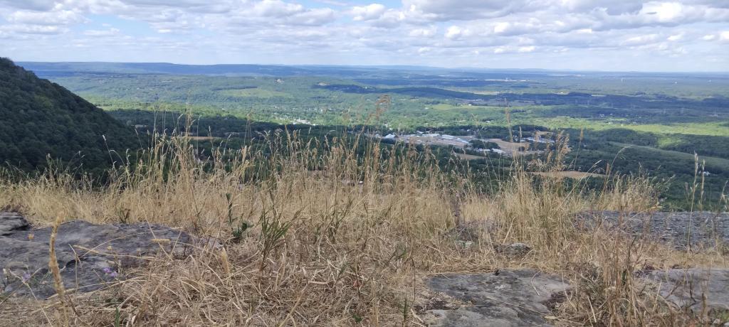
Dry Grass at Hang Gliders Cliff

V. Procedure:

The management and actions taken regarding road maintenance, rehabilitation, widening, relocation, and construction on Adirondack Forest Preserve lands shall be in accordance with the above stated policy and the following procedure:

1. Regional staff shall consult with Regional Forester to determine if a proposed project is ordinary maintenance, rehabilitation, minor relocation, relocation other than minor relocation, widening or new construction.

2. APA consultation is required if wetlands in the Adirondack Park might be impacted as required per the MOU. Depending on the scope of the work, an APA Jurisdictional Inquiry Form and Application for Wetlands General Permit, 2005G-1, may be required.

3. Ordinary maintenance of roads may be carried out with the approval of the Regional Forester. At the Regional Forester’s discretion, a work plan may be required for ordinary maintenance. Such work plans must be approved by the Regional Forester and the Director of the Division of Lands and Forests or their designees.

4. All rehabilitation, minor relocation, widening and new construction of roads in the Adirondack Park will be done in accordance with a written work plan prepared by DEC staff in consultation with the APA as per the MOU. All relocation projects should be forwarded to the Director of the Division of Lands and Forests for consultation with APA to determine if the project is considered a minor relocation. Projects that are not part of an approved UMP or UMP amendment and are not minor relocations will be referred to the Director of the Division of Lands and Forests forconsultation with APA to determine if an approved UMP or UMP amendment isrequired for the project.

5. The Regional Forester will ensure that the work plan details the work to be performed, the BMPs that will be used in performance of the work, and the desired final condition of the road and surrounding area. All work plans must describe the work to be performed, including any tree cutting, in relation to a linear distance from the project’s starting point. Markers corresponding to the work described in the work plan shall be placed at the work site. Work plans should include photographs taken at each station and at representative locations along with station by station descriptions of the road condition, driving surface and width.

The Regional Forester will forward work plans approved by the Regional Director or the Regional Director’s Designee to the Director of the Division of Lands and Forests. The Division Director or the Division Director’s designee will notify the Regional Forester of approval or denial of the work plan.

The management and actions taken regarding road maintenance, rehabilitation, minor relocation, relocation, widening and construction on Catskill Forest Preserve lands shall be in accordance with the above stated policy and the following procedure:

1. Regional staff shall consult with the Regional Forester to determine if the proposed project is ordinary maintenance, rehabilitation, minor relocation, relocation other than minor relocation, widening or new construction.

2. Consultation with the Department’s Division of Fish, Wildlife and Marine Resources Freshwater Wetlands Manager is required if wetlands might be impacted.

3. Ordinary maintenance of roads may be carried out with the approval of the Regional Forester.

4. All rehabilitation, minor relocation, widening and new construction of roads in the Forest Preserve will be done in accordance with a written work plan prepared by Department staff. All relocation projects should be forwarded to the Director of the Division of Lands and Forests to determine if the project is considered a minor relocation. Projects that are not part of an approved UMP or UMP amendment will be referred to the Director of the Division of Lands and Forests to determine if an approved UMP or UMP amendment is required for the project.

5. The Regional Forester will ensure that the work plan details the work to be performed and the Best Management Practices that will be used in performance of the work and the final condition of the road and surrounding area. All work plans must describe the work to be performed, including any tree cutting, in relation to a linear distance from the project’s starting point. Markers corresponding to the work described in the work plan shall be placed at the work site.

The Regional Forester will forward work plans approved by the Regional Director or the Regional Director’s Designee to the Director of the Division of Lands and Forests. The Division Director or the Division Director’s designee will notify the Regional Forester of approval or denial of the work plan.

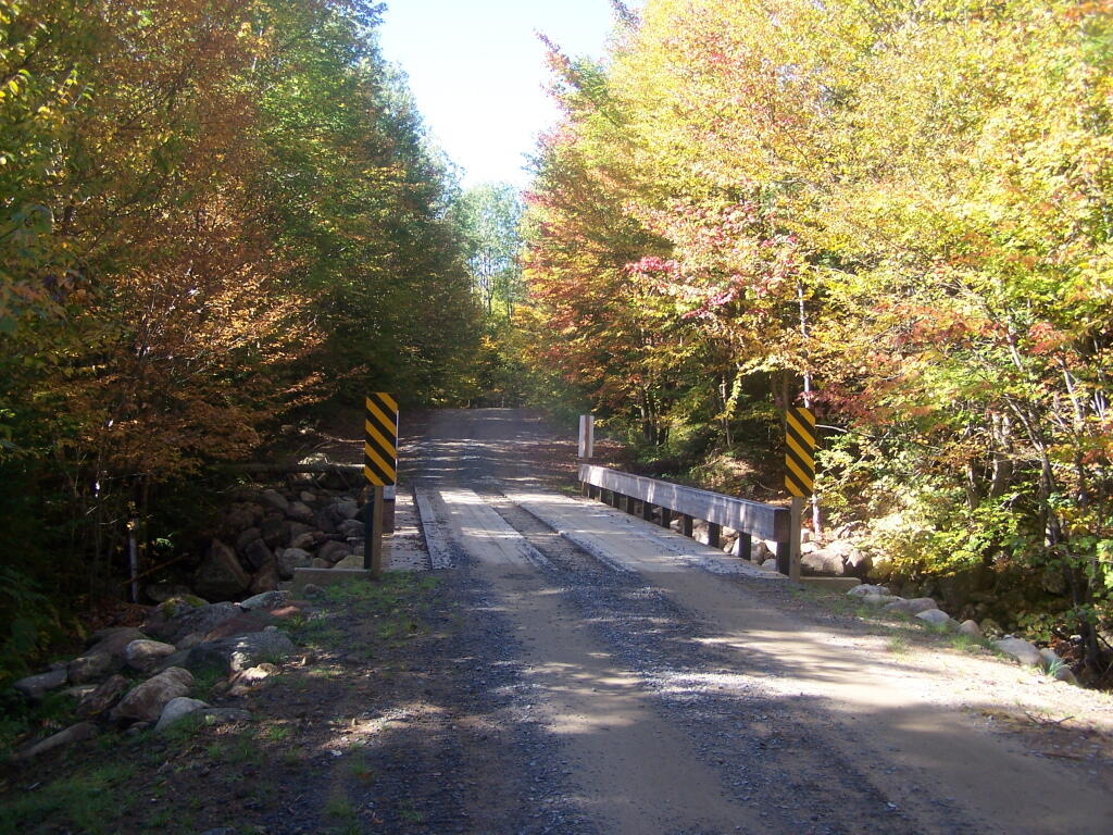
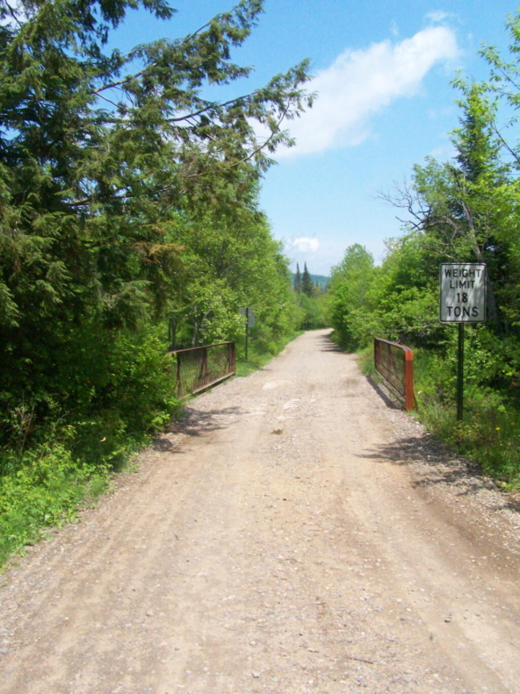
Sunny Morning at Powley Place Bridge

Related References:

Adirondack Park State Land Master Plan (APSLMP), Adirondack Park Agency, June 2001

Catskill Park State land Master Plan (CPSLMP), NYSDEC, 1985

New York State Forestry, Best Management Practices for Water Quality, BMP Field Guide,NYSDEC, January 2000

Lands and Forests Policy 91-2, Cutting and Removal of Trees in the Forest Preserve

2003 Adirondack Park Agency/Department of Environmental Conservation Memorandum ofUnderstanding

Section 212 of the State Highway Law

Section 212 of Highway Law.

S 212. Changing location of highways over certain lands owned and occupied by the state. 1. If a highway passes over or through lands wholly owned and occupied by the state, the location of such portion of such highway as passes through such lands may be altered and changed, or the same may be abandoned or the use thereof as a highway discontinued with the consent and approval of the state authority having jurisdiction or control over such lands by an order directing such change in location, abandonment or discontinuance. Such order shall contain a description of that portion of the highway the location of which has been changed, abandoned or discontinued, and a description of the new location thereof, if any, and shall be filed in the office of the state authority having control of such lands.

 Relatively Smooth Section of Crane Pond Road

John J. Kelly v. DEC Commissioner Jorling (1990).

You can read the court case online.

SUPREME COURT OF NEW YORK, APPELLATE DIVISION, THIRD DEPARTMENT

November 21, 1990

IN THE MATTER OF JOHN J. KELLY, APPELLANT,
v.
THOMAS C. JORLING, AS COMMISSIONER OF THE DEPARTMENT OF ENVIRONMENTAL CONSERVATION, RESPONDENT

Appeal from a judgment of the Supreme Court (Dominick J. Viscardi, J.), entered March 29, 1990 in Essex County in a proceeding pursuant to CPLR article 78, which dismissed a petition to prohibit respondent from directing closure of a portion of a road traversing State-owned land in Essex County.

Roemer & Featherstonhaugh (E. Guy Roemer of counsel), for appellant.

Robert Abrams, Attorney-General (Lawrence A. Rappoport of counsel), for respondent.

Kane, J. P. Casey, Mikoll, Yesawich, Jr., and Mercure, JJ., concur.

Author: Kane

OPINION OF THE COURT

Crane Pond Road is a gravel and dirt roadway located in the Town of Schroon, Essex County, of which the last 2 1/2 miles (hereinafter referred to as the road) lead through State-owned lands to the edge of Crane Pond. That part of the Adirondack Forest Preserve surrounding the road was reclassified “wilderness” in 1979 and, in 1987, the road itself was reclassified wilderness. In December 1989, respondent issued an order, pursuant to Highway Law ? 212, closing the road in accordance with the Adirondack State Land Master Plan. Guidelines within that plan called for the closing of roads which impermissibly allowed for the prohibited use by the public of motorized vehicles and equipment in wilderness areas. Petitioner, the Town Supervisor, subsequently commenced this CPLR article 78 proceeding to challenge respondent’s authority to close the road pursuant to Highway Law ? 212. Supreme Court found that respondent possessed such authority and dismissed the petition. This appeal followed.

We affirm. Petitioner apparently does not question respondent’s jurisdiction over the lands at issue or the State’s power to close the road, but instead challenges the specific statutory authority pursuant to which respondent ordered said closing. Highway Law Sec 212 was amended in 1988 to read as follows: “If a highway passes over or through lands wholly owned and occupied by the state, the location of such portion of such highway as passes through such lands may be altered and changed, or the same may be abandoned or the use thereof as a highway discontinued with the consent and approval of the state authority having jurisdiction or control over such lands by an order directing such change in location, abandonment or discontinuance. Such order shall contain a description of that portion of the highway the location of which has been changed, abandoned or discontinued, and a description of the new location thereof, if any, and shall be filed in the office of the state authority having control of such lands.” The 1988 amendment eliminated the need for the Commissioner of Transportation to issue the order of closure (see, L 1988, ch 161, ? 2), essentially leaving that decision to the State agency having appropriate jurisdiction (see, mem of State Dept of Transp, 1988 McKinney’s Session Laws of NY, at 1980-1981). Petitioner argues that the express language of the statute does not specifically authorize respondent to issue an order of closure and that no such power may properly be inferred therefrom. We disagree.

The primary consideration of statutory construction is legislative intent (see, Matter of Long v Adirondack Park Agency, 76 N.Y.2d 416, 422; Hudson City Savs. Inst. v Drazen, 153 A.D.2d 91, 93; see also, McKinney’s Cons Laws of NY, Book 1, Statutes ? 92), and courts are to avoid a literal construction when it leads to either a frustration of the over-all design of the Legislature (see, McKinney’s Cons Laws of NY, Book 1, Statutes ? 111) or an ineffectually absurd result (see, Matter of Long v Adirondack Park Agency, supra, at 421; see also, McKinney’s Cons Laws of NY, Book 1, Statutes ?? 144, 145). The legislative intent behind Highway Law ? 212 was to permit the State to close roads on State lands that endangered a State purpose (see, Matter of Altona Citizens Comm. v Hennessy, 77 A.D.2d 956, 957, lv denied 52 N.Y.2d 705). Adopting petitioner’s view, that respondent has the power to consent to and approve the closing of a roadway but does not possess the authority to order its closure, would eviscerate the statute and render it meaningless. In our view, the statute’s expressed intent provides an ample basis and rationale to conclude that “the state authority having jurisdiction or control over [state] lands” (Highway Law ? 212) is empowered to issue orders effectuating that authority. Accordingly, respondent’s order was a valid exercise of the statutory power given to the appropriate State agency pursuant to Highway Law ? 212.

Disposition

Judgment affirmed, without costs.

North Up to Piseco-Powley

In the Matter of the Alleged Violations by JAMES W. McCULLEY, Respondent. (2009)

This is an excerpt of relvant portions of this adminstrative law decision.

2. Department’s Jurisdiction To Regulate Motor Vehicle Traffic Over Old Mountain Road

Department staff contends that the portion of Lot 146 owned by the State is part of the forest preserve. Accordingly, staff asserts jurisdiction to regulate motor vehicle traffic over that portion of Old Mountain Road that crosses State-owned land.

Department staff has established that the State-owned portion of Lot 146 is part of the forest preserve. It is undisputed that the State acquired the northern half and southeastern quarter of Lot 146 in 1875 (see Deed, Department Exh 48, at 556). The forest preserve was subsequently created by chapter 283 of the Laws of 1885, which provided in relevant part:

“All lands now owned or which may hereinafter be acquired by the state of New York within the counties of . . . Essex . . . shall constitute and be known as the forest preserve.”

(L 1885, ch 283, § 7). Chapter 283 is now codified at ECL 9- 0101(6). Thus, the State-owned portion of Lot 146 was and remains part of the forest preserve.

The existence of Old Mountain Road as a public right of way, however, pre-dates the State’s ownership of Lot 146. In the 1810 legislation appropriating money for the repair of Old Mountain Road, the State Legislature declared the road to be a “public highway” (L 1810, ch CLXXVII, § I). Because the Legislature did not provide for acquisition of the fees underlying the public highway, the public acquired merely an easement of passage, the fee title remaining in the landowners (see Bashaw v Clark, 267 AD2d 681, 684-685 [1999]). Thus, when the State acquired its portion of Lot 146 from the prior landowner, it did so subject to a public highway in the nature of an easement (see id.; see also Matter of Moncure v New York State Dept. of Envtl. Conservation, 218 AD2d 262, 267 [1996] [when the Department acquires forest preserve lands burdened by a leasehold, the Department takes such property subject to that leasehold]).

Department staff asserts that subsequent statutory law vests the Department with jurisdiction over public rights of way crossing forest preserve land. Accordingly, citing the Vehicle and Traffic Law, Department staff asserts that it has the power to “prohibit, restrict or regulate” motor vehicle traffic on any highway under its jurisdiction, including Old Mountain Road (see Vehicle and Traffic Law [“VTL”] § 1630). Pursuant to section 1630, Department staff claims it has the authority to close Old Mountain Road to motor vehicle traffic while allowing pedestrian and other forms of non-motorized traffic (see Adirondack Park State Land Master Plan [updated June 2001], DEC Exh 17, at 66 [indicated that Old Military Road has been closed]).

Respondent, on the other hand, argues that Old Mountain Road was and remains under the jurisdiction of the Towns of North Elba and Keene. 3 Thus, respondent contends that the exception under 6 NYCRR 196.1(b) for roads under the jurisdiction of a town highway department applies in this case (see 6 NYCRR 196.1[b][1]). Respondent contends that the exception for public rights of way over State land also applies (see 6 NYCRR 196.1[b][5]).4

VTL § 1630 does not itself vest in the Department jurisdiction over any particular highway. Whether a State agency has jurisdiction to regulate motor vehicle traffic pursuant to section 1630 depends upon whether that agency is otherwise authorized by law to regulate the use and management of the public highway at issue (see People v Noto, 92 Misc 2d 611, 612- 613 [1977]; see also Highway Law § 3)

On this motion, it cannot be determined, as a matter of law, which entity has jurisdiction to regulate the use and management of Old Mountain Road. When the New York State Legislature declared Old Mountain Road to be a public highway in 1810, it provided that after an initial four-year period of repair and improvement by a commissioner specially appointed for that purpose, the maintenance of the road would be assumed by the several towns through which it passed (see L 1810, ch CLXXVII, § III). Thus, at the time the State acquired Lot 146, subject to the public right of way, that right of way was apparently a town road under the jurisdiction of the Town of Keene and later the Town of North Elba (see Highway Law § 3[5]).5

Nothing in the submissions on this motion allow me to conclude, as a matter of law, that jurisdiction to regulate the use and management of Old Mountain Road has transferred from the Towns of North Elba and Keene to the Department. To the contrary, conflicting statutory provisions and circumstantial evidence require further legal argument and evidentiary proof before such a determination can be made.

For example, in support of Departmental jurisdiction to regulate traffic, Department staff notes that when the powers of the Conservation Department were revised in 1916, the “free use of roads” provision from the 1885 law limiting the forest commission’s power to prescribe rules and regulations for the forest preserve, was eliminated (see L 1916, ch 451). Staff further notes that the current ECL and Executive Law provisions authorizing the Department to make necessary rules and regulations for the protection of the forest preserve generally, and the Adirondack Park specifically, contain no limitation on regulating the free use of roads (see ECL 9-0105[3]; Executive Law § 816). However, although the Department has the power to regulate uses of the forest preserve generally, and the Adirondack Park specifically, it does not necessarily follow that such power includes the authority to regulate public rights of way under the jurisdiction of other State entities or municipalities.

In contrast, legislation adopted subsequent to 1916 suggests that the Department was not vested with the power to regulate use and maintenance of highways in the forest preserve. In 1924, the former State Commission of Highways was granted the power to maintain existing State and county highways in the forest preserve (see L 1924, ch 275). In 1937, town superintendents were expressly granted the right to occupy a right of way over State lands as may be required in the maintenance or reconstruction of town highways that cross those lands, subject to the approval of the Superintendent of Public Works and the Conservation Commissioner (see L 1937, ch 488). The grant of a right of way over State land to maintain and repair town highways strongly implies that towns retained jurisdiction over town highways in the forest preserve, notwithstanding the Department’s grant of authority to regulate the forest preserve generally (see Flacke v Town of Fine, 113 Misc 2d 56 [1982]).

Department staff also points out that Old Mountain Road has not appeared on either the Town of North Elba or the Town of Keene inventory of town highways. The evidence on this is equivocal, however. Old Mountain Road has not appeared on any inventory of State or county highways either (see L 1921, ch 18 [designating system of State and county highways]). On the other hand, Old Mountain Road did appear on a 1935 Highway Survey Commission map, although its status as a State, county or town highway is not indicated (see Department Exhs 51-53).

Respondent provides some circumstantial evidence suggesting that the Towns of North Elba and Keene retain the jurisdiction to regulate traffic on Old Mountain Road. For example, in 1971, the Town of North Elba adopted a resolution, which is still in effect, regulating the use of snowmobiles on Old Mountain Road (see N. Elba Ordinance [2-12-71], Affidavit of Norman Harlow, Highway Superintendent, Town of North Elba, Exh B). Respondent also provides letters dated June 7 and November 13, 1996, respectively, from Mr. Tom Wahl, former Department Regional Forester, expressing the opinion that Old Mountain Road remains a town highway (see Respondent Exhs 16 and 17).

Finally, research reveals some authority suggesting that Old Mountain Road is under the jurisdiction of predecessors to the Department of Transportation (see People v Paul Smith’s Elec. Light and Power and R.R. Co., Sup Ct, Essex County, July 29, 1953, Imrie, J., Decision, at 3-4, 6; 1950 Opn of the Atty Gen 153-154). Whether the portions of Old Mountain Road at issue here are subject to the above authorities, however, is unclear at this time.

In sum, legal and factual issues exist concerning whether the Department has jurisdiction under VTL § 1630 to regulate motor vehicle traffic on Old Mountain Road that require further hearings and legal argument.

3. Request for Relief Pursuant to Highway Law § 212

In its motion for order without hearing, Department staff requests an order of the Commissioner declaring Old Mountain Road between the eastern and western boundaries of the Sentinel Range Wilderness Area closed to all motorized vehicles and motorized equipment. Among the statutory authorities staff relies upon for this request is Highway Law § 212.

Highway Law § 212 provides:

“If a highway passes over or through lands wholly owned and occupied by the state, the location of such portion of such highway as passes through such lands may be altered and changed, or the same may be abandoned or the use thereof as a highway discontinued with the consent and approval of the state authority having jurisdiction or control over such lands by an order directing such change in location, abandonment or discontinuance”

The Department is the State authority with jurisdiction to order abandonment or discontinuance of roads over forest preserve lands in order to protect a relevant State interest (see Matter of Kelly v Jorling, 164 AD2d 181 [1990], lv denied 77 NY2d 807 [1991]; see also Matter of Altona Citizens Comm., Inc. v Hennessy, 77 AD2d 956, lv denied 52 NY2d 705). Such authority includes the power to order the discontinuance or abandonment of town highways (see id.).

Department staff does not address this request for relief in its brief in support of its motion. Nevertheless, to the extent Department staff contends that the Department has already closed Old Mountain Road pursuant to Highway Law § 212, I conclude that triable issues exist before the requested relief may be granted. Staff supplies no evidence that a Departmental order pursuant to Highway Law § 212 has been filed with respect to that portion of Old Mountain Road that is at issue in this case. Accordingly, to the extent Department staff relies upon such a closure order in support of the violation alleged against respondent, staff has not established a prima facie case.

With respect to abandonment, an order of closure is not required to deem a public right of way extinguished by operation of law if the highway has in fact been abandoned by the public for six years or more (see Matter of Wills v Town of Orleans, 236 AD2d 889, 890 [1997]). However, the record reveals triable issues of fact concerning abandonment (see Matter of Smigel v Town of Rensselaerville, 283 AD2d 863, 864 [2001] [a determination of abandonment is a factual determination]).

Pedestrian use and even recreational use may support a finding of non-abandonment, even if a highway has not been subject to motor vehicle traffic, as staff alleges in this case (see Town of Leray v New York Cent. R. Co., 226 NY 109 [1919] [pedestrian use may preserve highway though vehicles are barred]; Matter of Smigel, 283 AD2d at 865 [recreational use may preclude finding of abandonment]). The record contains conflicting evidence concerning the degree to which the public has continued to use the road, thereby necessitating a hearing on abandonment.

With respect to discontinuance, assuming Department staff is seeking a prospective order from the Commissioner, such a prospective order would not support the violation alleged here. Moreover, it is not clear what findings, if any, the Commissioner must make and whether such an order can be issued on the present record. Again, Department staff does not address this item of relief in its brief. Accordingly, the request for a prospective order of closure pursuant to Highway Law § 212 is denied, without prejudice.

 Purple Flowers Along Otter Brook Road

Adirondack Council Press Release (2009).

You can read it here.

ADIRONDACK COUNCIL CALLS ON ENCON COMMISSIONER GRANNIS TO CLOSE FOREST PRESERVE ROADS IN WAKE OF JUDGE’S DECISION

Administrative Judge Declares Former Town Road in State Wilderness Area to be Open for Motorized Use; Grannis Should Re-Close it and Any Others Affected

For more information:
John F. Sheehan
518-432-1770 (ofc)
518-441-1340 (cell)

Released: Thursday, May 21, 2009

LAKE PLACID, N.Y. – The Adirondack Council today called on NYS Department of Environmental Conservation Commissioner Peter Grannis to use his administrative authority to re-close a former road in an Adirondack Wilderness Area that was opened to motorized traffic today by a state administrative law judge.

“It appears from the judge’s decision that the state didn’t properly close this road when it assumed ownership of it and converted it to a hiking, ski and horse trail,” said Adirondack Council Executive Director Brian L. Houseal. “But today’s decision doesn’t have to be the final word on the matter.

“Commissioner Grannis has the authority to use the NYS Vehicle and Traffic Law to prohibit the use of motorized vehicles on this and other roads that are affected by this decision,” Houseal explained. “We urge Commissioner Grannis to begin that process right away. He should have done so today, as this decision was announced, to avoid the chance that someone is already out there riding a jeep or an all-terrain vehicle on this road.

“It is also imperative that the DEC issue its ATV Policy for state lands, which was first announced by Commissioner Erin Crotty during the Pataki Administration,” Houseal said. “DEC cannot allow fragile wildlife habitat and water quality to suffer in New York’s premiere Wilderness Park due to DEC’s inability to complete its work in a timely way.”

Commissioner Grannis can act right now to stop motorized traffic in off-limits locations in the Adirondack Park by exercising NYS Highway Law Section 212, Houseal said,

NYS Highway Law Section 212:

§ 212. Changing location of highways over certain lands owned and occupied by the state. If a highway passes over or through lands wholly owned and occupied by the state, the location of such portion of such highway as passes through such lands may be altered and changed, or the same may be abandoned or the use thereof as a highway discontinued with the consent and approval of the state authority having jurisdiction or control over such lands by an order directing such change in location, abandonment or discontinuance. Such order shall contain a description of that portion of the highway the location of which has been changed, abandoned or discontinued, and a description of the new location thereof, if any, and shall be filed in the office of the state authority having control of such lands.

“If Commissioner Grannis doesn’t make use of Section 212, today’s decision could turn into a disaster for the natural character of the Adirondack Park,” Houseal explained. “There are more than one million acres of protected, roadless Wilderness in the Adirondack Park. It represents nearly 85 percent of all roadless, wilderness forest lands in the eastern United States. Yet, it is only 1/30th of New York State’s total land area – very rare.

“Opening these roads to motorized traffic will harm wildlife, water quality and the peaceful nature of the last big place left in the Northeast where you can escape the noise and pollution of motorized traffic,” he said.

Under the Adirondack Park State Land Master Plan, approved by the Legislature in 1972, all motorized or mechanized travel is banned by state law in Adirondack Wilderness Areas, including mountain bikes.

Another 1.5 million acres of the public Adirondack Forest Preserve is classified as Wild Forest, where motorized traffic is allowed on some designated highways, but not in sensitive areas. Today’s ruling could be interpreted to mean that any road that was never lawfully abandoned to motorized traffic is now open, regardless of its classification as Wilderness or Wild Forest.

The Adirondack Council is a privately funded not-for-profit organization dedicated to ensuring the ecological integrity and wild character of New York’s 9,300-square-mile Adirondack Park. The Council carries out its mission through research, education, advocacy and legal action. The Council has members in all 50 United States and on four continents.

Tiny Roadside Campsite

Resolution from Adirondack Assocation of Towns (2010).

From their 2010 Adirondack Towns Association Resolution Book.

RESOLUTION REQUESTING AMENDMENT OF HIGHWAY LAW SECTION 212 BACKGROUND OF RESOLUTION

The State of New York has closed Town roads in the Adirondacks without the consent and against the wishes of the involved Towns. Highway Law Section 212 which has been interpreted by the courts to authorize the Commissioner of the Department of Environmental Conservation to close roads by Commissioner’s order should be repealed or amended to remove that authority, because it does not provide due process to residents and the involved Towns. The remaining provisions of the Highway Law provide a procedure for towns to close abandoned town roads and to discontinue maintenance on roads which do not provide access to structures by declaring them to be “Qualified Abandoned”.

Whereas, Highway Law Section 212 entitled “Changing location of highways over certain lands owned and occupied by the state” provides as follows:

“If a highway passes over or through lands wholly owned and occupied by the state, the location of such portion of such highway as passes through such lands may be altered and19 changed, or the same may be abandoned or the use thereof as a highway discontinued with the consent and approval of the state authority having jurisdiction or control over such lands by an order directing such change in location, abandonment or discontinuance. Such order shall contain a description of that portion of the highway the location of which has been changed, abandoned or discontinued, and a description of the new location thereof, if any, and shall be filed in the office of the state authority having control of such lands.”

Whereas, the Appellate Division held in Altona Citizens Committee, Incorporated v. Hennessy, 77 AD2d 956 (3rd Dept., 1980) that “Section 212 as originally adopted, related to closing or changing the location of highways passing over lands wholly owned and occupied by the State for farm or prison purposes (L. 1920, ch. 558, s 1). In 1924, the statute was amended to permit the application of the statute to State lands without regard to their use (L. 1924, ch. 141). The removal of the restriction that only prison or farm lands were covered by the statute indicates a legislative intention that closure be permitted whenever a State purpose is endangered by a roadway on State land. To effectuate this intention of the Legislature the occupancy requirement of section 212 of the Highway Law should be given a liberal construction.”

Whereas, the State used Section 212 to close a road in the Town of Altona in the 1970s despite the fact that the State did not occupy the land and despite the fact that the land was occupied by the Ganienkeh group of Indians; and Whereas, the State used Section 212 to close a road in the Town of Wells in the 1970s (see Town of Wells v. New York State Department of Transportation, 90 Misc2d 535 [Sup. Ct. Hamilton County, 1977]); and

Where as, in December 1989 the Commissioner of the Department of Environmental Conservation ordered the closure of a well traveled town road (Crane Pond Road) in the Town of Schroon pursuant to Section 212, without the approval and despite the opposition of the duly elected officials of the Town of Schroon, (see Kelly v. Jorling, 164 AD2d 181 [3rd Dept., 1990]); and

Whereas, the New York State Department of Environmental Conservation proposes in the Silver Lake Unit Management Plan recently approved by the Adirondack Park Agency to “work with the Town of Wells”: to close the West River Road in the Town of Wells; and

Whereas, the Town Board of the Town of Wells is adamantly opposed to the closure of West River Road and wishes to continue to maintain it and to keep it open to the traveling public as it has been open for many decades; and

Whereas, Highway Law Section 212 as it currently exists; and as it has been interpreted, is a threat to the authority of the duly elected officials of the Town of Wells and their ability to maintain their transportation system; and20

Whereas, Section 212 also constitutes a threat to every town and village in the Adirondacks which has a town and village road passing through state lands,

NOW, THEREFORE, it is hereby RESOLVED that the Adirondack Association of Towns and Villages hereby requests that a bill be introduced in the New York State Legislature to amend Section 212 to make it clear that Section 212 may not be used by the State to close town and village roads in the Adirondacks, except where the lands are occupied and used by the State for prison or farm purposes as Section 212 provided when originally enacted.

CURRENT STATUS: DEC Commissioner Grannis dismissed an enforcement proceeding in Essex County against an individual driving on a road that the DEC had said was Forest Preserve on the ground that it had not been demonstrated that the road was an abandoned road or that the road was not a legal right-ofway for public use. The decision of Commissioner Grannis supports the town’s position that the DEC does not have the authority to close town roads that the town has continually maintained and does not wish to abandon.

Milepost 6 on Plains Road

Assemblywomen Sayward’s Bill Limiting Section 212 to Areas Outside of Adirondack Park (2011).

                STATE OF NEW YORK
        ________________________________________________________________________
 
            S. 343                                                    A. 149
 
                               2011-2012 Regular Sessions
 
                SENATE - ASSEMBLY
 
                                       (Prefiled)
 
                                     January 5, 2011
                                       ___________
 
        IN  SENATE — Introduced by Sen. LITTLE — read twice and ordered print-
          ed, and when printed to be committed to the Committee  on  Transporta-
          tion
 
        IN  ASSEMBLY — Introduced by M. of A. SAYWARD — read once and referred
          to the Committee on Transportation
 
        AN ACT to amend the highway law, in relation to changing the location of
          highways over certain lands owned and occupied by  the  state  in  the
          Adirondack park
 
          The  People of the State of New York, represented in Senate and Assem-
        bly, do enact as follows:
 
     1    Section 1. Section 212 of the highway law, as amended by  chapter  161
     2  of the laws of 1988, is amended to read as follows:
     3    §  212.  Changing  location  of  highways over certain lands owned and
     4  occupied by the state. 1. If a highway  passes  over  or  through  lands
     5  wholly  owned and occupied by the state, the location of such portion of
     6  such highway as passes through such lands may be altered and changed, or
     7  the same may be abandoned or the use thereof as a  highway  discontinued
     8  with the consent and approval of the state authority having jurisdiction
     9  or  control  over  such  lands  by  an  order  directing  such change in
    10  location, abandonment or discontinuance.  Such  order  shall  contain  a
    11  description  of  that  portion  of the highway the location of which has
    12  been changed, abandoned or discontinued, and a description  of  the  new
    13  location  thereof, if any, and shall be filed in the office of the state
    14  authority having control of such lands.
    15    2. The provisions of this section shall not apply to any highway with-
    16  in the Adirondack park, as defined in subdivision one of section  9-0101
    17  of the environmental conservation law.
    18    § 2. This act shall take effect immediately.
 
         EXPLANATION--Matter in italics (underscored) is new; matter in brackets
                              [ ] is old law to be omitted.
                                                                   LBD01285-01-1

State Should Maintain Truck Trails

Throughout the forest preserve and other state lands, there is a fairly extensive network of state truck trails, which are dirt roads that a designed for motor vehicle travel. They are designed to get you across what sometimes is quite vast expanses of state land.

 My Truck

The thing is they have not been well maintained. They may be dirt roads, with minimal gravel cover and minimal bridges to allow logging trucks through. But they should have minimal maintance to keep bridges up and maintained, including replacing wooden decking when needed. They should fix the worst of the potholes and muddy sections, and where the road has washed out.

Yet, the state has repeatly failed to keep up these roads. When a bridge washes out, the state’s response has been to close the road. When a road become rough and rutted, the state does nothing at all — and just hopes folks’ pickup trucks have the clearance to make it.

Pickup with Ice

There may be many priorities out there for the state. But for the many hunters, hikers, snowmobiles, and other users of state land, they should take more of an active effort to upkeep the state truck trails.