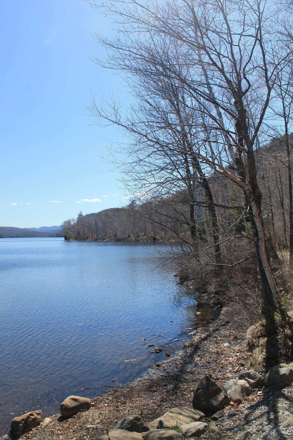
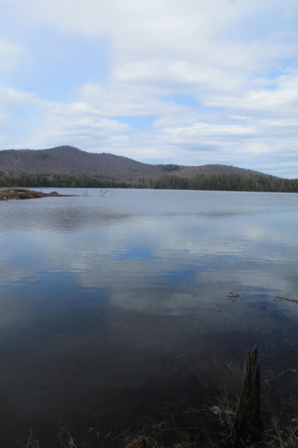
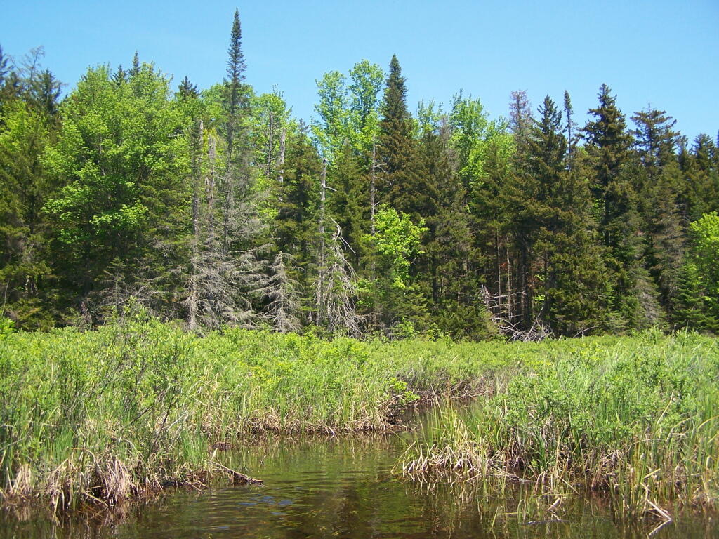
It’s been a relatively wet April compared to recent years.
But I’m not really opposed to all the rain.

Rain is good in April because it means things will green up faster.
![Untitled [Expires June 6 2024]](https://andyarthur.org//data/photo_012487_large.jpg)
Meaning things will have a lower fire risk.
And spring will be upon us sooner.

It’s been a relatively wet April compared to recent years.
But I’m not really opposed to all the rain.
Rain is good in April because it means things will green up faster.
Meaning things will have a lower fire risk.
And spring will be upon us sooner.
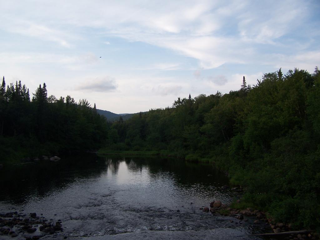
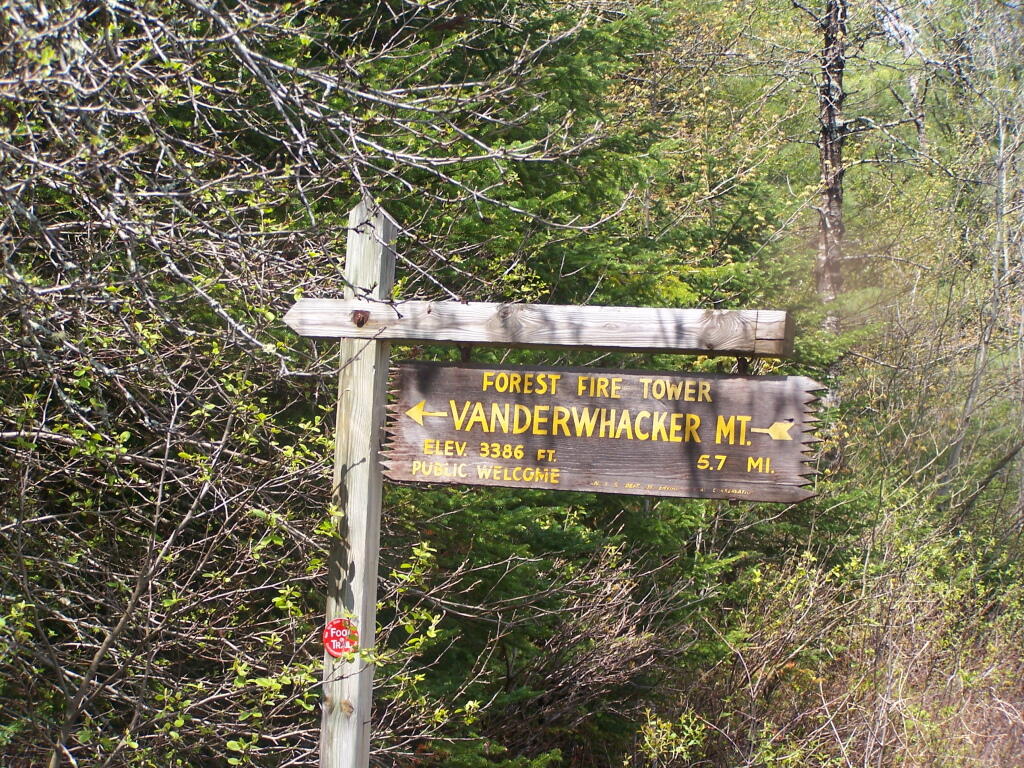
Last October I went for a hike up Lyon Mountain. The first 3/4 of a mile you can drive up to the parking lot, then from there, it’s a two mile hike to the summit, or about 3 miles if you take the new trail.
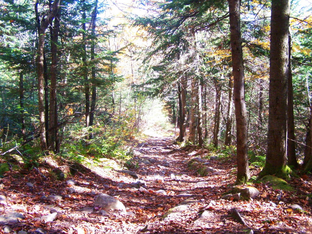
The old trail, following an old woods road is eroded and rough in places, but it well traveled as it much shorter. The new trail, being so twisty is not as well traveled, but it is far less steep and tends to be less wet in the spring time.
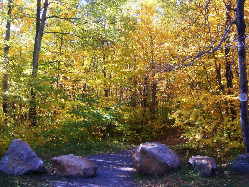
Heading up from the parking area, the first part of the trail follows the old trails route, before swinging left near a registration kiosk.
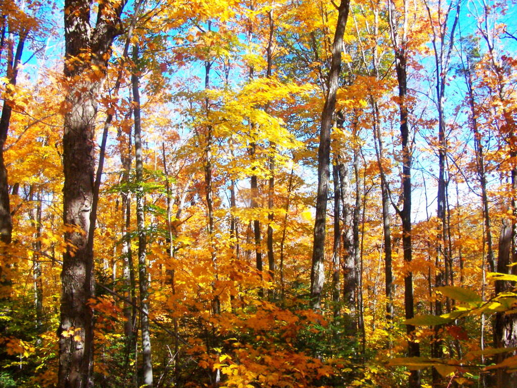
It was very colorful along the new trail as all the maples where at about peak color going up the mountain.
I decided to switch over from the new trail to the old trail, once I reached the point where the trails reached their closest point at the midpoint up the mountain.
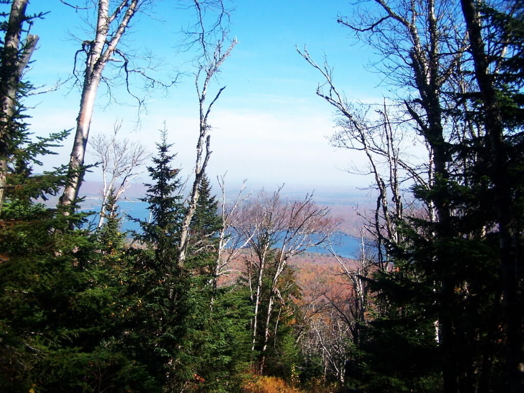
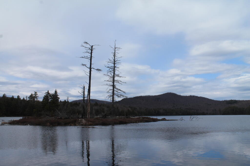
As you get about 2/3rds the way up the mountain, you can look back and see Lake Chazy.
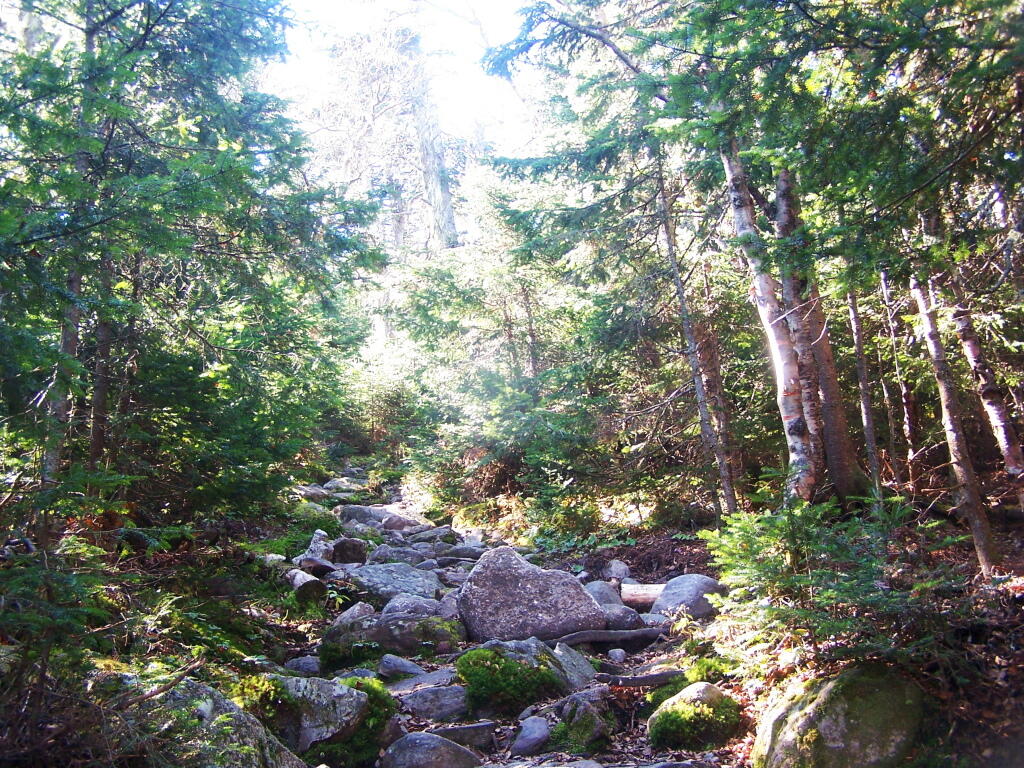
The old trail certainly is eroded and in rough sape in some parts. You can understand why they re-routed it.
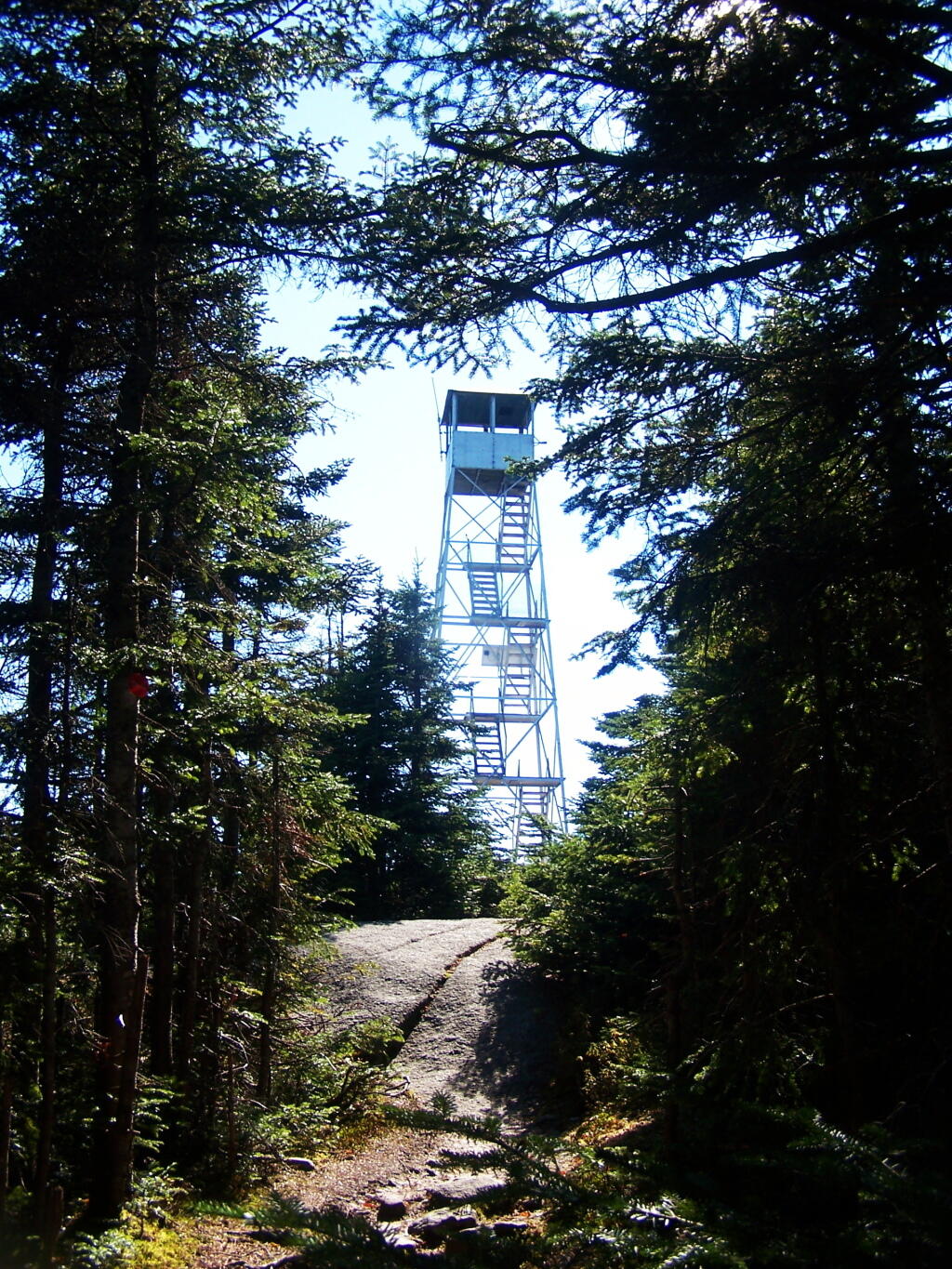
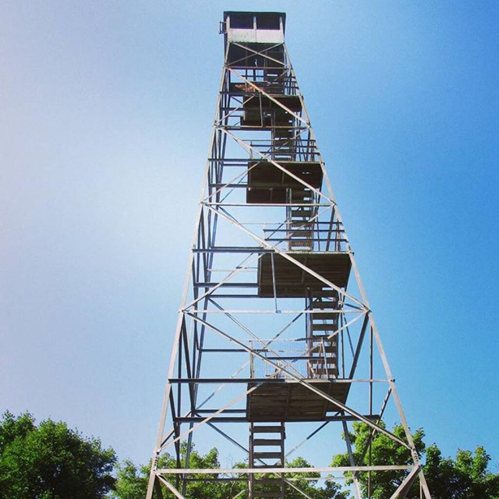
Ah, finally see the fire tower.
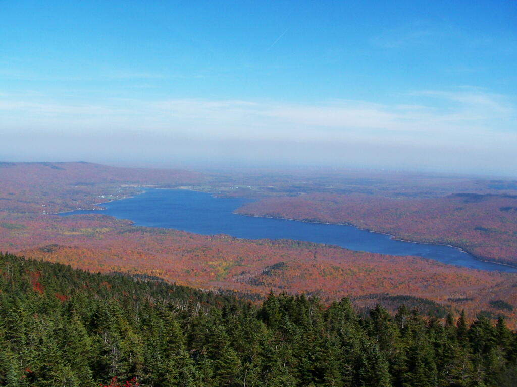
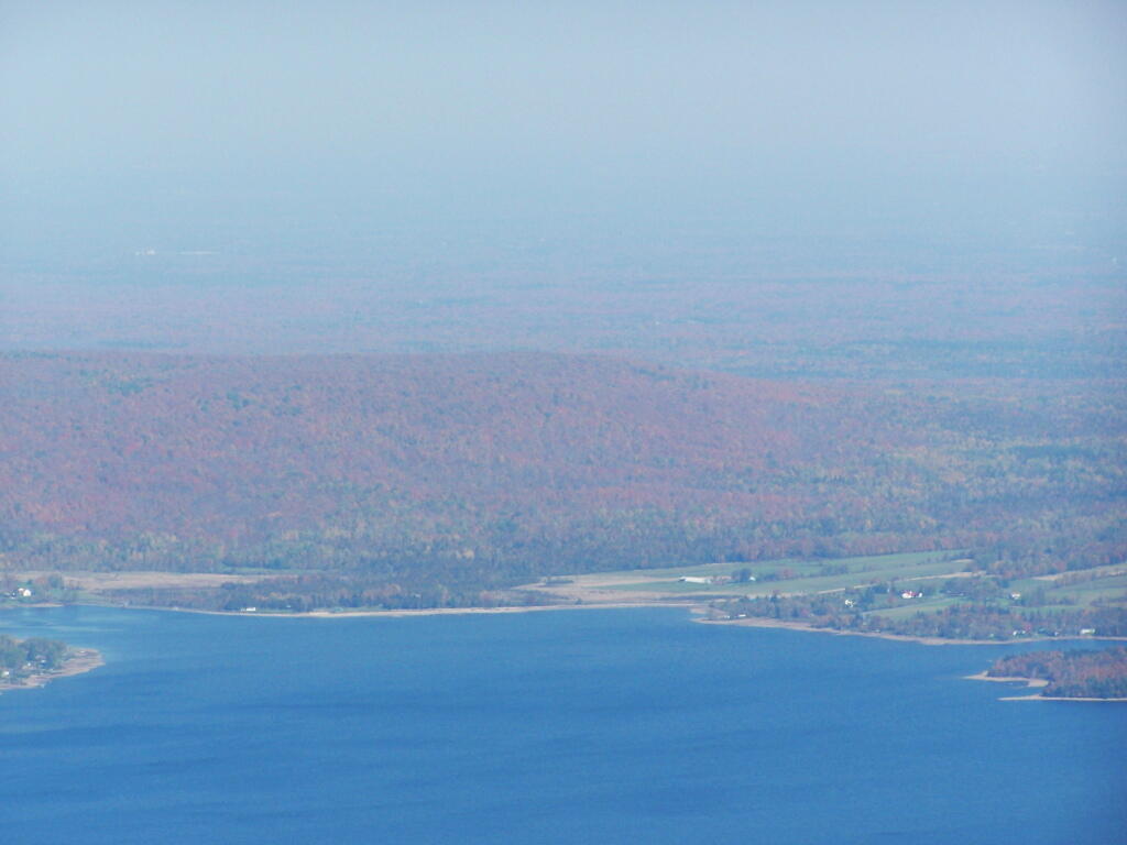
Hazy day, but there’s Lake Chazy and the farms along it.
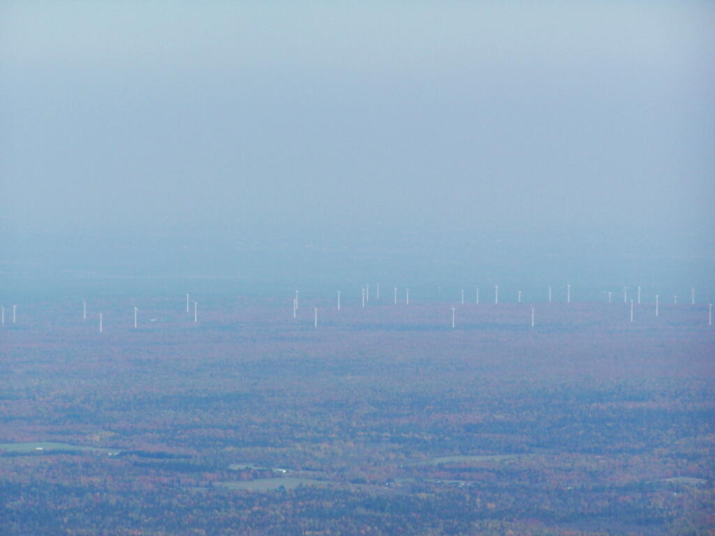
Wind turbines of the Chazy Highlands…
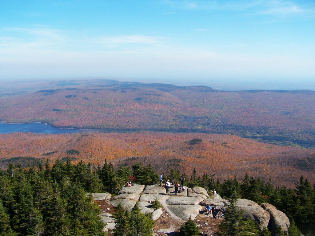
Lyon Mountain is a popular hike, as seen by all the hikers on the ledge.
Article XIV Section 4 states:
The policy of the state shall be to conserve and protect its natural resources and scenic beauty and encourage the development and improvement of its agricultural lands for the production of food and other agricultural products.
The legislature, in implementing this policy, shall include adequate provision for the abatement of air and water pollution and of excessive and unnecessary noise, the protection of agricultural lands, wetlands and shorelines, and the development and regulation of water resources.
While Article XIV Section 5 provides:
A violation of any of the provisions of this article may be restrained at the suit of the people or, with the consent of the supreme court in appellate division, on notice to the attorney-general at the suit of any citizen.
This would state affirmatively that the any citizen may sue the state for failing to “conserve and protect its natural resources and scenic beauty” and “encourage the development and improvement of its agricultural lands for the production of food and other agricultural products.”.
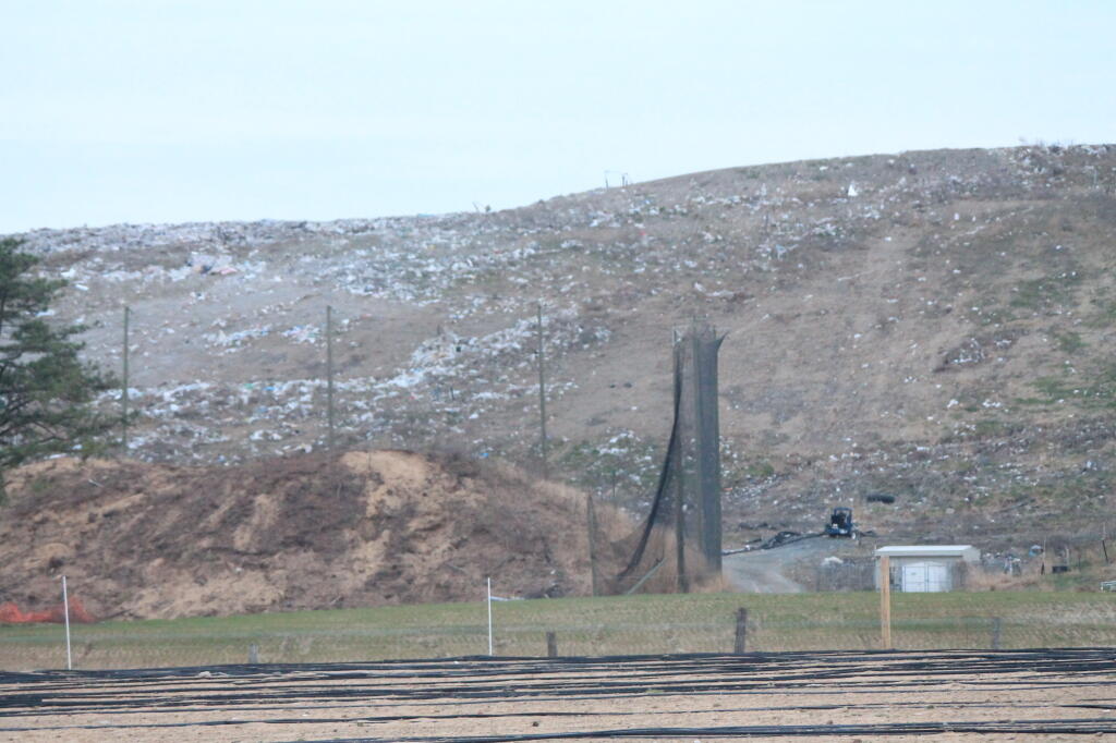
You often hear commericals on radio that “Subrarus are made in zero landfill factories.” Basically, what they are talking about is their automobile assembly factory, where manufactured components are shipped in reusable containers (to save money), bolted or welded together, and finished up.
They do not include manufacturing of components, or the mining of raw materials to build the cars. Even at zero-landfill assembly factories, some waste is generated, but valuable metal scraps are sent to scrap dealers, and plastic garbage and other wastes are shipped off to municipal trash incinerators, and burned for energy. Zero-landfill Assembly factories typically also have recycling programs in lunch rooms for aluminum cans and recycling for paper in offices, which is fairly common in most industries.
When you read into the claim, you have to be kind of skeptical. Indeed, zero-landfill is much different then zero-waste, or near zero-waste as many environmentalists are persuing. Indeed, much of it’s just certification, rather then any real change in process — as it’s stupid not to reuse shipping containers, scrap waste metals, and do other things that save businesses money.

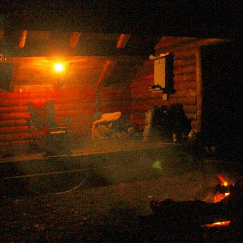
I don’t generate any trash when I camping that I haul home, and then take to the transfer station for disposal in a landfill. I seperate out the burnable trash from the non-burnable trash, the later which I take home for recycling either for remedemption of the deposit or regular municipal recycling at transfer station. I don’t leave any waste behind, and indeed, I often pick up litter from other persons, including small scraps of paper or plastic people overlook.
I do use styrofoam plates and plastic forks, paper towels, wet whipes, and often camp food comes in more packaging then stuff you get a home, as more stuff is canned or in dry packaging. I don’t use reusable bags when buying camp food, because having lots of plastic bags is handy for camping. It’s a lot easier to burn your trash, then have to wash up a lot of dishes. Food waste is also burned in a hot fire, because one doesn’t want attract bears.
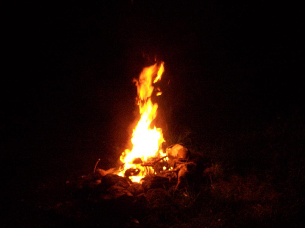
I generate a lot more trash at camp then I do at home. Yet, I don’t want to haul a lot of smelly trash around, so the garbage gets burned at the end of the evening in the campfire. The day’s plastic bag full of burnables gets burned in the hot campfire at the end of day — and is almost instantly incinerated. I like watching trash burn, and I’m not that worried about it compared to what a lot of farmers and rural folks in more rural states burn regularly in their burn barrels and pits.
Tin cans are burned out, to rid of food residue, and tossed in the bin with the aluminim beer and beverage cans. Glass bottles are washed out. Anything that doesn’t burn is hauled home for recycling. I make sure to pick out any aluminum foil or partially burnt trash out of the fire pit. I don’t litter, and there is no trash generated that ever sees a landfill.
To a certain extent I am mocking the concept of zero-landfill manufacturing, that some manufacturers like to brag about it. Are farmers and rural residents who burn their garbage, recycle tin cans and glass, compost, zero-landfill folk? They are keeping their waste out of landfills after all.
But more seriously, it’s not zero-landfill but zero-waste we should be getting to as a society. It’s one things for a country boy out in the boonies to burning his garbage in a fire, it’s another thing for an urban society to be taking steps to reduce it’s waste. All of the country boys, farmers, and rural residents of the world, generate relatively little trash compared to what our big cities generate.
Cities need to find steps to recycle more of their waste, and recover their organics through source-seperated organics composting, biogas, or source-seperate organic biomass energy production. Cities need to find ways to keep their organic waste seperate from toxic technical materials — we got to stop dumping massive quanities of plastics and metals mixed with organics like food waste and brush into massive garbage incinerators and landfills.
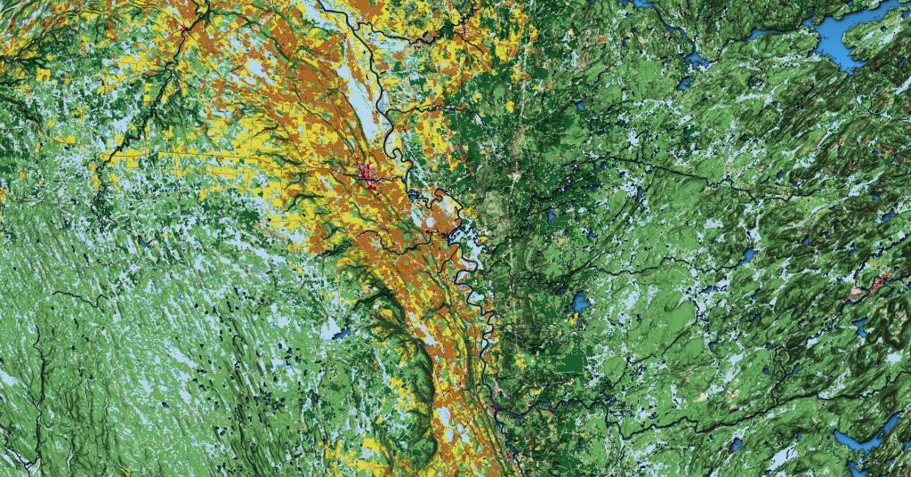
About a year ago, in the Capital Region Solid Waste Plan, the City of Albany proposed creating a mega-solid waste authority to manage the Solid Waste for most of the Eastern Half of New York State. The plan specifically called for creating a regional authority — to service up to nine counties, and cover an area of 100 miles from the center point of the Rapp Road Landfill.
So I decided to make a map, and run some numbers…
100 square miles equals roughly 30,500 square miles, with 21,500 sq miles in New York State and 9,000 sq miles out of State — primarily Southern Vermont, but also most of Western Massachussets, roughly 3/4th of Connecicut, and part of Pennsylvania in the Poconos.
In contrast to 30,500 square miles, Adirondack Park “Blue Line” covers roughly 9,100 sq miles in NY State and the Catskill Park “Blue Line” covers roughly 1,100 sq miles. That includes all land within those parks, publicly and privately owned.
That area, within NY State, covers an area were 2,957,993 persons reported residing in the 2010 census.
That is 2.95 million people, or almost 3 million people, a population greater then Manhattan at 1.5 million persons, and even Brooklyn at 2.5 million.
While no one town or city in the proposed in Authorty is particularly large — the City of Albany is the largest population center at 97,856 followed by Colonie at 81,591, the reality is those numbers add up, when you include the 406 towns and cities in NY State that fall within the 100 mile distance from the Rapp Road Landfill.
| Town /City | Population |
|---|---|
| Albany city | 97,856 |
| Colonie town | 81,591 |
| Schenectady city | 66,135 |
| Utica city | 62,235 |
| Troy city | 50,129 |
| Poughkeepsie town | 43,341 |
| Cortlandt town | 41,592 |
| Monroe town | 39,912 |
| Clifton Park town | 36,705 |
| Yorktown town | 36,081 |
| Guilderland town | 35,303 |
| Carmel town | 34,305 |
| Rome city | 33,725 |
| Bethlehem town | 33,656 |
| Poughkeepsie city | 32,736 |
| Warwick town | 32,065 |
| Newburgh town | 29,801 |
| Glenville town | 29,480 |
| Rotterdam town | 29,094 |
Here is entire list of towns partially or wholely contained in the proposed jurisdiction of the Albany Solid Waste Authority (including large cities and towns listed above)…
| Town /City | Population | Area (sq mi) | Pop sq/mi |
|---|---|---|---|
| Albany city | 97,856 | 21 | 4659.8 |
| Colonie town | 81,591 | 57 | 1431.4 |
| Schenectady city | 66,135 | 10 | 6613.5 |
| Utica city | 62,235 | 16 | 3889.7 |
| Troy city | 50,129 | 11 | 4557.2 |
| Poughkeepsie town | 43,341 | 31 | 1398.1 |
| Cortlandt town | 41,592 | 49 | 848.8 |
| Monroe town | 39,912 | 21 | 1900.6 |
| Clifton Park town | 36,705 | 50 | 734.1 |
| Yorktown town | 36,081 | 39 | 925.2 |
| Guilderland town | 35,303 | 58 | 608.7 |
| Carmel town | 34,305 | 40 | 857.6 |
| Rome city | 33,725 | 75 | 449.7 |
| Bethlehem town | 33,656 | 50 | 673.1 |
| Poughkeepsie city | 32,736 | 5 | 6547.2 |
| Warwick town | 32,065 | 105 | 305.4 |
| Newburgh town | 29,801 | 46 | 647.8 |
| Glenville town | 29,480 | 50 | 589.6 |
| Rotterdam town | 29,094 | 36 | 808.2 |
| East Fishkill town | 29,029 | 57 | 509.3 |
| Newburgh city | 28,866 | 4 | 7216.5 |
| Middletown city | 28,086 | 5 | 5617.2 |
| Queensbury town | 27,901 | 64 | 436.0 |
| Wallkill town | 27,426 | 62 | 442.4 |
| Wappinger town | 27,048 | 28 | 966.0 |
| Saratoga Springs city | 26,586 | 28 | 949.5 |
| New Windsor town | 25,244 | 36 | 701.2 |
| Kingston city | 23,893 | 8 | 2986.6 |
| Peekskill city | 23,583 | 5 | 4716.6 |
| Montgomery town | 22,606 | 51 | 443.3 |
| New Hartford town | 22,166 | 25 | 886.6 |
| Fishkill town | 22,107 | 32 | 690.8 |
| Niskayuna town | 21,781 | 15 | 1452.1 |
| Hyde Park town | 21,571 | 39 | 553.1 |
| Halfmoon town | 21,535 | 33 | 652.6 |
| Somers town | 20,434 | 32 | 638.6 |
| Saugerties town | 19,482 | 67 | 290.8 |
| Whitestown town | 18,667 | 27 | 691.4 |
| Amsterdam city | 18,620 | 6 | 3103.3 |
| Milton town | 18,575 | 35 | 530.7 |
| Southeast town | 18,404 | 34 | 541.3 |
| Blooming Grove town | 18,028 | 35 | 515.1 |
| East Greenbush town | 16,473 | 24 | 686.4 |
| Wilton town | 16,173 | 35 | 462.1 |
| Cohoes city | 16,168 | 4 | 4042.0 |
| La Grange town | 15,730 | 40 | 393.3 |
| Gloversville city | 15,665 | 5 | 3133.0 |
| Beacon city | 15,541 | 4 | 3885.3 |
| Thompson town | 15,308 | 87 | 176.0 |
| Stony Point town | 15,059 | 31 | 485.8 |
| Malta town | 14,765 | 31 | 476.3 |
| Moreau town | 14,728 | 43 | 342.5 |
| Glens Falls city | 14,700 | 3 | 4900.0 |
| Beekman town | 14,621 | 30 | 487.4 |
| Shawangunk town | 14,332 | 56 | 255.9 |
| New Paltz town | 14,003 | 34 | 411.9 |
| Oneonta city | 13,901 | 4 | 3475.3 |
| Goshen town | 13,687 | 44 | 311.1 |
| Kent town | 13,507 | 43 | 314.1 |
| German Flatts town | 13,258 | 34 | 389.9 |
| Wawarsing town | 13,157 | 133 | 98.9 |
| Fallsburg town | 12,870 | 79 | 162.9 |
| Schodack town | 12,794 | 63 | 203.1 |
| Kingsbury town | 12,671 | 40 | 316.8 |
| Cornwall town | 12,646 | 28 | 451.6 |
| Highlands town | 12,492 | 33 | 378.5 |
| Lewisboro town | 12,411 | 29 | 428.0 |
| Ulster town | 12,327 | 28 | 440.3 |
| Mamakating town | 12,085 | 98 | 123.3 |
| North Greenbush town | 12,075 | 18 | 670.8 |
| Patterson town | 12,023 | 32 | 375.7 |
| Chester town | 11,981 | 87 | 137.7 |
| Chester town | 11,981 | 25 | 479.2 |
| Brunswick town | 11,941 | 44 | 271.4 |
| Putnam Valley town | 11,809 | 42 | 281.2 |
| Catskill town | 11,775 | 64 | 184.0 |
| Oneida city | 11,393 | 22 | 517.9 |
| Woodbury town | 11,353 | 37 | 306.8 |
| Red Hook town | 11,319 | 40 | 283.0 |
| Lloyd town | 10,863 | 33 | 329.2 |
| Plattekill town | 10,499 | 35 | 300.0 |
| Kirkland town | 10,315 | 33 | 312.6 |
| Watervliet city | 10,254 | 1 | 10254.0 |
| Herkimer town | 10,175 | 32 | 318.0 |
| Liberty town | 9,885 | 80 | 123.6 |
| Ballston town | 9,776 | 30 | 325.9 |
| Pleasant Valley town | 9,672 | 33 | 293.1 |
| Philipstown town | 9,662 | 51 | 189.5 |
| Rensselaer city | 9,392 | 3 | 3130.7 |
| Crawford town | 9,316 | 40 | 232.9 |
| Lenox town | 9,122 | 36 | 253.4 |
| Esopus town | 9,041 | 41 | 220.5 |
| Marcy town | 8,982 | 33 | 272.2 |
| North Elba town | 8,957 | 156 | 57.4 |
| Coxsackie town | 8,918 | 38 | 234.7 |
| Marlborough town | 8,808 | 26 | 338.8 |
| Johnstown city | 8,743 | 4 | 2185.8 |
| Dover town | 8,699 | 56 | 155.3 |
| New Scotland town | 8,648 | 57 | 151.7 |
| Sand Lake town | 8,530 | 36 | 236.9 |
| Kinderhook town | 8,498 | 32 | 265.6 |
| Pawling town | 8,463 | 45 | 188.1 |
| Waterford town | 8,423 | 7 | 1203.3 |
| Stillwater town | 8,287 | 43 | 192.7 |
| Deerpark town | 7,901 | 67 | 117.9 |
| Greenfield town | 7,775 | 67 | 116.0 |
| Schaghticoke town | 7,679 | 51 | 150.6 |
| Frankfort town | 7,636 | 36 | 212.1 |
| Rhinebeck town | 7,548 | 39 | 193.5 |
| Coeymans town | 7,418 | 53 | 140.0 |
| Rochester town | 7,313 | 89 | 82.2 |
| Wawayanda town | 7,266 | 35 | 207.6 |
| Norwich city | 7,190 | 2 | 3595.0 |
| Johnstown town | 7,098 | 71 | 100.0 |
| Mount Hope town | 7,018 | 25 | 280.7 |
| Hoosick town | 6,924 | 63 | 109.9 |
| Hudson city | 6,713 | 2 | 3356.5 |
| Hamilton town | 6,690 | 41 | 163.2 |
| Cairo town | 6,670 | 60 | 111.2 |
| Granville town | 6,669 | 56 | 119.1 |
| Cobleskill town | 6,625 | 30 | 220.8 |
| Corinth town | 6,531 | 58 | 112.6 |
| Mayfield town | 6,495 | 64 | 101.5 |
| Lee town | 6,486 | 45 | 144.1 |
| Fort Edward town | 6,371 | 27 | 236.0 |
| Hurley town | 6,314 | 35 | 180.4 |
| Verona town | 6,293 | 69 | 91.2 |
| Windsor town | 6,274 | 93 | 67.5 |
| Fort Ann town | 6,190 | 111 | 55.8 |
| Westmoreland town | 6,138 | 43 | 142.7 |
| Duanesburg town | 6,122 | 71 | 86.2 |
| Rosendale town | 6,075 | 20 | 303.8 |
| Claverack town | 6,021 | 47 | 128.1 |
| Woodstock town | 5,884 | 67 | 87.8 |
| Sidney town | 5,774 | 50 | 115.5 |
| Pittstown town | 5,735 | 64 | 89.6 |
| Gardiner town | 5,713 | 43 | 132.9 |
| Saratoga town | 5,674 | 42 | 135.1 |
| Marbletown town | 5,607 | 55 | 101.9 |
| Greene town | 5,604 | 75 | 74.7 |
| Walton town | 5,576 | 97 | 57.5 |
| Amsterdam town | 5,566 | 30 | 185.5 |
| Hamptonburgh town | 5,561 | 26 | 213.9 |
| Vienna town | 5,440 | 95 | 57.3 |
| Vernon town | 5,408 | 37 | 146.2 |
| Ghent town | 5,402 | 45 | 120.0 |
| Broadalbin town | 5,260 | 39 | 134.9 |
| Eaton town | 5,255 | 45 | 116.8 |
| Colesville town | 5,232 | 79 | 66.2 |
| Oneonta town | 5,229 | 33 | 158.5 |
| Mechanicville city | 5,196 | 0 | |
| Delhi town | 5,117 | 64 | 80.0 |
| North Salem town | 5,104 | 22 | 232.0 |
| Northumberland town | 5,087 | 32 | 159.0 |
| Ticonderoga town | 5,042 | 88 | 57.3 |
| Little Falls city | 4,946 | 3 | 1648.7 |
| Greenwich town | 4,942 | 44 | 112.3 |
| Union Vale town | 4,877 | 37 | 131.8 |
| Moriah town | 4,798 | 71 | 67.6 |
| Nassau town | 4,789 | 45 | 106.4 |
| Washington town | 4,741 | 58 | 81.7 |
| Boonville town | 4,555 | 72 | 63.3 |
| Poestenkill town | 4,530 | 32 | 141.6 |
| Trenton town | 4,498 | 43 | 104.6 |
| Minisink town | 4,490 | 23 | 195.2 |
| Amenia town | 4,436 | 43 | 103.2 |
| Olive town | 4,419 | 65 | 68.0 |
| Paris town | 4,411 | 31 | 142.3 |
| Unadilla town | 4,392 | 46 | 95.5 |
| Minden town | 4,297 | 51 | 84.3 |
| Deerfield town | 4,273 | 33 | 129.5 |
| Bethel town | 4,255 | 90 | 47.3 |
| Greenport town | 4,165 | 20 | 208.3 |
| Charlton town | 4,133 | 32 | 129.2 |
| Chatham town | 4,128 | 53 | 77.9 |
| Warrensburg town | 4,094 | 64 | 64.0 |
| Athens town | 4,089 | 28 | 146.0 |
| Sherburne town | 4,048 | 43 | 94.1 |
| Whitehall town | 4,042 | 58 | 69.7 |
| Norwich town | 3,998 | 42 | 95.2 |
| Oxford town | 3,901 | 60 | 65.0 |
| Otsego town | 3,900 | 59 | 66.1 |
| Mohawk town | 3,844 | 35 | 109.8 |
| Stanford town | 3,823 | 50 | 76.5 |
| Floyd town | 3,819 | 34 | 112.3 |
| Argyle town | 3,782 | 57 | 66.4 |
| Rockland town | 3,775 | 95 | 39.7 |
| Middletown town | 3,750 | 97 | 38.7 |
| Middleburgh town | 3,746 | 49 | 76.4 |
| Greenville town | 3,739 | 39 | 95.9 |
| Greenville town | 3,739 | 30 | 124.6 |
| Canajoharie town | 3,730 | 43 | 86.7 |
| Livingston town | 3,646 | 38 | 95.9 |
| Perth town | 3,646 | 26 | 140.2 |
| Tuxedo town | 3,624 | 49 | 74.0 |
| Copake town | 3,615 | 42 | 86.1 |
| Neversink town | 3,557 | 86 | 41.4 |
| Galway town | 3,545 | 45 | 78.8 |
| Lake George town | 3,515 | 32 | 109.8 |
| Schuyler town | 3,420 | 40 | 85.5 |
| New Baltimore town | 3,370 | 43 | 78.4 |
| Westerlo town | 3,361 | 58 | 57.9 |
| White Creek town | 3,356 | 48 | 69.9 |
| Lake Luzerne town | 3,347 | 54 | 62.0 |
| Manheim town | 3,334 | 29 | 115.0 |
| Bainbridge town | 3,308 | 34 | 97.3 |
| Palatine town | 3,240 | 41 | 79.0 |
| Hancock town | 3,224 | 161 | 20.0 |
| Schoharie town | 3,205 | 29 | 110.5 |
| Otego town | 3,115 | 45 | 69.2 |
| Shandaken town | 3,085 | 120 | 25.7 |
| Sherrill city | 3,071 | 2 | 1535.5 |
| Callicoon town | 3,057 | 48 | 63.7 |
| Milford town | 3,044 | 47 | 64.8 |
| North East town | 3,031 | 43 | 70.5 |
| Annsville town | 3,012 | 60 | 50.2 |
| Madison town | 3,008 | 41 | 73.4 |
| Davenport town | 2,965 | 52 | 57.0 |
| Guilford town | 2,922 | 61 | 47.9 |
| Stephentown town | 2,903 | 58 | 50.1 |
| Afton town | 2,851 | 46 | 62.0 |
| Stockport town | 2,815 | 13 | 216.5 |
| Berne town | 2,794 | 64 | 43.7 |
| Hunter town | 2,732 | 90 | 30.4 |
| Durham town | 2,725 | 49 | 55.6 |
| Salem town | 2,715 | 52 | 52.2 |
| Florida town | 2,696 | 51 | 52.9 |
| Knox town | 2,692 | 41 | 65.7 |
| New Berlin town | 2,682 | 46 | 58.3 |
| Delaware town | 2,670 | 35 | 76.3 |
| Northampton town | 2,670 | 34 | 78.5 |
| St. Johnsville town | 2,631 | 17 | 154.8 |
| Green Island town | 2,620 | 0 | |
| Richmondville town | 2,610 | 30 | 87.0 |
| Russia town | 2,587 | 60 | 43.1 |
| Sangerfield town | 2,561 | 30 | 85.4 |
| Brookfield town | 2,545 | 78 | 32.6 |
| Highland town | 2,530 | 52 | 48.7 |
| Glen town | 2,507 | 39 | 64.3 |
| Roxbury town | 2,502 | 87 | 28.8 |
| Pine Plains town | 2,473 | 31 | 79.8 |
| Lumberland town | 2,468 | 49 | 50.4 |
| Laurens town | 2,424 | 42 | 57.7 |
| Franklin town | 2,411 | 81 | 29.8 |
| Sanford town | 2,407 | 91 | 26.5 |
| Johnsburg town | 2,395 | 206 | 11.6 |
| Richfield town | 2,388 | 32 | 74.6 |
| Milan town | 2,370 | 36 | 65.8 |
| Easton town | 2,336 | 63 | 37.1 |
| Bolton town | 2,326 | 90 | 25.8 |
| New Lebanon town | 2,305 | 35 | 65.9 |
| Newport town | 2,302 | 32 | 71.9 |
| Hartford town | 2,269 | 43 | 52.8 |
| Stamford town | 2,267 | 48 | 47.2 |
| Worcester town | 2,220 | 46 | 48.3 |
| Marshall town | 2,131 | 32 | 66.6 |
| Grafton town | 2,130 | 45 | 47.3 |
| Princetown town | 2,115 | 24 | 88.1 |
| Middlefield town | 2,114 | 63 | 33.6 |
| Hartwick town | 2,110 | 40 | 52.8 |
| Stockbridge town | 2,103 | 31 | 67.8 |
| Winfield town | 2,086 | 23 | 90.7 |
| Colchester town | 2,077 | 142 | 14.6 |
| Esperance town | 2,076 | 20 | 103.8 |
| Hadley town | 2,048 | 41 | 50.0 |
| Stuyvesant town | 2,027 | 26 | 78.0 |
| Crown Point town | 2,024 | 81 | 25.0 |
| Cambridge town | 2,021 | 36 | 56.1 |
| Augusta town | 2,020 | 27 | 74.8 |
| Lincoln town | 2,012 | 25 | 80.5 |
| Providence town | 1,995 | 45 | 44.3 |
| Nelson town | 1,980 | 44 | 45.0 |
| Clermont town | 1,965 | 19 | 103.4 |
| Salisbury town | 1,958 | 108 | 18.1 |
| Germantown town | 1,954 | 13 | 150.3 |
| Western town | 1,951 | 54 | 36.1 |
| Carlisle town | 1,948 | 34 | 57.3 |
| Remsen town | 1,929 | 36 | 53.6 |
| Hillsdale town | 1,927 | 48 | 40.1 |
| Oppenheim town | 1,924 | 56 | 34.4 |
| Maryland town | 1,897 | 51 | 37.2 |
| Watson town | 1,881 | 116 | 16.2 |
| Berlin town | 1,880 | 59 | 31.9 |
| Morris town | 1,878 | 39 | 48.2 |
| Hebron town | 1,853 | 56 | 33.1 |
| Sharon town | 1,846 | 39 | 47.3 |
| Rensselaerville town | 1,843 | 62 | 29.7 |
| Edmeston town | 1,826 | 44 | 41.5 |
| Webb town | 1,807 | 484 | 3.7 |
| Plymouth town | 1,804 | 42 | 43.0 |
| Jackson town | 1,800 | 37 | 48.6 |
| Butternuts town | 1,786 | 53 | 33.7 |
| Leyden town | 1,785 | 33 | 54.1 |
| North Norwich town | 1,783 | 28 | 63.7 |
| Seward town | 1,763 | 36 | 49.0 |
| Fenner town | 1,726 | 31 | 55.7 |
| Root town | 1,715 | 51 | 33.6 |
| Deposit town | 1,712 | 44 | 38.9 |
| Canaan town | 1,710 | 36 | 47.5 |
| Windham town | 1,703 | 45 | 37.8 |
| Ashland town | 1,695 | 25 | 67.8 |
| Ephratah town | 1,682 | 39 | 43.1 |
| Kortright town | 1,675 | 62 | 27.0 |
| Gallatin town | 1,668 | 39 | 42.8 |
| Coventry town | 1,655 | 48 | 34.5 |
| Schroon town | 1,654 | 141 | 11.7 |
| Austerlitz town | 1,654 | 48 | 34.5 |
| Fairfield town | 1,627 | 41 | 39.7 |
| DeRuyter town | 1,589 | 31 | 51.3 |
| Little Falls town | 1,587 | 22 | 72.1 |
| Columbia town | 1,580 | 35 | 45.1 |
| Harpersfield town | 1,577 | 42 | 37.5 |
| Ancram town | 1,573 | 42 | 37.5 |
| Wright town | 1,539 | 28 | 55.0 |
| Forestport town | 1,535 | 78 | 19.7 |
| Meredith town | 1,529 | 58 | 26.4 |
| Petersburgh town | 1,525 | 41 | 37.2 |
| West Turin town | 1,524 | 102 | 14.9 |
| Bridgewater town | 1,522 | 23 | 66.2 |
| Tusten town | 1,515 | 48 | 31.6 |
| Litchfield town | 1,513 | 30 | 50.4 |
| Fulton town | 1,442 | 65 | 22.2 |
| Jefferson town | 1,410 | 43 | 32.8 |
| Horicon town | 1,389 | 71 | 19.6 |
| Lewis town | 1,382 | 65 | 21.3 |
| Charleston town | 1,373 | 42 | 32.7 |
| Cochecton town | 1,372 | 37 | 37.1 |
| Pittsfield town | 1,366 | 38 | 35.9 |
| Springfield town | 1,358 | 45 | 30.2 |
| Indian Lake town | 1,352 | 266 | 5.1 |
| Lebanon town | 1,332 | 43 | 31.0 |
| Smithville town | 1,330 | 50 | 26.6 |
| Hamden town | 1,323 | 60 | 22.1 |
| Masonville town | 1,320 | 54 | 24.4 |
| Westport town | 1,312 | 66 | 19.9 |
| Taghkanic town | 1,310 | 40 | 32.8 |
| Gilboa town | 1,307 | 59 | 22.2 |
| Andes town | 1,301 | 112 | 11.6 |
| Smithfield town | 1,288 | 24 | 53.7 |
| Smyrna town | 1,280 | 42 | 30.5 |
| Tompkins town | 1,247 | 104 | 12.0 |
| Lyonsdale town | 1,227 | 70 | 17.5 |
| Cherry Valley town | 1,223 | 40 | 30.6 |
| Thurman town | 1,219 | 92 | 13.3 |
| Edinburg town | 1,214 | 67 | 18.1 |
| Caroga town | 1,205 | 54 | 22.3 |
| Greig town | 1,199 | 94 | 12.8 |
| Elizabethtown town | 1,163 | 83 | 14.0 |
| Summit town | 1,148 | 37 | 31.0 |
| Warren town | 1,143 | 38 | 30.1 |
| Burlington town | 1,140 | 45 | 25.3 |
| New Lisbon town | 1,114 | 44 | 25.3 |
| Keene town | 1,105 | 156 | 7.1 |
| Steuben town | 1,100 | 42 | 26.2 |
| Otselic town | 1,054 | 38 | 27.7 |
| Preston town | 1,044 | 35 | 29.8 |
| Danube town | 1,039 | 29 | 35.8 |
| Fremont town | 1,008 | 51 | 19.8 |
| Ohio town | 1,002 | 307 | 3.3 |
| Exeter town | 987 | 32 | 30.8 |
| Columbus town | 975 | 37 | 26.4 |
| Georgetown town | 974 | 40 | 24.4 |
| Broome town | 973 | 48 | 20.3 |
| Jewett town | 953 | 50 | 19.1 |
| Hampton town | 938 | 22 | 42.6 |
| Plainfield town | 915 | 29 | 31.6 |
| Kingston town | 889 | 7 | 127.0 |
| McDonough town | 886 | 39 | 22.7 |
| Westford town | 868 | 33 | 26.3 |
| Day town | 856 | 69 | 12.4 |
| Forestburgh town | 819 | 56 | 14.6 |
| Minerva town | 809 | 160 | 5.1 |
| Lexington town | 805 | 79 | 10.2 |
| Pitcher town | 803 | 28 | 28.7 |
| Lake Pleasant town | 781 | 198 | 3.9 |
| Stony Creek town | 767 | 83 | 9.2 |
| Norway town | 762 | 35 | 21.8 |
| Stark town | 757 | 31 | 24.4 |
| Clinton town | 737 | 38 | 19.4 |
| Conesville town | 734 | 40 | 18.4 |
| Long Lake town | 711 | 449 | 1.6 |
| Roseboom town | 711 | 33 | 21.5 |
| Prattsville town | 700 | 19 | 36.8 |
| Hague town | 699 | 80 | 8.7 |
| Ava town | 676 | 37 | 18.3 |
| Wells town | 674 | 177 | 3.8 |
| Dresden town | 652 | 54 | 12.1 |
| Bovina town | 633 | 44 | 14.4 |
| Stratford town | 610 | 76 | 8.0 |
| Putnam town | 609 | 35 | 17.4 |
| Pharsalia town | 593 | 39 | 15.2 |
| Denning town | 551 | 105 | 5.2 |
| Bleecker town | 533 | 59 | 9.0 |
| Newcomb town | 436 | 233 | 1.9 |
| Hope town | 403 | 41 | 9.8 |
| Lincklaen town | 396 | 26 | 15.2 |
| Blenheim town | 377 | 34 | 11.1 |
| Decatur town | 353 | 20 | 17.7 |
| Inlet town | 333 | 66 | 5.0 |
| Arietta town | 304 | 329 | 0.9 |
| Halcott town | 258 | 23 | 11.2 |
| North Hudson town | 240 | 185 | 1.3 |
| Hardenburgh town | 238 | 80 | 3.0 |
| Benson town | 192 | 83 | 2.3 |
| Morehouse town | 86 | 194 | 0.4 |
| Total | 2,957,993 | 21,462 | 386.0 |
For the first year of doing topographic maps, I relied extensively on using NYSDOT topographic maps, I originally downloaded from the NYSGIS consortium website. The NYSDOT topographic maps have a lot of good information on them, an in many ways have the most accurate topography.
But what I’ve also found with those maps is they have several real limitations…
NYSDOT topographic maps are designed to viewed at 1:2400 feet ratio, as they are 7.5″ quads. You can get away with rendering them anywhere between 1:1800 to 1:2600, but beyond that the text looks too small, too crowded, or two pixelated. For smaller parks and larger areas, NYSDOT topographic maps do not work well.
DOT Topographic Maps try to suit the need of any user, and include information like town lines and other jurisdictional information that is unnecessarily for the average outdoors person.
Often topographic maps have dated information on man-made boundaries and buildings. The state often buys new land, demolishes existing buildings, and closes off trails. Old trails appear on topographic maps, as do labels such a “Restricted”, even though to this day such roads may be valid, despite the incorrect or outdated information on topographic maps.
Metric elevations are maddening for anyone trying to calculate their elevation from select DOT topo maps, and often when you load multiple topographic maps, they do not fit together seamlessly, as one will be using one unit for contours, while another will use another unit. Contour scales throughout the state very widely, which when put together can be confusing.
On the other hand, topos do have some benefits…
The Census Water Area and Liner Water Shapefiles from TIGER/Line are pretty accurate, but they are not nearly as good as topographic maps.
Currently I don’t have any good source of data or wetlands to add to my maps. I probably should do more research into this, as I know the state does have wetland maps available — but how much of a PITA are they to use?
Topographic maps have many of the buildings on them. While this information can be outdated, it does provide useful information to the viewer of such maps. TIGER/line has some features, like cemeteries and some buildings, but this data set is tiny compared to what’s on the NYSDOT topographic maps.
Today’s fodder is based on the text of as Adirondack Park Land Acqusition Policy, as described in the Adirondack Park State Land Master Plan. I added the headings and pictures to make it more readable. — Andy
The Agency has an important interest inr future state land acquisitions since they can vitally affect both private and public land within the Adirondack Park. As a result the Agency recommends that the following guidelines should govern future acquisitions of state lands within the Park…
1. Future state acquisitions within the Adirondack Park should generally be restricted to the acquisition of forest preserve lands. Where special state purposes are such that non-forest preserve land might be acquired (if such acquisitions are constitutionally permissible) the amount acquired for other than forest preserve purposes should be kept to the minimum necessary. Thus, should the state acquire a 100-acre tract on which it wished to place a hospital, a prison, an office building or another facility only that part of the tract, say twenty-five acres, that is actually necessary for the facility should be classified as non-forest preserve.
2. As a general guideline, the state should avoid acquiring lands for non-forest preserve purposes (if such acquisitions are constitutionally permissible) within the Park where:
— the tract is not contiguous to a public highway; or,
— the tract is of a native forest character, i.e., stocked with any size, native tree species with twenty-five percent crown cover (plantations are not considered to be native forest land); or,
— the tract involved consists of more than 150 acres; or,
— the tract is contiguous to existing forest preserve land; or,
— the tract is within one-half mile of a block of forest preserve land of over 1,000 acres; or,
— the tract lies at an elevation greater than 2,500 feet; or,
— the proposed use of the tract will materially alter the surrounding environment; or,
— the tract is of significant scenic, ecological or geologic value or interest.
3. Save for (i) the two existing alpine skiing centers at Whiteface and Gore mountains and the Mt. Van Hoevenberg area; (ii) rustic state campsites, a long accepted intensive use of the forest preserve; (iii) visitor information centers, memorial highways, beaches and boat launching sites; and (iv) historic areas (guidelines for which are provided elsewhere in this master plan), the state should rely on private enterprise to develop intensive recreational facilities on private lands within the Park, to the extent that the character of these lands permits this type of development, and should not acquire lands for these purposes.
4. Highest priority should be given to acquiring fee title to, fee title subject to a term of life tenancy, or conservation easements providing public use or value or rights of first refusal over,
(i) key parcels of private land, the use or development of which could adversely affect the integrity of vital tracts of state land, particularly wilderness, primitive and canoe areas and
(ii) key parcels which would permit the upgrading of primitive areas to wilderness areas.
5. High priority should also be given to acquisitions of fee title which permit the consolidation of scattered tracts of state land.
6. Fee title or appropriate conservation easements should also be acquired to protect critical wildlife areas such as deer wintering areas, wetlands, habitats of rare or endangered species or other areas of unique value, such as lands bordering or providing access to classified or proposed wild, scenic and recreational rivers.
7. Efforts should be made, by conservation easement or fee acquisition, to protect the major scenic resources of the Park along travel corridors, with particular attention to the Adirondack Northway and those scenic vistas specifically identified on the Private Land Use and Development Plan Map and listed in Chapter III of this document.
8. The acquisition of fee title to or rights-of-way across private lands that effectively prevent access to important blocks of state land should be pursued, except where such acquisition would exacerbate or cause problems of overuse or inappropriate use of state lands.
9. Canoe route easements should be purchased to reopen Adirondack canoe routes for non-motorized access in appropriate areas of the Park.
10. The highly successful fishing rights easement purchase program of the Department of Environmental Conservation should be continued and expanded on appropriate streams.
11. Due to the importance of the forest products industry to the economy of the Adirondack region, bulk acreage purchases in fee should not normally be made where highly productive forest land is involved, unless such land is threatened with development that would curtail its use for forestry purposes or its value for the preservation of open space or of wildlife habitat. However, conservation easements permitting the continuation of sound forest management and other land uses compatible with the open space character of the Park should be acquired wherever possible to protect and buffer state lands.

While the Agency has not been given authority to review proposed acquisitions before title has vested in the state, once new lands have been acquired the Act requires the master plan to be revised by classifying the lands and setting guidelines for their management and use pursuant to the statutory procedures (consultation with the Department of Environmental Conservation and submission to the Governor for approval). The following procedures for revisions of the master plan will be followed in connection with new acquisitions:
— land acquisitions should be classified as promptly as possible following acquisition and in any case classification of new acquisitions will be done annually; and,
— prior to classification by the Agency, lands acquired by the Department of Environmental Conservation or any other state agency will be administered on an interim basis in a manner consistent with the character of the land and its capacity to withstand use and which will not foreclose options for eventual classification.