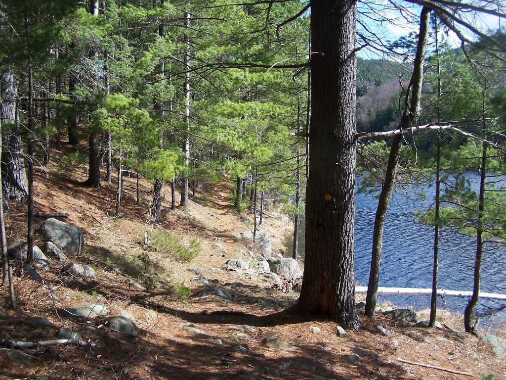
Pharaoh Mountain is located about 10 miles east of Schroon Lake, and can be accessed from the Long Swing / Pharaoh Mountain Trail from the North along with a much steeper and longer trail from Pharaoh Lake from south.
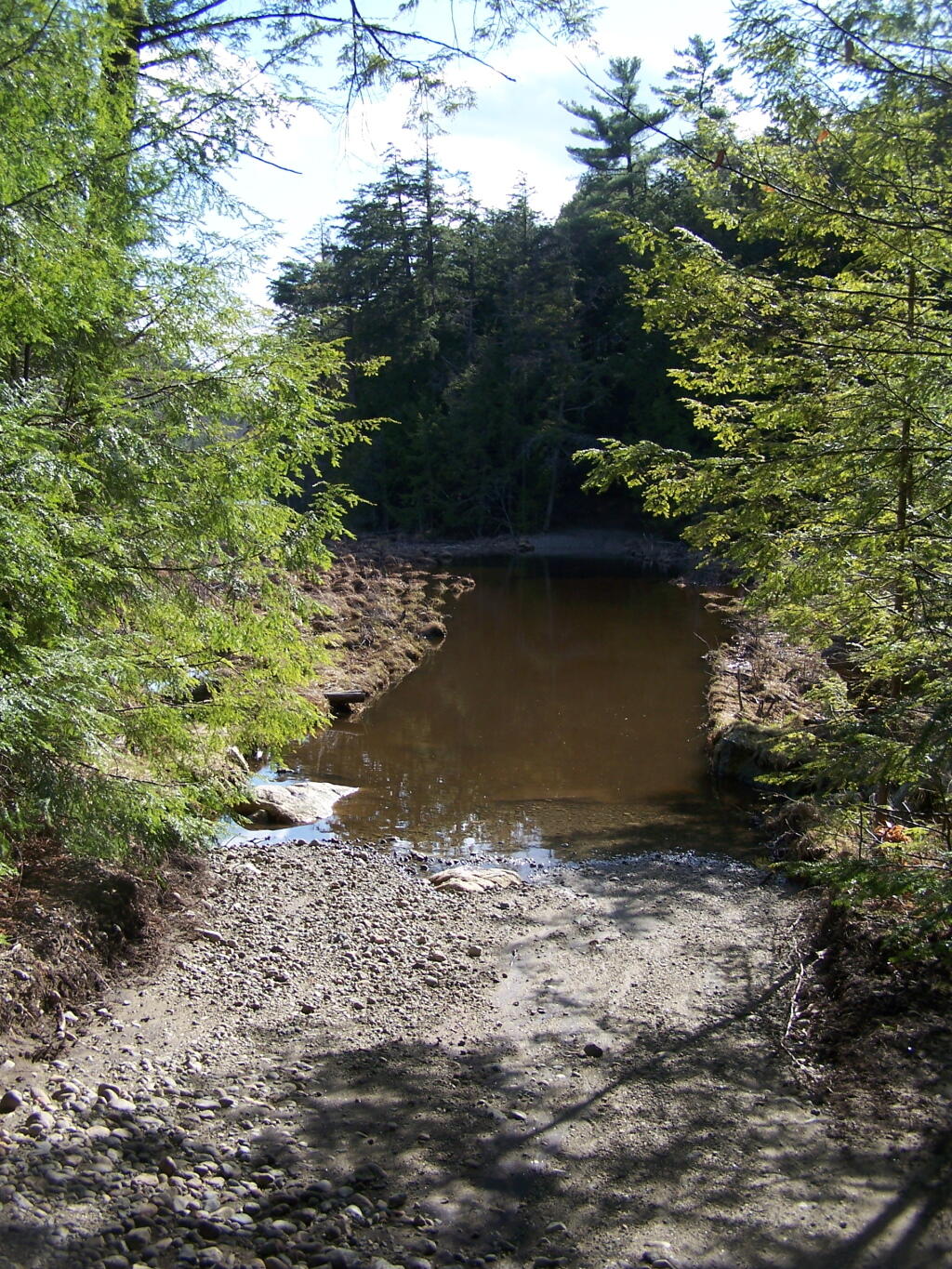
If you choose to take the infamous and rough Crane Pond Truck Trail to it’s end, and then park at Crane Pond, it’s only about a 3 1/2 mile hike up the mountain. If you stop at Alder Pond, and don’t drive through the shallow end of Alder Pond to get to the last mile of Crane Pond Road, then it’s a 4 1/2 mile hike each way.
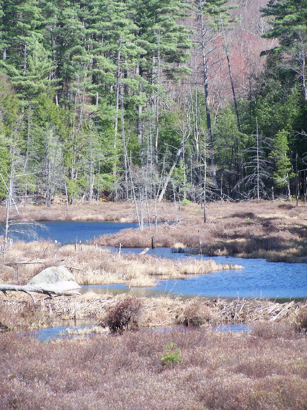
Below is Alder Pond. It was an amazing morning, as the rain let up and started to clear off. The truck trail cuts through the end of the pond, and with the recent rains, it was deeper then I wanted to take my old pickup through.
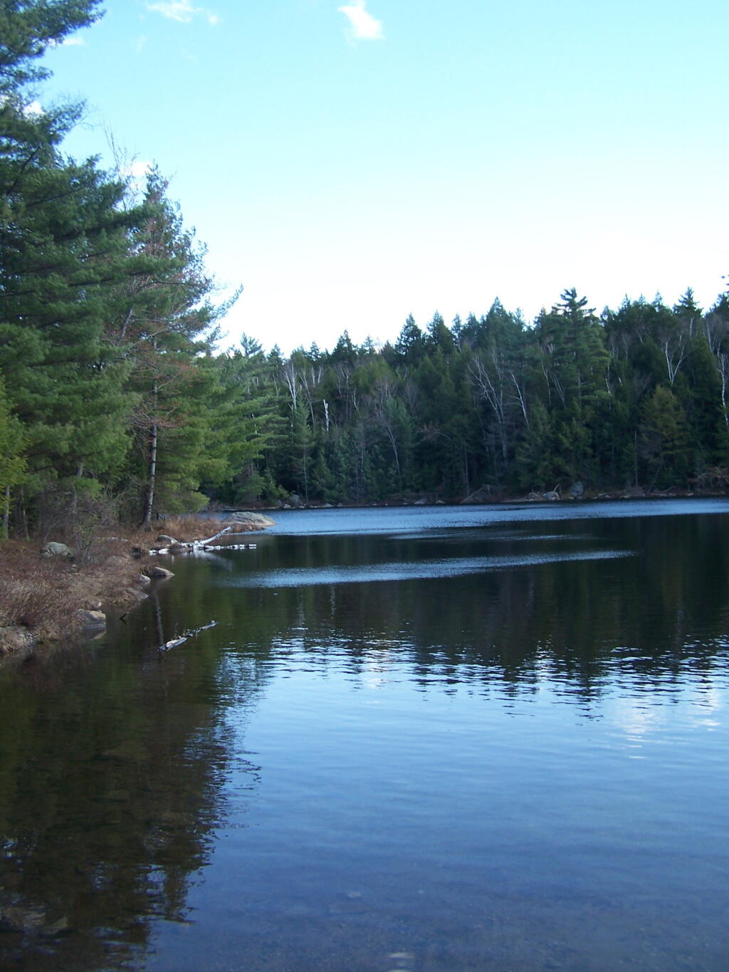
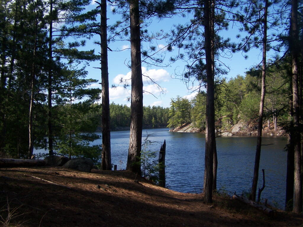
At end of Crane Pond Road is Crane Pond (not surpisingly!) There is a parking area here, and Crane Pond is known for it’s good fishing and beauty.
Reaching Glidden Marsh on the Pharaoh Mountain Trail. Pharoah Mountain is in the distance, with the peak sticking up. Most of the trail is relatively flat, until you reach the mountain, and then you start climbing.
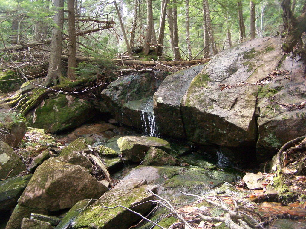
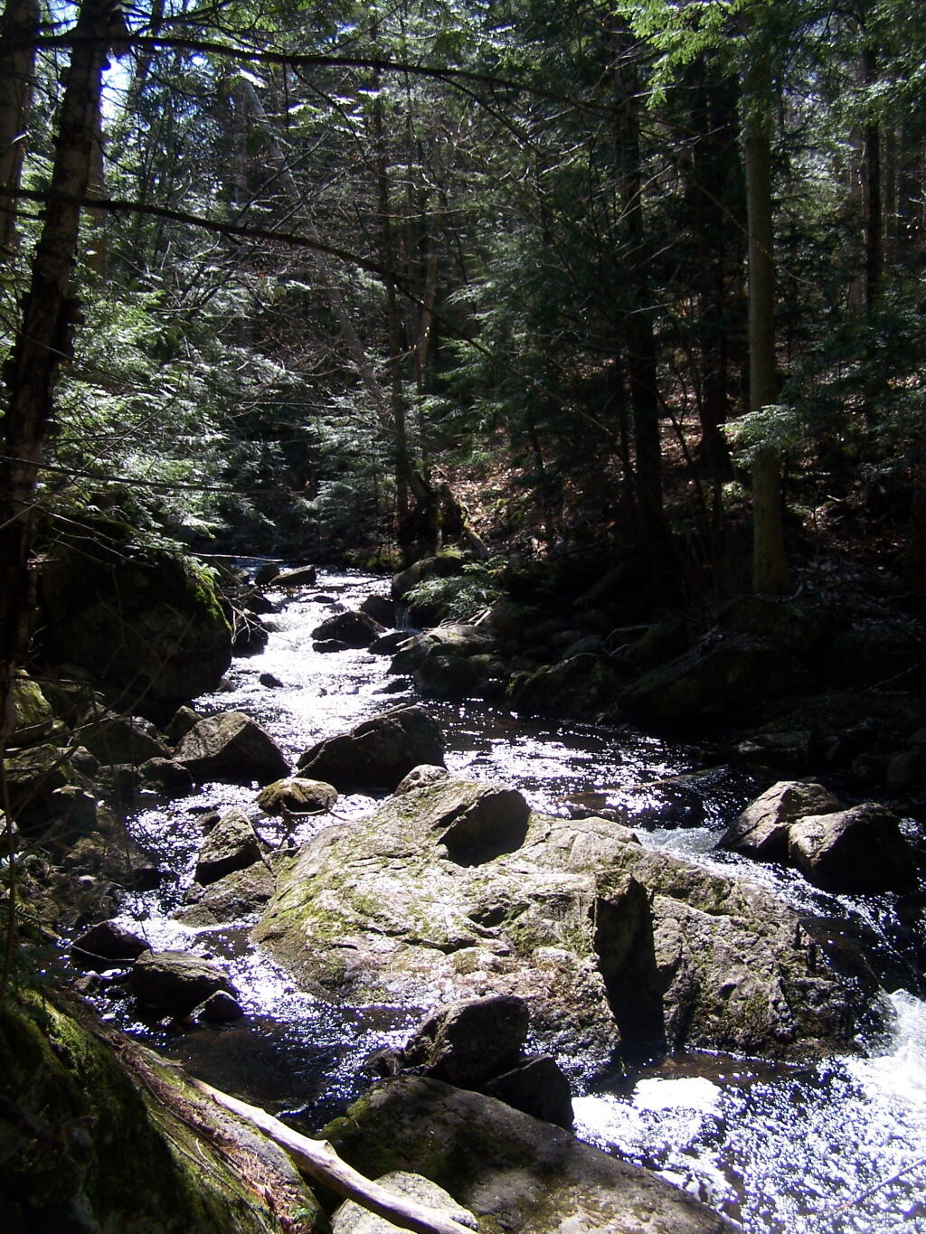
About halfway up there, there is the most charming little water fall.
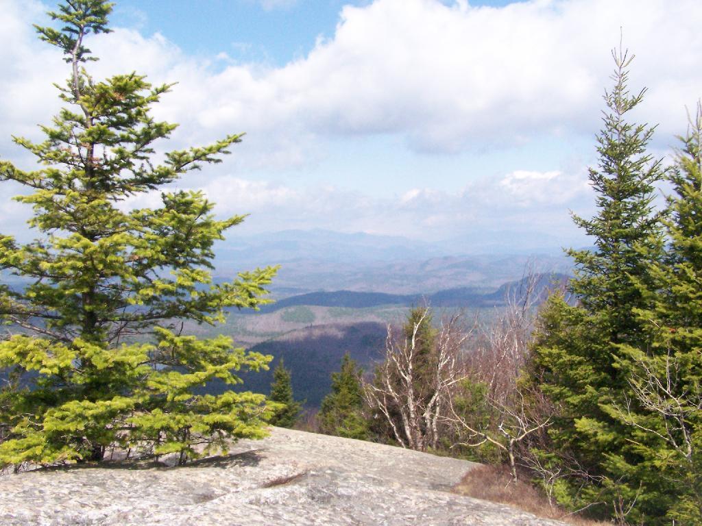
As you climb, views become progressively better.
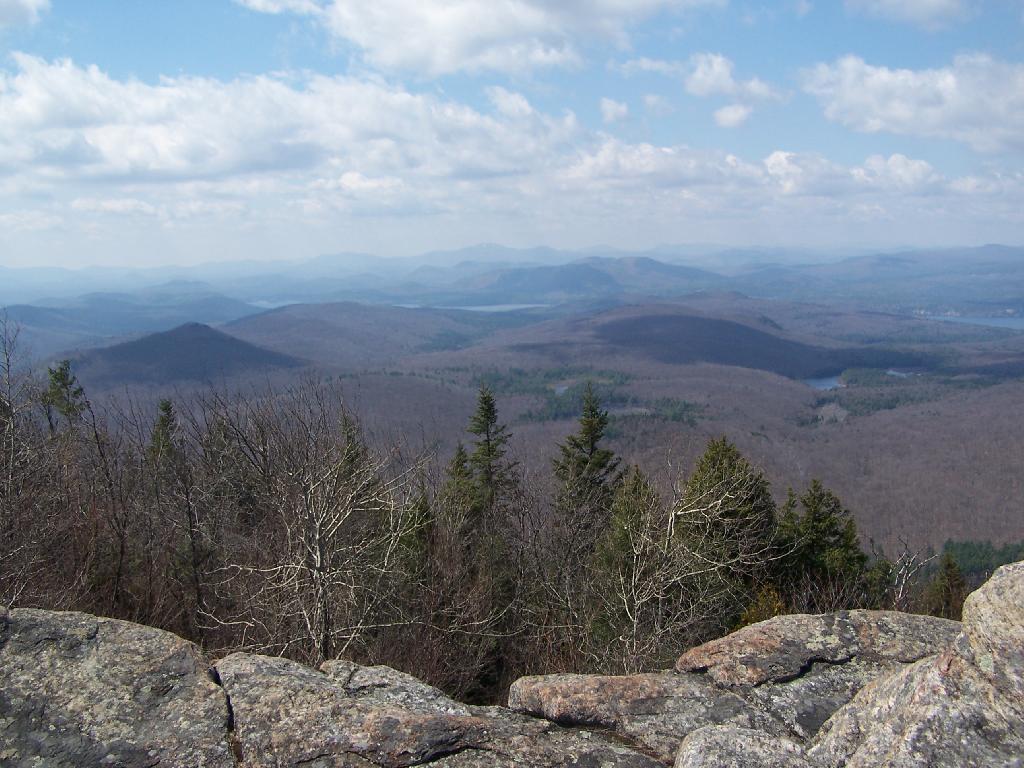
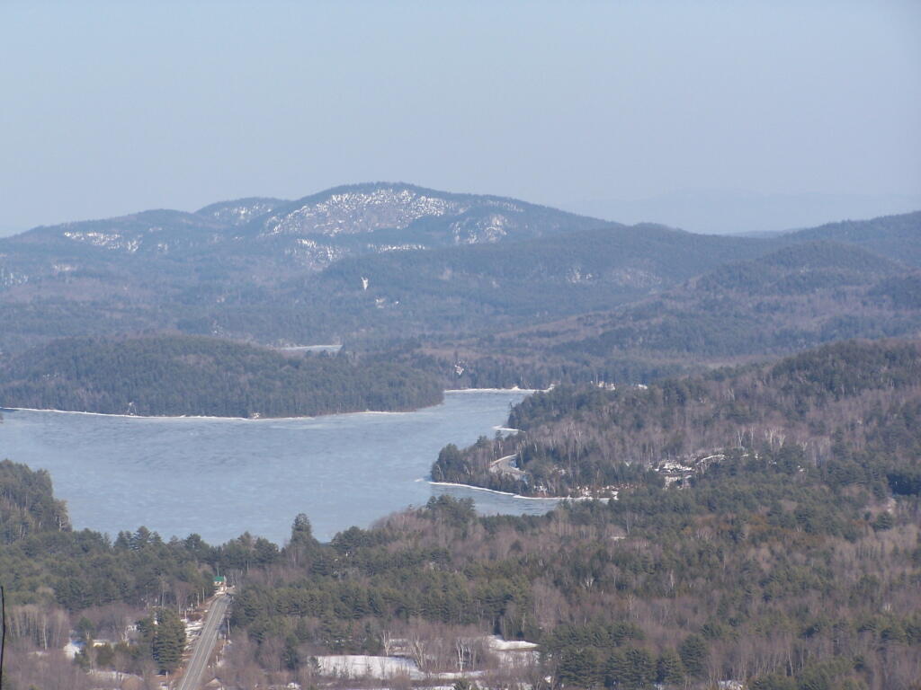
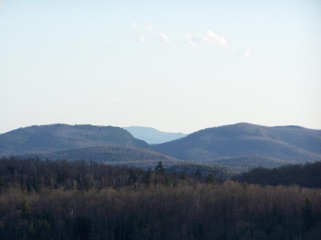
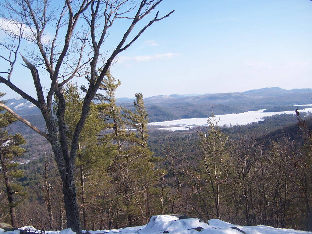
Reaching the summit, there are views in almost all directions, although you have to wonder around the top of the mountain to get all views. Here is looking North-East toward Ticonderoga. You can see Lake Champlain in the distance — barely, along with Crane Pond, Alder Pond, Oxbow Lake, and other features up close.
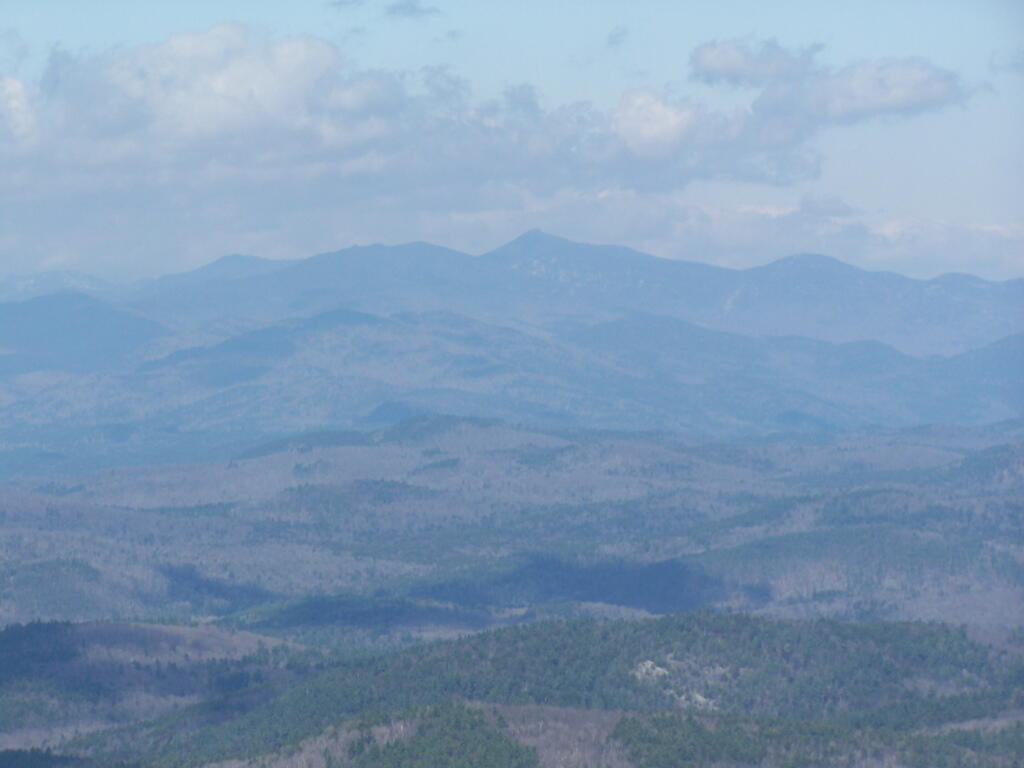
On the northernly view, you have nice views of the High Peaks Region of the Adirondacks, with Mount Marcy and Alonquin Mountains peaking out top.
To the south-west, there are view of Gore Mountain (ski trails still with snow on it as of April 11).
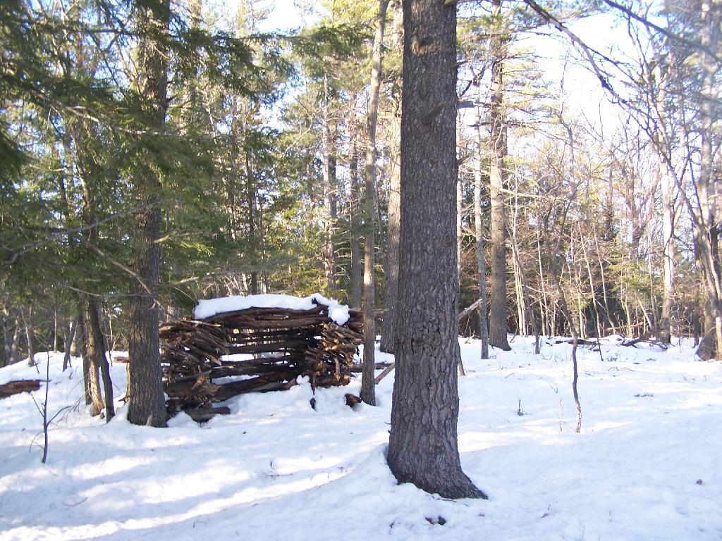
There also is a primative campsite on top of Pharaoh Mountain.
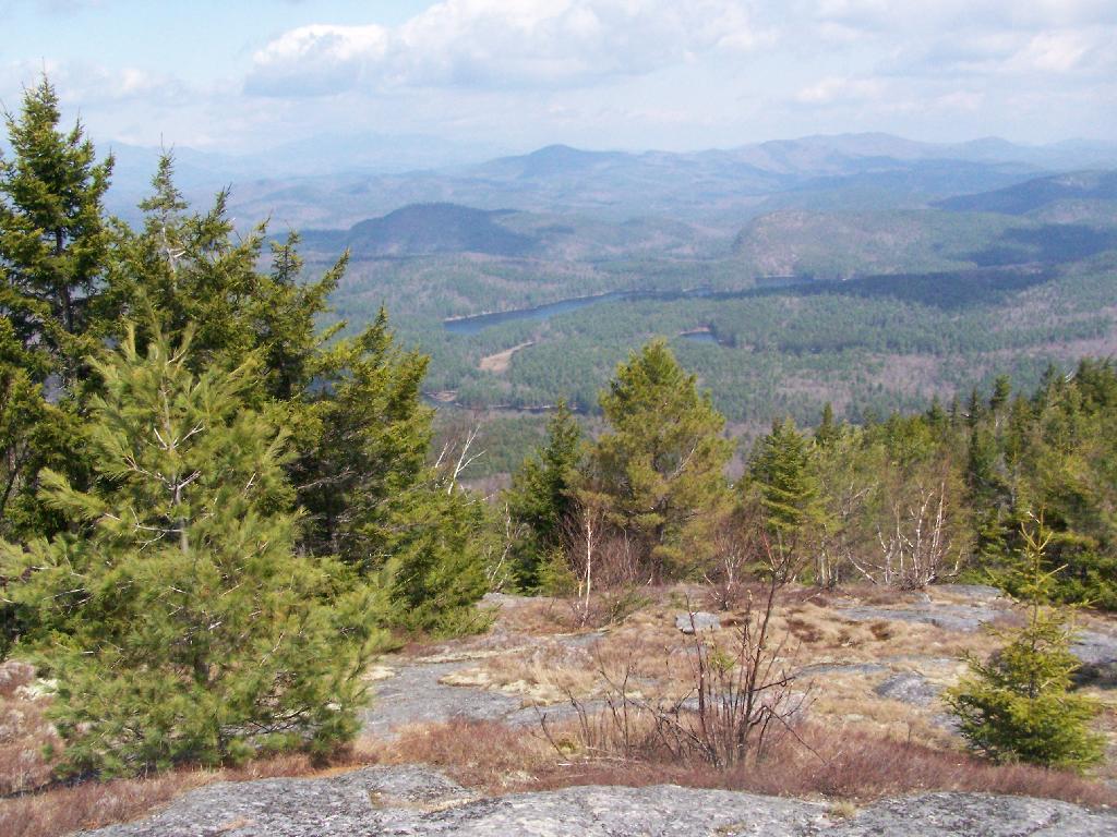
To the South-East there is Pharaoh Lake, which I did not visit, but the maps show about 5 lean-tos surround it.
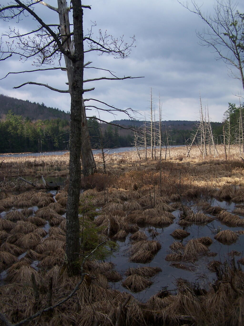
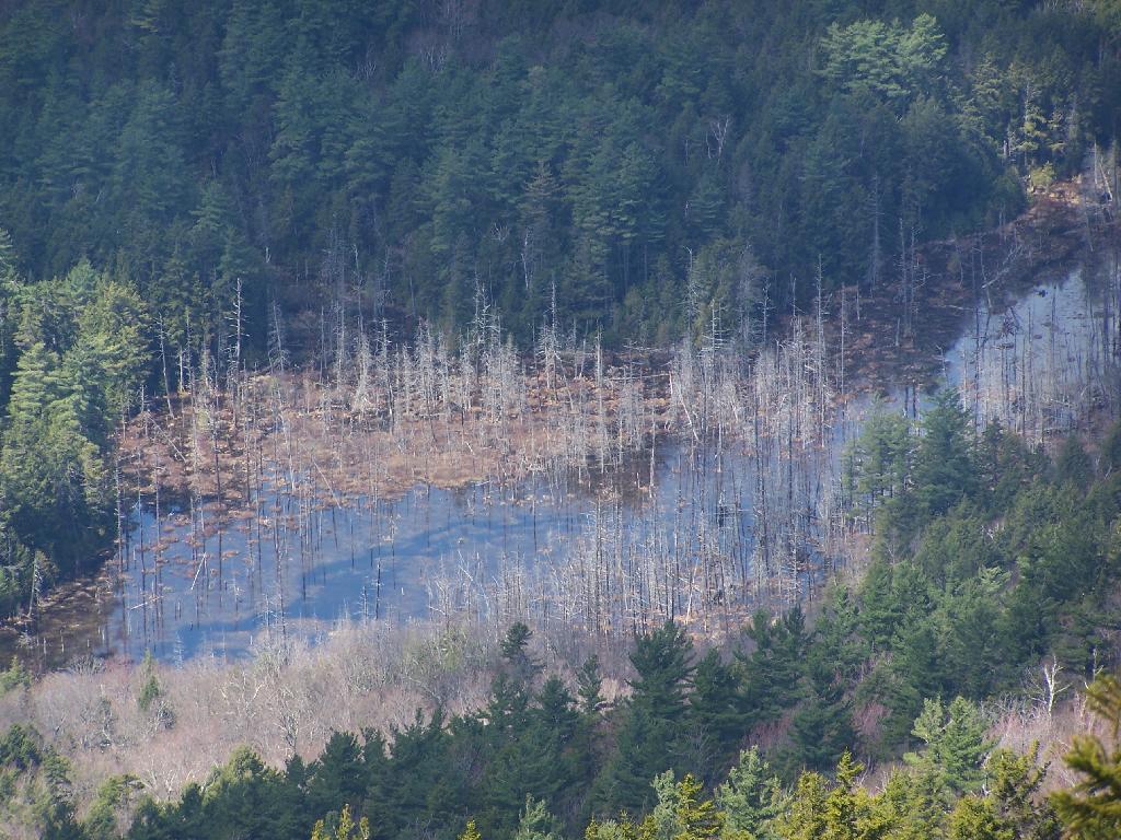
Desolate Swamp is quite purty from the mountain.
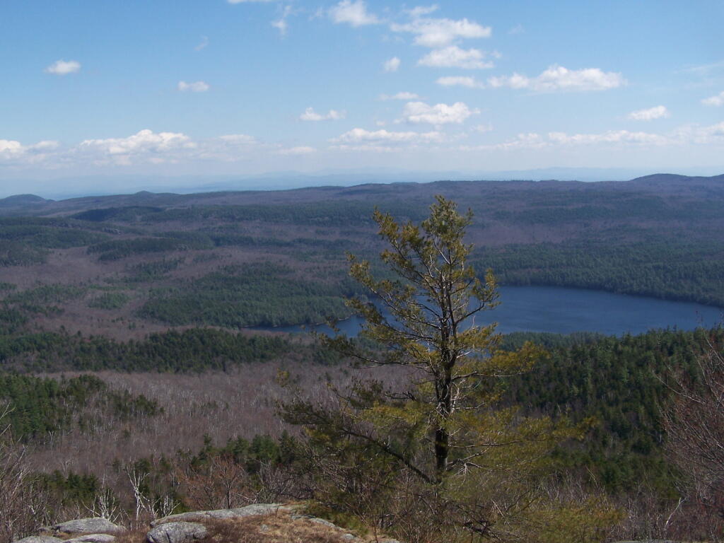
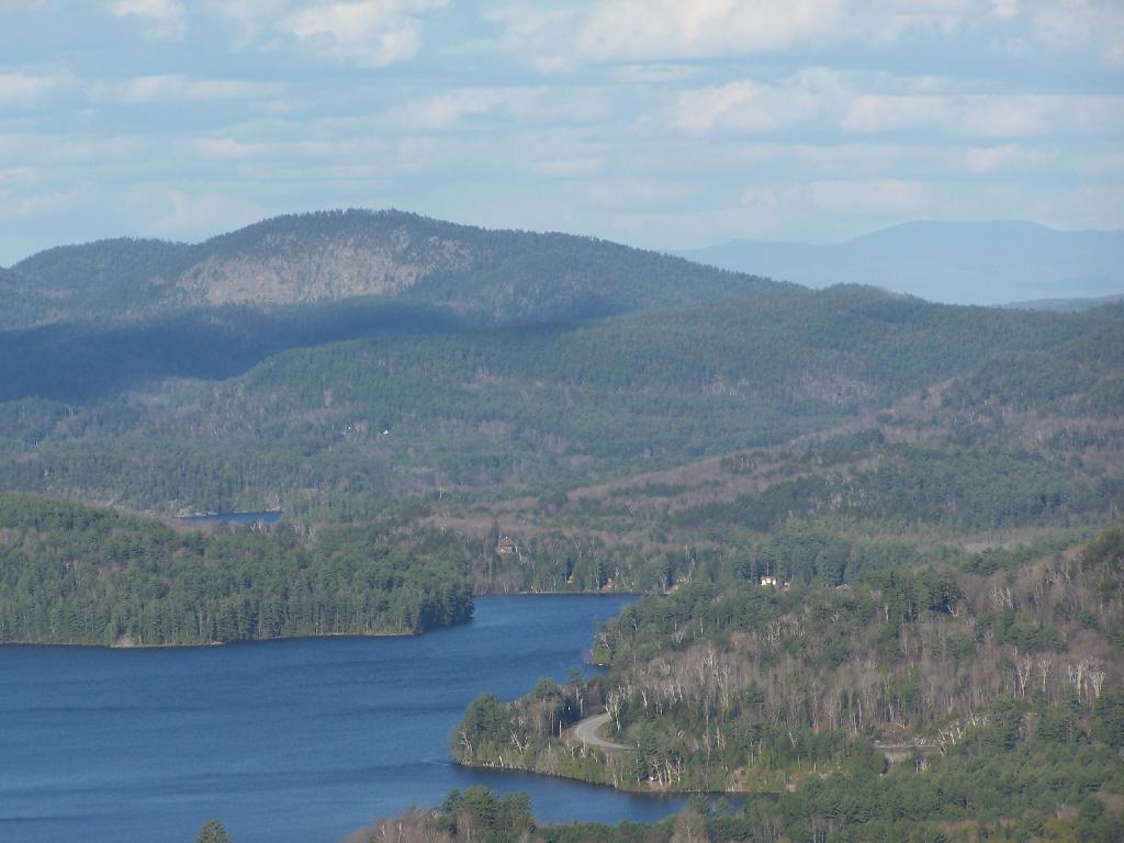
After hiking up the mountain, I took a side trip to the beautiful Oxbow Pond, and the other side of Glidden Marsh. Here is the Long-Swing Trail along the edge of Glidden Marsh, near the turn off to Oxbow Lake.
Oxbow Lake is so beautiful, and probably real deep.
The Oxbow Lean-To. It looks well used, but is in good shape, and has a decent outhouse a little ways from it, a fire pit, along with lots of water for cooking in the nearby pond.
The one end of Oxbow Lake is swampy, as it runs between outfall of Crab Pond down to Oxbow.
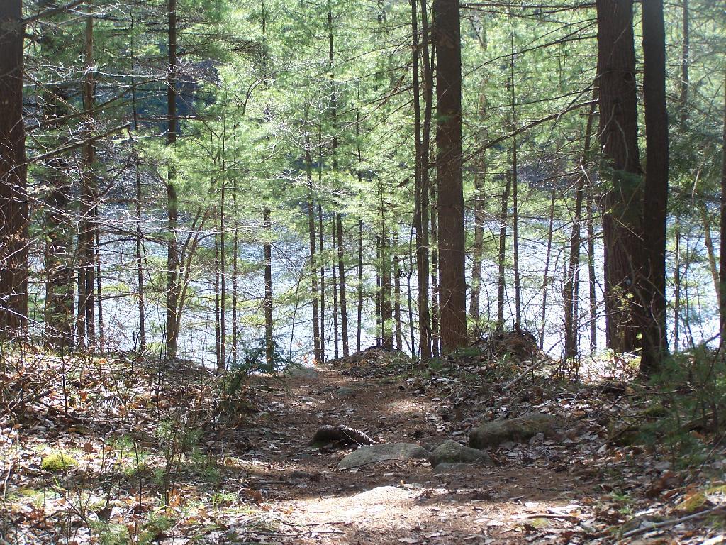
Heading back to the truck, the sun flickers on the outlet of Glidden Marsh.
An amazing hike. Definitely want to come back, and possibly spend a night at Oxbow Pond.
One month after my first hike up Severence Hill, I decided to do another “cool” down hike up this mountain. In only a month, the look off the mountain had changed quite dramatically.
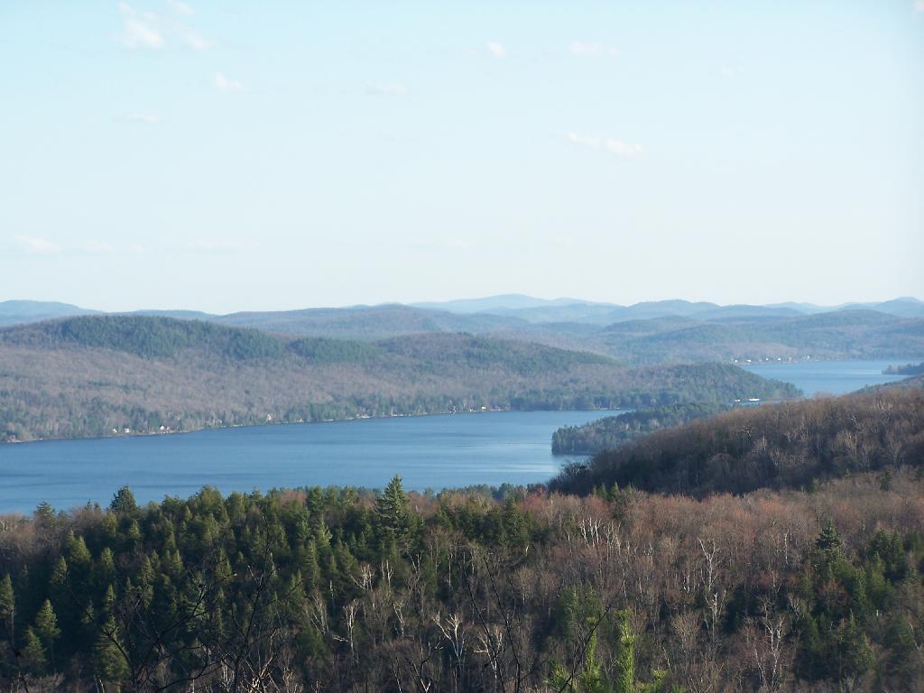
Here is Paradox Lake on March 7, 2010.
Here it is on April 11, 2010.
With the Adirondack Snow having melted in the past month, things looked a lot different for sure. Things where already starting to show some signs of spring, and life, even if the Adirondack Winter still had another month to go before casting off it’s winter.
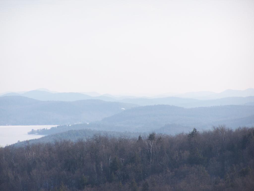
I must have spent an hour staring down at Schroon Lake, just pondering the Adirondacks and possibly moving out west. It was such delightful weather out there, and while I was tired from a day hiking, there was so much beauty with the setting sun. I had no reason at all to rush back to Albany, having no commitments when I got back home, except to get ready for the next day at work.
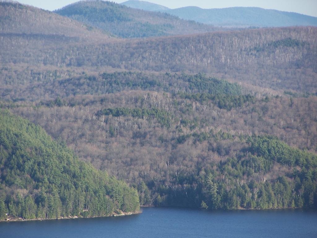
This hike, while short has so much beauty. Looking down at Steep Bay (part of Pharoah Mountain Wilderness) on Schroon Lake.
Then one last look at Hatchhack and Allered Hills to the south, silhouetted by the setting sun, as I descended the mountain, and headed back to Albany.
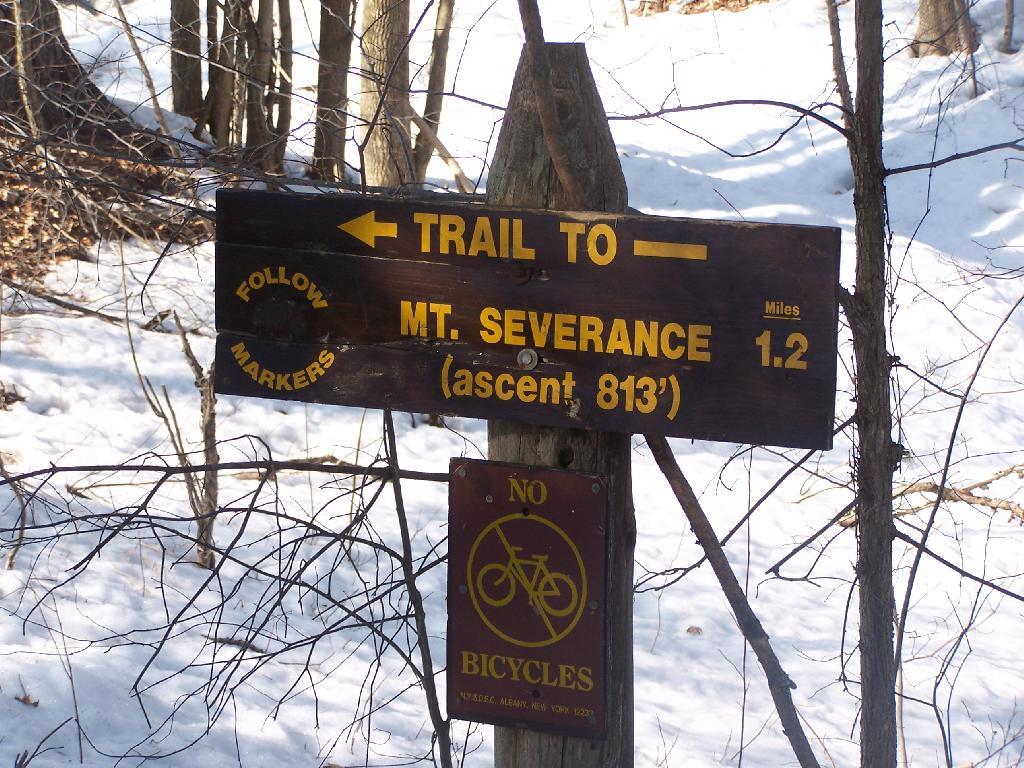
Severence Hill, mis-signed by the NYSDEC as Severence Mountain is located just North of Schroon Lake on US 9. It is a short hike, taking 45-minutes or so to go up, and is right off the Ticonderoga Exit of Adirondack Northway.
I’ve been up it a couple of times back when I was in college — if you have hour and a half to use up and your driving on the Northway near Saranac Lake it’s a must do.
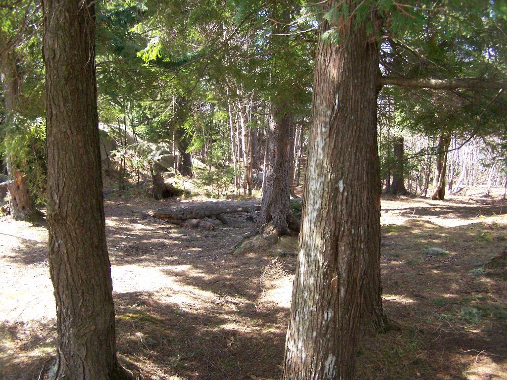
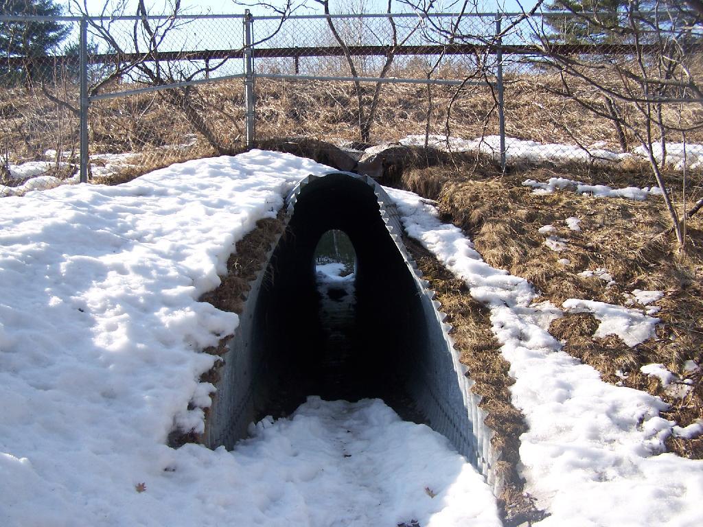
The first part of the trail goes under the two carriageways of the the Northway in a series of tunnels.
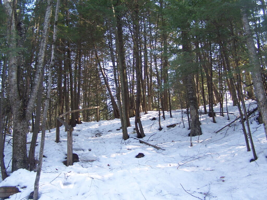
The next 1/4 mile of the trail is relatively flat until you cross a brook and head up a series of stairs, followed by a 1/4 mile ascent, some flat areas, then a quick ascent to the top.
As you reach towards the top, you have broken views of Schroon Lake to the South.
Reaching the top of the mountain, you have some beautiful views of Schroon Lake. Unfortunately the village is too close to see from the mountain and trees block the partial view.
On the top of Severence Mountain, overlook Schroon Lake is this cute little lean-to shelter hand-made out of branches.
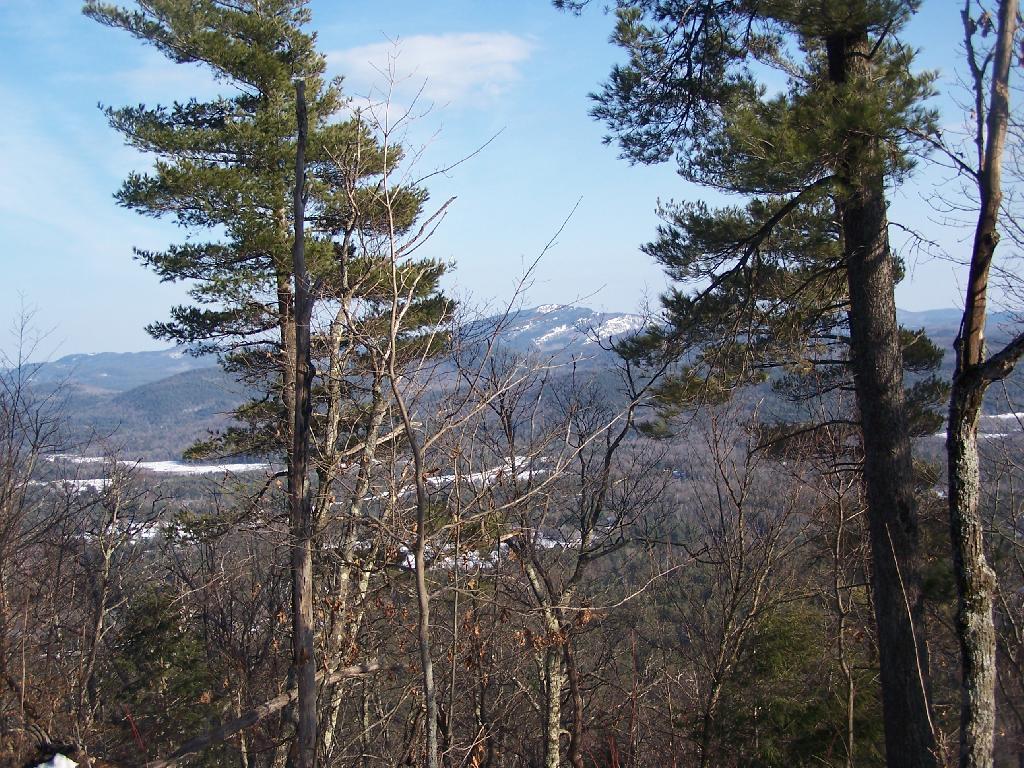
On the top of the mountain, the trail proceeds for another 1/4 mile, with broken views of Pharaoh Mountain.
As you continue along the trail to it’s end, you left with a good view of Paradox Lake with Skiff Mountain in the background. Blocked by that mountain range, after a significant descent, is Ticonderoga and Lake Champlain.
You come back the same way you came up the mountain. This is looking towards the southern-most portion of Schroon Lake at the mountains at the southern portion of the Adirondacks.