Section 212 of Highway Law.
S 212. Changing location of highways over certain lands owned and occupied by the state. 1. If a highway passes over or through lands wholly owned and occupied by the state, the location of such portion of such highway as passes through such lands may be altered and changed, or the same may be abandoned or the use thereof as a highway discontinued with the consent and approval of the state authority having jurisdiction or control over such lands by an order directing such change in location, abandonment or discontinuance. Such order shall contain a description of that portion of the highway the location of which has been changed, abandoned or discontinued, and a description of the new location thereof, if any, and shall be filed in the office of the state authority having control of such lands.
John J. Kelly v. DEC Commissioner Jorling (1990).
You can read the court case online.
SUPREME COURT OF NEW YORK, APPELLATE DIVISION, THIRD DEPARTMENT
November 21, 1990
IN THE MATTER OF JOHN J. KELLY, APPELLANT,
v.
THOMAS C. JORLING, AS COMMISSIONER OF THE DEPARTMENT OF ENVIRONMENTAL CONSERVATION, RESPONDENT
Appeal from a judgment of the Supreme Court (Dominick J. Viscardi, J.), entered March 29, 1990 in Essex County in a proceeding pursuant to CPLR article 78, which dismissed a petition to prohibit respondent from directing closure of a portion of a road traversing State-owned land in Essex County.
Roemer & Featherstonhaugh (E. Guy Roemer of counsel), for appellant.
Robert Abrams, Attorney-General (Lawrence A. Rappoport of counsel), for respondent.
Kane, J. P. Casey, Mikoll, Yesawich, Jr., and Mercure, JJ., concur.
Author: Kane
OPINION OF THE COURT
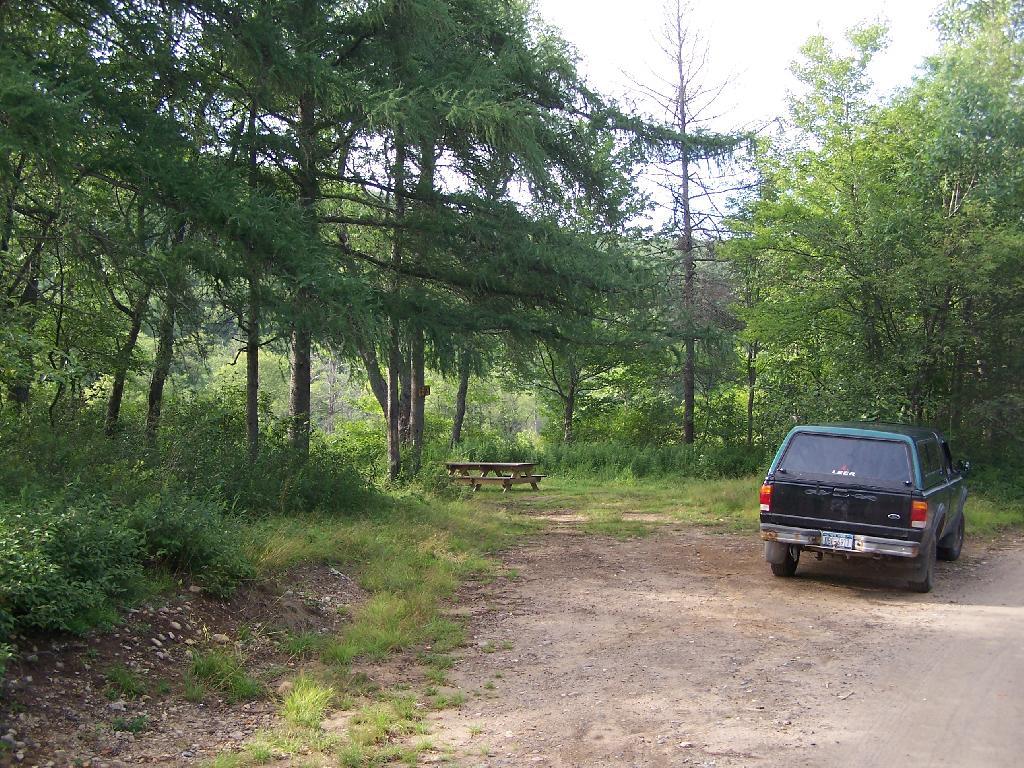
Crane Pond Road is a gravel and dirt roadway located in the Town of Schroon, Essex County, of which the last 2 1/2 miles (hereinafter referred to as the road) lead through State-owned lands to the edge of Crane Pond. That part of the Adirondack Forest Preserve surrounding the road was reclassified “wilderness” in 1979 and, in 1987, the road itself was reclassified wilderness. In December 1989, respondent issued an order, pursuant to Highway Law ? 212, closing the road in accordance with the Adirondack State Land Master Plan. Guidelines within that plan called for the closing of roads which impermissibly allowed for the prohibited use by the public of motorized vehicles and equipment in wilderness areas. Petitioner, the Town Supervisor, subsequently commenced this CPLR article 78 proceeding to challenge respondent’s authority to close the road pursuant to Highway Law ? 212. Supreme Court found that respondent possessed such authority and dismissed the petition. This appeal followed.
We affirm. Petitioner apparently does not question respondent’s jurisdiction over the lands at issue or the State’s power to close the road, but instead challenges the specific statutory authority pursuant to which respondent ordered said closing. Highway Law Sec 212 was amended in 1988 to read as follows: “If a highway passes over or through lands wholly owned and occupied by the state, the location of such portion of such highway as passes through such lands may be altered and changed, or the same may be abandoned or the use thereof as a highway discontinued with the consent and approval of the state authority having jurisdiction or control over such lands by an order directing such change in location, abandonment or discontinuance. Such order shall contain a description of that portion of the highway the location of which has been changed, abandoned or discontinued, and a description of the new location thereof, if any, and shall be filed in the office of the state authority having control of such lands.” The 1988 amendment eliminated the need for the Commissioner of Transportation to issue the order of closure (see, L 1988, ch 161, ? 2), essentially leaving that decision to the State agency having appropriate jurisdiction (see, mem of State Dept of Transp, 1988 McKinney’s Session Laws of NY, at 1980-1981). Petitioner argues that the express language of the statute does not specifically authorize respondent to issue an order of closure and that no such power may properly be inferred therefrom. We disagree.
The primary consideration of statutory construction is legislative intent (see, Matter of Long v Adirondack Park Agency, 76 N.Y.2d 416, 422; Hudson City Savs. Inst. v Drazen, 153 A.D.2d 91, 93; see also, McKinney’s Cons Laws of NY, Book 1, Statutes ? 92), and courts are to avoid a literal construction when it leads to either a frustration of the over-all design of the Legislature (see, McKinney’s Cons Laws of NY, Book 1, Statutes ? 111) or an ineffectually absurd result (see, Matter of Long v Adirondack Park Agency, supra, at 421; see also, McKinney’s Cons Laws of NY, Book 1, Statutes ?? 144, 145). The legislative intent behind Highway Law ? 212 was to permit the State to close roads on State lands that endangered a State purpose (see, Matter of Altona Citizens Comm. v Hennessy, 77 A.D.2d 956, 957, lv denied 52 N.Y.2d 705). Adopting petitioner’s view, that respondent has the power to consent to and approve the closing of a roadway but does not possess the authority to order its closure, would eviscerate the statute and render it meaningless. In our view, the statute’s expressed intent provides an ample basis and rationale to conclude that “the state authority having jurisdiction or control over [state] lands” (Highway Law ? 212) is empowered to issue orders effectuating that authority. Accordingly, respondent’s order was a valid exercise of the statutory power given to the appropriate State agency pursuant to Highway Law ? 212.
Disposition
Judgment affirmed, without costs.
In the Matter of the Alleged Violations by JAMES W. McCULLEY, Respondent. (2009)
This is an excerpt of relvant portions of this adminstrative law decision.
2. Department’s Jurisdiction To Regulate Motor Vehicle Traffic Over Old Mountain Road
Department staff contends that the portion of Lot 146 owned by the State is part of the forest preserve. Accordingly, staff asserts jurisdiction to regulate motor vehicle traffic over that portion of Old Mountain Road that crosses State-owned land.
Department staff has established that the State-owned portion of Lot 146 is part of the forest preserve. It is undisputed that the State acquired the northern half and southeastern quarter of Lot 146 in 1875 (see Deed, Department Exh 48, at 556). The forest preserve was subsequently created by chapter 283 of the Laws of 1885, which provided in relevant part:
“All lands now owned or which may hereinafter be acquired by the state of New York within the counties of . . . Essex . . . shall constitute and be known as the forest preserve.”
(L 1885, ch 283, § 7). Chapter 283 is now codified at ECL 9- 0101(6). Thus, the State-owned portion of Lot 146 was and remains part of the forest preserve.
The existence of Old Mountain Road as a public right of way, however, pre-dates the State’s ownership of Lot 146. In the 1810 legislation appropriating money for the repair of Old Mountain Road, the State Legislature declared the road to be a “public highway” (L 1810, ch CLXXVII, § I). Because the Legislature did not provide for acquisition of the fees underlying the public highway, the public acquired merely an easement of passage, the fee title remaining in the landowners (see Bashaw v Clark, 267 AD2d 681, 684-685 [1999]). Thus, when the State acquired its portion of Lot 146 from the prior landowner, it did so subject to a public highway in the nature of an easement (see id.; see also Matter of Moncure v New York State Dept. of Envtl. Conservation, 218 AD2d 262, 267 [1996] [when the Department acquires forest preserve lands burdened by a leasehold, the Department takes such property subject to that leasehold]).
Department staff asserts that subsequent statutory law vests the Department with jurisdiction over public rights of way crossing forest preserve land. Accordingly, citing the Vehicle and Traffic Law, Department staff asserts that it has the power to “prohibit, restrict or regulate” motor vehicle traffic on any highway under its jurisdiction, including Old Mountain Road (see Vehicle and Traffic Law [“VTL”] § 1630). Pursuant to section 1630, Department staff claims it has the authority to close Old Mountain Road to motor vehicle traffic while allowing pedestrian and other forms of non-motorized traffic (see Adirondack Park State Land Master Plan [updated June 2001], DEC Exh 17, at 66 [indicated that Old Military Road has been closed]).
Respondent, on the other hand, argues that Old Mountain Road was and remains under the jurisdiction of the Towns of North Elba and Keene. 3 Thus, respondent contends that the exception under 6 NYCRR 196.1(b) for roads under the jurisdiction of a town highway department applies in this case (see 6 NYCRR 196.1[b][1]). Respondent contends that the exception for public rights of way over State land also applies (see 6 NYCRR 196.1[b][5]).4
VTL § 1630 does not itself vest in the Department jurisdiction over any particular highway. Whether a State agency has jurisdiction to regulate motor vehicle traffic pursuant to section 1630 depends upon whether that agency is otherwise authorized by law to regulate the use and management of the public highway at issue (see People v Noto, 92 Misc 2d 611, 612- 613 [1977]; see also Highway Law § 3)
On this motion, it cannot be determined, as a matter of law, which entity has jurisdiction to regulate the use and management of Old Mountain Road. When the New York State Legislature declared Old Mountain Road to be a public highway in 1810, it provided that after an initial four-year period of repair and improvement by a commissioner specially appointed for that purpose, the maintenance of the road would be assumed by the several towns through which it passed (see L 1810, ch CLXXVII, § III). Thus, at the time the State acquired Lot 146, subject to the public right of way, that right of way was apparently a town road under the jurisdiction of the Town of Keene and later the Town of North Elba (see Highway Law § 3[5]).5
Nothing in the submissions on this motion allow me to conclude, as a matter of law, that jurisdiction to regulate the use and management of Old Mountain Road has transferred from the Towns of North Elba and Keene to the Department. To the contrary, conflicting statutory provisions and circumstantial evidence require further legal argument and evidentiary proof before such a determination can be made.
For example, in support of Departmental jurisdiction to regulate traffic, Department staff notes that when the powers of the Conservation Department were revised in 1916, the “free use of roads” provision from the 1885 law limiting the forest commission’s power to prescribe rules and regulations for the forest preserve, was eliminated (see L 1916, ch 451). Staff further notes that the current ECL and Executive Law provisions authorizing the Department to make necessary rules and regulations for the protection of the forest preserve generally, and the Adirondack Park specifically, contain no limitation on regulating the free use of roads (see ECL 9-0105[3]; Executive Law § 816). However, although the Department has the power to regulate uses of the forest preserve generally, and the Adirondack Park specifically, it does not necessarily follow that such power includes the authority to regulate public rights of way under the jurisdiction of other State entities or municipalities.
In contrast, legislation adopted subsequent to 1916 suggests that the Department was not vested with the power to regulate use and maintenance of highways in the forest preserve. In 1924, the former State Commission of Highways was granted the power to maintain existing State and county highways in the forest preserve (see L 1924, ch 275). In 1937, town superintendents were expressly granted the right to occupy a right of way over State lands as may be required in the maintenance or reconstruction of town highways that cross those lands, subject to the approval of the Superintendent of Public Works and the Conservation Commissioner (see L 1937, ch 488). The grant of a right of way over State land to maintain and repair town highways strongly implies that towns retained jurisdiction over town highways in the forest preserve, notwithstanding the Department’s grant of authority to regulate the forest preserve generally (see Flacke v Town of Fine, 113 Misc 2d 56 [1982]).
Department staff also points out that Old Mountain Road has not appeared on either the Town of North Elba or the Town of Keene inventory of town highways. The evidence on this is equivocal, however. Old Mountain Road has not appeared on any inventory of State or county highways either (see L 1921, ch 18 [designating system of State and county highways]). On the other hand, Old Mountain Road did appear on a 1935 Highway Survey Commission map, although its status as a State, county or town highway is not indicated (see Department Exhs 51-53).
Respondent provides some circumstantial evidence suggesting that the Towns of North Elba and Keene retain the jurisdiction to regulate traffic on Old Mountain Road. For example, in 1971, the Town of North Elba adopted a resolution, which is still in effect, regulating the use of snowmobiles on Old Mountain Road (see N. Elba Ordinance [2-12-71], Affidavit of Norman Harlow, Highway Superintendent, Town of North Elba, Exh B). Respondent also provides letters dated June 7 and November 13, 1996, respectively, from Mr. Tom Wahl, former Department Regional Forester, expressing the opinion that Old Mountain Road remains a town highway (see Respondent Exhs 16 and 17).
Finally, research reveals some authority suggesting that Old Mountain Road is under the jurisdiction of predecessors to the Department of Transportation (see People v Paul Smith’s Elec. Light and Power and R.R. Co., Sup Ct, Essex County, July 29, 1953, Imrie, J., Decision, at 3-4, 6; 1950 Opn of the Atty Gen 153-154). Whether the portions of Old Mountain Road at issue here are subject to the above authorities, however, is unclear at this time.
In sum, legal and factual issues exist concerning whether the Department has jurisdiction under VTL § 1630 to regulate motor vehicle traffic on Old Mountain Road that require further hearings and legal argument.
3. Request for Relief Pursuant to Highway Law § 212
In its motion for order without hearing, Department staff requests an order of the Commissioner declaring Old Mountain Road between the eastern and western boundaries of the Sentinel Range Wilderness Area closed to all motorized vehicles and motorized equipment. Among the statutory authorities staff relies upon for this request is Highway Law § 212.
Highway Law § 212 provides:
“If a highway passes over or through lands wholly owned and occupied by the state, the location of such portion of such highway as passes through such lands may be altered and changed, or the same may be abandoned or the use thereof as a highway discontinued with the consent and approval of the state authority having jurisdiction or control over such lands by an order directing such change in location, abandonment or discontinuance”
The Department is the State authority with jurisdiction to order abandonment or discontinuance of roads over forest preserve lands in order to protect a relevant State interest (see Matter of Kelly v Jorling, 164 AD2d 181 [1990], lv denied 77 NY2d 807 [1991]; see also Matter of Altona Citizens Comm., Inc. v Hennessy, 77 AD2d 956, lv denied 52 NY2d 705). Such authority includes the power to order the discontinuance or abandonment of town highways (see id.).
Department staff does not address this request for relief in its brief in support of its motion. Nevertheless, to the extent Department staff contends that the Department has already closed Old Mountain Road pursuant to Highway Law § 212, I conclude that triable issues exist before the requested relief may be granted. Staff supplies no evidence that a Departmental order pursuant to Highway Law § 212 has been filed with respect to that portion of Old Mountain Road that is at issue in this case. Accordingly, to the extent Department staff relies upon such a closure order in support of the violation alleged against respondent, staff has not established a prima facie case.
With respect to abandonment, an order of closure is not required to deem a public right of way extinguished by operation of law if the highway has in fact been abandoned by the public for six years or more (see Matter of Wills v Town of Orleans, 236 AD2d 889, 890 [1997]). However, the record reveals triable issues of fact concerning abandonment (see Matter of Smigel v Town of Rensselaerville, 283 AD2d 863, 864 [2001] [a determination of abandonment is a factual determination]).
Pedestrian use and even recreational use may support a finding of non-abandonment, even if a highway has not been subject to motor vehicle traffic, as staff alleges in this case (see Town of Leray v New York Cent. R. Co., 226 NY 109 [1919] [pedestrian use may preserve highway though vehicles are barred]; Matter of Smigel, 283 AD2d at 865 [recreational use may preclude finding of abandonment]). The record contains conflicting evidence concerning the degree to which the public has continued to use the road, thereby necessitating a hearing on abandonment.
With respect to discontinuance, assuming Department staff is seeking a prospective order from the Commissioner, such a prospective order would not support the violation alleged here. Moreover, it is not clear what findings, if any, the Commissioner must make and whether such an order can be issued on the present record. Again, Department staff does not address this item of relief in its brief. Accordingly, the request for a prospective order of closure pursuant to Highway Law § 212 is denied, without prejudice.
Adirondack Council Press Release (2009).
You can read it here.
ADIRONDACK COUNCIL CALLS ON ENCON COMMISSIONER GRANNIS TO CLOSE FOREST PRESERVE ROADS IN WAKE OF JUDGE’S DECISION
Administrative Judge Declares Former Town Road in State Wilderness Area to be Open for Motorized Use; Grannis Should Re-Close it and Any Others Affected
For more information:
John F. Sheehan
518-432-1770 (ofc)
518-441-1340 (cell)
Released: Thursday, May 21, 2009
LAKE PLACID, N.Y. – The Adirondack Council today called on NYS Department of Environmental Conservation Commissioner Peter Grannis to use his administrative authority to re-close a former road in an Adirondack Wilderness Area that was opened to motorized traffic today by a state administrative law judge.
“It appears from the judge’s decision that the state didn’t properly close this road when it assumed ownership of it and converted it to a hiking, ski and horse trail,” said Adirondack Council Executive Director Brian L. Houseal. “But today’s decision doesn’t have to be the final word on the matter.
“Commissioner Grannis has the authority to use the NYS Vehicle and Traffic Law to prohibit the use of motorized vehicles on this and other roads that are affected by this decision,” Houseal explained. “We urge Commissioner Grannis to begin that process right away. He should have done so today, as this decision was announced, to avoid the chance that someone is already out there riding a jeep or an all-terrain vehicle on this road.
“It is also imperative that the DEC issue its ATV Policy for state lands, which was first announced by Commissioner Erin Crotty during the Pataki Administration,” Houseal said. “DEC cannot allow fragile wildlife habitat and water quality to suffer in New York’s premiere Wilderness Park due to DEC’s inability to complete its work in a timely way.”
Commissioner Grannis can act right now to stop motorized traffic in off-limits locations in the Adirondack Park by exercising NYS Highway Law Section 212, Houseal said,
NYS Highway Law Section 212:
§ 212. Changing location of highways over certain lands owned and occupied by the state. If a highway passes over or through lands wholly owned and occupied by the state, the location of such portion of such highway as passes through such lands may be altered and changed, or the same may be abandoned or the use thereof as a highway discontinued with the consent and approval of the state authority having jurisdiction or control over such lands by an order directing such change in location, abandonment or discontinuance. Such order shall contain a description of that portion of the highway the location of which has been changed, abandoned or discontinued, and a description of the new location thereof, if any, and shall be filed in the office of the state authority having control of such lands.
“If Commissioner Grannis doesn’t make use of Section 212, today’s decision could turn into a disaster for the natural character of the Adirondack Park,” Houseal explained. “There are more than one million acres of protected, roadless Wilderness in the Adirondack Park. It represents nearly 85 percent of all roadless, wilderness forest lands in the eastern United States. Yet, it is only 1/30th of New York State’s total land area – very rare.
“Opening these roads to motorized traffic will harm wildlife, water quality and the peaceful nature of the last big place left in the Northeast where you can escape the noise and pollution of motorized traffic,” he said.
Under the Adirondack Park State Land Master Plan, approved by the Legislature in 1972, all motorized or mechanized travel is banned by state law in Adirondack Wilderness Areas, including mountain bikes.
Another 1.5 million acres of the public Adirondack Forest Preserve is classified as Wild Forest, where motorized traffic is allowed on some designated highways, but not in sensitive areas. Today’s ruling could be interpreted to mean that any road that was never lawfully abandoned to motorized traffic is now open, regardless of its classification as Wilderness or Wild Forest.
The Adirondack Council is a privately funded not-for-profit organization dedicated to ensuring the ecological integrity and wild character of New York’s 9,300-square-mile Adirondack Park. The Council carries out its mission through research, education, advocacy and legal action. The Council has members in all 50 United States and on four continents.
Resolution from Adirondack Assocation of Towns (2010).
From their 2010 Adirondack Towns Association Resolution Book.
RESOLUTION REQUESTING AMENDMENT OF HIGHWAY LAW SECTION 212 BACKGROUND OF RESOLUTION
The State of New York has closed Town roads in the Adirondacks without the consent and against the wishes of the involved Towns. Highway Law Section 212 which has been interpreted by the courts to authorize the Commissioner of the Department of Environmental Conservation to close roads by Commissioner’s order should be repealed or amended to remove that authority, because it does not provide due process to residents and the involved Towns. The remaining provisions of the Highway Law provide a procedure for towns to close abandoned town roads and to discontinue maintenance on roads which do not provide access to structures by declaring them to be “Qualified Abandoned”.
Whereas, Highway Law Section 212 entitled “Changing location of highways over certain lands owned and occupied by the state” provides as follows:
“If a highway passes over or through lands wholly owned and occupied by the state, the location of such portion of such highway as passes through such lands may be altered and19 changed, or the same may be abandoned or the use thereof as a highway discontinued with the consent and approval of the state authority having jurisdiction or control over such lands by an order directing such change in location, abandonment or discontinuance. Such order shall contain a description of that portion of the highway the location of which has been changed, abandoned or discontinued, and a description of the new location thereof, if any, and shall be filed in the office of the state authority having control of such lands.”
Whereas, the Appellate Division held in Altona Citizens Committee, Incorporated v. Hennessy, 77 AD2d 956 (3rd Dept., 1980) that “Section 212 as originally adopted, related to closing or changing the location of highways passing over lands wholly owned and occupied by the State for farm or prison purposes (L. 1920, ch. 558, s 1). In 1924, the statute was amended to permit the application of the statute to State lands without regard to their use (L. 1924, ch. 141). The removal of the restriction that only prison or farm lands were covered by the statute indicates a legislative intention that closure be permitted whenever a State purpose is endangered by a roadway on State land. To effectuate this intention of the Legislature the occupancy requirement of section 212 of the Highway Law should be given a liberal construction.”
Whereas, the State used Section 212 to close a road in the Town of Altona in the 1970s despite the fact that the State did not occupy the land and despite the fact that the land was occupied by the Ganienkeh group of Indians; and Whereas, the State used Section 212 to close a road in the Town of Wells in the 1970s (see Town of Wells v. New York State Department of Transportation, 90 Misc2d 535 [Sup. Ct. Hamilton County, 1977]); and
Where as, in December 1989 the Commissioner of the Department of Environmental Conservation ordered the closure of a well traveled town road (Crane Pond Road) in the Town of Schroon pursuant to Section 212, without the approval and despite the opposition of the duly elected officials of the Town of Schroon, (see Kelly v. Jorling, 164 AD2d 181 [3rd Dept., 1990]); and
Whereas, the New York State Department of Environmental Conservation proposes in the Silver Lake Unit Management Plan recently approved by the Adirondack Park Agency to “work with the Town of Wells”: to close the West River Road in the Town of Wells; and
Whereas, the Town Board of the Town of Wells is adamantly opposed to the closure of West River Road and wishes to continue to maintain it and to keep it open to the traveling public as it has been open for many decades; and
Whereas, Highway Law Section 212 as it currently exists; and as it has been interpreted, is a threat to the authority of the duly elected officials of the Town of Wells and their ability to maintain their transportation system; and20
Whereas, Section 212 also constitutes a threat to every town and village in the Adirondacks which has a town and village road passing through state lands,
NOW, THEREFORE, it is hereby RESOLVED that the Adirondack Association of Towns and Villages hereby requests that a bill be introduced in the New York State Legislature to amend Section 212 to make it clear that Section 212 may not be used by the State to close town and village roads in the Adirondacks, except where the lands are occupied and used by the State for prison or farm purposes as Section 212 provided when originally enacted.
CURRENT STATUS: DEC Commissioner Grannis dismissed an enforcement proceeding in Essex County against an individual driving on a road that the DEC had said was Forest Preserve on the ground that it had not been demonstrated that the road was an abandoned road or that the road was not a legal right-ofway for public use. The decision of Commissioner Grannis supports the town’s position that the DEC does not have the authority to close town roads that the town has continually maintained and does not wish to abandon.
Assemblywomen Sayward’s Bill Limiting Section 212 to Areas Outside of Adirondack Park (2011).
                STATE OF NEW YORK
        ________________________________________________________________________

            S. 343                                                    A. 149

                               2011-2012 Regular Sessions

                SENATE - ASSEMBLY

                                       (Prefiled)

                                     January 5, 2011
                                       ___________

        IN  SENATE — Introduced by Sen. LITTLE — read twice and ordered print-
          ed, and when printed to be committed to the Committee  on  Transporta-
          tion

        IN  ASSEMBLY — Introduced by M. of A. SAYWARD — read once and referred
          to the Committee on Transportation

        AN ACT to amend the highway law, in relation to changing the location of
          highways over certain lands owned and occupied by  the  state  in  the
          Adirondack park

          The  People of the State of New York, represented in Senate and Assem-
        bly, do enact as follows:

     1    Section 1. Section 212 of the highway law, as amended by  chapter  161
     2  of the laws of 1988, is amended to read as follows:
     3    §  212.  Changing  location  of  highways over certain lands owned and
     4  occupied by the state. 1. If a highway  passes  over  or  through  lands
     5  wholly  owned and occupied by the state, the location of such portion of
     6  such highway as passes through such lands may be altered and changed, or
     7  the same may be abandoned or the use thereof as a  highway  discontinued
     8  with the consent and approval of the state authority having jurisdiction
     9  or  control  over  such  lands  by  an  order  directing  such change in
    10  location, abandonment or discontinuance.  Such  order  shall  contain  a
    11  description  of  that  portion  of the highway the location of which has
    12  been changed, abandoned or discontinued, and a description  of  the  new
    13  location  thereof, if any, and shall be filed in the office of the state
    14  authority having control of such lands.
    15    2. The provisions of this section shall not apply to any highway with-
    16  in the Adirondack park, as defined in subdivision one of section  9-0101
    17  of the environmental conservation law.
    18    § 2. This act shall take effect immediately.

         EXPLANATION--Matter in italics (underscored) is new; matter in brackets
                              [ ] is old law to be omitted.
                                                                   LBD01285-01-1