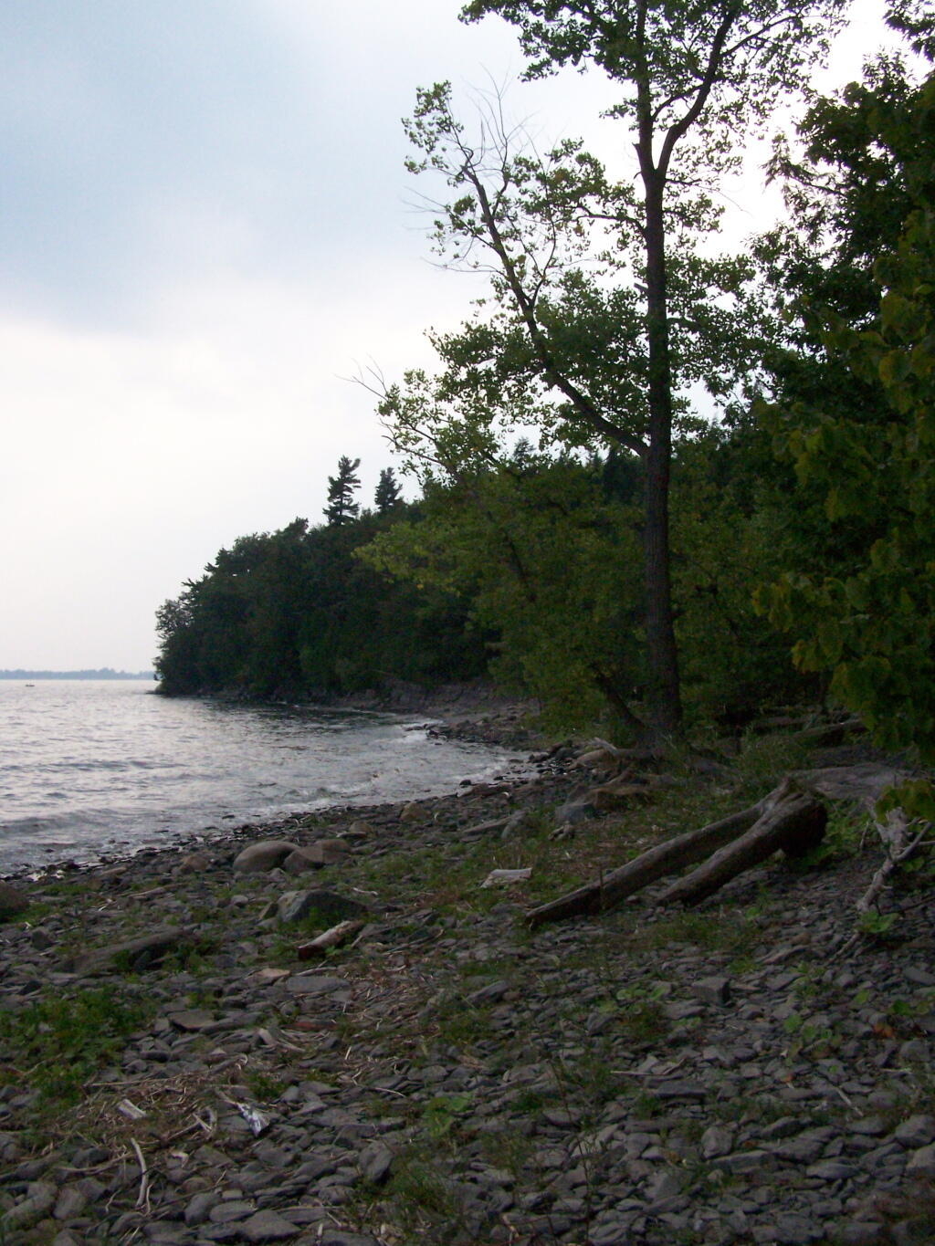
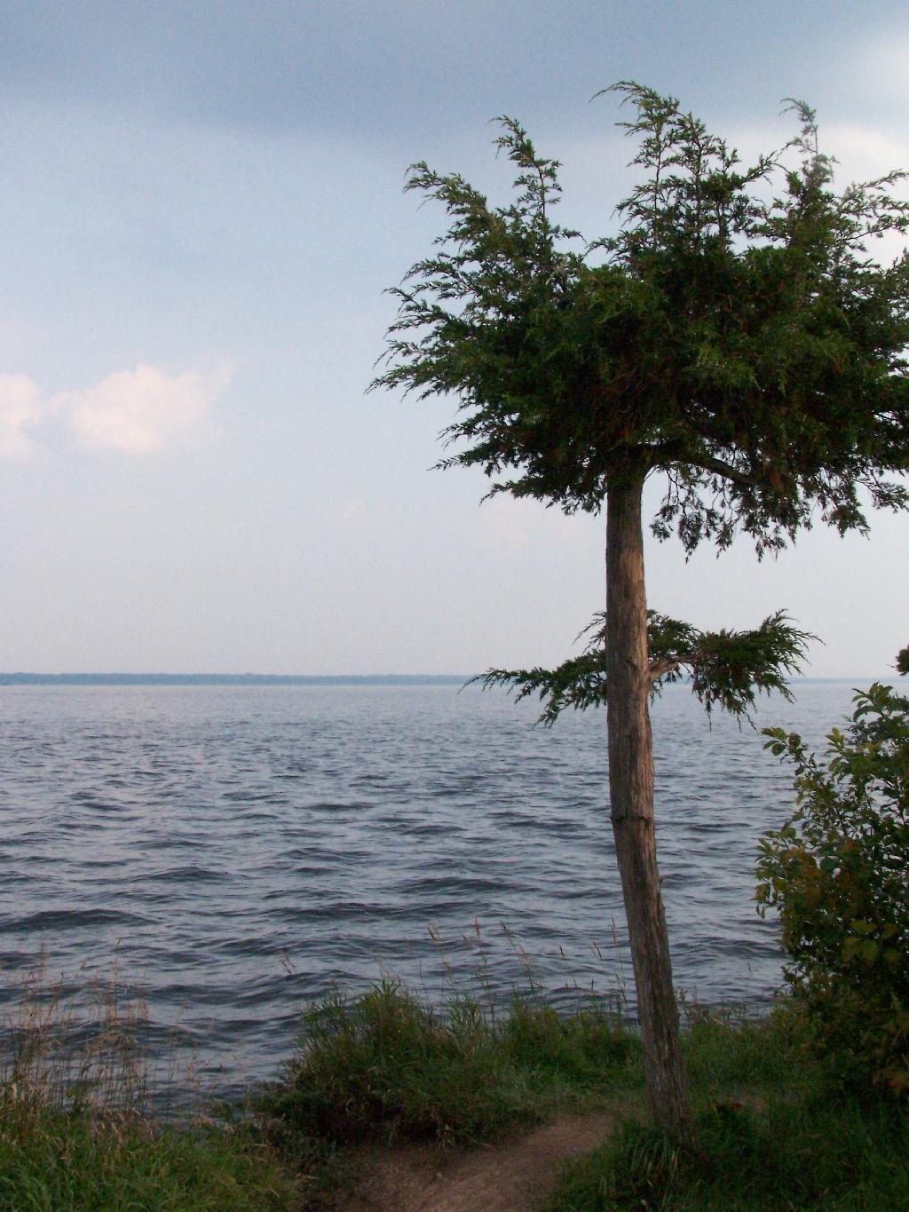
Back in my college days I used to either ride my bike or drive up in the pickup to Point Au Roche State Park, which is located about 8 miles from Plattsburgh. It has fantastic views of Lake Champlain, and on less humid days, some great views of the Adirondack Mountains.
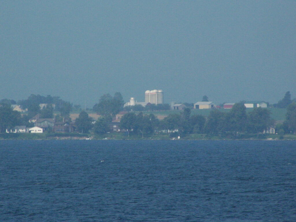
I went for a walk out along Long Point on Sunday Night and Monday morning. It was amazing to come back to the place which I so much remember from when I was back in college. The only difference I noticed was the wind turbines you could see on Rand Hill, just barely through the evening haze.
When I went for the walk this night, it was very hazy and hot. It wasn’t raining, but from the amount of fog and humidity you might not have guess it.
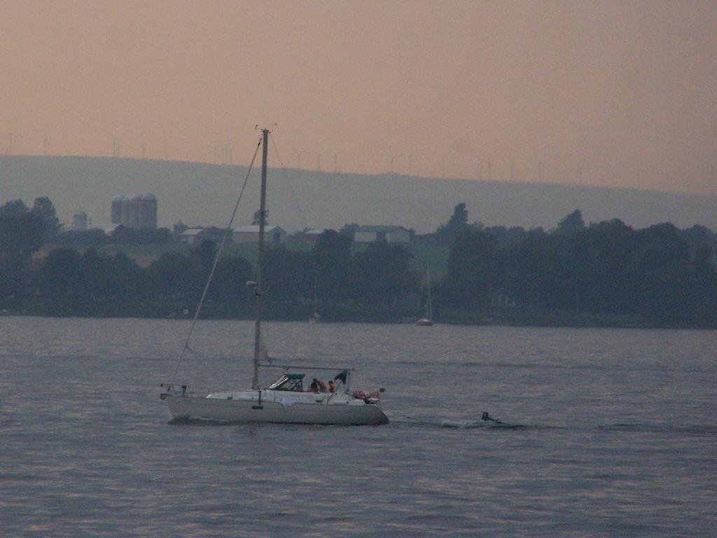
The next morning was almost as hazy and hot and humid, but with some nicer views.
There are around 25 active municipal waste landfills in our state, all of them located in Upstate New York. Here are some arterial views from Google Maps from the 10 closest active municpal solid waste landfills to Albany, NY. Feel free to zoom out to see surrounding landforms, notice developments, farm lands, and other things impacted by these trash dumping sites.
1) Albany City / Rapp Road Landfill.
Located in the Albany Pine Bush, a globally unique Pine Bush ecosystem, it is undergoing an expansion that will condemn 15 acres of this rare habitat. With no more land to expand on without expanding into high-quality Pine Bush, it’s likely to close in a couple of years.
Located on the Mohawk River, it is located north of the town near several smaller subdivisions and some of the suburban towns remaining farms. It recently was expanded, and there is concerns about pollution to neighbors and the nearby Mohawk River. Neighbors have claimed to have wells contaminated, and are concerned about impact on the river. Litter is a real problem.
This landfill was expanded in 2004, and as of 2008 is at about 60% of capacity. It serves Fulton County (owner), and also the MOSA communities (Montegomery-Otsego-Amsterdam-Schoharie) and downstate sources.
Located about a 1/8th of a mile, in the bend of the Saranac River, about 5 miles west of Plattsburgh, it takes trash from the North Country and far beyond at a low rate to make the county money. It was privatized about a decade ago.
This landfill near the Candian Border in the Town of Constable, Franklin County, is in the permitting process for a massive expansion, so the county can import more garbage and make more revenue off it.
A relatively small county landfill serving the trash disposal needs of Chenago County. It is located near East Pharsalia, about twenty miles from Norwich. It has suffered from low revenues in recent months.
Located near Boonsville / Town of Ava, this is the state’s newest landfill, providing 62-years of theoretical capacity for the Oneida-Herkimer communities. Permits for the landfill where granted about three years ago, and that’s why it’s not seen yet on this former farm field. It has been subject to significant controversy.
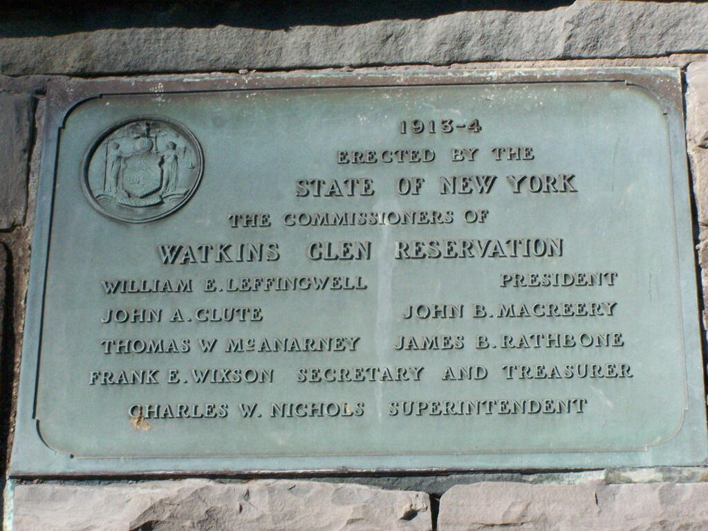
I happened to be driving through Watkins Glen on my trip from the Finger Lakes National Forest to Sugar Hill State Horse camp, so I figured I would take a walk up the trail once again. I’ve been there before, but I figured this would be a chance to get photos when the light was better.
The last time I was there it was early in the morning. This proved to be a problem for photograhpy, without a tripod, because it was so dark in there. It was much lighter in the middle of the day, abit much more crowded. It also was a very humid day out there.
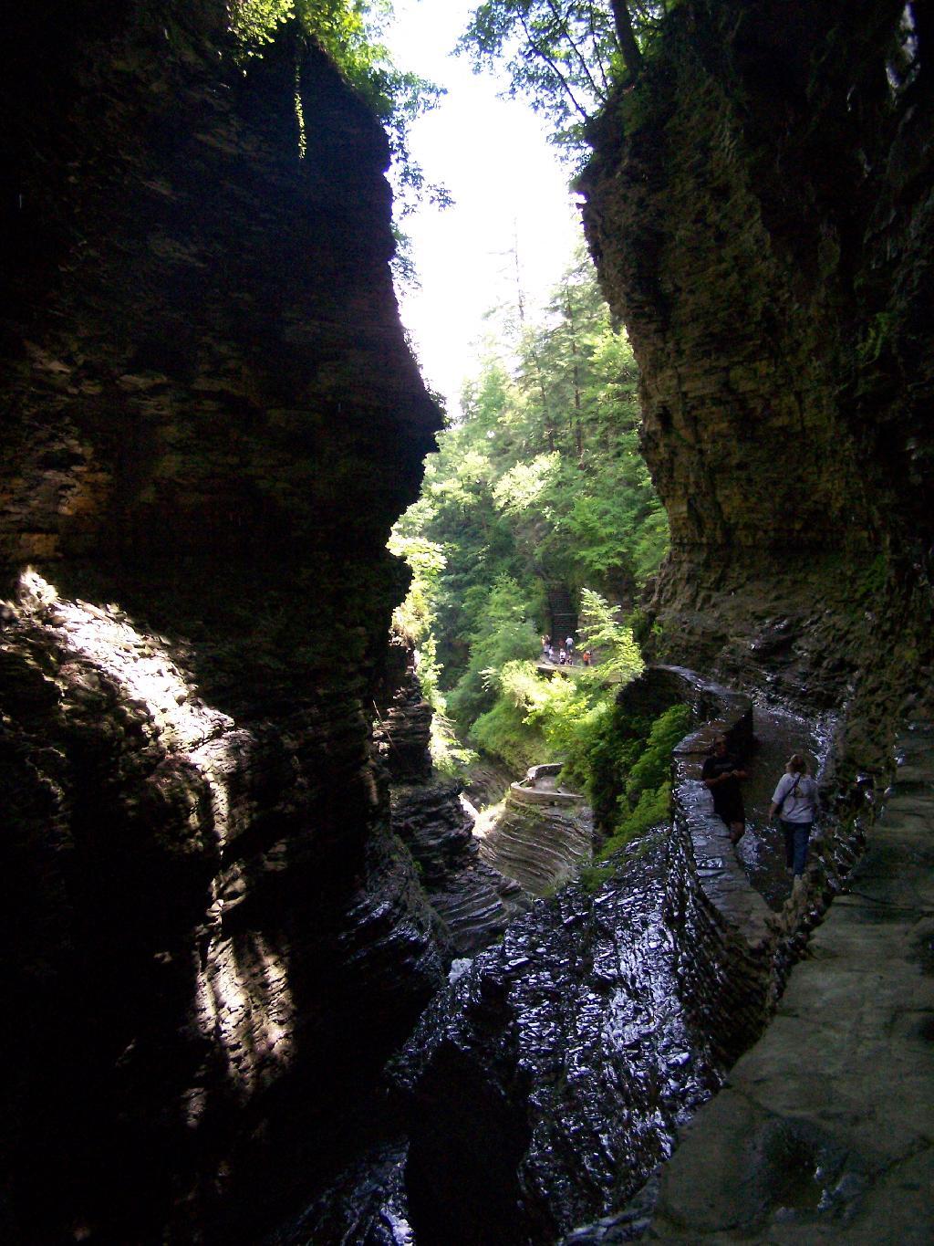
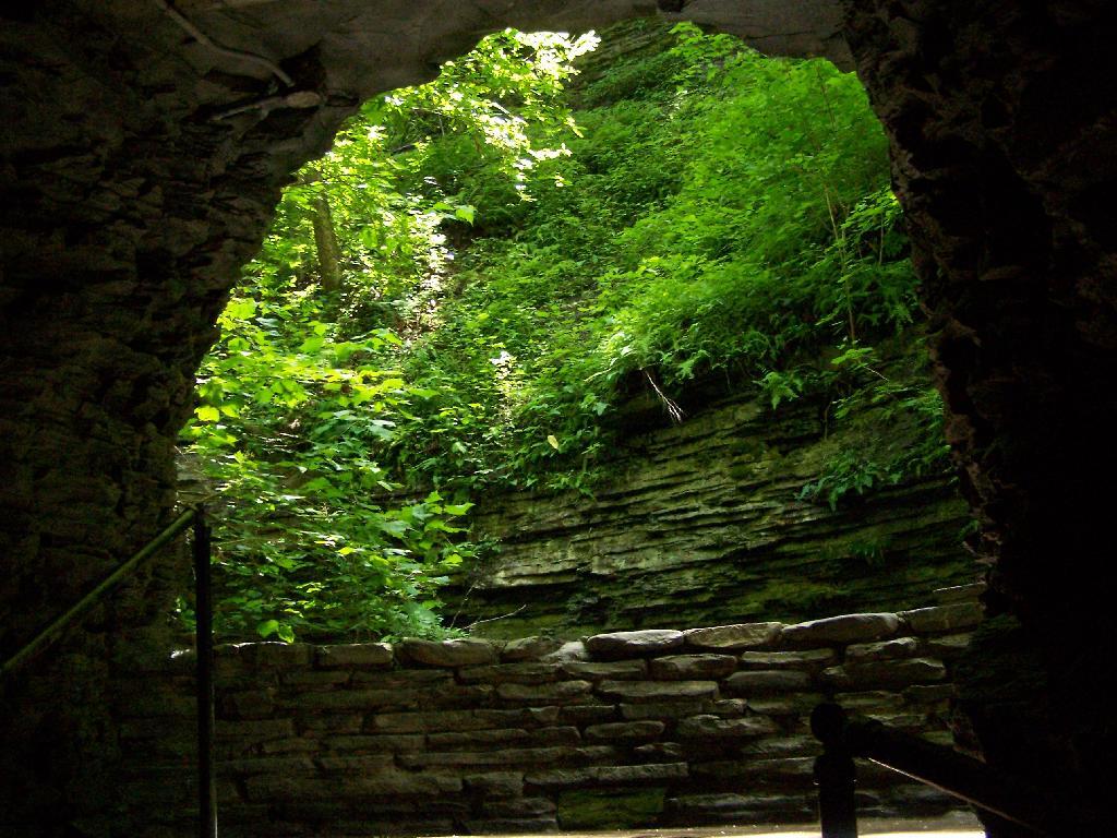
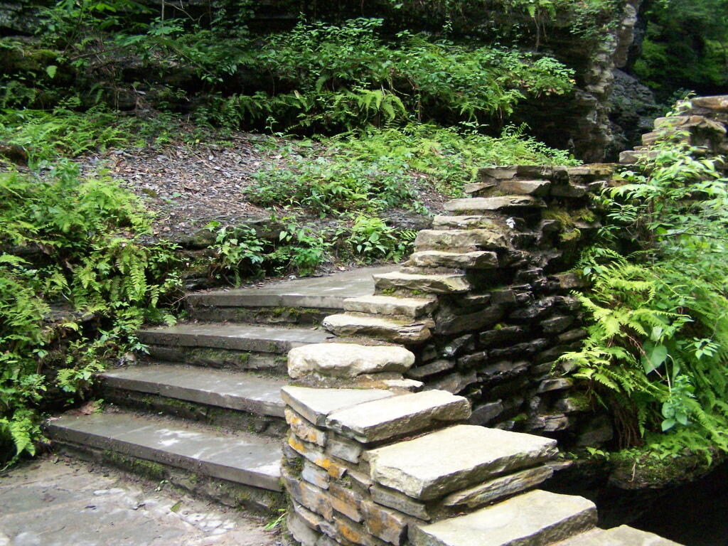
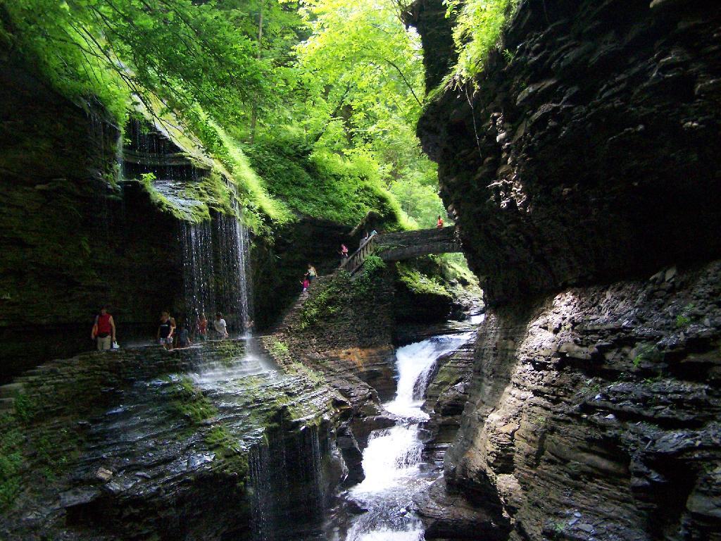
In several sections of Watkins Glen the trail cuts through caves to get around mountain faces, then emereges out to the most beautifully lit green areas.
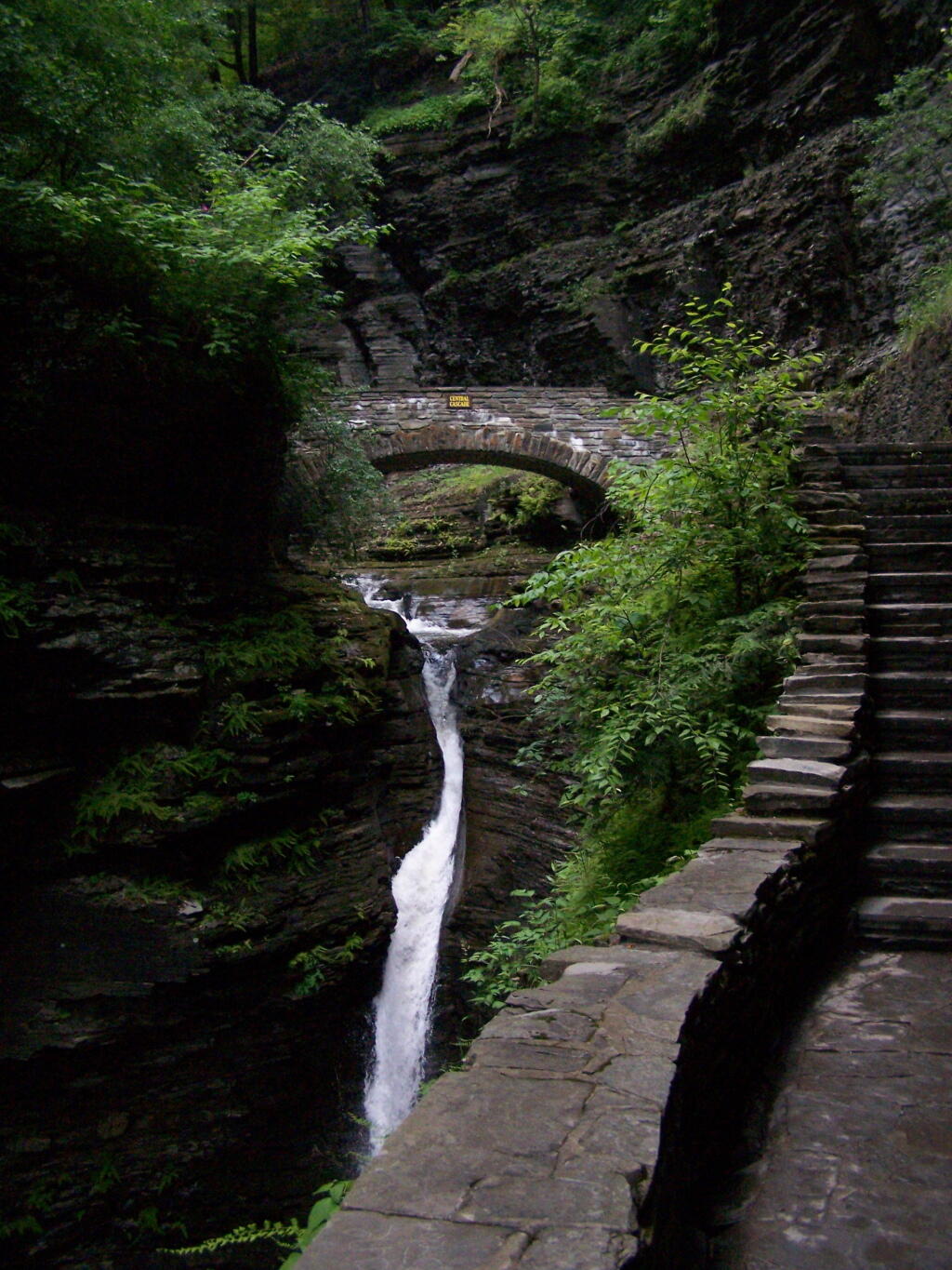
The trail follows the edge of the Glen, crossing it several times on beautiful stone bridges.
The trail is beautifully designed and a pleasure to walk, although on a humid day like today, it was pretty hot, despite being largely in the shade.
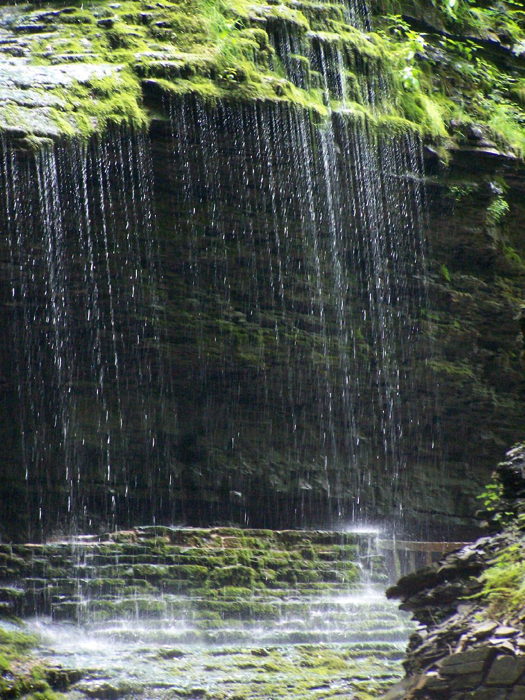
The trail goes under several waterfalls, and after the week’s rainy days, it was pretty wet in spots.
And almost magical scene in Watkins Glen. This whole area somewhat spirtual feeling, especially on the backdrop of such rich greens.
When you reach the top of the glen, the waterfalls become farther appart and less steep and the creek is relatively flat.
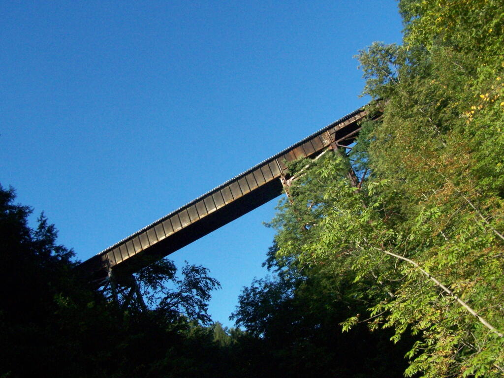
At the top of the Glen is this old railroad bridge. It appears the line is actively used; it would be neat to capture a train going over the Glen. Maybe someday.
Here is a map of the trail I walked in Watkins Glen.