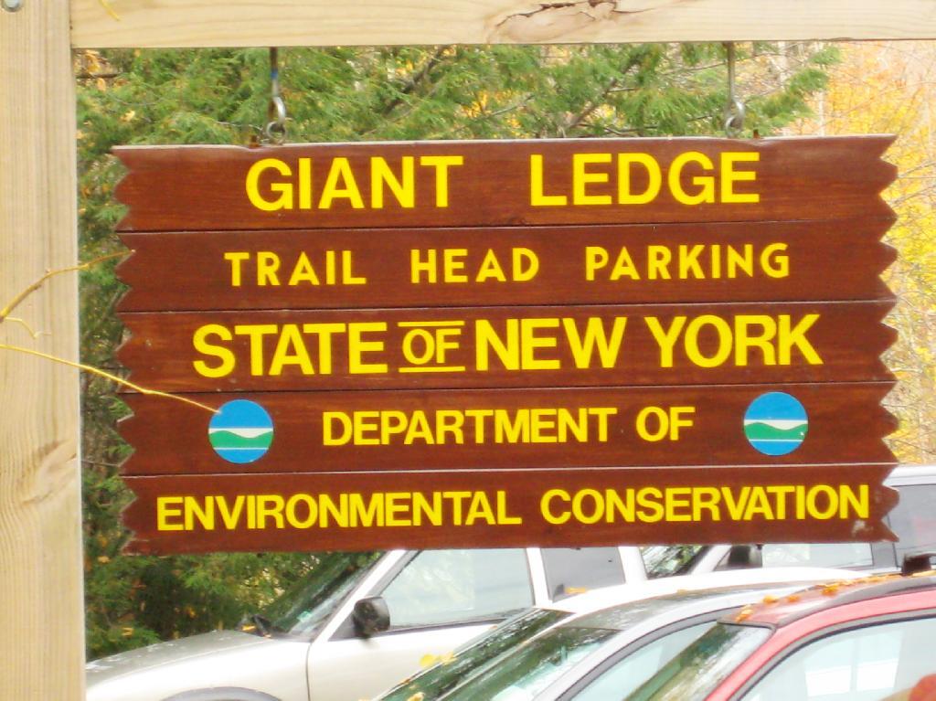
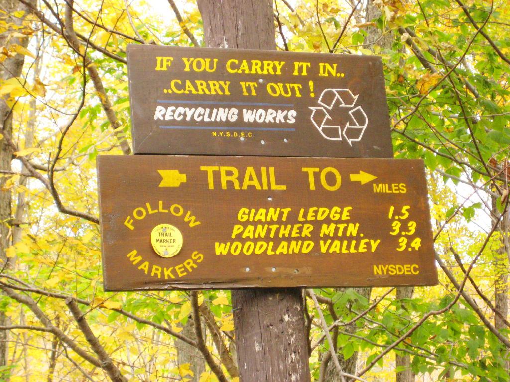
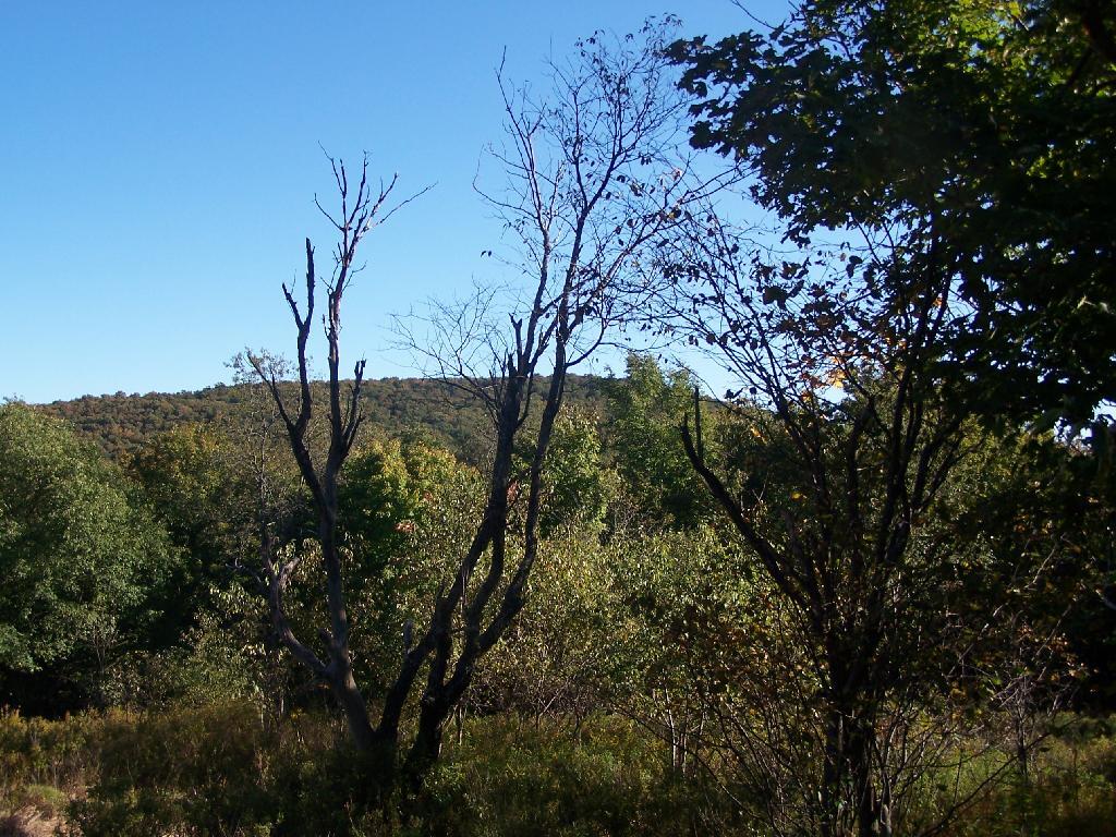
Giant Ledge is a relatively flat hill located on the ridge between Slide Mountain and Panther Mountain. It can be accessed from the Giant Ledge Parking Area, off of hairpin turn on Slide Mountain Road.
I went hiking on Columbus Day, a little past peak foliage system after spending two nights camping out in Schoharie County. It is a short hike.
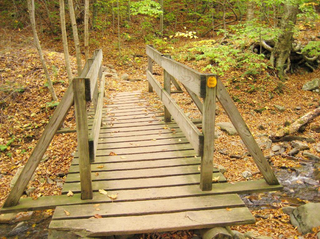
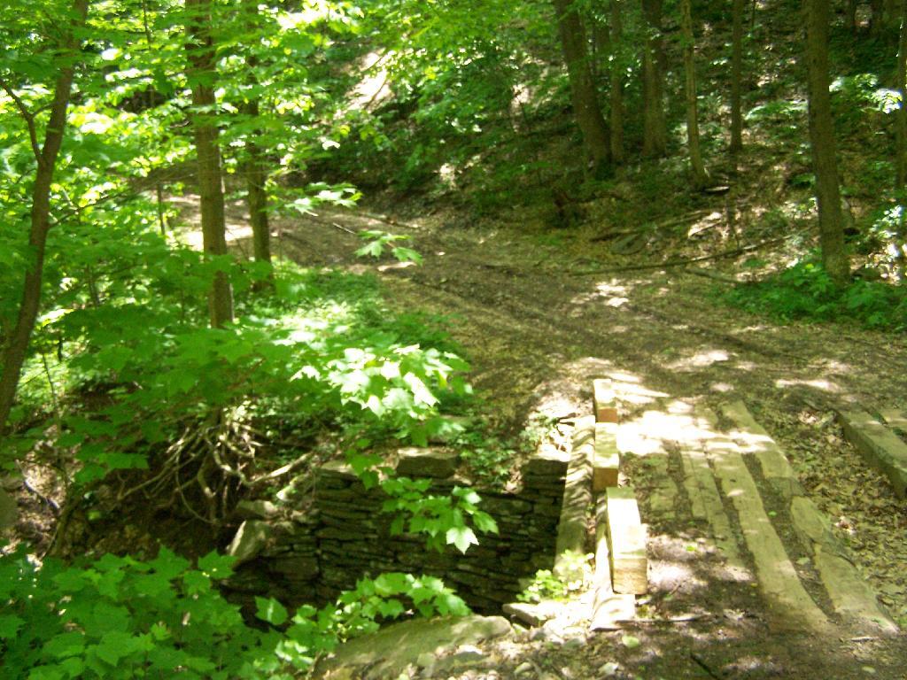
Here is cute little bridge that goes over an unamed creek, running down the northern face of Slide Mountain.
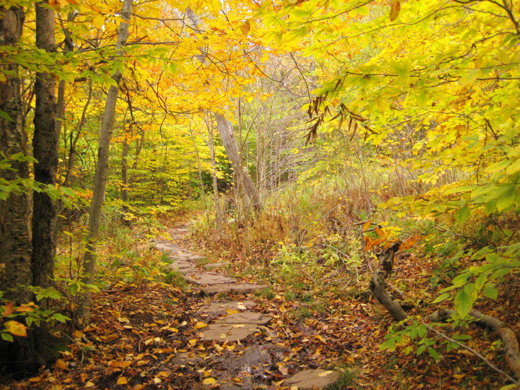
After a moderately steep 3/4 mile hike, you reach the “pass” that goes between Slide Mountain and Panther Mountain. This portion is relatively flat, until you reach the last 150 feet of elevation gain, to reach the top of Giant Ledge.
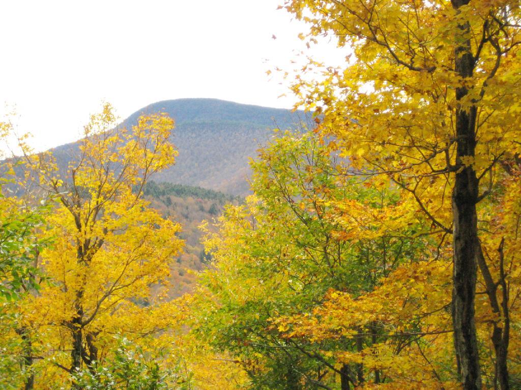
Here is Slide Mountain, peaking through the trees as your going up to the last bit to Giant Ledge.
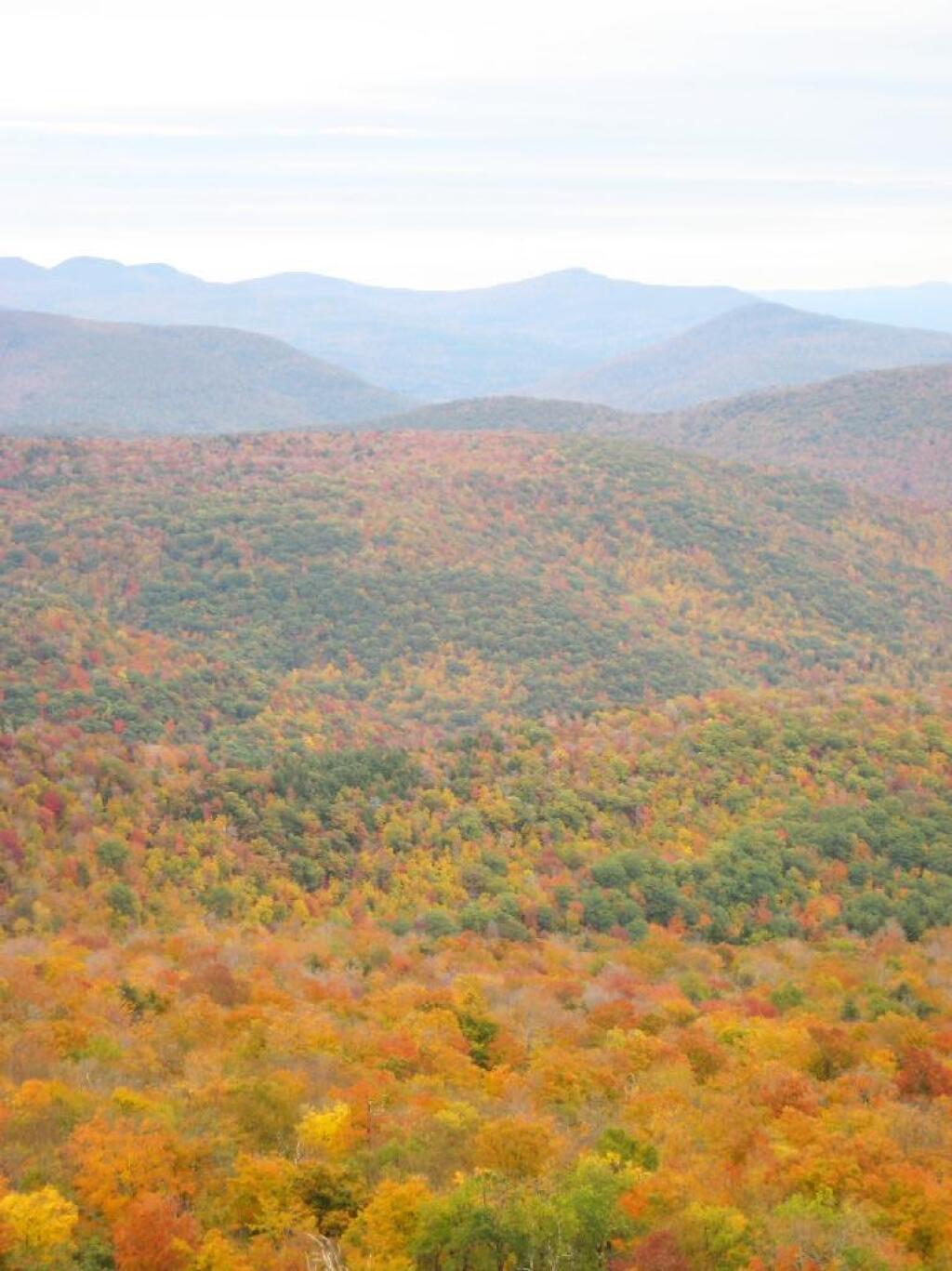
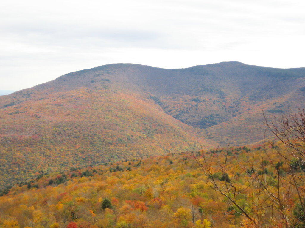
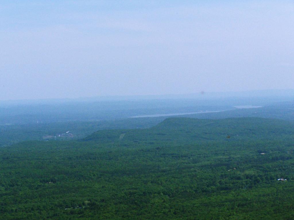
Looking off Giant Ledge, towards Woodlawn Valley (in the colorful foreground), with Plateau Mountain, Twin Mountain, Indian Head Mountain, and in the middle, Tremper Mountain.
Here is the Wittenberg and Cornell Mountains.
This is the Woodlawn Valley’s beautiful colors.
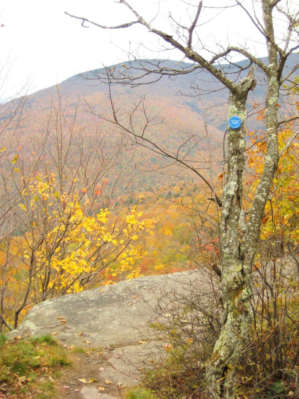
Part of the trail runs right along the edge.
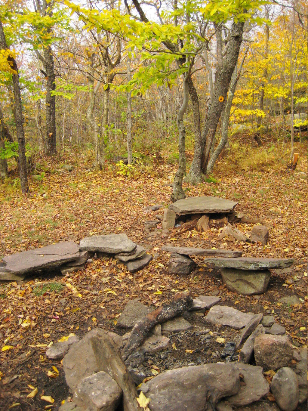
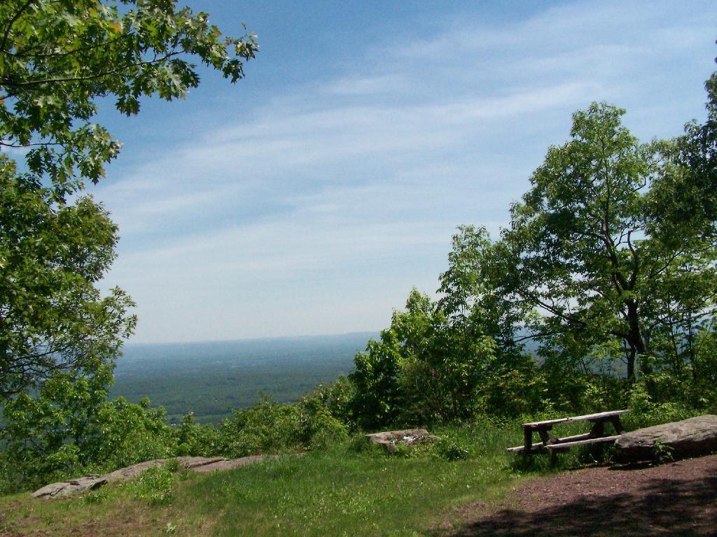
Off the main blue trail on Giant Ledge, there are two campsites at are primative, but nice. This also leads to a trail with views of the Big Indian Valley
Here is the second of two designated campsites on Giant Ledge. There are no campsites on Panther Mountain, which is too high to allow camping. There also is camping on the lower portion Slide Mountain, minus the wonderful views.
After you hike across the trail to the campsites, there is another short little trail that runs over to a viewpoint with views of Big Indian Mountain, and the Big Indian Valley (where Slide Mountain Road runs).
From here, I hiked up Panther Mountain. Here is a map of the hike.
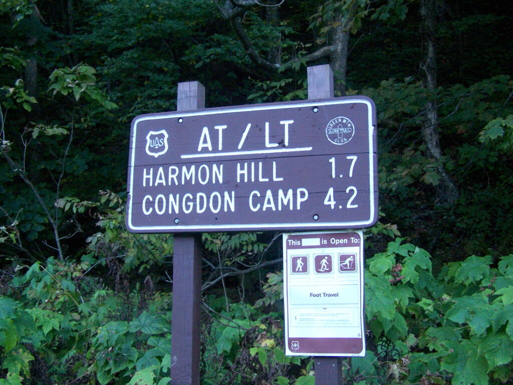
Harmon Hill is a short but steep hike outside of Bennington, VT. You go up some 1,200 feet in a little over 1.7 miles from the parking area deep in the Dunville Hollow just west of Bennington for modest views up north and west of Bennington.
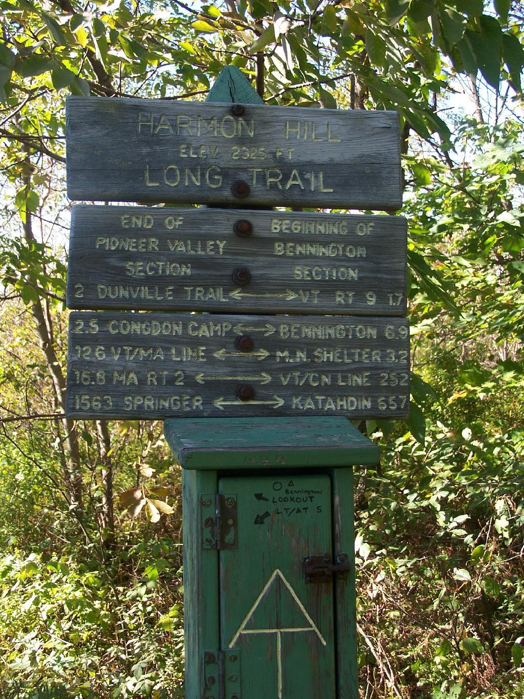
The trail up it is part of the Long Trail, which is duplexed with the Applachian Trail in Vermont. Here is the sign near the parking area.
It is a steep 1 mile as you make most of the 1,200 ascent. There are not much views as you climb out of the Dunville Hollow, just a lot of rock-steps and steep switch backs as one climbs up the mountain.
Likens along the trail.
Once you almost reach the top there are many meadows.
A destination sign tells you that you’ve reached the Pioneer Valley section of the Long Trail and are starting the Bennington section.
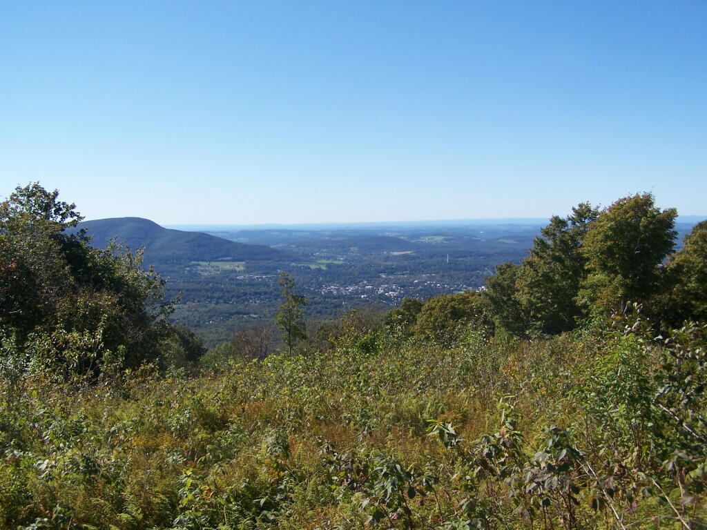
When you come to the top you have an interesting view of Mount Anthony, Bennington, and in the far distance the Champlain Valley and the Adirondacks.
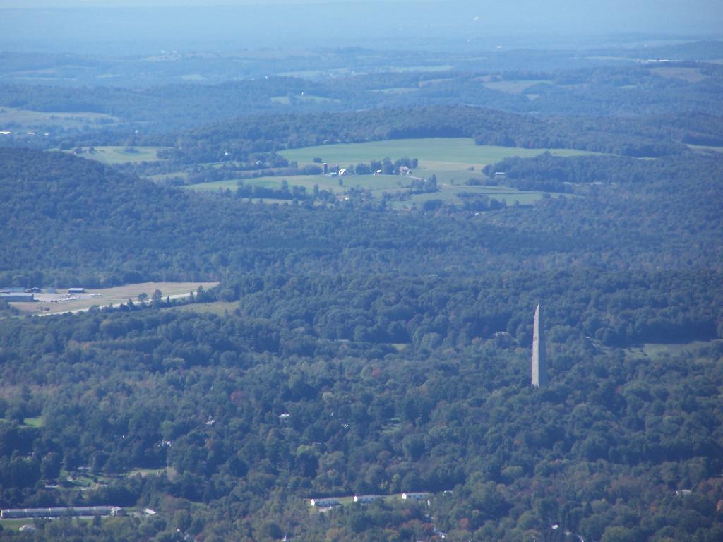
You can see the Bennington Monument and the surround farms near Bennington from the mountain.
Towards the North, you can see some of the Adirondacks towering over the much lower range of the Green Mountains, including Grass Mountain.
This is the second peak of Harmon Hill, which is view less. I hiked to Harmon Hill and the viewless points further south on the Long Trail.
I happened to be driving through Watkins Glen on my trip from the Finger Lakes National Forest to Sugar Hill State Horse camp, so I figured I would take a walk up the trail once again. I’ve been there before, but I figured this would be a chance to get photos when the light was better.
The last time I was there it was early in the morning. This proved to be a problem for photograhpy, without a tripod, because it was so dark in there. It was much lighter in the middle of the day, abit much more crowded. It also was a very humid day out there.
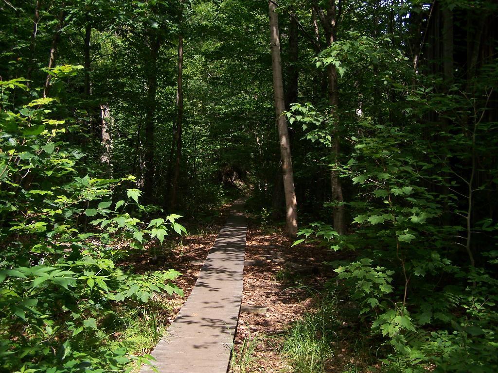
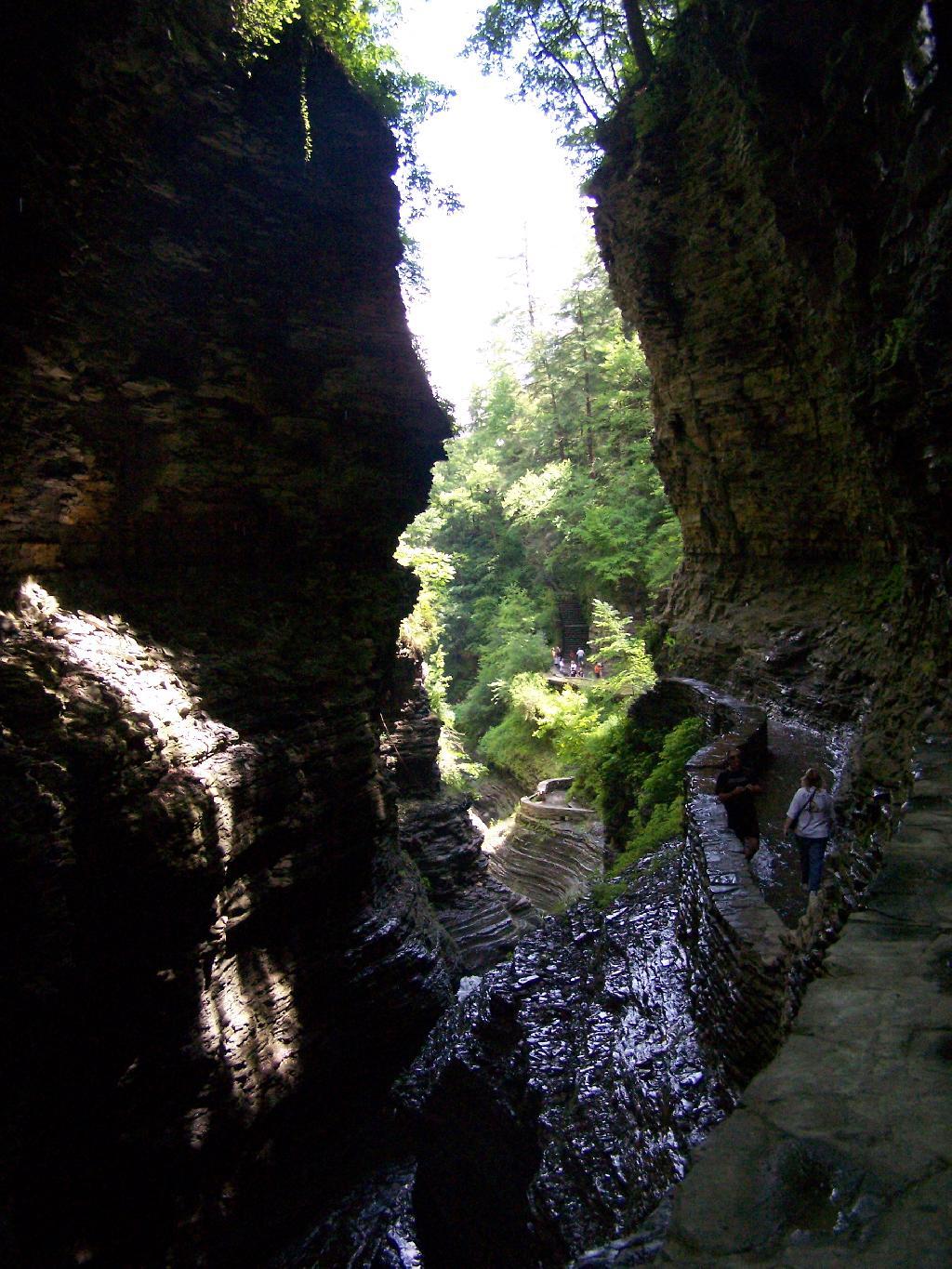
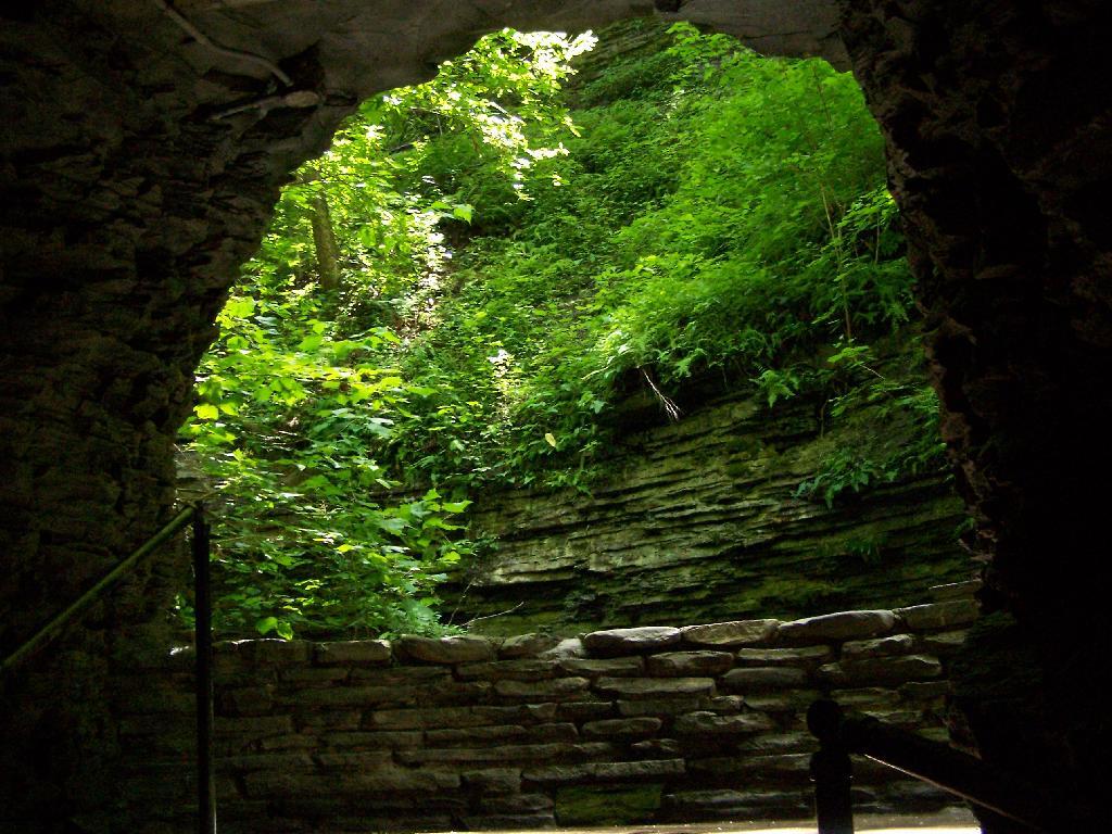
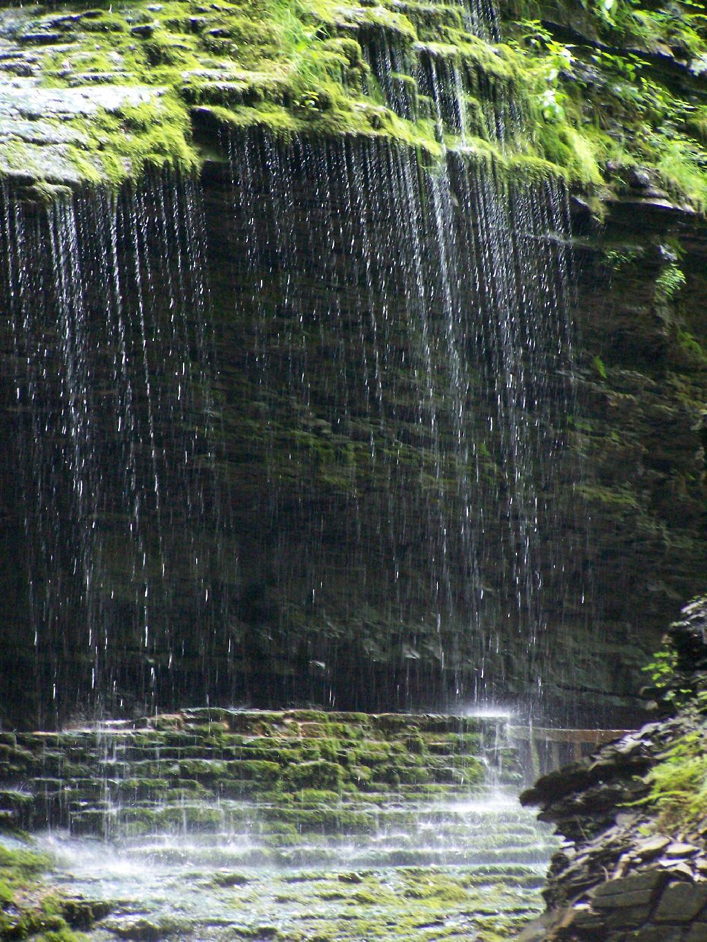
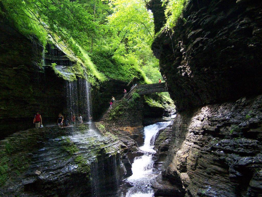
In several sections of Watkins Glen the trail cuts through caves to get around mountain faces, then emereges out to the most beautifully lit green areas.
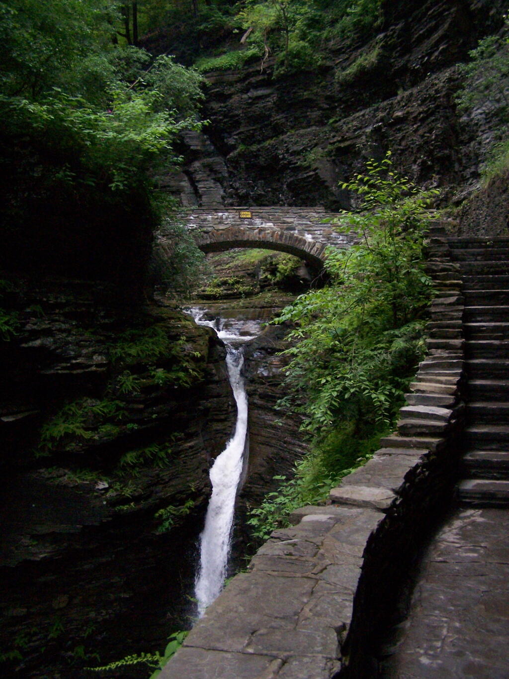
The trail follows the edge of the Glen, crossing it several times on beautiful stone bridges.
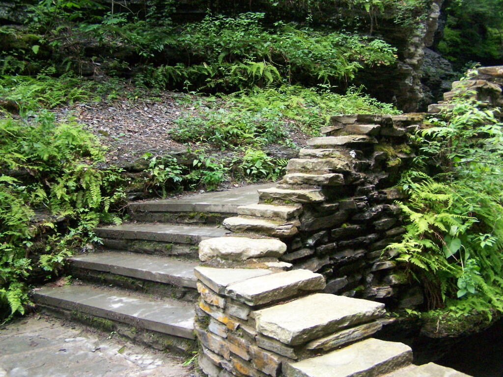
The trail is beautifully designed and a pleasure to walk, although on a humid day like today, it was pretty hot, despite being largely in the shade.
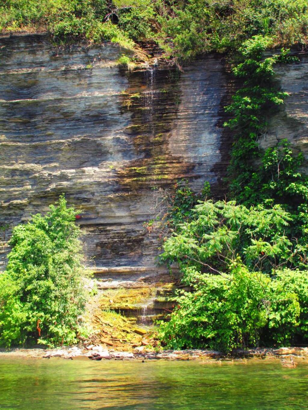
The trail goes under several waterfalls, and after the week’s rainy days, it was pretty wet in spots.
And almost magical scene in Watkins Glen. This whole area somewhat spirtual feeling, especially on the backdrop of such rich greens.
When you reach the top of the glen, the waterfalls become farther appart and less steep and the creek is relatively flat.
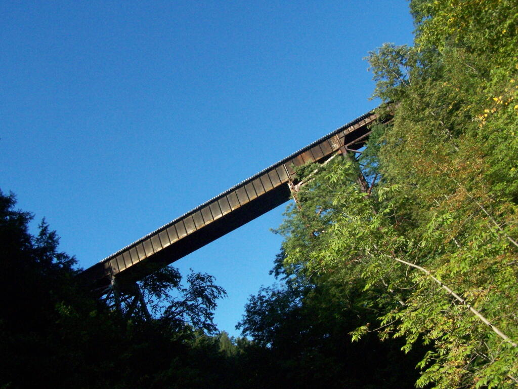
At the top of the Glen is this old railroad bridge. It appears the line is actively used; it would be neat to capture a train going over the Glen. Maybe someday.
Here is a map of the trail I walked in Watkins Glen.
On Memorial Day 2009, I decided to go on an afternoon hike to the Palenville Overlook, along the old Catskill Mountain House Road, which was used for horse and buggies during the era of that great mountain house prior to the installation of the inclined railroad and later automobile.
The first part of the trail is a moderately steep old wagon road that climbs about 1,000 feet to the site of the Halfway House / Rip Van Winkle Hollow. If it wasn’t gated closed, it would be passable by an automobile. When you reach the ruins of the Halfway House, there are horse tie-downs and ruins of the old tavern known as the Half Way House. It’s where passengers could get a good strong drink and so could horses, as they made their way up to the Mountain House.
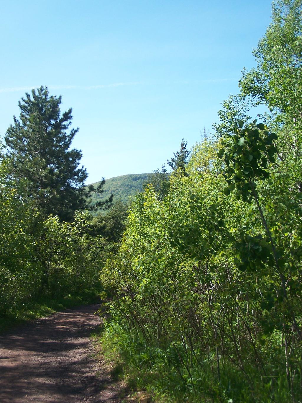
After this nice place for resting, the trail climbs a bit more and becomes a lot less steep. You pass by a private hunting cabin, and finally into the forest preserve. You arrive at a pinic area with nice views of the valley, a picnic table, horse tie-downs, and a fireplace full of trash.
From there the trail gently goes up, with two big switchbacks. The trail to the Palenville Overlook switch-backs down about 100 feet off the old Catskill Mountain House Road, and then winds on a narrow trail about another mile to the Palenville Overlook.
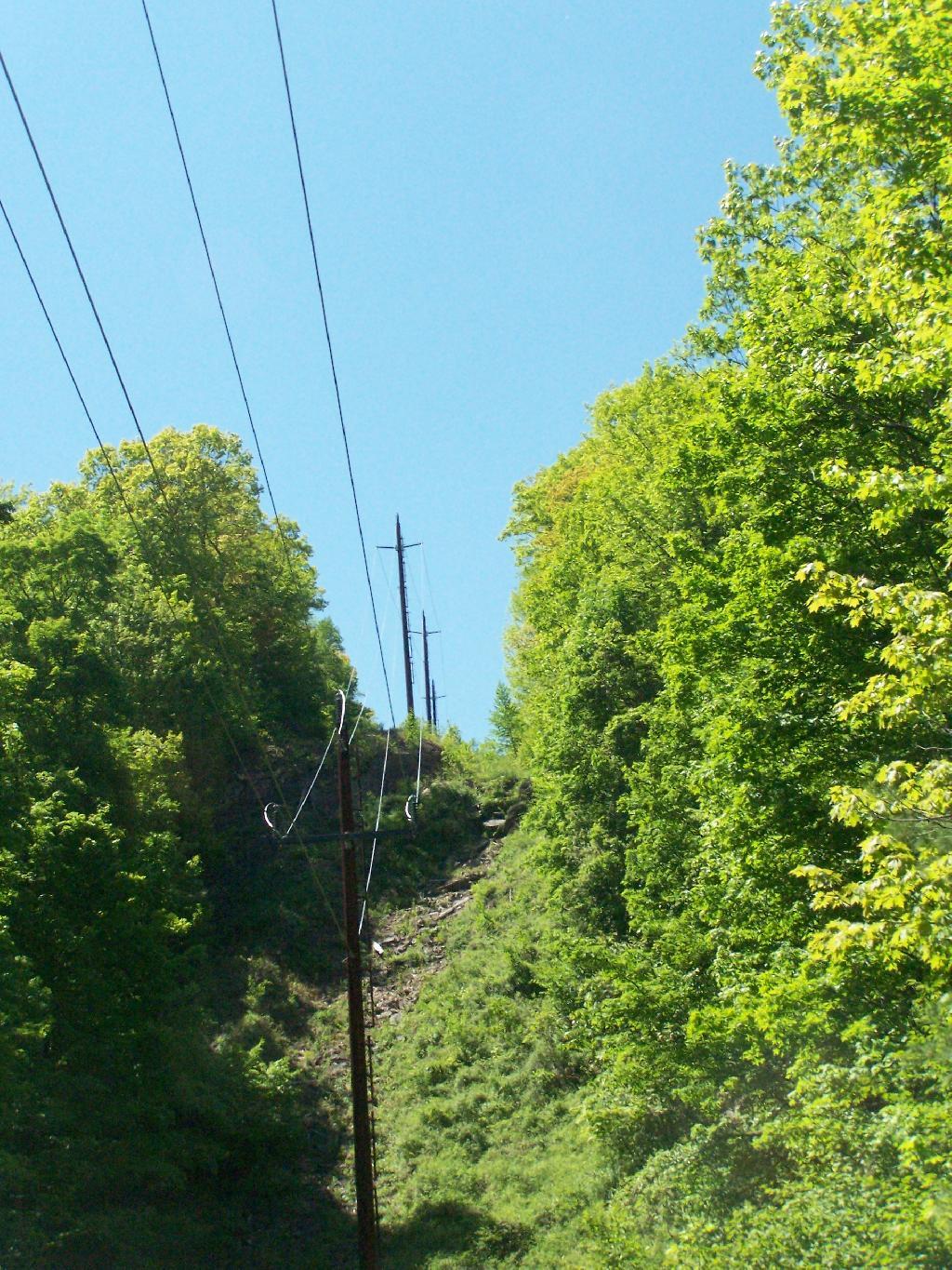
You then cross the ruins of the old inclined Otis Railroad tracks, in which all that remains are foundations. According to “AMC’s Best Day Hikes in the Catskills”, the rails and other scrap metal was sold to the War Department during World War I. By then the automobile had made this mode of obsolete as the old horse trail up the valley. All that remains is the cut on mountain, where a high-tension power wire runs.
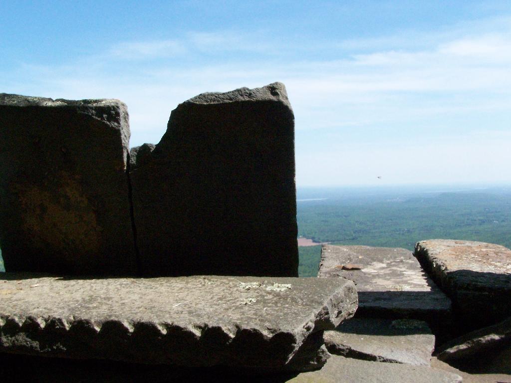
You eventually reach the Palenville Overlook. The views are amazing, although it was fairly hazy the day I went there. There are awesome stone-built chairs out of old Palenville Mountain House ruins, that provide a great place to sit with a book, as you enjoy views of the Hudson Valley looking south-east. There is another view along the escarpment of the valley somewhat to the north, that gives more due-east views.
From there, I hiked back to the old Catskill Mountain House road, and up to the site of the old Catskill Mountain House ruins. I took some pictures, and then started down the mountain, when I realized I had left my hat up the Catskill Mountain House site. So I ended up backtracking, and ended up missing Memorial Day dinner at my parents house. But so be it.
![Across the Potamac River to West VIrigina [Expires November 12 2023]](https://andyarthur.org//data/photo_003065_large.jpg)


![Untitled [Expires August 4 2024]](https://andyarthur.org//data/photo_001936_large.jpg)