Last week, the Department of Environmental Conservation announced that they would be suspending all controlled burn permits state wide, and banning all outdoor brush burning through October 10th. What they conviently forgot to mention was under the DEC rules created by executive fiat by Pete Grannis’ DEC, that all outdoor brush burning is banned by DEC rule from October 15th to May 15th. Essentially they are banning all brush burning for the next year, but they didn’t want to sound like they were doing that.
It is pretty dry out. The fire danger is “High” in many parts of state, which is the second highest level under “Very High” which is usually reserved for when actual large brush fires have broken out and all outdoor fires — including small campfires and barbeque grills. Those kind of conditions are generally unheard of in the relatively wet eastern states, except maybe in snowless periods of the early spring before things green up.
In previous times, regulating and preventing brush fires was largely a local task based on county decision making, except in the Adirondack Park (where the Adirondack Park Agency had that power). County Executives or County Legislatures would proclaim a high fire danger and ban various types of outdoor burning — camp fires, brush burn piles, trash fires, etc. Counties would typically insitute such bans based on local conditions, not some broad state handed down decree. Such bans would be short lived, until the rains came, and soaked down the landscape.
The reality is at a state level, an unholy alliance of radical environmentalists and solid waste hauling companies have come together to basically ban all outdoor burning. Industry likes it to, because if you blame backyard brush and trash burning for air pollution, you don’t have to look at what’s coming up the smoke stacks. Environmentalists claim to be concerned about the smoke from burning brush, or for that matter anything besides fossil fuels in highly controlled conditions
They have yet to ban campfires due to pollution controls, probably due to the political backlash of outdoors recreationalists, but you know that’s next. They are already after outdoor wood boilers, and fireplaces, due to so-called pollution controls, while ignoring serious environmental problems that are from large industrial polluters.
Both sides of the Mohawk Valley, for about ten miles north and south of the river have extensive dairy farming going on. Not large confined animal feeding operations, but instead relatively small dairies that overlook the river, and leave mostly a pastorial landscape of pastures and corn fields, sloped along the hills that overlook the river.
There are certainly other farming locations in state, but there is something specifically quite pictorial of this area, all overlooking the river, with the relatively high hills that surround the Mohawk River. Few areas of state are as open, or is farming concentrated around a single valley. Most farming areas in state are single valleys — like the Black River Valley — and not hills surrounding a major river.
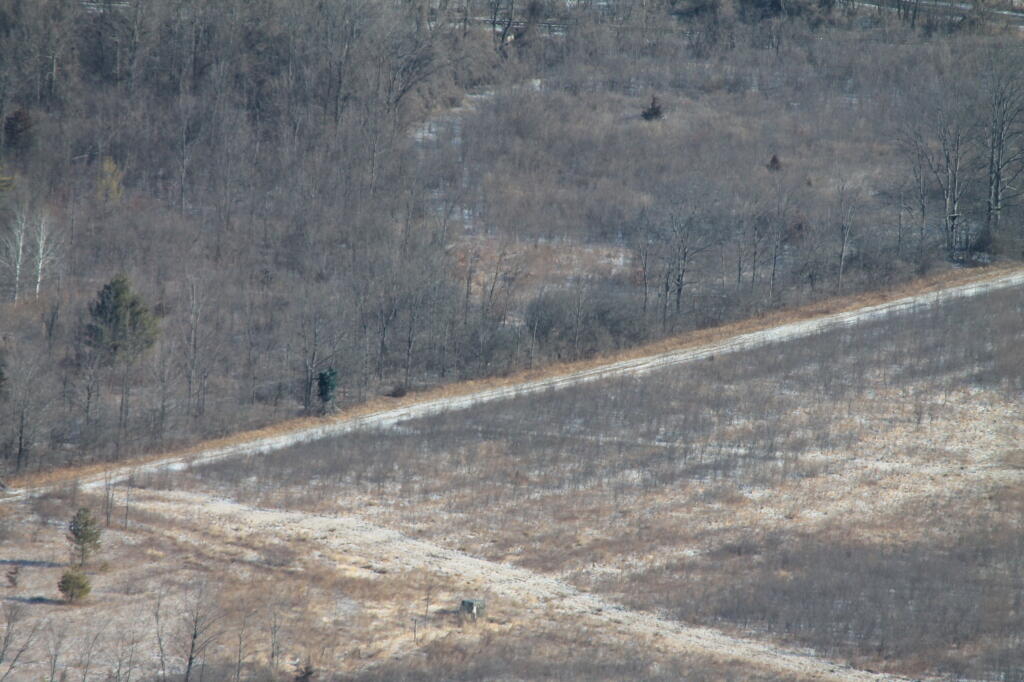
The Mohawk Valley Farm belt tends to petter out, as you climb out of the Mohawk Valley. Head to far north or south, and the farms are replaced with a lot of scrub land, where less productive farms, with poorer soils and shorter growing seasons have been abandoned. These lands nowadays are primarily owned by rural residents, and used mostly for hunting in the fall and the production of firewood. The worst parcels of all, as it comes to farming, are largely owned by the state, for timber and public recreation.
The belt is pretty clearly defined. Where farms begin and end in scrub land are as visible by the view of the window in your truck, as they are in view from the aerial photos looking down onto the earth. Farming, while an important part of the economy, really is limited to where can occur, and beyond that, most of the land is wasted.
Biomass companies, and alternative crops some day promise to recover this scrubland, that is all but abandoned for anything but deer hunting. It would be nice, but we will see the impacts to the environment once it happens. Scrublands, and recently abandoned, to the human mind look so disorderly, at least until they revert back to full forest.
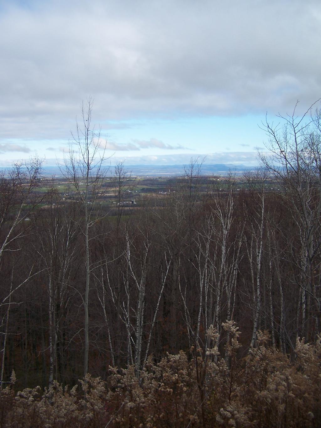
It’s a warm and sunny morning on the old dirt road between Harrisburg Lake and Wilcox Lake in Warren County, the sky above brilliant blue, the woods full of birdsong. A beautiful day to be hiking in the Forest Preserve.
Unfortunately, I have to watch where I step. The trail is full of deep and muddy ruts, the ugly kind that can ruin your boots. It takes some of the fun out of hiking.
Muddy ruts are commonplace in parts of the Wilcox Lake Wild Forest, the Independence River Wild Forest, and many other tracts of the forever-wild Forest Preserve. Usually, they have been created by all-terrain vehicles.
Seven years after the state Department of Environmental Conservation banned ATVs from state land in the Adirondacks and Catskills to stop “illegal and inappropriate ATV use … and to ensure that the resources of the Forest Preserve are protected,” trails are still being chewed up by the four-wheel vehicles.
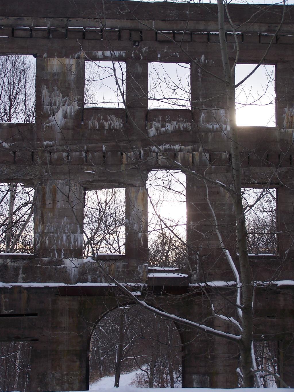
One of the claims sometimes made is that previously industrialized or man made landscapes can not ever be reversed into wilderness. It is claimed that once man touches a landscape, mines, farms, or timbers it surface, it can not ever revert back to a natural status.
The reality is that is far from that.
Man made works, while remarkable, quickly start to fall down and revert back to a more natural status, quickly after abadonmnet. Certainly man is powerful, can move large mounds of earth, and bring materials from far away. Yet, as soon as man walks away, plants start to grow into cracks, water erodes roadways and causes buildings ot fall apart, and animals start to return to recolonize a land once dominated by man.
Fragmentation and private inholdings can make it more challenging for abandoned lands to revert back to wilderness. Any attempt by man to upkeep man’s works, will prolong their existence. Man can fight the natural forces through his active stewartship of his products, and through design, but he can not stop nature’s processes once underway, by simply standing on the sidelines.
Buildings make take decades to fall in and rot away in soil. The lost of old growth timber might take hundreds of years to be replaced. Eroded soils, rock cuts might take thousands if not million years to be disolved back into a truly natural state. Yet, still man’s battle against wilderness is only temporary at best, for once man takes his hand of wilderness, it only starts the long path into wildness once again.
This Google Maps is based on the block level 2010 Census Population Counts. Census Blocks with no residents appear 100% clear.
Regardless, zoom in, to see how many people live in a particular block, and the density of residency of poeple in various communities. Compared to the city, the suburbs, and rural areas all seem depopulated.
The population density of New York State. Notice this is a totally different scale, and is by per square miles, per Census Tract rather then block. Makes all of upstate look rural compared to New York City. Zero population blocks are not clear on this map.
Today will take a look back at Year of 2011 in photos. Next week, I plan on doing an article featuring the Best of Photos of 2011. UNIX_TIMESTAMP(‘2011-1-1’) AND `date` < UNIX_TIMESTAMP('2012-1-1') ORDER BY `date` ASC";
$query = mysql_query("$sql");
while ($series = mysql_fetch_assoc($query) ) {
$date = strtotime($series['dated']);
if ($prevdate != date('F', $date) ) {
echo '
$sql = “SELECT `phototypes`.`filename` AS ‘type’, `photos`.`filename` FROM `photos`,`phototypes` WHERE `photos`.`typeid` = `phototypes`.`id` AND `date` > $min AND `date` < $max AND `phototypes`.`filename` NOT LIKE 'maps%' ORDER BY rand() LIMIT 1";
$pquery = mysql_query("$sql"); $photo = mysql_fetch_assoc($pquery);
echo "