Highway Law Section 115-A:
Abandonment of County Highways.
Whenever a county road or part thereof constructed as part of the county road system deviates from the line of an existing town highway, or from the line of a former town highway within the limits of an incorporated village, as shown on the map of the county road system, the board of supervisors by resolution duly adopted upon the recommendation of the county superintendent of highways, and pursuant to a written agreement with the town board or village board of trustees, or in the event such an agreement cannot be reached with the approval of the commissioner of transportation, may abandon to the town or the incorporated village as the case may be for future maintenance, that part of the town highway or former town highway within the limits of an incorporated village not improved and modify the map of the county road system accordingly. The portion of any town highway or former town highway within the limits of an incorporated village excluded from the county road system shall be maintained by the town or village in which it is located.

Highway Law Section 205:
Highways Abandoned By Local Governments.
1. Every highway that shall not have been opened and worked within six years from the time it shall have been dedicated to the use of the public, or laid out, shall cease to be a highway; but the period during which any action or proceeding shall have been, or shall be pending in regard to any such highway, shall form no part of such six years; and every highway that shall not have been traveled or used as a highway for six years, shall cease to be a highway, and every public right of way that shall not have been used for said period shall be deemed abandoned as a right-of-way. The town superintendent with the written consent of a majority of the town board shall file, and cause to be recorded in the town clerk’s office of the town a written description, signed by him, and by said town board of each highway and public right-of-way so abandoned, and the same shall thereupon be discontinued.
2. There may also be a qualified abandonment of a highway under the following conditions and for the following purposes, to wit: Where it appears to the town superintendent and said town board, at any time, that a highway has not become wholly disused as aforesaid, but that it has not for two years next previous thereto, been usually traveled along the greater part thereof, by more than two vehicles daily, in addition to pedestrians and persons on horseback, and it shall also appear to the superintendent of highways of the county in which such town is situate that a qualified abandonment of such highway is proper and will not cause injustice or hardship to the owner or occupant of any lands adjoining such highway after such superintendent shall have held a public hearing thereon upon giving at least twenty days’ written notice to such owners and occupants of such lands of the time and place of such hearing, they shall file and cause to be recorded in the town clerk’s office a certificate containing a description of that portion of the highway partly disused as aforesaid and declaring a qualified abandonment thereof. The effect of such qualified abandonment, with respect to the portion of said highway described in the certificate, shall be as follows: It shall no longer be worked at the public expense; it shall not cease to be a highway for purposes of the public easement, by reason of such suspension of work thereon; no persons shall impair its use as a highway nor obstruct it, except as hereinafter provided, but no persons shall be required to keep any part of it in repair; wherever an owner or lessee of adjoining lands has the right to possession of other lands wholly or partly on the directly opposite side of the highway therefrom, he may construct and maintain across said highway a fence at each end of the area of highway which adjoins both of said opposite pieces of land, provided that each said cross fence must have a gate in the middle thereof at least ten feet in length, which gate must at all times be kept unlocked and supplied with a sufficient hasp or latch for keeping the same closed; all persons owning or using opposite lands, connected by such gates and fences, may use the portion of highway thus enclosed for pasturage; any traveler or other person who intentionally, or by wilful neglect, leaves such gate unlatched, shall be guilty of a misdemeanor, and the fact of leaving it unlatched shall be prima facie evidence of such intent or wilful neglect. Excepting as herein abrogated, all other general laws relating to highways shall apply to such partially abandoned highway. This section shall not apply to highways less than two rods in width unless it shall appear to the town superintendent at any time that such a highway has not, during the months of June to September inclusive of the two years next previous thereto, been usually traveled along the greater part thereof by more than ten pedestrians daily.
Any action or proceeding involving the abandonment or qualified abandonment of a highway made pursuant to this section must, in the case of abandonment, be commenced within one year from the date of filing by the town superintendent as provided in subdivision one of this section.
Matter of Smigel v. Town of Rennselaer.
As seen on Google Scholar.
MATTER OF SMIGEL v. TOWN OF RENSSELAERVILLE
283 A.D.2d 863 (2001)
725 N.Y.S.2d 138
In the Matter of HENRIETTA SMIGEL, Respondent, v.
TOWN OF RENSSELAERVILLE et al., Appellants.
Appellate Division of the Supreme Court of the State of New York, Third Department.
Decided May 24, 2001.
Mercure, J. P., Peters, Spain and Carpinello, JJ., concur. Lahtinen, J.
Petitioner is the owner of land bordering the Camp Winsocki Road (hereinafter the road) located in respondent Town of Rensselaerville in Albany County, having acquired title to the property in 1986. In December 1995, petitioner requested that respondents abandon a portion of the road which she had barricaded at both ends in 1986, and which respondent Town Supervisor admitted had not been maintained by respondents for at least 20 years. Her request was continued for further study by the Town Board of the Town of Rensselaerville. In October 1999, petitioner and another petitioned respondents “to abandon a portion of its present easement to [the road].” In January 2000, after a public hearing, respondents refused to abandon the road and passed a resolution finding that the road had not been abandoned through disuse, ordering petitioner to remove all of her barricades, and making the road a seasonal road to be maintained from April 1 to December 1.
In January 2000, petitioner commenced this combined CPLR article 78 proceeding and action for declaratory judgment seeking a judgment clearing her title “as to the portion of her property previously subjected to an easement for the highway,” injunctive relief prohibiting respondents from removing her barriers on the road and trespassing on her property and an order directing respondents to file a certification of abandonment. Respondents answered, asserting that the petition/ complaint failed to state a cause of action.
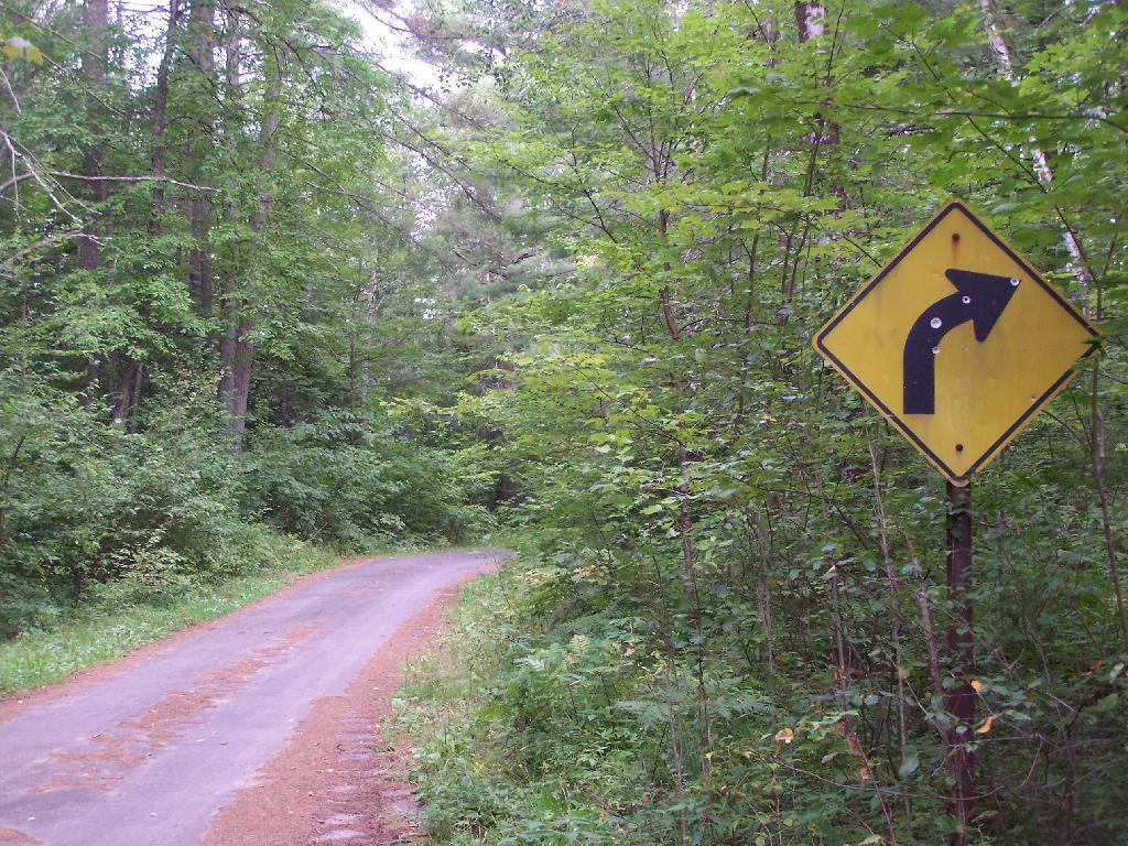
The parties submitted numerous affidavits and documentary evidence in support of their respective positions and, in April 2000, Supreme Court determined that because no photographs had been submitted by either party, the matter could not be summarily decided, and it therefore set a hearing date to determine whether recreational travel “follows the `lines of the ancient street.'” When the parties appeared on the scheduled hearing date, they were informed that the hearing had been canceled and were directed to leave any photographs that they had with the court for review. Both parties submitted photographs depicting the present condition of the road.* On May 26, 2000, Supreme Court granted the petition/complaint and declared the road to be abandoned. Respondents appeal and we reverse.
Highway Law § 205 (1) provides, in relevant part, that “every highway that shall not have been traveled or used as a highway for six years, shall cease to be a highway.” Once a highway exists, it is presumed to continue until the contrary is demonstrated and the presumption is in favor of continuance (see, City of Cohoes v Delaware & Hudson Canal Co., 134 N.Y. 397, 407; Matter of Van Aken v Town of Roxbury,211 A.D.2d 863, 865, lv denied 85 N.Y.2d 812). The burden of establishing abandonment is on the party claiming that the highway has been abandoned (see, Matter of Faigle v Macumber,169 A.D.2d 914, 915). In that regard, a municipality’s intention regarding a road is irrelevant (see, Daetsch v Taber,149 A.D.2d 864, 865) and its failure to maintain a road does not mean that the road ceases to be a highway (see, O’Leary v Town of Trenton,172 Misc.2d 447, 450). A determination of abandonment of a road by nonuse is a factual determination (see, e.g., Coleman v Village of Head of Harbor,163 A.D.2d 456, 458, lv denied76 N.Y.2d 768; Holland v Superintendent of Highways of Town of Smithtown,73 Misc.2d 851, 852).
It is undisputed that respondents never filed a certificate of abandonment to officially abandon the road. Likewise, it is clear that respondents did not maintain the road nor had the road been used by motor vehicles for more than the statutory six-year period. The narrow question left to be decided after submission of the photographs was framed by Supreme Court as follows: “[i]f the road entrance has been obstructed, and it is unpaved and overgrown with weeds, trees, bushes and shrubs, as claimed by petitioner, making travel along the `lines of the ancient street’ improbable, then even the most active recreational and seasonal use propounded by [respondents], that of snowmobilers, hikers, and bicyclists, would fall short of being highway use” (citing O’Leary v Town of Trenton, supra, at 451; Holland v Superintendent of Highways of Town of Smithtown, supra, at 853).
We find that Supreme Court correctly set forth the applicable law regarding abandonment of a highway through nonuse. After reviewing the photographs submitted by the parties, Supreme Court made the factual determination that the “photographs reveal many years of non-use as a highway” and “it is apparent that the road entrance has often been obstructed, preventing travel along the `lines of the ancient street,'” and summarily granted the relief sought by petitioner. We agree that the photographs show a number of barricades located at various points along the unpaved road, but they also show an ancient road, not overgrown with weeds, trees, bushes or shrubs, but clearly discernible, and not “virtually indistinguishable from the surrounding wooded area” (Matter of Faigle v Macumber, supra, at 916). Indeed, the pictures appear to depict a clearly defined, unpaved roadway through an area overgrown with brush and thick woods on both sides, precluding travel other than on the road, except with extreme difficulty. Our review of the photographs suggests to us that travel over this road by such disparate groups as snowmobilers, bicyclists, cross-country skiers and pedestrians would follow “along the lines of an existing street” (Town of Leray v New York Cent. R. R. Co., 226 N.Y. 109, 113). Moreover, respondents’ submissions reflect that although petitioner had barricaded the road on a number of occasions, those obstructions were either removed or knocked down so as to access its year-round recreational use. Therefore, the recreational uses found by Supreme Court may be sufficient to preclude a finding of abandonment of the road by nonuse. In our opinion, summary judgment should not have been granted in this matter in the absence of clarifying testimony as to the condition and use of the roadway.
Ordered that the judgment is reversed, on the law, without costs, and matter remitted to the Supreme Court for further proceedings not inconsistent with this Court’s decision.
MATTER OF VAN AKEN v. Town of Roxbury, 211 AD 2d 863.
As found on Google Scholar.
211 A.D.2d 863 (1995) 621 N.Y.S.2d 204 In the Matter of Millard Van Aken et al., Appellants, v. Town of Roxbury et al., Respondents
Appellate Division of the Supreme Court of the State of New York, Third Department.
January 5, 1995 Mikoll, Crew III, Yesawich Jr. and Peters, JJ., concur.
Cardona, P. J.
Petitioners are property owners with residences located in the Town of Roxbury, Delaware County, which extends beyond the roadway presently maintained by respondents as a Town road. On October 20, 1992, petitioners wrote to respondent Town of Roxbury requesting maintenance of the road segment at issue. On November 10, 1992, the Town Attorney responded by requesting evidence that the segment was a Town road. The attorney for petitioners wrote back indicating the reasons the particular segment was a Town highway. When no response was received, petitioner Millard Van Aken asked the Town Supervisor about the status of the request and was told that the Town Attorney was supposed to respond but had been delayed by other matters.
On March 4, 1993, the Town Attorney informed petitioners that if the segment was a Town road it had been abandoned. On July 1, 1993, petitioners commenced this CPLR article 78 proceeding seeking to compel the Town and respondent Town Superintendent of Highways to maintain the road segment pursuant to Highway Law § 140. In their answer, respondents asserted that the proceeding was barred by the four-month Statute of Limitations (see, CPLR 217 [1]). Supreme Court held that the Town was required to make a final binding determination on petitioners’ request before CPLR article 78 review was possible and the Town Attorney’s letter of March 4, 1993 did not constitute a binding determination. Unable to determine 864*864 if or when the Town had taken official action on petitioners’ request, Supreme Court dismissed the petition as either untimely or premature. By letter to the Town Board dated September 30, 1993, petitioners sought a formal vote on their request for maintenance. On October 11, 1993, the Town Board denied their request. Thereafter, petitioners moved for reconsideration, which Supreme Court denied.
Initially, we note that Supreme Court relied upon our decision in Treadway v Town Bd. (163 AD2d 637) in determining the Statute of Limitations issue. We treated the declaratory judgment action in Treadway as a mandamus to review for limitation purposes. However, the present proceeding is in the nature of mandamus to compel rather than mandamus to review. In mandamus to review, the court examines an administrative action involving the exercise of discretion for which no quasi-judicial hearing is required. On the other hand, in mandamus to compel an agency or officer’s performance of a ministerial act, the court examines whether the petitioner possesses a clear legal right to the relief sought and whether the agency or officer has a corresponding nondiscretionary duty to grant the relief requested (see, CPLR 7803 [1]; Matter of Scherbyn v Wayne-Finger Lakes Bd. of Coop. Educ. Servs., 77 N.Y.2d 753, 757; see also, Matter of Armstrong v Centerville Fire Co., 83 N.Y.2d 937, 939; Matter of Legal Aid Socy. v Scheinman, 53 N.Y.2d 12, 16).
In Treadway (supra), review was sought of an administrative action in the form of a declaration by the Town Board that the disputed road was not a public road. We held that the four-month Statute of Limitations began to run from that final binding determination. In this case, there is no question but that petitioners made a demand for maintenance to the Town on October 20, 1992. The March 4, 1993 letter from the Town Attorney[*] conveyed the Town’s refusal to perform its ministerial duty to maintain the road (see, Highway Law § 140). Accordingly, the four-month Statute of Limitations began to run at that time (see, CPLR 217 [1]; Matter of Waterside Assocs. v New York State Dept. of Envtl. Conservation, 72 N.Y.2d 1009, 1010; Matter of De Milio v Borghard, 55 N.Y.2d 216, 220; Matter of Pfingst v Levitt, 44 AD2d 157, 159, lv denied 34 N.Y.2d 518; see also, Siegel, NY Prac § 566, at 887 [2d ed]). Therefore, the petition filed on July 1, 1993 was 865*865 within the applicable period of limitations and the proceeding was timely commenced.
Having established that petitioners’ proceeding was timely commenced, we turn now to the merits of their petition. While it is clear that the Town has a legal duty to maintain Town roads (see, Highway Law § 140) and can be compelled to perform such a duty (see, People ex rel. Schau v McWilliams, 185 N.Y. 92, 100), the parties disagree on the fundamental question of whether the road segment at issue was abandoned by the Town and therefore no longer a Town highway. It is undisputed that no certificate of abandonment was ever filed by the Town, as provided for in Highway Law § 205. “Once a road becomes a highway, it remains such until the contrary is shown” (Matter of Shawangunk Holdings v Superintendent of Highways of Town of Shawangunk, 101 AD2d 905, 907; see, Matter of Flacke v Strack, 98 AD2d 881). A highway will be deemed abandoned if it is not traveled or used as a highway for six years (see, Highway Law § 205). The burden of proving such abandonment rests, in this case, with the Town (see, Matter of Shawangunk Holdings v Superintendent of Highways of Town of Shawangunk, supra, at 907).
Respondents have failed to meet their burden of proving that the road segment at issue was not traveled or used as a highway for six years. Although respondents argue that abandonment is shown because of a period of nonmaintenance in excess of 30 years, the law is clear that a highway does not cease to be a highway merely because the Town has failed to service it (see, Hewitt v Town of Scipio, 32 AD2d 734, affd 26 N.Y.2d 934). Nor is it relevant whether the Town intended an abandonment, as it is the substantive facts themselves which establish abandonment (see, Daetsch v Taber, 149 AD2d 864, 865). Petitioners have introduced uncontroverted cartographic and testimonial evidence to support their contention that the road has been and continues to be regularly used and traveled as a highway. We, therefore, find that no genuine issue of abandonment exists and that the contested road segment continues to be a Town road.
Ordered that the judgment and order are reversed, on the law, with costs, and petition granted.
Holland v. SUPT. OF HIGHWAYS, 73 Misc. 2d 851
This case also from Google Scholar.
73 Misc.2d 851 (1973)
Eugene W. Holland, Plaintiff,
v.
Superintendent of Highways of the Town of Smithtown et al., Defendants.
Supreme Court, Special Term, Nassau County.
April 3, 1973 Donner, Fagelson & Hariton for plaintiff. H. Paul King for defendants.
BERTRAM HARNETT, J.
Eugene W. Holland owns property in Smithtown, New York, bordering to the east on a plot of land about 50 feet wide sometimes known as the “Old Smithtown to St. Johnsland Road”. In this declaratory judgment action brought against the Town of Smithtown and its Superintendent of Highways, Mr. Holland now seeks, by summary judgment motion, a declaration that he owns the westerly one half of the land by virtue of State and town abandonment of 852*852 it. Defendants move to dismiss pursuant to CPLR 3211 (subd. [a], par. 10).
Despite some minor disputation, the parties essentially agree that the subject land is not used as a public road for motor vehicular traffic. It is unpaved, blocked off on both ends, and substantially overgrown with trees and shrubbery. Pedestrians and bicyclers occasionally use it as a sort of pathway or shortcut. No material issue of fact appears to prevent a summary disposition. (Sachs v. Real Estate Capital Corp., 31 A D 2d 916; Law Research Serv. v. Honeywell, 31 A D 2d 900.)
Subdivision 1 of section 205 of the Highway Law provides in pertinent part: “Every highway that shall not have been traveled or used as a highway for six years, shall cease to be a highway * * * The town superintendent with the written consent of a majority of the town board shall file, and cause to be recorded in the town clerk’s office of the town a written description, signed by him, and by said town board of each highway and public right-of-way so abandoned, and the same shall thereupon be discontinued”.
The statute does not specify any procedures to be followed in town ascertainment of an abandoned highway, in contrast to the notice and hearing required for a “qualified abandonment” finding. (See Highway Law, § 205, subd. 2.) Any route once declared and used as a highway is presumed to continue as such until shown, by the party seeking a contrary declaration, to have been abandoned. (Hallenbeck v. State of New York, 59 Misc 2d 475, 480; Stupnicki v. Southern New York Fish & Game Assn., 41 Misc 2d 266, affd. 19 A D 2d 921.) The focal determination is essentially a factual one. And, nonuse of only a portion of a highway, while the rest continues to be utilized as a highway, does not result in abandonment, even of the unused portion. (Bovee v. State of New York, 28 A D 2d 1165.)
While at one time the Smithtown to St. Johnsland Road may have been heavily traveled, after its completion in 1917, the portion abutting Mr. Holland’s land has been in substantial disuse since a realignment of the Jericho Turnpike intersection in 1930. The evidence is overwhelming for much more than the past six years the land was not used as a highway. Petitioner and 16 residents in the surrounding neighborhood so attest in sworn statements and the photographs submitted clearly indicate lack of highway activity for many years. Indeed, the town itself uses the easterly half of the old road land as part of a park.
853*853While use as a highway upon appropriate circumstances may encompass less than contemporary expressway traffic of trailer trucks and high-speed automobiles, even the most active use posited by the town, that of pedestrian and bicycle passage, falls far short of being highway use. (Town of Leray v. New York Cent. R. R. Co., 226 N.Y. 109, 113.) Were this activity to create a public easement, the ownership rights of the adjoining fee owner would still remain unaffected. “It is the rule that where an easement only exists in the public that upon abandonment the fee is presumptively in the owners of the adjoining land.” (Stupnicki v. Southern New York Fish & Game Assn., 41 Misc 2d 266, 271, affd. 19 A D 2d 921, supra).
As Judge CARDOZO observed in Barnes v. Midland R. R. Term. Co. (218 N.Y. 91, 98): “If for six years the highway remains closed with the acquiescence of the public, there is an extinguishment of the public right”.
One peculiar wrinkle remains. After the State apparently realized that this portion of the “Old Smithtown to St. Johnsland Road” would be unused because of the mentioned realignment, the Commissioner of the Department of Works, Division of Highways, issued an official order dated July 19, 1932, substituting as part of the official State highway the realigned section for the abandoned section, stating that the unused portion was to be “TURNED OVER to the COUNTY OF SUFFOLK for future maintenance and repair”. The town asserts, in seeking dismissal, that this directive adversely affects Mr. Holland’s fee interest, and further requires the County of Suffolk to be joined as a necessary party.
Mr. Holland’s fee interest, clearly established by his surveyor’s title search of deeds going back over one hundred years, is not disturbed by the State’s order which relates solely to maintenance and care of the discontinued stretch of highway, not to the underlying ownership. Under the State highway system, created in 1908, the State does not own its roads unless prescribed condemnation procedures are first completed. (L. 1908, ch. 330; Highway Law, § 30.) Here, there is no indication of any prior State condemnation. When the Department of Works’ order was issued in 1932, the State’s interest was merely that of a public right of way, limited to its entitlement and obligation to maintain the roads. Accordingly, even if the Commissioner had conveyance power, all that could have been “turned over” to Suffolk County in 1932 was the State’s maintenance right. In this proceeding to determine ownership rights in the land, the county is not, therefore, a necessary or 854*854 indispensable party, particularly where, upon abandonment declaration, and resulting ownership and use vesting in the adjoining owner, he would then assume use, control and maintenance of the land.
Moreover, the purported deed from the county to the town dated July 28, 1930, transferring the 15 feet on each side of the subject parcel to the town only for use as a park or plaza, does not appear to affect the easterly side of the road, not owned at any time by the town. In any event, it could not convey a fee interest that the county did not have.
Finally, the lack of any formal application for a town certificate is not at this stage fatal. The abandonment exists, independent of the town certification, a purely ministerial act. (See People ex rel. De Groat v. Marlette, 94 App. Div. 592, 594.) There are no procedures set forth in the statute indicating who may obtain, and how, the “consent” to abandonment by the Town Board. (Highway Law, § 205, subd. 1.) No reason is suggested why a court, with the town and its Highway Department fully and fairly before it, may not declare the respective rights of the parties so as to resolve the controversy. Exhaustion of administrative remedies is not a prerequisite in an action for declaratory judgment. (Northern Operating Corp. v. Town of Ramapo, 31 A D 2d 822.) Moreover, the town, by fully appearing here and expressing its opposition on the merits in the many forms indicated, has demonstrated that a remand of Mr. Holland’s application to the town would be a futile and superfluous avenue, and has therefore rendered the dispute ripe for judicial determination.
Accordingly, defendants’ motion to dismiss is denied, the plaintiff’s motion for summary judgment is granted, and a declaratory judgment shall be issued declaring the road land abutting plaintiff’s property to be abandoned.
Settle judgment on notice.
