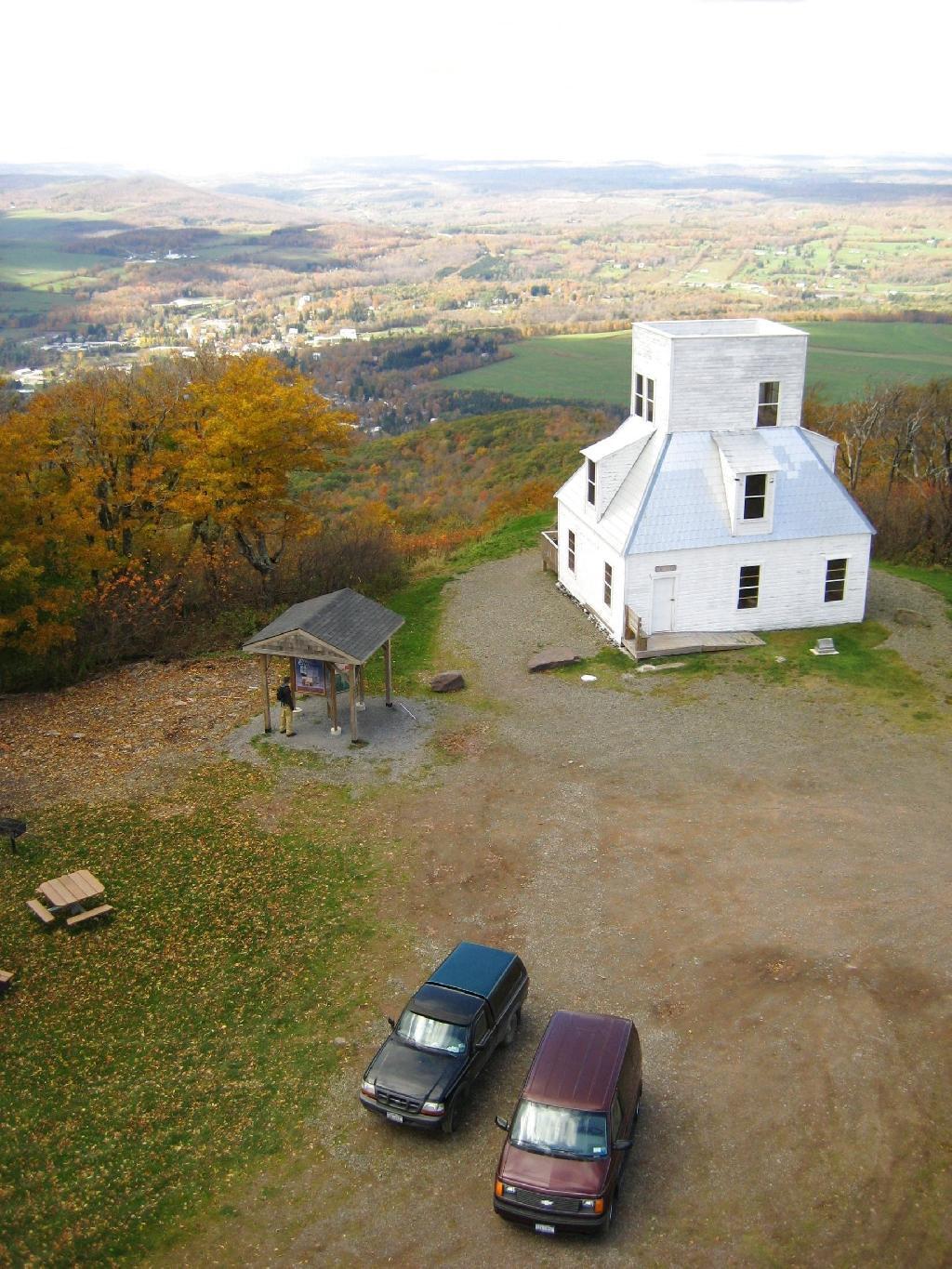
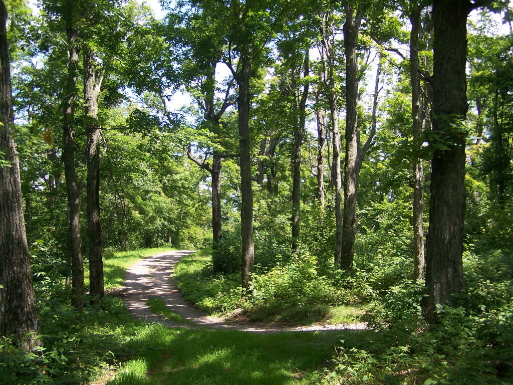
Mount Utsayantha is a village park, high above Stamford, NY. It is accessable either by driving or hiking up a steep one-lane truck trail. I decided to drive up, mainly because I was interested in the view more then the hike up (which would be delightful too).
Here is looking off the firetower at the former gift-shop/observation building that was badly vandalized and is in process of being restored.
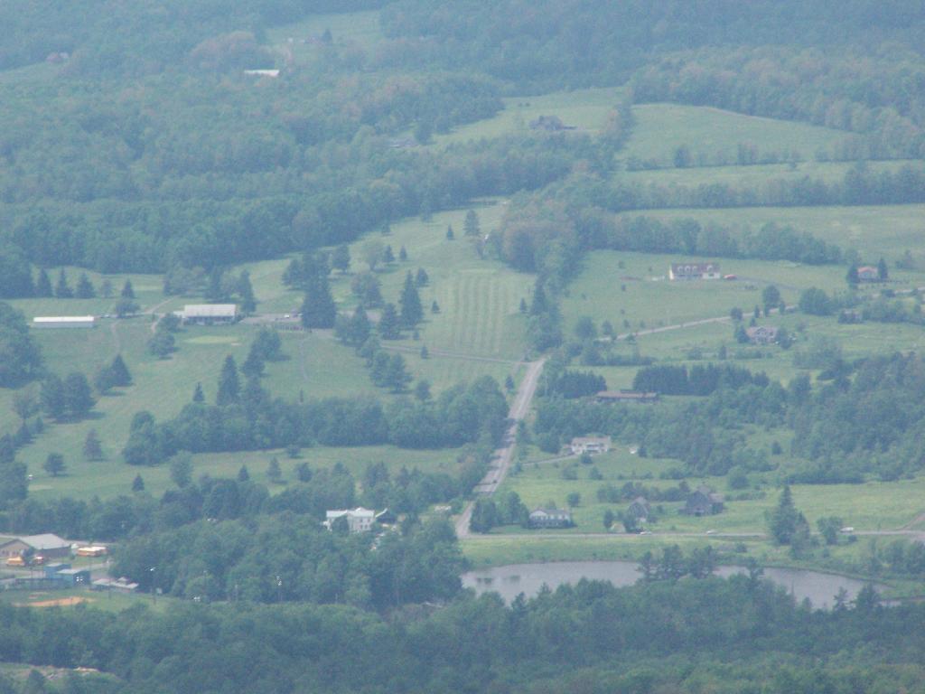
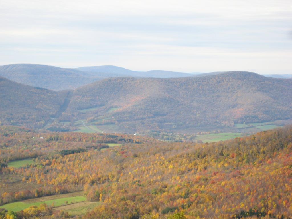
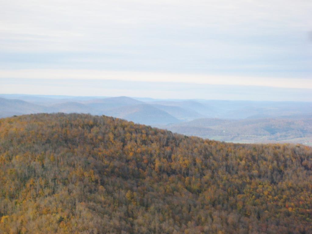
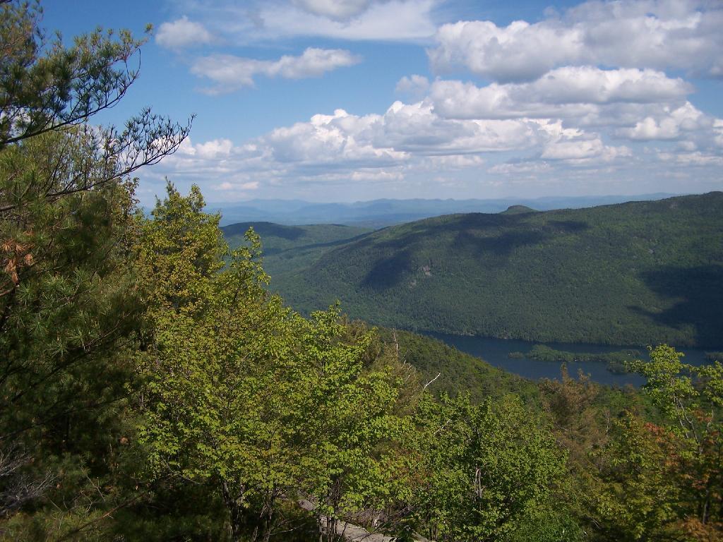
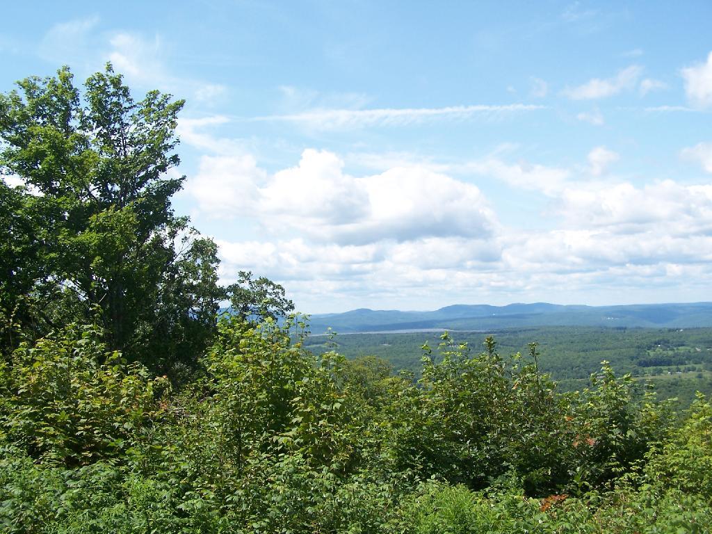
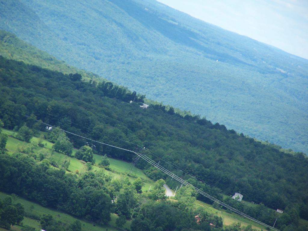
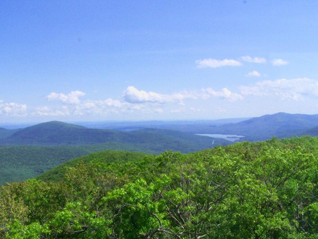
Driving up the truck trail to the park, when you almost reach the top, there is a location where you can pull off, and looking for a wonderful northernly view, with farmlands in the foreground, and Emmenence State Forest in the distance.
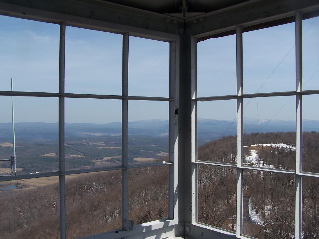
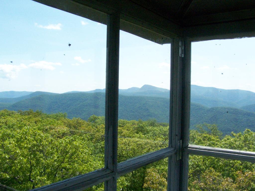
The views from atop of the fire tower are nothing short of amazing. This is from inside the tower, looking out the windows.
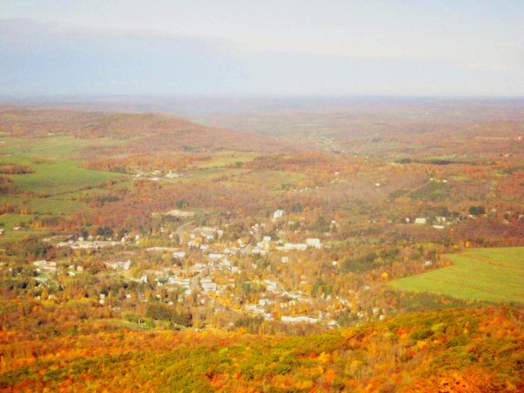
Here is Stamford, NY, looking off the mountain early on October 12th. They say on a clear day, in the distance you can see out towards Oneonta, or at least Hartwick College high up on the hill.
This is one of the amazing views looking out of the windows from the cabin of the fire tower.
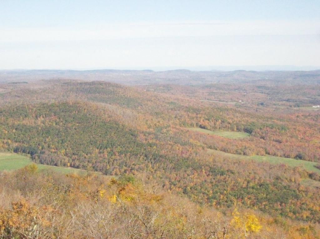
Here is Churchhill Mountain in the foreground, with Lyon Mountain and Cowan Mountains in the background.
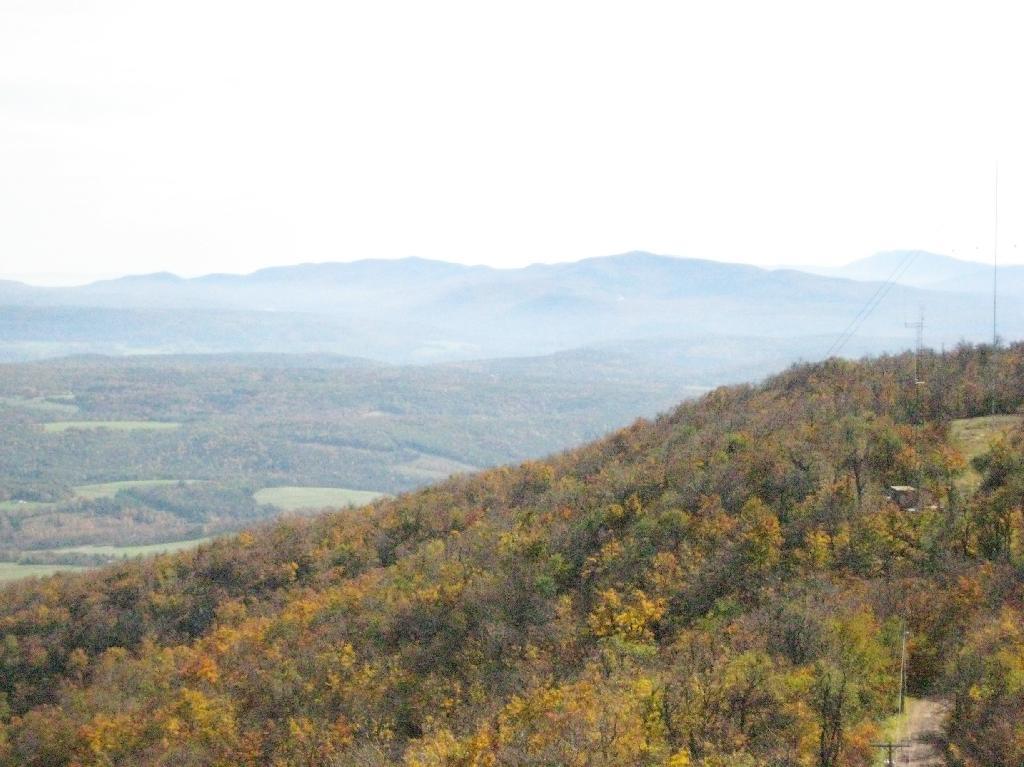
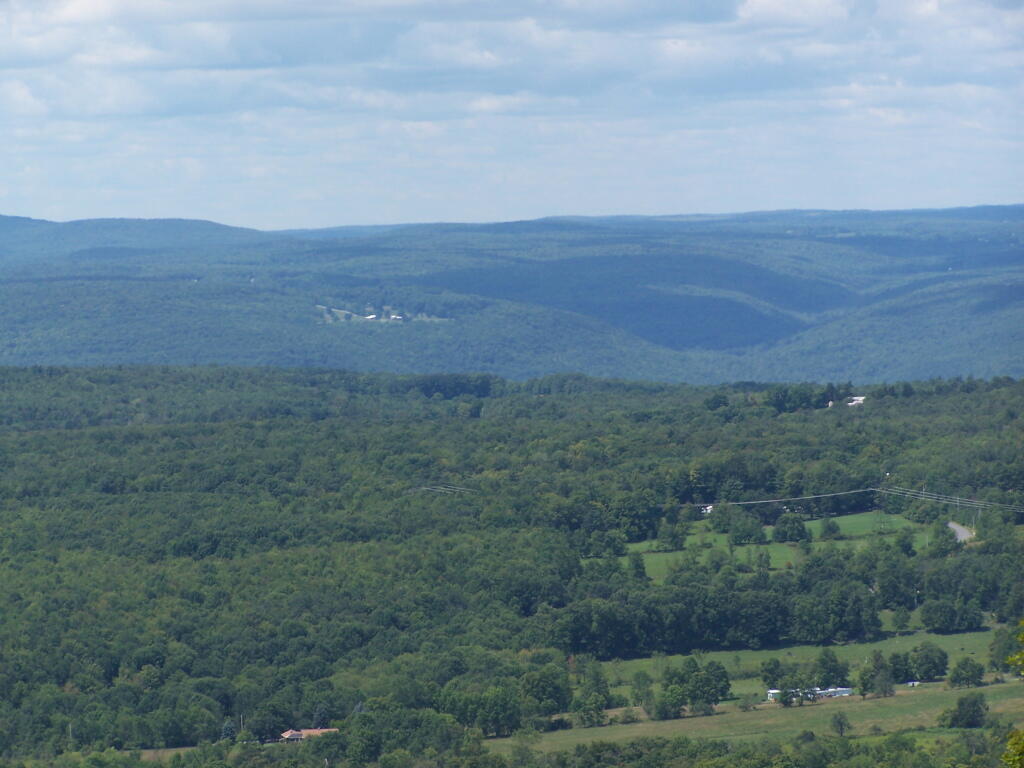
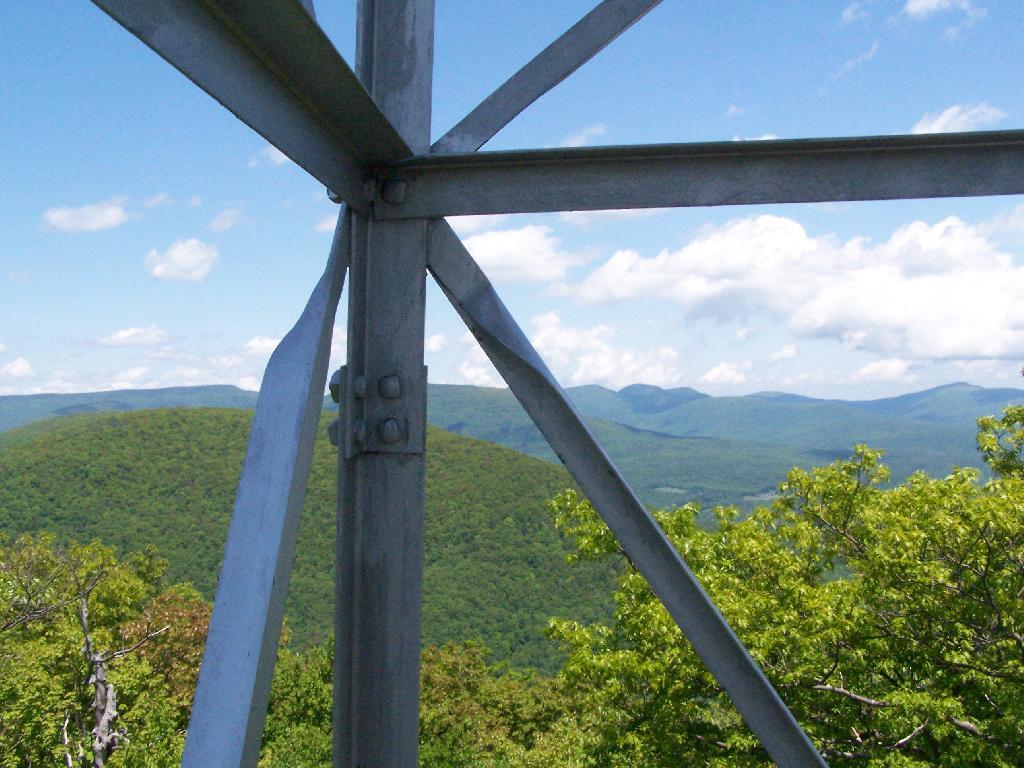
There are several radio towers on Utsayantha Mountain, which sometimes get in the way of pictures, but it’s still amazing what you see from the tower. In the background you see the area around Grand Gorge, and Irish and Pine Mountains inside of the park.
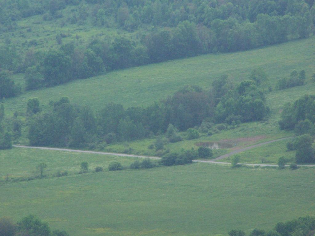
Here is the largely forested area north of Stamford, around places like Summit.
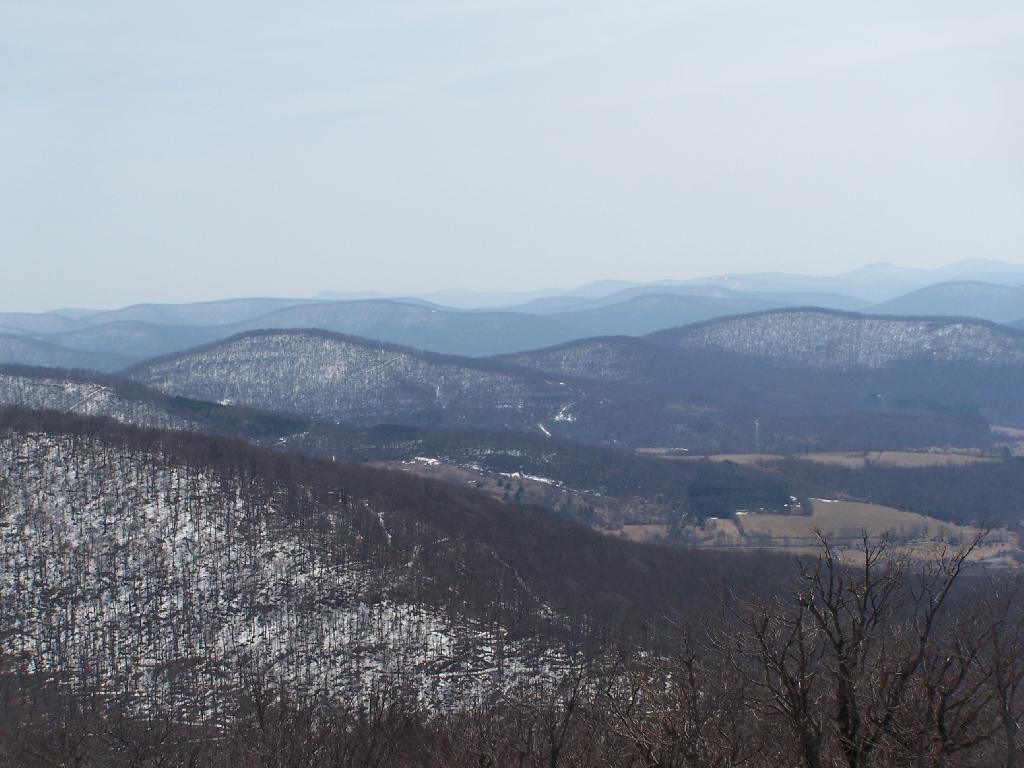
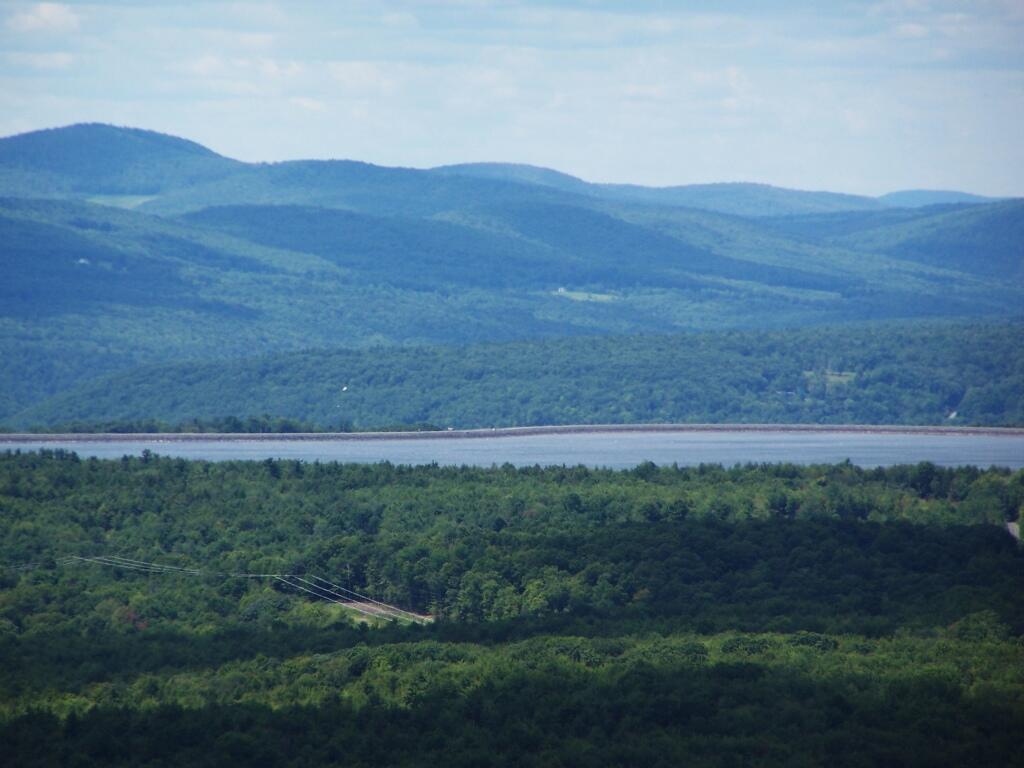
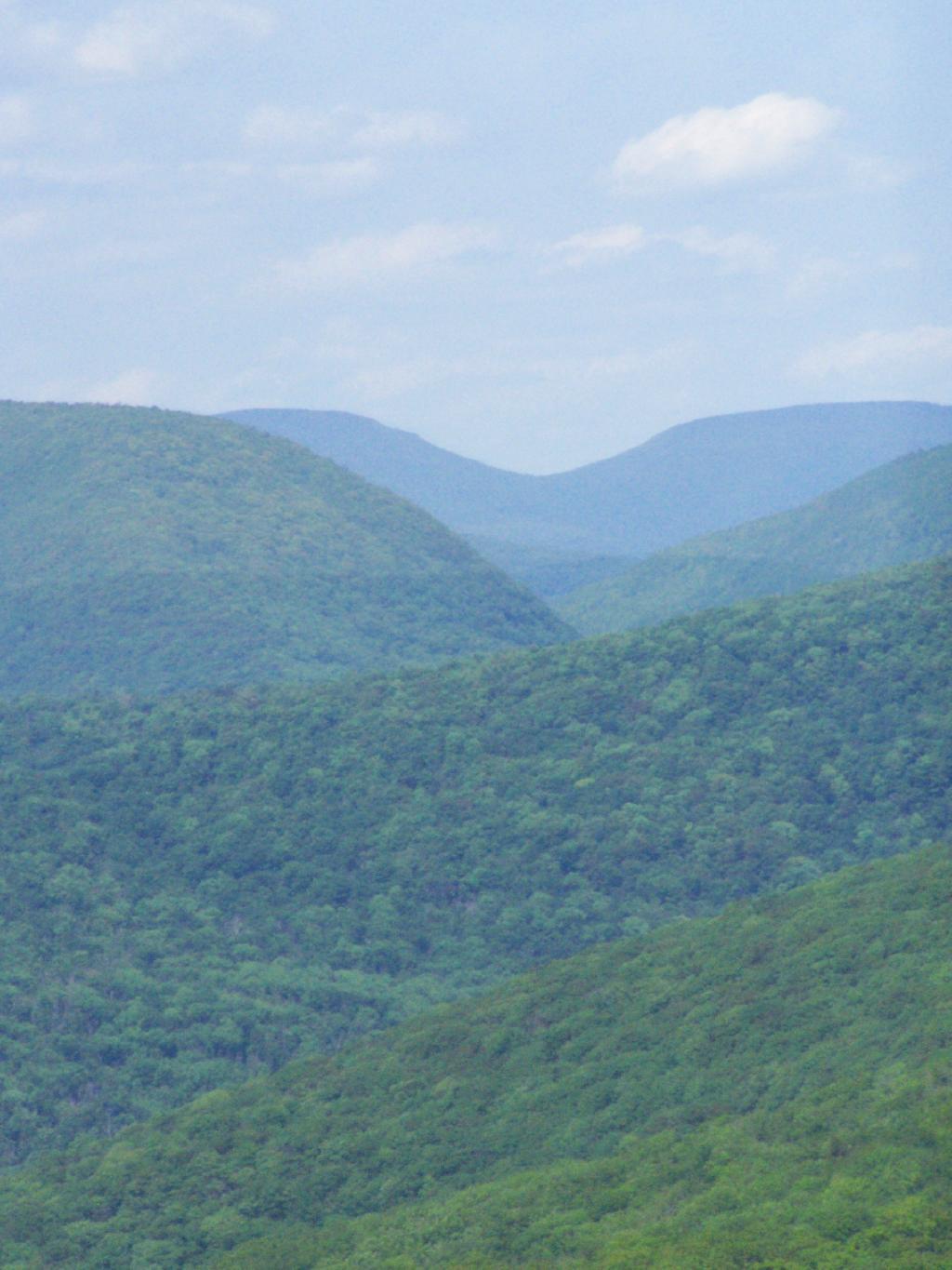
These are the many peaks around Roxbury, looking into the western Catskill Park.
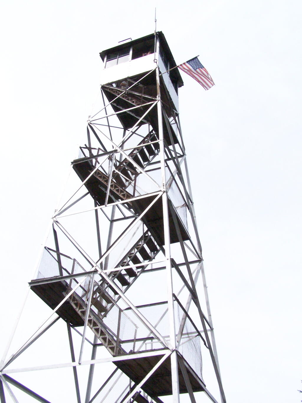
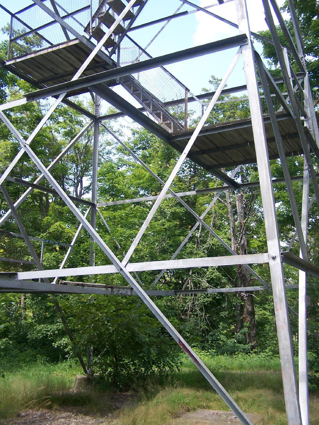
The Mount Utsayantha Fire Tower.
If you ever heading over NY 23, heading back from Oneonta to Albany, or otherwise can take a detour from NY 30 in the area of Grand George, it’s well worth to take a drive up to Stamford, and then up to the fire tower.
The truck trail up to Mount Utsayantha is unmaintained in the winter. Once ice sets in on the trail, you’ll be pretty much limited to going up it with snowshoes or x-country skis (if your careful — it’s steep). It’s probably very cold and windswept in the winter, but the views are probably still amazing.
Here is a map. To get there, take NY 23 East from Stamford to Tower Mountain Road on the outskirts of town, then drive Tower Mountain Road for about 2 miles, until you reach the top of a ridge. You can park from here, and either hike/snowshoe “Utsayantha Mountain” the dirt road a mile to the top or drive up it in nice weather.
Last weekend, after hiking up to Slide Mountain, I decided to drive another 30 minutes west to Balsam Lake Mountain. This was the final fire tower in the five remaining trails in the Catskills.
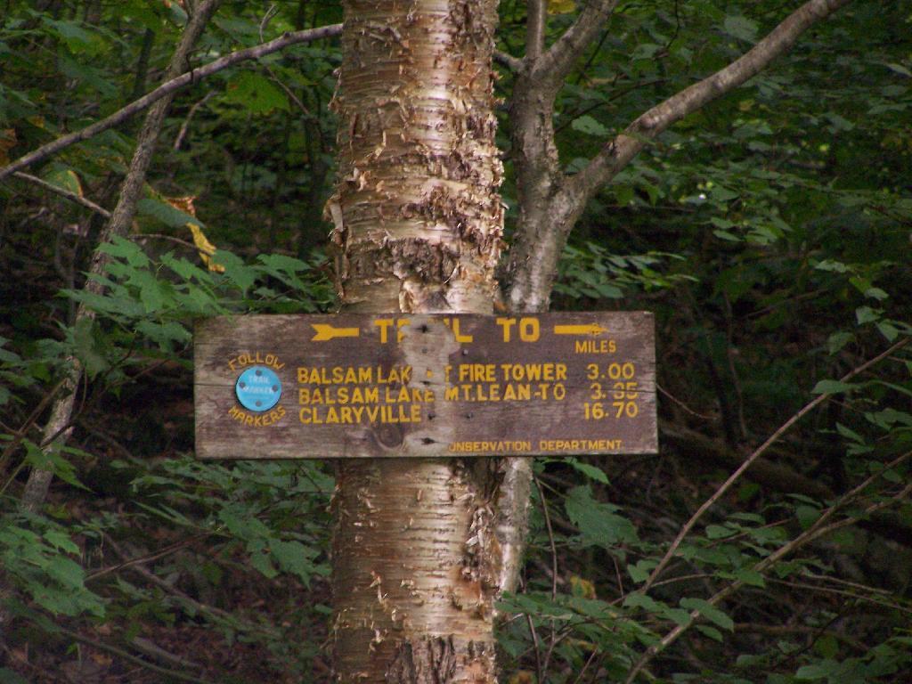
Across from the Dry Brook Parking Area is the blue trail heading south to the Balsam Lake Fire Tower. It is not well marked, but there is one sign that points across the lot, then this well worn sign at the start of the old woods road that leads to the fire tower.
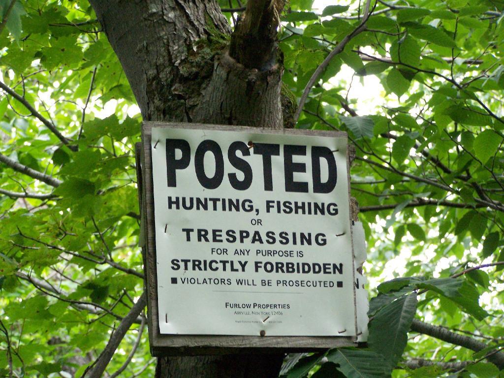
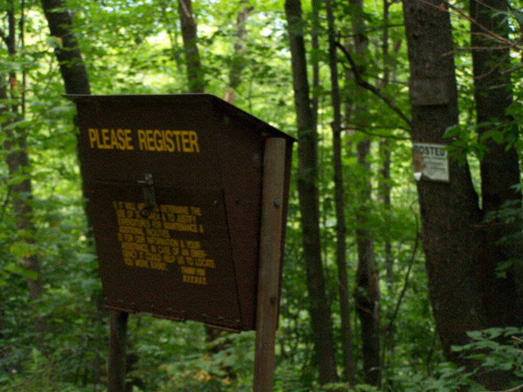
The first 2.25 miles of the trail runs entirely through private lands, and is heavily posted. There is also very few blue markers, so don’t be surpised until you reach the kisok that you feel you are on the wrong trail.
Seeing this was very re-assuring, as I signed my name into the book, and knew I was on the real trail. The kiosk is set about 1/4 mile back from the road. But if you’ve seen the first sign, your okay, as you’ll eventually reach the kiosk.
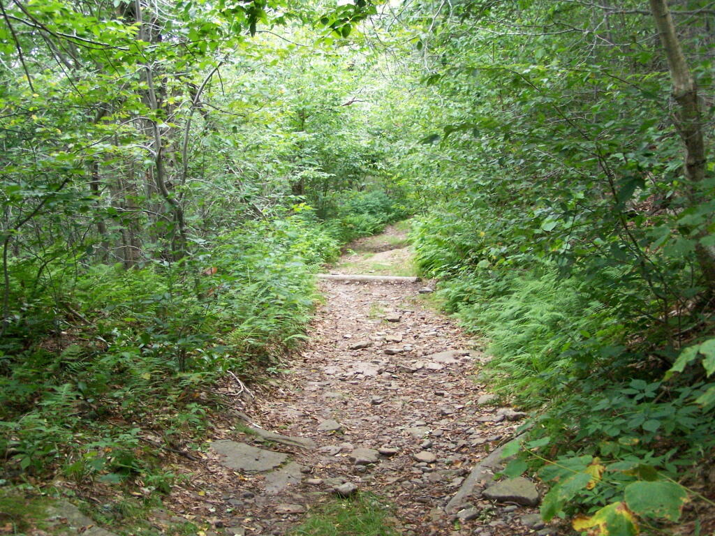
Here is a picture of the old woods road. When the tower was open, the Ranger could drive all the way up there. Today, you can technically drive in until you get to the start of the state land, although it would be rough without a pickup. This trail is not particularly steep.
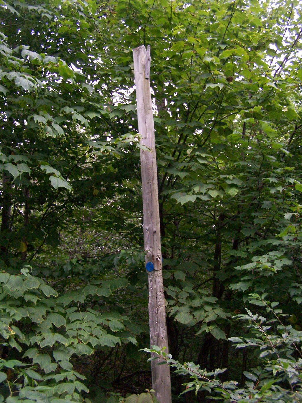
Along the trail is several old telephone polls, used to carry telegraph and/or telphone lines up to the way up it.
At 2.25 miles you reach the intersection of the blue and red trails, the red one that takes you to the tower. It might be only 3/4 miles to the tower, but you still have to go an additional 600 feet in elevation, on a trail with several moderately steep uphill.
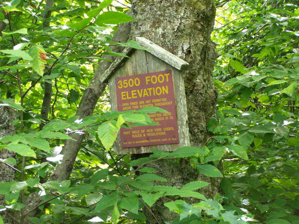
At 2.5 miles you reach the Balsam Lake State Forest, and about a minute later, you reach the 3,500 elevation mark.
You climb and you climb, and the trail opens up. You think your at the top when you here, but your not. Think about hiking for another 15 minutes.
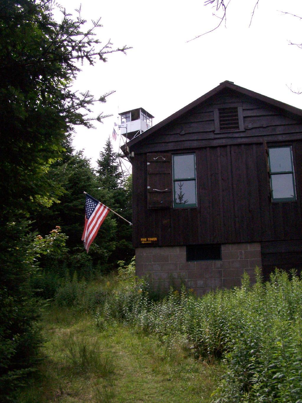
Finally, you see the Ranger’s station and the tower. This makes you happy, especially if you climbed Slide Mountain before this.
The fire tower is staffed on summer weekends, and the cab is open for inspection. At the Ranger’s cabin, there is historic posters from back in the day when the tower was staffed.
Here’s the tower against the very grey sky.
There are some views from the tower, but not super interesting or exciting. Maybe if it was clearer, with deep blue skies it would be a lot purtier.
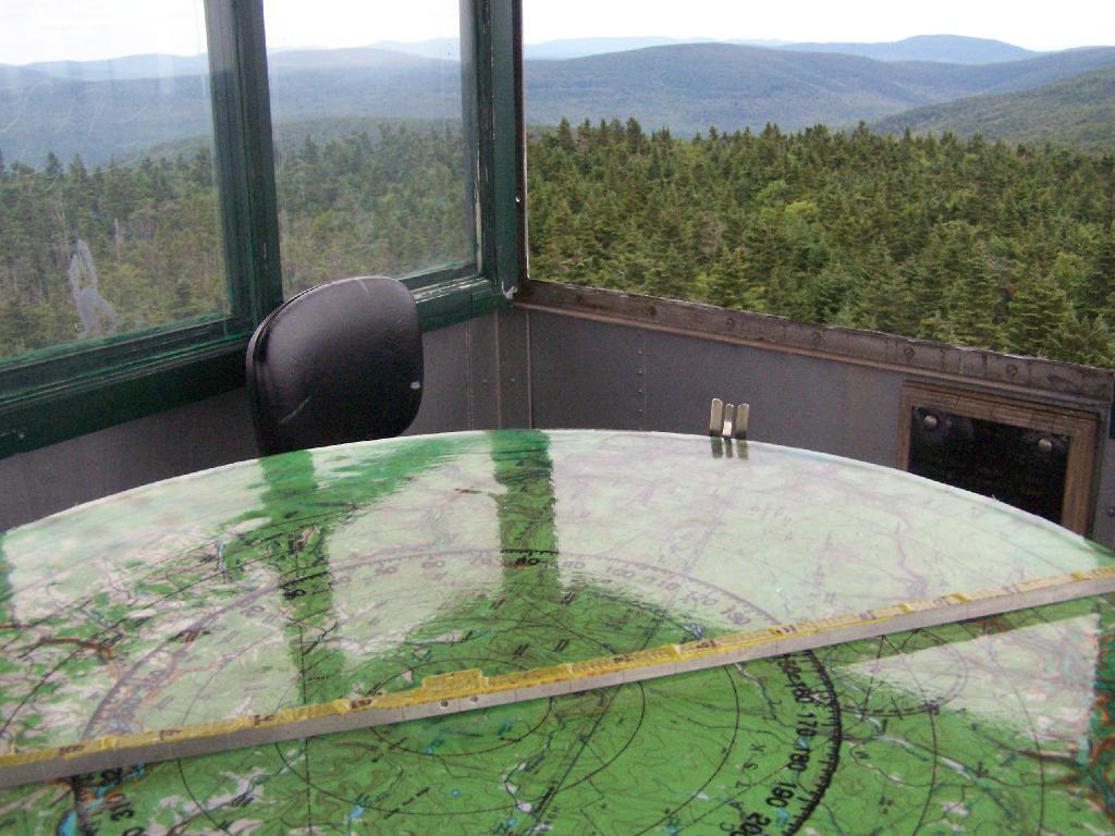
Here is the inside of the cab of the tower. There is a fixed map to help the ranger in the past observe where a forest fire was, and then call down to the firefighters.
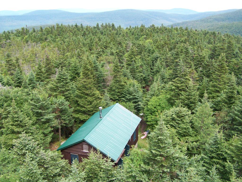
Here’s the Ranger’s Cabin from up top in the tower.
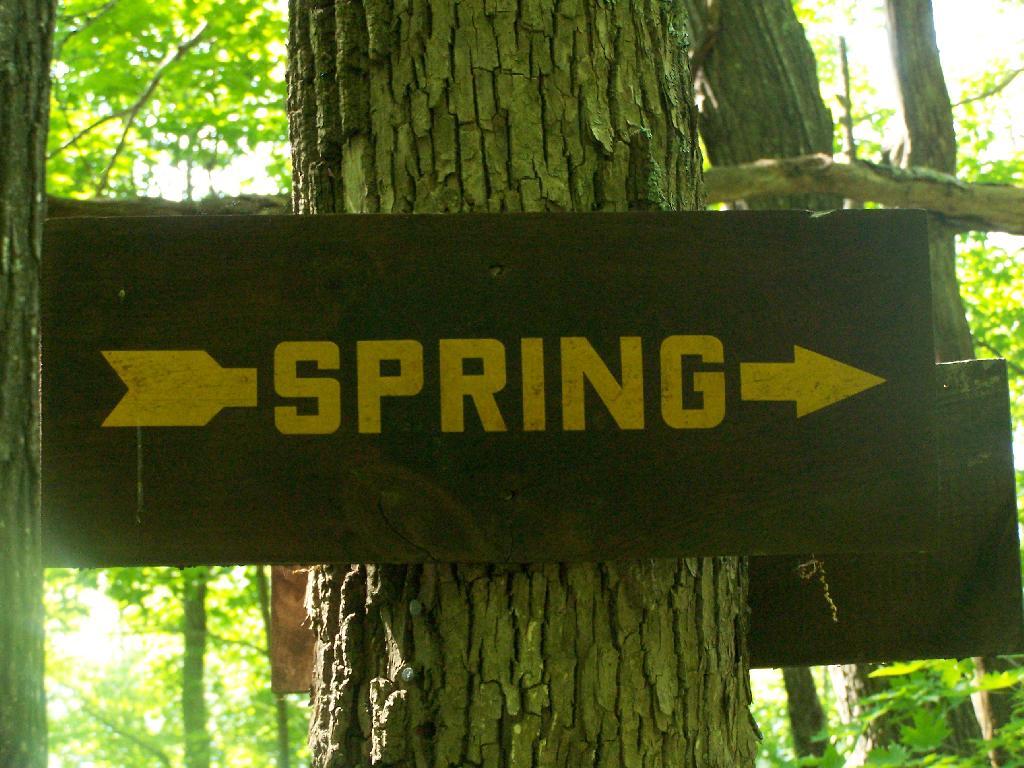
About 200 feet lower, and a 1/4 mile to the south, there is a spring. Also nearby is a lean-to, that is popular on the weekends.
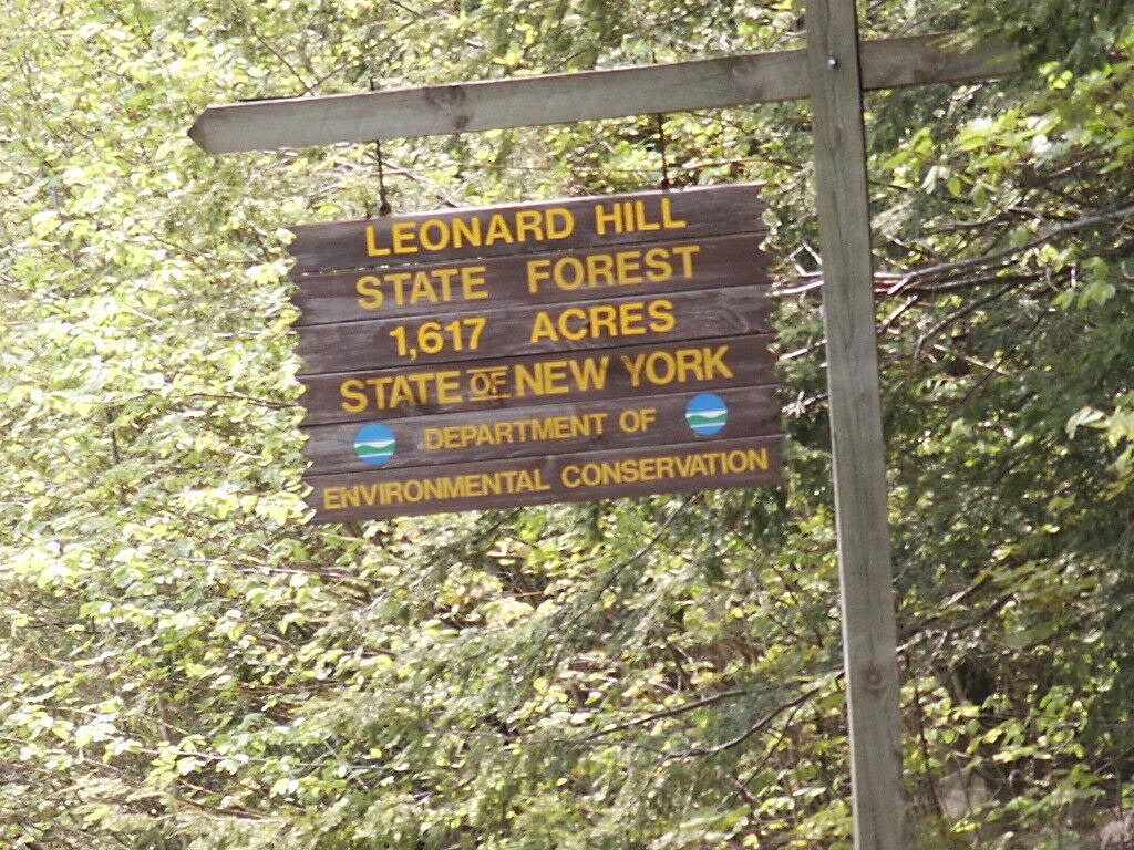
There is a currently closed, but slated for reconstruction, fire tower a top Leonard Hill in Schoharie County. You can drive up there with a car or truck as the road is well maintained.
You get there by driving out Broome Center/Potter Hollow Mountain Road, then taking a left up Leonard Mountain Road, which is located right in the middle of Broome Center. You take Leonard Mountain Road about a mile until you see an truck trail marked solely by a “Leonard Hill State Forest”, and take a right on it.
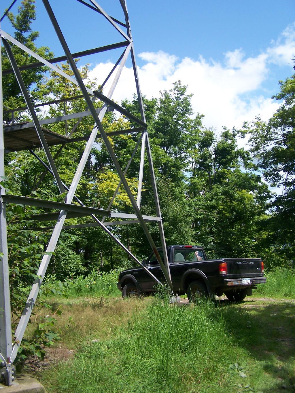
After about a mile on this truck trail, you are on a ridge between Hubbard Hill and Leonard Hill, and can see Leonard Hill Fire Tower ahead. Continue on that truck trail by another mile, and you’ll arrive up to the tower, and you can drive right up to it’s base.
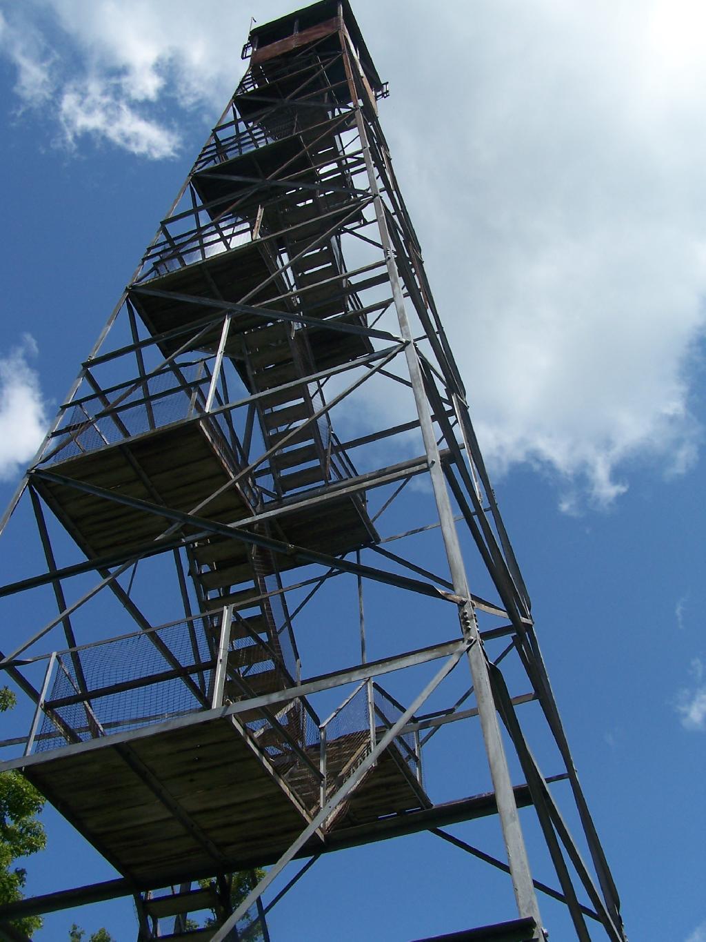
The tower looks a bit rusted in a places, but structurally good. It is awaiting a reconstruction project that the last time I had heard was delayed by concerns over the high cost of gasoline last summer.
To discourage people from climbing a potentially unsafe tower, they have removed the first two flights of stairs.
Just across from the tower is a beautiful campsite, with some fantastic views of the Catskills and the Schoharie Valley. I spent the following night down there, camping out. It was cloudy that night, however if the weather was beautiful, there could be a great sunset to watch from here.
Here is the Schoharie Valley.
Blenhium Mountain and the NYPA Blenhium Power Reservior can be seen well from the campsite. The reservior is partially lit up at night from generating equipment and safety lights by NYPA.
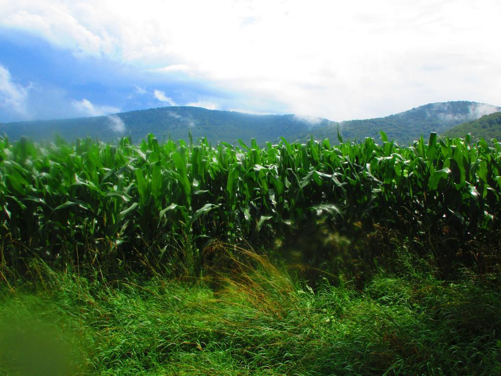
Here is the valley below, and the mountains beyond it, the Emminence State Forest.
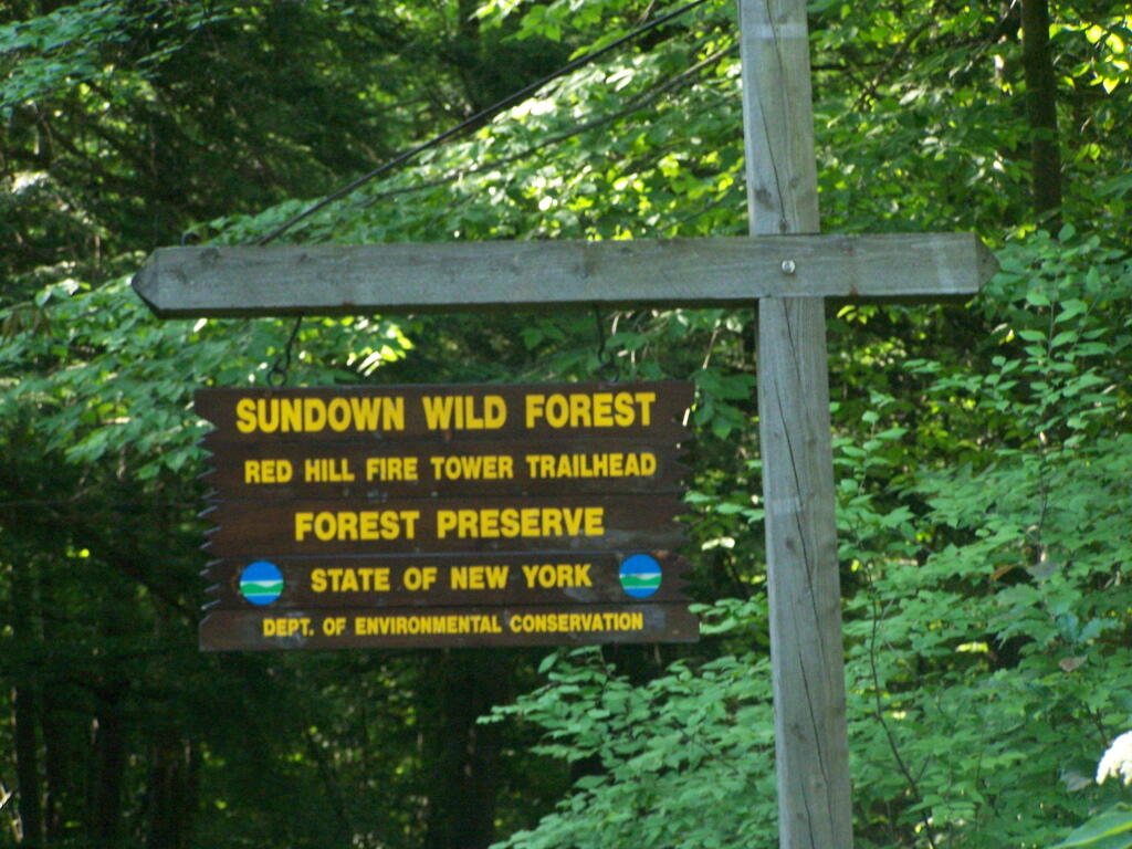
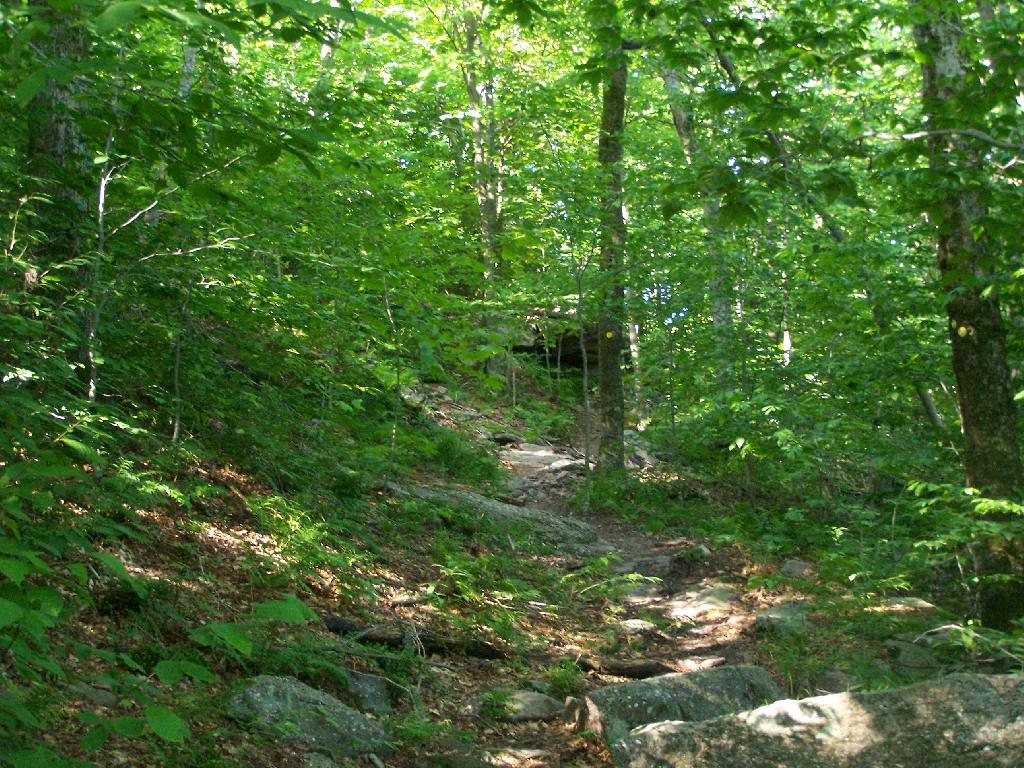
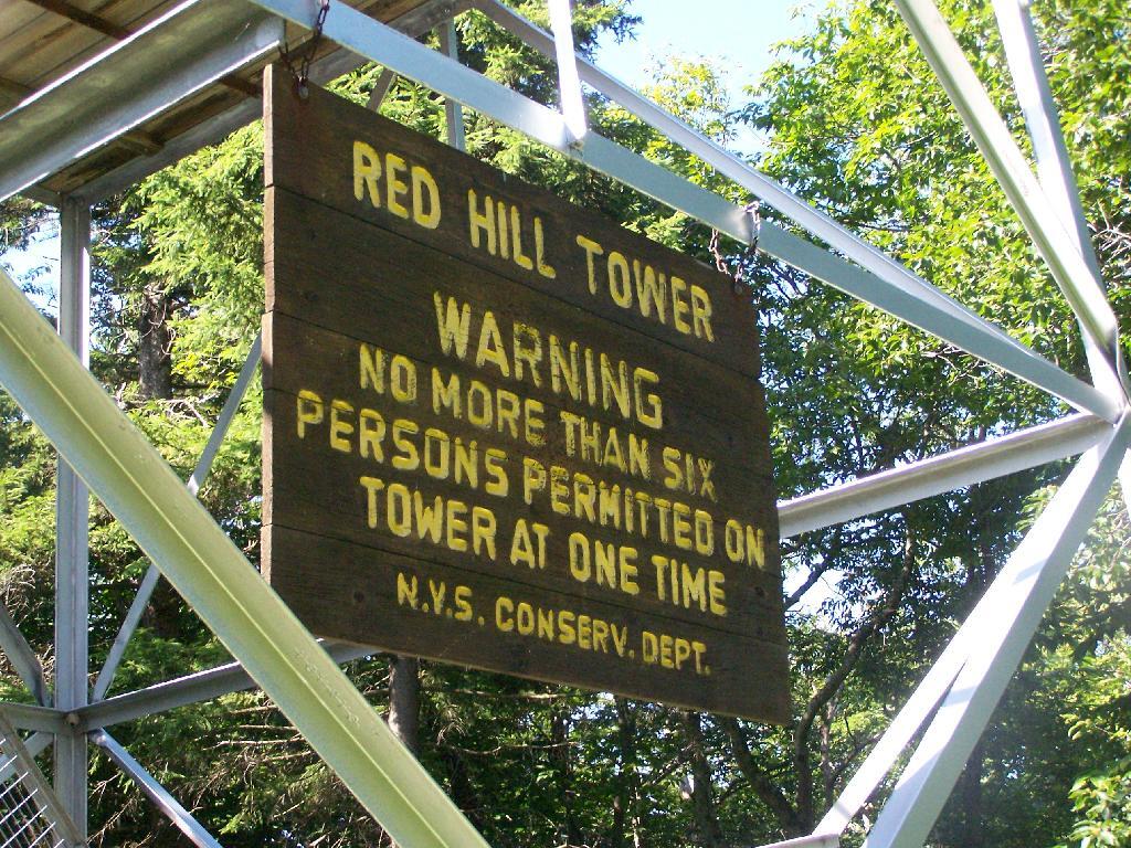
The Red Hill Firetower is on a relatively small in-holding of land by the state of New York that’s part of the larger Sundown Wild Forest. This was the forth Catskill firetower I have visited in recent weeks. I hiked on a beautiful Monday, which I had decided to take a vacation day on.
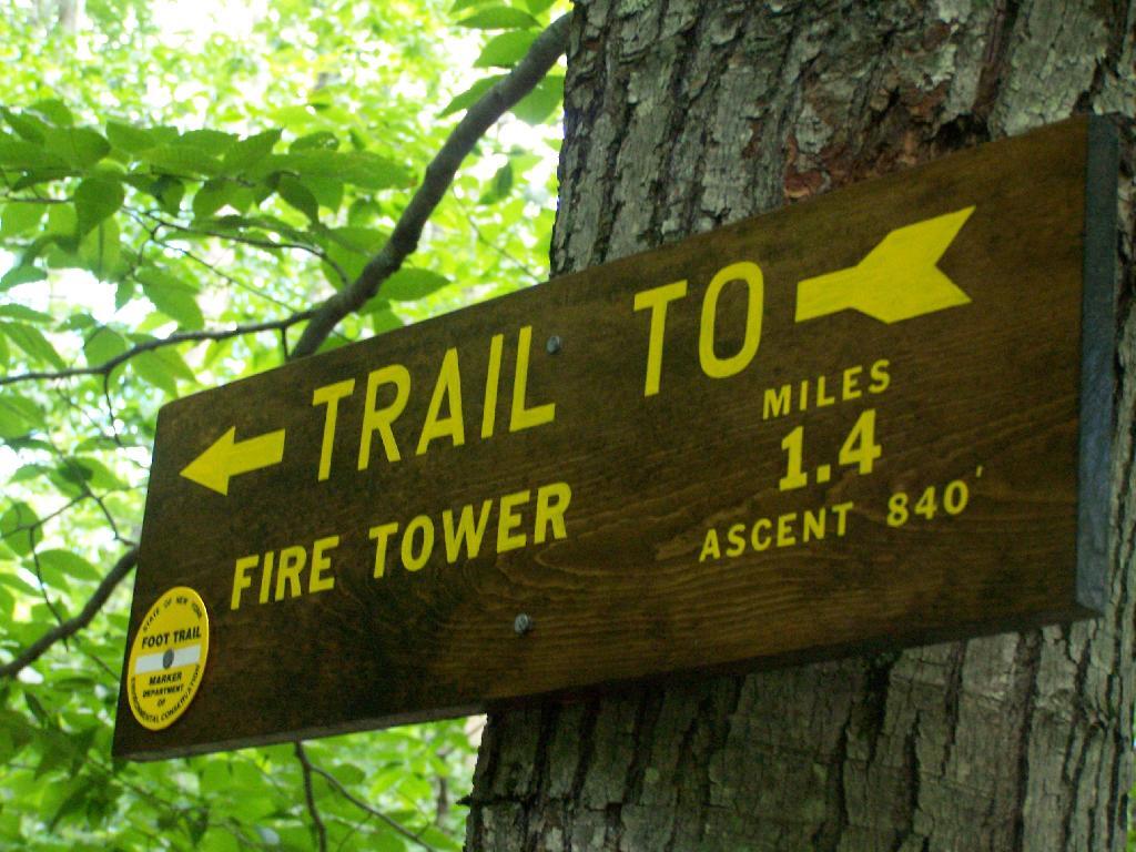
Red Hill is the easiest firetower to hike up to in the Catskills, even if it’s one of the most difficult to drive from the Albany-area. It is located outside of Grahamsville, about 10 miles North-West of Rondout Reservoir. There is only local dirt roads and windy county roads that run from NY Route 55, which itself is certainly not an expressway.
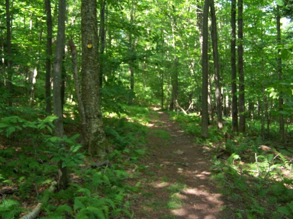
This is typical, relatively flat trail which you walk on for the first 9/10 of a mile.
The last 1/2th of a mile is relatively steep compared to the first part, maybe gaining 400 feet in elevation, and you’ll have to stop and breath a few times as you go up towards there.
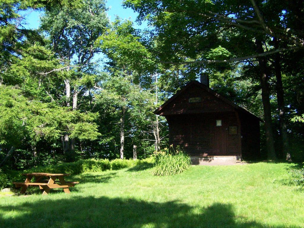
When you reach the top, there is an Ranger Station (open weekends) and several picnic tables. There are big signs saying fires are prohibited due to the fire danger, when the grass is dry. That should be a no brainier, but in the summer and winter, it seems a bit absurd. Must be a bad experience from years ago. There is no outhouse, you’ll have to walk off into the woods to find a place to squat and do your business.
This is the tower, directly across from the Ranger Station. It is staffed on the weekends.
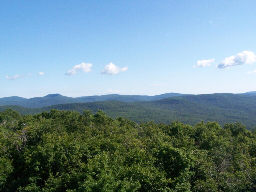
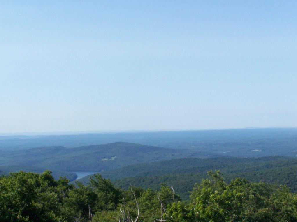
The views aren’t anything to write home about, unless you want to see mountains that are less then remarkable in the distance. This is to the north.
Red Hill is the southern edge of the Catskills, and as you can see looking to the south, the landscape is quite flat.
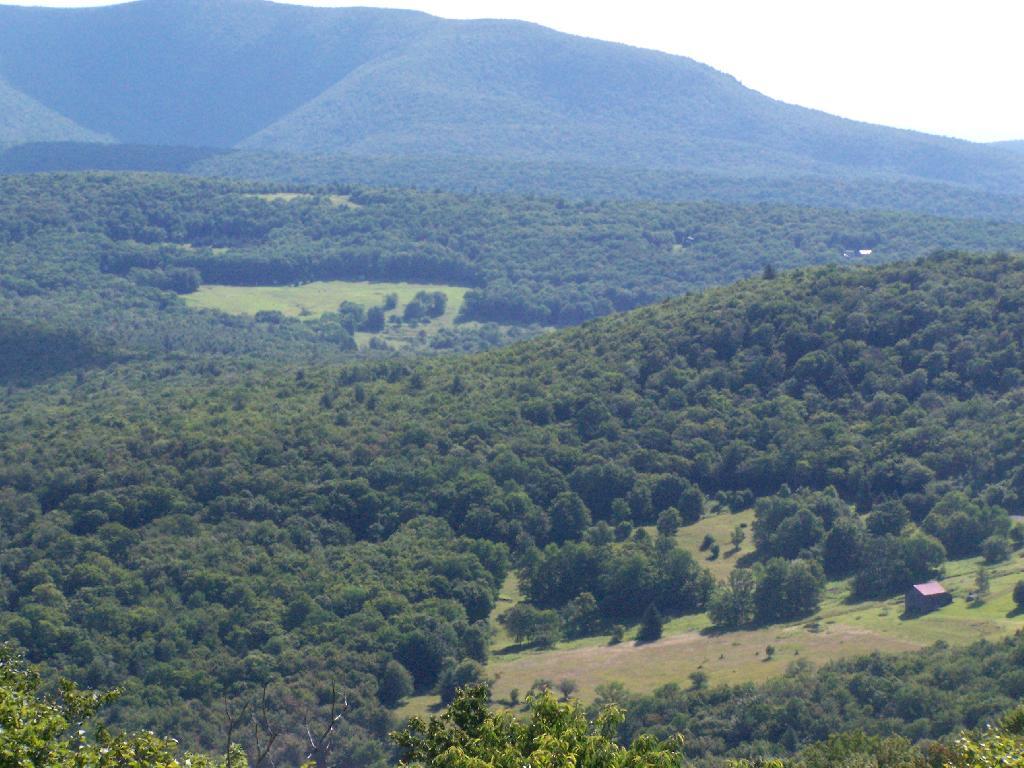
Most of the area around the tower is heavily wooded and owned by either the State or New York City DEP Water. There are a few farms around, especially looking west.
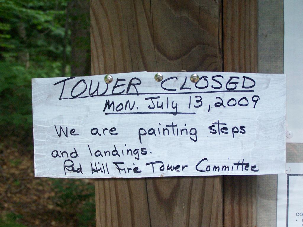
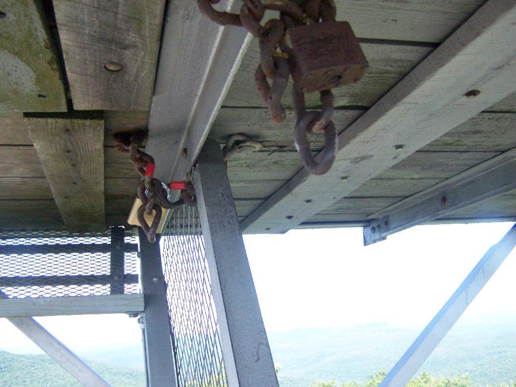
On the weekends, you can go into the tower’s cabin. Weekdays it is closed, supposedly because of vandalism. It’s bullshit if you ask me, because who drives 125 miles into the sticks and hikes 1.4 miles to vandalize an old tower? Mount Tremper is open.
Despite the lousy views (it’s a relative term), the fire tower must be popular, or so the many signs that warn people the tower can only support six people.
When I was leaving the fire tower I happened to hear an SUV coming up with the former Ranger (now a private individual). They where planning to paint the tower steps on Monday. He offered to unlock the tower, but I was inpatient, and he wouldn’t let me do it with the keys myself. I don’t know if I or him was being more of a dick.
After I left, he closed off the tower, because he was painting the steps.
This gives you an idea of what you see from the tower. Most notably, Doubletop Mountain and Rondout Reservoir. Nothing really super impressive though, just mountains and very little civilization in this rural part of Sullivan County.
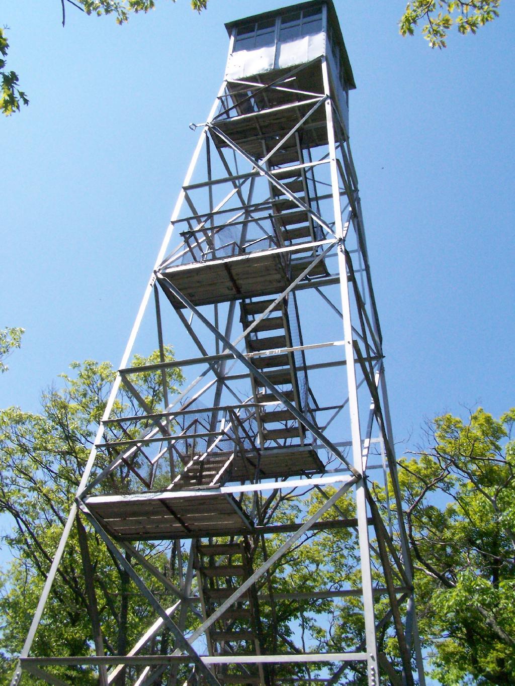
Last Saturday I went hiking up Mount Tremper in the Catskills. This is one of five remaining fire towers in the Catskills, and I was excited to do my fifth tower in the Catskills.
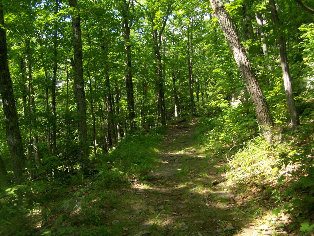
It was a nice day out, warm, but not to warm. It also was quite clear which I discovered when I reached the top of the mountain. The trail is 2.5 miles to the top, but it’s elevation increases are moderate, following an old woods road to the tower the entire way. Parts of the old woods road are eroded away, but it’s still an easy hike, as long as your patient.
As I often go hiking along, one technique I use on such a trail like this is to bring my Mp3 player and listen to podcasts as I hike on up. I knew it would be about a two hour hike up, so I put two hour long programs on the player, and the time passed quickly.
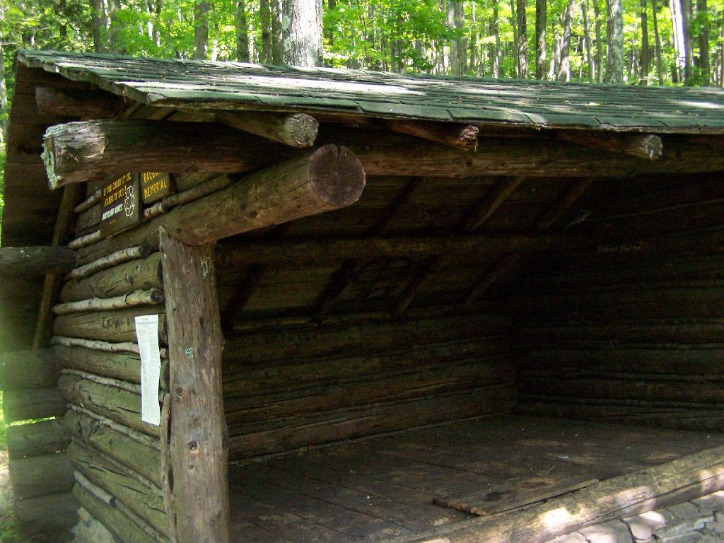
About 2/3rds the way up the mountain there is a lean to, the Baldwin Shelter once can stay in. There also is another lean-to adopt the mountain.
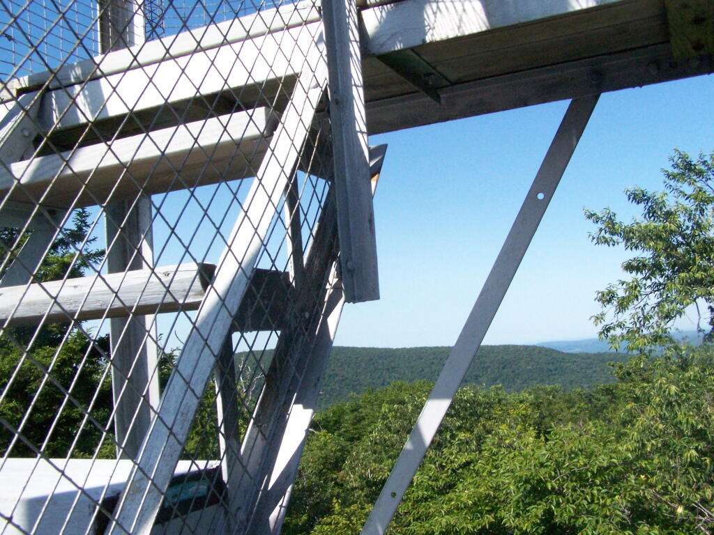
Once you reach the top, there are no views except a few between the trees. The only views you can see from this mountain are from the fire tower, which are quite spectaular, however you must go all the way up into the tower’s cabin before your above the tree level.
The views from the tower are amazing. This is out toward Hurley and the Ashoken Reservior.
Here’s Devils Clove. Some reflections are noticeable from trying to shoot through the windows of the Fire Tower cabin.
Slide Mountain through the windows of the tower. It was hot up there, and the bugs and glass made it hard to get pictures. I tried to open a window in the tower, but the latch wouldn’t budge.
Descending the tower.
I walked a ways onto the blue trail beyond the tower, searching for other views, however there are no views except on the tower on Mount Tremeper. A nice hike for sure, but I would have preferred some views where I could sit down, have my lunch, and enjoy the edge of the mountain.