Search Results for: photo limbs 2

Gorging on Gorges, An Adventure, Day 1

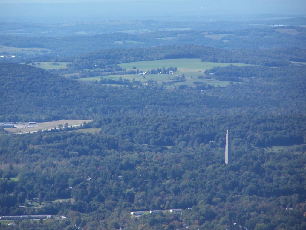
About a month ago, I took a trip I gave the name β€œGorging on Gorges”. As the name would suggest, most of the trip involved visiting various gorges, taking photographs of them, and otherwise exploring them. About half of them I had previously been to, while the rest were new. I also visited several other state parks, state forests, and national forests – and did something I haven’t done in a long time – camped one night in a developed campground.

Towards the Park

I started out my trip from Albany, taking US Route 20 West from I-88. I really wanted to avoid expressways for the bulk of my trip, is my general view is that expressways are the best way to get across America without really seeing anything. It’s more then a philosophical argument for me – what’s the purpose of a vacation if your rushing from point β€œA” to point β€œB”.

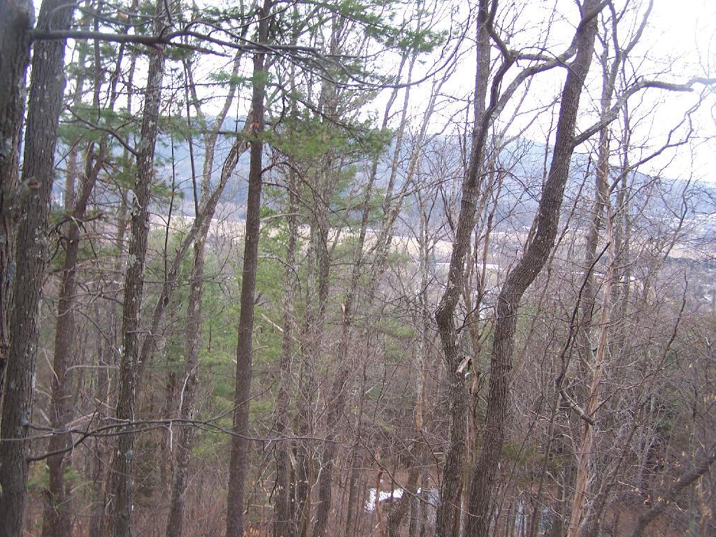
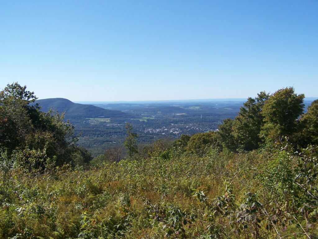
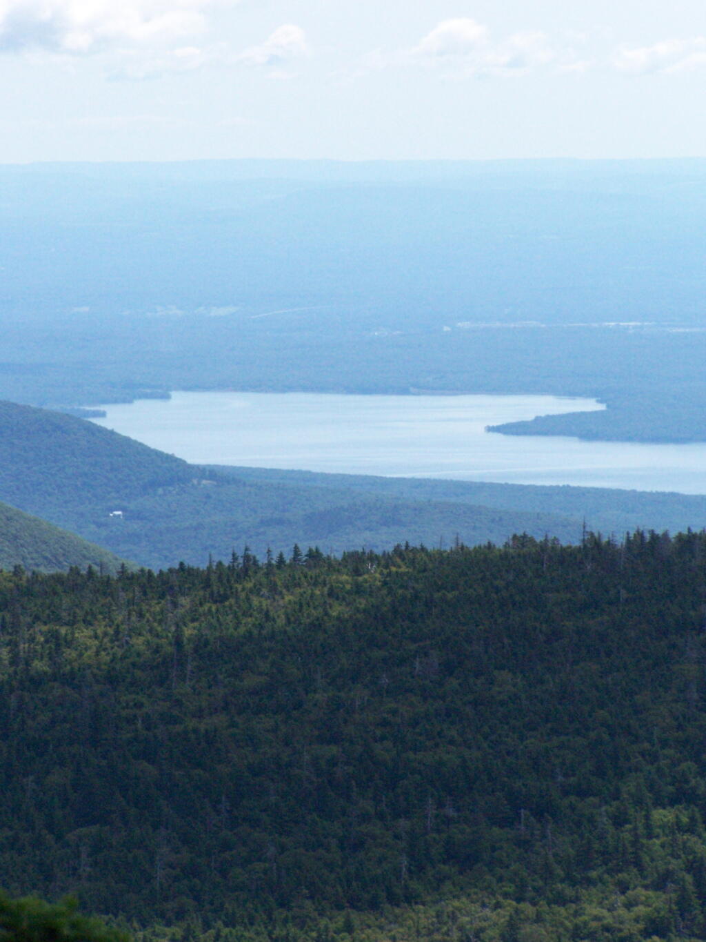
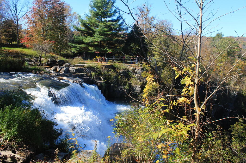
The first part of the trip, I drove to Chittenango Falls State Park via Nelson and beautiful farm country so high above. I walked down into the gorge, and up and around the falls. The color was somewhat muted, but it still was quite pretty. Then I headed off, taking some side roads as recommended by my GPS’s most direct route, and ended up passing a few miles from Labrador Hollow and the beautiful Labrador Pond, and said, heck, I got to stop on by there.

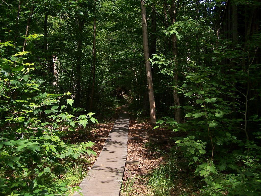
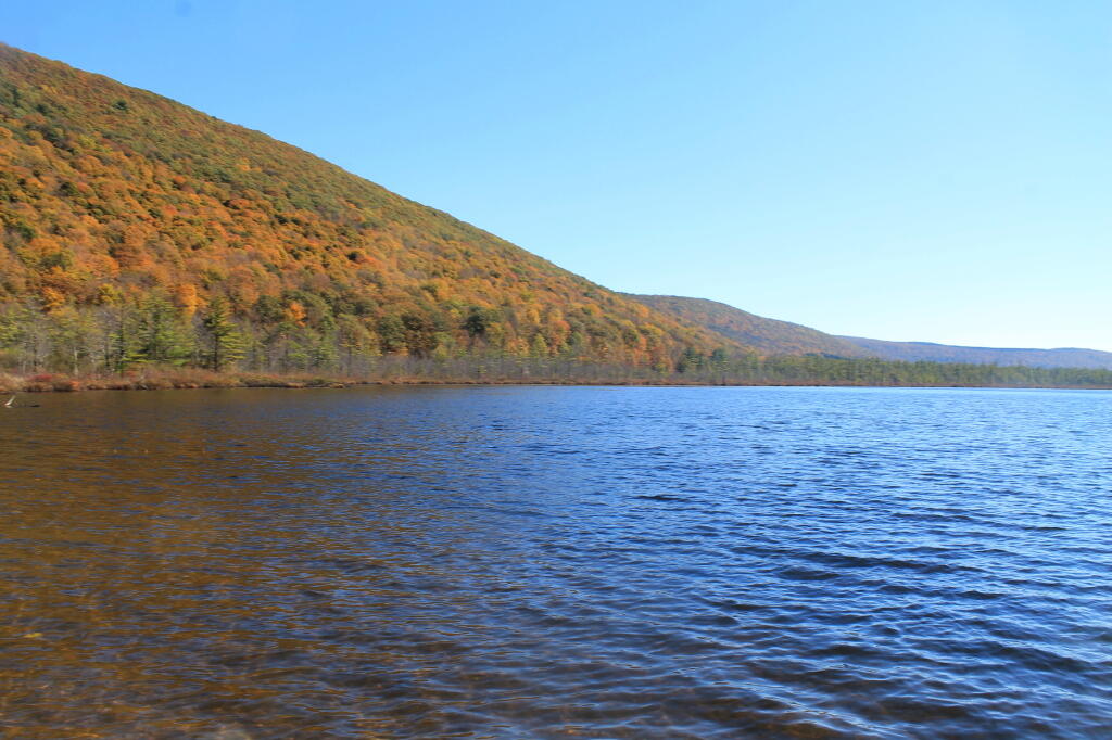
I drove down to Labrador Pond parking area, and hiked down to the pond. The colors were still not fully-turned on Jones Hill, but on Labrador Mountain were well past peak. Despite the crowds of fall foliage peepers from Syracuse, crowding the area, there were adequate opportunities for solitude. I walked down to the lake, snapped a few photos, then hiked the nature trail/boardwalk. It was nice. It also was great to see the boardwalk being used by a disabled man – he could get out and enjoy nature, despite his difficulties he had walking. One of the large dairies in the area was spreading something on fields nearby, and it sure stunk – it seemed nastier then fermented grain, although that’s probably what it was. Didn’t stick around too long, as I had places to go.

Somewhat Faded Colors

Drove down through Prebles, another deep, rich agricultural valley, dotted by large dairies that take advantage of the area’s rich soils for producing many bushels of corn on each acre. Got held up for about 5 minutes during a paving job, where they had the road restricted to one lane, for what had to been a half mile or so. Noticed how most of remaining trash burning barrels had disappeared from the landscape, that might have only been there 3 or 4 years ago.

Then it was off to Homer, where I passed a moose, made out of welded scrap metal along the road. It was kind of a neat roadside attraction, and I really should have stopped and got a picture, but I had a tight schedule and was burning daylight. I would come to later regret not getting that picture, but heck, I figure I can probably find a picture of it on the Internet using Google Images or Flickr. If not, it will certainly be there, the next time I find myself going through this roadside wilderness.

Millard Fillmore Historic Marker

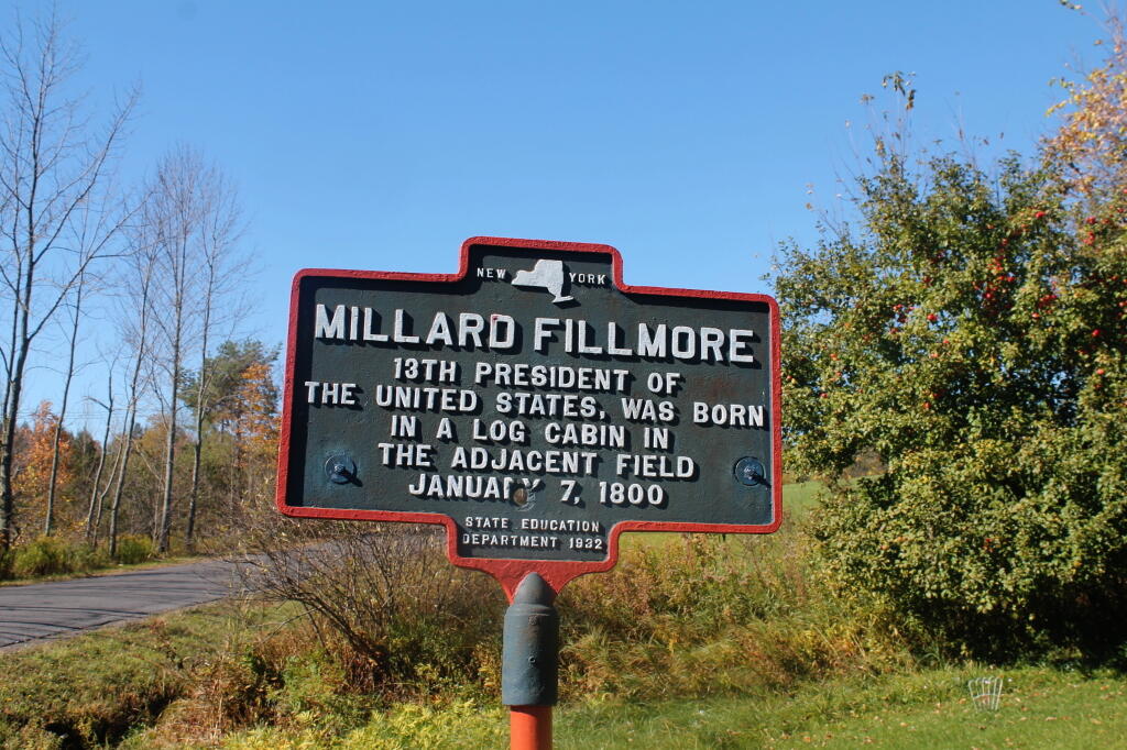
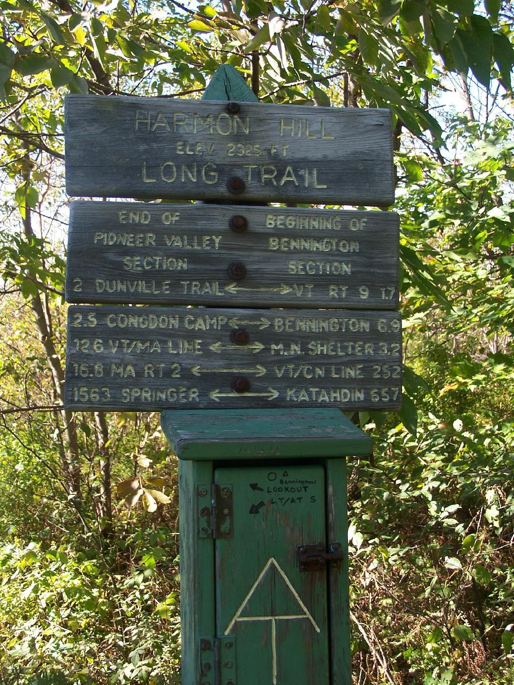
I got lost on my way to Moravia. Not really lost, because I was following the GPS, but because I had programmed the β€œmost direct route” rather then β€œfastest route”, the GPS.decided to take me up a rough dirt road through Hewitt State Forest. I declined, and eventually the GPS found a new route, that happened to take me past Milton Fillmore’s birthplace. There is now a picnic pavilion and a some landscaping in that location. I turned around, snapped a few pictures, and explored it briefly. I wanted to a get a picture for dad for his historical markers collection.

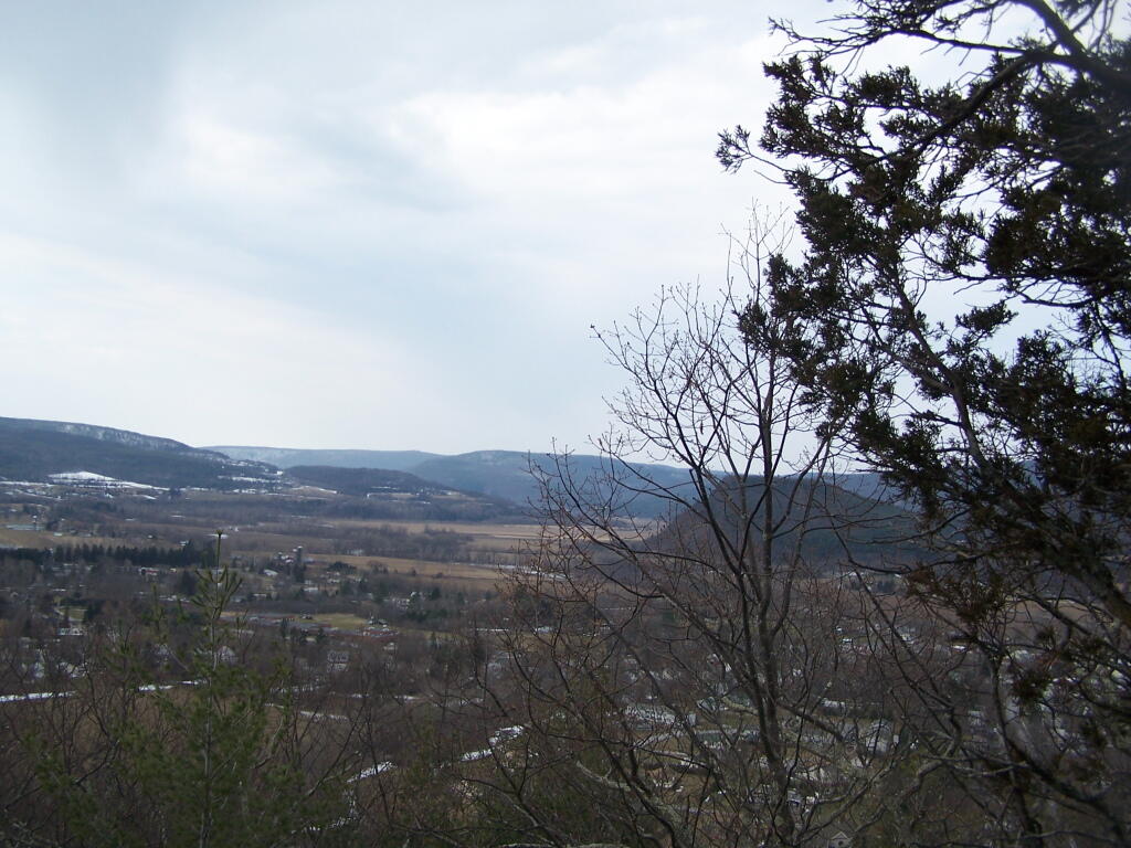
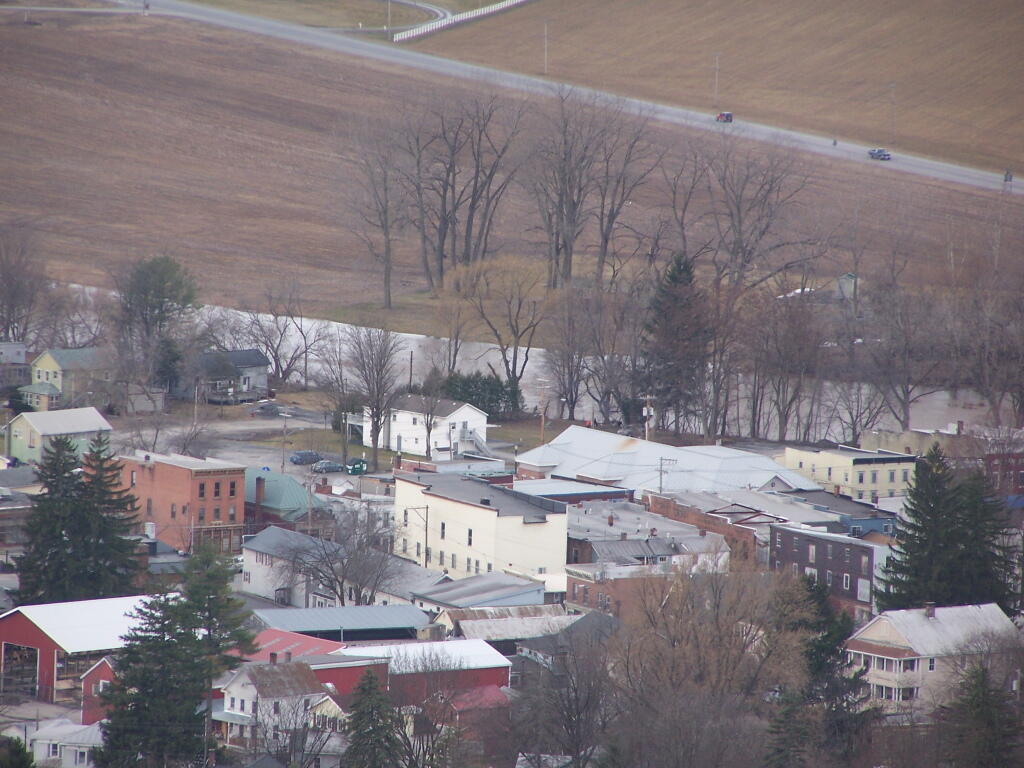
Then it was off to Fillmore Glen. I was running a bit late at this point, but it’s a pleasant drive down to Filmore. The landscape is pretty rural until you drop, rather quickly into Moravia. Moravia is a pretty, small rural town; the glen is located at far southernly end of the town. There was a bridge being replaced in town, and you had to wait, for what seemed like an eternity for the light to green on the on-one lane bridge.

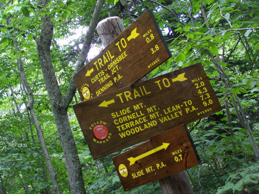
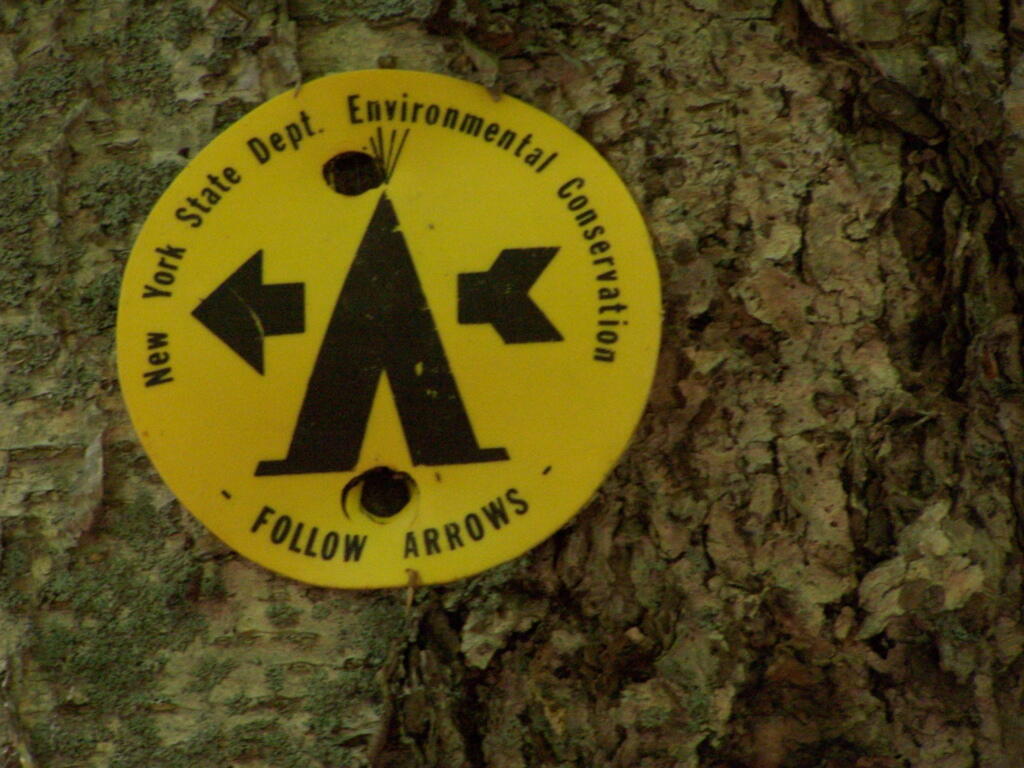
Finally, I got to the park entrance. The older guy there, grumbled when I said I had an Empire Pass. He was like β€œwhere is it – I can’t see it”. The rear window on my truck where the Empire Pass is tinted, but not that dark. I was slightly annoyed that the park entrance guy wasn’t friendly, and I forgot to ask for a map. I was kind of rushing. Got parked, and there was a big wedding going on, complete with horse drawn carriage. Crossed the β€œDry Creek” and started up the trail, first to the Cow Shed falls, then decided to take the Northern Rim Trail. It wasn’t apparent at first that it was the rim trail, but I didn’t have a map. I actually printed up a map, and had it my truck, but I of course forgot it.

Small Waterfall in Gorge

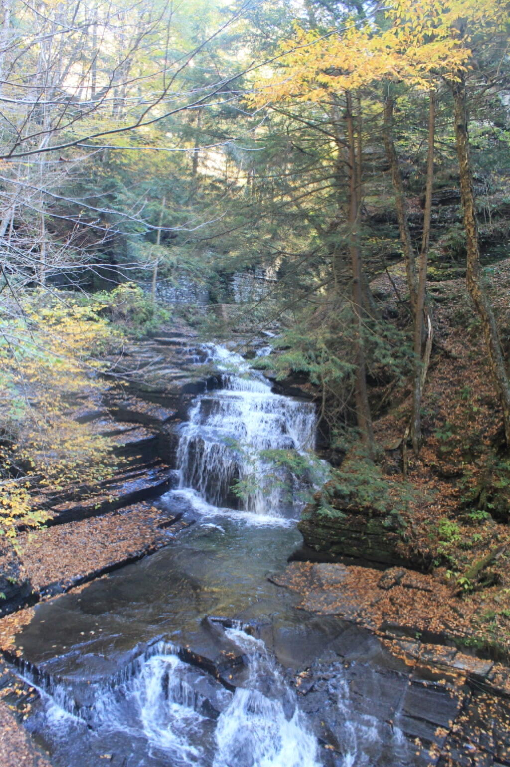
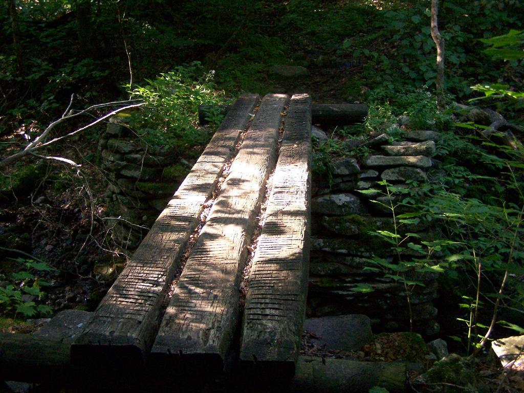
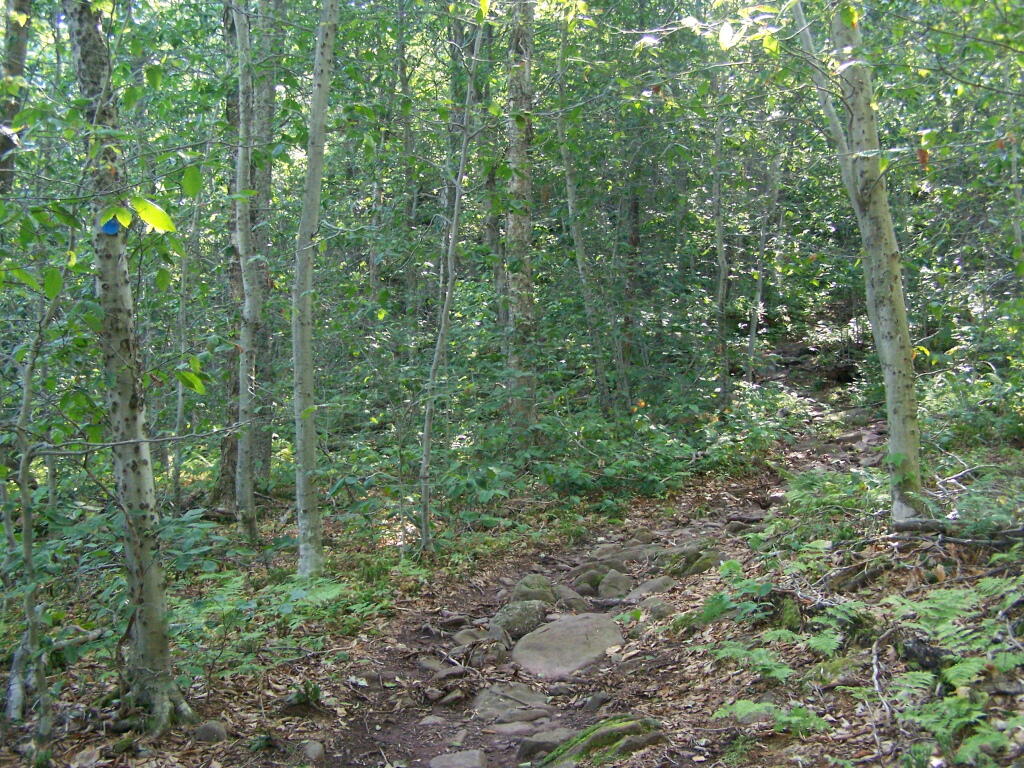
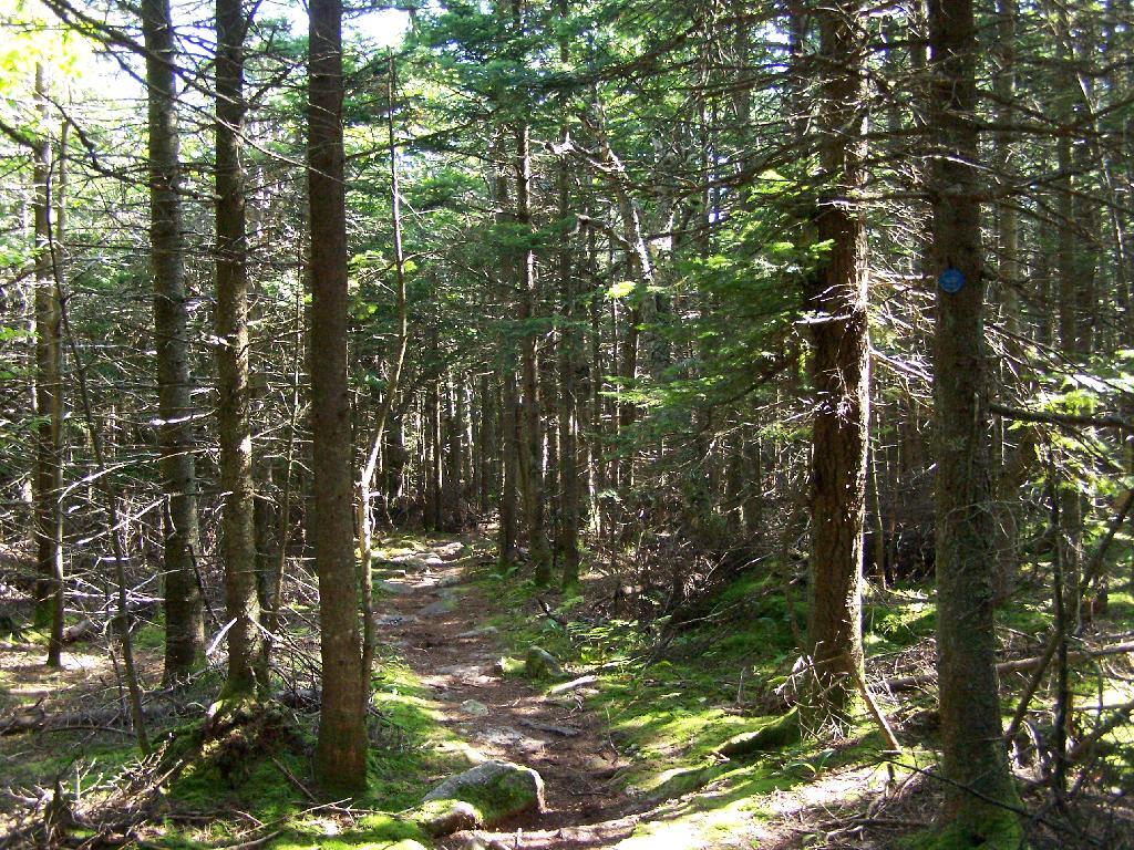
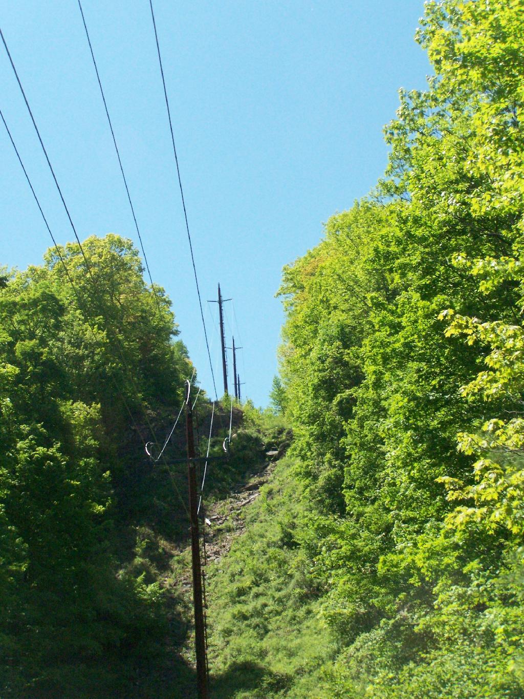
The Northern Rim climbs a fair bit, then runs along the rim, with very limited and occasional views. It crosses a pretty little creek that tumbles down the gorge, and eventually leads to a path down to the gorge trail, three-quarters the way up the gorge. I decided to hike down to the gorge trail, and then head back down the gorge towards the parking area. I missed a bit of the gorge trail, and the overlook, but so be it, time was tight.

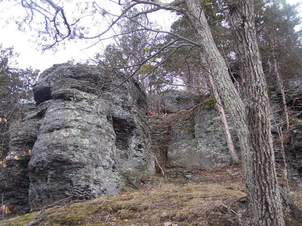
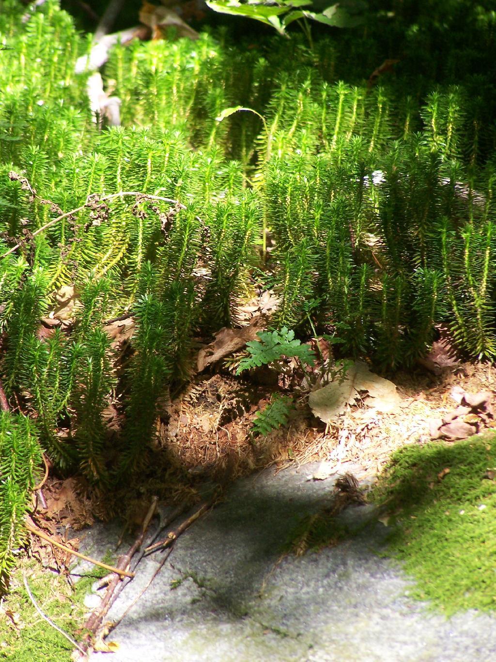
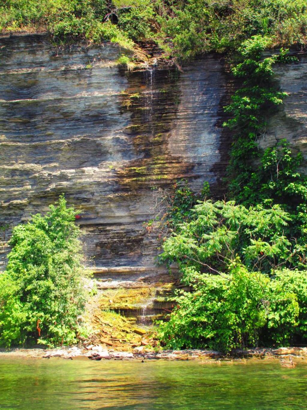
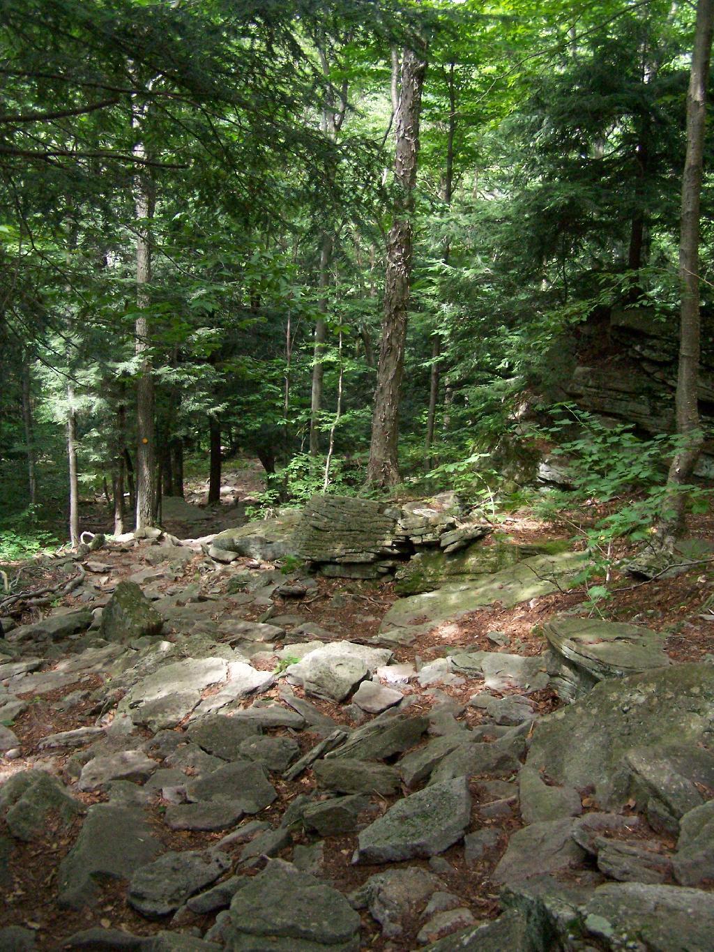
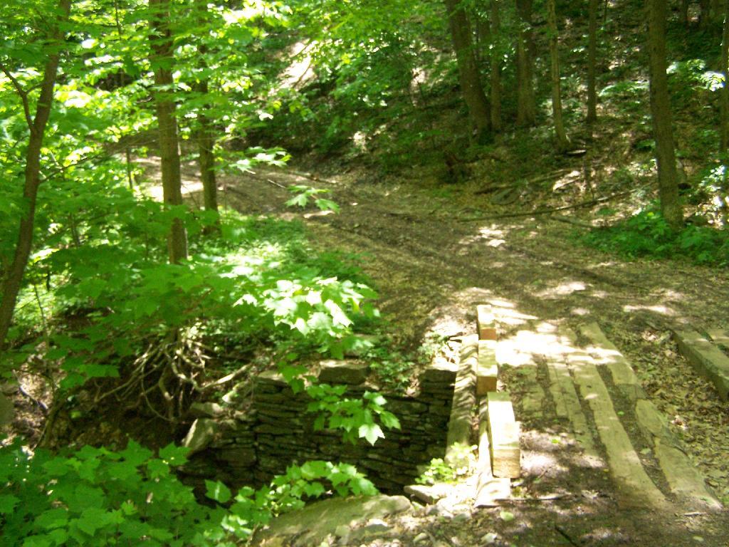
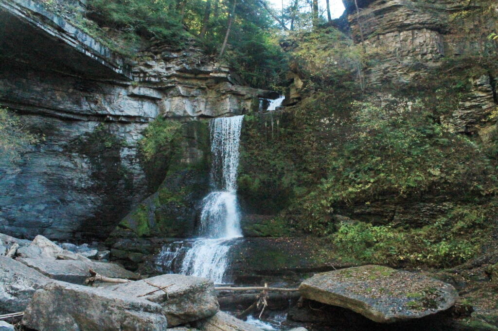
The Gorge trail was scenic, but certainly not the most scenic of gorges. There were several small waterfalls, and some stairs and bridges, although most of the trail was gravel along the edge. The β€œDry Creek” had plenty of water, but in general, the gorges was smaller then other Finger Lake gorges. There were several glens of interest, but the most beautiful portion of the glen was the Cow Sheds in the button of the gorge. Cow Sheds falls, are the wider portion of the gorge, where at one time, historically, cows would gather for shelter in severe or cold weather.

Cow Sheds Falls

Snapped a few more pictures of Fillmore Glen, and it was off to Ithaca. I made pretty good time to Ithaca, although I admit I certainly wasn’t poking along. I really should have stopped more places, but I wanted to get to the Finger Lakes National Forest relatively early so I could set up camp and/or make alternative plans should my desired campsite on Chicken Coop Road be unavailable. Passed a giant bull statue on a farm, along NY 38, a few miles south of Moravia. I really should have stopped for a picture, but I was burning daylight, and the Finger Lakes National Forest, was over an hour away. I think this is the one, that the farmer paid like $10,000 to haul from an abandoned Steakhouse in Binghamton to the farm. I am sure the bull will be there for a long time – in case anybody forgot what is raised on farms.

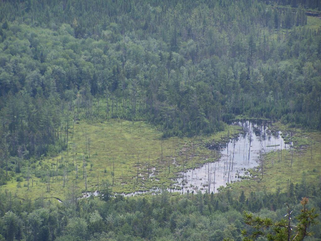
Then it was down to Freeville.. The only thing real remarkable about that town, was the pine barrens and swamps, consisting of heading into it. When you think of the Finger Lakes, you tend to think open landscapes and farms, at least until you get mostly south of them of them, or in the highest points to the west. But not here. The Finger Lakes Trust owns some land, on the north side, where it the land is mostly the backwaters of the Oswaco Inlet.

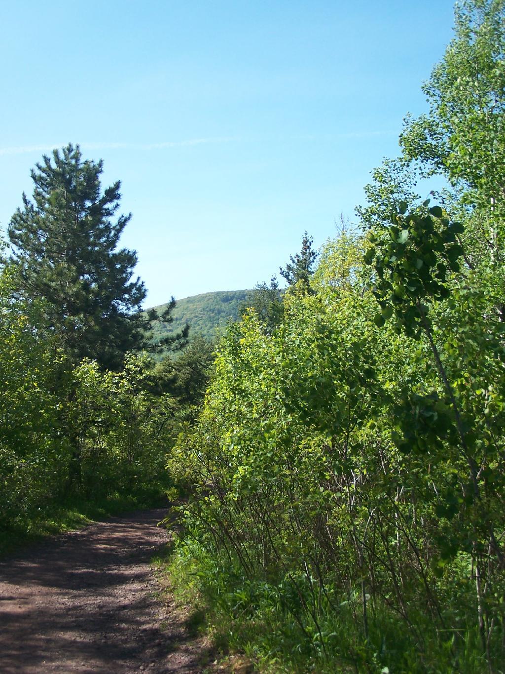
Finally made it to Ithaca by 4:45 PM. I was lucky at this hour that traffic wasn’t too much of a slog by Ithaca standards, then I was off heading up Trumansberg Road. It seemed like an endless drive. Finally made it to Perry City, and then to the Finger Lakes National Forest. There was no sign of the government closure when I got there, but a bit disappointed, my favorite campsite on Chicken Coop Road was already taken. It was off to campsite on Potamac Road, just past the hunting camp.

I wasn’t thrilled by campsite, a big field campsite, but it had some trees along one edge for hanging the flag and lights. It was pretty good site for observing the stars, although there was a hunting camp down the road a little ways, so I had to keep the music down. I really don’t want to piss off the hunters. I gathered up some firewood from the woods, and got a fire started. The sun was fading fast, but so be it. I wired up my lights, some Christmas lights, and got the spot light on the flag.

It got dark, and I tuned into the Ithaca Progressive Radio Station, and gazed on the stars for a couple of hours. Nibbled on some snacks, cracked open a beer or two. Tossed some more wood on fire, and was happy to finally be on vacation.

It was a good first day… more adventures to come.

Middleburgh Cliff

Directly to the East of Middleburgh there is a long narrow landform known as “The Cliff”. It’s a 500 foot high hill, with about 40 feet high cliffs, overlooking Middleburgh and Schoharie to the west. Cotton Hill sits above it to the east. While privately owned by the owners of the dairy farms in the valley below, the Long Path crosses it and you can use it to explore the cliffs.

As you climb the hill on the Long Path, looking backyards there are broken views.

Broken Views As You Climb

When your almost to the top of the Cliffs, there is a quick scramble over this ridge. This is a section that is very much hand and knees, you’ll probably toss your pack up and then climb up to retrieve it.

Cliff of Middleberg

After you get to the top, you have some views to the south, including Vromans Nose.

View South After First Ledge

Further along the trail you get some broken and then improving views of the Schoharie Valley just north of the Middleburgh. In the background is Middleburgh Roundtop Valley, and where NY 145 climbs the ridge to get over to East Cobelskill.

Middleburgh vs. Schoharie Creek

The agricultural flat lands south of Middleburgh.

Schoharie Creek Twists

The new more suburban section of Middleburgh, with the older village in the background. I never understood why people would live out in the sticks, but also live in a suburban subdivision in a classic small village.

New Portion of Middleburgh

A dairy farm along NY 30 north of Middleburgh.

All and all, this hike doesn’t provide amazing remote lands, but still has some interesting agricultural views of the fertile Schoharie Valley. Taking no longer then a total of a 45 minutes round trip, it’s a nice hike to do with Vromans Nose or take the trail farther west to Cotton Hill Lean-To.


View Cliff of Middleburgh in a larger map

Harmon Hill

Harmon Hill is a short but steep hike outside of Bennington, VT. You go up some 1,200 feet in a little over 1.7 miles from the parking area deep in the Dunville Hollow just west of Bennington for modest views up north and west of Bennington.

The trail up it is part of the Long Trail, which is duplexed with the Applachian Trail in Vermont. Here is the sign near the parking area.

Harmon Mountain Sign

It is a steep 1 mile as you make most of the 1,200 ascent. There are not much views as you climb out of the Dunville Hollow, just a lot of rock-steps and steep switch backs as one climbs up the mountain.

Boardwalk

Likens along the trail.

Likens

Once you almost reach the top there are many meadows.

Waterfalls Along Hector Cliffs

A destination sign tells you that you’ve reached the Pioneer Valley section of the Long Trail and are starting the Bennington section.

Harmon Hill Sign

When you come to the top you have an interesting view of Mount Anthony, Bennington, and in the far distance the Champlain Valley and the Adirondacks.

Mt. Anthony and Beyond

You can see the Bennington Monument and the surround farms near Bennington from the mountain.

Bennington Monument

Towards the North, you can see some of the Adirondacks towering over the much lower range of the Green Mountains, including Grass Mountain.

Adirondack Marshland

This is the second peak of Harmon Hill, which is view less. I hiked to Harmon Hill and the viewless points further south on the Long Trail.

Second Peak of Harmon

Here is a map of the hike.


View Hikes of 2009 in a larger map

Slide Mountain

I decided it was a nice day out, and I wanted to be able to say I had gone up to the tallest peak in the Catskills, at 4,180 feet. According to Wikipedia, it may actually be somewhat taller then that (as much as 4,200 feet), but they’ve never done a bench mark on the top of it.

The first part of the trail is fairly steep.

Continuing Downhill

It climbs up to an old woods road, that is an easy walk and relatively flat, as it goes up to the Curtis-Olsbee Trail. You see the split between the old Jeep trail up Slide Mountain, and the the trail to Curstis-Olsmbee.

Slide Mountain Options

The trail crosses a high footbridge, without rails. It once was a full-size bridge for vechicles, but no more.

Foot Bridge

Reaching a historic marker of Curtis-Olmsbee Trail.

Curtis-Olmsbee Winds Uphill Slowly

You climb, and then there are some places with views to South and West as you continue along. A few moderately steep places, but overall the trail is not super-steep.

Views to the South

The trail once you reach the first couple of views, remains relatively flat as you wander past several swamps and borreal forests.

Borreal Forest

When you reach almost the top there is a point where you can see almost 70 named peaks.

Trees and Mountains

Enjoying the mountains.

Texature

The top of the mountain is John Broughs Point. It has some interesting, partial views to the north and east.

Pinnacle of Slide

Remembering John Bouroughs

The Ashokan Reservior from Slide Mountain.

Asokahan Reservoir

An established, primative campsite about 3/4 the way down the mountain or one mile from the Slide Mountain Parking Area.

Camp Over This Way

Campsite

By the time I left, the parking lot was packed.

Packed Parking Lot at Noontime

Here is a map of the route I took.


View Hikes of 2009 in a larger map

Palenville Overlook

On Memorial Day 2009, I decided to go on an afternoon hike to the Palenville Overlook, along the old Catskill Mountain House Road, which was used for horse and buggies during the era of that great mountain house prior to the installation of the inclined railroad and later automobile.

Bridge By Halfway House

The first part of the trail is a moderately steep old wagon road that climbs about 1,000 feet to the site of the Halfway House / Rip Van Winkle Hollow. If it wasn’t gated closed, it would be passable by an automobile. When you reach the ruins of the Halfway House, there are horse tie-downs and ruins of the old tavern known as the Half Way House. It’s where passengers could get a good strong drink and so could horses, as they made their way up to the Mountain House.

Little Pine Orchard Pinic Area

After this nice place for resting, the trail climbs a bit more and becomes a lot less steep. You pass by a private hunting cabin, and finally into the forest preserve. You arrive at a pinic area with nice views of the valley, a picnic table, horse tie-downs, and a fireplace full of trash.

Tree

From there the trail gently goes up, with two big switchbacks. The trail to the Palenville Overlook switch-backs down about 100 feet off the old Catskill Mountain House Road, and then winds on a narrow trail about another mile to the Palenville Overlook.

Mount Airy

You then cross the ruins of the old inclined Otis Railroad tracks, in which all that remains are foundations. According to “AMC’s Best Day Hikes in the Catskills”, the rails and other scrap metal was sold to the War Department during World War I. By then the automobile had made this mode of obsolete as the old horse trail up the valley. All that remains is the cut on mountain, where a high-tension power wire runs.

Old Railroad Grade

You eventually reach the Palenville Overlook. The views are amazing, although it was fairly hazy the day I went there. There are awesome stone-built chairs out of old Palenville Mountain House ruins, that provide a great place to sit with a book, as you enjoy views of the Hudson Valley looking south-east. There is another view along the escarpment of the valley somewhat to the north, that gives more due-east views.

NYS Total Education Aid, 2023-24

Seat with a View

From there, I hiked back to the old Catskill Mountain House road, and up to the site of the old Catskill Mountain House ruins. I took some pictures, and then started down the mountain, when I realized I had left my hat up the Catskill Mountain House site. So I ended up backtracking, and ended up missing Memorial Day dinner at my parents house. But so be it.

Nice Day Out


View Andy Arthur – Hikes 2009 in a larger map

Plateau Mountain

Plateau Mountain, directly east of Hunter Mountain is one of the Catskill 3500 ft Mountains, but rarely gets much attention. It has a good trail up it, a bit a fairly steep one, that has wonderful southerly views, out towards Edgewood and many Catskill Peaks. It climbs about 1,900 feet in 1.8 miles — a good 20% grade, including several relatively flat places.

Once you reach the top, there is one section where you have to climb up hands and knees up two 4′ steps. Beyond that the trail is essentially flat for the next two miles. There some decent views over Tannersville and of the TriMount region of the Catskills. From there for the next mile and a half there are no views, as the trail wanders around properly lines until it reaches the easterly descent into Mink Hollow.

Not a lot to see once on top of the mountain, long and sprawling with dense forests. Regardless the various views are nice off this mountain, and it’s frequently overlooked as a mountain to hike in the Catskills.

It was a nice hike with some truly beautiful weather. The only mistake I made is I did not bring enough water. I was through 2 liters of water before I knew it. Still I conserved water and made it down safely by about 2 PM (I started up the mountain at 7:45 AM).

Be sure to see the Central Catskills Photos, where many are from Plateau Mountain.

Hikers – Devils Tombstone Parking Area
Green Line – Plateau Mountain Trail
Balloons – Various views from Plateau Mountain


View Plateau Mountain Trail in a larger map

Cole Hill State Forest

I went out for a walk at Cole Hill State Forest on Sunday. It was a delightful day, especially between the clouds.I took the loop to the east labeled steep hill. This forest road had a pretty good snow pack remaining on it, a bit not enough for snowmobiling.

Snow Melts

There was a fair bit of litter from trashy shooters, who had done some target practice and not taken their shit home. Idiots. Besides that I heard an ATV in the valley, and I thought it was closer, but I think it was just an echo.

Farther down the trail, below the steep hill there was an old volley ball with a wig or maybe horse hair on it. It was kind of creepy but cool at the same time. I got a nice photo of it I will have to post.The trail was closed off in several places by downed limbs that I had to sneak around. Snowmobilers all winter have been doing this. There is a lot of broken limbs and damaged tree from the ice storm this past Decemmber.

Blue Sky

Hiked down towards Cole Hill on the road and took some pretty pictures of the valley and the farmland down there. The earthy browns against the blue sky where beautiful. Hiked west on down to the Swamp past the Kiosk and to the bridge. It was pretty down there, although the sun made photography difficult.

Hikers – Trailhead
Balloons – Destination Points


View Cole Hill State Forest Hike in a larger map

This NYS DEC Map may also be of assistance.

Descending