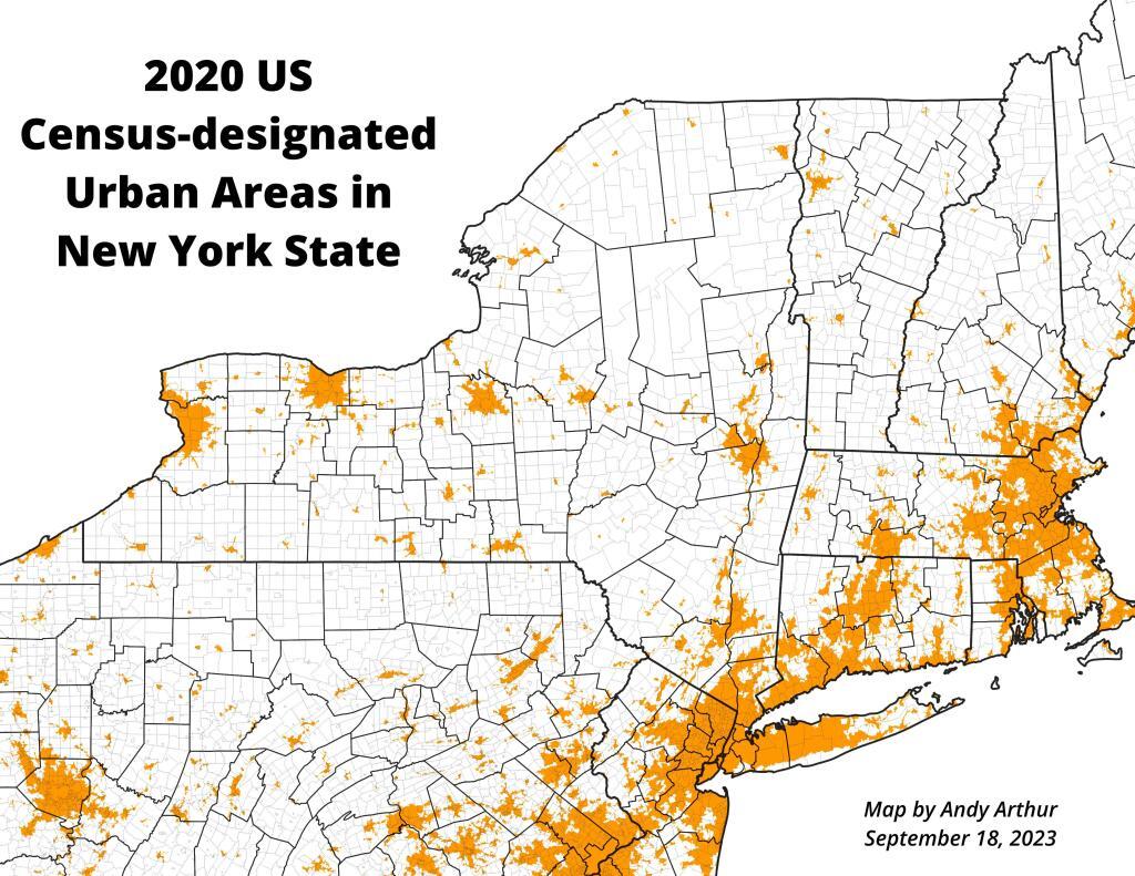
Bourne And Grout Pond
Clouds hang low above, looking out from the Stratton Firetower down at Stratton Pond and the Lye Brook Wilderness.
Taken on Sunday May 26, 2019 at Stratton Mountain.
Clouds hang low above, looking out from the Stratton Firetower down at Stratton Pond and the Lye Brook Wilderness.
Taken on Sunday May 26, 2019 at Stratton Mountain.The Bog River Flow, also known as Lows Lake is a spectacular wilderness/primitive area located in South-East Saint Lawerence County. It consists of two dams, Lows Upper and Lows Lower, that create to massive man-made lakes. It is home to over 100 paddle in campsites along with some amazing views and wildlife.
Here is a downloadable map.
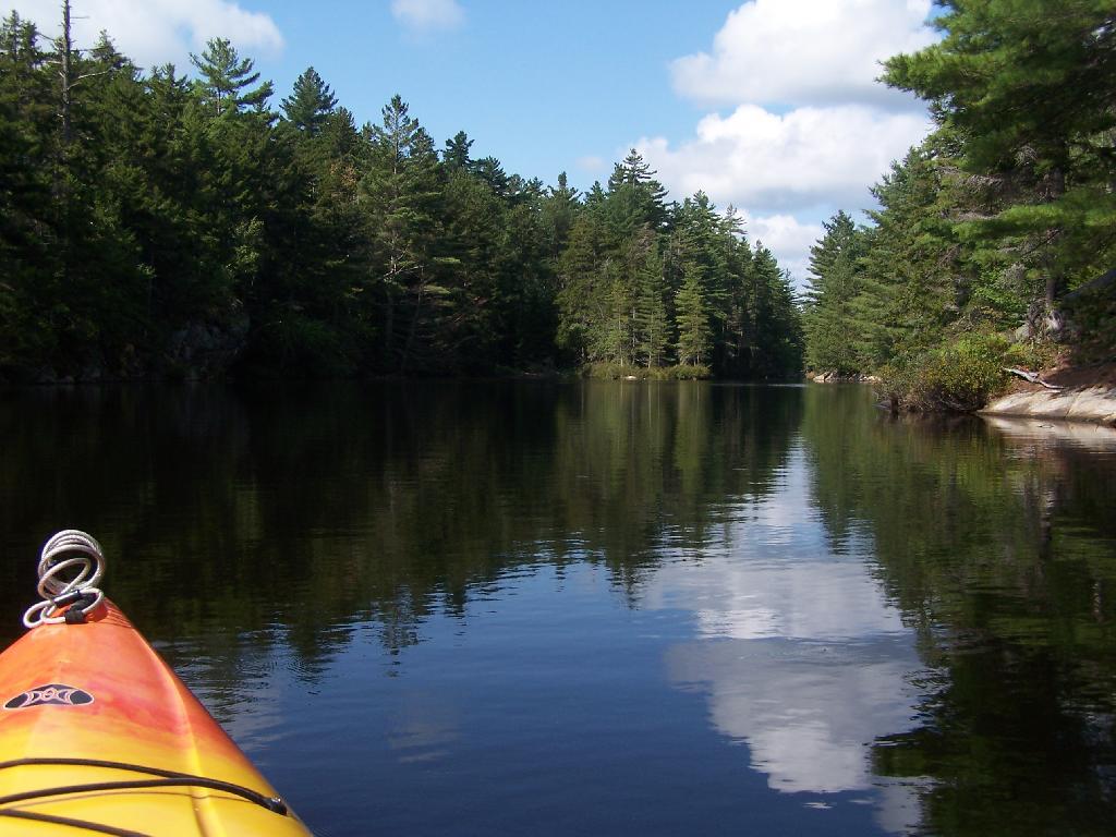
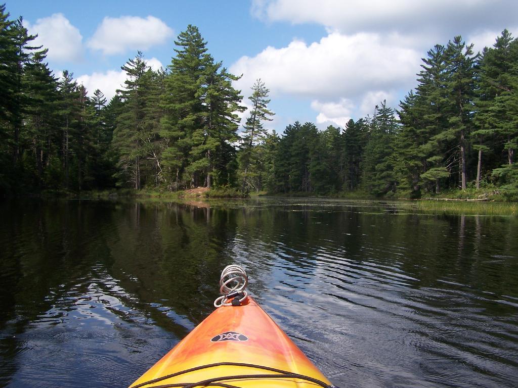
Above Lower Lows Dam. Paddling up the “flooded” Bog River, in the lower portion of Bog River flow, right above the Lower Lows Dam. If this area was not flooded by dams, it would be rapids, unaccessible by canoe or kayak.
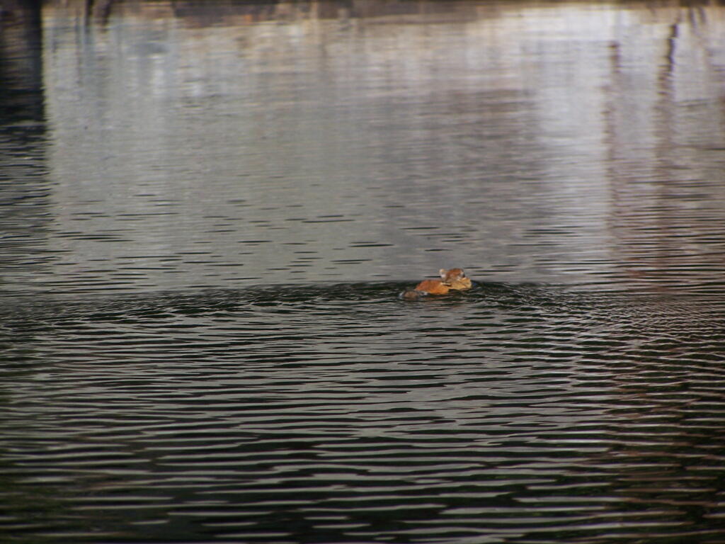
Chimpmunk Swims. This was taken about a mile above the Lower Lows Dam.
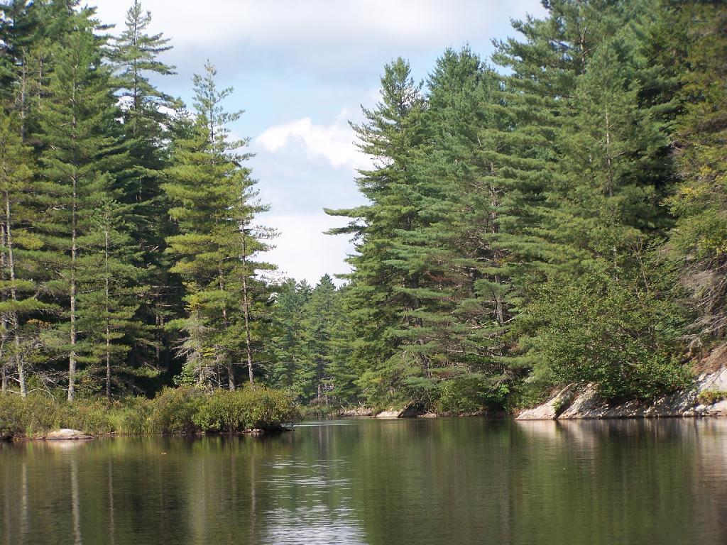
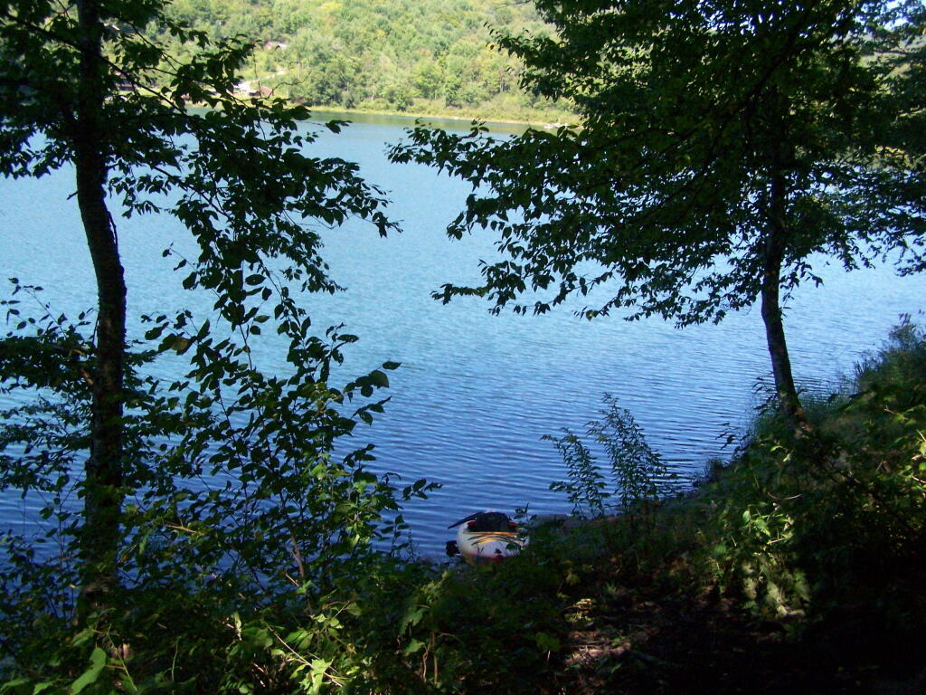
Bog River Flow Narrows. The Lower portion of the Bog River, is pretty narrow in part, due to the rocky terrain that it covers. You can easily bottom out a canoe or kayak in these parts, and other parts appear quite deep. There are a couple of paddle-in campsites along here.
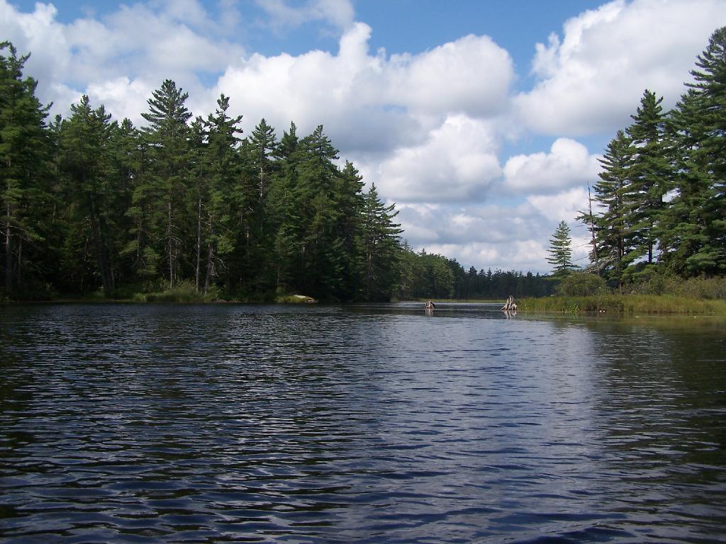
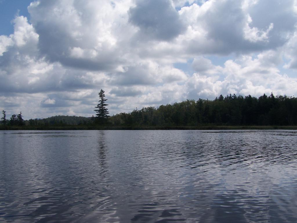
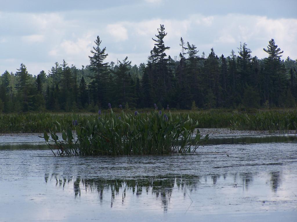
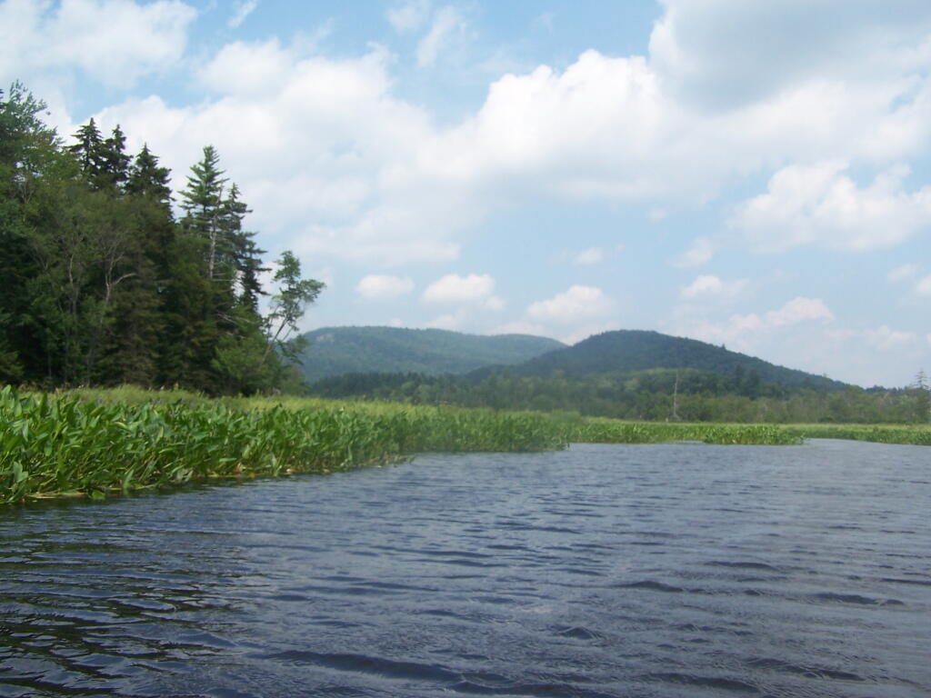
Bog River Open Up A Little Bit. The first mile or so of the Bog River Flow is mostly flooded stream. But as you get closer to Hitchens Pond, it starts to widen a bit.
Entering Hitchens Pond. Just past here, is a hairpin turn, as the flooded River, winds a bit, and becomes a much larger lake, in the form of a series of bays and marshes.
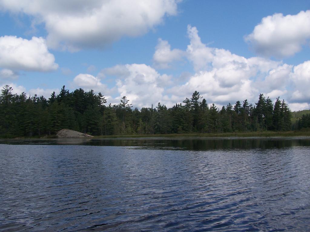
Hitchens Pond. Here things open up quite bit.
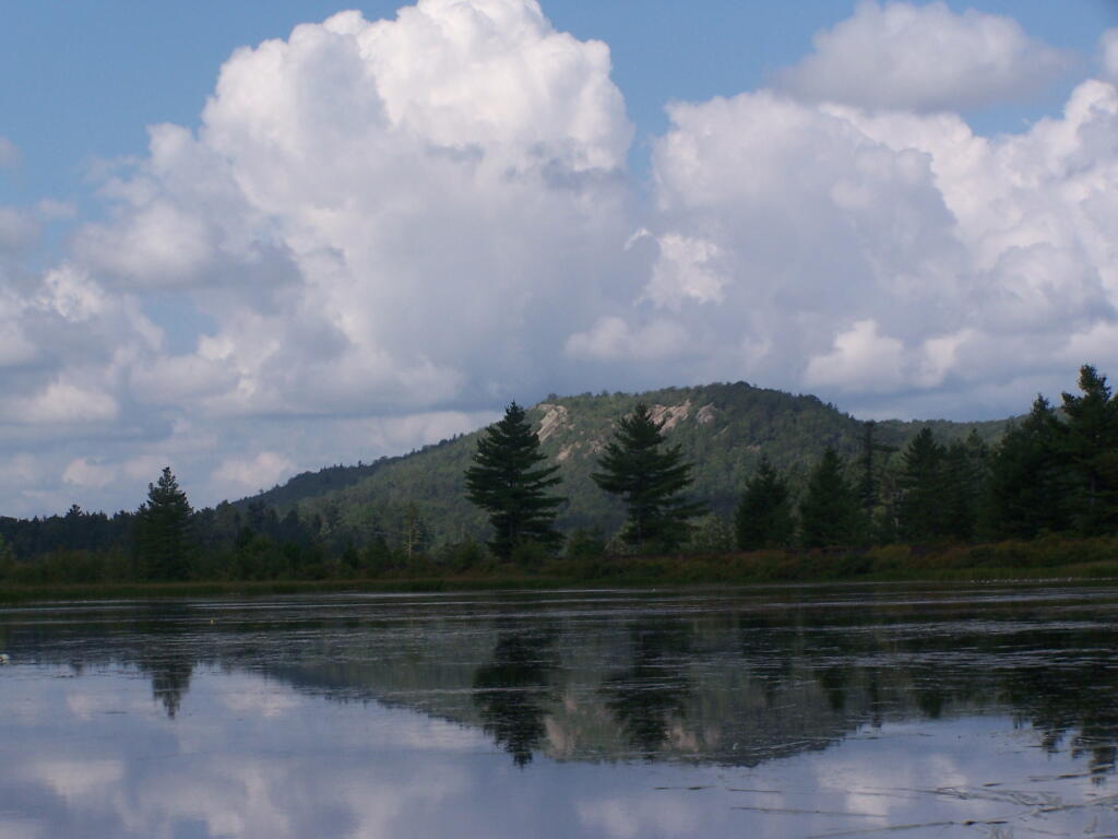
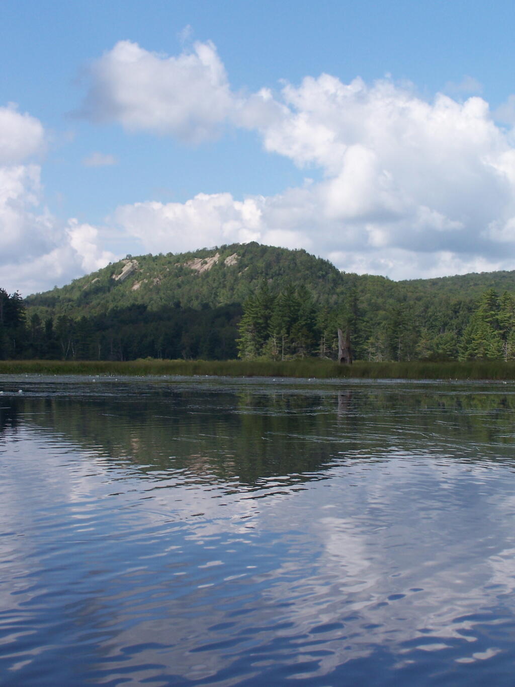
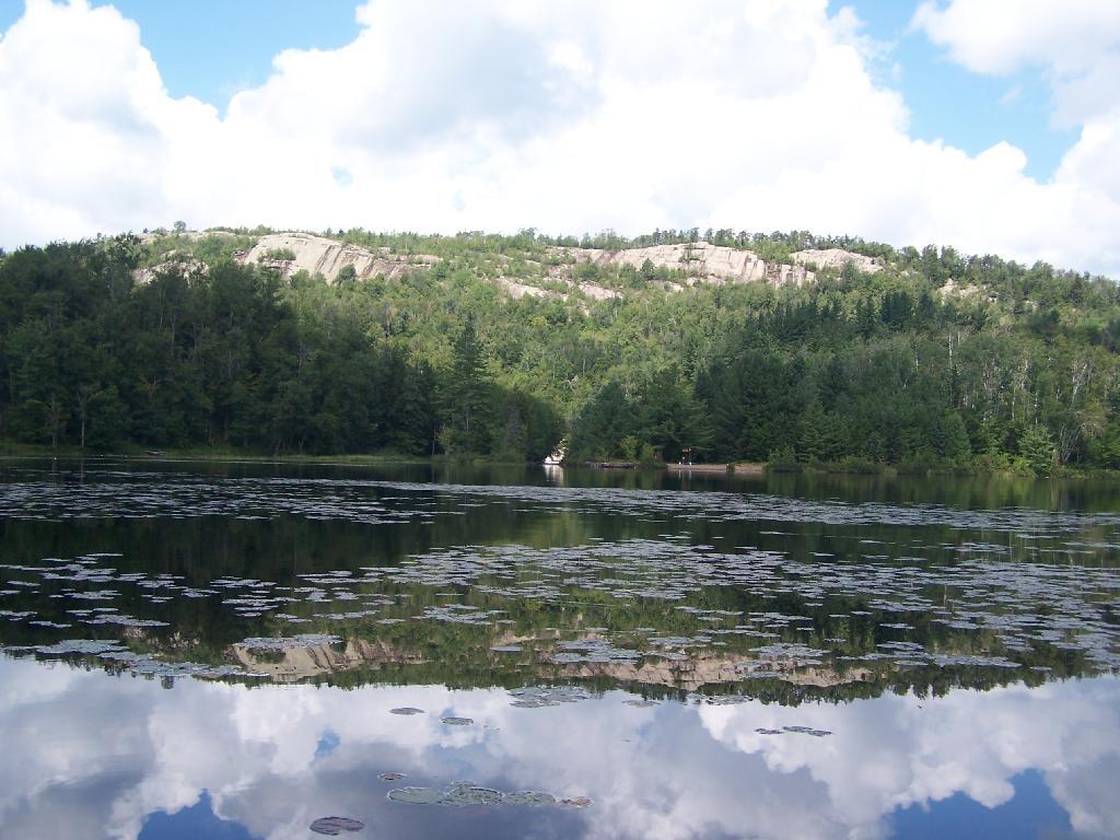
Lows Ledge. Here is Lows Ledge reflecting into Hitchins Pond. It’s much larger in person then it appears in this picture, unless you have a very big computer monitor.
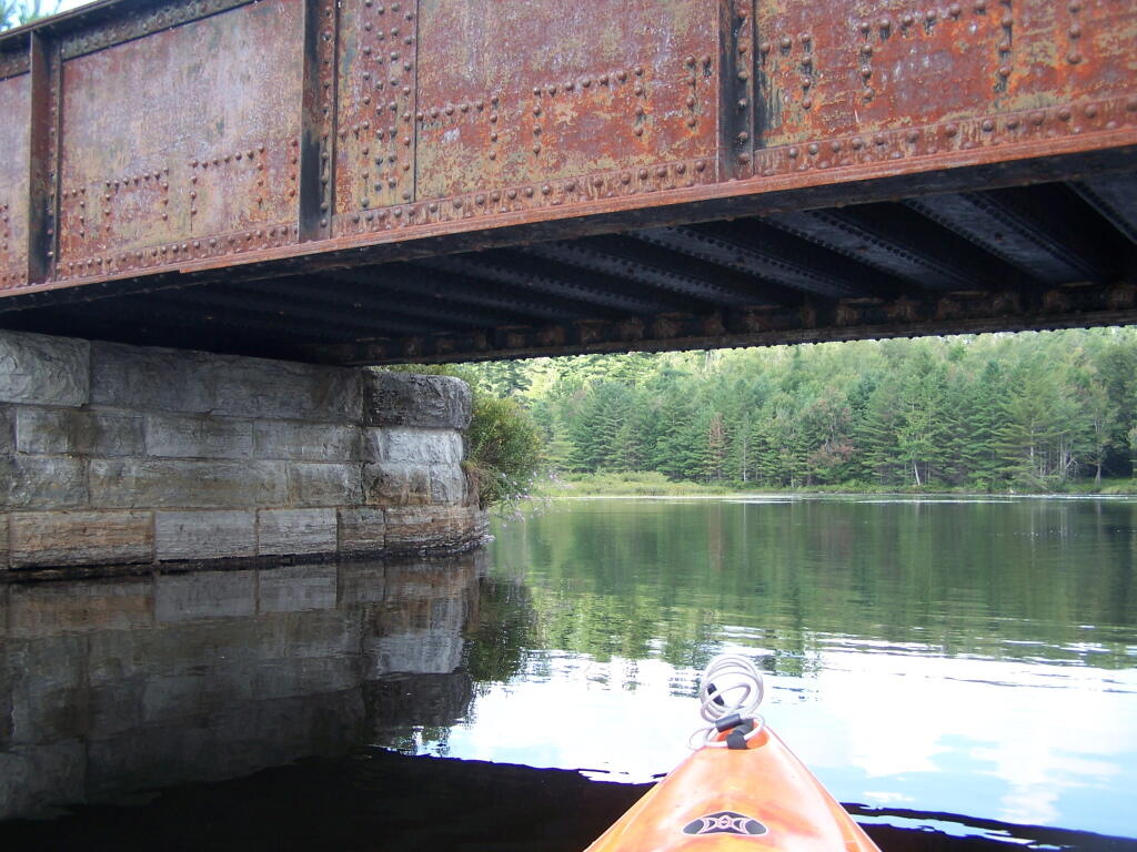
Railroad Bridge. About two miles into Bog River Flow, you cross under a relatively low railroad bridge. It’s actually about 5 or 6 feet above the flow, and doesn’t feel at all cramped in a canoe or kayak.
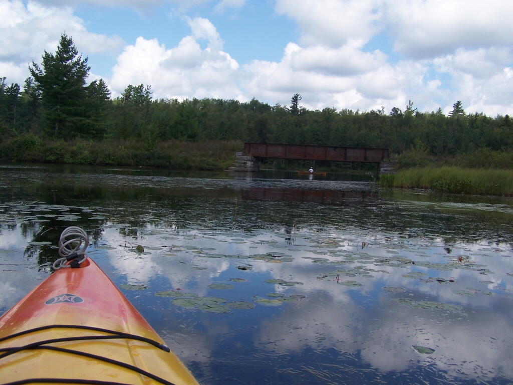
Under the Railroad Bridge. This shouldn’t be too bad to clear.
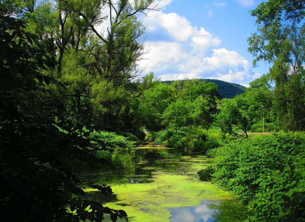
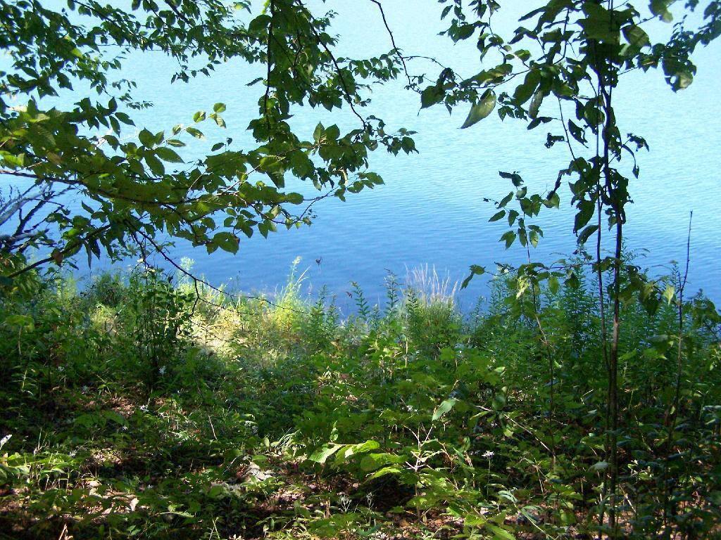
Trees Along Hitchens Pond. This picture can’t even reflect the beauty of this portion of Bog River Flow.
Break Time. Drinking all that beer, meant I had to find a place along the Flow to get out, stretch, and take a piss. Things being so boggy and soft in parts, meant there wasn’t a lot of open area to take a break.
Lows Ledge. I’m now about halfway between Lows Lower Dam and Lows Upper Dam, as the ledge reflects beautifully into the lake. It’s a very spiritual thing for sure, paddling along through this lake.
Clouds Rolling Out. To the south, it looked still quite cloudy. But there was something quiet spiritual about the area, and quiet vast. Something also spoke to me as being Saint Lawrence County, and as vast as one would expect the biggest county in the state to be.
The Channel. The lake turns once again, with beautiful marsh lands along the edge of the lake.
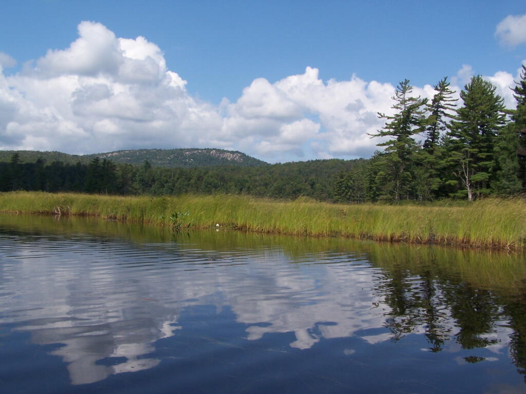
Marshy. Portions of Hitchens Pond are quite marshy, and can be tough going, especially if one gets out of the channel.
Trees. These trees line the last big turn at Hitchens Pond, where you finally get into the main bay, as you head towards the Upper Lows Dam.
Marshland. Along Hitchens Pond as we get closer to Lows Upper Dam.
Lows Ledge. Now we are almost up to the portage for Lows Upper Dam. Quite purty I must say.
Kayakers Pull Out. You have to pull your boat out of the water, and carry it over the Lows Lake Upper Dam, about a 10 feet elevation, and maybe a 50 foot portage.
Bog River Area Pull Off. A lot of people pull out here, for lunch. Or they can be fools, and not use the channel to bottom of the dam, and carry their canoes, an additional 1/4 mile for no real purpose, to get it over the Lows Upper Dam. Not like I would be that stupid, now right? Of course, I just covered my camera with beer, so I shouldn’t be opening my mouth.
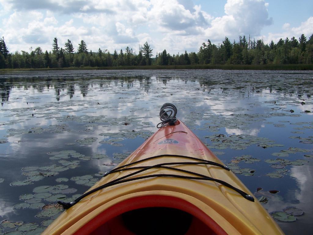
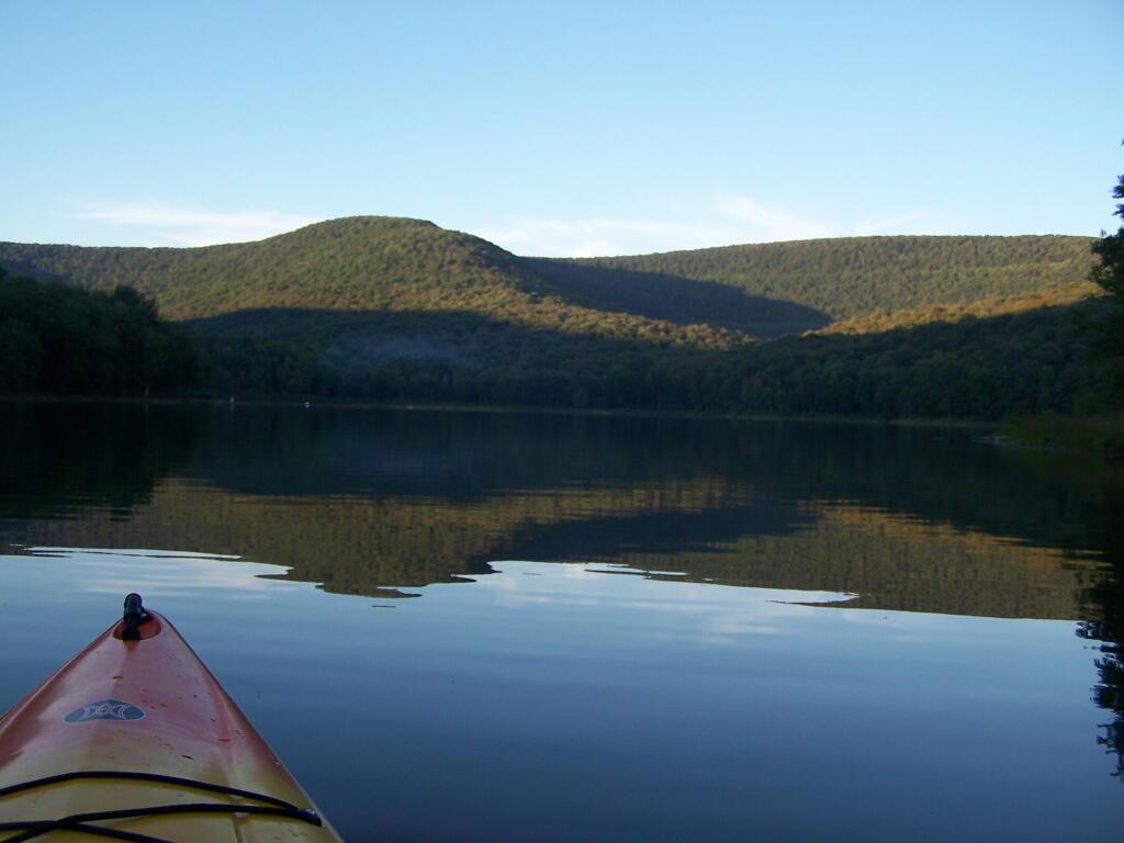
Lows Upper Dam. This is the last picture I got for the day, because I dropped the camera in a pool of beer in kayak, and things go wet. Eventually the camera dried out and started to work fine, but for now, we have to go pictureless. From here, the bottom portion of Lows Lake proper, above the Upper Lows dam, is much like the bottom part of Hitchens Pond, narrow, deep channel, that widens up.
Above Upper Lows Dam. This is the channel above the Upper Lows Dam, which technically is Lows Lake now. About a mile up from here, the lake gets shallow, and you must portage up into the more open Lows Lake main section. Yes, the camera lens has beer in it, that now has to dry out before I can take any more pictures. Nothing until tomorrow. It’s my Friday the 13th luck and stupidity of leaving the camera in the kayak, not in it’s protective case, as I pull out, and spilled beer soaks everything.
With Stratton Mountain high above the pond.
Taken on Saturday June 18, 2011 at Grout Pond.
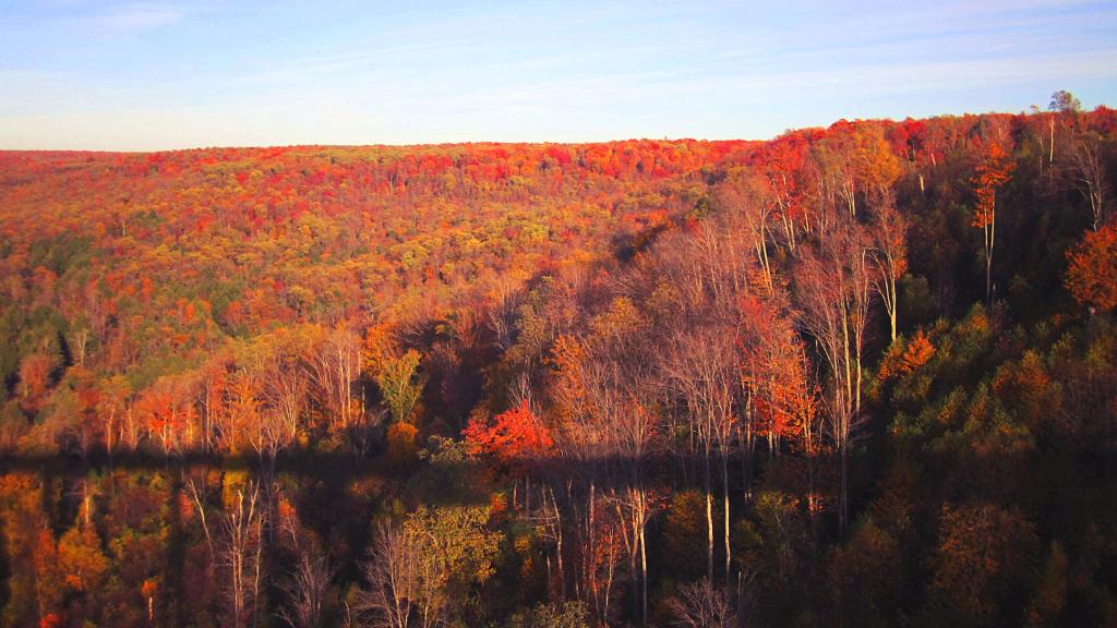
A fall view of the pond from up above on Jones Hill.
Taken on Saturday October 2, 2010 at Labrador Hollow Unique Area.In the Adirondack Park there is a Bad Luck Mountain and Bad Luck Pond, along with a Good Luck Mountain and Good Luck Cliffs. I have only been to later, but maybe sometime I will get a chance to visit the much more remote Bad Luck Pond as described by CNY Hiking.
If you are not feeling particularly lucky, consider visiting Big Bad Luck Pond, off of NY 28, roughly halfway between Northville and Indian Lake. It’s a little too far to carry a kayak back into, but it is a 3 mile hike from the trailhead to the pond, passing over the col of Bell Mountain, and several other small ponds. There are some designated campsites near the lake, and it’s below Bad Luck Mountain.
Alternatively, if your feeling lucky, consider visiting Good Luck Lake. Located north of Caroga Lake on NY 10, there are 12 paddle-in or hike-to campsites along the lake, which is located below Good Luck Mountain. It is a delightful paddle on in, but if you go, make sure to visit Good Luck Cliffs and Good Luck Mountain above it.
Big Pond is one of the two larger ponds in the Catskills accessible to the public. Located in the Western Catskills, near Alder Pond, it has eight paddle in or hike in tent sites, and some pretty views. I spent the night camping up there on August 27.
Night is Creeping Up on Me. I didn’t realize how quickly it got late at Big Pond, and I had even started dinner. To make matters worst, my white-gas lantern wouldn’t start, so I had to do everything by flash light.
Dark Night Before the Moonrose. All you can see is by the light of the campfire. I didn’t have a lantern, because it refused to start.
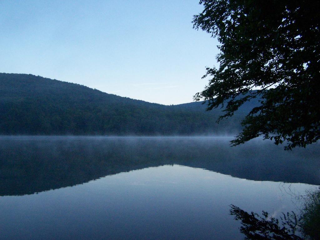
Waking Up at Big Pond. Looking out the window of tent prior to dawn, with a little smoke from the fire still smoldering, and lots of fog.
Pond Prior to Sunrise. The fog rises above the pond. It looks perfect for taking photos, so I decide to hop in the kayak, and go for a paddle.
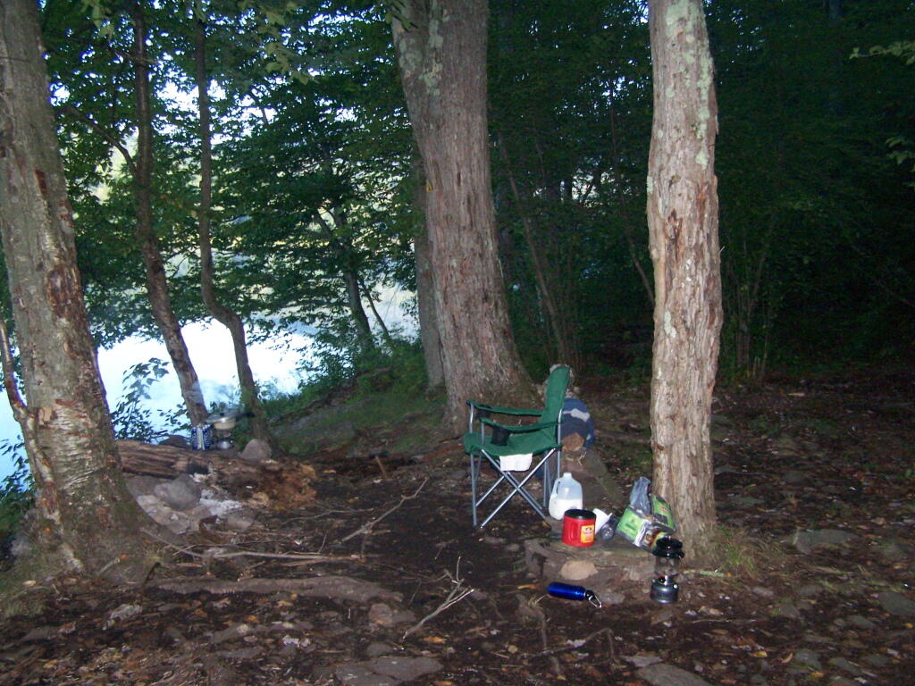
Campsite. Yes, the beer cans are empty, and I am using that pot to boil water for coffee, because I left the coffee pot in the truck. I doesn’t matter much because I use a coffee press to make the actual coffee.
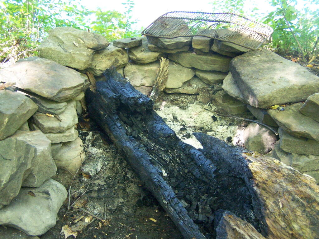
Firepit. This is while I’m making coffee and getting ready for the day.
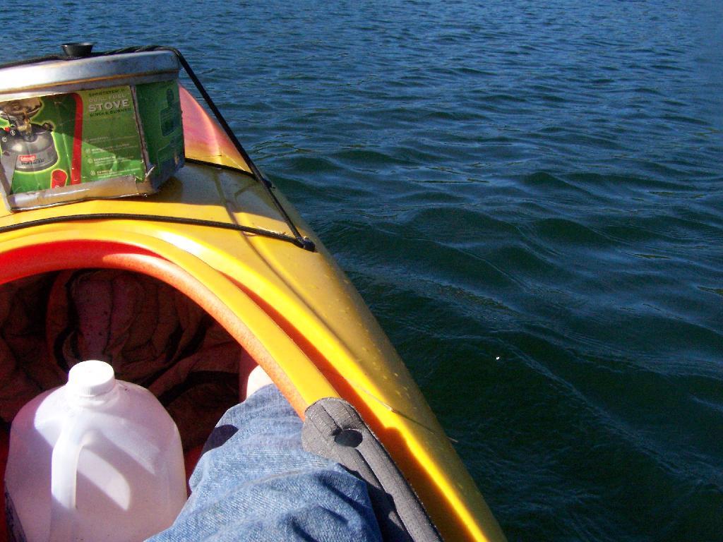
Paddling Gear Back. With all the camping gear in the kayak, or most of it, including the stove and pot top on the deck. The kayak rode well with all the gear.
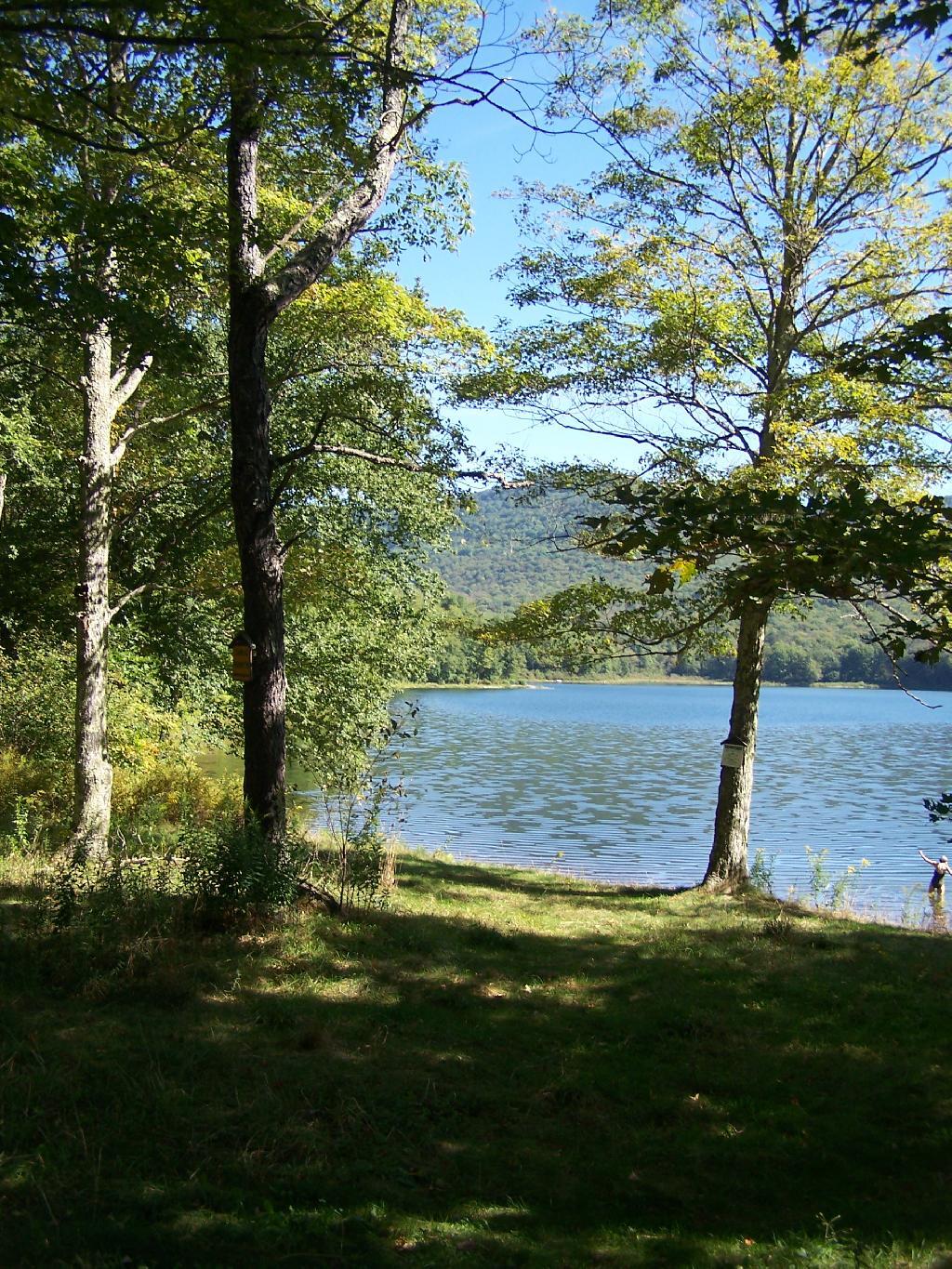
Big Pond from Parking Area. It certainly was quite pretty out there, and a great unguarded swimming beach that was packed with people.
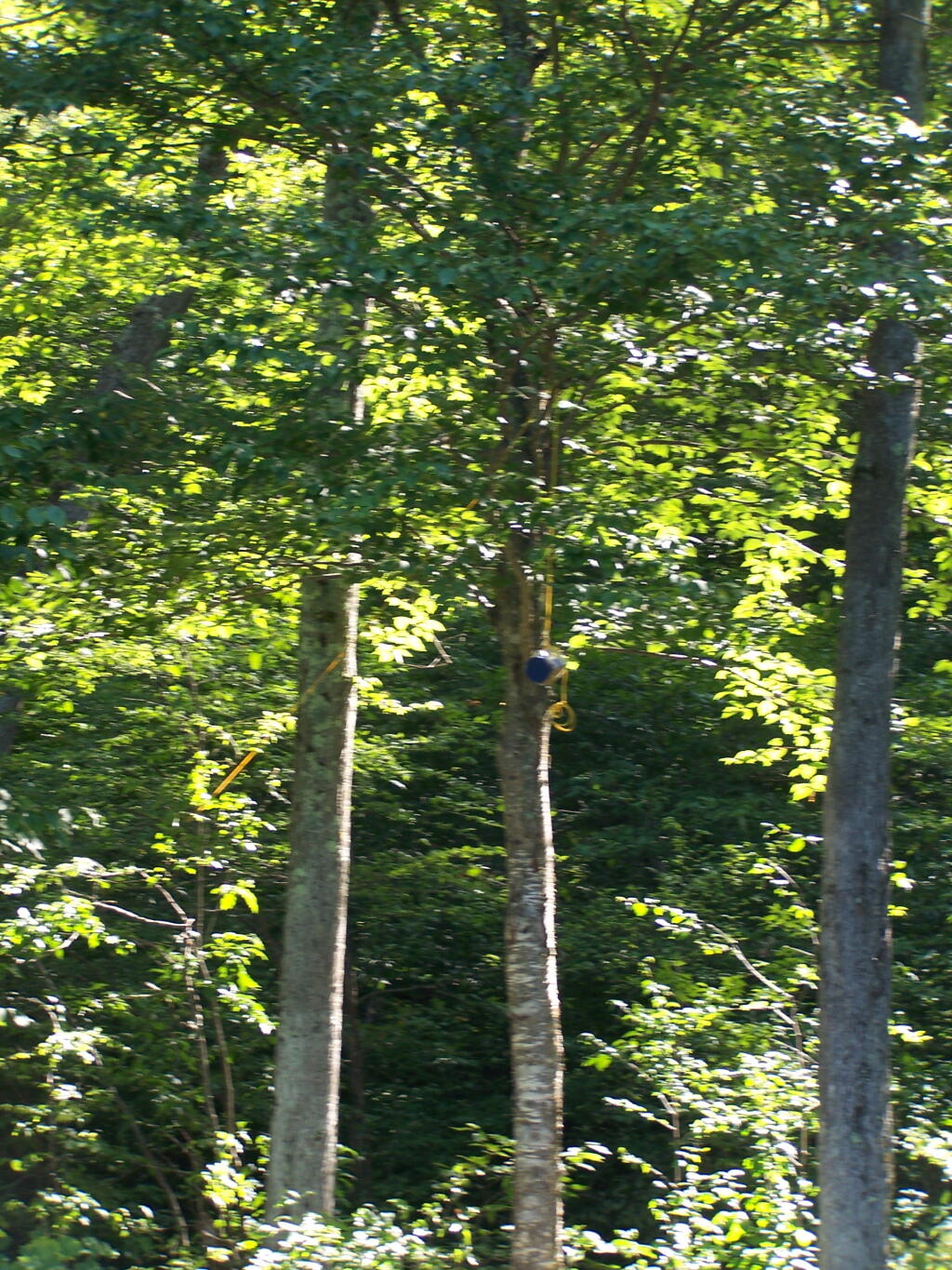
Bear Bag. Actually it was a peanut can, with cookies and other things. And despite the bear coming through, he left my site alone, and didn’t even try to get the bear bag that was about 12-13 feet off the ground, suspended from a limb, and 10 feet plus from the tree where it hung.
Tent. Yes, occasionally I will sleep in a tent. This actually is the second time I’ve slept in a tent this year. One other time I slept in a lean-to and the rest has been truck camping.
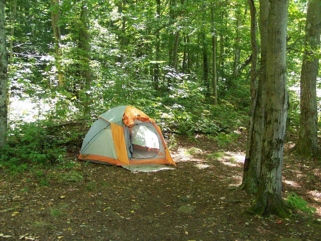
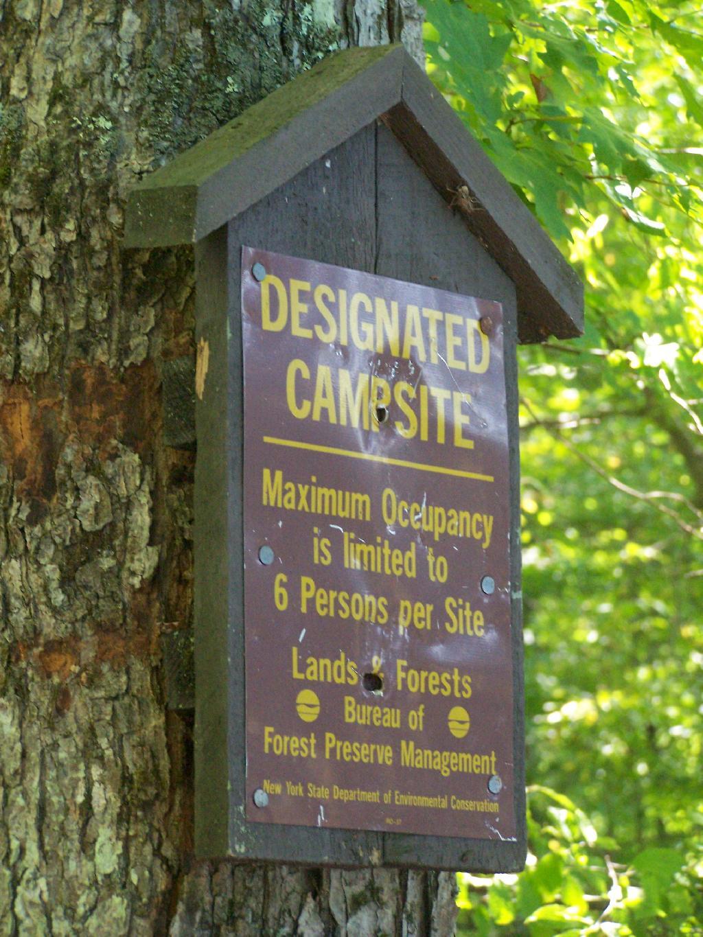
Designated Campsite. This is one of eight designated campsites around Big Pond. They are free to use, but are limited to 6 people, and you can only stay at one site for 3 nights without a permit.
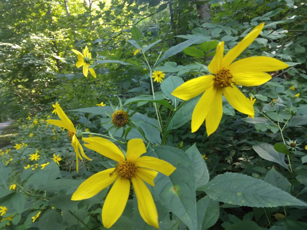
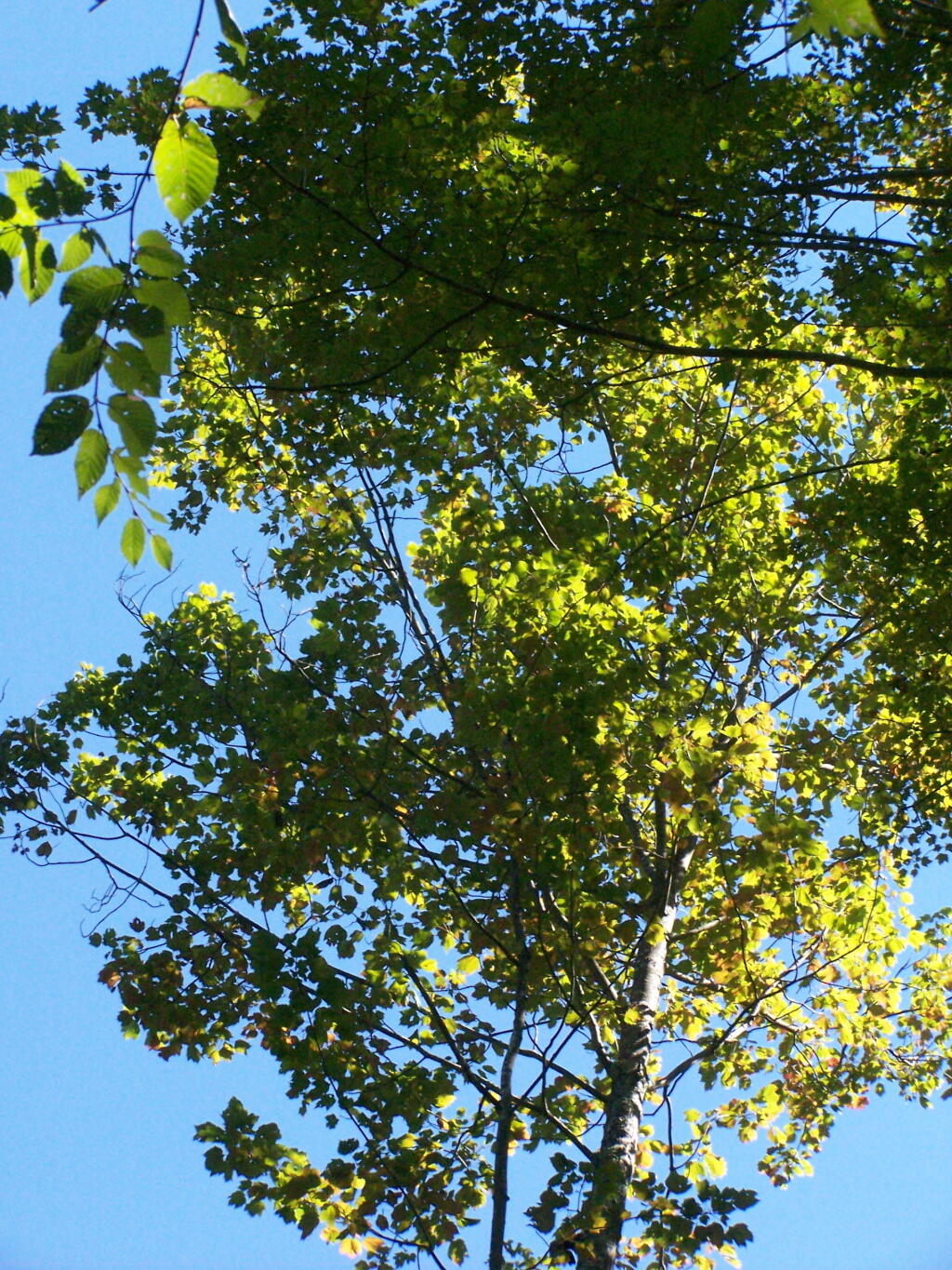
Looking Up at the Ash Trees. I was looking up at all the ash trees around the lake, and realizing that within 20-30 years they will all be gone. The maples will most likely replace them, but they also risk the Asian Longhorn Beetle.
Parked at Campsite. It was a pretty blue lake in the morning.
Finally Put That Smoldering Log Out. Remind me again, never to use a big punky old log like that in a campfire. It took a ton of water and rubbing the coals to get them to snuff out.
Blue and Green. I just liked this view from the campsite.
Started bothering me during the weekend but this morning it’s incredibly sore. Apparently all that tumerac that left my hands yellow over the weekend was not enough to arrest the pain. I’m growing old and it’s just been a stressful few weeks. So much change, so little time.
Good morning! Happy Tuesday. Sunny and 13 degrees in Delmar, NY. 🌞 Calm wind. Things will start to thaw out at around noontime. 🌡️
While I went for a morning bike 🚲 ride for about twenty minutes in the neighborhood, I am driving 🚘 into work today for the first time in years and the first time at the new office 🏢 with acres of parking. As I don’t yet have the private office, I want to be able to talk to the mortgage bankers 🏦 from the privacy 🔏 of my truck. Tomorrow I’ll ride in again, assuming my shoulder is okay enough. If anything the morning bike ride somewhat loosened up my shoulder and it’s a bit better. Cold though, even with my heavy duty biker gloves 🧤 and silk liners my fingers felt a bit chilly. Need to warm up my truck well before heading in today.
Today will be sunny 🌞, with a high of 37 degrees at 4pm. Typical for today. Calm wind becoming southeast around 6 mph in the afternoon. A year ago, we had mostly sunny skies. The high last year was 56 degrees. The record high of 66 was set in 1930. 11.2 inches of snow fell back in 1977.❄
New landlord replied back to my concerns and agreed 🤝🏻 to allow me to pay rent via paper check and gave me permission to store my kayak 🛶 outside. He also provided me with an address for written correspondence, which hopefully I’ll never need but you know when you have a financial relationship it’s important for both parties to protect their interest. 🏡 Likewise when buying a house and land, I am insisting on having a seperate buyer’s and seller’s agent – if a realtor finds me a property they’re also selling – I will insist they step down as my agent on the buyer side. I also will shy away from a suggested title agent or inspector by the realtor unless I get an independent recommendation that agrees. 👍🏻 It’s not about being an asshole but protecting one’s interests.
Solar noon 🌞 is at 12:10 pm with sun having an altitude of 36.3° from the due south horizon (-34.5° vs. 6/21). A six foot person will cast a 8.2 foot shadow today compared to 2.2 feet on the first day of summer. The golden hour 🏅 starts at 4:54 pm with the sun in the west-southwest (249°). 📸 The sunset is in the west-southwest (256°) with the sun dropping below the horizon at 5:33 pm after setting for 3 minutes with dusk around 6:01 pm, which is one minute and 17 seconds later than yesterday. 🌇 At dusk you’ll see the Full 🌝 Moon in the east (92°) at an altitude of 44° from the horizon, 246,156 miles away. 🚀 The best time to look at the stars is after 6:35 pm. At sunset, look for clear skies 🌄 and temperatures around 35 degrees. There will be a south-southeast breeze at 6 mph. Today will have 10 hours and 50 minutes of daytime, an increase of 2 minutes and 46 seconds over yesterday.
Tonight will be mostly clear 🌃, with a low of 20 degrees at 4am. One degree above normal, which is similar to a typical night around February 23rd. South wind 5 to 7 mph. In 2023, we had mostly clear skies in the evening, which became cloudy by the early hours of the morning. It got down to 27 degrees. The record low of -10 occurred back in 2015.
A picture perfect weekend on tap. 😎 Saturday, mostly sunny, with a high near 28. Sunday, mostly sunny, with a high near 40. Typical average high for the weekend is 38 degrees.
Looking ahead, there are 4 weeks until Last Day of Winter 🏂 when the sun will be setting at 7:08 pm with dusk at 7:35 pm (Daylight Savings Time). On that day in 2023, we had partly sunny skies with snow showers and temperatures between 33 and 22 degrees. That sounds ugh) Typically, the high temperature is 46 degrees. We hit a record high of 78 back in 2012.