Search Results for: map hudson river to ny 196

Essex Chain of Lakes – Coordinates and Maps 🏕

Essex Chain of Lakes – Coordinates and Maps 🏕

Interactive Map

Download the KML file for use in Google Maps or GPS apps.

Printable Maps

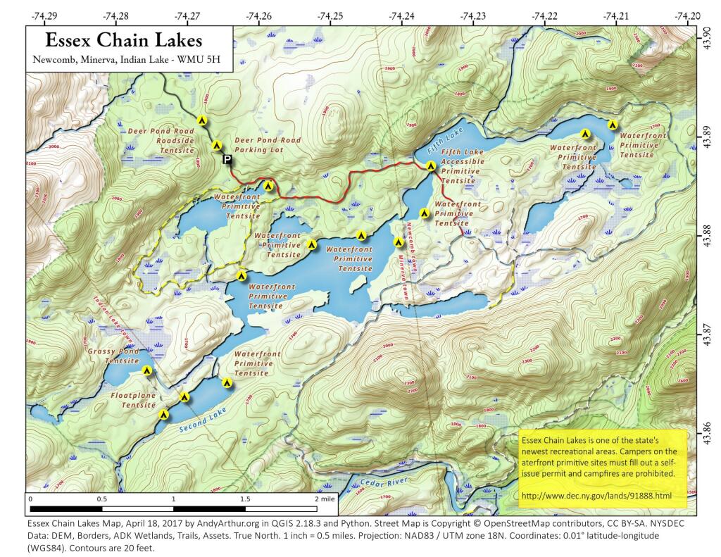
 Essex Chain Lakes

 Essex Chain Lakes

of Oswegatchie River Campsites and Lean-Tos

List of Essex Chain of Lakes Campsites

Here is a list of Essex Chain Lake Campsites. Special restrictions and reservation exist for many of these campsites, see the DEC website for details.

You can also get this as a Google Sheet for ease of downloading into your GPS.

Name Descrip Latitude Longitude
Camp Six Rd Seasonal (Fall) Parking Area 2-3 spaces 43.8781945875647 -74.1951257407619
Camp Six Road Roadside Tentsite   43.891098208087 -74.1858223467572
Camp Six Road Roadside Tentsite   43.880775618509 -74.1920319664505
Camp Six Road Roadside Tentsite   43.8867689717605 -74.1881150206844
Cedar/Hudson River Campsite   43.8526463367848 -74.188226184425
Chain Lakes Rd South Seasonal (Fall) Parking Area   43.8398670879606 -74.2193187297406
Chain Lakes Road South Parking Lot   43.8169730010758 -74.206490005958
Chain Lakes Road South Roadside Tentsite   43.8354885828321 -74.2095424278515
Chain Lakes Road South Roadside Tentsite   43.8318737372315 -74.2087246610165
Chain Lakes Road South Roadside Tentsite   43.8284300483248 -74.2005840726962
Cornell Road Roadside Tentsite   43.9127605502315 -74.2589305446633
Cornell Road Roadside Tentsite   43.90792941637 -74.2708080639985
Cornell Road Roadside Tentsite   43.9067653589248 -74.2728139422411
Cornell Road Roadside Tentsite   43.9119638675587 -74.2629609782825
Deer Pond Road Parking Lot   43.8881877909056 -74.26459017266
Deer Pond Road Roadside Tentsite   43.8921619513765 -74.2680906874901
Deer Pond Road Roadside Tentsite   43.8896153020103 -74.2660494488172
Essex Chain Equestrian Staging Area Includes accessible mounting platform & kiosk 43.9080902992726 -74.1856206534589
Floatplane Tentsite   43.8624107973145 -74.2738175850679
Floatplane Tentsite   43.8441807728989 -74.2572948564662
Floatplane Tentsite   43.8641746165881 -74.2708879596156
Grassy Pond Tentsite   43.8668988556171 -74.2761009397051
Indian River Put-In Parking Lot   43.8016889699131 -74.2299529872379
Indian River Put-In Water Access Hand-carry launch 43.8017043411256 -74.228261437504
Outer Gooley Parking Area   43.8273906506622 -74.2007441162829
Parking Area   43.9144824495811 -74.1846526844935
Pine Lake Primtive Tentsite   43.8493835353493 -74.2458702713384
Polaris (Iron) Bridge Tentsite   43.8946526943318 -74.1651586934731
Polaris Bridge Parking Area 2-3 spaces 43.8954955101626 -74.1682746441243
Waterfront Primitive Tentsite   43.8803564638727 -74.245948680651
Waterfront Primitive Tentsite   43.8794781290843 -74.2529060663751
Waterfront Primitive Tentsite   43.8825615413222 -74.2370898191954
Waterfront Primitive Tentsite   43.8854551161564 -74.2589146456769
Waterfront Primitive Tentsite   43.8763773474625 -74.2627649431543
Waterfront Primitive Tentsite   43.8913218971427 -74.2106406874051
Waterfront Primitive Tentsite   43.865579967021 -74.2649096009151
Waterfront Primitive Tentsite   43.8796521294405 -74.2407518111291
Waterfront Primitive Tentsite   43.8904359124813 -74.2144855367511

Past and Present Management Of Moose River Plains

Today’s fodder was is an excerpt from “Moose River Plains Wild Forest Revised Draft Unit Management Plan/Draft Generic Environmental Impact Statement ‐ July 2010”, Appendix III, a NYS Department of Conservation Document that is in the public domain. As the DEC will probably eventually remove this from the internet, and because it is only in PDF I have decided to share it in the entirity in this blog post.

I have added some pictures I’ve taken over the years at Moose River Plains. I hope you find this interesting and helpful. – Andy

Past and Present Management Of Moose River Plains.
As Written By NYSDEC, Revised Draft Unit Management Plan

The State acquired an original tract of 9,000 acres in the heart of what is now the MRPWF before 1900. In 1948 the Conservation Department issued a permit allowing Gould Paper Company to use an existing wagon road known as the Kenwell Road to haul timber across State lands and to maintain a gate at the end of the road near Limekiln Lake to prevent public access. The Department acquired 15,710 acres surrounding Limekiln Lake from Gould in 1960, then another Gould parcel encompassing Lost Ponds and containing approximately 1,803 acres in 1962. An individual owner sold the State a parcel of 356 acres including Beaver Lake in 1963. The majority of what is now the MRPWF and the northern part of the West Canada Lake Wilderness was added to the Forest Preserve in 1963 when Gould Paper Company sold the State a tract of 50,970 acres stretching from Horn Lake on the west to Manbury Mountain on the east. Major subsequent additions included 602 acres surrounding Wakely Dam and the north end of Cedar River Flow from Finch, Pruyn and Company in 1964 and two large parcels acquired from International Paper Company: the 1,120‐acre Cellar Mountain parcel in 1986 and a tract of 9,925 acres south of Wakely Mountain in 1988. The larger parcel was acquired subject to a 1987 easement conveyed by IP to Hamilton County for the maintenance of the four miles of Cedar River Road which crossed the parcel. Appendix 25 contains an acquisition map.

A small parcel was acquired in 1981 along Route 28. This acquisition included access to the shore of Fourth Lake. However, there is no potential to develop any water access at this location. Appendix 15 contains a deed and sketch map for this parcel.

Moose River Plains Overview

After this major acquisition, the Department took an active approach to the management of the area then referred to as the Moose River Recreation Area, a name which reflected the intent behind the purchase. From the beginning, the Department pursued the development of an extensive road system to provide public access to the remote interior for hunting, trapping, fishing and camping. An early Department report indicated that there were about 178 miles of primary gravel roads and an equal extent of secondary and winter roads throughout the former Gould lands. However none of the roads was suitable for public motor vehicle use without significant improvement. Minutes to a meeting of Department staff on December 9, 1963 included an estimated cost of $25,000 for the annual maintenance of 50 miles of roads and bridges. Starting in 1964, Division of Fish and Wildlife staff used heavy equipment to improve roads initially identified for public use. When the area first was opened to the public on October 23, 1964, the road connecting the Limekiln and Cedar River entrances had just been cleared by bulldozer, but remained difficult to traverse. In addition to the LLCR Road, the Rock Dam Road, Otter Brook Road and Sly Pond Loop were open to public use by permit for a total of about 30 miles. Fifty‐six parking areas were established along the road system. At the entrance gates, cars were assigned parking areas and travel was allowed only to and from those areas. The public were four‐wheel drive vehicles or tire chains. Pickups with slip‐on campers were permitted from the start, but because the roads were not yet suitable, trailers were not permitted.

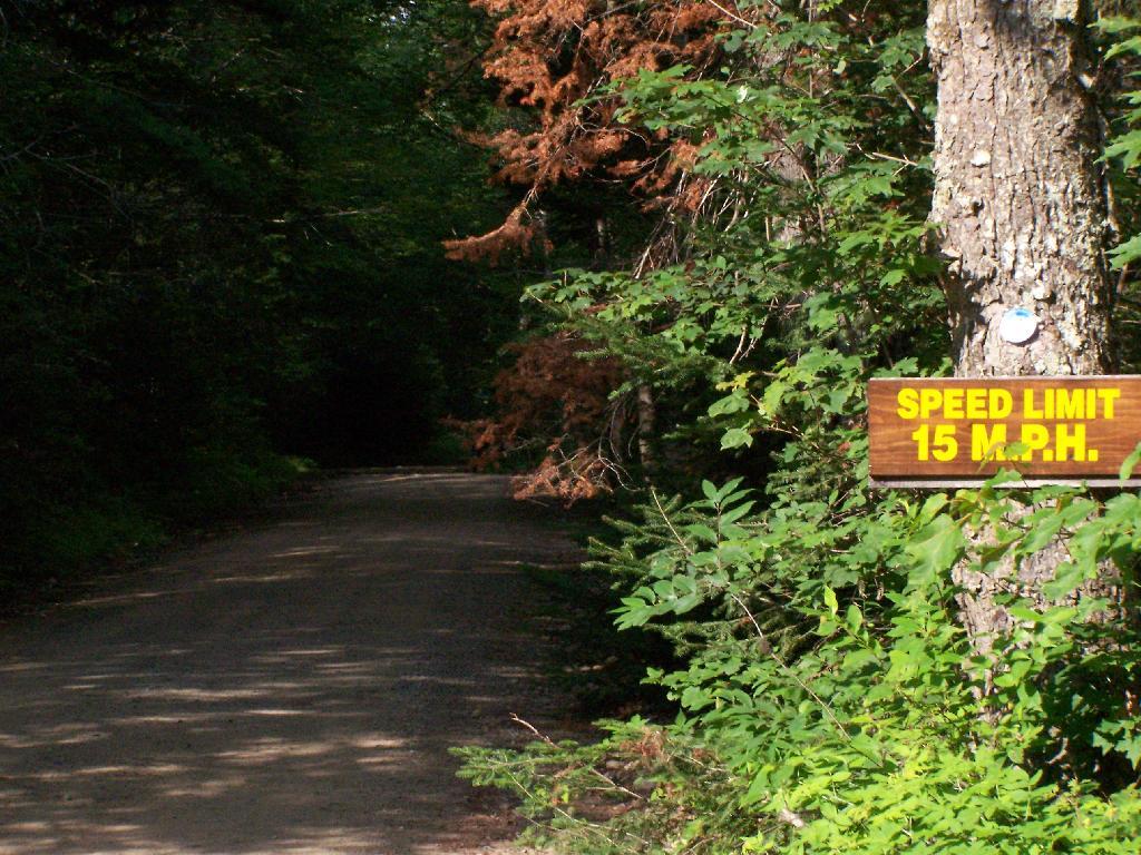
Speed Limit 15 MPH

In a road plan adopted in 1965, roads to be designated were divided into three categories. Twenty‐two miles would be first priority roads, open to all traffic; 30.5 miles would be second priority roads open only to fourwheel drive vehicles; and 7.5 miles would be administrative roads restricted to use by Department staff for crossing private property. In the first years after the area was opened to the public, access remained difficult because of the effects of weather on road conditions. In the summer of 1965, work needed to make the roads passable delayed opening until July 1. In order to minimize fire danger and facilitate the disposal of trash, the public was allowed to camp only in areas adjacent to the roads and for a maximum of 3 days. Trash receptacles eventually were provided at most campsites and Department staff collected trash twice a week through the 1970s. The trash was deposited at a dump site south of the LLCR Road east of Helldiver Pond.

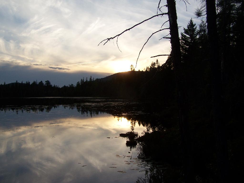
Helldiver Pond in Evening

The road crew worked steadily year by year to improve the roads with the intention of ultimately allowing them to be traveled safely by cars. After the extensive logging by Gould, especially after the 1950 Blowdown, much of the area was occupied by thick low vegetation, the tops of harvested and wind‐thrown trees. Foot travel was difficult. To allow hunters to more easily travel through more remote areas in search of game, Fish and Wildlife staff used a bulldozer to clear and extend logging roads and skid trails to serve as foot trails, starting in the late 1960s. Trails cleared in this way include routes to Mitchell Ponds, Bear Pond, Lost Ponds, Cellar Pond, Beaver Lake, Sly Pond and Squaw Lake, as well as those along Benedict Creek and Butter Brook. A number of routes cleared at that time are now within the West Canada Lake Wilderness, including the trails to Horn Lake and Falls Pond. Many of the cleared routes extended beyond the trails currently marked and maintained. A map prepared by Jack Harnish, a member of the crew that did the trail clearing work, is on file with the Department.

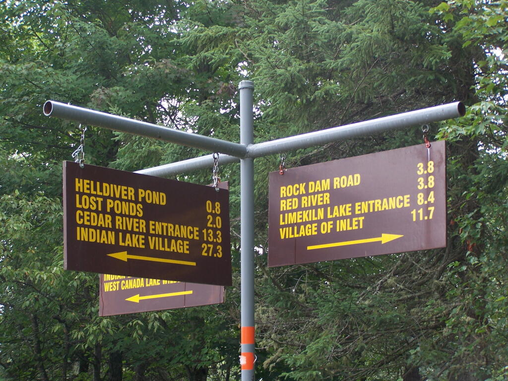
Direction Sign at The Big T Junction

The minutes of the December 9, 1963 Department staff meeting mentioned above included in the list of recommendations for the operation of the area that the Department should establish several small camping areas to include table, fireplace and latrine throughout the area adjacent to the roads where parties can park and camp. By 1965 the Department began constructing campsites and installing fireplaces, picnic tables and privies, which were built in a field just west of the Cedar River entrance. At each suitable location along the road system, a bulldozer was used to make a short access driveway and level an area where a car or pickup truck could park and camp. A number of campsites were created at former log landings. Many of the areas originally intended as roadside parking areas later were converted to campsites. Campsite construction was completed by the late 1960s.

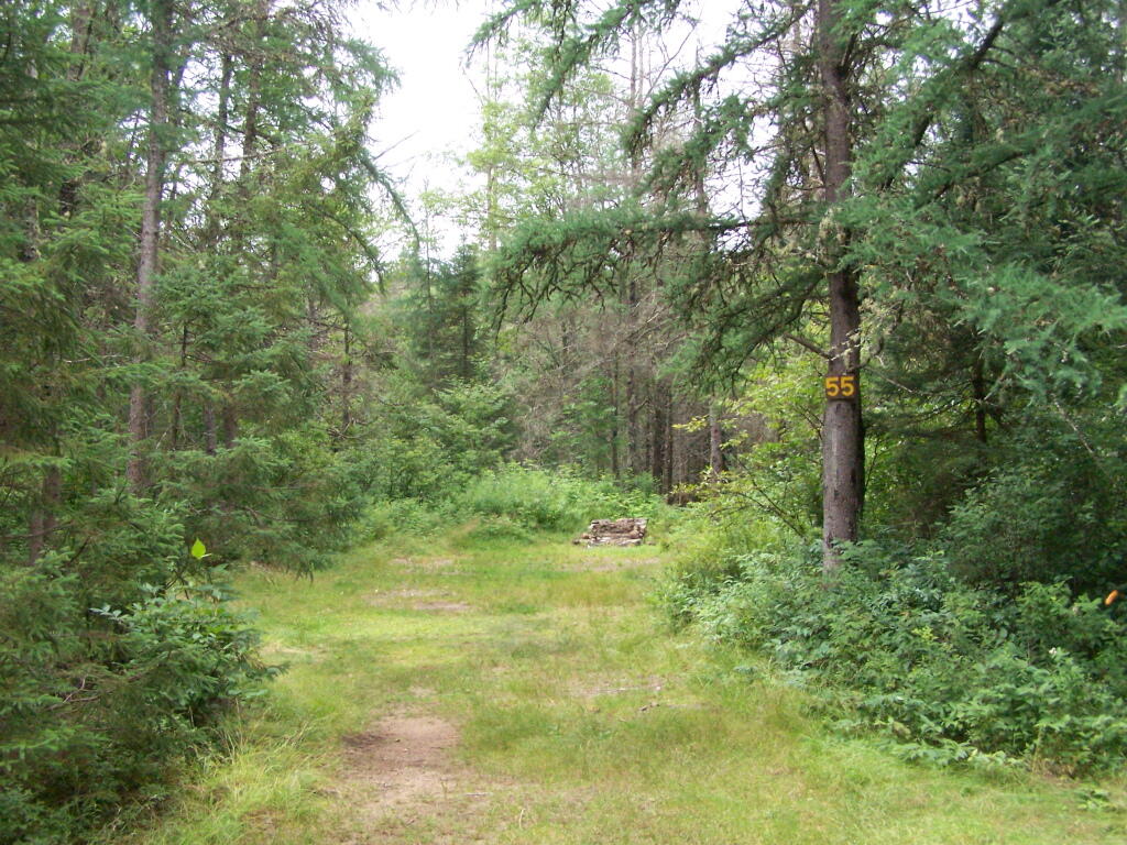
Campsite 55

Because of the importance of the Plains as a deer wintering area, the Departments game management staff began studying the area in 1931. Hunting and fishing advocates such as the Adirondack Conservation Council supported the acquisition of the Plains and the development of its roads, trails and campsites for hunting and fishing access. In 1965 and 1966 with federal Pittman‐Robertson Act funding, 30 log landings were graded for hunter parking access and 30,000 trees were planted in the Plains area as an experiment intended to provide winter deer shelter.

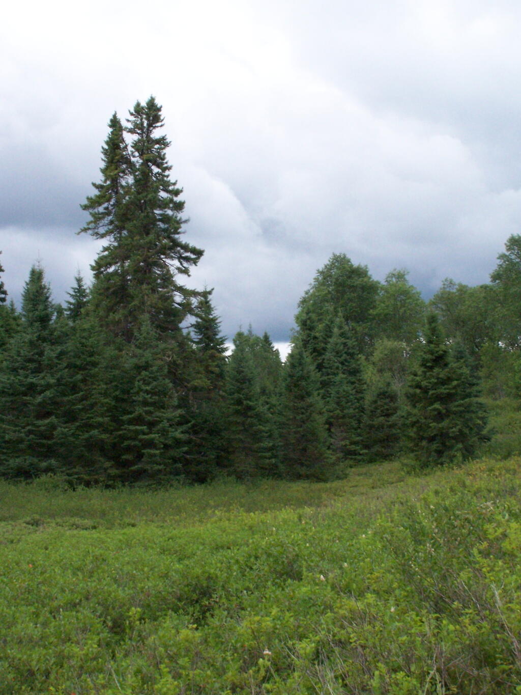
Tall Pines in the Plains

In 1965 housing was constructed for the Limekiln and Cedar River gatekeepers. The possibility of a use fee was discussed, but no fee was charged during the early years. During the 1976 season the Department charged a fee of $1.50 or $2.00 per car. A subsequent assessment determined that most of the revenue generated by the fee was offset by the costs of staffing and administration. The fee was discontinued the following year.

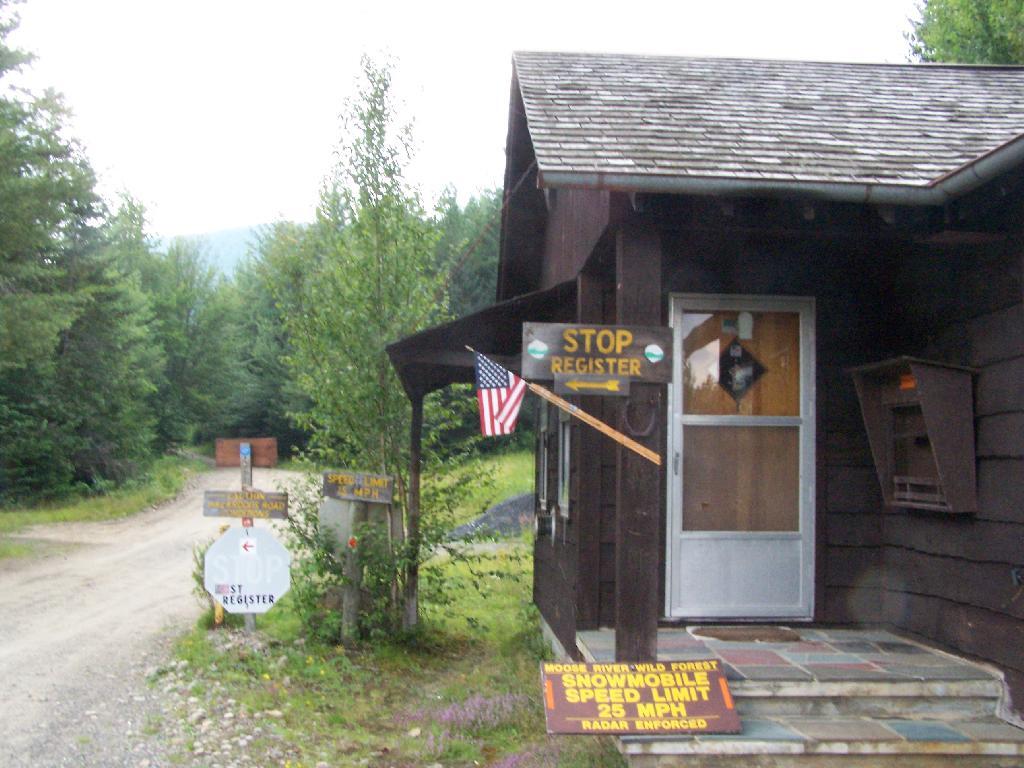
Entrance to Moose River Plains

Work to clear hunter access trails by bulldozer continued for a few years. However, after repeated incidents of public motor vehicle travel on these trails, 16 barriers were installed in 1970, and motor vehicles no longer were used to maintain the trails. Also in 1970, the original road plan was changed to close 22.5 miles of the original III. Management and Policy Moose River Plains Wild Forest Revised Draft Unit Management Plan/Draft Generic Environmental Impact Statement ‐ July 2010 67 30.5 miles of secondary roads to the public and retain them as administrative roads. The other 8 miles, consisting of the beginning of the Otter Brook truck trail and the road to the Indian River, were upgraded to primary roads and the gate at the Otter Brook bridge was removed.

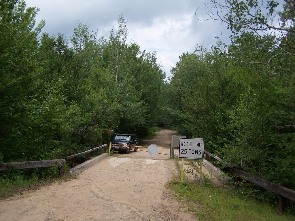
Otter Brook Bridge is Closed

As work progressed over the years and the condition of the road system improved, the Department relaxed restrictions on the types of vehicles the public could drive. In the late 1960s the Department decided to allow motorhomes up to 22 feet long to travel the roads through big game hunting season, as long as they had tire chains. It was thought that they were less likely to get stuck than vehicles towing camping trailers, which the Department continued to prohibit. However, pressure to allow trailers began early and continued to grow. After Department staff conducted an assessment of the roads and determined that they had been sufficiently improved, they decided to allow trailers beginning around 1980.

For several years after the Department first erected wood signs in the MRPWF, they were repeatedly damaged by black bears. To prevent further destruction, metal signs were installed in 1975.

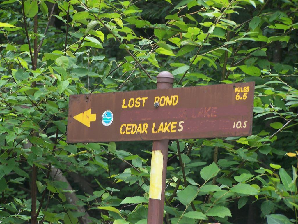
6.5 Miles to Lost Pond

A detailed Department map prepared in 1977 shows 222 campsite and parking area locations along the road system. The map provides an inventory of the structures at each site, showing the prevalence of fireplaces, picnic tables and privies at the time. Twenty sites were closed in 1980 after the reclassification of the southwestern portion of the area to wilderness, when the road to the Indian River was gated at Indian Lake. The campsites were not given numbers on the ground until the 1980s. A number of original sites that had fallen into disuse were bypassed when the numbers were assigned, so that in 2008 there are 170 numbered sites. In 2006 sites 7, 34, 66, 73, 90, 119a, 130 , and site 1 at Cedar River Flow were modified and designated as accessible sites.

In recent years, maintenance activities have focused on keeping the road system in passable condition, replacing inadequate culverts and trail maintenance. In 2001, four gravel pits were reclaimed and replanted.

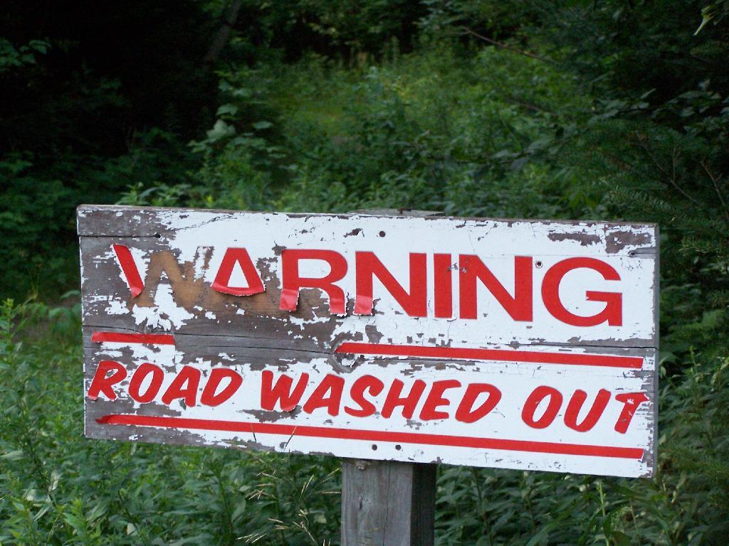
Warning! Road Washed Out

In 1996 an engineering evaluation was completed for the public motor vehicle roads in the unit. The report focused on 8 major and 12 minor culvert problem areas and made recommendations for replacing existing culverts with new structures of sufficient capacity to handle a design storm of 100‐year occurrence probability with a snowmelt allowance. Between 2000 and 2005, 11 of the 12 minor sites, with the exception of site 10B, were addressed and site 5A of the major sites is the only one complete. The report and an updated status can be found in Appendix 22.

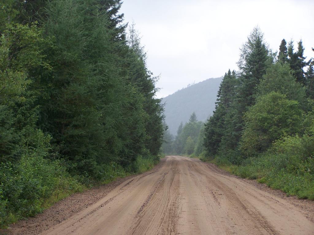
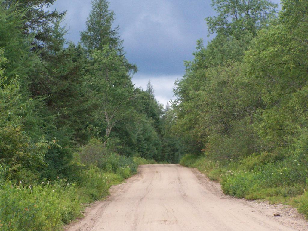
Straight Thru the Plains

In 1974, jurisdiction over approximately one acre of State land was transferred from the Hudson River‐Black River Regulating District to the Department for use as a canoe access site on Sixth Lake. In 1986, the Department transferred jurisdiction of 6.41 acres of State land along Sagamore Road to DOT. This parcel encompasses an old sand pit and was transferred so that DOT could relocate their maintenance facility from an area immediately adjacent to State Route 28 to a more screened location. DEC reserved the right to use gravel from this site, as long as it did not interfere with the DOT facility. Currently DOT does not use the site, but may use it at some time in the future.

Moose River Plains Overview

When the Moose River Recreation Area was first opened to the public, use levels were relatively high. During big game hunting season in 1964, 2,021 vehicles with 5,764 passengers signed in. Though the area originally was purchased and developed for use by hunters, trappers and anglers, the first 10‐day report filed after the 1965 opening on July 1 indicated that 75 percent of visitors were campers and sight‐seers. In 1966, 7,809 people signed in as anglers and 23,408 camper‐days were recorded during big game hunting season, about 6,000 of which were recorded for campsites beyond the Otter Brook bridge. Big game hunters were very successful in the early years, harvesting 373 deer and 15 bear in 1966 and a high of 404 deer in 1968. Deer harvest levels declined sharply after 1969, with 77 harvested in 1970 and 11 in 1971. Since the 1970s the number of deer taken by hunters has increased and in recent years harvest numbers have nearly returned to the levels recorded in the 1960s. The MRPWF remains popular with hunters, trappers and anglers.

Thunderstorm Coming to the Plains

Early management included the adoption of a number of regulations in 1972. These regulations, which still apply to public use of the area, require visitors to register at the Cedar River and Limekiln entrances, require the use of tire chains after October 1 except on 4‐wheel drive vehicles, prohibit snowmobile operation during the big game hunting season and prohibit the use of motorcycles and motorized bicycles. Current conditions may warrant the elimination of the registration requirement and the prohibition against motorcycle use.

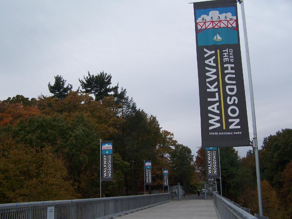
Walkway Over the Hudson

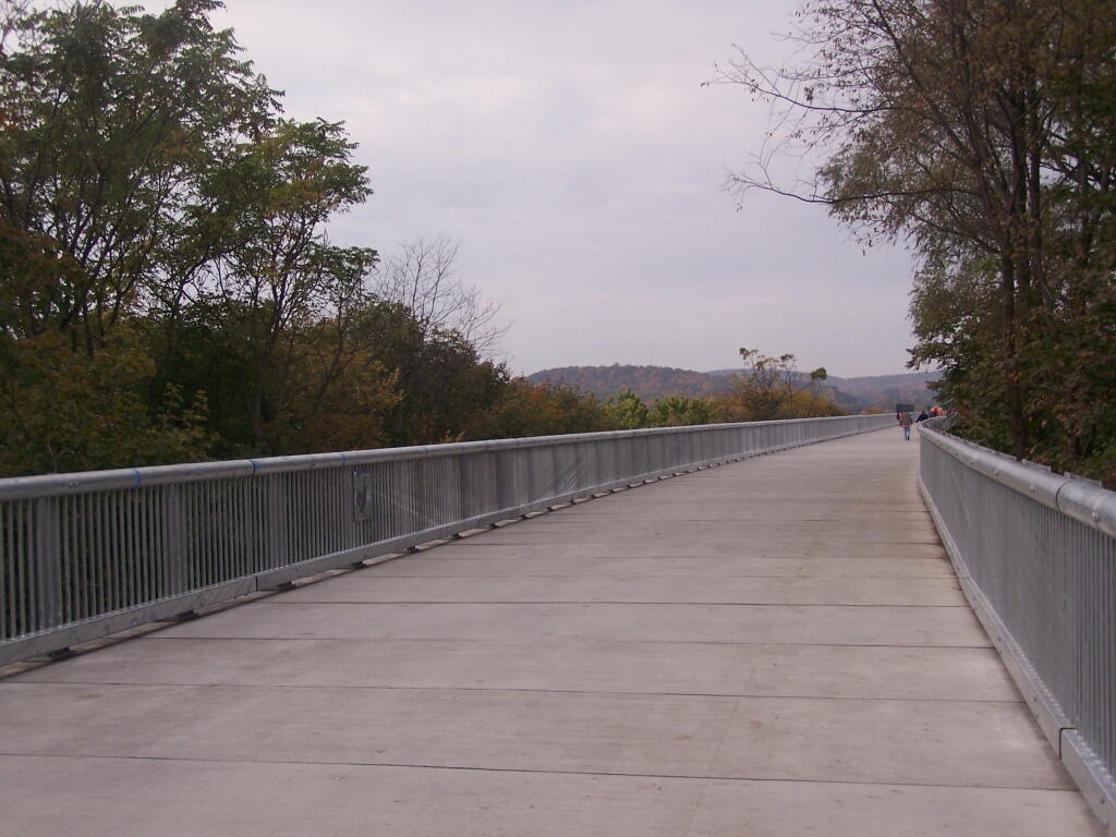
On a rather cloudy day that I had taken off from work last week, I decided to drive down to the Walkway Over the Hudson. I got down there around 9:30 PM, on a cloudy Wednesday, and the parking lot only had one parking spot left on the Pougkeepsie side. It is accessible from the Poughkeepsie side via taking US Route 9 North from Pougkeepsie then turning onto NY Route 9G south. Alternatively, you can access it from Haviland Road in Highland.

Flags

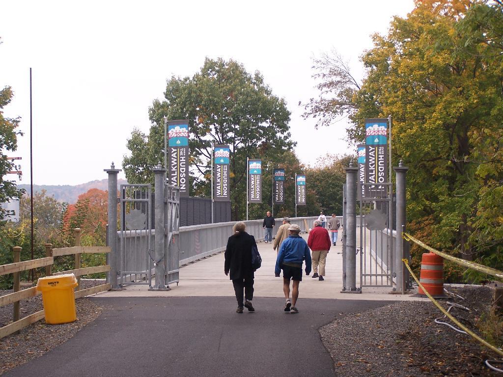
The newly extended bike trail leads directly to the Walkway from the rather large Poughkeepsie parking lot. If you can’t find space in the lot, there is plenty of space on nearby city streets.

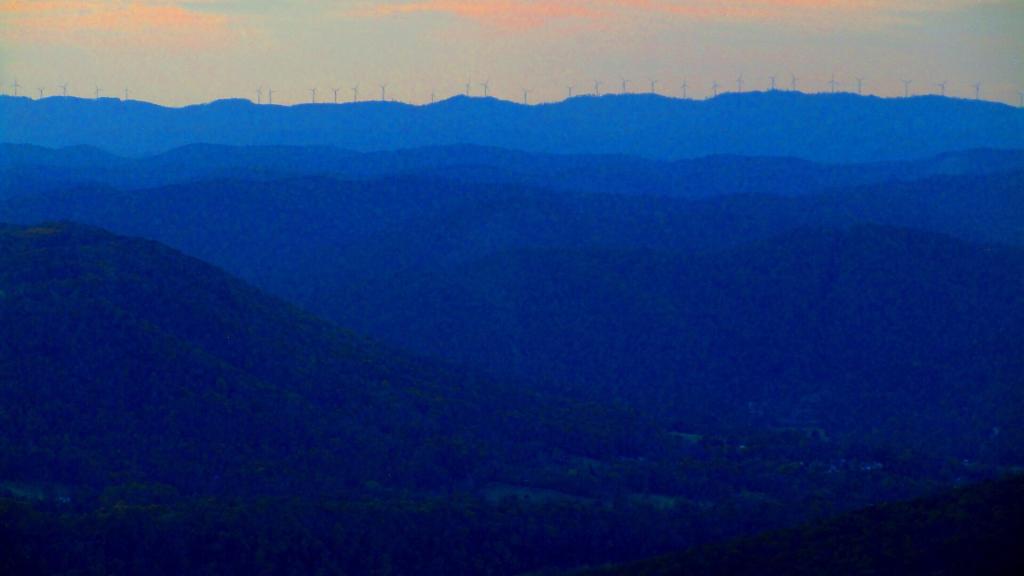
Wind on Backbone Mountain

Big crowds of people entering the Walkway.

Entering  the Walkway

At 28-feet wide and nearly two miles long, it’s pretty big and wide. Despite probably several hundred folks on the bridge, it doesn’t feel at claustrophobic or tight.

A Big Bridge

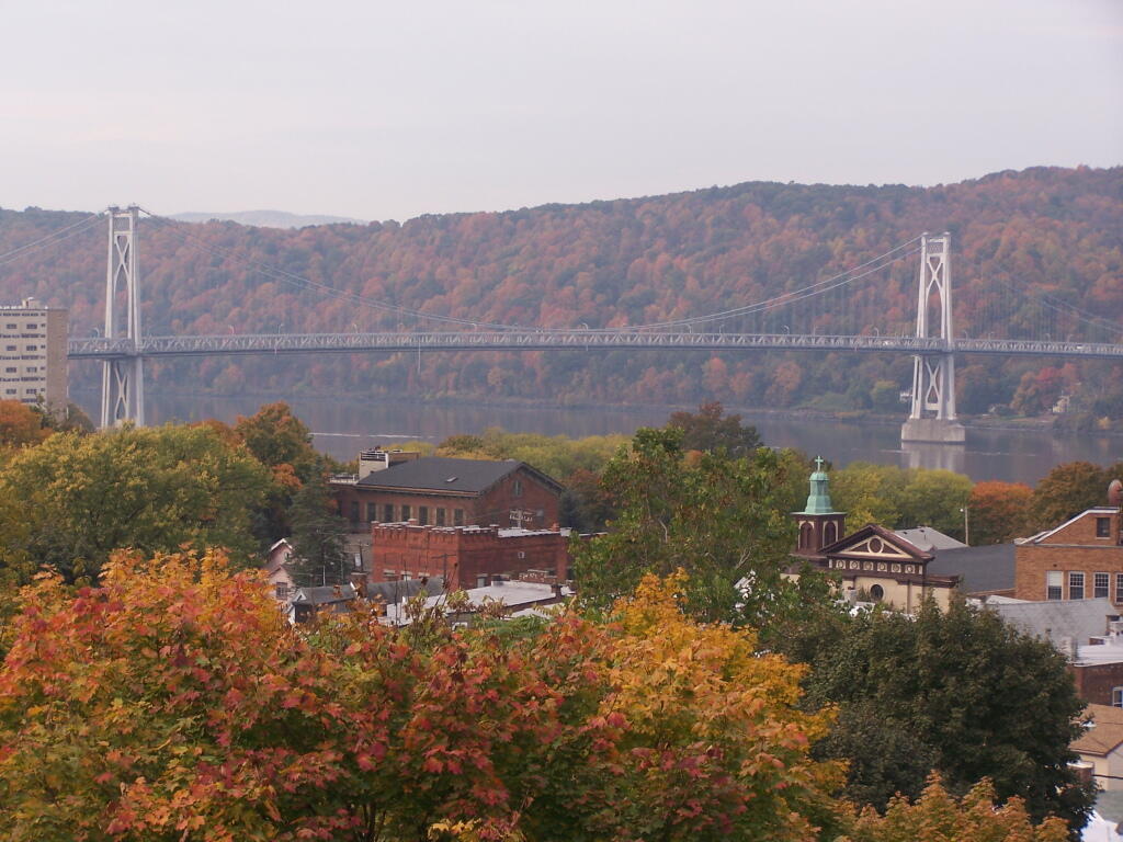
Looking across Poughkeepsie at the Mid-Hudson Vehicle/Pedestrian bridge.

Across the City to Mid Hudson Bridge

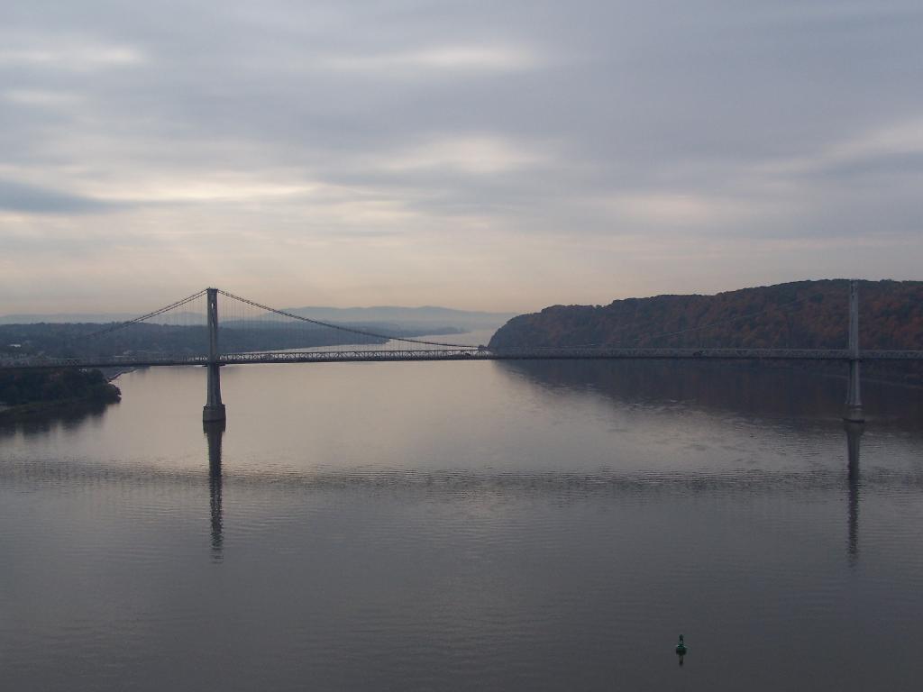
From the center of the bridge looking directly south.

Mid Hudson Bridge

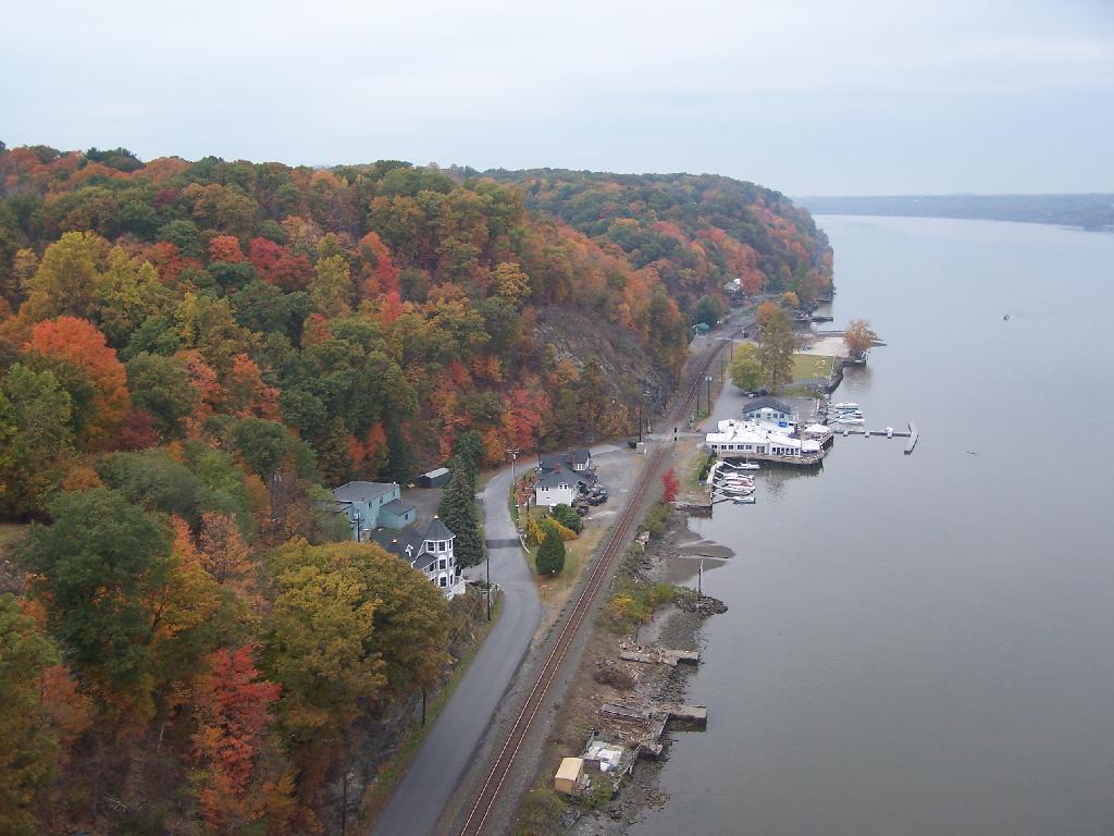
North along the Highland side of the Hudson River.

North Along River

All and all it is a beautiful walk across the bridge. If you plan on taking some pictures, and want to walk from one side of the bridge to another, you should figure about two hours of time. More at walkway.org.

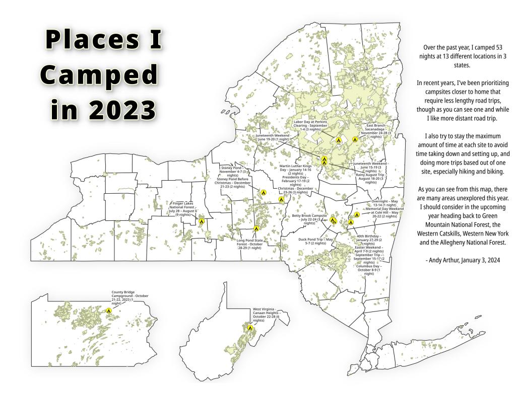
Places I Camped in 2023

While this year was a rainy one, and it rained during many of my trips, I was able to get out for 53 nights in the wilderness — mostly fairly close to home but I also did a trip down to West Virginia in late October with several trips to the Adirondacks, Central New York and summer vacation in the Finger Lakes.

Places I Camped in 2023

Martin Luther Kings Day – January 14-16 (2 nights)

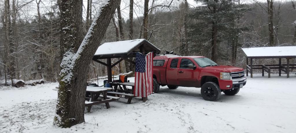
To start out my camping adventures in 2023, I drove out to Charles Baker State Forest and Brookfield Horse Camp. There wasn’t a lot of snow — just a dusting but it was a fun weekend, topped off by a beautiful sun-full glittery hike up Tassell Hill after a hoar frost. Explored Lost Pond and several of the trails in the middle of state forest.

Home for the weekend

40th Birthday – January 27-29 (2 nights)

For my fortieth birthday, I took off the Friday leading up to my 40th birthday to cross country ski and winter camp at Rensselaerville State Forest. It was a beautiful weekend with lots of blue skies, sufficient snow for skiing but not so much that was a ton of snowmobiles out on the trails.

Beautiful Day of Skiing

Presidents Day – February 17-19 (2 nights)

I decided for Presidents Day Weekend to do another trip out to Charles Baker State Forest and Brookfield Horse Camp. Slightly more snow then last time but again largely a snow-less winter, with some nice days for hikes through the various truck and horse trails. I hiked around much of state forest, especially the more southern part of the forest.

Evening on Truck Trail 13

Easter Weekend – April 7-9 (2 nights)

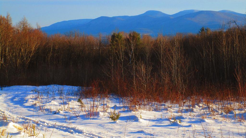
On Good Friday through Easter I camped at at Rensselaerville State Forest. The snow was gone and it was fairly mild though at times it was a bit cool. Spent a fair amount of time walking around and exploring the new OSI Parcel that has been recently added to state forest and is still largely open fields with sweeping views of the Catskill Mountains.

Hillcross Farm Pond

Duck Pond Trip – May 5-7 (2 nights)

The first Friday in May I took a half day from work and headed out to Schoharie County to camp at Duck Pond at Burnt-Rossman Hills State Forest. Originally the plan was to camp two nights at Duck Pond, hiking along the Long Path and exploring the state forest and then on Sunday hiking the Catskill Scenic Trail. That part of the trip changed when driving along Duck Pond Road the low tire pressure light came on I found a pallet nail in my truck tire. I was able to top off the truck tire and then change the tire when I got home and got the nail pulled and plugged. But it wasn’t the best way ever to end a trip early.

Spring

Overnight at Cole Hill – May 13-14 (1 night)

After visiting the folks on Mother’s Day Weekend, I decided to do a quick overnight hammock camp on Cole Hill State Forest in Berne. Nothing fancy or formal, it was as much a way to test out sleeping in my hammock with the bug screen. Kind of a chilly night, I took camp down fairly and headed home early in the morning.

Hammock Camping on Cole Hill

Memorial Day Weekend at Cole Hill – May 20-22 (2 nights)

This year I decided to eschew the Adirondacks and Greene Mountains for Memorial Day Weekend due to the black flies, my desire to look at bicycles, and work I had to do on the Saturday morning leading up to the holiday weekend. I decided to hammock camp again Cole Hill State Forest in Berne. This was a three-day two night trip, so it it gave me a chance to bring more gear up the mountain, set up a more formal camp. Cooked on the fire, hiked around the forest. It was a warm weekend, but I enjoy the solitude, along with having good cell service for listening to podcasts and watching videos.

Cooking down dinner

Juneteenth Weekend on Piseco-Powley – June 15-20 (4 nights)

To kick off summer, I did my usual Juneteenth weekend camping trip, tacking on some days on the Juneteenth Holiday Weekend. It was a bit of a cool and rainy weekend to kick off summer, one that would actually be followed by many cool and rainy weekends where I would stay home. Camped at House Pond for the first three nights, spending time down floating in the tube on East Branch while the final night I camped up at Powley Bridge site and kayaked along the East Branch. Really, like often is the case, the best weather was the day I took down camp.

Evening on East Canada Creek

Catskill Scenic Trail Trip – July 22-24 (3 nights)

After several months of researching and visiting various bike shops, I finally got a mountain bike. I decided it would be fun to do as much of the Catskill Scenic Trail as I could before my summer vacation got underway. Actually did quite a bit of riding and hiking that weekend — started out hiking Pratts Rock’s then riding from Grand George to Hobart. Sunday, I rode from Fultonham to Middleburgh on NY 30, doing a quick climb up Vromans Nose, then stopping at the farm market then going to Mine Kill State Park to swim. Monday I rode from Hobart down to Bloomville, getting caught in a major thunderstorm and downpour a few miles north of Bloomville with no shelter in sight. The trail became super boggy, then I went to Mine Kill State Park for one more swim, and then out to folks house for Sunday dinner a day later then usual.

After the rain showers

Finger Lakes National Forest – July 28 – August 6 (9 nights)

Every year for nearly a decade and a half I’ve been doing summer vacation out in the Finger Lakes — camping in the National Forest and exploring as much as possible during my days there. The past few years I’ve been driving there on a Friday, to get a better campsite before they’re taken by the weekend campers. This year was no exception. With Blackie, my mountain bike, I did nearly all of the bike trails in the near vicinity, from the Black Diamond Trail to the Cayuta Valley Trail to Dresden – Penn Yan Canal Trail. Kayaked on both Cayuga and Scenic Lakes, swam many days at Watkins Glen State Park and Taughannock State Park, explored the Cornell Campus and Botanical Gardens on my bike. Got some good ice cream at the Spotted Duck, explored the Geneva Waterfront along with the Cayuga-Seneca Canalway. Some rain but compared to the wet summer that was, this was a pretty good week.

Morning on Searsburg Road

Piseco-Powley – House Pond Campsite – August 18-20 (3 nights)

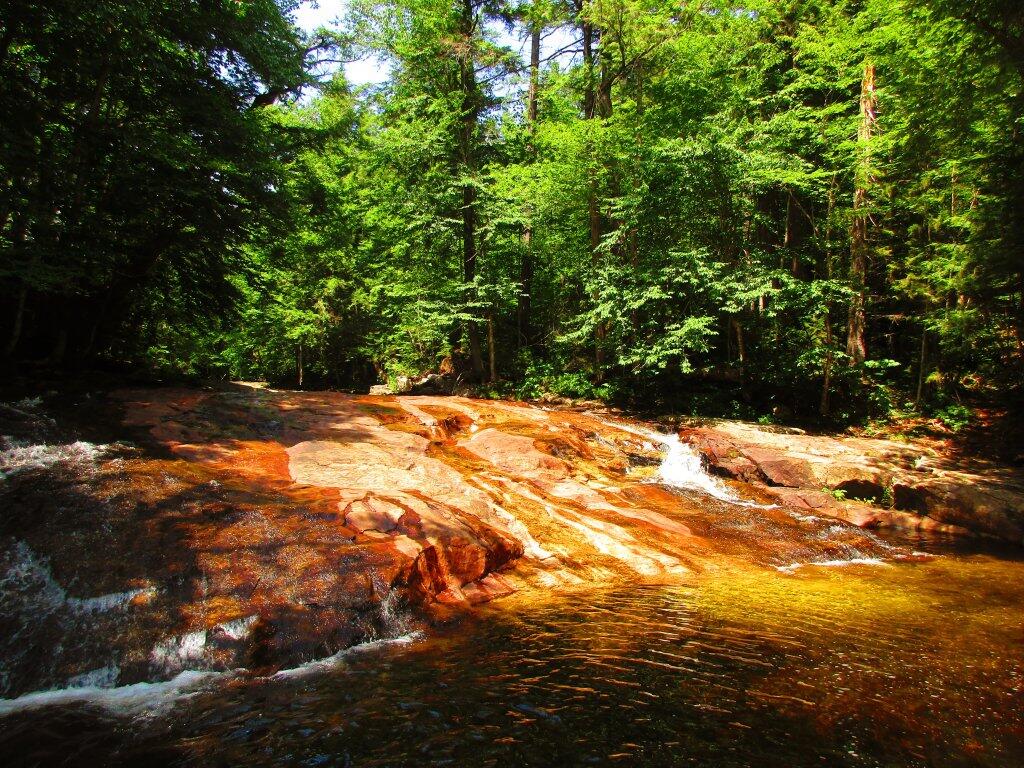
The next few weeks for rainy and by the time I got away for one more long weekend, it promised to be fairly nice weekend but turned out to be fairly cool and cloudy with some rain. Back at the House Pond Campsite, did some swimming in East Branch, but with the mercury in the 60s most of the weekend, I didn’t spend a lot of time in the water. Hardly what I had dreamed when the I planned the weekend. Rode Blackie up to Goldmine Stream Falls and relaxed down by the falls for a bit, also sat down by the swimming hole off of the Old Edick Road Snowmobile Trail, watching the rain fall, bemoaning the wet and cold weather. Still it was good to get away for a bit, and I did do a fair amount of reading in hammock, under the protection of the bug net, as the bugs were bad after such a wet summer.

Gentle Drop Into A Golden Pool

Labor Day at Perkins Clearing – September 1-4 (3 nights)

I took the Friday off before Labor Day to get a jump on the holiday season travel, and set up camp at the site I really enjoy up at Perkins Clearing overlooking the mountains. Did a fair amount of riding along the various dirt roads of Perkins Clearing, including over to Mason Lake and on Sunday rode most of the way to the Spruce Lake Trailhead, though didn’t make it there in time as I got a bit of a late start as I spent the balance of the day reading and swimming in the Jessup River Bridge swimming hole. Labor Day, I rode around the Spectulator Tree Farm, doing a large loop, through the tree farm, past the north end of Elm Lake, then down to Austin Falls and Old Route 8B. I had hoped to get ice cream, but by the time I got to the ice cream shop they were out of soft-ice cream, and there was a long line. Summer was dragging to a close.

Kunjamunk River from Long Level Bridge

September Trip to Rensselearville State Forest – September 15-17 (2 nights)

With time being fairly tight and the weather only so-so I decided to do a two night trip close to home out in Rennselearville to ride some of the gravel trails, explore the OSI Parcel further and just enjoy an early autumn weekend camping.

Evening

Columbus Day at Rensselearville State Forest – October 8-9 (1 night)

Columbus Day Weekend was cold and rainy for the first half of the weekend, but the Sunday heading into Columbus Day was nice, so I decided to head out to Rensselaerville for a quick overnight at the campsite on CCC Road. Leaves were late this year, so not a lot of color, but it still was nice to get away for a night and ride some of the trails around.

Leonard Hill

West Virginia Trip – October 21-29 (8 nights)

The banner trip of the year was my trip down to West Virigina. While it started and ended in rain, it was a very enjoyable trip with lots of new adventures this year. Camped the balance of the week — 6 nights in Canaan Heights — doing day trips from that area. Overnighted one night driving down at County Bridge Campground in Pennsylvania, and a on the way back camped overnight at Long Pond State Forest in New York. Adventures in West Virginia included hiking at Dolly Sods, mountain biking at night in the sods of Canaan Heights, riding up and hiking to Table Rock, exploring Blackwater Falls State Park on the mountain bike, MonPower Mountain Bike Park, Thomas Rail Grade and the Olson Firetower. Rode part of the Great Allegheny Trail through the Cumberland Passage, and the two sections of the Chesapeake and Ohio Canalway, including the Paw Paw Tunnel.

Sunrise

Stoney Pond – November 4-7 (3 nights)

A little over a week back from West Virginia, I headed out to Madison County to ride the Tassel Hill Mountain Bike Trails at Alfred Woodford, the Chenango Canal Trail in Hamilton and Erie Canalway from Chittenango to Green Lakes State Park and then to Canastota and Wampsville. The first night was cold at Stoney Pond but the subsequent nights were quite pleasant and mild.

Old Canal Warehouse in Chittenango  [Expires November 19 2023]

Prospect Mountain – East Branch Sacanadaga – Buttermilk Falls/Hudson Special Management Area – November 24-28 (3 nights)

Strangely enough, I had never been up Prospect Mountain. So I decided the day after Thanksgiving (Black Friday) to hike up Prospect Mountain, and then spend the next two nights camping on East Branch of the Sacandaga River. The Saturday and Sunday was fairly cold, so I ended up spending the bulk of day hanging around camp, doing a bit of hiking around Fox Lair. Sunday, evening around 8 PM it started to sleet, then snow, then rain, Monday morning, it turned into a white globby snow, and I ended up taking down camp fairly early after discovering I was out of propane and then spent much of the day exploring the Hudson River Special Management Area – Buttermilk Falls.

Icy River Road

Stoney Pond – Charles Baker – December 21-26 (5 nights)

On the days leading up to Christmas I decided to take a second trip to Madison County. I was originally planning to camp two nights at Stoney Pond then two nights at the Charles Baker Horse Camp but my family’s holiday plans were cancelled due to illness in my family, so I ended up staying an extra night at the horse camp, through the day after Christmas. On Friday, I rode the Erie Canalway from Canastota to East Verona, nearly to Rome. On Christmas Day I rode around many of truck trails at Charles Baker with my mountain bike, leaving my face splattered with mud. Many of the days were fairly cold and cloudy, but that’s too be expected in late December. Still it was a special way to spend Christmas.

Camp on this cold but still morning ?

Snow flurries for the bike ride in 🚲 ❄

It’s not going to discourage me from riding in. I’ve been looking through my phone and noticing how much I’ve been saving on bus fares by riding in – not as much since the time change – but still riding in one direction saves and it’s good exercise. Truth be told though I end up spending more though when I end up stopping to buy groceries mid week on my commute but I guess it’s important to have healthy eats.

Good morning! Snow flurries and 28 degrees in Delmar, NY. ❄ There is a north breeze at 6 mph. 🍃. Things will start to thaw out at around noontime.

Figure ride to work today 🚲 as time is limited. Not much time left in the year or daylight left to do this, especially as I move to that new office 🏢. I’m treasuring that view of the Capitol and the Hudson River as I know soon I’ll be forgoing it for the suburbs but admittedly better pay, more responsibility and a better sounding job title for experience and the future resume building. 📄 Plus it’s a way to use my skills better 👨‍💻 and expand my knowledge.

Noteworthy, 25 days remain until the end of the year. 🗓 I hope you’ve worked to maximize this year to the best of your ability. ⛺ Hoping to get at least one more adventure out in the wilderness maybe two before the end of the year. 🎄 Maybe Madison County in the days leading up to Christmas, but it all depends on how much snow and cold they have. Rensslaerville State Forest is another easy option, though I’d rather to NYE there.

After feeling kind of sick after work 🤮 yesterday evening and cleaning up after changing my pants 👖 💩, feeling better this morning. Too much stevia and cranberries yesterday with the oatmeal for breakfast followed by rice and lentils I guess or maybe I should have cooked the kale better. I have a lot of trouble with cooked oatmeal though fried or baked with bananas or eggs I’m good. I don’t know, I got washed up and showered and it was fine. 🚿 It’s like the pissing and farting problem, a matter of tweaking what I eat 🍽 to meet nutrition goals 🥅 while not destroying my digestive tract in the process.

I think a lot of the problem lately as I’ve gotten out of the habit of soaking lentils overnight 🥘 before cooking them, though I do wash them. I heard that can make them easier to digest. 🤰 Plus I am trying to drink more water with meals, eat slower, and mix things up. I want to include lots of fiber and protein in most meals, but I need to be careful about how many beans and alike I use for cooking. 👩‍🍳 I don’t have as many problems digesting the pea soup, when I make sure to add water and lots of balmastic vinger and not eat too much.

It was probably better to miss the talk by Miko Peled, Israeli-American human rights activist, as he’s really controversial and I didn’t want to go to the event and get caught on TV 📺 by the news 📰 attending it. The thing is if I’m interested in such alternative perspectives I can always watch on my phone 📱. I really try to stay away from controversy today, especially outside of the blog. Nothing in this world is quite as third rail 🚈 dangerous ⚡ as the Isreal 🇮🇱🇵🇸 conflict. Best to keep opinions to yourself. Not that I don’t know what really to believe which is why I kind of wanted to see controversial Miko Peled. Just to hear another view. 🎤 👤

Today will have snow showers. Mostly cloudy 🌨️, with a high of 33 degrees at 1pm. Eight degrees below normal, which is similar to a typical day around January 5th. North wind 6 to 8 mph. Chance of precipitation is 20%. A year ago, we had light rain. The high last year was 54 degrees. Going to likely be that warm come Saturday. The record high of 68 was set in 2001. 12.5 inches of snow fell back in 2003.❄

I was in bed 🛌 by around 7 PM last night, though I did more study of the Udemy course. 📱 Continuing to learn more about machine learning. 🤖 Woke up around 5 AM and started out with a cold glass of water with some apple cider vinger and ginger. Then frying sweet onions, peppers, adding stir-fry vegetables, mushrooms and corn. 👨‍🍳 Then turmeric, red peppers, two eggs scrambled, some corn starch and topped with nutritional yeast. 😋 A delicious meal complemented by coffee with skim milk, cinamon and ginger. ☕ Yum. Power to ride to work and make it through the day.

Solar noon 🌞 is at 11:47 am with sun having an altitude of 24.9° from the due south horizon (-45.9° vs. 6/21). A six foot person will cast a 12.9 foot shadow today compared to 2.2 feet on the first day of summer. The golden hour 🏅 starts at 3:38 pm with the sun in the southwest (232°). 📸 The sunset is in the west-southwest (240°) with the sun dropping below the horizon at 4:23 pm after setting for 3 minutes and 22 seconds with dusk around 4:53 pm, which is 8 seconds earlier than yesterday. 🌇 The best time to look at the stars is after 5:30 pm. At sunset, look for snow 🌨 and temperatures around 31 degrees. There will be a north breeze at 7 mph. Tomorrow will have 9 hours and 13 minutes of daytime, a decrease of one minute and 3 seconds over today.

Spent too much time yesterday trying to figure out what was wrong 😕 with the maps and graphs of landfills vs social deprivation. I realized that the issue was I should be comparing against state-wide numbers and as such have made up graphs and maps of income and race. I will have to revise the Messer deprivation maps later on when I have time. 🗺 At any rate, it’s been an interesting thought and coding experiment. 🤔 Also I am continuing on with my machine learning class, as its gotten further along and more technical, most of the stuff I’m learning is totally new to me.

Tonight will be mostly cloudy 🌫️, with a low of 20 degrees at 3am. Five degrees below normal, which is similar to a typical night around December 25th. Maximum wind chill around 13 at 3am; North wind 6 to 8 mph. In 2022, we had cloudy skies in the evening, which became partly cloudy by the early hours of the morning. It got down to 47 degrees. The record low of -7 occurred back in 1901.

Been enjoying grapefruit for breakfast or as a snack. 🍊 I never thought I’d like grapefruit as I thought they were awful as a child. But at first I was kind of mixed on it, then learning that my mom can no longer have grapefruit being on statins, I learned to treasure the fruit even more. I should enjoy it, as there might come a time I won’t be able to enjoy it. Healthy to boot. Grapefruit and statins is an interesting topic, the chemical interaction is fascinating. The good news is unless you are on certain statins like Liptour for high blood pressure, grapefruit is healthy and delicious.

Continuing to look at houses and land on Zillow. The thing I find so frustrating is there isn’t a lot of tiny houses with a lot of land — everybody seems to be listing the big house in the suburbs. 🏘 I’d like less then 1,000 feet with lots of acres, to have fires 🔥 and have pigs 🐷 or other livestock. I guess there just isn’t as much rural property out there, but it is fun to browse and see what is out there. I’m not serious, I’m just browsing. 🚜

Today in 1902, a coal mine explosion at Monongah, West Virginia, kills 362 workers.🚂 And in 1953, Vladimir Nabokov completes his controversial novel Lolita. 📙 More uplifting is Adrian Kantrowitz performs the first human heart transplant in the United States in 1967. ♥

Mild this weekend but rather gray.☁️ Saturday, mostly cloudy, with a high near 48. Sunday, a chance of rain after 1pm. Mostly cloudy, with a high near 58. Breezy. Chance of precipitation is 50%. Remember it’s mid December. Typical average high for the weekend is 40 degrees.

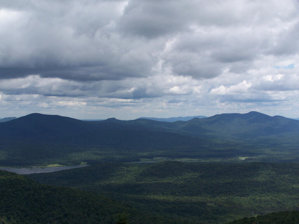
View into Valley

Empire Trail, Erie Canalway, Champlain Valley Trail Parking Areas

Name Address Latitude Longitude
Mohawk Hudson Bike Hike Trail (Albany to Peebles Island State Park) – 10.8 miles
Riverfront Garage 2 Columbia St, Albany, NY 12207 42.65149 -73.74890
Corning Preserve Parking Area Quay St, Albany, NY 12207 42.65346 -73.74496
Corning Preserve Boat Launch Parking Water St, Albany, NY 12207 42.65612 -73.74286
Mohawk Hudson Bike Hike Trail 330 Broadway, Watervliet, NY 12189 42.70950 -73.70495
Peebles Island State Park 1 Delaware Ave North, Cohoes, NY 12047 42.78469 -73.68042
Waterford Parking Lot Front St, Waterford, NY 12188 42.78592 -73.67788
Hudson Shores Park 23rd Street, Watervliet, NY 12189 42.73216 -73.69710
Green Island Trail Parking 260 Cannon St, Green Island, NY 12183 42.75824 -73.68804
Champlain Canalway Trail (Peebles Island State Park to Halfmoon) – 5.6 miles
Waterford Harbor Visitor Center 1 Tugboat Alley, Waterford, NY 12188 42.78741 -73.67902
Park at the Point 61 South St, Waterford, NY 12188 42.78823 -73.68159
Town of Halfmoon Trailhead Parking Brookwood Rd, Waterford, NY 12188 42.83700 -73.67586
Town of Halfmoon Trailhead Upper Newtown Rd, Mechanicville, NY 12118 42.86098 -73.68230
Lighthouse Park Halfmoon 597 Hudson River Rd, Waterford, NY 12188 42.83821 -73.67215
CCT Parking Schoolhouse Ln @ Bells Ln, Waterford, NY 12188 42.81920 -73.67628
On-Road Section (Halfmoon to Schuylerville) – 18.7 miles
Zim Smith East Trailhead 1044 Elizabeth St Exd, Mechanicville, NY 12118 42.90909 -73.70276
Champlain Canalway Trail (Schuylerville to Fort Miller) – 6.7 miles
Old Schuylerville Junction Lock County Rt 42, Schuylerville, NY 12871 43.11263 -73.57849
Hudson Crossing Park Co Rd 42, Schuylerville, NY 12871 43.11456 -73.57742
Schuylerville Visitor Center 30 Ferry St, Schuylerville, NY 12871 43.10001 -73.57954
Fort Hardy Park Reds Rd, Schuylerville, NY 12871 43.10025 -73.57857
Champlain Canalway Trail (Fort Edward to Fort Ann) – 11.9 miles
Fort Edward Adult Exercise Park 39 Mc Intyre St, Fort Edward, NY 12828 43.27362 -73.57990
Feeder Canal Trail Parking Towpath Ln, Fort Edward, NY 12828 43.28390 -73.56889
Champlain Canalway Trail Parking Baldwin Corners Rd, Fort Ann, NY 12827 43.39027 -73.48666
Champlain Canal Lock C-9 2450 NY-149, Fort Ann, NY 12827 43.35247 -73.49676
Champlain Canalway Trail New Swamp Rd, Hudson Falls, NY 12839 43.33236 -73.51177
Feeder Canal Trail Parking 2425 Burgoyne Ave, Hudson Falls, NY 12839 43.29780 -73.56977
Champlain Canalway Trail (Fort Ann to Comstock) – 5.1 miles
Fort Ann Canal Park Ann St, Fort Ann, NY 12827 43.41416 -73.48546
Champlain On-Road Bicycle Route (Whitehall to Ticonderoga) – 25.5 miles
TR41-Whitehall NEW Skenesborough Dr, Whitehall, NY 12887 43.55176 -73.40285
Champlain On-Road Bicycle Route (Ticonderoga to Westport) – 26.8 miles
Bicentennial Park McCormick St, Ticonderoga, NY 12883 43.84908 -73.42144
Westport Trailhead Main St (Route 9N), Westport, NY 12993 44.18174 -73.43264
Champlain On-Road Bicycle Route (Westport to Keeseville) – 30.8 miles
Keeseville Trailhead Front St, Keeseville, NY12944 44.50545 -73.48007
Champlain On-Road Bicycle Route (Keeseville to Plattsburgh) – 14.1 miles
Terry Gordon Bike Path Nevada Oval, Plattsburgh, NY 12901 44.67275 -73.44310
Champlain On-Road Bicycle Route (Plattsburgh to Rouses Point) – 25.8 miles
Plattsburgh Public Parking Green St, Plattsburgh, NY 12901 44.69910 -73.44864
Terry Gordon Bike Path Hamilton & Jay St, Plattsburgh, NY 12901 44.69380 -73.44494
Rouses Point Trailhead 39 Lake St, Rouses Point, NY 12979 44.99658 -73.36542
Shoreline Trail – 8 miles
Fishing and Kayaking South St, Buffalo, NY 14204 42.86554 -78.86801
Buffalo Harbor State Park Boat Launch 1111 Fuhrmann Boulevard, Buffalo, NY 14203 42.84629 -78.86315
Tifft Nature Preserve 1200 Fuhrmann Boulevard, Buffalo, NY 14203 42.84627 -78.85944
Buffalo Harbor State Park 1111 Fuhrmann Boulevard, Buffalo, NY 14203 42.84517 -78.86158
Shoreline Trail (Buffalo) – 8 miles
Lasalle Park DAR Drive, Buffalo, NY 14202 42.89368 -78.89556
Erie Canalway Trail (Tonawanda to Amherst) – 9.4 miles
Tonawanda EST Gateway 72 E Niagara St, Tonawanda, NY 14150 43.02244 -78.87073
Shoreline Trail (Buffalo to Tonawanda) – 9.4 miles
Riverwalk Parking 200 Niagara St, Tonawanda, NY 14150 43.01935 -78.88756
Niawanda Park 200 Niagara St, Tonawanda, NY 14150 43.01781 -78.88921
Riverwalk Parking 200 Niagara St, Tonawanda, NY 14150 43.01549 -78.89387
Niawanda Park Shoreline Trail, Tonawanda, NY 14150 43.01300 -78.90021
Niawanda Park 600 Niagara St, Tonawanda, NY 14150 43.01111 -78.90557
Niawanda Park 600 Niagara St, Tonawanda, NY 14150 43.00952 -78.91018
Niawanda Park 600 Niagara St, Tonawanda, NY 14150 43.00837 -78.91334
Niawanda Park 600 Niagara St, Tonawanda, NY 14150 43.00715 -78.91629
Isle View County Park 796 Niagara St, Tonawanda, NY 14150 43.00175 -78.92581
Aqua Lane Park 128 Aqua Ln, Tonawanda, NY 14150 42.96398 -78.92198
Black Rock Harbor Road Fort Ontario, Buffalo, NY 14207 42.94669 -78.90924
Black Rock Canal Park Aqua Ln, Buffalo, NY 14207 42.94531 -78.90952
Ontario Boat Launch Dog Park Fort Ontario, Buffalo, NY 14207 42.94442 -78.90943
Shoreline Trail – 9.4 miles
Towpath Park Hertel Ave, Buffalo, NY 14207 42.93993 -78.90773
Erie Canalway Trail (Tonawanda to Amherst) – 10 miles
Buffalo Niagara Heritage Village 3755 Tonawanda Creek Rd, Amherst, NY 14228 43.08452 -78.72916
Nature View Park Entrance 1087 Tonawanda Creek Rd, Buffalo, NY 14228 43.06125 -78.80003
Creekside Drive Picnic Area Creekside Dr, Tonawanda, NY 14150 43.02968 -78.82829
Creekside Drive Picnic Area Creekside Dr, Tonawanda, NY 14150 43.02484 -78.83238
Amherst Veterans Canal Park Tonawanda Creek Rd, Amherst, NY 14228 43.06492 -78.80158
Erie Canalway Trail (Amherst to Lockport) – 7.2 miles
Lockport Canal Bike Trail 151-217 State Rd, Lockport, NY 14094 43.16407 -78.70088
East Canal Road Parking E Canal Rd, Lockport, NY 14094 43.13259 -78.72467
Erie Canalway Trail Parking 5557-5599 Feigle Rd, Lockport, NY 14094 43.11317 -78.73737
Erie Canalway Trail (Lockport to Middleport) – 12 miles
Erie Canalway Trail Day Rd & N Canal Rd, Lockport, NY 14094 43.19173 -78.64967
Erie Canalway Trail Parking 7839 LA-57, Lockport, NY 14094 43.18668 -78.66616
Erie Canalway Trail Parking Peet St, Middleport, NY 14105 43.21479 -78.50538
Erie Canalway Trail Parking Hartland Rd, Gasport, NY 14067 43.19985 -78.57615
Lockport Gateway Parking Canal St, Lockport, NY 14094 43.17069 -78.69381
Erie Canalway Trail (Middleport to Albion) – 18.8 miles
Erie Canalway Trail Parking Bates Rd, Medina, NY 14103 43.23052 -78.37135
Erie Canalway Trail Parking Horan Rd, Medina, NY 14103 43.22577 -78.38031
Erie Canalway Trail Parking North Gravel Rd, Medina, NY 14103 43.22573 -78.39221
Middleport Trailhead Front St, Middleport, NY 14105 43.21348 -78.47537
Erie Canalway Trail Parking N Main St, Albion, NY 14411 43.24927 -78.19254
Erie Canalway Trail (Albion to Brockport) – 11.4 miles
Sans Souci Canal Park 4159 County Line Rd, Brockport, NY 14420 43.22226 -77.99676
Erie Canalway Trail Parking 1 Holley Falls Park Rd, Holley, NY 14470 43.22795 -78.02189
Erie Canalway Trail Parking Densmore Rd, Albion, NY 14411 43.25000 -78.13532
Brockport Trailhead Redman Rd (Rt 31), Brockport, NY 14420 43.21436 -77.96716
Erie Canalway Trail Parking N Main St, Brockport, NY 14420 43.21703 -77.93834
Erie Canalway Trail (Brockport to Rochester) – 19.2 miles
Erie Canalway Trail N Union St (Rt 259), Spencerport, NY 14559 43.19388 -77.80052
Erie Canalway Trail Access Lee Rd, Rochester, NY 14606 43.17123 -77.68022
Greece Canal Park 343 Elmgrove Rd, Rochester, NY 14626 43.19127 -77.73625
Greece Canal Park 343 Elmgrove Rd, Rochester, NY 14626 43.19877 -77.73751
Henpeck Park 2901 Ridgeway Ave, Rochester, NY 14626 43.18833 -77.73134
Genesee Valley Park 149 Elmwood Ave, Rochester, NY 14611 43.12358 -77.64017
Erie Canalway Trail (Rochester to Fairport) – 14.7 miles
Erie Canalway Trail Parking Marsh Rd, Pittsford, NY 14534 43.07433 -77.49283
Great Embankment Park Marsh Rd, Pittsford, NY 14534 43.07355 -77.49023
Lock 32 Canal Park 2759 Clover St, Pittsford, NY 14534 43.09300 -77.54798
Meridian Centre Park 2025 Meridian Centre Blvd, Rochester, NY 14618 43.10523 -77.59538
Erie Canalway Trail Parking S Clinton St, Rochester, NY 14618 43.10621 -77.59950
Erie Canalway Trail Parking 3 Schoen Pl, Pittsford, NY 14534 43.09200 -77.51250
Genesee Valley Park Hawthorne Dr, Rochester, NY 14620 43.11628 -77.63802
Lock 33 Canal Park Trailhead 1159-1175 Edgewood Ave, Rochester, NY 14618 43.09616 -77.56898
Perinton Community Park 99 O’Connor Rd, Fairport, NY 14450 43.10078 -77.45640
Genesee Valley Park Gateway Moore Rd, Rochester, NY 14620 43.11977 -77.63706
Erie Canalway Trail (Fairport to Palmyra) – 10.2 miles
Erie Canalway Trail Parking Wayneport Rd, Macedon, NY 14502 43.07609 -77.36101
Erie Canalway Trail Parking Cobb’s Ln, Fairport, NY 14450 43.09620 -77.43081
Macedon Bridge Parking O’Neil Rd, Macedon, NY 14502 43.07035 -77.28931
Erie Canalway Trail (Palmyra to Newark) – 10.2 miles
Pal-Mac Park 555 W Main St, Palmyra, NY 14522 43.06407 -77.24792
Erie Canalway Trail (Palmyra to Newark) – 9.6 miles
Harder Canal Park West Shore Rd, Newark, NY 14513 43.05272 -77.12667
On-Street Parking Van Buren St, Newark, NY 14513 43.04786 -77.09380
Swift Landing County Park Hogback Hill Rd, Palmyra, NY 14522 43.06683 -77.18848
Palmyra Marina Division St, Palmyra, NY 14522 43.06573 -77.22933
Erie Canalway Trail (Newark to Savannah) – 20.4 miles
Galen Boat Launch Water St, Clyde, NY 14433 43.08016 -76.87079
Abbey Park Trailhead 177 Water St, Lyons, NY 14489 43.06384 -77.00222
Erie Canalway Trail Parking Old Lyons Rd, Newark, NY 14513 43.06357 -77.02061
Lock 28B Canal Park 106 N Clinton St, Newark, NY 14513 43.04724 -77.08449
Empire State Bicycle Route (Savannah to Port Byron) – 10.2 miles
Old Erie Canal Heritage Park 1575 Rooker Dr, Port Byron, NY 13140 43.03579 -76.63501
Erie Canalway Trail (Port Byron to Camillus) – 20.2 miles
Nancy Brown Wildlife Sanctuary Warners Rd, Camillus, NY 13031 43.06302 -76.26889
Lock 51 Parking Route 31, Jordan, NY 13080 43.06668 -76.49592
Erie Canalway Trail Parking Route 31 (Erie Dr), Weedsport, NY 13166 43.04336 -76.57577
Nine Mile Creek Aqueduct Thompson Rd, Camillus, NY 13031 43.05869 -76.28733
Erie Canal Park 5750 Devoe Rd, Camillus, NY 13031 43.05262 -76.30320
Warners Park Newport Rd, Warners, NY 13164 43.07605 -76.32720
Schasel Park Trailhead 20-28 Utica St, Port Byron, NY 13140 43.03748 -76.61930
Empire State Trail (Camillus to Syracuse) – 9.2 miles
Inner Harbor Creekwalk W Kirkpatrick St, Syracuse, NY 13204 43.05922 -76.16602
Gere Lock Parking Horan Rd, Syracuse, NY 13209 43.06878 -76.23436
Loop the Lake Trail 280 Restoration Way, Syracuse, NY 13209 43.06680 -76.19696
Creekwalk Parking Bear St W, Syracuse, NY 13204 43.06129 -76.16960
State Fairgrounds Trailhead Gate 2 State Fair Blvd, Syracuse, NY 13209 43.07324 -76.21563
Reed Webster Park Warners Rd, Camillus, NY 13031 43.06405 -76.26878
Erie Canalway Trail (DeWitt to Chittenango) – 10.6 miles
Cedar Bay Park Lyndon Rd, Fayetteville, NY 13066 43.04328 -76.03750
Old Erie Canal State Park – Minoa Green Lakes Rd, Fayetteville, NY 13066 43.05389 -76.00029
Old Erie Canal State Park N Burdick St, East Syracuse, NY 13057 43.04350 -76.02227
Old Erie Canal State Park Kirkville Rd N, Kirkville, NY 13082 43.07030 -75.94932
Old Erie Canal State Park – Poolsbrook Andrus Rd, Kirkville, NY 13082 43.07335 -75.92142
DeWitt – Old Erie Canal State Park Butternut Dr, East Syracuse, NY 13057 43.04440 -76.05074
Erie Canalway Trail (Chittenango to Erie Canal Lock 21) – 19.6 miles
Old Erie Canal State Park Beebe Bridge Rd, Canastota, NY 13032 43.07399 -75.78531
Old Erie Canal State Park N Court St, Canastota, NY 13032 43.08891 -75.71069
Old Erie Canal State Park – Chittenango Lakeport Rd, Chittenango, NY 13037 43.06041 -75.87072
Erie Canalway Trail (Erie Canal Lock 21 to Rome) – 9.3 miles
Empire State Heritage Park NY-46, Rome, NY 13440 43.22640 -75.50188
Erie Canalway Trail (Rome to Utica) – 16.5 miles
Erie Canalway Trail Mohawk St, Marcy, NY 13403 43.13433 -75.27838
Lock 20 Trailhead 5842 NY-291, Marcy, NY 13403 43.14433 -75.29771
Oriskany Flats Wildlife Management Area Oriskany Rd (Rt 32), Oriskany, NY 13424 43.16634 -75.32525
Erie Canalway Trail Parking NY-69, Oriskany, NY 13424 43.16014 -75.33278
Erie Canalway Trail Parking Rome Oriskany Road, Rome, NY 13440 43.19383 -75.43258
Bellmay Harbor Park 139 E Whitesboro St #111, Rome, NY 13440 43.20229 -75.44865
Erie Canalway Trial Parking E Whitesboro St, Rome, NY 13440 43.20200 -75.45406
Gyziec Field Parking S James St & Muck Rd, Rome, NY 13440 43.20253 -75.46768
NYSCC-Utica 39-99 Harbor Lock Rd E, Utica, NY 13502 43.11242 -75.21740
Erie Canalway Trail (Frankfort to Little Falls) – 10.8 miles
Mohawk Boat Launch 102 E Main St, Mohawk, NY 13407 43.01485 -74.99466
Ilion Marina 190 Central Ave, Ilion, NY 13357 43.02058 -75.03039
German Flatts Town Park 575 NY-5S, Mohawk, NY 13407 43.01797 -74.95521
Erie Canalway Trail Parking W Shore St, Little Falls, NY 13365 43.03757 -74.86073
Erie Canal Lock E-18 State Route 5S, Mohawk, NY 13407 43.01600 -74.91772
Erie Canalway Trail (Little Falls to Canajoharie) – 18.7 miles
Erie Canalway Trail Parking Bridge St @ S Saint Johnsville Rd, Fort Plain, NY 13339 42.99223 -74.68075
Canajoharie Trailhead Old Fort Plain Rd, Canajoharie, NY 13317 42.90505 -74.58544
Herkimer Home SHS 200 NY-169, Little Falls, NY 13365 43.02756 -74.81748
Erie Canalway Trail (Canajoharie to Amsterdam) – 22.9 miles
Canalway Bike Parking Lot Bridge St, Amsterdam, NY 12010 42.93480 -74.19961
Auriesville Pilgrimage Lunch Area Queen Anne Road, Amsterdam, NY 12010 42.95260 -74.23838
Schoharie Crossing State Historic Site 129 Schoharie St, Fort Hunter, NY 12069 42.93994 -74.28280
Erie Canalway Trail (Amsterdam to Schenectady) – 16.9 miles
Erie Canalway Trail Parking Rice Rd, Schenectady, NY 12306 42.81765 -73.98462
Lock 8 Park 106 Rice Rd, Schenectady, NY 12306 42.82872 -73.99157
Rotterdam Kiwanis Park Route 5S, Rotterdam, NY 12306 42.84652 -74.01414
Erie Canalway Trail Parking Route 5S (River Rd), Pattersonville, NY 12137 42.89111 -74.08159
Mohawk River Gateway 1 Bridge St, Amsterdam, NY 12010 42.93520 -74.19560
Erie Canalway Trail (Schenectady to Niskayuna) – 10.9 miles
Lions Park 3439 Rosendale Rd, Niskayuna, NY 12309 42.77743 -73.82407
Lock 7 Park Lock 7 Rd, Schenectady, NY 12309 42.80253 -73.84749
Jeff Blatnick Park River Rd, Schenectady, NY 12309 42.81600 -73.86341
Erie Canalway Trail (Niskayuna to Green Island) – 10.5 miles
MHBHT Parking 27 Alexander St, Cohoes, NY 12047 42.76083 -73.70414
Erie Canalway Trail (Niskayuna to Cohoes) – 10.5 miles
MHBHT Parking Loudon Rd, Cohoes, NY 12047 42.79801 -73.73423
Colonie Mohawk River Park 71 Schermerhorn Rd, Cohoes, NY 12047 42.79498 -73.74503
Mohawk Riverside Landing Park 4071 River Rd, Schenectady, NY 12309 42.77184 -73.81475
Manhattan Greenway Trail (The Battery to Inwood Hill) – 13 miles
Riverside Park (limited parking) Henry Hudson Pkway Northbound @ W 96th St, Manhattan, NY 10025 40.79789 -73.97613
NYC On-Road Section (Inwood Hill to Van Cortlandt Park) – 3 miles
Manhattan Greenway Trail On-Street Parking 348 Dyckman St, New York, NY 10034 40.86824 -73.93033
Bronx and Westchester South County Trail (Van Cortlandt Park to Elmsford) – 13.6 miles
HF Redmond Park Redmond Park, Yonkers, NY 10701 40.93827 -73.86921
South County Trail Parking 132 Tuckahoe Rd, Yonkers, NY 10701 40.95519 -73.86624
South County Trail Parking Farragut Ave, Hastings-On-Hudson, NY 10706 40.98298 -73.86601
Great Hunger Memorial (VE Macy Park) Saw Mill River Parkway, Elmsford, NY 10523 41.02507 -73.84579
Tibbets Brook Park 355 Midland Ave, Yonkers, NY 10704 40.92976 -73.87722
Van Cortlandt Park Van Cortlandt Park S, The Bronx, NY 10463 40.88900 -73.89336
Tibbets Brook Park 355 Midland Ave, Yonkers, NY 10704 40.93049 -73.87427
South County Trail Parking Grey Oaks Ave, Yonkers, NY 10710 40.97597 -73.86766
On-Street Parking Broadway @ W 242nd St, Bronx, NY 10471 40.88919 -73.89824
Westchester North County Trail (Elmsford to New Castle) – 9.8 miles
South County Trail Parking Old Saw Mill River Rd (Route 303), Elmsford, NY 10523 41.08039 -73.82943
Tarrytown Lakes Park 209 Neperan Rd, Tarrytown, NY 10591 41.07811 -73.84834
Park and Ride Lot Old Saw Mill River Rd (Route 303), Elmsford, NY 10523 41.08239 -73.83067
North County Trail Parking Bedford Rd (Route 117), Pleasantville, NY 10570 41.12339 -73.81113
Walter Law Memorial Park Library Rd, Briarcliff Manor, NY 10510 41.14573 -73.82451
North County Trail Parking Route 100/N State Rd, Ossining, NY 10562 41.17522 -73.81163
Westchester Landing (Gov. Mario M. Cuomo Bridge) 333 S Broadway, Tarrytown, NY 10591 41.06540 -73.86343
Rockland Landing (Gov. Mario M. Cuomo Bridge) 267 S Broadway, Nyack, NY 10960 41.08169 -73.92205
Westchester North County Trail & Putnam Trailway (New Castle to Mahopac) – 16.1 miles
Mahopac Park and Ride Bucks Hollow Rd, Mohopac, NY 10541 41.37285 -73.73082
Putnam Trailway Parking Mt Hope Rd, Mahopac, NY 10541 41.37291 -73.72876
North County Trail Parking Station Rd (Route 133), Chappaqua, NY 10514 41.18680 -73.80079
Millwood Municipal Parking Route 133/Station Rd, Chappaqua, NY 10514 41.18968 -73.79717
North County Trail Parking Route 118 (Saw Mill River Rd), Yorktown Heights, NY 10598 41.23136 -73.77910
Yorktown Municipal Parking Kear St, Yorktown Heights, NY 10598 41.27055 -73.77999
Yorktown Heights Parking 363 Underhill Ave, Yorktown Heights, NY 10598 41.26911 -73.78163
Junior Lake Park 1939 Edgewater St, Yorktown Heights, NY 10598 41.27637 -73.77495
North County Trail Parking Route 118-Tomahawk St, Baldwin Place, NY 10505 41.34469 -73.75518
Bucks Hollow Rd Parking Bucks Hollow Rd (Off Route 6), Mahopac, NY 10541 41.36744 -73.73981
Putnam Trailway (Mahopac to Brewster) – 8 miles
Putnam Trailway Parking Mud Pond Rd, Mohapac, NY 10541 41.37876 -73.72301
Putnam Trailway Parking Willow Rd, Carmel Hamlet, NY 10512 41.41461 -73.68627
Putnam Trailway Parking 30 Tilly Foster Rd, Brewster, NY 10509 41.41327 -73.63908
Carmel Hamlet Parking 1808 US-6 (Stoneleigh Ave), Carmel Hamlet, NY 10512 41.41868 -73.67240
Maybrook Trailway (Brewster to Pawling) – 9.3 miles
Maybrook Trailway Parking – Lake Tonetta 146 Pumphouse Rd, Brewster, NY 10509 41.41778 -73.61374
Maybrook Trailway (Pawling to Hopewell Junction) – 14.8 miles
Maybrook Trailway Parking South Green Haven Rd, Poughquag, NY 12570 41.57587 -73.70843
Maybrook Trailway Parking 237 NY-292, Pawling, NY 12531 41.52423 -73.64727
Dutchess Rail Trail (Hopewell Junction to Poughkeepsie) – 13.6 miles
Dutchess Rail Trail Parking Diddell Rd, Wappingers Falls, NY 12590 41.62286 -73.85113
Dutchess Rail Trail Parking Van Wyck Lane, Wappingers Falls, NY 12590 41.60340 -73.83655
Dutchess Rail Trail Parking Railroad Ave, Hopewell Junction, NY 12533 41.58550 -73.80697
Victor Waryas Park 75 N Water St, Poughkeepsie, NY 12601 41.70748 -73.94009
Waryas Park 75 N Water St, Poughkeepsie, NY 12601 41.70700 -73.93943
Morgan Lake Park 51 Creek Rd, Poughkeepsie, NY 12601 41.71728 -73.90699
Overocker Rd Parking Area Overocker Rd, Arlington, NY 12603 41.69363 -73.88423
Old Manchester Rd Trail Parking Old Manchester Rd, Poughkeepsie, NY 12603 41.68336 -73.86533
LaGrange Trail Parking Old Machester Rd, Poughkeepsie, NY 12603 41.68297 -73.86347
Dutchess Rail Trail Parking 258 Titusville Rd, Poughkeepsie, NY 12603 41.65609 -73.85640
Dutchess Rail Trail Parking Lake Walton Rd, Hopewell Junction, NY 12533 41.60174 -73.83602
Walkway Over the Hudson 61 Parker Ave, Poughkeepsie, NY 12601 41.71244 -73.92491
Love Rd Parking Area 35-99 Love Rd, Arlington, NY 12603 41.69878 -73.88619
Hudson Valley Rail Trail (Lloyd to New Paltz) – 10.5 miles
Hudson Valley Rail Trail Haviland Rd Lot, Highland, NY 12528 41.71032 -73.95717
Hudson Valley Rail Trail Commercial Ave, Highland, NY 12528 41.71906 -73.96886
Hudson Valley Rail Trail New Paltz Rd, Highland, NY 12528 41.73418 -73.97483
Tony Williams Park S Riverside Rd, Highland, NY 12528 41.73595 -74.00204
HRVT South St Parking 565-557 NY-299, Highland, NY 12528 41.73749 -74.03449
Walkway Over the Hudson 87 Haviland Rd, Highland, NY 12528 41.71027 -73.95510
Sojourner Truth Park 55 Plains Rd, New Paltz, NY 12561 41.74322 -74.09299
Wallkill Valley Rail Trail (New Paltz to South Kingston) – 13.2 miles
DEC Wallkill Boat Launch 395 Springtown Rd, New Paltz, NY 12561 41.80199 -74.08566
WVRT Binnewater Parking 720 Binnewater Rd, Rosendale, NY 12472 41.84813 -74.08809
Ulster County Municipal Parking North Chestnut St, New Paltz, NY 12561 41.75464 -74.08436
Wallkill Valley Rail Trail Rt 32 and Rockwell Ln, Kingston, NY 12401 41.91026 -74.02140
WVRT Parking Coffey Rd, New Paltz, NY 12561 41.78143 -74.09244
Municipal Parking Lot Huguenot St, New Paltz, NY 12561 41.75075 -74.08973
Kingston Section (South Kingston – East Kingston) – 6.7 miles
City of Kingston Public Parking Dock St, Kingston, NY 12401 41.91696 -73.98465
West Strand Park Parking E Strand St, Kingston, NY 12401 41.91834 -73.98221
Rondout Landing Street Parking Rondout Lndg, Kingston, NY 12401 41.91917 -73.98089
Kingston Pt Rail Trail Parking East Chestnut St, Kingston, NY 12401 41.92687 -73.99380
Kingston Point Beach Delaware Ave Parking Lot, Kingston, NY 12401 41.92991 -73.96511
Hudson Valley On-Road Section (East Kingston to Tivoli) – 11.9 miles
Poets Walk Park 776 River Rd, Red Hook, NY 12571 41.98197 -73.91851
Tivoli Community Lot Broadway, Tivoli, NY 12583 42.05881 -73.91215
Tivoli Bays Wildlife Management Area Off Kidd Lane, Tivoli, NY 12583 42.03886 -73.91442
Hudson Brickyard Trail John St, Kingston, NY 12401 41.95186 -73.96395
Tivoli Bays Wildlife Management Area Kidd Lane, Tivoli, NY 12583 42.04595 -73.90676
Kingston-Rhinecliff Bridge Toll Plaza State Route 199 (NY-199), Kingston, NY  12402 41.98025 -73.96296
Kingston-Rhinecliff Bridge East Approach Parking State Route 199 (NY-199), Kingston, NY 12402 41.97267 -73.92535
Hudson Valley On-Road Section (Tivoli to Olana) – 16.1 miles
Clermont State Historic Site 1 Clermont Ave, Germantown, NY 12526 42.08409 -73.91881
Germantown Municipal Parking 189 Main St, Germantown, NY 12526 42.13217 -73.88266
Hudson Valley On-Road Section (Olana to Hudson) – 6.7 miles
Hudson Trailhead N 2nd St & Dock St, Hudson, NY 12534 42.25761 -73.78941
Hudson Skywalk Trailhead Routes 9G and 23, Hudson, NY 12534 42.21932 -73.83254
Albany-Hudson Electric Trail (Hudson to Kinderhook) – 10.5 miles
Stottville Park Trailhead Atlantic Ave, Stottville, NY 12172 42.28591 -73.73847
Stuyvesant Falls Trailhead CR 25A (Hudson Ave), Stuyvesant, NY 12174 42.35813 -73.73331
Stuyvesant Falls Park Lindenwald Ave, Stuyvesant, NY 12174 42.35723 -73.73241
Albany-Hudson Electric Trail (Kinderhook to Nassau) – 11.1 miles
Kinderhook Village Playground Park Rothermel Ave, Kinderhook, NY 12106 42.39639 -73.70419
Kinderhook / Valatie Trailhead Routes 9 & 9H, Valatie, NY 12184 42.40878 -73.69047
Niverville Trailhead Rt 203 and Main St (CR 28), Niverville, NY 12130 42.43335 -73.65889
Albany-Hudson Electric Trail (Nassau to East Greenbush) – 10.5 miles
Village of Nassau Trailhead John Street, Nassau, NY 12123 42.51454 -73.61221
Nassau Lake Trailhead County Route 7, Nassau, NY 12123 42.53585 -73.60887
North Chatham Trailhead Depot Street, North Chatham, NY 12132 42.47592 -73.63326
On-Road Section (East Greenbush to Albany) – 3.5 miles
Riverfront Park Trailhead Broadway, Rensselaer, NY 12144 42.64291 -73.74536
Clinton Street Trailhead Clinton St. and Columbia Turnpike (Rt 20), East Greenbush, NY 12061 42.61908 -73.73343
East Greenbush Trailhead Southern Avenue (at the intersection with Hudson Ave West), Rensselaer, NY 12144 42.61742 -73.73073

May 6, 2017 Night

Good evening! Heavy rain and 56 degrees in Delmar, NY. There is a south-southwest breeze at 8 mph. The dew point is 50 degrees. 0.31 inches of rain is expected before it ends Monday around 7 pm.

Tonight will rain with possibly a thunderstorm before midnight, then scattered showers. Mostly cloudy, with a low of 48 degrees at 5am. Four degrees above normal. South wind 5 to 8 mph becoming calm after midnight. Chance of precipitation is 60%. New precipitation amounts between a tenth and quarter of an inch, except higher amounts possible in thunderstorms. In 2016, it got down to 43 degrees with periods of shallow fog and patches of fog. The record low of 29 occurred back in 1874.

Well I hope I don’t have pink eye but my right eye is a bit irritated because I got something in it while I was fishing down at Henry Hudson Park this afternoon. I put in a fresh contact in it and drove home and flushed it out well with contact solution but it’s still recovering but that may in part be due to eye strain from wearing glasses. I think it will be better by morning or maybe I’ll be four eyes for a few days if I picked up pink eye from the tiny little rock bass I caught and tossed back in the Hudson River. 

Fishing at the Hudson River wasn’t bad but it was crowded, and the wind was a bit intense. Very high water levels from the high tide combined with the run off from the rain. Made casting a bit tricky. I need more sinkers. The red worms were fine, despite leaving them in my truck for a week under the seat. I’m surprised they didn’t cook in the heat but I guess lately it hasn’t been that warm. There was a party for elementary school kids at the pavilion, so they had obnoxious children music playing, so that didn’t make me want to stay for sure. It looked like there was some kind of rescue operation on the river as the Selkirk Fire Department had their rescue boat out there and some police down at the other end of the park. Not sure what that was all about. 

Hooked up the oscillating 12 volt fan in the truck cap. It just plugs into a cigarette lighter port and has a quite strong spring clip that seems to mount to rail on the truck cap just fine. Puts out a nice amount of air and the voltage drop is minimal in part thanks to the heavy wire I used to wire it. 

Wrote some code so I can use alternative colors for mapping primary races with Google Maps. The script I use for mapping had blue and red hard coded in but I’ve added new color options. Going to start making some Google Maps of recent Albany County primaries. 

I was going to return the old accessory  battery from my truck so I could get the core fee back at Walmart but the automotive section door was locked and closed.  I noticed the paramedic car and Bethlehem police there, so I wonder if there was some kind of accident. I’ll have to swing by there tomorrow to  get rid of that battery. I don’t care that much about getting back my core fee but I don’t want the battery sitting on my lawn forever. 

That rain is loud on the roof tonight but I don’t think it will last. I’m fine with us beefing up the ground water supply before the warmth of summer comes and things start to dry out. It looks like we will be stuck in this pattern for a while but I’m hoping the forecast for next weekend will change, so I have a nice weekend to get away. 

Waxing Gibbous Moon tonight with 77% illuminated. The moon will set around 4:35 am. You ain’t going to see it with the rain although maybe the clouds will break later. The Full “Flower” Moon is on Wednesday night with mostly cloudy skies expected. The sun will rise at 5:41 am with the first light at 5:10 am, which is one minute and 15 seconds earlier than yesterday. Tonight will have 9 hours and 38 minutes of darkness, a decrease of 2 minutes and 18 seconds over last night.

Tomorrow will have scattered showers, mainly after 9am. Cloudy, with a high of 54 degrees at 12pm. 12 degrees below normal. South wind 6 to 10 mph. Chance of precipitation is 40%. New precipitation amounts of less than a tenth of an inch possible. A year ago, we had shallow fog, patches of fog, then some sun and a high of 66 degrees. The record high of 92 was set in 1930. 0.2 inches of snow fell back in 1967.

In four weeks on June 3 the sun will be setting at 8:28 pm, which is 26 minutes and 40 seconds later then tonight. In 2016 on that day, we had rain and temperatures between 79 and 63 degrees. Typically, you have temperatures between 75 and 53 degrees. The record high of 97 degrees was set back in 1925.

Looking ahead, 15 Hours of Daylight is in 3 weeks, 8:30 PM Sunset is in 1 months, 50th Gas Up in Gallupville is in 5 weeks, Eat Your Vegatables Day is in 6 weeks, Latest Sunset of Year (8:37 PM) is in 7 weeks, July 1st is in 8 weeks, National Fried Chicken Day is in 2 months, Cow Apprechiation Day (Moo?) is in 10 weeks, Hottest Time of Year Ends (83 Average) is in 11 weeks, National Lasagna Day is in 12 weeks, Last Sunset After 8 PM is in 14 weeks, National Dog Day is in 16 weeks, Harvest Moon is in 4 months, Lowville Cream Cheese Festival is in 19 weeks, Beaver Moon is in 26 weeks and Election Day 2018 is in 18 months.