Mohonk Mountain Overlook
In the Shawanagunks.
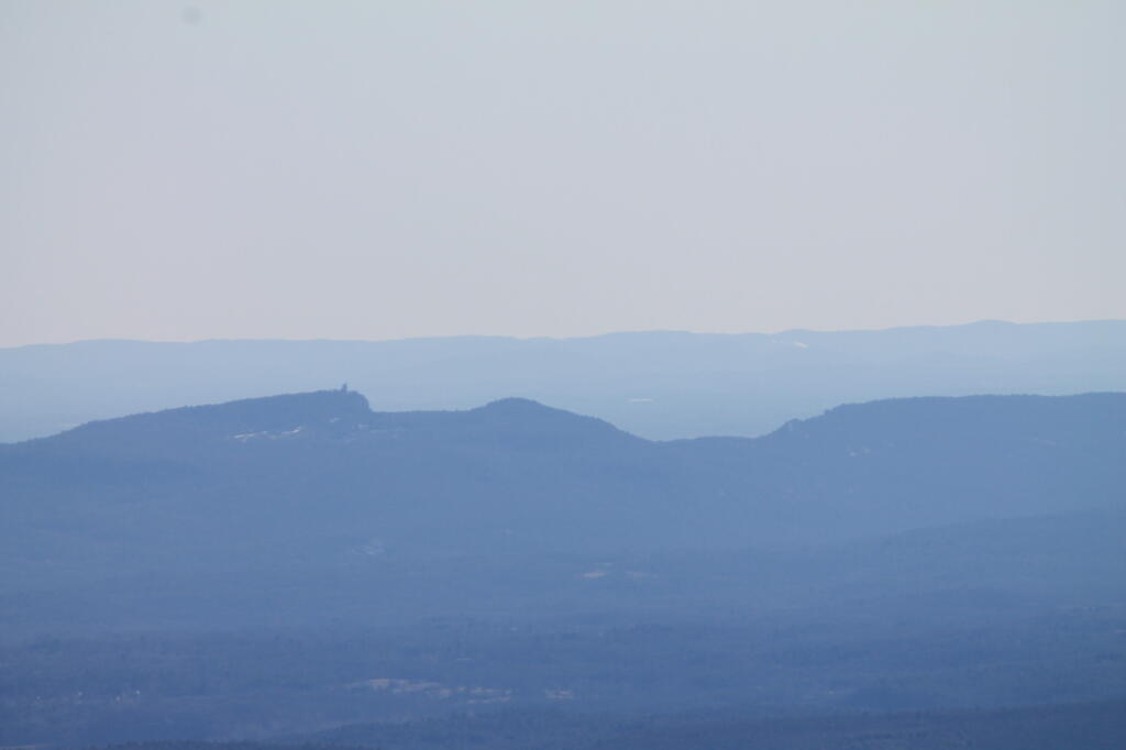
Monday February 20, 2012 — Overlook Mountain
In the Shawanagunks.
Monday February 20, 2012 — Overlook Mountain

In the distance is Snake Mountain and beyond that is Black and Buck Mountains.
Sunday March 26, 2006 — Addison County, VT

Earlier this week I wrote a small PHP script for analysis of the shadow cast by buildings on the surrounding landscape. To obtain sun position and altitude, it relies on SunCalc PHP which must be included in the script. It goes throughout the year, churning out how much of a shadow a building will produce each hour, in feet and direction. Additionally, the script will calculate the maximum point the shadow will be cast as a set of coordinates.
<?php
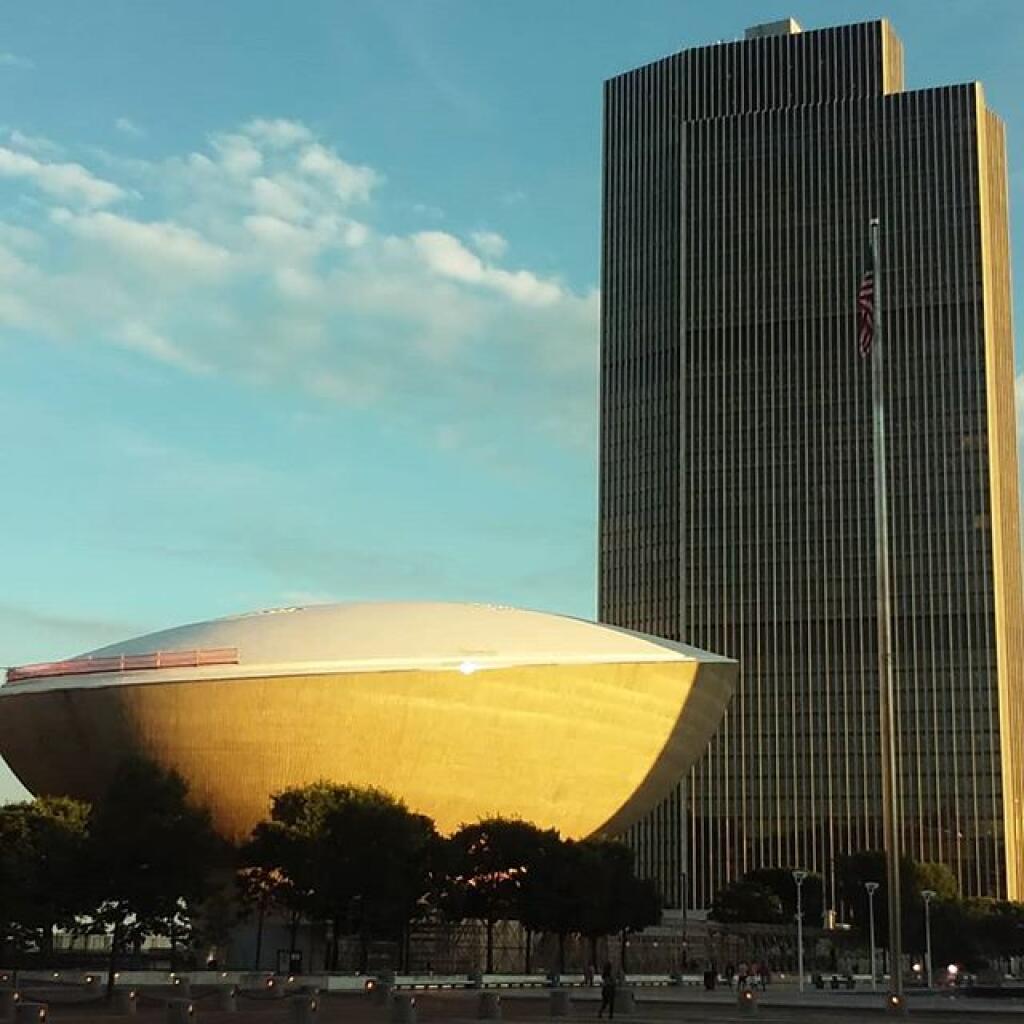
// The current values entered into this script currently are for the Empire Plaza.
$latitude = 42.64915;
$longitude = -73.75950;
$height = 610;
$start = strtotime("January 1, 2020 12 AM");
$end = strtotime("December 31, 2020 11 PM");
include("suncalc.php");
// Compass as a Reference
$compass = array(
'north', 'north-northeast', 'northeast',
'east-northeast', 'east', 'east-southeast',
'southeast', 'south-southeast', 'south',
'south-southwest', 'southwest',
'west-southwest', 'west', 'west-northwest',
'northwest', 'north-northwest');
function newPos($lat, $lng, $dist, $dir) {
// Earth Radius in KM
$R = 6378.14;
// distance in feet to KM
$d = (($dist * 0.3048) / 1000);
// Degree to Radian
$lat1 = $lat * (M_PI/180);
$lng1 = $lng * (M_PI/180);
$brng = $dir * (M_PI/180);
// Really Complicated Math (TM) that works based on the HAVERSINE formula from
// https://stackoverflow.com/questions/7222382/get-lat-long-given-current-point-distance-and-bearing
$lat2 = asin(sin($lat1)*cos($d/$R) + cos($lat1)*sin($d/$R)*cos($brng));
$lng2 = $lng1 + atan2(sin($brng)*sin($d/$R)*cos($lat1),cos($d/$R)-sin($lat1)*sin($lat2));
# back to degrees
$lat2 = $lat2 * (180/M_PI);
$lng2 = $lng2 * (180/M_PI);
return "$lat2,$lng2";
}
$output = "Month,Day,Hour,Sun Angle,Sun Position,Sun Pos Name,Shadow Length,Shadow Direction,Shadow Dir Name,Orginal Lat, Original Lng, Maximum Shadow Lat, Maximum Shadow Lng\n";
for ($time = $start; $time &lt; $end; $time += 60*60) { // get sun position for time $timeObj = new DateTime(); $timeObj-&gt;setTimestamp($time);
$sc = new AurorasLive\SunCalc($timeObj, $latitude, $longitude);
$sunPos = $sc-&gt;getSunPosition($timeObj);
// don't include any time when sun is below the horizon
if ($sunPos-&gt;altitude*(180/M_PI) &lt; 0) continue; // add month, day, hour $output .= date('n,j,G,',$time); // get sun altitude $output .= $sunPos-&gt;altitude*(180/M_PI).',';
// get sun position
$output .= 180+$sunPos-&gt;azimuth*(180/M_PI).',';
$output .= $compass[round((180+$sunPos-&gt;azimuth*(180/M_PI))/ 22.5) % 16].',';
// shadow length
$output .= $height/tan(deg2rad($sunPos-&gt;altitude*(180/M_PI))).',';
// shadow direction
$shadowDir = $sunPos-&gt;azimuth*(180/M_PI) + 360;
if ($shadowDir &gt; 360) $shadowDir -= 360;
$output .= $shadowDir.',';
$output .= $compass[round($shadowDir/ 22.5) % 16].',';
// building latitude and longitude
$output .= "$latitude, $longitude,";
// maximum extent of shadow
$output .= newPos($latitude, $longitude, $height/tan(deg2rad($sunPos-&gt;altitude*(180/M_PI))), $shadowDir).",";
$output .= "\n";
}
echo $output;
Here is an example output:
Month,Day,Hour,Sun Angle,Sun Position,Sun Pos Name,Shadow Length,Shadow Direction,Shadow Dir Name,Orginal Lat, Original Lng, Maximum Shadow Lat, Maximum Shadow Lng
1,1,8,4.370562595888,127.16997476055,southeast,7981.2630997694,307.16997476055,northwest,42.64915, -73.7595,42.662350867593,-73.783180446551,
1,1,9,12.464234785715,138.47001937172,southeast,2759.6833421566,318.47001937172,northwest,42.64915, -73.7595,42.654806428356,-73.766311948646,
1,1,10,18.826346377511,151.18871989968,south-southeast,1789.1660233981,331.18871989968,north-northwest,42.64915, -73.7595,42.653442385927,-73.762710054908,
1,1,11,22.92597731207,165.29270254371,south-southeast,1442.2476816852,345.29270254371,north-northwest,42.64915, -73.7595,42.652969571748,-73.76086316453,
1,1,12,24.317973645092,180.27827074558,south,1349.8710413416,0.27827074557518,north,42.64915, -73.7595,42.652845989302,-73.7594755931,
1,1,13,22.827705402895,195.24737437252,south-southwest,1449.1706789769,15.247374372522,north-northeast,42.64915, -73.7595,42.652978239559,-73.758081165062,
1,1,14,18.641667869753,209.31025239405,south-southwest,1808.2272087538,29.310252394054,north-northeast,42.64915, -73.7595,42.653467170112,-73.756204500047,
1,1,15,12.211118961179,221.98033545934,southwest,2818.7133569306,41.980335459338,northeast,42.64915, -73.7595,42.654887013398,-73.752480800429,
1,1,16,4.0670753820534,233.23837174035,southwest,8579.0650125467,53.238371740354,northeast,42.64915, -73.7595,42.663205632648,-73.733908619093,
1,2,8,4.3645441749857,127.03353849744,southeast,7992.3115188513,307.03353849744,northwest,42.64915, -73.7595,42.662327567958,-73.783255965565,
1,2,9,12.476443037614,138.33095911417,southeast,2756.8958218911,318.33095911417,northwest,42.64915, -73.7595,42.654788550435,-73.766323694576,
1,2,10,18.860737296743,151.04916237459,south-southeast,1785.6561891219,331.04916237459,north-northwest,42.64915, -73.7595,42.653428213262,-73.762717935368,
1,2,11,22.985140372821,165.15894624042,south-southeast,1438.1068136859,345.15894624042,north-northwest,42.64915, -73.7595,42.652956261035,-73.760871335783,
1,2,12,24.401639825801,180.15947237405,south,1344.6352402431,0.15947237405339,north,42.64915, -73.7595,42.652831682677,-73.759486067027,
1,2,13,22.932215921968,195.15131682951,south-southwest,1441.810083379,15.151316829514,north-northeast,42.64915, -73.7595,42.652960530629,-73.7580970562,
1,2,14,18.761308368827,209.23956034287,south-southwest,1795.8375075952,29.239560342872,north-northeast,42.64915, -73.7595,42.653440556697,-73.756234277101,
1,2,15,12.340240887742,221.93268535805,southwest,2788.302504508,41.932685358049,northeast,42.64915, -73.7595,42.654829364851,-73.752562956502,
1,2,16,4.2013827926665,233.20922777897,southwest,8303.8756666826,53.209227778967,northeast,42.64915, -73.7595,42.662764126188,-73.734739101558,


The East Branch Sacandaga River, stretching between Wevertown and Wells along NY 8, offers a rugged yet accessible Adirondack experience with a mix of roadside convenience and remote wilderness. This corridor is a popular destination for its “first-come, first-served” primitive camping, diverse trout fishing, and scenic hiking trails that lead to hidden waterfalls and quiet ponds.
Roadside Camping along NY 8
The New York Department of Environmental Conservation (DEC) maintains approximately 15 designated primitive roadside campsites along NY 8. These sites are free to use but lack amenities like running water or electricity.
Hiking & Waterfalls
Trails along the East Branch range from short walks to more challenging treks into the Siamese Ponds Wilderness.
Fishing & Hunting
The river is a productive trout fishery, with varying regulations depending on the specific reach.
Other Activities
The lowest elevation populated place in Adirondack Park is Putnam Station near Lake Champlain (114 ft elev), the highest elevation populated place is Shady Corner Grove near Mt Van Hoevenberg (2,260 ft elev).