Search Results for: photo line of green

Kayaking Big Pond

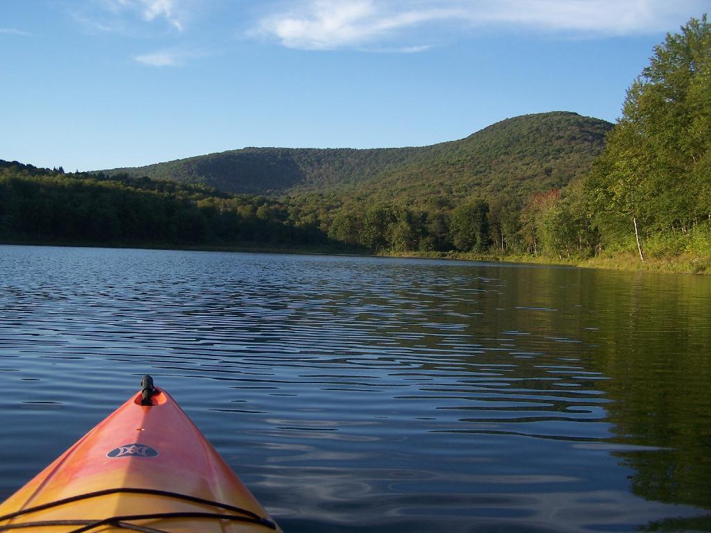
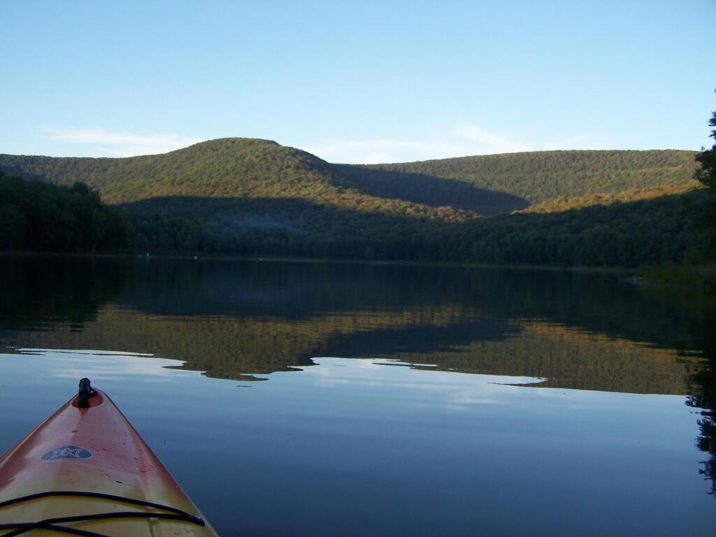
Big Pond is one of the two larger ponds in the Catskills accessible to the public. Located in the Western Catskills, near Alder Pond, it has eight paddle in or hike in tent sites, and some pretty views.

Seneca Rocks, WV

I paddled in on August 17, 2010. These are the pictures I took paddling around the lake.

Paddling

Night is Creeping Up on Me. I didn’t realize how quickly it got late at Big Pond, and I had even started dinner. To make matters worst, my white-gas lantern wouldn’t start, so I had to do everything by flash light.

Night is Creeping Up on Me

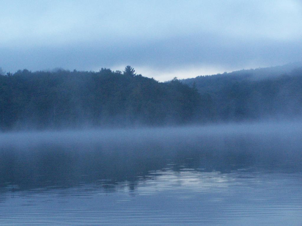
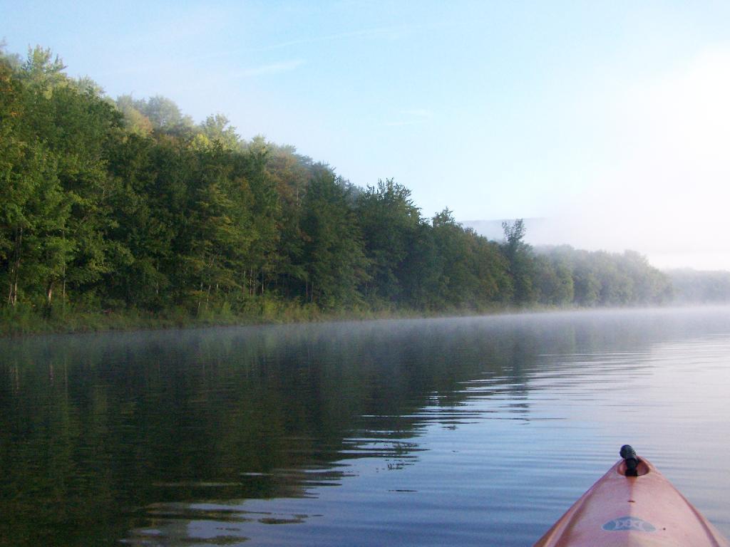
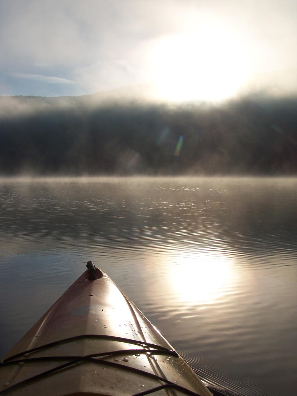
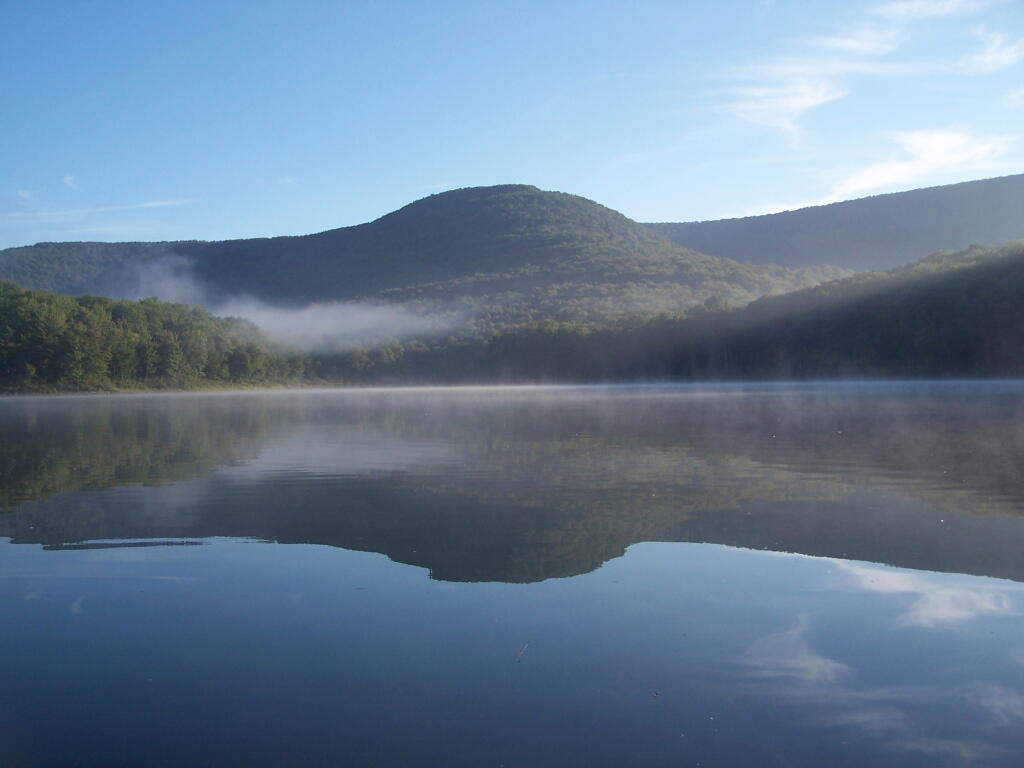
Towards the Dam. On this valley fog morning.

Towards the Dam

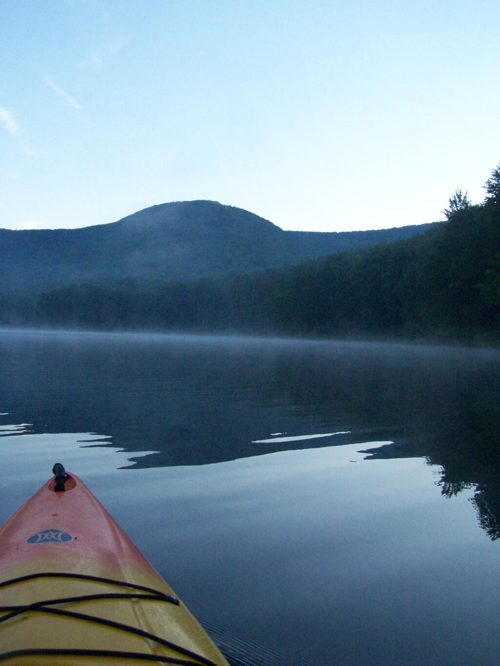
Barkaboom Mountain Before Dawn. The early rays of sun have yet to hit it on this beautiful morning.

Barkaboom Mountain Before Dawn

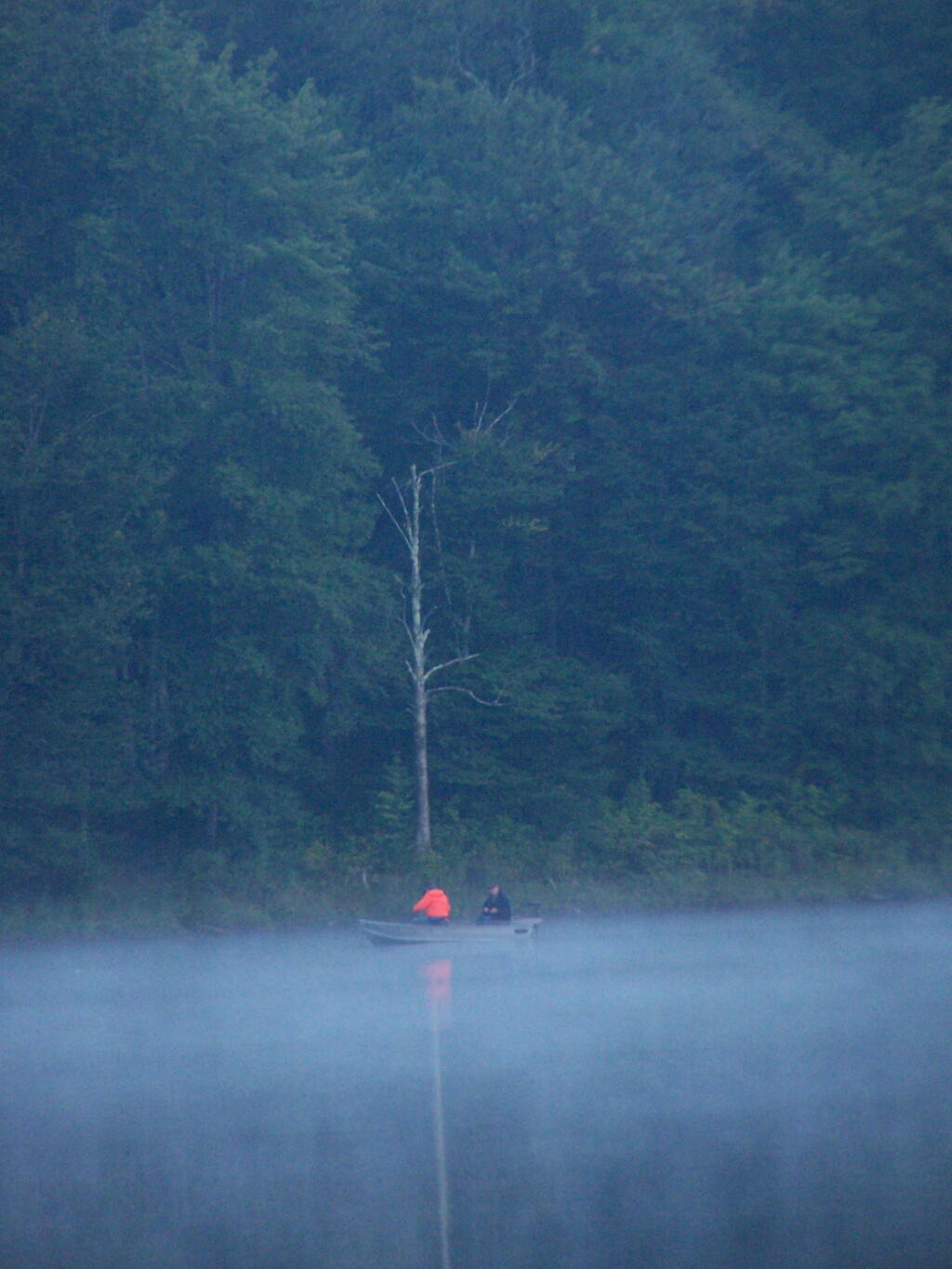
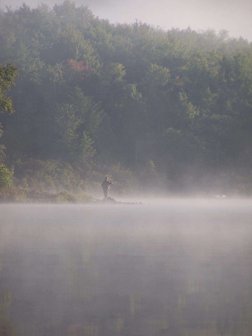
Fishermen. Out before the crack of dawn, dropping their line and testing their luck on Big Pond.

Fishermen

Light Hits Bank. The first rays hit the western bank of the lake, providing some of the greens of the day once again.

Light Hits Bank

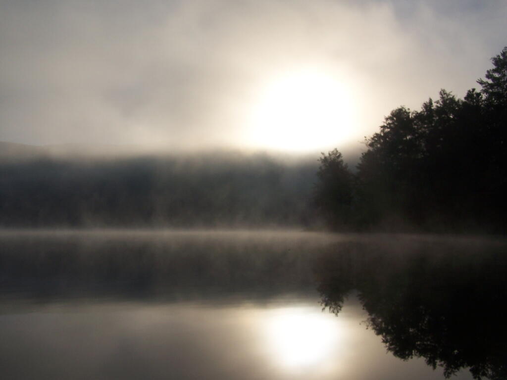
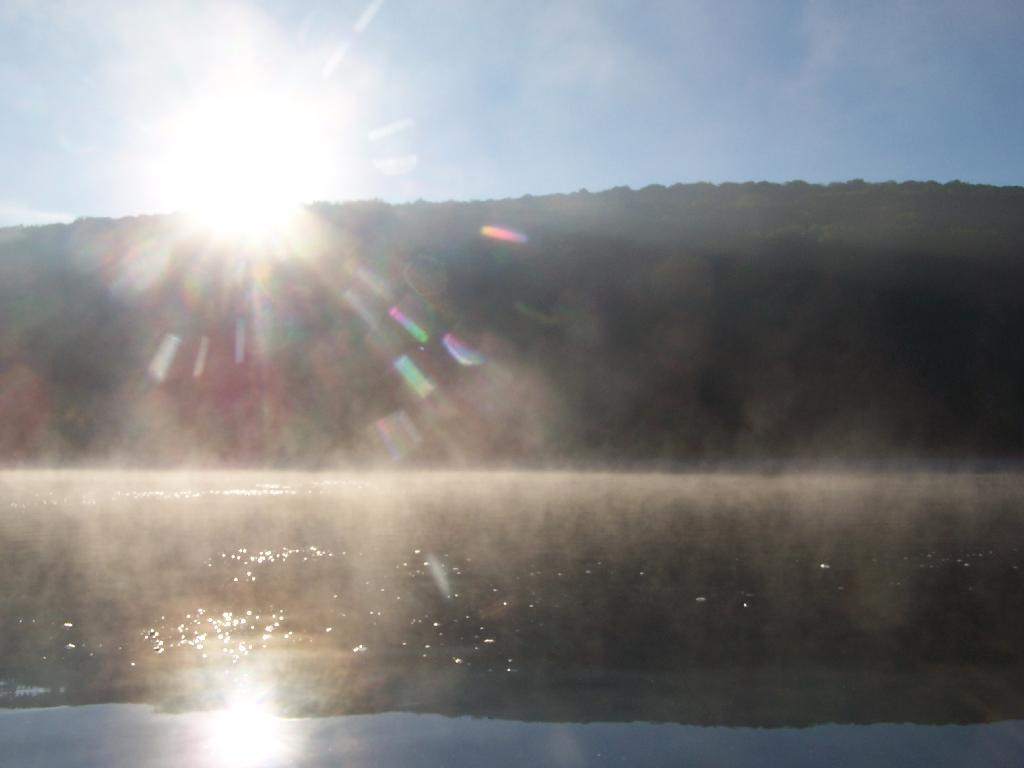
Sunrises. Through the fog as I’m paddling around the lake.

Sunrises

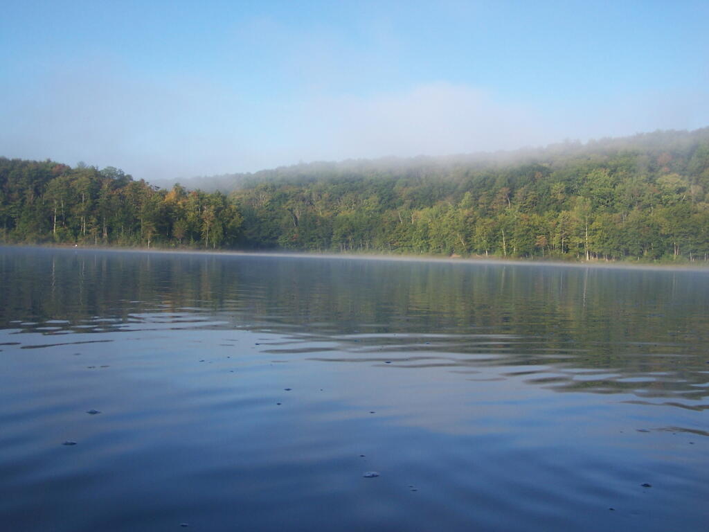
Fog is Burning Off. Along the Western Edge of the lake towards Barkaboom Mountain.

Fog is Burning Off

Rays of Sun. Sparkle down on the lake as it continues to clear on out.

Rays of Sun

Fishing. Man covers his eyes as he looks out across the water.

Fishing

South. Looking down and across the lake as morning arrives.

South

Sunlight sparkles through the trees. Good Morning on Big Pond.

Sunlight

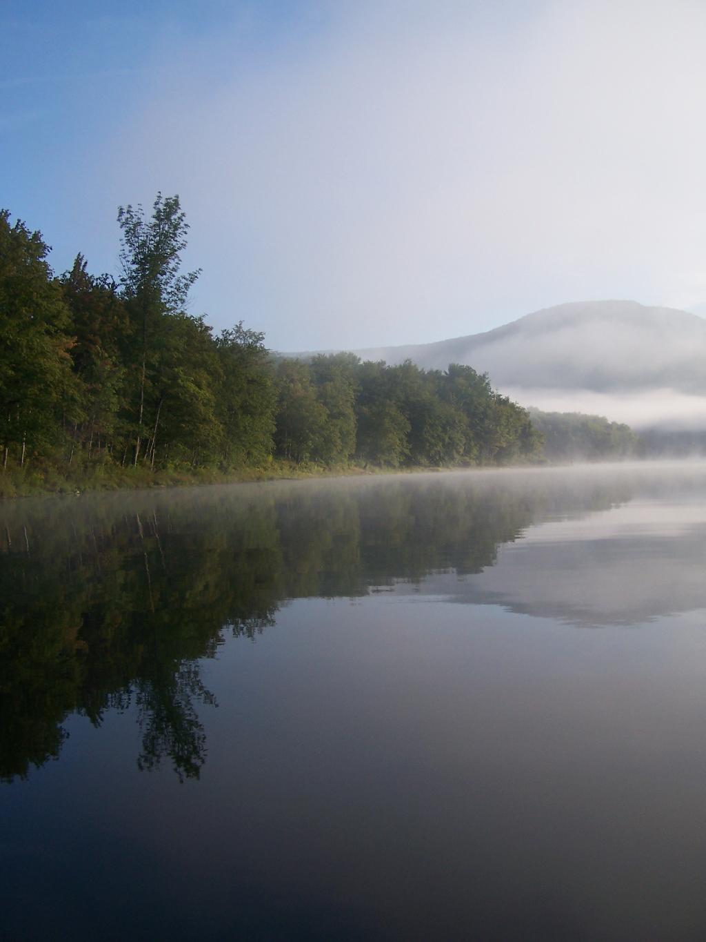
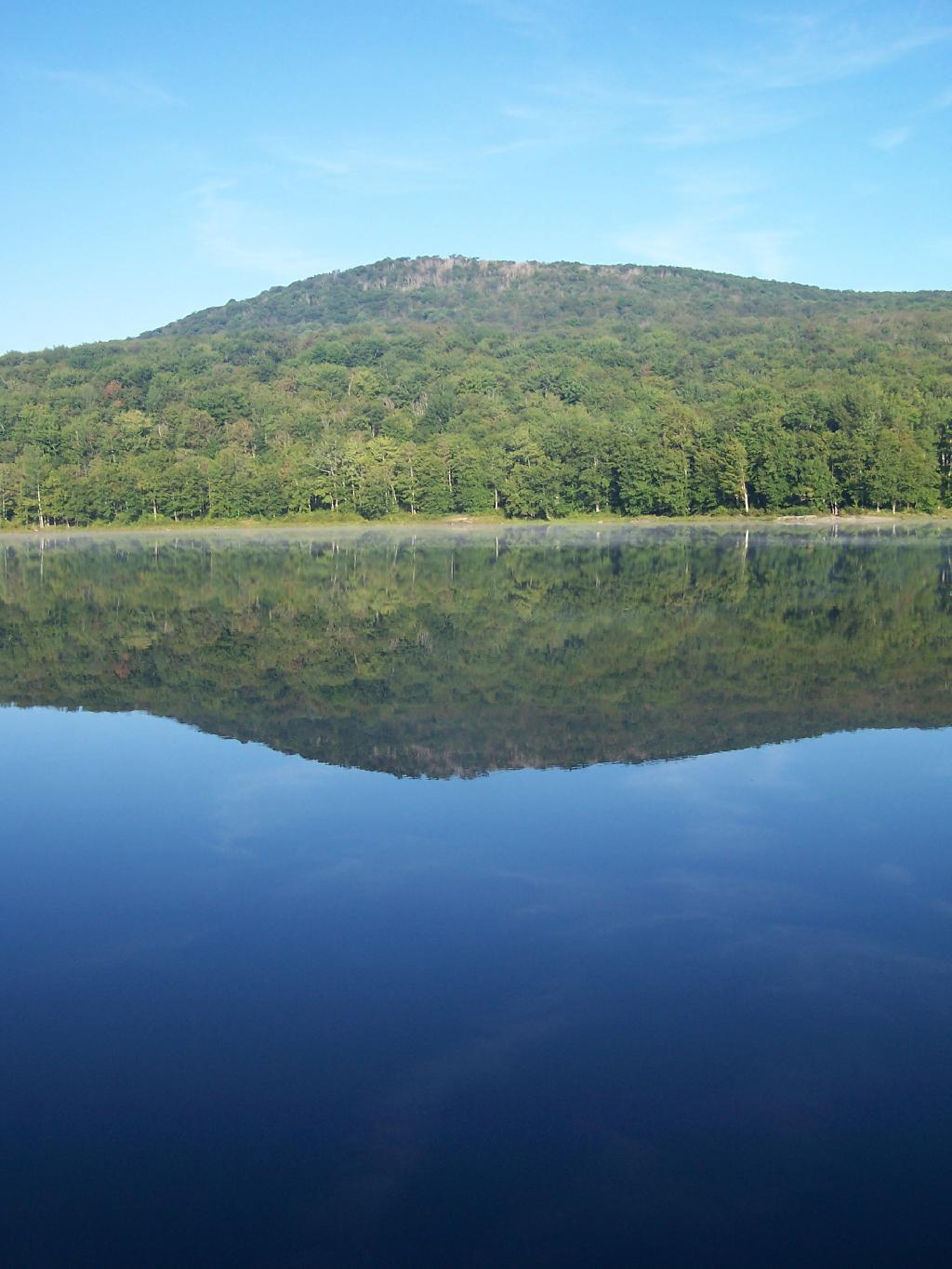
Barkaboom Mountain Reflects On the Lake.

Barkaboom Mountain Reflects On the Lake

Across the Lake. As I am making breakfast on this Sunday morning in the Catskills.

Across the Lake

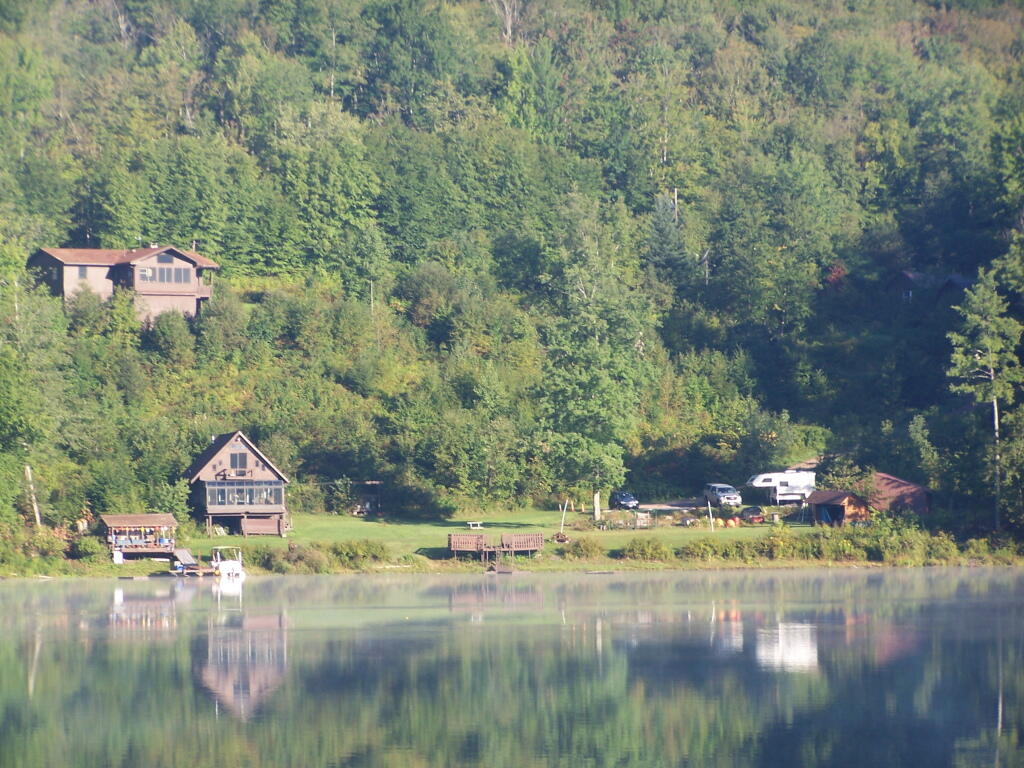
Inholding. While most of Big Pond is part of the Middle Mountain Wild Forest, about 200 feet of shore line is privately owned. The folks in the cabin where really friendly when they stopped by in their electric pontoon boat, but it did kind of wreck the scenic view especially from where I was camping.

Inholding

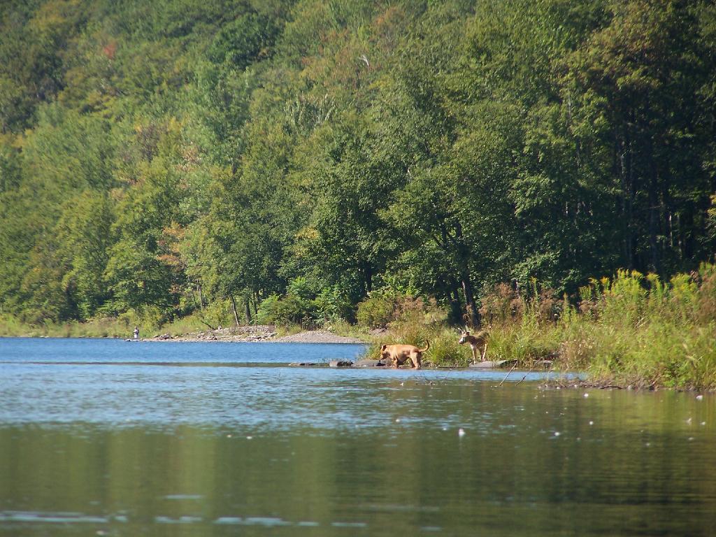
Dogs Swimming in Big Pond. This is at one of the other campsites at Big Pond.

Dogs Swimming in Big Pond

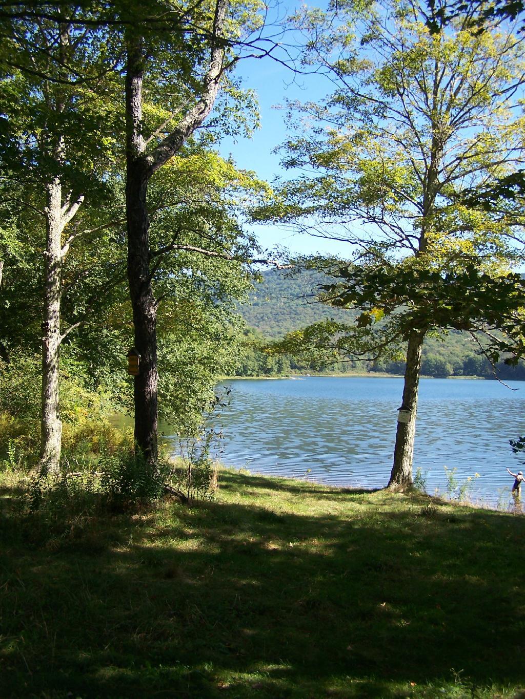
Big Pond, as seen from the Parking Area.

Big Pond from Parking Area

Here is a map of Big Pond. The inholding is not shown on this map, and the DEC land boundaries are incorrect, extending farther north then the map shows.

The absolutely gross Montour Falls Canal. 🛶

The absolutely gross Montour Falls Canal. 🛶

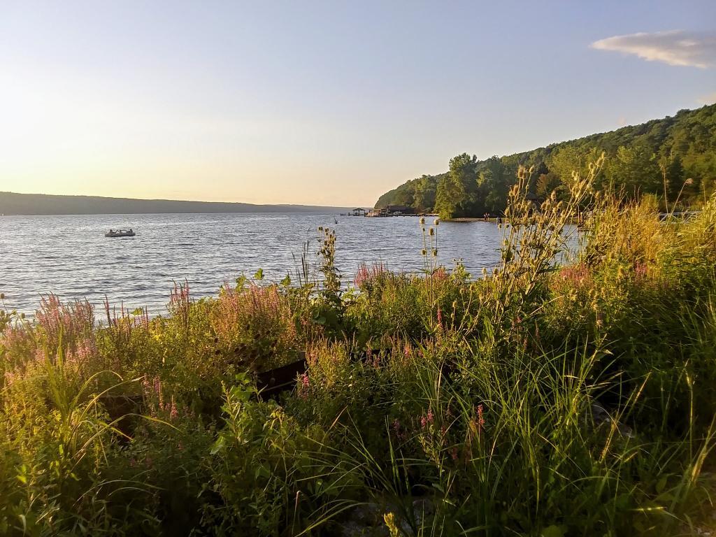
The other day I paddled the Montour Falls Canal, hoping to see some of Bad Indian Swamp but mostly taking in the bad odors of sewage and gasoline motors as I paddled through the pea green water in the trench dredged more for navigation of power boats than natural beauty.

I am sure a lot of the problem is the nature of the canal – water flows slowly through the marsh into Seneca Lake. It collects waste water from treatment plants Montour Falls and Watkins Glen, along with urban runoff from streets and lawns. It’s downgradient from farms, which run off its share of manure, synthetic fertilizer and pesticides. While no source of pollution is that significant – farmers follow their nutrient management plans, villages treat their waste water to a great extent, it just kind of adds up and collects.

More though needs to be done. The overwhelming smell of sewage suggests that either treatment plants are overflowing, they’re dumping too much treated waste or there are homes, businesses or marinas dumping directly into the lake. While probably a lot of the pollution is dilluted and biodegrades quickly when reaching the lake within hours it’s still pretty gross to say the least and not good for human health or the viability of the canal and the lake as a whole. An occasional emission may not make much of a difference but it adds up.

Lake Shore

August 11, 2020 Evening

Good evening! Partly clear and 74 degrees at the Finger Lakes National Forest. 🌃 There is a west breeze at 8 mph. 🍃. The dew point is 65 degrees. The muggy weather ends tomorrow around 10 am. 😓

To end the first half of summer vacation 🏖 I thought things went remarkably well. I spent about six hours at the pool 🏊🏻‍♂️ and two paddling the Montour Falls canal. 🛶 While it was a bit choppy at the end of the day on Seneca Lake for the most part it wasn’t bad. 🌊 A 38 mile lake, even if across its relatively narrow and sat below tall hills is always going to be somewhat rough. Might be even less windy tomorrow – I left the kayak 🛥 on the truck and come morning I might decide to do more paddling tomorrow.

That caramel sundae 🍧I got from the Glen Dairy Bar was pretty good today. I will have to get there a few more times before I leave the Finger Lakes for a few more options. It’s fun having good ice cream when you camp. Had more of those sausage paddies with cheese and ketchup on a hard role for dinner. 🍔 They’re a nice easy treat. I have two more to finish off tomorrow maybe for lunch and then I’ll figure out what is next for camp meals 🍴.

Tonight will be partly cloudy ☁️, with a low of 65 degrees at 6am. Four degrees above normal. Maximum dew point of 68 at 8pm. West wind 5 to 8 mph becoming light and variable in the evening. In 2019, we had mostly clear skies. It became somewhat humid as the night progressed. It got down to 56 degrees. The record low of 46 occurred back in 1987.

Tonight will have a Last Quarter 🌗 Moon with 46% illuminated. The darkest hour is at 1:13 am, followed by dawn at 5:41 am, and sun starting to rise at 6:12 am in the east-northeast (69°) and last for 3 minutes and 6 seconds. Sunrise is one minute and 4 seconds later than yesterday. 🌄 The golden hour ends at 6:51 am with sun in the east-northeast (75°). Tonight will have 9 hours and 58 minutes of darkness, an increase of 2 minutes and 26 seconds over last night.

I hiked back to Foster Pond this evening to watch the percid metriod showers 🌠but stayed only for about fifteen minutes when there was what appeared to be a very wild party 🎉 on the one end of the lake disturbing the solitude. Based on the noise and the late arrivers it seemed like an under age drinking 🍻 party. I wasn’t going to get mixed up with that and honestly myself I wasn’t that sober after having a few drinks with dinner to toast off the day and wash down those sausage paddies. That said, in the brief time I was there I saw two shooting stars and by the time I was heading back it had clouded up.

Tomorrow will be mostly sunny 🌞, with a high of 85 degrees at 3pm. Four degrees above normal. Maximum dew point of 64 at 6am. Northwest wind 3 to 7 mph. A year ago, we had partly cloudy skies in the morning with some clearing in the afternoon. The high last year was 86 degrees. The record high of 99 was set in 1944.

It should be another nice day tomorrow. ☀ I am not going to rush to get going tomorrow though as I need to try to get some more sleep tonight. 💤 I am thinking about more kayaking tomorrow 🛶, maybe off of Hector Park boat launch or maybe the Watkins Glen boat launch and paddling up along the shoreline of Seneca Lake to Hector Point. I don’t think I’ll do more of the Montour Canal – I found it kind of boring and it stunk of raw or partially treated sewage and was kind of green from pollution. I was hoping I could get off the canal to explore Bad Indian Marsh but there wasn’t a lot of navigable streams – I saw only one and it didn’t look very promising. 🛑

In four weeks on September 8 the sun will be setting in the west (278°) at 7:29 pm,🌄 which is 44 minutes and 56 seconds earlier then today. In 2019 on that day, we had partly cloudy and temperatures between 73 and 52 degrees. Typically, you have temperatures between 75 and 55 degrees. The record high of 94 degrees was set back in 2015.

Looking ahead, September 🍎 is in 3 weeks, September 11th 🇸 is a month away, Autumn 🍂 is in 6 weeks, Election Day 2019 🗳️ is in 12 weeks, Average High is 50 🍂 is in 13 weeks, Veterans Day 🇺🇸 is in 3 months, Regular Deer Season in Southern Zone 🦌 is in 14 weeks, December 🎄 is in 16 weeks, Bill of Rights Day 📜 is in 18 weeks, Days are Getting Longer ☀️ is in 19 weeks, Cold Moon 🌕 is in 20 weeks, National Bird Day 🐧 is in 21 weeks, 5:30 PM Dusk 🌆 is in 24 weeks, Ground Hog Day 🐻 is in 25 weeks and Don’t Cry over Spilled Milk Day 🥛 is in 6 months.

 Mohawk River

August 9, 2020 Morning

Good morning! Happy Sunday. Six weeks to Average High 70 🎑 . Sunny and 71 degrees at the Finger Lakes National Forest. Tree🌲🌞 Calm wind. The dew point is 64 degrees.

Went for a walk 🚶 again this morning on the Interlaken Trail and to Foster Pond. Definitely a nice morning, 🌞 lots of sun and wildflowers. 🌻Had a nice pan of corned beef hash and cheese for breakfast. 🍳 Some eggs 🥚 would be nice but I’ll have to get them today.

Wildflowers are definitely better this time of year 🌻🌼🦋🐝 compared to earlier in the summer when I often take my vacation. It just makes my vacation a little more enjoyable seeing the road sides in bloom, the butterflies and bees. And yes, all that field corn 🌽 is getting tall.

Been quite busy up here 👩‍👩‍👦‍👦👨‍👨‍👧, with so many things closed during the pandemic based on the number of cars 🚘 I’ve seen on the road. Fortunately, my campsite is quite remote and quiet 🤫 so nobody is bothering me. Seen more equestrians 🐴 than normal – in part because the Upper Assembly Area is closed at Sugar Hill. 🔐

Today will be sunny 🌞, with a high of 82 degrees at 4pm. Typical for today. Maximum dew point of 66 at 6pm. Light and variable wind becoming west 5 to 8 mph in the morning. A year ago, we had partly cloudy skies in the morning with some clearing in the afternoon. The high last year was 81 degrees. The record high of 96 was set in 2001.

Kind of breezy up here on the backbone 🗻 but I’m hoping the breeze will die down later and I can get out on Seneca Lake and the Montour Canal later. 🛶 I’m excited about all the wildlife I might see there. 🐦🦆🕊️🐸🐢🦎🐟 I just don’t want to go on Seneca Lake if it’s at all breezy 🚣🏻‍♂️ because it’s a big lake and can be very choppy. 🌊

Solar noon 🌞 is at 1:13 pm with sun having an altitude of 63.1° from the due south horizon (-7.6° vs. 6/21). A six foot person will cast a 3 foot shadow today compared to 2.2 feet on the first day of summer. The golden hour 🏅 starts at 7:38 pm with the sun in the west-northwest (286°). 📸 The sunset is in the west-northwest (292°) with the sun dropping below the horizon at 8:17 pm after setting for 3 minutes and 8 seconds with dusk around 8:46 pm, which is one minute and 21 seconds earlier than yesterday. 🌇 The best time to look at the stars is after 9:26 pm. At sunset, look for partly cloudy skies 🌃 and temperatures around 77 degrees. The dew point will be 67 degrees. There will be a west breeze at 5 mph. Today will have 14 hours and 8 minutes of daytime, a decrease of 2 minutes and 25 seconds over yesterday.

Tonight will be partly cloudy 🌤, with a low of 68 degrees at 5am. Seven degrees above normal. Maximum dew point of 67 at 7pm. Southwest wind 3 to 5 mph. In 2019, we had light rain in the evening, which became partly cloudy by the early hours of the morning. It got down to 57 degrees. The record low of 48 occurred back in 1955.

Been reading 📖 more of the Real Goods Solar Living Handbook. Half marketing catalog, half pseudo green living for rich folk, it sure seems like it’s gotten real dated fast. 🌎 Still an interesting read even if it’s more ideological and about marketing over-priced organic crap and green products for the landfill 🗑 then practical realities of providing for one’s self and obeying the laws of nature.

I was noticing how much of the forest along Potomac Road was ash trees. 🌳It’s only a matter of time before much of the forest is going to be dying than gone. I see they have an Emerald Ash Boerer trap on the road to detect the invaders but I doubt they’ll treat all of the trees. Already as little as 50 miles south of here in Wellsboro you can see the devestation of the forests from EAB. 🐛 Forests are always in a state of decline – thats entropy – but they’re always changing with the land and introduced species.

One week from now I’ll be taking down camp and heading back to Albany. 🏡 Or at least heading closer to that direction. But there is a lot more reading 📖, hiking 🚶 and paddling to do before then. Vacation really is just beginning – today is my first full day in the Finger Lakes.

I am still thinking I want to go the way I came 🤔 although I would want to avoid that rough seasonal use only road. If it’s really nice a week from Sunday I might overnight at Cherry Ridge 🍒 and then head back home through Madison County. I like seeing the rough dairy country. 🐮 The hills, the cows, the rundown shacks and hollows. 🗻

I really like the wild country 🐏 and wish I could live out here full time. Somehow I like it even better than the Adirondacks. Redneck country life is fun, even if at times it’s dirty and smelly. 💩 But alas I’m making good money at my job 💵 and are able to save a lot of it for a better tomorrow. It’s nice having some professional success in life and knowing it will lead to a better tomorrow, especially as I try to live frugally as possible. Some days I’ll live in a small town, have land and be able to listen 👂 to the moos of cattle full time. 🐄

Looking ahead, there are 6 weeks until Average High 70 🎑 when the sun will be setting at 7:06 pm with dusk at 7:34 pm. On that day in 2019, we had partly sunny, patches of fog and temperatures between 79 and 42 degrees. Typically, the high temperature is 71 degrees. We hit a record high of 90 back in 1946.
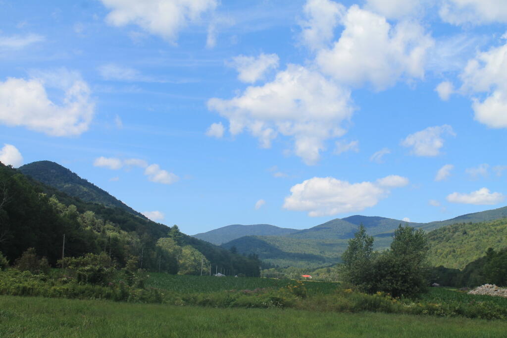
View from Former CC Camp on West Branch of the White River

May 16, 2020 Night

Good evening! Partly cloudy and 60 degrees in Delmar, NY. ⛅ Calm wind. The dew point is 46 degrees. Remarkably mild for this late in the night for mid May but then again it is mid May. Seems like it was March the last time I worked downtown, well actually it was. I haven’t been downtown since probably April when I picked up the work laptop.

It was a a beautiful spring day and I spent as much time as possible outdoors. 🌸 Things are still fairly gray in the hill towns on the hills but at the same time many other places are quite green. This afternoon I hiked a Thacher Park 🌿and this evening hiked at the Pine Bush well after dark 🌃 – from 10 pm to 11:30 to be exact.

I would have stayed longer but my knee was aching from the Lyme Disease. 🐜 I hadn’t taken the pill before I left for the evening. The doxycycline is controlling the symptoms but I’m not convinced it’s killing the Lyme and it may return when the medication runs out on Monday. If necessary I guess I’ll see my doctor again. 😷 One good thing about working from home is it makes scheduling easier. Plus I didn’t want to stay too late and be fatigued driving home. 🏡

It seemed like the Permethrin worked well on my clothes. 👚 So far no ticks I’ve found and the one black fly that landed on my jeans was crippled before it could bite. Didn’t protect my face from bugs out hiking but my arms were good as I applied Picardin to them. 😵 As much as I have pause about bathing myself in chemicals, ticks are insane this year and I am very worried about getting sick from Lyme and not recovering. Already I’m not doing great. I’m not willing to become a shut in just to avoid ticks.

Tonight will be mostly cloudy 🌥, with a low of 49 degrees at 5am. Two degrees above normal, which is similar to a typical night around May 21st. Calm wind. In 2019, we had mostly clear skies. It got down to 52 degrees. The record low of 30 occurred back in 1959.

Tonight will have a Waining Crescent 🌘 Moon with 26% illuminated. The darkest hour is at 12:53 am, followed by dawn at 5:00 am, and sun starting to rise at 5:33 am in the east-northeast (63°) and last for 3 minutes and 16 seconds. Sunrise is 59 seconds earlier than yesterday. 🌄 The golden hour ends at 6:13 am with sun in the east-northeast (69°). Tonight will have 9 hours and 18 minutes of darkness, a decrease of one minute and 59 seconds over last night.

Tomorrow will be partly sunny 🌞, with a high of 71 degrees at 3pm. One degree above normal, which is similar to a typical day around May 20th. Maximum dew point of 50 at 10am. Calm wind becoming southeast around 6 mph in the afternoon. Might be a decent day. A year ago, we had partly cloudy skies in the morning with some clearing in the afternoon. The high last year was 73 degrees. The record high of 92 was set in 2017.

So I’m pretty sure I’m going to delay my Memorial Day Weekend trip for the week after. ⛺ I’ve been on and off but I don’t think the weather will be all that great for Memorial Day Weekend based on the latest forecast and I’m not convinced that the gates north of the potholers will be open this year for Memorial Day Weekend. Been so wet and I know they had to rebuild the road last fall and with the pandemic everything is messed up. I’m thinking I might take Friday and Monday the week after Memorial Day and camp three nights either at the House Pond campsite or maybe up at Powley Place at one of the sandy open sites where I can use the solar to keep my batteries 🔋 charged and hang my hammock and set up my screen tent 🎪 for black fly prevention.

I am running low on socks and a few other supplies 🏪 which I will probably order from Walmart online but I’ve found it hard to come up with a $35 order for free shipping 📦 as the online store actually lacks a lot of the products that the regular stores would have in normal times. Walmart isn’t stocking any non food items in their retail outlets so if they sell out, it’s gone.

In four weeks on June 13 the sun will be setting in the west-northwest (303°) at 8:34 pm,🌄 which is 22 minutes and 2 seconds later then tonight. In 2019 on that day, we had partly sunny, rain showers and temperatures between 65 and 57 degrees. Typically, you have temperatures between 77 and 56 degrees. The record high of 94 degrees was set back in 1892.

Looking ahead, Memorial Day Weekend Starts 🏕️ is in 1 week, and Summer ️⛱️ is in 5 weeks.

🇺🇸🦅Only 6 days remain until the start of Memorial Day Weekend!🦅🇺🇸

View from Gravesite

Peaks on State Land in Hudson Valley, Northern Catskills and Long Island

A list of peaks on state land shown in the Open Street Map along with coordinates for Department of Environmental Conservation Regions 1 through 4 excluding the Catskill Park. These peaks are in the Heldebergs, Taconics, Hudson Highlands, Shawgunks and hills outside of the Catskill Park.

Region 1 – Suffolk County (Long Island)

Peak Name Elevation in Feet State Land Class UMP Region County Location
Flanders Hill 230 David A. Sarnoff Preserve   North Atlantic 1 Suffolk 40.8745441, -72.6045377

Region 3 – Dutchess County County (Hudson Highlands)

Peak Name Elevation in Feet State Land Class UMP Region County Location
Depot Hill 1305 Depot Hill Multiple Use Area   Lower New England East 3 Dutchess 41.5753714, -73.6751291

Region 3 – Putnam County (Hudson Highlands)

Big Buck Mountain 1115 Big Buck Mountain Multiple Use Area   Lower New England East 3 Putnam 41.4948155, -73.7165195
California Hill 1178 California Hill State Forest   Lower New England East 3 Putnam 41.4373157, -73.7762439
Castle Rock 626 Castle Rock Unique Area   Lower New England East 3 Putnam 41.367316, -73.935416
Cranberry Mountain 1233 Cranberry Mountain WMA   Cranberry Mountain Hmp 3 Putnam 41.5037049, -73.5626259
Nimham Mount 1273 Nimham Mountain Multiple Use Area   Lower New England East 3 Putnam 41.461407, -73.7250815
Pigeon Hill   Bashakill WMA     3 Sullivan 41.538532, -74.5191017
Unnamed Peak 1414 Wurtsboro Ridge State Forest   Shawangunk Ridge 3 Sullivan 41.5944736, -74.4385778

Region 3 – Orange County (Greater Newburgh)

Peak Name Elevation in Feet State Land Class UMP Region County Location
Buchanan Hill 649 Stewart State Forest   West Of Hudson 3 Orange 41.4912049, -74.1423678
Sloop Hill 128 Kowawese Unique Area   West Of Hudson 3 Orange 41.4584271, -74.0156961

Region 4 – Albany County (Heldebergs)

Peak Name Elevation in Feet State Land Class UMP Region County Location
Blodget Hill 1145 Louise E. Keir WMA   Louise E. Keir Hmp 4 Albany 42.5150798, -73.8954045
Henry Hill 2162 Partridge Run WMA   Partridge Run Hmp 4 Albany 42.5495213, -74.1979138

Region 4 – Delaware County (Western Catskills outside Catskill Park)

Peak Name Elevation in Feet State Land Class UMP Region County Location
Jensen Hill 1683 Hancock Fp Detached Parcel Wild Forest   4 Delaware 41.8670322, -75.1543365
Kenyon Mountain 2988 Plattekill State Forest   East Branch 4 Delaware 42.2938395, -74.6382349
McGregor Mountain 3191 Stamford Fp Detached Parcel Wild Forest   4 Delaware 42.3900808, -74.5790396
Murphy Hill 2306 Murphy Hill State Forest   East Branch 4 Delaware 42.1311981, -74.8676606
Pine Hill 2007 Pine Hill State Forest   Treaty Line 4 Delaware 42.2823038, -75.3435096
Plattekill Mountain 3267 Plattekill State Forest   East Branch 4 Delaware 42.2667522, -74.6482102
Round Top 3067 Plattekill State Forest   East Branch 4 Delaware 42.2714741, -74.6832109

Region 4 – Greene County (Northern Catskills outside Catskill Park)

Peak Name Elevation in Feet State Land Class UMP Region County Location
Bearpen Mountain 3601 Bearpen Mountain State Forest   Mt. Pisgah 4 Greene 42.2652179, -74.4737802
Huntersfield Mountain 3421 Huntersfield State Forest   Mt. Pisgah 4 Greene 42.355638, -74.3465339
Mount Hayden 2929 Mount Hayden State Forest   Mt. Pisgah 4 Greene 42.3586936, -74.2190298
Mount Pisgah 2909 Mount Pisgah State Forest   Mt. Pisgah 4 Greene 42.3773038, -74.2448639
North Bearpen Mountain 3529 Bearpen Mountain State Forest   Mt. Pisgah 4 Greene 42.2734189, -74.4840396
Richmond Mountain 3214 Mount Pisgah State Forest   Mt. Pisgah 4 Greene 42.367582, -74.270976
Richtmyer Peak 2985 Mount Pisgah State Forest   Mt. Pisgah 4 Greene 42.3756373, -74.2634757
Roundtop 3451 Bearpen Mountain State Forest   Mt. Pisgah 4 Greene 42.2939737, -74.4904283
Unnamed Peak 3398 Greene County Fp Detached Parcel Wild Forest 0 4 Greene 42.2368271, -74.4986128
Noahs Rump 1991 Plainfield State Forest   Leatherstocking 4 Otsego 42.8103497, -75.1862732
Stone Quarry Hill 2194 Decatur State Forest   Cherry Valley 4 Otsego 42.6322978, -74.6870919

Region 4 – Schoharie County (Northern Catskills outside Catskill Park)

Peak Name Elevation in Feet State Land Class UMP Region County Location
Blenheim Mountain 2004 Blenheim Hill State Forest   Eminence 4 Schoharie 42.4550782, -74.4923695
Burnt Hill 1906 Burnt-Rossman Hills State Forest   Eminence 4 Schoharie 42.4975764, -74.4962576
Cotton Hill 2109 Dutch Settlement State Forest     4 Schoharie 42.6289647, -74.267079
High Knob 2663 High Knob State Forest   Catskill Creek 4 Schoharie 42.4284128, -74.3126429
Hubbard Hill 2624 Leonard Hill State Forest   Catskill Creek 4 Schoharie 42.4489676, -74.3437545
Leonard Hill 2604 Leonard Hill State Forest   Catskill Creek 4 Schoharie 42.4506342, -74.3526436
Petersburg Mountain 2322 Petersburg State Forest   Eminence 4 Schoharie 42.6331311, -74.4490288
Rossman Hill 2080 Burnt-Rossman Hills State Forest   Eminence 4 Schoharie 42.5506316, -74.4812552
South Mountain 2886 South Mountain State Forest   Mt. Pisgah 4 Schoharie 42.3620266, -74.2851432
Steenburg Mountain 2565 South Mountain State Forest   Mt. Pisgah 4 Schoharie 42.3945253, -74.2748646

Region 4 – Columbia County (Taconics)

Peak Name Elevation in Feet State Land Class UMP Region County Location
Beebe Hill 1758 Beebe Hill Multiple Use Area   Taconic Highlands 4 Columbia 42.3359195, -73.485113
Pinnacle Point 1952 Harvey Mountain State Forest   Taconic Highlands 4 Columbia 42.3103647, -73.4434453

Region 4 – Rensselear County (Taconics)

Peak Name Elevation in Feet State Land Class UMP Region County Location
Bald Mountain 2483 Taconic Ridge State Forest   Taconic Highlands 4 Rensselaer 42.7648012, -73.2837205
Berlin Mountain 2798 Taconic Ridge State Forest   Taconic Highlands 4 Rensselaer 42.6920245, -73.2862195
Berlin Mountain 2795 Taconic Ridge State Forest   Taconic Highlands 4 Rensselaer 42.6917468, -73.2856639
Misery Mountain 2601 Taconic Ridge State Forest   Taconic Highlands 4 Rensselaer 42.6184144, -73.3176081
Mount Raimer 2572 Taconic Ridge State Forest   Taconic Highlands 4 Rensselaer 42.7161908, -73.2837199
White Rock 2542 Taconic Ridge State Forest   Taconic Highlands 4 Rensselaer 42.753968, -73.2803869

Untitled [Expires November 14 2024]

List of Peaks in the Catskill Park

Below is a list of peaks within the Catskill Park that are on state land. This is based on the OpenStreetMap data combined with the DEC property data. Click location for a map of the property, or click State Land to get more information about the land the peak is located on.

Region 3 – Ulster County

Peak Name Elevation in Feet State Land Class UMP Region County Location
Balsam Cap 3621 Slide Mountain Wilderness Wilderness Slide Mountain 3 Ulster 41.9770369, -74.3573722
Balsam Lake Mountain 3726 Balsam Lake Mountain Wild Forest Wild Forest Balsam Lake Mountain 3 Ulster 42.0459236, -74.5940438
Balsam Mountain 3601 Big Indian Wilderness Wilderness Big Indian 3 Ulster 42.0909235, -74.4882082
Beaver Kill Range 3310 Big Indian Wilderness Wilderness Big Indian 3 Ulster 41.9903736, -74.5999302
Beaver Kill Range 3211 Big Indian Wilderness Wilderness Big Indian 3 Ulster 41.9937721, -74.5912442
Belleayre Mountain 3431 Belleayre Mountain Ski Center Intensive Use Belleayre Mountain Ski Center 3 Ulster 42.1287084, -74.5187223
Big Indian Mountain 3680 Big Indian Wilderness Wilderness Big Indian 3 Ulster 42.0349959, -74.4966494
Breath Hill 2568 Slide Mountain Wilderness Wilderness Slide Mountain 3 Ulster 41.9366557, -74.3493054
Carl Mountain 2883 Phoenicia – Mt. Tobias Wild Forest Wild Forest Phoenicia – Mt. Tobias 3 Ulster 42.0959235, -74.2482011
Cornell Mountain 3851 Slide Mountain Wilderness Wilderness Slide Mountain 3 Ulster 42.001553, -74.3569987
Cross Mountain 2503 Slide Mountain Wilderness Wilderness Slide Mountain 3 Ulster 42.0195363, -74.3165372
Dink 3641 Slide Mountain Wilderness Wilderness Slide Mountain 3 Ulster 41.9970242, -74.3629146
Eagle Mountain 3601 Big Indian Wilderness Wilderness Big Indian 3 Ulster 42.0620352, -74.50932
East Wildcat 3339 Slide Mountain Wilderness Wilderness Slide Mountain 3 Ulster 41.9877507, -74.4406309
Edgewood Mountain 2998 Phoenicia – Mt. Tobias Wild Forest Wild Forest Phoenicia – Mt. Tobias 3 Ulster 42.1206399, -74.2305807
Fir Mountain 3628 Big Indian Wilderness Wilderness Big Indian 3 Ulster 42.0275916, -74.4690414
Friday Mountain 3690 Slide Mountain Wilderness Wilderness Slide Mountain 3 Ulster 41.9875924, -74.3620944
Garfield Mountain 2581 Slide Mountain Wilderness Wilderness Slide Mountain 3 Ulster 42.0912014, -74.3665379
Haynes Mountain 3424 Big Indian Wilderness Wilderness Big Indian 3 Ulster 42.0792571, -74.5079309
Hemlock Mountain 3247 Big Indian Wilderness Wilderness Big Indian 3 Ulster 42.0128698, -74.4390407
High Falls Ridge 3198 Big Indian Wilderness Wilderness Big Indian 3 Ulster 41.9919309, -74.5454022
Hirams Knob 2883 Big Indian Wilderness Wilderness Big Indian 3 Ulster 42.0981453, -74.5418203
Lone Mountain 3720 Slide Mountain Wilderness Wilderness Slide Mountain 3 Ulster 41.9691794, -74.3900258
Millbrook Ridge 3542 Balsam Lake Mountain Wild Forest Wild Forest Balsam Lake Mountain 3 Ulster 42.0523606, -74.6329273
Mongaup Mountain 3175 Big Indian Wilderness Wilderness Big Indian 3 Ulster 41.9934945, -74.6993963
Mongaup Mountain 2762 Big Indian Wilderness Wilderness Big Indian 3 Ulster 41.9909235, -74.6840456
Mount Pleasant 2811 Slide Mountain Wilderness Wilderness Slide Mountain 3 Ulster 42.0342583, -74.3082035
Mount Tobias 2542 Phoenicia – Mt. Tobias Wild Forest Wild Forest Phoenicia – Mt. Tobias 3 Ulster 42.0584244, -74.2157003
Overlook Mountain 3136 Overlook Mountain Wild Forest Wild Forest Overlook Mountain 3 Ulster 42.0850905, -74.0931954
Panther Mountain 3723 Slide Mountain Wilderness Wilderness Slide Mountain 3 Ulster 42.0564799, -74.3945946
Peekamoose Mountain 3844 Slide Mountain Wilderness Wilderness Slide Mountain 3 Ulster 41.9531481, -74.398207
Red Hill 2985 Sundown Wild Forest Wild Forest Sundown 3 Ulster 41.9242591, -74.5176554
Rocky Mountain 3493 Slide Mountain Wilderness Wilderness Slide Mountain 3 Ulster 41.9728703, -74.3726505
Romer Mountain 1978 Slide Mountain Wilderness Wilderness Slide Mountain 3 Ulster 42.0581466, -74.3187592
Sand Pond Mountain 3060 Big Indian Wilderness Wilderness Big Indian 3 Ulster 41.9851406, -74.6483978
Silver Hollow Notch Mountain 3008 Phoenicia – Mt. Tobias Wild Forest Wild Forest Phoenicia – Mt. Tobias 3 Ulster 42.1228609, -74.2271869
Slide Mountain 4152 Slide Mountain Wilderness Wilderness Slide Mountain 3 Ulster 41.999065, -74.3854779
Spruce Mountain 3385 Big Indian Wilderness Wilderness Big Indian 3 Ulster 42.0175919, -74.4498744
Table Mountain 3847 Slide Mountain Wilderness Wilderness Slide Mountain 3 Ulster 41.958642, -74.4048687
Terrace Mountain 2365 Slide Mountain Wilderness Wilderness Slide Mountain 3 Ulster 42.0275917, -74.33626
Ticetonyk Mountain 2509 Phoenicia – Mt. Tobias Wild Forest Wild Forest Phoenicia – Mt. Tobias 3 Ulster 42.0029749, -74.2173846
Tremper Mountain 2719 Phoenicia – Mt. Tobias Wild Forest Wild Forest Phoenicia – Mt. Tobias 3 Ulster 42.0745351, -74.2782022
Unnamed Peak 1791 Shawangunk Ridge State Forest Shawangunk Ridge 3 Ulster 41.6558434, -74.4070089
Unnamed Peak 3109 Balsam Lake Mountain Wild Forest Wild Forest Balsam Lake Mountain 3 Ulster 42.0274543, -74.6670466
Unnamed Peak 3159 Balsam Lake Mountain Wild Forest Wild Forest Balsam Lake Mountain 3 Ulster 42.0368578, -74.661665
Unnamed Peak 3178 Balsam Lake Mountain Wild Forest Wild Forest Balsam Lake Mountain 3 Ulster 42.0635553, -74.6666829
Unnamed Peak 3218 Balsam Lake Mountain Wild Forest Wild Forest Balsam Lake Mountain 3 Ulster 42.0565122, -74.6545078
Unnamed Peak 3375 Belleayre Mountain Ski Center Intensive Use Belleayre Mountain Ski Center 3 Ulster 42.1157723, -74.4975655
Unnamed Peak 2217 Big Indian Wilderness Wilderness Big Indian 3 Ulster 41.9659811, -74.6257213
Unnamed Peak 2988 Big Indian Wilderness Wilderness Big Indian 3 Ulster 41.9883105, -74.6775609
Unnamed Peak 2863 Big Indian Wilderness Wilderness Big Indian 3 Ulster 41.9914939, -74.6886245
Unnamed Peak 2755 Big Indian Wilderness Wilderness Big Indian 3 Ulster 41.9683169, -74.6448015
Unnamed Peak Big Indian Wilderness Wilderness Big Indian 3 Ulster 41.9833327, -74.660781
Unnamed Peak 2266 Big Indian Wilderness Wilderness Big Indian 3 Ulster 41.9677074, -74.6112706
Unnamed Peak 2808 Big Indian Wilderness Wilderness Big Indian 3 Ulster 41.9631866, -74.5913118
Unnamed Peak 2863 Big Indian Wilderness Wilderness Big Indian 3 Ulster 41.9788505, -74.5846009
Unnamed Peak 3296 Big Indian Wilderness Wilderness Big Indian 3 Ulster 42.004323, -74.5252835
Unnamed Peak 3208 Big Indian Wilderness Wilderness Big Indian 3 Ulster 42.0100949, -74.4705858
Unnamed Peak 3369 Big Indian Wilderness Wilderness Big Indian 3 Ulster 42.0171511, -74.4968178
Unnamed Peak 695 Bluestone Wild Forest Wild Forest Bluestone 3 Ulster 41.9413993, -74.1495688
Unnamed Peak 1696 Phoenicia – Mt. Tobias Wild Forest Wild Forest Phoenicia – Mt. Tobias 3 Ulster 41.990803, -74.2432915
Unnamed Peak 2900 Shandaken Wild Forest Wild Forest Shandaken 3 Ulster 42.1378009, -74.4295925
Unnamed Peak 2900 Shandaken Wild Forest Wild Forest Shandaken 3 Ulster 42.1378167, -74.4295943
Unnamed Peak 3444 Slide Mountain Wilderness Wilderness Slide Mountain 3 Ulster 41.9689055, -74.3556714
Unnamed Peak 2873 Slide Mountain Wilderness Wilderness Slide Mountain 3 Ulster 41.9453545, -74.3403039
Unnamed Peak 3086 Slide Mountain Wilderness Wilderness Slide Mountain 3 Ulster 41.9624268, -74.3454966
Unnamed Peak 2378 Slide Mountain Wilderness Wilderness Slide Mountain 3 Ulster 42.0646385, -74.4489903
Unnamed Peak 2355 Slide Mountain Wilderness Wilderness Slide Mountain 3 Ulster 42.0942486, -74.4384674
Unnamed Peak 3437 Slide Mountain Wilderness Wilderness Slide Mountain 3 Ulster 42.0712077, -74.396964
Unnamed Peak 2840 Slide Mountain Wilderness Wilderness Slide Mountain 3 Ulster 42.0578201, -74.3757381
Unnamed Peak 2952 Slide Mountain Wilderness Wilderness Slide Mountain 3 Ulster 42.1006889, -74.4121968
Unnamed Peak 2558 Slide Mountain Wilderness Wilderness Slide Mountain 3 Ulster 42.0539223, -74.3536646
Unnamed Peak 2831 Sundown Wild Forest Wild Forest Sundown 3 Ulster 41.9544141, -74.5265058
Unnamed Peak 1269 Vernooy Kill State Forest Sundown 3 Ulster 41.7928566, -74.3930704
Unnamed Peak 1328 Vernooy Kill State Forest Sundown 3 Ulster 41.7926582, -74.3698082
Unnamed Peak 2552 Willowemoc Wild Forest Wild Forest Willowemoc 3 Ulster 41.9710083, -74.5595555
Van Wyck Mountain 3201 Slide Mountain Wilderness Wilderness Slide Mountain 3 Ulster 41.9523147, -74.4354304
Wildcat Mountain 3162 Slide Mountain Wilderness Wilderness Slide Mountain 3 Ulster 41.9775924, -74.4759867
Willowemoc Mountain 3224 Big Indian Wilderness Wilderness Big Indian 3 Ulster 41.9902739, -74.6285258
Winnisook Lake Mountain (Western Summit) Big Indian Wilderness Wilderness Big Indian 3 Ulster 42.0181188, -74.4269859
Wittenberg Mountain 3782 Slide Mountain Wilderness Wilderness Slide Mountain 3 Ulster 42.0083192, -74.3472214
Woodpecker Ridge 3467 Balsam Lake Mountain Wild Forest Wild Forest Balsam Lake Mountain 3 Ulster 42.0393575, -74.617348

Region 4 – Delaware County

Peak Name Elevation in Feet State Land Class UMP Region County Location
Barkaboom Mountain 3004 Dry Brook Ridge Wild Forest Wild Forest Dry Brook Ridge 4 Delaware 42.0717554, -74.7201571
Barkaboom Mountain 3100 Dry Brook Ridge Wild Forest Wild Forest Dry Brook Ridge 4 Delaware 42.0619162, -74.7025722
Beech Hill 2844 Delaware Wild Forest Wild Forest Delaware 4 Delaware 42.0456442, -74.7854363
Bouchoux Hill 1765 Hancock Fp Detached Parcel Wild Forest 4 Delaware 41.8806433, -75.1698924
Brock Mountain 2758 Delaware Wild Forest Wild Forest Delaware 4 Delaware 42.0439174, -74.8962771
Brock Mountain 2512 Delaware Wild Forest Wild Forest Delaware 4 Delaware 42.052135, -74.9032495
Brock Mountain 2503 Delaware Wild Forest Wild Forest Delaware 4 Delaware 42.0525879, -74.9032173
Cabot 2968 Delaware Wild Forest Wild Forest Delaware 4 Delaware 42.0535303, -74.7612944
Campbell Mountain 2352 Delaware Wild Forest Wild Forest Delaware 4 Delaware 42.0604872, -74.9595139
Campbell Mountain 2221 Delaware Wild Forest Wild Forest Delaware 4 Delaware 42.0567543, -74.9479407
Carroll Hill 2148 Steam Mill State Forest Treaty Line 4 Delaware 42.183417, -75.296841
Cherry Ridge 2601 Delaware Wild Forest Wild Forest Delaware 4 Delaware 42.0240696, -74.9710699
Cherry Ridge 2627 Delaware Wild Forest Wild Forest Delaware 4 Delaware 42.0127288, -74.9609419
Clabber Peak 2152 Tompkins Fp Detached Parcel Wild Forest 4 Delaware 42.1298068, -75.2787843
Cross Mountain 2342 Dry Brook Ridge Wild Forest Wild Forest Dry Brook Ridge 4 Delaware 42.080922, -74.6957121
Dry Brook Ridge 3470 Dry Brook Ridge Wild Forest Wild Forest Dry Brook Ridge 4 Delaware 42.1130364, -74.6041347
Fork Mountain 2430 Bear Spring Mountain WMA 4 Delaware 42.1009197, -75.0704441
Fuller Hill 2463 Delaware Wild Forest Wild Forest Delaware 4 Delaware 42.0203657, -74.9912753
Hunt Hill 2348 Delaware Wild Forest Wild Forest Delaware 4 Delaware 42.0746419, -74.803095
Mary Smith Hill 2775 Delaware Wild Forest Wild Forest Delaware 4 Delaware 42.0436995, -74.833771
Middle Mountain 2972 Delaware Wild Forest Wild Forest Delaware 4 Delaware 42.0403664, -74.7954366
Pakatakan Mountain 2437 Dry Brook Ridge Wild Forest Wild Forest Dry Brook Ridge 4 Delaware 42.1381438, -74.6409887
Rodgers Hill 2476 Delaware Wild Forest Wild Forest Delaware 4 Delaware 41.9817551, -74.9412742
Starkweather Hill 2545 Bear Spring Mountain WMA 0 4 Delaware 42.127864, -75.0509992
Sugarloaf Mountain 2125 Delaware Wild Forest Wild Forest Delaware 4 Delaware 42.0686987, -74.926829
Sugarloaf Mountain 2135 Delaware Wild Forest Wild Forest Delaware 4 Delaware 42.0619719, -74.9175266
Touchmenot Mountain 2762 Delaware Wild Forest Wild Forest Delaware 4 Delaware 42.0481444, -74.740713
Unnamed Peak 1673 Delaware Wild Forest Wild Forest Delaware 4 Delaware 41.9810251, -74.9580186
Unnamed Peak 2519 Delaware Wild Forest Wild Forest Delaware 4 Delaware 42.022626, -74.9451568
Unnamed Peak 2230 Delaware Wild Forest Wild Forest Delaware 4 Delaware 42.0556575, -74.969054
Unnamed Peak 2526 Delaware Wild Forest Wild Forest Delaware 4 Delaware 42.0354957, -74.9401226
Unnamed Peak 2460 Delaware Wild Forest Wild Forest Delaware 4 Delaware 42.0470575, -74.9330147
Unnamed Peak 2611 Delaware Wild Forest Wild Forest Delaware 4 Delaware 42.02054, -74.912359
Unnamed Peak 2549 Delaware Wild Forest Wild Forest Delaware 4 Delaware 42.0435821, -74.9242729
Unnamed Peak 2512 Delaware Wild Forest Wild Forest Delaware 4 Delaware 41.9925937, -74.8795669
Unnamed Peak 2485 Delaware Wild Forest Wild Forest Delaware 4 Delaware 41.9998257, -74.8803694
Unnamed Peak 2521 Delaware Wild Forest Wild Forest Delaware 4 Delaware 42.0060898, -74.8751327
Unnamed Peak 2483 Delaware Wild Forest Wild Forest Delaware 4 Delaware 42.0011803, -74.8576575
Unnamed Peak 2598 Delaware Wild Forest Wild Forest Delaware 4 Delaware 42.0111026, -74.8035778
Unnamed Peak 2670 Delaware Wild Forest Wild Forest Delaware 4 Delaware 42.0173224, -74.8650151
Unnamed Peak 2444 Delaware Wild Forest Wild Forest Delaware 4 Delaware 42.0139118, -74.8548144
Unnamed Peak 2435 Delaware Wild Forest Wild Forest Delaware 4 Delaware 42.0385161, -74.8801795
Unnamed Peak 2309 Delaware Wild Forest Wild Forest Delaware 4 Delaware 42.0173083, -74.8366494
Unnamed Peak 2974 Delaware Wild Forest Wild Forest Delaware 4 Delaware 42.0399261, -74.7949904
Unnamed Peak 2909 Delaware Wild Forest Wild Forest Delaware 4 Delaware 42.0581708, -74.7714717
Unnamed Peak 2831 Dry Brook Ridge Wild Forest Wild Forest Dry Brook Ridge 4 Delaware 42.09821, -74.6268576
Unnamed Peak 2768 Dry Brook Ridge Wild Forest Wild Forest Dry Brook Ridge 4 Delaware 42.1071828, -74.6752039

Region 4 – Greene County

Peak Name Elevation in Feet State Land Class UMP Region County Location
Acra Point 3109 Windham-Blackhead Range Wilderness Wilderness Windham-Blackhead Range 4 Greene 42.2964745, -74.0998591
Arizona Mountain 3405 Windham-Blackhead Range Wilderness Wilderness Windham-Blackhead Range 4 Greene 42.2589767, -74.0899676
Balsam Mountain 3352 Hunter-West Kill Wilderness Wilderness Hunter-West Kill 4 Greene 42.1836992, -74.387371
Black Dome 4006 Windham-Blackhead Range Wilderness Wilderness Windham-Blackhead Range 4 Greene 42.2701836, -74.122551
Blackhead 3963 Windham-Blackhead Range Wilderness Wilderness Windham-Blackhead Range 4 Greene 42.2677434, -74.104636
Burnt Knob 3188 Windham-Blackhead Range Wilderness Wilderness Windham-Blackhead Range 4 Greene 42.3020297, -74.1190264
Camel”s Hump 3593 Windham-Blackhead Range Wilderness Wilderness Windham-Blackhead Range 4 Greene 42.2713509, -74.1497955
Caudal 3319 Windham-Blackhead Range Wilderness Wilderness Windham-Blackhead Range 4 Greene 42.2690287, -74.1608906
Cave Mountain 3106 Elm Ridge Wild Forest Wild Forest Elm Ridge 4 Greene 42.2859185, -74.2462543
East Rusk 3311 Rusk Mountain Wild Forest Wild Forest Rusk Mountain 4 Greene 42.2006614, -74.2601981
Evergreen Mountain 3369 Rusk Mountain Wild Forest Wild Forest Rusk Mountain 4 Greene 42.2117542, -74.3079238
Halcott Mountain 3523 Halcott Mountain Wild Forest Wild Forest Halcott Mountain 4 Greene 42.1800882, -74.4379281
Hunter Mountain 4044 Hunter-West Kill Wilderness Wilderness Hunter-West Kill 4 Greene 42.1778662, -74.2304216
Indian Head Mountain 3552 Indian Head Wilderness Wilderness Indian Head 4 Greene 42.116201, -74.1145846
Kaaterskill High Peak 3644 Kaaterskill Wild Forest Wild Forest Kaaterskill 4 Greene 42.162055, -74.0805665
Little Rocky Mountain 3050 Indian Head Wilderness Wilderness Indian Head 4 Greene 42.1150898, -74.2040325
Mount Sherrill 3549 Hunter-West Kill Wilderness Wilderness Hunter-West Kill 4 Greene 42.1756439, -74.3729262
North Dome 3595 Hunter-West Kill Wilderness Wilderness Hunter-West Kill 4 Greene 42.1737318, -74.3490098
North Mountain 3185 Windham-Blackhead Range Wilderness Wilderness Windham-Blackhead Range 4 Greene 42.2175881, -74.0487469
Olderbark Mountain 3437 Indian Head Wilderness Wilderness Indian Head 4 Greene 42.1142565, -74.1909765
Plateau Mountain 3844 Indian Head Wilderness Wilderness Indian Head 4 Greene 42.1378671, -74.1743088
Plattekill Mountain 3090 Indian Head Wilderness Wilderness Indian Head 4 Greene 42.1073123, -74.0865281
Roundtop Mountain 3451 Kaaterskill Wild Forest Wild Forest Kaaterskill 4 Greene 42.1684222, -74.094583
Rusk Mountain 3677 Rusk Mountain Wild Forest Wild Forest Rusk Mountain 4 Greene 42.2006434, -74.2770897
Saint Anne”s Peak 0 Hunter-West Kill Wilderness Wilderness Hunter-West Kill 4 Greene 42.1714402, -74.3207927
Sheridan Mountain 2221 Hunter-West Kill Wilderness Wilderness Hunter-West Kill 4 Greene 42.1039789, -74.3279255
Sleeping Lion 3408 Halcott Mountain Wild Forest Wild Forest Halcott Mountain 4 Greene 42.1976194, -74.4168462
South Mountain 2467 North/South Lake Campground Intensive Use North/South Lake Camp 4 Greene 42.1892553, -74.0518031
Southwest Hunter Mountain 3739 Hunter-West Kill Wilderness Wilderness Hunter-West Kill 4 Greene 42.1623721, -74.2436771
Stoppel Point 3421 Windham-Blackhead Range Wilderness Wilderness Windham-Blackhead Range 4 Greene 42.2250879, -74.0651364
Sugarloaf Mountain 3805 Indian Head Wilderness Wilderness Indian Head 4 Greene 42.1312006, -74.1501414
Thomas Cole Mountain 3977 Windham-Blackhead Range Wilderness Wilderness Windham-Blackhead Range 4 Greene 42.270546, -74.1355667
Twin Mountain 3631 Indian Head Wilderness Wilderness Indian Head 4 Greene 42.1256453, -74.1290294
Unnamed Peak 2883 Hunter-West Kill Wilderness Wilderness Hunter-West Kill 4 Greene 42.1515598, -74.3900499
Unnamed Peak 2801 Hunter-West Kill Wilderness Wilderness Hunter-West Kill 4 Greene 42.1246724, -74.3256104
Unnamed Peak 2889 Indian Head Wilderness Wilderness Indian Head 4 Greene 42.1029236, -74.1373223
Unnamed Peak 3559 Indian Head Wilderness Wilderness Indian Head 4 Greene 42.1185867, -74.1254157
Unnamed Peak 2539 Kaaterskill Wild Forest Wild Forest Kaaterskill 4 Greene 42.1338082, -74.0630825
Vly Mountain 3529 Bearpen Mountain State Forest Mt. Pisgah 4 Greene 42.2453645, -74.4459834
West Kill Mountain 3890 Hunter-West Kill Wilderness Wilderness Hunter-West Kill 4 Greene 42.1678663, -74.2895904
Windham High Peak 3533 Windham-Blackhead Range Wilderness Wilderness Windham-Blackhead Range 4 Greene 42.3147961, -74.1432647

Ashokan Mountain