Search Results for: photo line of green

The Catskill Wilderness Areas

Trees and Mountains

The text of today’s fodder is based on the Catskill Park State Lands Master Plan, as revised in 2008. Maps were rendered by myself, using Quantum GIS and DEC Lands and Forests data.

Big Indian Wilderness

(Formerly Big Indian – Beaverkill Range Wilderness Area)

This wilderness is located in the Towns of Hardenburgh, Denning and Shandaken in Ulster County. It lies generally west of Oliverea and the Frost Valley Road, south of Belleayre Ski Center, east of Seager and Hardenburgh and north of Willowemoc and Claryville. The area ranges in width from 1 to 5 miles, is about 19 miles long and contains approximately 33,500 acres of land. Elevations range from 1,500 feet in McKenley Hollow to 3,840 feet where the state boundary crosses Doubletop Mountain. The mountains in the northeastern portion of the area are quite rugged, while those to the south and west are more characteristic of high hills. Water from the area flows into three New York City water supply reservoirs and the Delaware River Basin. Nine mountains or ridges with elevations of over 3000 feet make up the area.

Peaks

Doubletop* 3,860′
Haynes 3,420′
Big Indian 3,700′
Spruce 3,380′
Fir 3,620′
Eagle 3,600′
Hemlock 3,240′
Balsam* 3,600′
Beaver Kill Range 3,377′

* Maximum elevations given are not necessarily located within the Wilderness Area.

The forest cover is predominantly hardwood mixtures in various associations. Spruce and fir, while present at some of the higher elevations, are less noticeable here than in other Catskill wilderness areas.

Interior facilities consisting of foot trails and lean-tos are generally considered adequate.

Area statistics:

Approximate Area 33,500 Acres
Roads (non conforming) 1.4 Miles
Foot Trails 29.4 Miles
Lean-tos 6
Designated Campsites 5
Parking Lots 5
Public Use (visitors/year) 4,500
Exterior Boundary Line 67 Miles
Minimum Elevation 1,500′
Maximum Elevation 3,840′

Non-conforming uses:

Motor vehicle use of Black Bear Road from the wilderness boundary to Fall Brook Lean-to.

A UMP for this area was completed in June of 1993.

Hunter – West Kill Wilderness

(Formerly West Kill – North Dome Wilderness, Ox Clove Wild Forest, and a portion of the former Hunter Mountain Wild Forest)

The unit generally lies within the following boundaries: New York State Route 42 on the west, the Shandakan Wild Forest and NYS Route 28 to the south, and NYS Route 214 on the east. The northern extent of the unit is County Route 6, and continues along a line 100′ parallel to, and south or east of, the edge of Spruceton trailhead parking area and the centerline of the Spruceton Truck Trail, to the junction of the Colonel’s Chair Trail. A corridor, 100 feet either side of the center line of the Spruceton Truck Trail, from the Colonel’s Chair Trail to the summit of Hunter Mountain, culminating in a circle 175′ in radius from the center of the chimney on the observer’s cabin shall be within the Rusk Mountain Wild Forest.

The unit contains approximately 27,000 acres of land, and inside it’s boundaries are found the named mountain peaks of Balsam, Sherrill, North Dome, West Kill, Sheridan, Hunter and Southwest Hunter. Hunter Mountain is the second highest peak in the Catskills at 4,040 feet, and portions of it’s summit, along with a fairly extensive area on the summits of West Kill, North Dome and Sherrill Mountains are within the Catskill High Peaks Bird Conservation Area, and are of special significance in that they provide habitat for high elevation spruce-fir inhabitants such as Bicknell’s Thrush and the Blackpoll Warbler, among others.

There are currently two lean-to’s on the unit, the Diamond Notch lean-to located just off the Diamond Notch Trail, and the Devil’s Acre Lean-to off of the Devil’s Path Trail. Waters from this unit drain into Schoharie and Esopus Creeks and then into the Schoharie and Ashokan Reservoirs, which are in the New York City water supply system.

Area statistics:

Approximate Area 27,000 Acres
Foot Trails 18 Miles
Lean-to’s 2
Parking Lots 5
Minimum Elevation 920′ Maximum Elevation 4,040′

Indian Head Wilderness

(Formerly Plateau Mountain – Indian Head Mountain Wilderness Area)

This wilderness is located in the Town of Hunter, Greene County and the Towns of Saugerties and Woodstock, Ulster County. It lies generally west of the east boundary of the Catskill Park, south of Platte Clove, east of Devil’s Tombstone Campground and north of Lake Hill and Shady. The area ranges from 1 ½ miles to 3 ½ miles in width, is eight miles long and contains approximately 16,800 acres.

Elevations range from 900 to 3840 feet and the four major mountains in the area are visible against the skyline from all directions. Echo Lake, the only natural lake in a Catskill wilderness, is located in the east-central portion of the area. Water from this eastern section flows into the Kingston and Saugerties water supply reservoirs, while drainage from the central and western section flows into two New York City water supply reservoirs. Six named mountain peaks over 3,000 feet in elevation dominate the area.

Peaks

Plateau 3,840′
Indian Head 3,573′
Sugarloaf 3,800′
Olderbark 3,440′
Twin 3,640′
Plattekill 3,100′

The forest cover varies from extensive oak stands on the eastern most slopes to mature spruce-fir on top of Plateau Mountain. An excellent mature stand of northern hardwood and hemlock occupies the slopes south of the Saw Kill.

Echo Lake, unique to the Catskill wilderness, is very popular for undeveloped camping. A small number of scattered primitive tent sites with fire rings have been established and public camping is limited to their capacities.

Public access is provided by several foot trails entering the area, including the old road from Meads to Overlook Mountain.

Area statistics:

Approximate Area 16,800 Acres
Roads 6.6 Miles
Foot Trails 24.1 Miles
Cross-country Ski Trails 5.6
Lean-tos 3
Designated Campsites 10
Parking Lots 1
Public Use (visitors/year) 8,000
Length of Boundary 33 Miles
Minimum Elevation 900′
Maximum Elevation 3,840′

A UMP for this area was completed in October of 1992.

Slide Mountain Wilderness

(Formerly Slide Mountain – Panther Mountain Wilderness Area)

This wilderness is located in the towns of Shandaken, Denning and Olive in Ulster County. It lies generally south of NYS Route 28, west of West Shokan, north of the Peekamoose Road (County Route 42) and east of the Frost Valley Road (County Route 47). It surrounds the Woodland Valley Campground and abuts the Sundown Wild Forest to its south. This area ranges from 1 to 10 miles in width, is about 13 miles long, and contains approximately 47,500 acres of land. The wilderness boundary is 118 miles long.

The terrain is rugged and steep with elevations ranging from 1,100 to 4,180 feet. All water draining from the area eventually reaches three New York City water supply reservoirs by way of the East and West Branches of the Neversink River, Rondout Creek and Esopus Creek. Twelve named mountain peaks with elevations over 3000 feet exist in the area. Of these, six may still be considered trail-less to the extent that they have no marked and maintained trails.

Peaks with Trails

Slide 4,180′
Peekamoose 3,843′
Cornell 3,860′
Wittenberg 3,780′
Table 3,847′
Panther 3,720′

Trail-less Peaks

Lone 3,721′
Rocky 3,508′
Friday 3,694′
Van Wyck 3,206′
Wildcat 3,340′
Balsam Cap 3,623′

The forest cover consists of nearly every possible mixture and association of hardwood and softwood trees native to the mountain region. While hardwoods predominate higher elevations are often covered with red spruce and balsam fir.

This area receives more public use than any other Catskill wilderness. Superb vistas are found on Slide, Wittenberg, Cornell, Giant Ledge and Panther Mountains. Access via foot trails is available from the north, south, east and west.

Area statistics:

Approximate Area 47,500 Acres
Foot Trails 35.3 Miles
Lean-tos 3
Parking Lots 10
Designated Campsites 29
Public Use (visitors/year) 23,000
Length of Boundary 118 Miles
Minimum Elevation 1,100′
Maximum Elevation 4,180′

A UMP for this area was completed in March of 1987 and revised in October of 1998.

Windham – Blackhead Range Wilderness

(Formerly Blackhead Range, and North Mountain Wild Forests, and portions of Windham High Peak, and Black Dome Valley Wild Forests)

The combination of these Wild Forest areas creates the Windham – Blackhead Range Wilderness Area, which lies within the Greene County towns of Cairo, Hunter, Jewett, Windham and Durham. The classification of these former Wild Forest areas was changed to Wilderness because their combined area comprises approximately 17,100 acres and contains rugged, high elevation land that clearly exhibits wilderness character. This newly classified area has seven named mountain peaks over 3,000 feet in elevation.

They are:

Peaks Black Dome 3,980′
Windham High Pk 3,520′
Blackhead 3,940′
Stoppel Point 3,420′
Thomas Cole 3,940′
Burnt Knob 3,180′
Acra Point 3,100′

The unit also contains six unnamed peaks over 3,000 feet, which range from 3,040 feet to 3,540 feet in elevation. Of the five highest peaks in the Catskills, three – Black Dome, Thomas Cole and Blackhead – are in this unit. This concentration of 13 peaks over 3,000 feet, within an area of approximately 28 square miles, with limited access, structures and improvements (30 miles of maintained foot trails and two lean-to’s) make the Windham – Blackhead Range Unit an area with excellent wilderness character.

A fairly extensive area of old growth forest can be found on this unit at the higher elevations, along the ridge stretching from an area west of Thomas Cole Mountain to Blackhead Mountain, and on Windham High Peak. The presence of this old growth forest, with its distinctive flora and fauna, add to the wilderness character of the unit. The unit also includes the headwaters of the Batavia Kill and, to the south over the Blackhead Range, the headwaters of the East Kill. Both of these rivers flow into Schoharie Creek, and are an integral part of the New York City Watershed system.

The western boundary of this unit shall be the east side of the Elm Ridge Trail, Black Dome Trail leaving it within the Elm Ridge Wild Forest, continuing north along the drainage to the Catskill Park boundary. The southern boundary of the unit shall be the Escarpment Trail approximately one half mile south of Stoppel Point to a point on the Escarpment Trail where it comes closest to the eastern Forest Preserve boundary. Both North Point and Stoppel Point will be within the Wilderness area. Lands to the south of the south edge of the Escarpment Trail in this area, will be in the Kaaterskill Wild Forest.

Because the Windham – Blackhead Range Wilderness surrounds the smaller Colgate Lake Wild Forest Unit, and because they are linked together by public use, the Unit Management Plans for the two units shall be contained in one document.

Area statistics:

Approximate Area 18,0000 Acres
Foot Trails 30 Miles
Lean-tos 2
Parking Lots 1
Minimum Elevation 980′
Maximum Elevation 3,980′
I Can Help You Make a Map

Geographic Information Services (GIS)MapsCartography 🗺

I am an amateur cartographer who designs maps and does a wide variety geospatial analysis using free and open-source geographic information software (GIS) and public sources of data to design quality maps, graphs, charts and datasets. I am looking for new and interesting projects to improve my skills, make connections and expand my portfolio.

Are you looking for my personal blog with it’s hiking, camping and outdoor recreation maps, along with a variety of charts, photos, and stories? Please visit andyarthur.org.

Mapping Avaliable

  • Tax/Property Mapping
  • High Resolution Aerial Photography
  • Recreational Maps – Hunting, Camping, Hiking
  • Georeference addresses using State Address Mapping service, plot them on a map
  • Wetlands, Topographic Contours, Land Cover
  • Compare historical aerial photos or maps to current photography
  • Web mapping using leaflet (HTML/Javascript file to embed on a website or use at home)

Example maps can found below.

Services Available

  • A list of property owners within 1,000 feet of a proposed development
  • How many cars per day pass a business?
  • How many people who live within 5 miles of a business or park?
  • How many African Americans and Hispanics live within 10 miles of Albany Pine Bush?
  • What are wealthiest election districts?
  • How many people ride public transit in a neighborhood?
  • How much of an area is wetland or farm field?
  • How big an interchange?
  • What is the average slope and elevation of an area or trail?

Example data can found below.

Pricing and Cost

For most projects, there is no fee. I am looking for experience, references, mentors and connections in the geospatial community.

If you have a large project, let’s talk about it. I might be willing to do it for free, if it’s something really interesting
or important like fighting suburban sprawl and pollution. I don’t a business or taxes set up, so I can’t really charge at this point.

How to get started?

Please send me an email describing the mapping or data project in as much detail as possible.

My email is andy@andyarthur.org

Data Avaliable

  • US Census – 2019 American Community Survey, 2020 US Census
  • NYS Tax and Assessment Rolls (2020)
  • NYSDOT Traffic Counts and Road Data
  • Historical Aerial Photography (primarily 1952, but earlier and later exist)
  • ArcGIS REST/Services and WMS Services from state and local agencies
  • LiDAR Elevation Profiles
  • USGS Topographic Maps, historic and modern – with overlays if requested
  • Data Repositories like CUGIR, DataNY.gov and NYSGIS
  • Recreation data from NYSDEC

Software Used

  • Quantum GIS (QGIS) including 3D Mapping
  • Geodata Abstraction Library (GDAL, ogr2ogr)
  • Python, including the data-science libraries PANDAS and GeoPANDAS
  • LeafletJS Web Mapping Services

Geographies Avaliable

  • Primary Capital Region and also much of New York State, also some for Pennsylvania, Vermont, West Virginia
  • State, county, municipal, school districts – Most data sets
  • Parks, highways, buffer (distance to) – Most data sets
  • Election districts – Roughly 75% of NYS counties
  • Census Tract or Blockgroup – 2019 American Community Survey
  • Tabulation Block – 2020 US Census

Are printed maps avaliable at this time?

Not currently. I can send you a file based on your specifications to print at your local print shop.

How long do mapping projects take?

Depends on complexity of the project. Many projects only take minutes, however if a project requires georeferencing, data cleaning, or custom shapes or layouts, it might take significantly longer. More revisions lead to better quality output.

Do you make maps professionally?

No! This is just a hobby. But I’m interested in expanding my skills. I do a lot of mapping for my blog and in support of community organizations like Save the Pine Bush.

Are my maps of good quality?

Thats for you to decide. I don’t have formal education in map making, and I don’t have professional tools. But do take a look at the work I’ve done below.

Examples of Maps


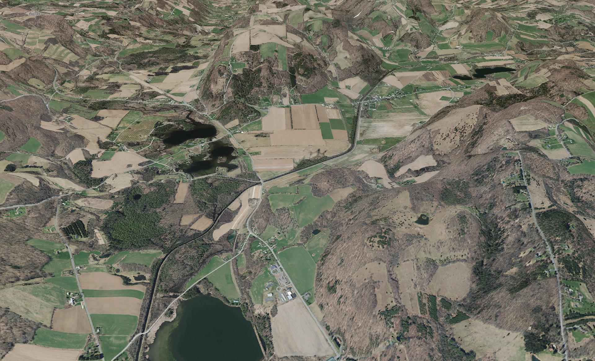
This shows a 3D rendering of the Buckville Canal north of Hamilton


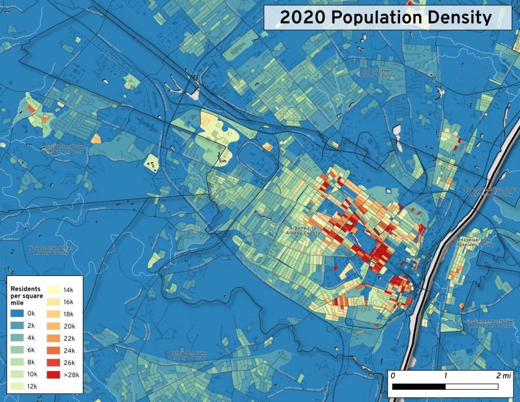
This map shows the use of 2020 PL 94-171 data to calculate population density in City of Albany.


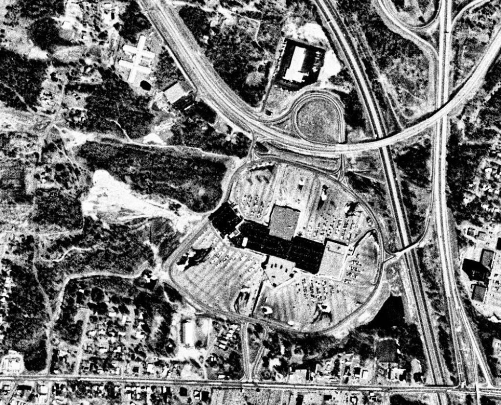
This 1985 aerial photo shows Crossgates Mall prior to it’s expansion.


This GIF image shows the change in unemployment during Coronavirus panademic.

This image shows hiking trails near Brooktrout, Falls Pond and Deep Lake.


Peebles Island, a Comparison 1952


3D Interactive of campsites at Moose River Plains.


Sample tax map in Albany.


Election results – 2020 Presidential Election, Onondoga County.


Map showing where sparklers are legally sold in New York.


Downtown Plattsburgh 1866 Beers (1866 Beers vs. 2020 OSM)


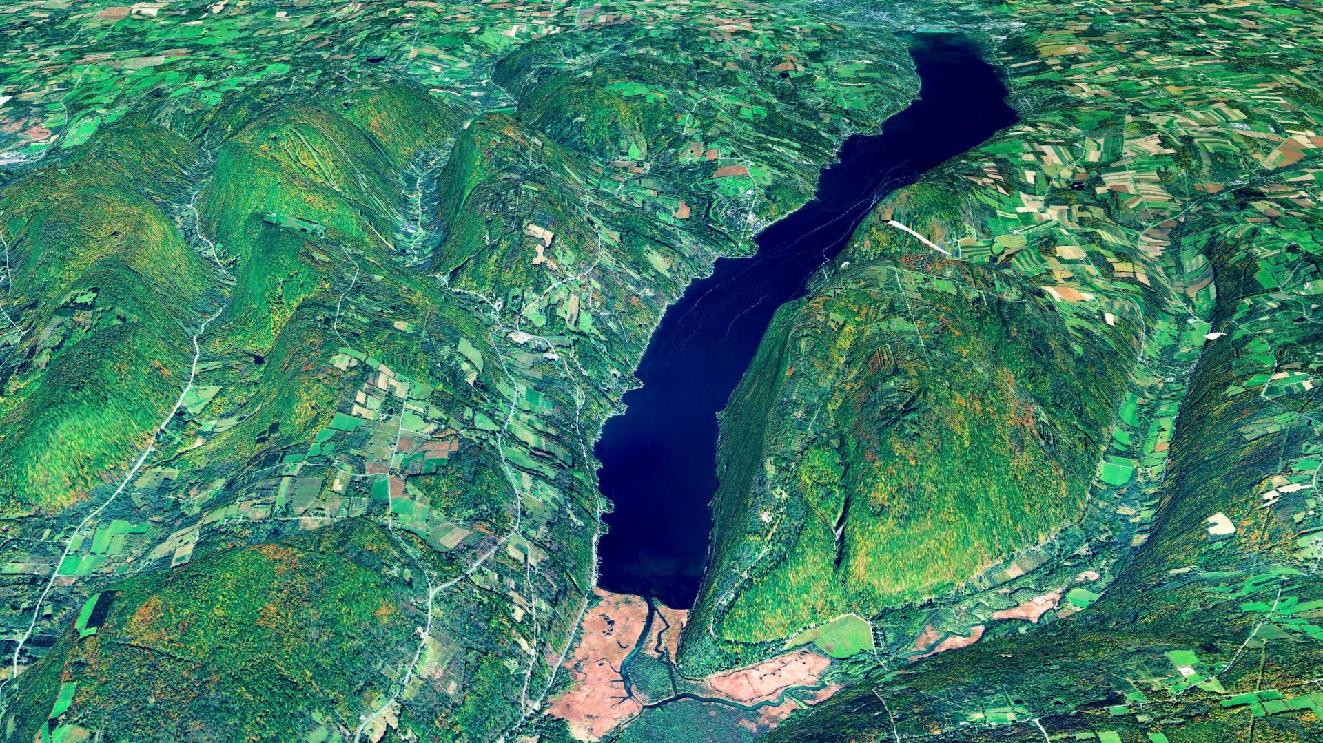
3D Rendering of Canandaigua Lake


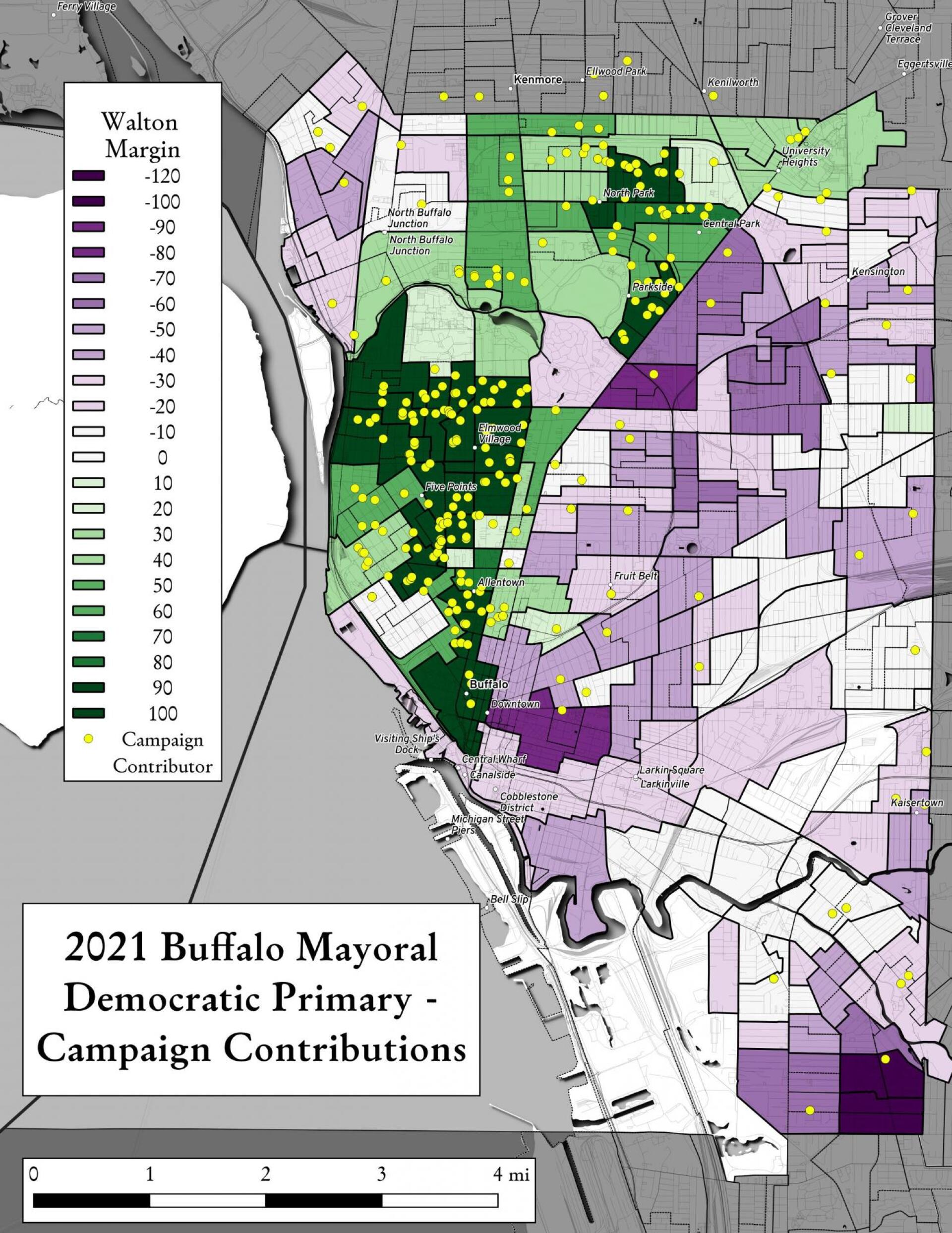
Map showing Buffalo Mayoral Primary results and campaign donors.


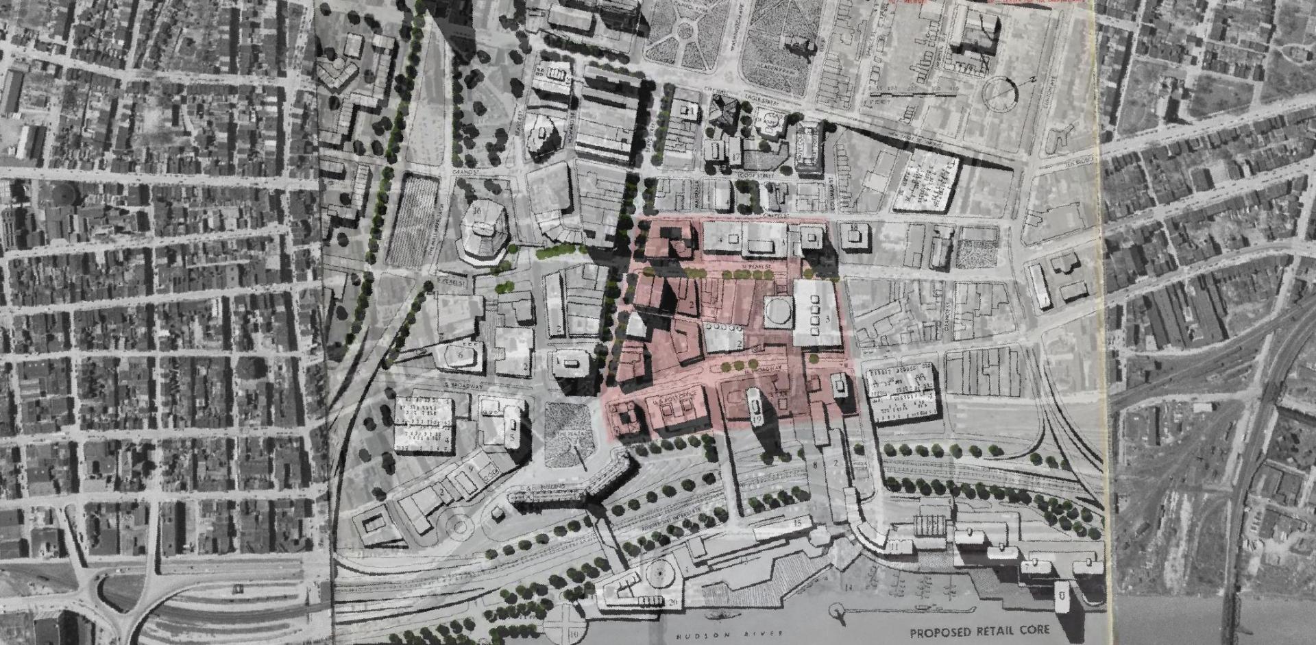
Overlay of Proposed Retail Core in 1963 Plan for the Capital City.


Map showing Local Area Unemployment Statistics – April 2020.


Interactive tax map in Delmar


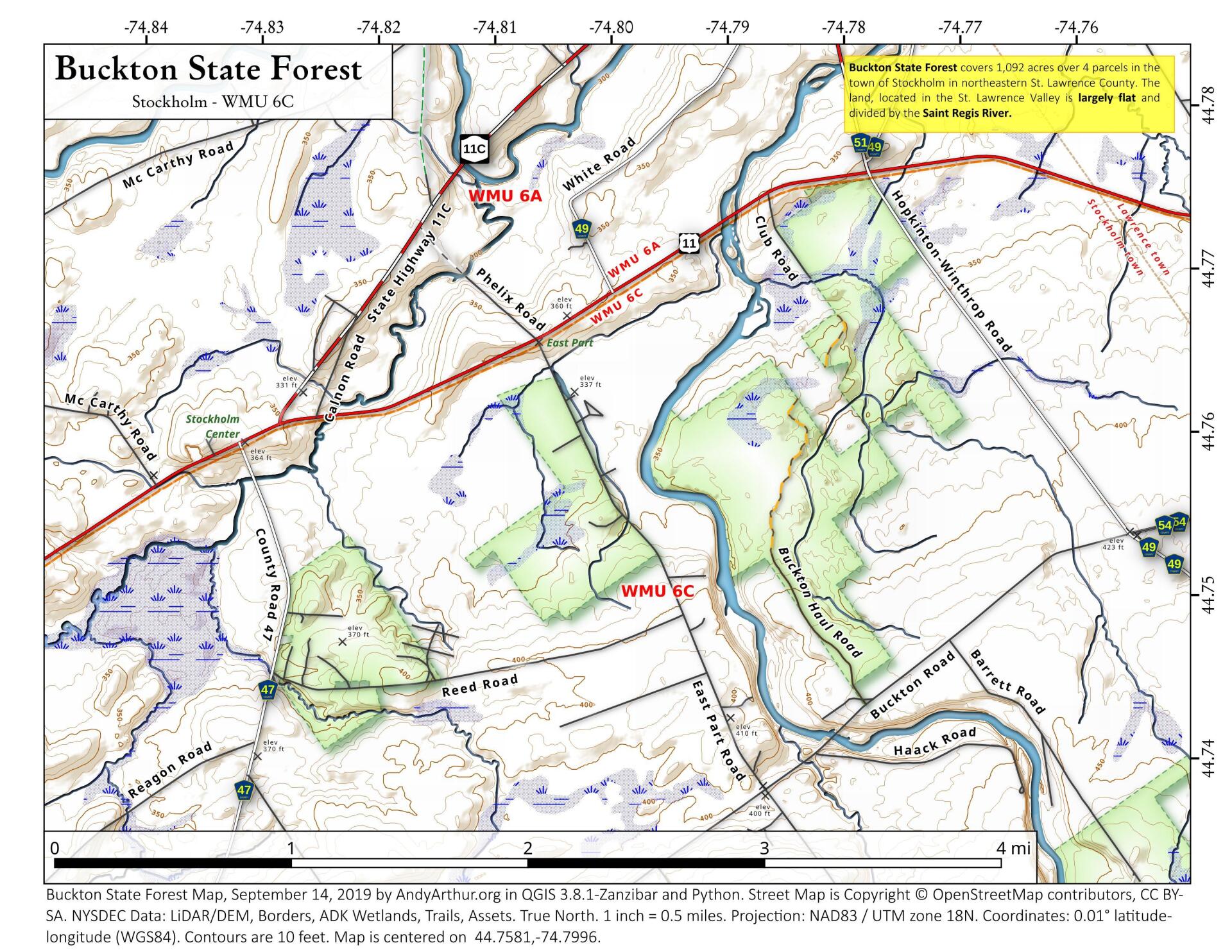
State Land in Stockholm, NY – Buckton State Forest.


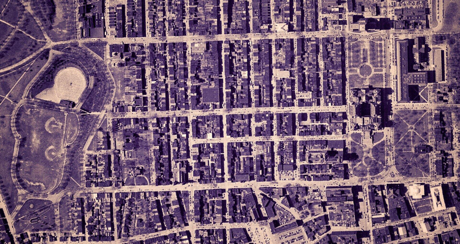
Empire State Plaza take area, 1952


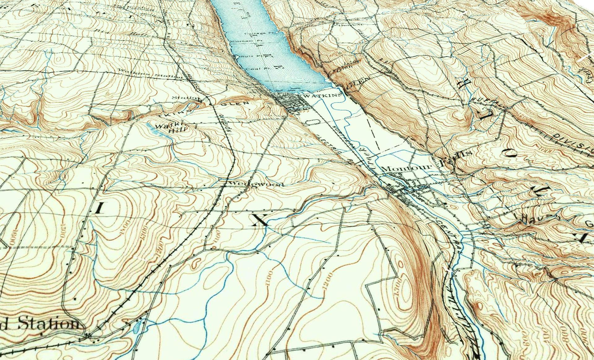
3D Rendering of the 1898 Watkins Glen Topographic Map

Examples of Data and Code

Properties in Albany Pine Bush Study Area,Excel Files: Various Tax Rolls,Find coordinates and political districts,Look Up State Tax Records and aScript for Processing RPTL 1520 PDFs.

Querying state property database, political enrollments, PL 94-171 Census files, calculating population statistics, what address is a district in, converting old districts to new districts.

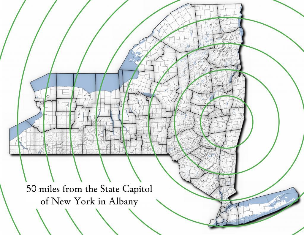
Miles from Albany millions population
50 1.002
100 1.750
150 3.511
200 17.102
250 17.725
300 18.699
350 19.411
400 20.187
450 20.201
import pandas as pd
import geopandas as gpd
 
# path to overlay shapefile
overlayshp = r'/tmp/dis_to_albany.gpkg'
 
# summary level -- 750 is tabulation block, 150 is blockgroup
# large areas over about 50 miles much faster to use bg
summaryLevel = 150
#summaryLevel = 750
 
# path to block or blockgroup file
if summaryLevel == 150:
    blockshp = r'/home/andy/Documents/GIS.Data/census.tiger/36_New_York/tl_2020_36_bg20.shp.gpkg'
else:
    blockshp = r'/home/andy/Documents/GIS.Data/census.tiger/36_New_York/tl_2020_36_tabblock20.shp.gpkg'
 
# path to PL 94-171 redistricting geoheader file
pl94171File = '/home/andy/Desktop/nygeo2020.pl'
 
# field to categorize on (such as Ward -- required!)
catField = 'Name'
 
# geo header contains 2020 census population in column 90 
# per PL 94-171 documentation, low memory chunking disabled 
# as it causes issues with the geoid column being mixed types
df=pd.read_csv(pl94171File,delimiter='|',header=None, low_memory=False )
 
# column 2 is summary level 
population=df[(df.iloc[:,2] == summaryLevel)][[9,90]]
 
# load overlay
overlay = gpd.read_file(overlayshp).to_crs(epsg='3857')
 
# shapefile of nys 2020 blocks, IMPORTANT (!) mask by output file for speed
blocks = gpd.read_file(blockshp,mask=overlay).to_crs(epsg='3857')
 
# geoid for linking to shapefile is column 9
joinedBlocks=blocks.set_index('GEOID20').join(population.set_index(9))
 
# store the size of unbroken blocks
# in case overlay lines break blocks into two
joinedBlocks['area']=joinedBlocks.area
 
# run union
unionBlocks=gpd.overlay(overlay, joinedBlocks, how='union')
 
# drop blocks outside of overlay
unionBlocks=unionBlocks.dropna(subset=[catField])
 
# create population projection when a block crosses
# an overlay line -- avoid double counting -- this isn't perfect
# as we loose a 0.15 percent due to floating point errors
unionBlocks['sublock']=unionBlocks[90]*(unionBlocks.area/unionBlocks['area'])
 
# sum blocks in category
unionBlocks=pd.DataFrame(unionBlocks.groupby(catField).sum()['sublock'])
 
# rename columns
unionBlocks=unionBlocks.rename({'sublock': '2020 Census Population'},axis=1)
 
# calculate cumulative sum as you go out each ring
unionBlocks['millions']=unionBlocks.cumsum(axis=0)['2020 Census Population']/1000000
 
# each ring is 50 miles
unionBlocks['miles']=unionBlocks.index*50
 
# output
unionBlocks

Land use in town of Berne (from 2016 National Land Cover Dataset)

Most highly assessed properties in Albany County …

from arcgis.features import FeatureLayer
lyr_url = 'https://gisservices.its.ny.gov/arcgis/rest/services/NYS_Tax_Parcel_Centroid_Points/MapServer/0'
layer = FeatureLayer(lyr_url)
query_result1 = layer.query(where="COUNTY_NAME='Albany' AND FULL_MARKET_VAL > 100000000", 
                                    out_fields='PARCEL_ADDR,CITYTOWN_NAME,FULL_MARKET_VAL,OWNER_TYPE', out_sr='4326')

df=query_result1.sdf.sort_values(by='FULL_MARKET_VAL', ascending=False)
df['Full Market Value'] = df['FULL_MARKET_VAL'].map('${:,.0f}'.format)

df
 OBJECTIDPARCEL_ADDRCITYTOWN_NAMEFULL_MARKET_VALOWNER_TYPESHAPEFull Market Value
112665264 Eagle StAlbany12042549252{“x”: -73.75980312511581, “y”: 42.650469918250…$1,204,254,925
391501200 Washington AveAlbany8862987152{“x”: -73.81092293494828, “y”: 42.679257168282…$886,298,715
4102081400 Washington AveAlbany6423982872{“x”: -73.82369286130952, “y”: 42.685845700657…$642,398,287
0885251 Fuller RdAlbany4400428272{“x”: -73.83559002316825, “y”: 42.690208093507…$440,042,827
518164632 New Scotland AveAlbany3775682018{“x”: -73.80381341626146, “y”: 42.655758957669…$377,568,201
1906141 Fuller RdAlbany3211991432{“x”: -73.83323986150171, “y”: 42.693189748928…$321,199,143
19108087See Card 1067Watervliet2808988761{“x”: -73.70670724174552, “y”: 42.719628647232…$280,898,876
1565380737 Alb Shaker RdColonie2639161003{“x”: -73.80365248218001, “y”: 42.747956678125…$263,916,100
921923304 Madison AveAlbany2342654182{“x”: -73.76227373289564, “y”: 42.648000674457…$234,265,418
2907201 Fuller RdAlbany2034261242{“x”: -73.83362605353057, “y”: 42.692609131686…$203,426,124
1669999515 Loudon RdColonie1660656008{“x”: -73.74958475282632, “y”: 42.719321807666…$166,065,600
72059247 New Scotland AveAlbany1622763388{“x”: -73.77597163421673, “y”: 42.653565689693…$162,276,338
620574132 S Lake AveAlbany1462963602{“x”: -73.77970918544908, “y”: 42.654390366929…$146,296,360
820597113 Holland AveAlbany1434985012{“x”: -73.77306688593143, “y”: 42.650762742870…$143,498,501
1778203MannsvilleColonie1425704001{“x”: -73.71245452369443, “y”: 42.718124477080…$142,570,400
18955091 Crossgates Mall RdGuilderland1305547008{“x”: -73.84702700595471, “y”: 42.687699053797…$130,554,700
102452186 S Swan StAlbany1284364032{“x”: -73.75980563770365, “y”: 42.653931892804…$128,436,403
13468831916 US 9WCoeymans1100000008{“x”: -73.83388475575597, “y”: 42.488730743021…$110,000,000
1235152380 River RdBethlehem1052631588{“x”: -73.76445503554325, “y”: 42.595925419330…$105,263,158
146509715 Wolf RdColonie1019672138{“x”: -73.81423716588279, “y”: 42.709939498581…$101,967,213
Categories:

Site Map

🌲🌲 Our Public Lands 🌳🌲

Interactive maps with backcountry and roadside camping: New York, Pennsylvania, West Virginia & Vermont.
List of NYS DEC Lean-Tos with map coordinates. List of NYS DEC Firetowers with map coordinates and more information.
Google Spreadsheet with Roadside, Primitive and Pay Campsites

Explore the Finger Lakes Trail, Long Path, Northville-Placid Trail and Long Trail/Appalachian in Vermont.
Catskill Park Mountain Peaks, Hudson Valley & Long Island Peaks, Peaks Over 3000 ft Elevation, Highest Peaks in Adirondacks, Interactive Map of All Named Summits in NYS, Blaze Colors in Catskill Park, Trailhead Parking Coordinates and Addresses in the Catskills.

Browse USGS Topo Quads as PDF 🆕 by State Lands or County. You can Bulk Download New & Old USGS Topograpic Maps.

Links to various NY State Land Websites 🆕. Get latest GIS Data from state Web Services.

⛺🌲 Camp 🌲🏕

Moose River PlainsCampsite Listing, Maps and photos of state’s largest free camping area.
Piseco-Powley RoadCampsite Listing, Maps and photos of 15 mile dirt road with camping.
Catskill Park Primitive CampsitesAn overview of free camping locations in Catskill Park.
Burnt-Rossman Forest, Cattaraugus County, East Branch Sacandaga River, Finger Lakes National Forest, Madison County, Pennsylvania, Vermont and West Virigina.

Campsite Coordinates for Bog River Flow / Lows Lake, Hudson River SMA (Buttermilk Falls), Lake Lila, Oswegathie River, Nine-Corner Lake, Pharaoh Lake Wilderness, Saranac River Campsites, Stillwater Lake, Schoharie County, and Sugar Hill State Forest.

Overview of Camping Areas in the Catskills, Green Mountains, Southern Adirondacks, Central Adirondacks, Northern Adirondacks, Allegheny National Forest and Penna. DCNR Motorized Campsites and the Monongahela National Forest West Virginia.

Free Campsite Overview Maps: Adirondack – North Country, Catskills, Central NY, Finger Lakes, Western NY. Interactive Map.

Places I camped in 2023, 2022, 2021 and 2020.

🏞 🛹 Bicycle Trails and “Blackie” My Mountain Bike 🚲 🚶

Finally bought a mountain bike, after chewing over a mountain vs commuter bike. Really enjoying riding my bike to work and when it rains there is always a bike rack to safely take it back home. One way to get to adventures at Thacher Park is the Nature Bus.

Empire Trail – KMZ and Interactive Map. Parking along it.

More Trailways with KMZ files including the Albany County Rail Trail, Black Diamond Trail, Catharine Valley Trail, Catskill Scenic Trail, Fonda, Johnstown & Gloversville Rail Trail, Genesee Valley Trail, Link Trail.

🦌🌲 Hunt 🦃🐿

Wildlife Management Units (Deer)KMZ Map shows the WMU boundaries.

Summer 2019 Aerial Photographs of WMUs

KMZ Maps of Deer Harvest Density by Town: 2019, 2018, 2017, 2016. By WMU 2017, 2016, 2015.

KMZ Maps of Buck Harvest Density by Town: 2019, 2018, 2017, 2016. By WMU 2017, 2016

2016 -2019 Deer and Buck Harvest by TownKMZ Spreadsheet with FIPS codes for making your own calculations.

🎣🐡 Fish 🐟🐠

Parking and Access to Trout StreamsAn interactive, downloadable KMZ Map.
Lakes with DEC Contour MapsA KMZ Map links to Contour Maps for Fishing.

🌨🏔 Sled & Wheel 🚙❄

State Truck Trails Over A Half MileDirt roads to explore in the backcountry.
NYS Statewide Snowmobile Trail SystemState trails on public and private lands.

📉📊 Learn 💵📈

Interactive Maps of NY CensusExplore and download KML files.
Charts and Interactive DiagramsFrom population to pollution control.
Andy Arthur GitHubGit my R and Python scripts used to make maps and diagrams.
Use ArcPullR to Get Geospatial DataSuper easy way to connect to get GIS data in R from government servers.
GDAL Opens E00 FilesMost open source programs nowadays can open common geospatial formats.
NY Building FootprintsWhere to find on the internet for making maps.
WMS and ArcMap ServicesDownloadable CSV file listing services used on the blog.
2022 US Census Population EstimatesRed states, south continue to gain population.
2020 Cartogram of State Population

💳 🏛 Property Taxes 🏠💸

Properties in Albany Pine Bush Study Area, Excel Files: Various Tax Rolls, Find coordinates and political districts, Look Up State Tax Records and a Script for Processing RPTL 1520 PDFs. Match NY SWIS Codes to FIPS Codes and GEOID. How to Find MapServer Data and Load Into QGIS.

🚗🚗 Big Red 🚗🚗

Big RedPhotos and Videos of my lifted truck with its camper shell. Big Red’s Dual Battery Setup for Camp Power, Video Tour and Diagram. Big Red is getting old. What is next? I’ve thought about going carless for a while to save money and reduce pollution. Or maybe going bigger? Or smaller? Five dollar gas sucks.

🔥🌲 Off-Grid Living 🏠🤠

I am seriously thinking about building an off-grid house. I have a first draft. I need to learn CAD! I have a road map towards buying land and building. I concede might have to live with long commute and give up traveling and camping. I need to be strong.

Why off grid? Well, I’m not into contemporary society. I want to own land, but not be called a landowner, and a cabin, not hooked to electrical grid, farm, raise pigs for food and burn my own trash. I’m saving for a better tomorrow, hoping to make the leap to another freer state. Having acreage is important. Cornfields aren’t bad neighbors. Maybe though my vision has grown smaller and more local. More on off-grid living.

I am 16 years into my career and have made some significant progress in my life. I love my job. But I do wonder on all the things I’m missing out but saving sure makes me high. Maybe it will be different when I own my own land — the end of goal of all this saving.

2020 into 2021 during the pandemic was a year of remote work. It was a struggle not having internet at home, worked a lot out of my truck. But I worked remotely from Horseshoe Lake which was super cool.

Generally I like the idea of owning land in a red state, particularly Idaho, Iowa, Pennsylvania, West Virginia, Wisconsin — and Midwest more generally. But I may settle for New York – it’s all about the f-ing money!

💻👨‍💻 Open Source 🗺️📍

I use open source software and public sources of data for the blog. Quantum GIS (QGIS), GDAL/ogr2ogr, PyQGIS, GeoPANDAS, R Studio and Leaflet for map making, Arduino and ESP32 microprocessors, Ubuntu Linux and XFCE Window Manager. I’ve recently gotten interested in machine learning.

I avoid using commercial software like Microsoft Windows and do not have home internet or television. If you don’t use commercial software and use your brain, fears of computer viruses are overblown. I deleted most of my social media accounts.

Creating Digital Surface Models using LiDAR Point Clouds.

📊🗺 R Statistical Programming 📜👨‍🏫

The R programming language and RStudio are powerful tools for statistical analysis, making maps and charts. Many of the blog posts and analysis I do are in R, ggplot not only makes great charts but also maps using tidycensus. Generally, R is better then Python for geospatial work.

Use IDW Interpolation to fill in missing Census data, Zonal Histograms for land cover, load WMS Aerial Photography in R, find mountain peaks, save Census shapefiles using tigris quickly, pull NY Election Night Results using Selenium. Fast reverse Geocoding in PostGIS. Working with PDFs in R. Fix a common error starting rselenium/wdman. Make data-filled calendars. R is wonderful and weird, learn it!

🐼🔢 Python and Pandas 💻🐍

Querying state property database, political enrollments, PL 94-171 Census files, calculating population statistics, what address is a district in, converting old districts to new districts, Shapefiles missing Projection information in QGIS.

Learn to code for free modern HTML, Javascript, Python and SQL at freeCodeCamp and web development at the Odin Project.

🐴 🐘 Politics 🦁 🐍

Crunched Election Results with Turnout for Albany County: November 2023, 2022, 2021, 2020, 2019 and Primaries June 2019, Pres/June 2020, June 2021, June 2022, Aug 2022, June 2023.

Albany County Races converted to the new 2023 EDs using Super EDs and Code: 2022, 2021, 2020, 2019 and Primaries June 2019, Pres/June 2020, June 2021, June 2022, Aug 2022.

Above Election Results as zipped Excel files.

Albany County Legislature Districts 2024 Maps

Maps Comparing 2017 and 2023 Albany County Election Districts and a Crosswalk Table Showing the Proposition of Voting Age Population in New and Old EDs

Maps of 2022 NYC Assembly Races, NYS Assembly Races, NY Senate Races, Governor’s Race in Erie County and Statewide. Partisan shift in governor race between 2010 and 2018.

A comparison of Democratic Performance 2022 Assembly Districts to those proposed in 2023 by the IRC. Here is latest 4/20/23 IRC Maps, showing ADP and how they change from existing Assembly districts. Most towns upstate, outside of cities, are quite red. Using LATFOR data with R to calculate Average Democratic Performance.

You can scrape employee salary data from SeeThroughNY using R. Other useful investigative resources.

I often think politics is for losers. I’m into the politics of statistical analysis and reading history books.

I believe strongly in the first amendment, second amendment, oppose gun restrictions and I support de-funding the police in favor of lower-cost technology and civilian employees. Maybe use red flag laws for voting to stop dangerous voters? And the media should stop promoting mass-shootings, even if it’s super profitable for all involved. They should tax the media when it promotes violence. I think some people are much too paranoid in politics. How elections are rigged under law to benefit incumbents. But vote, it’s the best option and inexpensive.

Yeah for the third parties! I voted for Larry Sharpe for Governor and Jo Jergenson for President but my views are complicated and often vote for Democrats, after voting Jill Stein Green Party in 2016.

Some thoughts on Joe Biden not seeking re-election. Times change, but Biden was been a good change over DJT and glad the Trump era is over and are glad prosecutors and grand jurors are holding him responsible by indicting him for many serious felonies. I don’t think Trump can win in 2024, as nothing has changed politically from 2020.

I think rural people should be left alone and not worship government workers or have parades for them. I am no fan of Donald Trump, his speeches are bad, I don’t like Trump’s embrace of radical environmentalists, but do admire the homemade roadside monuments to DJT.

🌲🌳The Earth 🌎 🐸

Why I oppose wilderness areas and parks. It’s trendy to be green these days, but is eco-marketing good for the planet? I visited the Mount Storm Coal Plant and Corridor H.

I worry about a lot about overly-aggressive Climate Change Action, and Undermining Environment Laws for Climate Action. I think we should all admit we are Addicted to Fossil Fuels. These days, urban recycling has become a joke, when it’s still an option at all. It’s better to just buy less shit and avoid the alure of Costcos. I really don’t like how aging radicals have become industrial solar salespeople.

Big bucks are coming to state-designated disadvantaged communities under the CLCP. Which counties and political districts are in line for the the most pork? Interactive map.

I’m a big of farmers who are essentially Living Off the Earth and think Rednecks are Noble Savages. Dairy Farming are key to our rural landscape. I’d trust a farmer or a hunter in a pile of guts he’s butchered over any ivory-tower scientist.

🌎🔆 Industrial Solar 🌞 🏭

Hundreds of multi-acre industrial solar farms are being built in our state. How bad is solar for the environment? We should ask tough questions. Interactive of recently built solar farms, proposed facilities. List of proposed industrial solar facilities. See how the Greenville Solar Farm changed the landscape.

💳 💸Saving Money 💰 💷

I am not a fan of ESG Investing as it’s not well diversified. I prefer index-funds and other tax-advantaged ways of saving. Why I am concerned about saving enough for retirement, even though I’m in my late 30s. We as a nation should save more, consume less. I like the idea of carbon tax to replace capital gains taxes to discourage consumption.

🥦 🍎Mission Fifty, Smoking Grass & Being Healthier 🏠🧠

I am now officially in my 40s! I am building to a better life in my 50s, which means getting up early, walking a lot, saying no to cake and yes to more fruit. In many ways, the forties are an awesome time to be alive.

And eating healthy for less without losing sleep over arsenic. And I don’t think we should subsidize unhealthy habits. How I got started in eating healther. Meals are too focused on meat and carbs due to how we describe them, maybe I eat too many bananas in the office, what to eat while camping, worry more about salt then GMOs, eat more beans. Do spend extra for farmers market peaches, especially doughnut peaches and plums. Consider ethnic supermarkets. Thinking about how to make a healthier macaroni and cheese, spinach-mackeral-pasta salad, quick-cook biscuits and whole-wheat bread. That said, too many recipes are junk food crap. Okay in moderation is not okay. The fact that I’m thinner is not a sign I’m dying.

A few years back I decided to explore my mental illness with therapy, thinking about why I have so much anxiety and how many of my values are rational or just thinking too much rednecks’ burn barrels and how much of a throwaway society we live in. Do I want to change?

I’ve learned to care less about the world, and focus more on myself. Maybe I am happier as I am now, saving and investing a lot towards owning my own land, where I don’t have to deal with all the bullshit of modern life.

And smoke more grass, now that’s legal. Smoking pot is fascinating. Enjoying the rich colors. A map of licensed pot retailers in NYS. Yes, that stuff we used to think of as the smell of crime. Thoughts on Stoner Culture. Not that the blog advertisers like it.

Mission Fifty: Getting to the point where I own my own land. 🚜
Healthy Eating 🍎 / Growing My Wealth 💰
Healthy Thoughts 💭 / Enjoying Life 😃

Questions, comments? Feel free to email me at andy@andyarthur.org.

You do your thing, I’ll do mine.
I smoke pot and drink cheap beer, up in the wilderness. Yes it’s my right !

I use GNU open source software.
Plus I like buck goats,
because they’re real macho men
spraying their beards with goat urine.

I own guns, but not nearly enough. Some day when I live in a pro-2A state …
I can’t make everybody happy, so I’ll just be myself.” – Andy Arthur

Return to the Top

Laugh a bit and learn how your data is used on this blog: Privacy Policy

This blog is © Copyright 1997-2023 Andy Arthur.org, please share using the Creative Commons Attribution 3.0 License.

Categories:

June 1, 2021 Morning

Good morning! Suddenly it’s June 🐮 ! Dairy month with all those cows eating delicious first cut hay and corn silage popping up out of ground, 🌱 Gay Pride month so hang your flag, 🏳️‍🌈 and Black Lives Matter month. ✊🏾 Next Tuesday is 8:30 PM Sunset. 🌇 Mostly cloudy and 59 degrees in Delmar, NY. ☁ Calm wind. A bit gray this morning, but it’s expected skies will clear around noontime.

I can’t believe that the we are starting out this morning so cloudy ☁️, but I’m hopeful that we will see more sun ☀ later. At least it’s a nice enough of a morning for the walk 🚶🏻. My laptop is fully charged so I can work out back later on when it’s gets nicer. Might as well work outside today as tomorrow and Thursday it’s back in the office 🏢. I don’t mind but I like the sunshine when I can get it.

Today will be partly sunny 🌞, with a high of 76 degrees at 3pm. Typical for today. Maximum dew point of 49 at 11am. Calm wind becoming southwest around 6 mph in the afternoon. A year ago, we had cloudy skies in the morning with more sun in the afternoon. The high last year was 68 degrees. The record high of 94 was set in 1918.

Today I will work from home after my morning walk. I need to get groceries, 👜 contact solution, 👀 and some other supplies at lunch time so I want to head to Walmart today. I probably should get groceries for the weekend, although maybe I can get out on Thursday night after work. I will probably start packing for the weekend, 💼 as I might have to work late on Thursday night or end up over in the archives continuing to sort, pack and dry John Wolcott’s files. 📂 I plan to leave early Friday morning at this point to work remote from Lake Pleasant and camp up that way over the weekend. 🏖 Going to be a hot weekend and even hotter next week. While I could probably work remote on next Tuesday, I probably will come back Monday night after work so I have time to prepare for next week in office and Wednesday and Thursday and work from home on the following Tuesday.

Solar noon 🌞 is at 12:54 pm with sun having an altitude of 69.5° from the due south horizon (-1.3° vs. 6/21). A six foot person will cast a 2.2 foot shadow today compared to 2.2 feet on the first day of summer. The golden hour 🏅 starts at 7:45 pm with the sun in the west-northwest (295°). 📸 The sunset is in the west-northwest (302°) with the sun dropping below the horizon at 8:27 pm after setting for 3 minutes and 23 seconds with dusk around 9:00 pm, which is 47 seconds later than yesterday. 🌇 The best time to look at the stars is after 9:45 pm. At sunset, look for mostly clear skies 🌄 and temperatures around 66 degrees. The dew point will be 51 degrees. There will be a calm wind. Today will have 15 hours and 6 minutes of daytime, an increase of one minute and 16 seconds over yesterday.

Tonight will be partly cloudy 🌤, with a low of 50 degrees at 4am. Four degrees below normal, which is similar to a typical night around May 23rd. Light southwest wind. In 2020, we had cloudy skies in the evening, which became light rain by the early hours of the morning. It got down to 45 degrees. The record low of 39 occurred back in 1971.

Today I expect my Bluetooth speaker 🔊 to arrive in the mail ✉. The old one I’ve had for six years now stopped charging 🔋 and the battery life wasn’t great. I thought about trying to take it apart for parts or repair 🛠 but opening the waterproof case will be a rather destructive process I fear and the result wouldn’t be great in a wet and muddy camp environment. I kind of think it would be fun to shoot 🔫 it and then burn it but that rubber would stink to high heaven and I couldn’t salvage parts. I hope I got a good quality model, I researched it over a couple of days but I don’t know. Always hard to know which on line reviews are legit. As long as it’s loud enough to be heard over woods and road noise and the battery life is reasonable I’m good.

Going to be a nice, hot summer weekend. 🏊 Saturday, a chance of showers after 2pm. Mostly sunny, with a high near 86. Chance of precipitation is 30%. Maximum dew point of 64 at 7pm. Sunday, mostly sunny, with a high near 89. Maximum dew point of 66 at 7pm. Typical average high for the weekend is 77 degrees. Yeah, that’s going to be a toasty one especially back in Albany. With that heat I’ll definitely want the screen tent not just to keep cool but control the bugs. Thinking of doing some swimming in Speculator and maybe some fishing. 🎣 I thought about going to the Green Mountains but I like being closer to WI-FI should something come up, and I prefer to do my Friday meeting using the laptop rather then the phone, especially when I’m away from home with the virtual background.

As previously noted, next Tuesday is 8:30 PM Sunset 🌇 when the sun will be setting at 8:31 pm with dusk at 9:06 pm. On that day in 2020, we had mostly sunny and temperatures between 81 and 49 degrees. Typically, the high temperature is 77 degrees. We hit a record high of 93 back in 2011. It is quite possible we break that record this year, it seems like the dog days of summer will be coming early this year.

 Bourne And Grout Pond

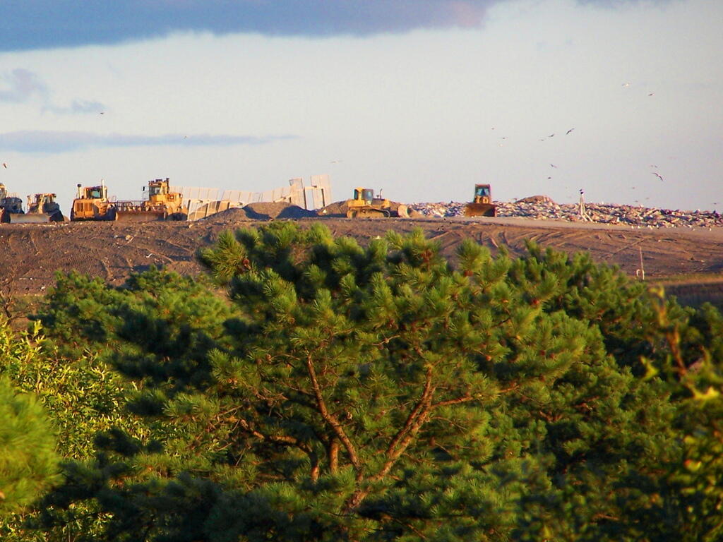
It’s already under six inch of dirt in the Rennselear Landfill

It’s already under six inch of dirt in the Rennselear Landfill

And all I can taste and smell this evening is like smoldering garbage in a burning barrel. That kind of yuck.

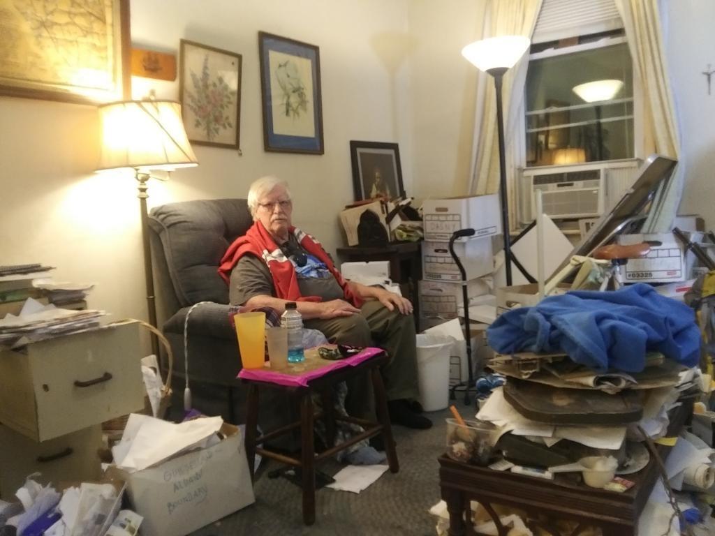
Interviewing Albany Historian John Wolcott for a documentary

This morning I started out my day trying to recover whatever historical documents I could from John Wolcott’s house which was severely burned and roof collapsed after a Sunday evening fire that jumped from a neighboring house, turning John’s archives in his attic into a raging inferno and leading to an emergency demolition at noontime today when the big diesel trucks lined up on Sheridan Street waiting to haul away the pulverized remains of 344 and 346 Sheridan Avenue rapidly removed by Di’Tonnonio and Sons’ Excavator. Another Dutch building pulverized with all its contents and covered with dirt at the Dunn Landfill in Rennselear.

I think we recovered a lot. Most of John’s files I had been going through over the past five years were saved, as much of the water damage occurred in other parts of the house. The Fort Orange and DASNY files were safe. Certainly the best of it wasn’t soaked. All the stuff upstairs was lost, as the fire was fed by decades of dry paper consisting of maps, photocopies, books and original research. Anything I hadn’t seen was lost and probably at this point with his failing memory is forever gone. That said, so much of it before the fire was faded photostat documents and with notes disjointed and memories faded its not clear how much was worth saving even before the fire. Even some of the fabled files that John Wolcott always talked about probably never existed or where just exaggerations of facts after talking with Jim Lafferty. It’s quite possible that the Democratic machine never wanted them found, although who really cares about the machinations of Dan O’Connell and Jim Coyne in 2020. Neither are likely to go to prison in the coming years even if they stole tax money and ran booze and prostitution rings more than a half century ago.

The city fire department retrieved a great deal of momentums that John and Linda had on their list to keep. Some of those boxes and books they hauled out where heavy with water. Very professional and caring. They also retrieved some of the files I had sorted, later on we were able to sneak in the back door and grab some more, along with a few other files that remain a mystery. The fire department grabbed the hard drive and computer so hopefully we can salvage the data off of that. Albany Historian and former Assemblyman John McEneny helped us salvage some materials and had some good ideas on how to save them. We are trying to dry what we can, they may take the papers to a freeze drier to salvage them. We stored them in a vacant apartment, they were going to figure out how to preserve later on.

One thing I couldn’t believe was the stink from the fire. I was prepared to go in the building, I knew it would be wet, smokey smelling. I wore old clothes, knowing that I would be covered with soot and ash by the time I had to leave – and planned to take a shower when I got home but I had no idea how pungent the smell would be, how I would track it home on my boots and my clothes. Despite taking a shower and washing my hands it’s still on them, it’s in my mouth and nose. Most just from handling documents and my brief run on doors to fetch more. It’s like everything had a sticky tar residue from the fire that reeked of smoldering plastic garbage. I wasn’t in the building more than five minutes and while I handled wet sooty boxes, I couldn’t believe how much rubbed off me.

Linda was very concerned about retrieving clothing and things like makeup from the building. That seemed so trivial to me when history was about to be forever pulverized and buried in the Dunn Landfill within a few hours. Her sister was very concerned about that but I couldn’t imagine even after washing you would want to wear any of the clothes. Certainly the fire department didn’t. Russell salvaged some of the bags of clothes but they were so wet and nasty. I thought it silly when there might have been more historical documents to save. Minutes before history lost, rather than trying to sneak in and save wet and terribly pungent clothing. Maybe it’s more salvageable then wet historical documents, and it’s better than it all going to the Rennselear Landfill this afternoon but nothing was historic or not easily purchased with money from the insurance settlement. Trying to save the new chair or chest freezer they had was pointless.

Truth be told, probably a lot more could have been salvaged from the landfill had we had a bit more time. The downstairs while water damaged especially in the back had very little fire damage. The first floor was in little risk of collapse even though the top floor was a mess. Probably in a rural or even suburban town the burned building would have sat for a while before demolition. And ultimately if labor was cheaper and material more expensive like 50 years ago, they could have saved the bottom floor while replacing the top. Assuming that they could get rid of that smell. It was so pungent! But today, the landfill is king, buildings are disposable, used for a few years to be thrown away like everything else.

They talk about all this green stuff and feel good recycling of tin cans and plastic bottles in front of every suburbanites house. But the truth is laid bare after a house fire when everything is pulverized and hauled to the landfill whether it was damaged by fire or water or not. Momentums are considered salvageable but nothing else is. Anything else you can remove is insurance fraud. And too risky, the building could collapse unexpected after the damage of the fire and water we are told. No time to seperate out the asbestos or the television or the vinyl records or the smokey, soaked rug or furniture before its buried in the landfill. The potent greenhouse gas HFC refrigerant in the refrigerator and air conditioner must be vented to the atmosphere as the building must come down, pulverized and be hauled to the landfill as soon as possible.

Maybe speed was of the essence and the building posed an immediate threat to public safety. The city engineer did and he understood better than any of us how a building could suddenly collapse. The building was old, the neighborhood had rapidly deteriorated since a drug rehab center had opened across the street. Gunfire rang out on the street minutes after I walked up it the last time I visited John to go through files. Plus the fire made everything stink so badly. Yuck. It would have been a job to restore such a mess. But in an era of greater material scarcity it probably would have happened. Probably not a lot of value at least on paper with today’s economy.

I’m just glad no one was hurt and we recovered a lot of important papers although certainly many others were lost. That house was a mess, it was full of papers and random junk. It inspired me to go on a purge of some of my own filing cabinets and discarding worn clothing so that I have less junk. Makes me even more resistant to getting more stuff. I didn’t grow up in the era before computers but I can’t imagine ever having nearly as much paper as Mr. Wolcott once had. If it’s important and I’m likely to use , scan it in. Otherwise, toss it. I know I won’t be saving nearly as much anytime random stuff in my future.

Plowing Day's Trash

Allegheny National Forest Dispersed Camping and Pennsylvania DNCR Motor Vehicle Camping

Allegheny National Forest Dispersed Camping and Pennsylvania DNCR Motor Vehicle Camping 🏕

Please see also information on dispersed, roadside and back-country camping in New York State, Vermont and West Virginia.

Allegheny National Forest Dispersed Campsites (shown on this map with a round Yellow Camp logo) are free-to-use with a 14-day stay limit in any 30 day period. Many of these campsites are informal areas used for camping, others like along Forest Road 160 and 259 near Jake’s Rocks and along Lolita Grade have enhanced gravel pads/parking areas. Unlike New York State, they do not have formal markings at the sites. More detailed map.

PA DCNR Motor Vehicle Campsites (shown on this map with a Blue Camp logo) are free to stay at with a permit which can now be obtained online, 3 days in advance.

Download a spreadsheet with the coordinates of Allegheny National Forest Dispersed and Motor vehicle campsites.

More About Allegheny National Forest Camping …

In the Allegheny National Forest there are a variety of back country roads, offering primitive roadside camping.

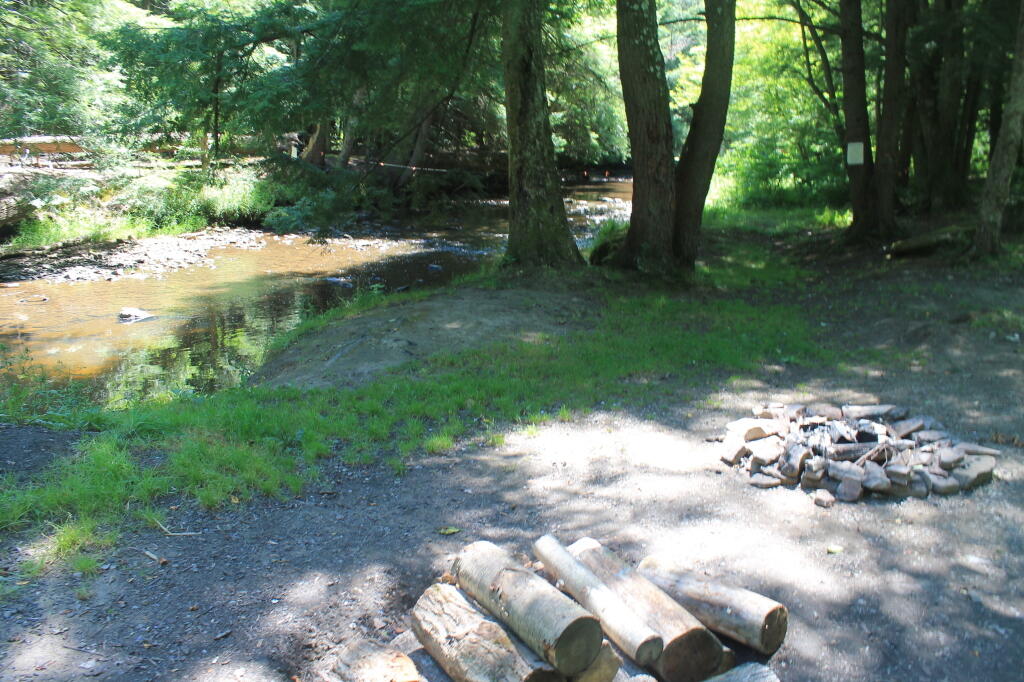
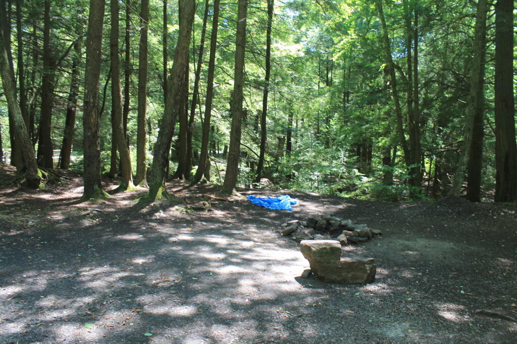
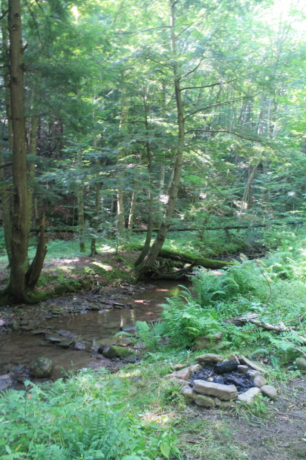
  • Campsites are free to use, and have no facilities except for a fire ring and a pull-off from the road, and sometimes a site reinforced with gravel.
  • As noted below, some campsites have additional facilities.
  • Don’t make a mess of campsites, pack out any garbage left over.
  • Burn only dead and down trees, don’t bring in wood from out of state.
  • You can camp up to 14 days per 30 day period in Allegheny National Forest — no permits are required.

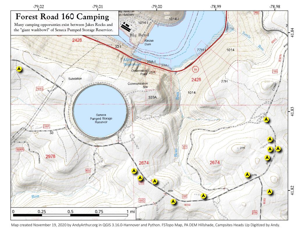
Forest Road 160/259 is the most popular dispersed camping area near Jakes Rocks and the Allegheny Reservior. Above are some campsites in this area. Many of these campsites have gravel parking areas and hardend campsites.

Forest Road 160 Camping

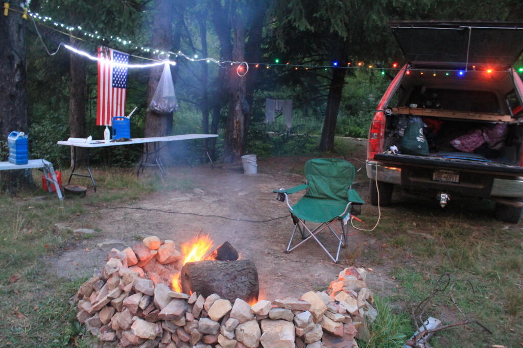
Before Dark

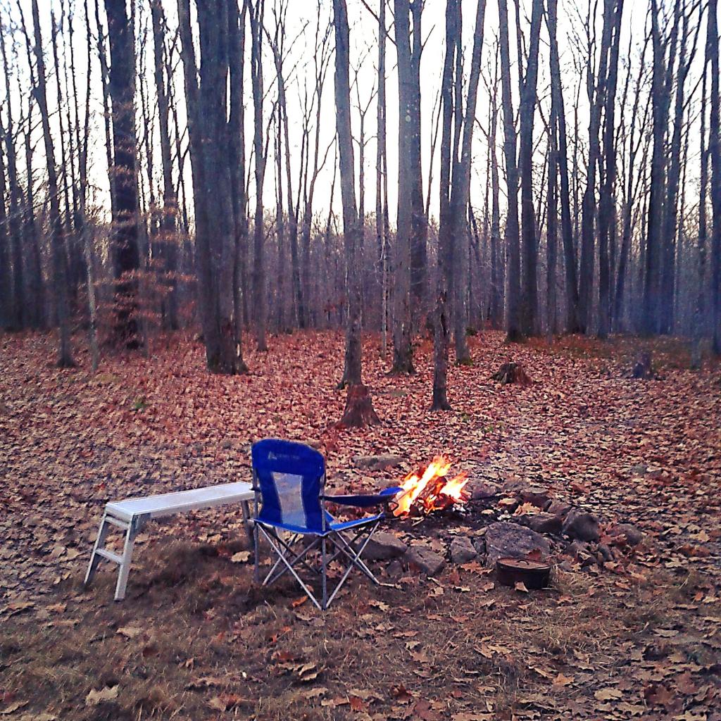
Sitting Next to the Campfire

There are several campsites along Loleta Grade, south of Lamonaville (FR 131).  This is on the backside of Buzzard Swamp Wildlife Refuge, and is a much more wilderness experience. Many of these campsites have gravel parking areas and hardened campsites. Some of the campsites along the Gurgling Run can be buggy during the summer month, but get much less use then the Jakes Rocks area. Be aware that Forest Road 131 from Loleta Recreation Area to Forest Road 288 is permanently closed due to damage after Superstorm Sandy.

Canal Street [Expires July 9 2024]

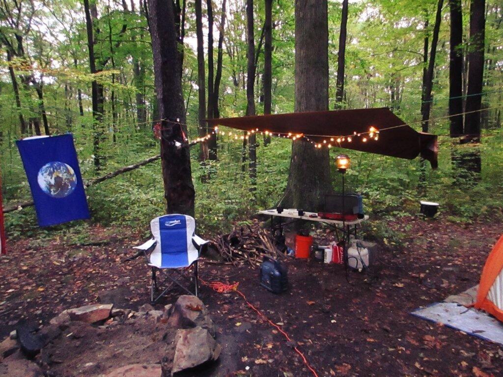
Camping with Lots of Light

Good morning from camp!

There is a handful of campsites along Fire Road FR 137 along the Dry Run and Whitney Creek near the Willow Creek ATV Area.

2020 State Population

Sitting Next to the Campfire

There are a handful of campsites along the East Tionesta Creek south of Kane/Shefield.

Another Campsite on Tionesta

Tionesta Creek Campsite

There are many other roads that have camping but these are some of my favorite locations.

More About DCNR Motor Vehicle Camping …

On Pennsylvania State Forests there are a variety of back country roads, offering primitive roadside camping.

Camping Down at the Painter Run

Camping at Painter Run

I have not done a lot of DCNR Motor Vehicle Camping, but above is a picture from 2012 when I spent half a week truck camping at Painter Run in the Tioga State Forest near the Pennsylvania Grand Canyon. There are many other opportunities as can be seen above, if you plan ahead and get your permit.

Also, see the DCNR Interactive Map if you are interested in fee campgrounds. They have several “rustic” campgrounds which are inexpensive at $10 night, and do not require reservation. These are traditional campgrounds with hand pump water, pit privies and no electricity but often are well maintained and quiet — although the campsites aren’t spread out like back country camping. Many of these campsites are lightly used off-season and are often a good place to spend a night when traveling. 

Allegheny National Forest Dispersed Campsites are free-to-use with a 14-day stay limit in any 30 day period. Many of these campsites are informal areas used for camping, others like along Forest Road 160 and 259 near Jake's Rocks and along Lolita Grade have enhanced gravel pads/parking areas. Unlike New York State, they do not have formal markings at the sites. More detailed map.

PA DCNR Motor Vehicle Campsites are free to stay at with a permit which can be obtained from the local DCNR Forestry office (click on the black dot) during ordinary business hours or by emailing/calling their office with your license plate and contact information.

April 30, 2021 Morning

Good morning! Where did April go? Same thing that happened Indian Point. ⚛ No more, just for the history books. 👴🏼 Tomorrow is May, although I’ve already heard of reports of black flies 🐜 in the Adirondacks. Starting to green up a lot around here. 🌿 Next Friday is 8 PM Sunset 🌇 . Mostly cloudy and 53 degrees in Delmar, NY. ☁ There is a west breeze at 14 mph. 🍃. The dew point is 46 degrees. A few breaks of sun, kind of breezy, and we expect the skies will clear around 9 am.

Today start out mostly cloudy 🌥 but become sunny and windy 🌞 🌬 , with a high of 55 degrees at 11am. Nine degrees below normal, which is similar to a typical day around April 9th. Maximum dew point of 46 at 8am. Windy, with a west wind 14 to 19 mph increasing to 26 to 31 mph in the afternoon. Winds could gust as high as 55 mph. 🌬 That’s the State Speed Limit! A year ago, we had light rain in the morning, which became cloudy by afternoon. The high last year was 59 degrees. The record high of 86 was set in 1903. There was a dusting of snow in 2008.❄

Should be a pretty nice day. 😀 Kind of a busy one with work though, 💼 as I have meetings and other things to do throughout the day. I really should try to get down to the laundromat 👕 and maybe work down at the library, 💻 but after working up in Speculator and being off-grid all weekend camping, I actually am doing quite well managing my bandwidth. But it seems like I am using more bandwidth lately with work, as things just have been pretty busy. Sometimes it’s nice to be down at the library and not have to be constantly watching the meter. 📶

Solar noon 🌞 is at 12:53 pm with sun having an altitude of 62.3° from the due south horizon (-8.6° vs. 6/21). A six foot person will cast a 3.2 foot shadow today compared to 2.2 feet on the first day of summer. The golden hour 🏅 starts at 7:16 pm with the sun in the west-northwest (285°). 📸 The sunset is in the west-northwest (291°) with the sun dropping below the horizon at 7:55 pm after setting for 3 minutes and 6 seconds with dusk around 8:25 pm, which is one minute and 8 seconds later than yesterday. 🌇 The best time to look at the stars is after 9:03 pm. At sunset, look for partly cloudy skies 🌃 and temperatures around 46 degrees. Blustery, 🌬 with a stiff breeze at 28 mph the west-northwest with gusts up to 47mph. Pulling out all the superlatives today. Today will have 14 hours and 3 minutes of daytime, an increase of 2 minutes and 31 seconds over yesterday.

Tonight will have a chance of rain showers, mixing with snow after midnight, then gradually ending. Mostly cloudy 🌧, with a low of 36 degrees at 4am. Seven degrees below normal, which is similar to a typical night around April 12th. Windy, with a northwest wind 16 to 26 mph, with gusts as high as 45 mph. Chance of precipitation is 50%. Little or no snow accumulation expected. That could be a cold night fo sure, especially up north. In 2020, we had cloudy skies in the evening, which became partly cloudy by the early hours of the morning. It got down to 49 degrees. The record low of 28 occurred back in 2008.

Tomorrow will be mostly sunny 🌞, with a high of 58 degrees at 4pm. Seven degrees below normal, which is similar to a typical day around April 15th. Northwest wind 13 to 15 mph. A year ago, we had light rain in the morning, which became cloudy by afternoon. The high last year was 61 degrees. The record high of 86 was set in 2001. There was a dusting of snow in 1978.❄

No ideas what my plan will be for the weekend, 🚶‍♀️ although walking out to Five Rivers is always a good option. 🐸 Doesn’t cost anything to go for a walk, except maybe for some wear and tear on my boots, and I’m going to have to think about replacing them fairly soon. 👢 Been very happy with those steel-toe boots I got from Wally World online last September, maybe I should order them again along with some jeans, as most of my jeans are worn out 👖 as I haven’t bought any in over a year and a half, as working from home, nobody cares if you clothes are worn out, as long as you wear a jacket and dress shirt for the Zoom meetings. 📽

Looking ahead to Sunday, a slight chance of showers. 😎 Partly sunny, with a high near 69. West wind 6 to 9 mph. Chance of precipitation is 20%. Maximum dew point of 47 at 11am. Maybe I’ll do some fishing 🎣 and hiking up at Partridge Run. Not sure. Typical average high for the weekend is 65 degrees.

I am kind of thinking about heading out of town next weekend, 🏕 if the weather is decent. Maybe not the Adirondacks, as I hear the Black Flies are out in the force. Considering Schoharie County and Madison County, but there are other options too. I do have my therapy session on Friday afternoon but I could cancel or reschedule that if I want to leave on Thursday night and work from out in the field. 💻 I guess I could find out if I could do that remotely too. I don’t have any in-person meetings scheduled for next week, and as long as I have cell reception and enough solar power, I can work from virtually anywhere I want. 💻

As previously noted, next Friday is 8 PM Sunset 🌇 when the sun will be setting at 8:02 pm with dusk at 8:33 pm. On that day in 2020, we had partly sunny, rain showers and temperatures between 65 and 43 degrees. Typically, the high temperature is 67 degrees. We hit a record high of 92 back in 1930.

Middle Falls