Search Results for: photo fire 4

June 12, 2017 Night

Good evening! Partly clear and 79 degrees in Delmar, NY. There is a west breeze at 7 mph. The dew point is 62 degrees. Pretty warm evening after a hot day but it could be a lot worse. We only tied the record for today and the dew point was only in the muggy, not the oppressive range. 

After getting back from my evening walk, I’m sitting out back in a lawn chair with the fan in my truck cap blowing air on me making it feel a little better cooler. With the breeze from the fan and the relatively low dew point its pretty reasonable but when I was in my apartment earlier getting changed, it’s still pretty oppressive. I’m quite impressed by this little oscillating fan. It pushes around a lot of air for being an inexpensive 12 volt fan. I have the truck cap lights doing the slow cycle through their colors. 

Tonight will be partly cloudy, with a low of 73 degrees at 4am. 16 degrees above normal. Maximum dew point of 66 at 5am.  As the night progresses, it will get stickier. West wind 5 to 7 mph becoming southwest after midnight. In 2016, it got down to 52 degrees with rain and mostly cloudy skies. The record low of 38 occurred back in 1974.

Waning Gibbous Moon tonight with 77% illuminated. The moon will rise around 9:58 pm. The Last Quarter Moon is on Saturday night with chance of t-storms expected. The Full β€œBuck” Moon is on Sunday, July 9th. The sun will rise at 5:16 am with the first light at 4:42 am, which is 4 seconds earlier than yesterday. Tonight will have 8 hours and 42 minutes of darkness, a decrease of 31 seconds over last night.

Nice summer evening, the air smells a little like fresh hay from the farm chopping it down the road. The stars are decent tonight, although it’s not totally dark yet. Some fire flies around, although I think I walked a bit too early to see the bat. I’m sure he’s around although I don’t think they are common as they once were. That’s kind of bad, because we need more bats after such a buggy spring. I heard more rain the second half of the week into the weekend. 

Today was the work picnic at Martell’s at the Albany Golf Course. Wasn’t a half bad evening but it was hot. I made the mistake of walking back to my truck parked up by SUNY which made me into a sweaty pig. I didn’t mind abstaining from drinking because the one glass of Coors Light I had made the diet soda taste good in constrast. Food, while basic picnic food was pretty good and by evening it had cooled down a bit. Nice way to close out another session year. I think I had the biggest truck in the lot but then again they’re aren’t a lot of people in government who drive pickup trucks, at least to work. 

Tomorrow will have a slight chance of showers and thunderstorms. Partly sunny, with a high of 85 degrees at 2pm. Nine degrees above normal. Maximum dew point of 69 at 11am. The mercury won’t be as high tomorrow as today but it will feel a lot more muggy. Northwest wind 6 to 9 mph. Chance of precipitation is 20%. Some relief expected Thursday when it becomes less humid. A year ago, we had rain, mostly cloudy skies and a high of 66 degrees. The record high of 94 was set in 1892.

Not a particularly nice weekend on tap. Saturday, mostly cloudy, with a high near 78. Maximum dew point of 66 at 4pm. Sunday, a chance of showers and thunderstorms. Mostly cloudy, with a high near 83. Chance of precipitation is 50%. Maximum dew point of 71 at 4pm. That’s going to be pretty oppressive.  Typical average high for the weekend is 79 degrees. Summer like temperatures but not a lot of sun expected this weekend for sure. 

In four weeks on July 10 the sun will be setting at 8:33 pm, which is 9 seconds earlier then tonight. In 2016 on that day, we had rain, drizzle, patches of fog, mist, mostly cloudy skies and temperatures between 79 and 63 degrees. Typically, you have temperatures between 82 and 61 degrees. The record high of 100 degrees was set back in 1936.

Finally got the photos and videos uploaded from the last weekend. It was a good weekend if it was fairly ordinary on Pisceo Powley Road. I keep playing with video. My only complaint is that I wish the weekend was a bit longer and the weather a bit sunnier and warmer on Saturday. It was almost perfect on Sunday though, until it was time to go home. Bugs were bad though. 

Been having some problems with my dashboard camera locking in the mountains due to a GPS bug. I noticed that they have a firmware update that may address this issue. I like how the dash cam manufacturer keeps putting out meaningful upgrades and how all you have to do to upgrade is save the file on the root of the flash card then put it back in the dash cam and turn it on. Doesn’t require Windows or any specific PC program to update the firmware. 

Next weekend I’m heading to the Gas Up. It looks like Saturday will have the best weather. I want to get the homemade ice cream there, made by the antique Blackstone engine or whatever that is called. I want to poke around the exhibits more and make some more videos. Probably no to camping this weekend but it depends on the weather. 

Then the following weekend I might go swimming at Mine Kill State Park, camp at Burnt Rossman, fish the Schoharie Creek and maybe visit the farm markets in Fulton for fresh fruit. And maybe hike the Cliffs of Middleburg. So many fun things to do in Schoharie County. Probably just one night as I expect to be tired after a busy week at work. 

Using the headphone speaker wire to tie my wallet to my belt seems to work fine, although I guess to the paranoid it looks like I’m wearing a wire for spying. But especially with the suit on it looks essentially invisible and if it does fall out of my pocket I’ll feel the wire tug on my belt. The insulated headphone wire is quite durable and because I break ear buds with some regularity, i should have plenty of wire to replace it when it wears out and breaks again. 

Looking ahead, Mutts Day is in 7 weeks, Strugeon Moon is in 8 weeks, Last Sunset After 8 PM is in 2 months, Labor Day is in 12 weeks, September 11th is in 13 weeks, More Night Then Day in Albany is in 15 weeks, Columbus Day is in 17 weeks, Christmas is in 28 weeks, January 1, 2018 is in 29 weeks and 35th Birthday is in 33 weeks.

With that sun coming up so early and the mercury now dropping a bit, I probably should retire to bed. 

2017 NYSDEC Lean-To Listing

Location Region Facility Name Notes
40.8977396062,
-72.6606151038
1 David A. Sarnoff Pine Barrens Preserve Interior Lean- To
42.039846675,
-74.593646931
3 Balsam Lake Mountain Wild Forest Balsam Lake Mountain Lean-To
42.0821851976,
-74.5866114487
3 Balsam Lake Mountain Wild Forest Dry Brook Ridge Lean-To
42.0669125899,
-74.6546347244
3 Balsam Lake Mountain Wild Forest Kelly Hollow Lean-To
42.0673682324,
-74.5869876883
3 Balsam Lake Mountain Wild Forest Mill Brook Lean-To
42.0490509759,
-74.644686588
3 Balsam Lake Mountain Wild Forest Mill Brook Ridge Lean-To
42.1150311581,
-74.4907498238
3 Belleayre Mtn Ski Center East Ski Lean-To
42.1177186512,
-74.5031992126
3 Belleayre Mtn Ski Center West Ski Lean-To
42.009105151,
-74.4838519037
3 Big Indian Wildernes Area Biscuit Brook Lean-To
41.9980754336,
-74.5603918334
3 Big Indian Wildernes Area Fall Brook Lean-To
42.0753394054,
-74.4858565042
3 Big Indian Wildernes Area Mckinly Hollow Lean-To
42.0920121203,
-74.50571316
3 Big Indian Wildernes Area Rider Hollow Lean-To
42.0502743293,
-74.5106001667
3 Big Indian Wildernes Area Shandaken Brook Lean-To
42.0697505965,
-74.2874492999
3 Phoenicia – Mt. Tobias Wild Forest Tremper Mountain Lean-To 1
42.0719347774,
-74.280350018
3 Phoenicia – Mt. Tobias Wild Forest Tremper Mountain Lean-To 2
42.1388242073,
-74.4544191301
3 Shandaken Wild Forest Rochester Hollow Lean-To
42.1027865494,
-74.3948255307
3 Slide Mountain Wilderness Fox Hollow Lean-To
41.9591817103,
-74.4068771821
3 Slide Mountain Wilderness Table Mountain Lean-To
42.0273156785,
-74.3356447251
3 Slide Mountain Wilderness Terrace Mountain Lean-To
41.9400595492,
-74.6320548238
3 Willowemoc Wild Forest Long Pond Lean-To
42.1584913515,
-75.3620266032
4 Arctic China State Forest A-40 Lean-To
42.1528069973,
-75.3102096425
4 Barbour Brook State Forest A-41 Lean To
42.2276166115,
-75.3902198332
4 Beals Pond State Forest
42.3354251044,
-73.4841812463
4 Beebe Hill State Forest Beebe Hill Lean-To
42.543303724,
-74.4885945942
4 Burnt-Rossman Hills State Forest Eminence Lean-To
42.5282012278,
-74.6420043552
4 Clapper Hollow State Forest Clapper Hollow Lean-To
42.0491041533,
-74.9281738602
4 Delaware Wild Forest Cat Hollow Lean-To
42.0118726464,
-74.9483763817
4 Delaware Wild Forest Mud Pond Trail Lean-To
42.0058597072,
-74.8682131934
4 Delaware Wild Forest Pelnor Hollow Lean-To
42.0124988931,
-74.9472696156
4 Delaware Wild Forest Trout Pond Trail Lean-To Built For ADA
42.6294376039,
-74.2675434311
4 Dutch Settlement State Forest Lean-To
42.2197534864,
-74.4391024687
4 Halcott Mountain Wild Forest Halcott Lean-To
42.313988005,
-73.4414954693
4 Harvey Mountain State Forest Harvey Mountain Lean-To
42.1660752671,
-74.2304343401
4 Hunter-West Kill Wilderness Devil’s Acre Lean-To Good Condition
42.1692897833,
-74.2576582937
4 Hunter-West Kill Wilderness Diamond Notch Lean-To
42.3550413796,
-74.3460668476
4 Huntersfield State Forest Lean-To
42.1196391066,
-74.0873843029
4 Indian Head Wilderness Devils Kitchen Lean-To
42.0985881282,
-74.0915994051
4 Indian Head Wilderness Echo Lake Lean-To
42.1357750354,
-74.1634997793
4 Indian Head Wilderness Mink Hollow Lean-To
42.1894936316,
-74.239507302
4 Rusk Mountain Wild Forest John Robb Lean-To
42.2789596573,
-74.1033902943
4 Windham Blackhead Range Wilderness Batavia Kill Lean-To
42.3062546068,
-74.1744107284
4 Windham Blackhead Range Wilderness Elm Ridge Lean-To
43.8755968409,
-74.366426237
5 Blue Mountain Wild Forest O’neill Flow Lean-To
43.8873444776,
-74.3788006261
5 Blue Mountain Wild Forest Tirrel Pond North Lean-To
43.829937473,
-74.4366163022
5 Blue Ridge Wilderness Cascade Pond Lean-To Fair
43.8186736685,
-74.4205248717
5 Blue Ridge Wilderness Stephens Pond Lean-To Good
43.8201917816,
-74.4686803224
5 Blue Ridge Wilderness Wilson Pond Lean-To Fair
44.5989256982,
-74.2285921246
5 Debar Mtn. Wild Forest Debar Mountian Lean-To Debar Mtn Leanto
44.4918501724,
-74.2523227309
5 Debar Mtn. Wild Forest Grass Pond Lean-To
44.5192586399,
-74.2710522386
5 Debar Mtn. Wild Forest Sheep Meadow Lean-To #1
44.5193465505,
-74.2711670085
5 Debar Mtn. Wild Forest Sheep Meadow Lean-To #2
44.108205472,
-73.7738312581
5 Dix Mountain Wilderness Bouquet Lean-To
44.0601596209,
-73.8078167801
5 Dix Mountain Wilderness Lilian Brook Lean-To
44.044126198,
-73.8058583966
5 Dix Mountain Wilderness Slide Brook Lean-To
44.1759172265,
-73.7215350426
5 Giant Mountain Wilderness Giant Mtn. Lean-To
43.8863219437,
-73.5641701351
5 Hammond Pond Wild Forest Eagle Lake Lean-To
43.9655912049,
-73.6440374623
5 Hammond Pond Wild Forest Moose Mt Pond Lean-To
44.1447454969,
-73.9547665307
5 High Peaks Wilderness Avalanche
44.1809734501,
-73.8284043214
5 High Peaks Wilderness Bear Brook Lean-To
44.121015479,
-73.9821264349
5 High Peaks Wilderness Beaver Point #1
44.1207874446,
-73.9817139904
5 High Peaks Wilderness Beaver Point #2
44.1825279757,
-74.1805220238
5 High Peaks Wilderness Blueberry Lean-To
44.1449655863,
-73.8833895452
5 High Peaks Wilderness Bushnell Falls #1 Lean-To
44.1444007481,
-73.8834828976
5 High Peaks Wilderness Bushnell Falls #2 Lean-To
44.1129718174,
-73.9928913122
5 High Peaks Wilderness Calamity #1 Lean-To
44.1448580137,
-74.2751710479
5 High Peaks Wilderness Calkin’s Brook Lean-To
44.1058294131,
-74.3120366857
5 High Peaks Wilderness Calkin’s Creek Lean-To
43.9980126927,
-74.3927845611
5 High Peaks Wilderness Catlin Bay #1 Lean-To
43.9972143811,
-74.3959393656
5 High Peaks Wilderness Catlin Bay #2 Lean-To
44.1425166432,
-74.1303582429
5 High Peaks Wilderness Cold River #2 Lean-To
44.091459278,
-74.2576417508
5 High Peaks Wilderness Cold River #3 Lean-To
44.0913902533,
-74.2557348025
5 High Peaks Wilderness Cold River #4 Lean-To
44.1427273763,
-74.1298402107
5 High Peaks Wilderness Cold River Lean-To #1 Lean-To
44.1778467491,
-73.833854921
5 High Peaks Wilderness Deer Brook Lean-To
44.141626874,
-74.1069373468
5 High Peaks Wilderness Duck Hole #1 Lean-To
44.1416768647,
-74.1065435467
5 High Peaks Wilderness Duck Hole #2 Lean-To
44.1142099053,
-73.9556152329
5 High Peaks Wilderness Feldspar Lean-To
44.1186643668,
-73.9840090128
5 High Peaks Wilderness Flowed Lands #2 Lean-To
44.1077341951,
-73.9912056361
5 High Peaks Wilderness Griffin Lean-To
44.1773165403,
-74.3218077012
5 High Peaks Wilderness Hemlock Hill Lean-To
44.1041784421,
-74.0669132937
5 High Peaks Wilderness Henderson Lake Lean-To
44.1117549601,
-74.0592189223
5 High Peaks Wilderness Henderson Lean-To
44.1178828905,
-73.9873641274
5 High Peaks Wilderness Herbert Brook Lean-To
44.0026552882,
-74.3864802633
5 High Peaks Wilderness Hidden Cove Lean-To
44.0760291647,
-74.3235341651
5 High Peaks Wilderness Island House Lean-To
44.1494011459,
-73.9557902347
5 High Peaks Wilderness Kagel Lean-To
44.0288002362,
-74.367307986
5 High Peaks Wilderness Kelly Point #1 Lean-To
44.0287025672,
-74.3671303487
5 High Peaks Wilderness Kelly Point #2 Lean-To
44.1706807759,
-73.9050776091
5 High Peaks Wilderness Klondike Lean-To
44.1130126221,
-73.9888393806
5 High Peaks Wilderness Livingston Point Lean-To
44.1469386475,
-73.9552287453
5 High Peaks Wilderness Marcy Brook Lean-To
44.1579156535,
-73.953395811
5 High Peaks Wilderness Marcy Dam #1 Lean-To
44.1573119259,
-73.9533863686
5 High Peaks Wilderness Marcy Dam #2 Lean-To
44.1573817221,
-73.9512823564
5 High Peaks Wilderness Marcy Dam #3 Lean-To
44.158399029,
-73.9510719571
5 High Peaks Wilderness Marcy Dam #4 Lean-To
44.1586913289,
-73.9524288871
5 High Peaks Wilderness Marcy Dam #5 Lean-To
44.1828433824,
-74.0736410238
5 High Peaks Wilderness Moose Pond Lean-To
44.079589789,
-74.2389368367
5 High Peaks Wilderness Moose Pond Stream Lean-To
44.0795538786,
-74.2391509433
5 High Peaks Wilderness Moose Pond Stream Lean-To #2
44.1992083493,
-73.9059885406
5 High Peaks Wilderness Mr. Van Lean-To
44.0158171441,
-74.1523218843
5 High Peaks Wilderness Newcomb Lake Lean-To #1
44.0205306743,
-74.1522782707
5 High Peaks Wilderness Newcomb Lake Lean-To #2
44.1733720177,
-74.1571389816
5 High Peaks Wilderness Number Four #1 Lean-To
44.1733860424,
-74.1561240274
5 High Peaks Wilderness Number Four #2 Lean-To
44.1110695692,
-73.9924324205
5 High Peaks Wilderness Opalescent Lean-To
44.1466502842,
-73.8622440861
5 High Peaks Wilderness Ore Bed Brook Lean-To
44.1202212816,
-74.1874471739
5 High Peaks Wilderness Ouluska Pass Brook Lean-To
44.0996351514,
-73.9133647612
5 High Peaks Wilderness Panther Gorge Lean-To
44.0654422644,
-74.3285192442
5 High Peaks Wilderness Plumley Point #1 Lean-To
44.0655989161,
-74.3276122455
5 High Peaks Wilderness Plumley Point #2 Lean-To
44.1472355081,
-74.318105399
5 High Peaks Wilderness Raquette Falls #1 Lean-To
44.1568302695,
-74.3133083456
5 High Peaks Wilderness Raquette Falls #2 Lean-To
44.1710800022,
-73.9974911766
5 High Peaks Wilderness Rocky Falls Lean-To
44.0414093849,
-74.3501490964
5 High Peaks Wilderness Rodney Point #1 Lean-To
44.0429767454,
-74.3493346475
5 High Peaks Wilderness Rodney Point #2 Lean-To
44.099413657,
-74.1052871721
5 High Peaks Wilderness Santanoni Lean-To
44.159177638,
-74.013876769
5 High Peaks Wilderness Scott Clearing Lean-To
44.1062441377,
-74.2091536428
5 High Peaks Wilderness Seward Lean-To
44.1247329647,
-73.9010796778
5 High Peaks Wilderness Slant Rock Lean-To
44.1988046777,
-74.3183103111
5 High Peaks Wilderness Stony Creek Lean-To
44.1093110139,
-73.961729679
5 High Peaks Wilderness Uphill Lean-To
44.1191510722,
-73.9841831313
5 High Peaks Wilderness Walker Brook Lean-To
44.1221483174,
-74.0532242803
5 High Peaks Wilderness Wallface Lean-To
44.1784419747,
-74.1736369919
5 High Peaks Wilderness Ward Brook Lean-To
44.161824666,
-73.8555947195
5 High Peaks Wilderness Wm. G. Howard Lean-To
44.1538919753,
-73.8510077515
5 High Peaks Wilderness Wolf Jaw Lean-To
44.2530195934,
-73.7180348153
5 Hurricane Mountain Primitive Area Gulf Brook Lean-To Fair
44.2607301476,
-73.7100106669
5 Hurricane Mountain Primitive Area Lost Pond/Biesemeyer Lean-To Fair
43.5996600139,
-73.5330643346
5 Lake George Wild Forest Black Mountain Ponds Lean-To Lean-To With Privy And Fire Ring Black Mtn Pond Trail
43.6193129088,
-73.5841121844
5 Lake George Wild Forest Fifth Peak Lean-To Lean-To W/ Privy And Fire Ring Tongue Mtn Range Trail
43.5760391953,
-73.5361031163
5 Lake George Wild Forest Fishbrook Pond North Lean-To Leanto With Privy, Picnic Table And Fire Ring Fishbrook Pd-Lk Grg Shore Trl
43.5738720148,
-73.5384766731
5 Lake George Wild Forest Fishbrook Pond South Lean-To Leanto With Privy, Picnic Table And Fire Ring Fishbrook Pd E Shore Trl
43.6473357817,
-73.5745337831
5 Lake George Wild Forest Five Mile Mountain Lean-To Lean-To W/ Privy And Fire Ring Tongue Mtn Range Trail
43.5778037953,
-73.5168397538
5 Lake George Wild Forest Greenland Pond Lean-To Leanto With Privy, Picnic Table And Fire Ring Greenland Pd Shelter Spur
43.5958213341,
-73.5179510245
5 Lake George Wild Forest Lapland Pond Lean-To Campsite With Lean-To 13-27 Lapland Pond Lean-To Conector
43.5871682823,
-73.5277594231
5 Lake George Wild Forest Millman Pond Lean-To Campsite With Lean-To 5-10 Old Farm To Millman Pond Trl
44.3214560457,
-74.0307860439
5 Mckenzie Mtn. Wilderness Placid Lean-To
44.3442169075,
-73.9286469378
5 Mckenzie Mtn. Wilderness White Face Brook Lean-To
43.7790246336,
-74.7044289121
5 Moose River Plains Wild Forest 8th Lake Island Lean-To
43.7801152974,
-74.7044390115
5 Moose River Plains Wild Forest 8th Lake North Shore
43.7897826664,
-74.6985922707
5 Moose River Plains Wild Forest 8thlake East Shore Lean-To
43.8316711731,
-74.6617561796
5 Moose River Plains Wild Forest Beaver Bay Lean-To 1
43.8316049364,
-74.6615109228
5 Moose River Plains Wild Forest Beaver Bay Lean-To 2
43.8314336654,
-74.6609019165
5 Moose River Plains Wild Forest Beaver Bay Lean-To 3
43.7478050188,
-74.7441985068
5 Moose River Plains Wild Forest Seventh Lake Lean-To 1
43.7507665118,
-74.7346427944
5 Moose River Plains Wild Forest Seventh Lake Lean-To 2
43.7563901134,
-74.7178174969
5 Moose River Plains Wild Forest Seventh Lake Lean-To 3
43.8145480145,
-73.5808194792
5 Pharaoh Lake Wilderness Berrymill Pond Lean-To Digitized From National Geographic Map
43.8384100119,
-73.5916749102
5 Pharaoh Lake Wilderness Clear Pond Lean-To Digitized From National Geographic Map
43.8412911595,
-73.6316882519
5 Pharaoh Lake Wilderness Crab Pond Lean-To Digitized From National Geographic Map
43.8223693677,
-73.5906397879
5 Pharaoh Lake Wilderness Grizzle Ocean Lean-To Digitized From National Geographic Map
43.8492027141,
-73.6180024108
5 Pharaoh Lake Wilderness Lillypad Pond Lean-To Digitized From National Geographic Map
43.8500028762,
-73.5895397847
5 Pharaoh Lake Wilderness Little Rock Pond Lean-To Digitized From National Geographic Map
43.8405296779,
-73.6501782303
5 Pharaoh Lake Wilderness Oxshoe Pond Lean-To Digitized From National Geographic Map
43.7945783128,
-73.6458567831
5 Pharaoh Lake Wilderness Pharaoh Lake #1 Lean-To Digitized From National Geographic Map
43.7966550547,
-73.6403349616
5 Pharaoh Lake Wilderness Pharaoh Lake #2 Lean-To Digitized From National Geographic Map
43.8049450672,
-73.6240085371
5 Pharaoh Lake Wilderness Pharaoh Lake #3 Lean-To Digitized From National Geographic Map
43.8049450672,
-73.6240085371
5 Pharaoh Lake Wilderness Pharaoh Lake #3 Lean-To Digitized From National Geographic Map
43.8121074537,
-73.6282851829
5 Pharaoh Lake Wilderness Pharaoh Lake #4 Lean-To Digitized From National Geographic Map
43.8021964679,
-73.6391689125
5 Pharaoh Lake Wilderness Pharaoh Lake #5 Lean-To Digitized From National Geographic Map
43.8505590671,
-73.5922949091
5 Pharaoh Lake Wilderness Rock Pond Lean-To Digitized From National Geographic Map
43.8581713271,
-73.626483712
5 Pharaoh Lake Wilderness Tubmill Marsh Lean-To Digitized From National Geographic Map
44.3961331068,
-74.3704212658
5 Saint Regis Canoe Area Fish Pond Site 2 Lean-To Saint Regis Mountain
44.3913013571,
-74.3658071555
5 Saint Regis Canoe Area Fish Pond Site 5 Lean-To New Lean-To Built Sept. 2010,Relocated Further From Water
44.3808655111,
-74.3200340382
5 Saint Regis Canoe Area St. Regis Pond Site 3 Lean-To Lean-To Too Close To Water, Need To Move Back When Major Work Is Needed
44.3250945507,
-74.3498966646
5 Saranac Lakes Wild Forest Follensby Clear Lean-To
44.2866574735,
-74.1626018103
5 Saranac Lakes Wild Forest Kiwasa Lake Site 3 Lean-To
44.3322955804,
-73.9566258523
5 Saranac Lakes Wild Forest Lake Placid Site 2 Lean-To Lake Placid
44.3325954268,
-73.9566801194
5 Saranac Lakes Wild Forest Lake Placid Site 3 Lean-To Lake Placid
44.2253525405,
-74.3803783852
5 Saranac Lakes Wild Forest Raquette Lean-To Built In 2013 Relocated From Trombley Landing Site
44.3092299998,
-74.1801499997
5 Saranac Lakes Wild Forest Saranac Islands Site 2 Lean-To
44.2890999998,
-74.2172199999
5 Saranac Lakes Wild Forest Saranac Islands Site 45 Lean-To
44.2666999994,
-74.2447999995
5 Saranac Lakes Wild Forest Saranac Islands Site 63 Lean-To
44.2729500004,
-74.27398
5 Saranac Lakes Wild Forest Saranac Islands Site 81 Lean-To
44.2878799998,
-74.2885399997
5 Saranac Lakes Wild Forest Saranac Islands Site 87 Lean-To
44.2287716477,
-74.3755334312
5 Saranac Lakes Wild Forest Trombley Landing Lean-To
44.3028866826,
-74.3026336593
5 Saranac Lakes Wild Forest Upper Saranac Lake Lean-To
43.8161997506,
-74.6446678086
5 Sargent Ponds Wild Forest Big Island Lean-To 1
43.8170896757,
-74.6432509546
5 Sargent Ponds Wild Forest Big Island Lean-To 2
43.8171339137,
-74.6437800321
5 Sargent Ponds Wild Forest Big Island Lean-To 3
43.8707715776,
-74.6285067054
5 Sargent Ponds Wild Forest Boucher Point Lean-To #1
43.8710064606,
-74.6281079204
5 Sargent Ponds Wild Forest Boucher Point Lean-To #2
43.8707202965,
-74.629171869
5 Sargent Ponds Wild Forest Boucher Point Lean-To #3
44.1027442039,
-74.321862706
5 Sargent Ponds Wild Forest Deep Hole Lean-To
43.9262175397,
-74.4753958672
5 Sargent Ponds Wild Forest Deerland Carry # 2 Lean-To Fair Condition
43.9257807189,
-74.4758457554
5 Sargent Ponds Wild Forest Deerland Carry #1 Lean-To Fair Condition
43.9028470717,
-74.5480629364
5 Sargent Ponds Wild Forest Forked Lake Lean-To
44.0814068183,
-74.3358291461
5 Sargent Ponds Wild Forest Long Lake Nw Lean-To #1
44.0825043385,
-74.3339145725
5 Sargent Ponds Wild Forest Long Lake Nw Lean-To #2
43.8593314968,
-74.5626945075
5 Sargent Ponds Wild Forest Lower Sargents Pond Lean-To Fair Condition
43.8794136061,
-74.6060523536
5 Sargent Ponds Wild Forest Outlet Bay Lean-To Hit By Tree, 2011
43.9066458928,
-74.5025901551
5 Sargent Ponds Wild Forest Pinebrook Lean-To Fair Condition
43.8368984989,
-74.5352656022
5 Sargent Ponds Wild Forest Utowana Lake Lean-To
44.3317122951,
-73.8997103538
5 Sentinel Range Wilderness Copperas Pond Lean-To
43.2171873383,
-74.3641178087
5 Shaker Mountain Wild Forest Chase Lake Lean-To
43.1885867657,
-74.4310218123
5 Shaker Mountain Wild Forest Holmes Lake Lean-To
43.6161332228,
-74.1506253912
5 Siamese Ponds Wilderness E. Sacandaga River Lean-To
43.7007731961,
-74.1581732825
5 Siamese Ponds Wilderness Hour Pond Lean-To
43.7278247362,
-74.2012685562
5 Siamese Ponds Wilderness John Pond Lean-To
43.6775543215,
-74.1916025718
5 Siamese Ponds Wilderness Puffer Pond #1 Lean-To
43.6765395437,
-74.1997399401
5 Siamese Ponds Wilderness Puffer Pond #2 Lean-To
43.3974135952,
-74.45529759
5 Silver Lake Wilderness Hamilton Lake Stream #1 Lean-To
43.3426710732,
-74.4562907856
5 Silver Lake Wilderness Mud Lake Lean-To
43.2919354568,
-74.4237351677
5 Silver Lake Wilderness Silver Lake Lean-To
44.4897002134,
-73.8614267379
5 Taylor Pond Wild Forest North Shore Taylor Pond Lean-To Managed By Operations
44.4776887718,
-73.881283087
5 Taylor Pond Wild Forest Northwest Shore Taylor Pond Lean-To Managed By Operations
44.3997973549,
-73.5145569962
5 Taylor Pond Wild Forest Poke-O-Moonshine Summit Lean-To
44.4828880086,
-73.8537772441
5 Taylor Pond Wild Forest South East Taylor Pond Lean-To Managed By Operations
43.9326741166,
-73.9690844017
5 Vanderwhacker Mountain Wild Forest Cheney Pond Lean-To
43.8387348153,
-73.9856219154
5 Vanderwhacker Mountain Wild Forest Stony Pond Lean-To
43.6259693968,
-74.5492715037
5 West Canada Lake Wilderness Beaver Pond (AKA Cedar Lakes Lean-To #2)
43.6787448835,
-74.4954982188
5 West Canada Lake Wilderness Carry Lean-To
43.628125665,
-74.5404732399
5 West Canada Lake Wilderness Cedar Lakes #1 Lean-To
43.6084635843,
-74.559724172
5 West Canada Lake Wilderness Cedar Lakes #3 Lean-To
43.6524139144,
-74.4903803529
5 West Canada Lake Wilderness Colvin Brook Lean-To
43.5968984709,
-74.5316653645
5 West Canada Lake Wilderness Pillsbury Lake Lean-To
43.5807608964,
-74.576533363
5 West Canada Lake Wilderness Sampson Lake Lean-To
43.5872448097,
-74.6215788384
5 West Canada Lake Wilderness South Lake Lean-To
43.5272841126,
-74.6099246975
5 West Canada Lake Wilderness Spruce Lake #1 Lean-To
43.5346306298,
-74.6080858031
5 West Canada Lake Wilderness Spruce Lake #2 Lean-To
43.5371297279,
-74.608209628
5 West Canada Lake Wilderness Spruce Lake #3 Lean-To
43.4527175892,
-74.5822815394
5 West Canada Lake Wilderness T Lake Lean-To
43.586987614,
-74.613997971
5 West Canada Lake Wilderness West Canada Creek Lean-To
43.5931622288,
-74.6268866843
5 West Canada Lake Wilderness West Lake #1 Lean-To
43.5970642572,
-74.6231056496
5 West Canada Lake Wilderness West Lake #2 Lean-To
43.5102617091,
-74.0492883971
5 Wilcox Lake Wild Forest Lizard Pond Lean-To Digitized From National Geographic Map
43.3363734227,
-74.2173211966
5 Wilcox Lake Wild Forest Murphy Lake Lean-To Digitized From National Geographic Map
43.396075559,
-74.1532214824
5 Wilcox Lake Wild Forest Wilcox Lake #1 Lean-To Digitized From National Geographic Map
43.39859675,
-74.1554639493
5 Wilcox Lake Wild Forest Wilcox Lake #2 Lean-To Digitized From National Geographic Map
44.0021452737,
-74.7756817712
5 William C. Whitney Wilderness Lake Lila # 7 Lean-To
44.4244015852,
-73.8486868866
5 Wilmington Wild Forest Cooper Kill Lean-To Too Close To Water, Need To Replocate, Do Not Repair
44.1070894301,
-75.0674448544
6 Aldrich Pond Wild Forest Streeter Lake Lean-To Wood
43.7434886212,
-74.8776068003
6 Alger Island Campground Campsite # 01
43.7443528827,
-74.8771318496
6 Alger Island Campground Campsite # 02
43.7456011181,
-74.8768832894
6 Alger Island Campground Campsite # 03
43.7466942129,
-74.8745145576
6 Alger Island Campground Campsite # 04
43.746535972,
-74.8735980503
6 Alger Island Campground Campsite # 05
43.7467703384,
-74.8722666576
6 Alger Island Campground Campsite # 06
43.7465482669,
-74.8718037808
6 Alger Island Campground Campsite # 07
43.7458848539,
-74.8729191925
6 Alger Island Campground Campsite # 08
43.7454701717,
-74.8727721949
6 Alger Island Campground Campsite # 09
43.7450840439,
-74.8725955649
6 Alger Island Campground Campsite # 10
43.744783668,
-74.8724088972
6 Alger Island Campground Campsite # 11
43.7441622435,
-74.8727256743
6 Alger Island Campground Campsite # 12
43.7440135576,
-74.8739878218
6 Alger Island Campground Campsite # 13
43.7431429387,
-74.875172598
6 Alger Island Campground Campsite # 14
43.7428736074,
-74.8760835968
6 Alger Island Campground Campsite # 15
43.6000735406,
-75.0530032053
6 Black River Wild Forest Bear Lake Lean-To
43.5245079024,
-75.0409215605
6 Black River Wild Forest Chub Pond #1 Lean-To Rehabbed In 2008
43.5298225654,
-75.0424937056
6 Black River Wild Forest Chub Pond #2 Lean-To Built By Lean-To Permit 1963, Taken Care Of By Plumley Family
43.5537469236,
-75.059377614
6 Black River Wild Forest Gull Lake Lean-To
43.5341150034,
-74.9280935302
6 Black River Wild Forest Lean-To
43.6299248982,
-75.0362877527
6 Black River Wild Forest Remsen Falls Lean-To Rehabbed In 2008
43.5589136946,
-75.0030576033
6 Black River Wild Forest Sand Lake Falls Lean-To Rehabbed In 2008
43.5998849075,
-75.0203817469
6 Black River Wild Forest Woodhull Lake Lean-To Rehabbed In 2008, Double Sized Lean-To
43.6520754244,
-75.0592470923
6 Black River Wildforest Nelson Lake Trail Lean-To
43.3445446485,
-75.6722203255
6 Cobb Brook State Forest Leanto
44.1990987752,
-74.8148790735
6 Cranberry Lake Wild Forest Bear Mountain Lean-To
44.2105729246,
-74.7181527787
6 Cranberry Lake Wild Forest Burntbridge Pond Lean-To
44.1533999108,
-74.8840290725
6 Cranberry Lake Wild Forest Ranger School Lean-To Campsite 41 Aka Inlet Flow Lean-To
44.0529214425,
-74.9471939334
6 Five Ponds Wilderness Big Shallow Lean-To Cs 30
44.0528916324,
-75.0090580588
6 Five Ponds Wilderness Cage Lake Lean-To
44.0931113064,
-74.8498397365
6 Five Ponds Wilderness Cowhorn Pond Lean-To
44.1123581654,
-74.8914922468
6 Five Ponds Wilderness Janacks Landing Lean-To With Full Sized Privy
44.0474525004,
-74.9526919257
6 Five Ponds Wilderness Little Shallow Lean-To Cs 30
44.1198328093,
-74.8454890242
6 Five Ponds Wilderness Olmstead Pond Lean-To With Full Sized Privy
44.0689970407,
-74.9112845696
6 Five Ponds Wilderness Oswegatchie River Site 13 Lean-To Cs 13 Lt
44.0688665373,
-74.9093532798
6 Five Ponds Wilderness Oswegatchie River Site 15 Lean-To Cs 15 Lt
44.0746275016,
-74.9613775006
6 Five Ponds Wilderness Oswegatchie River Site 34 Lean-To Cs 34 Lt
44.0843538607,
-74.9687312803
6 Five Ponds Wilderness Oswegatchie River Site 38 Lean-To Cs 38 Lt
44.0154640897,
-75.0054753701
6 Five Ponds Wilderness Sand Lake Lean-To Cs 30
43.9284894776,
-74.9448704212
6 Five Ponds Wilderness Trout Pond Lean-To
43.9284894776,
-74.9448704212
6 Five Ponds Wilderness Trout Pond Lean-To
44.0299676783,
-74.9801386129
6 Five Ponds Wilderness Wolf Lake Lean-To Cs 30
43.7029255425,
-75.0960024266
6 Haderondah Middle Branch Lake Lean-To
43.6859486954,
-75.0986138399
6 Haderondah Middle Settlement Lake Lean-To
44.1511613292,
-74.5657606156
6 Horseshoe Lake Wild Forest Black Bay Lean-To Checked 11/2015
44.196860294,
-74.5121752893
6 Horseshoe Lake Wild Forest Eagle Landing Lean-To Tupper Lake Site #5
43.8235350455,
-75.1693122081
6 Independence River Wild Forest Panther Pond Lean-To
43.7083935125,
-75.14645298
6 Independence River Wild Forest Pine Lake Lean-To
43.8089062032,
-75.474955964
6 Lowville Demonstration Area Lowville Forestry Demonstration Area
43.8558345419,
-74.804220953
6 Pigeon Lake Wilderness Andes Creek Lean-To
43.8575116443,
-74.8252446695
6 Pigeon Lake Wilderness Gull Lake Lean-To
43.8764050748,
-74.7655286668
6 Pigeon Lake Wilderness Lower Sister Lake Lean-To
43.8421644493,
-74.8055993839
6 Pigeon Lake Wilderness Russian Lake Lean-To
43.8139160683,
-74.7983685471
6 Pigeon Lake Wilderness Area Queer Lake Lean-To Campsite With Lean-To
43.8348742486,
-75.8607286637
6 Tug Hill State Forest Electric Loop Lean-Too Wooden Lean-Too Built In 1982, By Steve Wood Troop 7
44.3578220602,
-75.3160008277
6 Wolf Lake State Forest Beaver Flow Lean-To Beaver Flow Leanto
44.3242717044,
-75.3337383742
6 Wolf Lake State Forest Huckleberry Lake Lean-To Huckleberry Lake Leanto
44.3322757137,
-75.3211717792
6 Wolf Lake State Forest Moon Pond Lean-To Moon Lake Leanto
44.3322757137,
-75.3211717792
6 Wolf Lake State Forest Moon Pond Lean-To Moon Lake Leanto
44.3322757137,
-75.3211717792
6 Wolf Lake State Forest Moon Pond Lean-To Moon Lake Leanto
44.3322757137,
-75.3211717792
6 Wolf Lake State Forest Moon Pond Lean-To Moon Lake Leanto
44.3363136709,
-75.313863327
6 Wolf Lake State Forest Wolf Lake Lean-To Wolf Lake Leanto
42.746653083,
-75.3797255193
7 Charles E. Baker State Forest Trail 17 Lean-To Primitive Campsite With Fire Pit
42.7627233838,
-75.379619514
7 Charles E. Baker State Forest Woodland Pond Lean-To Primitive Campsite With Hore Tie Rail And Fire Pit
42.3270424066,
-76.4900608723
7 Danby State Forest Chestnut Lean-To
42.3176423354,
-76.4225442513
7 Danby State Forest Tamarack Lean-To
42.8201846305,
-75.8591052772
7 Deruyter State Forest Deruyter Lean-To
42.4228873052,
-75.7674346807
7 Genegantslet State Forest Top Ten Lean-To 20′ X 20′ Log Cabin
42.4728525684,
-76.1787322193
7 Kennedy State Forest Foxfire Lean-To
42.4458019158,
-75.7015069607
7 Ludlow Creek State Forest Ludlow Creek Lean-To 8′ X 10′ Constructed 2002
42.723126977,
-75.8709545002
7 Mariposa State Forest Mariposa Finger Lakes Lean-To
42.7672022335,
-76.0112561891
7 Morgan Hill State Forest Morgan Hill Lean-To
42.6423073773,
-75.7437663179
7 Perkins Pond State Forest Flt Lean-To Lean-To
42.3905962266,
-76.2718006242
7 Robinson Hollow State Forest Kimme Lean-To
42.3276442724,
-76.3290355678
7 Shindagin Hollow State Forest Shindagin Lean-T0 Scheduled For Replacement In 2004
42.5122011517,
-76.1208238604
7 Tuller Hill State Forest Woodchuck Hollow Lean-To Rebuilt In 2002 From Local State Forest Red Pine, Built By Volunteers From Suny Cortland
42.6060629372,
-75.4671141039
7 Whaupaunaucau State Leanto
42.3132130609,
-77.5663734584
8 Burt Hill State Forest On Finger Lake Trail Lean-To
42.625051213,
-77.3586638233
8 High Tor Wma High Tor North Lean-To Campsite With Stone Firepit And Privy Updated By Emily Bonk Forest Tech
42.6146971076,
-77.3661109424
8 High Tor Wma High Tor South Lean-To Campsite With Firepit And Privy Updated By Emily Bonk Forest Tech
42.0965007548,
-77.1964378403
8 Mccarthy Hill State Forest Mccarthy Hill Leanto Built By Fltc 2012
42.2891155929,
-77.1188809327
8 South Bradford State Forest Moss Hill Lean-To
42.3730816642,
-76.9554800047
8 Sugar Hill State Forest Buck Settlement Lean-To Built 2006 By Fltc
42.369515888,
-77.0127591279
8 Sugar Hill State Forest Parks Hollow Lean-To
42.3690917205,
-77.0130036276
8 Sugar Hill State Forest Parks Hollow Lean-To Log Built 2011
42.3822533326,
-77.0026799995
8 Sugar Hill State Forest The Twin Lean-To’s 2 Lean-To At This Location
42.3898077706,
-76.9725898373
8 Sugar Hill State Forest Vanzandt Lean-To
42.3340314562,
-78.532889311
9 Boyce Hill State Forest Flt Lean To Log Lean To Built In 2012 By Flt Club
42.53472215,
-73.9623319605
Cabins
42.3492343019,
-77.8075299409
Flt

Lean-To Side

This lists out the 331 lean-tos with coordinates in the DEC's April 2017 release of Points of Interest Shapefile, that can be obtained from here: http://gis.ny.gov/gisdata/inventories/member.cfm?OrganizationID=529

April 23, 2017 Afternoon

Good afternoon! Sunny and 58 degrees in Wells. There is a southwest breeze at 5 mph. Definitely a really nice afternoon after a fairly cold and wet weekend at the Adirondacks. I hate it when the best weather is the time your going home but still it was a pretty nice somewhat extended weekend in the Adirondacks. 

This afternoon will be sunny, with a high of 64 degrees at 4pm. Two degrees above normal. West wind 5 to 7 mph. A year ago, we had mostly cloudy skies and a high of 64 degrees. The record high of 87 was set in 2007. 2.4 inches of snow fell back in 1956. Goblers and the birds are definitely enjoying the nice weather. 

The sun will set at 7:50 pm with dusk around 8:21 pm, which is one minute and 10 seconds later than yesterday. Today will have 13 hours and 50 minutes of daytime, an increase of 2 minutes and 43 seconds over yesterday. By Wednesday we will be up to 14 hours of daylight. Not bad. But the sun sure seems to rise early. 

Tonight will be mostly clear, with a low of 37 degrees at 4am. Three degrees below normal. West wind 3 to 6 mph. In 2016, it got down to 35 degrees under partly clear skies. The record low of 25 occurred back in 1965.

Looking ahead for all you mothers (pun intended), there are 3 weeks until Mother’s Day when the sun will be setting at 8:14 pm with dusk at 8:47 pm. On that day in 2016, we had fog, rain and temperatures between 73 and 46 degrees. Typically, the high temperature is 69 degrees. We hit a record high of 93 back in 1900.

This past weekend I camped at one of the campsites down the road Fox Lair on NY 8. Same campsite that I previously camped in many times before. This campsite is nice because it’s an old homesite that is well drained and gravel with high dirt berm and a mountain on one side which is good for safe shooting. My shoulder is a bit sore from the recoil. I didn’t damage state property. Anything not fully burnt to a crisp was packed out. This campsite is protected from the wind, especially compared to the beautiful but often windy Fox Lair campsite. 

Camping at NY 8 us great off season but it’s hardly wilderness camping with semi trucks roaring up the start of the hill leading up to Eleventh Mountain. I don’t mind the noise but especially on Friday night there were trucks rumbling along all night. The campsite is above and well screened from the road but still the noise of cars and trucks in passing gear echoing in the valley. A lot of folks with their big diesel pickups were towing their campers up to camp. A loggers hauling logs to the mill in Ticonderoga from Perkins Clearing. Saw a bunch of folks scoping out turkey for spring turkey which starts two weeks from Monday. I certainly heard and saw gobblers up at camp. They’ve done pretty good in this portion of the Adirondacks.  

I cannot lie the first half of the weekend was pretty cold. Today with the sun out is much warmer but for the first half of the weekend camping it was on and off rain with clouds and temperatures around 40. Pretty much what you would expect for the Adirondacks for late April. Spring doesn’t come to the Adirondacks until about May 15th. There still was snow and ice in the campsite. Spring peepers were out though on Saturday night and especially once the wind went quiet. Indeed the stars were great once the sky cleared. Sometimes as the weather gets progressively better on your trip you get to have more warm and fuzzy memories of it. 

Really nice how much longer the days have gotten. It was nearly 8:30 and it wasn’t pitch black where I was camping in the Adirondacks. True evidence that summer is coming. While the only evidence of spring in the Adirondacks was the rapidly melting snow. Only five weeks until Memorial Day Weekend when Moose River Plains will open. That said this year again I’m thinking about going back up to Vermont for Memorial Day Weekend. We’ll see. I’m sure in the summer I’ll head up to Moose River. 

It was rainy on Friday although not a heavy rain most of the time. Once I got the tarp up and got a smokey campfire I was good to go. I was able to coax the heater up which kept my chair toasty but I am having trouble with the quick connect hose and I may have to replace that. I am probably just going to go the route of the conventional LP hose and the replaceable filter modules. I don’t like the idea of disposable filters but I rather have them then a more expensive plugged regulator. It tough keeping the LP hoses which get greasy in cold weather from condensation and the mud and dirt from camping. The heater didn’t work on the hose at all on Saturday. I could run the heater off a 1 lb disposable bottle but I don’t like refilling them because of the scary warning printed on the bottle and because honestly I’ve never had much luck refilling them anywhere near capacity. 

Saturday wasn’t quite as rainy but it still was pretty cloudy. As planned I drove down to Garnet Lake and went for a walk along the shoreline then out fishing on Mill Creek. Didn’t catch anything but it’s possible that the DEC hasn’t stocked it yet for the year. They say on their website that it’s stocked for trout and there are many access points but I didn’t have no luck. Beautiful area though and I was able to top off my batteries in the truck driving down there. 

Sitting back in the woods last night next to the campfire I was listening to Glen Campbell’s Galveston and thinking about how much fun the good ole days most have been in the Adirondacks. But then I remember back then I would have never had the lights and pickup truck camping would have been a much different experience. I certainly wouldn’t be listening to Glen Campbell through my smartphone played through the Bluetooth Speaker. 

Sunday morning to start out was very cold, there was ice on the windows of my truck cap. I could have really used the heater this morning. Ended up getting out of bed to take shit in the bucket, and then quickly heading back to the truck for a few more hours of sleep. When I woke up, lots of much desired blue skies and by breakfast time it warmed up a lot. 

The gobblers are definitely out there all horney and impregnating then the hens. I saw a hen crossing the road yesterday and I awoke to gobble, gobble. The spring peepers are put and making a lot of chirping noise this morning. It really is a great day. 

I had a slow breakfast and broke camp and after packing up discovered my day pack was left home, so without my water jug and backpack I decided to skip my planned hike at Moreau Lake State Park in favor of a short hike to Auger Falls. I stopped at Wells but decided I was running late, so I skipped fishing for the day. I’ll be back to hit up the Sacandaga River later in the spring time. 

Auger Falls was really raging. I don’t think I’ve ever seen so much water running over it. But then again it’s spring, the snow is still melting and we’ve had a lot of rain over the past few days. I also hiked along the river all the way up to the flatwater. Despite all the rain the trails up there weren’t too muddy as the ground is still frozen. Maybe it worked out better hiking here then going up Moreau Lake overlook. Plus I get to avoid driving the Adirondack Northway which I hate driving with a passion especially with all the speeding Sunday traffic. 

Went to the library and got out several books to read but I never ended up opening them. It was kind of cold so I was either huddled over the fire or moving around in part to remain warm. I had a lot of podcasts to sit and listen to so between that and listening to NPR that occupied the time. I really enjoy listening to podcasts next to the campfire. And the nice thing is they are all on my phone and they play wireless to my Bluetooth speaker which is waterproof and can play 20 plus hours without needing a charge. I just plug it into one of USB ports in my truck at night to keep it charged. 

The new accessory battery has amazing run time and I don’t have to worry about over discharge as the loads are automatically shed at below 12.1 volts, not that I’ve ever gotten it that low with the new battery. I expect a long life with good runtime with this battery as it was a step up from what I had and the low voltage disconnect is preventing abuse. It’s nice not having to monitor the voltage or hear the chirp of the inverter sensing low voltage. 

It is nice getting back out camping but I can’t wait until it gets warmer. I mean I could skip black fly season but I just hate having to be so bundled up. I know if you camp in the woods away from the swamps you can avoid the worse of the black flies. I miss the Potholers and Pisceo Powely Road. Those warm summer nights at Powely Bridge can’t be far away. 

As much as horrifies my liberal friends I do love my Gadsden flag. You don’t know how long I’ve wanted to own my own Don’t Tread on Me Flag but was too embarrassed to spend the $8 to buy it. I mean I’m a life long liberal Democrat who loves guns and all things fire, but I also think government is too much in our lives. I’ve flirted with the Tea Party because I love the Man (lol!) and his aerial highway patrols as much as the next person, but I also think that Obamacare has helped a lot of people even if I think that the subsidies should have been a lot more generous for middle class families. Why can’t government help people get healthcare and an affordable college education without spying on our emails or beating up on the farmers just trying to do their jobs? Animal rights and environmental extremists have gotten much too much control in our society today. Not every acre of land should be declared wilderness. We can have public lands with great backcountry camping and trails but also have logging. I believe we can have a government that works for the people and promote the common good without treading on people’s rights. 

I have lots of great photos and videos to upload this week. Stay tuned for more! Movies are going to be a big part of the blog going forward. 

Enjoy this beautiful day! I’m on my way back to the cesspool, aka Albany. But I’m sure I’ll be back to the Adirondacks sooner than later. Big summer ahead! 

December 25, 2016 Evening

I hope you had a good Christmas. It was nice seeing my niece and sister today for breakfast. Lots of fresh fruits and waffles with cream. Gifts were exchanged with each other and it was nice.  You most likely saw some of the photos from my hike at Five Rivers Environmental Education Center this morning. It was very quiet there. Seeing that big doe up close was neat. 

I hadn’t really hadn’t decided what my afternoon and evening plans were going to be until around 1 pm, but I ended up deciding to go up to Cole Hill State Forest, build a Christmas Campfire and set up a tent and enjoy a nice evening in the wilderness next to the fire. 
Tonight is going to be fairly cold with a low around 12, but that’s to be expected for Christmas which occurs in the coldest time of year. I’m not worried about the cold because I brought ample sleeping bags and the propane heater so I can reach over and turn the heater on from time to time and take the chill off the tent. 

Right now we are around 21 degrees under very starry skies. The clear skies will allow the mercury to drop to 12 degrees on the hills around Berne. Six degrees below normal. A bit cool but it is Christmas and I’m up I’m the mountains and it’s colder here then I’m the city.  Northeast wind 3 to 8 mph. About four inches of snow where I’m camping but dragging the gear up to camp sometime I was dragging the gear through the mud on the plastic sled. As the breeze is light and because I’m dressed in layers next to the fire and the Big Buddy Heater, it’s not that cold. I got the long johns on, coat, sweater and wool socks. Times in the past when it’s been windy, I’ve been much colder in the woods. 

Last year on Christmas I was camping at Cherry Ridge at Charles Baker State Forest in Madison County. There was no snow them. In 2015, it got down to 34 degrees under mostly cloudy skies. The record low of -17 occurred back in 1914.

Waning Crescent Moon tonight with 19% illuminated. The moon will rise around 3:27 am. The New Moon is on Wednesday night with chance of snow showers. 

Tomorrow will have a slight chance of snow, freezing rain, and sleet before noon, then a chance of freezing rain between noon and 5pm, then a chance of rain or freezing rain after 5pm. Increasing clouds, with a high of 35 degrees at 6pm. Four degrees above normal. South wind 7 to 12 mph increasing to 13 to 18 mph in the afternoon. Winds could gust as high as 29 mph. Chance of precipitation is 40%. Little or no snow and sleet accumulation expected. A year ago, we had mostly cloudy skies and a high of 49 degrees. The record high of 59 was set in 1895. 13.9 inches of snow fell back in 1969. The sun will rise at 7:25 am with the first light at 6:53 am, which is 20 seconds later then yesterday.

I didn’t pack at camp stove or breakfast, because I plan to tear down the camp first thing and head home. It’s only a 25 minute drive home and I didn’t want to bother with the camp stove. I will have to take down the tent and make several trips back to the truck to bring all the sleep bags and gear back to the truck. The nice thing is it’s down hill to the truck. I hope to be home by 9 or 10 tomorrow. I want to avoid the freezing rain that is expected later in the day. If the weather is okay, I may go down to the laundromat and was up my smokey clothing so the smoke smell doesn’t sit into it all week. I didn’t wear my new coat because I didn’t want to get it dirty or smoky. 

Found out why the dash cam and cellphone charger wasn’t getting power in my truck. Ground wire had pulled out of solar charger which provides current to those devices, from the accessory battery. It was just a simple reinserting of the wire and screwing in a screw. Easy. Now I don’t have to worry about forgetting to shut off the dash camera and running down the starting battery. I like leaving the camera running while parked too in case my truck is hit in the parking lot. 

I’m also experimenting with dash board camera settings to see if I can improve image quality. It should be interesting to find out what happens. I think I have found the best compression for uploading to YouTube but there are still a lot resolutions, frame rates, and HDR vs no HDR enhancement. It will be interesting to see what happens. 

Looking ahead, New Years Day is Next Sunday, My 34th Birthday is in 5 weeks, Daylight Savings Time is in 11 weeks, Palm Sunday is in 15 weeks, Easter is in 16 weeks, Mother’s Day is in 20 weeks and Father’s Day is in 25 weeks.

DEC Commissioner Policy #38 – Forest Preserve Roads

For today’s fodder, we take a look at the policies relating to the development and maintenance of the forest preserve system of roads. In March 2006, DEC Commissioner Denise M. Sheehan issued this policy based on a lawsuit by the Residents Committee to Protect the Adirondacks, that allows for limited road maintenance and development, consistent with the Adirondack and Catskill Unit Management Plans.

While any road in a Adirondack or Catskill Park is bound to be controversial, there is a need to make some portions of the backcountry accessible to the general public. This policy attempts to balance constitutional restraints with the desire of the public to have access to parts of Adirondack and Catskill Park, that might otherwise be unaccessible.

Note: These requirements do not apply to roughly 800,000 acres of public lands outside of the Adirondack and Catskill Park on State Forests, Wildlife Management Areas and other areas. They also do not apply to intensive use areas.
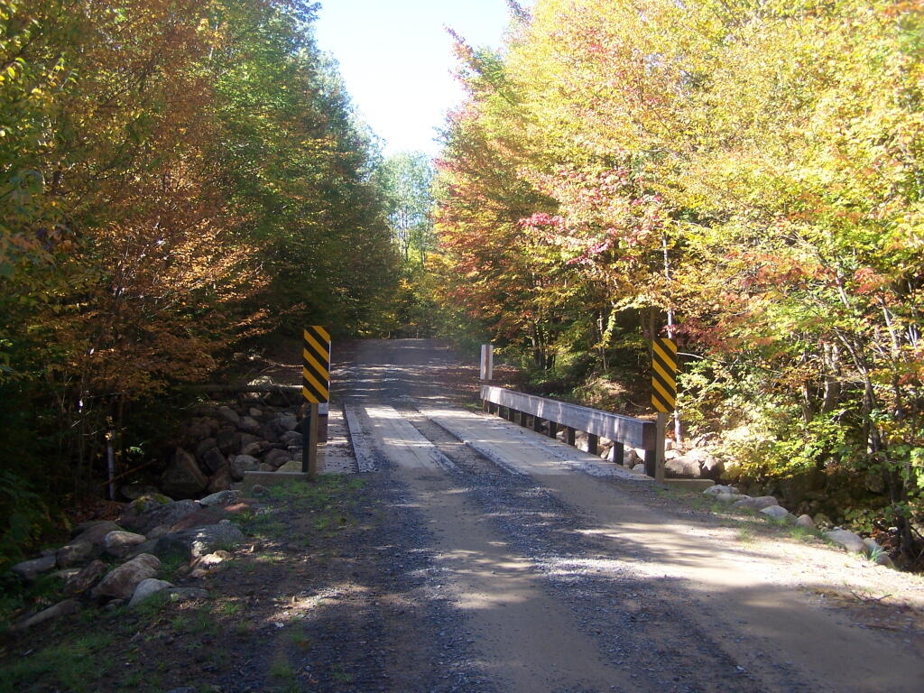
New Bridge Over Bradley Brook

I. Summary

This policy establishes procedures and protocols for the maintenance, rehabilitation, relocation, and, when authorized by the State Constitution, widening and new construction of roads and state truck trails under Department of Environmental Conservation (“Department”)jurisdiction in the Forest Preserve which are situated in units classified by the Adirondack Park State Land Master Plan (“APSLMP”) as Wild Forest, Primitive or Canoe Area or classified by the Catskill Park State Land Master Plan (“CPSLMP”) as Wild Forest. This policy pertains to all such roads and state truck trails on Forest Preserve lands whether or not they are open for public motor vehicle use, except it does not pertain to roads or state truck trails in Intensive Use Areas and Administrative Areas. Further, this policy establishes that generally Forest Preserve roads are low maintenance seasonal roads which are narrow, surfaced with gravel, suitable for low speeds, lightly traveled by the public, and partially or fully shaded by tree canopy. Such roads are further constructed and maintained to the minimum standard necessary to provide passage by appropriate motor vehicles in a manner which protects the environment.
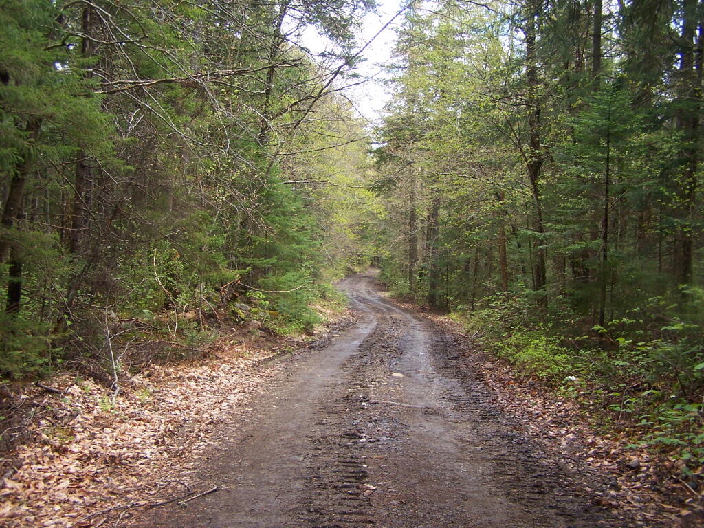
Less Muddy Section of Moose Club Way

II. Policy:

It is the policy of the Department to ensure that comprehensive and consistent procedures are applied to all maintenance, rehabilitation, widening and construction of roads and state truck trails (roads) in the Forest Preserve to ensure that such activities minimize the impacts on the environment and maintain the wild forest character of the road and state truck trail corridors.The 2003 Memorandum of Understanding Between the Adirondack Park Agency and theDepartment of Environmental Conservation Concerning Implementation of the State LandMaster Plan for the Adirondack Park (MOU) provides guidance concerning ordinary maintenance, rehabilitation and minor relocation of conforming structures and improvements on Forest Preserve lands in the Adirondack Park, including whether consultation between the two agencies is required. This policy is intended in part to build upon the MOU and provide additional direction and clarification on coordination of road work in the Adirondack Forest Preserve. This Policy takes precedence over previously existing authority, guidelines, andpolicies.

This policy does not include standards for determining if a road has become legally abandoned. Determinations of road abandonment will be made on a case by case basis inc onsultation with the Division of Legal Affairs.

1 The following definitions, guidelines, responsibilities and procedures shall govern work to be done on roads and state truck trails being carried out on lands of the Forest Preserve which are classified by the APSLMP or CPSLMP as Wild Forest, Primitive, or Canoe.

A. Definitions:

1.Brushing means cutting of woody vegetation less than 3 inches in diameter at breast height (d.b.h.).

2. Ditch means an excavated drainage structure situated adjacent and generally parallel to the driving surface and shoulder of a road or truck trail, designed to convey water away from the driving surface.

3. Ditchline means the low point or centerline of the ditch.

4. Drainage structure means a device which drains water off or away from the road. Drainage structures include such structures as water bars, ditches, French drains,culverts and underdrains.

5. Driving Surface means that portion of the road surface which is designed for vehicles to travel on.

6. Footprint means the limits of disturbance of the road. The foot print includes the driving surface, shoulders, drainage structures, and side slopes. The Original Footprint is the limit of disturbance of the road at the time that it was initially constructed. The currently maintained or existing foot print means areas of the footprint not currently occupied by trees greater than 3″ dbh.

7. French drain means a subsurface drain consisting of a trench backfilled with porous soil or loose stone and covered with earth or other appropriate surface material.

8. Minor relocation of a road or state truck trail means the relocation of a short segment of a road in order to avoid drainage, wetlands, safety, or other site specific problems which cannot otherwise be adequately addressed. A minor relocation shall be the minimum length of new road required to avoid or lessen the site specific problem, but shall not exceed 300 feet in length.

9. Mowing means cutting of non-woody vegetation and woody vegetation less than 3feet in height.

10. Ordinary maintenance means activities within the currently maintained footprint of the road which are needed to keep the road in good working order and which overtime do not materially change the use or appearance of the land or the vegetation thereon from its current use and appearance, including the maintenance or in-kind replacement of road appurtenances and work to address public health and safety issues where such maintenance or activities periodically occur on an as-needed basis. For purposes of this policy, ordinary maintenance includes the following activities when carried out within the currently maintained footprint:

i. pothole filling;

ii. blowdown clearing;

iii. grading of driving surface;iv. bridge repair and maintenance;

v. bridge replacement with a bridge of the same design and of similar dimensions and which is constructed of similar materials;

vi. culvert maintenance, or replacement with a culvert of a length not to exceed the existing foot print and the same nominal height as the culvert being replaced in the same location, provided that the culvert does not involve a freshwater wetland;

vii. drainage structure maintenance, or replacement with a structure in the same location with the same design and similar dimensions and which is constructed of similar materials;

viii. cleaning of existing ditches and culverts that do not impact fresh waterwetlands;

ix. mowing and brushing routinely maintained roads up to four feet beyond theshoulder or ditchline to maintain existing sight lines, road shoulders, andditches;

x. resurfacing of driving surface, with similar material as currently used on theroad, provided that such resurfacing will not likely facilitate levels of public motor vehicle use which significantly exceed existing levels of such use;

xi. limited rock removal that does not require blasting;

xii. trimming select individual tree branches that impede vehicular traffic, obscure sight lines, and hide roadside hazards; and

xiii. cutting select individual dead or hazardous trees pursuant to Lands and Forests Policy 91-2, Cutting and Removal of Trees in the Forest Preserve.

11. Rehabilitation means work that does not occur on a routine basis within the currently maintained footprint of the road which is essential to address environmental impacts, improve safety, or to restore the road or truck trail to a usable condition. It includes the construction of new road appurtenances or work outside of the currently maintained foot print of a road, but within the original footprint of the road. Rehabilitation includes but is not limited to the following activities:

i. placing culverts at new locations;

ii. replacing existing culverts with culverts that have a nominal height greaterthan the nominal height of the existing culvert;

iii. constructing new ditches or drainage structures;

iv. widening existing ditches;

v. cutting trees other than dead or hazardous trees pursuant to Lands and ForestsPolicy Lands and Forests Policy 91-2, Cutting and Removal of Trees in theForest Preserve;

vi. brushing in areas which have not been routinely maintained;

vii. resurfacing the driving surface where such resurfacing will likely facilitate levels of public motor vehicle use which significantly exceed existing levels of such use;

viii. resurfacing of the driving surface with material that is different from the material which currently covers the surface of the road when there is a clear determination that this measure is necessary to protect the natural resources of the Forest Preserve adjoining the road corridor by controlling erosion or runoff; and

ix. regrading of side slopes.

12. Road means motorized transportation corridors that include both roads and state truck trails as defined in the Catskill and Adirondack Park State Land Master Plans, unless the context indicates otherwise.

Road (APSLMP definition): The APSLMP defines “road” on page 18-19 as “an improved or partially improved way designed for travel by automobiles and which may also be used by other types of motor vehicles except snowmobiles, unless the way is a designated snowmobile trail; and is, either maintained by a state agency or a local government and open to the general public maintained by private persons or corporations primarily for private use but which may also be open to the general public for all or a segment thereof; or maintained by the Department of Environmental Conservation or other state agency and open to the public on a discretionary basis.

Road (CPSLMP definition): The CPSLMP defines “road” in Appendix C as “an improved way designed for travel by automobiles and which may also be used by other types of motor vehicles except snowmobiles, unless the way is a designated snowmobile trail; and is, either maintained by a state agency or a local government and open to the general public; or maintained by private persons or corporations primarily for private use but which may also be open to the general public for all or a segment thereof; or, maintained by the Department of Environmental Conservation or other state agency and open to the public on a discretionary basis; or, maintained by the Department of Environmental Conservation for its administrative use only.”

13. Road work means any physical alteration of a road including ordinary maintenance, minor relocation, rehabilitation, widening and new construction as defined in this policy.

14. Shoulder means a transition zone between the driving surface and the road edge or the ditchline. In general, a wheel of a motor vehicle is not on the shoulder unless the motor vehicle is parked or pulled over to let another car pass.

15. Side slope means that area outside of the ditch or road shoulder that is graded to a uniform slope in order to stabilize the soil between the ditch or shoulder and the native, undisturbed ground.

16. State truck trail:

i. State truck trail (APSLMP definition). The APSLMP on page 19 defines “state truck trail” as an improved way maintained by the Department ofEnvironmental Conservation for the principal purpose of facilitatingadministration of state lands or of allowing access for fire fighting equipment and not normally open for public use of motorized vehicles.

ii. State truck trail (CPSLMP definition). “State truck trail†is defined in Appendix C of the CPSLMP as “an improved way maintained by the Department of Environmental Conservation for the principal purpose offacilitating administration of state lands or to allow access for fire fighting equipment and not normally open to the public for motorized vehicle use.

17. Trimming means the removal of lateral branches or leaders of a tree or shrub, that does not sever the plant from its roots.

18. Underdrain means a perforated culvert in porous fill for drawing off subsurface water from the soil.

19. Widening means a lateral expansion of the currently maintained footprint, or lateral expansion of the driving surface of the road. Widening includes the clearing of trees and other vegetation from areas of the existing footprint that are not currently so maintained to restore the opening of the original footprint.

20. Work plan means a detailed description of work to be performed, the Best Management Practices that will be used in performance of the work, and the desired final condition of the road and surrounding area.

B. Guidelines for roads subject to this Policy

1. Determination of Road Width, Driving Surface and Desired Condition. The width, existing condition and desired condition of all roads will be addressed in Unit Management Plans (“UMPs”).. 2. Relocation, rehabilitation, widening or construction of roads. Any road work, except for ordinary maintenance, not authorized in a UMP may not be performed until it is determined whether or not a UMP amendment may be required. This determination will be made by the Director of the Division of Lands and Forests in consultation with APA after a work plan has been developed. Ordinary maintenance of existing roads does not require UMP authorization. Roads designated as closed in a UMP may not be maintained.

3. Work plans. All rehabilitation, relocation (including minor relocation), widening and new construction of roads in the Adirondack Park and the Catskill Park will be done in accordance with a written work plan. Work plans will detail the work to be performed and the Best Management Practices that will be used in performance of the work and the desired final condition of the road and surrounding area. In both the Adirondack Park and Catskill Park, ordinary maintenance of a road requires approval from the Regional Forester in the form of a written work order or an approved “Requests for Routine Maintenance Projects on Forest Preserve Lands.All work plans will describe the work to be performed, including any tree cutting, in relation to a linear distance from the projectâ’ starting point. Markers corresponding to the work described in the work plan shall be placed at the work site. Work plans should include photographs taken at representative locations along with location by location descriptions of the road condition, driving surface and width.

5 All work plans in the Adirondack Park will be developed in consultation with APA as per the MOU and must be approved by the Regional Director and the Director of the Division of Lands and Forests or their designees. If a work plan for a project in the Adirondack Park indicates that the proposed work may materially change the appearance of the land or vegetation thereon or use of the road, then the Director of the Division of Lands and Forests or the Director’s designee shall consult with APA staff to determine whether such work must first be authorized by an approved UMP or UMP amendment. If a work plan for a project in the Catskill Park indicates that the proposed work may materially change theappearance of the land or vegetation or use of the road, then the Director of the Division of Lands and Forests shall determine whether such work must first be authorized by an approved UMP or UMP amendment.

4. Best Management Practices. All work on roads shall be done in accordance with Best Management Practices (BMPs). The New York State Forestry Best Management Practices for Water Quality, BMP Field Guide shall serve as a reference for developing BMPs.

5. Approvals and Consultation

i. Ordinary Maintenance. Ordinary maintenance of a road in the Adirondack Park does not require either APA consultation or UMP authorization, except that, as per the MOU, APA consultation is required if wetlands might be impacted. Ordinary maintenance of a road in the Catskill Park does not require UMP authorization, except that consultation with the Department’s Division Fish, Wildlife and Marine Resources Freshwater Wetlands Manager is required if wetlands might be impacted. In both the Adirondack Park and Catskill Park, ordinary maintenance of a road requires approval from the Regional Forester in the form of a written work order or an approved “Requests for Routine Maintenance Projects on Forest Preserve Lands.”

ii. Rehabilitation. Rehabilitation of roads has the potential to impact the wild forest character of the road, cause significant environmental impacts and facilitate additional public use. For these reasons, rehabilitation of roads inthe Adirondack Park requires a written work plan and consultation with the APA. Depending upon site specific considerations, rehabilitation may require authorization by an approved UMP or UMP amendment. This determination requires approval from the Director of the Division of lands and Forests and will be made in consultation with APA.

ehabilitation of roads in the Catskill Park requires approval from the Director of the Division of Lands and Forests or the Director’s designee and, depending upon site specific considerations, may require authorization in an approved UMP or UMP amendment.

iii. Minor relocation . Minor relocation of roads in the Adirondack Parkrequires a written work plan, approval from the Director of the Division of Lands and Forests and consultation with the APA, and may require a UMP or UMP amendment. Minor relocation of roads in the Catskill Park requires a written work plan and approval from the Director of the Division of Lands and Forests, or the Director’s designee, and requires authorization in an approved UMP or UMP amendment. Relocation of portions of roads or state truck trails that are greater than 300 feet, or any or relocation that may have significant environmental impacts will be considered as constituting new road construction and must follow the procedures and protocols on new road construction set forth subsequently in this document.In the Adirondack Park, the determination of whether a particular road relocation project constitutes a minor relocation will be made by the Director of the Division of Lands andForests or the Director’s designee in consultation with the APA. In theCatskill Park, the determination of whether a particular road relocation project constitutes a minor relocation will be made by the Director of the Division of Lands and Forests or the Director’s designee.

iv. Road widening and new road construction on roads in units classified as Wild Forest. As noted above, the widening of existing state truck trails and roads and the construction of new state truck trails and roads on lands classified as Wild Forest under the APSLMP and the CPSLMP, must be authorized by the State Constitution.

Supplementing this constitutional requirement is the APSLMP’s requirement that “No new roads will be constructed in wild forest areas nor will new state truck trails be constructed unless such construction is absolutely essential to the protection or administration of an area, no feasible alternative exists and no deterioration of the wild forest character or natural resources quality of the area will result.

The CPSLMP requires that, in Wild Forest, “No new roads will beconstructed. No new state truck trails will be constructed unless suchconstruction is absolutely essential to protect or administer an area and there will be no material adverse effect on the wild forest character of the area by the proposed construction. Further, the APSLMP and the CPSLMP require that such work must be authorized by an approved UMP. To ensure that such work is authorized by the State Constitution and that environmental issues are identified and fully addressed, widening and new construction of roads in the Adirondack Park must be authorized by an approved UMP or UMP amendment, and require a written work plan and consultation with the APA as per the MOU.

Widening and new construction of roads in the Catskill Park must be authorized by an approved UMP or UMP amendment, and require a written work plan which must be approved by the Regional Director and the Director of the Division of Lands and Forests, or their designees.
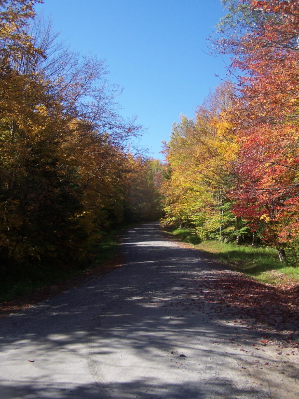
Road Wandering Up Back Side of Sturges Hills

III. Purpose and Background:

Forest Preserve roads, which are generally low maintenance seasonal roads, are a means of providing the public with access to recreational programs on Forest Preserve lands.

Although design, maintenance and rehabilitation standards for these roads must provide for the health and safety of users, such roads must be consistent with the “wild forest” character of the Forest Preserve and comply with the requirements of the APSLMP or the CPSLMP, as applicable. Thus, proposals for road work in the Forest Preserve must be carefully scrutinized to ensure that health and safety goals are accomplished in a manner which maintains the existing wild forest character of the road corridors and otherwise complies with applicable law.

Article XIV, Section 1 of the New York State Constitution, the paramount legal authority with respect to Forest Preserve land management, provides in relevant part:

“The lands of the state, now owned or hereafter acquired, constituting the forest preserve as now fixed by law, shall be forever kept as wild forest lands. They shall not be leased, sold or exchanged, or be taken by any corporation, public or private, nor shall the timber thereon besold, removed or destroyed. (Emphasis added).”

All road work for roads in the Forest Preserve must be consistent with the directives contained in this constitutional provision. Case law interpreting this provision has held that an immaterial amount of tree cutting does not violate this clause when done in furtherance of one of the purposes for which the Forest Preserve was created, namely, watershed protection and public recreation in a forever wild forest setting. See The Association for the Protection of the Adirondacks v. MacDonald, 253N.Y. 234 (1930); Balsam Lake Anglers Club v. Department of Environmental Conservation, 199 A.D. 2d 852, 605 N.Y.S. 2d 795 (App. Div., Third Department, 1993); Helms v. Reid, 90 Misc. 2d 583 (Hamilton County Supreme Court, 1977), and Flacke v. Town of Fine 113 Misc. 2d 56 (St. Lawrence County Supreme Court, 1982).

Under the rationale set forth in these cases, Forest Preserve road corridors should maintain a wild forest character, with minimal tree cutting. Thus, the current character of Forest Preserve roads should not be changed, and such roads should continue to have narrow driving surfaces, be surfaced with gravel, be suitable for low speeds only, and be shaded by tree canopy.

Roads and state truck trails are nonconforming in areas classified by the APSLMP and CPSLMP as Wilderness. Therefore, there shall be no maintenance, rehabilitation, relocation, widening, or new construction of roads or state truck trails in Wilderness areas.

In areas classified as Primitive by the APSLMP, existing roads and state truck trails may be maintained, rehabilitated or relocated only if the road or truck trail was in existence when the land was classified as Primitive and the road or truck trail is used by administrative personnelto reach and maintain structures and improvements whose removal cannot be effected by a fixed deadline or whose presence is of an essentially permanent character.

In addition, existing roads in areas classified as Primitive may be maintained, rehabilitated or relocated if the roads are open for public use at the Department’s discretion pending wilderness classification. There may be no widening or new construction of roads or state truck trails in Primitive Areas.

In areas classified as Canoe by the APSLMP, the use of roads is prohibited and therefore such roads may not be maintained, rehabilitated, relocated, widened or constructed. Existing state truck trails in areas classified as Canoe may be maintained, rehabilitated or relocatedwhere the truck trails are being used by administrative personnel for purposes designed to preserve or enhance the water or fishery resources of the area as specified in UMPs. The widening or new construction of truck trails is prohibited in Canoe areas.

In areas classified as Wild Forest by the APSLMP, existing roads and state truck trails which are used solely by administrative personnel to reach, maintain and construct permitted structures and improvements may be maintained, rehabilitated, and relocated, but may not be widened. New roads and state truck trails to be used solely for these purposes may not be constructed. Existing public roads open to the public for motor vehicle use in APSLMP Wild Forest areas may be maintained, rehabilitated and relocated. Existing public roads maybe wide ned only if authorized by Article XIV, Section 1 of the New York State Constitution.

No new roads or state truck trails will be constructed in APSLMP Wild Forest areas unless such construction is authorized by Article XIV, Section 1 of the New York State Constitution and such construction is absolutely essential to the protection or administration of the area, no feasible alternative exists and no deterioration of the wild forest character or natural resource quality of the area will result. In addition, such construction is allowed only if it will not result in a material increase in the cumulative mileage of roads open to motorized use by the public in Adirondack Park Wild Forest units.

In areas classified as Wild Forest by the CPSLMP, existing roads and state truck trails which are used by administrative personnel to reach, maintain and construct permitted structures and improvements, to conduct approved fish and wildlife research and management projects, for rescues, or for other appropriate law enforcement and general supervision of public use may be maintained, rehabilitated, and relocated, but may not be widened.

New roads and state truck trails to be used solely for these purposes may not be constructed. Existing public roads open to the public for motor vehicle use in CPSLMP Wild Forest areas may be maintained, rehabilitated, and relocated. Existing roads and state truck trails may be widenedonly if authorized by Article XIV, Section 1 of the New York State Constitution. No new roads or new state truck trails will be constructed in CPSLMP Wild Forest areas unless such construction is authorized by Article XIV, Section 1 of the New York State Constitution and such construction is absolutely essential to protect or administer the area and there will be no material adverse effect on the wild forest character of the area by the proposed construction.

In addition, such construction is allowed only if it will not result in a material increase in the cumulative mileage of roads open to motorized use by the public in the Catskill Park Wild Forest units. This policy is intended to ensure that road work in the Forest Preserve is in compliance with constitutional and APSLMP and CPSLMP directives. Thus, this policy will ensure that all road and state truck trail maintenance, rehabilitation, relocation, widening and construction projects will be properly authorized and that work plans will be developed and appropriately approved prior to the commencement of such work. This policy will enable staff to determine whether such work: requires approval by the Regional Forester and the Director of the Division of Lands and Forests or the Director’s designee; requires consultation with the Adirondack Park Agency; and requires authorization by an approved UMP or UMP amendment

The policy also will enable staff to determine whether a work plan is needed, and, if so, what it must contain and who must approve it.
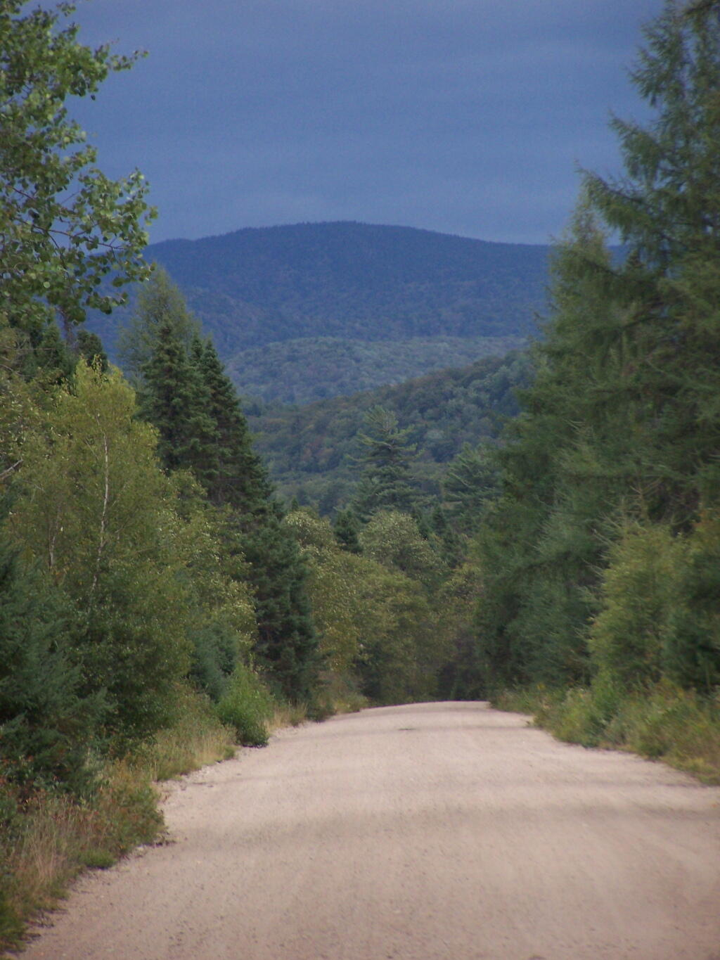
Little Moose Mountain

IV. Responsibility:

It shall be the responsibility of all Department divisions and staff to implement the guidelines and procedures of this policy.

It shall be the responsibility of the Forester assigned as the land manger of a management unit to prepare work plans for the unit in consultation with the Division of Operations. It shall be the responsibility of the Regional Forester to review and approve work plans for road work and ensure that work plans are developed for all road work as required by this policy. The Regional Forester shall ensure work plans are in compliance with UMPs and that current best management practices are utilized and any associated impacts on the environment are minimized. It shall be the responsibility of all Department staff involved in road work projects in the Forest Preserve to ensure that all work authorized and is carried out in accordance with the approved work plan and to ensure that any tree cutting complies with policy Lands and Forests Policy 91-2, Cutting and Removal of Trees in the Forest Preserve.It shall be the responsibility of the Regional Director and the Division Director or their designees to review and approve any work plans for road work involving maintenance, relocation, rehabilitation, widening, and new construction proposed under this policy and to assign staff to coordinate with the APA where such coordination is appropriate under thispolicy.

It shall also be the responsibility of the Director of the Division of Lands and Forests to periodically review the provisions of this policy and recommend amendments, where necessary.
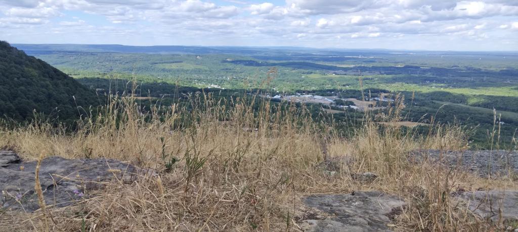
Dry Grass at Hang Gliders Cliff

V. Procedure:

The management and actions taken regarding road maintenance, rehabilitation, widening, relocation, and construction on Adirondack Forest Preserve lands shall be in accordance with the above stated policy and the following procedure:

1. Regional staff shall consult with Regional Forester to determine if a proposed project is ordinary maintenance, rehabilitation, minor relocation, relocation other than minor relocation, widening or new construction.

2. APA consultation is required if wetlands in the Adirondack Park might be impacted as required per the MOU. Depending on the scope of the work, an APA Jurisdictional Inquiry Form and Application for Wetlands General Permit, 2005G-1, may be required.

3. Ordinary maintenance of roads may be carried out with the approval of the Regional Forester. At the Regional Forester’s discretion, a work plan may be required for ordinary maintenance. Such work plans must be approved by the Regional Forester and the Director of the Division of Lands and Forests or their designees.

4. All rehabilitation, minor relocation, widening and new construction of roads in the Adirondack Park will be done in accordance with a written work plan prepared by DEC staff in consultation with the APA as per the MOU. All relocation projects should be forwarded to the Director of the Division of Lands and Forests for consultation with APA to determine if the project is considered a minor relocation. Projects that are not part of an approved UMP or UMP amendment and are not minor relocations will be referred to the Director of the Division of Lands and Forests forconsultation with APA to determine if an approved UMP or UMP amendment isrequired for the project.

5. The Regional Forester will ensure that the work plan details the work to be performed, the BMPs that will be used in performance of the work, and the desired final condition of the road and surrounding area. All work plans must describe the work to be performed, including any tree cutting, in relation to a linear distance from the project’s starting point. Markers corresponding to the work described in the work plan shall be placed at the work site. Work plans should include photographs taken at each station and at representative locations along with station by station descriptions of the road condition, driving surface and width.

The Regional Forester will forward work plans approved by the Regional Director or the Regional Director’s Designee to the Director of the Division of Lands and Forests. The Division Director or the Division Director’s designee will notify the Regional Forester of approval or denial of the work plan.
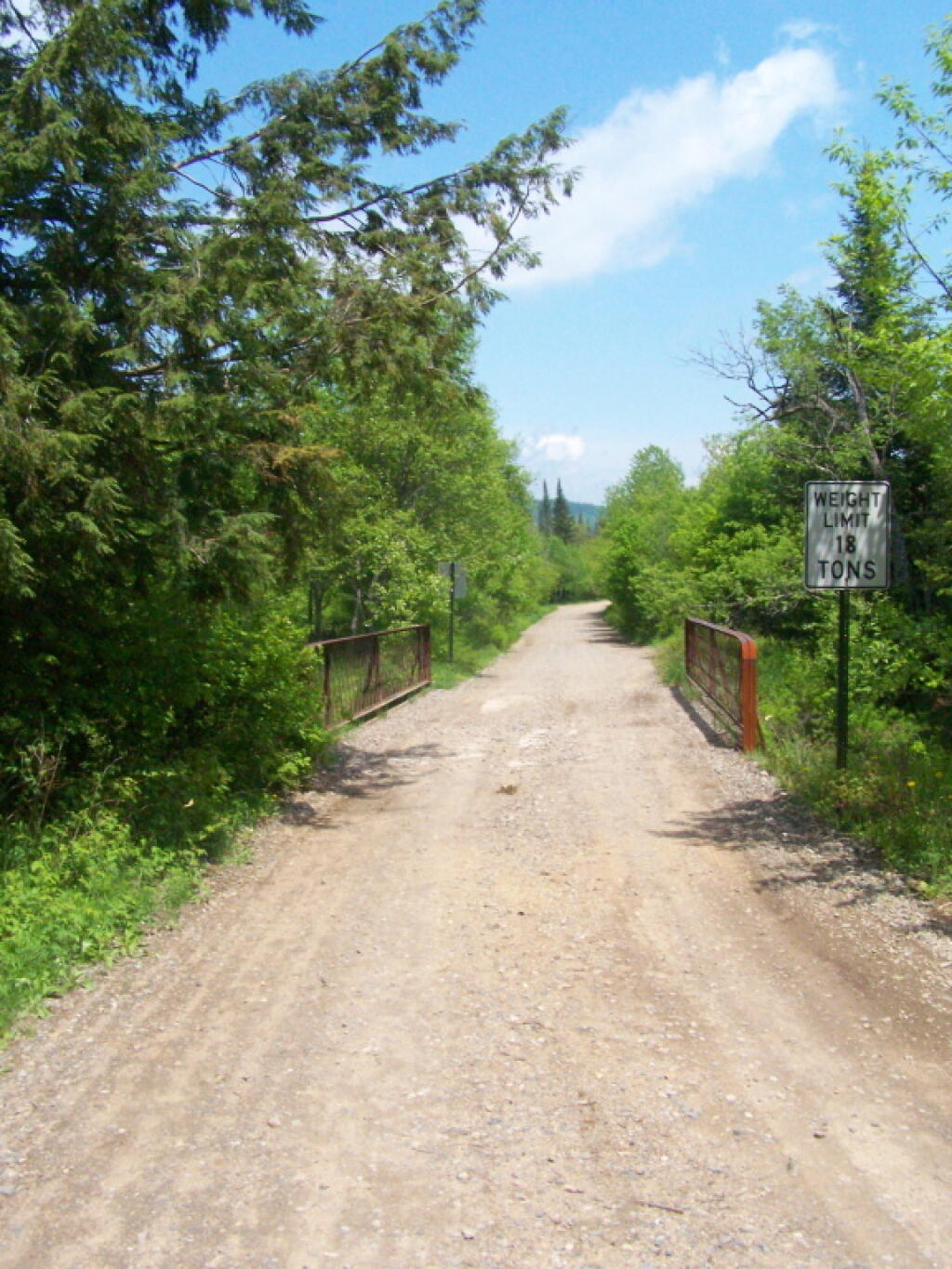
The management and actions taken regarding road maintenance, rehabilitation, minor relocation, relocation, widening and construction on Catskill Forest Preserve lands shall be in accordance with the above stated policy and the following procedure:

1. Regional staff shall consult with the Regional Forester to determine if the proposed project is ordinary maintenance, rehabilitation, minor relocation, relocation other than minor relocation, widening or new construction.

2. Consultation with the Department’s Division of Fish, Wildlife and Marine Resources Freshwater Wetlands Manager is required if wetlands might be impacted.

3. Ordinary maintenance of roads may be carried out with the approval of the Regional Forester.

4. All rehabilitation, minor relocation, widening and new construction of roads in the Forest Preserve will be done in accordance with a written work plan prepared by Department staff. All relocation projects should be forwarded to the Director of the Division of Lands and Forests to determine if the project is considered a minor relocation. Projects that are not part of an approved UMP or UMP amendment will be referred to the Director of the Division of Lands and Forests to determine if an approved UMP or UMP amendment is required for the project.

5. The Regional Forester will ensure that the work plan details the work to be performed and the Best Management Practices that will be used in performance of the work and the final condition of the road and surrounding area. All work plans must describe the work to be performed, including any tree cutting, in relation to a linear distance from the project’s starting point. Markers corresponding to the work described in the work plan shall be placed at the work site.

The Regional Forester will forward work plans approved by the Regional Director or the Regional Director’s Designee to the Director of the Division of Lands and Forests. The Division Director or the Division Director’s designee will notify the Regional Forester of approval or denial of the work plan.

Sunny Morning at Powley Place Bridge

Related References:

Adirondack Park State Land Master Plan (APSLMP), Adirondack Park Agency, June 2001

Catskill Park State land Master Plan (CPSLMP), NYSDEC, 1985

New York State Forestry, Best Management Practices for Water Quality, BMP Field Guide,NYSDEC, January 2000

Lands and Forests Policy 91-2, Cutting and Removal of Trees in the Forest Preserve

2003 Adirondack Park Agency/Department of Environmental Conservation Memorandum ofUnderstanding
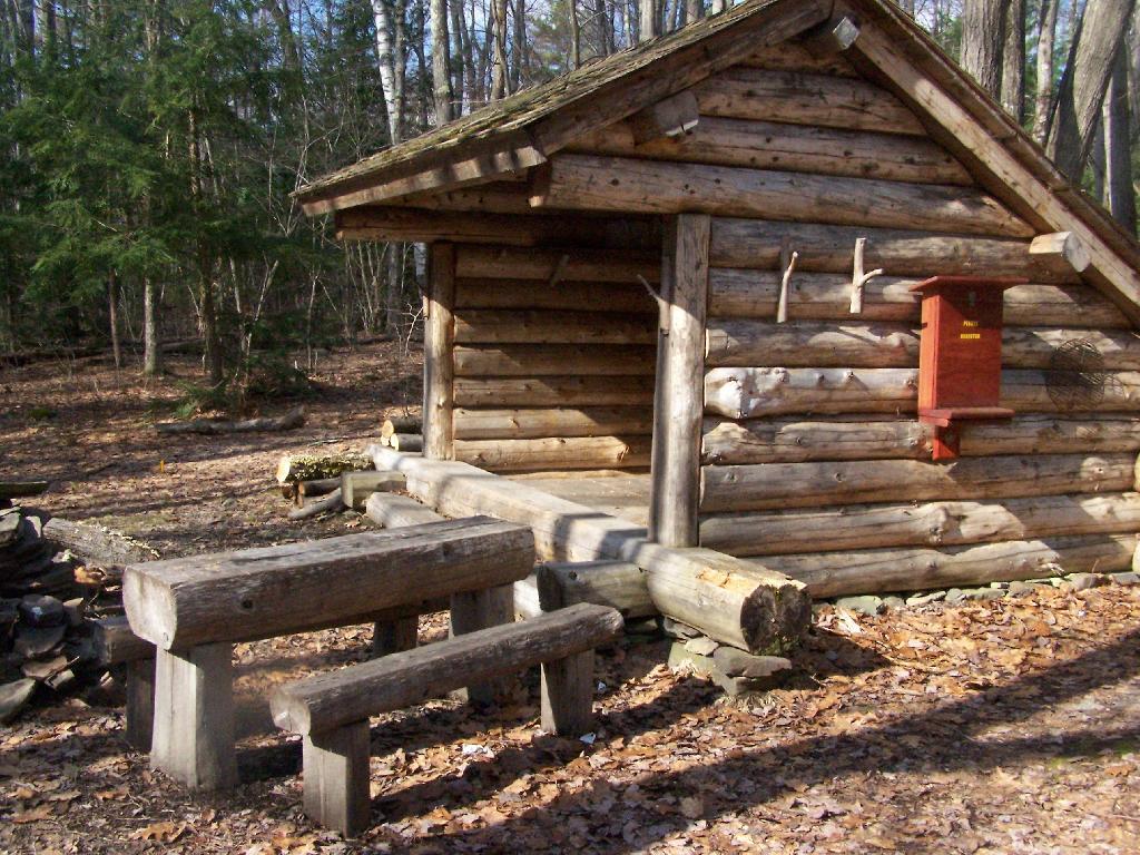
October 2, 2016 Morning

Good morning! Happy Sunday. Cloudy, damp and 57 degrees out hiking in the fields of Green Lakes State Park in Fayetteville. Calm wind. The dew point is 55 degrees. The skies will clear Tuesday around 7 am.

The colors are starting to come out a bit, although the trees are still mostly green with some yellow popping in locations. Columbus Day will be close to peak color, although it may be fairly late in these lower elevations. On a cloudy day like this you get better pictures if you set the white balance set properly on the camera, although that can be fixed on post processing if the photos aren’t over exposed. I’m afraid I didn’t get a good picture of the buck that ran out in the field. 

Joggers on the trails are pretty annoying but it is still pretty quiet on the open meadows that dominate the hilltops up here. 

Today will have a chance of showers, mainly after 4pm. Mostly cloudy, with a high of 69 degrees at 3pm. Four degrees above normal. Maximum dew point of 59 at 4pm. South wind 3 to 5 mph. Chance of precipitation is 30%. New precipitation amounts of less than a tenth of an inch possible. The record high of 85 was set in 1927. The sun will set at 6:41 pm with dusk around 7:10 pm, which is 1 minutes and 46 seconds earlier than yesterday. 

As we head towards the winter solstice, our days quickly get shorter. Today will have 11 hours and 37 minutes of daylight, a decrease of 2 minutes and 54 seconds over yesterday.I remember back to the 26th when we had 12 hours of light and day. Thank God for coal fired power plants, electric lamps, and headlights. 

Tonight will have showers and possibly a thunderstorm before midnight, then a chance of showers. Low around 53, with a low of 53 degrees at 6am. Another mild evening. Nine degrees above normal. Maximum dew point of 59 at 6pm. Light and variable wind. Chance of precipitation is 80%. New precipitation amounts between a quarter and half of an inch possible. The record low of 29 occurred back in 1945.

There are 2 weeks until the Hunter’s  Moon when the sun will be setting at 6:18 pm with dusk at 6:46 pm. The average high temperature is 60 degrees, with a record high of 88 in 1947. Autumn always comes and goes so quickly. 

July 31, 2016 Night

Good evening! Light rain and 67 degrees in Westerlo. There is a east-northeast breeze at 5 mph. The dew point is 66 degrees.

Tonight will rain likely and possibly a thunderstorm before 3am, then a chance of rain and thunderstorms after 3am. Some of the storms could produce heavy rain. Cloudy, with a low of 66 degrees at 10pm. Four degrees above normal. Southeast wind around 5 mph. Chance of precipitation is 70%. New rainfall amounts between a quarter and half of an inch possible. Maximum dew point of 66 at 8pm. The record low of 46 occurred back in 1964. The sun will set at 8:15 pm with dusk around 8:47 pm, which is 1 minutes and 9 seconds earlier than yesterday. Today will have 14 hours and 27 minutes of daylight, a decrease of 2 minutes and 11 seconds over yesterday.

Tomorrow will have a chance of rain and thunderstorms, then rain likely and possibly a thunderstorm after 5pm. Some of the storms could produce heavy rain. Cloudy, with a high of 75 degrees at 3pm. Six degrees below normal. Southeast wind around 6 mph. Chance of precipitation is 60%. New rainfall amounts between a quarter and half of an inch possible. Maximum dew point of 67 at 1pm. The record high of 101 was set in 1933.

1 inch of rain expected between Sunday 8pm and Tuesday 11am.

We have some muggy weather coming up. Thursday 12pm – Friday 12am. Maximum temperature will be 84 degrees, a heat index reaching 87, and a maximum dew point of 67. Friday 7am – Saturday 3pm. Maximum temperature will be 87 degrees, a heat index reaching 91, and a maximum dew point of 68.

There are 6 weeks until September 11th when the sun will be setting at 7:11 pm with dusk at 7:39 pm. The average high temperature is 74 degrees, with a record high of 98 in 1931.

Last night was a surprisingly beautiful night with ample stars.Β After I killed the lights, I sat up for a while next to the fire. I was up until nearly 1 AM, so I got a late start this morning, and hit heavy rain on the long slog back to Albany. It was a scenic drive and US 6 has enough stoplights and hills to keep you awake. A lot of construction and detours in Pennsylvania, along with more construction on I-88 on the way home.

No coffee this morning, as I was out of coffee grounds and propane. If I wasn’t leaving and had coffee, I could have used the liquid fuel stove,Β alas Β ended up stopping at Sheetz for coffee and mid-morning snack when I gassed up Big Red. I wasn’t nearly as low on fuel as I thought, having nearly 4 gallons of fuel left in the tank when I stopped in Port Allegheny this morning.

Made it back home and are now starting to unpack.Β I went out to my parents house, and will head home in a bit, and before bed, try to get the rest of the photos back on my laptop, then my camera to upload. Β But we will see.