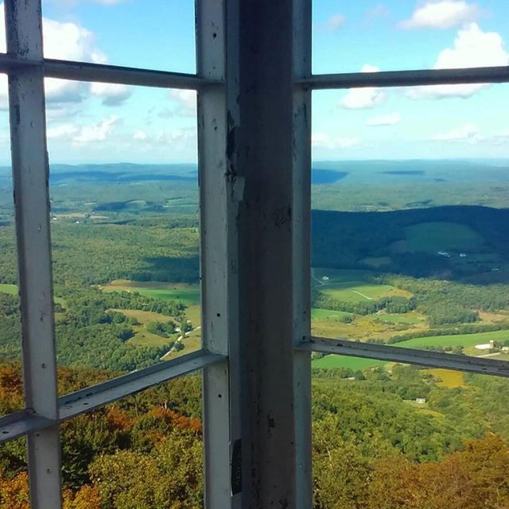
Next weekend I am thinking of camping outside of Bennington and remote working Friday and Monday. That leaves the weekend to consider doing some hikes, particularly on peaks I’ve never done before.
Sucker Pond Via Long Trail (from end of Prospect Mountain Road)
The Sucker Pond via Long Trail hike from the end of Prospect Mountain Road (often noted on maps as starting near the Stamford Stream Trailhead in Woodford) is a 5.0-mile out-and-back route. It is highly regarded as a quiet, deeply wooded, and rugged wilderness trek. [1, 2, 3]
The trail delivers a true backcountry feel but requires careful navigation and a willingness to navigate mud. [2, 4]
🚗 Trailhead & Parking
- Location: Drive to the very end of Prospect Mountain Road in Woodford, VT. Ignore earlier GPS prompts to pull off; instead, continue to the dead end, where you will find a generous, established gravel parking lot.
- The Start: You will begin your hike at the Stamford Stream Trailhead. [2]
🥾 Route Overview & Navigation
- The Old Road Launch: The hike kicks off on an old, wide logging road that makes for smooth, easy walking to start. Shortly into the trek, you will turn right and cross a scenic wooden footbridge over Stamford Stream, which is an excellent photo opportunity. [2]
- The “Hinky” Turnoff: After the bridge, the path follows a slightly narrower, gravelly road. Watch your map closely here: Roughly 0.10 miles past the bridge, the actual hiking trail veers sharply to the left. Because this turn is notoriously poorly marked, many hikers accidentally miss it and continue too far down the old road bed. [2]
- The Wilderness Singletrack: Once you successfully make the left turn, the terrain transforms into a classic, narrow Vermont singletrack. It is heavily choked with exposed tree roots and large rocks, requiring agile footing. [2]
- The Pond Loop: As you approach Sucker Pond (also known locally as Lake Hancock), you will reach a fork. You can go straight or right to trace the edge of the water. [2]
🌲 What to Expect at the Pond
Sucker Pond is a remote, primitive mountain pond heavily shaped by active beaver engineering. A highlight of the destination is the unique opportunity to walk right alongside a massive beaver dam wall, occasionally aided by partially submerged boardwalk planks. The area is exceptionally green, wild, and serves as a quiet nesting ground for loons and other wildlife. [2, 3, 5, 6]
⚠️ Critical Trail Notes
- Mud & High Water: Because it sits in a low-lying drainage area close to beaver activity, this trail is notoriously muddy. Puddles can be deep, and parts of the right-hand pond loop are frequently completely underwater. Waterproof boots are highly recommended. [2, 4]
- Blazing: Reviewers consistently mention that the trail markings can be sparse or faded. Downloading an offline GPS map via an app like AllTrails before you lose cell service is highly recommended. [2]
[1] https://www.alltrails.com
[2] https://www.alltrails.com
[3] https://www.onxmaps.com
[4] https://www.onxmaps.com
[5] https://sectionhiker.com
[6] https://www.alltrails.com
Haystack Mountain
The Haystack Mountain Trail is a highly popular, rewarding route located in the Green Mountain National Forest near Wilmington, Vermont (roughly a 30-minute drive east of Bennington along Route 9). [1, 2]
It strikes a great balance as a morning or afternoon hike, offering a steady physical workout with an impressive panoramic payoff at the top. [2]
🥾 Trail Stats
- Distance: 4.2 miles out-and-back
- Elevation Gain: 1,026 feet
- Difficulty: Moderate
- Time: Around 2 to 2.5 hours to complete [3]
🚗 The Trailhead & Parking
Locating the trailhead can be slightly tricky because it begins inside a private residential community. From Route 9, you will turn into the Chimney Hill development and navigate up to the end of Upper Dam Road. [1, 3, 4]
- Parking: There is no official gravel lot; instead, you will see a U.S. Forest Service informational bulletin board on the right side of the road, and hikers park along the roadside shoulder. [1, 5]
🗺️ Route Description
1. The Warm-Up (First 0.5 Miles)
The hike begins past a vehicle gate on a flat, wide, and gravelly old logging road. This first half-mile serves as a gentle warm-up, passing through a lovely hardwood forest with a light, gradual incline alongside the Binney Brook ravine. [6, 7, 8]
2. The Turn & The Climb (Miles 0.5 to 1.8)
At the 0.5-mile mark, the trail makes a sharp, distinct left-hand turn. (Note: Continuing straight here takes you on a separate path to Haystack Pond). Once you make the turn, the terrain changes dramatically into an active snowmobile route marked by orange signs and blue hiking blazes. The trail narrows, the incline becomes much steeper, and you will begin navigating a classic Vermont floor of heavy tree roots, loose rocks, and mud. [2, 5, 7, 8]
3. The Summit Cone (The Final Push)
As you near the peak, the hardwood trees fade into a dense stand of high-elevation pines and spruce. The grade intensifies into a steep, rugged series of tight switchbacks. You will need to do a tiny bit of light rock scrambling over exposed stone ledges to break out onto the summit ridge. [2, 3]
🏔️ The Summit Payoff
The 3,445-foot summit features a steep, precipitous drop-off that opens up into a magnificent 180-degree panoramic view. From the main rocky outcroppings, you can look straight down at the pristine, deep-blue Haystack Pond nestled directly below the cliffs. Looking further out, you get sweeping views of the Deerfield Valley, the massive Harriman Reservoir to the south, the Searsburg wind turbines, and the neighboring ski trails of Mount Snow. [2, 6, 9, 10, 11]
⚠️ Pro-Tips for the Trail
- Footwear & Poles: Due to the rocky and root-filled nature of the upper half of the trail, sturdy hiking boots with good ankle support are highly recommended. Trekking poles are incredibly helpful for maintaining balance on the slippery, steep descent. [2, 8]
- Bugs & Mud: True to Vermont, this trail can be exceptionally muddy during spring “mud season” and can harbor heavy mosquito populations mid-summer. Bring bug spray and be prepared to step from rock to rock. [2]
[1] https://www.fs.usda.gov
[2] https://www.alltrails.com
[3] https://www.alltrails.com
[4] https://www.trailfinder.info
[5] https://connecticutpaddler.com
[6] https://www.visitvermont.com
[7] https://www.benningtongmc.org
[8] https://freshlyvermont.com
[9] https://en.wikipedia.org
[10] https://www.google.com
[11] https://www.trailfinder.info
Maple Hill via Long Trail
The Maple Hill via Long Trail hike is a hidden gem located within the Glastenbury Wilderness portion of the Green Mountain National Forest. Sharing its route with the famous Appalachian Trail (AT), this trek offers a great workout with peaceful woodland solitude. [1, 2]
🥾 Trail Stats
- Distance: 4.3 miles out-and-back
- Elevation Gain: 1,335 feet
- Difficulty: Moderate
- Time: Around 2.5 to 3 hours to complete [1, 2]
🚗 Trailhead & Parking
- Location: The hike leaves directly from the main Route 9 Appalachian Trail/Long Trail Parking Area located just east of Bennington (on the border of Woodford). This is the exact same parking lot used to access the steep Harmon Hill trail, but for Maple Hill, you will head north into the woods instead of crossing the road south.
- Amenities: The parking lot is free, medium-sized, and features clean public restrooms. [2, 3, 4, 5]
🗺️ Route Description
1. The River Crossing & The “Stairmaster” Start (First 0.5 Miles)
The hike begins beautifully by crossing the William D. MacArthur Memorial Bridge, a scenic wooden footbridge over a rushing mountain stream. Take photos here because immediately after the bridge, the real work begins. The trail launches into a very steep, rocky, and quad-burning ascent over a natural staircase of stones and boulders. This first half-mile serves as the most physically punishing section of the entire hike. [1, 2, 5, 6]
2. The Gradual Ridgeline (Miles 0.5 to 1.8)
Once you conquer the initial boulder climb, the trail significantly flattens out into a much more forgiving, gradual incline. You will follow the white blazes of the AT/LT through a thick “green tunnel” of mature northern hardwoods and dense conifers. [1, 2, 4]
Around 1.5 miles in, you will pass the Melville Nauheim Shelter, a classic wilderness log lean-to with nearby tent platforms and a stream. This is a great spot to pause, read the logbook left by thru-hikers, or use the composting privy. [2, 6]
3. The Summit Clearing (The Payoff)
The official 2,690-foot summit of Maple Hill is heavily wooded and lacks expansive views. However, just past the true peak, the trail breaks out into a wide, dramatic power line easement clearing. Because the trees are clear-cut here, it serves as the ultimate destination for the hike. You are treated to excellent, sweeping views of the surrounding Green Mountain valleys and a welcome mountain breeze. [1, 2, 5]
⚠️ Pro-Tips for the Trail
- Less Crowded: Unlike its neighbor Harmon Hill across the highway, Maple Hill gets significantly less traffic. It is highly likely you will have sections of this wilderness entirely to yourself. [1, 7, 8]
- Footwear is Key: Because of the wet, rocky staircases at the bottom and standard “Vermont mud” along the ridge, waterproof hiking shoes with an aggressive grip are essential. [2, 9]
- Overgrowth: The very beginning of the trail right after the bridge can occasionally be a bit overgrown in mid-summer, so wearing long pants is smart to protect against ticks and thorns. [1, 2]
Are you planning to complete this as a day hike, or are you looking to extend it into an overnight backpacking trip deeper into the Glastenbury Wilderness?
[1] https://www.alltrails.com
[2] https://www.alltrails.com
[3] https://www.benningtongmc.org
[4] https://www.onxmaps.com
[5] https://www.komoot.com
[6] https://www.alltrails.com
[7] https://www.alltrails.com
[8] https://www.alltrails.com
[9] https://www.alltrails.com
Catamount Cross Country Ski Trail via Woods Rd
The Catamount Cross Country Ski Trail via Woods Rd refers to a highly scenic section of the massive 300-mile Catamount Trail, which spans the entire length of Vermont from Massachusetts to Canada. [1, 2]
This specific route (officially part of Section 2 of the statewide network) traces the remote western shore of the Harriman Reservoir (Lake Whitingham) and the Deerfield River, connecting the Harriman Dam to Route 9. [2, 3]
🥾 Trail Stats
- Distance: 6.8 miles (Point-to-Point)
- Elevation Gain: 472 feet
- Difficulty: Easy to Moderate (nearly flat, but long and occasionally rugged) [2, 4]
🚗 Trailheads & Parking
Because it is a point-to-point trail, many winter recreationists spot cars at both ends, though it can easily be done as an out-and-back day trip from either side. [2]
- North End (Woods Rd): Located off Route 9 east of Wilmington. You will turn onto Woods Road (also referred to near the reservoir as New England Power Road) to find a gravel parking access zone. [2, 5]
- South End (Harriman Dam): Located at the formal Catamount Trail Harriman Dam Parking Lot in Whitingham, VT. This side features grassy picnic grounds and portable restrooms. [2, 6]
❄️ Winter Experience (Backcountry Skiing & Snowshoeing)
In the winter, this is a premier, true backcountry route. Because it follows an old historic railroad grade, the terrain is beautifully level and wide, making it exceptionally approachable for classic cross-country skiers and snowshoers. [2, 7]
- The Terrain: The first few miles from the north side ride smoothly along an old gravel/dirt roadbed before transitioning into a tighter, pristine single-track trail cutting through dense maple and birch forests. [2, 7]
- Snow Conditions: This trail is ungroomed. If you are the first out after a heavy Southern Vermont dump, expect to break trail through deep powder. [1, 2]
- The Highlights: The trail offers quiet, frosted windows looking out across Vermont’s largest wholly contained lake. On the southern terminus, you can marvel at the unique “Glory Hole” spillway at the Harriman Dam. [2]
☀️ Off-Season Mud & Overgrowth Alert
While it is an elite winter pathway, a crucial distinction of this route is that it is not formally maintained for summer hiking. [2]
- Spring/Summer Conditions: From May through August, the trail can become heavily overgrown with brush, plagued by aggressive gnats and mosquitoes, and deeply muddy in low-lying sections near the water. Blowdowns (fallen trees) are common midway through the route.
- Early Autumn Exception: If you want to explore it without snow, September and October are the ideal windows. The ground dries out significantly, the bugs thin out, and the reflection of the peak fall foliage over the massive reservoir is spectacular. [2, 7]
[1] https://www.trailfinder.info
[2] https://www.alltrails.com
[3] https://catamounttrail.org
[4] https://www.alltrails.com
[5] https://www.alltrails.com
[6] https://www.google.com
[7] https://www.alltrails.com
Mount Anthony Summit Trail
The Mount Anthony Summit Trail is a demanding, steep route that scales the striking peak framing the western side of downtown Bennington. Part of the Bennington Area Trail System (BATS), it offers a great blend of historic estate exploring and rugged wilderness hiking. [1, 2]
🥾 Trail Stats
- Distance: 3.4 miles out-and-back
- Elevation Gain: 1,410 feet
- Difficulty: Hard (extremely steep upper sections)
- Time: 2.5 to 3 hours to complete [1]
🚗 Trailhead & Parking
- Location: The hike starts on the property of the former Southern Vermont College campus (now owned by the Southwestern Vermont Medical Center). [1, 3]
- Where to Park: Free parking is permitted at the fieldhouse/gym parking lot off Mansion Drive. Walk past the historic Everett Mansion and follow the access signs toward the upper soccer fields to find the official trail kiosk. [4, 5, 6]
- Hours: Property access is strictly daylight hours only (typically 8:00 AM to 5:00 PM), and the gates are locked overnight. [1]
🗺️ Route Description
1. The Historic Estate Walk (First 0.5 Miles)
The hike begins on the lower slopes of Mount Anthony, weaving along old carriage roads flanked by crumbling 19th-century stone walls, overgrown formal gardens, and historic estate monuments from the Everett family era. The grade here is moderate and exceptionally pleasant. [6, 7, 8]
2. The Steep Singletrack (Miles 0.5 to 1.3)
Once you pass the lower BATS loops, the trail shrinks to a narrow singletrack and the real work begins. The incline escalates significantly, forcing you over a continuous staircase of exposed tree roots and slick rocks. Small mountain streams run alongside or directly over sections of the path, making the footing muddy and wet even in mid-summer. [4, 7, 9]
3. The Final Scramble & The Summit
The final third of the climb is a grueling, quad-burning push. You will encounter a couple of brief Class 2 rock scrambles over exposed ledges before reaching the 2,950-foot peak. [4, 7]
🏔️ The View Strategy (Important!)
- The Summit: The true geographical summit of Mount Anthony is completely tree-covered and heavily developed with commercial cell towers, a chain-link fence, and utility shacks. There are no views at the very top. [1, 6, 9]
- The Detour: To find the payoff, you must take a short detour onto Zaphod’s Run Trail (sometimes marked as Zorba’s or Zephyr’s) on your way back down. This side trail leads to Zaphod’s Overlook, a magnificent rocky clearing that provides a sweeping, panoramic view of the Bennington Valley, the sprawling town below, and the Green Mountains to the east. [1, 5, 6, 9]
⚠️ Pro-Tips for the Trail
- Bring Trekking Poles: Because the descent is incredibly steep and often masked by loose gravel, mud, or thick autumn leaves, trekking poles are crucial to avoid slipping.
- Navigation Caution: While the lower BATS loops are excellently mapped, the upper summit singletrack can be poorly marked and heavily obstructed by seasonal blowdowns. Keeping a map downloaded via AllTrails or a GPS unit is highly recommended. [1, 10, 11]
[1] https://www.alltrails.com
[2] https://www.alltrails.com
[3] https://www.benningtongmc.org
[4] https://www.trailforks.com
[5] https://www.alltrails.com
[6] https://peakery.com
[7] https://www.onxmaps.com
[8] https://savingtimeinabottle.com
[9] https://www.alltrails.com
[10] https://www.alltrails.com
[11] https://www.trailforks.com



![At the Red River [Expires July 27 2026]](https://andyarthur.org//data/photo_025200_large.jpg)