Gilboa is a town in Schoharie County, New York, United States. The population was 1,215 at the 2000 census. The Town of Gilboa is in the south part of the county and is southwest of Albany.
ccording to the United States Census Bureau, the town has a total area of 59.3 square miles (154 km2), of which, 57.8 square miles (150 km2) of it is land and 1.6 square miles (4.1 km2) of it (2.63%) is water.
The south town line forms a border with Delaware County and Greene County. The Schoharie Creek flows northward through the town. New York State Route 30 is a north-south highway in Gilboa. New York State Route 23 cuts through the southwest corner of the town. New York State Route 990V is a highway running eastward from NY-30 in the southeast part of Gilboa.
Next create a pipeline.txt for pdal with the classification (For DSM, 1 are unclassified points like buildings and treetops, while 2 are ground points, if you want a DEM, you can also make them this way too with Classification of 2:2):
Next convert the point clouds into digital surface model (GeoTIFF), you can use this shell command with xargs to go over each LAS file, using the above pipeline:
The above command can be somewhat slow depending on how many LAZ point clouds you need to go through and your selected resolution. -P3 sets the number of parallel process (3) which can help speed things up a bit.
Now we have the digital surface models raster that can be used in QGIS for hillshade for 3D.
Build a virtual raster (dsm.vrt) for easy loading into QGIS rather than loading separate files.
I am very concerned about proposals to require licensing and regulations on artificial intelligence and all that might fall under that umbrella – machine learning, natural language models. Look who is putting forward proposals to regulate artificial intelligence – it’s the big incumbent players like Chat GPT and Facebook.
Maybe commercial products for sale should be regulated but free, open source projects should not be. Frameworks should be widely available to the public for any purpose they want, good or bad. Let the people play and innovate. If harm exists, go after the harmful commercial users, not the everyday people experimenting with the technology for non profit purposes to see how they can innovate.
Stopping bad actors seems like a good idea but you can’t stop a technology from moving forward in a global internet. If the US bans innovation, another less regulated country is likely to move it forward – China, Switzerland or some other place. I’m okay with regulating Meta and Open AI but not what goes on inside people’s basements.
Most of them from the early 1940s or 1950s. I’m really quite interested in post World War II sprawl and changes to highways as the modern motoring age came to be.
The nice thing about the old USGS maps is they are all geo referenced, so you can load them into the QGIS for quick comparison – and you can use any 1:24k index to quickly remove the collars. Plus they’re available for a lot more years – going back to the 1890s compared to the 1940s or 1950s for aerial photos.
They will make for interesting blog posts in the coming months and they are fascinating to look at and study the progression of cities over the years. I do want to try and find some contemporary maps in the same style for comparison – I was going to use the DOT topographic maps I have from the early 2000s from the CUGIR website or something made with OpenStreetMap data but I’d like to get something from USGS in a similar scale and design for better comparison. I’ll have to dig around tomorrow.
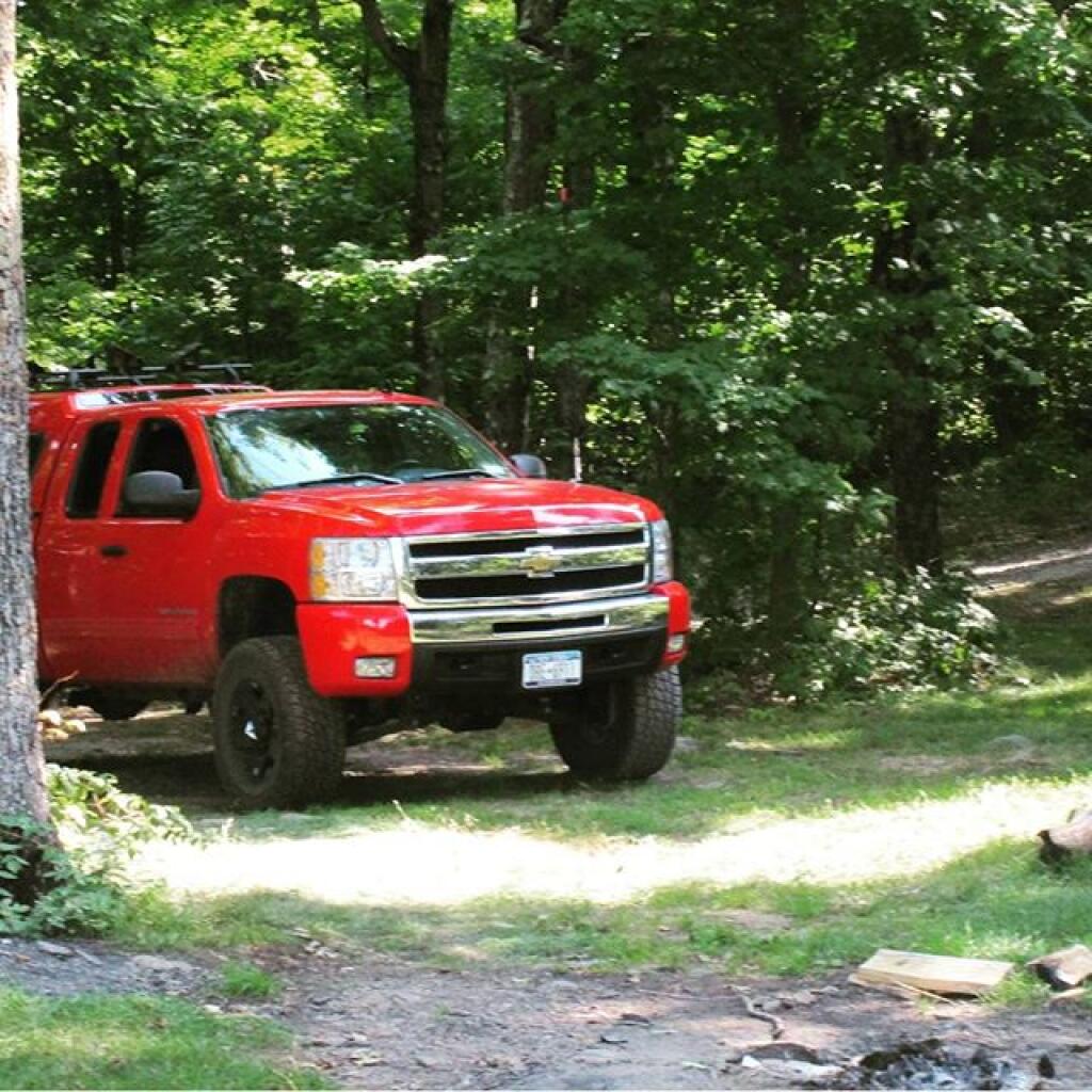
Truck cap camping is perfect for the type of camping I prefer to do on the back roads where I like to travel and camp.
I like to camp in quiet isolated areas where I can listen to music, shoot guns and fireworks, have a big fire without bothering others. Yet such sites are not always accessible with anything bigger then a pickup truck.
Maybe when I get older I’ll want something more like an truck camper but I have my doubts as I’m not big into fancy soft things. I also don’t like the higher clearance or extra weight in the bed. I prefer things that are easier to clean off the mud on and spending my time actually outdoors in the elements.
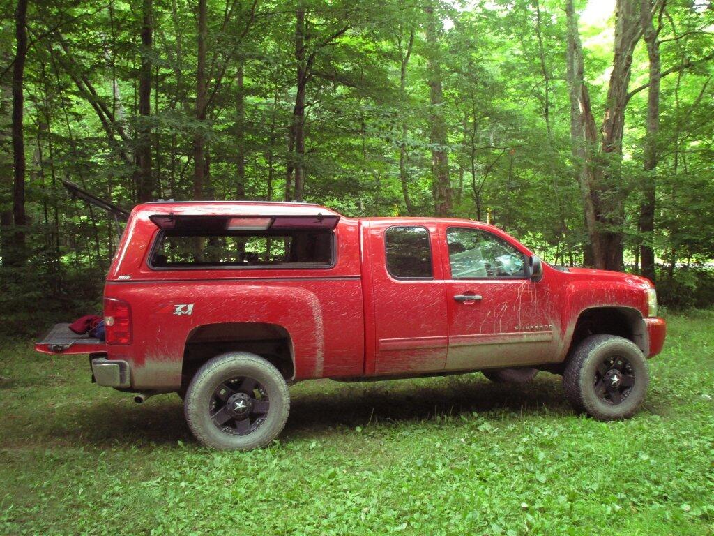
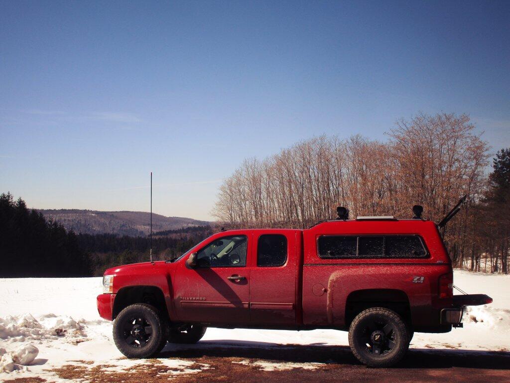
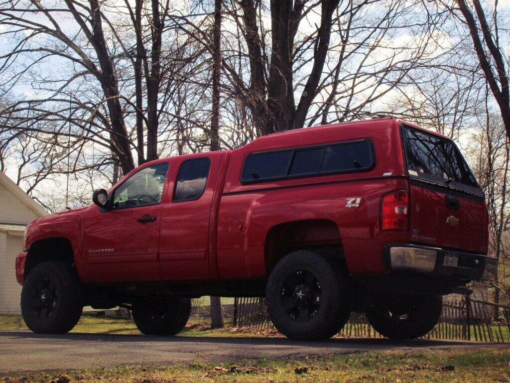
For 13 1/2 years I’ve been using Big Red as my primary vehicle — that is for camping and traveling, though in the city I use buses or walk to get most places except maybe for the weekly or these days every-two weeks grocery shop. I like Big Red, but I realize even if I do keep it in good repair, it has a limited useful life.
Having a Big Jacked-Up nice truck is fun when one is young. You should do it once, if you have the money. But I am no longer in my late 20s or 30s. Priorities change. I don’t want to spend $50,000 on a new truck, nor do I want to spend money on big tires or a lift kit. It’s not that I don’t have the money, but I’d rather allocate the money to other things in life.
The big truck is fun, but it’s costly. Repairs are more with a lift kit, as are the tires. Bigger tires, bigger engine, heavy uses more fuel, which became an issue in the past year when gas prices pushed past $5. But even when you don’t worry that much about fuel — as I drive recreationally — a big truck kind of sucks.
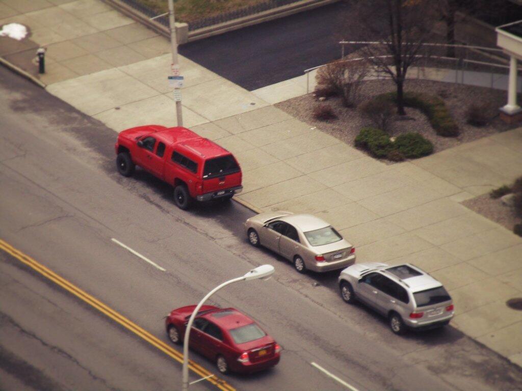
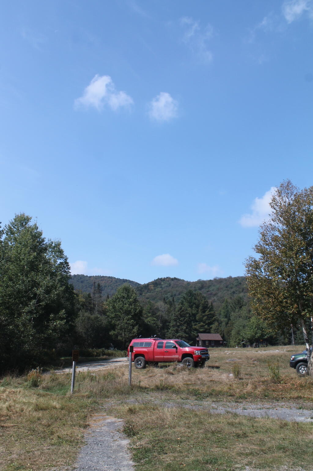
Big Red is a bitch to drive around parking lots, through narrow city streets, and anywhere there are a lot of other automobiles, like at repair shops or even the dealership. Big Red keeps me away from crowded trailheads in back country, as he’s too difficult to park. Even many smaller campsites are tricky to park in at Red.
Nowadays, my priority is more towards owning my own land and early retirement. A big truck is fine, but I would rather have land where I can shoot guns, have fires and livestock. Out in the woods, where I’m free to do what I want without people bossing me around. I’m trying to grow my wealth, not spend it all. As I want to have more options on where and how I live my life, especially as I head into my 50s, which likely whatever vehicle I get next will go with me into.
I haven’t decided for sure if I am going to get a truck next. I’ve thought about electric vehicles or even a sedan, to save money. But if I want to do more camping in a truck cap, then I’ll need a truck. And probably 4×4 to get on the rough, snowy roads I like to traverse. I really don’t want to spend a lot of money, as inflation has made everything so much more expensive, and money spent now is money that can’t grow in the markets.
One should never confuse the Town of Highlands in Orange County (containing West Point, Bear Mountain, and Bear Mountain Bridge on the Hudson River) with the Town of Highland in Sullivan County (containing Barryville, Eldred, Highland Lake, Minisink Ford and Yulan on Delaware River), with the Hamlet of Highland in the Town of Lloyd in Ulster County (which also borders the Hudson River, and contains the Mid-Hudson Bridge to Poughkeespie).
The hamlet of Highland is pronounced as two seperate words — “high land”, stressing the syllables. In contrast, the Town of Highland in Sullivan County and Highlands in Orange County rhymes with “island”.
You can also drive from Ulster County to Orange County to Sullivan County, without ever crossing any other counties.