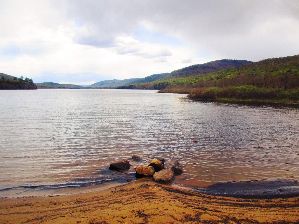
John Boyd Thacher State Park, is situated along the Helderberg Escarpment, one of the richest fossil-bearing formations in the world. Even as it safeguards six miles of limestone cliff-face, rock-strewn slopes, woodland and open fields, the park provides a marvelous panorama of the Hudson-Mohawk Valleys and the Adirondack and Green Mountains. The park has volleyball courts, playgrounds, ball fields and numerous picnic areas with nine reservable shelters. Interpretive programs are offered year-round, including guided tours of the famous Indian Ladder Trail. There are over 25 additional miles of trails for summer hiking and mountain biking, and winter cross-country skiing, snowshoeing, hiking, and snowmobiling.
While it is possible to convert electricity into other forms of energy like chemical or physical energy, your not actually storing electricity – your storing another form of energy that can be converted back to electricity. ⚡
Capacitors do store small amounts of electricity temporarily but inductors actually convert electricity to magnetism temporarily so they don’t count. So some of the rules of electricity don’t always apply.
One of the most entertaining parts of voir dire at jury duty is the way some people either try to get on or off the jury. Retires and blue collar union and state folks like jury duty.
While juror numbers are picked at random there many things a potential juror can say to be instantly disqualified and many ways to explain away potential disqualifiers.
My number was never called but I spent two days listening to people’s excuses and figuring out the best disqualifications – usually showing knowledge about the case’s subject matter, personal emotional experiences, and suggesting that your blatantly prejudicial towards one side.
On the other side, there was folks who had a way to explain away anything. Those folks who were determined to get on the jury usually did. Apparently if people express and interest and profess a view that they are non-biased get on, despite mitigating factors.
If you haven’t served on a jury (actually served, not just called) within 6 years , you can request to serve on a jury by calling the commissioner of jurors. Some seniors do this — because if your called in and even if you don’t serve, you can get $40-80 for the time you sit waiting to be interviewed.
The scriptures define it that way, it doesn’t matter if calendar spring is on March 19, 20, 21 or 22nd.
The earliest Easter can occur is March 22 if the full moon is March 22, which means Good Friday is on March 20th.
The latest Easter can occur is April 25th.
In 1943, the first full moon after March 21st was Tuesday April 20th which put Easter on April 25. That’s because the March full moon was on March 21st and the scripture says the full moon must be after March 21. This will happen again in 2038.
People were asking how I was extracting the digital terrain model (tree/building elevation) from the NYS GIS LiDAR point clouds (LAS) files. While the digital surface models (bare earth) models are widely available in raster digital elevation model GeoTIFF, these files are bare earth and don’t include vegetation or buildings. But you can easily create raster digital elevation model GeoTIFF from the LIDAR point clouds with the PDAL – Point Data Abstraction Library.
Install PDAL
It’s easy if you are running Ubuntu Linux — it’s in standard distribution with 20.04 LTS or later. Most modern distributions of Linux include it in their repositories.
sudo apt install pdal
Download LiDAR Point Clouds
You can download the individual cloud files from NYS GIS FTP site. You can use the LiDAR Shapefile indexes on that website to figure out which file you need. Be aware you may have to download and store a significant amount of data — each roughly 556 acre tile (less then a square mile) is between 500 and 1,000 MB. So you will want to do this somewhere you have a lot of free unlimited data service and storage on your hard drive. And patience while it downloads.
Extract the Digital Terrain Model
You should create a text file called pdal_dtm.json or something similar. The text file should contain:
This creates the pdal “pipeline” configuration file for the conversion. An explanation of important lines you will need to change:
“18TWN220520.las” – Input point cloud LAS file “type”: “filters.range” – Tells PDAL to filter points based on request “limits”: “Classification[1:1]” – Layer to extract * “filename”:”dsm.tif” – Export file name “gdaldriver”:”GTiff” – Use GeoTIFF export (same as standard DEM files) “resolution”: 0.5 – Resolution in meters for export, typically 0.5m or 1m depending on survey “output_type”: “max” – Highest point reflected back within that point, to get digital surface elevation. You can also use min/max/mean/count/stdev/idw. “type”:”writers.gdal” – Use the GDAL library for create GeoTIFF
* Layers in NYS GIS Point Clouds – “These point clouds will have at a minimum 2 classifications; Class 1 Unclassified, and Class 2 Bare Earth.” Layer 1 is the digital surface model, it contains building heights and tree/crop cover. Layer 2 “Bare Earth” is the same as what you get from the LiDAR Digital Elevation GeoTIFFs that are widely available on NYSGIS website. Be aware that the Class 2 points may have no-data areas, where no ground elevation was detected due to tree cover or other things blocking ground. The DEM files you download from NYSGIS have these areas filled in with interpolation from surrounding areas.
Once your configuration file is done, run the command:
pdal pipeline pdal_dtm.json
As the Point Cloud files are internally indexed, the export should take only a matter of seconds on a modern desktop computer. The exported DEM/GeoTIFF file will be between 15 to 25 MB, which is much smaller then the point cloud. Then you can load in Quantum GIS or your favorite non-free software GIS client like any other Raster DEM file.
To calculate the building or tree height, just subtract the Class 1 raster from Class 2 raster, using the Raster Calculator in QGIS or your favorite GIS program. Or better yet, subtract Class 1 points from the already processed DEM files on NYSGIS website, as they have the missing bare earth data filled in.
Brown in many ways is the color of April. The dirt and ground is brown or gray, with the snow mostly gone but still too cold for things to green up in the more upland areas. Mud and muck get on the boots, the air often has a pungent taste to it in farm country. The warmth of May sometimes breaks through in April, but color is limited, for this is not a month known for it’s diverse color.