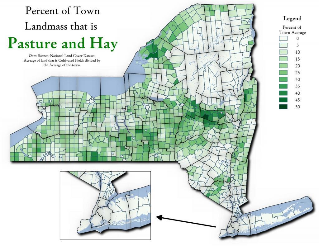
Town Landmass Used for Pasture and Hay 🗺️ Download a High Resolution JPEG Image of the Town Landmass Used for Pasture and Hay or an Adobe Acrobat Printable PDF of the Thematic Town Landmass Used for Pasture and Hay. More about Agriculture...Maps and InteractivesNorth of Little Falls – Fields and Crop LandTown Landmass Used for Pasture and HayThe fertile lands of the Black River Valley are Surounded by Tug Hill and AdirondacksThe Barns of Schoharie CountyPercent of Town Landmass Used for CropsPasture and Haylands of New YorkMost Agricultural Town in New York StateForest Cover of Moose River PlainsFarmland in NYFarm Land by New York State County in 2021Byrne Dairy Locations in New YorkAgriculture in New YorkAgriculture in New England2022 Lands Planted with Corn in NYS2020 Major Farm Crops Grown in New YorkPercent of Town Landmass Used for AgricultureMajor Land Resource Regions with Major Dense Cities OverlayedMajor Land Resource RegionsLand Resource Regions (Agriculture)... photos, maps and other content from from Agriculture. Leave a Reply Cancel replyYour email address will not be published. Required fields are marked *Comment * Name * Email * Website Save my name, email, and website in this browser for the next time I comment. Δ
More about Agriculture...Maps and InteractivesNorth of Little Falls – Fields and Crop LandTown Landmass Used for Pasture and HayThe fertile lands of the Black River Valley are Surounded by Tug Hill and AdirondacksThe Barns of Schoharie CountyPercent of Town Landmass Used for CropsPasture and Haylands of New YorkMost Agricultural Town in New York StateForest Cover of Moose River PlainsFarmland in NYFarm Land by New York State County in 2021Byrne Dairy Locations in New YorkAgriculture in New YorkAgriculture in New England2022 Lands Planted with Corn in NYS2020 Major Farm Crops Grown in New YorkPercent of Town Landmass Used for AgricultureMajor Land Resource Regions with Major Dense Cities OverlayedMajor Land Resource RegionsLand Resource Regions (Agriculture)... photos, maps and other content from from Agriculture.
Leave a Reply Cancel replyYour email address will not be published. Required fields are marked *Comment * Name * Email * Website Save my name, email, and website in this browser for the next time I comment. Δ
