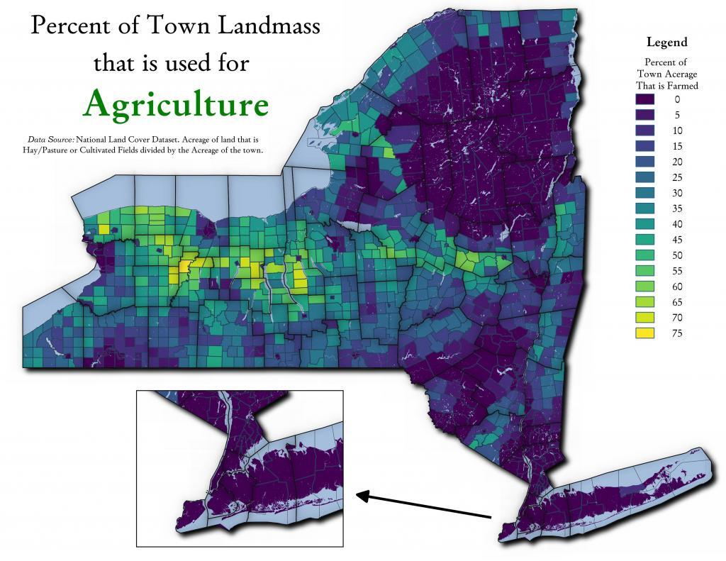
Thematic Map: Percent of Town Landmass Used for Agriculture
Download a High Resolution JPEG Image of the Percent of Town Landmass Used for Agriculture or an Adobe Acrobat Printable PDF of the Thematic Percent of Town Landmass Used for Agriculture.
About Percent of Town Landmass Used for Agriculture ....
One thing that is misleading with the table I just shared is some towns are larger then others. Some towns have a lot of farm acerage, because they are big towns in area. This map shows the percentage of town landmass used for agriculture - including field crops and forage production.
More about Agriculture...
Maps and Interactives
Soil Map – Schoharie Valley
North of Little Falls – Fields and Crop Land
Town Landmass Used for Pasture and Hay
The Barns of Schoharie County
Percent of Town Landmass Used for Crops
Farmland in NY
Farm Land by New York State County in 2021
Agriculture in New York
Agriculture in New England
2020 Major Farm Crops Grown in New York
Percent of Town Landmass Used for Agriculture
2022 Lands Planted with Corn in NYS
Major Land Resource Regions with Major Dense Cities Overlayed
Major Land Resource Regions
Land Resource Regions (Agriculture)
Forest Cover of Moose River Plains
Farming In Black River Valley: Narrow Band of Farms Between Tug Hill and Adirondack Foothills
... photos, maps and other content from from Agriculture.
