Search Results for: Pine Hill State Forest

Late Fall Camping at Sugar Hill

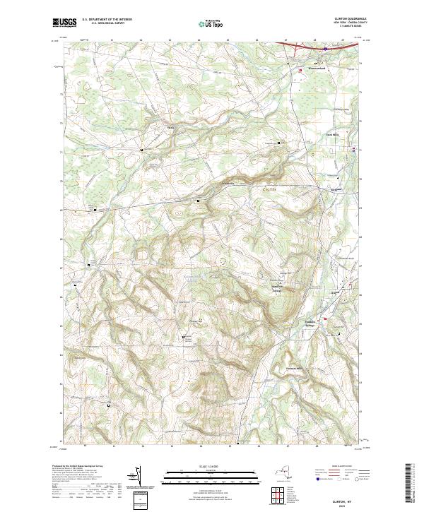
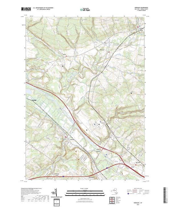
On my way down to Pennsylvania and on my way back to Albany, I spent a two nights camping out at Sugar Hill State Forest, lower Assembly area. While the area is primarily designed for equestrians, it does offer a person who seeks drive-in camping without a permit in Finger Lakes Region a place to stay.

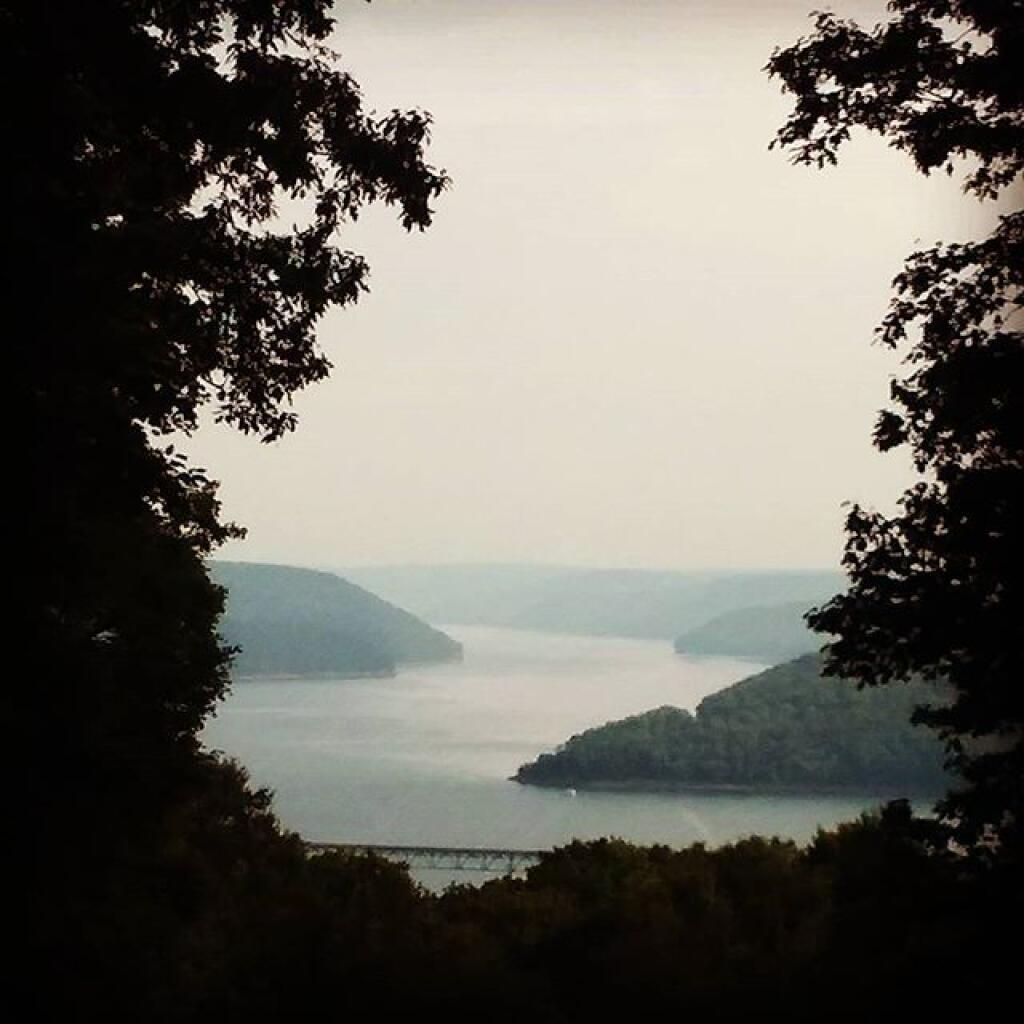
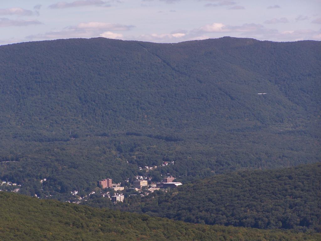
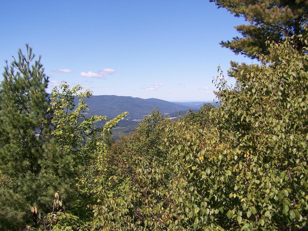
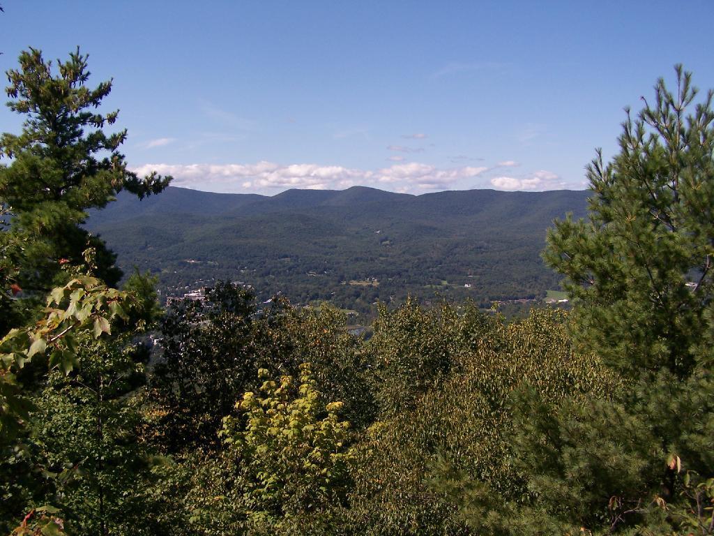
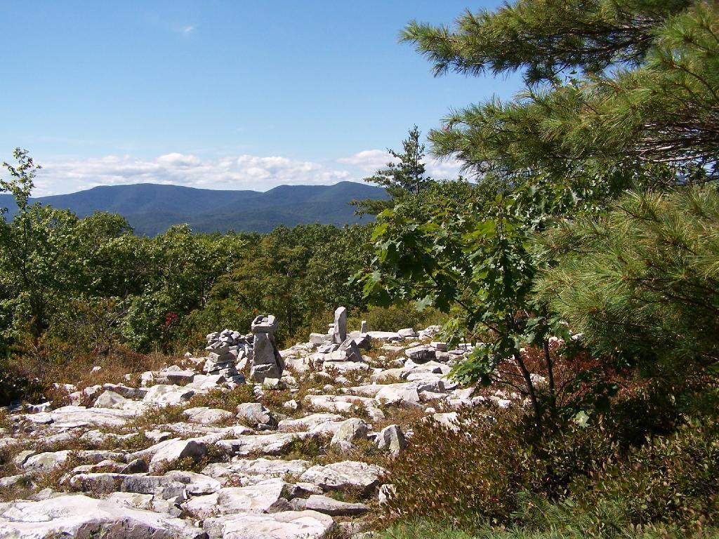
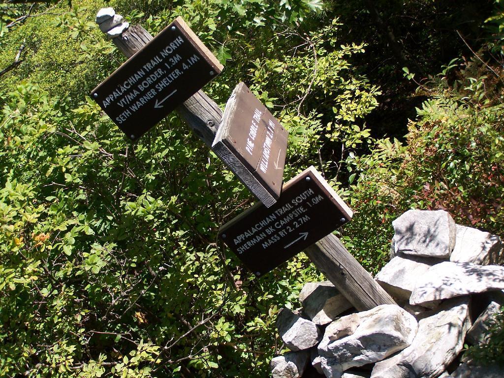
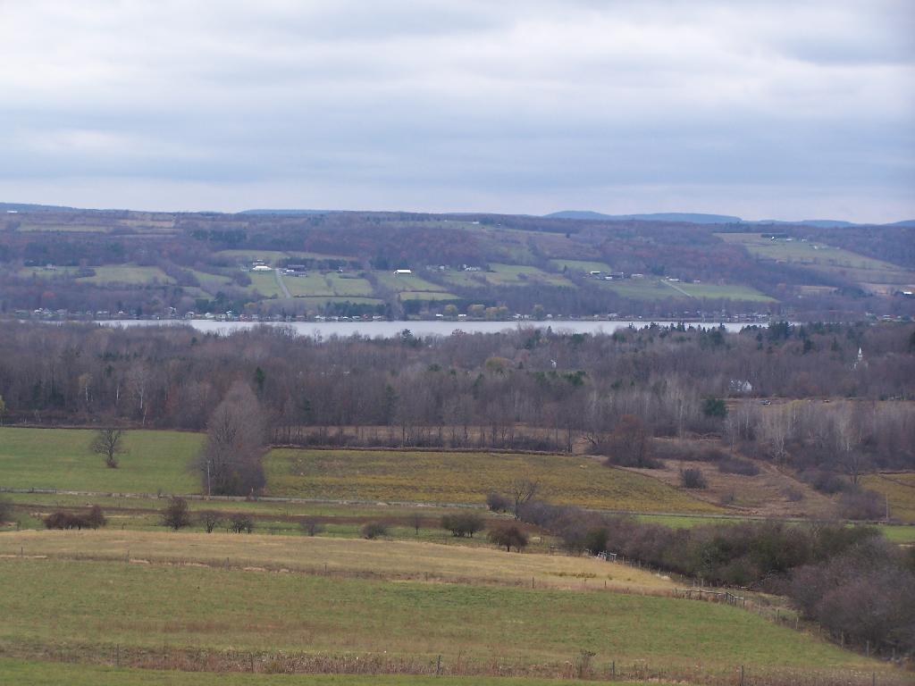
On the Sunday night driving down to Pennsylvania, there was nobody else around but a bow hunter I saw in the morning. On Friday night, there where a lot of horse owners, because the Upper Assembly-area was closed for the winter. I drove around, hoping to visit the fire tower a top the Assembly area. Unfortunately, it was closed for the year. I did get some interesting shots from Tower Hill Road, heading up there, looking down at Seneca Lake.

Tower Hill Road

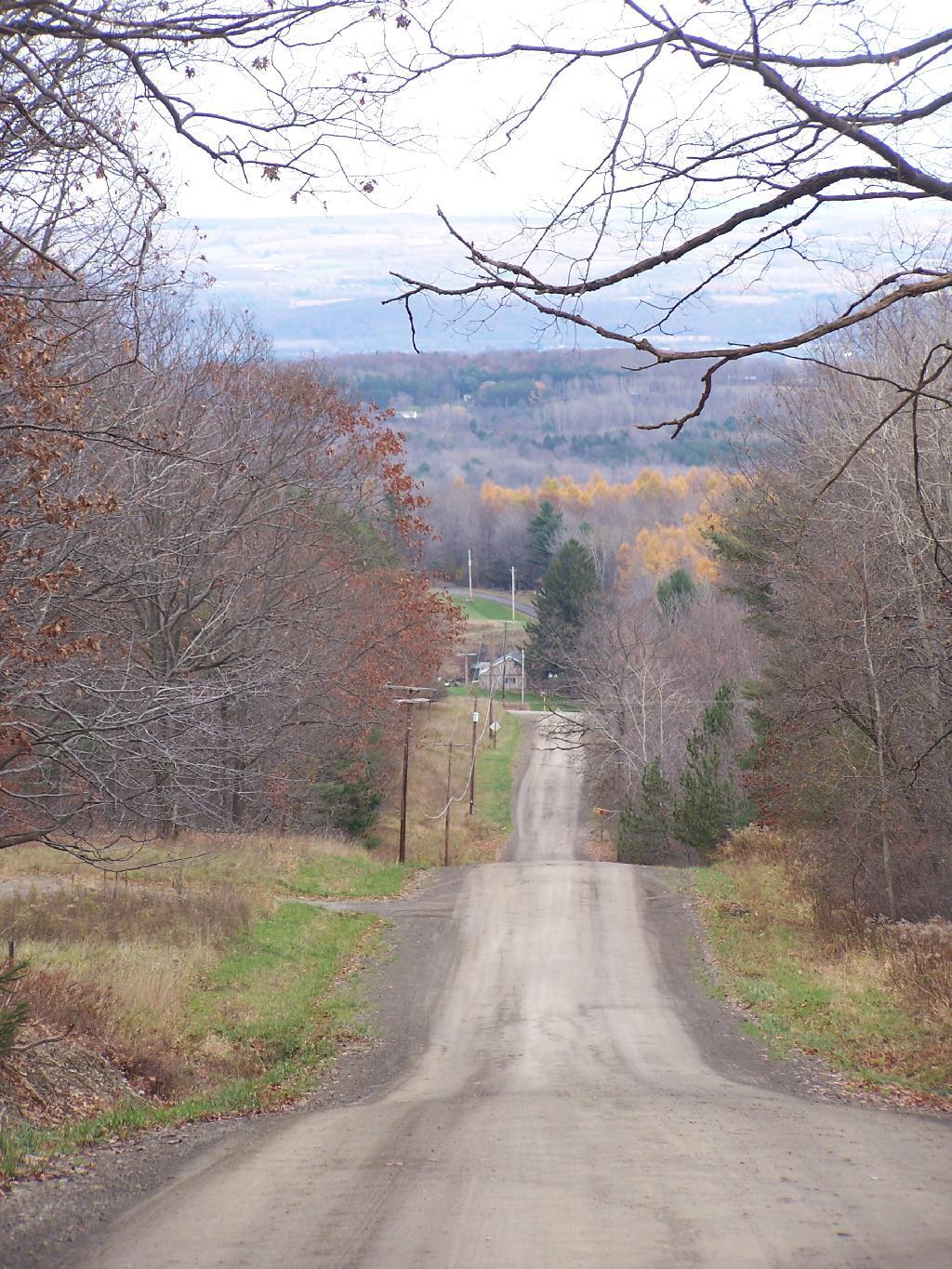
On the other side of the ridge from Tower Hill Road, you can see Keuka Lake. It looks a lot different this time of year then in other times of year. I do wish I could have seen it from the fire tower, although I guess the fire tower has limited views due to trees growing up. I could have hiked up to the tower, but it’s a ways back, with the road gated off.

Valley

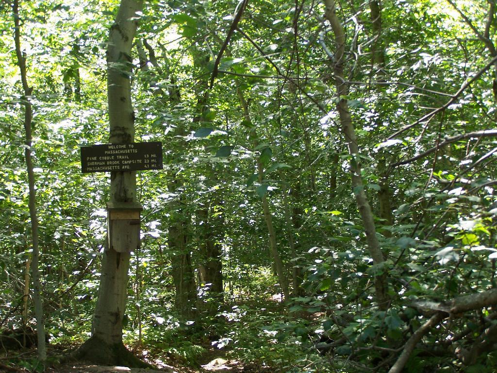
Next I drove down to Birdseye Hollow State Forest / Sanford Lake. Got lost. I know this time of year you don’t need camping permits for it, but it looked it was only tent sites. Things where pretty grown up, and it was getting late. I ended up driving back up the hill, to Sugar Hill, and settling in at the Lower Assembly area. On Sunday night, all the horse campers had packed up and gone back home.

I proceeded to make baked zita in the dutch oven, over a warm open fire. Somebody had left firewood from the previous weekend, and there was ample dead and down wood nearby in the forest, so I really nice warm fire.

Cooking Dinner

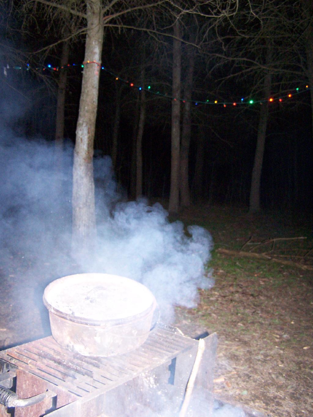
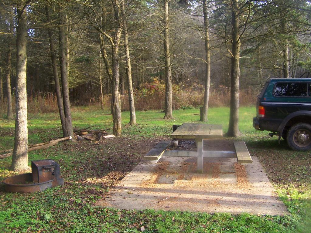
I like the campsites down at Sugar Hill, although I wish they offered more privacy. Yet, I guess that’s not how Assembly areas work at horse camps. That said, on a Sunday evening, there was nobody else around. It was a bit more crowded the following Friday, for my return trip. It was a nice night, and great meal.

Campsite

Morning unfortunately came early, with the change of day light savings time, and it was dark when I set my alarm clock for 6:30 AM. Yet I knew I had a big day ahead, driving down to Pennsylvania, so I was before dawn. But eventually the sun rose over the pines of the Lower Assembly day, and it was a beautiful morning.

Camping Set Up

Sunrise

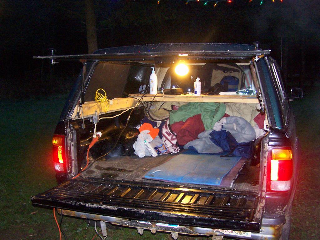
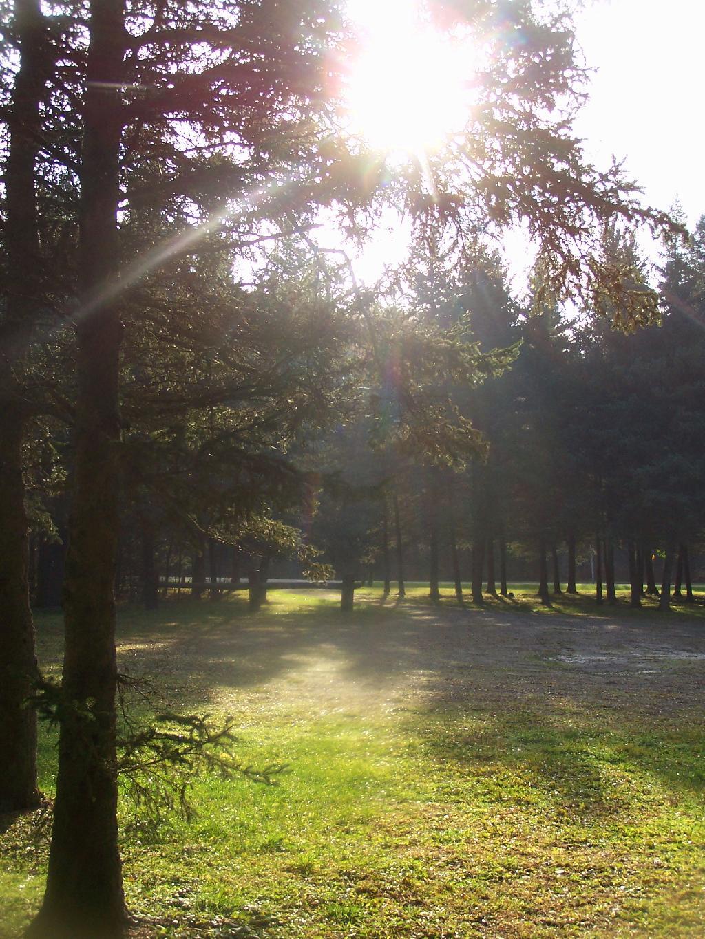
I packed up my gear, headed across a muddy truck trail to get packed up, took kind of a bath using a tea-kettle with hot water, and I was on my way to Pennsylvania. The camera lens kind of was fogged up from the cold.

Old Canal Warehouse in Chittenango  [Expires November 19 2023]

Campsite

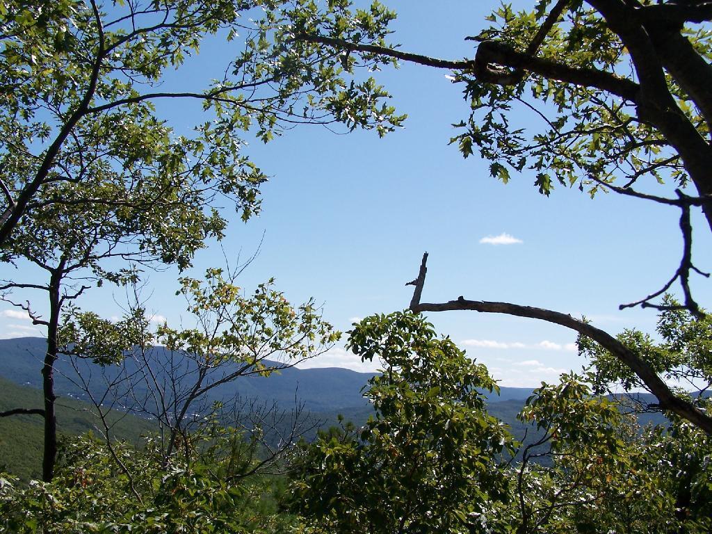
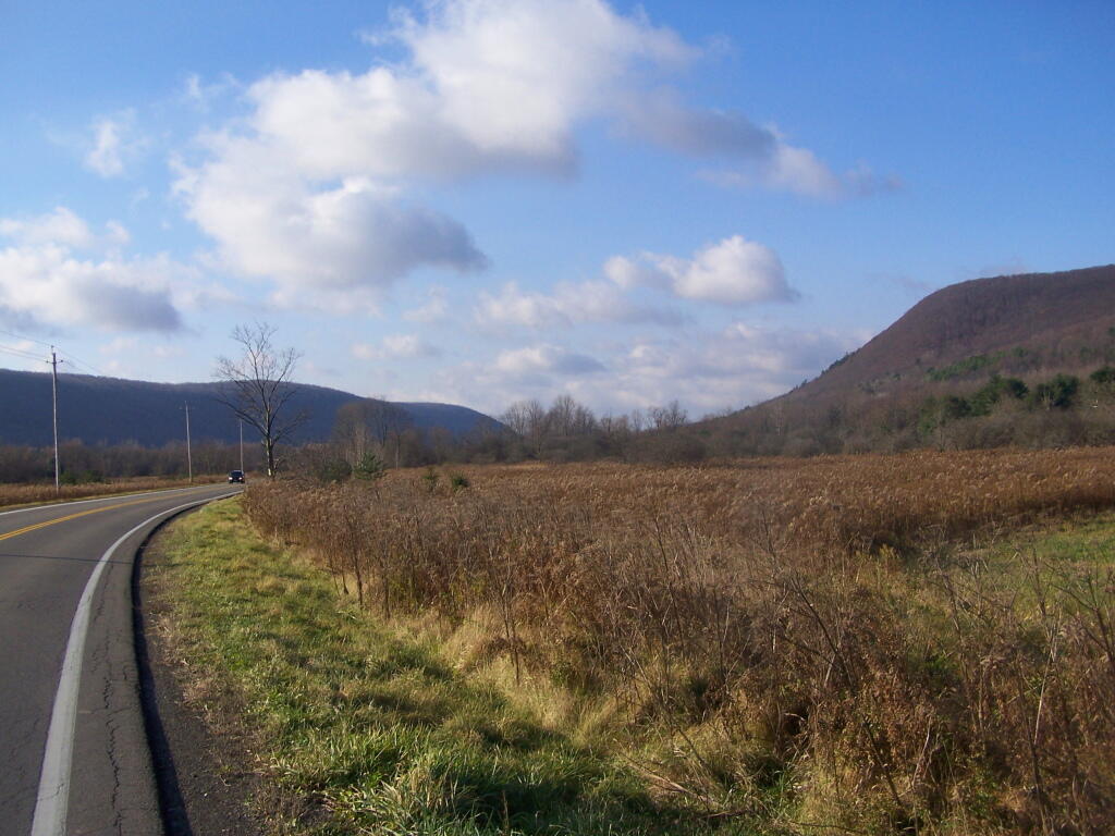
The drive to Pennsylvania was spectular, especially just South of Sugar Hill in Coon Hollow (really a wide valley), with beautiful farms lining the road, and tall mountains surrounding it.

Coon Hollow

As a side note, I also stayed here on Friday, November 12. There where a lot of equestrians that where using the area by around 9 PM, with lots of horse trailers. Many came late. This Lower Assembly area doesn’t get much use in the summer, compared to the Upper Assembly area, but this time of year with the Upper Assembly area closed, many where down here for the weekend. Weekdays, you’ll probably be alone camping here — especially in the winter.

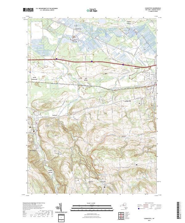
Here is a map of Sugar Hill.

Love this view of Cornplanter Bridge

Pine Cobble

Two weekends ago, I went for a hike up Pine Cobble outside Williamstown, MA. This is the first time I’ve really been hiking in the Berkshires, formally, and not just on the New York-Massachusetts line on the Taconic Crest Trail. That said, the Taconic Crest trails runs on such a high ridge compared to the rest of the Taconics, and is closer to the height of the Berkshires, that it is probably in the Berkshires and not the Taconics, regardless of where the state line may rest.

The Pine Cobble starts off a steep road that has the Pine Cobble private development on it. It’s not a gated community, but as close as one can get to it. The parking is limited here, with a lot for seven cars, so if it’s full, as it was on this beautiful Sunday morning on labor day, you will be forced to park on the shoulder.

There is a six-inch asphalt curb you have to jump to get on the grass sholder, but if you have a truck, it shouldn’t be a problem. They didn’t give me a ticket, and lots other did it, so I guess it’s legal. They do have a sign, just past the parking lot, as you go into the development, that says NO PARKING on ROADWAY and it’s posted, but downhill from the lot, seems okay.

Limited Parking

The trail head is very well signed. The entire trail is well worn, and the occassional Williamstown Trail Blazes makes it easy to follow the trail.

Pine Cobble Trail Entrance

Parts of the trail are either relatively smooth or steep and rocky. It’s called Pine Cobble, so you would expect to be walking on a lot of rock cobble. It’s not nice small stuff, but big enough that you have to keep a careful eye on where you step.

Rough on the Feet

Three quarters of the way to the top there is this oak tree with three shoots up that provides a perfect little pool where water accumulates throughout the year. It’s quite neat looking. Talking to other people, this is actually quite a common occurance with a certain type of oak.

Three Oaks form a Pool

A top Pine Cobble, looking at East Mountain.

East Mountain

You’ve almost made it to the top of Pine Cobble. Once you’ve checked it, make sure to take the trail up East Mountain for a 1/2 mile to get some awesome westerly views.

Trail Up East Mountain

Here is the summit of Pine Cobble. It’s not the most impressive summit, and indeed the best views are along the edges of Pine Cobble, where there are several to be enjoyed.

Summit

Looking down at North Adams from Pine Cobble. The city’s high rises are surrounded by the mountains that form Hoosic Valley where the river runs north through Williamstown, Pownal, Vermont, and ultimately Rensselear County, New York into the Hudson.

North Adams

Here is the Pownal Valley, where the Hoosic River heads up through the corner of Vermont and back into New York State.

Pownal Valley

West from Pine Cobble, you can see the last range of the Taconics / first of Berkshires, where Berlin Mountain and Mount Raimer. Also in the foreground is a little bit of Williamstown.

West

On East Mountain there are these exciting views of that same range, but with the addition of lots of bright white marble rock, cairns, and at least on this blue day, a deep blue sky.

Exciting Views

When you reach the top of East Mountain, there is sections of the Appalachian Trail that remind me a lot of the look of Albany Pine Bush, minus the sandy soils. The Berlin Mountain range in the distance pull some kind of emotion into my heart, just like looking at the Heldebergs from the Albany Pine Bush.

The Applachian Trail sign on East Mountain.

East Mountain at A.T.

At the Massachussets and Vermont (Green Mountain National Forest & Long Trail) border.

A.T. Log Book

A beautiful day for sure.

Looking East off Pine Cobble

Here is a map of the hike.

USGS Topographic Maps – Albany to Delaware Counties

Counties: Albany to Delaware / Dutchess to Livingston / Madison to Otsego / Putnam to Suffolk / Sullivan to Yates

Browse Topographic Maps: Full State / Historical USGS Topographic Maps

Albany County

PDF (50-60 MB Download) Historical USGS Topo Maps State Lands (Links to DEC Website) Towns (Percent of Town’s Area)
Current Albany GeoPDF Map
1953 Map No. 136552, 1953 Map No. 136553, 1953 Map No. 136559, 1978 Map No. 136558, 1994 Map No. 137061 Albany Pine Bush Preserve Albany city (85%), Bethlehem (14%), Colonie (41%), Guilderland (7%), New Scotland (2%), Rensselaer city (3%)
Current Alcove GeoPDF Map
1953 Map No. 136571, 1953 Map No. 136572, 1953 Map No. 136573 Coxsackie FP Detached Parcel, Greenville FP Detached Parcel Coeymans (33%), Coxsackie (6%), Greenville (30%), New Baltimore (39%), Westerlo (12%)
Current Altamont GeoPDF Map
1944 Map No. 136597, 1944 Map No. 136598, 1944 Map No. 136599, 1944 Map No. 136602 Margaret Burke WMA Berne (12%), Duanesburg (3%), Guilderland (30%), Knox (60%), New Scotland (4%), Princetown (1%)
Current Clarksville GeoPDF Map
1953 Map No. 137631, 1953 Map No. 137632, 1953 Map No. 137633, 1953 Map No. 137634 Five Rivers Environmental Education Center, Louise E. Keir WMA Bethlehem (4%), Coeymans (24%), New Scotland (62%), Westerlo (7%)
Current Delmar GeoPDF Map
1953 Map No. 137861, 1953 Map No. 137862, 1953 Map No. 137863, 1953 Map No. 137865, 1953 Map No. 137866, 1978 Map No. 137864 Coeymans Creek WMA, Onesquethaw Creek Fishing Access Albany city (2%), Bethlehem (81%), Coeymans (19%), East Greenbush (5%), New Scotland (0%), Rensselaer city (8%), Schodack (4%)
Current Durham GeoPDF Map
1945 Map No. 137938, 1946 Map No. 137933, 1946 Map No. 137934, 1967 Map No. 137937 Catskill Creek Fishing Access, Mount Hayden State Forest, Mount Pisgah State Forest, Scott Patent State Forest, Rensselaerville State Forest Broome (4%), Conesville (0%), Durham (36%), Rensselaerville (57%), Windham (0%)
Current Gallupville GeoPDF Map
1944 Map No. 137216, 1944 Map No. 138096, 1944 Map No. 138097 Dutch Settlement State Forest Berne (3%), Duanesburg (16%), Knox (40%), Schoharie (2%), Wright (83%)
Current Greenville GeoPDF Map
1945 Map No. 129624, 1945 Map No. 129625, 1946 Map No. 129626, 1980 Map No. 129627 NA Durham (16%), Greenville (42%), Rensselaerville (11%), Westerlo (41%)
Current Livingstonville GeoPDF Map
1945 Map No. 130298, 1945 Map No. 130301, 1946 Map No. 130299, 1962 Map No. 130300 South Mountain State Forest, Mount Pisgah State Forest, Stone Store State Forest, Keyserkill State Forest, Scott Patent State Forest, High Knob State Forest, Leonard Hill State Forest, Dutton Ridge State Forest, Bates State Forest Broome (42%), Conesville (64%), Durham (0%), Gilboa (13%), Rensselaerville (2%), Windham (0%)
Current Niskayuna GeoPDF Map
1954 Map No. 128733, 1954 Map No. 128734, 1954 Map No. 128735, 1954 Map No. 137464 NA Clifton Park (58%), Colonie (22%), Halfmoon (17%), Niskayuna (48%)
Current Ravena GeoPDF Map
1953 Map No. 136024, 1953 Map No. 136025, 1953 Map No. 136026 Bronck Island, Hannacroix Unique Area, Van Schaak Unique Area, New Baltimore FP Detached Parcel, Nutten Hook State Tidal Wetland, Coeymans Creek WMA Coeymans (25%), Coxsackie (3%), New Baltimore (61%), Schodack (7%), Stuyvesant (38%)
Current Rensselaerville GeoPDF Map
1946 Map No. 136056, 1946 Map No. 136057 Dutch Settlement State Forest, Rensselaerville State Forest, Partridge Run State Forest, Partridge Run WMA Berne (42%), Broome (9%), Middleburgh (12%), Rensselaerville (26%), Wright (5%)
Current Schenectady GeoPDF Map
1954 Map No. 129430, 1954 Map No. 129431, 1954 Map No. 129433, 1954 Map No. 129434 Albany Pine Bush Preserve Clifton Park (4%), Colonie (4%), Glenville (32%), Guilderland (3%), Niskayuna (52%), Princetown (0%), Rotterdam (36%), Schenectady city (100%)
Current Troy North GeoPDF Map
1954 Map No. 139377, 1954 Map No. 139378, 1954 Map No. 139379, 1954 Map No. 139381, 1978 Map No. 139380 NA Brunswick (12%), Cohoes city (100%), Colonie (12%), Green Island (42%), Halfmoon (45%), Schaghticoke (23%), Troy city (30%), Waterford (100%)
Current Troy South GeoPDF Map
1953 Map No. 139382, 1953 Map No. 139383, 1953 Map No. 139384, 1953 Map No. 139386, 1953 Map No. 139387, 1978 Map No. 139385 NA Albany city (8%), Brunswick (12%), Colonie (18%), East Greenbush (28%), Green Island (58%), North Greenbush (91%), Rensselaer city (84%), Sand Lake (1%), Troy city (70%), Watervliet city (100%)
Current Voorheesville GeoPDF Map
1954 Map No. 139503, 1954 Map No. 139504, 1954 Map No. 139505 Albany Pine Bush Preserve, Black Creek Marsh WMA Albany city (4%), Bethlehem (0%), Colonie (3%), Guilderland (59%), New Scotland (30%)
Current Westerlo GeoPDF Map
1943 Map No. 137019, 1943 Map No. 140234, 1943 Map No. 140235 Cole Hill State Forest, Partridge Run WMA Berne (43%), New Scotland (3%), Rensselaerville (3%), Westerlo (40%)

Allegany County

PDF (50-60 MB Download) Historical USGS Topo Maps State Lands (Links to DEC Website) Towns (Percent of Town’s Area)
Current Alfred GeoPDF Map
1964 Map No. 136588, 1964 Map No. 136589, 1964 Map No. 136590 Phillips Creek State Forest, Hiltonville State Forest, Palmer’s Pond State Forest, Karr Valley Creek State Forest, Turnpike State Forest, Bully Hill State Forest, Klipnocky State Forest Alfred (33%), Almond (63%), Birdsall (9%), Ward (5%), West Almond (30%)
Current Allentown GeoPDF Map
1965 Map No. 136592, 1965 Map No. 137063 Alma Pond Alma (63%), Bolivar (43%), Scio (24%), Wellsville (4%), Wirt (19%)
Current Andover GeoPDF Map
1965 Map No. 136637, 1965 Map No. 137077 Vandermark State Forest, Phillips Creek State Forest Alfred (56%), Andover (70%), Ward (25%), Wellsville (8%)
Current Angelica GeoPDF Map
1964 Map No. 136644, 1964 Map No. 136645, 1964 Map No. 136646 Coyle Hill State Forest, Allen Lake State Forest Allen (20%), Amity (8%), Angelica (63%), Belfast (43%), Caneadea (13%), Friendship (5%)
Current Arkport GeoPDF Map
1965 Map No. 136691, 1965 Map No. 136692, 1965 Map No. 136693 NA Almond (4%), Burns (22%), Dansville (62%), Fremont (24%), Hornell city (10%), Hornellsville (14%), Ossian (7%)
Current Belmont GeoPDF Map
1965 Map No. 123245, 1965 Map No. 123246 Coyle Hill State Forest Amity (58%), Friendship (38%), Scio (36%), Wellsville (1%), Wirt (24%)
Current Birdsall GeoPDF Map
1964 Map No. 123309, 1964 Map No. 123311 English Hill State Forest, Gillies Hill State Forest, Keeney Swamp State Forest, Gas Springs State Forest, Rattlesnake Hill WMA, Keeney Swamp WMA Allen (26%), Birdsall (48%), Granger (32%), Grove (55%)
Current Black Creek GeoPDF Map
1964 Map No. 123312, 1964 Map No. 123313, 1964 Map No. 137111 Crab Hollow State Forest, Rush Creek State Forest, Hanging Bog WMA – Showy Lady Slipper, Hanging Bog WMA Belfast (57%), Caneadea (17%), Cuba (6%), Friendship (7%), New Hudson (50%), Rushford (15%)
Current Bliss GeoPDF Map
1966 Map No. 123318, 1966 Map No. 123319 Lost Nation State Forest Arcade (43%), Centerville (13%), Eagle (50%), Freedom (12%), Java (9%), Wethersfield (10%)
Current Bolivar GeoPDF Map
1965 Map No. 123114, 1965 Map No. 123338 NA Bolivar (57%), Clarksville (22%), Genesee (50%), Wirt (25%)
Current Canaseraga GeoPDF Map
1964 Map No. 122771 Ossian State Forest, Canaseraga State Forest, Hiltonville State Forest, Klipnocky State Forest, Gas Springs State Forest, Slader Creek State Forest, Rattlesnake Hill WMA, Keeney Swamp WMA Almond (21%), Birdsall (21%), Burns (78%), Grove (24%), Ossian (22%)
Current Cuba GeoPDF Map
1961 Map No. 137759, 1961 Map No. 137760, 1961 Map No. 137761, 1961 Map No. 137762 NA Clarksville (28%), Cuba (43%), Hinsdale (48%), Ischua (28%), Oil Springs Reservation (100%), Oil Springs Reservation (100%), Portville (3%)
Current Fillmore GeoPDF Map
1964 Map No. 138145, 1964 Map No. 138146 English Hill State Forest, Allen Lake State Forest Allen (43%), Caneadea (30%), Granger (50%), Hume (33%)
Current Freedom GeoPDF Map
1963 Map No. 137211, 1963 Map No. 137212, 1963 Map No. 138173 Lost Nation State Forest, Bush Hill State Forest, Farmersville State Forest, Harwood Lake Mua Centerville (37%), Farmersville (30%), Freedom (37%), Rushford (35%)
Current Friendship GeoPDF Map
1965 Map No. 138182, 1965 Map No. 138183 NA Clarksville (28%), Cuba (44%), Friendship (50%), Wirt (31%)
Current Greenwood GeoPDF Map
1965 Map No. 129641, 1965 Map No. 129642, 1978 Map No. 129643 Rock Creek State Forest, Greenwood State Forest Alfred (6%), Andover (4%), Canisteo (0%), Greenwood (67%), Hartsville (66%)
Current Hornell GeoPDF Map
1965 Map No. 129772, 1965 Map No. 129773, 1978 Map No. 129771 Canacadea State Forest, Bully Hill State Forest Alfred (4%), Almond (11%), Fremont (4%), Hartsville (33%), Hornell city (90%), Hornellsville (75%)
Current Houghton GeoPDF Map
1964 Map No. 129789, 1964 Map No. 129790, 1978 Map No. 129788 Lost Nation State Forest, Swift Hill State Forest Caneadea (39%), Centerville (38%), Hume (39%), Rushford (35%)
Current Nunda GeoPDF Map
1943 Map No. 128828, 1972 Map No. 128834, 1972 Map No. 137474 Rattlesnake Hill WMA Castile (1%), Granger (9%), Grove (15%), Mount Morris (12%), Nunda (70%), Portage (54%)
Current Ossian GeoPDF Map
1943 Map No. 135910, 1972 Map No. 135911 Ossian State Forest, Canaseraga State Forest, Rattlesnake Hill WMA Grove (6%), Mount Morris (3%), Nunda (30%), Ossian (54%), West Sparta (55%)
Current Pike GeoPDF Map
1943 Map No. 128996, 1972 Map No. 128998, 1972 Map No. 136801 Wiscoy Creek Fishing Access, Lost Nation State Forest, Cold Creek State Forest Centerville (13%), Eagle (50%), Gainesville (10%), Hume (13%), Pike (64%), Wethersfield (9%)
Current Portageville GeoPDF Map
1943 Map No. 129125, 1972 Map No. 129128, 1972 Map No. 129129, 1972 Map No. 129131 East Koy Creek Fishing Access, Wiscoy Creek Fishing Access, Genesee Valley WMA Castile (11%), Gainesville (8%), Genesee Falls (100%), Granger (10%), Hume (15%), Mount Morris (0%), Pike (36%), Portage (46%)
Current Portville GeoPDF Map
1961 Map No. 129134, 1961 Map No. 129135, 1961 Map No. 136828 NA Clarksville (22%), Genesee (50%), Portville (82%)
Current Rawson GeoPDF Map
1963 Map No. 136027, 1963 Map No. 136028 Crab Hollow State Forest, Bush Hill State Forest, Hanging Bog WMA Cuba (6%), Farmersville (13%), Ischua (8%), Lyndon (61%), New Hudson (50%), Rushford (15%)
Current Rexville GeoPDF Map
1965 Map No. 136058, 1965 Map No. 136059 NA Andover (1%), Greenwood (25%), Independence (2%), Troupsburg (5%), West Union (100%)
Current Wellsville North GeoPDF Map
1965 Map No. 137002, 1965 Map No. 140121, 1965 Map No. 140122 Vandermark State Forest, Phillips Creek State Forest, Plumbottom State Forest Amity (30%), Andover (4%), Scio (41%), Ward (60%), Wellsville (32%)
Current Wellsville South GeoPDF Map
1965 Map No. 140123, 1965 Map No. 140124 Wag Trail, Alma Pond, Genesee River Wildlife Management Area Alma (37%), Wellsville (47%), Willing (70%)
Current West Almond GeoPDF Map
1964 Map No. 140125, 1964 Map No. 140126 Jersey Hill State Forest, Phillips Creek State Forest, Hiltonville State Forest, Palmer’s Pond State Forest, Karr Valley Creek State Forest, Turnpike State Forest, Gillies Hill State Forest, Bald Mountain State Forest Allen (12%), Amity (4%), Angelica (37%), Birdsall (22%), Ward (11%), West Almond (70%)
Current Whitesville GeoPDF Map
1965 Map No. 137029, 1965 Map No. 140293 Wag Trail Andover (21%), Independence (98%), Wellsville (9%), Willing (30%)

Bronx County

PDF (50-60 MB Download) Historical USGS Topo Maps State Lands (Links to DEC Website) Towns (Percent of Town’s Area)
Current Central Park GeoPDF Map
1947 Map No. 122894, 1956 Map No. 122895, 1956 Map No. 122896, 1966 Map No. 122897, 1966 Map No. 122898, 1966 Map No. 122899, 1966 Map No. 122900, 1995 Map No. 137165 Bronx River Trail Bronx borough (31%), Manhattan borough (68%), Queens borough (7%)
Current Flushing GeoPDF Map
1947 Map No. 138246, 1947 Map No. 138247, 1955 Map No. 138248, 1955 Map No. 138249, 1966 Map No. 137330, 1966 Map No. 138250, 1966 Map No. 138251, 1966 Map No. 138252, 1995 Map No. 137332 Bronx River Trail Bronx borough (42%), North Hempstead (2%), Queens borough (17%)
Current Mount Vernon GeoPDF Map
1956 Map No. 130718, 1956 Map No. 130719, 1966 Map No. 130720, 1966 Map No. 130721, 1966 Map No. 130722, 1966 Map No. 130723, 1995 Map No. 137393 Titus Mill Pond State Tidal Wetland Bronx borough (13%), Eastchester (100%), Greenburgh (11%), Mamaroneck (48%), Mount Vernon city (100%), New Rochelle city (100%), Pelham (100%), Scarsdale (74%), White Plains city (2%), Yonkers city (60%)
Current Yonkers GeoPDF Map
1966 Map No. 140393, 1966 Map No. 140394, 1998 Map No. 137051 NA Bronx borough (14%), Greenburgh (5%), Manhattan borough (1%), Orangetown (0%), Yonkers city (40%)

Broome County

PDF (50-60 MB Download) Historical USGS Topo Maps State Lands (Links to DEC Website) Towns (Percent of Town’s Area)
Current Afton GeoPDF Map
1957 Map No. 136536, 1957 Map No. 136537, 1957 Map No. 136538, 1957 Map No. 137055 Beaver Pond State Forest, Melondy Hill State Forest, Marsh Pond State Forest, Susquehanna River Boat Launch Afton (49%), Colesville (28%), Coventry (3%), Sanford (10%), Windsor (0%)
Current Belden GeoPDF Map
1957 Map No. 123233 Beaver Flow State Forest Afton (3%), Colesville (62%), Coventry (2%), Fenton (9%), Greene (0%), Windsor (1%)
Current Binghamton East GeoPDF Map
1937 Map No. 123290, 1937 Map No. 123291, 1961 Map No. 123294, 1968 Map No. 123295, 1968 Map No. 123296 Kirkwood Sub-Office, Skyline Drive State Forest Binghamton city (9%), Binghamton (8%), Conklin (98%), Kirkwood (73%), Windsor (7%)
Current Binghamton West GeoPDF Map
1935 Map No. 123297, 1961 Map No. 123299, 1968 Map No. 123300, 1968 Map No. 123301, 1968 Map No. 137107 NA Binghamton city (89%), Binghamton (92%), Conklin (2%), Dickinson (25%), Kirkwood (0%), Union (10%), Vestal (33%)
Current Castle Creek GeoPDF Map
1934 Map No. 122840, 1942 Map No. 122841, 1961 Map No. 122846, 1968 Map No. 122847, 1968 Map No. 122848 NA Barker (12%), Binghamton city (2%), Chenango (72%), Dickinson (75%), Fenton (4%), Kirkwood (0%), Maine (26%), Nanticoke (5%), Union (20%)
Current Chenango Forks GeoPDF Map
1935 Map No. 122947, 1942 Map No. 122948, 1960 Map No. 122954, 1968 Map No. 122955, 1968 Map No. 122956 NA Barker (3%), Chenango (28%), Colesville (9%), Fenton (87%), Greene (1%), Kirkwood (24%), Windsor (0%)
Current Deposit GeoPDF Map
1965 Map No. 137205, 1965 Map No. 137880 Oquaga Creek Fishing Access, Lower West Branch Delaware River Fishing Access, West Branch Delaware River Waterway Access, Oquaga Creek Fishing Access, Columbia Lake State Forest, Michigan Hill State Forest, Whitaker Swamp State Forest, Cat Hollow State Forest, West Branch Delaware River Deposit (41%), Sanford (41%)
Current Endicott GeoPDF Map
1956 Map No. 138228, 1956 Map No. 138229, 1969 Map No. 137326, 1969 Map No. 138234, 1969 Map No. 138235 Tracy Creek State Forest Owego (7%), Union (37%), Vestal (67%)
Current Greene GeoPDF Map
1948 Map No. 129612, 1950 Map No. 129613 NA Barker (19%), Greene (58%), Triangle (9%)
Current Gulf Summit GeoPDF Map
1952 Map No. 129660, 1952 Map No. 129661, 1952 Map No. 129662, 1952 Map No. 129663 Beaver Pond State Forest, Marsh Pond State Forest, Cascade Valley State Forest Colesville (1%), Sanford (27%), Windsor (33%)
Current Lisle GeoPDF Map
1949 Map No. 130273, 1949 Map No. 130275, 1951 Map No. 130274 Ketchumville State Forest, Nanticoke Lake Multiple Use Area Berkshire (13%), Lisle (56%), Maine (5%), Nanticoke (73%), Newark Valley (7%), Richford (4%)
Current Maine GeoPDF Map
1956 Map No. 130418, 1956 Map No. 130419, 1969 Map No. 130420, 1969 Map No. 130421, 1969 Map No. 137425 Ketchumville State Forest, Nanticoke Creek Fishing Access Maine (69%), Nanticoke (2%), Newark Valley (18%), Owego (2%), Union (33%)
Current Marathon GeoPDF Map
1950 Map No. 130449, 1950 Map No. 130450, 1950 Map No. 130451, 1950 Map No. 130452, 1950 Map No. 137432 Beaver Dam State Forest, Hoxie Gorge State Forest, James Kennedy State Forest Freetown (13%), Lapeer (66%), Lisle (34%), Marathon (62%), Richford (1%), Virgil (8%)
Current North Sanford GeoPDF Map
1965 Map No. 128768, 1965 Map No. 128769 Arctic China State Forest, Beals Pond State Forest, Michigan Hill State Forest, Steam Mill State Forest, Beaver Pond State Forest, Melondy Hill State Forest Afton (33%), Bainbridge (2%), Deposit (13%), Masonville (25%), Sanford (22%)
Current Smithville Flats GeoPDF Map
1948 Map No. 136183, 1948 Map No. 136184, 1948 Map No. 136185 Genegantslet Creek Fishing Access, Triangle State Forest, Red Brook State Forest, Long Pond State Forest, Genegantslet State Forest, Five Streams State Forest Cincinnatus (1%), German (53%), Greene (4%), McDonough (14%), Smithville (53%), Triangle (5%), Willet (8%)
Current Whitney Point GeoPDF Map
1949 Map No. 137030, 1949 Map No. 140294, 1949 Map No. 140295, 1951 Map No. 140296 Triangle State Forest Barker (66%), Lisle (7%), Nanticoke (20%), Triangle (49%)
Current Willet GeoPDF Map
1949 Map No. 140297, 1951 Map No. 140298 Papish Pond Multiple Use Area, Triangle State Forest Cincinnatus (15%), Freetown (6%), Lisle (4%), Marathon (38%), Triangle (37%), Willet (92%)
Current Windsor GeoPDF Map
1952 Map No. 140350, 1952 Map No. 140351, 1952 Map No. 140352 Skyline Drive State Forest, Hawkins Pond State Forest, Susquehanna Waterway Access Colesville (1%), Kirkwood (2%), Windsor (59%)

Cattaraugus County

PDF (50-60 MB Download) Historical USGS Topo Maps State Lands (Links to DEC Website) Towns (Percent of Town’s Area)
Current Arcade GeoPDF Map
1966 Map No. 136682, 1966 Map No. 136683 NA Arcade (57%), Freedom (12%), Holland (7%), Java (12%), Sardinia (19%), Yorkshire (14%)
Current Ashford GeoPDF Map
1964 Map No. 136703 Boyce Hill State Forest, Bryant Hill State Forest, Golden Hill State Forest Ellicottville (37%), Franklinville (50%), Great Valley (3%), Humphrey (9%), Machias (19%)
Current Ashford Hollow GeoPDF Map
1964 Map No. 136700, 1964 Map No. 136701, 1964 Map No. 136702, 1964 Map No. 710169 NA Ashford (64%), Concord (9%), East Otto (36%), Ellicottville (2%)
Current Bliss GeoPDF Map
1966 Map No. 123318, 1966 Map No. 123319 Lost Nation State Forest Arcade (43%), Centerville (13%), Eagle (50%), Freedom (12%), Java (9%), Wethersfield (10%)
Current Cattaraugus GeoPDF Map
1963 Map No. 122868, 1963 Map No. 122869, 1963 Map No. 137161 Mansfield Creek Fishing Access, Cattaraugus State Forest, Dobbins Memorial State Forest East Otto (8%), Little Valley (8%), Mansfield (59%), Napoli (5%), New Albion (42%), Otto (27%), Persia (1%)
Current Cherry Creek GeoPDF Map
1954 Map No. 122963, 1954 Map No. 122964, 1954 Map No. 137172 NA Cherry Creek (55%), Conewango (6%), Dayton (16%), Ellington (7%), Leon (52%), Villenova (17%)
Current Collins Center GeoPDF Map
1963 Map No. 137682, 1963 Map No. 137683, 1963 Map No. 137684 Cattaraugus Creek Waterway Access, Zoar Valley Multiple Use Area, Zoar Valley Unique Area, East Otto State Forest Collins (35%), Concord (5%), East Otto (37%), Otto (61%)
Current Cuba GeoPDF Map
1961 Map No. 137759, 1961 Map No. 137760, 1961 Map No. 137761, 1961 Map No. 137762 NA Clarksville (28%), Cuba (43%), Hinsdale (48%), Ischua (28%), Oil Springs Reservation (100%), Oil Springs Reservation (100%), Portville (3%)
Current Delevan GeoPDF Map
1963 Map No. 137977, 1963 Map No. 137978, 1963 Map No. 137979 Lime Lake Outlet Fishing Access, Bush Hill State Forest, Harwood Lake Mua Farmersville (41%), Freedom (39%), Machias (23%), Yorkshire (28%)
Current Ellicottville GeoPDF Map
1964 Map No. 138205, 1964 Map No. 138206 Poverty Hill WMA, Dobbins Memorial State Forest, Mccarty Hill State Forest East Otto (19%), Ellicottville (59%), Great Valley (5%), Little Valley (6%), Mansfield (41%)
Current Farnham GeoPDF Map
1960 Map No. 138142, 1960 Map No. 138143 NA Brant (61%), Cattaraugus Reservation (54%), Cattaraugus Reservation (49%), Cattaraugus Reservation (100%), Evans (13%), Hanover (20%), Perrysburg (17%)
Current Franklinville GeoPDF Map
1963 Map No. 138165, 1963 Map No. 138166 Ischua Creek Fishing Access, Bear Creek State Forest, Bush Hill State Forest, Golden Hill State Forest Farmersville (17%), Franklinville (50%), Humphrey (4%), Ischua (11%), Lyndon (39%), Machias (8%)
Current Freedom GeoPDF Map
1963 Map No. 137211, 1963 Map No. 137212, 1963 Map No. 138173 Lost Nation State Forest, Bush Hill State Forest, Farmersville State Forest, Harwood Lake Mua Centerville (37%), Farmersville (30%), Freedom (37%), Rushford (35%)
Current Gowanda GeoPDF Map
1963 Map No. 129589, 1963 Map No. 129590 Zoar Valley Multiple Use Area, Zoar Valley Unique Area Cattaraugus Reservation (39%), Cattaraugus Reservation (8%), Collins (25%), Dayton (33%), Otto (11%), Perrysburg (30%), Persia (69%)
Current Hinsdale GeoPDF Map
1961 Map No. 129865, 1971 Map No. 129864, 1979 Map No. 129863 NA Allegany (9%), Hinsdale (52%), Humphrey (27%), Ischua (53%), Olean (5%), Portville (1%)
Current Humphrey GeoPDF Map
1961 Map No. 129943, 1961 Map No. 129944, 1961 Map No. 129945, 1961 Map No. 137268 Nine Mile Creek State Forest, Raecher Hill State Forest, Golden Hill State Forest, Windfall Creek State Forest Allegany (19%), Carrollton (0%), Great Valley (38%), Humphrey (60%)
Current Ivory GeoPDF Map
1954 Map No. 129956, 1954 Map No. 129957, 1954 Map No. 129958, 1954 Map No. 137278 South Valley State Forest Carroll (60%), Poland (24%), Randolph (23%), South Valley (50%)
Current Kennedy GeoPDF Map
1954 Map No. 130016, 1954 Map No. 130017, 1954 Map No. 130019, 1979 Map No. 130018 Harris Hill State Forest, Conewango Swamp WMA Conewango (45%), Ellington (48%), Poland (31%), Randolph (28%)
Current Knapp Creek GeoPDF Map
1961 Map No. 130138, 1961 Map No. 130139, 1979 Map No. 130140 Nine Mile Creek State Forest, Birch Run Ponds Fwma Allegany Reservation (9%), Allegany (49%), Carrollton (39%)
Current Limestone GeoPDF Map
1961 Map No. 130267, 1961 Map No. 130268, 1961 Map No. 137359, 1961 Map No. 137360 Windfall Creek State Forest Allegany Reservation (15%), Carrollton (60%), Red House (43%)
Current Little Valley GeoPDF Map
1962 Map No. 130285, 1962 Map No. 130286, 1962 Map No. 130287, 1962 Map No. 130288, 1962 Map No. 137364 Bucktooth State Forest, Elkdale State Forest Allegany Reservation (13%), Coldspring (16%), Little Valley (50%), Napoli (37%), Red House (2%), Salamanca city (9%), Salamanca (60%)
Current New Albion GeoPDF Map
1963 Map No. 130784, 1963 Map No. 137402 Conewango Creek Waterway Access Conewango (6%), Dayton (15%), Leon (48%), Napoli (7%), New Albion (58%), Otto (1%), Persia (30%)
Current North Collins GeoPDF Map
1960 Map No. 128742, 1960 Map No. 128743 NA Brant (39%), Cattaraugus Reservation (7%), Cattaraugus Reservation (41%), Collins (17%), Eden (10%), Evans (8%), North Collins (43%), Perrysburg (4%)
Current Olean GeoPDF Map
1961 Map No. 128897, 1961 Map No. 128898, 1961 Map No. 128899 NA Allegany (23%), Olean city (100%), Olean (95%), Portville (14%)
Current Perrysburg GeoPDF Map
1954 Map No. 128964, 1954 Map No. 128965, 1954 Map No. 128966, 1954 Map No. 136790 NA Dayton (36%), Hanover (29%), Perrysburg (49%), Villenova (38%)
Current Portville GeoPDF Map
1961 Map No. 129134, 1961 Map No. 129135, 1961 Map No. 136828 NA Clarksville (22%), Genesee (50%), Portville (82%)
Current Randolph GeoPDF Map
1962 Map No. 136010, 1962 Map No. 136011 Randolph Fish Hatchery, Conewango Swamp WMA Allegany Reservation (1%), Coldspring (21%), Conewango (43%), Napoli (51%), Randolph (27%)
Current Rawson GeoPDF Map
1963 Map No. 136027, 1963 Map No. 136028 Crab Hollow State Forest, Bush Hill State Forest, Hanging Bog WMA Cuba (6%), Farmersville (13%), Ischua (8%), Lyndon (61%), New Hudson (50%), Rushford (15%)
Current Red House GeoPDF Map
1962 Map No. 136036, 1962 Map No. 136037, 1962 Map No. 136852, 1962 Map No. 136853 NA Allegany Reservation (21%), Coldspring (33%), Red House (54%)
Current Salamanca GeoPDF Map
1961 Map No. 129323, 1961 Map No. 129324, 1961 Map No. 129325 Mccarty Hill State Forest, Rock City State Forest, Windfall Creek State Forest Allegany Reservation (9%), Carrollton (0%), Great Valley (54%), Little Valley (35%), Red House (1%), Salamanca city (91%), Salamanca (40%)
Current Sardinia GeoPDF Map
1957 Map No. 129402, 1957 Map No. 129403, 1957 Map No. 136888 Cattaraugus Creek Fishing Access Parking Ashford (2%), Colden (8%), Holland (15%), Sardinia (80%), Yorkshire (14%)
Current Steamburg GeoPDF Map
1962 Map No. 139892, 1962 Map No. 139893, 1962 Map No. 139894 Pine Hill State Forest, South Valley State Forest Allegany Reservation (31%), Coldspring (30%), Randolph (22%), South Valley (50%)
Current West Valley GeoPDF Map
1964 Map No. 140223, 1964 Map No. 140224 NA Ashford (34%), Ellicottville (2%), Machias (50%), Yorkshire (44%)

Cayuga County

PDF (50-60 MB Download) Historical USGS Topo Maps State Lands (Links to DEC Website) Towns (Percent of Town’s Area)
Current Auburn GeoPDF Map
1953 Map No. 136737, 1954 Map No. 136738, 1954 Map No. 136739, 1954 Map No. 136743 NA Auburn city (100%), Aurelius (19%), Fleming (38%), Owasco (31%), Sennett (51%), Throop (48%)
Current Cato GeoPDF Map
1954 Map No. 122851, 1954 Map No. 122852, 1954 Map No. 137160 NA Cato (39%), Conquest (13%), Ira (79%), Victory (24%)
Current Cayuga GeoPDF Map
1954 Map No. 122871, 1954 Map No. 122872 Northern Montezuma WMA Aurelius (81%), Fayette (0%), Fleming (3%), Montezuma (40%), Seneca Falls (14%), Springport (26%), Throop (35%), Tyre (10%)
Current Fair Haven GeoPDF Map
1943 Map No. 138121, 1954 Map No. 138123, 1954 Map No. 138124, 1954 Map No. 138125 Lake Shore Marshes WMA Sterling (76%), Victory (1%), Wolcott (25%)
Current Genoa GeoPDF Map
1942 Map No. 129506, 1970 Map No. 129510, 1970 Map No. 137221 NA Genoa (57%), Lansing (0%), Ledyard (1%), Venice (72%)
Current Groton GeoPDF Map
1942 Map No. 129649, 1942 Map No. 129650, 1970 Map No. 129654, 1970 Map No. 137236 NA Cortlandville (7%), Dryden (21%), Groton (58%), Locke (1%), Summerhill (4%), Virgil (4%)
Current Hannibal GeoPDF Map
1943 Map No. 129704, 1954 Map No. 129707, 1954 Map No. 129708, 1978 Map No. 129709 NA Granby (4%), Hannibal (92%), Ira (5%), Oswego (8%), Sterling (14%), Victory (1%)
Current Jordan GeoPDF Map
1955 Map No. 130109, 1955 Map No. 130110, 1978 Map No. 130111, 1978 Map No. 130112 Cold Brook Parking Area, Carpenter’s Creek Fishing Access, Cross Lake Islands WMA, Cross Lake Waterway Access Brutus (5%), Camillus (0%), Cato (5%), Elbridge (99%), Lysander (4%), Sennett (3%), Skaneateles (5%), Van Buren (19%)
Current Lysander GeoPDF Map
1955 Map No. 130408, 1955 Map No. 130409, 1955 Map No. 137424 Three Rivers WMA Cato (13%), Granby (16%), Ira (15%), Lysander (47%), Van Buren (20%)
Current Montezuma GeoPDF Map
1954 Map No. 130619, 1954 Map No. 130620, 1954 Map No. 130621 Northern Montezuma WMA Conquest (41%), Mentz (61%), Montezuma (60%), Savannah (39%), Throop (7%), Tyre (8%)
Current Moravia GeoPDF Map
1943 Map No. 130657, 1943 Map No. 130658, 1971 Map No. 130663, 1971 Map No. 137461 Owasco Flats WMA, Summer Hill State Forest, Owasco Lake Inlet Fishing Access Genoa (18%), Lansing (0%), Locke (85%), Moravia (60%), Venice (20%)
Current Oswego West GeoPDF Map
1954 Map No. 135927, 1954 Map No. 135928, 1954 Map No. 135929, 1954 Map No. 137498 NA Minetto (8%), Oswego city (47%), Oswego (90%), Sterling (3%)
Current Owasco GeoPDF Map
1943 Map No. 135945, 1955 Map No. 135946, 1955 Map No. 135947, 1955 Map No. 135948 Dutch Hollow Brook Parking Area, Frozen Ocean State Forest, Owasco Lake Water Access Moravia (35%), Niles (64%), Owasco (23%), Scipio (7%), Skaneateles (14%), Spafford (1%), Venice (3%)
Current Scipio Center GeoPDF Map
1956 Map No. 136113, 1956 Map No. 136114 NA Fleming (55%), Ledyard (0%), Niles (3%), Owasco (10%), Scipio (90%), Venice (5%)
Current Sempronius GeoPDF Map
1943 Map No. 136135, 1971 Map No. 136136 Grout Brook Fishing Access, Bear Swamp State Forest, Summer Hill State Forest Cortlandville (0%), Homer (9%), Locke (8%), Moravia (4%), Scott (17%), Sempronius (61%), Summerhill (96%)
Current Sheldrake GeoPDF Map
1942 Map No. 136151, 1971 Map No. 136152, 1971 Map No. 136912 NA Covert (7%), Genoa (23%), Ledyard (51%), Ovid (31%), Romulus (11%)
Current Skaneateles GeoPDF Map
1955 Map No. 136178, 1955 Map No. 136179, 1955 Map No. 136180 Skaneateles Lake Boat Launch Owasco (36%), Sennett (35%), Skaneateles (72%), Spafford (4%)
Current Spafford GeoPDF Map
1955 Map No. 139819, 1955 Map No. 139820 Grout Brook Fishing Access, Carpenter Falls Unique Area, Bear Swamp State Forest, Otisco Lake Waterway Access Site Moravia (1%), Niles (33%), Otisco (10%), Scott (8%), Sempronius (39%), Skaneateles (1%), Spafford (60%)
Current Union Springs GeoPDF Map
1955 Map No. 139440, 1955 Map No. 139441, 1955 Map No. 139442 Canoga Marsh WMA Fayette (10%), Fleming (4%), Ledyard (48%), Romulus (0%), Scipio (3%), Springport (74%), Varick (5%), Venice (0%)
Current Victory GeoPDF Map
1954 Map No. 139502 Northern Montezuma WMA Butler (35%), Conquest (30%), Savannah (3%), Sterling (0%), Victory (75%), Wolcott (10%)
Current Weedsport GeoPDF Map
1954 Map No. 136997, 1954 Map No. 140099, 1954 Map No. 140100, 1954 Map No. 140101 Seneca River Boat Launch Brutus (95%), Cato (43%), Conquest (16%), Mentz (39%), Sennett (11%), Throop (11%)
Current West Groton GeoPDF Map
1943 Map No. 140160, 1943 Map No. 140161, 1970 Map No. 140162, 1970 Map No. 140163 NA Dryden (14%), Groton (42%), Lansing (28%), Locke (6%)
Current West Ninemile Point GeoPDF Map
NA NA Sterling (6%)

Chautauqua County

PDF (50-60 MB Download) Historical USGS Topo Maps State Lands (Links to DEC Website) Towns (Percent of Town’s Area)
Current Brocton GeoPDF Map
1954 Map No. 123107, 1954 Map No. 123108 NA Dunkirk (10%), Pomfret (24%), Portland (38%)
Current Cassadaga GeoPDF Map
1954 Map No. 122829, 1954 Map No. 122830, 1954 Map No. 122831 Stockton State Forest, Canadaway Creek WMA, Kabob WMA Arkwright (12%), Charlotte (39%), Gerry (5%), Pomfret (16%), Stockton (58%)
Current Chautauqua GeoPDF Map
1954 Map No. 122944, 1954 Map No. 122945, 1954 Map No. 122946 Whalen Memorial State Forest, Chautauqua Fish Hatchery, Chautauqua Lake Fish And Wildlife Management Area Chautauqua Lake UT (61%), Chautauqua (17%), Ellery (32%), North Harmony (39%), Stockton (0%)
Current Cherry Creek GeoPDF Map
1954 Map No. 122963, 1954 Map No. 122964, 1954 Map No. 137172 NA Cherry Creek (55%), Conewango (6%), Dayton (16%), Ellington (7%), Leon (52%), Villenova (17%)
Current Clymer GeoPDF Map
1954 Map No. 137791, 1954 Map No. 137792, 1954 Map No. 137793 Findley Lake Waterway Access Clymer (17%), French Creek (100%), Mina (44%), Sherman (7%)
Current Dunkirk GeoPDF Map
1954 Map No. 137928, 1954 Map No. 137929, 1954 Map No. 137930 Canadaway Creek Nature Sanctuary, Dunkirk Office, Canadaway Creek WMA Arkwright (27%), Dunkirk city (98%), Dunkirk (85%), Pomfret (52%), Sheridan (27%)
Current Ellery Center GeoPDF Map
1954 Map No. 137319, 1954 Map No. 137356, 1954 Map No. 138079, 1954 Map No. 138080, 1954 Map No. 255475 Chautauqua Lake Fish And Wildlife Management Area Chautauqua Lake UT (7%), Ellery (66%), Ellicott (25%), Gerry (34%), Stockton (5%)
Current Farnham GeoPDF Map
1960 Map No. 138142, 1960 Map No. 138143 NA Brant (61%), Cattaraugus Reservation (54%), Cattaraugus Reservation (49%), Cattaraugus Reservation (100%), Evans (13%), Hanover (20%), Perrysburg (17%)
Current Forestville GeoPDF Map
1954 Map No. 138265, 1954 Map No. 138266, 1954 Map No. 138267 Canadaway Creek WMA Arkwright (43%), Hanover (29%), Sheridan (38%), Villenova (31%)
Current Gerry GeoPDF Map
1954 Map No. 129512, 1954 Map No. 129513, 1954 Map No. 129514, 1954 Map No. 255471 Harris Hill State Forest, Hatch Creek State Forest, Hartson Swamp WMA Ellicott (40%), Ellington (40%), Gerry (53%), Jamestown city (0%), Poland (25%)
Current Hamlet GeoPDF Map
1954 Map No. 129676, 1954 Map No. 137239 Clear Creek Fishing Access, Harris Hill State Forest, Hatch Creek State Forest, Boutwell Hill State Forest, Canadaway Creek WMA Arkwright (19%), Charlotte (61%), Cherry Creek (45%), Ellington (6%), Gerry (8%), Villenova (14%)
Current Hartfield GeoPDF Map
1954 Map No. 129811, 1954 Map No. 129812 Bear Lake Boat Launch, Stockton State Forest Chautauqua Lake UT (3%), Chautauqua (29%), Pomfret (8%), Portland (42%), Stockton (37%)
Current Ivory GeoPDF Map
1954 Map No. 129956, 1954 Map No. 129957, 1954 Map No. 129958, 1954 Map No. 137278 South Valley State Forest Carroll (60%), Poland (24%), Randolph (23%), South Valley (50%)
Current Jamestown GeoPDF Map
1954 Map No. 129975, 1954 Map No. 129976, 1954 Map No. 129979, 1979 Map No. 129978 Clay Pond WMA, Hartson Swamp WMA Busti (9%), Carroll (40%), Ellicott (19%), Jamestown city (72%), Kiantone (100%), Poland (20%)
Current Kennedy GeoPDF Map
1954 Map No. 130016, 1954 Map No. 130017, 1954 Map No. 130019, 1979 Map No. 130018 Harris Hill State Forest, Conewango Swamp WMA Conewango (45%), Ellington (48%), Poland (31%), Randolph (28%)
Current Lakewood GeoPDF Map
1954 Map No. 130206, 1954 Map No. 130207, 1954 Map No. 130208, 1954 Map No. 130209 Wellman Multiple Use Area Busti (87%), Chautauqua Lake UT (27%), Ellery (2%), Ellicott (16%), Jamestown city (27%), North Harmony (2%)
Current North Clymer GeoPDF Map
1954 Map No. 128739, 1954 Map No. 137465, 1954 Map No. 137466 Panama State Forest, Brokenstraw State Forest, Whalen Memorial State Forest, North Harmony State Forest, Alder Bottom WMA, Jacquins Pond WMA Clymer (83%), Harmony (19%), North Harmony (9%), Sherman (37%)
Current North Of Dunkirk GeoPDF Map
NA NA Dunkirk city (2%), Dunkirk (5%), Sheridan (8%)
Current Panama GeoPDF Map
1954 Map No. 135962, 1954 Map No. 136769 Hill Higher State Forest, Panama State Forest, Brokenstraw State Forest, Whalen Memorial State Forest, North Harmony State Forest, Watts WMA Busti (4%), Chautauqua Lake UT (2%), Harmony (81%), North Harmony (40%)
Current Perrysburg GeoPDF Map
1954 Map No. 128964, 1954 Map No. 128965, 1954 Map No. 128966, 1954 Map No. 136790 NA Dayton (36%), Hanover (29%), Perrysburg (49%), Villenova (38%)
Current Ripley GeoPDF Map
1954 Map No. 136075, 1954 Map No. 136076 NA Ripley (35%), Westfield (10%)
Current Sherman GeoPDF Map
1954 Map No. 136157, 1954 Map No. 136916, 1954 Map No. 136918 Chautauqua Gorge State Forest, Whalen Memorial State Forest, Mount Pleasant State Forest Chautauqua (38%), North Harmony (11%), Sherman (46%), Westfield (17%)
Current Silver Creek GeoPDF Map
1943 Map No. 136171, 1960 Map No. 136168, 1960 Map No. 136172 NA Brant (0%), Cattaraugus Reservation (3%), Hanover (22%), Sheridan (27%)
Current South Ripley GeoPDF Map
1954 Map No. 136201, 1954 Map No. 136202, 1954 Map No. 136203 NA Mina (56%), Ripley (65%), Sherman (9%), Westfield (11%)
Current Westfield GeoPDF Map
1954 Map No. 137021, 1954 Map No. 137022, 1954 Map No. 140247, 1954 Map No. 140248, 1954 Map No. 140249 Chatauqua Creek Fishing Access Chautauqua (16%), Portland (20%), Westfield (61%)

Chemung County

PDF (50-60 MB Download) Historical USGS Topo Maps State Lands (Links to DEC Website) Towns (Percent of Town’s Area)
Current Alpine GeoPDF Map
1950 Map No. 136593, 1950 Map No. 136594, 1969 Map No. 136595, 1969 Map No. 136596, 1969 Map No. 137064 Newfield State Forest, Cliffside State Forest, Connecticut Hill WMA Catharine (45%), Cayuta (82%), Newfield (36%), Veteran (7%)
Current Beaver Dams GeoPDF Map
1953 Map No. 123229, 1953 Map No. 123230, 1953 Map No. 137095 Beaver Dams State Forest, Sugar Hill State Forest, Coon Hollow State Forest Catlin (33%), Dix (74%), Hornby (8%), Orange (22%)
Current Big Flats GeoPDF Map
1953 Map No. 123273, 1953 Map No. 123274, 1969 Map No. 123275, 1969 Map No. 123276, 1969 Map No. 123277 Catlin State Forest Big Flats (53%), Catlin (42%), Corning (24%), Hornby (16%)
Current Elmira GeoPDF Map
1953 Map No. 138214, 1953 Map No. 138215, 1969 Map No. 137321, 1969 Map No. 137322, 1969 Map No. 138224 NA Ashland (56%), Big Flats (5%), Elmira city (100%), Elmira (63%), Horseheads (0%), Southport (48%)
Current Erin GeoPDF Map
1954 Map No. 138116, 1969 Map No. 137327, 1969 Map No. 138117 NA Baldwin (5%), Cayuta (14%), Elmira (1%), Erin (91%), Horseheads (18%), Van Etten (2%), Veteran (9%)
Current Horseheads GeoPDF Map
1953 Map No. 129783, 1953 Map No. 129784, 1969 Map No. 129782, 1978 Map No. 129780, 1978 Map No. 129781 NA Big Flats (8%), Catlin (13%), Elmira (1%), Horseheads (82%), Veteran (44%)
Current Montour Falls GeoPDF Map
1950 Map No. 130637, 1950 Map No. 130638, 1950 Map No. 130640, 1950 Map No. 130641, 1961 Map No. 130639 Catharine Creek Fishing Access, Catharine Creek WMA Catharine (39%), Catlin (11%), Dix (17%), Montour (90%), Veteran (40%)
Current Seeley Creek GeoPDF Map
1953 Map No. 136130, 1953 Map No. 136131, 1969 Map No. 136132, 1969 Map No. 136133, 1969 Map No. 136134 Big Flats WMA Big Flats (34%), Caton (29%), Corning (11%), Southport (52%)
Current Van Etten GeoPDF Map
1954 Map No. 139471, 1969 Map No. 139472, 1969 Map No. 139473 NA Baldwin (5%), Barton (11%), Cayuta (0%), Erin (9%), Spencer (25%), Van Etten (75%)
Current Waverly GeoPDF Map
1954 Map No. 140068, 1954 Map No. 140069, 1969 Map No. 136995, 1969 Map No. 140070, 1969 Map No. 140071 Maple Hill State Forest Baldwin (13%), Barton (38%), Chemung (58%)
Current Wellsburg GeoPDF Map
1954 Map No. 140112, 1969 Map No. 140113 Maple Hill State Forest Ashland (44%), Baldwin (77%), Chemung (42%), Elmira (35%)
Current West Danby GeoPDF Map
1950 Map No. 140144, 1950 Map No. 140145, 1969 Map No. 140146, 1969 Map No. 140147 Danby State Forest Cayuta (3%), Danby (23%), Newfield (48%), Spencer (8%), Van Etten (23%)

Chenango County

PDF (50-60 MB Download) Historical USGS Topo Maps State Lands (Links to DEC Website) Towns (Percent of Town’s Area)
Current Afton GeoPDF Map
1957 Map No. 136536, 1957 Map No. 136537, 1957 Map No. 136538, 1957 Map No. 137055 Beaver Pond State Forest, Melondy Hill State Forest, Marsh Pond State Forest, Susquehanna River Boat Launch Afton (49%), Colesville (28%), Coventry (3%), Sanford (10%), Windsor (0%)
Current Belden GeoPDF Map
1957 Map No. 123233 Beaver Flow State Forest Afton (3%), Colesville (62%), Coventry (2%), Fenton (9%), Greene (0%), Windsor (1%)
Current Brisben GeoPDF Map
1949 Map No. 123012, 1949 Map No. 123013, 1951 Map No. 123014 Coventry State Forest, Bobell State Forest, Beaver Flow State Forest Coventry (47%), Greene (35%), Oxford (9%)
Current Cincinnatus GeoPDF Map
1943 Map No. 137173, 1943 Map No. 137621, 1943 Map No. 137622 Baker School House State Forest, Gee Brook State Forest, Papish Pond Multiple Use Area, Taylor Valley State Forest Cincinnatus (83%), Freetown (26%), Pitcher (3%), Solon (20%), Taylor (69%)
Current Cuyler GeoPDF Map
1943 Map No. 137763, 1943 Map No. 137850, 1943 Map No. 137853, 1943 Map No. 137854 East Branch Tioughnioga River Fishing Access, Cuyler Hill State Forest, Dog Hollow State Forest, Maxon Creek State Forest, Taylor Valley State Forest, Morgan Hill State Forest, Mariposa State Forest Cuyler (66%), DeRuyter (5%), Lincklaen (13%), Pitcher (1%), Solon (7%), Taylor (31%), Truxton (21%)
Current Earlville GeoPDF Map
1943 Map No. 137989, 1943 Map No. 137990 Sherburne Sub-Office, Rogers Environmental Education Center, Pigeon Hill State Forest, Lebanon State Forest, Earlville State Forest Hamilton (4%), Lebanon (7%), North Norwich (14%), Plymouth (14%), Sherburne (37%), Smyrna (57%)
Current East Pharsalia GeoPDF Map
1943 Map No. 137348, 1943 Map No. 138019, 1943 Map No. 138020 Berry Hill Radio Facility, Pigeon Hill State Forest, Perkins Pond State Forest, Pharsalia Woods State Forest, Mcdonough State Forest, Balsam Swamp State Forest, Pharsalia WMA McDonough (36%), Pharsalia (53%), Plymouth (29%), Preston (22%)
Current Greene GeoPDF Map
1948 Map No. 129612, 1950 Map No. 129613 NA Barker (19%), Greene (58%), Triangle (9%)
Current Guilford GeoPDF Map
1943 Map No. 129655, 1943 Map No. 129656, 1943 Map No. 129657 South Hill State Forest Butternuts (10%), Guilford (58%), Norwich (27%), Unadilla (5%)
Current Holmesville GeoPDF Map
1943 Map No. 129732, 1943 Map No. 129733, 1943 Map No. 129885, 1943 Map No. 137255 Whaupaunaucau State Forest, Skinner Hill State Forest, Hunts Pond State Forest, Ambler State Forest, Unadilla River Fishing Access Butternuts (3%), Morris (0%), New Berlin (63%), North Norwich (37%), Norwich (32%)
Current New Berlin North GeoPDF Map
NA Charles E. Baker State Forest Brookfield (3%), Columbus (56%), Edmeston (43%), New Berlin (8%), Pittsfield (23%)
Current New Berlin South GeoPDF Map
NA Morris Reservoir Waterway Access, General Jacob Morris State Forest, Wagner Farm State Forest, Calhoun Creek State Forest, Hunts Pond State Forest Butternuts (12%), Morris (55%), New Berlin (23%), Pittsfield (43%)
Current North Sanford GeoPDF Map
1965 Map No. 128768, 1965 Map No. 128769 Arctic China State Forest, Beals Pond State Forest, Michigan Hill State Forest, Steam Mill State Forest, Beaver Pond State Forest, Melondy Hill State Forest Afton (33%), Bainbridge (2%), Deposit (13%), Masonville (25%), Sanford (22%)
Current Norwich GeoPDF Map
1943 Map No. 128804, 1943 Map No. 137469, 1944 Map No. 128807 Pharsalia Woods State Forest North Norwich (35%), Norwich city (100%), Norwich (25%), Plymouth (48%), Preston (35%)
Current Otselic GeoPDF Map
1943 Map No. 135937, 1943 Map No. 135940, 1943 Map No. 136760 Texas Hill State Forest, Pigeon Hill State Forest, Perkins Pond State Forest, Otselic State Forest, Muller Hill State Forest, Lebanon State Forest, Beaver Meadow State Forest, Pharsalia WMA Georgetown (10%), Lebanon (7%), Otselic (58%), Pharsalia (11%), Plymouth (8%), Smyrna (43%)
Current Oxford GeoPDF Map
1949 Map No. 135955, 1951 Map No. 135956 Wiley Brook State Forest, Lyon Brook State Forest, Basswood State Forest Guilford (12%), Norwich (16%), Oxford (53%), Preston (26%)
Current Pitcher GeoPDF Map
1943 Map No. 129024, 1943 Map No. 129025, 1944 Map No. 129026, 1944 Map No. 129027 Pitcher Springs State Forest, Perkins Pond State Forest, Pharsalia Woods State Forest, Lincklaen State Forest, Five Streams State Forest, Balsam Swamp State Forest Cincinnatus (2%), German (47%), McDonough (15%), Pharsalia (30%), Pitcher (82%)
Current Sherburne GeoPDF Map
1943 Map No. 136155, 1943 Map No. 136156, 1943 Map No. 136914, 1943 Map No. 136915 Skinner Hill State Forest, Pine Ridge State Forest, Charles E. Baker State Forest Brookfield (3%), Columbus (44%), Hamilton (4%), New Berlin (7%), North Norwich (14%), Sherburne (63%)
Current Sidney GeoPDF Map
1943 Map No. 136165, 1943 Map No. 136166, 1943 Map No. 136167 Pine Hill State Forest, South Hill State Forest, Oak Ridge State Forest Afton (3%), Bainbridge (67%), Guilford (24%), Masonville (9%), Sidney (10%), Unadilla (12%)
Current Smithville Flats GeoPDF Map
1948 Map No. 136183, 1948 Map No. 136184, 1948 Map No. 136185 Genegantslet Creek Fishing Access, Triangle State Forest, Red Brook State Forest, Long Pond State Forest, Genegantslet State Forest, Five Streams State Forest Cincinnatus (1%), German (53%), Greene (4%), McDonough (14%), Smithville (53%), Triangle (5%), Willet (8%)
Current South Otselic GeoPDF Map
1943 Map No. 136928 Perkins Pond State Forest, Otselic State Forest, Muller Hill State Forest, Mariposa State Forest, Lincklaen State Forest, Bucks Brook State Forest, South Otselic Fish Hatchery DeRuyter (19%), Georgetown (10%), Lincklaen (87%), Otselic (42%), Pharsalia (6%), Pitcher (14%)
Current Tyner GeoPDF Map
1949 Map No. 136977, 1949 Map No. 139421, 1949 Map No. 139422, 1951 Map No. 139423 Mcdonough State Forest, Ludlow Creek State Forest, Genegantslet State Forest Greene (2%), McDonough (34%), Oxford (17%), Preston (16%), Smithville (47%)
Current West Bainbridge GeoPDF Map
1949 Map No. 137003, 1949 Map No. 140127, 1951 Map No. 140128 Wiley Brook State Forest, Oak Ridge State Forest, Coventry State Forest, Bumps Creek State Forest Afton (12%), Bainbridge (31%), Coventry (48%), Guilford (6%), Oxford (21%)

Clinton County

PDF (50-60 MB Download) Historical USGS Topo Maps State Lands (Links to DEC Website) Towns (Percent of Town’s Area)
Current Alder Brook GeoPDF Map
1968 Map No. 136574 Taylor Pond Wild Forest, Chazy Highlands Wild Forest Black Brook (12%), Franklin (16%), Saranac (8%)
Current Altona GeoPDF Map
1966 Map No. 136603, 1966 Map No. 136604 Clinton Mooers FP Detached Parcel, Spring Brook State Forest, Flat Rock State Forest, Great Chazy River Fishing Access Altona (16%), Mooers (44%)
Current Au Sable Forks GeoPDF Map
NA Taylor Pond Wild Forest, Wilmington Wild Forest Au Sable (2%), Black Brook (17%), Chesterfield (1%), Jay (43%), Wilmington (0%)
Current Beekmantown GeoPDF Map
1966 Map No. 123231, 1966 Map No. 123232 Lake Alice WMA, Montys Bay WMA Beekmantown (36%), Chazy (44%), Plattsburgh (0%)
Current Brainardsville GeoPDF Map
1964 Map No. 123115, 1964 Map No. 123116 Chazy Highlands Wild Forest Bellmont (29%), Burke (0%), Chateaugay (6%), Ellenburg (1%)
Current Champlain GeoPDF Map
1966 Map No. 122911, 1966 Map No. 137166 Great Chazy River Special Use, Kings Bay WMA, Lake Alice WMA Champlain (72%), Chazy (24%)
Current Chateaugay GeoPDF Map
1964 Map No. 122927, 1964 Map No. 122928, 1964 Map No. 137169, 1993 Map No. 137170 Valley View State Forest, Chateaugay Fish Hatchery Burke (0%), Chateaugay (88%), Clinton (10%), Ellenburg (0%)
Current Churubusco GeoPDF Map
1964 Map No. 122747, 1964 Map No. 122748 Clinton FP Detached Parcel Clinton (68%), Ellenburg (7%)
Current Clintonville GeoPDF Map
NA Taylor Pond Wild Forest, Poke-O-Moonshine Day Use Area Au Sable (26%), Chesterfield (35%), Jay (4%), Lewis (3%)
Current Colchester Point GeoPDF Map
NA Schuyler Island Primitive Area Au Sable (4%), Chesterfield (8%), Peru (0%)
Current Dannemora GeoPDF Map
1966 Map No. 137955, 1966 Map No. 137956 Burnt Hill State Forest, Chazy Highlands State Forest, Dunkin’s Reserve State Forest, Macomb State Forest, Cadyville State Forest Beekmantown (4%), Dannemora (13%), Plattsburgh (7%), Saranac (26%), Schuyler Falls (20%)
Current Ellenburg Center GeoPDF Map
1964 Map No. 138065 Chazy Highlands Wild Forest, Chazy Highlands State Forest, Upper Chateaugay Lake Boat Launch Bellmont (0%), Dannemora (8%), Ellenburg (44%)
Current Ellenburg Depot GeoPDF Map
1964 Map No. 138066, 1964 Map No. 138067 Clinton FP Detached Parcel, Clinton Mooers FP Detached Parcel, Spring Brook State Forest, The Gulf Unique Area Altona (5%), Clinton (23%), Ellenburg (16%), Mooers (19%)
Current Ellenburg Mountain GeoPDF Map
1964 Map No. 138068, 1964 Map No. 138069 Chazy Highlands Wild Forest, Spring Brook State Forest, Chazy Highlands State Forest, Moon Pond State Forest Altona (9%), Dannemora (15%), Ellenburg (32%)
Current Franklin Falls GeoPDF Map
NA Mckenzie Mountain Wilderness, Taylor Pond Wild Forest, Wilmington Wild Forest, Whiteface Mountain Ski Center Black Brook (7%), Franklin (12%), St. Armand (25%), Wilmington (12%)
Current Jericho GeoPDF Map
1966 Map No. 129992, 1966 Map No. 129993 Spring Brook State Forest, Dunkin’s Reserve State Forest, Flat Rock State Forest, Lewis Preserve WMA Altona (38%), Beekmantown (8%), Dannemora (13%)
Current Keeseville GeoPDF Map
1966 Map No. 130007, 1966 Map No. 130008 Unclassified, Valcour Island Primitive Area, Garden Island, Schuyler Island Primitive Area, Taylor Pond Wild Forest, Peru Dock Boat Launch, Ausable Marsh WMA, Wickham Marsh WMA, Ausable Point Campground Au Sable (24%), Chesterfield (12%), Peru (31%), Plattsburgh (0%)
Current Lyon Mountain GeoPDF Map
1968 Map No. 130400 Chazy Highlands Wild Forest, Chazy Highlands WMA Bellmont (7%), Dannemora (27%), Franklin (0%), Saranac (19%)
Current Moffitsville GeoPDF Map
1968 Map No. 130592 Chazy Highlands Wild Forest, Chazy Highlands State Forest Dannemora (24%), Saranac (32%)
Current Mooers GeoPDF Map
1966 Map No. 130654 Clinton FP Detached Parcel, Flat Rock State Forest, Lake Alice WMA Altona (9%), Champlain (11%), Chazy (11%), Mooers (38%)
Current Morrisonville GeoPDF Map
1966 Map No. 130679, 1966 Map No. 137384 Macomb State Forest, Saranac River Access Beekmantown (10%), Peru (0%), Plattsburgh (27%), Schuyler Falls (74%)
Current North Hero GeoPDF Map
NA NA Beekmantown (11%), Chazy (1%), Plattsburgh (0%)
Current Peasleeville GeoPDF Map
1966 Map No. 135990, 1966 Map No. 136778 Burnt Hill State Forest, Taylor Pond Wild Forest, Terry Mountain State Forest, Macomb State Forest Au Sable (3%), Black Brook (14%), Peru (30%), Saranac (5%), Schuyler Falls (2%)
Current Peru GeoPDF Map
1966 Map No. 128967, 1966 Map No. 136792 Macomb State Forest Au Sable (41%), Peru (37%), Schuyler Falls (3%)
Current Plattsburgh GeoPDF Map
1966 Map No. 129044, 1966 Map No. 136813 Valcour Island Primitive Area, Imperial Mills Dam, Spoon Island Primitive Area, Plattsburg Boat Launch Beekmantown (4%), Peru (1%), Plattsburgh city (100%), Plattsburgh (65%), Schuyler Falls (1%)
Current Redford GeoPDF Map
1968 Map No. 136043 Unclassified, Taylor Pond Wild Forest, Chazy Highlands Wild Forest Black Brook (31%), Saranac (10%)
Current Rouses Point GeoPDF Map
NA Rouses Point, Kings Bay WMA Champlain (17%), Chazy (4%)
Current West Chazy GeoPDF Map
1966 Map No. 140142, 1966 Map No. 140143 Dunkin’s Reserve State Forest, Flat Rock State Forest, Lake Alice WMA Altona (23%), Beekmantown (28%), Chazy (16%)
Current Wilmington GeoPDF Map
NA Taylor Pond Wild Forest, Wilmington Wild Forest, Taylor Pond Campground, Whiteface Mountain Ski Center Black Brook (20%), Jay (2%), Wilmington (39%)

Columbia County

PDF (50-60 MB Download) Historical USGS Topo Maps State Lands (Links to DEC Website) Towns (Percent of Town’s Area)
Current Ancram GeoPDF Map
1948 Map No. 136625, 1948 Map No. 710141, 1960 Map No. 136626, 1960 Map No. 136627, 1960 Map No. 137076, 1960 Map No. 710139 Roeliff Jansenkill Multiple Use Area, New Forge State Forest, Doodletown Wildlife Management Area Ancram (16%), Gallatin (80%), Milan (3%), Pine Plains (3%), Taghkanic (36%)
Current Canaan GeoPDF Map
1946 Map No. 123077, 1959 Map No. 123081, 1959 Map No. 123082, 1973 Map No. 123083, 1973 Map No. 137145 Hand Hollow State Forest Canaan (61%), New Lebanon (84%), Stephentown (1%)
Current Cementon GeoPDF Map
1963 Map No. 122882, 1963 Map No. 122883, 1963 Map No. 122884, 1963 Map No. 137143 Seward’s Island, Catskill FP Detatched Parcel, Great Vly WMA Athens (0%), Cairo (0%), Catskill (68%), Germantown (29%), Saugerties (12%)
Current Chatham GeoPDF Map
1953 Map No. 122929, 1953 Map No. 122930, 1953 Map No. 122931, 1953 Map No. 122932, 1953 Map No. 137171 Beebe Hill Multiple Use Area Austerlitz (55%), Canaan (4%), Chatham (10%), Claverack (0%), Ghent (31%), Hillsdale (15%)
Current Claverack GeoPDF Map
1947 Map No. 137637, 1960 Map No. 137176, 1960 Map No. 137641, 1960 Map No. 137642, 1960 Map No. 137643 NA Claverack (68%), Greenport (0%), Livingston (8%), Taghkanic (49%)
Current Clermont GeoPDF Map
1963 Map No. 137177, 1963 Map No. 137654, 1963 Map No. 137655, 1963 Map No. 137656 NA Clermont (63%), Gallatin (19%), Germantown (21%), Livingston (31%), Milan (21%), Red Hook (30%), Taghkanic (2%)
Current Copake GeoPDF Map
1953 Map No. 137709, 1953 Map No. 137710, 1953 Map No. 137711, 1953 Map No. 137712 Doodletown Wildlife Management Area Ancram (71%), Copake (46%), North East (14%), Taghkanic (3%)
Current East Chatham GeoPDF Map
1953 Map No. 137998, 1953 Map No. 137999, 1953 Map No. 138000 NA Canaan (13%), Chatham (76%), Nassau (12%), New Lebanon (11%), Schodack (0%), Stephentown (0%)
Current Egremont GeoPDF Map
NA NA Copake (6%), Hillsdale (21%)
Current Hancock MA-NY GeoPDF Map
NA Taconic Ridge State Forest Berlin (4%), New Lebanon (2%), Stephentown (27%)
Current Hillsdale GeoPDF Map
1953 Map No. 129847, 1953 Map No. 129848, 1953 Map No. 137251, 1980 Map No. 129845 NA Claverack (8%), Copake (48%), Ghent (0%), Hillsdale (57%), Taghkanic (10%)
Current Hudson North GeoPDF Map
1953 Map No. 129935, 1953 Map No. 129936, 1953 Map No. 129937, 1980 Map No. 129938 Brandow Point Unique Area, Charles Flood WMA At The Empire Brickyard, Middle Ground Flats Unique Area, Stockport Flats Estuarine Sanctuary, Nutten Hook State Tidal Wetland, Stockport WMA, Vosburgh Swamp WMA, Athens State Boat Launch Athens (59%), Claverack (1%), Coxsackie (56%), Greenport (17%), Hudson city (58%), Stockport (56%), Stuyvesant (15%)
Current Hudson South GeoPDF Map
1963 Map No. 129939, 1963 Map No. 129940, 1963 Map No. 129942, 1980 Map No. 129941 Brandow Point Unique Area, Livingston State Forest, Rogers Island WMA Athens (5%), Catskill (8%), Claverack (3%), Clermont (4%), Germantown (34%), Greenport (82%), Hudson city (42%), Livingston (61%), Taghkanic (0%)
Current Kinderhook GeoPDF Map
1953 Map No. 130032, 1953 Map No. 130033, 1980 Map No. 130034 NA Chatham (14%), Kinderhook (81%), Nassau (1%), Schodack (18%), Stuyvesant (37%)
Current Millerton GeoPDF Map
1955 Map No. 130590, 1955 Map No. 130591, 1955 Map No. 137452, 1955 Map No. 137453 NA Amenia (9%), Ancram (12%), North East (86%), Pine Plains (31%), Stanford (3%)
Current Pine Plains GeoPDF Map
1948 Map No. 129004, 1960 Map No. 129005, 1960 Map No. 129006, 1960 Map No. 136805, 1960 Map No. 136806 Shekomeko Creek Parking Fishing Access, Lafayetteville Multiple Use Area, Stissing Mountain Multiple Use Area Ancram (1%), Gallatin (1%), Milan (20%), North East (0%), Pine Plains (66%), Stanford (54%)
Current Ravena GeoPDF Map
1953 Map No. 136024, 1953 Map No. 136025, 1953 Map No. 136026 Bronck Island, Hannacroix Unique Area, Van Schaak Unique Area, New Baltimore FP Detached Parcel, Nutten Hook State Tidal Wetland, Coeymans Creek WMA Coeymans (25%), Coxsackie (3%), New Baltimore (61%), Schodack (7%), Stuyvesant (38%)
Current Saugerties GeoPDF Map
1963 Map No. 129404, 1963 Map No. 136889, 1963 Map No. 136890, 1963 Map No. 136891, 1963 Map No. 136892, 1997 Map No. 136893 Turkey Point State Forest, Tivoli Bays WMA Clermont (33%), Germantown (15%), Red Hook (39%), Saugerties (41%), Ulster (12%)
Current State Line GeoPDF Map
1944 Map No. 139884, 1944 Map No. 139885, 1959 Map No. 139886, 1959 Map No. 139887, 1973 Map No. 136934, 1973 Map No. 139888 Beebe Hill Multiple Use Area, Beebe Hill State Forest, Harvey Mountain State Forest Austerlitz (45%), Canaan (21%), Hillsdale (7%)
Current Stephentown Center GeoPDF Map
1945 Map No. 136935, 1945 Map No. 136936, 1945 Map No. 139895, 1945 Map No. 139896 Capital District WMA Berlin (8%), Nassau (11%), New Lebanon (3%), Sand Lake (7%), Stephentown (72%)
Current Stottville GeoPDF Map
1953 Map No. 139918, 1953 Map No. 139919, 1953 Map No. 139920 NA Chatham (0%), Claverack (19%), Ghent (69%), Greenport (0%), Kinderhook (19%), Stockport (44%), Stuyvesant (10%)

Cortland County

PDF (50-60 MB Download) Historical USGS Topo Maps State Lands (Links to DEC Website) Towns (Percent of Town’s Area)
Current Cincinnatus GeoPDF Map
1943 Map No. 137173, 1943 Map No. 137621, 1943 Map No. 137622 Baker School House State Forest, Gee Brook State Forest, Papish Pond Multiple Use Area, Taylor Valley State Forest Cincinnatus (83%), Freetown (26%), Pitcher (3%), Solon (20%), Taylor (69%)
Current Cortland GeoPDF Map
1955 Map No. 137193, 1955 Map No. 137830, 1955 Map No. 137831, 1955 Map No. 137832 Cortland Sub-Office, Tuller Hill State Forest, James Kennedy State Forest Cortland city (100%), Cortlandville (56%), Virgil (49%)
Current Cuyler GeoPDF Map
1943 Map No. 137763, 1943 Map No. 137850, 1943 Map No. 137853, 1943 Map No. 137854 East Branch Tioughnioga River Fishing Access, Cuyler Hill State Forest, Dog Hollow State Forest, Maxon Creek State Forest, Taylor Valley State Forest, Morgan Hill State Forest, Mariposa State Forest Cuyler (66%), DeRuyter (5%), Lincklaen (13%), Pitcher (1%), Solon (7%), Taylor (31%), Truxton (21%)
Current Deruyter GeoPDF Map
1943 Map No. 137206 Morgan Hill State Forest, Deruyter State Forest, Fabius Brook Fishing Access Cazenovia (8%), Cuyler (33%), DeRuyter (18%), Fabius (55%), Pompey (8%)
Current Dryden GeoPDF Map
1949 Map No. 137901, 1951 Map No. 137902, 1951 Map No. 137903, 1969 Map No. 137339, 1969 Map No. 137904, 1969 Map No. 137905 Dryden Lake Multiple Use Area, Robinson Hollow State Forest, Yellow Barn State Forest, Hammond Hill State Forest, West Branch Owego Creek Caroline (23%), Dryden (38%), Harford (6%), Richford (13%), Virgil (1%)
Current Groton GeoPDF Map
1942 Map No. 129649, 1942 Map No. 129650, 1970 Map No. 129654, 1970 Map No. 137236 NA Cortlandville (7%), Dryden (21%), Groton (58%), Locke (1%), Summerhill (4%), Virgil (4%)
Current Harford GeoPDF Map
1949 Map No. 129714, 1951 Map No. 129715, 1976 Map No. 129716, 1976 Map No. 129717 Beaver Dam State Forest, Griggs Gulf State Forest, Michigan Hill State Forest, Robinson Hollow State Forest, Turkey Hill State Forest, James Kennedy State Forest Harford (94%), Lapeer (34%), Lisle (0%), Richford (39%), Virgil (18%)
Current Homer GeoPDF Map
1955 Map No. 129736, 1955 Map No. 129738, 1978 Map No. 129737 Hewitt State Forest, Casterline Pond Waterway Access Cortlandville (3%), Homer (64%), Preble (32%), Scott (54%)
Current Marathon GeoPDF Map
1950 Map No. 130449, 1950 Map No. 130450, 1950 Map No. 130451, 1950 Map No. 130452, 1950 Map No. 137432 Beaver Dam State Forest, Hoxie Gorge State Forest, James Kennedy State Forest Freetown (13%), Lapeer (66%), Lisle (34%), Marathon (62%), Richford (1%), Virgil (8%)
Current Mcgraw GeoPDF Map
NA Baker School House State Forest, Hoxie Gorge State Forest, Taylor Valley State Forest, Tuller Hill State Forest Cortlandville (32%), Freetown (56%), Solon (53%), Virgil (19%)
Current Otisco Valley GeoPDF Map
1955 Map No. 135933, 1955 Map No. 135934, 1955 Map No. 135935, 1955 Map No. 136759 Hewitt State Forest, Tully Lake Fishing Access LaFayette (8%), Otisco (52%), Preble (24%), Scott (20%), Spafford (23%), Tully (59%)
Current Sempronius GeoPDF Map
1943 Map No. 136135, 1971 Map No. 136136 Grout Brook Fishing Access, Bear Swamp State Forest, Summer Hill State Forest Cortlandville (0%), Homer (9%), Locke (8%), Moravia (4%), Scott (17%), Sempronius (61%), Summerhill (96%)
Current Smithville Flats GeoPDF Map
1948 Map No. 136183, 1948 Map No. 136184, 1948 Map No. 136185 Genegantslet Creek Fishing Access, Triangle State Forest, Red Brook State Forest, Long Pond State Forest, Genegantslet State Forest, Five Streams State Forest Cincinnatus (1%), German (53%), Greene (4%), McDonough (14%), Smithville (53%), Triangle (5%), Willet (8%)
Current Spafford GeoPDF Map
1955 Map No. 139819, 1955 Map No. 139820 Grout Brook Fishing Access, Carpenter Falls Unique Area, Bear Swamp State Forest, Otisco Lake Waterway Access Site Moravia (1%), Niles (33%), Otisco (10%), Scott (8%), Sempronius (39%), Skaneateles (1%), Spafford (60%)
Current Truxton GeoPDF Map
1955 Map No. 136970, 1955 Map No. 139394, 1955 Map No. 139395, 1955 Map No. 139396 Donahue Woods State Forest, Taylor Valley State Forest, Morgan Hill State Forest Cortlandville (3%), Cuyler (0%), Homer (27%), Preble (27%), Solon (20%), Truxton (59%)
Current Tully GeoPDF Map
1943 Map No. 139399, 1955 Map No. 136971, 1955 Map No. 139401, 1955 Map No. 139402, 1955 Map No. 139403 Labrador Hollow Unique Area, Morgan Hill State Forest, Kettlebail State Forest Cuyler (1%), Fabius (45%), LaFayette (14%), Pompey (5%), Preble (17%), Truxton (20%), Tully (41%)
Current Willet GeoPDF Map
1949 Map No. 140297, 1951 Map No. 140298 Papish Pond Multiple Use Area, Triangle State Forest Cincinnatus (15%), Freetown (6%), Lisle (4%), Marathon (38%), Triangle (37%), Willet (92%)

Delaware County

PDF (50-60 MB Download) Historical USGS Topo Maps State Lands (Links to DEC Website) Towns (Percent of Town’s Area)
Current Andes GeoPDF Map
1965 Map No. 136634, 1965 Map No. 136635, 1965 Map No. 136636 Murphy Hill State Forest, Wolf Hollow WMA Andes (37%), Bovina (19%), Colchester (0%), Delhi (8%), Hamden (0%)
Current Arena GeoPDF Map
1945 Map No. 136684, 1945 Map No. 136685, 1945 Map No. 136686, 1945 Map No. 136690, 1946 Map No. 136687, 1946 Map No. 136689 Delaware Wild Forest, Willowemoc Wild Forest, Big Indian Wilderness, Balsam Lake Mountain Wild Forest, Dry Brook Ridge Wild Forest, Little Pond Campground Andes (9%), Hardenburgh (33%), Middletown (19%), Rockland (0%)
Current Bloomville GeoPDF Map
1943 Map No. 123322, 1943 Map No. 123323, 1943 Map No. 137116 NA Bovina (36%), Delhi (23%), Kortright (25%), Meredith (5%), Stamford (11%)
Current Callicoon GeoPDF Map
1965 Map No. 123143, 1965 Map No. 123144, 1965 Map No. 123145, 1992 Map No. 137140 Callicoon Creek North Branch Fishing Access, Crystal Lake Wild Forest, Delaware River Waterway Access Callicoon (3%), Delaware (39%), Fremont (55%), Hancock (1%)
Current Cannonsville Reservoir GeoPDF Map
1965 Map No. 122784, 1965 Map No. 122785, 1965 Map No. 122786 Tompkins FP Detached Parcel, Kerryville State Forest, Michigan Hill State Forest Deposit (32%), Hancock (2%), Sanford (0%), Tompkins (36%)
Current Charlotteville GeoPDF Map
1943 Map No. 122912, 1943 Map No. 122913, 1943 Map No. 122916, 1943 Map No. 137167 Schenevus Creek Fishing Access, Lutheranville State Forest, Clapper Hollow State Forest Decatur (1%), Harpersfield (6%), Jefferson (17%), Summit (38%), Worcester (65%)
Current Corbett GeoPDF Map
1965 Map No. 137811, 1965 Map No. 137812, 1965 Map No. 137813 Colchester FP Detached Parcel, Tomannex State Forest, Delaware Wild Forest, Bear Spring Mountain Campground, Bear Spring Mountain WMA Colchester (24%), Hancock (8%), Tompkins (0%), Walton (8%)
Current Davenport GeoPDF Map
1943 Map No. 137962, 1943 Map No. 137963, 1943 Map No. 137966 John Lennox State Demonstration Forest, South Hill State Forest Davenport (34%), Harpersfield (10%), Kortright (48%), Maryland (0%), Meredith (5%)
Current Delhi GeoPDF Map
1943 Map No. 137855, 1943 Map No. 137856, 1943 Map No. 137860 NA Delhi (44%), Hamden (0%), Meredith (46%)
Current Deposit GeoPDF Map
1965 Map No. 137205, 1965 Map No. 137880 Oquaga Creek Fishing Access, Lower West Branch Delaware River Fishing Access, West Branch Delaware River Waterway Access, Oquaga Creek Fishing Access, Columbia Lake State Forest, Michigan Hill State Forest, Whitaker Swamp State Forest, Cat Hollow State Forest, West Branch Delaware River Deposit (41%), Sanford (41%)
Current Downsville GeoPDF Map
1965 Map No. 137337, 1965 Map No. 137894 Murphy Hill State Forest, Delaware Wild Forest Colchester (39%)
Current Fishs Eddy GeoPDF Map
1965 Map No. 138153, 1965 Map No. 138154 Hancock FP Detached Parcel, East Branch Delaware River Waterway Access Hancock (34%)
Current Fleischmanns GeoPDF Map
1945 Map No. 138238, 1945 Map No. 138239, 1945 Map No. 138241, 1945 Map No. 138242, 1946 Map No. 138240 Belleayre Mountain Ski Center, Greene County FP Detached Parcel, Big Indian Wilderness, Dry Brook Ridge Wild Forest Halcott (19%), Hardenburgh (0%), Middletown (36%), Roxbury (15%), Shandaken (2%)
Current Franklin GeoPDF Map
1943 Map No. 138167, 1943 Map No. 138168, 1943 Map No. 138171, 1943 Map No. 138172 NA Franklin (38%), Masonville (1%), Otego (4%), Sidney (40%), Unadilla (1%), Walton (2%)
Current Hamden GeoPDF Map
1965 Map No. 129670, 1965 Map No. 137237, 1982 Map No. 129671 Murphy Hill State Forest Andes (4%), Colchester (3%), Delhi (18%), Hamden (58%), Walton (0%)
Current Hancock NY-PA GeoPDF Map
NA NA Deposit (1%), Hancock (13%), Sanford (0%)
Current Harpersfield GeoPDF Map
1945 Map No. 129799, 1945 Map No. 129800, 1982 Map No. 129798 NA Harpersfield (81%), Jefferson (19%), Kortright (15%), Stamford (6%)
Current Hobart GeoPDF Map
1945 Map No. 129866, 1945 Map No. 129867, 1945 Map No. 129868 Relay State Forest, Plattekill State Forest Bovina (37%), Kortright (10%), Middletown (1%), Roxbury (9%), Stamford (48%)
Current Horton GeoPDF Map
1965 Map No. 129786, 1965 Map No. 129787, 1982 Map No. 129785 Hancock FP Detached Parcel, Crystal Lake Wild Forest Colchester (5%), Fremont (14%), Hancock (26%)
Current Lewbeach GeoPDF Map
1965 Map No. 130250, 1965 Map No. 130251, 1965 Map No. 130253, 1965 Map No. 137316 Andes FP Detached Parcel, Murphy Hill State Forest, Delaware Wild Forest, Dry Brook Ridge Wild Forest, Little Pond Campground Andes (34%), Colchester (9%), Hardenburgh (2%), Middletown (0%), Rockland (2%)
Current Livingston Manor GeoPDF Map
1965 Map No. 130296, 1965 Map No. 130297, 1965 Map No. 137365 Little Beaverkill Fishing Access, Willowemoc Creek Fishing Access, Willowemoc Creek Waterway Access, Delaware Wild Forest, Willowemoc Wild Forest, Beaverkill Campground Callicoon (3%), Colchester (2%), Liberty (3%), Rockland (51%)
Current Long Eddy GeoPDF Map
1965 Map No. 130336, 1992 Map No. 137373 Delaware River Access, Hancock FP Detached Parcel Fremont (1%), Hancock (4%)
Current Margaretville GeoPDF Map
1945 Map No. 130463, 1945 Map No. 130464, 1945 Map No. 130468, 1946 Map No. 130465 Middletown FP Detached Parcel, Dry Brook Ridge Wild Forest Andes (15%), Bovina (7%), Middletown (35%), Roxbury (1%)
Current North Sanford GeoPDF Map
1965 Map No. 128768, 1965 Map No. 128769 Arctic China State Forest, Beals Pond State Forest, Michigan Hill State Forest, Steam Mill State Forest, Beaver Pond State Forest, Melondy Hill State Forest Afton (33%), Bainbridge (2%), Deposit (13%), Masonville (25%), Sanford (22%)
Current Oneonta GeoPDF Map
1943 Map No. 128915, 1943 Map No. 128916, 1943 Map No. 128917, 1943 Map No. 128920, 1943 Map No. 128921, 1943 Map No. 137485 Charlotte River Fishing Access Davenport (11%), Franklin (18%), Laurens (3%), Meredith (4%), Milford (2%), Oneonta city (100%), Oneonta (76%), Otego (1%)
Current Otego GeoPDF Map
1943 Map No. 135930, 1943 Map No. 135931, 1943 Map No. 135932 NA Butternuts (9%), Franklin (2%), Laurens (3%), Morris (2%), Oneonta (8%), Otego (95%), Sidney (0%), Unadilla (2%)
Current Prattsville GeoPDF Map
1945 Map No. 129181, 1945 Map No. 129182, 1945 Map No. 129183, 1946 Map No. 129184 Huntersfield State Forest, Bearpen Mountain State Forest Ashland (9%), Conesville (5%), Gilboa (4%), Halcott (12%), Lexington (13%), Prattsville (93%), Roxbury (18%)
Current Readburn GeoPDF Map
1965 Map No. 136029, 1965 Map No. 136030, 1965 Map No. 136031 Tomannex State Forest Hancock (12%), Tompkins (24%), Walton (11%)
Current Roscoe GeoPDF Map
1965 Map No. 129208, 1965 Map No. 129209, 1965 Map No. 136874 Delaware County Scenic Resource, Colchester FP Detached Parcel, Delaware FP Detached Parcel, Beaverkill Fishing Access, Willowemoc Creek Fishing Access, Delaware Wild Forest, Willowemoc Wild Forest Callicoon (12%), Colchester (17%), Fremont (19%), Hancock (0%), Rockland (17%)
Current Roxbury GeoPDF Map
1945 Map No. 129246, 1945 Map No. 129247, 1945 Map No. 129250, 1945 Map No. 136876 Town Brook Fishing Access, Bearpen Mountain State Forest, Relay State Forest Halcott (0%), Roxbury (53%), Stamford (18%)
Current Schenevus GeoPDF Map
1943 Map No. 129435, 1943 Map No. 129436, 1943 Map No. 129439, 1943 Map No. 136899 Schenevus Creek Fishing Access, Hooker Mountain WMA, South Hill State Forest, Hooker Mountain State Forest Davenport (5%), Decatur (1%), Harpersfield (2%), Maryland (61%), Westford (25%), Worcester (22%)
Current Seager GeoPDF Map
1945 Map No. 136121, 1945 Map No. 136122, 1945 Map No. 136124, 1945 Map No. 136125, 1945 Map No. 136126, 1946 Map No. 136123 Belleayre Mountain Ski Center, Big Indian Wilderness, Balsam Lake Mountain Wild Forest, Dry Brook Ridge Wild Forest Denning (5%), Hardenburgh (53%), Middletown (5%), Shandaken (1%)
Current Sidney GeoPDF Map
1943 Map No. 136165, 1943 Map No. 136166, 1943 Map No. 136167 Pine Hill State Forest, South Hill State Forest, Oak Ridge State Forest Afton (3%), Bainbridge (67%), Guilford (24%), Masonville (9%), Sidney (10%), Unadilla (12%)
Current Stamford GeoPDF Map
1945 Map No. 136933, 1945 Map No. 139862, 1945 Map No. 139863, 1945 Map No. 139864 Stamford Regional Sub-Office, Stamford FP Detached Parcel, Blenheim Hill State Forest, Burnt-Rossman Hills State Forest Blenheim (26%), Gilboa (30%), Harpersfield (1%), Jefferson (38%), Roxbury (4%), Stamford (16%)
Current Treadwell GeoPDF Map
1943 Map No. 139356, 1943 Map No. 139357, 1943 Map No. 139360 NA Delhi (7%), Franklin (42%), Hamden (14%), Meredith (11%), Walton (2%)
Current Trout Creek GeoPDF Map
1965 Map No. 139367, 1965 Map No. 139369 Tompkins FP Detached Parcel, Arctic China State Forest, Barbour Brook State Forest, Michigan Hill State Forest, Steam Mill State Forest Deposit (13%), Masonville (42%), Tompkins (26%)
Current Unadilla GeoPDF Map
1943 Map No. 139426, 1943 Map No. 139427, 1943 Map No. 139433, 1943 Map No. 139434 Pine Hill State Forest Masonville (20%), Sidney (50%), Unadilla (41%)
Current Walton East GeoPDF Map
1965 Map No. 139529, 1965 Map No. 139530 Walton FP Detached Parcel, Bear Spring Mountain WMA Colchester (1%), Hamden (28%), Walton (39%)
Current Walton West GeoPDF Map
1965 Map No. 136989, 1965 Map No. 139531 NA Masonville (3%), Sidney (0%), Tompkins (14%), Walton (39%)
Current West Davenport GeoPDF Map
1943 Map No. 140148, 1943 Map No. 140149, 1943 Map No. 140150 Davenport FP Detached Parcel, Susquehanna River Fishing Access Davenport (49%), Kortright (1%), Maryland (11%), Meredith (30%), Milford (10%), Oneonta (6%)
Current West Kill GeoPDF Map
1945 Map No. 140167, 1960 Map No. 137008, 1960 Map No. 140169, 1960 Map No. 140170 Belleayre Mountain Ski Center, Belleayre Mountain Day Use Area, Greene County FP Detached Parcel, Halcott Mountain Wild Forest, Bearpen Mountain State Forest, Rusk Mountain Wild Forest, Shandaken Wild Forest, Hunter-West Kill Wilderness, Vinegar Hill WMA Halcott (69%), Lexington (28%), Middletown (4%), Shandaken (11%)

USGS Topographic Maps – Madison to Otsego Counties

Counties: Albany to Delaware / Dutchess to Livingston / Madison to Otsego / Putnam to Suffolk / Sullivan to Yates

Browse Topographic Maps: Full State / Historical USGS Topographic Maps

Madison County

PDF (50-60 MB Download) Historical USGS Topo Maps State Lands (Links to DEC Website) Towns (Percent of Town’s Area)
Current Brookfield GeoPDF Map
1943 Map No. 123110, 1943 Map No. 123111 Mount Hunger State Forest, Gorton Lake State Forest, Charles E. Baker State Forest, Brookfield Railroad State Forest, Beaver Creek State Forest Bridgewater (4%), Brookfield (63%), Edmeston (6%), Plainfield (0%), Sangerfield (5%)
Current Canastota GeoPDF Map
1957 Map No. 122776, 1957 Map No. 122777, 1957 Map No. 137151 NA Cazenovia (1%), Fenner (8%), Lenox (36%), Lincoln (38%), Sullivan (40%)
Current Cazenovia GeoPDF Map
1943 Map No. 122876, 1943 Map No. 122877, 1943 Map No. 122878, 1943 Map No. 137162 Chittenango Creek Fishing Access, Stoney Pond State Forest, Nelson Swamp Unique Area Cazenovia (41%), Fenner (65%), Nelson (29%)
Current Cleveland GeoPDF Map
1941 Map No. 137657, 1941 Map No. 137658, 1957 Map No. 137662, 1957 Map No. 137663, 1973 Map No. 137178, 1973 Map No. 137664, 1973 Map No. 137665 Training Academy, Unclassifed, Oneida Lake Boat Launch, Cicero Swamp WMA, Oneida Fish Hatchery Cicero (11%), Constantia (34%), Sullivan (19%), Vienna (1%)
Current Cuyler GeoPDF Map
1943 Map No. 137763, 1943 Map No. 137850, 1943 Map No. 137853, 1943 Map No. 137854 East Branch Tioughnioga River Fishing Access, Cuyler Hill State Forest, Dog Hollow State Forest, Maxon Creek State Forest, Taylor Valley State Forest, Morgan Hill State Forest, Mariposa State Forest Cuyler (66%), DeRuyter (5%), Lincklaen (13%), Pitcher (1%), Solon (7%), Taylor (31%), Truxton (21%)
Current Deruyter GeoPDF Map
1943 Map No. 137206 Morgan Hill State Forest, Deruyter State Forest, Fabius Brook Fishing Access Cazenovia (8%), Cuyler (33%), DeRuyter (18%), Fabius (55%), Pompey (8%)
Current Earlville GeoPDF Map
1943 Map No. 137989, 1943 Map No. 137990 Sherburne Sub-Office, Rogers Environmental Education Center, Pigeon Hill State Forest, Lebanon State Forest, Earlville State Forest Hamilton (4%), Lebanon (7%), North Norwich (14%), Plymouth (14%), Sherburne (37%), Smyrna (57%)
Current Erieville GeoPDF Map
1943 Map No. 138236, 1943 Map No. 138237 Three Springs State Forest, Muller Hill State Forest, Morrow Mountain State Forest, Deruyter State Forest, Tioughnioga WMA Cazenovia (20%), DeRuyter (59%), Georgetown (38%), Nelson (24%)
Current Hamilton GeoPDF Map
1943 Map No. 129672, 1943 Map No. 129673, 1943 Map No. 137238 Chenango River Fishing Access, Earlville State Forest, Lebanon Reservoir Fishing Access, Madison Reservoir Fishing Access Eaton (21%), Hamilton (41%), Lebanon (46%), Madison (21%)
Current Hubbardsville GeoPDF Map
1943 Map No. 129928, 1943 Map No. 129929 Gorton Lake State Forest, Charles E. Baker State Forest Brookfield (30%), Hamilton (51%), Madison (20%), Sangerfield (7%)
Current Jewell GeoPDF Map
1941 Map No. 129994, 1957 Map No. 130091, 1957 Map No. 130092, 1957 Map No. 137285 Stone Barn State Forest, Oneida Lake At Jewell Fishing Access Constantia (0%), Lenox (23%), Sullivan (9%), Vienna (41%)
Current Manlius GeoPDF Map
1957 Map No. 130446, 1957 Map No. 130447, 1973 Map No. 130448, 1973 Map No. 137429, 1973 Map No. 137430, 1973 Map No. 137431 Cicero Swamp WMA, Limestone Creek Fishing Access Cazenovia (2%), Cicero (2%), Manlius (59%), Sullivan (32%)
Current Morrisville GeoPDF Map
1943 Map No. 130686, 1943 Map No. 130687 Stoney Pond State Forest Eaton (30%), Fenner (24%), Nelson (25%), Smithfield (91%), Stockbridge (1%)
Current Munnsville GeoPDF Map
1943 Map No. 130731, 1943 Map No. 130732 Chenango River Fishing Access, Leland Pond Fishing Access Augusta (39%), Eaton (26%), Madison (31%), Smithfield (0%), Stockbridge (60%)
Current New Berlin North GeoPDF Map
NA Charles E. Baker State Forest Brookfield (3%), Columbus (56%), Edmeston (43%), New Berlin (8%), Pittsfield (23%)
Current Oneida GeoPDF Map
1947 Map No. 128908, 1955 Map No. 128909, 1955 Map No. 128910, 1955 Map No. 128911, 1955 Map No. 137484 NA Fenner (3%), Lenox (28%), Lincoln (62%), Oneida city (84%), Smithfield (9%), Stockbridge (9%), Vernon (3%), Verona (5%)
Current Oran GeoPDF Map
1942 Map No. 128929, 1943 Map No. 128930, 1973 Map No. 128933, 1973 Map No. 137488 Chittenango Creek Fishing Access, Limestone Creek Fishing Access Parking, Limestone Creek Fishing Access Cazenovia (27%), Manlius (8%), Pompey (55%)
Current Oriskany Falls GeoPDF Map
1943 Map No. 135895, 1943 Map No. 135896, 1943 Map No. 137490, 1944 Map No. 135898 NA Augusta (36%), Kirkland (1%), Madison (29%), Marshall (57%), Sangerfield (44%)
Current Otselic GeoPDF Map
1943 Map No. 135937, 1943 Map No. 135940, 1943 Map No. 136760 Texas Hill State Forest, Pigeon Hill State Forest, Perkins Pond State Forest, Otselic State Forest, Muller Hill State Forest, Lebanon State Forest, Beaver Meadow State Forest, Pharsalia WMA Georgetown (10%), Lebanon (7%), Otselic (58%), Pharsalia (11%), Plymouth (8%), Smyrna (43%)
Current Sherburne GeoPDF Map
1943 Map No. 136155, 1943 Map No. 136156, 1943 Map No. 136914, 1943 Map No. 136915 Skinner Hill State Forest, Pine Ridge State Forest, Charles E. Baker State Forest Brookfield (3%), Columbus (44%), Hamilton (4%), New Berlin (7%), North Norwich (14%), Sherburne (63%)
Current South Otselic GeoPDF Map
1943 Map No. 136928 Perkins Pond State Forest, Otselic State Forest, Muller Hill State Forest, Mariposa State Forest, Lincklaen State Forest, Bucks Brook State Forest, South Otselic Fish Hatchery DeRuyter (19%), Georgetown (10%), Lincklaen (87%), Otselic (42%), Pharsalia (6%), Pitcher (14%)
Current Sylvan Beach GeoPDF Map
1947 Map No. 139931, 1955 Map No. 136943, 1955 Map No. 139933, 1955 Map No. 139934, 1955 Map No. 139935 NA Lenox (13%), Oneida city (4%), Rome city (5%), Verona (39%), Vienna (19%)
Current Unadilla Forks GeoPDF Map
1943 Map No. 139435, 1943 Map No. 139436 Plainfield State Forest, Basswood Pond State Forest Bridgewater (0%), Brookfield (1%), Burlington (18%), Edmeston (16%), Exeter (15%), Plainfield (97%), Richfield (2%), Winfield (19%)
Current Vernon GeoPDF Map
1955 Map No. 139488, 1955 Map No. 139489 NA Augusta (13%), Oneida city (12%), Stockbridge (30%), Vernon (73%), Verona (13%), Westmoreland (0%)
Current West Eaton GeoPDF Map
1943 Map No. 140153, 1943 Map No. 140154 Texas Hill State Forest, Morrow Mountain State Forest, Lebanon State Forest, Eaton Reservoir Boat Launch Eaton (23%), Georgetown (42%), Lebanon (41%), Nelson (22%)

Monroe County

PDF (50-60 MB Download) Historical USGS Topo Maps State Lands (Links to DEC Website) Towns (Percent of Town’s Area)
Current Braddock Heights GeoPDF Map
1934 Map No. 123371, 1934 Map No. 123372, 1934 Map No. 123373, 1952 Map No. 123374, 1952 Map No. 123375, 1952 Map No. 123376, 1952 Map No. 123377, 1971 Map No. 123378, 1971 Map No. 123379 Slater Creek Waterway Access, Braddock Bay WMA Greece (45%), Parma (0%)
Current Brockport GeoPDF Map
1934 Map No. 123100, 1952 Map No. 123101, 1952 Map No. 123102, 1952 Map No. 123103, 1971 Map No. 123104, 1971 Map No. 123106 NA Bergen (9%), Clarendon (2%), Clarkson (38%), Murray (1%), Ogden (11%), Riga (1%), Sweden (99%)
Current Caledonia GeoPDF Map
1950 Map No. 123137, 1950 Map No. 123138, 1950 Map No. 123139, 1950 Map No. 123142 Caledonia Fish Hatchery Avon (22%), Caledonia (68%), Rush (0%), Wheatland (17%), York (21%)
Current Churchville GeoPDF Map
1935 Map No. 122736, 1950 Map No. 122738, 1950 Map No. 122739 NA Bergen (72%), Le Roy (32%), Riga (48%), Wheatland (13%)
Current Clifton GeoPDF Map
1934 Map No. 137669, 1934 Map No. 137670, 1950 Map No. 137671, 1950 Map No. 137672, 1950 Map No. 137673, 1971 Map No. 137674, 1971 Map No. 137675, 1971 Map No. 137676 Cedar Springs Fish Hatchery Chili (54%), Riga (49%), Wheatland (53%)
Current Fairport GeoPDF Map
1932 Map No. 139532, 1934 Map No. 138126, 1952 Map No. 138129, 1952 Map No. 138130, 1952 Map No. 138131, 1952 Map No. 138132, 1971 Map No. 138133, 1971 Map No. 138134, 1971 Map No. 138135 NA East Rochester (98%), Mendon (5%), Penfield (2%), Perinton (97%), Pittsford (16%), Victor (37%)
Current Hamlin GeoPDF Map
1932 Map No. 139631, 1935 Map No. 129677, 1935 Map No. 129678, 1952 Map No. 129679, 1952 Map No. 129680, 1971 Map No. 129681, 1978 Map No. 129682 Sandy Creek Fishing Access Parking, Sandy Creek Wetlands Clarkson (44%), Hamlin (73%), Kendall (4%), Murray (2%)
Current Hilton GeoPDF Map
1934 Map No. 129854, 1934 Map No. 129855, 1952 Map No. 129851, 1952 Map No. 129852, 1952 Map No. 129853, 1971 Map No. 129849, 1971 Map No. 129850 Braddock Bay WMA Clarkson (12%), Greece (0%), Hamlin (27%), Parma (59%)
Current Honeoye Falls GeoPDF Map
1934 Map No. 129754, 1951 Map No. 129752, 1951 Map No. 129753, 1971 Map No. 129750, 1971 Map No. 129751, 1971 Map No. 137256 NA Lima (49%), Mendon (58%), Rush (4%), West Bloomfield (57%)
Current Le Roy GeoPDF Map
1950 Map No. 130235, 1950 Map No. 130236, 1950 Map No. 130237, 1950 Map No. 137314 Groveland Secondary Trailway Caledonia (24%), Le Roy (40%), Pavilion (39%), Wheatland (5%), York (23%)
Current Macedon GeoPDF Map
1951 Map No. 130414, 1951 Map No. 130415, 1951 Map No. 130416, 1951 Map No. 130417 NA Farmington (37%), Macedon (98%), Marion (0%), Penfield (0%), Perinton (3%), Victor (1%), Walworth (2%)
Current Ninemile Point GeoPDF Map
1934 Map No. 128722, 1934 Map No. 128725, 1952 Map No. 128723, 1952 Map No. 128724, 1952 Map No. 128726, 1971 Map No. 128727, 1971 Map No. 137422 NA Ontario (0%), Webster (18%)
Current Pittsford GeoPDF Map
1971 Map No. 129031, 1971 Map No. 129032, 1971 Map No. 129033, 1994 Map No. 136811 NA Brighton (47%), East Rochester (2%), Henrietta (38%), Mendon (29%), Penfield (0%), Pittsford (84%), Rochester city (2%), Rush (5%)
Current Rochester East GeoPDF Map
1931 Map No. 148332, 1935 Map No. 136081, 1935 Map No. 136082, 1935 Map No. 136083, 1952 Map No. 136084, 1952 Map No. 136085, 1952 Map No. 136086, 1971 Map No. 136087, 1971 Map No. 136088, 1971 Map No. 136089 NA Brighton (33%), Greece (1%), Irondequoit (100%), Penfield (15%), Rochester city (54%), Webster (15%)
Current Rochester West GeoPDF Map
1931 Map No. 148335, 1935 Map No. 136091, 1935 Map No. 136092, 1952 Map No. 136093, 1952 Map No. 136094, 1952 Map No. 136095, 1971 Map No. 136096, 1971 Map No. 136097, 1971 Map No. 136860, 1971 Map No. 136861, 1994 Map No. 136862 NA Chili (0%), Gates (95%), Greece (53%), Rochester city (37%)
Current Rush GeoPDF Map
1931 Map No. 148375, 1934 Map No. 129251, 1934 Map No. 129252, 1951 Map No. 129253, 1951 Map No. 129254, 1971 Map No. 129255, 1971 Map No. 129256, 1971 Map No. 136877 Avon Regional Office, Genesee River Waterway Access, Twin Cedars Environmental Area, Rush Oak Openings Unique Area Avon (52%), Caledonia (8%), Lima (22%), Mendon (1%), Rush (70%), Wheatland (3%)
Current Spencerport GeoPDF Map
1932 Map No. 148525, 1934 Map No. 139834, 1934 Map No. 139835, 1952 Map No. 139836, 1952 Map No. 139837, 1952 Map No. 139838, 1971 Map No. 139839, 1971 Map No. 139840 NA Chili (1%), Clarkson (6%), Gates (5%), Greece (1%), Ogden (89%), Parma (41%), Riga (2%), Sweden (1%)
Current Victor GeoPDF Map
1951 Map No. 139496, 1951 Map No. 139497, 1951 Map No. 139498, 1971 Map No. 139499, 1971 Map No. 139500, 1971 Map No. 139501 NA East Bloomfield (74%), Mendon (8%), Victor (59%), West Bloomfield (21%)
Current Webster GeoPDF Map
1932 Map No. 144023, 1934 Map No. 140091, 1934 Map No. 140092, 1934 Map No. 140093, 1952 Map No. 140094, 1952 Map No. 140095, 1952 Map No. 140096, 1971 Map No. 136996, 1971 Map No. 140097, 1971 Map No. 140098 NA Ontario (0%), Penfield (82%), Walworth (0%), Webster (67%)
Current West Henrietta GeoPDF Map
1971 Map No. 140165, 1971 Map No. 140166 Black Creek Waterway Access Brighton (20%), Chili (45%), Henrietta (62%), Rochester city (6%), Rush (20%), Wheatland (10%)

Montgomery County

PDF (50-60 MB Download) Historical USGS Topo Maps State Lands (Links to DEC Website) Towns (Percent of Town’s Area)
Current Amsterdam GeoPDF Map
1954 Map No. 136622, 1954 Map No. 136623, 1954 Map No. 136624, 1954 Map No. 137071 NA Amsterdam city (100%), Amsterdam (56%), Duanesburg (0%), Florida (47%), Perth (28%), Princetown (0%)
Current Canajoharie GeoPDF Map
1944 Map No. 123405, 1944 Map No. 123406 NA Canajoharie (28%), Ephratah (9%), Minden (1%), Palatine (84%), Root (3%), St. Johnsville (9%)
Current Carlisle GeoPDF Map
1943 Map No. 122809, 1943 Map No. 122810 Rural Grove State Forest, Yatesville Falls State Forest Carlisle (36%), Charleston (28%), Glen (5%), Root (56%)
Current Duanesburg GeoPDF Map
1954 Map No. 137906, 1954 Map No. 137907, 1954 Map No. 137909 Featherstonhaugh State Forest Duanesburg (59%), Esperance (0%), Florida (24%)
Current East Springfield GeoPDF Map
1943 Map No. 138023, 1943 Map No. 138024 NA Cherry Valley (34%), Middlefield (19%), Minden (1%), Otsego (0%), Roseboom (4%), Springfield (57%), Stark (3%)
Current Esperance GeoPDF Map
1943 Map No. 138118, 1943 Map No. 138120 Lost Valley State Forest, Charleston State Forest Carlisle (9%), Charleston (72%), Duanesburg (3%), Esperance (54%), Florida (7%), Glen (11%)
Current Fort Plain GeoPDF Map
1944 Map No. 138157, 1944 Map No. 138280 NA Canajoharie (9%), Danube (4%), Manheim (0%), Minden (87%), Palatine (2%), St. Johnsville (25%)
Current Oppenheim GeoPDF Map
1945 Map No. 128927, 1945 Map No. 128928 Fulton FP Detached Parcel, Lassellsville State Forest, Ferris Lake Wild Forest Danube (0%), Manheim (3%), Oppenheim (75%), Salisbury (0%), St. Johnsville (62%), Stratford (1%)
Current Pattersonville GeoPDF Map
1954 Map No. 135974, 1954 Map No. 135975 NA Amsterdam (30%), Charlton (37%), Duanesburg (0%), Florida (5%), Galway (13%), Glenville (40%), Perth (6%), Princetown (7%), Rotterdam (5%)
Current Randall GeoPDF Map
1944 Map No. 136007, 1944 Map No. 136008, 1944 Map No. 136009 Yatesville Falls State Forest Ephratah (1%), Glen (28%), Johnstown city (27%), Johnstown (7%), Mohawk (62%), Palatine (14%), Root (18%)
Current Sharon Springs GeoPDF Map
1943 Map No. 136148, 1943 Map No. 136149, 1943 Map No. 136150 NA Canajoharie (39%), Carlisle (8%), Root (23%), Seward (0%), Sharon (61%)
Current Sprout Brook GeoPDF Map
1943 Map No. 136932, 1943 Map No. 139853, 1943 Map No. 139854 Cherry Valley State Forest, Honey Hill State Forest Canajoharie (24%), Cherry Valley (66%), Minden (9%), Roseboom (9%), Sharon (26%)
Current Tribes Hill GeoPDF Map
1944 Map No. 139361, 1944 Map No. 139363 NA Amsterdam (13%), Florida (17%), Glen (56%), Johnstown city (8%), Johnstown (6%), Mohawk (38%), Perth (8%)
Current Van Hornesville GeoPDF Map
1943 Map No. 139474, 1943 Map No. 139475 Otsquago State Forest, Ohisa State Forest, Van Hornesville Fish Hatchery Danube (69%), Little Falls (7%), Minden (2%), Springfield (6%), Stark (90%), Warren (0%)

Nassau County

PDF (50-60 MB Download) Historical USGS Topo Maps State Lands (Links to DEC Website) Towns (Percent of Town’s Area)
Current Amityville GeoPDF Map
1947 Map No. 136609, 1954 Map No. 136610, 1969 Map No. 136611, 1969 Map No. 136612, 1994 Map No. 137067 Babylon Marsh-Elder And Petteanger Isl Stw Babylon (34%), Hempstead (4%), Oyster Bay (23%)
Current Bayville GeoPDF Map
1954 Map No. 123220, 1954 Map No. 123221, 1967 Map No. 123222, 1967 Map No. 123223, 1967 Map No. 123224 Oyster Bay Western Waterfront Waterway Glen Cove city (9%), Oyster Bay (10%)
Current Far Rockaway GeoPDF Map
1947 Map No. 138136, 1954 Map No. 138137, 1969 Map No. 138139, 1969 Map No. 138140 Norton Basin Natural Resource Area Brooklyn borough (7%), Hempstead (1%), Queens borough (11%)
Current Flushing GeoPDF Map
1947 Map No. 138246, 1947 Map No. 138247, 1955 Map No. 138248, 1955 Map No. 138249, 1966 Map No. 137330, 1966 Map No. 138250, 1966 Map No. 138251, 1966 Map No. 138252, 1995 Map No. 137332 Bronx River Trail Bronx borough (42%), North Hempstead (2%), Queens borough (17%)
Current Freeport GeoPDF Map
1947 Map No. 138178, 1955 Map No. 138179, 1969 Map No. 138180, 1969 Map No. 138181, 1994 Map No. 137214 NA Hempstead (40%), North Hempstead (1%), Oyster Bay (1%)
Current Hicksville GeoPDF Map
1947 Map No. 129919, 1954 Map No. 129917, 1954 Map No. 129918, 1967 Map No. 129914, 1967 Map No. 129915, 1967 Map No. 129916 Old Westbury Unique Area, Underhill Unique Area Glen Cove city (29%), Hempstead (0%), North Hempstead (19%), Oyster Bay (39%)
Current Huntington GeoPDF Map
1947 Map No. 129952, 1954 Map No. 129954, 1954 Map No. 129955, 1967 Map No. 130047, 1967 Map No. 137270 NA Babylon (3%), Huntington (33%), Oyster Bay (20%)
Current Jones Inlet GeoPDF Map
1947 Map No. 129875, 1954 Map No. 130099, 1954 Map No. 130100, 1967 Map No. 130101, 1967 Map No. 130103 Lido Beach State Tidal Wetland Hempstead (12%)
Current Lawrence GeoPDF Map
1947 Map No. 130229, 1954 Map No. 130230, 1966 Map No. 130231, 1966 Map No. 130232, 1966 Map No. 130233 NA Hempstead (11%), Long Beach city (100%), Queens borough (1%)
Current Lloyd Harbor GeoPDF Map
1954 Map No. 130306, 1954 Map No. 130307, 1967 Map No. 130308, 1967 Map No. 137367 NA Huntington (21%), Oyster Bay (1%)
Current Lynbrook GeoPDF Map
1947 Map No. 130380, 1954 Map No. 130381, 1954 Map No. 130382, 1969 Map No. 130383, 1969 Map No. 191791 Oceanside Landing Waterway Access Site, Inwood Bay State Tidal Wetland Hempstead (30%), North Hempstead (7%), Queens borough (9%)
Current Mamaroneck GeoPDF Map
1947 Map No. 130436, 1955 Map No. 130438, 1955 Map No. 130439, 1967 Map No. 130440, 1967 Map No. 137428 NA Glen Cove city (27%), Harrison (30%), Mamaroneck (52%), Rye city (100%), Rye (31%), Scarsdale (3%), White Plains city (9%)
Current Sea Cliff GeoPDF Map
1947 Map No. 136120, 1954 Map No. 136115, 1954 Map No. 136116, 1968 Map No. 136117, 1968 Map No. 136118 Udall’s Cove And Ravine Natural Resource Area, Udall’s Cove And Ravine Natural Resource Area Glen Cove city (36%), North Hempstead (70%), Oyster Bay (2%), Queens borough (2%)
Current West Gilgo Beach GeoPDF Map
NA Babylon Marsh-Elder And Petteanger Isl Stw Babylon (2%), Hempstead (1%), Oyster Bay (4%)

New York County

PDF (50-60 MB Download) Historical USGS Topo Maps State Lands (Links to DEC Website) Towns (Percent of Town’s Area)
Current Brooklyn GeoPDF Map
1947 Map No. 123124, 1956 Map No. 123127, 1956 Map No. 123128, 1967 Map No. 123129, 1967 Map No. 123130, 1967 Map No. 123131, 1967 Map No. 123132, 1995 Map No. 137132 NA Brooklyn borough (47%), Manhattan borough (18%), Queens borough (10%)
Current Central Park GeoPDF Map
1947 Map No. 122894, 1956 Map No. 122895, 1956 Map No. 122896, 1966 Map No. 122897, 1966 Map No. 122898, 1966 Map No. 122899, 1966 Map No. 122900, 1995 Map No. 137165 Bronx River Trail Bronx borough (31%), Manhattan borough (68%), Queens borough (7%)
Current Jersey City GeoPDF Map
NA NA Brooklyn borough (7%), Manhattan borough (12%), Staten Island borough (7%)

Niagara County

PDF (50-60 MB Download) Historical USGS Topo Maps State Lands (Links to DEC Website) Towns (Percent of Town’s Area)
Current Akron GeoPDF Map
1949 Map No. 136539, 1951 Map No. 136540, 1951 Map No. 710097 Onondaga Escarpment Unique Area, John White WMA, Tonawanda WMA Alabama (46%), Newstead (17%), Pembroke (24%), Royalton (6%), Tonawanda Reservation (100%), Tonawanda Reservation (100%), Tonawanda Reservation (100%)
Current Barker GeoPDF Map
1949 Map No. 123175, 1965 Map No. 123176 Hartland Swamp WMA Hartland (45%), Somerset (73%)
Current Cambria GeoPDF Map
1949 Map No. 123146, 1965 Map No. 123148 NA Cambria (92%), Lockport (3%), Newfane (1%), Pendleton (8%), Wheatfield (5%), Wilson (25%)
Current Clarence Center GeoPDF Map
1950 Map No. 137625, 1950 Map No. 137626, 1965 Map No. 137627 Great Baehre Swamp WMA Amherst (28%), Clarence (41%), Lockport (21%), Pendleton (29%)
Current Fort Niagara GeoPDF Map
NA NA Porter (13%)
Current Gasport GeoPDF Map
1950 Map No. 129475, 1965 Map No. 129476 NA Hartland (27%), Lockport (4%), Royalton (55%)
Current Lewiston GeoPDF Map
1950 Map No. 130254, 1965 Map No. 130255 NA Lewiston (37%), Niagara Falls city (3%), Niagara (10%), Porter (17%)
Current Lockport GeoPDF Map
1950 Map No. 130317, 1965 Map No. 130318 NA Hartland (2%), Lockport city (100%), Lockport (69%), Newfane (24%), Pendleton (5%)
Current Lyndonville GeoPDF Map
1951 Map No. 130384, 1951 Map No. 130385 NA Hartland (13%), Ridgeway (34%), Somerset (22%), Yates (59%)
Current Medina GeoPDF Map
1949 Map No. 130524, 1951 Map No. 130527 Tonawanda WMA Alabama (4%), Hartland (9%), Ridgeway (20%), Royalton (16%), Shelby (58%)
Current Newfane GeoPDF Map
1950 Map No. 130845, 1965 Map No. 130846 NA Hartland (4%), Newfane (73%), Somerset (5%)
Current Niagara Falls GeoPDF Map
1949 Map No. 128711, 1965 Map No. 128712 NA Grand Island (9%), Niagara Falls city (67%), Niagara (10%)
Current Ransomville GeoPDF Map
1950 Map No. 136015, 1965 Map No. 136016 NA Cambria (8%), Lewiston (63%), Niagara (15%), Porter (31%), Tuscarora Nation Reservation (100%), Wheatfield (6%), Wilson (5%)
Current Sixmile Creek GeoPDF Map
1949 Map No. 136173, 1965 Map No. 136174, 1973 Map No. 136175 NA Porter (38%), Wilson (10%)
Current Tonawanda East GeoPDF Map
1950 Map No. 139339, 1950 Map No. 139340, 1965 Map No. 139341, 1980 Map No. 139342 NA Amherst (31%), North Tonawanda city (64%), Pendleton (57%), Tonawanda city (41%), Tonawanda (13%), Wheatfield (39%)
Current Tonawanda West GeoPDF Map
1948 Map No. 139343, 1948 Map No. 139344, 1950 Map No. 139345, 1965 Map No. 139347 Spicer Creek WMA Grand Island (66%), Niagara Falls city (30%), Niagara (65%), North Tonawanda city (36%), Tonawanda city (57%), Tonawanda (3%), Wheatfield (51%)
Current Wilson GeoPDF Map
1949 Map No. 140342, 1965 Map No. 140343 NA Newfane (3%), Wilson (60%)
Current Wolcottsville GeoPDF Map
1950 Map No. 140363, 1965 Map No. 140364 Tonawanda WMA, Tonawanda Creek Fishing Access Clarence (25%), Lockport (2%), Newstead (47%), Royalton (23%)

Oneida County

PDF (50-60 MB Download) Historical USGS Topo Maps State Lands (Links to DEC Website) Towns (Percent of Town’s Area)
Current Boonville GeoPDF Map
1945 Map No. 123359, 1955 Map No. 123361, 1955 Map No. 123362, 1955 Map No. 137122 Hogsback State Forest, Buck Hill State Forest, Clark Hill State Forest, Penn Mountain State Forest, Jackson Hill State Forest, Black River Fishing Access Ava (3%), Boonville (59%), Leyden (0%), Steuben (16%), Western (7%)
Current Brookfield GeoPDF Map
1943 Map No. 123110, 1943 Map No. 123111 Mount Hunger State Forest, Gorton Lake State Forest, Charles E. Baker State Forest, Brookfield Railroad State Forest, Beaver Creek State Forest Bridgewater (4%), Brookfield (63%), Edmeston (6%), Plainfield (0%), Sangerfield (5%)
Current Camden East GeoPDF Map
1955 Map No. 123164, 1955 Map No. 123165, 1955 Map No. 137141 Oneida FP Detached Parcel, Fish Creek State Forest, Cobb Brook State Forest, Furnace Creek State Forest, West Branch Fish Creek Fishing Access Annsville (36%), Camden (33%), Florence (3%), Rome city (0%), Vienna (14%)
Current Camden West GeoPDF Map
1943 Map No. 123170, 1960 Map No. 123168, 1960 Map No. 123169, 1960 Map No. 137142 Oneida FP Detached Parcel, Stone Barn State Forest Amboy (1%), Camden (54%), Constantia (2%), Vienna (24%)
Current Cassville GeoPDF Map
1943 Map No. 122832, 1943 Map No. 122833 Sauquoit Creek Fishing Access, Mount Hunger State Forest, Gorton Lake State Forest, Beaver Creek State Forest, Albert J. Woodford Memorial State Forest Bridgewater (55%), Marshall (40%), Paris (48%), Sangerfield (43%)
Current Cleveland GeoPDF Map
1941 Map No. 137657, 1941 Map No. 137658, 1957 Map No. 137662, 1957 Map No. 137663, 1973 Map No. 137178, 1973 Map No. 137664, 1973 Map No. 137665 Training Academy, Unclassifed, Oneida Lake Boat Launch, Cicero Swamp WMA, Oneida Fish Hatchery Cicero (11%), Constantia (34%), Sullivan (19%), Vienna (1%)
Current Clinton GeoPDF Map
1949 Map No. 137768, 1955 Map No. 137769, 1955 Map No. 137770 NA Augusta (11%), Kirkland (58%), Marshall (0%), Vernon (24%), Westmoreland (51%), Whitestown (0%)
Current Florence GeoPDF Map
1955 Map No. 138243, 1955 Map No. 138244, 1955 Map No. 138245 Lewis FP Detached Parcel, Lot 127 FP Detached Parcel, Lot 134 FP Detached Parcel, Salmon River Fishing Access, Big Brook State Forest, Swancott Hill State Forest, Tri-County State Forest, Fall Brook State Forest, Furnace Creek State Forest, Mad River State Forest, West Osceola State Forest, Swancott Mill State Forest, East Osceola State Forest, Salmon River East Branch Fishing Access Annsville (10%), Camden (0%), Florence (51%), Lewis (13%), Osceola (13%)
Current Forestport GeoPDF Map
1945 Map No. 138257, 1945 Map No. 138258, 1945 Map No. 138259, 1945 Map No. 138260 Forestport FP Detached Parcel, Woodhull Creek Fishing Access, Hogsback State Forest, Punkeyville State Forest, Woodhull State Forest, Penn Mountain State Forest, Black River Fishing Access Boonville (16%), Forestport (39%), Remsen (24%), Steuben (7%)
Current Hinckley GeoPDF Map
1946 Map No. 129856, 1946 Map No. 129857, 1946 Map No. 137252 Hinckley State Forest, Ferris Lake Wild Forest, Black River Wild Forest, Hinckley Day Use Area Norway (2%), Ohio (2%), Remsen (23%), Russia (66%), Trenton (1%)
Current Hubbardsville GeoPDF Map
1943 Map No. 129928, 1943 Map No. 129929 Gorton Lake State Forest, Charles E. Baker State Forest Brookfield (30%), Hamilton (51%), Madison (20%), Sangerfield (7%)
Current Jewell GeoPDF Map
1941 Map No. 129994, 1957 Map No. 130091, 1957 Map No. 130092, 1957 Map No. 137285 Stone Barn State Forest, Oneida Lake At Jewell Fishing Access Constantia (0%), Lenox (23%), Sullivan (9%), Vienna (41%)
Current Lee Center GeoPDF Map
1955 Map No. 130240, 1955 Map No. 130241, 1955 Map No. 130242 West Branch State Forest, Canada Creek State Forest, Point Rock State Forest, Rome Sand Plains Unique Area Annsville (30%), Lee (61%), Rome city (10%), Vienna (1%)
Current Mckeever GeoPDF Map
NA Black River Wild Forest Forestport (11%), Lyonsdale (1%), Ohio (6%), Webb (5%)
Current Munnsville GeoPDF Map
1943 Map No. 130731, 1943 Map No. 130732 Chenango River Fishing Access, Leland Pond Fishing Access Augusta (39%), Eaton (26%), Madison (31%), Smithfield (0%), Stockbridge (60%)
Current Newport GeoPDF Map
1943 Map No. 130848, 1943 Map No. 130849, 1943 Map No. 130850, 1982 Map No. 130852 West Canada Creek Fishing Access Deerfield (24%), Herkimer (2%), Newport (85%), Norway (0%), Russia (14%), Schuyler (24%)
Current North Western GeoPDF Map
1955 Map No. 128773, 1955 Map No. 128774 Buck Hill State Forest, South Hill State Forest, Clark Hill State Forest, Penn Mountain State Forest Floyd (43%), Steuben (48%), Trenton (2%), Western (32%)
Current North Wilmurt GeoPDF Map
1946 Map No. 128775, 1946 Map No. 128777 Forestport FP Detached Parcel, Woodhull Detached Parcel, Black River Wild Forest, Black River Fishing Access Forestport (14%), Ohio (10%), Remsen (12%), Russia (11%)
Current Oneida GeoPDF Map
1947 Map No. 128908, 1955 Map No. 128909, 1955 Map No. 128910, 1955 Map No. 128911, 1955 Map No. 137484 NA Fenner (3%), Lenox (28%), Lincoln (62%), Oneida city (84%), Smithfield (9%), Stockbridge (9%), Vernon (3%), Verona (5%)
Current Oriskany GeoPDF Map
1949 Map No. 135899, 1955 Map No. 135900, 1955 Map No. 135902 Mohawk River Fishing Access, Oriskany Flats WMA Floyd (45%), Marcy (66%), Rome city (2%), Trenton (7%), Whitestown (45%)
Current Oriskany Falls GeoPDF Map
1943 Map No. 135895, 1943 Map No. 135896, 1943 Map No. 137490, 1944 Map No. 135898 NA Augusta (36%), Kirkland (1%), Madison (29%), Marshall (57%), Sangerfield (44%)
Current Panther Lake GeoPDF Map
1959 Map No. 135963, 1959 Map No. 135964, 1959 Map No. 136770 Klondike State Forest, Oneida Fish Hatchery Amboy (42%), Camden (1%), Constantia (38%)
Current Point Rock GeoPDF Map
1955 Map No. 129062, 1955 Map No. 129063, 1955 Map No. 136814, 1955 Map No. 136815 Lewis FP Detached Parcel, East Branch Fish Creek Fishing Access, Fish Creek Fishing Access, Fall Brook State Forest, Point Rock State Forest, Raywood Unique Area, Swancott Mill State Forest, East Branch Fish Creek State Forest, Cottrell State Forest, Kotary Road Fishing Access Annsville (23%), Ava (21%), Lee (4%), Lewis (47%)
Current Port Leyden GeoPDF Map
1966 Map No. 129118, 1966 Map No. 129119 Boonville FP Detached Parcel, Lyonsdale FP Detached Parcel, Popple Pond State Forest, Independence River Wild Forest, Black River Wild Forest, Sand Flats State Forest, Black River Fishing Access Boonville (14%), Leyden (48%), Lyonsdale (38%), West Turin (1%)
Current Remsen GeoPDF Map
1955 Map No. 136052, 1955 Map No. 136053, 1955 Map No. 136054, 1955 Map No. 136855 Cincinnati Creek Waterway Access, Penn Mountain State Forest Floyd (1%), Remsen (41%), Russia (9%), Steuben (29%), Trenton (48%)
Current Rome GeoPDF Map
1949 Map No. 136103, 1955 Map No. 136104, 1955 Map No. 136105, 1955 Map No. 136869, 1955 Map No. 136870 Rome WMA Floyd (5%), Rome city (42%), Westmoreland (39%), Whitestown (17%)
Current South Trenton GeoPDF Map
1955 Map No. 136206, 1955 Map No. 136207, 1983 Map No. 136208 NA Deerfield (72%), Marcy (31%), Russia (0%), Schuyler (4%), Trenton (41%), Utica city (2%)
Current Sylvan Beach GeoPDF Map
1947 Map No. 139931, 1955 Map No. 136943, 1955 Map No. 139933, 1955 Map No. 139934, 1955 Map No. 139935 NA Lenox (13%), Oneida city (4%), Rome city (5%), Verona (39%), Vienna (19%)
Current Utica East GeoPDF Map
1943 Map No. 139462, 1955 Map No. 139464, 1955 Map No. 139465, 1983 Map No. 139466 Herkimer FP Detached Parcel, Utica Marsh WMA Deerfield (3%), Frankfort (60%), Litchfield (12%), Marcy (2%), New Hartford (24%), Paris (8%), Schuyler (15%), Utica city (74%)
Current Utica West GeoPDF Map
1949 Map No. 139468, 1955 Map No. 136980, 1955 Map No. 139470 NA Kirkland (41%), Marcy (1%), Marshall (2%), New Hartford (76%), Paris (17%), Utica city (24%), Westmoreland (0%), Whitestown (38%)
Current Vernon GeoPDF Map
1955 Map No. 139488, 1955 Map No. 139489 NA Augusta (13%), Oneida city (12%), Stockbridge (30%), Vernon (73%), Verona (13%), Westmoreland (0%)
Current Verona GeoPDF Map
1948 Map No. 139490, 1955 Map No. 139491, 1955 Map No. 139492, 1955 Map No. 139493 Rome WMA, Rome Sand Plains Unique Area Rome city (28%), Verona (42%), Vienna (0%), Westmoreland (9%)
Current West Leyden GeoPDF Map
1955 Map No. 137009, 1955 Map No. 140171 Buck Hill State Forest, Webster Hill State Forest, Point Rock State Forest, Jackson Hill State Forest, Mohawk Springs State Forest Ava (77%), Boonville (4%), Lee (3%), Lewis (16%), Leyden (13%), West Turin (0%), Western (10%)
Current West Winfield GeoPDF Map
1943 Map No. 137017, 1943 Map No. 140225, 1943 Map No. 140226 NA Bridgewater (41%), Litchfield (63%), Paris (27%), Plainfield (1%), Richfield (0%), Winfield (72%)
Current Westdale GeoPDF Map
1946 Map No. 140228, 1959 Map No. 137018, 1959 Map No. 140230, 1959 Map No. 140231 West Branch Fish Creek Fishing Access, Florence Hill State Forest, Tri-County State Forest, Mad River State Forest, O’hara State Forest, Orton Hollow State Forest, West Osceola State Forest Amboy (5%), Camden (12%), Florence (46%), Osceola (1%), Redfield (7%), Williamstown (33%)
Current Westernville GeoPDF Map
1955 Map No. 140237, 1955 Map No. 140238, 1955 Map No. 140239, 1955 Map No. 140241, 1955 Map No. 140242 Buck Hill State Forest, Rome Fish Hatchery Floyd (5%), Lee (32%), Rome city (14%), Western (51%)
Current Woodgate GeoPDF Map
NA Boonville FP Detached Parcel, Hogsback State Forest, Popple Pond State Forest, Black River Wild Forest, Sand Flats State Forest Boonville (8%), Forestport (36%), Lyonsdale (28%)

Onondaga County

PDF (50-60 MB Download) Historical USGS Topo Maps State Lands (Links to DEC Website) Towns (Percent of Town’s Area)
Current Baldwinsville GeoPDF Map
1948 Map No. 123393, 1957 Map No. 123394, 1957 Map No. 123395, 1973 Map No. 123400, 1973 Map No. 123401, 1973 Map No. 123402 Peter Scott Swamp Freshwater Wetlands, Three Rivers WMA, Seneca River Boat Launch Clay (11%), Granby (6%), Lysander (47%), Salina (0%), Schroeppel (18%), Van Buren (23%)
Current Brewerton GeoPDF Map
1940 Map No. 122993, 1957 Map No. 122998, 1957 Map No. 122999, 1973 Map No. 123000, 1973 Map No. 123001 Seneca River Waterway Access, Hamlin Marsh WMA Cicero (11%), Clay (81%), Hastings (3%), Lysander (2%), Salina (5%), Schroeppel (14%), West Monroe (1%)
Current Camillus GeoPDF Map
1943 Map No. 123173, 1943 Map No. 123174, 1955 Map No. 123068, 1955 Map No. 123069 Split Rock Unique Area, Nine Mile Creek Fishing Access, Camillus Forest Unique Area Camillus (90%), Elbridge (1%), Geddes (14%), Lysander (0%), Marcellus (11%), Onondaga (7%), Salina (0%), Skaneateles (0%), Van Buren (38%)
Current Central Square GeoPDF Map
1956 Map No. 122904, 1956 Map No. 122906, 1956 Map No. 122907, 1956 Map No. 122908, 1956 Map No. 122909 Three Mile Bay WMA Clay (4%), Hastings (76%), Palermo (24%), Schroeppel (17%), West Monroe (1%)
Current Cicero GeoPDF Map
1940 Map No. 137611, 1957 Map No. 137615, 1957 Map No. 137616, 1973 Map No. 137617, 1973 Map No. 137618, 1973 Map No. 137619, 1973 Map No. 137620 Unclassifed, Cicero Swamp WMA, Three Mile Bay WMA Cicero (72%), Constantia (14%), West Monroe (15%)
Current Cleveland GeoPDF Map
1941 Map No. 137657, 1941 Map No. 137658, 1957 Map No. 137662, 1957 Map No. 137663, 1973 Map No. 137178, 1973 Map No. 137664, 1973 Map No. 137665 Training Academy, Unclassifed, Oneida Lake Boat Launch, Cicero Swamp WMA, Oneida Fish Hatchery Cicero (11%), Constantia (34%), Sullivan (19%), Vienna (1%)
Current Deruyter GeoPDF Map
1943 Map No. 137206 Morgan Hill State Forest, Deruyter State Forest, Fabius Brook Fishing Access Cazenovia (8%), Cuyler (33%), DeRuyter (18%), Fabius (55%), Pompey (8%)
Current Jamesville GeoPDF Map
1943 Map No. 129980, 1955 Map No. 129985, 1955 Map No. 129986, 1973 Map No. 129988 Butternut Creek Fishing Access De Witt (15%), LaFayette (60%), Manlius (2%), Onondaga (6%), Pompey (32%), Syracuse city (0%)
Current Jordan GeoPDF Map
1955 Map No. 130109, 1955 Map No. 130110, 1978 Map No. 130111, 1978 Map No. 130112 Cold Brook Parking Area, Carpenter’s Creek Fishing Access, Cross Lake Islands WMA, Cross Lake Waterway Access Brutus (5%), Camillus (0%), Cato (5%), Elbridge (99%), Lysander (4%), Sennett (3%), Skaneateles (5%), Van Buren (19%)
Current Lysander GeoPDF Map
1955 Map No. 130408, 1955 Map No. 130409, 1955 Map No. 137424 Three Rivers WMA Cato (13%), Granby (16%), Ira (15%), Lysander (47%), Van Buren (20%)
Current Manlius GeoPDF Map
1957 Map No. 130446, 1957 Map No. 130447, 1973 Map No. 130448, 1973 Map No. 137429, 1973 Map No. 137430, 1973 Map No. 137431 Cicero Swamp WMA, Limestone Creek Fishing Access Cazenovia (2%), Cicero (2%), Manlius (59%), Sullivan (32%)
Current Marcellus GeoPDF Map
1955 Map No. 130455, 1955 Map No. 130456, 1955 Map No. 130457, 1955 Map No. 130458 Otisco Lake Waterway Access Marcellus (89%), Onondaga (21%), Otisco (14%), Skaneateles (8%), Spafford (13%)
Current Oran GeoPDF Map
1942 Map No. 128929, 1943 Map No. 128930, 1973 Map No. 128933, 1973 Map No. 137488 Chittenango Creek Fishing Access, Limestone Creek Fishing Access Parking, Limestone Creek Fishing Access Cazenovia (27%), Manlius (8%), Pompey (55%)
Current Otisco Valley GeoPDF Map
1955 Map No. 135933, 1955 Map No. 135934, 1955 Map No. 135935, 1955 Map No. 136759 Hewitt State Forest, Tully Lake Fishing Access LaFayette (8%), Otisco (52%), Preble (24%), Scott (20%), Spafford (23%), Tully (59%)
Current Owasco GeoPDF Map
1943 Map No. 135945, 1955 Map No. 135946, 1955 Map No. 135947, 1955 Map No. 135948 Dutch Hollow Brook Parking Area, Frozen Ocean State Forest, Owasco Lake Water Access Moravia (35%), Niles (64%), Owasco (23%), Scipio (7%), Skaneateles (14%), Spafford (1%), Venice (3%)
Current Skaneateles GeoPDF Map
1955 Map No. 136178, 1955 Map No. 136179, 1955 Map No. 136180 Skaneateles Lake Boat Launch Owasco (36%), Sennett (35%), Skaneateles (72%), Spafford (4%)
Current South Onondaga GeoPDF Map
1955 Map No. 136195, 1955 Map No. 136196, 1955 Map No. 136197, 1973 Map No. 136198 NA LaFayette (18%), Onondaga Nation Reservation (100%), Onondaga (50%), Otisco (24%), Syracuse city (8%)
Current Spafford GeoPDF Map
1955 Map No. 139819, 1955 Map No. 139820 Grout Brook Fishing Access, Carpenter Falls Unique Area, Bear Swamp State Forest, Otisco Lake Waterway Access Site Moravia (1%), Niles (33%), Otisco (10%), Scott (8%), Sempronius (39%), Skaneateles (1%), Spafford (60%)
Current Syracuse East GeoPDF Map
1938 Map No. 139939, 1938 Map No. 139940, 1957 Map No. 139943, 1957 Map No. 139944, 1957 Map No. 139945, 1957 Map No. 139947, 1977 Map No. 139946 NA Cicero (4%), De Witt (85%), Manlius (31%), Onondaga (1%), Salina (8%), Syracuse city (25%)
Current Syracuse West GeoPDF Map
1939 Map No. 139950, 1939 Map No. 139952, 1958 Map No. 139953, 1958 Map No. 139954, 1973 Map No. 139955, 1973 Map No. 139956 Onondaga Lake Access, Split Rock Unique Area Camillus (10%), Cicero (0%), Clay (5%), Geddes (86%), Onondaga (14%), Salina (86%), Syracuse city (67%)
Current Tully GeoPDF Map
1943 Map No. 139399, 1955 Map No. 136971, 1955 Map No. 139401, 1955 Map No. 139402, 1955 Map No. 139403 Labrador Hollow Unique Area, Morgan Hill State Forest, Kettlebail State Forest Cuyler (1%), Fabius (45%), LaFayette (14%), Pompey (5%), Preble (17%), Truxton (20%), Tully (41%)

Ontario County

PDF (50-60 MB Download) Historical USGS Topo Maps State Lands (Links to DEC Website) Towns (Percent of Town’s Area)
Current Bristol Center GeoPDF Map
1951 Map No. 123015, 1951 Map No. 123016, 1951 Map No. 123017, 1951 Map No. 137130 Stid Hill Mua Bristol (95%), East Bloomfield (21%), Richmond (18%), South Bristol (7%), West Bloomfield (7%)
Current Bristol Springs GeoPDF Map
1943 Map No. 123020, 1943 Map No. 123021, 1943 Map No. 123022, 1943 Map No. 123023 Honeoye Inlet WMA, High Tor WMA, Stid Hill Mua Canadice (2%), Naples (44%), Richmond (13%), South Bristol (69%), Springwater (3%)
Current Canandaigua GeoPDF Map
1951 Map No. 122761, 1951 Map No. 122762, 1951 Map No. 122764 NA Canandaigua city (89%), Canandaigua (40%), East Bloomfield (3%), Farmington (60%), Victor (2%)
Current Canandaigua Lake GeoPDF Map
1951 Map No. 122751, 1951 Map No. 122752, 1951 Map No. 122753, 1951 Map No. 122754 Bare Hill Unique Area, Skenoh Island WMA, Canandaigua Lake Access Bristol (5%), Canandaigua city (11%), Canandaigua (58%), East Bloomfield (1%), Gorham (21%), Middlesex (8%), South Bristol (4%)
Current Clifton Springs GeoPDF Map
1951 Map No. 137666, 1951 Map No. 137667, 1951 Map No. 137668 Canandaigua Outlet Boat Launch Canandaigua (2%), Farmington (2%), Hopewell (78%), Manchester (58%), Phelps (4%), Seneca (1%)
Current Fairport GeoPDF Map
1932 Map No. 139532, 1934 Map No. 138126, 1952 Map No. 138129, 1952 Map No. 138130, 1952 Map No. 138131, 1952 Map No. 138132, 1971 Map No. 138133, 1971 Map No. 138134, 1971 Map No. 138135 NA East Rochester (98%), Mendon (5%), Penfield (2%), Perinton (97%), Pittsford (16%), Victor (37%)
Current Geneva North GeoPDF Map
1953 Map No. 129490, 1953 Map No. 129491, 1953 Map No. 129492, 1953 Map No. 129493 Junius Pond Unique Area Fayette (6%), Geneva city (29%), Geneva (12%), Junius (65%), Phelps (19%), Waterloo (81%)
Current Geneva South GeoPDF Map
1953 Map No. 129495, 1953 Map No. 129496, 1953 Map No. 129497, 1953 Map No. 129498, 1953 Map No. 129499 NA Benton (6%), Fayette (34%), Geneva city (56%), Geneva city (100%), Geneva (36%), Romulus (0%), Varick (39%), Waterloo (1%)
Current Honeoye GeoPDF Map
1951 Map No. 129741, 1951 Map No. 129742, 1951 Map No. 129743 Hemlock-Canadice State Forest, Honeoye Creek WMA Canadice (14%), Conesus (2%), Lima (17%), Livonia (29%), Richmond (65%), West Bloomfield (15%)
Current Honeoye Falls GeoPDF Map
1934 Map No. 129754, 1951 Map No. 129752, 1951 Map No. 129753, 1971 Map No. 129750, 1971 Map No. 129751, 1971 Map No. 137256 NA Lima (49%), Mendon (58%), Rush (4%), West Bloomfield (57%)
Current Lyons GeoPDF Map
1953 Map No. 130403, 1953 Map No. 130404, 1953 Map No. 130405 Galen WMA Galen (56%), Junius (18%), Lyons (38%), Phelps (3%), Rose (1%)
Current Macedon GeoPDF Map
1951 Map No. 130414, 1951 Map No. 130415, 1951 Map No. 130416, 1951 Map No. 130417 NA Farmington (37%), Macedon (98%), Marion (0%), Penfield (0%), Perinton (3%), Victor (1%), Walworth (2%)
Current Middlesex GeoPDF Map
1942 Map No. 130556, 1942 Map No. 130558, 1942 Map No. 130559 Bare Hill Unique Area, Italy Hill State Forest, High Tor WMA – Clark Gully, High Tor WMA – Parrish Gully, High Tor WMA, Woodville Boat Launch Italy (45%), Middlesex (80%), Naples (3%), Potter (1%), South Bristol (19%)
Current Naples GeoPDF Map
1942 Map No. 130756, 1942 Map No. 130761, 1942 Map No. 137395 High Tor WMA Cohocton (47%), Naples (49%), Prattsburgh (15%), Springwater (3%)
Current Newark GeoPDF Map
1952 Map No. 130822, 1952 Map No. 130823, 1952 Map No. 130824, 1952 Map No. 130825 NA Arcadia (67%), Lyons (37%), Phelps (9%)
Current Palmyra GeoPDF Map
1952 Map No. 135960, 1952 Map No. 135961 NA Arcadia (8%), Farmington (1%), Macedon (2%), Manchester (42%), Marion (0%), Palmyra (98%), Phelps (1%)
Current Phelps GeoPDF Map
1953 Map No. 128973, 1953 Map No. 128974 NA Geneva city (2%), Geneva (12%), Phelps (66%), Seneca (19%)
Current Prattsburg GeoPDF Map
1942 Map No. 129177, 1942 Map No. 129178 Italy Hill State Forest, High Tor WMA – Parrish Gully, High Tor WMA Italy (50%), Naples (4%), Prattsburgh (65%)
Current Rushville GeoPDF Map
1952 Map No. 129258, 1952 Map No. 129259, 1952 Map No. 129260 NA Canandaigua (1%), Gorham (78%), Hopewell (22%), Middlesex (2%), Potter (12%), Seneca (1%)
Current Springwater GeoPDF Map
1942 Map No. 136931, 1942 Map No. 139848, 1942 Map No. 139849, 1942 Map No. 139850 Hemlock-Canadice State Forest, Honeoye Inlet WMA Canadice (84%), Conesus (16%), Richmond (3%), Springwater (38%)
Current Stanley GeoPDF Map
1952 Map No. 139873, 1952 Map No. 139874 NA Benton (13%), Geneva city (13%), Geneva (40%), Gorham (1%), Potter (0%), Seneca (79%)
Current Victor GeoPDF Map
1951 Map No. 139496, 1951 Map No. 139497, 1951 Map No. 139498, 1971 Map No. 139499, 1971 Map No. 139500, 1971 Map No. 139501 NA East Bloomfield (74%), Mendon (8%), Victor (59%), West Bloomfield (21%)

Orange County

PDF (50-60 MB Download) Historical USGS Topo Maps State Lands (Links to DEC Website) Towns (Percent of Town’s Area)
Current Cornwall-on-Hudson GeoPDF Map
1994 Map No. 137191 Moodna Creek Waterway Access, Stewart State Forest, Kowawese Unique Area Blooming Grove (4%), Cornwall (92%), Fishkill (0%), Highlands (12%), New Windsor (54%), Newburgh city (33%), Newburgh (2%), Woodbury (6%)
Current Goshen GeoPDF Map
1942 Map No. 129570, 1957 Map No. 129576, 1957 Map No. 129577, 1957 Map No. 129578 NA Blooming Grove (0%), Chester (2%), Goshen (49%), Hamptonburgh (53%), Montgomery (3%), Wallkill (28%), Wawayanda (0%)
Current Greenwood Lake GeoPDF Map
1954 Map No. 129633, 1954 Map No. 129634, 1954 Map No. 129635, 1954 Map No. 129636, 1954 Map No. 137234 Mount Peter Hawk Watch Trailway Warwick (31%)
Current Maybrook GeoPDF Map
1957 Map No. 130490, 1957 Map No. 130491, 1957 Map No. 130492, 1957 Map No. 130493 Stewart State Forest Blooming Grove (72%), Chester (0%), Hamptonburgh (47%), Montgomery (7%), New Windsor (38%), Woodbury (1%)
Current Middletown GeoPDF Map
1942 Map No. 130561, 1969 Map No. 130564, 1969 Map No. 137445 NA Goshen (10%), Middletown city (100%), Mount Hope (18%), Wallkill (37%), Wawayanda (53%)
Current Monroe GeoPDF Map
1957 Map No. 130608, 1957 Map No. 130609, 1957 Map No. 130610, 1957 Map No. 130611, 1957 Map No. 137458 NA Blooming Grove (24%), Chester (23%), Monroe (100%), Palm Tree (100%), Tuxedo (23%), Warwick (0%), Woodbury (25%)
Current Newburgh GeoPDF Map
1957 Map No. 130832, 1957 Map No. 130833, 1957 Map No. 130834, 1957 Map No. 130835 Ulster FP Detached Parcel Marlborough (18%), Montgomery (0%), New Windsor (1%), Newburgh city (60%), Newburgh (83%), Plattekill (24%)
Current Otisville GeoPDF Map
1942 Map No. 135936, 1969 Map No. 135938, 1969 Map No. 135939 Graham Mountain State Forest, Gobbler’s Knob State Forest, Huckleberry Ridge State Forest, Bashakill WMA Deerpark (25%), Forestburgh (0%), Greenville (46%), Mamakating (0%), Minisink (0%), Mount Hope (78%), Wallkill (1%), Wawayanda (14%)
Current Peekskill GeoPDF Map
1947 Map No. 128944, 1957 Map No. 128946, 1957 Map No. 128948, 1957 Map No. 128949, 1957 Map No. 136783, 1957 Map No. 136784, 1957 Map No. 136785 NA Cortlandt (40%), Highlands (20%), Peekskill city (100%), Philipstown (24%), Putnam Valley (6%), Stony Point (28%)
Current Pine Bush GeoPDF Map
1956 Map No. 128999, 1956 Map No. 129000, 1956 Map No. 136802 NA Crawford (88%), Mamakating (0%), Montgomery (15%), Shawangunk (12%), Wallkill (9%)
Current Pine Island GeoPDF Map
1942 Map No. 129001, 1942 Map No. 129002, 1969 Map No. 136803 Pochuck Mountain State Forest Goshen (22%), Minisink (10%), Warwick (30%), Wawayanda (32%)
Current Pond Eddy GeoPDF Map
1965 Map No. 129064, 1965 Map No. 129065, 1965 Map No. 129066, 1965 Map No. 129067, 1965 Map No. 136816, 1992 Map No. 136817, 1997 Map No. 136818 Hickok Brook Multiple Use Area, Mongaup Valley WMA Deerpark (2%), Forestburgh (0%), Highland (1%), Lumberland (56%)
Current Popolopen Lake GeoPDF Map
1946 Map No. 129072, 1947 Map No. 129074, 1957 Map No. 129075, 1957 Map No. 129076, 1957 Map No. 129077, 1957 Map No. 129078, 1957 Map No. 129079, 1994 Map No. 136820 NA Cornwall (1%), Highlands (47%), Stony Point (30%), Tuxedo (11%), Woodbury (69%)
Current Port Jervis North GeoPDF Map
NA Cherry Island WMA, Huckleberry Ridge State Forest, Mongaup Valley WMA Deerpark (70%), Forestburgh (3%), Greenville (3%), Port Jervis city (68%)
Current Port Jervis South GeoPDF Map
NA Huckleberry Ridge State Forest Deerpark (3%), Greenville (18%), Port Jervis city (32%)
Current Sloatsburg GeoPDF Map
1955 Map No. 136181, 1955 Map No. 136182 NA Haverstraw (7%), Ramapo (31%), Tuxedo (62%), Warwick (1%)
Current Thiells GeoPDF Map
1955 Map No. 136954, 1955 Map No. 140002, 1955 Map No. 140003, 1955 Map No. 140004 NA Clarkstown (11%), Haverstraw (62%), Ramapo (38%), Stony Point (27%), Tuxedo (4%)
Current Unionville GeoPDF Map
1953 Map No. 139444, 1963 Map No. 139445, 1967 Map No. 139446, 1969 Map No. 139447, 1969 Map No. 139448, 1969 Map No. 139449 Huckleberry Ridge State Forest, Pochuck Mountain State Forest Greenville (34%), Minisink (90%), Warwick (3%), Wawayanda (1%)
Current Walden GeoPDF Map
1942 Map No. 139517, 1957 Map No. 139519, 1957 Map No. 139520 Stewart State Forest Crawford (1%), Montgomery (75%), New Windsor (6%), Newburgh (3%), Plattekill (1%), Shawangunk (24%)
Current Wappingers Falls GeoPDF Map
1956 Map No. 140039, 1956 Map No. 140040, 1956 Map No. 140041 Stonykill Environmental Education Center, Baxtertown Woods WMA Beacon city (64%), Fishkill (56%), Marlborough (24%), Newburgh city (3%), Newburgh (12%), Poughkeepsie (17%), Wappinger (60%)
Current Warwick GeoPDF Map
1943 Map No. 140047, 1957 Map No. 136991, 1957 Map No. 140048, 1957 Map No. 140049 NA Chester (75%), Goshen (19%), Warwick (28%)
Current Wawayanda GeoPDF Map
NA NA Warwick (6%)
Current West Point GeoPDF Map
1941 Map No. 140199, 1947 Map No. 140198, 1957 Map No. 137014, 1957 Map No. 140200, 1957 Map No. 140201, 1957 Map No. 140202 NA Beacon city (36%), Cornwall (8%), Fishkill (29%), Highlands (21%), New Windsor (0%), Newburgh city (4%), Philipstown (63%), Putnam Valley (7%)
Current Wurtsboro GeoPDF Map
1943 Map No. 140385, 1943 Map No. 140386, 1969 Map No. 137046, 1969 Map No. 137047, 1969 Map No. 140387 Wurtsboro Ridge State Forest, Roosa Gap State Forest, Bashakill WMA Crawford (10%), Mamakating (36%), Mount Hope (3%), Shawangunk (1%), Wallkill (25%)

Orleans County

PDF (50-60 MB Download) Historical USGS Topo Maps State Lands (Links to DEC Website) Towns (Percent of Town’s Area)
Current Albion GeoPDF Map
1950 Map No. 136565, 1950 Map No. 136566, 1950 Map No. 137062, 1952 Map No. 136570 NA Albion (64%), Barre (64%), Elba (7%), Oakfield (1%)
Current Ashwood GeoPDF Map
1950 Map No. 136715, 1950 Map No. 136716, 1952 Map No. 136717 NA Albion (1%), Carlton (31%), Gaines (26%), Ridgeway (30%), Yates (41%)
Current Brockport GeoPDF Map
1934 Map No. 123100, 1952 Map No. 123101, 1952 Map No. 123102, 1952 Map No. 123103, 1971 Map No. 123104, 1971 Map No. 123106 NA Bergen (9%), Clarendon (2%), Clarkson (38%), Murray (1%), Ogden (11%), Riga (1%), Sweden (99%)
Current Hamlin GeoPDF Map
1932 Map No. 139631, 1935 Map No. 129677, 1935 Map No. 129678, 1952 Map No. 129679, 1952 Map No. 129680, 1971 Map No. 129681, 1978 Map No. 129682 Sandy Creek Fishing Access Parking, Sandy Creek Wetlands Clarkson (44%), Hamlin (73%), Kendall (4%), Murray (2%)
Current Holley GeoPDF Map
1950 Map No. 129882, 1950 Map No. 129883, 1950 Map No. 137254 NA Albion (5%), Barre (5%), Bergen (2%), Byron (7%), Clarendon (98%), Elba (1%), Murray (43%)
Current Kendall GeoPDF Map
1951 Map No. 130013, 1951 Map No. 130014, 1978 Map No. 130015 NA Albion (0%), Carlton (5%), Gaines (5%), Kendall (96%), Murray (55%)
Current Kent GeoPDF Map
1951 Map No. 130020 NA Albion (4%), Carlton (64%), Gaines (69%)
Current Knowlesville GeoPDF Map
1950 Map No. 130142, 1950 Map No. 130143, 1950 Map No. 255469 Oak Orchard WMA Alabama (3%), Albion (26%), Barre (31%), Oakfield (6%), Ridgeway (17%), Shelby (42%)
Current Lyndonville GeoPDF Map
1951 Map No. 130384, 1951 Map No. 130385 NA Hartland (13%), Ridgeway (34%), Somerset (22%), Yates (59%)
Current Medina GeoPDF Map
1949 Map No. 130524, 1951 Map No. 130527 Tonawanda WMA Alabama (4%), Hartland (9%), Ridgeway (20%), Royalton (16%), Shelby (58%)

Oswego County

PDF (50-60 MB Download) Historical USGS Topo Maps State Lands (Links to DEC Website) Towns (Percent of Town’s Area)
Current Baldwinsville GeoPDF Map
1948 Map No. 123393, 1957 Map No. 123394, 1957 Map No. 123395, 1973 Map No. 123400, 1973 Map No. 123401, 1973 Map No. 123402 Peter Scott Swamp Freshwater Wetlands, Three Rivers WMA, Seneca River Boat Launch Clay (11%), Granby (6%), Lysander (47%), Salina (0%), Schroeppel (18%), Van Buren (23%)
Current Boylston Center GeoPDF Map
1959 Map No. 123366, 1959 Map No. 123367, 1959 Map No. 123368 Winona State Forest, Littlejohn WMA Boylston (67%), Lorraine (40%), Redfield (7%), Worth (13%)
Current Brewerton GeoPDF Map
1940 Map No. 122993, 1957 Map No. 122998, 1957 Map No. 122999, 1973 Map No. 123000, 1973 Map No. 123001 Seneca River Waterway Access, Hamlin Marsh WMA Cicero (11%), Clay (81%), Hastings (3%), Lysander (2%), Salina (5%), Schroeppel (14%), West Monroe (1%)
Current Camden West GeoPDF Map
1943 Map No. 123170, 1960 Map No. 123168, 1960 Map No. 123169, 1960 Map No. 137142 Oneida FP Detached Parcel, Stone Barn State Forest Amboy (1%), Camden (54%), Constantia (2%), Vienna (24%)
Current Central Square GeoPDF Map
1956 Map No. 122904, 1956 Map No. 122906, 1956 Map No. 122907, 1956 Map No. 122908, 1956 Map No. 122909 Three Mile Bay WMA Clay (4%), Hastings (76%), Palermo (24%), Schroeppel (17%), West Monroe (1%)
Current Cicero GeoPDF Map
1940 Map No. 137611, 1957 Map No. 137615, 1957 Map No. 137616, 1973 Map No. 137617, 1973 Map No. 137618, 1973 Map No. 137619, 1973 Map No. 137620 Unclassifed, Cicero Swamp WMA, Three Mile Bay WMA Cicero (72%), Constantia (14%), West Monroe (15%)
Current Cleveland GeoPDF Map
1941 Map No. 137657, 1941 Map No. 137658, 1957 Map No. 137662, 1957 Map No. 137663, 1973 Map No. 137178, 1973 Map No. 137664, 1973 Map No. 137665 Training Academy, Unclassifed, Oneida Lake Boat Launch, Cicero Swamp WMA, Oneida Fish Hatchery Cicero (11%), Constantia (34%), Sullivan (19%), Vienna (1%)
Current Dugway GeoPDF Map
1957 Map No. 137912, 1957 Map No. 137913, 1957 Map No. 137914, 1957 Map No. 137915 Happy Valley WMA Albion (40%), Amboy (0%), Hastings (1%), Mexico (0%), Parish (79%), Richland (3%)
Current Ellisburg GeoPDF Map
1958 Map No. 137320, 1958 Map No. 138208 North Pond Sandy Creek Waterway Access, Little Sandy Creek Fishing Access, Lakeview WMA Ellisburg (23%), Sandy Creek (29%)
Current Fulton GeoPDF Map
1955 Map No. 138083, 1955 Map No. 138087, 1955 Map No. 138198, 1955 Map No. 138199 Curtiss Gale WMA Fulton city (100%), Granby (72%), Hannibal (8%), Ira (1%), Minetto (5%), Oswego (1%), Volney (24%)
Current Hannibal GeoPDF Map
1943 Map No. 129704, 1954 Map No. 129707, 1954 Map No. 129708, 1978 Map No. 129709 NA Granby (4%), Hannibal (92%), Ira (5%), Oswego (8%), Sterling (14%), Victory (1%)
Current Lysander GeoPDF Map
1955 Map No. 130408, 1955 Map No. 130409, 1955 Map No. 137424 Three Rivers WMA Cato (13%), Granby (16%), Ira (15%), Lysander (47%), Van Buren (20%)
Current Mallory GeoPDF Map
1957 Map No. 130423, 1957 Map No. 130424, 1957 Map No. 130425 Three Mile Bay WMA, Oneida Fish Hatchery Amboy (1%), Constantia (12%), Hastings (14%), Parish (8%), West Monroe (83%)
Current Mexico GeoPDF Map
1956 Map No. 130542, 1956 Map No. 130543 Grindstone Creek Fishing Access Hastings (7%), Mexico (78%), Palermo (15%), Parish (8%), Richland (9%)
Current New Haven GeoPDF Map
1956 Map No. 130804, 1956 Map No. 130805 NA Mexico (10%), New Haven (82%), Palermo (23%), Scriba (8%), Volney (23%)
Current Orwell GeoPDF Map
1943 Map No. 135904, 1959 Map No. 135905, 1959 Map No. 135906, 1959 Map No. 137491, 1959 Map No. 137492 Stave Mill State Forest, Salmon River North Branch Fishing Access, Salmon River Fishing Access, Lower Salmon River State Forest, Chateaugay State Forest, Hall Island State Forest, Salmon River State Forest, Salmon River Falls Unique Area, Trout Brook State Forest, Salmon River Reservoir Boat Launch, Salmon River Fish Hatchery Albion (8%), Boylston (15%), Orwell (86%), Redfield (8%), Williamstown (4%)
Current Oswego East GeoPDF Map
1954 Map No. 135924, 1954 Map No. 135925, 1954 Map No. 135926 NA Minetto (87%), Oswego city (53%), Oswego (2%), Scriba (79%), Volney (19%)
Current Oswego West GeoPDF Map
1954 Map No. 135927, 1954 Map No. 135928, 1954 Map No. 135929, 1954 Map No. 137498 NA Minetto (8%), Oswego city (47%), Oswego (90%), Sterling (3%)
Current Panther Lake GeoPDF Map
1959 Map No. 135963, 1959 Map No. 135964, 1959 Map No. 136770 Klondike State Forest, Oneida Fish Hatchery Amboy (42%), Camden (1%), Constantia (38%)
Current Pennellville GeoPDF Map
1956 Map No. 128960, 1956 Map No. 128961, 1956 Map No. 128962, 1956 Map No. 128963 Peter Scott Swamp Freshwater Wetlands Granby (1%), Palermo (37%), Schroeppel (51%), Volney (34%)
Current Pulaski GeoPDF Map
1956 Map No. 129192, 1956 Map No. 129193, 1956 Map No. 129194, 1956 Map No. 136834, 1956 Map No. 136836 Salmon River Fishing Access, Grindstone Creek Fishing Access, Salmon River Fishing Access, Deer Creek Marsh WMA Mexico (8%), Richland (54%), Sandy Creek (11%)
Current Redfield GeoPDF Map
1942 Map No. 136039, 1960 Map No. 136040, 1960 Map No. 136041, 1960 Map No. 136042, 1960 Map No. 136854 Stave Mill State Forest, Salmon River North Branch Fishing Access, Salmon River Fishing Access, Battle Hill State Forest, Hall Island State Forest, O’hara State Forest, Salmon River State Forest, West Osceola State Forest, Line Brook State Forest, Mill Stream Fishing Access, Mill Stream Fishing Access Osceola (6%), Redfield (52%)
Current Richland GeoPDF Map
1958 Map No. 136067, 1958 Map No. 136068, 1958 Map No. 136069 Salmon River Fishing Access, Lower Salmon River State Forest, Altmar State Forest, Sandy Creek State Forest, Trout Brook State Forest, Trout Brook Parking Area Albion (35%), Boylston (2%), Orwell (14%), Richland (35%), Sandy Creek (24%)
Current Sandy Creek GeoPDF Map
1942 Map No. 129339, 1958 Map No. 129341, 1958 Map No. 129342, 1958 Map No. 129343, 1958 Map No. 129344 Lindsey Creek Fishing Access, Little Sandy Creek Fishing Access, Winona State Forest Boylston (16%), Ellisburg (31%), Lorraine (10%), Sandy Creek (37%)
Current Texas GeoPDF Map
1955 Map No. 136947, 1955 Map No. 139977, 1955 Map No. 139978 NA Mexico (4%), New Haven (18%), Scriba (1%)
Current West Of Texas GeoPDF Map
NA NA Scriba (12%)
Current Westdale GeoPDF Map
1946 Map No. 140228, 1959 Map No. 137018, 1959 Map No. 140230, 1959 Map No. 140231 West Branch Fish Creek Fishing Access, Florence Hill State Forest, Tri-County State Forest, Mad River State Forest, O’hara State Forest, Orton Hollow State Forest, West Osceola State Forest Amboy (5%), Camden (12%), Florence (46%), Osceola (1%), Redfield (7%), Williamstown (33%)
Current Williamstown GeoPDF Map
1960 Map No. 137031, 1960 Map No. 140303, 1960 Map No. 140304 Kasoag State Forest, Orton Hollow State Forest, Stone Hill State Forest, Happy Valley WMA, Salmon River Fish Hatchery, Fish Creek Fishing Access, West Branch Fish Creek Fishing Access Albion (17%), Amboy (50%), Parish (5%), Redfield (0%), Williamstown (63%)
Current Worth Center GeoPDF Map
1960 Map No. 137044, 1960 Map No. 137045, 1960 Map No. 140382, 1960 Map No. 140383 Tug Hill State Forest, Sears Pond State Forest, Littlejohn WMA Montague (14%), Osceola (1%), Redfield (26%), Worth (44%)

Otsego County

PDF (50-60 MB Download) Historical USGS Topo Maps State Lands (Links to DEC Website) Towns (Percent of Town’s Area)
Current Brookfield GeoPDF Map
1943 Map No. 123110, 1943 Map No. 123111 Mount Hunger State Forest, Gorton Lake State Forest, Charles E. Baker State Forest, Brookfield Railroad State Forest, Beaver Creek State Forest Bridgewater (4%), Brookfield (63%), Edmeston (6%), Plainfield (0%), Sangerfield (5%)
Current Charlotteville GeoPDF Map
1943 Map No. 122912, 1943 Map No. 122913, 1943 Map No. 122916, 1943 Map No. 137167 Schenevus Creek Fishing Access, Lutheranville State Forest, Clapper Hollow State Forest Decatur (1%), Harpersfield (6%), Jefferson (17%), Summit (38%), Worcester (65%)
Current Cooperstown GeoPDF Map
1943 Map No. 137188, 1943 Map No. 137189, 1943 Map No. 137720, 1943 Map No. 137721 NA Hartwick (27%), Middlefield (37%), Otsego (35%), Westford (0%)
Current East Springfield GeoPDF Map
1943 Map No. 138023, 1943 Map No. 138024 NA Cherry Valley (34%), Middlefield (19%), Minden (1%), Otsego (0%), Roseboom (4%), Springfield (57%), Stark (3%)
Current Edmeston GeoPDF Map
1943 Map No. 137351, 1943 Map No. 138041, 1943 Map No. 138042 Texas School House State Forest, Basswood Pond State Forest, Butternut Creek Fishing Access Burlington (48%), Edmeston (34%), New Lisbon (29%), Pittsfield (13%)
Current Franklin GeoPDF Map
1943 Map No. 138167, 1943 Map No. 138168, 1943 Map No. 138171, 1943 Map No. 138172 NA Franklin (38%), Masonville (1%), Otego (4%), Sidney (40%), Unadilla (1%), Walton (2%)
Current Gilbertsville GeoPDF Map
1943 Map No. 129515, 1943 Map No. 129519 NA Butternuts (67%), Guilford (0%), Morris (2%), Otego (0%), Unadilla (40%)
Current Guilford GeoPDF Map
1943 Map No. 129655, 1943 Map No. 129656, 1943 Map No. 129657 South Hill State Forest Butternuts (10%), Guilford (58%), Norwich (27%), Unadilla (5%)
Current Hartwick GeoPDF Map
1943 Map No. 129821, 1943 Map No. 129822, 1943 Map No. 137246, 1943 Map No. 137247 Hartwick State Forest, Texas School House State Forest, Basswood Pond State Forest Burlington (30%), Exeter (0%), Hartwick (46%), New Lisbon (19%), Otsego (24%)
Current Holmesville GeoPDF Map
1943 Map No. 129732, 1943 Map No. 129733, 1943 Map No. 129885, 1943 Map No. 137255 Whaupaunaucau State Forest, Skinner Hill State Forest, Hunts Pond State Forest, Ambler State Forest, Unadilla River Fishing Access Butternuts (3%), Morris (0%), New Berlin (63%), North Norwich (37%), Norwich (32%)
Current Milford GeoPDF Map
1943 Map No. 130570, 1943 Map No. 130571, 1943 Map No. 130573, 1943 Map No. 137449 Crumhorn Mountain WMA, Hooker Mountain State Forest, Susquehanna State Forest, Arnold Lake State Forest, Goodyear Lake Waterway Access Hartwick (10%), Maryland (28%), Middlefield (9%), Milford (61%), Westford (6%)
Current Millers Mills GeoPDF Map
1943 Map No. 130585, 1943 Map No. 130586 Herkimer FP Detached Parcel Columbia (86%), Frankfort (3%), German Flatts (23%), Litchfield (24%), Richfield (19%), Winfield (9%)
Current Morris GeoPDF Map
1943 Map No. 130674, 1943 Map No. 130675, 1943 Map No. 137385 NA Laurens (40%), Morris (41%), New Lisbon (32%), Otego (0%), Pittsfield (21%)
Current Mount Vision GeoPDF Map
NA Milford State Forest, Arnold Lake State Forest Hartwick (18%), Laurens (54%), Milford (28%), New Lisbon (20%), Oneonta (10%)
Current New Berlin North GeoPDF Map
NA Charles E. Baker State Forest Brookfield (3%), Columbus (56%), Edmeston (43%), New Berlin (8%), Pittsfield (23%)
Current New Berlin South GeoPDF Map
NA Morris Reservoir Waterway Access, General Jacob Morris State Forest, Wagner Farm State Forest, Calhoun Creek State Forest, Hunts Pond State Forest Butternuts (12%), Morris (55%), New Berlin (23%), Pittsfield (43%)
Current Oneonta GeoPDF Map
1943 Map No. 128915, 1943 Map No. 128916, 1943 Map No. 128917, 1943 Map No. 128920, 1943 Map No. 128921, 1943 Map No. 137485 Charlotte River Fishing Access Davenport (11%), Franklin (18%), Laurens (3%), Meredith (4%), Milford (2%), Oneonta city (100%), Oneonta (76%), Otego (1%)
Current Otego GeoPDF Map
1943 Map No. 135930, 1943 Map No. 135931, 1943 Map No. 135932 NA Butternuts (9%), Franklin (2%), Laurens (3%), Morris (2%), Oneonta (8%), Otego (95%), Sidney (0%), Unadilla (2%)
Current Richfield Springs GeoPDF Map
1943 Map No. 136062, 1943 Map No. 136063 Maumee Swamp Columbia (0%), Middlefield (2%), Otsego (34%), Richfield (15%), Springfield (35%), Warren (33%)
Current Schenevus GeoPDF Map
1943 Map No. 129435, 1943 Map No. 129436, 1943 Map No. 129439, 1943 Map No. 136899 Schenevus Creek Fishing Access, Hooker Mountain WMA, South Hill State Forest, Hooker Mountain State Forest Davenport (5%), Decatur (1%), Harpersfield (2%), Maryland (61%), Westford (25%), Worcester (22%)
Current Schuyler Lake GeoPDF Map
1943 Map No. 136108, 1943 Map No. 136109, 1943 Map No. 136905 Exeter State Forest, Basswood Pond State Forest Burlington (4%), Columbia (1%), Exeter (85%), Otsego (7%), Plainfield (1%), Richfield (63%), Warren (0%)
Current Sidney GeoPDF Map
1943 Map No. 136165, 1943 Map No. 136166, 1943 Map No. 136167 Pine Hill State Forest, South Hill State Forest, Oak Ridge State Forest Afton (3%), Bainbridge (67%), Guilford (24%), Masonville (9%), Sidney (10%), Unadilla (12%)
Current South Valley GeoPDF Map
1943 Map No. 136210, 1943 Map No. 136211, 1943 Map No. 136212, 1943 Map No. 136929 Bear Swamp State Forest, Cherry Valley State Forest, Decatur State Forest, Honey Hill State Forest, Maple Valley State Forest, R. Milton Hick Memorial State Forest Decatur (95%), Richmondville (4%), Roseboom (58%), Seward (17%), Sharon (6%), Summit (0%), Worcester (13%)
Current Sprout Brook GeoPDF Map
1943 Map No. 136932, 1943 Map No. 139853, 1943 Map No. 139854 Cherry Valley State Forest, Honey Hill State Forest Canajoharie (24%), Cherry Valley (66%), Minden (9%), Roseboom (9%), Sharon (26%)
Current Unadilla GeoPDF Map
1943 Map No. 139426, 1943 Map No. 139427, 1943 Map No. 139433, 1943 Map No. 139434 Pine Hill State Forest Masonville (20%), Sidney (50%), Unadilla (41%)
Current Unadilla Forks GeoPDF Map
1943 Map No. 139435, 1943 Map No. 139436 Plainfield State Forest, Basswood Pond State Forest Bridgewater (0%), Brookfield (1%), Burlington (18%), Edmeston (16%), Exeter (15%), Plainfield (97%), Richfield (2%), Winfield (19%)
Current Van Hornesville GeoPDF Map
1943 Map No. 139474, 1943 Map No. 139475 Otsquago State Forest, Ohisa State Forest, Van Hornesville Fish Hatchery Danube (69%), Little Falls (7%), Minden (2%), Springfield (6%), Stark (90%), Warren (0%)
Current West Davenport GeoPDF Map
1943 Map No. 140148, 1943 Map No. 140149, 1943 Map No. 140150 Davenport FP Detached Parcel, Susquehanna River Fishing Access Davenport (49%), Kortright (1%), Maryland (11%), Meredith (30%), Milford (10%), Oneonta (6%)
Current Westford GeoPDF Map
1943 Map No. 137023, 1943 Map No. 140253, 1943 Map No. 140254 Maple Valley State Forest, R. Milton Hick Memorial State Forest, Roseboom State Forest Decatur (3%), Middlefield (34%), Roseboom (29%), Westford (68%)

Listening to the roar of traffic climbing the Molly Stark Byway out of Bennington ๐Ÿš™

I can understand why this campsite was available even if it’s small and right off the recently mowed Prospect Mountain ski trails that I figure I can wander around over the next few days when I have downtime.

After a hell of a week ๐Ÿ‘ฟ it’s nice to be out in the Green Mountains just chilling in the hammock. Cool day and fairly cloudy โ›… with a breeze but I have the heater if I need it later and it’s good to be away. You just know the landlord is going to be grinding away at my apartment all weekend long ๐Ÿช“and it was such a long shitty week in so many ways.

Got the eighth gear โš™ on my mountain bike and the cassette is good. Riding well enough though I should do the crankset at some point again. That’s the more expensive part to replace. I’m going to get a chain ๐Ÿ”— stretch tool and make sure to be regularly checking that, have a chain breaker and chain in stock. I just put a lot of miles on it but I hate not having my bike working ๐Ÿšฒ especially on these beautiful autumn days when I’m running between the Menands office and downtown at the Plaza. The shuttle ๐Ÿš€ to the Enterprise is fine but it doesn’t always follow my own schedule and I’d much rather ride.

Rode about five miles today on some of the gravel roads in the National Forest. ๐Ÿ I wish there was a bit more color – I’m sure there is in the Adirondacks – but I am thinking of Speculator next weekend if it’s decent out. That said next week looks cloudy and rainy ๐ŸŒฆ๏ธ not sure if I’ll be heading out of town then much less riding to work too much. Is what it is, I have the Pine Bush dinner on Wednesday so I won’t be riding that day for sure. Now that I’m committed to doing my own bike maintenance, I need to order some spokes so I have them handy. And maybe a trueing stand as my wheels are constantly in poor true after riding trail or even gravel and the shit roads that are everywhere.

I’m glad I’m out in the Green Mountains โ›ฐ. I plan to stay until Monday. I’ll let them know on Monday I plan one more day of remote work and then I’ll be in the office in person at least through Thursday and maybe be in person on Friday. Truth is I have to be careful about getting enough state hours in and keeping up with the state data services team. ๐Ÿข But the campaign side of things has been keeping me busy.

Off to Pennsylvania ๐Ÿšฒ

It’s a long trip down to the Pine Creek Gorge trail but I’ve been wanting to do it for a long time and I will spend the balance of the day there.

Yesterday was a fun but busy day. ๐Ÿ›ถ Made it back camp by nine fifteen or so, it wasn’t quite pitch black then. ๐ŸŒ† Didn’t catch the sunset last night by the time I rode north from Montour Falls, got my ice cream ๐Ÿฆ and walked out on the Seneca Lake Pier. Still it was a great day and even got some pool time in at the Watkins Glen Pool. ๐ŸŠ

Smoked a bit last night and maybe had a puff with breakfast ๐Ÿšฌ which I realized was a bad idea when I got to Walmart and found myself staring at the bright colorful products, trying to remember everything on my shopping list. ๐Ÿ“ƒ It was weird, things were so bright ๐Ÿ”† and colorful in the store. ๐Ÿ›’ It’s fine, I didn’t get a DUI or crash and it was fully gone by the time I was done kayaking ๐Ÿ›ถ in the afternoon. Certainly not going to do that again even if I think it would provide relief ๐Ÿ˜Œ from a hang over. That was four hours after the puff and I had gone for a bike ๐Ÿšฒ ride earlier on in the National Forest and I felt fine to drive but that Walmart experience was a major wake up call. I am stone cold sober for the trip down to PA today.

It’s a long trip down to the Pine Creek Gorge ๐Ÿšฒ but I think it’s worth it for a full day bicycling. I plan to leave by 8 am to start riding at ten, ride and explore all day ๐Ÿฆ and leave Pennsylvania in the evening at 7 pm. Get back to camp by nine or so to avoid too much driving ๐Ÿš˜ after dark. ๐ŸฆŒ It worth it though it seems like I’m really front loading my camping trip ๐Ÿ• but as I like to say, gotta make hay when the sunshines.

Pennsylvania is different then New York. ๐Ÿž But the Pennsylvania parks are spotless and so well maintained. I’ve never been in the whole way through the Pine Creek Gorge – that is the wilderness section without roads between Ansonia and Blackwell.๐Ÿ›ข๏ธI wonder if the burning barrel bar is open on Sunday, might get a burger ๐Ÿ” and a beer ๐Ÿป there before hitting the road. No cannabis this morning ๐Ÿšญand I’m not bringing it to Pennsylvania lest I get stopped. ๐Ÿ‘ฎ Not worth the risk of a ticket or arrest, if it gets stolen it’s not that big of a loss, I’ll buy more in Ithaca later in the week. โ˜บ Maybe even see some trash fires ๐Ÿ”ฅ and burning barrels down there, smell the hillbilly insense, lol. ๐Ÿ˜‚ I don’t know, I think I’m starting to like cannabis better than fires and the freedom to burn shit but laws โš– are changing slowly but surely in America. ๐Ÿ‡บ๐Ÿ‡ธ I could see the federal prohibition ending under Harris administration.

Maybe Ithaca tomorrow, ๐ŸŒธ riding around the city, checking out the botanical gardens. Maybe Buttermilk State Park, ๐ŸŠ the parking ๐Ÿ…ฟ there sucks so I would probably just ride my bike there and park somewhere in the city. There is also some gorges and waterfalls I’ve never visited in the city too I probably should explore. ๐Ÿ“ธ Tuesday probably would be a Watkins Glen day and Wednesday or Thursday be hang out at camp under the tarp avoid the rain โ˜” doing a lot of reading ๐Ÿ“– and relaxing or maybe some time at the Watkins Glen library ๐Ÿ“š on the internet and writing that code for Data Services at work. While the cannabis has helped me sleep soundly, truth is I’ve been staying up late and getting up early and not really getting enough sleep lately. ๐Ÿ› Happens every vacation.

Truth is I’m not becoming a stoner ๐Ÿชด and honestly, I think much of the plants impact on people’s minds is seriously exaggerated. The biggest impact is it makes me hungry until I eat – makes brightly colored fruits and vegetables so delicious – those farm fresh tomatoes ๐Ÿ… disappeared quickly though the same is true sober. It also tends to make feel lazy but that’s nice at camp, and sometimes sleepy and sometimes energetic depending on my mood. But lazy is fine at camp. So far no real mind altering experiences, though I giggle more. It does somewhat enhance color preception and makes the woods seem clearer and things a bit more real. I actually got an e-book out ๐Ÿ“™ about Cannabis, though most of it is about the health benefits of smoking rather than different strains, how to buy it and how to grow it. Seems like a great homestead plant, ๐Ÿฎ especially now that it’s legal. That said, I downloaded a Grateful Dead album and have been enjoying it – I used to listen to them when commuting with a colleague to work – and I wanted some chill music ๐ŸŽถ to listen to at camp ๐Ÿ• when I’m relaxed and paying attention.

It could have been mine ๐Ÿš๏ธ

I keep telling myself that. And it’s probably not too late, though I have so many questions on my mind and I’m not sure if I’m ready to give up so much of my life to dedicate to a fixer upper and homesteading.

It’s a path not taken ๐Ÿž one of many I’ve chosen to skip in my life. Do too often I take the easy way out? Probably yes, but also I see myself 13 ยฝ years out from age 55 when I can early retire and have time for projects like this in a community I actually love. 13 ยฝ years to accumulate market growth and save the each week.

Truth is the more I look the more I see problems. ๐ŸŒพ Even that hayfield it comes with is choked with milkweed and probably saplings as apparently it hasn’t been harvested since the eviction a few years back. My friend from high school who used to harvest it must have heard I’ve been looking at the property as she keeps popping up in my Facebook feed. I’m sure she’d like access to the land again. And the foundation issues and potential bad well and septic worry me. Probably though for the $150k plus another $50k in repairs – I’m just assuming the leach field is bad and the well is crap and foundation needs a bunch of tearing up – it would be a pretty good homestead. And my current apartment is such a dump. But I want to still travel and not put so much time and money into the homestead right now. And the pasture is full of trash – overgrown with brush and the old farm dump despite what the agent claims is still full of tin cans and glass and other partially burnt garbage.

I’ve just been keeping busy. ๐ŸŒธ I enjoyed the ride from East Greenbush to Nassau and back again. Thacher Park was nice yesterday as is watching the sun set from Kooning Hill and Holt Preserve tonight. ๐Ÿ“š Before bed I need to check out the remaining seven books I have in my queue for Hoopla before my 10 June borrows expire for the month. Then I’ll have a bunch to read and listen to through the third week of July – at least the start of vacation when I can then get additional titles – truth is I get ten more titles for three weeks starting July 1st but I like to save new borrows for later in the month.

Got socks ๐Ÿงฆ and two more pairs of shorts at Wally World ๐Ÿ›’ besides groceries and sparklers. ๐ŸŽ‡ I realized that I might want to get the propane filled before four more nights of camping ๐Ÿ•. I still am not fully decided between Vermont – Forest 71 Somerset Airfield and going back to Piseco-Powley. I do like the Potholers and it’s going to be warm but the National Forest I can stay for four nights in one campsite but I’m going to need to get ice ๐ŸงŠ midweek regardless. Plus I want to get pot this week to smoke ๐Ÿšฌ and I know your not supposed to do that in the National Forest or bring it across state lines.

After a hot and humid summers day it cooled down a lot ๐ŸŒ‡ and I’m up here alone watching the sun set from Bennett Hill and the Holt Preserve. My old neighborhood is nice but it doesn’t give me that feeling of the deep rural country I often travel too. ๐Ÿฎ The hills and hollows aren’t as big, the houses ๐Ÿ˜ too close together. I mean that homestead is close to the highway and an easy commute to the office in Menands but it would be noisy on summer nights with trucks roaring down the hill with their Jake brakes roaring. ๐Ÿšš I mean someday I do want to have a place to call home and homestead but I still want to travel and explore while I’m still young ๐Ÿง’.

Dinner was nice with the folks ๐Ÿ ๐Ÿท๐Ÿ, grilled ham, pineapple and sweet potatoes. It’s good to spend time with them as you know it might be the last time you see them. So many times in your forties you say goodbye until next week and that week never comes. I don’t belabor all who I know are lost from this pineapple.

At any rate, ๐ŸŒ‡ there are some nice places to watch the sunset now from Holt Preserve now that they cut some trees ๐Ÿช“ and built some benches. It’s getting dark now and I got to get home and unpack my wash and bike.