Search Results for: photo under the railroad bridge 2

The Weekend that Was

Saturday was an action packed day but a good one. I started the day pretty early with the Save the Pine Bush Bird Hike and Neil Reilly did not disappoint. I wish I had some better glass. I got to invest in some binoculars. And a good bird book. 🐦Neil helped me learn a lot of birds but will I remember them all? I really need to learn more about the flora and fauna I’m observing in the wilderness. It would help with hunting too, especially if I eventually get into big game when I own my own land. πŸ”­

I bought a spatula at the Hannaford in Esperance. Forgot mine at home. $10 with tax seemed pricey but I figured hopefully this all metal one will hold up. 🍴 Then I can keep the big camp spatula for my camping supply box and use the other one at home. Unlike some of the spatulas I’ve previously owned this one is a single piece of metal so it’s less likely to break at the weld like some of the other I own. I burn a lot of food so I break a lot of spatulas scraping pans. 🍳 But now I have a camp and a home one and hopefully the home one lasts a long time.

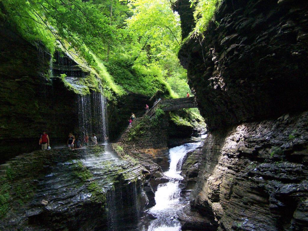
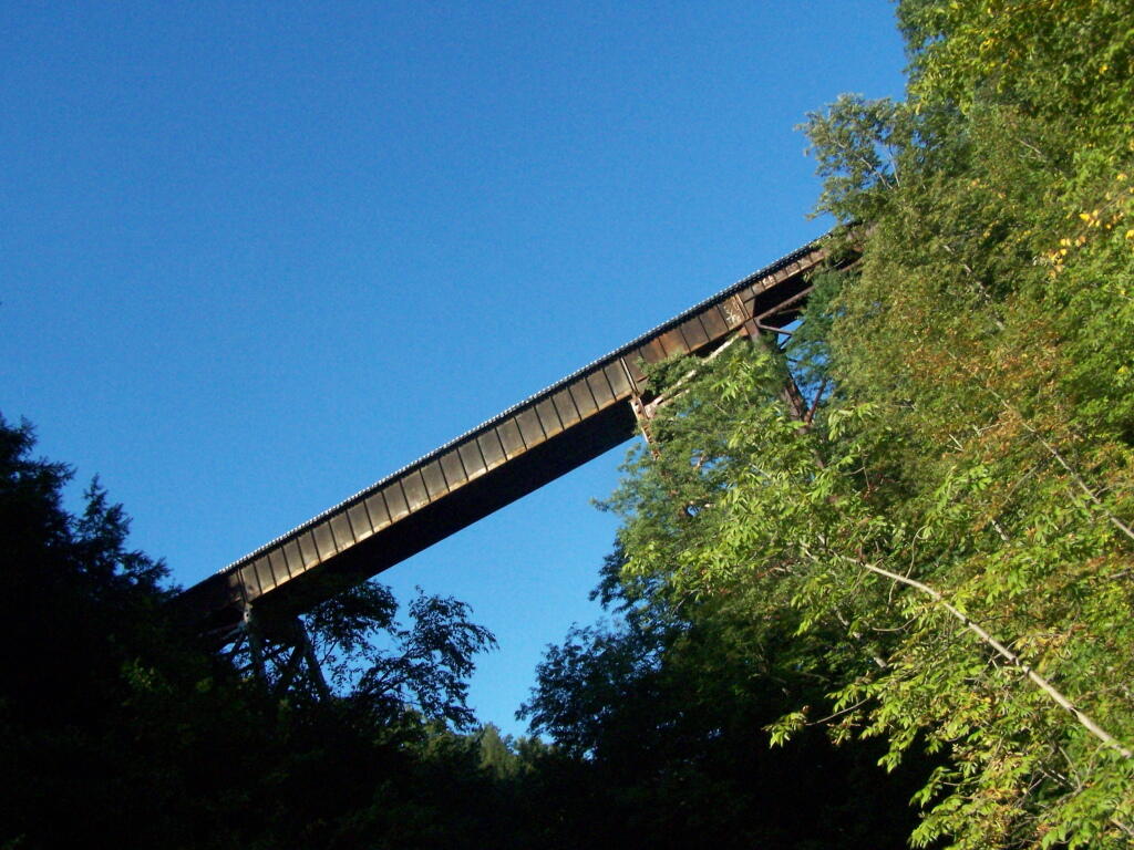
Moss Island was fun but the colors were just changing and it’s the third time I’ve been there so it’s less interesting now. Still a nice hike, as was doing some of the Erie Canal Trail through the deep railroad cut. 🚢 Japanese Knotweed is really taking over part of the gorge though. That invasive species is everywhere these days it seems. 🌾Went out for a short paddle on the Mohawk River from Little Falls past Moss Island to the old Fink Basin Bridge foundation. πŸŒ‰ It’s hard to spot the foundation at this point because the Japanese Knotweed is all over it. Needless to say, I’m very concerned about the Japanese Knotweed taking over everything. When they were pumping out the lock, the water Goya bit choppy but I was far enough away not to be real impacted. That Lock 17 drops 40 feet so it’s a pretty big lock with a lot of water to move downstream.

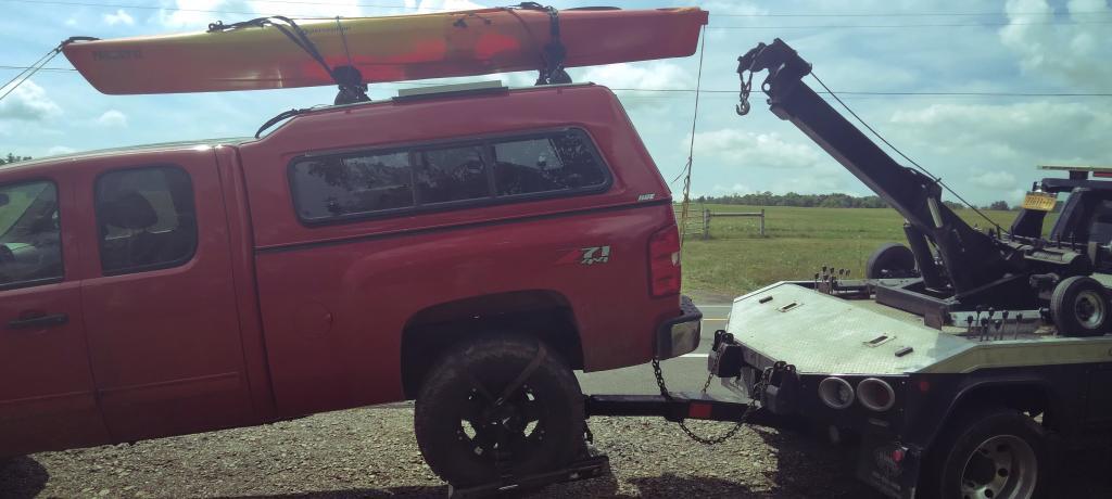
Leaving the Pine Bush hike I was a bit concerned about the squeak that was coming from the rear wheel of my truck. 🚚 It sounded like a brake noise because it changed when I applied the brakes. But they’re working fine and after a few good hard applies of the brakes they’ve mostly gone away. Think it’s either mud or maybe just glaze that’s built up from last week overheating the brakes heading down through Durham. Should have used a lower gear heading down the hill. Heading towards Stratford I smelled somebody burning their garbage and thought it might be the brakes but the smell went away after driving past their farm. Hillbilly incense getting me all upset. If y’all going to burn your plastic garbage, at least burn it in a hot fire so it don’t stink. πŸ”₯ I checked, rotators aren’t warm and aren’t dragging – and after a few hard braking the noise is mostly gone. But it’s concerning enough I scheduled an appointment to have it looked at. Pretty sure it’s just the drum brake mechanism is acting up.

Driving up to Pisceo-Powley Road from Little Falls I stopped and got some sweet corn 🌽 and tomatoes. πŸ… I then stopped at Green Acres Drive In and got Pumpkin Ice Cream πŸ¦πŸŽƒ which I swear the cream was a bit rancid. It was okay but I don’t think I’d get end of the season ice cream again from them.

I ended up camping at campsite five at Pisceo-Powley Road. β›Ί They cut up the tree that fell during that severe thunderstorm that came through ⚑ that mid August long weekend that I delayed my entry to avoid. I’m glad I missed that storm a lot of branches came down around this campsite but the DEC did a nice job cleaning up around the site. I like that campsite a lot because it’s remote and I can listen to music, 🎢 shoot guns πŸ”« and burn whatever I want without bothering folks. πŸ”₯Just like when I own my own land. No neighbors, no rules. πŸ“ But that doesn’t mean I’ll trash my own land. That said finding burnt out of aluminum cans wasn’t cool. I flattened them and will take home for recycling. It your going to burn stuff in the woods at least pack out what doesn’t burn completely. πŸš―β™» Outhouse seat also seemed like somebody broke it. A shame, the outhouse is only a year old. Still works but the wood in the seat is cracked. πŸ’Ί

The storm in August meant there was quite a bit of dead and down wood around camp. I had plenty for the fire. I always try to get wood a bit farther away from camp to save the close-by wood for other campers who get here late or myself for that matter. 🌲

Setting up camp went well but I discovered that I spilled bleach and water in my truck bed. Ruined another pair of jeans πŸ‘–. Ducks but I needed more jeans to wear on casual days to work. I can wear the bleached pair of jeans at home. Made some sweet sausage 🍣and mashed potatoes for dinner – along with sweet corn 🌽. I wanted to make angel hair pasta πŸ˜‡ with dinner but I forgot to pack butter.

Sun sets early this time of year but I had the mess cleaned up in my truck, dinner cooked and the lights strung by dark which occurred relatively late in the woods on this very clear day. πŸŒ‡ Still it was pitch black before 7:30 which made for a long night but with the two batteries powering the lights it wasn’t a big deal. I got things done that needed to be done by then including getting a fire going. πŸ”₯ Got cold and put the hoodie and long pants on. Even with the warm weather it gets cold at night. With the long night, I was shocked 😲 how quickly I drank the six pack I brought. 🍻 I wasn’t trying to get drunk but I made a lot of beer dissappear quickly. Oh well, I must have been thirsty and I slept it off. Minor hang over this morning.

This morning was quite nice I had eggs 🍳 and sausage along with coffee. β˜• It was a cold start but it warmed up relatively quickly. I ended up hanging out in the warm sun for a while, listening to the radio πŸ“» for a while and then swinging in the hammock while working on some blog posts.

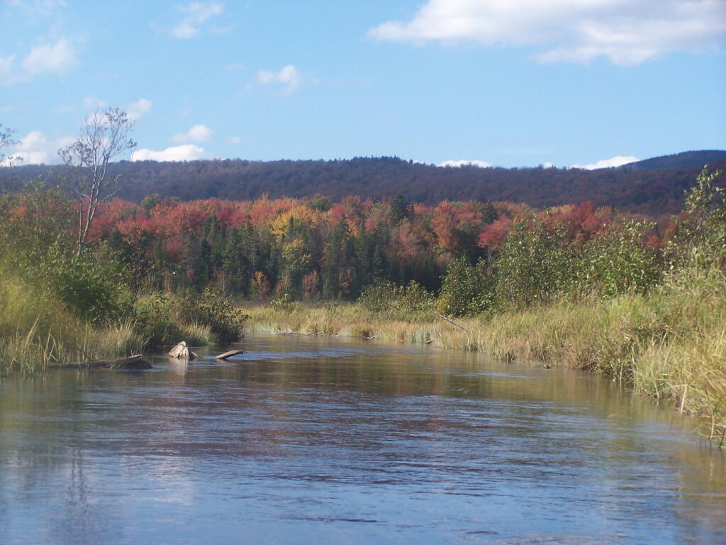
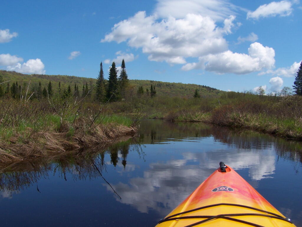
Midday I went for a kayak paddle down the East Canada Creek 🚀 and it was quite colorful and quiet out on the creek. Water levels were pretty low. But I made it over the beaver dam and the leaves were nice. 🍁 Didn’t bother with the fishing pole as I’ve never had much luck fishing there. Spent a little time at the potholers but it was quite cold and the sky had clouded up and it was getting late.

I got home, unpacked and scheduled an appointment for next week to have my truck looked at.πŸ”§ The noise seems to come and go but I think it’s getting worse so I should get it fixed. I’ll probably stay in town next week because I need to save money πŸ’΅ and I also I don’t want something to break while I am out of town.

I’ll post more photos πŸ“· and videos πŸŽ₯ throughout the week.

South Mountain

The Albany County Rail Trail

Several years back, the D&H Railroad abandoned the Slingerlands Railroad, that runs from the Port of Albany out to Altamont. This route had fallen out of favor for main freight line that runs from the Selkirk Railyard, north through Altamont.

Old Woods Road

I wasn’t a supporter of the rail trail, as I believe it will be an impediment in the future to preserve the right-of-away, for whatever future needs might come along — be it a bus rapid transit, a new rail line, or some future method of moving people and freight

I also maintain that rail trails are boring, overly straight routes, built for the convience of large locomotives pulling freight at high speeds, and not for recreational hiking or biking, at much lower speeds. Being that one can only bike or walk at speeds less then 25 MPH — and that bicycles aren’t even allowed yet — the trail seems relatively uninteresting at a walking speed.

Currently the rail trail runs from Slingerlands Fire Station down to the Delaware Avenue Bridge. West of Slingerlands Fire Station, the trail is posted No Tresspassing by the county, but east of Delaware Avenue Bridge, the trail is unmaintained but not posted.

Onondoga County Clerk 2023 - Emily A. Essi vs. Lisa Dell

Hiking under the Cherry Avenue Extension Bridge.

Onondoga County Executive 2023 - Marty Masterpole vs. Casey E. Jordan

One of the filled in areas where the rail line once run.

Getting Towed Away Again

Gully as seen from the rail trail viaduct.

Delaware Avenue Railroad Bridge (East)

Delaware Avenue as seen from the former Delaware Avenue Railroad Bridge (this ends the maintained section of the trail).

Elsmere Avenue from the Railroad Bridge

Elsmere Avenue as seen from the Railroad Bridge.

As a whole, I am very under impressed by the Albany County Rail Trail. I have heard the views

Adirondack Wild, Scenic and Recreational Rivers System

Today’s fodder is based on the text of the Adirondack Park State Land Master Plan that explains the Adirondack Scenic, Wild and Recreational Rivers System and the policies surrounding it quite well. — Andy

The Adirondack Park contains many rivers which, with their immediate environs, constitute an important and unusual resource. Classification of those portions of rivers that flow through state land is vital to the protection of existing free flowing streams. The classification system and the recommended guidelines specified below are designed to be consistent with and complementary to both the basic intent and structure of the legislation passed by the legislature in 1972 creating a wild, scenic and recreational rivers system on both state and private lands.

LED Driver built on perfboard as Arduino shield

Definitions

A wild river is a river or section of river that is free of diversions and impoundments, inaccessible to the general public except by water, foot or horse trail, and with a river area primitive in nature and free of any man-made development except foot bridges.

A scenic river is a river or section of river that is free of diversions or impoundments except for log dams, with limited road access and with a river area largely primitive and undeveloped, or that is partially or predominantly used for agriculture, forest management and other dispersed human activities that do not substantially interfere with public use and enjoyment of the river and its shore. A recreational river is a river or section of river that is readily accessible by road or railroad, that may have development in the river area and that may have undergone some diversion or impoundment in the past.

River Picks Up Speed As You End the Flow

Guidelines for Management and Use

Basic guidelines

1. No river or river area will be managed or used in a way that would be less restrictive in nature than the statutory requirements of the Wild, Scenic and Recreational Rivers Act, Article l5, title 27 of the Environmental Conservation Law, or than the guidelines for the management and use of the land classification within which the river area lies, but the river or river area may be administered in a more restrictive manner.

2. Rivers will be kept free of pollution and the water quality thereof kept sufficiently high to meet other management guidelines contained in this section.

3. No dam or other structure impeding the natural flow of a river will be constructed on a wild, scenic or recreational river, except for stream improvement structures for fisheries management purposes which are permissible on recreational and scenic rivers only.

4. The precise boundaries of the river area will be determined by the Department of Environmental Conservation, will be specified in the individual unit management plans for the river area or the areas, where the more restrictive guidelines of the particular area will apply) and with the following additional guidelines.

2. Access points to the river shore or crossings of the river by roads, fire truck trails or other trails open to motor vehicle use by the public or administrative personnel will normally be located at least two miles apart.

3. Other motor vehicle roads or trails in the river area will not be encouraged and, where permitted, will normally be kept at least 500 feet from the river shore and will be screened by vegetation or topography from view from the river itself.

4. The natural character of the river and its immediate shoreline will be preserved.

5. The following structures and improvements may be located so as to be visible from the river itself:

== fishing and waterway access sites;

== foot and horse trails and foot and horse trail bridges crossing the river; and,

== motor vehicle bridges crossing the river.

6. All other new, reconstructed or relocated conforming structures and improvements (other than individual lean-tos, primitive tent sites and pit privies which are governed by the regular guidelines of the master plan) will be located a minimum of 250 feet from the mean high water mark of the river and will in all cases be reasonably screened by vegetation or topography from view from the river itself.

7. Motorboat usage of scenic rivers will not normally be permitted but may be allowed by the Department of Environmental Conservation, where such use is already established, is consistent with the character of the river and river area, and will not result in any undue adverse impacts upon the natural resource quality of the area.

Recreational rivers

1. Recreational rivers and their river areas will be administered in accordance with the guidelines for management of wild forest areas (except where such rivers flow through wilderness, primitive or canoe areas, where the more restrictive guidelines of the particular area will apply) and with the following additional guidelines:

2. Where a recreational river flows through an intensive use area, structures, improvements and uses permitted in intensive use areas will be permitted, provided the scale and intensity of these intensive uses do not adversely affect the recreational character of the river and the river area.

3. The natural character of the river and its immediate shoreline will be preserved and enhanced.

4. The following structures and improvements may be located so as to be visible from the river itself:

== fishing and waterway access sites;

== docks;

== foot and horse trails and foot and horse trail bridges crossing the river;

== snowmobile trails, roads, and truck trails; and,

== motor vehicle bridges crossing the river.

5. All other new, reconstructed or relocated conforming structures and improvements (other than individual lean-tos and primitive tent sites which are governed by the regular guidelines of the master plan) will be located a minimum of 150 feet from the mean high water mark of the river and will in all cases be reasonably screened by vegetation or topography from view from the river itself.

6. Motorboat use of recreational rivers may be permitted, as determined by the Department of Environmental Conservation.

Cheney Pond Outlet

Designation of Wild, Scenic and Recreational Rivers

The application of the above definitions and criteria to rivers on state lands in the Park results in the current designation under this master plan of 155.1 miles of wild rivers, 511.3 miles of scenic rivers, and 539.5 miles of recreational rivers. A significant amount of private lands not covered by this master plan are included in these mileage figures. A brief description of these rivers and their classification is set forth in Chapter III.

River Wild Scenic Recreational
Ampersand Brook 8.6
Ausable — Main Branch 21.7
Ausable — East Branch 8.8 25.2
Ausable — West Branch 31.8
Black 6.8 5.8
Bog 6.2
Boreas 11.4
Bouquet 42.7
Bouquet — North Fork 5.9
Bouquet — South Fork 5.0
Blue Mountain Stream (Trib. of Middle Branch, Grasse River) 7.9
Cedar 13.5 13.0 10.4
Cold 14.5
Deer 5.7
East Canada Creek 19.3
Grasse — Middle Branch 12.9
Grasse — North Branch 25.4
Grasse — South Branch 36.1 4.2
Hudson 11.2 11.8 55.1
Independence 24.5
Indian (Trib. of Hudson River) 7.5
Indian (Trib. of Moose River — South Branch) 15.1
Jordan 15.7
Kunjamuk 7.1 9.1
Long Pond Outlet 16.3
Marion 4.4
Moose — Main Branch 15.0 11.0
Moose – North Branch 5.3 11.6
Moose — South Branch 33.6
Opalescent 10.4
Oswegatchie — Main Branch 14.9
Oswegatchie — Middle Branch 13.0 22.7
Oswegatchie — West Branch 7.2 6.3
Otter River 8.8
Ouluska Pass Brook 2.3
Piseco Outlet 3.8
Raquette 36.0 51.6
Red 8.0
Rock 6.4 1.3
Round Lake Outlet 2.4
St. Regis — East Branch 15.4 6.3
St. Regis — Main Branch 15.6 23.9
St. Regis — West Branch 31.5 5.5
Sacandaga — East Branch 11.3 12.6
Sacandaga — Main Branch 28.5
Sacandaga — West Branch 18.1 16.6
Salmon 11.6
Saranac 62.7
Schroon 63.9
West Canada Creek 7.4 17.1 9.1
West Canada Creek — South Branch 5.7 9.1
West Stony Creek 7.4 7.7
Total 148.4 487.2 545.6

Watkins Glen

I happened to be driving through Watkins Glen on my trip from the Finger Lakes National Forest to Sugar Hill State Horse camp, so I figured I would take a walk up the trail once again. I’ve been there before, but I figured this would be a chance to get photos when the light was better.

Watkins Glen Sign

The last time I was there it was early in the morning. This proved to be a problem for photograhpy, without a tripod, because it was so dark in there. It was much lighter in the middle of the day, abit much more crowded. It also was a very humid day out there.

Clove

In several sections of Watkins Glen the trail cuts through caves to get around mountain faces, then emereges out to the most beautifully lit green areas.

Green Cave

The trail follows the edge of the Glen, crossing it several times on beautiful stone bridges.

Bridge

The trail is beautifully designed and a pleasure to walk, although on a humid day like today, it was pretty hot, despite being largely in the shade.

Stairs Turn

The trail goes under several waterfalls, and after the week’s rainy days, it was pretty wet in spots.

Drip Drop

And almost magical scene in Watkins Glen. This whole area somewhat spirtual feeling, especially on the backdrop of such rich greens.

Stay Dry

When you reach the top of the glen, the waterfalls become farther appart and less steep and the creek is relatively flat.

Year of Peak Employment by County

At the top of the Glen is this old railroad bridge. It appears the line is actively used; it would be neat to capture a train going over the Glen. Maybe someday.

Railroad Bridge

Here is a map of the trail I walked in Watkins Glen.


View Hikes of 2009 in a larger map

Here are maps of Watkins Glen.