Search Results for: map south of cedar river flow

The Final Day at Moose River Plains

I thought my Moose River Trip was a pretty good one, even if I ran into some minor issues along the way.

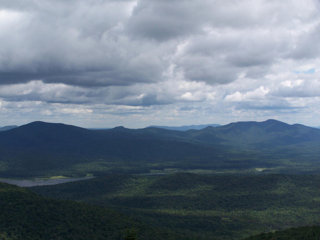
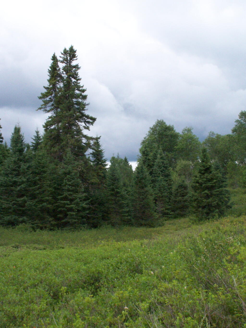
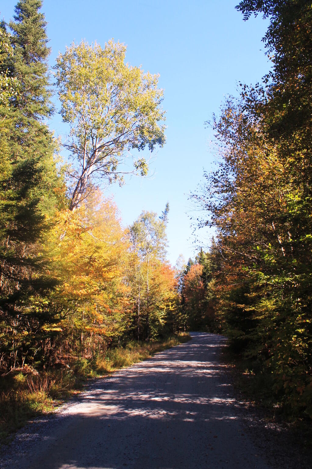
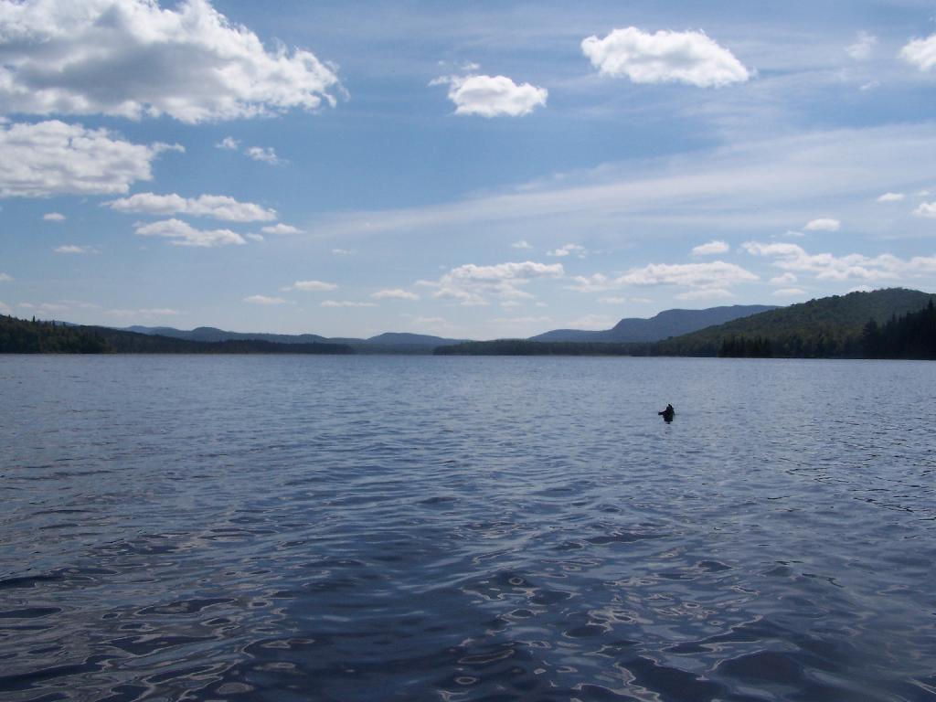
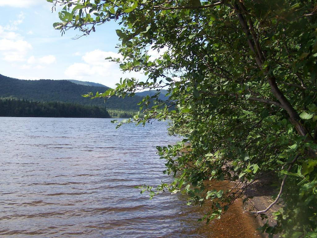
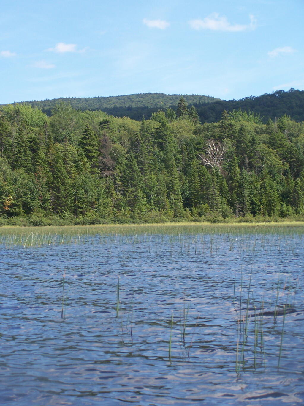
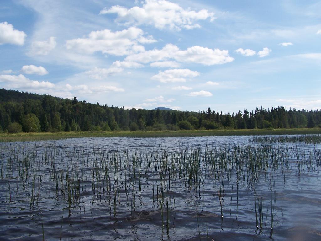
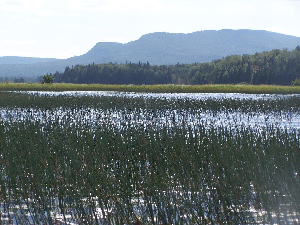
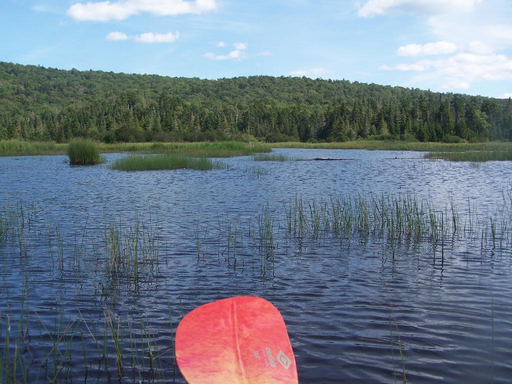
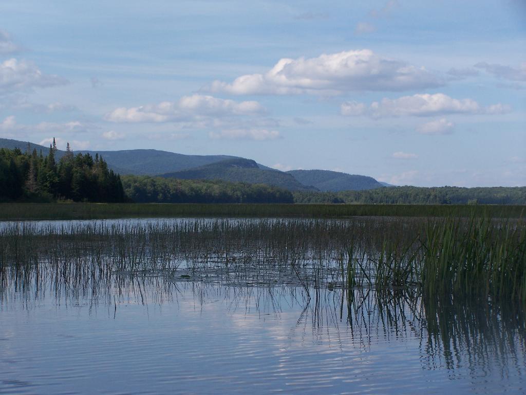
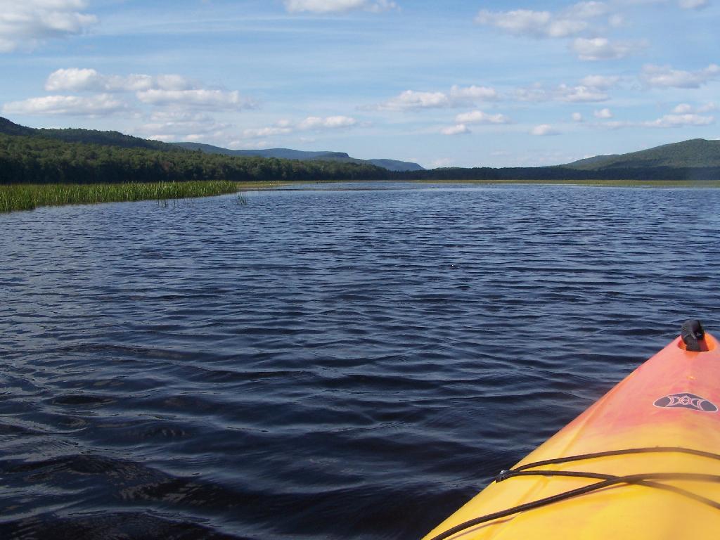
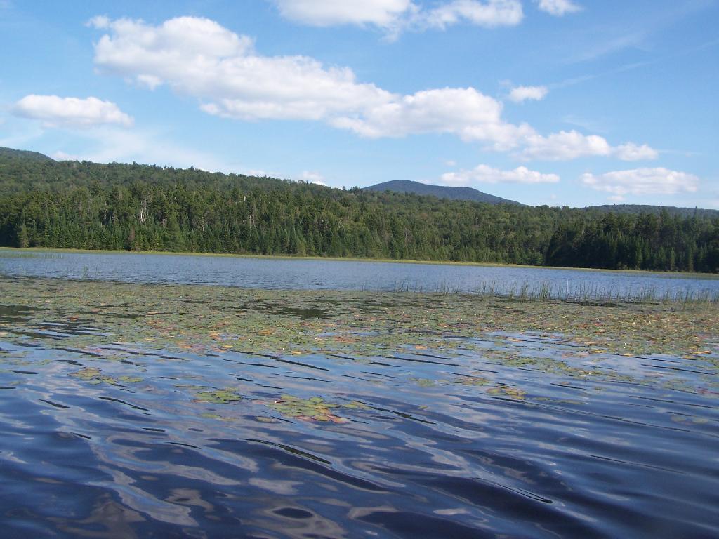
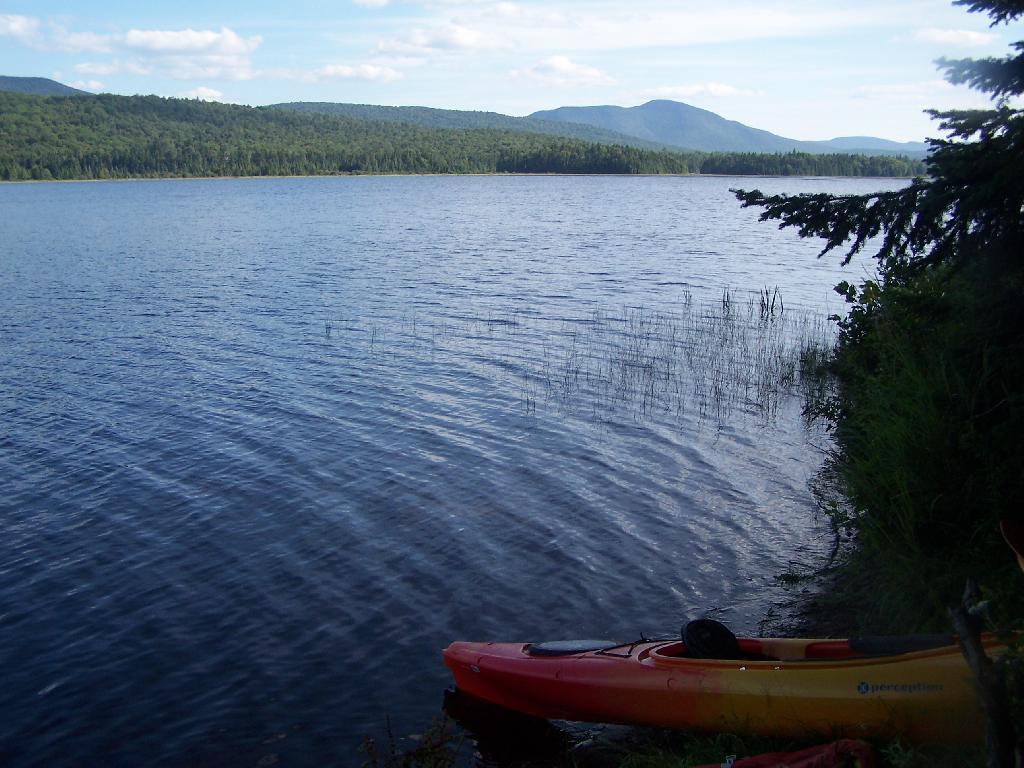
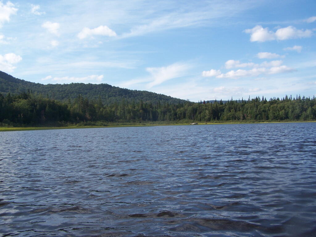
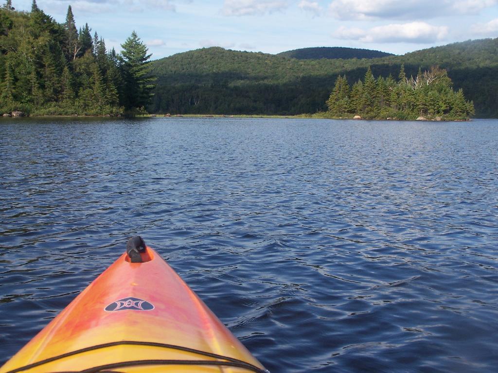
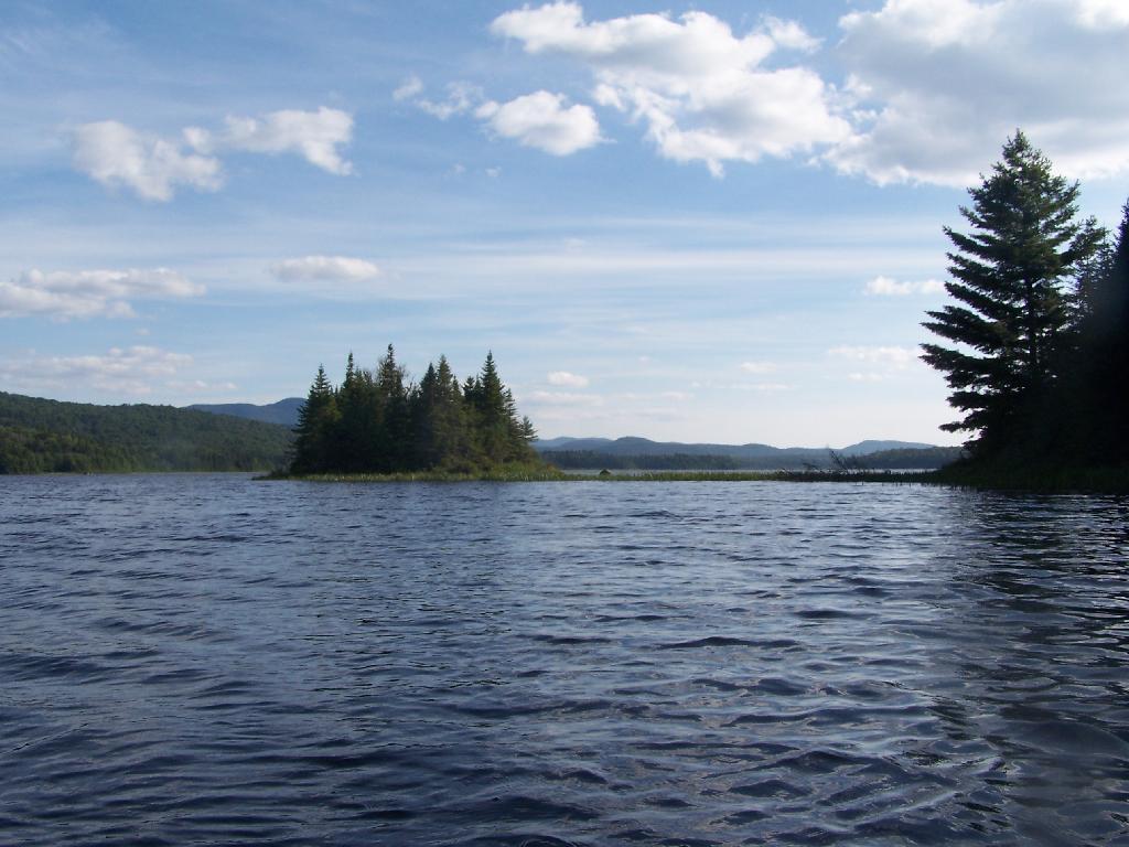
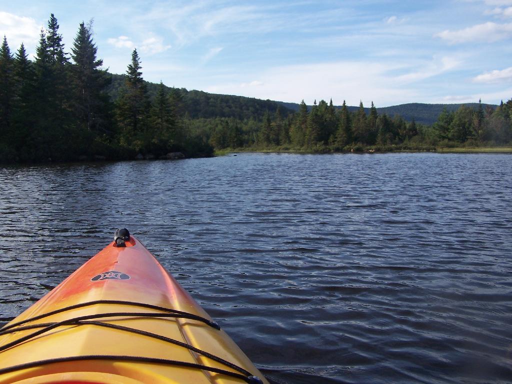
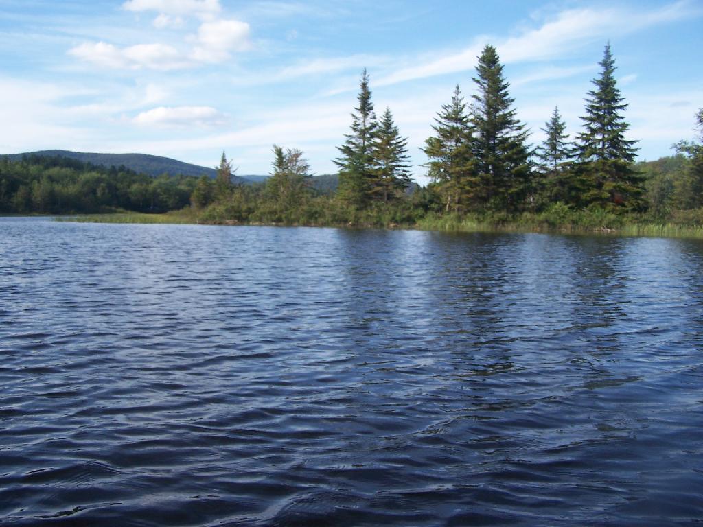
It was a pretty foggy start to my morning when I first woke up with the fog picking up right before eight AM then burning off a little while after the sun rose. While Friday and Saturday nights were fairly chilly the same could not be said about last night. Yesterday was pretty nice paddling along the Cedar River Flow then up on Cedar River to Carry Lean-To, which as the name suggests is close to the end of the navigable waters on the river. Maybe you can “carry” and get to another section of deep enough water but I have my doubts. The leaves along the flow were quite colorful, although the mountains surrounding the flow where already past peak and starting to turn quite brown and gray, with only some deep reds from the maples and greens from the evergreens remaining. It seems ironic that Moose River Plains is already looking like late fall, with the weather still in the 80s. Cool weather, some with a frost in early September made the leaves fall on many of the trees, despite the big warm up of this weekend.

While I don’t know how truly warm it got up here on Sunday — September 24th I should note — my phone said it was 87 degrees by mid afternoon, and the water in the Cedar River wasn’t super cold. I went swimming every day I was up here. The weather this weekend was warmer then it was when I camped up here over the Independence Day Weeekend. So be it.

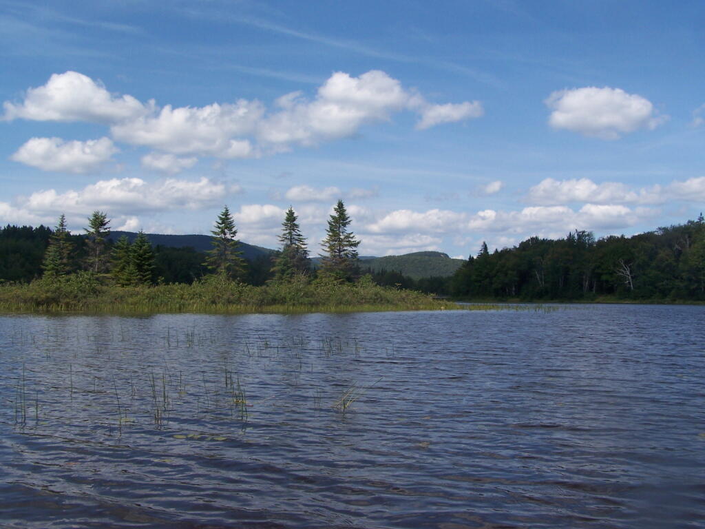
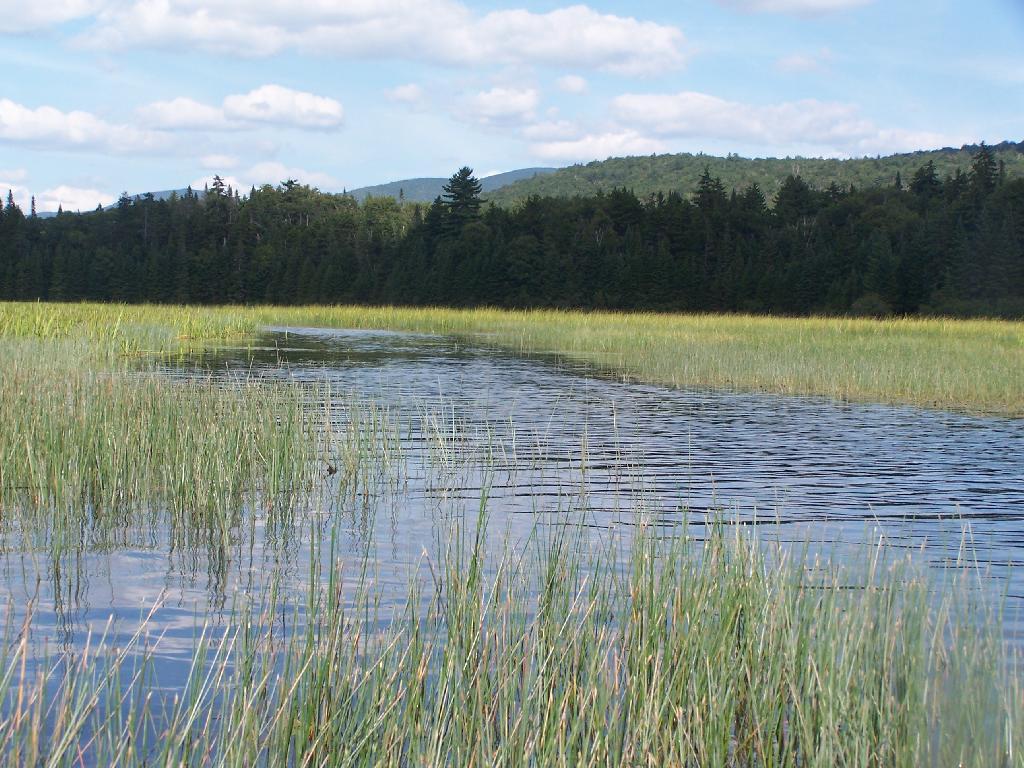
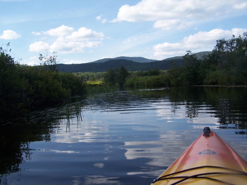
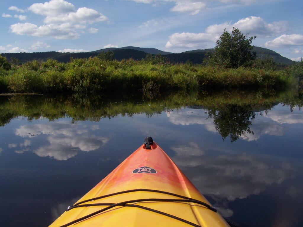
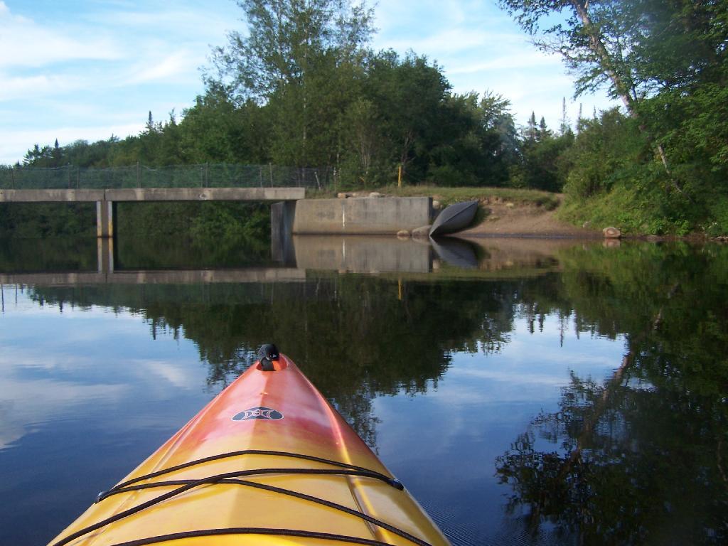
I got lost in the muck and vegetation looking for the Cedar River, which if your inexperienced paddling or been a while since the last time on the Cedar River Flow can be quite difficult to find. Fortunately I saw a passing kayaker and he gave me verbal advice on how to find the river. I had a topographic map on my phone but it’s only of limited use, because topographic maps are old, and do not reflect the lower lake level since the DEC put in the modern dam in 1969.

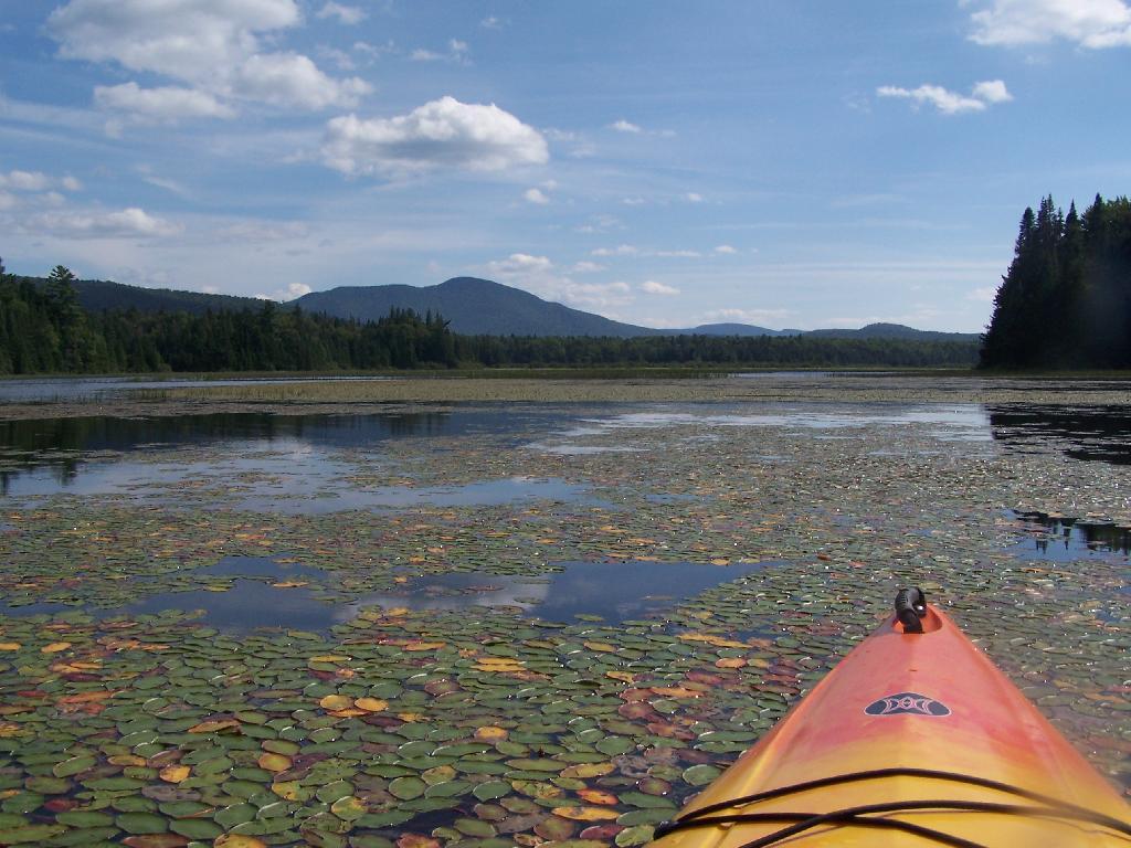
There was a dreaded beaver dam on the Cedar River, only a short distance from the entrance from the flow. I am really quite surprised a beaver dam survived the boats crossing the area and the trappers seeking beaver pelts. I guess beaver pelts haven’t been fetching the price they once did, and with less human pressures, beavers are able to build an dam up whatever they want these days.

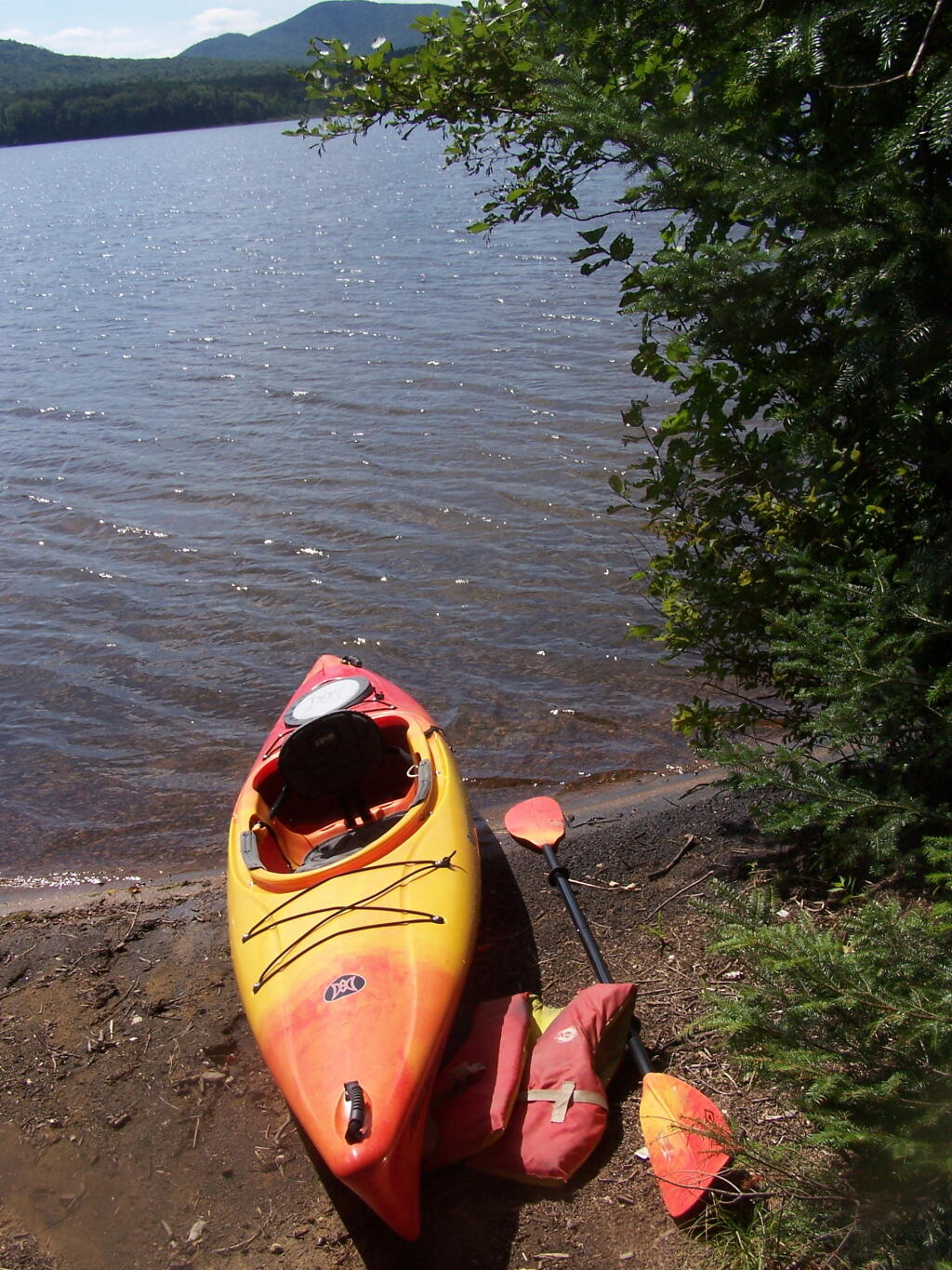
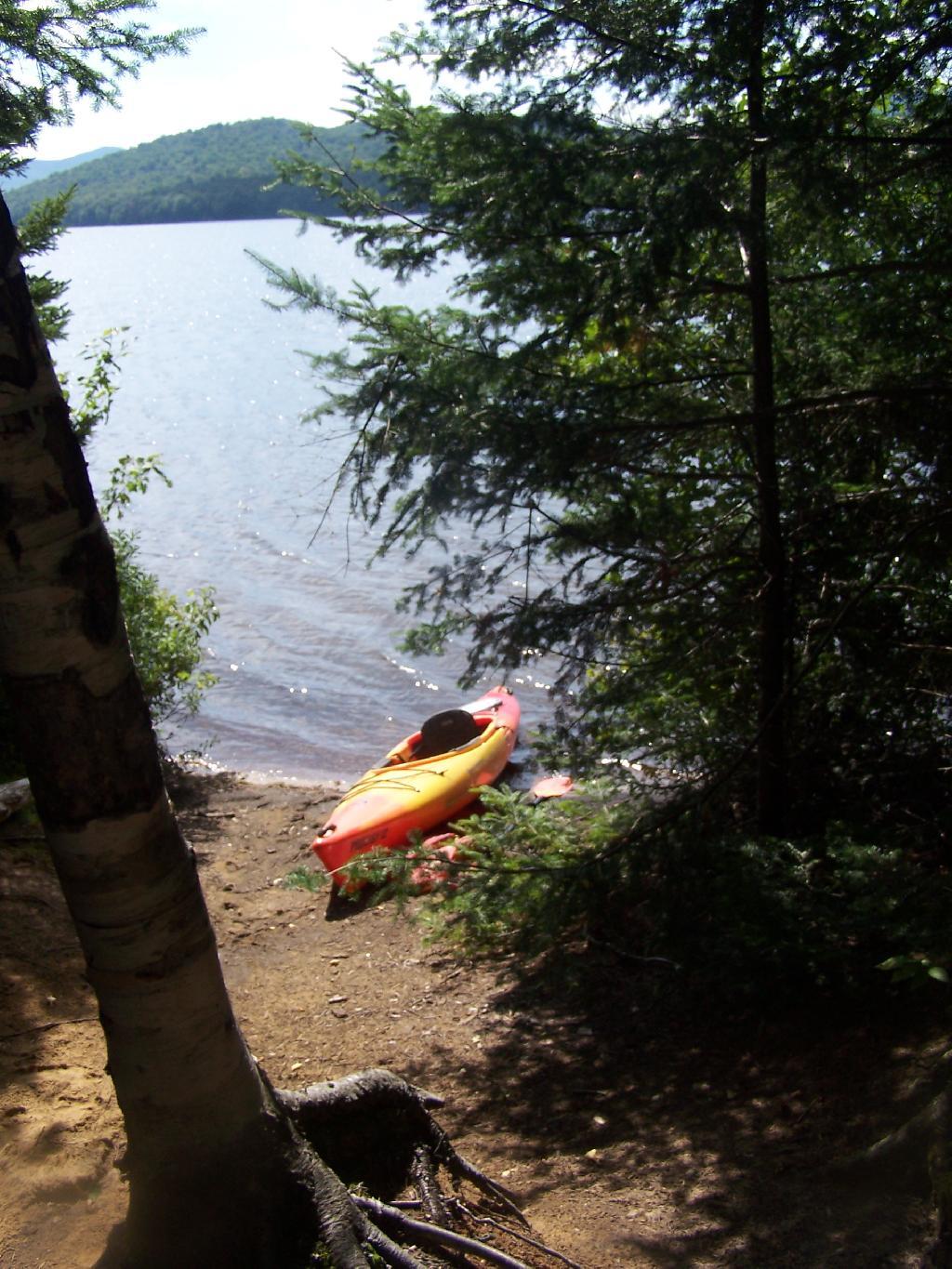
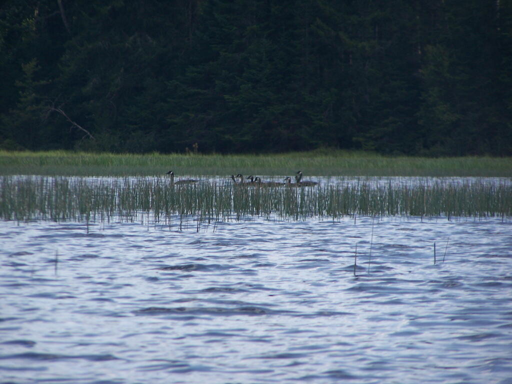
Coming back over the Beaver Dam the second time, I managed to flip my kayak getting back into it. My smartphone stayed plenty dry in it’s protective bag, but my camera and tackle box got soaked. Well, only briefly, but my camera is drying out and I assume in a day or two it will be fine to power back up again. So for the last day of my trip, I am limited to smartphone pictures.

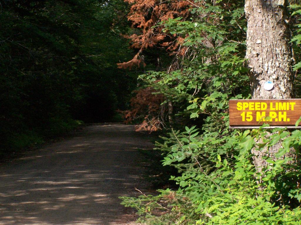
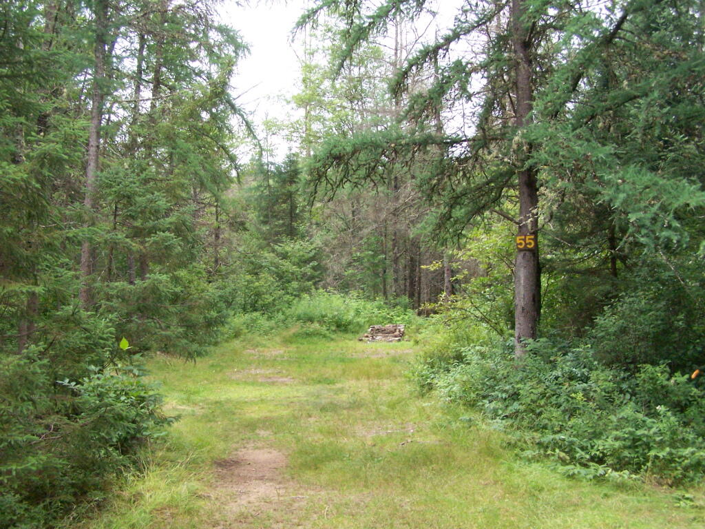
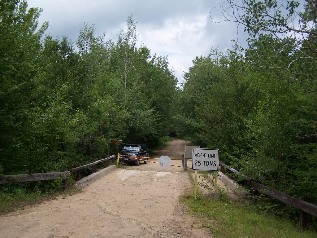
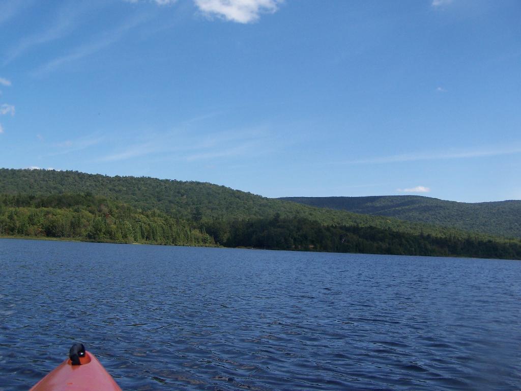
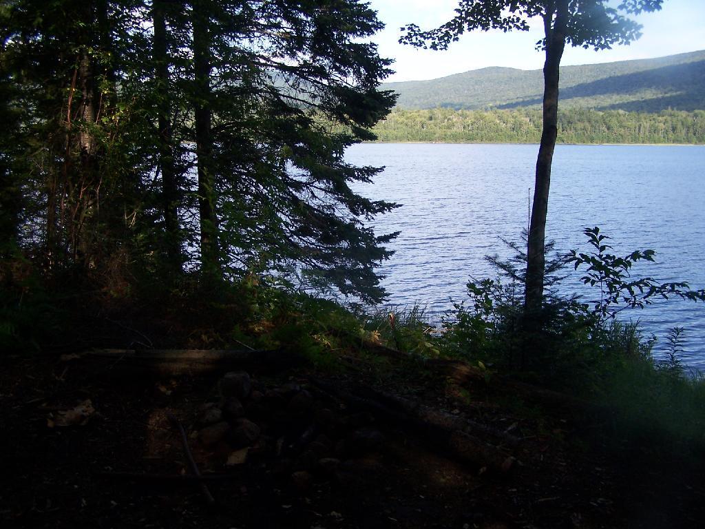
I haven’t paddled the Cedar River Flow in a while because I have been spending more time up in the western end of Moose River Plains, and it’s a big haul back there. At 15 MPH speed limit, it takes almost an hour. From Wakely Dam to Carry Lean-to, it’s an hour and a half paddle, assuming you find the entrance to the river with ease and don’t stop for an hour for lunch, personal business on the smartphone, and of course updating social media. I know, hah. But there is good AT&T GSM access from the upper end of Cedar River Flow, especially near Campsite 6. That’s not as common in much of the Moose River Recreation Area.

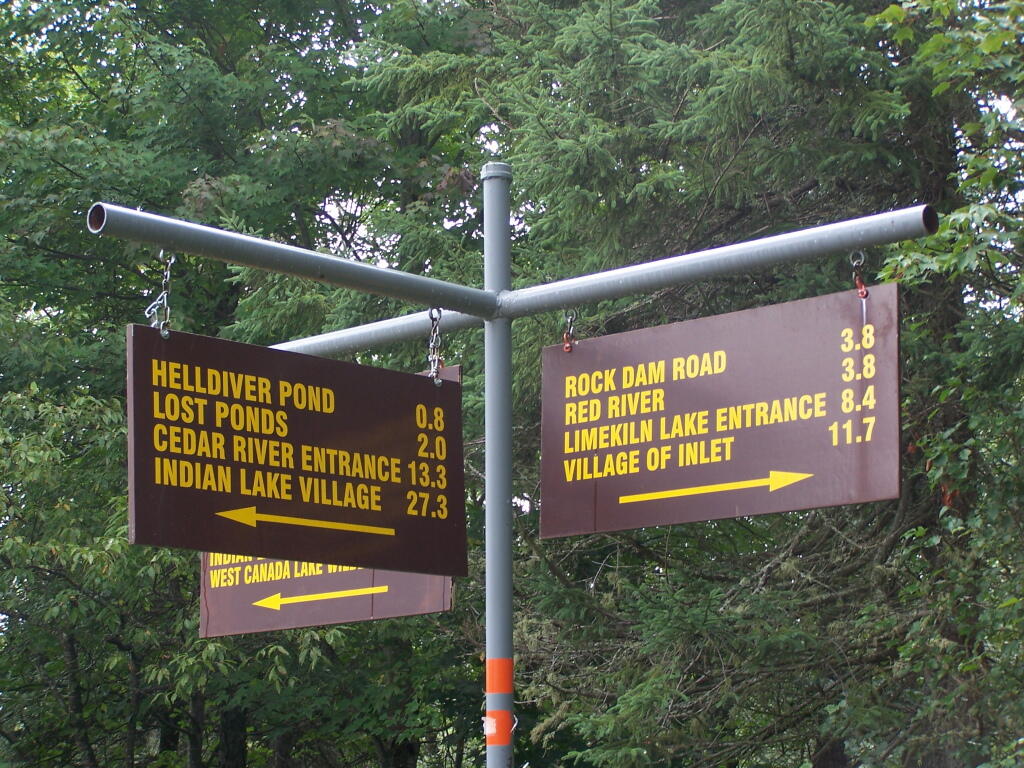
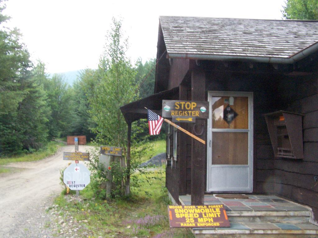
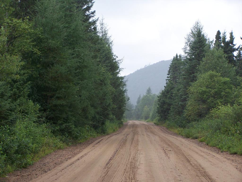
Driving to the Cedar River Flow from the camping area in the western part of the Moose River Plains near Helldiver is an hour long proposition, which is why I haven’t spent much time there lately. I’ve also been spending more time exploring things around Inlet, in part because I like being able to check my phone to see if any family or work things come on up. I also get a bit tired of all those bumpy miles of 15 MPH road, especially now that I know Cedar River – Limekiln Lake Road like the back of my hand.

I cooked up some beef, cheese and chilies, and had some more burritos with Corona beer. After a few beers, with the hot sun all day, the five hours of paddling, I watched the fire for a bit then I retired for the night. I was probably in bed by nine. Which seems silly, as it was it was a pleasant evening with billions of stars above and temperatures in the 60s, but I felt like I needed toothpicks to keep my eyes open. I’ve also been trying to get more sleep these days.

In the past few years, I’ve camped up at Moose River Plains but it’s been at least two years since I camped in the plains formal — the area where the campsites are sand, the canopies are open and the surrounding area is quite swampy. The reason for not camping up here is quite simple — the bugs can be quite horrific during the spring and early summer — while the surrounding wooded sites tend to be bug free or have much fewer mosquitoes. It can be like night or day, especially in black fly season.

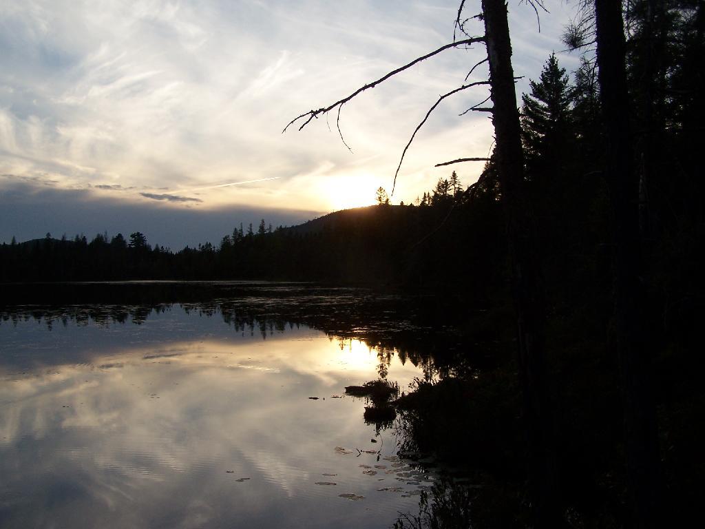
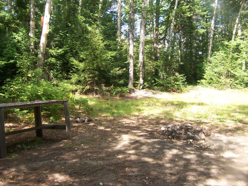
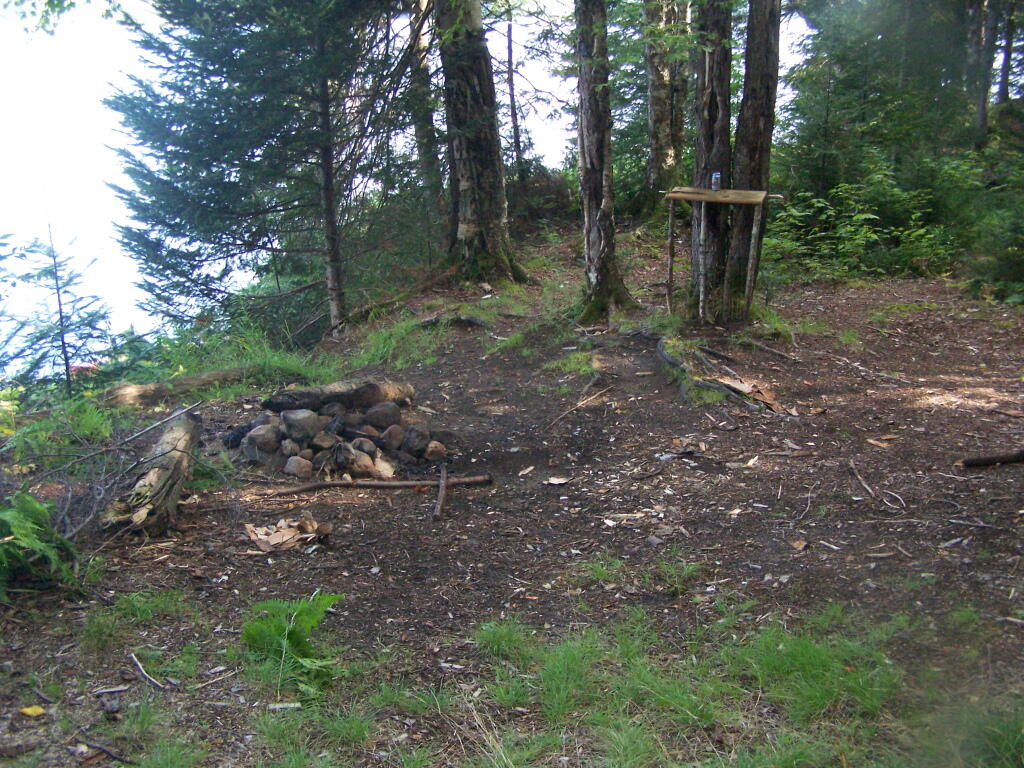
That said the “plains” campsites just are a special place to camp at with the big starry skies above in the remote country. I really enjoyed campsite 80, and should try to make sure to camp up here more often.

Broke camp before ten, walked down to the Moose River. Cooked up biscuits in the camp oven, took down the flags, put away the gear, hung out the wet stuff to dry, worked on the blog post, and once the fog burnt off it was a beautiful but rapidly warming morning as the leaves continued to fall.

First tried my hand at fishing the Moose River from the path behind my campsite, then I drove to the bridge over the Moose River and fished under there. Caught nothing. Hiked back from the Squaw Lake parking area first to Muskrat Pond and then to Indian Lake, that is the one in the southwestern most part of Moose River Plains. Nice hike, although at this point some of the colors are already done. Other places, less color. It varies a lot with elevation. But regardless the weather on this extended weekend has been amazing.

I tell you there aren’t many 80 degree days during the last week of September in the Adirondacks. It was nice sitting down by the lake with a fishing pole, even if I only caught a few bullheads. No mosquitoes which was nice too. And I almost slipped and fell in the lake which honestly today wouldn’t have been the worse thing. They’ve removed most of the signs and tables from the old campsites along the closed portion of Indian Lake Road, even if it’s in better condition than the open portion. The open portion of Indian Lake Road has been beat to shit by trucks and cars due to it being so wet and rainy this summer. Good colors along the road though. Definitely a beautiful day, not too humid with a lot of fair weather clouds.

Apparently I don’t have cell service up at Indian Lake or Muskrat Pond with my GSM phone like my old CDMA model. That’s fine but I do like to check in with the world from time to time. Oh well, by the time you read this I will be back in cellphone range.

I was looking at the map and thinking I have never hiked back to the Indian River. IΒ didn’t have time today but I should add that to my list for next summer. Also hiking back to Cellar Pond by Cellar Monument now that the DEC has a big sign announcing the trail and they’ve blocked off the old dirt track used by hunters to drive down that way. I always go to the same places at Moose River Plains, I should explore new places.

After visiting Muskrat Pond, Indian Lake, and Squaw Lake I made it back to my truck closer to four PM then three. And I was at the Inlet gate around five, when I stopped and put the front and back ropes back on the kayak, and headed back via Old Forge.I didn’t feel like driving all the way back through Moose River Plains to Indian Lake, and heck, I haven’t been back via NY 28 in a long time.

Driving back through Inlet and Old Forge was really quiet. It was nice to be on the nice smooth black top, after driving over Indian Lake Road, the little used and little maintained section between the Falls Pond and Squaw Lake Trailhead was particularly rough. The sound of windshield washer fluid hitting the kayak on NY 28 made me pull over, but it was just that noise, the kayak was riding fine. But in general it seemed like all of the roads at Moose River Plains were rougher then usual after such a wet summer, with some heavy rains eroding away the roads and vehicles giving the road a good pounding in spots.Β Β I thought there was a McDonalds in Old Forge where I could get a milk shake, but I couldn’t find it.

NY 28 except for the small towns is really a good road, if not boring. The DOT has straightened and improved much of the road except through the small towns. Without summer vacationer traffic and being a weekday, there was very little traffic. I always like that section of NY 28 when it meets up with NY 12 south of Alder Creek, and becomes a four lane, but I think people always seem to speed on it and there are always cops watching for speeders. But the scenery is nice along this section of the road, looking down at the Mohawk Valley and the rough farm country, and swamp land of the greater Remsen area. I always find the rocky, rough farms cut into the mountains to be much more interesting to look at then the lush, more heavily capitalized and better maintained farms of the lush alluvial valleys you see in some parts of the state. The Tug Hill, in it’s upper elevations is a rough country, with lots of snow, and very hardy people. A big black F-350 Harvey Davidson edition passed by with Agriculture plates, and I had to think, “he must do some good shit, “no pun intended”.

Drove down to Poland and Middleville via NY 28. I like this part of NY 28 even if the villages are pokey, just because it’s pretty along the East Canada Creek. I should try my hand trout fishing there one spring — I just got to find a good place to camp up that way — it’s a bit of a trip for a day trip from Albany in my opinion. Middleville is quite the quaint little town, reminding me of what America used to be like.

Then it was down to NY 169 to Little Falls from Herkimer. I like this section of road, even though it’s hilly, because it’s quite beautiful. I like seeing the farms and valleys, and a landscape that works but isn’t that perfect, and still somewhat rough. Drove through Little Falls, a nice little but struggling city that has much potential. Yeah, I was there last weekemd at Moss Island, then onwards toward the Thruway. Stopped at Fink Basin Road to tighten the kayak on the roof of my truck.

Right before getting on the Thruway, I decided to shun pike some more, and take NY 5S from the Little Falls exit to Canjahoharie. I don’t like having to drive through Fort Plain and then Canjahoharie before getting onto he Thruway, but so be it. I do like that section of NY 5S high above the valley though. Some farms in the valleys haven’t cut silage yet due to the high temperatures (more growing seasons, more yields) and lack of frost.

When I got to Fort Plain I almost stopped at the Red Dragon Chinese place. I like Chinese and they tend to be inexpensive. People always think small town Chinese places are bad, but actually some can be pretty good, especially if families are trying to make a living in a place with few other options. I liked the Chinese I got in Canastota when I was working there, but then again, I got awful tasting Chinese food in North Syracuse. I don’t know, I passed as it was getting dark and I wanted to get home.

When I got on the Thruway at Canjahoharie it was getting pretty dark. My eyes were watering up and I ended up stopping at the rest area outside of Amsterdam. Took a piss and washed my hands good — nice bathrooms — then went into my truck and cleaned off my contacts and reinstered them. That made the rest of the drive easier.

Got home around 8 PM and things unpacked, well mostly so, before the heat started to get to me. Then I took a shower, and finished up this blog post. And here we are now.

My current smartphone isn’t as good at picking up distant radio channels and I didn’t play with it much so I missed hearing the news during my extended weekend trip at Moose River Plains. I doubt I missed much, most of the things in the news don’t effect me much. I’m sure my political Facebook friends will post plenty of memes to fill me in on what I’ve been missing.

Links to NYS DEC Webpages on State Land and Topographic Maps πŸ—Ί 🌳

Here is an updated list of state land websites for March 2023. The topographic map links will bring you to the latest USGS Topographic Maps for the area, or you can use the listing to bulk download the maps or get the quads you need from USGS Store or your local map seller.

Facility Acres UMP USGS Topographic Map Quads (50-60 MB PDF)
Albany
Albany Pine Bush Preserve 1,918 Pine Bush Albany, Schenectady, Voorheesville
Black Creek Marsh WMA 580 Voorheesville
Catskill Creek Fishing Access 1 Durham
Coeymans Creek WMA 718 Delmar, Ravena
Cole Hill State Forest 858 Albany Westerlo
Five Rivers Environmental Education Center 445 Five Rivers Env Ed Center Clarksville
Louise E. Keir WMA 188 Louise E. Keir HMP Clarksville
Margaret Burke WMA 246 Margaret Burke HMP Altamont
Onesquethaw Creek Fishing Access 0 Delmar
Partridge Run State Forest 935 Albany Rensselaerville
Partridge Run WMA 8,231 Partridge Run HMP Rensselaerville, Westerlo
Rensselaerville State Forest 5,142 Albany Durham, Rensselaerville
Allegany
Allen Lake State Forest 4,849 Allegany Angelica, Fillmore
Alma Pond 130 Allentown, Wellsville South
Bald Mountain State Forest 763 Allegany West Almond
Bully Hill State Forest 7,048 Allegany Alfred, Hornell
Cold Creek State Forest 496 Allegany Pike
Coyle Hill State Forest 4,691 Allegany Angelica, Belmont
Crab Hollow State Forest 2,301 Allegany Black Creek, Rawson
English Hill State Forest 2,789 Allegany Birdsall, Fillmore
Gas Springs State Forest 4,551 Allegany Birdsall, Canaseraga
Genesee River Wildlife Management Area 318 Wellsville South
Genesee Valley WMA 717 Portageville
Gillies Hill State Forest 4,656 Allegany Birdsall, West Almond
Hanging Bog WMA 9,120 Hanging Bog HMP Black Creek, Rawson
Hanging Bog WMA – Showy Lady Slipper 2 Black Creek
Hiltonville State Forest 3,029 Allegany Alfred, Canaseraga, West Almond
Jersey Hill State Forest 1,092 Allegany West Almond
Karr Valley Creek State Forest 3,831 Allegany Alfred, West Almond
Keeney Swamp State Forest 2,411 Allegany Birdsall
Keeney Swamp WMA 1,232 Keeney Swamp HMP Birdsall, Canaseraga
Klipnocky State Forest 5,422 Allegany Alfred, Canaseraga
Lost Nation State Forest 5,400 Allegany Bliss, Freedom, Houghton, Pike
Palmer’s Pond State Forest 5,441 Allegany Alfred, West Almond
Phillips Creek State Forest 10,916 Allegany Alfred, Andover, Wellsville North, West Almond
Plumbottom State Forest 1,680 Allegany Wellsville North
Rush Creek State Forest 1,405 Allegany Black Creek
Slader Creek State Forest 1,225 Allegany Canaseraga
Swift Hill State Forest 1,571 Allegany Houghton
Turnpike State Forest 9,522 Allegany Alfred, West Almond
Vandermark State Forest 4,850 Allegany Andover, Wellsville North
Wag Trail 148 Allegany Wellsville South, Whitesville
Bronx
Bronx River Trail 1 Central Park, Flushing
Broome
Beaver Flow State Forest 2,053 Chenango Trail Belden, Brisben
Beaver Pond State Forest 2,372 Broome Afton, Gulf Summit, North Sanford
Cascade Valley State Forest 534 Broome Gulf Summit
Cat Hollow State Forest 760 Broome Deposit
Hawkins Pond State Forest 538 Broome Windsor
Kirkwood Sub-Office 10 Binghamton East
Marsh Pond State Forest 1,794 Broome Afton, Gulf Summit
Melondy Hill State Forest 1,983 Treaty Line North Sanford
Nanticoke Creek Fishing Access 1 Maine
Nanticoke Lake Multiple Use Area 339 Long Pond Lisle
Oquaga Creek Fishing Access 0 Deposit
Skyline Drive State Forest 1,066 Broome Binghamton East, Windsor
Susquehanna Waterway Access 1 Windsor
Tracy Creek State Forest 507 Broome Endicott
Triangle State Forest 1,988 Long Pond Smithville Flats, Whitney Point, Willet
West Branch Delaware River Waterway Access 3 Deposit
Whitaker Swamp State Forest 808 Broome Deposit
Cattaraugus
Bear Creek State Forest 562 Cattaraugus Franklinville
Birch Run Ponds Fwma 39 Knapp Creek
Boyce Hill State Forest 979 Cattaraugus Ashford
Bryant Hill State Forest 511 Cattaraugus Ashford
Bucktooth State Forest 2,281 Cattaraugus Little Valley
Bush Hill State Forest 11,295 Cattaraugus Delevan, Franklinville, Freedom, Rawson
Cattaraugus Creek Waterway Access 5 Collins Center
Cattaraugus State Forest 1,061 Cattaraugus Cattaraugus
Conewango Creek Waterway Access 267 New Albion
Conewango Swamp WMA 1,403 Kennedy, Randolph
Dobbins Memorial State Forest 2,206 Cattaraugus Cattaraugus, Ellicottville
East Otto State Forest 1,382 Niagara Frontier Collins Center
Elkdale State Forest 432 Cattaraugus Little Valley
Farmersville State Forest 1,148 Cattaraugus Freedom
Golden Hill State Forest 5,772 Cattaraugus Ashford, Franklinville, Humphrey
Harwood Lake Mua 602 Harwood Lake HMP Delevan, Freedom
Ischua Creek Fishing Access 1 Franklinville
Lime Lake Outlet Fishing Access 0 Delevan
Mansfield Creek Fishing Access 0 Cattaraugus
Mccarty Hill State Forest 6,399 Cattaraugus Ellicottville, Salamanca
Nine Mile Creek State Forest 6,681 Cattaraugus Humphrey, Knapp Creek
Pine Hill State Forest 1,142 Cattaraugus Steamburg
Poverty Hill WMA 1,106 Ellicottville
Raecher Hill State Forest 842 Cattaraugus Humphrey
Randolph Fish Hatchery 62 Randolph
Rock City State Forest 2,918 Cattaraugus Salamanca
South Valley State Forest 8,728 Cattaraugus Ivory, Steamburg
Windfall Creek State Forest 2,930 Cattaraugus Humphrey, Limestone, Salamanca
Zoar Valley Multiple Use Area 2,524 Zoar Valley Mua Collins Center, Gowanda
Zoar Valley Unique Area 2,992 Zoar Valley Mua Collins Center, Gowanda
Cayuga
Bear Swamp State Forest 5,642 Hewitt-Cayuga Highlands Sempronius, Spafford
Carpenter Falls Unique Area 37 Hewitt-Cayuga Highlands Spafford
Cross Lake Islands WMA 0 Jordan
Dutch Hollow Brook Parking Area 0 Owasco
Frozen Ocean State Forest 753 Hewitt-Cayuga Highlands Owasco
Northern Montezuma WMA 5,348 Montezuma, Victory
Owasco Flats WMA 52 Moravia
Owasco Lake Inlet Fishing Access 7 Moravia
Owasco Lake Water Access 9 Owasco
Seneca River Boat Launch 3 Weedsport
Summer Hill State Forest 8,842 Hewitt-Cayuga Highlands Moravia, Sempronius
Chautauqua
Alder Bottom WMA 820 North Clymer
Bear Lake Boat Launch 4 Hartfield
Boutwell Hill State Forest 2,965 Chautauqua County Hamlet
Brokenstraw State Forest 1,900 Chautauqua County North Clymer, Panama
Canadaway Creek Nature Sanctuary 33 Dunkirk
Canadaway Creek WMA 8,759 Canadaway Creek HMP Cassadaga, Dunkirk, Forestville, Hamlet
Chatauqua Creek Fishing Access 6 Westfield
Chautauqua Fish Hatchery 69 Chautauqua
Chautauqua Gorge State Forest 547 Chautauqua County Sherman
Chautauqua Lake Fish And Wildlife Management Area 134 Chautauqua, Ellery Center
Clay Pond WMA 215 Jamestown
Clear Creek Fishing Access 2 Hamlet
Dunkirk Office 6 Dunkirk
Findley Lake Waterway Access 0 Clymer
Harris Hill State Forest 3,504 Chautauqua County Gerry, Hamlet, Kennedy
Hartson Swamp WMA 199 Gerry, Jamestown
Hatch Creek State Forest 2,567 Chautauqua County Gerry, Hamlet
Hill Higher State Forest 1,160 Chautauqua County Panama
Jacquins Pond WMA 31 North Clymer
Kabob WMA 37 Kabob HMP Cassadaga
Mount Pleasant State Forest 1,539 Chautauqua County Sherman
North Harmony State Forest 5,150 Chautauqua County North Clymer, Panama
Panama State Forest 2,449 Chautauqua County North Clymer, Panama
Stockton State Forest 1,968 Chautauqua County Cassadaga, Hartfield
Watts WMA 1,395 Panama
Wellman Multiple Use Area 447 Chautauqua County Lakewood
Whalen Memorial State Forest 5,387 Chautauqua County Chautauqua, North Clymer, Panama, Sherman
Chemung
Big Flats WMA 241 Great Divide Seeley Creek
Catharine Creek Fishing Access 3 Montour Falls
Catlin State Forest 607 Great Divide Big Flats
Maple Hill State Forest 1,191 Great Divide Waverly, Wellsburg
Chenango
Ambler State Forest 642 Between Rivers Holmesville
Balsam Swamp State Forest 5,359 Five Streams East Pharsalia, Pitcher
Basswood State Forest 935 Between Rivers Oxford
Beaver Meadow State Forest 5,816 Northern Chenango Highlands Otselic
Berry Hill Radio Facility 1 East Pharsalia
Bobell State Forest 2,159 Chenango Trail Brisben
Bucks Brook State Forest 2,178 Northern Chenango Highlands South Otselic
Bumps Creek State Forest 527 Chenango Trail West Bainbridge
Coventry State Forest 2,337 Chenango Trail Brisben, West Bainbridge
Five Streams State Forest 9,946 Five Streams Pitcher, Smithville Flats
Genegantslet Creek Fishing Access 0 Smithville Flats
Genegantslet State Forest 6,405 Mcdonough Smithville Flats, Tyner
Hunts Pond State Forest 2,748 Between Rivers Holmesville, New Berlin South
Lincklaen State Forest 5,903 Northern Chenango Highlands Pitcher, South Otselic
Long Pond State Forest 3,185 Long Pond Smithville Flats
Ludlow Creek State Forest 3,197 Mcdonough Tyner
Lyon Brook State Forest 527 Between Rivers Oxford
Mcdonough State Forest 12,700 Mcdonough East Pharsalia, Tyner
Melondy Hill State Forest 6,052 Treaty Line Afton, North Sanford
Oak Ridge State Forest 1,130 Chenango Trail Sidney, West Bainbridge
Otselic State Forest 2,082 Northern Chenango Highlands Otselic, South Otselic
Perkins Pond State Forest 7,812 Pharsalia Woods East Pharsalia, Otselic, Pitcher, South Otselic
Pharsalia WMA 9,352 Pharsalia HMP East Pharsalia, Otselic
Pharsalia Woods State Forest 17,846 Pharsalia Woods East Pharsalia, Norwich, Pitcher
Pigeon Hill State Forest 2,209 Pharsalia Woods Earlville, East Pharsalia, Otselic
Pine Ridge State Forest 275 Between Rivers Sherburne
Pitcher Springs State Forest 1,836 Pharsalia Woods Pitcher
Red Brook State Forest 602 Five Streams Smithville Flats
Rogers Environmental Education Center 575 Earlville
Sherburne Sub-Office 12 Earlville
Skinner Hill State Forest 3,335 Between Rivers Holmesville, Sherburne
South Hill State Forest 2,647 Between Rivers Guilford, Sidney
South Otselic Fish Hatchery 142 South Otselic
Susquehanna River Boat Launch 6 Afton
Unadilla River Fishing Access 1 Holmesville
Whaupaunaucau State Forest 1,187 Between Rivers Holmesville
Wiley Brook State Forest 2,481 Between Rivers Oxford, West Bainbridge
Clinton
Ausable Marsh WMA 730 Keeseville
Ausable Point Campground 111 Ausable Point Camp Keeseville
Burnt Hill State Forest 3,157 Taylor Pond Dannemora, Peasleeville
Cadyville State Forest 371 Northern Clinton Dannemora
Chazy Highlands State Forest 11,081 Chazy Highlands Dannemora, Ellenburg Center, Ellenburg Mountain, Moffitsville
Chazy Highlands Wild Forest 51,403 Chazy Highlands Alder Brook, Brainardsville, Ellenburg Center, Ellenburg Mountain, Lyon Mountain, Moffitsville, Redford
Chazy Highlands WMA 1,005 Lyon Mountain
Clinton FP Detached Parcel 679 Churubusco, Ellenburg Depot, Mooers
Clinton Mooers FP Detached Parcel 664 Altona, Ellenburg Depot
Dunkin’s Reserve State Forest 4,573 Chazy Highlands Dannemora, Jericho, West Chazy
Flat Rock State Forest 3,669 Northern Clinton Altona, Jericho, Mooers, West Chazy
Garden Island 1 Lake Champlain Islands Keeseville
Great Chazy River Fishing Access 60 Altona
Great Chazy River Special Use 0 Champlain
Imperial Mills Dam 7 Plattsburgh
Kings Bay WMA 671 Champlain, Rouses Point
Lake Alice WMA 5,924 Beekmantown, Champlain, Mooers, West Chazy
Lewis Preserve WMA 1,325 Jericho
Macomb State Forest 2,800 Northern Clinton Dannemora, Morrisonville, Peasleeville, Peru
Montys Bay WMA 318 Beekmantown
Moon Pond State Forest 787 Chazy Highlands Ellenburg Mountain
Peru Dock Boat Launch 10 Lake Champlain Islands Keeseville
Plattsburg Boat Launch 0 Plattsburgh
Rouses Point 50 Rouses Point
Saranac River Access 0 Morrisonville
Spoon Island Primitive Area 2 Lake Champlain Islands Plattsburgh
Spring Brook State Forest 2,045 Chazy Highlands Altona, Ellenburg Depot, Ellenburg Mountain, Jericho
Taylor Pond Campground 147 Taylor Pond Camp Wilmington
Taylor Pond Wild Forest 5,640 Taylor Pond Keeseville, Peasleeville, Redford
Terry Mountain State Forest 4,814 Taylor Pond Peasleeville
The Gulf Unique Area 606 Northern Clinton Ellenburg Depot
Unclassified 3 Redford
Upper Chateaugay Lake Boat Launch 2 Chazy Highlands Ellenburg Center
Valcour Island Primitive Area 1,891 Lake Champlain Islands Keeseville, Plattsburgh
Wilmington Wild Forest 2,113 Wilmington Au Sable Forks, Wilmington
Columbia
Beebe Hill Multiple Use Area 2,913 Taconic Highlands Chatham, State Line
Beebe Hill State Forest 548 Taconic Highlands State Line
Charles Flood WMA At The Empire Brickyard 590 Hudson North
Doodletown Wildlife Management Area 2,155 Ancram, Copake
Hand Hollow State Forest 1,139 Taconic Highlands Canaan
Harvey Mountain State Forest 2,008 Taconic Highlands State Line
Livingston State Forest 319 Taconic Highlands Hudson South
New Forge State Forest 677 Taconic Highlands Ancram
Nutten Hook State Tidal Wetland 1,174 Hudson North, Ravena
Rogers Island WMA 322 Hudson Valley Hudson South
Stockport Flats Estuarine Sanctuary 478 Hudson North
Stockport WMA 354 Stockport HMP Hudson North
Cortland
Baker School House State Forest 2,527 Taylor Valley Cincinnatus, Mcgraw
Casterline Pond Waterway Access 15 Homer
Cortland Sub-Office 25 Cortland
Cuyler Hill State Forest 5,635 Cuyler Hill Cuyler
Dog Hollow State Forest 729 Cuyler Hill Cuyler
Donahue Woods State Forest 1,158 Taylor Valley Truxton
East Branch Tioughnioga River Fishing Access 1 Cuyler
Gee Brook State Forest 865 Taylor Valley Cincinnatus
Griggs Gulf State Forest 2,346 Rockefeller Harford
Grout Brook Fishing Access 20 Sempronius, Spafford
Hewitt State Forest 1,875 Hewitt-Cayuga Highlands Homer, Otisco Valley
Hoxie Gorge State Forest 3,067 Taylor Valley Marathon, Mcgraw
James Kennedy State Forest 11,071 Virgil Mountain Cortland, Harford, Marathon
Kettlebail State Forest 579 Hill And Hollow Tully
Maxon Creek State Forest 905 Cuyler Hill Cuyler
Morgan Hill State Forest 12,510 Hill And Hollow Cuyler, Deruyter, Truxton, Tully
Owasco Flats WMA 15 Moravia
Papish Pond Multiple Use Area 383 Taylor Valley Cincinnatus, Willet
Taylor Valley State Forest 18,523 Taylor Valley Cincinnatus, Cuyler, Mcgraw, Truxton
Tuller Hill State Forest 3,983 Virgil Mountain Cortland, Mcgraw
Tully Lake Fishing Access 1 Otisco Valley
Delaware
Andes FP Detached Parcel 98 Lewbeach
Arctic China State Forest 4,142 Treaty Line North Sanford, Trout Creek
Barbour Brook State Forest 759 Treaty Line Trout Creek
Beals Pond State Forest 1,113 Treaty Line North Sanford
Bear Spring Mountain Campground 12 Bear Spring Mountain Camp Corbett
Bear Spring Mountain WMA 14,280 Corbett, Walton East
Beaverkill Fishing Access 2 Roscoe
Colchester FP Detached Parcel 779 Corbett, Roscoe
Columbia Lake State Forest 701 Treaty Line Deposit
Davenport FP Detached Parcel 195 West Davenport
Delaware County Scenic Resource 218 East Branch Roscoe
Delaware FP Detached Parcel 67 Roscoe
Delaware Wild Forest 112,455 Delaware Arena, Corbett, Downsville, Lewbeach, Livingston Manor, Roscoe
Dry Brook Ridge Wild Forest 30,837 Dry Brook Ridge Arena, Fleischmanns, Lewbeach, Margaretville, Seager
East Branch Delaware River Waterway Access 12 Fishs Eddy
Hancock FP Detached Parcel 1,936 Fishs Eddy, Horton, Long Eddy
John Lennox State Demonstration Forest 175 Davenport
Kerryville State Forest 703 Treaty Line Cannonsville Reservoir
Little Pond Campground 874 Little Pond Camp Arena, Lewbeach
Lower West Branch Delaware River Fishing Access 4 Deposit
Michigan Hill State Forest 2,376 Treaty Line Cannonsville Reservoir, Deposit, North Sanford, Trout Creek
Middletown FP Detached Parcel 62 Margaretville
Murphy Hill State Forest 2,530 East Branch Andes, Downsville, Hamden, Lewbeach
Pine Hill State Forest 2,182 Treaty Line Sidney, Unadilla
Plattekill State Forest 1,788 East Branch Hobart
Relay State Forest 2,554 East Branch Hobart, Roxbury
South Hill State Forest 1,044 Cherry Valley Davenport, Schenevus
Stamford FP Detached Parcel 79 Stamford
Stamford Regional Sub-Office 12 Stamford
Steam Mill State Forest 11,176 Treaty Line North Sanford, Trout Creek
Tomannex State Forest 2,028 East Branch Corbett, Readburn
Tompkins FP Detached Parcel 719 Cannonsville Reservoir, Trout Creek
Town Brook Fishing Access 0 Roxbury
Walton FP Detached Parcel 110 Walton East
West Branch Delaware River 11 Deposit
Wolf Hollow WMA 52 East Branch Andes
Dutchess
Baxtertown Woods WMA 248 Wappingers Falls
Crum Elbow Creek Fishing Access 1 Hyde Park
Crum Elbow Creek Waterway Access 13 Hyde Park
Depot Hill Multiple Use Area 256 East Of Hudson Poughquag
Lafayetteville Multiple Use Area 718 East Of Hudson Pine Plains
Roeliff Jansenkill Multiple Use Area 119 East Of Hudson Ancram
Shekomeko Creek Parking Fishing Access 0 Pine Plains
Stissing Mountain Multiple Use Area 590 East Of Hudson Pine Plains
Stonykill Environmental Education Center 786 Wappingers Falls
Swamp River Fishing Access 0 Dover Plains
Swamp River Waterway Access 58 Dover Plains
Sylvan Lake Waterway Access 0 Poughquag
Taconic Hereford Multiple Use Area 2,751 East Of Hudson Pleasant Valley, Salt Point, Verbank
Tivoli Bays WMA 1,679 Saugerties
Wappinger Creek Fishing Access 2 Millbrook
Wassaic Creek Fishing Access 9 Amenia
Wassaic Multiple Use Area 513 East Of Hudson Amenia
West Mountain State Forest 3,299 East Of Hudson Dover Plains, Pawling, Poughquag, Verbank
Erie
Cattaraugus Creek Fishing Access Parking 0 Sardinia
Cazenovia Creek Fwma 127 Orchard Park
Clear Lake WMA 527 Langford
Eighteen Mile Creek Access 34 Eden
Great Baehre Swamp WMA 271 Clarence Center
Hampton Brook Woods WMA 78 Hanging Bog HMP Hamburg
Motor Island WMA 19 Buffalo NW
Onondaga Escarpment Unique Area 49 Niagara Frontier Akron
Reinstein Woods Nature Preserve And Environmental Education Center 292 Reinstein Woods Nature Preserve Lancaster
Spicer Creek WMA 34 Tonawanda West
Tillman Road WMA 237 Clarence
Essex
Bald Ledge Primitive Area 511 Pharaoh Lake Graphite
Bartlett Primitive Area 7 Sentinel Range Keene
Blue Mountain Wild Forest 19,826 Blue Mountain Bad Luck Mountain, Dun Brook Mountain, Newcomb
Boquet River Fishing Access 1 Taylor Pond Willsboro
Boquet River Primtive Area 86 Giant Mountain Underwood
Boreas Ponds Primitive Area 11 High Peaks Mount Marcy
Camp Santanoni Historic Area 74 Camp Santanoni Historic Area Newcomb, Santanoni Peak
Cole Island 1 Lake Champlain Islands Westport
Crown Point Campground 70 Crown Point Camp Port Henry
Crown Point Historic Area 364 Crown Point Camp Port Henry
Essex Chain Lakes Primitive Area 27,837 Essex Chain Lakes Bad Luck Mountain, Dun Brook Mountain, Newcomb, Rock Lake
Giant Mountain Wilderness 94,671 Giant Mountain Elizabethtown, Keene Valley, Rocky Peak Ridge, Underwood
Gooseneck Pond Primitive Area 1 Pharaoh Lake Graphite
Hammond Pond Wild Forest 159,303 Hammond Pond Blue Ridge, Crown Point, Eagle Lake, Elizabethtown, Graphite, Keene Valley, Keene, Paradox Lake, Pharaoh Mountain, Rocky Peak Ridge, Schroon Lake, Underwood, Westport, Witherbee
High Peaks Wilderness 6,318,923 Boreas Ponds Tract Ampersand Lake, Blue Ridge, Cheney Pond, Deerland, Dix Mountain, Dun Brook Mountain, Grampus Lake, Keene Valley, Keene, Kempshall Mountain, Mckenzie Mountain, Mount Adams, Mount Marcy, Newcomb, North Elba, Paradox Lake, Rocky Peak Ridge, Santanoni Peak, Saranac Lake, Stony Creek Mountain, Street Mountain, Underwood, Vanderwhacker Mountain
Hoffman Notch Primitive Area 4 Hoffman Notch Blue Ridge
Hoffman Notch Wilderness 192,627 Hoffman Notch Blue Ridge, Cheney Pond, Minerva, Paradox Lake, Schroon Lake
Hudson Gorge Wilderness 73,527 Hudson Gorge Bad Luck Mountain, Dutton Mountain, Newcomb
Hurricane Mountain Fire Tower Historic Area 0 Hurricane Mountain Ftha Rocky Peak Ridge
Hurricane Mountain Primitive Area 34 Hurricane Mountain Jay Mountain, Keene, Rocky Peak Ridge
Hurricane Mountain Wilderness 42,601 Hurricane Mountain Jay Mountain, Keene, Rocky Peak Ridge
Jay Mountain Wilderness 15,728 Jay Mountain Jay Mountain, Lewis
John Browns Farm Historic Site 114 Saranac Lakes Lake Placid
Johns Brook Primitive Area 147 High Peaks Keene Valley
Lake George Wild Forest 51 Lake George Schroon Lake, Ticonderoga
Lake Harris Campground 467 Lake Harris Camp Newcomb, Vanderwhacker Mountain
Lincoln Pond Campground 134 Lincoln Pond Camp Elizabethtown
Macintyre Primitive Area 11 High Peaks Mount Adams
Mckenzie Mountain Wilderness 187,079 Mckenzie Mountain Bloomingdale, Franklin Falls, Keene, Lake Placid, Mckenzie Mountain
Meadowbrook Campground 128 Meadowbrook Camp Mckenzie Mountain
Mirror Lake Boat Launch 2 Saranac Lakes Lake Placid
Mossy Point State Boat Launch 17 Lake George Ticonderoga
Mount Van Hoevenberg Winter Recreation Area 1,186 Mount Van Hoevenberg Olympic Sports Complex North Elba
Paradox Lake Campground 283 Paradox Lake Camp Paradox Lake
Pauline Murdock WMA 73 Taylor Pond Elizabethtown
Pharaoh Lake Wilderness 369,686 Pharaoh Lake Brant Lake, Eagle Lake, Graphite, Paradox Lake, Pharaoh Mountain, Schroon Lake, Silver Bay, Ticonderoga
Pine Lake Primitive Area 5,578 Essex Chain Lakes Bad Luck Mountain, Rock Lake
Poke-O-Moonshine Day Use Area 274 Taylor Pond Clintonville
Port Douglass Boat Launch 2 Taylor Pond Port Douglass
Port Henry Boat Launch 5 Wilmington Port Henry
Putnam Creek Access 0 Wilmington Crown Point
Putnam Creek Fishing Access 0 Wilmington Crown Point
Putnam Pond Campground 851 Putnam Pond Camp Graphite
Putts Creek WMA 112 Crown Point
Saranac Lakes Wild Forest 69,082 Saranac Lakes Ampersand Lake, Bloomingdale, Gabriels, Lake Placid, Mckenzie Mountain, North Elba, Saranac Lake, Street Mountain
Schuyler Island Primitive Area 669 Lake Champlain Islands Colchester Point, Juniper Island, Keeseville, Port Douglass
Sentinel Range Wilderness 92,185 Sentinel Range Keene Valley, Keene, Lake Placid, North Elba
Sharp Bridge Campground 193 Sharp Bridge Camp Underwood
Sheepshead Island 0 Lake Champlain Islands Crown Point
Signal Buoy Island 0 Lake Champlain Islands Crown Point
Split Rock Wild Forest 14,167 Split Rock Charlotte, Vergennes West, Westport, Willsboro
Tahawas Primitive Area 2 High Peaks Mount Adams
Taylor Pond Wild Forest 13,859 Taylor Pond Au Sable Forks, Bloomingdale, Clintonville, Elizabethtown, Franklin Falls, Jay Mountain, Keeseville, Lewis, Port Douglass, Willsboro
Unclassified 1,621 Bad Luck Mountain, Keeseville, Mckenzie Mountain, Port Douglass, Rock Lake
Vanderwhacker Mountain Wild Forest 777,644 Boreas Ponds Tract Bad Luck Mountain, Blue Ridge, Cheney Pond, Dutton Mountain, Gore Mountain, Minerva, Mount Adams, Mount Marcy, Newcomb, North Creek, Paradox Lake, Santanoni Peak, Schroon Lake, Vanderwhacker Mountain
Westport Boat Launch 3 Taylor Pond Westport
Whiteface Mountain Ski Center 12,089 Whiteface Mtn. Ski Center Franklin Falls, Keene, Lake Placid, Wilmington
Wickham Marsh WMA 716 Keeseville
Willsboro Bay Boat Launch 6 Taylor Pond Port Douglass
Wilmington Notch Campground 120 Wilmington Notch Camp Keene
Wilmington Wild Forest 57,527 Wilmington Au Sable Forks, Franklin Falls, Jay Mountain, Keene, Lake Placid, Wilmington
Wilsboro Dam Fish Dam 1 Taylor Pond Willsboro
Franklin
Ampersand Primitive Area 430 High Peaks Stony Creek Mountain
Bombay State Forest 8,719 St. Lawrence Flatlands Bombay, Brushton, Hogansburg, North Lawrence
Buck Pond Campground 596 Buck Pond Camp Bloomingdale, Loon Lake
Chateaugay Fish Hatchery 14 Chateaugay
Chazy Highlands Wild Forest 52,198 Chazy Highlands Alder Brook, Brainardsville, Chasm Falls, Debar Mountain, Lake Titus, Loon Lake, Lyon Mountain, Owls Head, Ragged Lake
Debar Mountain Wild Forest 427,454 Debar Mountain Bay Pond, Bloomingdale, Debar Mountain, Gabriels, Lake Ozonia, Lake Titus, Loon Lake, Meacham Lake, Meno, Owls Head, Saint Regis Falls, Saint Regis Mountain, Santa Clara
Deer River Primitive Area 3,742 Debar Mountain Lake Titus, Santa Clara
Deer River State Forest 45,392 Northern Franklin Bangor, Brushton, Lake Titus, Malone, Saint Regis Falls, Santa Clara
Fish Creek Pond Campground 1,687 Fish Creek Pond Camp Derrick, Upper Saranac Lake
Franklin FP Detached Parcel 138 Lake Titus
High Peaks Wilderness 4 Boreas Ponds Tract Stony Creek Mountain
Horseshoe Lake Wild Forest 3,627 Bog River Complex Piercefield, Tupper Lake
Lake Flower Boat Launch 1 Saranac Lakes Saranac Lake
Lake Titus Boat Launch 2 Lake Titus
Little Salmon River Access 4 Bangor
Lower Saranac Lake Boat Launch 12 Saranac Lakes Saranac Lake
Madawaska Flow – Quebec Brook Primitive Area 17,990 Debar Mountain Bay Pond, Meacham Lake, Meno, Saint Regis Mountain
Meacham Lake Campground 358 Meacham Lake Camp Meacham Lake
Middle Saranac Lake Boat Launch 6 High Peaks Stony Creek Mountain
Raquette River Boat Launch 6 Saranac Lakes Tupper Lake
Rollins Pond Campground 519 Rollins Pond Camp Derrick
Saint Regis Canoe Area 75,859 Saint Regis Canoe Area Bay Pond, Derrick, Saint Regis Mountain, Upper Saranac Lake
Saint Regis Mountain Fire Tower Historic Area 0 Saint Regis Canoe Area Saint Regis Mountain
Salmon River Waterway Access 0 Constable
Saranac Lake Boat Launch 4 Saranac Lakes Upper Saranac Lake
Saranac Lake Islands Campground 9 Second Pond Bl Saranac Lake
Saranac Lakes Wild Forest 226,054 Saranac Lakes Ampersand Lake, Derrick, Gabriels, Saint Regis Mountain, Saranac Lake, Stony Creek Mountain, Tupper Lake, Upper Saranac Lake
St. Regis River State Forest 929 Northern Franklin Saint Regis Falls
Taylor Pond Wild Forest 153,800 Taylor Pond Alder Brook, Bloomingdale, Franklin Falls, Loon Lake, Redford, Wilmington
Titusville Mountain State Forest 14,337 Northern Franklin Lake Titus, Owls Head
Trout River State Forest 643 Northern Franklin Constable
Tupper Lake Boat Launch 2 Bog River Complex Tupper Lake
Unclassified 7 Santa Clara
Valley View State Forest 75 Northern Franklin Chateaugay
Fulton
Broadalbin Boat Launch 16 Wilcox Lake Broadalbin
Caroga Lake Campground 99 Caroga Lake Camp Caroga Lake, Peck Lake
Ferris Lake Wild Forest 629 Ferris Lake Canada Lake, Oppenheim, Stratford
Fulton FP Detached Parcel 207 Sacandaga Lassellsville, Oppenheim
Johnstown FP Detached Parcel 135 Sacandaga Gloversville
Lassellsville State Forest 4,433 Sacandaga Lassellsville, Oppenheim
North Creek Fishing Access 1 Ferris Lake Stratford
Northampton Beach Campground 219 Northampton Beach Camp Northville
Peck Hill State Forest 2,744 Sacandaga Peck Lake
Rockwood State Forest 1,728 Sacandaga Lassellsville, Peck Lake
Sacandaga River State Boat Launch 20 Shaker Mountain Northville
Shaker Mountain Wild Forest 75,526 Shaker Mountain Canada Lake, Caroga Lake, Jackson Summit, Lassellsville, Northville, Peck Lake
Unclassified 19 Canada Lake
Wilcox Lake Wild Forest 483 Wilcox Lake Broadalbin, Edinburg, Galway, Northville
Zimmerman Creek Fishing Access 54 Lassellsville
Genesee
Groveland Secondary Trailway 1,267 Batavia South, Le Roy, Leicester, Stafford
John White WMA 329 Akron
Oak Orchard WMA 5,090 Knowlesville, Oakfield
Tonawanda WMA 11,496 Akron, Medina, Wolcottsville
Greene
Ashland Pinnacle State Forest 955 Mt. Pisgah Ashland
Athens FP Detached Parcel 81 Leeds
Athens State Boat Launch 2 Hudson North
Bearpen Mountain State Forest 5,680 Mt. Pisgah Prattsville, Roxbury, West Kill
Brandow Point Unique Area 126 Hudson Valley Hudson North, Hudson South
Bronck Island 57 Ravena
Cairo Lockwood State Forest 49 Mt. Pisgah Freehold
Catskill FP Detatched Parcel 23 Cementon
Colgate Lake Wild Forest 5,623 Colgate Lake Freehold, Hensonville, Hunter, Kaaterskill Clove
Coxsackie FP Detached Parcel 33 Alcove
Devil’s Tombstone Campground 193 Devil’s Tombstone Camp Hunter
Diamond Notch Primitive Bicycle Corridor 31 Hunter-West Kill Lexington
Dutcher Notch Primitive Bicycle Corridor 38 Windham-Blackhead Range Kaaterskill Clove
Elm Ridge Wild Forest 2,380 Elm Ridge Hensonville
Great Vly WMA 202 Hudson Valley Cementon
Greene County FP Detached Parcel 901 Fleischmanns, West Kill
Greenville FP Detached Parcel 102 Alcove
Halcott Mountain Wild Forest 4,934 Halcott Mountain West Kill
Hannacroix Unique Area 25 Hudson Valley Ravena
Hunter-West Kill Wilderness 67,007 Hunter-West Kill Hunter, Lexington, Phoenicia, West Kill
Huntersfield State Forest 2,653 Mt. Pisgah Ashland, Prattsville
Indian Head Wilderness 64,044 Indian Head Bearsville, Hunter, Kaaterskill Clove, Woodstock
Kaaterskill Wild Forest 16,042 Kaaterskill Hunter, Kaaterskill Clove, Woodstock
Middle Ground Flats Unique Area 323 Hudson Valley Hudson North
Mink Hollow Primitive Bicycle Corridor 65 Indian Head Bearsville, Hunter
Mount Hayden State Forest 881 Mt. Pisgah Durham, Hensonville
Mount Pisgah State Forest 2,606 Mt. Pisgah Ashland, Durham, Hensonville, Livingstonville
New Baltimore FP Detached Parcel 78 Ravena
North/South Lake Campground 1,107 North/South Lake Camp Kaaterskill Clove
Overlook Turnpike Primitive Bicycle Corridor 106 Indian Head Kaaterskill Clove, Woodstock
Rusk Mountain Wild Forest 11,720 Rusk Mountain Hunter, Lexington, West Kill
Seward’s Island 72 Cementon
Shandaken Wild Forest 10,244 Shandaken Lexington, Phoenicia, Shandaken, West Kill
Van Schaak Unique Area 25 Ravena
Vinegar Hill WMA 407 Vinegar Hill HMP West Kill
Vosburgh Swamp WMA 311 Vosburgh Swamp HMP Hudson North
Windham-Blackhead Range Wilderness 68,135 Windham-Blackhead Range Freehold, Hensonville, Hunter, Kaaterskill Clove
Hamilton
Blue Mountain Wild Forest 140,648 Blue Mountain Bad Luck Mountain, Blue Mountain Lake, Deerland, Dun Brook Mountain, Newcomb, Rock Lake
Blue Ridge Wilderness 289,578 Blue Ridge Blue Mountain Lake, Raquette Lake, Rock Lake, Sargent Ponds, Snowy Mountain, Wakely Mountain
Brown Tract Pond Campground 273 Brown Tract Pond Camp Raquette Lake
Cathead Mountain Primitive Area 173 Silver Lake Cathead Mountain
Dug Mountain Primitive Area 50 Siamese Ponds Kunjamuk River
Eastern Five Ponds Access Primitive Area 9 Five Ponds Wolf Mountain
Eighth Lake Campground 242 Eighth Lake Camp Raquette Lake
Ferris Lake Wild Forest 2,029,916 Ferris Lake Black Creek Lake, Canada Lake, Caroga Lake, Hoffmeister, Jerseyfield Lake, Lassellsville, Middleville, Morehouse Lake, Morehouseville, Ohio, Piseco Lake, Salisbury, Stratford, Tomany Mountain
Forked Lake Campground 354 Forked Lake Camp Forked Lake
Forks Mountain Primitive Area 29 Siamese Ponds Griffin, Wells
Fourth Lake Boat Launch 1 Fulton Chain Eagle Bay
Fulton Chain Boat Launch 9 Moose River Plains Mount Tom
Golden Beach Campground 99 Golden Beach Camp Sargent Ponds
High Peaks Wilderness 4 Boreas Ponds Tract Kempshall Mountain
Hudson Gorge Primitive Area 6 Hudson Gorge Dutton Mountain
Indian Lake Islands Campground 15 Indian Lake Camp Snowy Mountain
Jessup River Wild Forest 176,062 Jessup River Bad Luck Mountain, Blue Mountain Lake, Bullhead Mountain, Cathead Mountain, Griffin, Indian Lake, Kunjamuk River, Lake Pleasant, Page Mountain, Piseco Lake, Rock Lake, Snowy Mountain, Spruce Lake, Wells
Lake Durant Campground 276 Lake Durant Camp Blue Mountain Lake
Lake Eaton Campground 152 Lake Eaton Camp Deerland
Lewey Lake Campground 141 Lewey Lake Camp Snowy Mountain
Little Moose Wilderness 24,566 Moose River Plains Complex Mount Tom, Wakely Mountain
Little Sand Point Campground 67 Little Sand Point Camp Piseco Lake
Long Lake State Boat Launch 20 Blue Mountain Deerland
Moffitt Beach Campground 396 Moffitt Beach Camp Lake Pleasant
Moose River Plains Camping Area 11,633 Moose River Plains Limekiln Lake, Mount Tom, Snowy Mountain, Wakely Mountain
Moose River Plains Wild Forest 602,967 Moose River Plains Eagle Bay, Honnedaga Lake, Limekiln Lake, Mount Tom, Raquette Lake, Sargent Ponds, Snowy Mountain, Spruce Lake Mountain, Wakely Mountain
Nehasane Primitive Area 263 William C. Whitney Nehasane Lake, Sabattis, Wolf Mountain
Ok Slip Pond Primitive Area 19 Hudson Gorge Dutton Mountain
Partlow Lake Primitive Area 78 Five Ponds Nehasane Lake, Wolf Mountain
Pigeon Lake Wilderness 305,007 Pigeon Lake Beaver River, Big Moose, Brandreth Lake, Eagle Bay, Nehasane Lake, Raquette Lake
Point Comfort Campground 83 Point Comfort Camp Piseco Lake
Poplar Point Day Use Area 35 Poplar Point Camp Piseco Lake
Round Lake Wilderness 34,218 Bog River Complex Little Tupper Lake, Long Tom Mountain, Sabattis
Sacandaga Campground 160 Sacandaga Camp Cathead Mountain
Sacandaga Primitive Area 15 Silver Lake Cathead Mountain, Whitehouse
Sargent Ponds Wild Forest 273,893 Sargent Ponds Blue Mountain Lake, Brandreth Lake, Deerland, Forked Lake, Grampus Lake, Kempshall Mountain, Little Tupper Lake, Raquette Lake, Sargent Ponds
Shaker Mountain Wild Forest 96,382 Shaker Mountain Cathead Mountain, Gloversville, Hope Falls, Jackson Summit, Northville
Silver Lake Wilderness 1,095,495 Silver Lake Canada Lake, Caroga Lake, Cathead Mountain, Hope Falls, Jackson Summit, Lake Pleasant, Piseco Lake, Tomany Mountain, Wells, Whitehouse
Tioga Point Campground 36 Tioga Point Camp Raquette Lake
Twitchell Lake Primitive Area 1 Pigeon Lake Big Moose
Vanderwhacker Mountain Wild Forest 192 Vanderwhacker Mtn Dutton Mountain
Wakely Mountain Primitive Area 224 Blue Ridge Wakely Mountain
West Canada Lake Wilderness 2,441,375 West Canada Lake Bisby Lakes, Blue Mountain Lake, Hoffmeister, Honnedaga Lake, Indian Lake, Limekiln Lake, Morehouseville, Mount Tom, Page Mountain, Piseco Lake, Snowy Mountain, Spruce Lake Mountain, Spruce Lake, Wakely Mountain
West Canada Mountain Primitive Area 12,555 West Canada Lake Hoffmeister, Honnedaga Lake, Morehouseville, Spruce Lake Mountain
Wilcox Lake Wild Forest 40 Wilcox Lake Wells
William C. Whitney Wilderness 117,753 William C. Whitney Brandreth Lake, Forked Lake, Little Tupper Lake, Nehasane Lake, Sabattis, Wolf Mountain
Wilmurt Club Road Primitive Area 3 West Canada Lake Hoffmeister
Winding Falls Primitive Area 26 Bog River Complex Little Tupper Lake
Herkimer
Alder Creek Primitive Area 46 Five Ponds Soft Maple Reservoir, Stillwater
Alger Island Campground 75 Alger Island Camp Limekiln Lake, Old Forge
Bear Pond Primitive Area 17 Five Ponds Stillwater
Black Creek State Forest 2,021 Adirondack Foothills Middleville, Ohio
Black River Wild Forest 1,348,000 Black River Bisby Lakes, Black Creek Lake, Hinckley, Honnedaga Lake, Mckeever, Morehouseville, North Wilmurt, Ohio, Old Forge, Thendara, Woodgate
Ferris Lake Wild Forest 1,768 Ferris Lake Black Creek Lake, Hinckley, Ohio, Salisbury
Five Ponds Wilderness 1,548,894 Five Ponds Beaver River, Cranberry Lake, Five Ponds, Long Tom Mountain, Nehasane Lake, Newton Falls, Oswegatchie SE, Oswegatchie SW, Oswegatchie, Sabattis, Stillwater, Wolf Mountain
Former Dairy Hill Firetower Site 0 Adirondack Foothills Middleville
Fourth Lake Day Use Area 12 Alger Island Camp Old Forge
Fulton Chain Wild Forest 38,105 Fulton Chain Big Moose, Eagle Bay, Limekiln Lake, Old Forge
Ha-De-Ron-Dah Wilderness 128,161 Ha-De-Ron-Dah Big Moose, Copper Lake, Old Forge, Stillwater Mountain, Thendara
Herkimer FP Detached Parcel 1,107 Jordanville, Millers Mills, Salisbury, Stratford, Utica East
Hinckley Day Use Area 573 Ferris Lake Hinckley
Hinckley State Forest 1,594 Adirondack Foothills Hinckley
Independence River Wild Forest 1,095 Independence River Copper Lake, Stillwater, Thendara
Limekiln Lake Campground 312 Limekiln Lake Camp Limekiln Lake
Maumee Swamp 38 Richfield Springs
Moose River Plains Wild Forest 0 Moose River Plains Limekiln Lake
Nicks Lake Campground 687 Nicks Lake Camp Old Forge
Ohisa State Forest 681 Mohawk Vista Van Hornesville
Otsquago State Forest 411 Mohawk Vista Van Hornesville
Pepperbox Wilderness 97,268 Pepperbox Number Four, Oswegatchie SE, Soft Maple Reservoir, Stillwater
Plantation Island WMA 268 Plantation Island HMP Herkimer
Raven Lake Road Primitive Area 29 Pepperbox Stillwater
Steuben Hill State Forest 1,009 Mohawk Vista Ilion
Stillwater Boat Launch 4 Independence River Stillwater
Tied Lake Primitive Area 9 Pepperbox Stillwater
Van Hornesville Fish Hatchery 8 Van Hornesville
Wanakena Primitive Area 15 Five Ponds Five Ponds, Newton Falls
Watson’s East Triangle Wild Forest 47,230 Watson East Triangle Oswegatchie SE, Oswegatchie SW, Soft Maple Reservoir, Stillwater
West Canada Creek Fishing Access 29 Herkimer, Newport
Jefferson
Ashland Flats WMA 3,855 Ashland Flats HMP Chaumont, Saint Lawrence
Black Pond WMA 551 Henderson
Black River At Huntingtonville Waterway Access 34 Rutland Center
Brownville WMA 237 Dexter
Butterfield Lake Waterway Access 9 Redwood
Collins Landing WMA 52 Alexandria Bay
Coyote Flats State Forest 1,120 Ontario Plains La Fargeville, Theresa
Cranberry Creek WMA 13 Cranberry Creek HMP Alexandria Bay
Crystal Lake Waterway Access 1 Henderson
Dexter Marsh WMA 2,480 Dexter, Sackets Harbor
Eastern Ontario Waterway Access 18 Cape Vincent South
French Creek WMA 4,536 Clayton, Saint Lawrence
Gould’s Corners State Forest 2,065 Tug Hill North Rodman
Henderson Shores Unique Area 891 Ontario Plains Stony Point
Honeyville WMA 111 Honeyville HMP Rodman
Hyde Lake Fishing Access 12 Redwood, Theresa
Indian River Fishing Access 0 Theresa
Indian River WMA 1,278 Indian River HMP Muskellunge Lake, Redwood
Lake Of The Woods Waterway Access 2 Muskellunge Lake
Lake Ontario Waterway Access 1 Chaumont
Lake Ontario Islands WMA 75 Galloo Island, Henderson Bay
Lake Ontario Waterway Access 12 Cape Vincent South
Lakeview WMA 6,888 Lakeview HMP Ellisburg, Henderson
Lindsey Creek Fishing Access 0 Sandy Creek
Millsite Lake Fishing Access 3 Redwood
Moon Lake Fishing Access 2 Muskellunge Lake
Ontario Lake Boat Launch 18 Henderson
Oswegatchie River At Oxbow Fishing Access 4 Natural Dam
Perch River WMA 16,100 Brownville, Dexter, La Fargeville
Point Peninsula WMA 4,020 Cape Vincent South, Chaumont, Henderson Bay, Point Peninsula
Pulpit Rock State Forest 1,602 Ontario Plains Muskellunge Lake
Sixberry Lake Fishing Access 1 Redwood
South Sandy Creek Fishing Access 0 Rodman
Stony Creek Fishing Access 1 Henderson
Tug Hill State Forest 24,593 Tug Hill North Barnes Corners, Rodman, Worth Center
Lewis
Aldrich Pond Wild Forest 449 Aldrich Pond Remington Corners
Balsam Creek State Forest 561 Westward Waters Belfort
Beartown State Forest 20,176 Westward Waters Carthage, Croghan, Natural Bridge
Black River At Glenfield Fishing Access 4 Westward Waters Glenfield
Black River At Beeches Bridge Fishing Access 19 Lowville
Black River At Lowville Fishing Access 2 Lowville
Black River Fishing Access 6 Carthage, Glenfield
Black River Waterway Access 2 Carthage
Black River Wild Forest 219 Black River Port Leyden, Woodgate
Bonaparte’s Cave State Forest 2,875 Westward Waters Harrisville, Lake Bonaparte
Burdicks Crossing Fishing Access 9 Brantingham
Cobb Creek State Forest 2,203 Tug Hill North New Boston
Cottrell State Forest 482 Tug Hill East Point Rock
Crystal Creek Fishing Access 7 Crystal Dale
Diana FP Detached Parcel 461 Westward Waters Harrisville
East Br Fish/Big Alder Creek Fishing Access 0 High Market
East Branch Fish Creek Fishing Access 1 High Market, Point Rock
East Branch Fish Creek State Forest 2,728 East Branch Of Fish Creek Rec High Market, Page, Point Rock
East Osceola State Forest 3,010 East Branch Of Fish Creek Rec Florence, North Osceola
Fish Creek Fishing Access 2 Point Rock
Frank E. Jadwin Memorial State Forest 36,949 Westward Waters Belfort, Harrisville, Natural Bridge, Remington Corners
Gomer Hill Radio Facility 2 Glenfield
Granger State Forest 737 Tug Hill North Barnes Corners
Grant Powell State Forest 17,195 Tug Hill North New Boston, Page, Sears Pond, West Lowville
Greig FP Detached Parcel 245 Brantingham
High Towers State Forest 730 Westward Waters Brantingham
Hogsback State Forest 629 Westward Waters Natural Bridge
Independence River State Forest 1,387 Westward Waters Brantingham, Crystal Dale
Independence River Wild Forest 844,450 Independence River Beaver River, Big Moose, Brantingham, Copper Lake, Crystal Dale, Nehasane Lake, Number Four, Port Leyden, Soft Maple Reservoir, Stillwater Mountain, Stillwater, Thendara
Indian Pipe State Forest 1,185 Westward Waters Crystal Dale, Lowville
Kotary Road Fishing Access 7 Point Rock
Lesser Wilderness State Forest 34,335 Tug Hill East Constableville, Glenfield, High Market, Page
Lewis FP Detached Parcel 1,701 East Branch Of Fish Creek Rec Florence, High Market, North Osceola, Point Rock
Line Brook State Forest 2,135 Tug Hill East North Osceola, Redfield
Lookout State Forest 7,966 Tug Hill North Barnes Corners, New Boston
Lot 127 FP Detached Parcel 272 East Branch Of Fish Creek Rec Florence
Lot 134 FP Detached Parcel 74 East Branch Of Fish Creek Rec Florence
Lot 38 FP Detached Parcel 61 North Osceola
Lot 50 FP Detached Parcel 124 North Osceola
Lot 69 FP Detached Parcel 24 East Branch Of Fish Creek Rec North Osceola
Lot 74 FP Detached Parcel 239 East Branch Of Fish Creek Rec North Osceola
Lot 98 FP Detached Parcel 188 East Branch Of Fish Creek Rec North Osceola
Lowville Demonstration Area 80 Westward Waters Lowville
Lowville Office 10 Lowville
Lyonsdale FP Detached Parcel 29 Brantingham, Port Leyden
Mill Stream Fishing Access 1 Redfield
Mohawk Springs State Forest 1,840 Tug Hill East Constableville, West Leyden
Onjebonge State Forest 3,660 Westward Waters Natural Bridge, North Wilna
Otter Creek State Forest 1,411 Westward Waters Brantingham
Pinckney State Forest 8,263 Tug Hill North Barnes Corners, Copenhagen, New Boston, Rutland Center
Raywood Unique Area 317 Tug Hill East Point Rock
Salmon River East Branch Fishing Access 0 Florence
Salmon River Fishing Access 0 Florence
Sand Bay State Forest 325 Westward Waters Lake Bonaparte
Sand Flats State Forest 5,060 Westward Waters Port Leyden, Woodgate
Sears Pond State Forest 16,497 Tug Hill North Barnes Corners, New Boston, Sears Pond, Worth Center
Swancott Mill State Forest 1,482 Tug Hill East Florence, Point Rock
Tug Hill WMA 5,081 Tug Hill HMP Sears Pond
Turin FP Detached Parcel 13 Glenfield
Watson’s East Triangle Wild Forest 3,300 Watson East Triangle Oswegatchie SW, Soft Maple Reservoir
West Martinsburg Radio Facility 5 Page
Livingston
Avon Regional Office 20 Northern Finger Lakes Rush
Caledonia Fish Hatchery 38 Caledonia
Canaseraga State Forest 2,571 Livingston Canaseraga, Ossian
Conesus Inlet WMA 1,142 Livingston Conesus
Conesus Lake Waterway Access 5 Livonia
Genesee River Waterway Access 8 Rush
Hemlock-Canadice State Forest 28,241 Hemlock Canadice Conesus, Honeoye, Livonia, Springwater
Ossian State Forest 2,583 Livingston Canaseraga, Ossian
Rattlesnake Hill WMA 20,554 Livingston Birdsall, Canaseraga, Nunda, Ossian
Sonyea State Forest 926 Livingston Sonyea
Twin Cedars Environmental Area 62 Rush
Madison
Beaver Creek State Forest 6,420 Brookfield Brookfield, Cassville
Brookfield Railroad State Forest 847 Brookfield Brookfield
Charles E. Baker State Forest 33,930 Brookfield Brookfield, Hubbardsville, New Berlin North, Sherburne
Chenango River Fishing Access 0 Hamilton, Munnsville
Chittenango Creek Fishing Access 2 Cazenovia, Oran
Deruyter State Forest 1,944 Tioughnioga Deruyter, Erieville
Earlville State Forest 1,270 Northern Chenango Highlands Earlville, Hamilton
Eaton Reservoir Boat Launch 1 West Eaton
Gorton Lake State Forest 1,521 Brookfield Brookfield, Cassville, Hubbardsville
Lebanon Reservoir Fishing Access 1 Hamilton
Lebanon State Forest 2,337 Northern Chenango Highlands Earlville, Otselic, West Eaton
Leland Pond Fishing Access 2 Munnsville
Madison Reservoir Fishing Access 2 Hamilton
Mariposa State Forest 5,110 Muller Hill Cuyler, South Otselic
Morrow Mountain State Forest 2,580 Tioughnioga Erieville, West Eaton
Muller Hill State Forest 9,140 Muller Hill Erieville, Otselic, South Otselic
Nelson Swamp Unique Area 972 Nelson Swamp Cazenovia
Oneida Lake Boat Launch 7 Cleveland
Stoney Pond State Forest 2,938 Tioughnioga Cazenovia, Morrisville
Texas Hill State Forest 1,409 Northern Chenango Highlands Otselic, West Eaton
Three Springs State Forest 797 Muller Hill Erieville
Tioughnioga WMA 3,903 Tioughnioga HMP Erieville
Monroe
Black Creek Waterway Access 58 West Henrietta
Braddock Bay WMA 2,865 Braddock Heights, Hilton
Cedar Springs Fish Hatchery 46 Clifton
Rush Oak Openings Unique Area 240 Northern Finger Lakes Rush
Sandy Creek Fishing Access Parking 0 Hamlin
Sandy Creek Wetlands 9 Hamlin
Slater Creek Waterway Access 7 Braddock Heights
Montgomery
Charleston State Forest 4,032 Charleston Esperance
Lost Valley State Forest 748 Charleston Esperance
Rural Grove State Forest 1,287 Charleston Carlisle
Yatesville Falls State Forest 1,425 Charleston Carlisle, Randall
Nassau
Inwood Bay State Tidal Wetland 11 North Atlantic Lynbrook
Lido Beach State Tidal Wetland 99 Jones Inlet
Oceanside Landing Waterway Access Site 1 Lynbrook
Old Westbury Unique Area 32 North Atlantic Hicksville
Oyster Bay Western Waterfront Waterway 4 Bayville
Udall’s Cove And Ravine Natural Resource Area 0 Sea Cliff
Underhill Unique Area 25 North Atlantic Hicksville
Niagara
Hartland Swamp WMA 402 Barker
Tonawanda Creek Fishing Access 1 Wolcottsville
Oneida
Albert J. Woodford Memorial State Forest 2,649 Mohawk Vista Cassville
Big Brook State Forest 3,866 Forty-Six Corners Florence
Black River Fishing Access 13 Boonville, Forestport, North Wilmurt, Port Leyden
Black River Wild Forest 9,515 Black River Mckeever, Woodgate
Boonville FP Detached Parcel 647 Adirondack Foothills Port Leyden, Woodgate
Buck Hill State Forest 6,794 Oneida Hills Boonville, North Western, West Leyden, Westernville
Canada Creek State Forest 627 Oneida Hills Lee Center
Cincinnati Creek Waterway Access 5 Remsen
Clark Hill State Forest 6,557 Oneida Hills Boonville, North Western
Cobb Brook State Forest 689 Forty-Six Corners Camden East
Fall Brook State Forest 8,963 Forty-Six Corners Florence, Point Rock
Fish Creek State Forest 679 Vienna Woods Camden East
Florence Hill State Forest 1,361 Forty-Six Corners Westdale
Forestport FP Detached Parcel 811 Adirondack Foothills Forestport, North Wilmurt
Furnace Creek State Forest 2,788 Forty-Six Corners Camden East, Florence
Hogsback State Forest 3,347 Adirondack Foothills Boonville, Forestport, Woodgate
Jackson Hill State Forest 2,799 Oneida Hills Boonville, West Leyden
Mad River State Forest 5,600 Forty-Six Corners Florence, Westdale
Mohawk River Fishing Access 1 Oriskany
Mount Hunger State Forest 1,200 Mohawk Vista Brookfield, Cassville
Oneida FP Detached Parcel 852 Vienna Woods Camden East, Camden West
Oneida Lake At Jewell Fishing Access 1 Jewell
Oriskany Flats WMA 784 Oriskany Flats HMP Oriskany
Penn Mountain State Forest 14,921 Oneida Hills Boonville, Forestport, North Western, Remsen
Point Rock State Forest 3,617 Oneida Hills Lee Center, Point Rock, West Leyden
Popple Pond State Forest 4,910 Adirondack Foothills Port Leyden, Woodgate
Punkeyville State Forest 535 Adirondack Foothills Forestport
Rome Fish Hatchery 84 Westernville
Rome Sand Plains Unique Area 4,721 Rome Sand Plains Lee Center, Verona
Rome WMA 2,426 Romw HMP Rome, Verona
Sauquoit Creek Fishing Access 1 Cassville
South Hill State Forest 528 Oneida Hills North Western
Stone Barn State Forest 1,241 Vienna Woods Camden West, Jewell
Swancott Hill State Forest 2,025 Forty-Six Corners Florence
Tri-County State Forest 2,567 Forty-Six Corners Florence, Westdale
Utica Marsh WMA 194 Utica Marsh HMP Utica East
Webster Hill State Forest 1,064 Oneida Hills West Leyden
West Branch Fish Creek Fishing Access 9 Camden East, Westdale
West Branch State Forest 527 Oneida Hills Lee Center
West Canada Creek Fishing Access 0 Newport
Woodhull Creek Fishing Access 0 Forestport
Woodhull Detached Parcel 301 Adirondack Foothills North Wilmurt
Woodhull State Forest 568 Adirondack Foothills Forestport
Onondaga
Butternut Creek Fishing Access 0 Jamesville
Camillus Forest Unique Area 340 Onondaga Camillus
Carpenter’s Creek Fishing Access 0 Jordan
Cicero Swamp WMA 15,034 Cicero Swamp HMP Cicero, Cleveland, Manlius
Cold Brook Parking Area 0 Jordan
Cross Lake Islands WMA 26 Jordan
Cross Lake Waterway Access 16 Jordan
Fabius Brook Fishing Access 0 Deruyter
Hamlin Marsh WMA 1,668 Brewerton
Labrador Hollow Unique Area 1,491 Hill And Hollow Tully
Limestone Creek Fishing Access 1 Manlius, Oran
Limestone Creek Fishing Access Parking 0 Oran
Morgan Hill State Forest 4,330 Hill And Hollow Deruyter, Tully
Nine Mile Creek Fishing Access 30 Camillus
Onondaga Lake Access 9 Syracuse West
Otisco Lake Waterway Access 4 Marcellus
Otisco Lake Waterway Access Site 17 Spafford
Seneca River Boat Launch 2 Baldwinsville
Seneca River Waterway Access 19 Brewerton
Skaneateles Lake Boat Launch 6 Skaneateles
Split Rock Unique Area 68 Onondaga Camillus, Syracuse West
Three Rivers WMA 4,282 Three Rivers HMP Baldwinsville, Lysander
Ontario
Bare Hill Unique Area 95 Northern Finger Lakes Canandaigua Lake
Canandaigua Lake Access 7 Canandaigua Lake
Canandaigua Outlet Boat Launch 12 Clifton Springs
Honeoye Creek WMA 749 Northern Finger Lakes Honeoye
Honeoye Inlet WMA 5,251 Northern Finger Lakes Bristol Springs, Springwater
Skenoh Island WMA 0 Northern Finger Lakes Canandaigua Lake
Stid Hill Mua 1,035 Northern Finger Lakes Bristol Center, Bristol Springs
Orange
Cherry Island WMA 14 Port Jervis North
Gobbler’s Knob State Forest 304 Shawangunk Ridge Otisville
Graham Mountain State Forest 163 Shawangunk Ridge Otisville
Huckleberry Ridge State Forest 3,185 Shawangunk Ridge Otisville, Port Jervis North, Port Jervis South, Unionville
Kowawese Unique Area 165 West Of Hudson Cornwall-on-Hudson
Moodna Creek Waterway Access 3 Cornwall-on-Hudson
Mount Peter Hawk Watch Trailway 5 West Of Hudson Greenwood Lake
Pochuck Mountain State Forest 1,010 West Of Hudson Pine Island, Unionville
Stewart State Forest 13,305 West Of Hudson Cornwall-on-Hudson, Maybrook, Walden
Oswego
Altmar State Forest 926 Eastern Lake Ontario Richland
Battle Hill State Forest 1,730 Upper Salmon River Redfield
Chateaugay State Forest 4,047 Eastern Lake Ontario Orwell
Curtiss Gale WMA 46 Fulton
Deer Creek Marsh WMA 1,771 Pulaski
Fish Creek Fishing Access 8 Williamstown
Grindstone Creek Fishing Access 2 Mexico, Pulaski
Hall Island State Forest 4,241 Upper Salmon River Orwell, Redfield
Happy Valley WMA 17,795 Happy Valley HMP Dugway, Williamstown
Kasoag State Forest 1,052 Fish Creek Williamstown
Klondike State Forest 868 Fish Creek Panther Lake
Little Sandy Creek Fishing Access 2 Ellisburg, Sandy Creek
Littlejohn WMA 15,395 Boylston Center, Worth Center
Lower Salmon River State Forest 2,666 Orwell, Richland
Mill Stream Fishing Access 2 Redfield
North Pond Sandy Creek Waterway Access 6 Ellisburg
O’hara State Forest 2,794 Upper Salmon River Redfield, Westdale
Oneida Fish Hatchery 37 Cleveland, Mallory, Panther Lake
Oneida Lake Boat Launch 4 Cleveland
Orton Hollow State Forest 886 Fish Creek Westdale, Williamstown
Peter Scott Swamp Freshwater Wetlands 779 Baldwinsville, Pennellville
Salmon River Falls Unique Area 121 Salmon River Falls Ua Orwell
Salmon River Fish Hatchery 1,009 Lower Salmon River Orwell, Williamstown
Salmon River Fishing Access 49 Orwell, Pulaski, Redfield, Richland
Salmon River North Branch Fishing Access 1 Orwell, Redfield
Salmon River Reservoir Boat Launch 36 Orwell
Salmon River State Forest 5,161 Upper Salmon River Orwell, Redfield
Sandy Creek State Forest 538 Eastern Lake Ontario Richland
Stave Mill State Forest 6,257 Upper Salmon River Orwell, Redfield
Stone Hill State Forest 1,031 Fish Creek Williamstown
Three Mile Bay WMA 8,474 The Cuse Central Square, Cicero, Mallory
Training Academy 14 Cleveland
Trout Brook Parking Area 0 Richland
Trout Brook State Forest 1,252 Eastern Lake Ontario Orwell, Richland
Unclassifed 2 Cicero, Cleveland
West Branch Fish Creek Fishing Access 0 Williamstown
West Osceola State Forest 5,803 Upper Salmon River Florence, North Osceola, Redfield, Westdale
Winona State Forest 27,704 Winona Boylston Center, Rodman, Sandy Creek
Otsego
Arnold Lake State Forest 2,506 Leatherstocking Milford, Mount Vision
Basswood Pond State Forest 2,864 Leatherstocking Edmeston, Hartwick, Schuyler Lake, Unadilla Forks
Bear Swamp State Forest 1,748 Cherry Valley South Valley
Butternut Creek Fishing Access 3 Edmeston
Calhoun Creek State Forest 723 Leatherstocking New Berlin South
Charlotte River Fishing Access 1 Oneonta
Cherry Valley State Forest 3,022 Cherry Valley South Valley, Sprout Brook
Crumhorn Mountain WMA 60 Leatherstocking Milford
Decatur State Forest 595 Cherry Valley South Valley
Exeter State Forest 1,966 Leatherstocking Schuyler Lake
General Jacob Morris State Forest 1,191 Leatherstocking New Berlin South
Goodyear Lake Waterway Access 29 Leatherstocking Milford
Hartwick State Forest 1,241 Leatherstocking Hartwick
Honey Hill State Forest 2,029 Cherry Valley South Valley, Sprout Brook
Hooker Mountain State Forest 1,607 Cherry Valley Milford, Schenevus
Hooker Mountain WMA 83 Cherry Valley Schenevus
Maple Valley State Forest 1,612 Cherry Valley South Valley, Westford
Milford State Forest 512 Leatherstocking Mount Vision
Morris Reservoir Waterway Access 13 New Berlin South
Plainfield State Forest 1,862 Leatherstocking Unadilla Forks
R. Milton Hick Memorial State Forest 2,792 Cherry Valley South Valley, Westford
Roseboom State Forest 632 Cherry Valley Westford
Schenevus Creek Fishing Access 1 Charlotteville, Schenevus
Susquehanna River Fishing Access 0 West Davenport
Susquehanna State Forest 425 Leatherstocking Milford
Texas School House State Forest 2,503 Leatherstocking Edmeston, Hartwick
Wagner Farm State Forest 458 Leatherstocking New Berlin South
Putnam
Big Buck Mountain Multiple Use Area 361 East Of Hudson Lake Carmel, Poughquag
Bog Brook Unique Area 132 East Of Hudson Brewster
California Hill State Forest 983 East Of Hudson Oscawana Lake
Cranberry Mountain WMA 1,829 Cranberry Mountain HMP Brewster, Pawling
Great Swamp WMA 972 Brewster, Pawling
Nimham Mountain Multiple Use Area 1,021 East Of Hudson Lake Carmel
White Pond Multiple Use Area 512 East Of Hudson Lake Carmel, Poughquag
Queens
Norton Basin Natural Resource Area 10 Gateway Far Rockaway
Udall’s Cove And Ravine Natural Resource Area 42 Gateway Sea Cliff
Rensselaer
Berlin State Forest 1,949 Taconic Highlands Berlin
Capital District WMA 12,851 Capital District HMP Stephentown Center, Taborton
Cowee State Forest 320 Taborton
Hoosick River Waterway Access 1 Eagle Bridge
Kinderhook Creek Fishing Access 2 Nassau
Pittstown State Forest 4,685 Taconic Highlands Grafton, Tomhannock
Poesten Kill Fishing Access 0 Averill Park
Taconic Ridge State Forest 17,246 Taconic Highlands Berlin, Hancock MA-NY, North Pownal
Tibbitts State Forest 846 Taconic Highlands North Pownal
Richmond
Arden Heights Woods 8 Southern Staten Island Arthur Kill
Bloesser’s Pond State Tidal Wetland 4 Southern Staten Island Arthur Kill
Butler Manor Woods 19 Southern Staten Island Arthur Kill
Goethals Pond Complex State Tidal Wetland 62 Elizabeth
Lemon Creek State Tidal Wetland 42 Southern Staten Island Arthur Kill
Mount Loretto Unique Area 193 Southern Staten Island Arthur Kill
North Mount Loretto 75 Southern Staten Island Arthur Kill
Oakwood Beach State Tidal Wetland 1 The Narrows
Old Place Creek State Tidal Wetland 90 Arthur Kill, Elizabeth
Sawmill Creek State Tidal Wetland 5 Arthur Kill
Sharrotts Shoreline 25 Gateway Arthur Kill
St. Francis Woodlands 25 Gateway The Narrows
Todt Hill Woods 56 Gateway The Narrows
Zuckermann Natural Resource Area 3 Arthur Kill
Rockland
Minisceongo Creek Err 20 Haverstraw
Piermont Marsh State Tidal Wetland 70 Nyack
Saratoga
Daketown State Forest 506 Saratoga Warren Middle Grove
Daniels Road State Forest 1,048 Corinth, Saratoga Springs
Great Sacandaga Lake Boat Launch 3 Wilcox Lake Ohmer Mountain
Hudson River Boat Launch 6 Hudson Falls
Hudson River Special Management Area 193 Lake George Lake Luzerne
Kayaderosseras Creek Fishing Access 1 Middle Grove, Saratoga Springs
Lake Desolation State Forest 610 Saratoga Warren Porter Corners
Lincoln Mountain State Forest 1,219 Saratoga Warren Corinth
Middle Grove State Forest 792 Saratoga Warren Middle Grove
Parcel 48 WMA 0 Quaker Springs
Saratoga FP Detached Parcel 142 Burnt Hills, Corinth, Galway, Porter Corners
Saratoga Nursery 268 Saratoga Springs
Saratoga Sand Plains Archery Range 51 Quaker Springs
Saratoga Sand Plains State Forest 352 Gansevoort
Saratoga Sand Plains WMA 1,153 Gansevoort, Quaker Springs
Stewarts Bridge Reservoir Fishing Access 0 Wilcox Lake Conklingville
Ushers Road State Forest 121 Saratoga Warren Round Lake
Victory Mills 47 Schuylerville
Wilcox Lake Wild Forest 13,373 Wilcox Lake Conklingville, Edinburg, Lake Luzerne, Ohmer Mountain, Porter Corners
Schenectady
Featherstonhaugh State Forest 1,381 Charleston Duanesburg, Rotterdam Junction
Schoharie
Armlin Hill State Forest 511 Catskill Creek Middleburgh
Bates State Forest 1,137 Catskill Creek Livingstonville
Blenheim Hill State Forest 1,559 Eminence Gilboa, Stamford
Burnt-Rossman Hills State Forest 29,508 Eminence Breakabeen, Gilboa, Stamford, Summit
Clapper Hollow State Forest 818 Cherry Valley Charlotteville
Cotton Hill State Forest 995 Albany Middleburgh, Schoharie
Dutch Settlement State Forest 4,036 Gallupville, Middleburgh, Rensselaerville, Schoharie
Dutton Ridge State Forest 2,434 Catskill Creek Livingstonville, Middleburgh
Franklinton Vlaie WMA 226 Catskill Creek Middleburgh
Gates Hill State Forest 1,501 Catskill Creek Breakabeen, Middleburgh
High Knob State Forest 1,345 Catskill Creek Livingstonville
Keyserkill State Forest 4,680 Catskill Creek Breakabeen, Gilboa, Livingstonville, Middleburgh
Leonard Hill State Forest 1,636 Catskill Creek Livingstonville
Lutheranville State Forest 3,537 Cherry Valley Charlotteville, Summit
Mallet Pond State Forest 5,155 Eminence Breakabeen, Summit
Patria State Forest 2,181 Eminence Breakabeen
Petersburg State Forest 2,177 Eminence Breakabeen, Cobleskill
Schoharie Creek Parking Fishing Access 2 Schoharie
Scott Patent State Forest 2,829 Catskill Creek Durham, Livingstonville
South Mountain State Forest 2,998 Mt. Pisgah Ashland, Livingstonville
Stone Store State Forest 1,445 Catskill Creek Livingstonville, Middleburgh
Vroman’s Nose Unique Area 139 Middleburgh
Schuyler
Catharine Creek WMA 1,321 Great Divide Burdett, Montour Falls
Cayuta Lake Boat Launch 80 Mecklenburg
Cliffside State Forest 963 New Field Alpine
Coon Hollow State Forest 4,967 Six Nations Beaver Dams, Bradford
Goundry Hill State Forest 2,107 Six Nations Bradford
Sugar Hill State Forest 36,851 Six Nations Beaver Dams, Bradford, Reading Center, Wayne
Texas Hollow State Forest 985 Great Divide Burdett
Waneta Lamoka WMA 160 Wayne
Seneca
Canoga Marsh WMA 104 Union Springs
Junius Pond Unique Area 201 Northern Finger Lakes Geneva North
Northern Montezuma WMA 175 Cayuga, Seneca Falls
Willard WMA 154 Ovid
St Lawrence
Unclassified 1,897 Brother Ponds, Cranberry Lake
St. Lawrence
Aldrich Pond Wild Forest 122,912 Aldrich Pond Fine, Harrisville, Oswegatchie SE, Oswegatchie SW, Oswegatchie
Alice Brook Primitive Area 25 Five Ponds Newton Falls, Oswegatchie
Beaver Creek State Forest 6,380 St. Lawrence Rock Ridge Heuvelton, Pope Mills, Richville
Black Lake Waterway Access 31 Hammond
Bonner Lake State Forest 98 St. Lawrence Rock Ridge South Edwards
Brasher State Forest 48,420 St. Lawrence Flatlands Brasher Falls, Hogansburg, North Lawrence, Raquette River
Buck Pond Primitive Area 94 Five Ponds Five Ponds, Oswegatchie SE, Oswegatchie
Buckton State Forest 1,936 St. Lawrence Flatlands Brasher Falls, Parishville
California Road State Forest 2,828 St. Lawrence Rock Ridge Harrisville, Lake Bonaparte
Catherineville State Forest 3,246 St. Lawrence Foothills Nicholville, Sylvan Falls
Cold Spring Brook State Forest 1,882 St. Lawrence Rock Ridge Fine, Harrisville
Cranberry Lake Boat Launch 5 Cranberry Lake Bl Cranberry Lake
Cranberry Lake Campground 264 Cranberry Lake Camp Cranberry Lake
Cranberry Lake Wild Forest 52,691 Cranberry Lake Complex Brother Ponds, Childwold, Cranberry Lake, Five Ponds, Long Tom Mountain, Newton Falls
Crary Mills State Forest 579 St. Lawrence Foothills Pierrepont
De Peyster FP Detached Parcel 81 St. Lawrence Rock Ridge Edwardsville
Dead Creek Primitive Area 2,271 Bog River Complex Long Tom Mountain, Piercefield
Degrasse State Forest 2,362 St. Lawrence Foothills Degrasse, West Pierrepont
Dekalb FP Detached Parcel 0 St. Lawrence Rock Ridge Rensselaer Falls
Downerville State Forest 1,443 St. Lawrence Foothills West Pierrepont
Eastern Five Ponds Access Primitive Area 3,798 Five Ponds Long Tom Mountain, Sabattis, Wolf Mountain
Fire-Fall State Forest 3,225 St. Lawrence Rock Ridge Bigelow, Edwards
Fish Creek WMA 13,667 Edwardsville, Heuvelton, Pope Mills
Five Ponds Wilderness 4,285 Five Ponds Long Tom Mountain, Oswegatchie SE, Oswegatchie, Sabattis
Fort Jackson State Forest 1,829 St. Lawrence Flatlands Nicholville, Parishville
Glenmeal State Forest 1,653 St. Lawrence Foothills Pierrepont, West Pierrepont
Gouverneur FP Detached Parcel 17 St. Lawrence Rock Ridge Gouverneur
Grantville State Forest 1,550 St. Lawrence Flatlands Massena, Norfolk
Grass Lake Fishing Access 7 Muskellunge Lake
Grass River Wild Forest 26,908 Grass River Complex Albert Marsh, Brother Ponds, Childwold, Cranberry Lake, Degrasse, Fine, Stark, Tooley Pond, West Pierrepont
Greenwood Creek State Forest 1,022 St. Lawrence Rock Ridge Fine
Hickory Lake State Forest 581 St. Lawrence Rock Ridge Pope Mills
High Flats State Forest 3,942 St. Lawrence Foothills Colton, Rainbow Falls
Horseshoe Lake Wild Forest 60,075 Bog River Complex Little Tupper Lake, Long Tom Mountain, Piercefield, Sabattis
Indian Meadows FP Detached Parcel 45 Raquette River
Knapp Station State Forest 1,803 St. Lawrence Flatlands Brasher Falls, Norfolk
Lake Ozonia Fishing Access Site 3 Raquette Boreal Complex Lake Ozonia, Sylvan Falls
Lisbon FP Detached Parcel 34 Lisbon, Morley
Lonesome Bay State Forest 1,122 St. Lawrence Rock Ridge Hammond
Lost Nation State Forest 3,836 St. Lawrence Flatlands Brasher Falls, Norfolk
Louisville FP Detached Parcel 664 Massena, Norfolk
Orebed Creek State Forest 791 St. Lawrence Foothills Degrasse
Pitcairn FP Detached Parcel 174 St. Lawrence Rock Ridge Harrisville
Pleasant Lake State Forest 1,926 St. Lawrence Rock Ridge Natural Dam, Pope Mills
Raquette River Wild Forest 5,216 Raquette Boreal Complex Carry Falls Reservoir, Childwold, Stark
Raquette-Jordan Boreal Primitive Area 44,297 Raquette Boreal Complex Augerhole Falls, Carry Falls Reservoir, Childwold, Mount Matumbla, Piercefield
Raymondville State Forest 644 St. Lawrence Flatlands Norfolk
Silver Hill State Forest 1,566 St. Lawrence Foothills Degrasse, South Edwards
Snow Bowl State Forest 797 St. Lawrence Foothills Stark
Sodom State Forest 1,424 St. Lawrence Flatlands Chase Mills
South Hammond State Forest 3,866 St. Lawrence Rock Ridge Hammond, Muskellunge Lake
Southville State Forest 1,103 St. Lawrence Flatlands Parishville, Potsdam
St. Lawrence FP Detached Parcel 289 St. Lawrence Rock Ridge Harrisville, Lake Bonaparte
Stammer Creek State Forest 460 St. Lawrence Rock Ridge South Edwards
Sucker Lake Water Access 187 Aldrich Pond Fine, Oswegatchie
Swallow Bluffs WMA 55 Sparrowhawk Point
Tamarack Creek Primitive Area 48 Aldrich Pond Oswegatchie
Taylor Creek State Forest 3,686 St. Lawrence Foothills Albert Marsh, West Pierrepont
Toothaker Creek State Forest 709 St. Lawrence Rock Ridge Harrisville
Trout Lake State Forest 2,173 St. Lawrence Rock Ridge Edwards, South Edwards
Upper And Lower Lakes WMA 35,212 Upper And Lower Lakes HMP Canton, Lisbon, Morley, Rensselaer Falls
Waddington FP Detached Parcel 10 Waddington
West Parishville State Forest 793 St. Lawrence Foothills Colton
Whippoorwill Corners State Forest 2,562 St. Lawrence Foothills Hermon, West Pierrepont
Whiskey Flats State Forest 4,231 St. Lawrence Foothills Nicholville, Parishville, Rainbow Falls
White Hill Wild Forest 19,132 Raquette Boreal Complex Carry Falls Reservoir, Rainbow Falls, Stark, Sylvan Falls
Wilson Hill WMA 4,036 Wilson Hill HMP Louisville
Wolf Lake State Forest 8,724 St. Lawrence Rock Ridge Bigelow, Edwards
Yellow Lake State Forest 760 St. Lawrence Rock Ridge Natural Dam
Yellow Lake Waterway Access 5 Natural Dam
Steuben
Bath Fish Hatchery 23 Bath, Rheims
Beaver Dams State Forest 1,065 Six Nations Beaver Dams, Bradford
Birdseye Hollow State Forest 10,487 Keuka Lowlands Bradford, Hammondsport, Savona
Burt Hill Multiple Use Area 398 Canisteo River Basin Canisteo
Cameron Mills State Forest 1,089 Canisteo River Basin Cameron, Rathbone
Cameron State Forest 3,933 Canisteo River Basin Cameron, Towlesville
Canacadea State Forest 1,632 Canisteo River Basin Hornell
Cinnamon Lake State Forest 1,772 Six Nations Bradford
Cohocton River Fishing Access 0 Avoca
Cold Brook WMA 143 Hammondsport
Dry Run State Forest 2,662 Six Nations Bradford, Corning
Erwin Hollow State Forest 529 Great Divide Corning
Erwin Mountain State Forest 1,005 Great Divide Addison, Campbell
Erwin WMA 2,507 Great Divide Campbell
Greenwood State Forest 911 Canisteo River Basin Greenwood
Helmer Creek WMA 126 Canisteo River Basin Rathbone
Keuka Lake Inlet Parking Area 0 Rheims
Mccarthy Hill State Forest 792 Great Divide Addison
Meads Creek State Forest 5,671 Six Nations Bradford, Campbell, Corning, Savona
Mill Creek Fishing Access 0 Wayland
Moss Hill State Forest 2,727 Keuka Lowlands Bath, Savona
Mount Washington Multiple Use Area 1,325 Keuka Lowlands Bath, Hammondsport, Savona
Pigtail Hollow State Forest 995 Keuka Highlands Rheims
Rock Creek State Forest 704 Canisteo River Basin Greenwood
South Bradford State Forest 3,635 Six Nations Bradford, Savona
Tracy Creek State Forest 568 Canisteo River Basin Rathbone
Turkey Ridge State Forest 683 Canisteo River Basin South Canisteo
Urbana State Forest 5,412 Keuka Highlands Hammondsport, Rheims
West Cameron WMA 165 Canisteo River Basin Cameron
West Hill State Forest 895 Six Nations Corning
NA 20 Campbell, Corning
Suffolk
Accabonac Marsh State Tidal Wetland 6 Gardiners Island West
Babylon Marsh-Elder And Petteanger Isl Stw 136 Amityville, West Gilgo Beach
Baiting Hollow State Tidal Wetland 77 Wading River
Bellport Bay State Tidal Wetland 55 Bellport
Brookhaven Pine Barrens State Forest 35 North Atlantic Middle Island
Browns River State Tidal Wetland 9 Sayville
Calverton Pine Barrens State Forest 191 Peconic Headwaters Wading River
Carmans River Pine Barrens State Forest 25 North Atlantic Bellport
David A. Sarnoff Pine Barrens State Forest 5,634 North Atlantic Eastport, Mattituck, Quogue, Riverhead
East Bartlett Pine Barrens State Forest 210 North Atlantic Bellport, Middle Island
Eastport Pine Barrens State Forest 880 Peconic Headwaters Eastport, Moriches
Edgewood Oak Brush Plains State Forest 806 North Atlantic Greenlawn
Fireplace Neck State Tidal Wetland 182 Bellport
Flax Pond State Tidal Wetland 149 Saint James
Hashamomuck Pond Waterway Access 4 Southold
Havens Point State Tidal Wetland 72 Eastport
Henry’s Hollow Pine Barrens State Forest 545 North Atlantic Mattituck, Quogue
Isbrandtsen Marsh State Tidal Wetland 71 Bay Shore West
Johns Neck State Tidal Wetland 180 Moriches, Pattersquash Island
Kings Park 208 North Atlantic Central Islip, Northport, Saint James
Lake Ronkonkoma Boat Launch 2 Central Islip
Laurel Lake Waterway Access 14 Mattituck
Linda A. Gronlund Memorial Nature State Forest At Barcelona Neck 565 North Atlantic Greenport, Sag Harbor
Little Bay State Tidal Wetland 62 Port Jefferson
Little Northwest Creek State Tidal Wetland 376 Greenport, Sag Harbor
Long Beach Bay State Tidal Wetland 457 Orient, Plum Island
Longwood Pine Barrens State Forest 330 North Atlantic Bellport, Middle Island
Ludlow Creek State Tidal Wetland 267 Bay Shore East, Sayville
Lymans Marsh State Tidal Wetland 36 Howells Point
Mastic-Shirley Conservation Area 0 Moriches
Mattituck Creek Waterway Access Site 17 Mattituck Hills
Moneyboque Bay State Tidal Wetland 57 Eastport
Moriches Bay Marine Waterway Access 16 Eastport
Mount Sinai State Tidal Wetland 6 Port Jefferson
Namkee Creek State Tidal Wetland 21 Sayville
Napeague Harbor State Tidal Wetland 78 Gardiners Island East, Napeague Beach
North Haven State Tidal Wetland 7 Greenport
Northwest Harbor State Tidal Wetland 48 Gardiners Island West
Oregon Marsh State Tidal Wetland 31 Mattituck Hills
Otis Pike Pine Barrens State Forest – Canoe Lake 75 Peconic Headwaters Riverhead, Wading River
Otis Pike Pine Barrens State Forest – East 1,283 Peconic Headwaters Riverhead, Wading River
Otis Pike Pine Barrens State Forest – Fresh Pond 492 Peconic Headwaters Wading River
Otis Pike Pine Barrens State Forest – Nugent Drive 267 Peconic Headwaters Riverhead
Otis Pike Pine Barrens State Forest – South River Road 155 Peconic Headwaters Riverhead
Otis Pike Pine Barrens State Forest – Toppings Path 3,648 Peconic Headwaters Eastport, Riverhead, Wading River
Otis Pike Pine Barrens State Forest – West 893 Peconic Headwaters Moriches, Wading River
Oyster Ponds Waterway Access Site 2 Orient
Panamoka Pine Barrens State Forest 100 Peconic Headwaters Wading River
Patriots Hollow State Forest 42 North Atlantic Port Jefferson
Pepperidge Hall Marsh State Tidal Wetland 156 Bay Shore East, Sayville
Pickman-Rimmer State Tidal Wetland 132 Bay Shore East
Ridge Pine Barrens State Forest And Maintenance Center 190 North Atlantic Middle Island
Rocky Point Pine Barrens State Forest 5,795 North Atlantic Middle Island
Sag Harbor State Tidal Wetland 1 Sag Harbor
Shelter Island State Tidal Wetland 39 Greenport
Shinnecock Bay State Tidal Wetland 17 Shinnecock Inlet
Stillman Creek State Tidal Wetland 32 Sayville
Stony Brook Harbor State Tidal Wetland 11 Saint James
Timber Point State Tidal Wetland 186 Bay Shore East
Tuthill Cove State Tidal Wetland 7 Moriches
Westhampton Dwarf Pine Plains Pine Barrens State Forest 1,323 North Atlantic Eastport, Quogue
Wildwood Lake Waterway Access 2 Riverhead
Youngs Island State Tidal Wetland 21 Saint James
Sullivan
Bashakill WMA 8,110 Otisville, Wurtsboro, Yankee Lake
Beaverkill Campground 267 Beaverkill Camp Livingston Manor
Beaverkill Fishing Access 0 Roscoe
Callicoon Creek North Branch Fishing Access 1 Callicoon, Jeffersonville
Crystal Lake Wild Forest 1,003 Crystal Lake Callicoon, Horton
Delaware River Access 1 Long Eddy
Delaware River Waterway Access 1 Callicoon
Hickok Brook Multiple Use Area 4,145 Eldred, Highland Lake, Pond Eddy, Shohola
Lake Huntington Waterway Access 1 Lake Huntington
Little Beaverkill Fishing Access 1 Liberty West, Livingston Manor
Mongaup Pond Campground 682 Mongaup Pond Camp Willowemoc
Mongaup Valley WMA 19,247 Highland Lake, Pond Eddy, Port Jervis North
Neversink River Fishing Access 1 Grahamsville, Woodridge
Neversink River Unique Area 13,165 Neversink River Hartwood, Yankee Lake
Painter Hill Multiple Use Area 104 Ellenville
Roosa Gap State Forest 2,184 Shawangunk Ridge Ellenville, Wurtsboro
Sandburg Creek Fishing Access 0 Ellenville
Sullivan FP Detached Parcel 361 Eldred, Grahamsville, Highland Lake, Yankee Lake
Sundown Wild Forest 232 Sundown Claryville
Willowemoc Creek Fishing Access 2 Livingston Manor, Roscoe
Willowemoc Creek Waterway Access 10 Livingston Manor
Willowemoc Wild Forest 48,699 Willowemoc Arena, Claryville, Livingston Manor, Roscoe, Willowemoc
Wolf Brook Multiple Use Area 559 Neversink River Yankee Lake
Wurtsboro Ridge State Forest 1,137 Shawangunk Ridge Wurtsboro
Tioga
Andersen Hill State Forest 550 Tri-County Richford
Beaver Dam State Forest 3,453 Rockefeller Harford, Marathon, Richford
East Branch Owego Creek Parking 0 Richford
Fairfield State Forest 810 Tioga Speedsville
Jenksville State Forest 1,345 Tioga Richford
Ketchumville State Forest 1,983 Tioga Lisle, Maine, Newark Valley, Richford
Michigan Hill State Forest 1,198 Rockefeller Harford
Oakley Corners State Forest 1,154 Tioga Newark Valley
Robinson Hollow State Forest 3,942 Tri-County Dryden, Harford
Shindagin Hollow State Forest 71 Rapid Waters Speedsville
Susquehanna River Waterway Access 1 Barton
Turkey Hill State Forest 2,268 Rockefeller Harford, Richford
Tompkins
Connecticut Hill WMA 22,361 Connecticut Hill HMP Alpine, Mecklenburg
Danby State Forest 14,947 Rapid Waters West Danby, Willseyville
Dryden Lake Multiple Use Area 198 Dryden
Hammond Hill State Forest 3,702 Twin Sheds Dryden
Myers Point Boat Launch 38 Ludlowville
Newfield State Forest 1,561 New Field Alpine
Potato Hill State Forest 1,716 Tri-County Richford, Speedsville
Reynolds Game Farm 166 Ithaca East
Shindagin Hollow State Forest 5,246 Rapid Waters Speedsville
West Branch Owego Creek 12 Dryden
Yellow Barn State Forest 1,386 Twin Sheds Dryden
Ulster
Balsam Lake Mountain Wild Forest 27,218 Balsam Lake Mountain Arena, Seager
Belleayre Mountain Day Use Area 105 Belleayre Mountain Dua Shandaken, West Kill
Belleayre Mountain Ski Center 9,039 Belleayre Mountain Ski Center Fleischmanns, Seager, Shandaken, West Kill
Big Indian Wilderness 237,019 Big Indian Arena, Claryville, Fleischmanns, Peekamoose Mountain, Seager, Shandaken, Willowemoc
Black Creek State Forest 1,156 West Of Hudson Hyde Park, Rosendale
Black Creek Waterway Access 1 Hyde Park
Bluestone Wild Forest 5,359 Bluestone Ashokan, Kingston West, Woodstock
Chodikee Lake Wetlands 124 Hyde Park
Esopus Creek Fishing Access 16 Phoenicia – Mt. Tobias Phoenicia
Esopus Creek Waterway Access 2 Kingston West
Hemlock Ridge Multiple Use Area 83 West Of Hudson Clintondale
High Woods Multiple Use Area 43 West Of Hudson Woodstock
Kenneth L. Wilson Campground 594 Kenneth L. Wilson Camp Bearsville
New Paltz Office 11 Clintondale
Oak Ridge Multiple Use Area 96 Ellenville
Overlook Mountain Wild Forest 2,261 Overlook Mountain Bearsville, Woodstock
Phoenicia – Mt. Tobias Wild Forest 25,701 Phoenicia – Mt. Tobias Ashokan, Bearsville, Hunter, Lexington, Phoenicia, West Shokan
Rondout Creek Waterway Access 1 Kingston West
Sams Point Ellensville Radio Facility 1 Shawangunk Ridge Napanoch
Shandaken Wild Forest 5,881 Shandaken Phoenicia, Shandaken, West Kill
Shawangunk Ridge State Forest 1,452 Shawangunk Ridge Ellenville
Simpson Ski Slope 7 Phoenicia – Mt. Tobias Phoenicia
Slide Mountain Wilderness 253,529 Slide Mountain Claryville, Peekamoose Mountain, Phoenicia, Shandaken, West Shokan
Sundown Wild Forest 148,098 Sundown Claryville, Grahamsville, Kerhonkson, Peekamoose Mountain, Rondout Reservoir, West Shokan
Turkey Point State Forest 141 West Of Hudson Saugerties
Ulster FP Detached Parcel 471 Ashokan, Clintondale, Ellenville, Kerhonkson, Napanoch, Newburgh, Rosendale
Unclassified 961 Phoenicia, Shandaken
Vernooy Kill State Forest 7,441 Sundown Kerhonkson, Rondout Reservoir
West Branch Beerkill Fishing Access 0 Ellenville
Whiteport WMA 11 Kingston West
Willowemoc Wild Forest 1,287 Willowemoc Claryville
Witch’s Hole State Forest 592 Shawangunk Ridge Napanoch
Woodland Valley Campground 109 Woodland Valley Camp Phoenicia
Woodland Valley Stream Parking 0 Phoenicia
Warren
Chatiemac Lake Primitive Area 2 Siamese Ponds Gore Mountain
Eagle Point Campground 42 Eagle Point Camp Chestertown, Schroon Lake
First Brother Primitive Area 91 Pharaoh Lake Brant Lake
Gore Mountain Ski Center 7,522 Gore Mountain Ski Center Gore Mountain, North Creek
Hearthstone Point Campground 97 Hearthstone Point Camp Lake George
Horicon Boat Launch 19 Horicon Boat Launch Chestertown
Hudson River Special Management Area 10,580 Lake George Lake Luzerne, Stony Creek, Warrensburg
Hudson River Waterway Access 1 Corinth
Lake George Battlefield Campground 34 Lake George Battlefield Camp Lake George
Lake George Battlefield Day Use Area 23 Lake George Battlefield Dua Lake George
Lake George Beach Day Use Area 55 Lake George Beach Dua Lake George
Lake George Islands Campground 610 Lake George Islands Camp Bolton Landing, Lake George, Putnam, Shelving Rock, Silver Bay, Ticonderoga
Lake George Wild Forest 166,239 Lake George Bolton Landing, Brant Lake, Chestertown, Graphite, Johnsburg, Lake George, Lake Luzerne, North Creek, Pharaoh Mountain, Putnam Mountain, Shelving Rock, Silver Bay, Stony Creek, The Glen, Ticonderoga, Warrensburg
Luzerne Campground 854 Luzerne Camp Lake Luzerne
Mill Creek Fishing Access 0 Wilcox Lake North Creek
Mill Creek Parking Area 0 Wilcox Lake Johnsburg
North Creek Parking Fishing Access 0 Vanderwhacker Mtn. Gore Mountain, North Creek
Prospect Mountain Parkway 2,004 Prospect Mountain Dua Lake George, Warrensburg
Ralph Road State Forest 544 Saratoga Warren Lake Luzerne
Rogers Rock Campground 308 Rogers Rock Camp Ticonderoga
Scaroon Manor Campground 241 Scaroon Manor Camp Schroon Lake
Siamese Ponds Wilderness 1,256,668 Siamese Ponds Bad Luck Mountain, Bakers Mills, Bullhead Mountain, Dutton Mountain, Gore Mountain, Griffin, Indian Lake, Kunjamuk River, Page Mountain, South Pond Mountain, Wells
Unclassified 2,106 Johnsburg, Warrensburg
Upper Hudson River Boat Launch 24 Lake Luzerne
Vanderwhacker Mountain Wild Forest 5,479 Vanderwhacker Mtn Chestertown, Gore Mountain, North Creek, Schroon Lake
Warren FP Detached Parcel 48 Corinth
Wilcox Lake Wild Forest 1,245,190 Wilcox Lake Bakers Mills, Cathead Mountain, Conklingville, Griffin, Harrisburg, Hope Falls, Johnsburg, North Creek, Ohmer Mountain, South Pond Mountain, Stony Creek, The Glen, Warrensburg, Wells
Washington
Batten Kill State Forest 535 Northern Piedmont Shushan
Battenkill River Fishing Access 5 Salem, Shushan
Carters Pond WMA 446 Northern Piedmont Cossayuna
Chestnut Woods State Forest 1,602 Northern Piedmont Hoosick Falls, Shushan
Cossayuna Lake Waterway Access 3 Cossayuna
Dolph Pond State Forest 1,454 Northern Piedmont Fort Ann, Whitehall
East Bay WMA 78 Thorn Hill, Whitehall
Eldridge Swamp State Forest 533 Northern Piedmont Shushan
Goose Egg State Forest 925 Northern Piedmont Shushan
Lake George Wild Forest 126,791 Lake George Bolton Landing, Lake George, Putnam Mountain, Putnam, Shelving Rock, Silver Bay, Ticonderoga, Whitehall
Maple Bend Island WMA 451 Lake George Putnam
Mettawee River Fishing Access 2 Granville
Mount Tom State Forest 3,449 Northern Piedmont Hoosick Falls, Shushan
South Bay State Boat Launch 8 Lake George Whitehall
The Saddles State Forest 2,472 Northern Piedmont Whitehall
Washington County Grasslands 646 Fort Miller, Hudson Falls
Washington FP Detached Parcel 37 Cambridge, Salem
Wayne
Galen WMA 763 Lyons
Lake Shore Marshes WMA 9,408 Lake Shore Marshes HMP Fair Haven, North Wolcott, Rose, Sodus Point, Wolcott
Northern Montezuma WMA 2,330 Montezuma, Savannah, Wolcott
Westchester
Croton Gorge Unique Area 19 East Of Hudson Ossining
Montrose Point State Forest 51 East Of Hudson Haverstraw
Salt Hill State Forest 538 East Of Hudson Mohegan Lake, Ossining
Titus Mill Pond State Tidal Wetland 7 Mount Vernon
Wyoming
Carlton Hill Mua 2,501 Dale
East Koy Creek Fishing Access 26 Portageville
Silver Lake Outlet WMA 10 Castile
Tonawanda Creek Fishing Access Parking 1 Johnsonburg
Wiscoy Creek Fishing Access 0 Pike, Portageville
Yates
Bare Hill Unique Area 359 Northern Finger Lakes Middlesex
High Tor WMA 22,307 Canandaiqua Highlands Bristol Springs, Middlesex, Naples, Prattsburg
High Tor WMA – Clark Gully 158 Canandaiqua Highlands Middlesex
High Tor WMA – Parrish Gully 560 Canandaiqua Highlands Middlesex, Prattsburg
Italy Hill State Forest 7,622 Canandaiqua Highlands Middlesex, Potter, Prattsburg, Pulteney
Seneca Lake Boat Launch 13 Dundee
Woodville Boat Launch 18 Canandaiqua Highlands Middlesex

Many of the state lands in New York have DEC websites. Here is an index of all of the webpages about various state lands. Some lands do not have state websites, and therefore do not have links to pages. Updated with UMP, acerage and formatting improvements from DEC data produced March 2016.

Past and Present Management Of Moose River Plains

Today’s fodder was is an excerpt from “Moose River Plains Wild Forest Revised Draft Unit Management Plan/Draft Generic Environmental Impact Statement ‐ July 2010”, Appendix III, a NYS Department of Conservation Document that is in the public domain. As the DEC will probably eventually remove this from the internet, and because it is only in PDF I have decided to share it in the entirity in this blog post.

I have added some pictures I’ve taken over the years at Moose River Plains. I hope you find this interesting and helpful. – Andy

Past and Present Management Of Moose River Plains.
As Written By NYSDEC, Revised Draft Unit Management Plan

The State acquired an original tract of 9,000 acres in the heart of what is now the MRPWF before 1900. In 1948 the Conservation Department issued a permit allowing Gould Paper Company to use an existing wagon road known as the Kenwell Road to haul timber across State lands and to maintain a gate at the end of the road near Limekiln Lake to prevent public access. The Department acquired 15,710 acres surrounding Limekiln Lake from Gould in 1960, then another Gould parcel encompassing Lost Ponds and containing approximately 1,803 acres in 1962. An individual owner sold the State a parcel of 356 acres including Beaver Lake in 1963. The majority of what is now the MRPWF and the northern part of the West Canada Lake Wilderness was added to the Forest Preserve in 1963 when Gould Paper Company sold the State a tract of 50,970 acres stretching from Horn Lake on the west to Manbury Mountain on the east. Major subsequent additions included 602 acres surrounding Wakely Dam and the north end of Cedar River Flow from Finch, Pruyn and Company in 1964 and two large parcels acquired from International Paper Company: the 1,120‐acre Cellar Mountain parcel in 1986 and a tract of 9,925 acres south of Wakely Mountain in 1988. The larger parcel was acquired subject to a 1987 easement conveyed by IP to Hamilton County for the maintenance of the four miles of Cedar River Road which crossed the parcel. Appendix 25 contains an acquisition map.

A small parcel was acquired in 1981 along Route 28. This acquisition included access to the shore of Fourth Lake. However, there is no potential to develop any water access at this location. Appendix 15 contains a deed and sketch map for this parcel.

Moose River Plains Overview

After this major acquisition, the Department took an active approach to the management of the area then referred to as the Moose River Recreation Area, a name which reflected the intent behind the purchase. From the beginning, the Department pursued the development of an extensive road system to provide public access to the remote interior for hunting, trapping, fishing and camping. An early Department report indicated that there were about 178 miles of primary gravel roads and an equal extent of secondary and winter roads throughout the former Gould lands. However none of the roads was suitable for public motor vehicle use without significant improvement. Minutes to a meeting of Department staff on December 9, 1963 included an estimated cost of $25,000 for the annual maintenance of 50 miles of roads and bridges. Starting in 1964, Division of Fish and Wildlife staff used heavy equipment to improve roads initially identified for public use. When the area first was opened to the public on October 23, 1964, the road connecting the Limekiln and Cedar River entrances had just been cleared by bulldozer, but remained difficult to traverse. In addition to the LLCR Road, the Rock Dam Road, Otter Brook Road and Sly Pond Loop were open to public use by permit for a total of about 30 miles. Fifty‐six parking areas were established along the road system. At the entrance gates, cars were assigned parking areas and travel was allowed only to and from those areas. The public were four‐wheel drive vehicles or tire chains. Pickups with slip‐on campers were permitted from the start, but because the roads were not yet suitable, trailers were not permitted.

Speed Limit 15 MPH

In a road plan adopted in 1965, roads to be designated were divided into three categories. Twenty‐two miles would be first priority roads, open to all traffic; 30.5 miles would be second priority roads open only to fourwheel drive vehicles; and 7.5 miles would be administrative roads restricted to use by Department staff for crossing private property. In the first years after the area was opened to the public, access remained difficult because of the effects of weather on road conditions. In the summer of 1965, work needed to make the roads passable delayed opening until July 1. In order to minimize fire danger and facilitate the disposal of trash, the public was allowed to camp only in areas adjacent to the roads and for a maximum of 3 days. Trash receptacles eventually were provided at most campsites and Department staff collected trash twice a week through the 1970s. The trash was deposited at a dump site south of the LLCR Road east of Helldiver Pond.

Helldiver Pond in Evening

The road crew worked steadily year by year to improve the roads with the intention of ultimately allowing them to be traveled safely by cars. After the extensive logging by Gould, especially after the 1950 Blowdown, much of the area was occupied by thick low vegetation, the tops of harvested and wind‐thrown trees. Foot travel was difficult. To allow hunters to more easily travel through more remote areas in search of game, Fish and Wildlife staff used a bulldozer to clear and extend logging roads and skid trails to serve as foot trails, starting in the late 1960s. Trails cleared in this way include routes to Mitchell Ponds, Bear Pond, Lost Ponds, Cellar Pond, Beaver Lake, Sly Pond and Squaw Lake, as well as those along Benedict Creek and Butter Brook. A number of routes cleared at that time are now within the West Canada Lake Wilderness, including the trails to Horn Lake and Falls Pond. Many of the cleared routes extended beyond the trails currently marked and maintained. A map prepared by Jack Harnish, a member of the crew that did the trail clearing work, is on file with the Department.

Direction Sign at The Big T Junction

The minutes of the December 9, 1963 Department staff meeting mentioned above included in the list of recommendations for the operation of the area that the Department should establish several small camping areas to include table, fireplace and latrine throughout the area adjacent to the roads where parties can park and camp. By 1965 the Department began constructing campsites and installing fireplaces, picnic tables and privies, which were built in a field just west of the Cedar River entrance. At each suitable location along the road system, a bulldozer was used to make a short access driveway and level an area where a car or pickup truck could park and camp. A number of campsites were created at former log landings. Many of the areas originally intended as roadside parking areas later were converted to campsites. Campsite construction was completed by the late 1960s.

Campsite 55

Because of the importance of the Plains as a deer wintering area, the Departments game management staff began studying the area in 1931. Hunting and fishing advocates such as the Adirondack Conservation Council supported the acquisition of the Plains and the development of its roads, trails and campsites for hunting and fishing access. In 1965 and 1966 with federal Pittman‐Robertson Act funding, 30 log landings were graded for hunter parking access and 30,000 trees were planted in the Plains area as an experiment intended to provide winter deer shelter.

Tall Pines in the Plains

In 1965 housing was constructed for the Limekiln and Cedar River gatekeepers. The possibility of a use fee was discussed, but no fee was charged during the early years. During the 1976 season the Department charged a fee of $1.50 or $2.00 per car. A subsequent assessment determined that most of the revenue generated by the fee was offset by the costs of staffing and administration. The fee was discontinued the following year.

Entrance to Moose River Plains

Work to clear hunter access trails by bulldozer continued for a few years. However, after repeated incidents of public motor vehicle travel on these trails, 16 barriers were installed in 1970, and motor vehicles no longer were used to maintain the trails. Also in 1970, the original road plan was changed to close 22.5 miles of the original III. Management and Policy Moose River Plains Wild Forest Revised Draft Unit Management Plan/Draft Generic Environmental Impact Statement ‐ July 2010 67 30.5 miles of secondary roads to the public and retain them as administrative roads. The other 8 miles, consisting of the beginning of the Otter Brook truck trail and the road to the Indian River, were upgraded to primary roads and the gate at the Otter Brook bridge was removed.

Otter Brook Bridge is Closed

As work progressed over the years and the condition of the road system improved, the Department relaxed restrictions on the types of vehicles the public could drive. In the late 1960s the Department decided to allow motorhomes up to 22 feet long to travel the roads through big game hunting season, as long as they had tire chains. It was thought that they were less likely to get stuck than vehicles towing camping trailers, which the Department continued to prohibit. However, pressure to allow trailers began early and continued to grow. After Department staff conducted an assessment of the roads and determined that they had been sufficiently improved, they decided to allow trailers beginning around 1980.

For several years after the Department first erected wood signs in the MRPWF, they were repeatedly damaged by black bears. To prevent further destruction, metal signs were installed in 1975.

6.5 Miles to Lost Pond

A detailed Department map prepared in 1977 shows 222 campsite and parking area locations along the road system. The map provides an inventory of the structures at each site, showing the prevalence of fireplaces, picnic tables and privies at the time. Twenty sites were closed in 1980 after the reclassification of the southwestern portion of the area to wilderness, when the road to the Indian River was gated at Indian Lake. The campsites were not given numbers on the ground until the 1980s. A number of original sites that had fallen into disuse were bypassed when the numbers were assigned, so that in 2008 there are 170 numbered sites. In 2006 sites 7, 34, 66, 73, 90, 119a, 130 , and site 1 at Cedar River Flow were modified and designated as accessible sites.

In recent years, maintenance activities have focused on keeping the road system in passable condition, replacing inadequate culverts and trail maintenance. In 2001, four gravel pits were reclaimed and replanted.

Warning! Road Washed Out

In 1996 an engineering evaluation was completed for the public motor vehicle roads in the unit. The report focused on 8 major and 12 minor culvert problem areas and made recommendations for replacing existing culverts with new structures of sufficient capacity to handle a design storm of 100‐year occurrence probability with a snowmelt allowance. Between 2000 and 2005, 11 of the 12 minor sites, with the exception of site 10B, were addressed and site 5A of the major sites is the only one complete. The report and an updated status can be found in Appendix 22.

Straight Thru the Plains

In 1974, jurisdiction over approximately one acre of State land was transferred from the Hudson River‐Black River Regulating District to the Department for use as a canoe access site on Sixth Lake. In 1986, the Department transferred jurisdiction of 6.41 acres of State land along Sagamore Road to DOT. This parcel encompasses an old sand pit and was transferred so that DOT could relocate their maintenance facility from an area immediately adjacent to State Route 28 to a more screened location. DEC reserved the right to use gravel from this site, as long as it did not interfere with the DOT facility. Currently DOT does not use the site, but may use it at some time in the future.

Moose River Plains Overview

When the Moose River Recreation Area was first opened to the public, use levels were relatively high. During big game hunting season in 1964, 2,021 vehicles with 5,764 passengers signed in. Though the area originally was purchased and developed for use by hunters, trappers and anglers, the first 10‐day report filed after the 1965 opening on July 1 indicated that 75 percent of visitors were campers and sight‐seers. In 1966, 7,809 people signed in as anglers and 23,408 camper‐days were recorded during big game hunting season, about 6,000 of which were recorded for campsites beyond the Otter Brook bridge. Big game hunters were very successful in the early years, harvesting 373 deer and 15 bear in 1966 and a high of 404 deer in 1968. Deer harvest levels declined sharply after 1969, with 77 harvested in 1970 and 11 in 1971. Since the 1970s the number of deer taken by hunters has increased and in recent years harvest numbers have nearly returned to the levels recorded in the 1960s. The MRPWF remains popular with hunters, trappers and anglers.

Thunderstorm Coming to the Plains

Early management included the adoption of a number of regulations in 1972. These regulations, which still apply to public use of the area, require visitors to register at the Cedar River and Limekiln entrances, require the use of tire chains after October 1 except on 4‐wheel drive vehicles, prohibit snowmobile operation during the big game hunting season and prohibit the use of motorcycles and motorized bicycles. Current conditions may warrant the elimination of the registration requirement and the prohibition against motorcycle use.

Kayaking Cedar River Flow, August 2010

The Cedar River Flow is a 3 mile dammed up river, that provides a beautiful area to paddle around in between the Blue Ridge Hills, and other mountains that surround it. There are dozens of campsites along the lake, you can paddle on around in. On August 11th, I camped up at the Cedar River Flow Camping-area in my pickup truck, and paddled around the lake, up into the Cedar River a ways beyond the end of the flow.

Cedar River-Limekiln Lake Road

Hook Near Payne Brook. Where it enters the Cedar River Flow, about a 1/2 mile from the entrance of the Flow.

Hook Near Payne Brook

Across Cedar River Flow. This more open portion was a bit rougher, although the wind was pretty slack on this day. Blue Ridge is in the distance.

Across Cedar River Flow


Wakely Fire Tower. As seen from the middle of Cedar River Flow, over Sturges Hill. I previously hiked it, and it was a nice hike</>.

Wakely Fire Tower

South Over Cedar River Flow. It was pretty bright and glarey on the lake. I had my sunglasses on, and even had enough sunscreen on, along with the cowboy hat, but not putting sunscreen on my legs, left with me with bad burns on the legs.

South Over Cedar River Flow

Parked on Cedar River Flow. At one of the campsites. I really had to take a piss, because that’s what drinking beer does to me, and it’s pretty hard to do in a kayak, without hoping out.

Parked on Cedar River Flow

Campsite on Cedar River Flow. This was one of the less nicer campsites on Cedar River Flow, causally developed and not by the DEC. The nicer paddle in campsites have picnic tables, and outhouses.

Campsite on Cedar River Flow

View from Cedar River Paddle-In Campsite. Quite nice, and a sandy beach for swimming and getting clean.

View from Cedar River Paddle-In Campsite

Edge of Cedar River Flow. This was at the campsite I pulled off at to take a piss.

Edge of Cedar River Flow

Cedar River Flow Becomes Marshier. As you proceed west on Cedar River Flow, it becomes shallower and shallower, until it’s marshland. It can be a little hard to paddle if you get out of the channel, but in the channel, it’s pretty deep.

Cedar River Flow Becomes Marshier

Marshy Flow and Pillsbury Mountain. This is almost the end of the flow, before it becomes all marsh, and you have to follow the Cedar River to get farther west then this.

Marshy Flow and Pillsbury Mountain

Sturges Hills and Wilson Ridge. This is across the marshy end of Cedar River Flow, looking to the north-west.

Sturges Hills and Wilson Ridge

Tougher Paddling. Soon I will find my way onto the Cedar River, which gets much easier, despite a fairly strong current on the river.

Tougher Paddling

Canadian Geese. On the Cedar River Flow.

Canadian Geese

Pond Lillies on the Marsh and Mush. Not fun at all for paddling through on the Flow. That said, if I was in the channel, it wouldn’t be so hard, but I was looking for another stretch and piss spot. All that beer made for tough going in the boat.

Pond Lillies on the Marsh and Mush

End of Cedar River Flow. From here it’s just marshland and the river, flowing to the south west.

End of Cedar River Flow

Paddling Thru Cedar River. The current was pretty strong, but still very much paddle-able from here.

Paddling Thru Cedar River

Down Along the Cedar River. It was a pretty afternoon for paddling, but my arms where starting to feel it against the current of the river.

Salad for the Pine Bush Dinner

Navigating Oxbow in Cedar River.

Navigating Oxbow in Cedar River

Back in the Flow. The low hills of Blue Ridge and Sturges Hills follow along the landscape of the flow.

Back in the Flow

Heading East Along Cedar River Flow. Only a couple miles back to the campsite.

Heading East Along Cedar River Flow

East Across Flow.

East Across Flow

South Across Cedar River Flow.

South Across Cedar River Flow

Kayak in Site on Cedar River Flow. This is one of the beautiful kayak-in sites that the DEC is proposing to close to appease the environmental extermists who believe the public should have no access to public lands.

Kayak in Site on Cedar River Flow

Very Basic Campsite. Still it seemed like some place that would be nice to paddle in one day with a tent.

Very Basic Campsite

A Quick Swim, Then Back in Kayak. This is another nice sandy beach at Cedar River Flow.

A Quick Swim, Then Back in Kayak

Shoreline Near Payne Brook. This is the hook that jets out into Cedar River Flow.

Shoreline Near Payne Brook

Kayaking Pass an Island. On the Cedar River Flow.

Kayaking Pass an Island

Island with Pillsbury Mountain. And several other mountains, looking west down towards the Plains.

Island with Pillsbury Mountain

Past the Payne Brook. On the Cedar River Flow. Almost back to Wakely Dam, and the drive-in campsites.

Past the Payne Brook

Flooded Lake. This portion of the Cedar River Flow, demostrates how very much this area was once open plains, until the DEC flooded the area shortly after obtaining the land from Gould Paper Company in 1967.

Flooded Lake

Back to the Wakely Dam. As you can see, it’s already starting to get dark. By the time I’m out of the water, and cleaned up, it’s already 6:30 PM. I then go for a little drive up to the plains (an hour away), and pick blueberries.

At the door

The Wakely Dam. There are no posted weight restrictions on this dam, and people regularly bring their fifth wheel campers across it. That said, the Albany bureaucrats in the DEC wants to close off vehicular access, because they don’t believe the public should be allowed to camp on their own lands, especially not in something like a pickup truck or an RV.

The Wakely Dam

Getting Ready to Pull Out. I’m camping at the site right next to Wakely Dam</>, namely site No 8.

Getting Ready to Pull Out

Here is a map of the lake. The Wakely Dam is to the North, the Cedar River flows from the south in the West Canada Wilderness.

Below is a list of lean-tos, campsites, parking areas, and other assets along the Northville – Placid Trail πŸ•οΈ

Link to anΒ  Interactive Map of the Northville Placid Trail.

Type Name Description Coordinates
Hand Launch Ceder River Flow Boat Ramp Hand Carry Launch, Ramp 43.725826369700904, -74.47289916126694
Lean-To Beaver Pond (Aka Cedar Lakes Lean-To #2) Β  43.625969396804386, -74.54927150370021
Lean-To Carry Lean-To Β  43.67874488347091, -74.49549821879448
Lean-To Catlin Bay #1 Lean-To Β  43.99801269269887, -74.39278456108421
Lean-To Cedar Lakes #1 Lean-To Β  43.628125665037935, -74.54047323992656
Lean-To Cold River #2 Lean-To Β  44.14251664317184, -74.13035824291548
Lean-To Cold River #3 Lean-To Β  44.091459278051204, -74.25764175084498
Lean-To Cold River #4 Lean-To Β  44.09139025333258, -74.25573480252505
Lean-To Cold River Lean-To #1 Lean-To Β  44.14272737628489, -74.12984021065587
Lean-To Duck Hole #1 Lean-To Β  44.14162687400988, -74.10693734676616
Lean-To Duck Hole #2 Lean-To Β  44.14167686466829, -74.10654354672256
Lean-To Hamilton Lake Stream #1 Lean-To Β  43.39741359517532, -74.45529759002217
Lean-To Hidden Cove Lean-To Β  44.00265528819394, -74.38648026325164
Lean-To Kelly Point #1 Lean-To Β  44.02880023617087, -74.36730798599064
Lean-To Kelly Point #2 Lean-To Β  44.02870256717196, -74.36713034867948
Lean-To Moose Pond Lean-To Β  44.182843382402666, -74.07364102375995
Lean-To Mud Lake Lean-To Β  43.342671073157994, -74.45629078563864
Lean-To O’neill Flow Lean-To Β  43.875596840936154, -74.36642623697053
Lean-To Ouluska Pass Brook Lean-To Β  44.120221281603584, -74.18744717390932
Lean-To Plumley Point #2 Lean-To Β  44.06559891610762, -74.32761224546002
Lean-To Rodney Point #1 Lean-To Β  44.04140938489936, -74.35014909639557
Lean-To Rodney Point #2 Lean-To Β  44.042976745412616, -74.34933464753136
Lean-To Seward Lean-To Β  44.106244137686204, -74.2091536427719
Lean-To Silver Lake Lean-To Β  43.29193545679836, -74.4237351676776
Lean-To South Lake Lean-To Β  43.58724480971, -74.62157883837274
Lean-To Spruce Lake #1 Lean-To Β  43.52728411257782, -74.6099246975027
Lean-To Spruce Lake #2 Lean-To Β  43.53463062983387, -74.60808580306896
Lean-To Spruce Lake #3 Lean-To Β  43.53712972792447, -74.60820962802477
Lean-To Stephens Pond Lean-To Β  43.818673668554965, -74.42052487172707
Lean-To Tirrel Pond North Lean-To Β  43.887344477557306, -74.37880062606054
Lean-To West Canada Creek Lean-To Β  43.58698761405157, -74.61399797100106
Lean-To West Lake #1 Lean-To Β  43.59316222884976, -74.62688668431306
Lean-To West Stony Creek Lean-To Β  43.22474428954461, -74.26933345717664
Paved Parking Lot Lake Durant Northville Placid Trail Parking Lot Paved, 12 Vehicle Capacity 43.84219550506574, -74.3862742856788
Paved Parking Lot Northville Lake Placid Trail Parking Lot Paved, Good Condition 43.84213270187873, -74.38656792328511
Primitive Tent Site Canary Pond Campsite Β  43.30513256312245, -74.4472062440692
Primitive Tent Site Cedar Lake Dam 1 Β  43.62894580965635, -74.53639939387939
Primitive Tent Site Cedar Lake Dam Tentsite Β  43.62937624507422, -74.53679785644344
Primitive Tent Site Cedar River Flow Tentsite Β  43.70292480315104, -74.48713041165333
Primitive Tent Site Fall Stream Tentsites Β  43.49661052800474, -74.53713112743992
Primitive Tent Site Jessup River Tentsites Β  43.51246207852797, -74.57229710138834
Primitive Tent Site Kelly Point Tentsites Β  44.02910364406153, -74.36670207204214
Primitive Tent Site Moose Pond Tentsites Β  44.18274441156179, -74.07408240028583
Primitive Tent Site Moose River Plains Campsite 01 Live 43.72667672123972, -74.47410026642402
Primitive Tent Site Moose River Plains Campsite 02 Live 43.72665150100841, -74.47331107300782
Primitive Tent Site Moose River Plains Campsite 03 Live 43.725959512295866, -74.47389996564202
Primitive Tent Site Moose River Plains Campsite 04 Live 43.726067692208126, -74.47423264719026
Primitive Tent Site Moose River Plains Campsite 05 Live 43.725563790898704, -74.47417512282912
Primitive Tent Site Moose River Plains Campsite 06 Live 43.72522313374867, -74.47458303719159
Primitive Tent Site Mud Lake Tentsites Β  43.59647433847274, -74.61354076182431
Primitive Tent Site O’neill Flow Tentsite Β  43.87567135918534, -74.3666467203306
Primitive Tent Site Rock Lake Campsite Β  43.265591839994535, -74.41543516012669
Primitive Tent Site Salmon River Tentsites Β  43.907925071619914, -74.38530801916977
Primitive Tent Site Shattuck Clearing Tentsites Β  44.08679657756681, -74.26368397541134
Primitive Tent Site Silver Lake Tent Site Β  43.29112770008321, -74.4240469986026
Primitive Tent Site Spruce Lake Tentsite Β  43.53695545329776, -74.60818912022354
Primitive Tent Site Tirrell Pond North Tentsites Β  43.88594343639596, -74.37834897628142
Primitive Tent Site Trailside Campsite Β  43.2716741112023, -74.43107546264162
Primitive Tent Site Wanika Falls Tentsites Β  44.19944690357389, -74.05663862305364
Primitive Tent Site West Lake Former Caretaker Clearing Tentsites Β  43.59389874347195, -74.62560220247346
Primitive Tent Site Whitehouse Campsite Β  43.373430193527696, -74.43578942968477
Primitive Tent Site Whitehouse Campsite Β  43.37406302094423, -74.43516794694158
Primitive Tent Site Woods Lake Campsite #2 Fire Pit, Water Front Campsite 43.25071034607129, -74.31177480398298
Primitive Tent Site Woods Lake Campsite #3 Fire Ring, Water Front Tentsite, Scenic View 43.250888826581715, -74.31104030228295
Primitive Tent Site Woods Lake Campsite #4 Fire Place, Water Front Campsite, Nice View 43.251811433787196, -74.3092782205918
Unpaved Parking Lot Benson Road Parking Area 8 Vehicle Capacity 43.24745928673895, -74.31187044250609
Unpaved Parking Lot Chubb River Bridge Β  44.2628824981147, -74.01364844250504
Unpaved Parking Lot Moose River Recrieation Area Northville-Placid And Cedar River Trails 43.726457025366315, -74.47386984656715
Unpaved Parking Lot Norhtville Placid Parking-Haskells Rd Β  43.45841038153893, -74.52201705350714
Unpaved Parking Lot Northville Placid Trail Parking Area 6 Car Interior Parking Area 43.21330828950083, -74.2083824784703
Unpaved Parking Lot Northville Placid Trail Route 28n Parking Lot Β  43.97584466308438, -74.39296138679799
Unpaved Parking Lot Tarbell Road Shoulder Parking Lot Β  43.984346733793245, -74.39813014848872
Unpaved Parking Lot Wakely Dam Β  43.72640808237045, -74.47425964611213
Unpaved Parking Lot Wakely Mountain Trailhead Parking Lot 1250 Sq Feet 43.732197733217824, -74.47253968128065
Unpaved Parking Lot Wakely Pond Accessible Fishing Dock Β  43.737643556916666, -74.46542853470272
Unpaved Parking Lot Wakely Pond Accessible Launch Β  43.738042554833534, -74.46399313053813

 Whitehouse Suspension Bridge

Empire Trail, Erie Canalway, Champlain Valley Trail Parking Areas

Name Address Latitude Longitude
Mohawk Hudson Bike Hike Trail (Albany to Peebles Island State Park) – 10.8 miles
Riverfront Garage 2 Columbia St, Albany, NY 12207 42.65149 -73.74890
Corning Preserve Parking Area Quay St, Albany, NY 12207 42.65346 -73.74496
Corning Preserve Boat Launch Parking Water St, Albany, NY 12207 42.65612 -73.74286
Mohawk Hudson Bike Hike Trail 330 Broadway, Watervliet, NY 12189 42.70950 -73.70495
Peebles Island State Park 1 Delaware Ave North, Cohoes, NY 12047 42.78469 -73.68042
Waterford Parking Lot Front St, Waterford, NY 12188 42.78592 -73.67788
Hudson Shores Park 23rd Street, Watervliet, NY 12189 42.73216 -73.69710
Green Island Trail Parking 260 Cannon St, Green Island, NY 12183 42.75824 -73.68804
Champlain Canalway Trail (Peebles Island State Park to Halfmoon) – 5.6 miles
Waterford Harbor Visitor Center 1 Tugboat Alley, Waterford, NY 12188 42.78741 -73.67902
Park at the Point 61 South St, Waterford, NY 12188 42.78823 -73.68159
Town of Halfmoon Trailhead Parking Brookwood Rd, Waterford, NY 12188 42.83700 -73.67586
Town of Halfmoon Trailhead Upper Newtown Rd, Mechanicville, NY 12118 42.86098 -73.68230
Lighthouse Park Halfmoon 597 Hudson River Rd, Waterford, NY 12188 42.83821 -73.67215
CCT Parking Schoolhouse Ln @ Bells Ln, Waterford, NY 12188 42.81920 -73.67628
On-Road Section (Halfmoon to Schuylerville) – 18.7 miles
Zim Smith East Trailhead 1044 Elizabeth St Exd, Mechanicville, NY 12118 42.90909 -73.70276
Champlain Canalway Trail (Schuylerville to Fort Miller) – 6.7 miles
Old Schuylerville Junction Lock County Rt 42, Schuylerville, NY 12871 43.11263 -73.57849
Hudson Crossing Park Co Rd 42, Schuylerville, NY 12871 43.11456 -73.57742
Schuylerville Visitor Center 30 Ferry St, Schuylerville, NY 12871 43.10001 -73.57954
Fort Hardy Park Reds Rd, Schuylerville, NY 12871 43.10025 -73.57857
Champlain Canalway Trail (Fort Edward to Fort Ann) – 11.9 miles
Fort Edward Adult Exercise Park 39 Mc Intyre St, Fort Edward, NY 12828 43.27362 -73.57990
Feeder Canal Trail Parking Towpath Ln, Fort Edward, NY 12828 43.28390 -73.56889
Champlain Canalway Trail Parking Baldwin Corners Rd, Fort Ann, NY 12827 43.39027 -73.48666
Champlain Canal Lock C-9 2450 NY-149, Fort Ann, NY 12827 43.35247 -73.49676
Champlain Canalway Trail New Swamp Rd, Hudson Falls, NY 12839 43.33236 -73.51177
Feeder Canal Trail Parking 2425 Burgoyne Ave, Hudson Falls, NY 12839 43.29780 -73.56977
Champlain Canalway Trail (Fort Ann to Comstock) – 5.1 miles
Fort Ann Canal Park Ann St, Fort Ann, NY 12827 43.41416 -73.48546
Champlain On-Road Bicycle Route (Whitehall to Ticonderoga) – 25.5 miles
TR41-Whitehall NEW Skenesborough Dr, Whitehall, NY 12887 43.55176 -73.40285
Champlain On-Road Bicycle Route (Ticonderoga to Westport) – 26.8 miles
Bicentennial Park McCormick St, Ticonderoga, NY 12883 43.84908 -73.42144
Westport Trailhead Main St (Route 9N), Westport, NY 12993 44.18174 -73.43264
Champlain On-Road Bicycle Route (Westport to Keeseville) – 30.8 miles
Keeseville Trailhead Front St, Keeseville, NY12944 44.50545 -73.48007
Champlain On-Road Bicycle Route (Keeseville to Plattsburgh) – 14.1 miles
Terry Gordon Bike Path Nevada Oval, Plattsburgh, NY 12901 44.67275 -73.44310
Champlain On-Road Bicycle Route (Plattsburgh to Rouses Point) – 25.8 miles
Plattsburgh Public Parking Green St, Plattsburgh, NY 12901 44.69910 -73.44864
Terry Gordon Bike Path Hamilton & Jay St, Plattsburgh, NY 12901 44.69380 -73.44494
Rouses Point Trailhead 39 Lake St, Rouses Point, NY 12979 44.99658 -73.36542
Shoreline Trail – 8 miles
Fishing and Kayaking South St, Buffalo, NY 14204 42.86554 -78.86801
Buffalo Harbor State Park Boat Launch 1111 Fuhrmann Boulevard, Buffalo, NY 14203 42.84629 -78.86315
Tifft Nature Preserve 1200 Fuhrmann Boulevard, Buffalo, NY 14203 42.84627 -78.85944
Buffalo Harbor State Park 1111 Fuhrmann Boulevard, Buffalo, NY 14203 42.84517 -78.86158
Shoreline Trail (Buffalo) – 8 miles
Lasalle Park DAR Drive, Buffalo, NY 14202 42.89368 -78.89556
Erie Canalway Trail (Tonawanda to Amherst) – 9.4 miles
Tonawanda EST Gateway 72 E Niagara St, Tonawanda, NY 14150 43.02244 -78.87073
Shoreline Trail (Buffalo to Tonawanda) – 9.4 miles
Riverwalk Parking 200 Niagara St, Tonawanda, NY 14150 43.01935 -78.88756
Niawanda Park 200 Niagara St, Tonawanda, NY 14150 43.01781 -78.88921
Riverwalk Parking 200 Niagara St, Tonawanda, NY 14150 43.01549 -78.89387
Niawanda Park Shoreline Trail, Tonawanda, NY 14150 43.01300 -78.90021
Niawanda Park 600 Niagara St, Tonawanda, NY 14150 43.01111 -78.90557
Niawanda Park 600 Niagara St, Tonawanda, NY 14150 43.00952 -78.91018
Niawanda Park 600 Niagara St, Tonawanda, NY 14150 43.00837 -78.91334
Niawanda Park 600 Niagara St, Tonawanda, NY 14150 43.00715 -78.91629
Isle View County Park 796 Niagara St, Tonawanda, NY 14150 43.00175 -78.92581
Aqua Lane Park 128 Aqua Ln, Tonawanda, NY 14150 42.96398 -78.92198
Black Rock Harbor Road Fort Ontario, Buffalo, NY 14207 42.94669 -78.90924
Black Rock Canal Park Aqua Ln, Buffalo, NY 14207 42.94531 -78.90952
Ontario Boat Launch Dog Park Fort Ontario, Buffalo, NY 14207 42.94442 -78.90943
Shoreline Trail – 9.4 miles
Towpath Park Hertel Ave, Buffalo, NY 14207 42.93993 -78.90773
Erie Canalway Trail (Tonawanda to Amherst) – 10 miles
Buffalo Niagara Heritage Village 3755 Tonawanda Creek Rd, Amherst, NY 14228 43.08452 -78.72916
Nature View Park Entrance 1087 Tonawanda Creek Rd, Buffalo, NY 14228 43.06125 -78.80003
Creekside Drive Picnic Area Creekside Dr, Tonawanda, NY 14150 43.02968 -78.82829
Creekside Drive Picnic Area Creekside Dr, Tonawanda, NY 14150 43.02484 -78.83238
Amherst Veterans Canal Park Tonawanda Creek Rd, Amherst, NY 14228 43.06492 -78.80158
Erie Canalway Trail (Amherst to Lockport) – 7.2 miles
Lockport Canal Bike Trail 151-217 State Rd, Lockport, NY 14094 43.16407 -78.70088
East Canal Road Parking E Canal Rd, Lockport, NY 14094 43.13259 -78.72467
Erie Canalway Trail Parking 5557-5599 Feigle Rd, Lockport, NY 14094 43.11317 -78.73737
Erie Canalway Trail (Lockport to Middleport) – 12 miles
Erie Canalway Trail Day Rd & N Canal Rd, Lockport, NY 14094 43.19173 -78.64967
Erie Canalway Trail Parking 7839 LA-57, Lockport, NY 14094 43.18668 -78.66616
Erie Canalway Trail Parking Peet St, Middleport, NY 14105 43.21479 -78.50538
Erie Canalway Trail Parking Hartland Rd, Gasport, NY 14067 43.19985 -78.57615
Lockport Gateway Parking Canal St, Lockport, NY 14094 43.17069 -78.69381
Erie Canalway Trail (Middleport to Albion) – 18.8 miles
Erie Canalway Trail Parking Bates Rd, Medina, NY 14103 43.23052 -78.37135
Erie Canalway Trail Parking Horan Rd, Medina, NY 14103 43.22577 -78.38031
Erie Canalway Trail Parking North Gravel Rd, Medina, NY 14103 43.22573 -78.39221
Middleport Trailhead Front St, Middleport, NY 14105 43.21348 -78.47537
Erie Canalway Trail Parking N Main St, Albion, NY 14411 43.24927 -78.19254
Erie Canalway Trail (Albion to Brockport) – 11.4 miles
Sans Souci Canal Park 4159 County Line Rd, Brockport, NY 14420 43.22226 -77.99676
Erie Canalway Trail Parking 1 Holley Falls Park Rd, Holley, NY 14470 43.22795 -78.02189
Erie Canalway Trail Parking Densmore Rd, Albion, NY 14411 43.25000 -78.13532
Brockport Trailhead Redman Rd (Rt 31), Brockport, NY 14420 43.21436 -77.96716
Erie Canalway Trail Parking N Main St, Brockport, NY 14420 43.21703 -77.93834
Erie Canalway Trail (Brockport to Rochester) – 19.2 miles
Erie Canalway Trail N Union St (Rt 259), Spencerport, NY 14559 43.19388 -77.80052
Erie Canalway Trail Access Lee Rd, Rochester, NY 14606 43.17123 -77.68022
Greece Canal Park 343 Elmgrove Rd, Rochester, NY 14626 43.19127 -77.73625
Greece Canal Park 343 Elmgrove Rd, Rochester, NY 14626 43.19877 -77.73751
Henpeck Park 2901 Ridgeway Ave, Rochester, NY 14626 43.18833 -77.73134
Genesee Valley Park 149 Elmwood Ave, Rochester, NY 14611 43.12358 -77.64017
Erie Canalway Trail (Rochester to Fairport) – 14.7 miles
Erie Canalway Trail Parking Marsh Rd, Pittsford, NY 14534 43.07433 -77.49283
Great Embankment Park Marsh Rd, Pittsford, NY 14534 43.07355 -77.49023
Lock 32 Canal Park 2759 Clover St, Pittsford, NY 14534 43.09300 -77.54798
Meridian Centre Park 2025 Meridian Centre Blvd, Rochester, NY 14618 43.10523 -77.59538
Erie Canalway Trail Parking S Clinton St, Rochester, NY 14618 43.10621 -77.59950
Erie Canalway Trail Parking 3 Schoen Pl, Pittsford, NY 14534 43.09200 -77.51250
Genesee Valley Park Hawthorne Dr, Rochester, NY 14620 43.11628 -77.63802
Lock 33 Canal Park Trailhead 1159-1175 Edgewood Ave, Rochester, NY 14618 43.09616 -77.56898
Perinton Community Park 99 O’Connor Rd, Fairport, NY 14450 43.10078 -77.45640
Genesee Valley Park Gateway Moore Rd, Rochester, NY 14620 43.11977 -77.63706
Erie Canalway Trail (Fairport to Palmyra) – 10.2 miles
Erie Canalway Trail Parking Wayneport Rd, Macedon, NY 14502 43.07609 -77.36101
Erie Canalway Trail Parking Cobb’s Ln, Fairport, NY 14450 43.09620 -77.43081
Macedon Bridge Parking O’Neil Rd, Macedon, NY 14502 43.07035 -77.28931
Erie Canalway Trail (Palmyra to Newark) – 10.2 miles
Pal-Mac Park 555 W Main St, Palmyra, NY 14522 43.06407 -77.24792
Erie Canalway Trail (Palmyra to Newark) – 9.6 miles
Harder Canal Park West Shore Rd, Newark, NY 14513 43.05272 -77.12667
On-Street Parking Van Buren St, Newark, NY 14513 43.04786 -77.09380
Swift Landing County Park Hogback Hill Rd, Palmyra, NY 14522 43.06683 -77.18848
Palmyra Marina Division St, Palmyra, NY 14522 43.06573 -77.22933
Erie Canalway Trail (Newark to Savannah) – 20.4 miles
Galen Boat Launch Water St, Clyde, NY 14433 43.08016 -76.87079
Abbey Park Trailhead 177 Water St, Lyons, NY 14489 43.06384 -77.00222
Erie Canalway Trail Parking Old Lyons Rd, Newark, NY 14513 43.06357 -77.02061
Lock 28B Canal Park 106 N Clinton St, Newark, NY 14513 43.04724 -77.08449
Empire State Bicycle Route (Savannah to Port Byron) – 10.2 miles
Old Erie Canal Heritage Park 1575 Rooker Dr, Port Byron, NY 13140 43.03579 -76.63501
Erie Canalway Trail (Port Byron to Camillus) – 20.2 miles
Nancy Brown Wildlife Sanctuary Warners Rd, Camillus, NY 13031 43.06302 -76.26889
Lock 51 Parking Route 31, Jordan, NY 13080 43.06668 -76.49592
Erie Canalway Trail Parking Route 31 (Erie Dr), Weedsport, NY 13166 43.04336 -76.57577
Nine Mile Creek Aqueduct Thompson Rd, Camillus, NY 13031 43.05869 -76.28733
Erie Canal Park 5750 Devoe Rd, Camillus, NY 13031 43.05262 -76.30320
Warners Park Newport Rd, Warners, NY 13164 43.07605 -76.32720
Schasel Park Trailhead 20-28 Utica St, Port Byron, NY 13140 43.03748 -76.61930
Empire State Trail (Camillus to Syracuse) – 9.2 miles
Inner Harbor Creekwalk W Kirkpatrick St, Syracuse, NY 13204 43.05922 -76.16602
Gere Lock Parking Horan Rd, Syracuse, NY 13209 43.06878 -76.23436
Loop the Lake Trail 280 Restoration Way, Syracuse, NY 13209 43.06680 -76.19696
Creekwalk Parking Bear St W, Syracuse, NY 13204 43.06129 -76.16960
State Fairgrounds Trailhead Gate 2 State Fair Blvd, Syracuse, NY 13209 43.07324 -76.21563
Reed Webster Park Warners Rd, Camillus, NY 13031 43.06405 -76.26878
Erie Canalway Trail (DeWitt to Chittenango) – 10.6 miles
Cedar Bay Park Lyndon Rd, Fayetteville, NY 13066 43.04328 -76.03750
Old Erie Canal State Park – Minoa Green Lakes Rd, Fayetteville, NY 13066 43.05389 -76.00029
Old Erie Canal State Park N Burdick St, East Syracuse, NY 13057 43.04350 -76.02227
Old Erie Canal State Park Kirkville Rd N, Kirkville, NY 13082 43.07030 -75.94932
Old Erie Canal State Park – Poolsbrook Andrus Rd, Kirkville, NY 13082 43.07335 -75.92142
DeWitt – Old Erie Canal State Park Butternut Dr, East Syracuse, NY 13057 43.04440 -76.05074
Erie Canalway Trail (Chittenango to Erie Canal Lock 21) – 19.6 miles
Old Erie Canal State Park Beebe Bridge Rd, Canastota, NY 13032 43.07399 -75.78531
Old Erie Canal State Park N Court St, Canastota, NY 13032 43.08891 -75.71069
Old Erie Canal State Park – Chittenango Lakeport Rd, Chittenango, NY 13037 43.06041 -75.87072
Erie Canalway Trail (Erie Canal Lock 21 to Rome) – 9.3 miles
Empire State Heritage Park NY-46, Rome, NY 13440 43.22640 -75.50188
Erie Canalway Trail (Rome to Utica) – 16.5 miles
Erie Canalway Trail Mohawk St, Marcy, NY 13403 43.13433 -75.27838
Lock 20 Trailhead 5842 NY-291, Marcy, NY 13403 43.14433 -75.29771
Oriskany Flats Wildlife Management Area Oriskany Rd (Rt 32), Oriskany, NY 13424 43.16634 -75.32525
Erie Canalway Trail Parking NY-69, Oriskany, NY 13424 43.16014 -75.33278
Erie Canalway Trail Parking Rome Oriskany Road, Rome, NY 13440 43.19383 -75.43258
Bellmay Harbor Park 139 E Whitesboro St #111, Rome, NY 13440 43.20229 -75.44865
Erie Canalway Trial Parking E Whitesboro St, Rome, NY 13440 43.20200 -75.45406
Gyziec Field Parking S James St & Muck Rd, Rome, NY 13440 43.20253 -75.46768
NYSCC-Utica 39-99 Harbor Lock Rd E, Utica, NY 13502 43.11242 -75.21740
Erie Canalway Trail (Frankfort to Little Falls) – 10.8 miles
Mohawk Boat Launch 102 E Main St, Mohawk, NY 13407 43.01485 -74.99466
Ilion Marina 190 Central Ave, Ilion, NY 13357 43.02058 -75.03039
German Flatts Town Park 575 NY-5S, Mohawk, NY 13407 43.01797 -74.95521
Erie Canalway Trail Parking W Shore St, Little Falls, NY 13365 43.03757 -74.86073
Erie Canal Lock E-18 State Route 5S, Mohawk, NY 13407 43.01600 -74.91772
Erie Canalway Trail (Little Falls to Canajoharie) – 18.7 miles
Erie Canalway Trail Parking Bridge St @ S Saint Johnsville Rd, Fort Plain, NY 13339 42.99223 -74.68075
Canajoharie Trailhead Old Fort Plain Rd, Canajoharie, NY 13317 42.90505 -74.58544
Herkimer Home SHS 200 NY-169, Little Falls, NY 13365 43.02756 -74.81748
Erie Canalway Trail (Canajoharie to Amsterdam) – 22.9 miles
Canalway Bike Parking Lot Bridge St, Amsterdam, NY 12010 42.93480 -74.19961
Auriesville Pilgrimage Lunch Area Queen Anne Road, Amsterdam, NY 12010 42.95260 -74.23838
Schoharie Crossing State Historic Site 129 Schoharie St, Fort Hunter, NY 12069 42.93994 -74.28280
Erie Canalway Trail (Amsterdam to Schenectady) – 16.9 miles
Erie Canalway Trail Parking Rice Rd, Schenectady, NY 12306 42.81765 -73.98462
Lock 8 Park 106 Rice Rd, Schenectady, NY 12306 42.82872 -73.99157
Rotterdam Kiwanis Park Route 5S, Rotterdam, NY 12306 42.84652 -74.01414
Erie Canalway Trail Parking Route 5S (River Rd), Pattersonville, NY 12137 42.89111 -74.08159
Mohawk River Gateway 1 Bridge St, Amsterdam, NY 12010 42.93520 -74.19560
Erie Canalway Trail (Schenectady to Niskayuna) – 10.9 miles
Lions Park 3439 Rosendale Rd, Niskayuna, NY 12309 42.77743 -73.82407
Lock 7 Park Lock 7 Rd, Schenectady, NY 12309 42.80253 -73.84749
Jeff Blatnick Park River Rd, Schenectady, NY 12309 42.81600 -73.86341
Erie Canalway Trail (Niskayuna to Green Island) – 10.5 miles
MHBHT Parking 27 Alexander St, Cohoes, NY 12047 42.76083 -73.70414
Erie Canalway Trail (Niskayuna to Cohoes) – 10.5 miles
MHBHT Parking Loudon Rd, Cohoes, NY 12047 42.79801 -73.73423
Colonie Mohawk River Park 71 Schermerhorn Rd, Cohoes, NY 12047 42.79498 -73.74503
Mohawk Riverside Landing Park 4071 River Rd, Schenectady, NY 12309 42.77184 -73.81475
Manhattan Greenway Trail (The Battery to Inwood Hill) – 13 miles
Riverside Park (limited parking) Henry Hudson Pkway Northbound @ W 96th St, Manhattan, NY 10025 40.79789 -73.97613
NYC On-Road Section (Inwood Hill to Van Cortlandt Park) – 3 miles
Manhattan Greenway Trail On-Street Parking 348 Dyckman St, New York, NY 10034 40.86824 -73.93033
Bronx and Westchester South County Trail (Van Cortlandt Park to Elmsford) – 13.6 miles
HF Redmond Park Redmond Park, Yonkers, NY 10701 40.93827 -73.86921
South County Trail Parking 132 Tuckahoe Rd, Yonkers, NY 10701 40.95519 -73.86624
South County Trail Parking Farragut Ave, Hastings-On-Hudson, NY 10706 40.98298 -73.86601
Great Hunger Memorial (VE Macy Park) Saw Mill River Parkway, Elmsford, NY 10523 41.02507 -73.84579
Tibbets Brook Park 355 Midland Ave, Yonkers, NY 10704 40.92976 -73.87722
Van Cortlandt Park Van Cortlandt Park S, The Bronx, NY 10463 40.88900 -73.89336
Tibbets Brook Park 355 Midland Ave, Yonkers, NY 10704 40.93049 -73.87427
South County Trail Parking Grey Oaks Ave, Yonkers, NY 10710 40.97597 -73.86766
On-Street Parking Broadway @ W 242nd St, Bronx, NY 10471 40.88919 -73.89824
Westchester North County Trail (Elmsford to New Castle) – 9.8 miles
South County Trail Parking Old Saw Mill River Rd (Route 303), Elmsford, NY 10523 41.08039 -73.82943
Tarrytown Lakes Park 209 Neperan Rd, Tarrytown, NY 10591 41.07811 -73.84834
Park and Ride Lot Old Saw Mill River Rd (Route 303), Elmsford, NY 10523 41.08239 -73.83067
North County Trail Parking Bedford Rd (Route 117), Pleasantville, NY 10570 41.12339 -73.81113
Walter Law Memorial Park Library Rd, Briarcliff Manor, NY 10510 41.14573 -73.82451
North County Trail Parking Route 100/N State Rd, Ossining, NY 10562 41.17522 -73.81163
Westchester Landing (Gov. Mario M. Cuomo Bridge) 333 S Broadway, Tarrytown, NY 10591 41.06540 -73.86343
Rockland Landing (Gov. Mario M. Cuomo Bridge) 267 S Broadway, Nyack, NY 10960 41.08169 -73.92205
Westchester North County Trail & Putnam Trailway (New Castle to Mahopac) – 16.1 miles
Mahopac Park and Ride Bucks Hollow Rd, Mohopac, NY 10541 41.37285 -73.73082
Putnam Trailway Parking Mt Hope Rd, Mahopac, NY 10541 41.37291 -73.72876
North County Trail Parking Station Rd (Route 133), Chappaqua, NY 10514 41.18680 -73.80079
Millwood Municipal Parking Route 133/Station Rd, Chappaqua, NY 10514 41.18968 -73.79717
North County Trail Parking Route 118 (Saw Mill River Rd), Yorktown Heights, NY 10598 41.23136 -73.77910
Yorktown Municipal Parking Kear St, Yorktown Heights, NY 10598 41.27055 -73.77999
Yorktown Heights Parking 363 Underhill Ave, Yorktown Heights, NY 10598 41.26911 -73.78163
Junior Lake Park 1939 Edgewater St, Yorktown Heights, NY 10598 41.27637 -73.77495
North County Trail Parking Route 118-Tomahawk St, Baldwin Place, NY 10505 41.34469 -73.75518
Bucks Hollow Rd Parking Bucks Hollow Rd (Off Route 6), Mahopac, NY 10541 41.36744 -73.73981
Putnam Trailway (Mahopac to Brewster) – 8 miles
Putnam Trailway Parking Mud Pond Rd, Mohapac, NY 10541 41.37876 -73.72301
Putnam Trailway Parking Willow Rd, Carmel Hamlet, NY 10512 41.41461 -73.68627
Putnam Trailway Parking 30 Tilly Foster Rd, Brewster, NY 10509 41.41327 -73.63908
Carmel Hamlet Parking 1808 US-6 (Stoneleigh Ave), Carmel Hamlet, NY 10512 41.41868 -73.67240
Maybrook Trailway (Brewster to Pawling) – 9.3 miles
Maybrook Trailway Parking – Lake Tonetta 146 Pumphouse Rd, Brewster, NY 10509 41.41778 -73.61374
Maybrook Trailway (Pawling to Hopewell Junction) – 14.8 miles
Maybrook Trailway Parking South Green Haven Rd, Poughquag, NY 12570 41.57587 -73.70843
Maybrook Trailway Parking 237 NY-292, Pawling, NY 12531 41.52423 -73.64727
Dutchess Rail Trail (Hopewell Junction to Poughkeepsie) – 13.6 miles
Dutchess Rail Trail Parking Diddell Rd, Wappingers Falls, NY 12590 41.62286 -73.85113
Dutchess Rail Trail Parking Van Wyck Lane, Wappingers Falls, NY 12590 41.60340 -73.83655
Dutchess Rail Trail Parking Railroad Ave, Hopewell Junction, NY 12533 41.58550 -73.80697
Victor Waryas Park 75 N Water St, Poughkeepsie, NY 12601 41.70748 -73.94009
Waryas Park 75 N Water St, Poughkeepsie, NY 12601 41.70700 -73.93943
Morgan Lake Park 51 Creek Rd, Poughkeepsie, NY 12601 41.71728 -73.90699
Overocker Rd Parking Area Overocker Rd, Arlington, NY 12603 41.69363 -73.88423
Old Manchester Rd Trail Parking Old Manchester Rd, Poughkeepsie, NY 12603 41.68336 -73.86533
LaGrange Trail Parking Old Machester Rd, Poughkeepsie, NY 12603 41.68297 -73.86347
Dutchess Rail Trail Parking 258 Titusville Rd, Poughkeepsie, NY 12603 41.65609 -73.85640
Dutchess Rail Trail Parking Lake Walton Rd, Hopewell Junction, NY 12533 41.60174 -73.83602
Walkway Over the Hudson 61 Parker Ave, Poughkeepsie, NY 12601 41.71244 -73.92491
Love Rd Parking Area 35-99 Love Rd, Arlington, NY 12603 41.69878 -73.88619
Hudson Valley Rail Trail (Lloyd to New Paltz) – 10.5 miles
Hudson Valley Rail Trail Haviland Rd Lot, Highland, NY 12528 41.71032 -73.95717
Hudson Valley Rail Trail Commercial Ave, Highland, NY 12528 41.71906 -73.96886
Hudson Valley Rail Trail New Paltz Rd, Highland, NY 12528 41.73418 -73.97483
Tony Williams Park S Riverside Rd, Highland, NY 12528 41.73595 -74.00204
HRVT South St Parking 565-557 NY-299, Highland, NY 12528 41.73749 -74.03449
Walkway Over the Hudson 87 Haviland Rd, Highland, NY 12528 41.71027 -73.95510
Sojourner Truth Park 55 Plains Rd, New Paltz, NY 12561 41.74322 -74.09299
Wallkill Valley Rail Trail (New Paltz to South Kingston) – 13.2 miles
DEC Wallkill Boat Launch 395 Springtown Rd, New Paltz, NY 12561 41.80199 -74.08566
WVRT Binnewater Parking 720 Binnewater Rd, Rosendale, NY 12472 41.84813 -74.08809
Ulster County Municipal Parking North Chestnut St, New Paltz, NY 12561 41.75464 -74.08436
Wallkill Valley Rail Trail Rt 32 and Rockwell Ln, Kingston, NY 12401 41.91026 -74.02140
WVRT Parking Coffey Rd, New Paltz, NY 12561 41.78143 -74.09244
Municipal Parking Lot Huguenot St, New Paltz, NY 12561 41.75075 -74.08973
Kingston Section (South Kingston – East Kingston) – 6.7 miles
City of Kingston Public Parking Dock St, Kingston, NY 12401 41.91696 -73.98465
West Strand Park Parking E Strand St, Kingston, NY 12401 41.91834 -73.98221
Rondout Landing Street Parking Rondout Lndg, Kingston, NY 12401 41.91917 -73.98089
Kingston Pt Rail Trail Parking East Chestnut St, Kingston, NY 12401 41.92687 -73.99380
Kingston Point Beach Delaware Ave Parking Lot, Kingston, NY 12401 41.92991 -73.96511
Hudson Valley On-Road Section (East Kingston to Tivoli) – 11.9 miles
Poets Walk Park 776 River Rd, Red Hook, NY 12571 41.98197 -73.91851
Tivoli Community Lot Broadway, Tivoli, NY 12583 42.05881 -73.91215
Tivoli Bays Wildlife Management Area Off Kidd Lane, Tivoli, NY 12583 42.03886 -73.91442
Hudson Brickyard Trail John St, Kingston, NY 12401 41.95186 -73.96395
Tivoli Bays Wildlife Management Area Kidd Lane, Tivoli, NY 12583 42.04595 -73.90676
Kingston-Rhinecliff Bridge Toll Plaza State Route 199 (NY-199), Kingston, NYΒ  12402 41.98025 -73.96296
Kingston-Rhinecliff Bridge East Approach Parking State Route 199 (NY-199), Kingston, NY 12402 41.97267 -73.92535
Hudson Valley On-Road Section (Tivoli to Olana) – 16.1 miles
Clermont State Historic Site 1 Clermont Ave, Germantown, NY 12526 42.08409 -73.91881
Germantown Municipal Parking 189 Main St, Germantown, NY 12526 42.13217 -73.88266
Hudson Valley On-Road Section (Olana to Hudson) – 6.7 miles
Hudson Trailhead N 2nd St & Dock St, Hudson, NY 12534 42.25761 -73.78941
Hudson Skywalk Trailhead Routes 9G and 23, Hudson, NY 12534 42.21932 -73.83254
Albany-Hudson Electric Trail (Hudson to Kinderhook) – 10.5 miles
Stottville Park Trailhead Atlantic Ave, Stottville, NY 12172 42.28591 -73.73847
Stuyvesant Falls Trailhead CR 25A (Hudson Ave), Stuyvesant, NY 12174 42.35813 -73.73331
Stuyvesant Falls Park Lindenwald Ave, Stuyvesant, NY 12174 42.35723 -73.73241
Albany-Hudson Electric Trail (Kinderhook to Nassau) – 11.1 miles
Kinderhook Village Playground Park Rothermel Ave, Kinderhook, NY 12106 42.39639 -73.70419
Kinderhook / Valatie Trailhead Routes 9 & 9H, Valatie, NY 12184 42.40878 -73.69047
Niverville Trailhead Rt 203 and Main St (CR 28), Niverville, NY 12130 42.43335 -73.65889
Albany-Hudson Electric Trail (Nassau to East Greenbush) – 10.5 miles
Village of Nassau Trailhead John Street, Nassau, NY 12123 42.51454 -73.61221
Nassau Lake Trailhead County Route 7, Nassau, NY 12123 42.53585 -73.60887
North Chatham Trailhead Depot Street, North Chatham, NY 12132 42.47592 -73.63326
On-Road Section (East Greenbush to Albany) – 3.5 miles
Riverfront Park Trailhead Broadway, Rensselaer, NY 12144 42.64291 -73.74536
Clinton Street Trailhead Clinton St. and Columbia Turnpike (Rt 20), East Greenbush, NY 12061 42.61908 -73.73343
East Greenbush Trailhead Southern Avenue (at the intersection with Hudson Ave West), Rensselaer, NY 12144 42.61742 -73.73073

State Truck Trails and Forest Preserve Roads Over A Half Mile

Looking for state land to wheel on? This list shows all of the conservation department-maintained DEC truck trails and public access roads that are more then a 1/2 mile long. This roads are varied, but most of them are dirt roads that take you through the back country. Town maintained roads through state forests are generally not shown on in this listing.

State Land Road Miles
Albert J. Woodford Memorial State Forest Truck Trail 0.7
Albert J. Woodford Memorial State Forest Janis Road 1.1
Aldrich Pond Wild Forest Powell Road 0.5
Aldrich Pond Wild Forest Mullins Flow Road 0.6
Aldrich Pond Wild Forest Little River Road 0.7
Aldrich Pond Wild Forest Silver Dawn Road 0.7
Aldrich Pond Wild Forest Jackworks Trail 1.1
Aldrich Pond Wild Forest South Creek Lake Road 1.6
Aldrich Pond Wild Forest Tyler Road 3.7
Aldrich Pond Wild Forest Streeter Lake Road 4.8
Allen Lake State Forest George Forest Road 1.5
Ambler State Forest Truck Trail 1.8
Ampersand Primitive Area Ampersand Park Road 3.2
Andersen Hill State Forest Big Pine Public Forest Acess Road 1.5
Arctic China State Forest China Public Forest Access Road 1.1
Arctic China State Forest Shears Public Forest Access Road 2
Arctic China State Forest Dunbar Public Forest Access Road 2.1
Armlin Hill State Forest Truck Trail 1.1
Arnold Lake State Forest Public Forest Access Road 0.9
Arnold Lake State Forest Hartwick Forest Access Road 1
Ashland Pinnacle State Forest Ashland Pinnacle Access Road #2 0.5
Ashland Pinnacle State Forest Haul Road #1/Long Path Hiking Trail 1.4
Avon Regional Office Goodlake Year Entrance Road 0.7
Baker School House State Forest Baker School House Public Forest Acess Road 1.8
Bald Mountain State Forest Howe Forest Road 2.4
Balsam Creek State Forest Briar Hill Road 1.5
Barbour Brook State Forest Barbour Brook Public Forest Access Road 2
Basswood State Forest Burlington Public Forest Access Road 0.5
Basswood State Forest Basswood Pond Public Forest Access Road 1
Basswood State Forest Dr. Crouch Truck Trail 1.3
Bates State Forest Pucker Street 1
Bates State Forest Bates Forest Road 2.6
Battle Hill State Forest Unnamed 1.3
Bear Pond Primitive Area Bear Pond Road 0.8
Bear Swamp State Forest Karsch Haul Road 0.5
Bear Swamp State Forest Joe Chamberlin Public Forest Access Road 1.6
Bear Swamp State Forest Roseboom Public Facility Truck Trail 1.8
Bear Swamp State Forest Snowmobile Trail 8.3
Bearpen Mountain State Forest Ski Run Road 2.1
Beartown State Forest Town Road 0.7
Beartown State Forest Cotton Road 0.8
Beartown State Forest Steam Mill Road 0.8
Beartown State Forest Aspen Hollow Road 2.4
Beaver Creek State Forest Public Forest Access Road 2, Madison 11 0.5
Beaver Creek State Forest Truck Trail -2-12 0.7
Beaver Creek State Forest Public Forest Access Road 1, Madison 11 1.3
Beaver Creek State Forest Truck Trail -1-12 3.6
Beaver Dam State Forest Sears Public Forest Acess Road 1.4
Beaver Meadow State Forest Weir Dam Truck Trail 0.5
Beebe Hill State Forest Barrett Pond Road 1.4
Beebe Hill State Forest Loop Road 2.3
Big Brook State Forest County Line Road Spur 0.6
Big Brook State Forest Walasek Mulcoy Road 0.8
Big Brook State Forest Hanifin Road 0.9
Big Brook State Forest County Line Road 1.4
Birdseye Hollow State Forest Sanford Lake Access Road 0.5
Black Creek State Forest Stanley Road 1.1
Black River Wild Forest Remsen Falls Trail 0.5
Black River Wild Forest Woods Lake Road 0.5
Black River Wild Forest Gull Lake Road 0.6
Black River Wild Forest Flansburg Road 0.7
Black River Wild Forest Party Road 0.7
Black River Wild Forest Black Creek Road 0.8
Black River Wild Forest Cohen Road 1.7
Black River Wild Forest Flansberg Road 2.6
Black River Wild Forest Black Creek Lake Road 3
Black River Wild Forest Haskell Road 3
Black River Wild Forest Mill Creek Road 3.4
Black River Wild Forest Nicks Lake Campground Roads 3.5
Black River Wild Forest Wolf Lake Landing Road 4.8
Black River Wild Forest West Creek Road 6.3
Blenheim Hill State Forest Ward Allen Road 1.1
Blenheim Hill State Forest Quarry Road 1.2
Blue Mountain Wild Forest Deer Pond Road 1.1
Blue Mountain Wild Forest Chain Lakes Road North 1.3
Blue Mountain Wild Forest Polaris Road 1.3
Bombay State Forest Cross Haul Road 0.7
Bombay State Forest Railroad Bed Public Forest Acess Road 1.2
Bombay State Forest Pike Brook Haul Road 3.1
Bonaparte’s Cave State Forest Corbine Road 0.8
Bonaparte’s Cave State Forest Mud Pond Road 0.8
Boutwell Hill State Forest Arab Hill Forest Road, Cha 1 Section 0.8
Boutwell Hill State Forest Arab Hill Forest Road, Cha 7 Section 2.1
Boyce Hill State Forest Jackson Forest Road 0.6
Brasher State Forest Route 53 Haul Road 0.5
Brasher State Forest Beaver Pond Trail 0.6
Brasher State Forest Kennehan Haul Road 0.8
Brasher State Forest Bush Road 1.1
Brasher State Forest Buckley Haul Road 1.2
Brasher State Forest Cc Dam Public Forest Access Road 1.2
Brasher State Forest Mccarthy Public Forest Access Road 1.6
Brasher State Forest Liberty Public Forest Access Road 1.7
Brasher State Forest Hastings Falls Haul Road 2.1
Brasher State Forest Wilson Public Forest Access Road 2.1
Brasher State Forest Camp / Larue Public Forest Access Road 2.2
Brasher State Forest Pascal Haul Road 2.4
Brasher State Forest Bush Public Forest Access Road 2.9
Brasher State Forest Railroad Bed Public Forest Access Road 3.6
Brokenstraw State Forest Brokenstraw Forest Road 1.7
Bryant Hill State Forest Hawk Forest Road 1.4
Buck Hill State Forest Hertz Road 0.7
Buck Hill State Forest Truck Trail 1.5
Buck Hill State Forest Buck Hill Road 3.1
Bucks Brook State Forest Access Trail 0.6
Buckton State Forest Buckton Haul Road 0.8
Bucktooth State Forest Baily Hollow Forest Road 0.6
Bucktooth State Forest Manley Hill Forest Road 1
Bully Hill State Forest Dixon Forest Road 1
Bully Hill State Forest Connection Forest Road 1.6
Bully Hill State Forest Stearns Forest Road 2.1
Burnt-Rossman Hills State Forest Koenig Road 0.5
Burnt-Rossman Hills State Forest Betty Brook Haul Road 0.6
Burnt-Rossman Hills State Forest Eminence Dead End Truck Trail 0.7
Burnt-Rossman Hills State Forest Duck Pond Road 1.2
Burnt-Rossman Hills State Forest Monkey Run Truck Trail East 1.3
Burnt-Rossman Hills State Forest Yankee Street Truck Trail 1.3
Burnt-Rossman Hills State Forest Betty Brook Road 1.4
Burnt-Rossman Hills State Forest Betty Brook Truck Trail 1.5
Burnt-Rossman Hills State Forest Duck Pond Truck Trail 1.5
Burnt-Rossman Hills State Forest Morey Road Truck Trail 1.7
Burnt-Rossman Hills State Forest Eminence Road Truck Trail 2.6
Burnt-Rossman Hills State Forest Burnt Hill Road 2.9
Bush Hill State Forest Fox Cross Forest Road 2
California Hill State Forest Wayawanda Road 0.7
Canacadea State Forest Macduff Road 2.3
Canadaway Creek Wma Dibble Hill Forest Road 2
Canaseraga State Forest Ringelberg Truck Trail 0.5
Canaseraga State Forest Right Fork Truck Trail 1
Canaseraga State Forest Stanley Road 1.1
Canaseraga State Forest Left Fork Truck Trail 1.4
Caroga Lake Campground Campground Road 2
Catherineville State Forest Santamont Access Trail 1.1
Catherineville State Forest Circle Public Forest Access Road 1.8
Charles E. Baker State Forest Truck Trail 5 0.6
Charles E. Baker State Forest Truck Trail 2 0.9
Charles E. Baker State Forest Truck Trail 6 0.9
Charles E. Baker State Forest Truck Trail 4 1.4
Charles E. Baker State Forest Truck Trail 12 1.5
Charles E. Baker State Forest Truck Trail 8 1.9
Charles E. Baker State Forest Truck Trail 7 2.1
Charles E. Baker State Forest Truck Trail 1 3
Charles E. Baker State Forest Truck Trail 13 3.2
Chazy Highlands State Forest Spring Road 0.6
Cherry Valley State Forest Kniskern Public Access Road 1.2
Cherry Valley State Forest Mosse Public Forest Access Road 1.9
Cinnamon Lake State Forest Hornby Road Haul Road 0.7
Clapper Hollow State Forest Clapper Hollow Truck Trail 1
Clark Hill State Forest Abandoned Town Road 0.8
Clark Hill State Forest Truck Trail 0.9
Clark Hill State Forest Access Road North Of Buck Hill Road 0.9
Clark Hill State Forest Class A Truck Trail 1.2
Clark Hill State Forest Haul Road 1.3
Cliffside State Forest Railroad Haul Road 1.3
Cobb Brook State Forest Unnamed Truck Trail 0.6
Cold Creek State Forest Headwaters Forest Road 1.4
Cold Spring Brook State Forest Cold Spring Brook Public Forest Access Road 1.9
Cole Hill State Forest Cr 2 Access Road 0.8
Coyle Hill State Forest Warner Spur Forest Road 0.5
Coyle Hill State Forest Slawson Forest Road 0.8
Coyle Hill State Forest Warner Forest Road 1.8
Cranberry Lake Campground Campground Road 2.5
Cranberry Lake Wild Forest Grass River Railroad 6.1
Cuyler Hill State Forest Jipson Hill Public Forest Acess Road 1.3
Cuyler Hill State Forest Cuyler Hill Public Forest Acess Road 5.1
David A. Sarnoff Preserve Field Access Road 0.8
Debar Mountain Wild Forest Debar Game Refuge Road 0.5
Debar Mountain Wild Forest Debar Meadow Road 0.6
Debar Mountain Wild Forest Vanderwalker Road 0.9
Debar Mountain Wild Forest 4 Mile Road Riffle Season Access Corridor 1.1
Debar Mountain Wild Forest Ny Centrail Railroad Bed 2.2
Deer River State Forest Ccc Road 0.6
Deer River State Forest Hogsback Road 0.6
Deer River State Forest Willow Road 0.6
Deer River State Forest Glaze Road 0.7
Deer River State Forest Avery Lot Road 0.9
Deer River State Forest Esseltine Hill Road 0.9
Deer River State Forest Ricky’s Number Trail 1
Deer River State Forest Horse Barn Road 1.2
Deer River State Forest Laramie Road 1.3
Deer River State Forest Beanville Road 1.4
Deer River State Forest Spruce Road 1.6
Deer River State Forest Loope Road 2
Deer River State Forest Firewood Road 2.6
Degrasse State Forest Burns Flats Road 0.5
Degrasse State Forest Loop Road 1.2
Deruyter State Forest Tromp Road 1.5
Dobbins Memorial State Forest Snowmobile Trail 3.5
Dog Hollow State Forest Brewer Public Forest Acess Road 0.9
Downerville State Forest River Public Forest Access Road 1
Dry Run State Forest Wildcat Hollow 0.8
Dunkin’s Reserve State Forest Access Road 3.5
Dutch Settlement State Forest Haul Road #1 0.6
Dutton Ridge State Forest Dutton Ridge Access Road 1.5
Earlville State Forest Mad 2 Forest Access Road 1.5
East Osceola State Forest Malloy Brook Road 1.1
East Otto State Forest Kriedeman Forest Road 1.7
Edgewood Oak Brush Plains Preserve Edgewood Oak Brush Plains Preserve 0.5
Edgewood Oak Brush Plains Preserve Unpaved Forest Road 0.5
Edgewood Oak Brush Plains Preserve Old Commack Road 1.6
English Hill State Forest Ricketts Forest Road 0.9
Exeter State Forest Exeter Public Forest Access Road 1.3
Fairfield State Forest Jenksville Hill Public Forest Acess Road 2
Fall Brook State Forest Gossner Road 0.6
Fall Brook State Forest Haul Road To B-45 Wetland 0.9
Fall Brook State Forest Access Road From Co. Rt 67A 1
Fall Brook State Forest Forest Access Roaad 1.2
Ferris Lake Wild Forest Meco Lake Trail 0.9
Ferris Lake Wild Forest Sheriff Lake Trail 0.9
Ferris Lake Wild Forest Mud Lake Road 5.5
Fish Creek State Forest Forward Road 0.5
Fish Creek State Forest Trestle Road 0.6
Fish Creek Wma State Highway 184 Access Road 0.9
Five Rivers Education Center Goose Lane 0.5
Flat Rock State Forest Pedobo Road 0.8
Flat Rock State Forest Karsch Haul Road 0.9
Flat Rock State Forest Ampersand Park Road 1.9
Florence Hill State Forest Florence Hill Road 1.9
Fort Jackson State Forest Sheldon Public Forest Access Road 0.5
Frank E. Jadwin Memorial State Forest Keesler Road 0.6
Frank E. Jadwin Memorial State Forest Old Croghan Road 0.7
Frank E. Jadwin Memorial State Forest Henry Road 0.8
Frank E. Jadwin Memorial State Forest Nelson Road 0.8
Frank E. Jadwin Memorial State Forest Wahalula Road 0.8
Frank E. Jadwin Memorial State Forest Q- Road 1.5
Frank E. Jadwin Memorial State Forest Patchin Road 1.7
Frank E. Jadwin Memorial State Forest Blanchard Creek Road 2.7
Frank E. Jadwin Memorial State Forest Wisner Road 2.7
Frank E. Jadwin Memorial State Forest Judy Cole Road 2.8
Frank E. Jadwin Memorial State Forest Loop Road 3.2
Fulton Chain Wild Forest Cary Lake Road 1.8
Furnace Creek State Forest Miller Road East 0.7
Furnace Creek State Forest Powerline Row 0.7
Furnace Creek State Forest Sheehan Road 1.2
Furnace Creek State Forest B-29 Road 1.4
Gates Hill State Forest Coons Den Truck Trail 0.6
Gates Hill State Forest Eviann Road 1.2
Genegantslet State Forest South Loomis Road 0.7
Gillies Hill State Forest Abbey Forest Road 0.9
Gillies Hill State Forest Pettit Forest Road 1.4
Golden Hill State Forest Firelane Forest Road 1.6
Goundry Hill State Forest Guiren Road 1
Goundry Hill State Forest Corbett Hollow Access Road 1.1
Grant Powell State Forest Huck Berry Road 2.1
Grass River Wild Forest Spruce Mountain Road 0.8
Grass River Wild Forest Hollywood Road 2.5
Grass River Wild Forest Railroad Grade Road 2.9
Greenwood Creek State Forest Grass Pond Public Forest Access Road 0.9
Grigg’s Gulf State Forest Grigg’s Gulf Public Forest Acess Road 1.5
Gulf Unique Area Gulf R.O.W. Road 0.5
Gulf Unique Area Old Skid Road 1.1
Hall Island State Forest Unnamed Public Forest Acess Road 0.7
Hammond Hill State Forest Redman Run Public Forest Acess Road 1.1
Hammond Hill State Forest Cannan Public Forest Acess Road 1.3
Hammond Pond Wild Forest Paynes Way 0.7
Harris Hill State Forest Sprague Forest Road 0.8
Harvey Mountain State Forest Harvey Mt Access Road 0.9
Harvey Mountain State Forest East Hill Access Road 2.4
Hatch Creek State Forest Hodge Forest Road 0.6
Hatch Creek State Forest North Forest Road 0.8
Hatch Creek State Forest South Forest Road 0.9
Hemlock-Canadice State Forest South Hemlock Access Road 0.7
Henderson Shores Unique Area Radar Road 0.8
Hewitt State Forest Hewitt Rd 1.1
Hickok Brook Multiple Use Area Spur Road 0.7
Hickok Brook Multiple Use Area Main Road 1.1
High Flats State Forest Chapel Hill Access Trail 0.5
High Flats State Forest Crowley Access Trail 0.5
High Flats State Forest Close Pond Access Trail 0.7
High Flats State Forest Donovan Public Forest Access Road 1.1
High Knob State Forest Shale Pit Road 1.9
High Peaks Wilderness Northville-Placid Trail-Northern Terminus 1.1
Hill Higher State Forest Hill Higher Forest Road 1.1
Hinckley State Forest Elm Flats Road 0.5
Hinckley State Forest Roberts Road 0.5
Hinckley State Forest Lanning Road 0.8
Hinckley State Forest Access Road 1.6
Hinckley State Forest Black Creek Road 2
Hogsback State Forest Forest Access Road 3
Honey Hill State Forest Edwards Public Forest Access Road 1.4
Hooker Mountain State Forest Norton Public Forest Access Road 0.8
Horseshoe Lake Wild Forest Cut Off Road 0.6
Horseshoe Lake Wild Forest Lower Dam Road 0.7
Horseshoe Lake Wild Forest Otter Brook Trail 0.9
Horseshoe Lake Wild Forest Grass River Railroad 1.7
Horseshoe Lake Wild Forest Otter Brook Road 2.2
Hoxie Gorge State Forest Russel Hill Public Forest Acess Road 2.5
Huntersfield State Forest Huntersfield Access Road #2 0.7
Huntersfield State Forest Huntersfield Access Road #1 1.9
Hunts Pond State Forest Truck Trail 1.7
Independence River State Forest Assembly Road 1
Independence River Wild Forest Blue Jog Road 0.5
Independence River Wild Forest Sunday Lake Road 0.5
Independence River Wild Forest Evies Pond Road 0.7
Independence River Wild Forest Burnt Creek Road 0.7
Independence River Wild Forest Elbow Rd 0.7
Independence River Wild Forest Shortcut Road 0.8
Independence River Wild Forest Fish Pond Road 1
Independence River Wild Forest Halfmoon Lake Rd 1
Independence River Wild Forest Little Otter Creek Road 1
Independence River Wild Forest Long Pond Spur 1
Independence River Wild Forest East Loop Road 1.1
Independence River Wild Forest Copper Lake Road 1.2
Independence River Wild Forest Necessary Dam Road 1.2
Independence River Wild Forest Pitcher Pond Road 1.3
Independence River Wild Forest Hinchings Pond Road 1.8
Independence River Wild Forest Basket Factory Road 2.1
Independence River Wild Forest Catspaw Lake Road 2.4
Independence River Wild Forest Confusion Flats Road 2.6
Independence River Wild Forest Big Otter Lake Road 3.1
Independence River Wild Forest Stony Lake Road 3.1
Independence River Wild Forest Florence Pond Road 3.1
Independence River Wild Forest Steam Mill Road 3.5
Independence River Wild Forest Smith Road 3.7
Indian Pipe State Forest Dunes Road 0.7
Indian River Wma Red Lake Road 2
Jackson Hill State Forest Forest Access Road 2.1
Jersey Hill State Forest Scholes Forest Road 1.6
Jessup River Wild Forest Lake Colby Camp Road 0.7
Karr Valley Creek State Forest Frungillo Forest Road 0.8
Karr Valley Creek State Forest Norton Forest Road 1.3
Karr Valley Creek State Forest Davison Forest Road 1.4
Keeney Swamp State Forest Fitch Hill Spur Forest Road 0.7
Keeney Swamp State Forest C3D 0.8
Keeney Swamp State Forest Fitch Hill Forest Road 1.2
Keeney Swamp State Forest Gordon Forest Road 1.4
Kennedy State Forest Courtney Hill Public Forest Acess Road 0.7
Kennedy State Forest Cotton-Hanlon Public Forest Acess Road 1
Kennedy State Forest Kennedy Public Forest Acess Road 2.5
Kenneth Wilson Campground Campground Road 9.7
Ketchumville State Forest Ketchumville Public Forest Acess Road 1
Keyserkill State Forest Guinea Road Truck Trail 1
Keyserkill State Forest Keyserkill Truck Trail #1 1.3
Klipnocky State Forest Emery Forest Road 1.2
Klipnocky State Forest Marble Forest Road 1.6
Klondike State Forest Klondike Public Forest Acess Road 1.7
Lafayetteville Multiple Use Area Wilbur Flats Road 0.9
Lake Durant Campground Scott Public Forest Acess Road 0.9
Lake George Wild Forest Jabe Pond Road 1
Lake George Wild Forest Dacy Clearing Road 1.6
Lake George Wild Forest Lily Pond Road 2.1
Lake George Wild Forest Gay Pond Road 4
Lake Harris Campground Campground Road 0.9
Lakeview Marsh Wma Skinner Road 0.7
Leonard Hill State Forest Leonard Hill Access Road #1 0.7
Leonard Hill State Forest Leonard Hill Access Road #3 1.2
Leonard Hill State Forest Leonard Hill Access Road #2 1.6
Lesser Wilderness State Forest Gomer Hill Road 0.5
Lesser Wilderness State Forest Toole Road 0.6
Lesser Wilderness State Forest Alguire Road 0.7
Lesser Wilderness State Forest Smith Road 0.8
Lesser Wilderness State Forest Nob Road 0.9
Lesser Wilderness State Forest Seelman Road 1.3
Lesser Wilderness State Forest Mcgoldrick Road 3
Lesser Wilderness State Forest #9 Road 4.7
Limekiln Lake Campground Lime Kiln Lake Campground Trails 3.9
Linda Gronlund Memorial At Barcelona Neck Trustee Road West 1
Linda Gronlund Memorial At Barcelona Neck Trustee Road East 1.7
Lonesome Bay State Forest Alamogin Public Forest Access Road 2.2
Long Pond State Forest Access Road 0.5
Long Pond State Forest Truck Trail 0.7
Long Pond State Forest Long Pond Snowmobile Trail 0.8
Lookout State Forest Ball Road 0.6
Lost Nation State Forest Brookdale Road / Jenkins Corners Rd / Red Barn Rd 2.5
Lost Valley State Forest Lost Valley Haul Road 1.2
Lowville Demonstration Area Dadville Road 0.6
Ludlow Creek State Forest Trail Road 1.3
Lutheranville State Forest Access Road #1 0.5
Lutheranville State Forest Access Road #2 1.2
Lyon Brook State Forest Lyon Brook Truck Trail 1.2
Mad River State Forest Thompson Corners Florence Road 0.5
Mad River State Forest Bartlett Road 0.6
Mad River State Forest Rehm Road 0.6
Mad River State Forest Phalen Road South 1.9
Mad River State Forest Mcspirit Road 2.1
Madawaska Flow – Quebec Brook Primitive Area Benz Pond Road 2.2
Mallet Pond State Forest Cemetery Road Truck Trail 2
Maxon Creek State Forest Pease Hill Public Forest Acess Road 1
Mccarthy Hill State Forest Main Access Road 0.5
Mccarty Hill State Forest Ccc Forest Road 1.5
Mccarty Hill State Forest Mccarty Hill East Forest Road 2
Mcdonough State Forest Ccc Trail 1
Mcdonough State Forest Truck Trail 4 1.1
Mcdonough State Forest Finger Lakes Trail 1.8
Mcdonough State Forest Truck Trail 3 2
Melondy Hill State Forest Public Forest Access Road 2.5
Montrose Point State Forest Through Trail 0.6
Moose River Plains Wild Forest Loop Road 1.2
Moose River Plains Wild Forest Indian Lake Road 3.4
Moose River Plains Wild Forest Otter Brook Road 3.4
Moose River Plains Wild Forest Rock Dam Road 4.2
Moose River Plains Wild Forest Lime Kiln Lake – Cedar River Road 16.9
Morgan Hill State Forest Herlihy Haul Road 0.6
Morgan Hill State Forest Keith Gutchess Haul Road 0.7
Morrow Mountain State Forest Mollie Road 2.8
Mount Hunger State Forest Whalen Road 0.6
Mount Pisgah State Forest Mt Pisgah Access Road #1 1.3
Mount Pleasant State Forest Beck Forest Road 0.6
Mount Pleasant State Forest Brumagin Forest Road 0.7
Mount Pleasant State Forest Spruce Forest Road 0.8
Mount Tom State Forest Notch Lane Access Road 1.4
Mount Tom State Forest Shaker Hollow Access Trail 1.4
Muller Hill State Forest Davenport Road 1.4
Muller Hill State Forest Bliss Road 1.5
New Forge State Forest New Forge Access Road #2 0.5
New Forge State Forest New Forge Access Road #3 0.6
New Forge State Forest New Forge Access Road 1.5
Newfield State Forest Irish Hill Haul Road 0.8
Nicks Lake Campground Nicks Lake Campground Roads 0.6
Nimham Mountain Multiple Use Area Coles Mills Road 0.7
Nimham Mountain Multiple Use Area Tower Road 0.7
Nine Mile Creek State Forest North Nine Mile Town Road 0.5
Nine Mile Creek State Forest Phearsdorf Forest Road 0.5
Nine Mile Creek State Forest North Nine Mile Forest Road 2.2
North Harmony State Forest Snake Forest Road 0.9
North South Lake Campground South Lake Road 1.3
North South Lake Campground North Lake Campground Road 1.8
Northhampton Beach Campground Campground Road 5.5
Oakley Corners State Forest Oakley Corners North Public Forest Acess Road 1.6
Ohissa State Forest Cramers Corner Road 0.8
Onjebonge State Forest Lime Quarry Road 1.3
Onjebonge State Forest Alice Coffey Road 2.5
Orebed Creek State Forest Ritz Road 1.3
Ossian State Forest Back Road To Rattlesnake 0.7
Ossian State Forest Scoville Access Road 1
Ossian State Forest Linzy Road Truck Trail 1.8
Otselic State Forest Truck Trail 3.1
Otsquago State Forest Wagner Hill Road 0.8
Otter Creek State Forest Eatonville Road 0.6
Otter Creek State Forest Mikes Road 1.2
Otter Creek State Forest Otter Creek Road 1.5
Palmer’s Pond State Forest Geitner Forest Road 0.7
Palmer’s Pond State Forest Palmer’s Pond Forest Road 1.5
Palmer’s Pond State Forest 6 2.4
Partridge Run Wma Boys Camp Road Ext 2
Patria State Forest Pleasant Valley Road 0.6
Patria State Forest Barkman Road Access 0.6
Patria State Forest Hardscrabble Road Access 0.8
Peck Hill State Forest Swamp Road 0.5
Peck Hill State Forest West Boundary Trail 0.6
Peck Hill State Forest Beaver Vly 0.7
Peck Hill State Forest Dam Road 0.7
Penn Mountain State Forest Star Hill Road 1
Penn Mountain State Forest West Gate Road 2.6
Penn Mountain State Forest South Gate Road 3.6
Penn Mountain State Forest East Gate Road 3.8
Perch River Wma Perch Lake Road 0.5
Perch River Wma Buckminster Road 0.9
Perch River Wma Cook Road 1.4
Perch River Wma Allen Road 2.1
Perch River Wma State Route 12 2.6
Perch River Wma Vaadi Road 3
Perch River Wma Dog Hill Road 4
Pharsalia Woods State Forest Nine Mile Truck Trail Snowmobile Trail 1.6
Piermont Marsh Tidal Wetland Piermont Pier Access Road 0.9
Pine Hill State Forest Bundy Hollow Public Forest Access Road 1
Pittstown State Forest State Fire Lane 2.2
Plainfield State Forest Hughes Public Forest Access Road 1.3
Plattekill State Forest Mountain Brook Road 1
Plumbottom State Forest Reddy Forest Road 3
Point Peninsula Wma Pine Woods Road 1.5
Point Peninsula Wma Beach Road 2.1
Point Peninsula Wma Shore Road 8
Point Rock State Forest Egger Brrok Raod 1.3
Popple Pond State Forest Smith Road 0.7
Popple Pond State Forest Haul Road Shared By Oneida 6 And County Forest 1.6
Popple Pond State Forest Truck Trail 3
Potato Hill State Forest Blackman Hill Rd 1.1
Potato Hill State Forest Level Green Rd 1.2
Pulpit Rock State Forest Watson Road 0.6
Punkeyville State Forest Irish Settlement Road 0.7
Punkeyville State Forest River Road 0.9
R Milton Hick Memorial State Forest Lafleuer Road 1.2
Relay State Forest Relay Public Forest Access Road 1.2
Rensselaerville State Forest Kenyon Road Access 2.4
Ridge Conservation Area And Maintenance Center Mid-Island Access Road 0.5
Rock City State Forest Salamanca Forest Road 0.8
Rock City State Forest Eckert Forest Road 0.9
Rock City State Forest Little Rock City Forest Road 2
Rock Creek State Forest Admin Access Road 1.3
Rockwood State Forest Spring Road 0.5
Rockwood State Forest B Road 0.6
Rocky Point Pine Barrens State Forest Accessible 0.5
Rocky Point Pine Barrens State Forest Firestone Road 1.7
Rural Grove State Forest Rural Grove Access Road (Shibley Road) 3.1
Rush Creek State Forest C2-C 1.2
Rush Creek State Forest Russell Forest Road 3
Sacandaga Campground Sacandaga Campground 1.4
Salmon River State Forest Harpers Ferry Public Forest Acess Road 0.9
Sand Flats State Forest Bucks Corners Road 0.9
Sand Flats State Forest Obrian Road 0.9
Sand Flats State Forest Water Hole Road 1
Sand Flats State Forest Y Road 1.5
Sand Flats State Forest Powell Road 1.7
Sand Flats State Forest Fall Brook Road 2.2
Saranac Lakes Wild Forest Horseshoe Pond Trail 0.5
Saranac Lakes Wild Forest Little Clear Pond Road 0.5
Saranac Lakes Wild Forest Connery Pond Road 0.6
Saranac Lakes Wild Forest Little Green Pond Road 0.6
Saranac Lakes Wild Forest Rollins Pond Access Road 0.8
Saranac Lakes Wild Forest Medow Pond Truck Trail 0.9
Saranac Lakes Wild Forest Bartlett Carry Road 1.2
Saranac Lakes Wild Forest Floodwood Mountain Road 1.2
Saranac Lakes Wild Forest Rat Pond Road 1.5
Saranac Lakes Wild Forest Sunday Pond Road 1.6
Scott Patent State Forest Scott Patent Access Road 1.4
Shawangunk Ridge State Forest Woods Road 1
Shindagin Hollow State Forest Ekroos Public Forest Acess Road 1.4
Skyline Drive State Forest Skyline Drive Public Forest Acess Road 2.2
Slader Creek State Forest Oberdorf Forest Road 2.1
Sonyea State Forest Shaker Access Road 1.9
South Bradford State Forest Ccc Road 1.6
South Hill State Forest South Hill Truck Trail 0.5
South Hill State Forest Public Forest Access Road Extension 0.9
South Hill State Forest South Hill Public Forest Access Road 0.9
South Hill State Forest Kotary Road Extension 1
South Hill State Forest Powerline Road 1
South Mountain State Forest Ashland Pinnacle Access Road #2 0.5
South Mountain State Forest South Mountain Access Road 0.9
South Mountain State Forest Bluebird Road 1.1
South Valley State Forest Phillips Brook Fr First Section 0.7
South Valley State Forest Phillips Brook Forest Road 1.2
St. Regis River State Forest Old Railroad Bed 1.6
Stammer Creek State Forest Sugar Bush Haul Road 1.1
Steam Mill State Forest Zion Public Forest Access Road #2 0.5
Steam Mill State Forest Glass House Hill Road 1
Steam Mill State Forest Assembly Road 1.1
Steam Mill State Forest Steammill Rd 1.4
Steam Mill State Forest Carroll Hill Public Forest Access Road #2 1.9
Steam Mill State Forest Zion Public Forest Access Road #1 2
Steam Mill State Forest Carroll Hill Public Forest Access Road #3 2.5
Stewart State Forest Great Swamp Road 0.5
Stewart State Forest Drakes Ln 0.6
Stewart State Forest Orlando Dr 0.6
Stewart State Forest Ridge Road South 0.6
Stewart State Forest Scofield Lane 0.7
Stewart State Forest Armstrong Lane Trail 0.9
Stewart State Forest Giles Road 0.9
Stewart State Forest Pittman Robertson Pond Road 0.9
Stewart State Forest Weed Road 1.2
Stewart State Forest Beaver Pond Road 1.3
Stewart State Forest Barron Road 1.8
Stewart State Forest Barron Road South 208 1.8
Stewart State Forest Ridge Road 2.8
Stewart State Forest Maple Ave 3.1
Stewart State Forest New Road 3.4
Stockton State Forest Blackman Forest Road 1.4
Stone Store State Forest Fawn Ridge Road 2.7
Sugar Hill State Forest Firetower Access Road 0.5
Sugar Hill State Forest Old Westerfield Road 0.5
Sugar Hill State Forest A Trail 1
Sugar Hill State Forest Pine Knob Road 1
Sugar Hill State Forest Maple Lane 2.1
Summer Hill State Forest Snowmobile Trail 5
Sundown Wild Forest South Mountain Extension 1
Swancott Hill State Forest Tower Road 2.3
Swancott Mill State Forest Swancott Mill Road 0.9
Taconic Hereford Multiple Use Area Pirate Crrek 0.5
Taconic Hereford Multiple Use Area Whatchamacallit 0.5
Taconic Hereford Multiple Use Area Camp 0.6
Taconic Hereford Multiple Use Area Mercury 0.6
Taconic Hereford Multiple Use Area Border Trail 0.8
Taconic Hereford Multiple Use Area Mustang 0.8
Taconic Hereford Multiple Use Area Outer Gut 0.8
Taconic Hereford Multiple Use Area Brockway Road 0.9
Taconic Hereford Multiple Use Area Green Acres 1.2
Taconic Hereford Multiple Use Area Tsp Road 1.2
Taconic Hereford Multiple Use Area Pond Gut Road 1.3
Taconic Hereford Multiple Use Area Timbuktu 1.3
Taconic Hereford Multiple Use Area Fong’s Way 1.4
Taconic Hereford Multiple Use Area Getaway 1.9
Taconic Hereford Multiple Use Area Upper Snowmobile Trail 1.9
Taconic Ridge State Forest Rounds Mountain Rd. 0.8
Taconic Ridge State Forest Robinson’s Hollow Road 0.9
Taconic Ridge State Forest Green Hollow Access Road 1.1
Taylor Creek State Forest T Road Public Forest Access Road 1
Taylor Valley State Forest Seacord Hill Spur Public Forest Acess Road 0.9
Taylor Valley State Forest Seacord Hill Public Forest Acess Road 2.1
Taylor Valley State Forest Mount Roderick Public Forest Acess Road 4.3
Terry Mountain State Forest Lynch Mt Road Trail 1
Terry Mountain State Forest Red Road 1.7
Terry Mountain State Forest Mud Pond Road Trail 2
Terry Mountain State Forest Tower Road 2
Texas Hill State Forest M8 Access Trail 0.6
Texas Hill State Forest Texas Hill Truck Trail 0.7
Texas School House State Forest New Lisbon Public Forest Access Road 1.2
Three Springs State Forest Three Springs Access Road 1.6
Tied Lake Primitive Area Tied Lake Road 1.2
Titusville Mountain State Forest Lee Road 2
Tomannex State Forest Tomannex Public Forest Access Road 1
Tomannex State Forest Haul Road #1 4.7
Toothaker Creek State Forest Garrison Access Trail 1.1
Tri-County State Forest Flanagan Road 0.5
Trout Lake State Forest Cedar Lake Public Forest Access Road 0.5
Tug Hill State Forest Home Run Road 0.6
Tug Hill State Forest Babbit Road 0.8
Tug Hill State Forest Gruntley Road 1.3
Tug Hill State Forest Mile Strip Road 2.5
Tug Hill State Forest Denning (West) Road 2.8
Tug Hill State Forest Willams Road 2.9
Tug Hill State Forest Horace Forward Road 3.3
Tug Hill Wma Alphabet Lane Road 0.8
Tug Hill Wma Runing George Road 1.3
Tug Hill Wma Beech Street Road 1.7
Tug Hill Wma Running George Road 3.8
Tuller Hill State Forest Snyder Hill Public Forest Acess Road 1.6
Tuller Hill State Forest Pipeline Public Forest Acess Road 1.6
Tuller Hill State Forest Vinnedge Public Forest Acess Road 1.7
Turkey Hill State Forest Turkey Hill Public Forest Acess Road 1.3
Turkey Ridge State Forest Turkey Road 0.7
Turnpike State Forest Turnpike Forest Road 2.2
Turnpike State Forest Stewart Forest Road 3.1
Upper And Lower Lakes Wma Canton Access Road 0.5
Upper And Lower Lakes Wma Logging Access Road 0.5
Upper And Lower Lakes Wma Corning Access Road 1
Upper And Lower Lakes Wma Middle Access Road 1.2
Vandermark State Forest Allen Forest Road 1.1
Vandermark State Forest Bird Forest Road 1.5
Vanderwhacker Mountain Wild Forest Cheney Pond Road 0.5
Vanderwhacker Mountain Wild Forest Thilo Road 1.7
Vanderwhacker Mountain Wild Forest Vanderwhacker Road 2.6
Watson’s East Triangle Wild Forest Wolf Creek Road West 0.5
Watson’s East Triangle Wild Forest Deep Cuts Road 0.6
Watson’s East Triangle Wild Forest Tunnel Road 0.7
Watson’s East Triangle Wild Forest Number 1 Road 2.1
Watson’s East Triangle Wild Forest Bear Pond Road 8.4
Webster Hill State Forest Webster Hill Forest Access Road 0.8
West Canada Lake Wilderness Northville-Placid Trail 2.2
West Parishville State Forest Scotch Pine Access Trail 0.5
West Parishville State Forest Red Pine Access Trail 0.7
West Parishville State Forest Kidney Killer Access Trail 0.9
Whalen Memorial State Forest Whalen Forest Road 1.6
Whaupaunaucau State Forest Haul Road #4 0.5
Whaupaunaucau State Forest Alguire Road 1
Whaupaunaucau State Forest C8 – B15 Road 1.3
Whippoorwill Corners State Forest Loop Access Road 1.3
Whiskey Flats State Forest Capell Access Road 0.5
Whiskey Flats State Forest Sochia Pond Public Forest Access Road 0.5
Whiskey Flats State Forest Sandy Public Forest Access Road 0.7
White Pond Multiple Use Area Farmers Mills Road 0.9
White Pond Multiple Use Area White Pond Road 1
Wilcox Lake Wild Forest Dorr Road 0.5
Wilcox Lake Wild Forest Lizard Pond Road 0.6
Wilcox Lake Wild Forest Mud Pond Road 0.7
Wilcox Lake Wild Forest Fish Ponds Road 0.8
Wilcox Lake Wild Forest Harrisburg Lake Road 1.5
Wilcox Lake Wild Forest Pumpkin Hollow Road 1.5
Wilcox Lake Wild Forest Oregon Road 1.7
Wilcox Lake Wild Forest West Stony Creek Road 5.4
Wiley Brook State Forest Finger Lakes Trail 0.7
William C. Whitney Wilderness Lake Lila Road 5.8
Wilson Hill Wma Sand Road 0.6
Wilson Hill Wma Northern Access Road 1.9
Winona State Forest Blood Road 0.7
Winona State Forest Hessel Road 0.9
Winona State Forest Remington 1.1
Winona State Forest Hawley Road 1.5
Winona State Forest Tucker Road 2.6
Winona State Forest Bargy (Main) Road 3.2
Wolf Lake State Forest Orbegezo Row 1.4
Woodland Valley Campground Woodland Valley Road 0.5
Woodland Valley Campground Camping Trail Road 0.8
Yatesville Falls State Forest Yatesville Falls Access Road 1.2

Along Pheasant Truck Trail

Looking for state land to wheel on? This list shows all of the conservation department-maintained DEC truck trails and public access roads that are more then a 1/2 mile long. This roads are varied, but most of them are dirt roads that take you through the back country. Town maintained roads through state forests are generally not shown on in this listing.