Search Results for: map blue mountain hike

Owls Head Mountain Firetower (Long Lake)

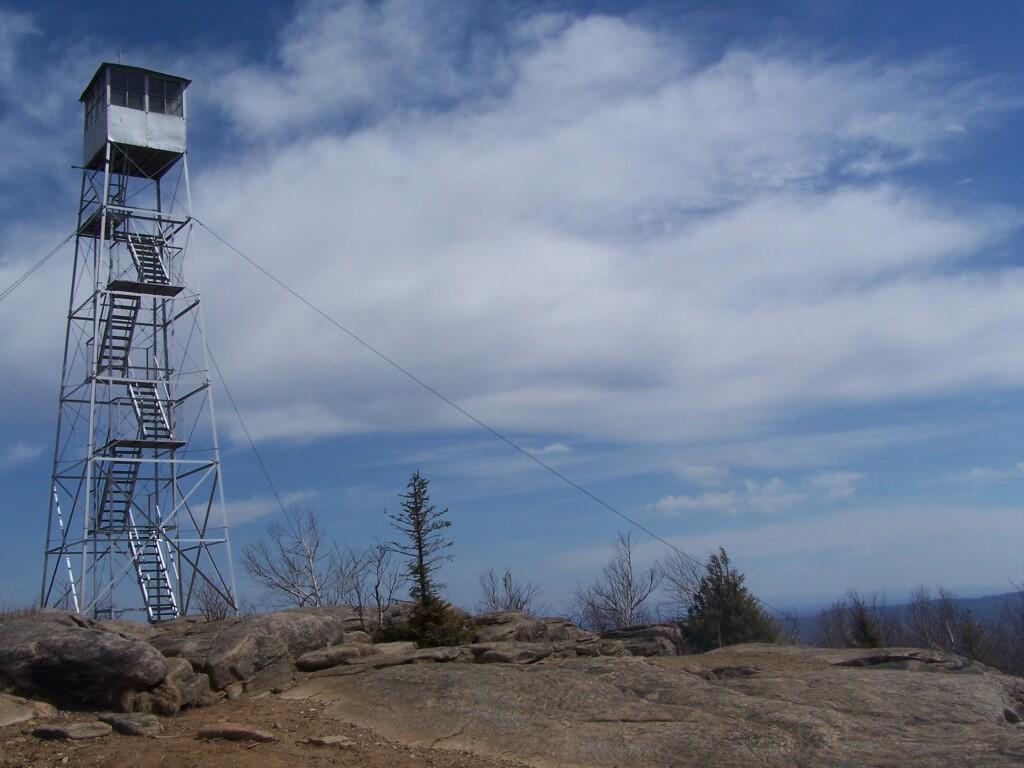
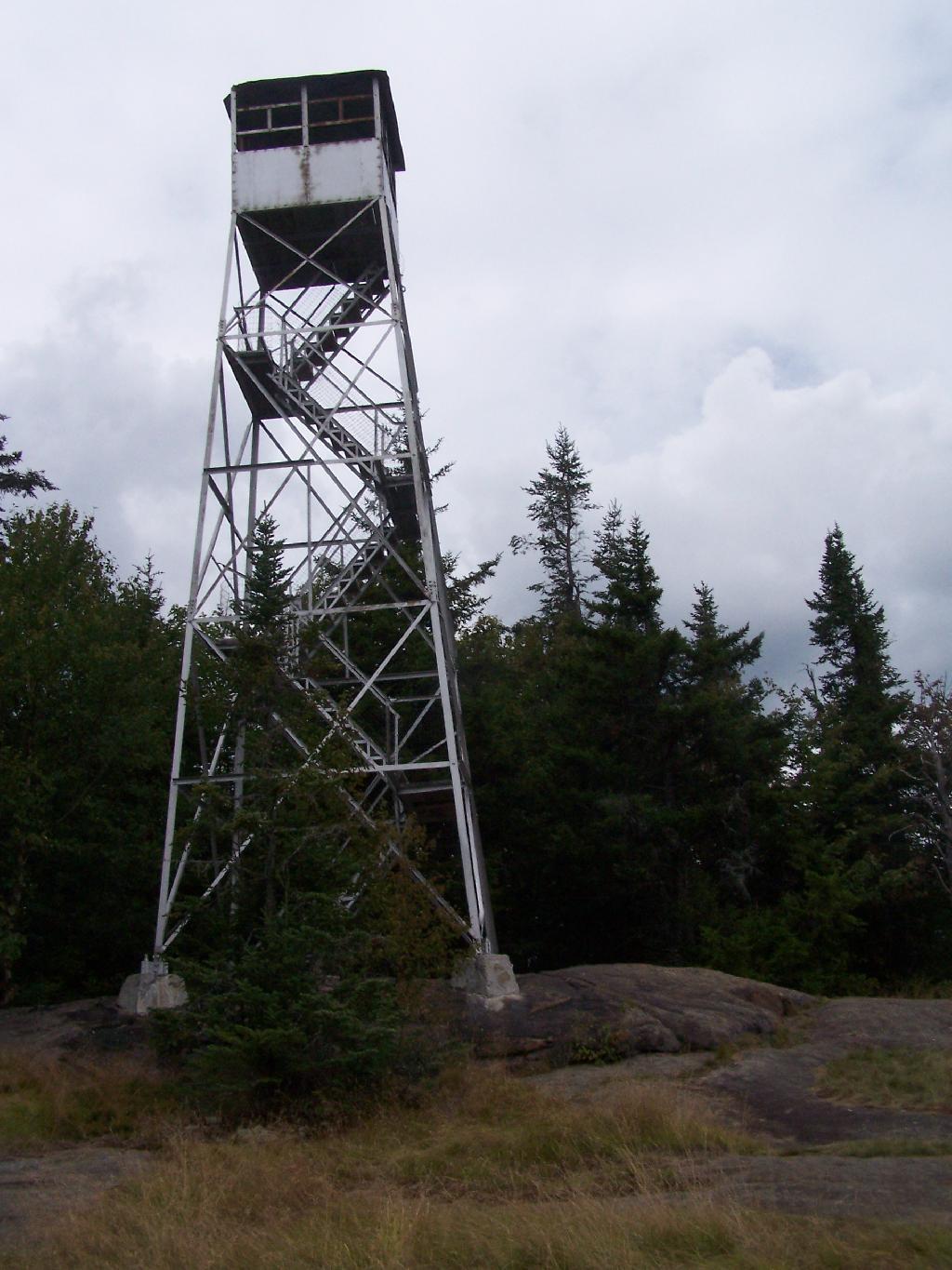
There are at least three different mountains in the Adirondacks known as Owls’ Head due to their small rounded peaks, with broad cols for shoulders. This one is the one near Long Lake, that has a 30 foot LS 45 Aermotor Firetower on top of it.

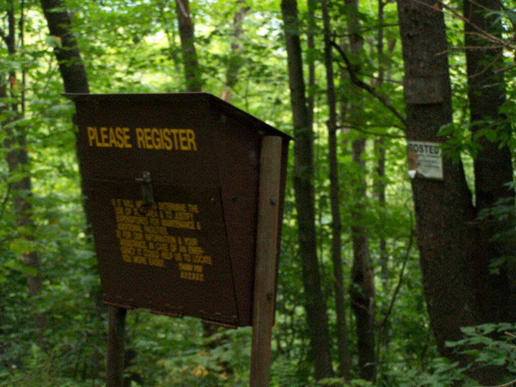
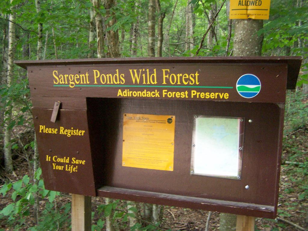
Sargent Ponds Wild Forest Kiosk. This is where you sign in, so they can have an idea on trail use, and make it easier to find you if your lost or injured.

Sargent Ponds Wild Forest Kiosk

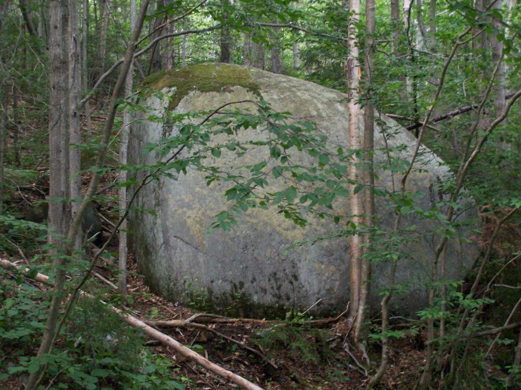
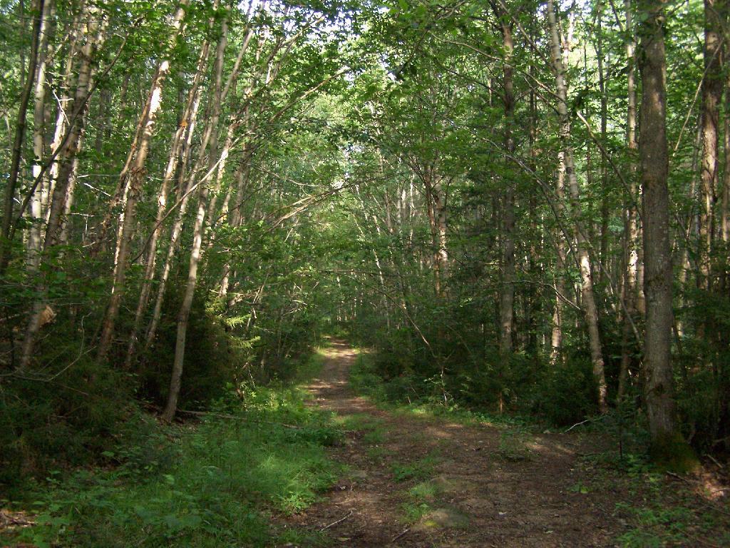
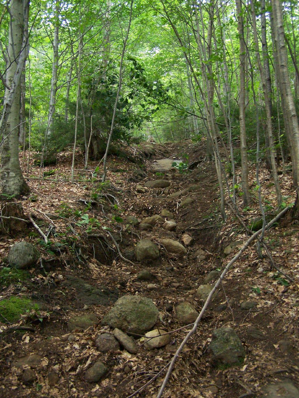
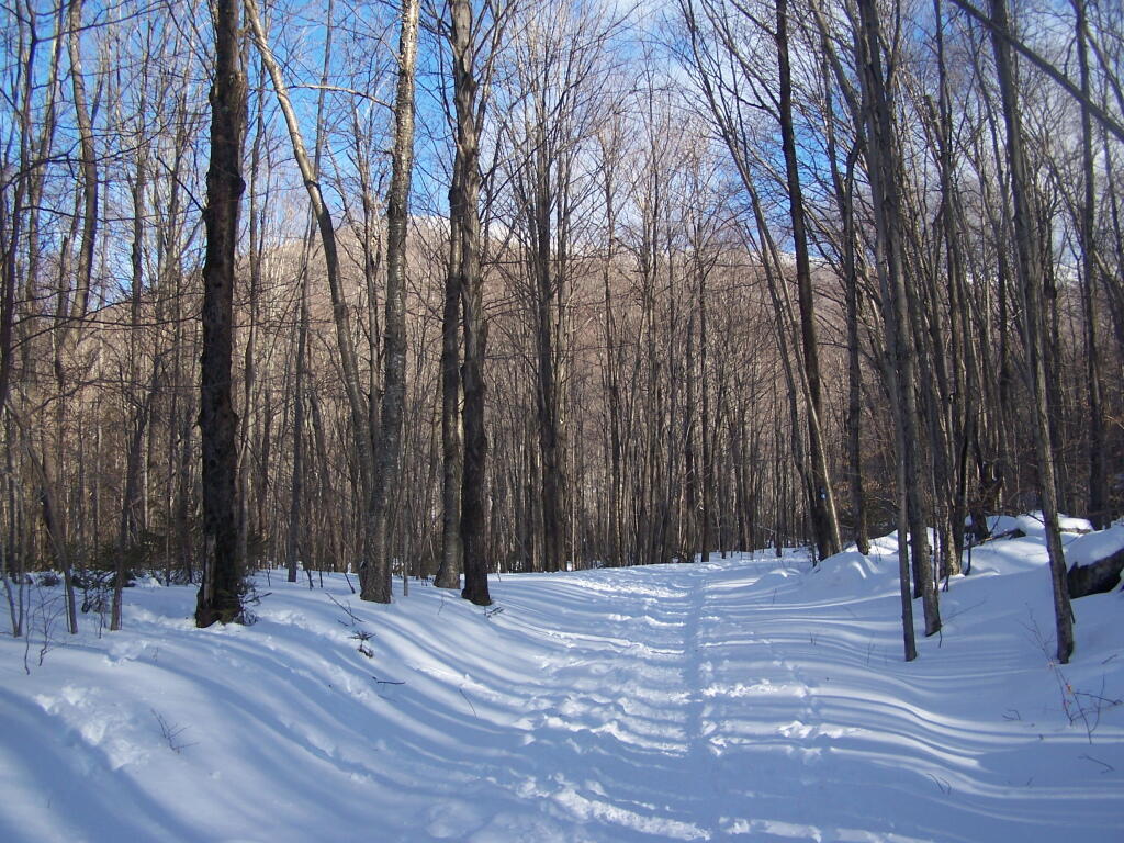
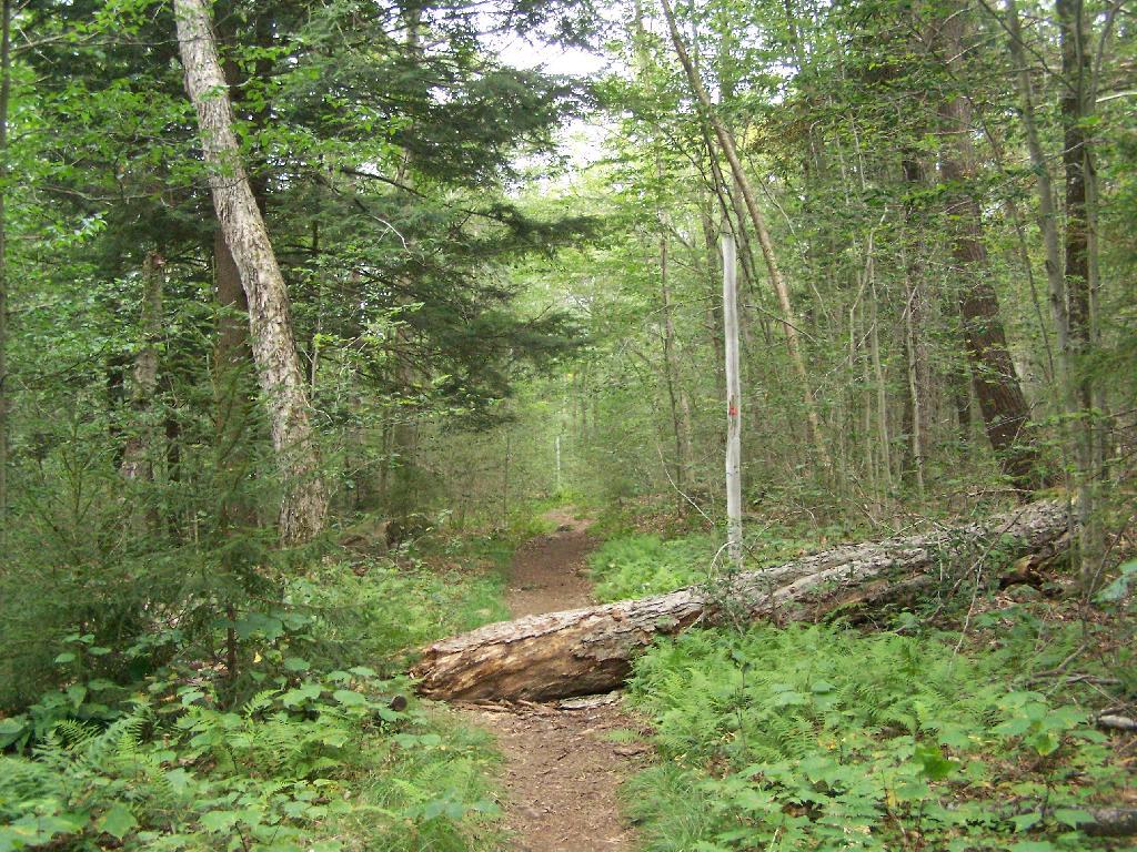
1/2 Mile In. The trail crosses this downed tree.

1/2 Mile In

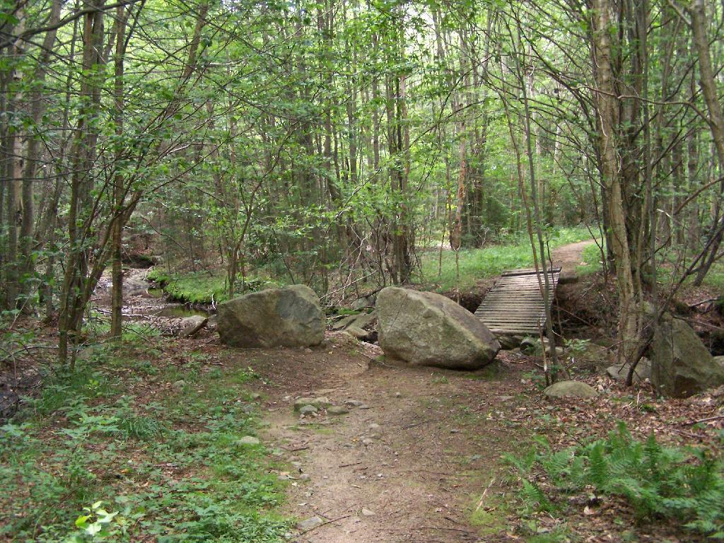
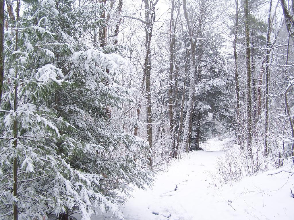
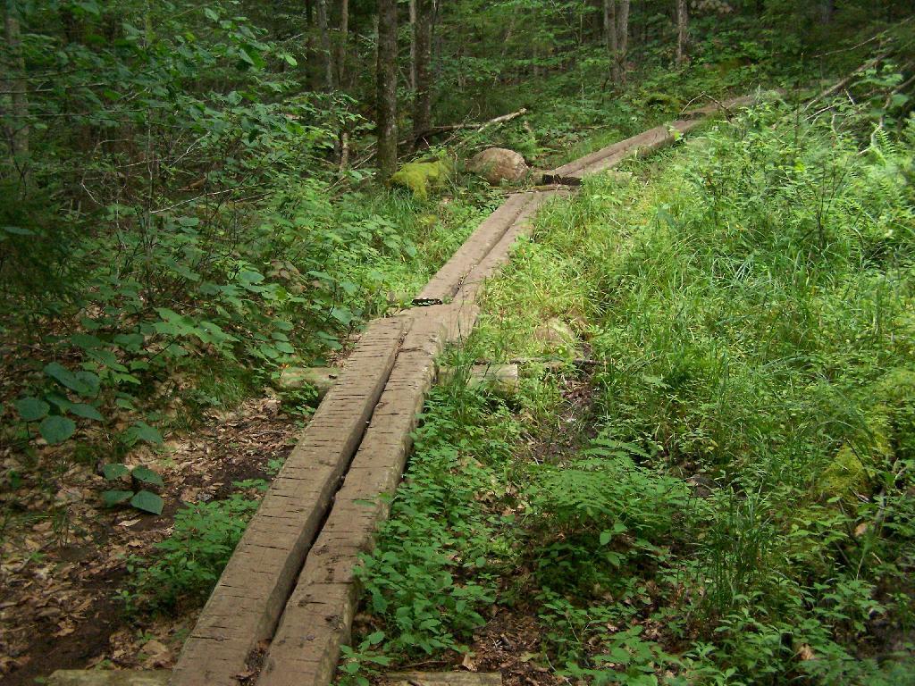
Boardwalks. Parts of the trail cross marshy areas on board walks, like these constructed on the first 3/4 mile of the trail.

Boardwalks

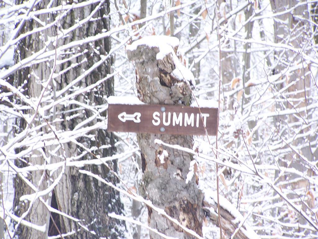
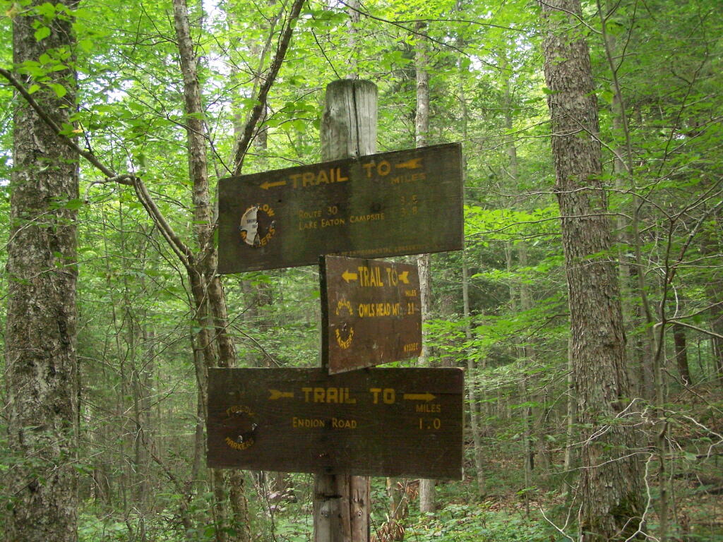
T Intersection. Make a left at one mile, to go up Owls Head. The other direction takes you to the Lake Eaton State Campground.

T Intersection

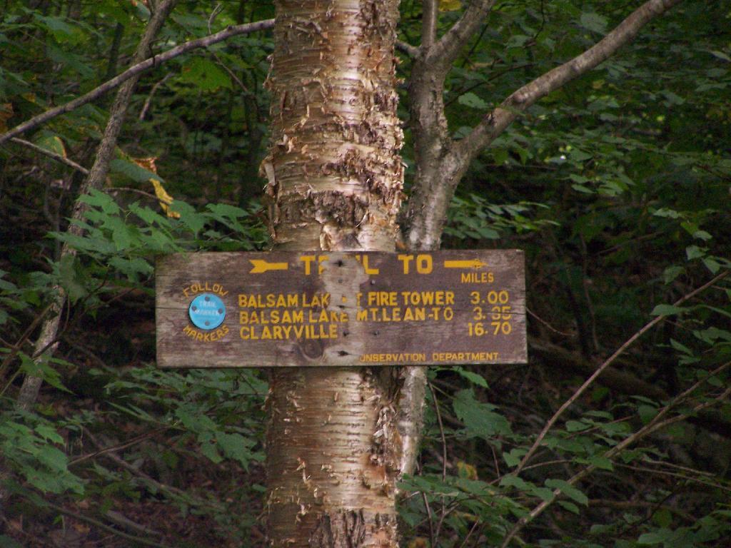
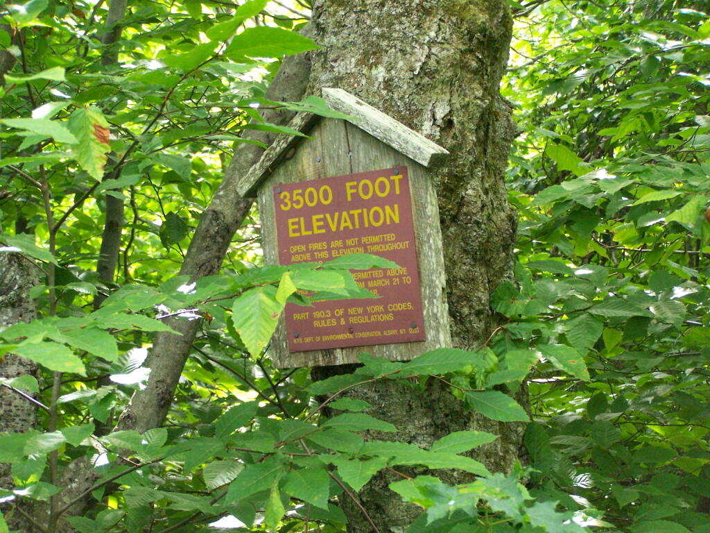
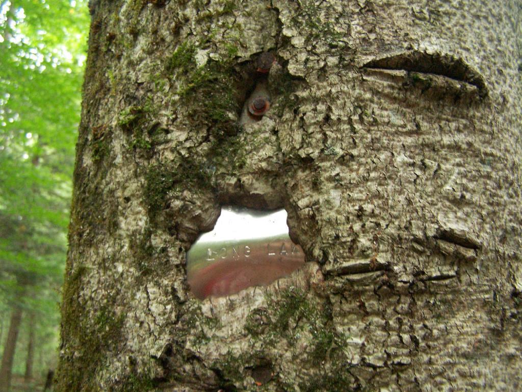
Grown Over Steel Trail Marker. It looks like in 1982, the state experimented with these imprinted steel trail markers along the trail, long since largely grown into the barks of the tree.

Grown Over Steel Trail Marker

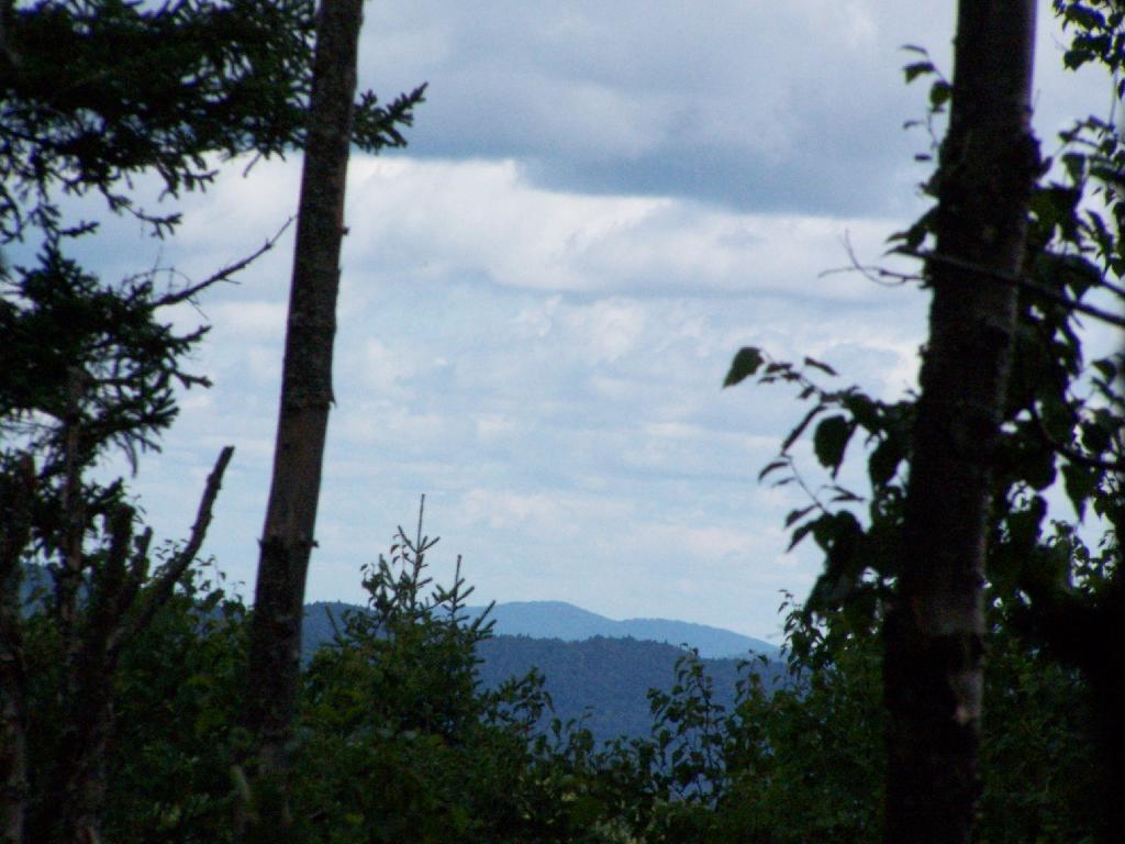
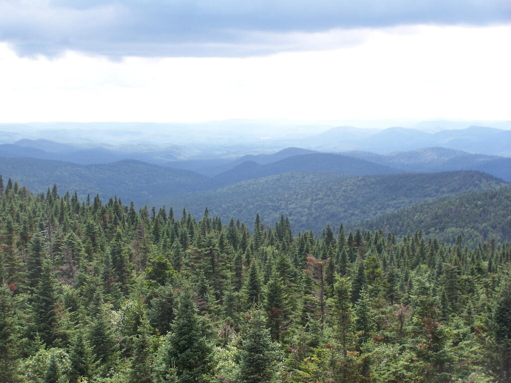
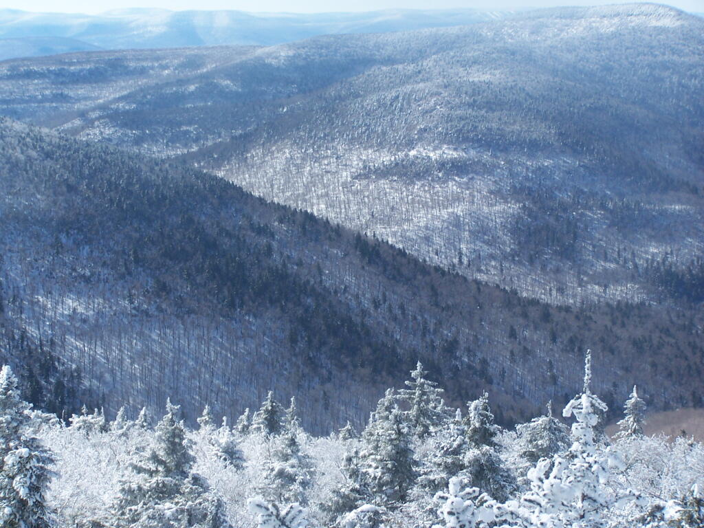
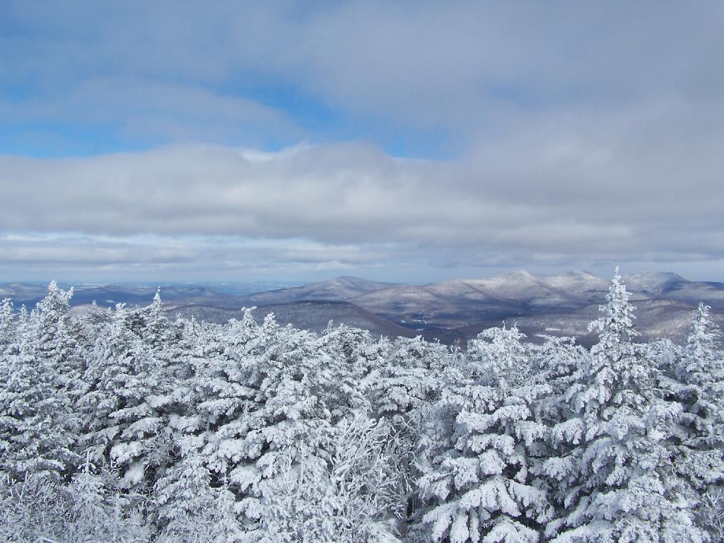
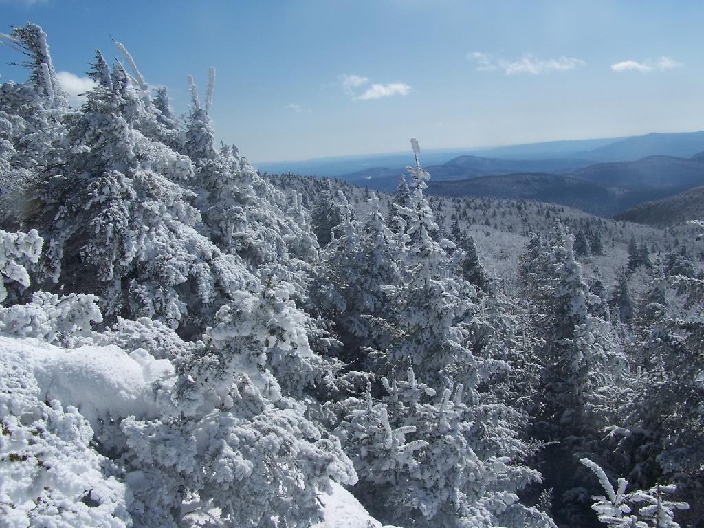
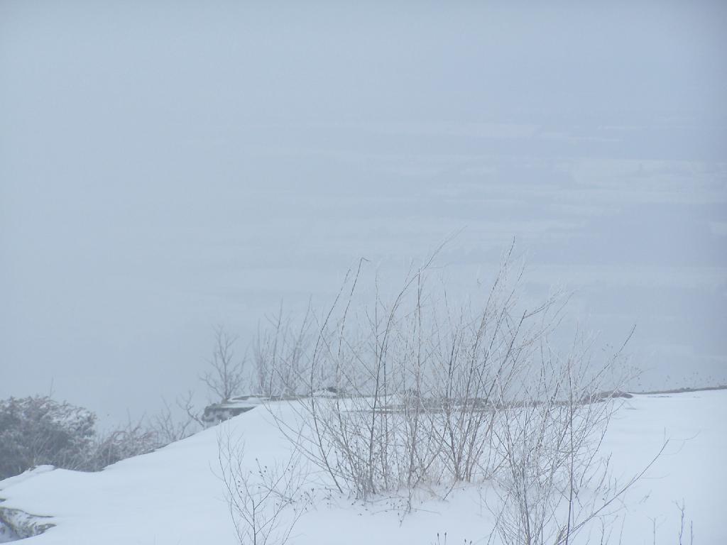
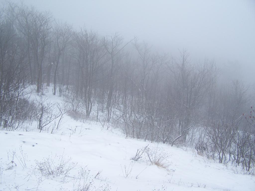
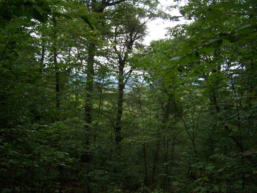
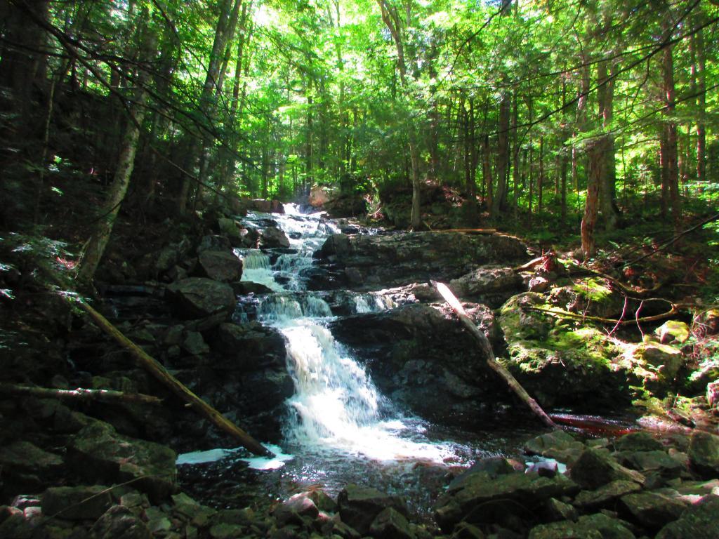
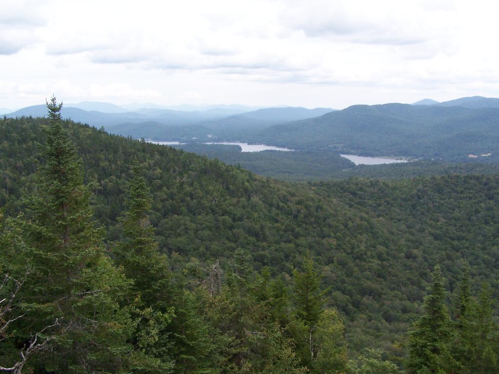
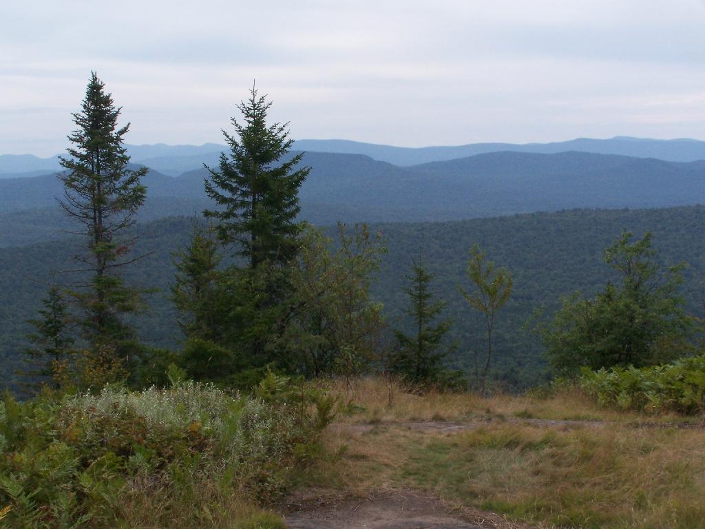
Views as You Ascend. This is looking backwards, towards the Sargent Ponds Wilderness, Lake Eaton, and the timber lands between here and Tupper Lake.

Views as You Ascend

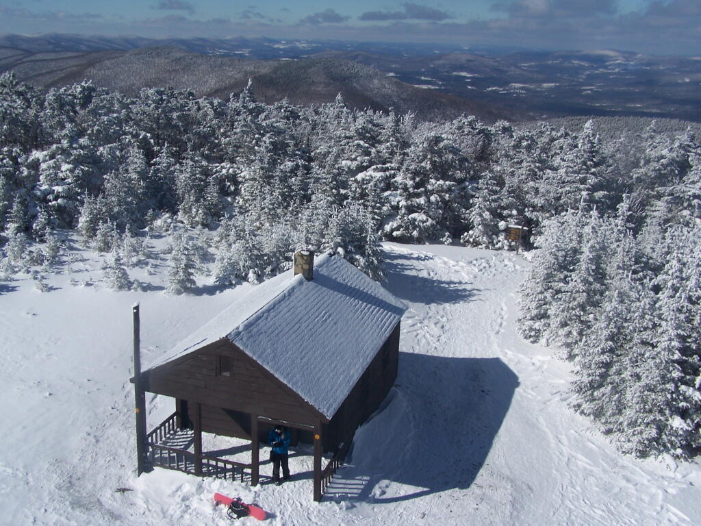
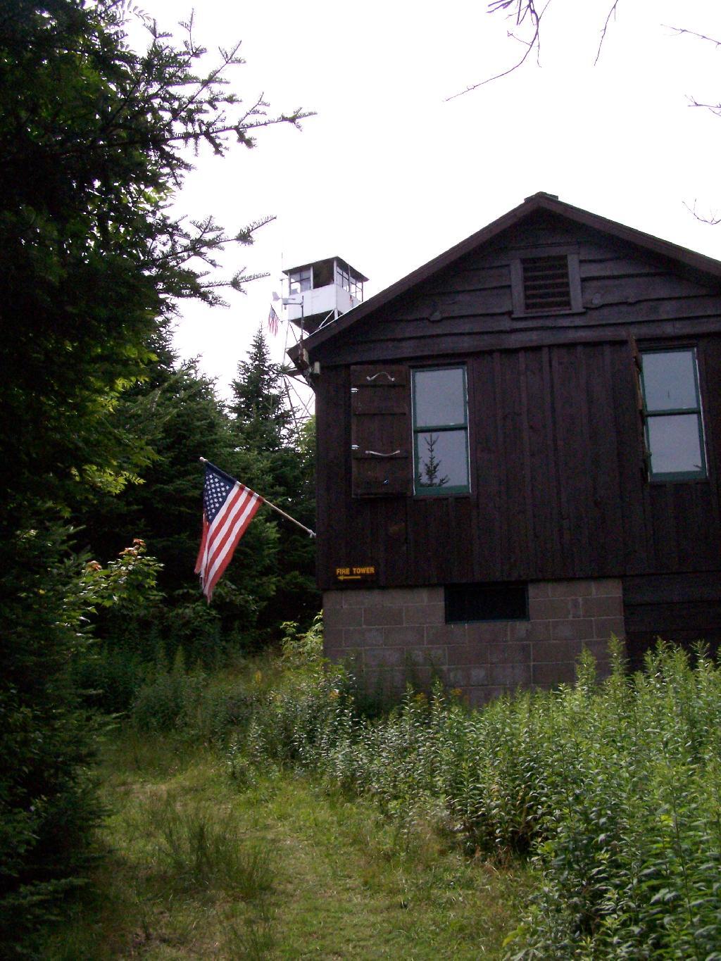
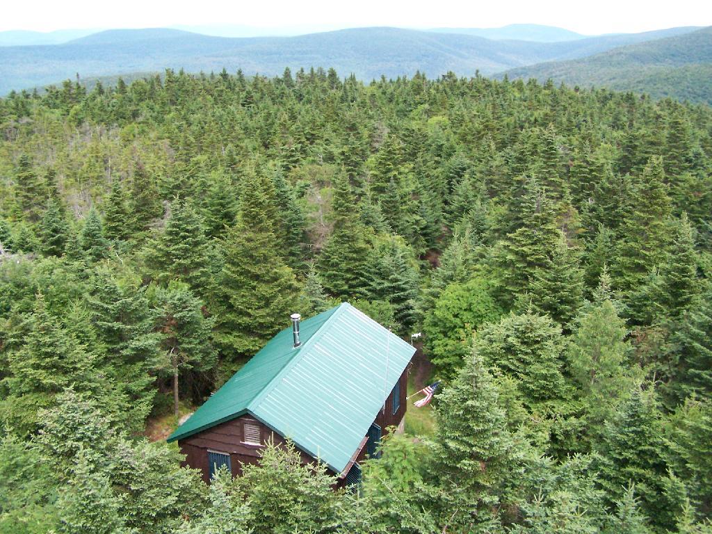
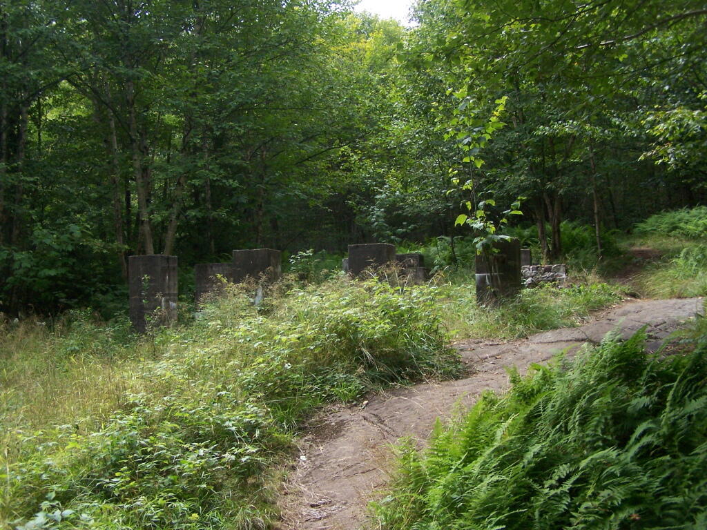
Observers Cabin Ruins. The cabin the fire warden lived in years ago, is not located on top of Owl’s Head, but below it on the shoulder. It’s a 1/4 mile hike to the top, and you accent about 200 more feet, up the pointly little head. The cabin was probably located here, so the warden could meet visitors, and escort them to the top.

Observers Cabin Ruins

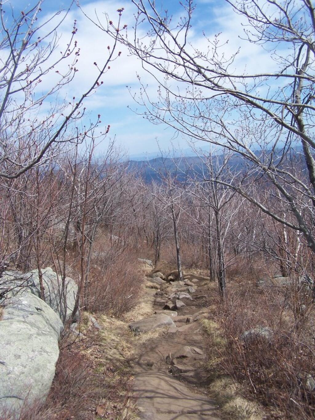
Well Worn Trail. Part of the trail is well worn, and is on open rock face. The good news however is with the lush tree cover, you don’t have to worry about acrophobia up here.

Well Worn Trail

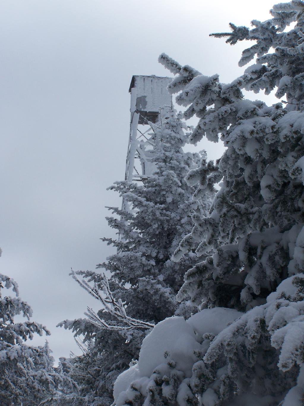
Reaching the Tower. You can’t see the fire tower until your almost on top of it, due to the heavy trees that surround the summit of the mountain, except for the bald portion where the tower is located, open to views to the south and east.

North Creek Falls

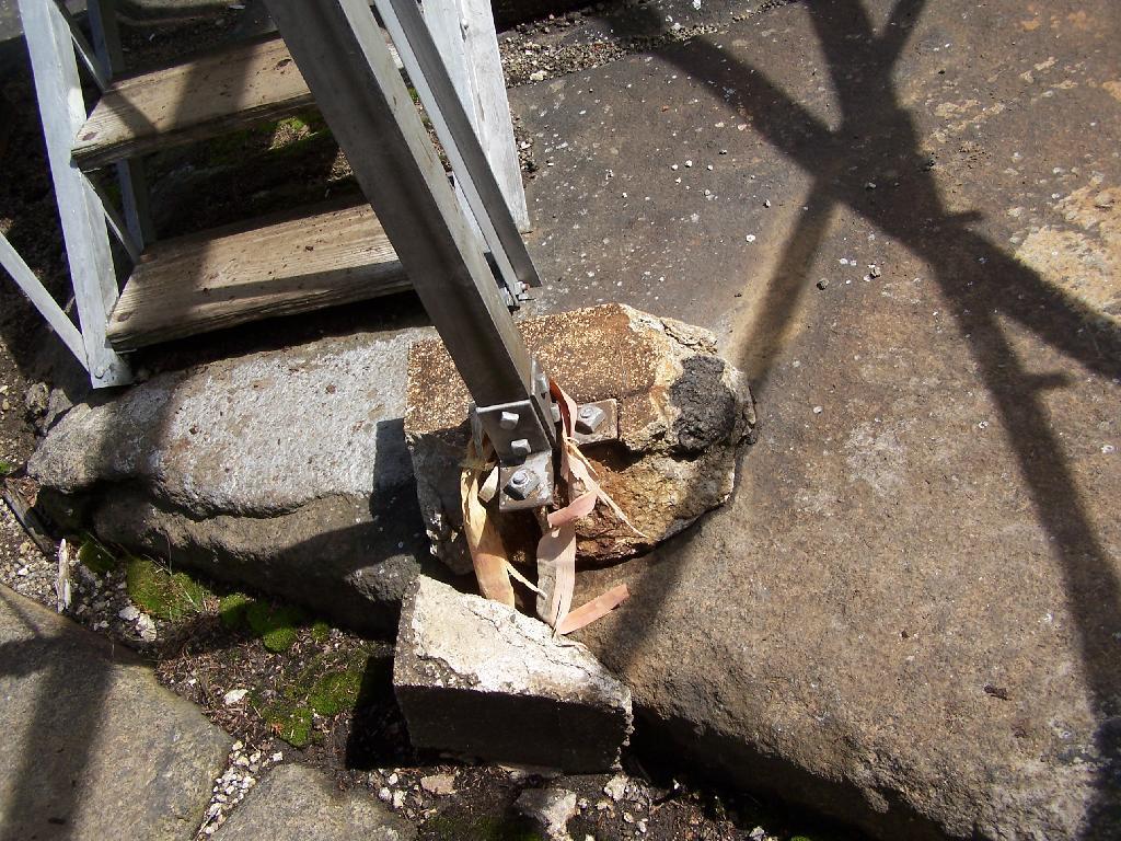
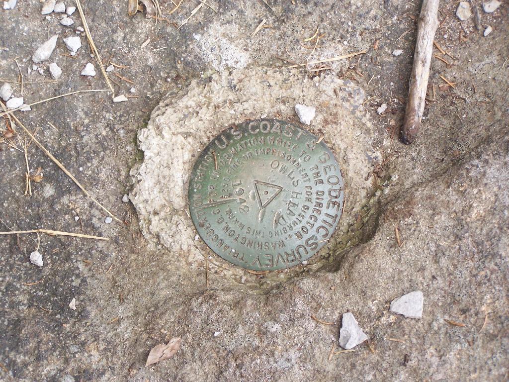
Survey Marker. It says it was placed in 1942 by USGS. It’s right below the fire tower proper.

Survey Marker

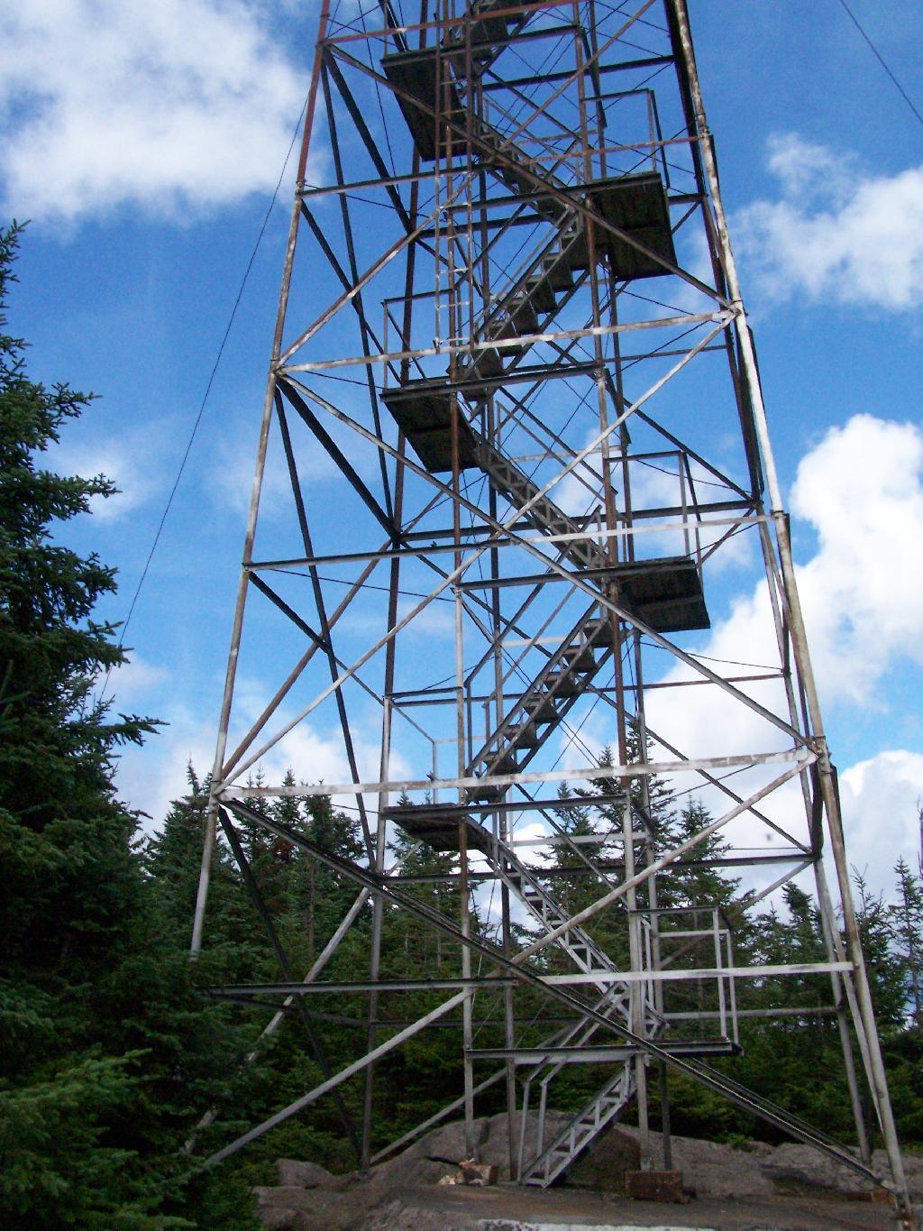
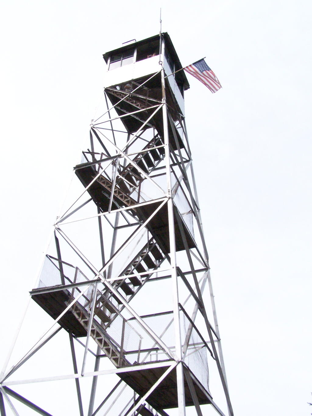
Fire Tower. The fire tower is a 30 foot LS 45 Aermotor tower, pretty typical for NY State. It’s one of the short little towers, like also seen on Rondaxe Mountain in Eagle Bay.

Fire Tower

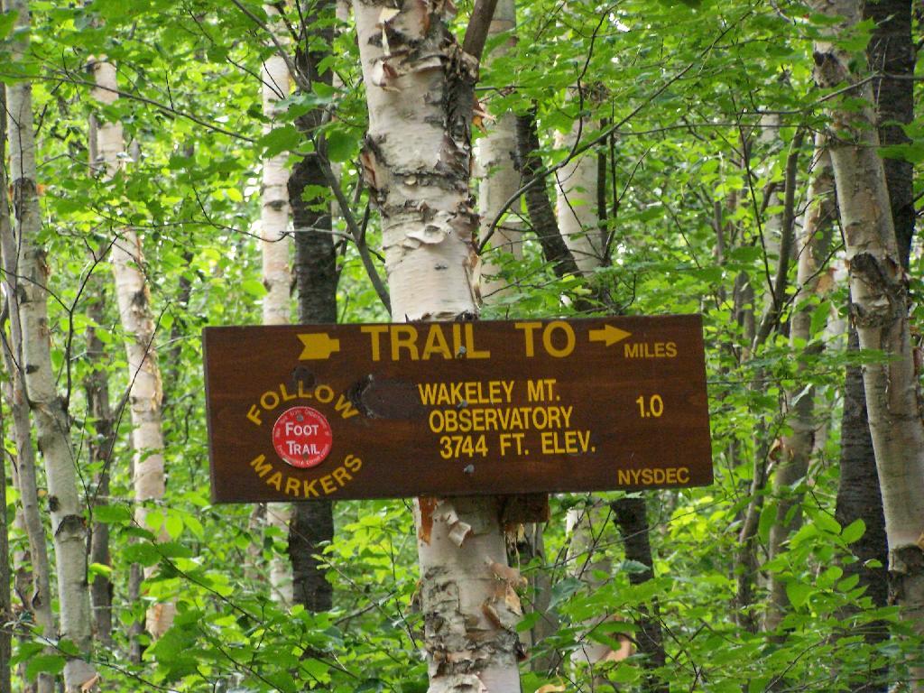
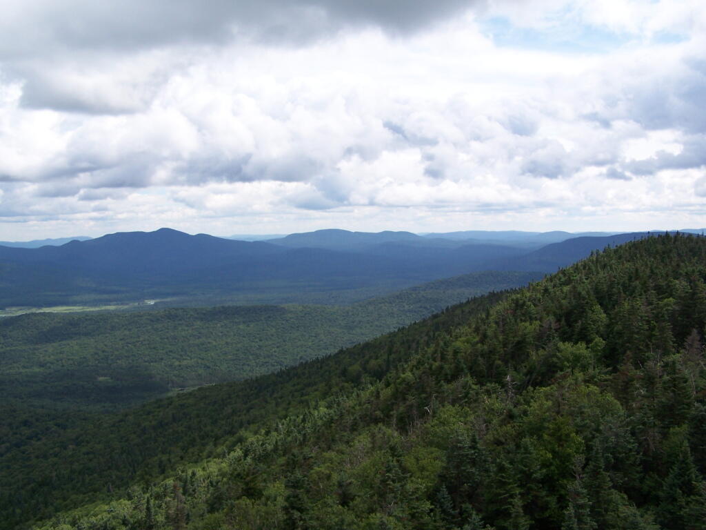
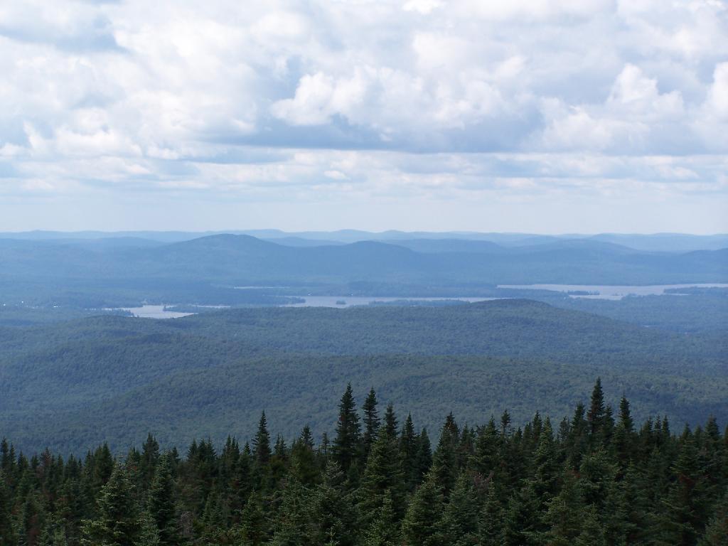
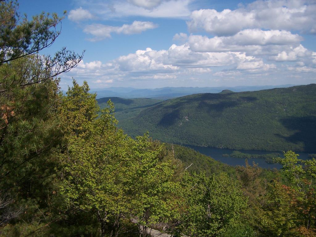
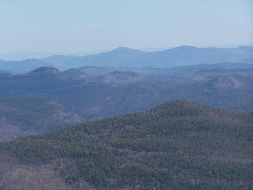
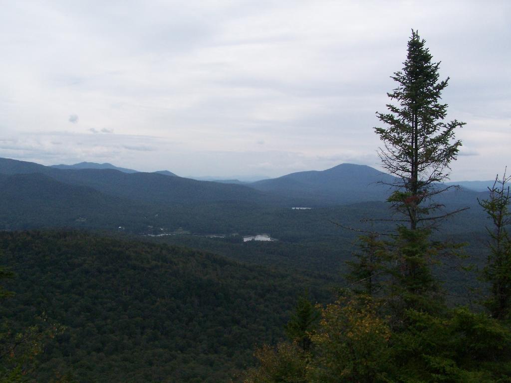
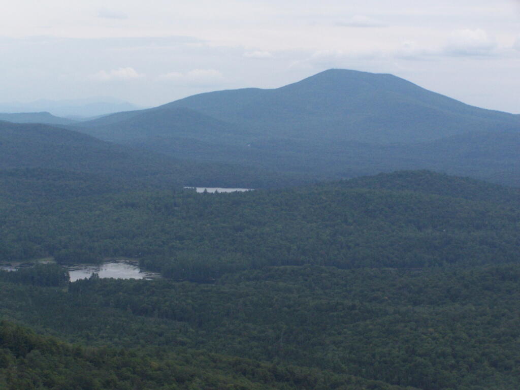
Forked Lake. This is looking south from the summit towards Forked Lake Campground and possibly Racquette Lake. The mountain in the distance is Wakely Mountain, one of the other fire towers originally used to pin-point fires in the Adirondacks (it takes two towers to locate a fire through triangulation).

Forked Lake

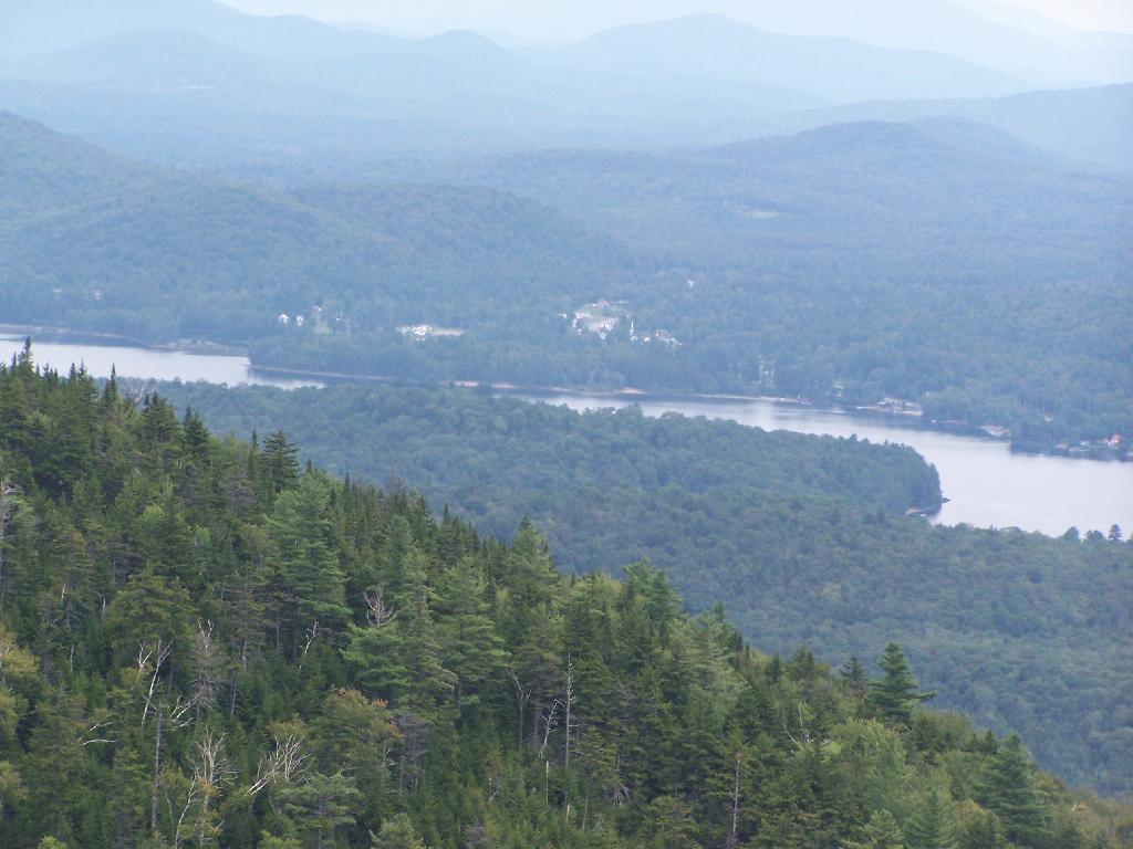
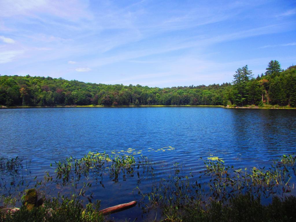
Long Lake. This is another picture of Long Lake, a little bit farther north, with the shoulder/col of Owls Head visible in the foreground.

Long Lake

North. In the distance is Saranac Lake and Lake Placid, with Whiteface just beyond it. Not the clearest or nicest of days, but still visable. In the foreground is the col/shoulder of Owls Head.

North

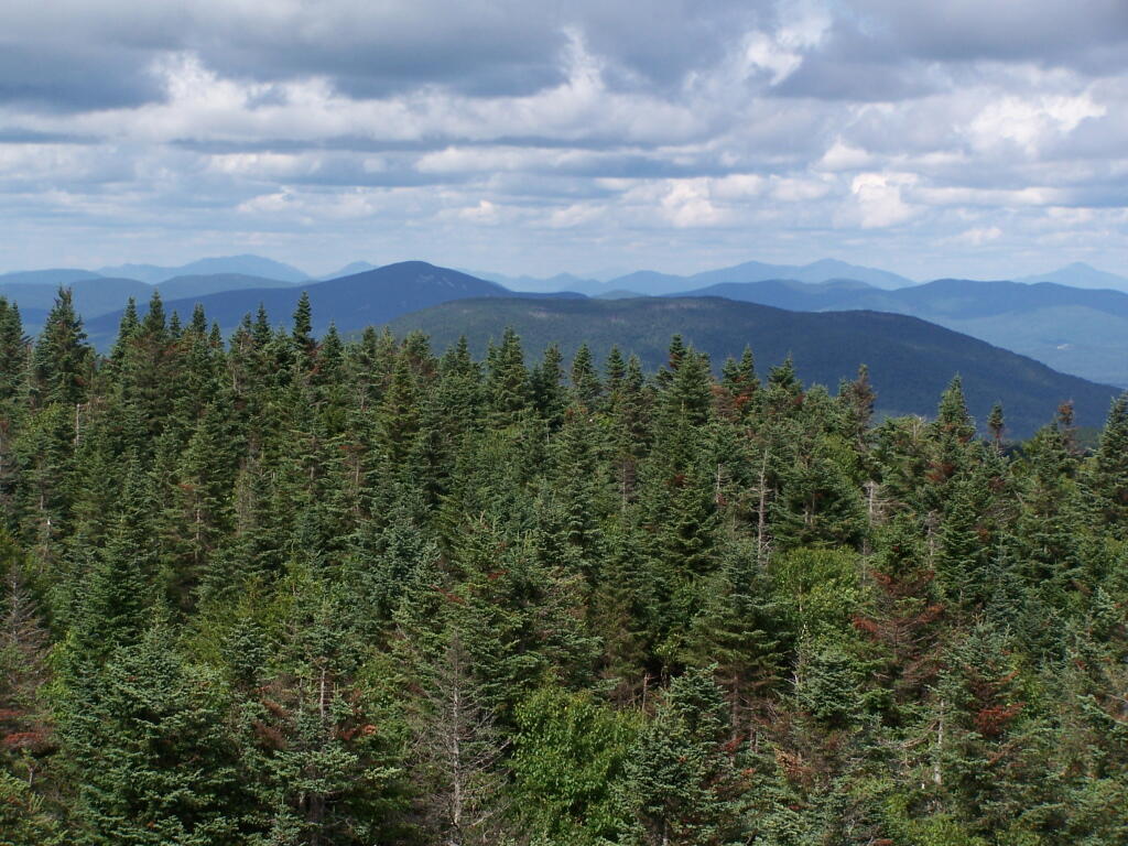
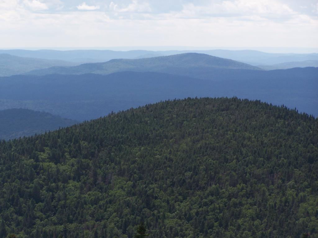
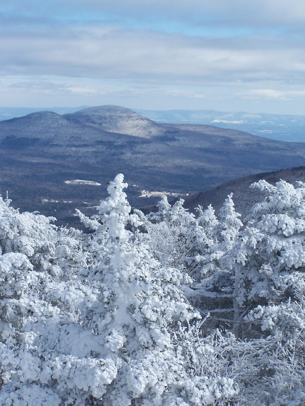
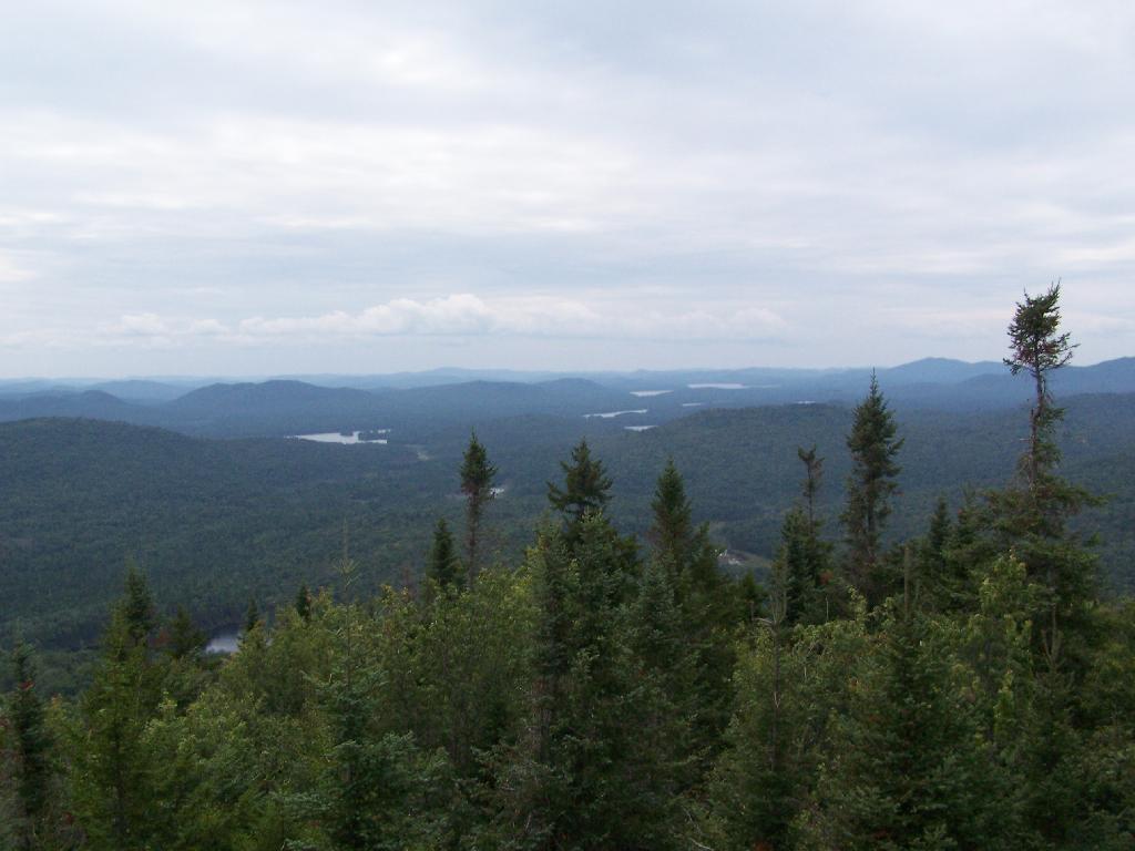
Blue Mountain. Blue Mountain is another fire tower / mountain that is visible from Owls Head. Located about 10 miles away, in the foreground are Minnow Pond and Mud Pond.

Blue Mountain

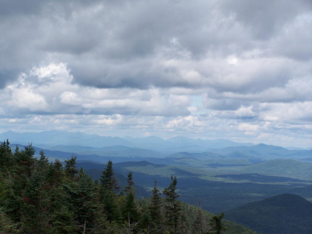
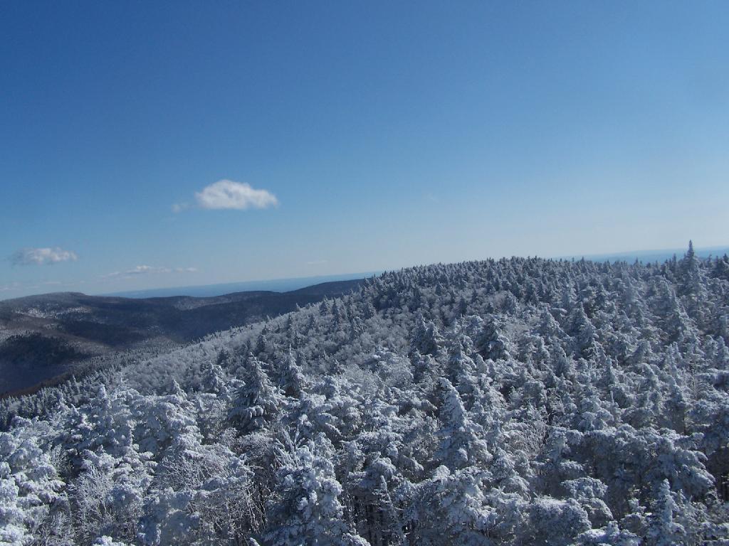
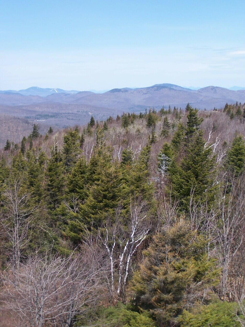
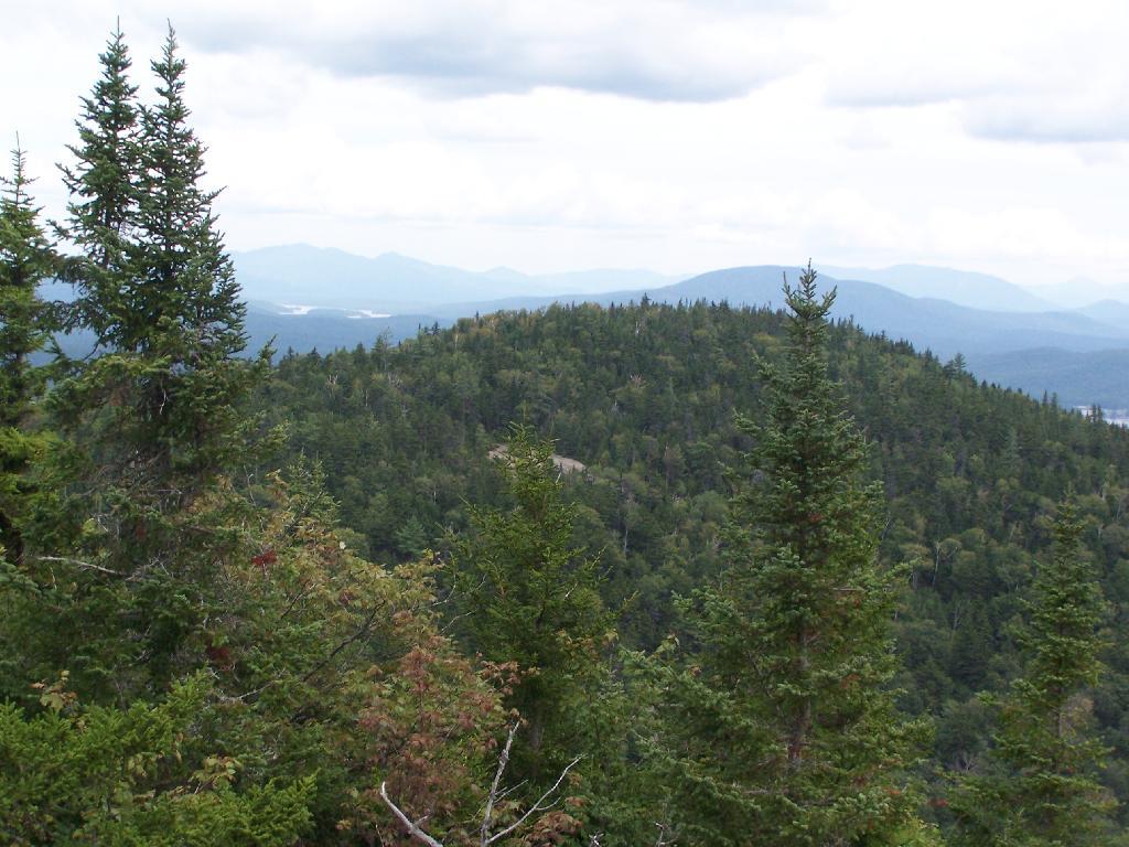
Sargent Ponds Area & Timberland. This portion north of NY 28 Corridor and Fulton Chain of Lakes is relatively flat, wild, and many portions privately owned as timberland.

Sargent Ponds Area & Timberland

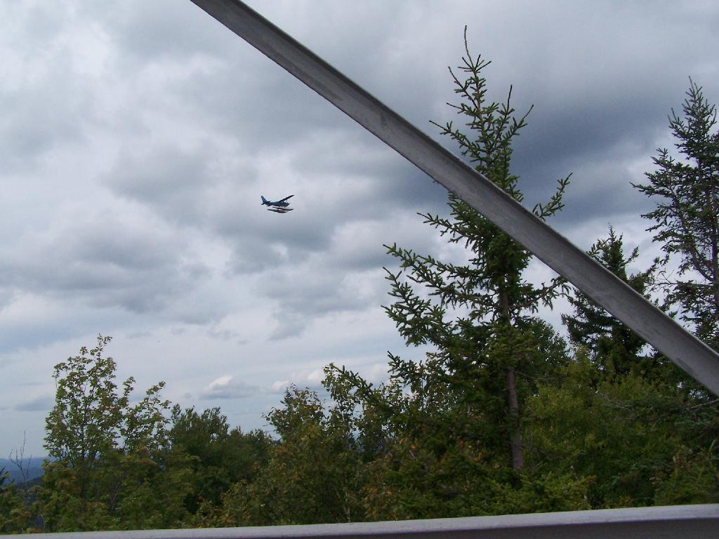
Float Plane. Owls Head is not the quietest mountain out there. Throughout the day, tourist float planes for hire, fly on and off Long Lake, just to north of mountain. They fly quiet low, as they are making the decent back to Long Lake.

Float Plane

Long Lake Village. While hazy today, you can see village of Long Lake quite well from the tower. It’s always crazy there, and I try to avoid towns whenever I’m in the Adirondacks.

Long Lake Village

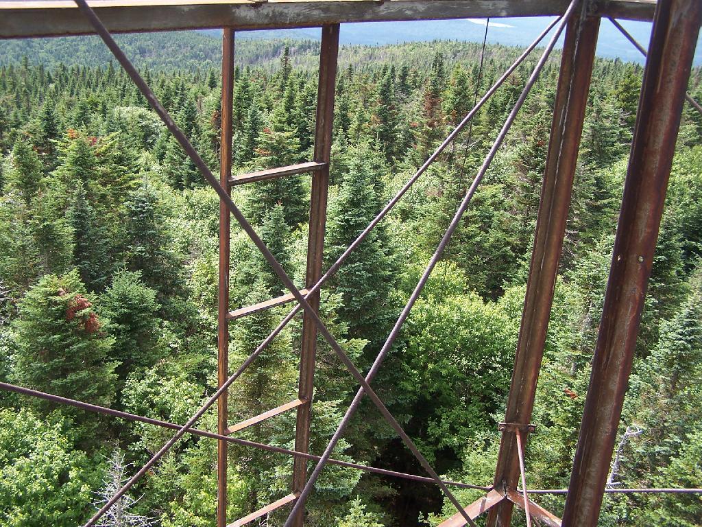
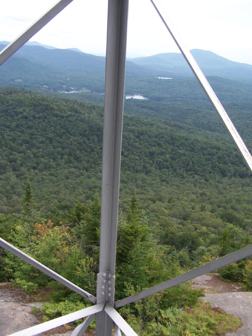
Fire Tower Corner. I always like pictures of the angles and construction of the fire tower. While common after climbing so many, fire towers have a lot of character in their structural steel.

Fire Tower Corner

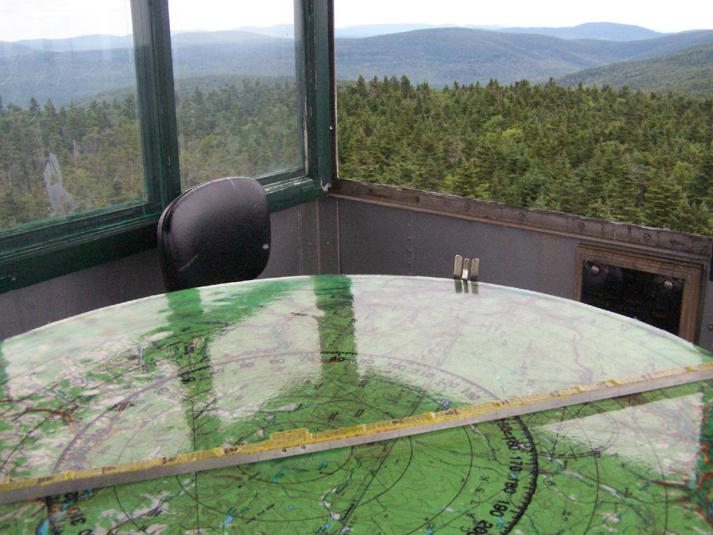
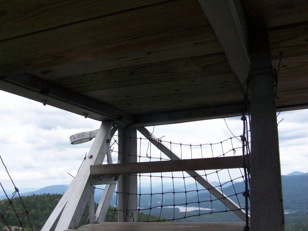
Tower Cabin Closed. It’s unfortunate but the tower’s cabin on this tower is closed, as it’s used for communications equipment.

Tower Cabin Closed

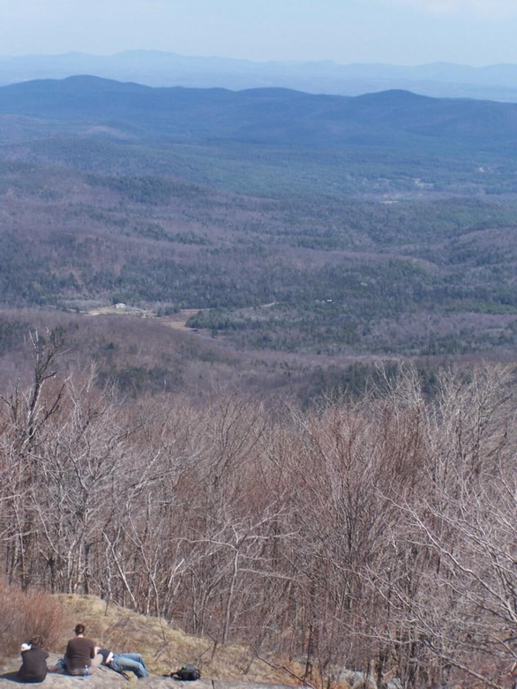
Sitting on Mountain. Just sitting back and looking south from the open rock face a top Owls Head.

Sitting on Mountain

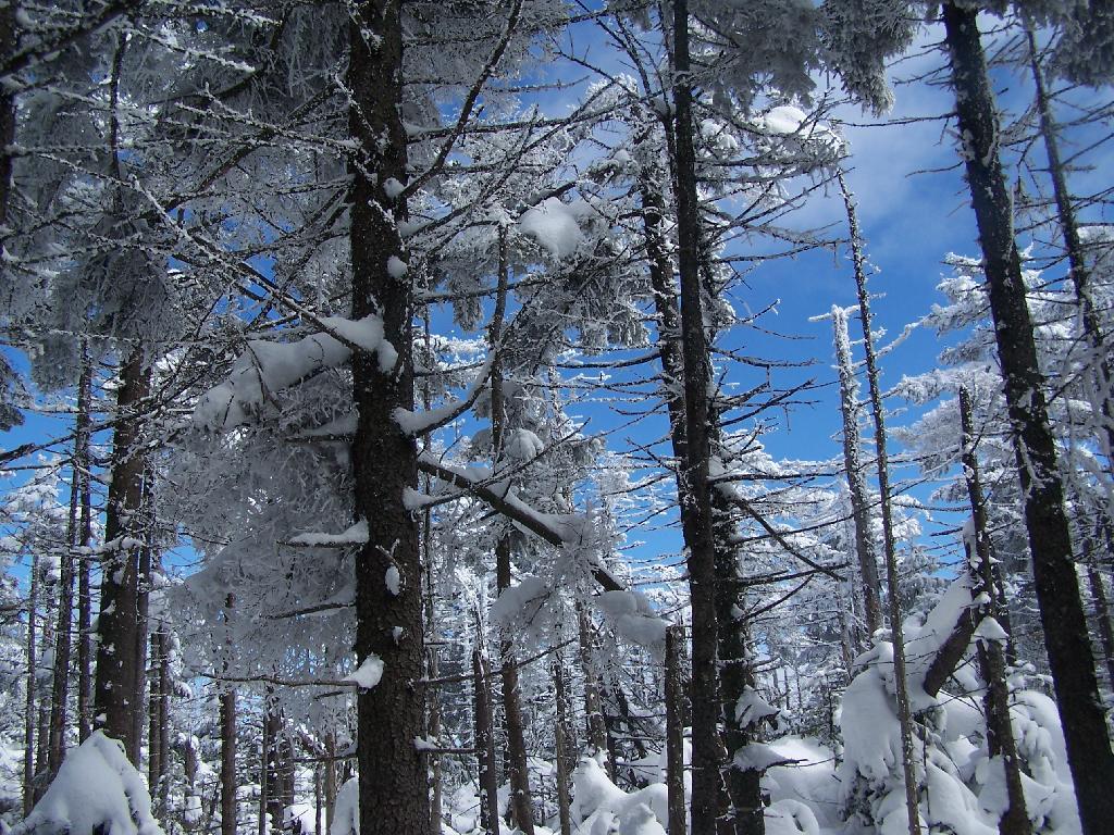
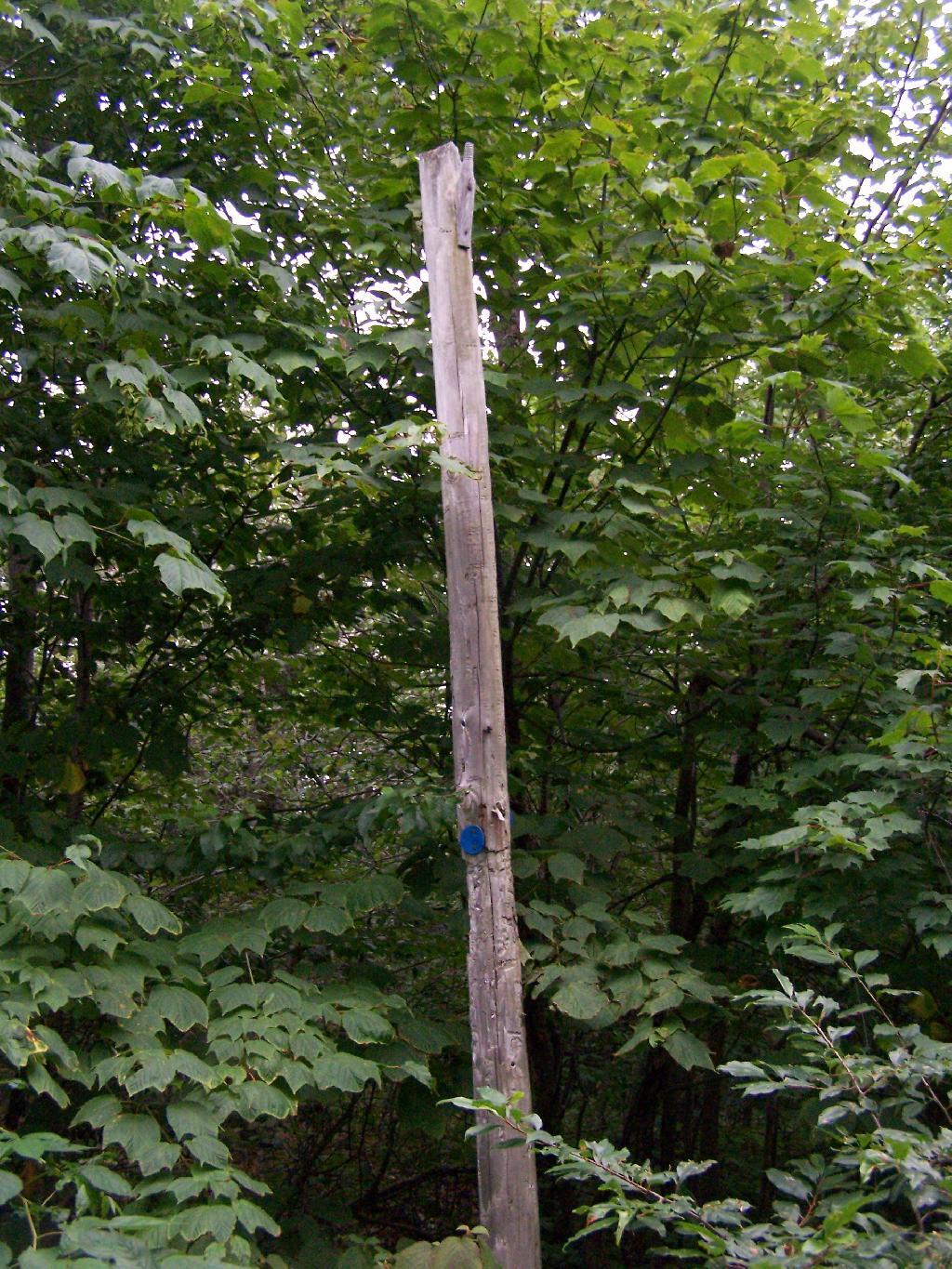
Old Telephone Poll. Descending the trail off Owls Head, I saw several of the old telephone poles, heading up to the former Ranger’s cabin. Some have been cut down, and used to control run-off on the trail, but others still remain.

Dexter Lake

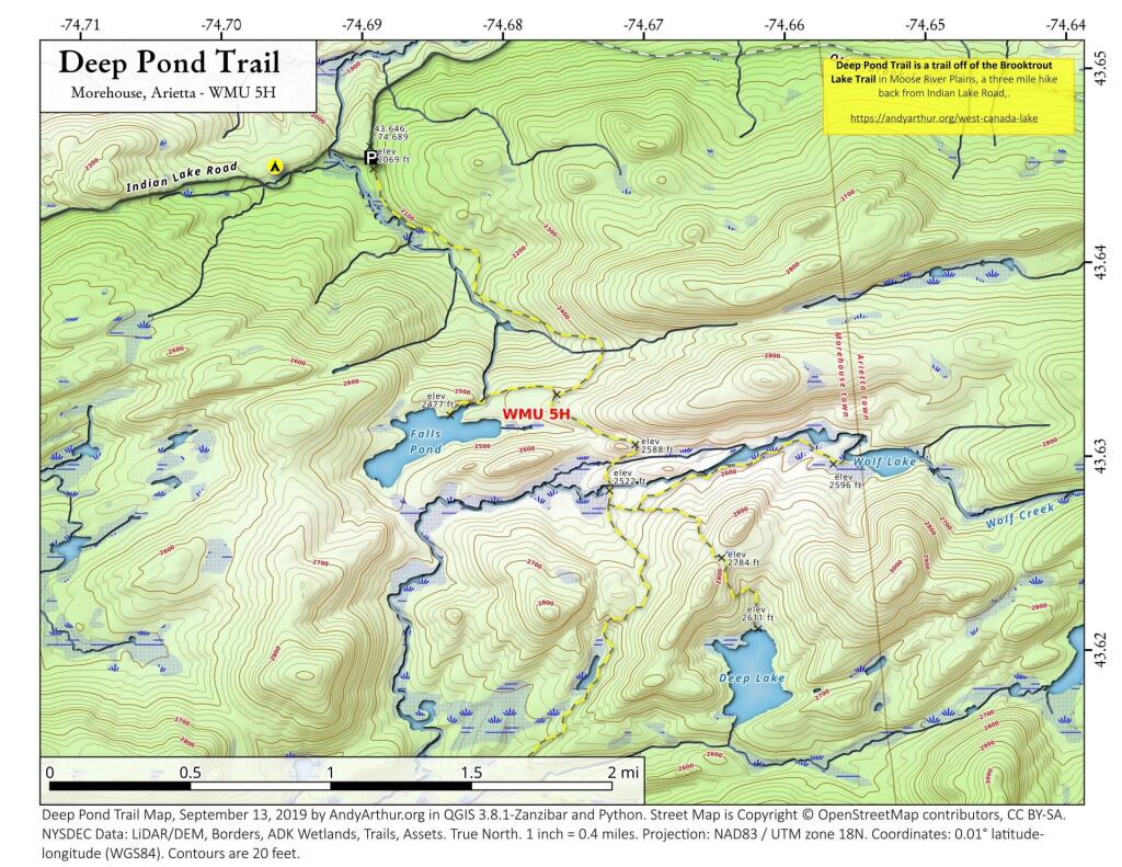
Here is a map of the hike.


View Owls Head in a larger map

Wakely Mountain Firetower

On the afternoon of Thursday July 22nd I hiked up to the Wakley Mountain Firetower. The weather wasn’t perfect, but it was still quite popular, passing several hikers and families visting this tower. The views are pretty good, but probably not as good as Pillsbury Mountain or Snowy Mountain to the south. The nice thing is it’s a 5 minute drive from Cedar River Flow and pretty close from Moose River Plans too, and provides a great overview of the Plains.

Camp Fire

You can print the above map, by clicking it, to be taken to a high resolution (500 DPI) that will print nicely on a laser or inkjet printer.

When you first start up the mountain, you pass a “Warning! Road Washed Out” sign. This sign is at the parking area for Wakely Mountain, to warn drivers that they won’t get very far on Wakely Mountain Road, since the DEC has basically abandoned it.

Warning! Road Washed Out

Washed Out Road to Wakely Mountain. I honestly don’t expect the DEC to fix this road, but instead will make people walk the entire 3 miles up the mountain, because that keeps the eco-facists happy.

Washed Out Road to Wakely Mountain

Washout on Wakely Road

The End of Wakely Road. That said, you’d be hard press to get a vehicle this far, due to the wash out at the earlier marsh.

The End of Wakely Road

As you climb, you pass this big boulder On side of Wakely.

Big Boulder On Side of Wakely

The first two miles of the trail are pretty flat, a small incline that increases above 400 feet in elevation over two miles.

Flatter Two Miles of Wakely Trail

Marsh Along Wakely Mountain Trail. That’s Payne Mountain, not Wakely Mountain in the background.

Marsh Along Wakely Mountain Trail

The Final Mile. You might think the previous two miles of the Wakely Mountain trail where easy, rising maybe 300 feet, until you hit the last mile, as indicated by this sign. It’s another 1200 feet on up for that last mile.

The Final Mile

The trail up Wakely Mountain is badly eroded due to heavy use and neglect by the DEC.

Badly Eroded Wakley Mountain Trail

The last mile up Wakely Mountain is a long one, especially if you start late in the afternoon as I did. You are treated with some limited views while climbing Wakely Mountain, but all and all, there isn’t a lot to see except steep trail (but no open rock face!).

Broken Views Climbing Wakely

Once you almost reach the top of the mountain, you come to the Wakely Mountain Helipad. This is used by emergency responders, providing quick access to the top of mountain, to either access the tower for observation, or to help those injured on top of the mountain.

Next to helipad is a trash pile. I was wondering how this trash ended up top of the mountain, but after thinking about it a bit, it probably was trash from the ranger’s cabin, that was dumped here some time in the past, and was dug up in the re-construction of the helipad.

Trash Pile Next to Helipad

Eventually you reach the fire tower, about a 500 feet from the Helipad. The Wakely Fire Tower is an interesting Aeromotor LS 25 tower, that originally lacked a staircase, but was added in the form of an internal ladder, for the convience of hikers and the fire warden alike. Prior to the 1919 addition of the “stairs tower within the fire tower”, you had to climb a ladder on the side of the tower, to get all 60 feet to the top of the tower.

Wakely Fire Tower Stairs Inside Tower

Here is the original ladder you had to climb. They removed the lower flights to discourage people from trying to use the ladder, although the stairs themselves also lack any safety fencing, so it’s a bit scary if your not used to climbing towers.

Tower within a Tower

A close up over the tower within the tower.

Wakely Fire Tower Stairs Inside Tower

The firetower presents one with spectular views of the upper Moose River Plains, from the marshy end of Cedar River Flow to the Lost Ponds area, to around Wakely Dam and Wakely Pond.

Plains from Firetower

To the east is the Blue Ridge Wilderness and Blue Mountain.

Blue Ridge and Blue Mountain

Looking down towards Indian Lake from the Fire Tower. There are many beautiful peaks to the south east.

Towards Indian Lake

You can also see the High Peaks from Wakley Mountain.

High Peaks from Wakley Mountain

And the Fulton Chain of Lakes.

Fulton Chain of Lakes

Cellar Mountain somewhat blocks the views to the west, as you look down to the plains, towards the ridges that follow along the NY 28 Corridor.

Cellar Mountain

The tower’s foundation sadly is in bad shape and needs work. The cabin of the tower is also only accessible via ladder, if your crazy enough to do that. It lacks safety fences on the various landings. Hopefully the state will find the funds and resources to restore this beautiful and popular tower, even though it’s likely to be expensive due to the need to use to Helicopter in supplies and possibly ironworkers to restore it.

Cracked Firetower Foundation

A Google Map of the hike…


View Wakely Mountain Firetower in a larger map

Hunter Mountain via Spruceton Horse Trail

On Sunday, February 21, 2010 I got up at 5 AM and started out on the Spruceton Horse Trail to Hunter Mountain around 8 AM. Previously I went up Hunter Mountain using the much steeper Mink Hollow Trail, which in a couple of parts would be challenging to snowshoe for a novice like myself. The Spruceton Trail is 3.5 miles and an accent of 1,900 feet versus Mink Hollow Trail at 2.1 miles and 2,200 feet accent.

 Deep Pond Trail

Here I am starting up the mountain, with trail-less high peak Rusk Mountain in the distance.

Starting Up the Spruceton Trail

The Old Hunter Road (abandoned 1937) is straight, wide, and modest ascent. With the sun rising, I had issues with snow blindness, but it offered some interesting broken views of West Kill Mountain in the background.

Westkill Mountain from Hunter

About half-way up the Mountain, you reach the “saddle” between Rusk and Hunter Mountain. After snowshoeing for a little over an hour, with this sign telling you there is 1.7 miles to go, an accent of 1,100 feet is a bit discouraging, but so be it.

1.7 Miles to Hunter Tower

After about 2 hours of snowshoeing I reached the spring. The past half hour of hiking, from the saddle up to the spring, may not be a long distance at 1/2 mile, it is a vigrous but not not steep 500 foot ascent by an old but wide abandoned truck trail.

Looking Down a Steeper Trail

The AMC’s Best Day Hikes in the Catskills and Hudson Valley suggests that one has to be careful with drinking out of this spring, because thirsty horseback riders sometimes bring their horses back to give them a drink too, ignoring the sign.

Spring

Going a little bit farther past the spring, you come across the trail down to the John Robb Lean To. About 1/4 mile and 100 feet below the Spruceton Trail, after going a narrow little rock crevice, there is the Spruceton Leanto.

From the Lean To, it’s approximately 1 mile to the Hunter Fire Tower. The next mile is either flat or a slight ascent, until you reach the last 1/4 mile of the trail where is ascent quickly with switchbacks, but again, not steeply.

One Mile to Hunter Fire Tower

Finally after about 4 1/2 hours of snowshoeing (including breaks and taking photos), I reached the Hunter Mountain Fire Tower. By now it had clouded up, and it reminds one of a picture out of a movie.

Approaching the Fire Tower

It felt good to get the snowshoes off, stop, and have some lunch for an extended break.

Snowshoeing Down the Trail

Looking North off the Fire Tower towards the Catskills famous TriMount-range aka Thomas Cole, Black Dome, and Black Head Mountains.

North from Tower

To the due east one can see Catskill’s Sunset Point, the upper Hudson Valley near Catskill, and in the distance, the Taconics, including the other Sunset Point in the Taconic State Park.

Sunset Point in the Catskills

It was frigid on the fire tower with the winds blowing. Off the tower it wasn’t quite so bad. After spending a little time relaxing at the picnic table, and putting another layer of clothes on, I headed south along the blue trail to the Hunter Mountain Overlook which overlooks the South-Western Catskills.

Boreal Forest

Reaching the Hunter Mountain Overlook, the views where quite amazing, showing mountains from Mount Tremper to the east to West Kill Mountain in the West.

South

The saddle between Hunter and West Kill Mountain. It was amazingly beautiful.

Westkill Mountain from Hunter

After taking half a dozen photos at the Overlook, I headed back to the Fire Tower, and went up it once again. Here I am looking to the North West towards Blenheim Mountain and Schoharie County. The former Hunter Mountain Ranger’s cabin is in the foreground, with a snowboarder who snowshoed with board on back from Hunter Mountain Ski Resort on the balcony.

Ranger's Cabin

Here is South Hunter Mountain, looking due South.

South Hunter Mountain

Heading back down the trail, looking at Rusk Mountain.

Looking Towards Rusk

I arrived back to my truck around 4 PM. I was tired, as snowshoeing is a lot more work then hiking. Snowshoes kind of drag on the snow, and the cold just makes everything a bit more tiresome. Yet, the beauty was amazing even at a balmy 22 degrees.

Balmy 24 Degrees

Make sure to browse all of the amazing photos from the hike up there. Also, see my April 12, 2009 trip up to Hunter Mountain via Mink Hollow.

Co-Signed Spruceton Trail

Here is the map of the Spruceton Horse Trail up Hunter Mountain.

Snake Mountain in a Snowstorm

I was up in Addison, Vermont to watch the demolition of the Champlain Bridge and I figured while I was up there I would go for a hike in the afternoon to see some of the beautiful vistas of the Champlain Valley. I have only been hiking once before on the Vermont side of the lake, and never down in this part of the Champlain Valley.

Snake Mountain Preserve Sign

I really was hoping for a nice clear day with blue skies. What I got instead was heavy snow squalls and cold winds whipping along the mountain. I am sure things would have been quite beautiful if that was the conditions. Yet things where just a bit snowier throughout the day. This is what it looked like 3 PM when I was done hiking and reaching my truck to return back to Albany.

Reaching My Truck

Regardless, it was a beautiful hike up the mountain with the trees being snow covered and the trail easy to follow. Everything looked so fresh from the morning’s snow, and the on-and-off sometimes very heavy snow throughout the day. As you can see, the trail is easily accessible on foot in the summertime, and in the winter by cross country skis or snowshoes.

Descending the Mountain

There are occasional trail markers up the mountain, including signs on turns for the Summit, but a few side trails so you will want to make sure you have a map. Fortunately, you can get one from Vermont DNR with on Snake Mountain WMA. One thing with that map is it doesn’t include a lot of the switchbacks, so you might think you have gotten off the trail even though you haven’t. For the most part, it’s not bad, as it’s an old woods road.

Turn for Summit

The view off the summit of Snake Mountain is one of the most remarkable ones (so I’ve been told on the Internet), but not a day when it’s snowing. You can see a little of the farm fields below when the snow let up a little bit, but it pretty much was a blind view. I was seriously disappointed, after driving up to Addison from Albany, NY and seeing neither the demolition of the bridge or off Snake Mountain from the snow.

View off Snake Mountain

At times walking around the Summit of Snake Mountain I couldn’t really tell if it was snowing as much as I was up in the clouds. It was cold and the wind was whipping around, and visibility was really poor.

Cold on Snake Mountain.

It’s winter out, and it is snows in Vermont. The moral of the story is while hiking is delightful in fresh winter snows, it also means that visibility off the mountain really isn’t all that great.

Balsam Lake Mountain Fire Tower

Last weekend, after hiking up to Slide Mountain, I decided to drive another 30 minutes west to Balsam Lake Mountain. This was the final fire tower in the five remaining trails in the Catskills.

Across from the Dry Brook Parking Area is the blue trail heading south to the Balsam Lake Fire Tower. It is not well marked, but there is one sign that points across the lot, then this well worn sign at the start of the old woods road that leads to the fire tower.

Sign to Balsam Lake Mountain Trail

The first 2.25 miles of the trail runs entirely through private lands, and is heavily posted. There is also very few blue markers, so don’t be surpised until you reach the kisok that you feel you are on the wrong trail.

Heavily Posted

Seeing this was very re-assuring, as I signed my name into the book, and knew I was on the real trail. The kiosk is set about 1/4 mile back from the road. But if you’ve seen the first sign, your okay, as you’ll eventually reach the kiosk.

Reassurance

Here is a picture of the old woods road. When the tower was open, the Ranger could drive all the way up there. Today, you can technically drive in until you get to the start of the state land, although it would be rough without a pickup. This trail is not particularly steep.

Old Woods Road

Along the trail is several old telephone polls, used to carry telegraph and/or telphone lines up to the way up it.

Telephone Poll

At 2.25 miles you reach the intersection of the blue and red trails, the red one that takes you to the tower. It might be only 3/4 miles to the tower, but you still have to go an additional 600 feet in elevation, on a trail with several moderately steep uphill.

At 2.5 miles you reach the Balsam Lake State Forest, and about a minute later, you reach the 3,500 elevation mark.

Entering the Forest Preserve

3500 Feet

You climb and you climb, and the trail opens up. You think your at the top when you here, but your not. Think about hiking for another 15 minutes.

Corn Fields

Finally, you see the Ranger’s station and the tower. This makes you happy, especially if you climbed Slide Mountain before this.

Entering the Forest Preserve

The fire tower is staffed on summer weekends, and the cab is open for inspection. At the Ranger’s cabin, there is historic posters from back in the day when the tower was staffed.

Ranger's Cabin from the Fire Tower

Here’s the tower against the very grey sky.

Balsam Lake Firetower

There are some views from the tower, but not super interesting or exciting. Maybe if it was clearer, with deep blue skies it would be a lot purtier.

North East from Five Mile Mountain

Here is the inside of the cab of the tower. There is a fixed map to help the ranger in the past observe where a forest fire was, and then call down to the firefighters.

Observation Station

Here’s the Ranger’s Cabin from up top in the tower.

Ranger's Cabin from the Fire Tower

About 200 feet lower, and a 1/4 mile to the south, there is a spring. Also nearby is a lean-to, that is popular on the weekends.

Spring

The fire tower steps.

Stairs Turn

Here is a map of the hike that I took.


View Hikes of 2009 in a larger map

Harvey Mountain

I hiked about 6 miles west to Harvey Mountain from Beebe Hill, a hill top with nice southerly views. The trail was well marked, but the section between Osmer Road (CR 5) and NY Route 22 had some serious blow down and was less traveled. Also the section of blue trail from Route 22 to where it met the red trail had extensive blow down from last year’s ice storm, which made for slow hiking.

Arriving at Harvey Mountain, the southernly views where good, and there where minimal north-western views. I was underwhelmed by Harvey Mountain, although it’s not untypical for what you see in the Taconics. The hot glaring sun made it difficult to get good pictures, and I was hot.

I hiked out to the Massachusetts state line marker, which you get to about a 1/8 of a mile from the top of Harvey Mountain on an unmarked trail.

I lost my cellphone on the way out there, and did not find it on the way back. Another hiker did find it and mailed it back. I didn’t get back to my truck until 5:45 PM, in a large part because the 6 miles of trail each way where a lot of climbing over downed brush, which slowed me down.

See more photos from this hike in the Taconics Photos Series.

Hikers – Bartlet Pond Parking Area
Blue Trail – Beebe Hill to Harvey Mountain Trail
Tent – Beebe Hill Leanto
Flag – Beebe Hill Fire Tower
Bubble – Harvey Mountain; State Line

Hadley Mountain Firetower

This is my first hike of the year in the Adirondacks. I normally don’t go to the Adirondacks due to the length of the drive from Albany, however I wanted a break from the Catskills. Hadley Mountain has a fire tower on it, and it was a beautiful day out for the hike.

Gully

I arrived at the trail head at around 9:30 after a two hour drive from Albany, via. the Bachelorville Bridge and several Saratoga County Roads. It would have been faster to take Route 9N and the Northway, however I wanted to see some of the nearby country.

Fire Tower Secured By Guidewires

It was a relatively short hike up the mountain, with a distance of a mile and a half, and an elevation increase of 1,500 feet. Most of the trail was eroded sloping rock face. Admittedly, it was a lot more difficult on the ankles coming down then going up.

Descending the Hill

Once you arrive up top there is the Fire Tower, some open face worn down to rocks, from use, and a ranger’s cabin. The views are spectacularsome of the best from any Fire Tower around. It would be awesome to visit in the summer when everything is all green and purty.

Pointed Mountains

Spent about an two hour up there, snapping photos and watching the light change. I got a pretty bad sun burn, but it was so nice and sunny out there. It was fun. I returned back to the truck around 3:30 PM.

Trees and Peaks

See more photos from this hike in the Hadley Mountain Photos Series.

Hikers – Trail Head
Blue Line – Hadley Mountain Trail
Flag – Hadley Mountain Fire Tower


View Hadley Mountain Hike in a larger map

Enjoying the Mountains