Search Results for: cornell mountain

Giant Ledge, October 2009

Giant Ledge is a relatively flat hill located on the ridge between Slide Mountain and Panther Mountain. It can be accessed from the Giant Ledge Parking Area, off of hairpin turn on Slide Mountain Road.

When Thanksgiving Falls, 2000 to 2099

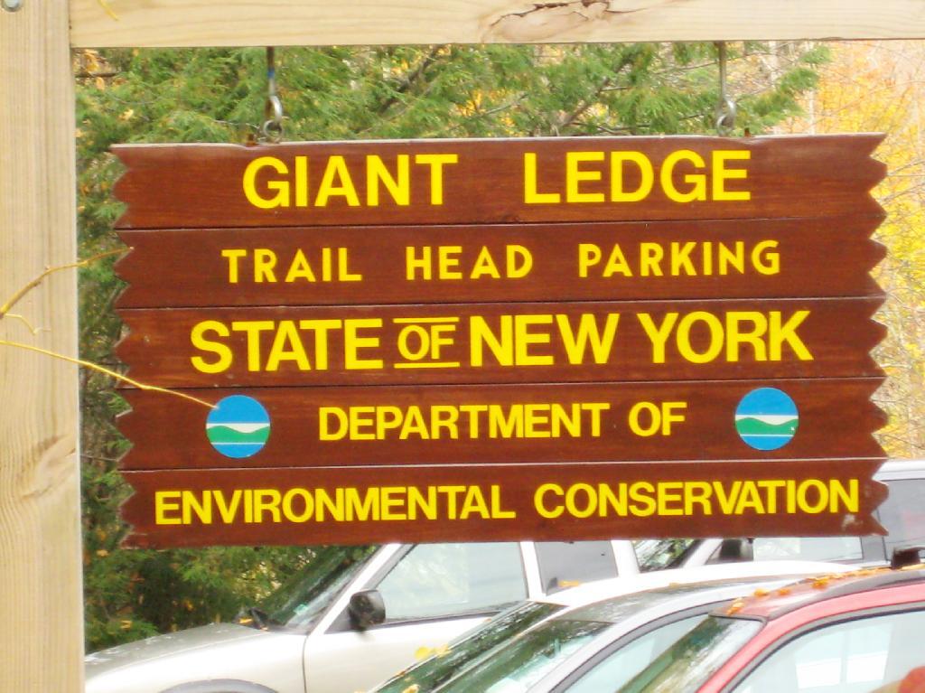
Giant Ledge Parking Area

I went hiking on Columbus Day, a little past peak foliage system after spending two nights camping out in Schoharie County. It is a short hike.

Short Hike to the Ledge

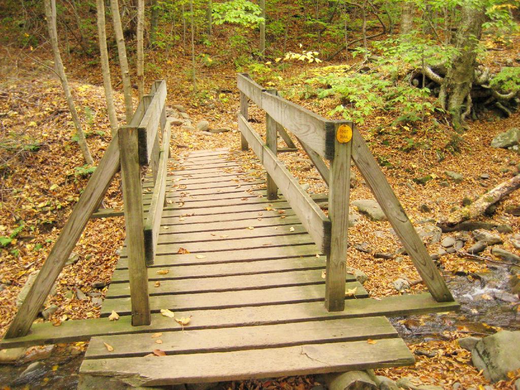
Here is cute little bridge that goes over an unamed creek, running down the northern face of Slide Mountain.

Bridge

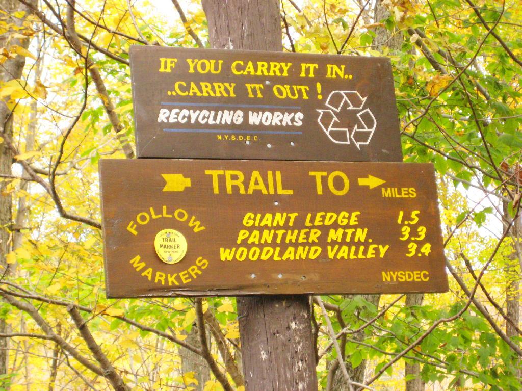
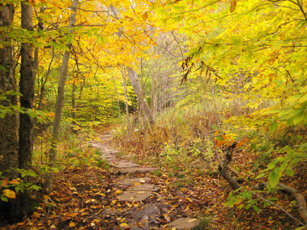
After a moderately steep 3/4 mile hike, you reach the “pass” that goes between Slide Mountain and Panther Mountain. This portion is relatively flat, until you reach the last 150 feet of elevation gain, to reach the top of Giant Ledge.

Plateau

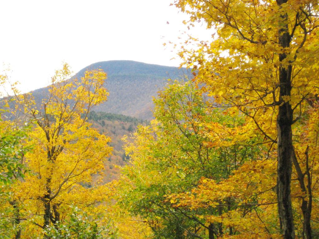
Here is Slide Mountain, peaking through the trees as your going up to the last bit to Giant Ledge.

Slide Mountain

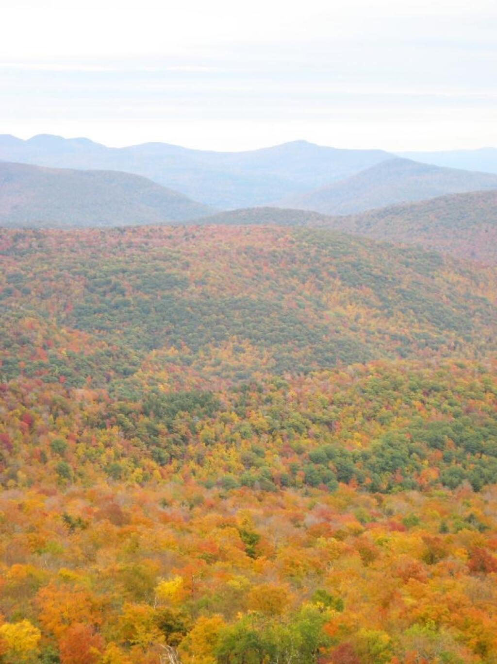
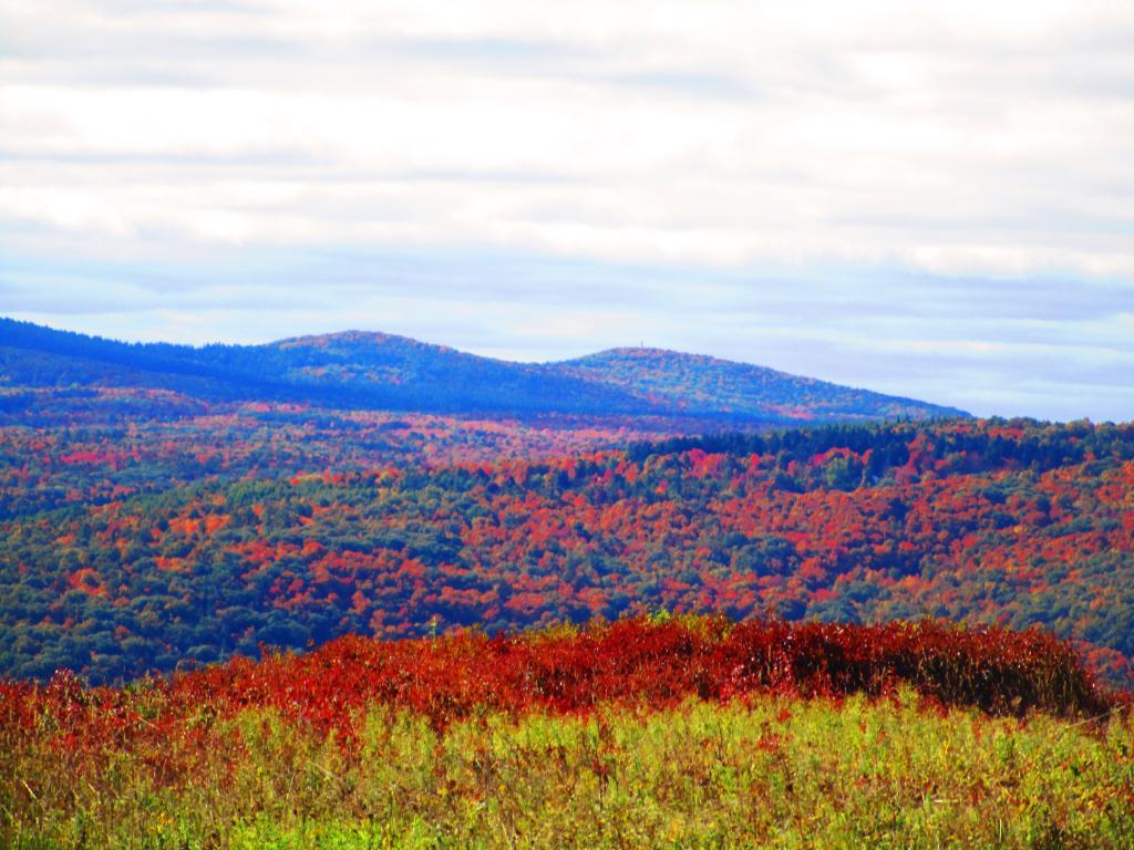
Looking off Giant Ledge, towards Woodlawn Valley (in the colorful foreground), with Plateau Mountain, Twin Mountain, Indian Head Mountain, and in the middle, Tremper Mountain.

 Colors

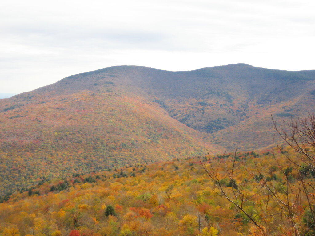
Here is the Wittenberg and Cornell Mountains.

Wittenberg and Cornell Mountains

This is the Woodlawn Valley’s beautiful colors.

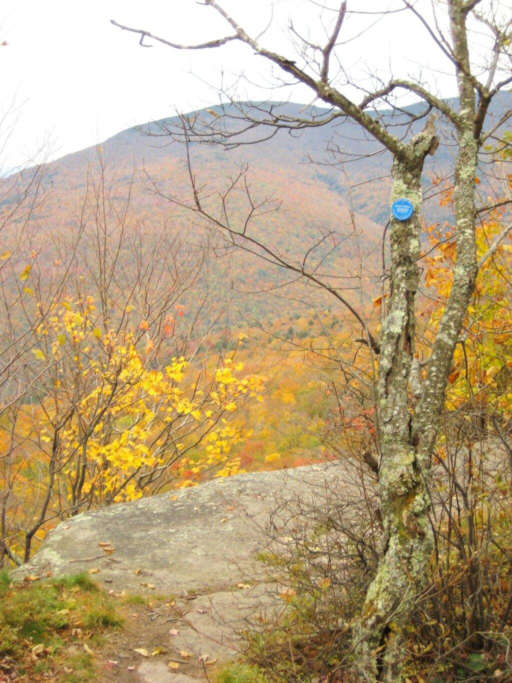
Part of the trail runs right along the edge.

Trail Along the Edge

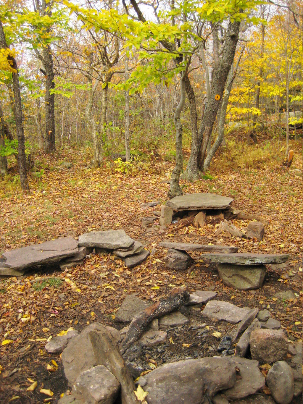
Off the main blue trail on Giant Ledge, there are two campsites at are primative, but nice. This also leads to a trail with views of the Big Indian Valley

Camp Here

Here is the second of two designated campsites on Giant Ledge. There are no campsites on Panther Mountain, which is too high to allow camping. There also is camping on the lower portion Slide Mountain, minus the wonderful views.

Campsite 2

After you hike across the trail to the campsites, there is another short little trail that runs over to a viewpoint with views of Big Indian Mountain, and the Big Indian Valley (where Slide Mountain Road runs).

Across the Potamac River to West VIrigina [Expires November 12 2023]

From here, I hiked up Panther Mountain. Here is a map of the hike.


View Hikes of 2009 in a larger map

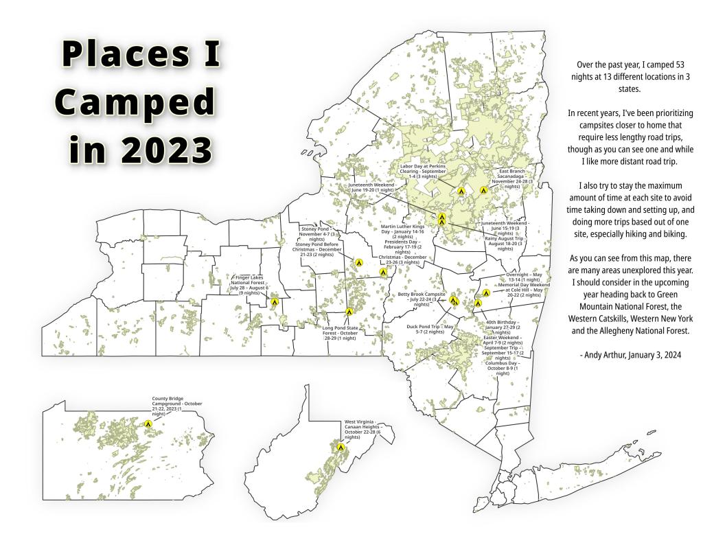
Places I Camped in 2023

While this year was a rainy one, and it rained during many of my trips, I was able to get out for 53 nights in the wilderness — mostly fairly close to home but I also did a trip down to West Virginia in late October with several trips to the Adirondacks, Central New York and summer vacation in the Finger Lakes.

Places I Camped in 2023

Martin Luther Kings Day โ€“ January 14-16 (2 nights)

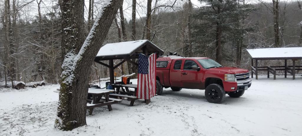
To start out my camping adventures in 2023, I drove out to Charles Baker State Forest and Brookfield Horse Camp. There wasn’t a lot of snow — just a dusting but it was a fun weekend, topped off by a beautiful sun-full glittery hike up Tassell Hill after a hoar frost. Explored Lost Pond and several of the trails in the middle of state forest.

Home for the weekend

40th Birthday โ€“ January 27-29 (2 nights)

For my fortieth birthday, I took off the Friday leading up to my 40th birthday to cross country ski and winter camp at Rensselaerville State Forest. It was a beautiful weekend with lots of blue skies, sufficient snow for skiing but not so much that was a ton of snowmobiles out on the trails.

Beautiful Day of Skiing

Presidents Day โ€“ February 17-19 (2 nights)

I decided for Presidents Day Weekend to do another trip out to Charles Baker State Forest and Brookfield Horse Camp. Slightly more snow then last time but again largely a snow-less winter, with some nice days for hikes through the various truck and horse trails. I hiked around much of state forest, especially the more southern part of the forest.

Evening on Truck Trail 13

Easter Weekend โ€“ April 7-9 (2 nights)

On Good Friday through Easter I camped at at Rensselaerville State Forest. The snow was gone and it was fairly mild though at times it was a bit cool. Spent a fair amount of time walking around and exploring the new OSI Parcel that has been recently added to state forest and is still largely open fields with sweeping views of the Catskill Mountains.

Hillcross Farm Pond

Duck Pond Trip โ€“ May 5-7 (2 nights)

The first Friday in May I took a half day from work and headed out to Schoharie County to camp at Duck Pond at Burnt-Rossman Hills State Forest. Originally the plan was to camp two nights at Duck Pond, hiking along the Long Path and exploring the state forest and then on Sunday hiking the Catskill Scenic Trail. That part of the trip changed when driving along Duck Pond Road the low tire pressure light came on I found a pallet nail in my truck tire. I was able to top off the truck tire and then change the tire when I got home and got the nail pulled and plugged. But it wasn’t the best way ever to end a trip early.

Spring

Overnight at Cole Hill – May 13-14 (1 night)

After visiting the folks on Mother’s Day Weekend, I decided to do a quick overnight hammock camp on Cole Hill State Forest in Berne. Nothing fancy or formal, it was as much a way to test out sleeping in my hammock with the bug screen. Kind of a chilly night, I took camp down fairly and headed home early in the morning.

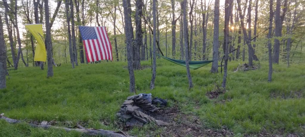
Hammock Camping on Cole Hill

Memorial Day Weekend at Cole Hill โ€“ May 20-22 (2 nights)

This year I decided to eschew the Adirondacks and Greene Mountains for Memorial Day Weekend due to the black flies, my desire to look at bicycles, and work I had to do on the Saturday morning leading up to the holiday weekend. I decided to hammock camp again Cole Hill State Forest in Berne. This was a three-day two night trip, so it it gave me a chance to bring more gear up the mountain, set up a more formal camp. Cooked on the fire, hiked around the forest. It was a warm weekend, but I enjoy the solitude, along with having good cell service for listening to podcasts and watching videos.

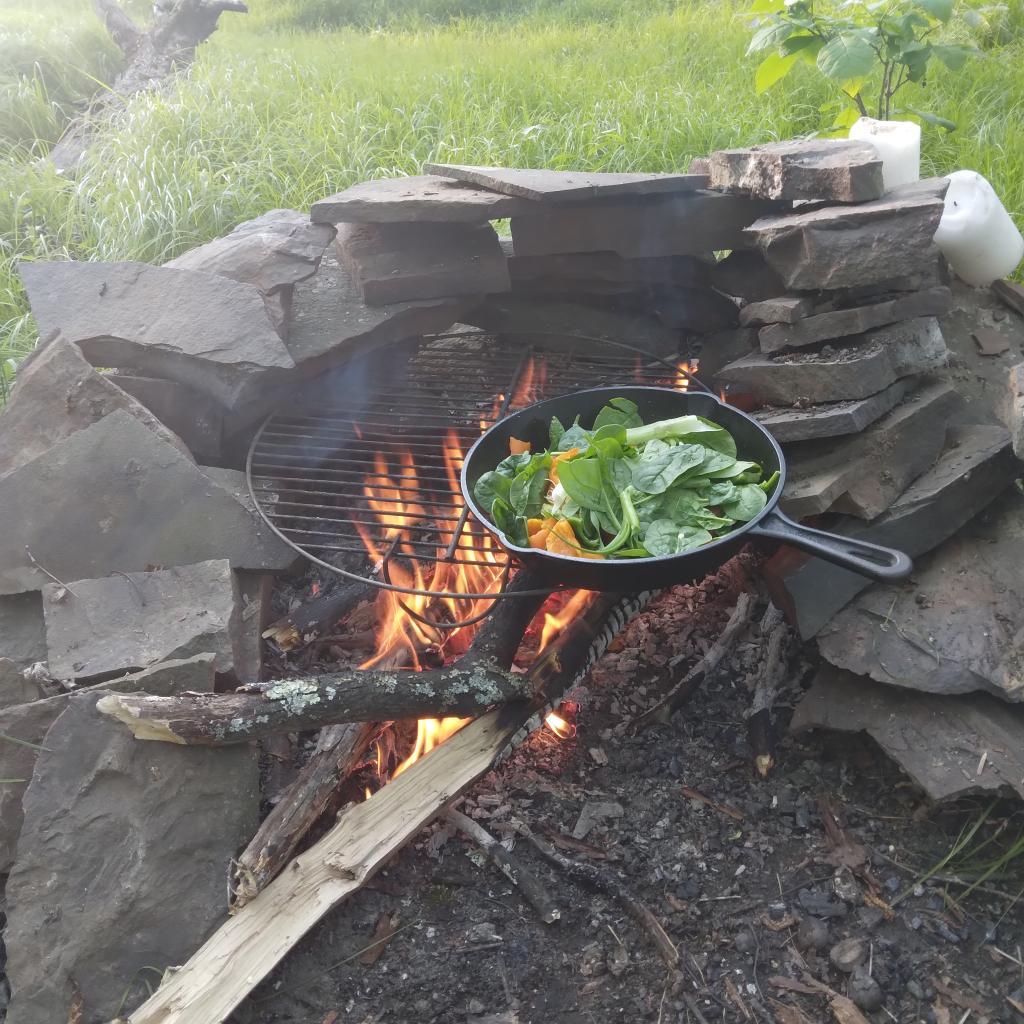
Cooking down dinner

Juneteenth Weekend on Piseco-Powley โ€“ June 15-20 (4 nights)

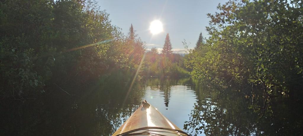
To kick off summer, I did my usual Juneteenth weekend camping trip, tacking on some days on the Juneteenth Holiday Weekend. It was a bit of a cool and rainy weekend to kick off summer, one that would actually be followed by many cool and rainy weekends where I would stay home. Camped at House Pond for the first three nights, spending time down floating in the tube on East Branch while the final night I camped up at Powley Bridge site and kayaked along the East Branch. Really, like often is the case, the best weather was the day I took down camp.

Evening on East Canada Creek

Catskill Scenic Trail Trip โ€“ July 22-24 (3 nights)

After several months of researching and visiting various bike shops, I finally got a mountain bike. I decided it would be fun to do as much of the Catskill Scenic Trail as I could before my summer vacation got underway. Actually did quite a bit of riding and hiking that weekend — started out hiking Pratts Rock’s then riding from Grand George to Hobart. Sunday, I rode from Fultonham to Middleburgh on NY 30, doing a quick climb up Vromans Nose, then stopping at the farm market then going to Mine Kill State Park to swim. Monday I rode from Hobart down to Bloomville, getting caught in a major thunderstorm and downpour a few miles north of Bloomville with no shelter in sight. The trail became super boggy, then I went to Mine Kill State Park for one more swim, and then out to folks house for Sunday dinner a day later then usual.

After the rain showers

Finger Lakes National Forest โ€“ July 28 โ€“ August 6 (9 nights)

Every year for nearly a decade and a half I’ve been doing summer vacation out in the Finger Lakes — camping in the National Forest and exploring as much as possible during my days there. The past few years I’ve been driving there on a Friday, to get a better campsite before they’re taken by the weekend campers. This year was no exception. With Blackie, my mountain bike, I did nearly all of the bike trails in the near vicinity, from the Black Diamond Trail to the Cayuta Valley Trail to Dresden – Penn Yan Canal Trail. Kayaked on both Cayuga and Scenic Lakes, swam many days at Watkins Glen State Park and Taughannock State Park, explored the Cornell Campus and Botanical Gardens on my bike. Got some good ice cream at the Spotted Duck, explored the Geneva Waterfront along with the Cayuga-Seneca Canalway. Some rain but compared to the wet summer that was, this was a pretty good week.

Morning on Searsburg Road

Piseco-Powley โ€“ House Pond Campsite โ€“ August 18-20 (3 nights)

The next few weeks for rainy and by the time I got away for one more long weekend, it promised to be fairly nice weekend but turned out to be fairly cool and cloudy with some rain. Back at the House Pond Campsite, did some swimming in East Branch, but with the mercury in the 60s most of the weekend, I didn’t spend a lot of time in the water. Hardly what I had dreamed when the I planned the weekend. Rode Blackie up to Goldmine Stream Falls and relaxed down by the falls for a bit, also sat down by the swimming hole off of the Old Edick Road Snowmobile Trail, watching the rain fall, bemoaning the wet and cold weather. Still it was good to get away for a bit, and I did do a fair amount of reading in hammock, under the protection of the bug net, as the bugs were bad after such a wet summer.

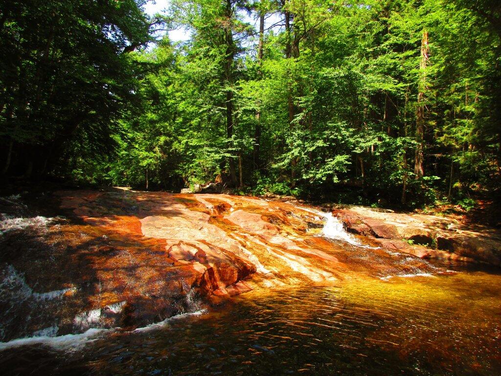
Gentle Drop Into A Golden Pool

Labor Day at Perkins Clearing – September 1-4 (3 nights)

I took the Friday off before Labor Day to get a jump on the holiday season travel, and set up camp at the site I really enjoy up at Perkins Clearing overlooking the mountains. Did a fair amount of riding along the various dirt roads of Perkins Clearing, including over to Mason Lake and on Sunday rode most of the way to the Spruce Lake Trailhead, though didn’t make it there in time as I got a bit of a late start as I spent the balance of the day reading and swimming in the Jessup River Bridge swimming hole. Labor Day, I rode around the Spectulator Tree Farm, doing a large loop, through the tree farm, past the north end of Elm Lake, then down to Austin Falls and Old Route 8B. I had hoped to get ice cream, but by the time I got to the ice cream shop they were out of soft-ice cream, and there was a long line. Summer was dragging to a close.

Kunjamunk River from Long Level Bridge

September Trip to Rensselearville State Forest โ€“ September 15-17 (2 nights)

With time being fairly tight and the weather only so-so I decided to do a two night trip close to home out in Rennselearville to ride some of the gravel trails, explore the OSI Parcel further and just enjoy an early autumn weekend camping.

Evening

Columbus Day at Rensselearville State Forest โ€“ October 8-9 (1 night)

Columbus Day Weekend was cold and rainy for the first half of the weekend, but the Sunday heading into Columbus Day was nice, so I decided to head out to Rensselaerville for a quick overnight at the campsite on CCC Road. Leaves were late this year, so not a lot of color, but it still was nice to get away for a night and ride some of the trails around.

Leonard Hill

West Virginia Trip โ€“ October 21-29 (8 nights)

The banner trip of the year was my trip down to West Virigina. While it started and ended in rain, it was a very enjoyable trip with lots of new adventures this year. Camped the balance of the week — 6 nights in Canaan Heights — doing day trips from that area. Overnighted one night driving down at County Bridge Campground in Pennsylvania, and a on the way back camped overnight at Long Pond State Forest in New York. Adventures in West Virginia included hiking at Dolly Sods, mountain biking at night in the sods of Canaan Heights, riding up and hiking to Table Rock, exploring Blackwater Falls State Park on the mountain bike, MonPower Mountain Bike Park, Thomas Rail Grade and the Olson Firetower. Rode part of the Great Allegheny Trail through the Cumberland Passage, and the two sections of the Chesapeake and Ohio Canalway, including the Paw Paw Tunnel.

Sunrise

Stoney Pond โ€“ November 4-7 (3 nights)

A little over a week back from West Virginia, I headed out to Madison County to ride the Tassel Hill Mountain Bike Trails at Alfred Woodford, the Chenango Canal Trail in Hamilton and Erie Canalway from Chittenango to Green Lakes State Park and then to Canastota and Wampsville. The first night was cold at Stoney Pond but the subsequent nights were quite pleasant and mild.

Old Canal Warehouse in Chittenango  [Expires November 19 2023]

Prospect Mountain – East Branch Sacanadaga โ€“ Buttermilk Falls/Hudson Special Management Area โ€“ November 24-28 (3 nights)

Strangely enough, I had never been up Prospect Mountain. So I decided the day after Thanksgiving (Black Friday) to hike up Prospect Mountain, and then spend the next two nights camping on East Branch of the Sacandaga River. The Saturday and Sunday was fairly cold, so I ended up spending the bulk of day hanging around camp, doing a bit of hiking around Fox Lair. Sunday, evening around 8 PM it started to sleet, then snow, then rain, Monday morning, it turned into a white globby snow, and I ended up taking down camp fairly early after discovering I was out of propane and then spent much of the day exploring the Hudson River Special Management Area – Buttermilk Falls.

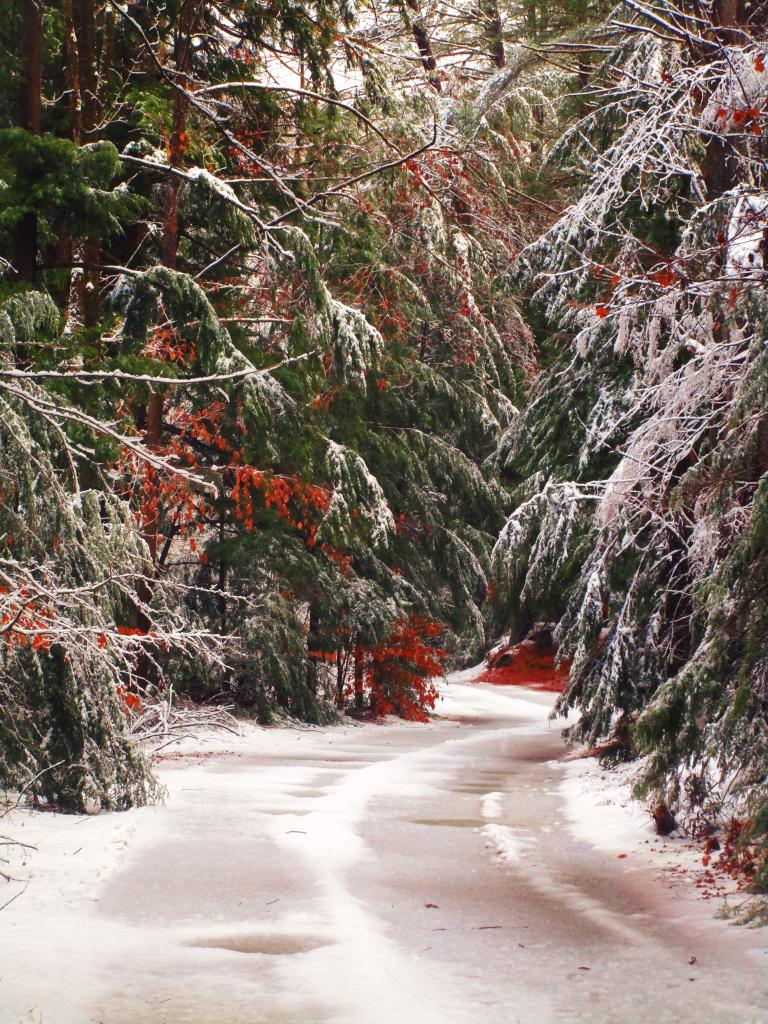
Icy River Road

Stoney Pond – Charles Baker โ€“ December 21-26 (5 nights)

On the days leading up to Christmas I decided to take a second trip to Madison County. I was originally planning to camp two nights at Stoney Pond then two nights at the Charles Baker Horse Camp but my family’s holiday plans were cancelled due to illness in my family, so I ended up staying an extra night at the horse camp, through the day after Christmas. On Friday, I rode the Erie Canalway from Canastota to East Verona, nearly to Rome. On Christmas Day I rode around many of truck trails at Charles Baker with my mountain bike, leaving my face splattered with mud. Many of the days were fairly cold and cloudy, but that’s too be expected in late December. Still it was a special way to spend Christmas.

Camp on this cold but still morning ?

Down to a single cooler ๐ŸงŠ

That’s always a sign that summer vacation is coming to a close. With all the various things I cooked up with the clams last night I was able to use up enough food that today I’m down to a single cooler and even that’s pretty empty post the scrambled eggs I had for breakfast the last of which I’m currently boiling as a protein source for today and tomorrow. Hoping if I can get some fresh farm stand peaches today I’ll be good on food until I get home Sunday, yet not bring much extra food home. The only thing that ultimately expired while camping was the black beans I cooked prior to camping, the fire got them last night, I eat everything else. And obviously Glen Dairy Bar ice cream tonight.

Good morning! Partly cloudy โ›… and 63 degrees at the Finger Lakes National Forest. โ›… Final morning before I take down camp tomorrow. There is a west-northwest breeze at 6 mph. ๐Ÿƒ. The dew point is 62 degrees. I think a rain stop came through briefly this morning but it looks like this has been a largely rain free week except for last Saturday afternoon and a brief shower on Monday when I was out hiking at Beebe Pond at Cornell University.

Today will be partly sunny ๐ŸŒž, with a high of 74 degrees at 3pm. Nine degrees below normal, which is similar to a typical day around September 17th. Maximum dew point of 63 at 9am. North wind 6 to 10 mph. A year ago, we had mostly sunny skies in the morning with a few breaks of sun the afternoon. It was sticky. The high last year was 93 degrees. It looks like we might actually get some hot weather come mid to late August, that’s good, I’ll plan my next long weekend for the Potholers then. The record high of 99 was set in 1955.

Today’s plans call for visiting Sugar Hill State Forest ๐Ÿด and riding and hiking some of the trails there. ๐Ÿšต Most of the horse trails there are open to mountain bikes and while I don’t plan to ride any of the real rough and muddy trails. Then head back to Watkins Glen, float on my tube โญ• in Seneca Lake, ride down through Rock Cabin Road, Montour Falls, Catharine WMA, ๐Ÿฆ Glen Dairy Bar, ๐Ÿฆ Seneca Harbor โš“ and watch the sunset ๐ŸŒ‡ before returning to camp โ›บ one last time around nine.

Solar noon ๐ŸŒž is at 1:14 pm with sun having an altitude of 64.4ยฐ from the due south horizon (-6.3ยฐ vs. 6/21). A six foot person will cast a 2.9 foot shadow today compared to 2.2 feet on the first day of summer. The golden hour ๐Ÿ… starts at 7:44 pm with the sun in the west-northwest (288ยฐ). ๐Ÿ“ธ The sunset is in the west-northwest (294ยฐ) with the sun dropping below the horizon at 8:24 pm after setting for 3 minutes and 11 seconds with dusk around 8:54 pm, which is one minute and 15 seconds earlier than yesterday. ๐ŸŒ‡ The best time to look at the stars is after 9:35 pm. At sunset, look for partly cloudy skies ๐ŸŒƒ and temperatures around 65 degrees. The dew point will be 55 degrees. There will be a north breeze at 6 mph. Today will have 14 hours and 22 minutes of daytime, a decrease of 2 minutes and 18 seconds over yesterday.

Yesterday I started my day at the Queen’s Castle on Caywood Point Seneca Lake. ๐Ÿฐ The morning started out quite gray โ˜๏ธ but then cleared out and was hot. I wouldn’t be surprised if today isn’t a similar kind of day. Then I headed across the northern part of the National Forest to Trumansburg ๐Ÿšฒ and rode from the top of the Taughannock Gorge parking ๐Ÿ…ฟ area along the Black Diamond Trail to Ithaca then rode along the Cayuga Inlet for a while before doing the 9 mile 450 ft climb back to Taughannock, and then rode Taughannock Falls Road to the overlook ๐Ÿšฒ and then up to NY 96 in Trumansburg. ๐ŸŠโ€โ™‚๏ธ Drove down to the Main Park area and swam and did the beach ๐Ÿ– thing in Cayuga Lake until 5 pm when I headed back to camp โ›บ – early – for onions, peppers, mushroom clams and sweet corn cooked in beer and clam broth ๐ŸŒฝ before bicycling along the dirt roads, up to Parameter Road up towards the north end of the National Forest before riding the Interloken Trail through the woods and then Horton Pasture, covering my mountain bike with cow manure and mud. ๐Ÿฎ Damn cows didn’t want to move off the trail.

Tonight will be partly cloudy ๐ŸŒƒ, with a low of 54 degrees at 6am. Eight degrees below normal, which is similar to a typical night around September 12th. Not surprising, it’s cooler in the Finger Lakes especially on Hector’s backbone. Maximum dew point of 56 at 6pm. North wind around 6 mph becoming calm in the evening. In 2022, we had mostly clear skies. It was very sticky. It got down to 70 degrees. The record low of 45 occurred back in 1994.

Looking ahead, next Saturday is Last Sunset After 8 PM in Albany ๐ŸŒ† but when the sun will be setting at 8:15 pm with dusk at 8:44 pm in the Finger Lakes. On that day in 2022, we had partly sunny and temperatures between 79 and 60 degrees. Typically, the high temperature is 83 degrees. We hit a record high of 99 back in 1944.

When the ice cream makes you sick ๐Ÿจ๐Ÿ˜”

Getting those large maple walnut sundaes at the Glen Dairy Bar is quite a tradition for me. But maybe not so much in my forties. All that sugar made me feel so sick and kept me up half the night. I might get ice cream later in the week but it won’t be a large portion for sure! I still feel kind of sick today from all that sugar. Soft ice cream has so much.

Good morning! Where did July go? Lost to vacationland I guess. Today is Ithaca day, exploring the city and the gorges on my bicycle. Beautiful day, partly sunny and 72 degrees at the Cass Park ๐Ÿž on Cayuga Lake. There is a northwest breeze at 9 mph. ๐Ÿƒ. The dew point is 58 degrees. Big day ahead. Monday, Monday on vacation. ๐Ÿ– It really doesn’t seem too bad.

As I noted, Today is Ithaca Day, that is I plan to do Ithaca is Gorges. Start out at Stewart Park ๐Ÿž this time starting closer to 9 am then 11:30 am. I need to stop and get ice on the way back to camp, the Enfield Dandy’s should be good for that. Mostly for the coolers but I’ll also fill one of the water bottles with ice so as it melts down in the evening I can use it for lemonade with Stevia. ๐Ÿ‹

I don’t have cell service up at camp so I’ve been slow at uploading photos to the blog ๐Ÿ“ธ as it requires a lot of data, and even when I bike or hike where I have good service ๐Ÿ“ถ it seems like it’s still pretty weak up on the backbone and in parts of Watkins Glen. Ithaca today I should have better service but too much blogging ๐Ÿ“ takes time away from adventures. ๐Ÿง—โ€โ™‚๏ธ Ain’t got no time for that!

Today will have a chance of showers, with thunderstorms also possible after 2pm. Partly sunny , with a high of 77 degrees at 4pm. Seven degrees below normal, which is similar to a typical day around September 8th. Maximum dew point of 59 at 12pm. Northwest wind around 10 mph. Chance of precipitation is 40%. New rainfall amounts of less than a tenth of an inch, except higher amounts possible in thunderstorms. A year ago, we had partly cloudy skies in the morning with some clearing in the afternoon. The high last year was 86 degrees. The record high of 98 was set in 1917.

That sugar from the ice cream was so bad. ๐Ÿคฎ I thought I was going to have the runs all night spraying poop ๐Ÿ’ฉ off the tailgate of my pickup, having to shovel it come the morning. Wasn’t that bad but I was bouncing off the walls well after midnight, riding the Forest Service roads after dark on my mountain bike ๐Ÿšต,, hanging out at Foster Pond well into the moonlit hours of Monday early hours with no desire to sleep. Sugar is a narcotic when your not used to eating it. Hell of it was I was still a bit hungry when I got back to camp but frying up an onion ๐Ÿง… with some fresh spinach more than filled me up fine. No alcohol yesterday, and only other thing I eat all day was a banana ๐ŸŒ or two, the remainder of pancake ๐Ÿฅž mix and sausage I had bought last winter. But they’re done now and I’m done with that chapter of my life in the thirties. I’m forty now.

Solar noon ๐ŸŒž is at 1:13 pm with sun having an altitude of 65.8ยฐ from the due south horizon (-5ยฐ vs. 6/21). A six foot person will cast a 2.7 foot shadow today compared to 2.2 feet on the first day of summer. The golden hour ๐Ÿ… starts at 7:48 pm with the sun in the west-northwest (289ยฐ). ๐Ÿ“ธ The sunset is in the west-northwest (296ยฐ) with the sun dropping below the horizon at 8:29 pm after setting for 3 minutes and 13 seconds with dusk around 8:59 pm, which is one minute and 7 seconds earlier than yesterday. ๐ŸŒ‡ At dusk you’ll see the Full ๐ŸŒ Moon in the southeast (133ยฐ) at an altitude of 6ยฐ from the horizon, 227,253 miles away. ๐Ÿš€ The best time to look at the stars is after 9:41 pm. At sunset, look for rain ๐ŸŒง and thunderstorms ๐ŸŒฉ and temperatures around 69 degrees. The dew point will be 58 degrees. There will be a north-northwest breeze at 6 mph. Today will have 14 hours and 33 minutes of daytime, a decrease of 2 minutes and 8 seconds over yesterday.

This morning I avoided anything with sugar and instead fried up spring onions, tomatoes, mushrooms, peppers with a bunch of spinach and an egg or two. ๐Ÿณ Added some parm cheese ๐Ÿง€ and MSG plus pepper. It was good. No desire for anything sweet at this point. ๐Ÿคฎ My stomach still is rumbling from the sugar. I also hard boiled eggs ๐Ÿฅš for protein later. Probably eat dinner on the run this evening.

Swimming ๐ŸŠ in Cayuta Lake at Taughannock, Buttermilk Falls swimming and Enfield Glen swimming are open until seven. That is after exploring the Casacadilla Glen at Cornell University and other bike ๐Ÿšฒ paths and trails in the city. Figuring a light snacky dinner when I get back, probably sugar free syrup plus kidney beans, or maybe I’ll cut into the watermelon ๐Ÿ‰ I got on Friday. That should be good but I know as soon as I cut into the watermelon the clock will be ticking โณand I’ll be eating a lot of water melon. Just like if I get clams ๐Ÿฆช later in the week. Eat eat eat! Just hopefully not get sick like all that ice cream.

Tonight will have a slight chance of showers and thunderstorms before 10pm. Partly cloudy ๐ŸŒƒ with a low of 54 degrees at 5am. Eight degrees below normal, which is similar to a typical night around September 12th. Maximum dew point of 58 at 6pm. Northwest wind around 6 mph becoming calm in the evening. Chance of precipitation is 20%. In 2022, we had cloudy skies in the evening, which became partly cloudy by the early hours of the morning. It was somewhat humid. It got down to 69 degrees. The record low of 46 occurred back in 1964.

Yesterday besides my adventures in eating and ice cream sickness it was a busy day, bicycled ๐Ÿšฒ 30 miles, hiked 4 ยฝ, ๐Ÿšถ swam for about a half hour. ๐ŸŠโ€โ™‚๏ธ Did all of the Catharine Valley Trail from Watkins Glen to Montour Falls to the end outside of Horsesheads in Pine Valley at the Mark Twain Golf Course โ›ณ. Rode in the evening along Rock Dam Road, you can really fly down there on a mountain bike. ๐Ÿšต Then along Airport Road ๐Ÿ›ฌ at the Catharine Valley WMA to Boat ๐Ÿ›ฅ Launch Lane, then over through the village to the Watkins Glen pier on Seneca Lake. Walked out on the pier, it was colorful evening ๐ŸŒƒ but the sunset was kind of blocked by clouds that came in late. Went back through Clute Park then rode back to my truck around dusk disappointed by the lack of a classic sunset. On the whole it was a beautiful day!

Going to close out vacation next weekend with good swimming weather. ๐ŸŠโ€โ™‚๏ธ Saturday, partly sunny, with a high near 79. Maximum dew point of 66 at 11am. Maybe paddle Seneca Lake then swim at the Watkins Glen pool. Sunday, mostly sunny, with a high near 83. Maximum dew point of 64 at 11am. Swimming in Cayuga Lake? Then head home around 4 pm or so to be home by dark? ๐Ÿก That’s a long way off, no need to think about it. Typical average high for the weekend is 83 degrees.

Looking ahead, there are 3 weeks until World Mosquito Day ๐Ÿž when the sun will be setting at 8:00 pm with dusk at 8:28 pm. Bugs seem worse this year then normal but no so bad now that the front came through and cooler. On that day in 2022, we had hot, partly sunny and temperatures between 88 and 70 degrees. Typically, the high temperature is 82 degrees. We hit a record high of 98 back in 1916.

Pines Along Cedar River Flow

Coordinates of Fire Towers Lit Up for Light Up the Night September 3, 2022 9 PM

Coordinates of Fire Towers Lit Up for Light Up the Night
September 3, 2022 9 PM


Name Latitude Longitude
Azure Mtn. 44.5412691466877 -74.500715014616
Balsam Lake 42.0453615282152 -74.5943899744151
Belfry 44.0977872311198 -73.5480590796979
Berry Hill 42.5498119175697 -75.6903168971155
Black 43.6068341623889 -73.5315613708008
Blue 43.8723074548714 -74.4007368455303
Cathedral Rock 44.15322 -74.91545
Cornell Hill 43.141365 -73.72195
Goodnow 43.959881365533 -74.2096108652094
Hadley 43.3769188552114 -73.9709664076338
Hunter 42.1779385299225 -74.2297636133714
Hurricane 44.2353039001798 -73.710108607601
Kane 43.1810875997078 -74.5151636314626
Mount Adam 44.0874918847472 -74.0228654001999
Mount Tremper 42.0739561817837 -74.2781544663862
Mt Arab 44.2046241193408 -74.5879311870301
Mt Morris 44.159722 -74.475556
Overlook 42.0850321045745 -74.0933608599262
Owls Head 43.9542993083868 -74.4984634763008
Page Pond 42.147778 -75.495
Red Hill 41.9238207235123 -74.5170637152794
Snowy Mt 43.700330181926 -74.3866018841036
Spectulator 43.497398 -74.359506
Spruce 43.216327545775 -73.9061208048149
St. Regis Mtn. 44.4085927729876 -74.3296147010155
Stillwater 43.861843114587 -75.0333296007225
Stissing 41.9566 -73.6928
Sweede 43.734901 -73.582871
Utsayatha 42.399075 -74.5895
Vanderwhacker Mountain 43.8982359573344 -74.0959140415274
Wakely 43.7358975965762 -74.5152311432257
Woodhull 43.6230249091415 -74.9615472479824

The Catskill Wilderness Areas

Trees and Mountains

The text of today’s fodder is based on the Catskill Park State Lands Master Plan, as revised in 2008. Maps were rendered by myself, using Quantum GIS and DEC Lands and Forests data.

Big Indian Wilderness

(Formerly Big Indian – Beaverkill Range Wilderness Area)

This wilderness is located in the Towns of Hardenburgh, Denning and Shandaken in Ulster County. It lies generally west of Oliverea and the Frost Valley Road, south of Belleayre Ski Center, east of Seager and Hardenburgh and north of Willowemoc and Claryville. The area ranges in width from 1 to 5 miles, is about 19 miles long and contains approximately 33,500 acres of land. Elevations range from 1,500 feet in McKenley Hollow to 3,840 feet where the state boundary crosses Doubletop Mountain. The mountains in the northeastern portion of the area are quite rugged, while those to the south and west are more characteristic of high hills. Water from the area flows into three New York City water supply reservoirs and the Delaware River Basin. Nine mountains or ridges with elevations of over 3000 feet make up the area.

Peaks

Doubletop* 3,860′
Haynes 3,420′
Big Indian 3,700′
Spruce 3,380′
Fir 3,620′
Eagle 3,600′
Hemlock 3,240′
Balsam* 3,600′
Beaver Kill Range 3,377′

* Maximum elevations given are not necessarily located within the Wilderness Area.

The forest cover is predominantly hardwood mixtures in various associations. Spruce and fir, while present at some of the higher elevations, are less noticeable here than in other Catskill wilderness areas.

Interior facilities consisting of foot trails and lean-tos are generally considered adequate.

Area statistics:

Approximate Area 33,500 Acres
Roads (non conforming) 1.4 Miles
Foot Trails 29.4 Miles
Lean-tos 6
Designated Campsites 5
Parking Lots 5
Public Use (visitors/year) 4,500
Exterior Boundary Line 67 Miles
Minimum Elevation 1,500′
Maximum Elevation 3,840′

Non-conforming uses:

Motor vehicle use of Black Bear Road from the wilderness boundary to Fall Brook Lean-to.

A UMP for this area was completed in June of 1993.

Hunter – West Kill Wilderness

(Formerly West Kill – North Dome Wilderness, Ox Clove Wild Forest, and a portion of the former Hunter Mountain Wild Forest)

The unit generally lies within the following boundaries: New York State Route 42 on the west, the Shandakan Wild Forest and NYS Route 28 to the south, and NYS Route 214 on the east. The northern extent of the unit is County Route 6, and continues along a line 100′ parallel to, and south or east of, the edge of Spruceton trailhead parking area and the centerline of the Spruceton Truck Trail, to the junction of the Colonel’s Chair Trail. A corridor, 100 feet either side of the center line of the Spruceton Truck Trail, from the Colonel’s Chair Trail to the summit of Hunter Mountain, culminating in a circle 175′ in radius from the center of the chimney on the observer’s cabin shall be within the Rusk Mountain Wild Forest.

The unit contains approximately 27,000 acres of land, and inside it’s boundaries are found the named mountain peaks of Balsam, Sherrill, North Dome, West Kill, Sheridan, Hunter and Southwest Hunter. Hunter Mountain is the second highest peak in the Catskills at 4,040 feet, and portions of it’s summit, along with a fairly extensive area on the summits of West Kill, North Dome and Sherrill Mountains are within the Catskill High Peaks Bird Conservation Area, and are of special significance in that they provide habitat for high elevation spruce-fir inhabitants such as Bicknell’s Thrush and the Blackpoll Warbler, among others.

There are currently two lean-to’s on the unit, the Diamond Notch lean-to located just off the Diamond Notch Trail, and the Devil’s Acre Lean-to off of the Devil’s Path Trail. Waters from this unit drain into Schoharie and Esopus Creeks and then into the Schoharie and Ashokan Reservoirs, which are in the New York City water supply system.

Area statistics:

Approximate Area 27,000 Acres
Foot Trails 18 Miles
Lean-to’s 2
Parking Lots 5
Minimum Elevation 920′ Maximum Elevation 4,040′

Indian Head Wilderness

(Formerly Plateau Mountain – Indian Head Mountain Wilderness Area)

This wilderness is located in the Town of Hunter, Greene County and the Towns of Saugerties and Woodstock, Ulster County. It lies generally west of the east boundary of the Catskill Park, south of Platte Clove, east of Devil’s Tombstone Campground and north of Lake Hill and Shady. The area ranges from 1 ½ miles to 3 ½ miles in width, is eight miles long and contains approximately 16,800 acres.

Elevations range from 900 to 3840 feet and the four major mountains in the area are visible against the skyline from all directions. Echo Lake, the only natural lake in a Catskill wilderness, is located in the east-central portion of the area. Water from this eastern section flows into the Kingston and Saugerties water supply reservoirs, while drainage from the central and western section flows into two New York City water supply reservoirs. Six named mountain peaks over 3,000 feet in elevation dominate the area.

Peaks

Plateau 3,840′
Indian Head 3,573′
Sugarloaf 3,800′
Olderbark 3,440′
Twin 3,640′
Plattekill 3,100′

The forest cover varies from extensive oak stands on the eastern most slopes to mature spruce-fir on top of Plateau Mountain. An excellent mature stand of northern hardwood and hemlock occupies the slopes south of the Saw Kill.

Echo Lake, unique to the Catskill wilderness, is very popular for undeveloped camping. A small number of scattered primitive tent sites with fire rings have been established and public camping is limited to their capacities.

Public access is provided by several foot trails entering the area, including the old road from Meads to Overlook Mountain.

Area statistics:

Approximate Area 16,800 Acres
Roads 6.6 Miles
Foot Trails 24.1 Miles
Cross-country Ski Trails 5.6
Lean-tos 3
Designated Campsites 10
Parking Lots 1
Public Use (visitors/year) 8,000
Length of Boundary 33 Miles
Minimum Elevation 900′
Maximum Elevation 3,840′

A UMP for this area was completed in October of 1992.

Slide Mountain Wilderness

(Formerly Slide Mountain – Panther Mountain Wilderness Area)

This wilderness is located in the towns of Shandaken, Denning and Olive in Ulster County. It lies generally south of NYS Route 28, west of West Shokan, north of the Peekamoose Road (County Route 42) and east of the Frost Valley Road (County Route 47). It surrounds the Woodland Valley Campground and abuts the Sundown Wild Forest to its south. This area ranges from 1 to 10 miles in width, is about 13 miles long, and contains approximately 47,500 acres of land. The wilderness boundary is 118 miles long.

The terrain is rugged and steep with elevations ranging from 1,100 to 4,180 feet. All water draining from the area eventually reaches three New York City water supply reservoirs by way of the East and West Branches of the Neversink River, Rondout Creek and Esopus Creek. Twelve named mountain peaks with elevations over 3000 feet exist in the area. Of these, six may still be considered trail-less to the extent that they have no marked and maintained trails.

Peaks with Trails

Slide 4,180′
Peekamoose 3,843′
Cornell 3,860′
Wittenberg 3,780′
Table 3,847′
Panther 3,720′

Trail-less Peaks

Lone 3,721′
Rocky 3,508′
Friday 3,694′
Van Wyck 3,206′
Wildcat 3,340′
Balsam Cap 3,623′

The forest cover consists of nearly every possible mixture and association of hardwood and softwood trees native to the mountain region. While hardwoods predominate higher elevations are often covered with red spruce and balsam fir.

This area receives more public use than any other Catskill wilderness. Superb vistas are found on Slide, Wittenberg, Cornell, Giant Ledge and Panther Mountains. Access via foot trails is available from the north, south, east and west.

Area statistics:

Approximate Area 47,500 Acres
Foot Trails 35.3 Miles
Lean-tos 3
Parking Lots 10
Designated Campsites 29
Public Use (visitors/year) 23,000
Length of Boundary 118 Miles
Minimum Elevation 1,100′
Maximum Elevation 4,180′

A UMP for this area was completed in March of 1987 and revised in October of 1998.

Windham – Blackhead Range Wilderness

(Formerly Blackhead Range, and North Mountain Wild Forests, and portions of Windham High Peak, and Black Dome Valley Wild Forests)

The combination of these Wild Forest areas creates the Windham – Blackhead Range Wilderness Area, which lies within the Greene County towns of Cairo, Hunter, Jewett, Windham and Durham. The classification of these former Wild Forest areas was changed to Wilderness because their combined area comprises approximately 17,100 acres and contains rugged, high elevation land that clearly exhibits wilderness character. This newly classified area has seven named mountain peaks over 3,000 feet in elevation.

They are:

Peaks Black Dome 3,980′
Windham High Pk 3,520′
Blackhead 3,940′
Stoppel Point 3,420′
Thomas Cole 3,940′
Burnt Knob 3,180′
Acra Point 3,100′

The unit also contains six unnamed peaks over 3,000 feet, which range from 3,040 feet to 3,540 feet in elevation. Of the five highest peaks in the Catskills, three – Black Dome, Thomas Cole and Blackhead – are in this unit. This concentration of 13 peaks over 3,000 feet, within an area of approximately 28 square miles, with limited access, structures and improvements (30 miles of maintained foot trails and two lean-to’s) make the Windham – Blackhead Range Unit an area with excellent wilderness character.

A fairly extensive area of old growth forest can be found on this unit at the higher elevations, along the ridge stretching from an area west of Thomas Cole Mountain to Blackhead Mountain, and on Windham High Peak. The presence of this old growth forest, with its distinctive flora and fauna, add to the wilderness character of the unit. The unit also includes the headwaters of the Batavia Kill and, to the south over the Blackhead Range, the headwaters of the East Kill. Both of these rivers flow into Schoharie Creek, and are an integral part of the New York City Watershed system.

The western boundary of this unit shall be the east side of the Elm Ridge Trail, Black Dome Trail leaving it within the Elm Ridge Wild Forest, continuing north along the drainage to the Catskill Park boundary. The southern boundary of the unit shall be the Escarpment Trail approximately one half mile south of Stoppel Point to a point on the Escarpment Trail where it comes closest to the eastern Forest Preserve boundary. Both North Point and Stoppel Point will be within the Wilderness area. Lands to the south of the south edge of the Escarpment Trail in this area, will be in the Kaaterskill Wild Forest.

Because the Windham – Blackhead Range Wilderness surrounds the smaller Colgate Lake Wild Forest Unit, and because they are linked together by public use, the Unit Management Plans for the two units shall be contained in one document.

Area statistics:

Approximate Area 18,0000 Acres
Foot Trails 30 Miles
Lean-tos 2
Parking Lots 1
Minimum Elevation 980′
Maximum Elevation 3,980′