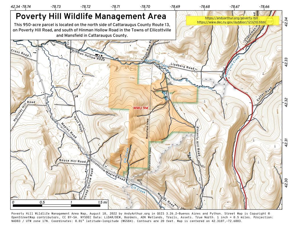
Public Lands Policy

NYS Watersheds

This map shows the 8-digit watersheds that intersect New York State. These hydrologic unit boundaries provide a uniquely identified and uniform method of subdividing the state into large drainage areas at 1:250,000 scale.

Data Source:  8-Digit Watersheds, New York State, 1994. U. S. Geological Survey (USGS). CUGIR. https://cugir.library.cornell.edu/catalog/cugir-007314


Birds visit new areas or vanish from the Adirondacks – Adirondack Explorer

Birds visit new areas or vanish from the Adirondacks – Adirondack Explorer

As Kirchman and others monitoring climate change in the Adirondacks realize, this small, unflashy species will also probably not be the last boreal bird to dwindle in the Adirondacks and then disappear from the region.

Fifteen years ago, if you asked almost any ornithologist about the biggest threat to birds, they would have cited habitat loss. Habitat loss remains a serious problem, but now biologists better understand how changes in habitat are linked to two key elements of climate change: temperature and precipitation. In the Adirondack Park, that relationship between habitat and climate change is illustrated through two long-running surveys of boreal birds—the birds of the Northern Forest that stretches from far Upstate New York into Vermont, New Hampshire and Maine. The Adirondack Park is the southernmost range for several boreal birds.