Lands of the Oneida Indian Nation
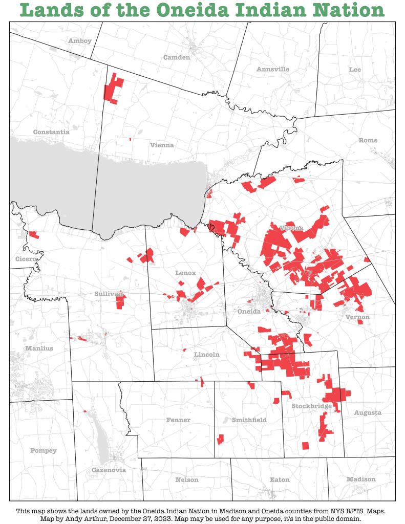
Here is an interactive map of the Lands of the Oneida Indian Nation from the NYS Tax Rolls that lets you zoom in and click to view property details from the tax rolls.
Here is an interactive map of the Lands of the Oneida Indian Nation from the NYS Tax Rolls that lets you zoom in and click to view property details from the tax rolls.

I was curious about the contemporary lands of the Oneida Indian Nation while I was out in Madison County during the Christmas holiday. I thought it would be an interesting map, querying it from the state tax maps.

Showing the buy outs and demolition of this portion of Oneida that is prone to flooding over the past 25 years.

The area to the north of Oneida Lake is heavily forested, while south of the lake is a combination of pasture/hay and crop land.
