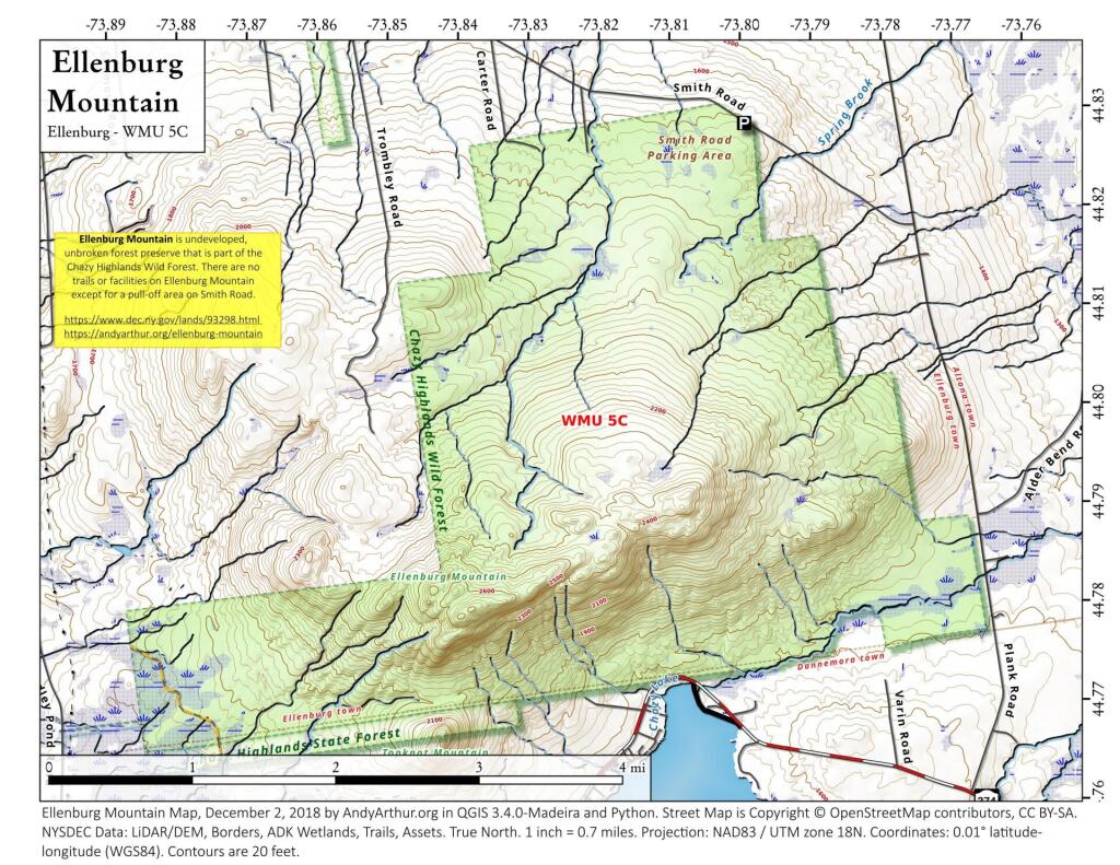
Ellenburg Mountain
Ellenburg Mountain is one of the few in the Adirondacks that lacks formal trail but is easily accessible by local roads such as NY 374 and Smith Road in Danemora.
Ellenburg Mountain is one of the few in the Adirondacks that lacks formal trail but is easily accessible by local roads such as NY 374 and Smith Road in Danemora.

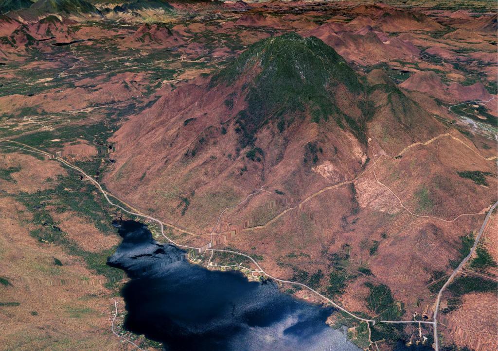
With Chazy Lake in the foreground.

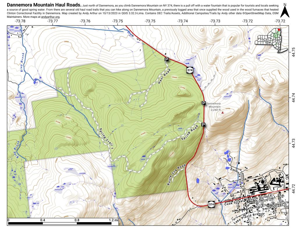
Just north of Dannemora, as you climb Dannemora Mountain on NY 374, there is a pull off with a water fountain that is popular for tourists and locals seeking a source of good spring water. From there are several old haul road trails that you can hike along on Dannemora Mountain, a previously logged area that once supplied the wood used in the wood furnaces that heated Clinton Correctional Facility in Dannemora. At one time, the state brought prisoners up here to log the area, and provide heat for their facility. The mixed cover is good for wildlife viewing and hunting in this remote, little visited portion of the Northern Adirondacks.

![Untitled [Expires June 24 2024]](https://andyarthur.org//data/photo_014145_large.jpg)
