Weekend #4 at House Pond Campsite

I spent a lot of my summer in 2021 at House Pond Campsite on Piseco-Powley Road, mainly because I really like the swimming hole on warm days when I hike down there and cool off and not have to drive anywhere, especially with the DWI laws these days. The only downside about camping there, is there isn't any place that is good for setting up a target and plinking and it's a bit closer to other campsites, so I can't listen to music quite as loud -- the nearest campsite is about 1,200 feet away.

Shot Shells

Plinking is fun to do up in the woods. This is a fairly safe gravel pit with a good backstop. Just people should pick up their trash after plinking.

Taken on Saturday January 27, 2007 at Cole Hill State Forest.

January 6, 2022 – Next Sixteen Weeks

Here is a brief chart that shows the climate normals, sunset times, and length of day for next four months in Elm Ave Park and Ride…

Week Date Dawn Sun-
rise
Sun-
set
Dusk Day Noon Sun Angle Avg High Avg Low Record Hi Record Low
0 Jan 6 6:53 am 7:25 am 4:37 pm 5:09 pm 9:12 24.9° 33 17 71 (2007) -19 (1996)
1 Jan 13 6:52 am 7:23 am 4:44 pm 5:16 pm 9:21 25.9° 33 16 71 (1932) -18 (1968)
2 Jan 20 6:48 am 7:19 am 4:53 pm 5:24 pm 9:33 27.3° 32 15 53 (2006) -22 (1970)
3 Jan 27 6:43 am 7:13 am 5:02 pm 5:32 pm 9:48 29° 33 15 62 (1974) -23 (1994)
4 Feb 3 6:37 am 7:06 am 5:11 pm 5:41 pm 10:04 30.9° 33 15 57 (2016) -18 (1955)
5 Feb 10 6:29 am 6:58 am 5:20 pm 5:49 pm 10:22 33.1° 35 16 53 (1955) -21 (1948)
6 Feb 17 6:20 am 6:48 am 5:29 pm 5:58 pm 10:40 35.4° 36 18 60 (1981) -16 (1973)
7 Feb 24 6:10 am 6:38 am 5:38 pm 6:07 pm 11:00 38° 38 20 74 (2017) -11 (1894)
8 Mar 3 5:59 am 6:27 am 5:47 pm 6:15 pm 11:20 40.6° 41 22 64 (2002) -10 (1950)
9 Mar 10 5:47 am 6:15 am 5:55 pm 6:23 pm 11:40 43.3° 43 24 72 (1977) 0 (1996)
10 Mar 17 6:35 am 7:03 am 7:04 pm 7:32 pm 12:00 46.1° 45 26 75 (1990) -1 (1916)
11 Mar 24 6:22 am 6:51 am 7:12 pm 7:40 pm 12:21 48.9° 48 29 69 (1976) 0 (1875)
12 Mar 31 6:10 am 6:38 am 7:20 pm 7:48 pm 12:41 51.6° 52 31 89 (1998) 12 (1923)
13 Apr 7 5:58 am 6:26 am 7:28 pm 7:56 pm 13:01 54.3° 55 34 87 (2010) 13 (1982)
14 Apr 14 5:45 am 6:15 am 7:36 pm 8:05 pm 13:20 56.8° 59 36 83 (1968) 19 (1973)
15 Apr 21 5:34 am 6:04 am 7:44 pm 8:13 pm 13:39 59.3° 62 39 89 (1923) 20 (1875)
16 Apr 28 5:23 am 5:53 am 7:51 pm 8:22 pm 13:58 61.6° 65 42 92 (1990) 25 (1947)

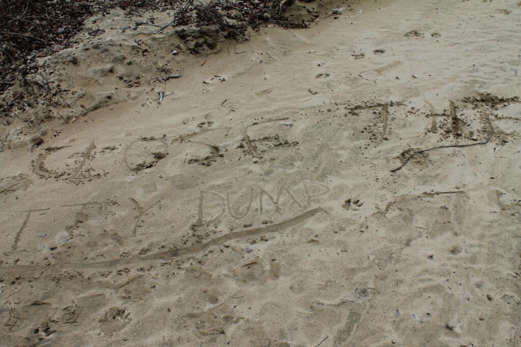
Close the City Dump

Somebody wrote this in the sand. In the other words, in the view of the Albany Pine Bush Commission: VANADALS DESTROY OF THE PINE BUSH PRESERVE BY WRITING IN THE SAND.

Taken on Saturday January 7, 2012 at Albany Pine Bush.

Upcoming Holidays – January 6, 2022

  • Next Thursday is Make Your Dream Come True Day 🏑 – Jan 13
  • One month – Save the Pine Bush Turns 44 πŸ¦‹ – Sun Feb 6
  • Five Thursdays until Clean Your Computer Day 🧹 – Feb 10
  • Six Thursdays until 5:30 PM Sunset πŸŒ‡ – Feb 17
  • Ten Thursdays until St. Patrick’s Day πŸ€ – Mar 17
  • 13 Thursdays until 7:30 PM Sunset πŸŒ‡ – Apr 7
  • 17 Thursdays until Cinco de Mayo 🀠 – May 5
  • 27 Thursdays until National Nude Day πŸ‘± – Jul 14
  • 34 Thursdays until Average High 70 πŸŽ‘ – Sep 1
  • 34 Thursdays until September 🍎 – Sep 1
  • 37 Thursdays until Autumn πŸ‚ – Sep 22
  • 46 Thursdays until Thanksgiving πŸ¦ƒ – Nov 24
  • 47 Thursdays until December πŸŽ„ – Dec 1
  • 11 months – Saint Nicholas Day πŸŽ… – Tuesday Dec 6
  • 49 Thursdays until Bill of Rights Day πŸ“œ – Dec 15
  • 50 Thursdays until Days are Getting Longer β˜€οΈ – Dec 22

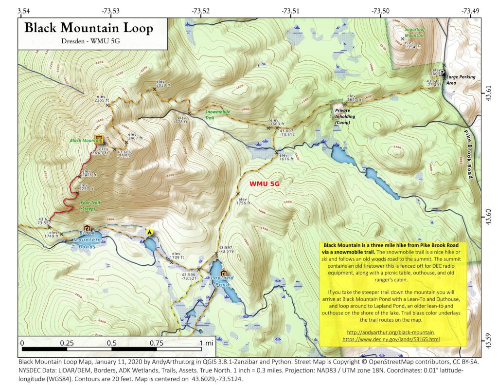
Black Mountain Loop

 Black Mountain Loop

Black Mountain is a three mile hike from Pike Brook Road via a snowmobile trail. The snowmobile trail is a nice hike or ski and follows an old woods road to the summit. The summit contains an old firetower this is fenced off for DEC radio equipment, along with a picnic table, outhouse, and old ranger's cabin.

If you take the steeper trail down the mountain you will arrive at Black Mountain Pond with a Lean-To and Outhouse, and loop around to Lapland Pond, an older lean-to and outhouse on the shore of the lake. Trail blaze color underlays the trail routes on the map.

https://andyarthur.org/black-mountain

https://www.dec.ny.gov/lands/53165.html