Going To Aldis Is Always Fun
I just like how small and quick in and out Aldi's is during the pandemic. Plus I think their prices are good but I wish they had more bulk foods.
Friday May 8, 2020 — Rensselear County

Declaring_it_is_the_policy_of_the_United_States_that_a_nuclear_Islamic_Republic_of_Iran_is_not_accep

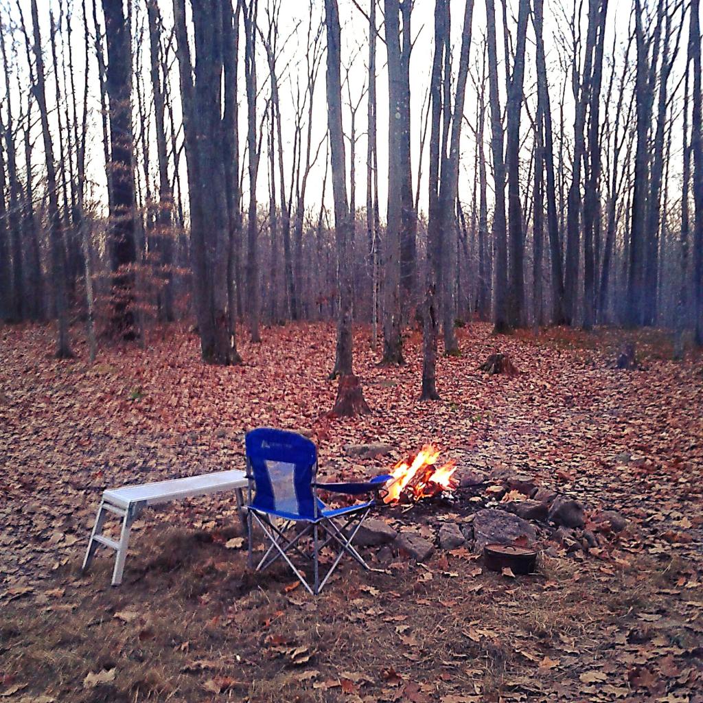
Sitting Next to the Campfire

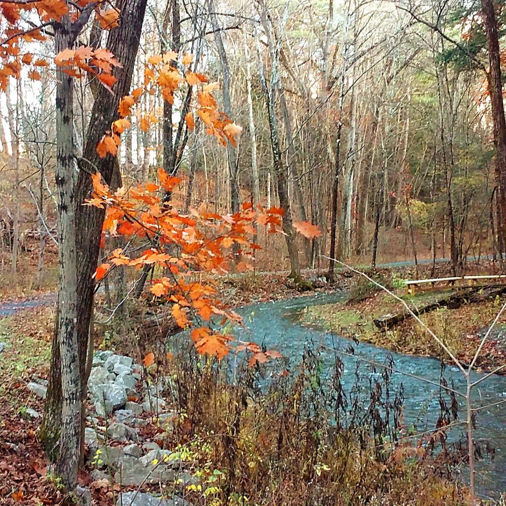
Canal Road
Very flat but a popular road for bicyclists.
Sunday November 8, 2020 — Delmar, NY

Main Street
Lit by gas lamps, and with a classic main street appearance.
Tuesday November 9, 2010 — Wellsboro PA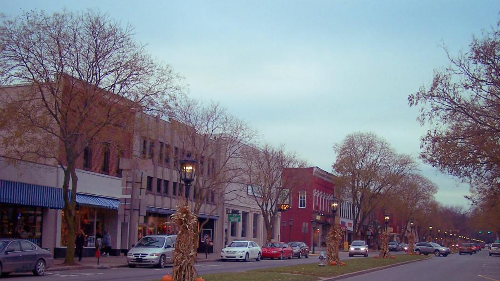

Last day of the year riding home from work at least at five o’clock 🚲
Doesn’t necessarily mean that I won’t still ride in the morning or if I can ask the big director to leave early occasionally I can leave early to ride home. But soon a lot more busing it home on the express hopefully! The authority is about to get rich on my back.
Good morning! Yeah, it’s Friday! Time to blow this town, head out to Mad County come Saturday. Kind of like West Virginia but with more cows and smaller hills and no coal fields but more manure. 💩 Partly clear and 35 degrees in Delmar, NY. 🌅 There is a south-southeast breeze at 8 mph. 🍃. Going to need the gloves 🧤 for the ride in.
My arm is a bit sore 💪🏻 feels like I spent the day at the range 🔫 from getting my COVID and flu jabs 💉 last night but I made up for it with a protein packed breakfast of eggs 🍳 with edamame 🟢, broccoli, onions and topped with lots of cottage cheese, tumeriac and nutritional yeast. Lunch is brown rice with lentils and even more edamame and tumeriac. 🍚 Got to have that protein to make my arm feel good. And coffee ☕ with cinnamon and ginger. Ginger and turmeric are supposed to reduce pain and aches. But I’ll be pissing like a cow in a pasture today. But then again tomorrow I’ll be heading to Madison County where they have a lot of them. 🐮
Had a mouse 🐁 making a ton of noise last night after I got up to take a piss 🚽 in part because I drunk extra water 💦 yesterday after getting vaxxed as recommended by the CDC to help with symptoms. I’m going to have to try the bucket trap again 🪤 or get more sticky traps as the spring trap isn’t working well as they keep picking the peanut 🥜 butter off it. Plus my arm 💪🏻 started to hurt a bit after waking up. Annoying as hell but I made up for it by sleeping into six. ⏰ No need to rush as the rice 🍚 doesn’t take as long as many of the soups I cook makes.
Got the space heater out yesterday. ♨ And also the heating pad and electric blanket though the later is not yet on my bed. 🛏 Only used the heating pad and space heater briefly the other night when my fingers were cold from riding home. Need to work on using some sealant tape around the door 🚪 to stop air leaks and put the storm windows 🪟 back in and lock the other windows for the winter. ❄ I think the cold season is back but just wait and we’ll have a heat wave 🌊 during this El Niño winter. ☀ Holding off on the central gas heat for now, as it’s not so cold plus the cooking each morning warms things up.
Today will be mostly sunny 🌞, with a high of 55 degrees at 3pm. Not as cold mercury wise but it might feel colder with the wind. One degree above normal, which is similar to a typical day around November 2nd. South wind 8 to 17 mph, with gusts as high as 28 mph. Going to feel that wind riding home past Ezra Prentiss one last time before the time change. 🌬️ 🚲 A year ago, we had mostly sunny skies in the morning with sunny skies in the afternoon. The high last year was 68 degrees. The record high of 75 was set in 1990. 0.9 inches of snow fell back in 1951.❄
Why can’t we have such nice weather for the four 4⃣ days election weekend? 🗳 I stuffed my split ticket ballot 🗳 into the box so I’m free to head to Madison County to camp ⛺ and ride trail 🚵 assuming that I can get the day off but it doesn’t look like a problem from the work calendar 🗓.
Solar noon 🌞 is at 12:40 pm with sun having an altitude of 32.4° from the due south horizon (-38.4° vs. 6/21). A six foot person will cast a 9.5 foot shadow today compared to 2.2 feet on the first day of summer. The golden hour 🏅 starts at 5:07 pm with the sun in the west-southwest (243°). 📸 The sunset is in the west-southwest (250°) with the sun dropping below the horizon at 5:47 pm after setting for 3 minutes and 5 seconds with dusk around 6:15 pm, which is one minute and 15 seconds earlier than yesterday. 🌇 The best time to look at the stars is after 6:50 pm. At sunset, look for partly clear skies 🌄 and temperatures around 54 degrees. Breezy, 16 mph breeze ⛅ from the south. Tomorrow will have 10 hours and 15 minutes of daytime, a decrease of 2 minutes and 31 seconds over today.
Got Udemy Business installed on my phone 📱 which allows you to take free online classes on a wide variety of technical ⚙ and computer 🖥 classes online with your library card 💳 at least those libraries that offer it 📚 which looks like mostly just the Bethlehem Library locally. I’m enrolled in a class on the basics of remote sensing 🌎 which is about using satellites 🛰 to detect what is happening on earth’s surface. Interesting stuff so many great classes offered. 🧑🏫
I survived my vaxxing 💉 and while I noticed my shoulder was a bit sore 💪🏻come the middle of the night it was worth it to know I’m significantly protected from the latest in the COVID and flu strains. Took both shots to the left arm. It was a nice walk 🚶 to the pharmacy, and no I didn’t become autistic and stab myself with a knife 🗡 or go crazy 🤪 donate any money 💵 to Sandy’s Hookers Promise. Honestly the only side effect I’ve had feels like an afternoon at the range with the kick of a shotgun. With ammo I bought down at West Virginia, lol 😂. Don’t tell Governor Hokey that. She should be just proud that I got my jabs and now the geriatrics and mentally retarded immune suppressed children won’t die, or so we’ve been told. Actually at this point the pharmacy ⚕ isn’t even filling out the COVID cards 🎴 and it was quick in an out, no crowds or this fake bullshit vaccine patriotism of a few years back.
It was a pleasant evening for that walk. 🏃♀️ As I won’t be riding home after tonight, I should plan to start doing more evening walks. I think I got out of the habit after riding home and being tired, after having a good meal and wanting to retire to bed with a book. 📖 But I really need to start doing more steps if I’m riding less. Got home and shredded some apples in the food processor 🍎 with cinnamon and ginger, had a good glass of water 🥛 and some yogurt in hope of avoiding the worse effects of the flu and COVID vaccine.
Tonight will be mostly cloudy 🌥, with a low of 38 degrees at 6am. Three degrees above normal, which is similar to a typical night around October 27th. South wind 8 to 13 mph. In 2022, we had clear skies in the evening, which became mostly clear by the early hours of the morning. It got down to 46 degrees. The record low of 17 occurred back in 1951.
Normally I wouldn’t head out of town right after vacation 🛻but it’s November and rifle season starts in two weeks and it might be cold and wet next week though the forecast has improved recently. The other director is off around Thanksgiving 🦃 so that makes it difficult for me to extend that weekend plus I wouldn’t want to miss turkey day and we may have snow by then. Who know, winters coming. ☃️
Tomorrow will be mostly cloudy 🌥, with a high of 56 degrees at 4pm. Two degrees above normal, which is similar to a typical day around October 31st. South wind around 7 mph. A year ago, we had mostly sunny skies in the morning with sunny skies in the afternoon. The high last year was 71 degrees. The record high of 76 was set in 1994. There was a dusting of snow in 2006.❄
Looking ahead to Sunday, partly sunny, with a high near 55. ☀ Calm wind becoming northwest around 6 mph in the afternoon. Definitely an improvement from a few days ago but maybe not quite as nice in Madison County That said if I can’t get Monday off its not the end of the world. Typical average high for the weekend is 54 degrees.
As previously noted, there are 3 weeks until Buy Nothing Day 🛍️ when the sun will be setting at 4:27 pm with dusk at 4:57 pm (Standard Time). On that day in 2022, we had partly sunny and temperatures between 49 and 24 degrees. Typically, the high temperature is 46 degrees. We hit a record high of 70 back in 2014.