Counties: Albany to Delaware / Dutchess to Livingston / Madison to Otsego / Putnam to Suffolk / Sullivan to Yates
Browse Topographic Maps: Full State / Historical USGS Topographic Maps
Counties: Albany to Delaware / Dutchess to Livingston / Madison to Otsego / Putnam to Suffolk / Sullivan to Yates
Browse Topographic Maps: Full State / Historical USGS Topographic Maps


Many of the state lands in New York have DEC websites. Here is an index of all of the webpages about various state lands. Some lands do not have state websites, and therefore do not have links to pages. Updated with UMP, acerage and formatting improvements from DEC data produced March 2016.
Here is an updated list of state land websites for March 2023. The topographic map links will bring you to the latest USGS Topographic Maps for the area, or you can use the listing to bulk download the maps or get the quads you need from USGS Store or your local map seller.


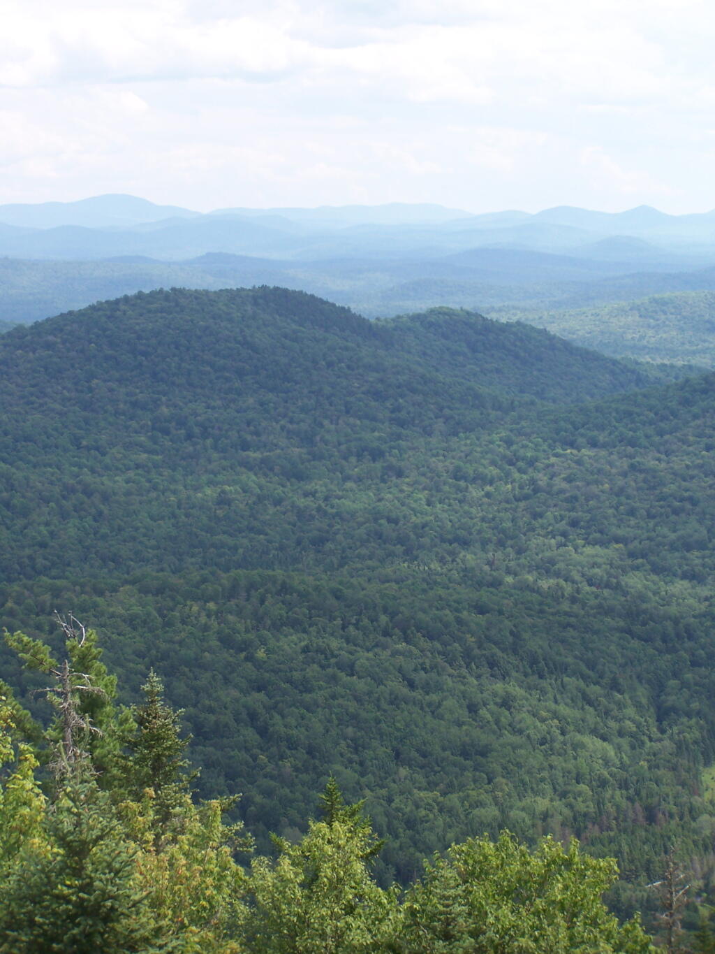
The Vanderwhacker Mountain Wild Forest Unit Management Plan mentions the following about Roadside Camping in the area…
“The area has a diverse mix of camping options available to visitors. There are designated interior camping facilities at Stony Pond, Cheney Pond, 29th Pond, and Newcomb Lake. There are also many Vanderwhacker Mountain Wild Forest roadside locations used seasonally by hunters and during the summer by others along the Northwoods Club Road, the Moose Pond Road, State Route 28N and at other locations. There is generally an increasing in camping in VMWF during the regular big game season.”
— NYSDEC Vanderwhacker Mountain Wild Forest UMP.
| Road | Number of Campsites |
|---|---|
| Boreas Road | 1 |
| Moose Pond Road | 3 |
| North Woods Road | 3 |
| NY 28N at Boreas River | 1 |
|
This lists out the 331 lean-tos with coordinates in the DEC's April 2017 release of Points of Interest Shapefile, that can be obtained from here: http://gis.ny.gov/gisdata/inventories/member.cfm?OrganizationID=529
| Location | Region | Facility | Name | Notes |
|---|---|---|---|---|
| 40.8977396062, -72.6606151038 |
1 | David A. Sarnoff Pine Barrens Preserve | Interior Lean- To | |
| 42.039846675, -74.593646931 |
3 | Balsam Lake Mountain Wild Forest | Balsam Lake Mountain Lean-To | |
| 42.0821851976, -74.5866114487 |
3 | Balsam Lake Mountain Wild Forest | Dry Brook Ridge Lean-To | |
| 42.0669125899, -74.6546347244 |
3 | Balsam Lake Mountain Wild Forest | Kelly Hollow Lean-To | |
| 42.0673682324, -74.5869876883 |
3 | Balsam Lake Mountain Wild Forest | Mill Brook Lean-To | |
| 42.0490509759, -74.644686588 |
3 | Balsam Lake Mountain Wild Forest | Mill Brook Ridge Lean-To | |
| 42.1150311581, -74.4907498238 |
3 | Belleayre Mtn Ski Center | East Ski Lean-To | |
| 42.1177186512, -74.5031992126 |
3 | Belleayre Mtn Ski Center | West Ski Lean-To | |
| 42.009105151, -74.4838519037 |
3 | Big Indian Wildernes Area | Biscuit Brook Lean-To | |
| 41.9980754336, -74.5603918334 |
3 | Big Indian Wildernes Area | Fall Brook Lean-To | |
| 42.0753394054, -74.4858565042 |
3 | Big Indian Wildernes Area | Mckinly Hollow Lean-To | |
| 42.0920121203, -74.50571316 |
3 | Big Indian Wildernes Area | Rider Hollow Lean-To | |
| 42.0502743293, -74.5106001667 |
3 | Big Indian Wildernes Area | Shandaken Brook Lean-To | |
| 42.0697505965, -74.2874492999 |
3 | Phoenicia – Mt. Tobias Wild Forest | Tremper Mountain Lean-To 1 | |
| 42.0719347774, -74.280350018 |
3 | Phoenicia – Mt. Tobias Wild Forest | Tremper Mountain Lean-To 2 | |
| 42.1388242073, -74.4544191301 |
3 | Shandaken Wild Forest | Rochester Hollow Lean-To | |
| 42.1027865494, -74.3948255307 |
3 | Slide Mountain Wilderness | Fox Hollow Lean-To | |
| 41.9591817103, -74.4068771821 |
3 | Slide Mountain Wilderness | Table Mountain Lean-To | |
| 42.0273156785, -74.3356447251 |
3 | Slide Mountain Wilderness | Terrace Mountain Lean-To | |
| 41.9400595492, -74.6320548238 |
3 | Willowemoc Wild Forest | Long Pond Lean-To | |
| 42.1584913515, -75.3620266032 |
4 | Arctic China State Forest | A-40 Lean-To | |
| 42.1528069973, -75.3102096425 |
4 | Barbour Brook State Forest | A-41 Lean To | |
| 42.2276166115, -75.3902198332 |
4 | Beals Pond State Forest | ||
| 42.3354251044, -73.4841812463 |
4 | Beebe Hill State Forest | Beebe Hill Lean-To | |
| 42.543303724, -74.4885945942 |
4 | Burnt-Rossman Hills State Forest | Eminence Lean-To | |
| 42.5282012278, -74.6420043552 |
4 | Clapper Hollow State Forest | Clapper Hollow Lean-To | |
| 42.0491041533, -74.9281738602 |
4 | Delaware Wild Forest | Cat Hollow Lean-To | |
| 42.0118726464, -74.9483763817 |
4 | Delaware Wild Forest | Mud Pond Trail Lean-To | |
| 42.0058597072, -74.8682131934 |
4 | Delaware Wild Forest | Pelnor Hollow Lean-To | |
| 42.0124988931, -74.9472696156 |
4 | Delaware Wild Forest | Trout Pond Trail Lean-To | Built For ADA |
| 42.6294376039, -74.2675434311 |
4 | Dutch Settlement State Forest | Lean-To | |
| 42.2197534864, -74.4391024687 |
4 | Halcott Mountain Wild Forest | Halcott Lean-To | |
| 42.313988005, -73.4414954693 |
4 | Harvey Mountain State Forest | Harvey Mountain Lean-To | |
| 42.1660752671, -74.2304343401 |
4 | Hunter-West Kill Wilderness | Devil’s Acre Lean-To | Good Condition |
| 42.1692897833, -74.2576582937 |
4 | Hunter-West Kill Wilderness | Diamond Notch Lean-To | |
| 42.3550413796, -74.3460668476 |
4 | Huntersfield State Forest | Lean-To | |
| 42.1196391066, -74.0873843029 |
4 | Indian Head Wilderness | Devils Kitchen Lean-To | |
| 42.0985881282, -74.0915994051 |
4 | Indian Head Wilderness | Echo Lake Lean-To | |
| 42.1357750354, -74.1634997793 |
4 | Indian Head Wilderness | Mink Hollow Lean-To | |
| 42.1894936316, -74.239507302 |
4 | Rusk Mountain Wild Forest | John Robb Lean-To | |
| 42.2789596573, -74.1033902943 |
4 | Windham Blackhead Range Wilderness | Batavia Kill Lean-To | |
| 42.3062546068, -74.1744107284 |
4 | Windham Blackhead Range Wilderness | Elm Ridge Lean-To | |
| 43.8755968409, -74.366426237 |
5 | Blue Mountain Wild Forest | O’neill Flow Lean-To | |
| 43.8873444776, -74.3788006261 |
5 | Blue Mountain Wild Forest | Tirrel Pond North Lean-To | |
| 43.829937473, -74.4366163022 |
5 | Blue Ridge Wilderness | Cascade Pond Lean-To | Fair |
| 43.8186736685, -74.4205248717 |
5 | Blue Ridge Wilderness | Stephens Pond Lean-To | Good |
| 43.8201917816, -74.4686803224 |
5 | Blue Ridge Wilderness | Wilson Pond Lean-To | Fair |
| 44.5989256982, -74.2285921246 |
5 | Debar Mtn. Wild Forest | Debar Mountian Lean-To | Debar Mtn Leanto |
| 44.4918501724, -74.2523227309 |
5 | Debar Mtn. Wild Forest | Grass Pond Lean-To | |
| 44.5192586399, -74.2710522386 |
5 | Debar Mtn. Wild Forest | Sheep Meadow Lean-To #1 | |
| 44.5193465505, -74.2711670085 |
5 | Debar Mtn. Wild Forest | Sheep Meadow Lean-To #2 | |
| 44.108205472, -73.7738312581 |
5 | Dix Mountain Wilderness | Bouquet Lean-To | |
| 44.0601596209, -73.8078167801 |
5 | Dix Mountain Wilderness | Lilian Brook Lean-To | |
| 44.044126198, -73.8058583966 |
5 | Dix Mountain Wilderness | Slide Brook Lean-To | |
| 44.1759172265, -73.7215350426 |
5 | Giant Mountain Wilderness | Giant Mtn. Lean-To | |
| 43.8863219437, -73.5641701351 |
5 | Hammond Pond Wild Forest | Eagle Lake Lean-To | |
| 43.9655912049, -73.6440374623 |
5 | Hammond Pond Wild Forest | Moose Mt Pond Lean-To | |
| 44.1447454969, -73.9547665307 |
5 | High Peaks Wilderness | Avalanche | |
| 44.1809734501, -73.8284043214 |
5 | High Peaks Wilderness | Bear Brook Lean-To | |
| 44.121015479, -73.9821264349 |
5 | High Peaks Wilderness | Beaver Point #1 | |
| 44.1207874446, -73.9817139904 |
5 | High Peaks Wilderness | Beaver Point #2 | |
| 44.1825279757, -74.1805220238 |
5 | High Peaks Wilderness | Blueberry Lean-To | |
| 44.1449655863, -73.8833895452 |
5 | High Peaks Wilderness | Bushnell Falls #1 Lean-To | |
| 44.1444007481, -73.8834828976 |
5 | High Peaks Wilderness | Bushnell Falls #2 Lean-To | |
| 44.1129718174, -73.9928913122 |
5 | High Peaks Wilderness | Calamity #1 Lean-To | |
| 44.1448580137, -74.2751710479 |
5 | High Peaks Wilderness | Calkin’s Brook Lean-To | |
| 44.1058294131, -74.3120366857 |
5 | High Peaks Wilderness | Calkin’s Creek Lean-To | |
| 43.9980126927, -74.3927845611 |
5 | High Peaks Wilderness | Catlin Bay #1 Lean-To | |
| 43.9972143811, -74.3959393656 |
5 | High Peaks Wilderness | Catlin Bay #2 Lean-To | |
| 44.1425166432, -74.1303582429 |
5 | High Peaks Wilderness | Cold River #2 Lean-To | |
| 44.091459278, -74.2576417508 |
5 | High Peaks Wilderness | Cold River #3 Lean-To | |
| 44.0913902533, -74.2557348025 |
5 | High Peaks Wilderness | Cold River #4 Lean-To | |
| 44.1427273763, -74.1298402107 |
5 | High Peaks Wilderness | Cold River Lean-To #1 Lean-To | |
| 44.1778467491, -73.833854921 |
5 | High Peaks Wilderness | Deer Brook Lean-To | |
| 44.141626874, -74.1069373468 |
5 | High Peaks Wilderness | Duck Hole #1 Lean-To | |
| 44.1416768647, -74.1065435467 |
5 | High Peaks Wilderness | Duck Hole #2 Lean-To | |
| 44.1142099053, -73.9556152329 |
5 | High Peaks Wilderness | Feldspar Lean-To | |
| 44.1186643668, -73.9840090128 |
5 | High Peaks Wilderness | Flowed Lands #2 Lean-To | |
| 44.1077341951, -73.9912056361 |
5 | High Peaks Wilderness | Griffin Lean-To | |
| 44.1773165403, -74.3218077012 |
5 | High Peaks Wilderness | Hemlock Hill Lean-To | |
| 44.1041784421, -74.0669132937 |
5 | High Peaks Wilderness | Henderson Lake Lean-To | |
| 44.1117549601, -74.0592189223 |
5 | High Peaks Wilderness | Henderson Lean-To | |
| 44.1178828905, -73.9873641274 |
5 | High Peaks Wilderness | Herbert Brook Lean-To | |
| 44.0026552882, -74.3864802633 |
5 | High Peaks Wilderness | Hidden Cove Lean-To | |
| 44.0760291647, -74.3235341651 |
5 | High Peaks Wilderness | Island House Lean-To | |
| 44.1494011459, -73.9557902347 |
5 | High Peaks Wilderness | Kagel Lean-To | |
| 44.0288002362, -74.367307986 |
5 | High Peaks Wilderness | Kelly Point #1 Lean-To | |
| 44.0287025672, -74.3671303487 |
5 | High Peaks Wilderness | Kelly Point #2 Lean-To | |
| 44.1706807759, -73.9050776091 |
5 | High Peaks Wilderness | Klondike Lean-To | |
| 44.1130126221, -73.9888393806 |
5 | High Peaks Wilderness | Livingston Point Lean-To | |
| 44.1469386475, -73.9552287453 |
5 | High Peaks Wilderness | Marcy Brook Lean-To | |
| 44.1579156535, -73.953395811 |
5 | High Peaks Wilderness | Marcy Dam #1 Lean-To | |
| 44.1573119259, -73.9533863686 |
5 | High Peaks Wilderness | Marcy Dam #2 Lean-To | |
| 44.1573817221, -73.9512823564 |
5 | High Peaks Wilderness | Marcy Dam #3 Lean-To | |
| 44.158399029, -73.9510719571 |
5 | High Peaks Wilderness | Marcy Dam #4 Lean-To | |
| 44.1586913289, -73.9524288871 |
5 | High Peaks Wilderness | Marcy Dam #5 Lean-To | |
| 44.1828433824, -74.0736410238 |
5 | High Peaks Wilderness | Moose Pond Lean-To | |
| 44.079589789, -74.2389368367 |
5 | High Peaks Wilderness | Moose Pond Stream Lean-To | |
| 44.0795538786, -74.2391509433 |
5 | High Peaks Wilderness | Moose Pond Stream Lean-To #2 | |
| 44.1992083493, -73.9059885406 |
5 | High Peaks Wilderness | Mr. Van Lean-To | |
| 44.0158171441, -74.1523218843 |
5 | High Peaks Wilderness | Newcomb Lake Lean-To #1 | |
| 44.0205306743, -74.1522782707 |
5 | High Peaks Wilderness | Newcomb Lake Lean-To #2 | |
| 44.1733720177, -74.1571389816 |
5 | High Peaks Wilderness | Number Four #1 Lean-To | |
| 44.1733860424, -74.1561240274 |
5 | High Peaks Wilderness | Number Four #2 Lean-To | |
| 44.1110695692, -73.9924324205 |
5 | High Peaks Wilderness | Opalescent Lean-To | |
| 44.1466502842, -73.8622440861 |
5 | High Peaks Wilderness | Ore Bed Brook Lean-To | |
| 44.1202212816, -74.1874471739 |
5 | High Peaks Wilderness | Ouluska Pass Brook Lean-To | |
| 44.0996351514, -73.9133647612 |
5 | High Peaks Wilderness | Panther Gorge Lean-To | |
| 44.0654422644, -74.3285192442 |
5 | High Peaks Wilderness | Plumley Point #1 Lean-To | |
| 44.0655989161, -74.3276122455 |
5 | High Peaks Wilderness | Plumley Point #2 Lean-To | |
| 44.1472355081, -74.318105399 |
5 | High Peaks Wilderness | Raquette Falls #1 Lean-To | |
| 44.1568302695, -74.3133083456 |
5 | High Peaks Wilderness | Raquette Falls #2 Lean-To | |
| 44.1710800022, -73.9974911766 |
5 | High Peaks Wilderness | Rocky Falls Lean-To | |
| 44.0414093849, -74.3501490964 |
5 | High Peaks Wilderness | Rodney Point #1 Lean-To | |
| 44.0429767454, -74.3493346475 |
5 | High Peaks Wilderness | Rodney Point #2 Lean-To | |
| 44.099413657, -74.1052871721 |
5 | High Peaks Wilderness | Santanoni Lean-To | |
| 44.159177638, -74.013876769 |
5 | High Peaks Wilderness | Scott Clearing Lean-To | |
| 44.1062441377, -74.2091536428 |
5 | High Peaks Wilderness | Seward Lean-To | |
| 44.1247329647, -73.9010796778 |
5 | High Peaks Wilderness | Slant Rock Lean-To | |
| 44.1988046777, -74.3183103111 |
5 | High Peaks Wilderness | Stony Creek Lean-To | |
| 44.1093110139, -73.961729679 |
5 | High Peaks Wilderness | Uphill Lean-To | |
| 44.1191510722, -73.9841831313 |
5 | High Peaks Wilderness | Walker Brook Lean-To | |
| 44.1221483174, -74.0532242803 |
5 | High Peaks Wilderness | Wallface Lean-To | |
| 44.1784419747, -74.1736369919 |
5 | High Peaks Wilderness | Ward Brook Lean-To | |
| 44.161824666, -73.8555947195 |
5 | High Peaks Wilderness | Wm. G. Howard Lean-To | |
| 44.1538919753, -73.8510077515 |
5 | High Peaks Wilderness | Wolf Jaw Lean-To | |
| 44.2530195934, -73.7180348153 |
5 | Hurricane Mountain Primitive Area | Gulf Brook Lean-To | Fair |
| 44.2607301476, -73.7100106669 |
5 | Hurricane Mountain Primitive Area | Lost Pond/Biesemeyer Lean-To | Fair |
| 43.5996600139, -73.5330643346 |
5 | Lake George Wild Forest | Black Mountain Ponds Lean-To | Lean-To With Privy And Fire Ring Black Mtn Pond Trail |
| 43.6193129088, -73.5841121844 |
5 | Lake George Wild Forest | Fifth Peak Lean-To | Lean-To W/ Privy And Fire Ring Tongue Mtn Range Trail |
| 43.5760391953, -73.5361031163 |
5 | Lake George Wild Forest | Fishbrook Pond North Lean-To | Leanto With Privy, Picnic Table And Fire Ring Fishbrook Pd-Lk Grg Shore Trl |
| 43.5738720148, -73.5384766731 |
5 | Lake George Wild Forest | Fishbrook Pond South Lean-To | Leanto With Privy, Picnic Table And Fire Ring Fishbrook Pd E Shore Trl |
| 43.6473357817, -73.5745337831 |
5 | Lake George Wild Forest | Five Mile Mountain Lean-To | Lean-To W/ Privy And Fire Ring Tongue Mtn Range Trail |
| 43.5778037953, -73.5168397538 |
5 | Lake George Wild Forest | Greenland Pond Lean-To | Leanto With Privy, Picnic Table And Fire Ring Greenland Pd Shelter Spur |
| 43.5958213341, -73.5179510245 |
5 | Lake George Wild Forest | Lapland Pond Lean-To | Campsite With Lean-To 13-27 Lapland Pond Lean-To Conector |
| 43.5871682823, -73.5277594231 |
5 | Lake George Wild Forest | Millman Pond Lean-To | Campsite With Lean-To 5-10 Old Farm To Millman Pond Trl |
| 44.3214560457, -74.0307860439 |
5 | Mckenzie Mtn. Wilderness | Placid Lean-To | |
| 44.3442169075, -73.9286469378 |
5 | Mckenzie Mtn. Wilderness | White Face Brook Lean-To | |
| 43.7790246336, -74.7044289121 |
5 | Moose River Plains Wild Forest | 8th Lake Island Lean-To | |
| 43.7801152974, -74.7044390115 |
5 | Moose River Plains Wild Forest | 8th Lake North Shore | |
| 43.7897826664, -74.6985922707 |
5 | Moose River Plains Wild Forest | 8thlake East Shore Lean-To | |
| 43.8316711731, -74.6617561796 |
5 | Moose River Plains Wild Forest | Beaver Bay Lean-To 1 | |
| 43.8316049364, -74.6615109228 |
5 | Moose River Plains Wild Forest | Beaver Bay Lean-To 2 | |
| 43.8314336654, -74.6609019165 |
5 | Moose River Plains Wild Forest | Beaver Bay Lean-To 3 | |
| 43.7478050188, -74.7441985068 |
5 | Moose River Plains Wild Forest | Seventh Lake Lean-To 1 | |
| 43.7507665118, -74.7346427944 |
5 | Moose River Plains Wild Forest | Seventh Lake Lean-To 2 | |
| 43.7563901134, -74.7178174969 |
5 | Moose River Plains Wild Forest | Seventh Lake Lean-To 3 | |
| 43.8145480145, -73.5808194792 |
5 | Pharaoh Lake Wilderness | Berrymill Pond Lean-To | Digitized From National Geographic Map |
| 43.8384100119, -73.5916749102 |
5 | Pharaoh Lake Wilderness | Clear Pond Lean-To | Digitized From National Geographic Map |
| 43.8412911595, -73.6316882519 |
5 | Pharaoh Lake Wilderness | Crab Pond Lean-To | Digitized From National Geographic Map |
| 43.8223693677, -73.5906397879 |
5 | Pharaoh Lake Wilderness | Grizzle Ocean Lean-To | Digitized From National Geographic Map |
| 43.8492027141, -73.6180024108 |
5 | Pharaoh Lake Wilderness | Lillypad Pond Lean-To | Digitized From National Geographic Map |
| 43.8500028762, -73.5895397847 |
5 | Pharaoh Lake Wilderness | Little Rock Pond Lean-To | Digitized From National Geographic Map |
| 43.8405296779, -73.6501782303 |
5 | Pharaoh Lake Wilderness | Oxshoe Pond Lean-To | Digitized From National Geographic Map |
| 43.7945783128, -73.6458567831 |
5 | Pharaoh Lake Wilderness | Pharaoh Lake #1 Lean-To | Digitized From National Geographic Map |
| 43.7966550547, -73.6403349616 |
5 | Pharaoh Lake Wilderness | Pharaoh Lake #2 Lean-To | Digitized From National Geographic Map |
| 43.8049450672, -73.6240085371 |
5 | Pharaoh Lake Wilderness | Pharaoh Lake #3 Lean-To | Digitized From National Geographic Map |
| 43.8049450672, -73.6240085371 |
5 | Pharaoh Lake Wilderness | Pharaoh Lake #3 Lean-To | Digitized From National Geographic Map |
| 43.8121074537, -73.6282851829 |
5 | Pharaoh Lake Wilderness | Pharaoh Lake #4 Lean-To | Digitized From National Geographic Map |
| 43.8021964679, -73.6391689125 |
5 | Pharaoh Lake Wilderness | Pharaoh Lake #5 Lean-To | Digitized From National Geographic Map |
| 43.8505590671, -73.5922949091 |
5 | Pharaoh Lake Wilderness | Rock Pond Lean-To | Digitized From National Geographic Map |
| 43.8581713271, -73.626483712 |
5 | Pharaoh Lake Wilderness | Tubmill Marsh Lean-To | Digitized From National Geographic Map |
| 44.3961331068, -74.3704212658 |
5 | Saint Regis Canoe Area | Fish Pond Site 2 Lean-To | Saint Regis Mountain |
| 44.3913013571, -74.3658071555 |
5 | Saint Regis Canoe Area | Fish Pond Site 5 Lean-To | New Lean-To Built Sept. 2010,Relocated Further From Water |
| 44.3808655111, -74.3200340382 |
5 | Saint Regis Canoe Area | St. Regis Pond Site 3 Lean-To | Lean-To Too Close To Water, Need To Move Back When Major Work Is Needed |
| 44.3250945507, -74.3498966646 |
5 | Saranac Lakes Wild Forest | Follensby Clear Lean-To | |
| 44.2866574735, -74.1626018103 |
5 | Saranac Lakes Wild Forest | Kiwasa Lake Site 3 Lean-To | |
| 44.3322955804, -73.9566258523 |
5 | Saranac Lakes Wild Forest | Lake Placid Site 2 Lean-To | Lake Placid |
| 44.3325954268, -73.9566801194 |
5 | Saranac Lakes Wild Forest | Lake Placid Site 3 Lean-To | Lake Placid |
| 44.2253525405, -74.3803783852 |
5 | Saranac Lakes Wild Forest | Raquette Lean-To | Built In 2013 Relocated From Trombley Landing Site |
| 44.3092299998, -74.1801499997 |
5 | Saranac Lakes Wild Forest | Saranac Islands Site 2 Lean-To | |
| 44.2890999998, -74.2172199999 |
5 | Saranac Lakes Wild Forest | Saranac Islands Site 45 Lean-To | |
| 44.2666999994, -74.2447999995 |
5 | Saranac Lakes Wild Forest | Saranac Islands Site 63 Lean-To | |
| 44.2729500004, -74.27398 |
5 | Saranac Lakes Wild Forest | Saranac Islands Site 81 Lean-To | |
| 44.2878799998, -74.2885399997 |
5 | Saranac Lakes Wild Forest | Saranac Islands Site 87 Lean-To | |
| 44.2287716477, -74.3755334312 |
5 | Saranac Lakes Wild Forest | Trombley Landing Lean-To | |
| 44.3028866826, -74.3026336593 |
5 | Saranac Lakes Wild Forest | Upper Saranac Lake Lean-To | |
| 43.8161997506, -74.6446678086 |
5 | Sargent Ponds Wild Forest | Big Island Lean-To 1 | |
| 43.8170896757, -74.6432509546 |
5 | Sargent Ponds Wild Forest | Big Island Lean-To 2 | |
| 43.8171339137, -74.6437800321 |
5 | Sargent Ponds Wild Forest | Big Island Lean-To 3 | |
| 43.8707715776, -74.6285067054 |
5 | Sargent Ponds Wild Forest | Boucher Point Lean-To #1 | |
| 43.8710064606, -74.6281079204 |
5 | Sargent Ponds Wild Forest | Boucher Point Lean-To #2 | |
| 43.8707202965, -74.629171869 |
5 | Sargent Ponds Wild Forest | Boucher Point Lean-To #3 | |
| 44.1027442039, -74.321862706 |
5 | Sargent Ponds Wild Forest | Deep Hole Lean-To | |
| 43.9262175397, -74.4753958672 |
5 | Sargent Ponds Wild Forest | Deerland Carry # 2 Lean-To | Fair Condition |
| 43.9257807189, -74.4758457554 |
5 | Sargent Ponds Wild Forest | Deerland Carry #1 Lean-To | Fair Condition |
| 43.9028470717, -74.5480629364 |
5 | Sargent Ponds Wild Forest | Forked Lake Lean-To | |
| 44.0814068183, -74.3358291461 |
5 | Sargent Ponds Wild Forest | Long Lake Nw Lean-To #1 | |
| 44.0825043385, -74.3339145725 |
5 | Sargent Ponds Wild Forest | Long Lake Nw Lean-To #2 | |
| 43.8593314968, -74.5626945075 |
5 | Sargent Ponds Wild Forest | Lower Sargents Pond Lean-To | Fair Condition |
| 43.8794136061, -74.6060523536 |
5 | Sargent Ponds Wild Forest | Outlet Bay Lean-To | Hit By Tree, 2011 |
| 43.9066458928, -74.5025901551 |
5 | Sargent Ponds Wild Forest | Pinebrook Lean-To | Fair Condition |
| 43.8368984989, -74.5352656022 |
5 | Sargent Ponds Wild Forest | Utowana Lake Lean-To | |
| 44.3317122951, -73.8997103538 |
5 | Sentinel Range Wilderness | Copperas Pond Lean-To | |
| 43.2171873383, -74.3641178087 |
5 | Shaker Mountain Wild Forest | Chase Lake Lean-To | |
| 43.1885867657, -74.4310218123 |
5 | Shaker Mountain Wild Forest | Holmes Lake Lean-To | |
| 43.6161332228, -74.1506253912 |
5 | Siamese Ponds Wilderness | E. Sacandaga River Lean-To | |
| 43.7007731961, -74.1581732825 |
5 | Siamese Ponds Wilderness | Hour Pond Lean-To | |
| 43.7278247362, -74.2012685562 |
5 | Siamese Ponds Wilderness | John Pond Lean-To | |
| 43.6775543215, -74.1916025718 |
5 | Siamese Ponds Wilderness | Puffer Pond #1 Lean-To | |
| 43.6765395437, -74.1997399401 |
5 | Siamese Ponds Wilderness | Puffer Pond #2 Lean-To | |
| 43.3974135952, -74.45529759 |
5 | Silver Lake Wilderness | Hamilton Lake Stream #1 Lean-To | |
| 43.3426710732, -74.4562907856 |
5 | Silver Lake Wilderness | Mud Lake Lean-To | |
| 43.2919354568, -74.4237351677 |
5 | Silver Lake Wilderness | Silver Lake Lean-To | |
| 44.4897002134, -73.8614267379 |
5 | Taylor Pond Wild Forest | North Shore Taylor Pond Lean-To | Managed By Operations |
| 44.4776887718, -73.881283087 |
5 | Taylor Pond Wild Forest | Northwest Shore Taylor Pond Lean-To | Managed By Operations |
| 44.3997973549, -73.5145569962 |
5 | Taylor Pond Wild Forest | Poke-O-Moonshine Summit Lean-To | |
| 44.4828880086, -73.8537772441 |
5 | Taylor Pond Wild Forest | South East Taylor Pond Lean-To | Managed By Operations |
| 43.9326741166, -73.9690844017 |
5 | Vanderwhacker Mountain Wild Forest | Cheney Pond Lean-To | |
| 43.8387348153, -73.9856219154 |
5 | Vanderwhacker Mountain Wild Forest | Stony Pond Lean-To | |
| 43.6259693968, -74.5492715037 |
5 | West Canada Lake Wilderness | Beaver Pond (AKA Cedar Lakes Lean-To #2) | |
| 43.6787448835, -74.4954982188 |
5 | West Canada Lake Wilderness | Carry Lean-To | |
| 43.628125665, -74.5404732399 |
5 | West Canada Lake Wilderness | Cedar Lakes #1 Lean-To | |
| 43.6084635843, -74.559724172 |
5 | West Canada Lake Wilderness | Cedar Lakes #3 Lean-To | |
| 43.6524139144, -74.4903803529 |
5 | West Canada Lake Wilderness | Colvin Brook Lean-To | |
| 43.5968984709, -74.5316653645 |
5 | West Canada Lake Wilderness | Pillsbury Lake Lean-To | |
| 43.5807608964, -74.576533363 |
5 | West Canada Lake Wilderness | Sampson Lake Lean-To | |
| 43.5872448097, -74.6215788384 |
5 | West Canada Lake Wilderness | South Lake Lean-To | |
| 43.5272841126, -74.6099246975 |
5 | West Canada Lake Wilderness | Spruce Lake #1 Lean-To | |
| 43.5346306298, -74.6080858031 |
5 | West Canada Lake Wilderness | Spruce Lake #2 Lean-To | |
| 43.5371297279, -74.608209628 |
5 | West Canada Lake Wilderness | Spruce Lake #3 Lean-To | |
| 43.4527175892, -74.5822815394 |
5 | West Canada Lake Wilderness | T Lake Lean-To | |
| 43.586987614, -74.613997971 |
5 | West Canada Lake Wilderness | West Canada Creek Lean-To | |
| 43.5931622288, -74.6268866843 |
5 | West Canada Lake Wilderness | West Lake #1 Lean-To | |
| 43.5970642572, -74.6231056496 |
5 | West Canada Lake Wilderness | West Lake #2 Lean-To | |
| 43.5102617091, -74.0492883971 |
5 | Wilcox Lake Wild Forest | Lizard Pond Lean-To | Digitized From National Geographic Map |
| 43.3363734227, -74.2173211966 |
5 | Wilcox Lake Wild Forest | Murphy Lake Lean-To | Digitized From National Geographic Map |
| 43.396075559, -74.1532214824 |
5 | Wilcox Lake Wild Forest | Wilcox Lake #1 Lean-To | Digitized From National Geographic Map |
| 43.39859675, -74.1554639493 |
5 | Wilcox Lake Wild Forest | Wilcox Lake #2 Lean-To | Digitized From National Geographic Map |
| 44.0021452737, -74.7756817712 |
5 | William C. Whitney Wilderness | Lake Lila # 7 Lean-To | |
| 44.4244015852, -73.8486868866 |
5 | Wilmington Wild Forest | Cooper Kill Lean-To | Too Close To Water, Need To Replocate, Do Not Repair |
| 44.1070894301, -75.0674448544 |
6 | Aldrich Pond Wild Forest | Streeter Lake Lean-To | Wood |
| 43.7434886212, -74.8776068003 |
6 | Alger Island Campground | Campsite # 01 | |
| 43.7443528827, -74.8771318496 |
6 | Alger Island Campground | Campsite # 02 | |
| 43.7456011181, -74.8768832894 |
6 | Alger Island Campground | Campsite # 03 | |
| 43.7466942129, -74.8745145576 |
6 | Alger Island Campground | Campsite # 04 | |
| 43.746535972, -74.8735980503 |
6 | Alger Island Campground | Campsite # 05 | |
| 43.7467703384, -74.8722666576 |
6 | Alger Island Campground | Campsite # 06 | |
| 43.7465482669, -74.8718037808 |
6 | Alger Island Campground | Campsite # 07 | |
| 43.7458848539, -74.8729191925 |
6 | Alger Island Campground | Campsite # 08 | |
| 43.7454701717, -74.8727721949 |
6 | Alger Island Campground | Campsite # 09 | |
| 43.7450840439, -74.8725955649 |
6 | Alger Island Campground | Campsite # 10 | |
| 43.744783668, -74.8724088972 |
6 | Alger Island Campground | Campsite # 11 | |
| 43.7441622435, -74.8727256743 |
6 | Alger Island Campground | Campsite # 12 | |
| 43.7440135576, -74.8739878218 |
6 | Alger Island Campground | Campsite # 13 | |
| 43.7431429387, -74.875172598 |
6 | Alger Island Campground | Campsite # 14 | |
| 43.7428736074, -74.8760835968 |
6 | Alger Island Campground | Campsite # 15 | |
| 43.6000735406, -75.0530032053 |
6 | Black River Wild Forest | Bear Lake Lean-To | |
| 43.5245079024, -75.0409215605 |
6 | Black River Wild Forest | Chub Pond #1 Lean-To | Rehabbed In 2008 |
| 43.5298225654, -75.0424937056 |
6 | Black River Wild Forest | Chub Pond #2 Lean-To | Built By Lean-To Permit 1963, Taken Care Of By Plumley Family |
| 43.5537469236, -75.059377614 |
6 | Black River Wild Forest | Gull Lake Lean-To | |
| 43.5341150034, -74.9280935302 |
6 | Black River Wild Forest | Lean-To | |
| 43.6299248982, -75.0362877527 |
6 | Black River Wild Forest | Remsen Falls Lean-To | Rehabbed In 2008 |
| 43.5589136946, -75.0030576033 |
6 | Black River Wild Forest | Sand Lake Falls Lean-To | Rehabbed In 2008 |
| 43.5998849075, -75.0203817469 |
6 | Black River Wild Forest | Woodhull Lake Lean-To | Rehabbed In 2008, Double Sized Lean-To |
| 43.6520754244, -75.0592470923 |
6 | Black River Wildforest | Nelson Lake Trail Lean-To | |
| 43.3445446485, -75.6722203255 |
6 | Cobb Brook State Forest | Leanto | |
| 44.1990987752, -74.8148790735 |
6 | Cranberry Lake Wild Forest | Bear Mountain Lean-To | |
| 44.2105729246, -74.7181527787 |
6 | Cranberry Lake Wild Forest | Burntbridge Pond Lean-To | |
| 44.1533999108, -74.8840290725 |
6 | Cranberry Lake Wild Forest | Ranger School Lean-To | Campsite 41 Aka Inlet Flow Lean-To |
| 44.0529214425, -74.9471939334 |
6 | Five Ponds Wilderness | Big Shallow Lean-To | Cs 30 |
| 44.0528916324, -75.0090580588 |
6 | Five Ponds Wilderness | Cage Lake Lean-To | |
| 44.0931113064, -74.8498397365 |
6 | Five Ponds Wilderness | Cowhorn Pond Lean-To | |
| 44.1123581654, -74.8914922468 |
6 | Five Ponds Wilderness | Janacks Landing Lean-To | With Full Sized Privy |
| 44.0474525004, -74.9526919257 |
6 | Five Ponds Wilderness | Little Shallow Lean-To | Cs 30 |
| 44.1198328093, -74.8454890242 |
6 | Five Ponds Wilderness | Olmstead Pond Lean-To | With Full Sized Privy |
| 44.0689970407, -74.9112845696 |
6 | Five Ponds Wilderness | Oswegatchie River Site 13 Lean-To | Cs 13 Lt |
| 44.0688665373, -74.9093532798 |
6 | Five Ponds Wilderness | Oswegatchie River Site 15 Lean-To | Cs 15 Lt |
| 44.0746275016, -74.9613775006 |
6 | Five Ponds Wilderness | Oswegatchie River Site 34 Lean-To | Cs 34 Lt |
| 44.0843538607, -74.9687312803 |
6 | Five Ponds Wilderness | Oswegatchie River Site 38 Lean-To | Cs 38 Lt |
| 44.0154640897, -75.0054753701 |
6 | Five Ponds Wilderness | Sand Lake Lean-To | Cs 30 |
| 43.9284894776, -74.9448704212 |
6 | Five Ponds Wilderness | Trout Pond Lean-To | |
| 43.9284894776, -74.9448704212 |
6 | Five Ponds Wilderness | Trout Pond Lean-To | |
| 44.0299676783, -74.9801386129 |
6 | Five Ponds Wilderness | Wolf Lake Lean-To | Cs 30 |
| 43.7029255425, -75.0960024266 |
6 | Haderondah | Middle Branch Lake Lean-To | |
| 43.6859486954, -75.0986138399 |
6 | Haderondah | Middle Settlement Lake Lean-To | |
| 44.1511613292, -74.5657606156 |
6 | Horseshoe Lake Wild Forest | Black Bay Lean-To | Checked 11/2015 |
| 44.196860294, -74.5121752893 |
6 | Horseshoe Lake Wild Forest | Eagle Landing Lean-To | Tupper Lake Site #5 |
| 43.8235350455, -75.1693122081 |
6 | Independence River Wild Forest | Panther Pond Lean-To | |
| 43.7083935125, -75.14645298 |
6 | Independence River Wild Forest | Pine Lake Lean-To | |
| 43.8089062032, -75.474955964 |
6 | Lowville Demonstration Area | Lowville Forestry Demonstration Area | |
| 43.8558345419, -74.804220953 |
6 | Pigeon Lake Wilderness | Andes Creek Lean-To | |
| 43.8575116443, -74.8252446695 |
6 | Pigeon Lake Wilderness | Gull Lake Lean-To | |
| 43.8764050748, -74.7655286668 |
6 | Pigeon Lake Wilderness | Lower Sister Lake Lean-To | |
| 43.8421644493, -74.8055993839 |
6 | Pigeon Lake Wilderness | Russian Lake Lean-To | |
| 43.8139160683, -74.7983685471 |
6 | Pigeon Lake Wilderness Area | Queer Lake Lean-To | Campsite With Lean-To |
| 43.8348742486, -75.8607286637 |
6 | Tug Hill State Forest | Electric Loop Lean-Too | Wooden Lean-Too Built In 1982, By Steve Wood Troop 7 |
| 44.3578220602, -75.3160008277 |
6 | Wolf Lake State Forest | Beaver Flow Lean-To | Beaver Flow Leanto |
| 44.3242717044, -75.3337383742 |
6 | Wolf Lake State Forest | Huckleberry Lake Lean-To | Huckleberry Lake Leanto |
| 44.3322757137, -75.3211717792 |
6 | Wolf Lake State Forest | Moon Pond Lean-To | Moon Lake Leanto |
| 44.3322757137, -75.3211717792 |
6 | Wolf Lake State Forest | Moon Pond Lean-To | Moon Lake Leanto |
| 44.3322757137, -75.3211717792 |
6 | Wolf Lake State Forest | Moon Pond Lean-To | Moon Lake Leanto |
| 44.3322757137, -75.3211717792 |
6 | Wolf Lake State Forest | Moon Pond Lean-To | Moon Lake Leanto |
| 44.3363136709, -75.313863327 |
6 | Wolf Lake State Forest | Wolf Lake Lean-To | Wolf Lake Leanto |
| 42.746653083, -75.3797255193 |
7 | Charles E. Baker State Forest | Trail 17 Lean-To | Primitive Campsite With Fire Pit |
| 42.7627233838, -75.379619514 |
7 | Charles E. Baker State Forest | Woodland Pond Lean-To | Primitive Campsite With Hore Tie Rail And Fire Pit |
| 42.3270424066, -76.4900608723 |
7 | Danby State Forest | Chestnut Lean-To | |
| 42.3176423354, -76.4225442513 |
7 | Danby State Forest | Tamarack Lean-To | |
| 42.8201846305, -75.8591052772 |
7 | Deruyter State Forest | Deruyter Lean-To | |
| 42.4228873052, -75.7674346807 |
7 | Genegantslet State Forest | Top Ten Lean-To | 20′ X 20′ Log Cabin |
| 42.4728525684, -76.1787322193 |
7 | Kennedy State Forest | Foxfire Lean-To | |
| 42.4458019158, -75.7015069607 |
7 | Ludlow Creek State Forest | Ludlow Creek Lean-To | 8′ X 10′ Constructed 2002 |
| 42.723126977, -75.8709545002 |
7 | Mariposa State Forest | Mariposa Finger Lakes Lean-To | |
| 42.7672022335, -76.0112561891 |
7 | Morgan Hill State Forest | Morgan Hill Lean-To | |
| 42.6423073773, -75.7437663179 |
7 | Perkins Pond State Forest | Flt Lean-To Lean-To | |
| 42.3905962266, -76.2718006242 |
7 | Robinson Hollow State Forest | Kimme Lean-To | |
| 42.3276442724, -76.3290355678 |
7 | Shindagin Hollow State Forest | Shindagin Lean-T0 | Scheduled For Replacement In 2004 |
| 42.5122011517, -76.1208238604 |
7 | Tuller Hill State Forest | Woodchuck Hollow Lean-To | Rebuilt In 2002 From Local State Forest Red Pine, Built By Volunteers From Suny Cortland |
| 42.6060629372, -75.4671141039 |
7 | Whaupaunaucau State | Leanto | |
| 42.3132130609, -77.5663734584 |
8 | Burt Hill State Forest | On Finger Lake Trail Lean-To | |
| 42.625051213, -77.3586638233 |
8 | High Tor Wma | High Tor North Lean-To | Campsite With Stone Firepit And Privy Updated By Emily Bonk Forest Tech |
| 42.6146971076, -77.3661109424 |
8 | High Tor Wma | High Tor South Lean-To | Campsite With Firepit And Privy Updated By Emily Bonk Forest Tech |
| 42.0965007548, -77.1964378403 |
8 | Mccarthy Hill State Forest | Mccarthy Hill Leanto | Built By Fltc 2012 |
| 42.2891155929, -77.1188809327 |
8 | South Bradford State Forest | Moss Hill Lean-To | |
| 42.3730816642, -76.9554800047 |
8 | Sugar Hill State Forest | Buck Settlement Lean-To | Built 2006 By Fltc |
| 42.369515888, -77.0127591279 |
8 | Sugar Hill State Forest | Parks Hollow Lean-To | |
| 42.3690917205, -77.0130036276 |
8 | Sugar Hill State Forest | Parks Hollow Lean-To | Log Built 2011 |
| 42.3822533326, -77.0026799995 |
8 | Sugar Hill State Forest | The Twin Lean-To’s | 2 Lean-To At This Location |
| 42.3898077706, -76.9725898373 |
8 | Sugar Hill State Forest | Vanzandt Lean-To | |
| 42.3340314562, -78.532889311 |
9 | Boyce Hill State Forest | Flt Lean To | Log Lean To Built In 2012 By Flt Club |
| 42.53472215, -73.9623319605 |
Cabins | |||
| 42.3492343019, -77.8075299409 |
Flt |


Roadside: 9, Tent: 1, Leanto: 0 nights …
| Date | Campsite | Where | Type | Notes |
|---|---|---|---|---|
| 06/19/11 | Campsite On Forest Road 70 Near Lye Wilderness | Forest Road 70, Green Mountains NF, Kelley Stand, VT | Roadside camping (in pickup truck): no charge | Hiked towards Big Alder, but couldn’t cross stream. Rainy day, did a little paddling in Powley Place. Nicer day on Memorial Day |
| 06/04/11 | Campsite On Back Side of Stockmans Island | Stockmans Island, Hudson River State Park, NY | Tent camping after paddling in on kayak | Put in at Coxscakie Boat Launch, camped on an island in Hudson River. |
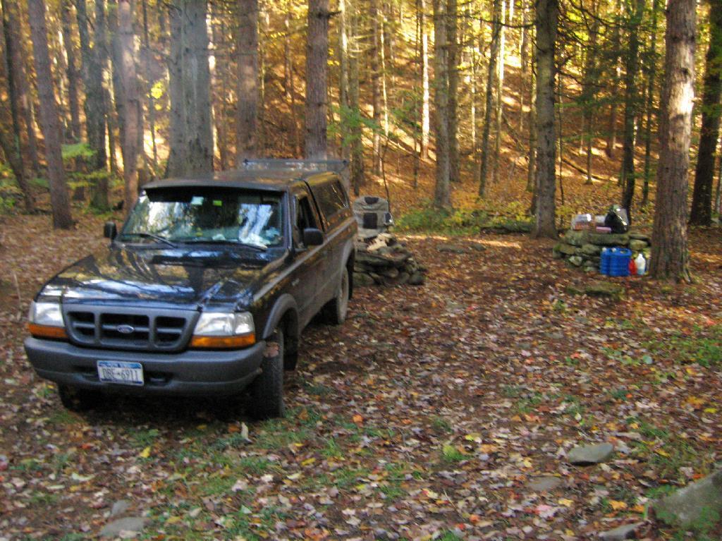
| 05/29/11 | Powley Place (Campsite 9) | Piseco-Powley Road, Ferris Lake Wild Forest, Stratford, NY | Roadside camping (in pickup truck): no charge | Hiked towards Big Alder, but couldn’t cross stream. Rainy day, did a little paddling in Powley Place. Nicer day on Memorial Day. |
| 05/28/11 | Powley Place (Campsite 9) | Piseco-Powley Road, Ferris Lake Wild Forest, Stratford, NY | Roadside camping (in pickup truck): no charge | Rainy day. Hiked around Powley Place. |
| 05/27/11 | Powley Place (Campsite 9) | Piseco-Powley Road, Ferris Lake Wild Forest, Stratford, NY | Roadside camping (in pickup truck): no charge | Left work early, drove up there. Nice evening before the rain. |
| 05/21/11 | Cheney Pond | Cheney Pond, Vanderwhacker Wild Forest, Newcomb, NY | Roadside camping (in pickup truck): no charge | Explored Vanderwhacker Wild Forest. Kayaked around Cheney Pond couple of times, explored Tawandus Ruins. |
| 05/20/11 | Fox Lair Campsite | NY Route 8, Wilcox Lake Wild Forest, Bakers Mills, Adirondacks, NY | Roadside camping (in pickup truck): no charge | Much nicer this time, a little rain, things greened up. Got a little rain, very damp. |
| 04/22/11 | Fox Lair Campsite | NY Route 8, Wilcox Lake Wild Forest, Bakers Mills, Adirondacks, NY | Roadside camping (in pickup truck): no charge | Woke up to 3” of cold wet snow and rain, decided to go home and abandon trip. |
| 04/21/11 | Gravel Pit Campsite | NY Route 8, Wilcox Lake Wild Forest, Griffin, Adirondacks, NY | Roadside camping (in pickup truck): no charge | Cold morning, trees covered with ice. Hike up around part of 13th Lake near North Creek, NY |
| 04/09/11 | Moscow Hill Horse Camp | Brookfield State Forest aka Charles Baker State Forest, Brookfield, NY | Roadside camping (in pickup truck): no charge | One other camper here, no equestrians this time of year. Wanted to camp on Cherry Ridge, however too much snow there. |

Roadside: 28, Tent: 2, Leanto: 1 nights …
| Date | Campsite | Where | Type | Notes |
|---|---|---|---|---|
| 12/4/10 | Old NY 8 | Wilcox Lake Wild Forest, Griffin, NY | Roadside camping (in pickup truck): no charge | Very cold. Ice and snow on truck in morning. Kind of close to NY 8, but all the best campsites taken by hunters. |
| 11/12/10 | Lower Assembly Area | Sugar Hill State Forest, Watkins Glen, NY | Roadside camping (in pickup truck): no charge | Woke up surrounded by Horse Trailers and equestrians in morning. Assembly area was closed this time of year, but horse trails still widely used. |
| 11/11/10 | Informal campsite on Forest Road 151 | Allegheny National Forest, Near Sayre, PA | Roadside camping (in pickup truck): no charge | Second night at Allegheny National Forest. I liked the site I stayed in the previous day a lot, and the days where too short (sunset at 4:45 PM), so no time to waste searching for a site. |
| 11/10/10 | Informal campsite on Forest Road 151 | Allegheny National Forest, Near Bradford, PA | Roadside camping (in pickup truck): no charge | Many sites in Allegheny National Forest. This one I particularly liked, so I decided to stay there. |
| 11/09/10 | Aspah Run Camping Area | Aspah, near Wellsboro, PA | Roadside camping (in pickup truck): paid primitive area | Decided due to a lack of a time due to early sunset, would have done roadside/back country camping, but for $10, and being alone, it was fine. |
| 11/08/10 | Aspah Run Camping Area | Aspah, near Wellsboro, PA | Roadside camping (in pickup truck): paid primitive area | Camped here, because I didn’t want to camp back country, and didn’t know the area well enough. |
| 11/07/10 | Lower Assembly Area | Sugar Hill State Forest, Watkins Glen, NY | Roadside camping (in pickup truck): no charge | Originally wanted to camp at Birds Eye Lake or something like that, but the map I had got me lost, and I couldn’t find the road campsite up there. |
| 11/06/10 | Campsite 7 | Stoney Pond State Forest, Madison, NY | Roadside camping (in pickup truck): no charge | Frost/ice on puddles in morning. Some snow in some places. |
| 09/05/10 | Campsite 56 | Moose River Plains, Inlet, Adirondacks, NY | Roadside camping (in pickup truck): no charge | Rain showers, enjoyed staying in a very private and quite campsite up in the sandy plains. |
| 09/04/10 | Campsite 56 | Moose River Plains, Inlet, Adirondacks, NY | Roadside camping (in pickup truck): no charge | Hiked to Mitchells Pond. More rain. It was kind of wet and cold. |
| 09/03/10 | Campsite 56 | Moose River Plains, Inlet, Adirondacks, NY | Roadside camping (in pickup truck): no charge | Kind of wet and rainy, hung out in camp, did a little exploring of the plains. Also, paddled in Cedar River Flow for a while. Enjoyed the very private drive in site here. |
| 09/02/10 | Campsite 2 | Moose River Plains, Inlet, Adirondacks, NY | Roadside camping (in pickup truck): no charge | I left work at 5 PM…. but with traffic, and wanting to get a pizza to eat on the way up, didn’t get to Moose River Plains until after 9 PM. Very dark, very tired, just wanted a place to collapse. |
| 08/28/10 | An Designated Campsite | Big Pond, near Margretville, NY | Kayak in Primitive Campsite: no charge | Did a little hiking an exploring around Ashfield Pinnacle, then drove south to Big Pond. Lantern did not work, a very dark night. |
| 08/27/10 | Betty Brook Campsite | Burnt-Rossman Hill State Forest, Schoharie, NY | Roadside camping (in pickup truck): no charge | Nice night after work…. drove around Mallet Pond State Forest, looking for campsites and interesting places to explore. |
| 08/14/10 | Mountain Pond Campsite 4 | Mountain Pond, Paul Smiths, NY | Roadside camping (in pickup truck): no charge | Last day of NY 30 Kayak vacation. Mountain Pon was nice, very remote, just off of NY 30. |
| 08/13/10 | Floodwood Road Campsite 3 | Floodwood Road, Fish Creek Ponds, NY | Roadside camping (in pickup truck): no charge | Crowded, stayed down by Poliwog Pond… wouldn’t go there again. |
| 08/12/10 | Horseshoe Lake Campsite 8 (about a ½ mile from lake) | NY 421, Horseshoe Lake, NY | Roadside camping (in pickup truck): no charge | Couldn’t get a site right on Horseshoe Lake. Discovered Lows Lake – amazing. |
| 08/11/10 | Wakely Pond Campsite 7 | Moose River Plains, Inlet, Adirondacks, NY | Roadside camping (in pickup truck): no charge | Wanted to paddle Cedar River Flow and enjoy camping up near water … |
| 08/10/10 | Undesigned Campsite, west side of road | Mason Lake, Spectulator, NY | Roadside camping (in pickup truck): no charge | First day of kayak vacation, as I drove up from work, decided to go somewheres not too far away … |
| 07/31/10 | Undesigned Campsite, west side of road | Mason Lake, Spectulator, NY | Roadside camping (in pickup truck): no charge | Hiked to Pillsbury Mountain Firetower, then camped down at Mason Lake. |
| 07/18/10 | Otter Brook Campsite (MRP Number 110) | Moose River Plains, Inlet, Adirondacks, NY | Roadside camping (in pickup truck): no charge | Camped by the Otter Brook Bridge, at a rather large campsite. Not my favorite campsite, and it poured out. |
| 07/17/10 | Wakely Pond Campsite 8 | Moose River Plains, Inlet, Adirondacks, NY | Roadside camping (in pickup truck): no charge | Camped down by Cedar River Flow, in a drive in site, a short way from the Flow, but also pretty private. |
| 07/16/10 | Wakely Pond Campsite 8 | Moose River Plains, Inlet, Adirondacks, NY | Roadside camping (in pickup truck): no charge | Camped down by Cedar River Flow, in a drive in site, a short way from the Flow, but also pretty private. |
| 07/15/10 | Wakely Pond Campsite 8 | Moose River Plains, Inlet, Adirondacks, NY | Roadside camping (in pickup truck): no charge | Camped down by Cedar River Flow, in a drive in site, a short way from the Flow, but also pretty private. |
| 06/27/10 | Balsam Swamp Camping Area Site 3 | Balsam Pond, East East Pharsalia, NY | Roadside camping (in pickup truck): no charge | Came back to here, after exploring Labrador Hollow. |
| 06/26/10 | Balsam Swamp Camping Area Site 3 | Balsam Pond, East East Pharsalia, NY | Roadside camping (in pickup truck): no charge | Stop over between Burnt-Rossman and Labrador Hollow. Liked camping here in the past. |
| 06/25/10 | Duck Pond Campsite | Burnt-Rossman Hill State Forest, Summit, NY | Roadside camping (in pickup truck): no charge | Camped up a Duck Pond for a change, after driving out here after work. |
| 06/05/10 | Leonard Hill Informal Overlook and Campsite | Leonard Hill, Broome Center, NY | Roadside camping (in pickup truck): no charge | Camped up by the Firetower at an informal campsite, watched sun set, weather turned to rain by morning … |
| 06/04/10 | Betty Brook Campsite | Burnt-Rossman Hill State Forest, Schoharie, NY | Roadside camping (in pickup truck): no charge | Camped at Betty Brook, very humid, drove down to Utsaythana Firetower. |
| 05/15/10 | Alder Pond Campsite 2 | Alder Pond, Balsam Lake Wild Forest, Margretville, NY | Tent campsite…. short backpack in: no charge | Camped at one of the campsites around Alder Pond. |
| 04/03/10 | Betty Brook Campsite | Burnt-Rossman Hill State Forest, Schoharie, NY | Roadside camping, in a tent | Didn’t have the cap on my truck yet, but wanted to roadside camp. |
| 03/21/10 | Cotton Hill Lean To | Cotton Hill, Middleburgh | Short backpack into a leanto | There was about a foot of snow up by Cotton Hill Leanto on first day of spring, but due to abnormally warm weather, wasn’t all that cold until late into the night. |
Roadside: 3, Tent: 0, Leanto: 0 (thru August 2009) …
| Date | Campsite | Where | Type | Notes |
|---|---|---|---|---|
| 10/11/09 | Betty Brook Campsite | Burnt-Rossman Hill State Forest, Schoharie, NY | Roadside camping (in pickup truck): no charge | First really cold evening of the year, very much fall like. I didn’t bring my warm coat with me. |
| 10/10/09 | Betty Brook Campsite | Burnt-Rossman Hill State Forest, Schoharie, NY | Roadside camping (in pickup truck): no charge | Fairly cold night, but not as bad as one might have thought. On way out, stopped at Leonard Hill to take some pictures. |
| 08/08/09 | Betty Brook – informal campsite along road | Burnt-Rossman Hill State Forest, Schoharie, NY | Roadside camping (in pickup truck): no charge | After hiking Slide Mountain and Balsam Lake Firetower. Dead tired … |
Notifications


