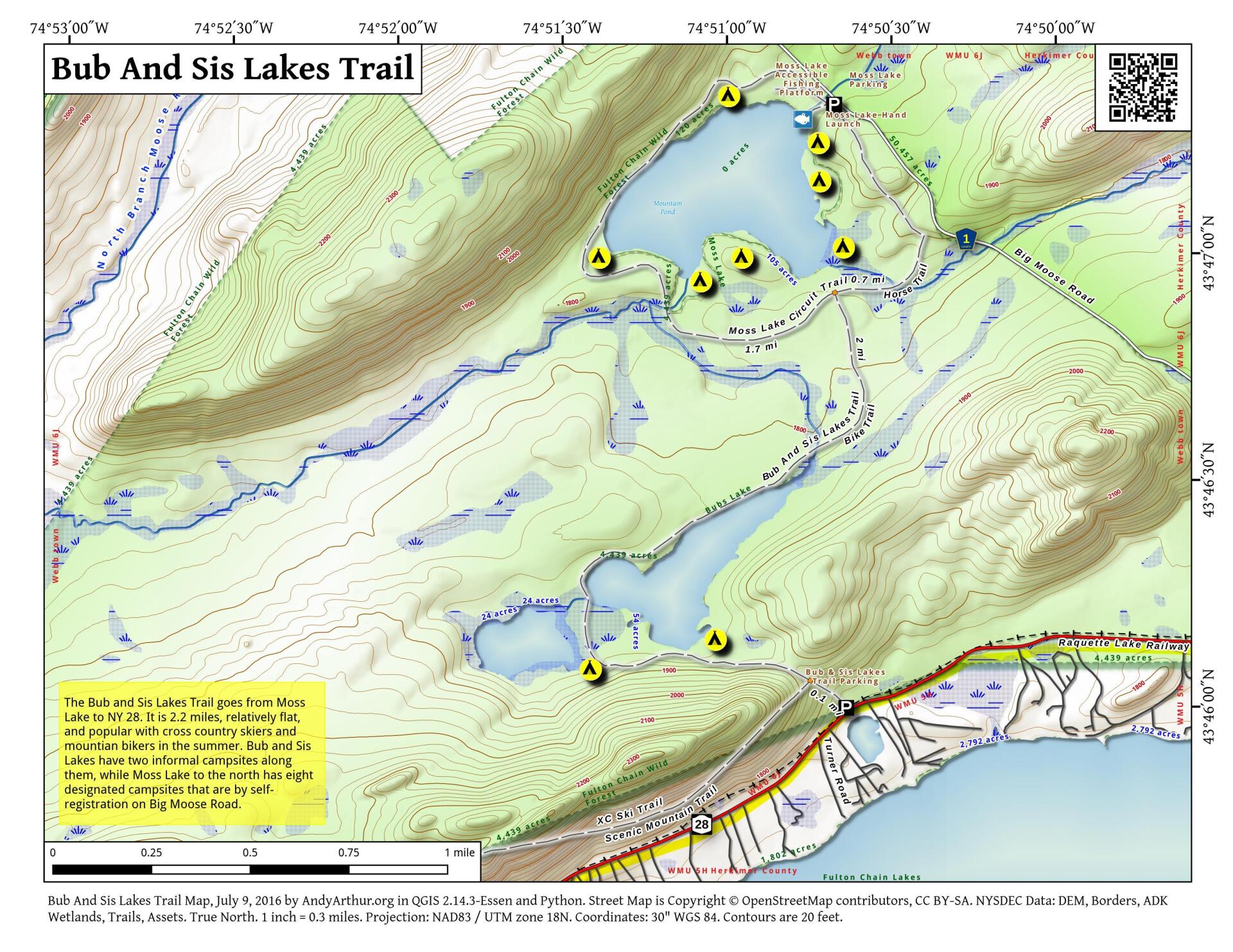
Map: Bubb And Sis Lakes Trail

Download a High Resolution JPEG Image of the Bubb And Sis Lakes Trail or an Adobe Acrobat Printable PDF of the Bubb And Sis Lakes Trail.

Bookmark my free Interactive GPS Map for your phone:
https://andyarthur.org/ny
... shows your location as a blue dot in relationship to campsites, trails, state land. This online map requires cell service, won't work in remote country, so also bring a paper map.
Free Download of New & Historical USGS 1:24k Topograpic Maps
Interactive maps with backcountry and roadside camping: New York, Pennsylvania, West Virginia & Vermont. List of NYS DEC Lean-Tos and Firetowers.
Google Spreadsheet with Roadside, Primitive and Pay Campsites
More about Bubb Lake...
(and beyond to Moss Lake) and also a trail along the top of a ridge called the Vista Trail. They start out together and split after about 0.2 miles. Take some time to explore the Vista Trail.
The trail to the three lakes is a very pleasant walk in the woods suitable for families. It ascends about 200 feet and the walk to the nearest water is about 0.5 miles. The walk to the stream that flows between Sis and Bubb lakes (where both are visible) is about 0.9 miles. The total mileage for the whole loop including Moss Lake is 6.5 miles. Look below for a shorter loop option.
http://www.cnyhiking.com/SisBubbMossLakeLoop.htm
Maps and Interactives
Bubb And Sis Lakes Trail
Bub And Sis Lakes
... photos, maps and other content from from Bubb Lake.