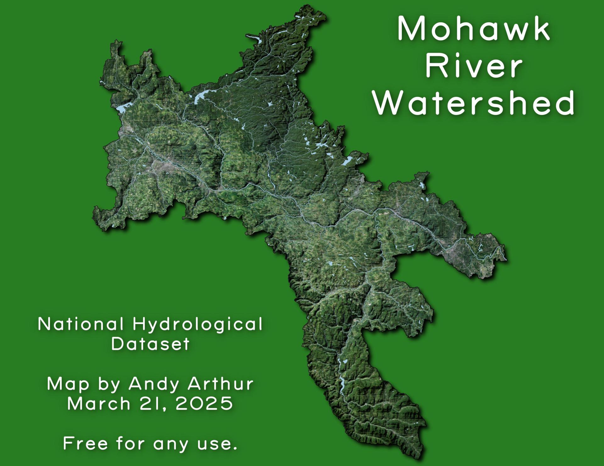
Mohawk River Watershed 🗺️ Download a High Resolution JPEG Image of the Mohawk River Watershed or an Adobe Acrobat Printable PDF of the Thematic Mohawk River Watershed. More about Mohawk Valley...Maps and InteractivesWillie Marsh TrailsWaterford Flight of LocksTrace the Black River Canal !The NosesMohawk ValleySodus DitchRockwood State ForestRockwood LakeOld MOSA Dump along the Lasher CreekOak Orchard Viaduct – MedinaNational Land Cover Dataset – Mohawk ValleyMiddenvilleLock 9 Bridge DamLock 8Lock 2Erie Canal Lock 16Lisha Kill and Mohawk RiverFultonville 1944/1946Fort Herkimer – Canalway TrailFormer Remmington Plant Before It Was ShutteredFonda – Fultonville 1896Flat Rock CreekFlat Creek – NY 162 Outside of SprakersAdirondack Power and Light Station – Cranesville BlockNY Canal Corporation Dams... photos, maps and other content from from Mohawk Valley. Leave a Reply Cancel replyYour email address will not be published. Required fields are marked *Comment * Name * Email * Website Save my name, email, and website in this browser for the next time I comment. Δ
More about Mohawk Valley...Maps and InteractivesWillie Marsh TrailsWaterford Flight of LocksTrace the Black River Canal !The NosesMohawk ValleySodus DitchRockwood State ForestRockwood LakeOld MOSA Dump along the Lasher CreekOak Orchard Viaduct – MedinaNational Land Cover Dataset – Mohawk ValleyMiddenvilleLock 9 Bridge DamLock 8Lock 2Erie Canal Lock 16Lisha Kill and Mohawk RiverFultonville 1944/1946Fort Herkimer – Canalway TrailFormer Remmington Plant Before It Was ShutteredFonda – Fultonville 1896Flat Rock CreekFlat Creek – NY 162 Outside of SprakersAdirondack Power and Light Station – Cranesville BlockNY Canal Corporation Dams... photos, maps and other content from from Mohawk Valley.
Leave a Reply Cancel replyYour email address will not be published. Required fields are marked *Comment * Name * Email * Website Save my name, email, and website in this browser for the next time I comment. Δ

