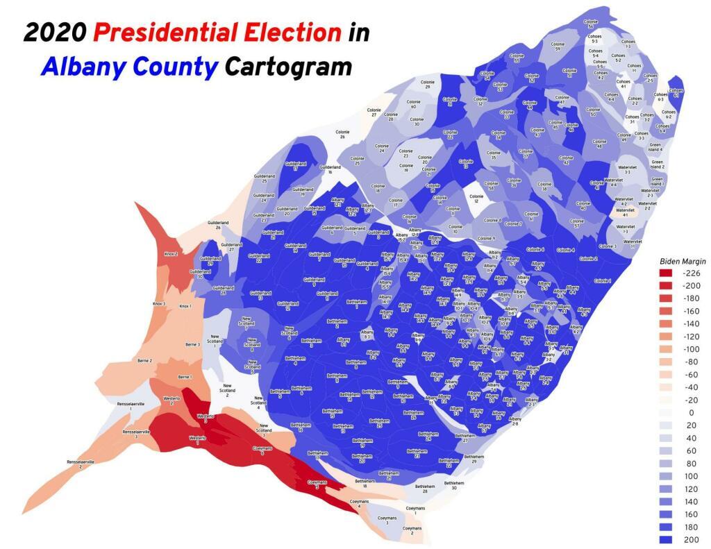
Thematic Map: 2020 Presidential Election In Albany County Cartogram
Download a High Resolution JPEG Image of the 2020 Presidential Election In Albany County Cartogram or an Adobe Acrobat Printable PDF of the Thematic 2020 Presidential Election In Albany County Cartogram.
About 2020 Presidential Election In Albany County Cartogram ....
When you look at the map of the election districts that are red, you might think Albany County is redder then it really is. But truth be told, that redness is misleading as the red districts are rural and large in area but have close to the same population as many city election districts.
More about Politics...
Maps and Interactives
The Mar-a-Lago Club
State Capitol 1952
A night view, Martin Luther King Day 2021
Voting Machines in Use in New York State
Peter Vallone vs George Pataki (1998)
NYS 2022 Governor’s Race
NY State Media Markets
Deep Red Counties
Capital Region 2020 Average Democratic Performance
2024 Albany County District Attorney Primary [Expires December 31 2024]
2020 US Presidential Election Cartogram
2020 Presidential Election In Albany County Cartogram
2020 Presidential Election
2020 NY Population Cartogram
Partisan Shift Between the 2010 and 2020 Gubernatorial Races
2018 Governor Andrew Cuomo vs Marc Molinaro
2016 Presidential Election In NY State Cartogram
... photos, maps and other content from from Politics.
