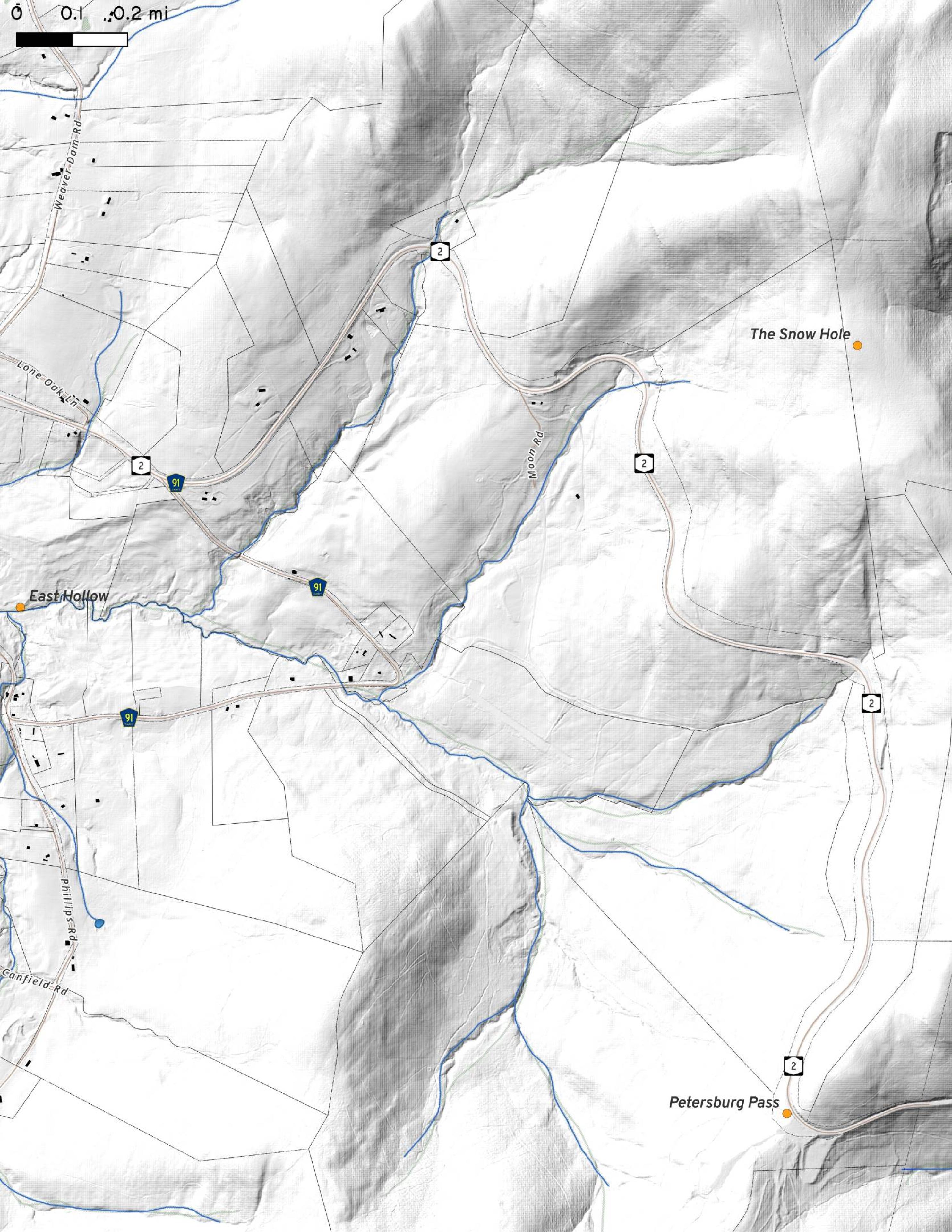
Terrain Map: FEMA LIDAR of East Hollow - Taconic Trail Over the Crest - NY 2 Download a High Resolution JPEG Image of the Terrain FEMA LIDAR of East Hollow - Taconic Trail Over the Crest - NY 2 or an Adobe Acrobat Printable PDF of the Terrain FEMA LIDAR of East Hollow - Taconic Trail Over the Crest - NY 2. More about Taconic Crest Trail...Maps and InteractivesWhite Rocks – Taconic Crest TrailsOriginal Taconic Trail – NY 2 Past White RocksFEMA LIDAR of East Hollow – Taconic Trail Over the Crest – NY 2... photos, maps and other content from from Taconic Crest Trail. Leave a Reply Cancel replyYour email address will not be published. Required fields are marked *Comment * Name * Email * Website Save my name, email, and website in this browser for the next time I comment. Δ
More about Taconic Crest Trail...Maps and InteractivesWhite Rocks – Taconic Crest TrailsOriginal Taconic Trail – NY 2 Past White RocksFEMA LIDAR of East Hollow – Taconic Trail Over the Crest – NY 2... photos, maps and other content from from Taconic Crest Trail.
Leave a Reply Cancel replyYour email address will not be published. Required fields are marked *Comment * Name * Email * Website Save my name, email, and website in this browser for the next time I comment. Δ

